I eat oatmeal from a blue bowl, folded origami style from a sheet of plastic my cousin, Nicole, gave me for Christmas...
I eat oatmeal from a blue bowl, folded origami style from a sheet of plastic my cousin, Nicole, gave me for Christmas...
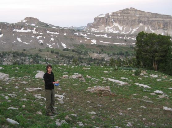
Wendy gets food ready at the cooking rock, waiting for the sun...
The sun did come out, but then quickly faded behind morning clouds. It was a weak sunrise, and no good pictures to show for it...
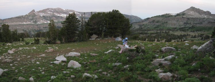
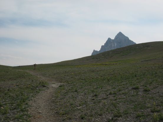
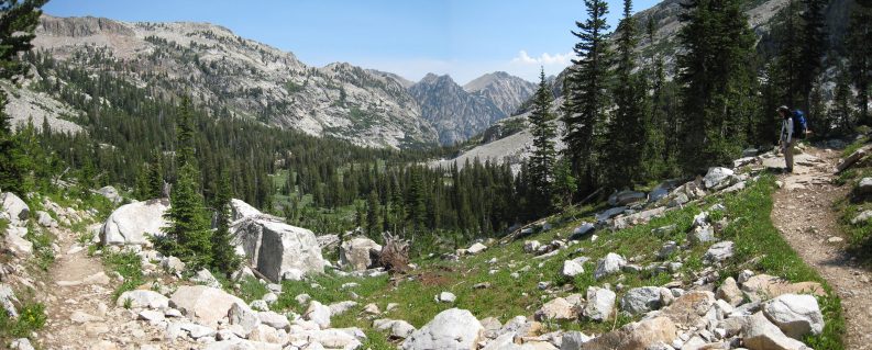
We walked up the hill further, following a trail, hoping for the sun to emerge, but the clouds held fast, and I realized that this morning would be dull for pictures. As we packed up camp, I realized that I lost my sunglasses. At least the clouds would be good for something today...
We began hiking at 8am. We needed to refill our water at the stream before climbing the 700' up Hurricane Pass. We only needed to hike 8 miles to reach the next camping zone, and we had a 11.3 mile option of taking a direct path back to the Visitors center today. We see how we felt later on the trail.
I stopped by the place we ate dinner last night, to see if my sunglasses were around. Didn't find them, nor was there any trace of the food we spilled the night before. I did find a marmot, just 3 feet away from where I was looking.
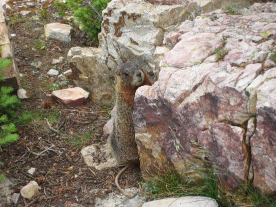
This cute little marmot was stood very close to me for a while, then ran away...
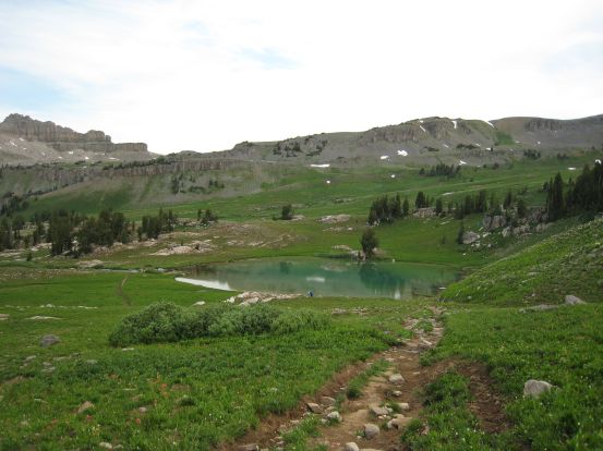
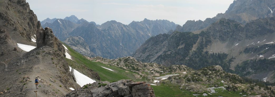
We made out way to Sunset Lake, crossed a stream, and headed up towards the ridge straight ahead in the pic...
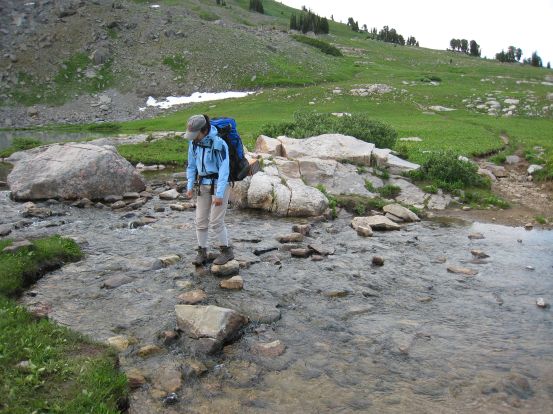
The stream flowing out of sunset lake, and the sketchy crossing, with just enough small stones to make it across with boots...
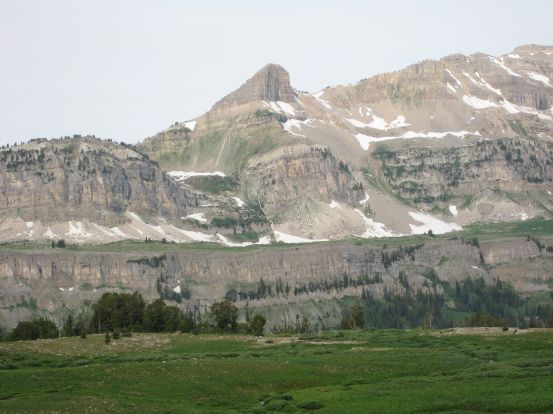
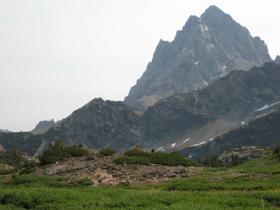
A look towards that fascinating profiled mountain...
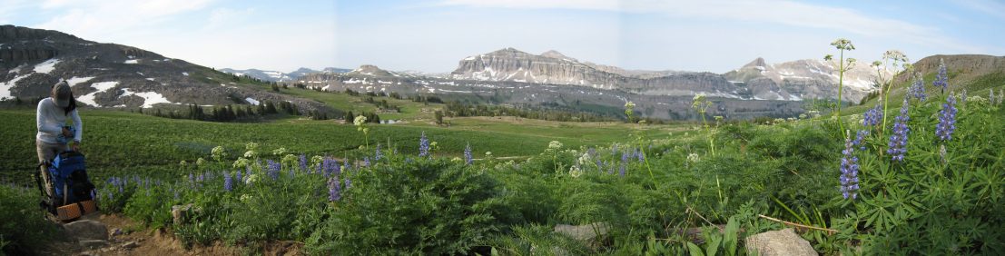
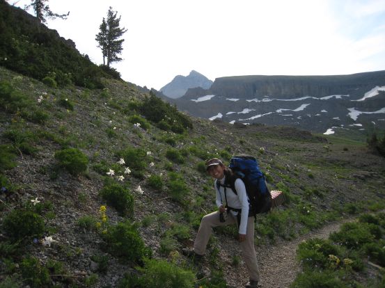
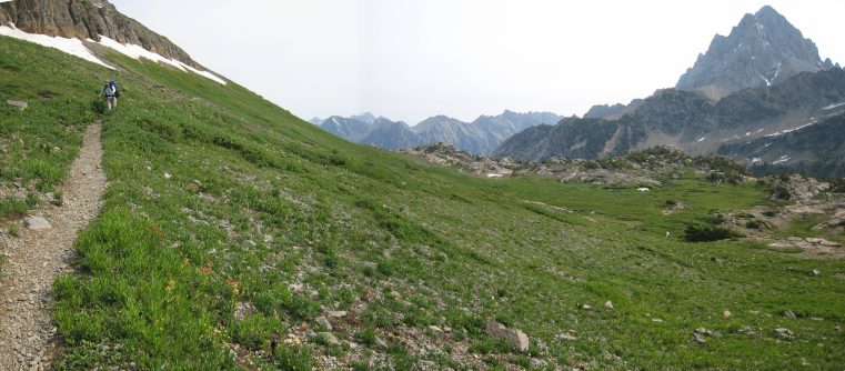
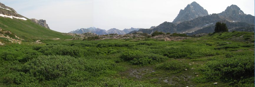
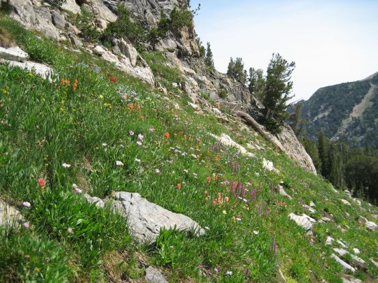
We made out way across a grassy field that rose towards the opposing ridge. I had read about the wonderful wildflowers in Alaska Basin, but perhaps flowers bloom later here than elsewhere in the park, cause we didn't see as many compared to Granite Canyon and Death Canyon Shelf. There were some areas with flowers here though.
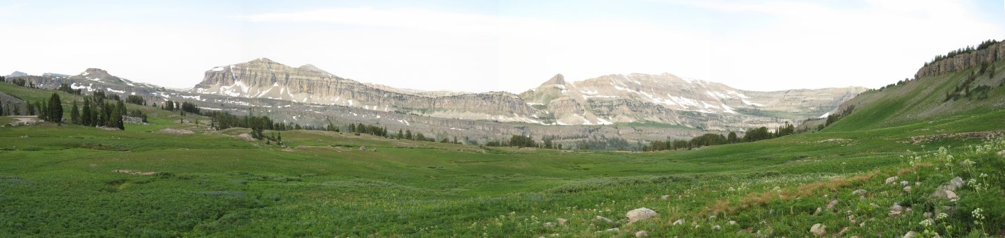
Looking across the grassy field. I wondered if this field turns all sorts of colors with wildflowers later in the season...
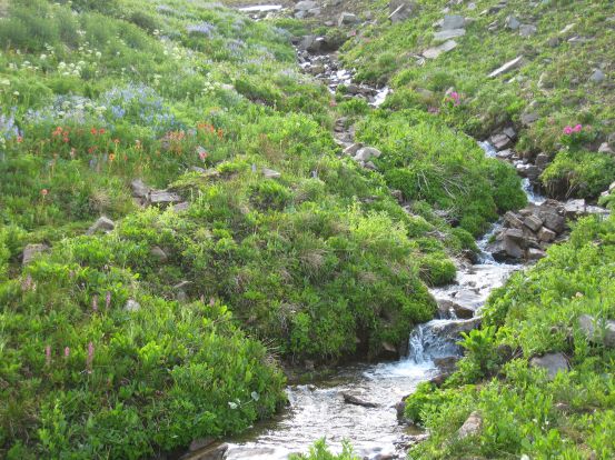
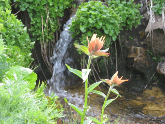
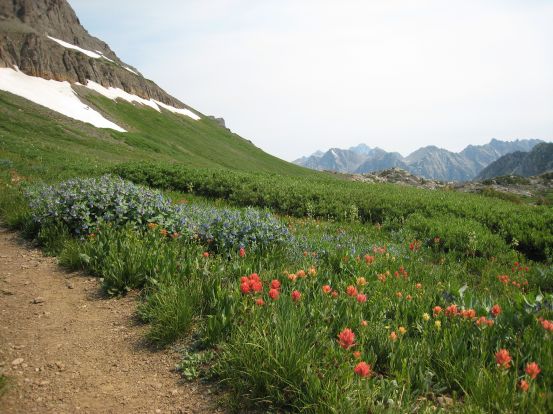
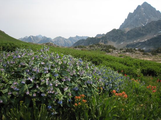
There were some pink, purple, orange, and blue flowers around this stream...
And a section of trail that ran through some blue flowers...
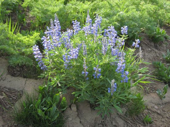
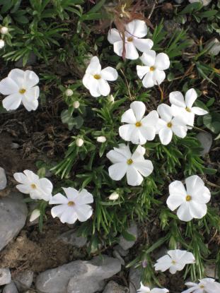
Another look at the blue flowers, and some white flowers found a bit further up the trail...
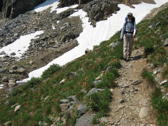
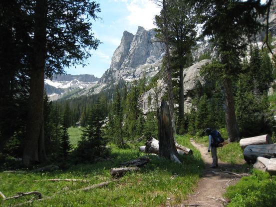
The trail began slicing up to the ridge, and crossed a snow patch. Wendy poses near some white columbines, with the Tetons rising through the notch in the rock wall behind...
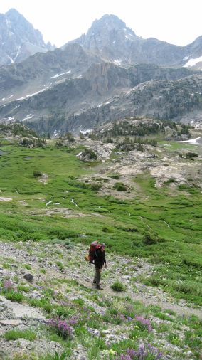
Can you tell I'm into flower shots with mountains in the background? More columbines here. Last night we camped on the grassy rise on the far side of Sunset Lake...
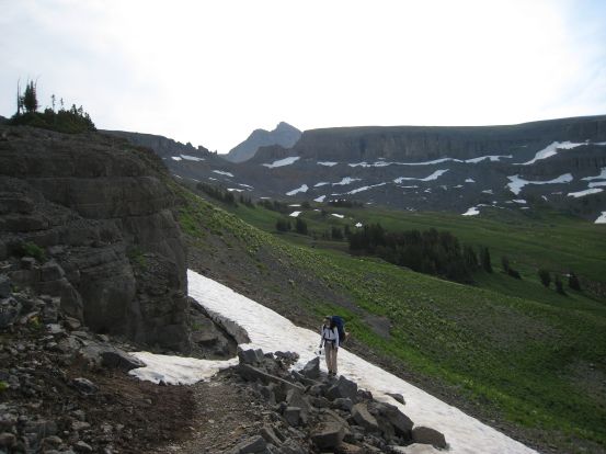
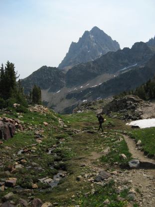
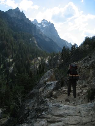
The trail became steeper as we switched-back up the ridge...
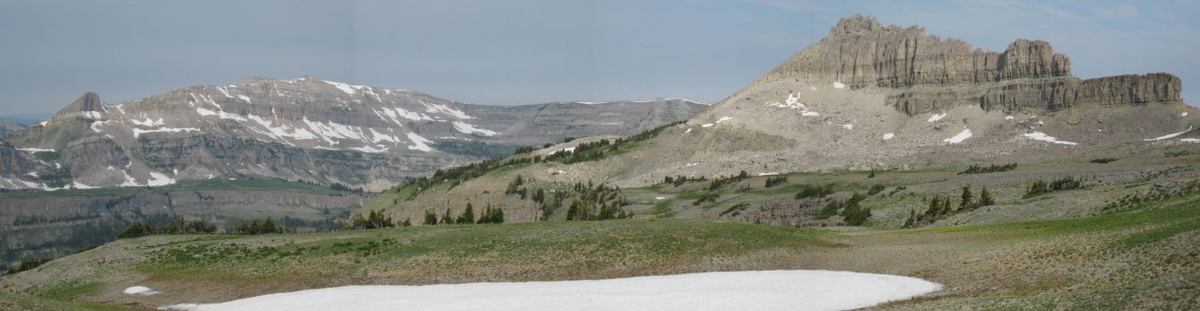
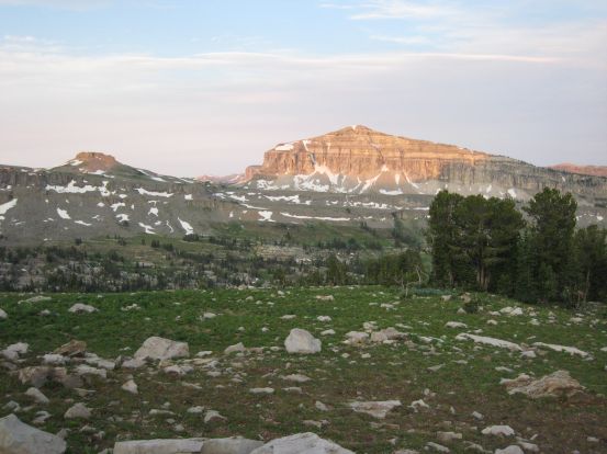
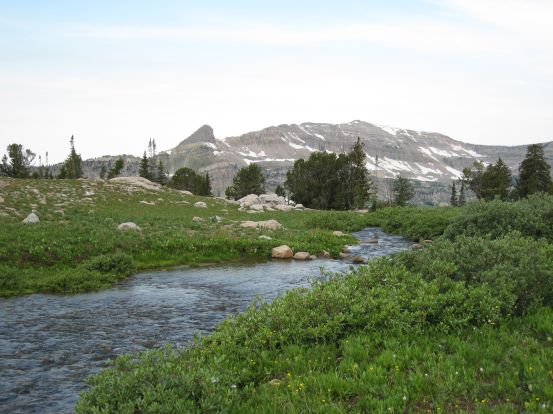
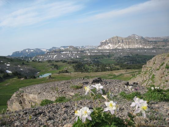
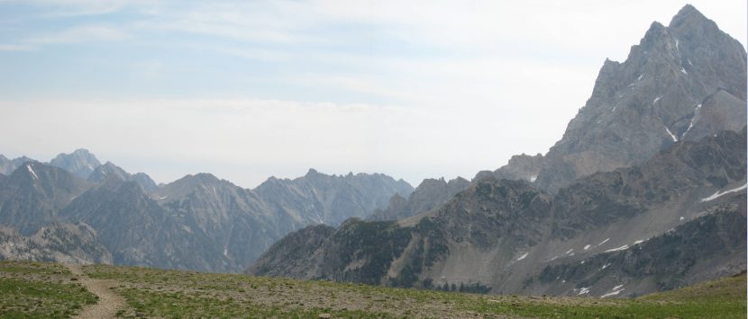
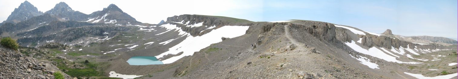
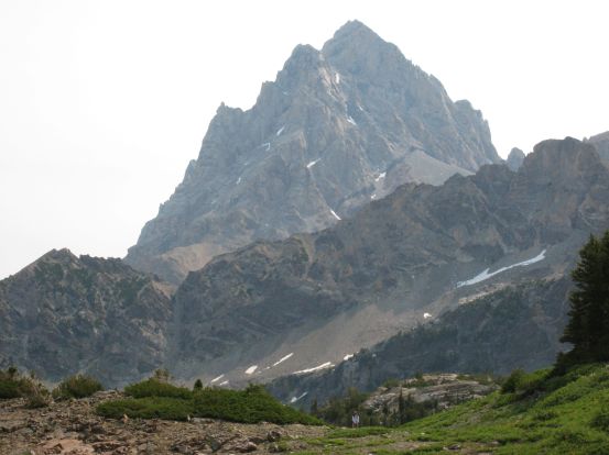
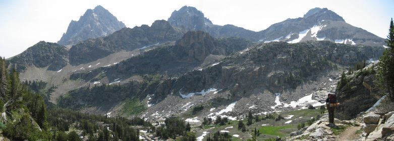
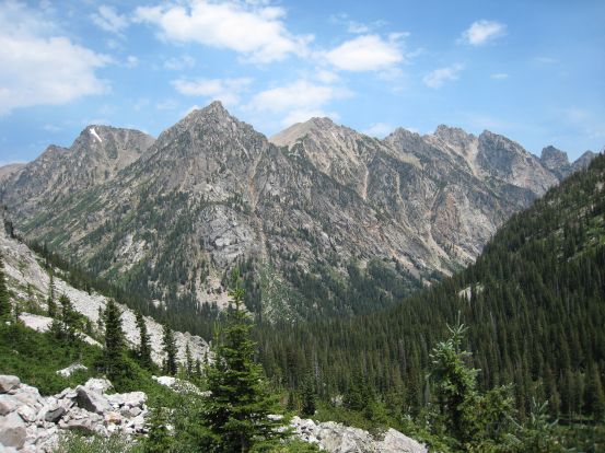
Above the ridge we hit the expanse of Hurricane Pass (10,372'). The formation on the right is called Battleship Mountain. No argument here...
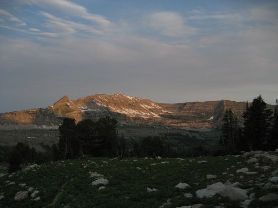
Though Hurricane Pass must be known for it's wind, there was no movement in the air this morning. While we walked across the tundra, up to the crest of the pass, and saw a pointy mountain tip appear, followed by 2 others, and saw them grow wider across the horizon, as the Tetons powerfully emerged into view.
Something big lies beyond this pass...

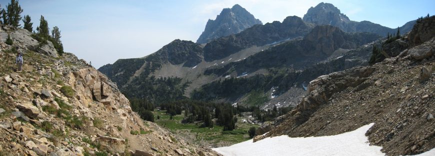
A grand view of the Tetons from the top of Hurrican Pass. 9.8 miles to the Jenny Lake west boat dock, the sign says...
The enormity and proximity of Grand Teton dwarfed the other mountains making up the Teton range...
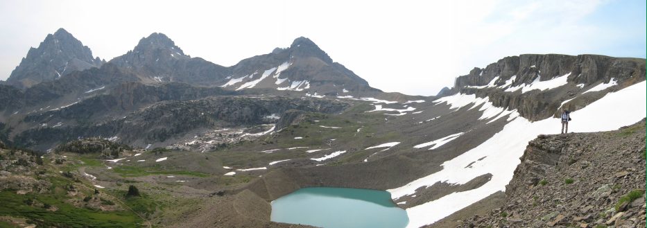
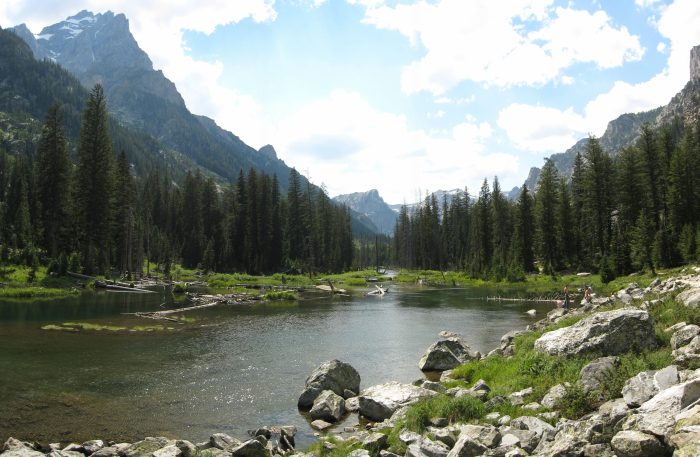
As we continued, the upper South Fork valley opened up, revealing an aquamarine glacier fed lake. We stopped here for a snack, at a little after 10am. Some hikers passed by in the opposity direction heading in the reverse loop that we did. One guy said he only had 2 pictures left on his camera. Bummer for him, as I had taken probably 500 pictures so far.
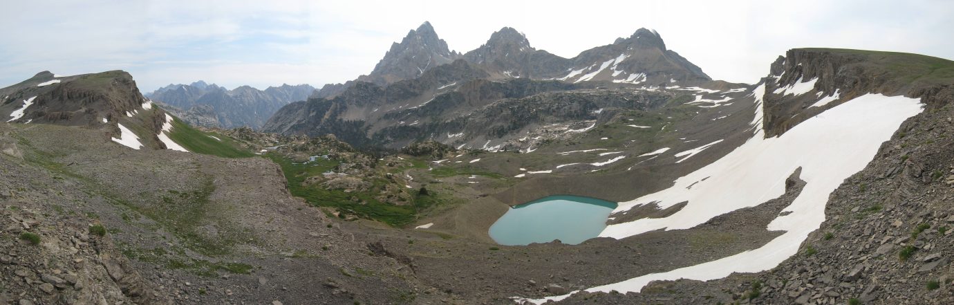
Disappointing lighting, but still an amazing view. The color of the lake reminded me of fjords and streams in Norway...
We took SO many pictures from here. All for the purpose of putting up the best ones here...
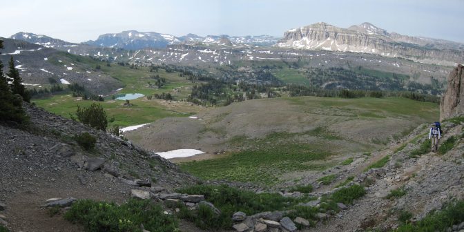
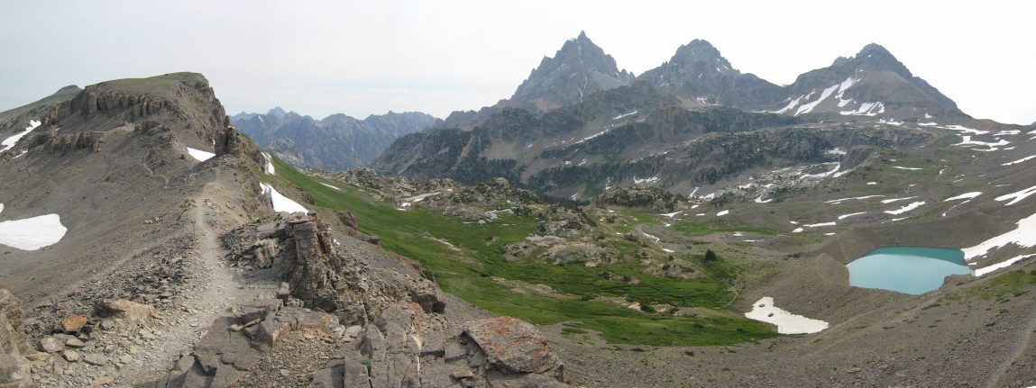
Another look at the mountains making up the North Fork, South Fork, Paintbrush, and Cascade Canyons. We saw a marmot on the trail here run down the left slope...
A view along the saddle. You can see the trail switch back on the left side. The view to the right was pretty too, but hardly got noticed when you have the Tetons on the other side...
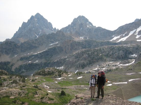
A group of people were hiking up in the opposite direction, and they took a picture of us, from a ledge on the switchbacks...
I told Wendy to stay there, while I stitched these pics together...
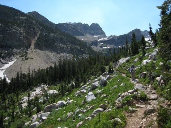
The trail crossed a thin but steep snowfield, but was otherwise entirely melted. This would be incredible treachorous to hike in the snow/ice without crampons and an ice axe. There's no way we would have made it down here 2 years ago with all the snow then. This trail was switching back on a scree field, but was amazingly sculpted into flat areas to walk on. The most pleasant rock trail ever. Eventually we reach grassy slopes, and flowers emerged.
Back on a dirt trail through the grass and flowers...
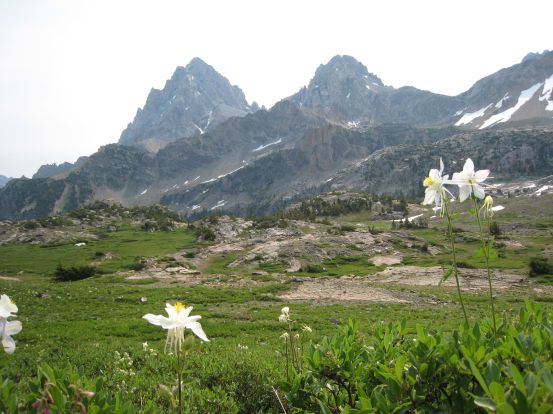
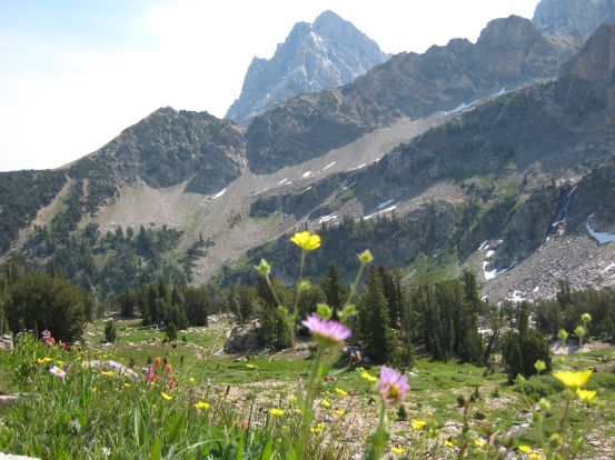
More columbines, this time in front of the Tetons...
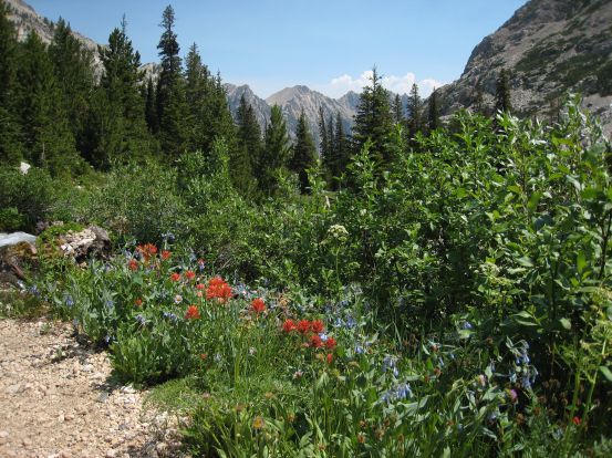
Blue and orange flowers along the trail. It felt like walking through a splendid garden with the best scenery in the world...
This whole garden area was a large flat shelf inbetween the South Fork valley, and Hurricane Pass...
The trail was elegantly laid out with stone siding. It felt like a gourmet garden. Wendy is a speck of white at the bottom of the right picture, before exiting this garden shelf...
I just loved this place so much, I had to put up one more pic, even if it's getting repetitive...
The only shame was that the sun was behind the clouds, and even then, you need to be here in the afternoon with the sun shining from the west, lighting up the mountains and turning the sky blue. Next time I'll have to plan to arrive here later in the day. The trail dropped down again, into a deeper valley. Patches of snow existed along the mostly rock trail, and still more flowers.
The trail wound down deeper into the valley. There were several camp sites at the bottom. Definitely a great place to stay...
Flowers along the trail as we head down into the green valley...
Seems like you can find a flower of every color along this bank, if you look hard enough. The Tetons gradually disappeared as we got closer to the canyon wall on the other side...
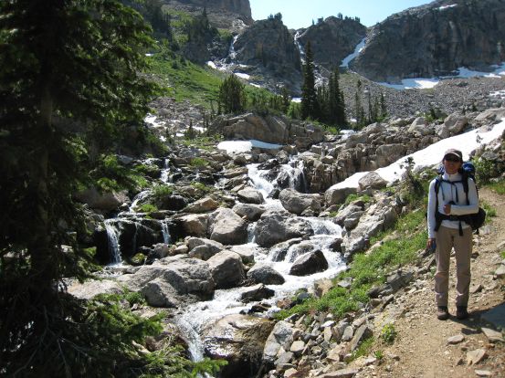
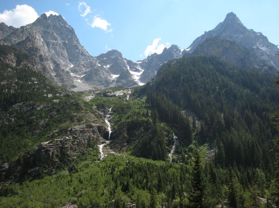
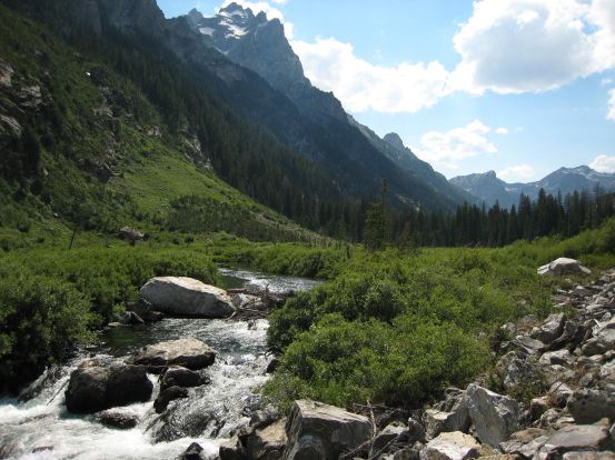
We walked past the multiple campsite spots, and followed the trail out down the cayon. The trail followed a powerful stream, that was fed from a couple of waterfalls high up the canyon walls. Trail would drift high on the side of the canyon, and meet up with the stream aagain later.
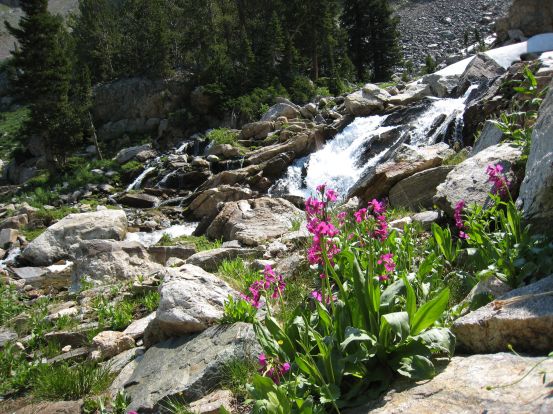
More pretty flowers. Two water flows can be seem in the distance flowing down the canyon behind Wendy...
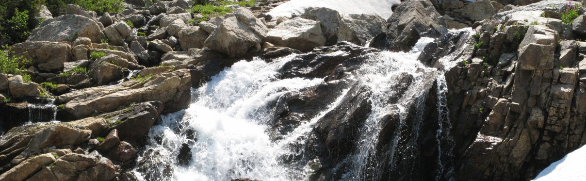
A close-up of the wide and raging stream. Some pink flowers in the upper right corner...
The trail from Hurricane Pass to the North/South Fork junction was 5.2 miles long, and all downhill with some occasion flat stretches. About 2400' downhill in that span.
A look back up the canyon during the descent...
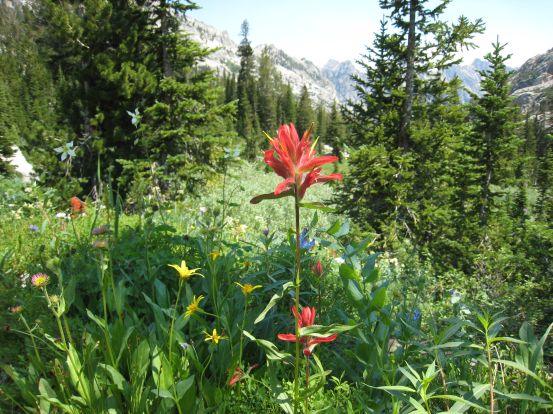
The flowers were still blooming along the South Fork trail...
A look east from a bend in the trail. The North/South Fork, Cascade Canyon junction lies at the foot of the mountain in the distance, in the center of this pic...
Around noon we stopped for lunch. The mosquitos were acting up again, and I sprayed down Wendy with bug spray. We must have used half the bottle this trip. I ate Irish Soda bread with chocolate for lunch (as I had done yesterday too). Wendy was feeling a bit sick to her stomach, and thought that we might need to hike back today, instead of make a side trip up the North Fork and visit Lake Solitude. We still had 2 miles left before getting to the junction where we'd have to decide which path to take.
While we were stopped, we saw the hikers from last night that were setting up their camp shortly before the big storm. We found out they got their tent up just in time. They were headed back home today.
Our lunch spot, on the log, half way through the South Fork...
A view of the juncion of canyons. We were in the South Fork, the North Fork lies to the left of the center mountain, and Cascade Canyon lies to the right (back to Jenny lake)...
When we got to the junction, it was 2:15pm. Our option was to hike another mile up the North Fork, and find a place to set up camp, ditch our heavy packs, and hike up the remaining 1.7 miles to Lake Solitude, or hike out the last 4.5 miles to Jenny lake, and catch a boat back to the Visitor's center (we needed to be back by 6pm to catch a boat). Wendy's stomach was still bothering her, and so we decided play it safe and hike back to civilization. We were both dissapointed to be ending our amazing trip early, though we had experienced so much beauty and adventure already. Plus, now we have reason to come back and backpack the Paintbrush/Cascade Canyon 19.2 mile loop sometime.
So we donned our packs and headed east on the trail to Jenny Lake, stopping a couple times to be sure it was the right thing to do. It would be a late night driving back to Fort Collins, but also nice to have a Sunday for relaxing before heading straight into a busy work week. This trail was full of people, as it's closest to a visitor's center. I was excited to check out Cascade Canyon, as we missed out on it 2 years ago. It didn't quite meet my high expectations though, probably because we had just come from so many amazing areas (and were tired), but it's worth the hike, if you visit and only have 1 day.
There were very few wildflowers on this trail though. It's not until you get to the upper canyons that they come out in force (same for Granite Canyon). You really need to backpack into the Teton's wilderness to experience all it has to offer.
A couple of impressive peaks, with some water streaming in between, in Cascade Caynon...
The trail is mostly flat for seemingly 3.5 of the 4.5 miles, before dropping 1200' in the last mile. We saw a bunch of people clustered near a stream, and heard that they were watching a moose. This was cool, cause out of the 4 times I've seen a moose, this was the first that had antlers and looked like Bullwinkle.
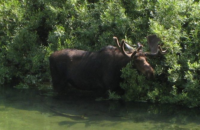
Check out those felt coated antlers. I'd stay in a cool stream on a hot day like today too if I were a moose...
The stream widened into a pond here, amid towering rocks...
Similar setting, but back to a stream...
My legs were definitely aching after all this downhill with a heavy pack, but I wasn't expecting the steep drop that was left to reach the lake. Once we reached Inspiration Point, the trail was mobbed with people. I was surprised how steep and relatively tricky this portion of the trail was, considering it was so popular with tourists. Though I think everything was starting to become hard and tricky with this pack on for so long, pushing the 11th mile today.
Jenny Lake, our final destination, but at a lot less elevation that I had hoped. This stretch down was bumpy and steep, but pretty...
After the steep descent, there were more people, and flatter terrain. I saw a sign for hidden falls, checked it out. Quite spectacular! Quite crowded too.
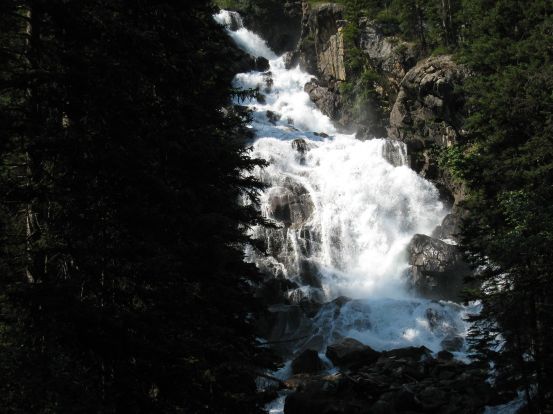
I managed to get a clear shot of the falls, despite the crowds...
It was just a few hundred yards to the boat dock. We could have hiked another 2 miles back to visitor's center, but Wendy likes boats, and I was ready for a rest (and like boats a little too). There was a long line to get a boat though, and we had to wait 30 minutes before getting one. I felt quite out of place with a huge pack, boots, and 3-day worn-in clothes, standing in line with tourists in tank tops, and flip-flops. It was about 5:40 when we finally got a boat and made the 10 minute trip across the lake.
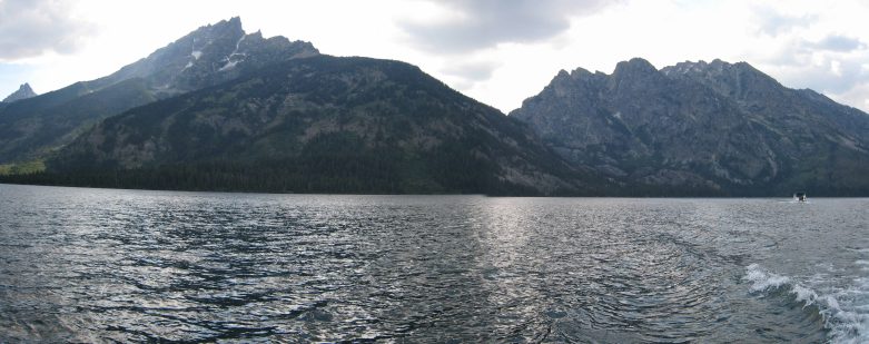
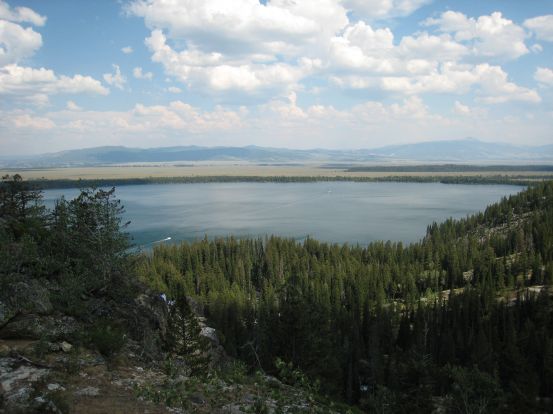
A view from Jenny Lake. My sister and her boyfriend kayaked here just 6 days ago while driving cross country...
We called up the taxi service when we landed, and they arrived in about 25 minutes. The trip back to our car in Granite Canyon cost us $50, but given we had free lodging for our stay at the Tetons, it wasn't too painful. We quickly changed shoes, and packed the car, and were on the road at 6:40pm with a 7.5 hour drive back to fort collins. As we headed out, it looked like another storm was developing over the Teton range. The cab driver said it didn't rain in Jackson the previous night though, so must be the Teton's attract isolated storms.
We traded off driving, though Wendy drove most of it. I stitched 70 pics in the car-ride back (still many more at home later). We stopped at a gas station with a Subway for dinner, and later at a McDonalds for ice-cream. Made it back home at 2:30am (yikes, we got up at 5:30am), and still had 30 minutes left on the audiobook.
Teton adventures have been 2 for 2 so far. I'm sure it will be 3 for 3 in the not too distant future...