
Ben and I each cooked up some oatmeal on our stoves, and Dave munched on some energy bars. After we had eaten and prepped our gear, it was 4:45am, and we made the short walk to the Little Bear climbers trail, spotting the cairn with our headlamps. We scrambled up the first 50 foot section and were surprised to see a pair of headlamps ahead up of us before the long rock scramble to the ridge.
Ben and I were flying across the rock and up the slope, bursting with energy it seemed. Dave was not far behind. We all passed the two headlamps a short ways up the ~500' rock slope. It was fairly simple class 3 scrambling up small boulders and loose rock in places. We were careful to avoid kicking rocks down below. Ben and I made it to the top of the ridge in ~30 minutes since leaving camp, and we tried taking pictures of the mountain's pre-dawn siloheute, still an hour before sunrise. Dave made it up about 7 minutes later, and we rested a bit longer, watching another 6 headlamps floating in the air down below. Apparently this was going to be a fairly crowded hike today. Way off to the north we could see a few specks of light heading towards Ellingwood and some towards Blanca. Plenty of early risers for these respected peaks. After our rest we departed along the backside of the ridge at ~5:45.
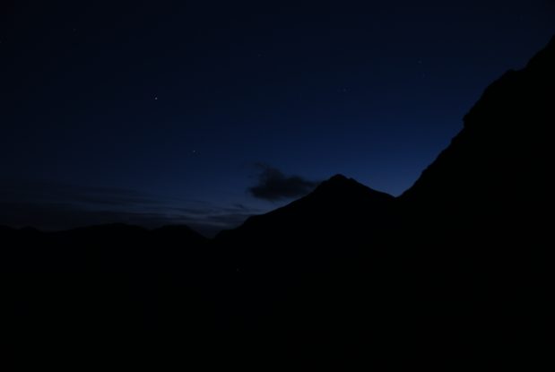
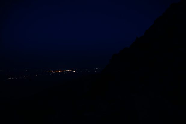
Ben captured some amazing pics with a 20 second exposure on a tripod. You can make out some stars in the north facing pic to the left. The city of Alamosa is lit up looking to the southwest. My pics all came out black...
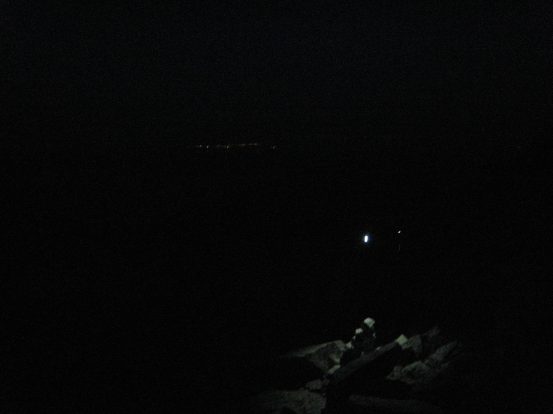
Oh why not throw in a pic of mine too. Ben's headlamp lights up the cairn at the top of the ridge (12,500'). Dave's headlamp is more feint behind...
There was a cairned trail along the backside of the ridge, and since we weren't climbing the crest of the ridge, the path was at a gentle incline. We lost the trail at one point, and began scrambling across the rougher rocky terrain, before climbing higher and catching up with the trail again.
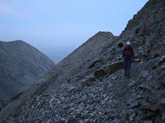
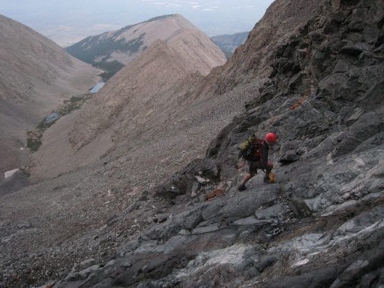
The view east along the back side of the ridge we had just climbed. Then looking back along the trail at Dave and Ben. We crested the ridge at the notch...
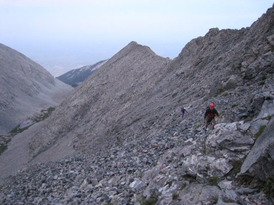
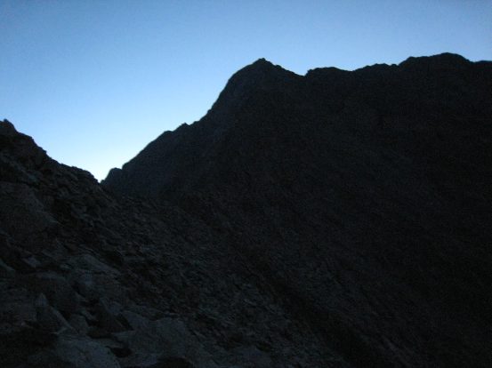
6 minutes after the last picture was taken, we had covered more ground, and the light was getting brighter. Up ahead we could see the fold in the ridge where the famous Hourglass section was, leading to Little Bear summit...
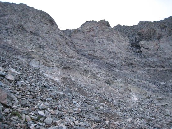
The cairned path steepened and wrapped up to an opening on the left where the Hourglass section lay. The smooth in-layed center of the rock glistened with thin layer of water trickling down, dripping down over small overhangs along the way. This section is considered the toughest out of any standard 14er route, even when considering Capital's knife edge ridge. I was curious to get a closer look and see just how intimidating this pitch was.
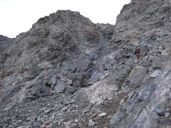

The Hourglass had a wet dark stripe running down the middle, and we decided to climb up on its right a ways first on dry rock first. There were long rust colored stripes in the rock here, which we recognized from pictures, and knew we were at the right spot on the trail...
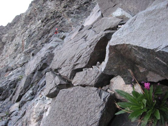
There were few wildflowers anywhere in these mountains, and I was shocked to find the most beautiful flower of the trip growing out of a rock near the entrance of the Hourglass. Ben begins the lower portion of the Hourglass...
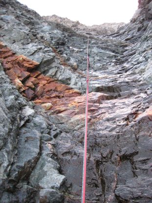
It was time to begin the climb up the Hourglass. We had the advantage of knowing there were no people ahead of us that could send rocks tumbling done into this funnel as we climbed. They also call this section a "bowling alley". There was rope tied to a large rock at the top, though most people avoid it, as it's not very safe practice to trust a random rope (though this looked secure, and would be a safe aid). The water ran right underneath the rope, making the rope useless with the ability to gain traction on the rock. So we climbed up the steeper edges of the Hourglass. We crossed from side to side occasionally to find the easiest pitch to climb.
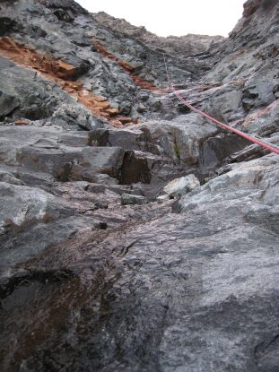
The rope hung down over the layer of water. Ben climbs up one of the steeper sections. It was indeed a serious climb, made much more difficult with the wet rock (thanks to the rain yesterday). The copper stripes in the rock marked your progress...
Midway up we reached the crux of the Hourglass, and ~12-15' pitch with a class 5 climb on the left, or a climb up the smooth, slick, and steep water covered rock along the rope. The water section looked way too slick, so I climbed up on the left. It was certainly class 5+, with good 6-8' of exposure, but the holds were good and solid, and after I made it to the top, I helped guide Ben up. From there we waited for Dave to catch up to us at the crux. Dave spent some time investigating the routes up the crux, and opted to climb the smooth rock around the water (Ben and I were surprised it was manageable), and cut back across the water to meet up with us and continue on.
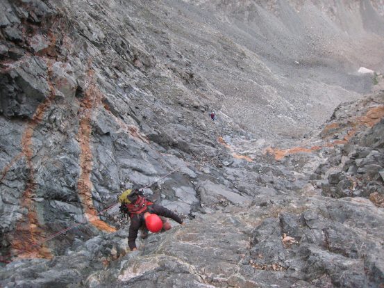
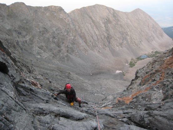
Looking up near the crux. Ben climbs up the class 5 pitch, avoiding the water and rope. Dave arrives at the Hourglass below...
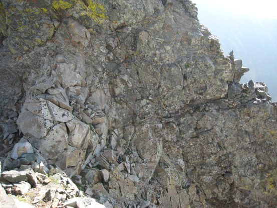
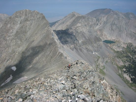
The worst of the Hourglass was behind us. But there was still a few hundred feet of Class 3-4 scambling to go. From above the Hourglass the grade lessoned, and then rose up again to the ridge of Little Bear. We climbed up the loose rock, careful not to kick any rocks down. We thought we were supposed to stay to the left, but the trail was hard to pick up. I scouted out ahead, and climbed up a steep section to the ridge top. From there I was hit with an amazing view of the valley with Lake Como that we had camped in, and some sun lighting up the opposing peaks. But when I looked up the ridge, I saw a cliff leading up to Little Bear. This was not the way. I downclimbed back to Ben and Dave, which turned out to be the trickiest part of the day, climbing wise. If you start climbing class 4-5 on a trail that should be class 3, it's a good clue that you're heading in the wrong direction (though I was hoping for a short cut).
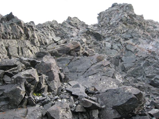
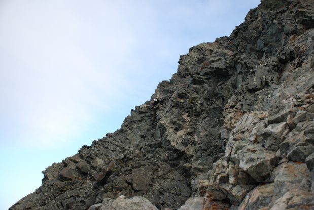
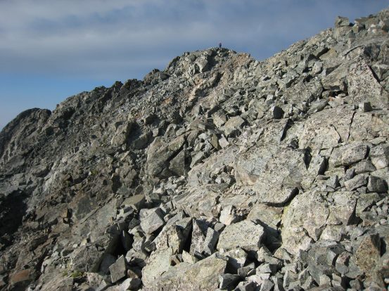
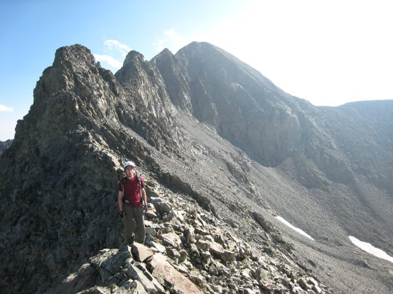
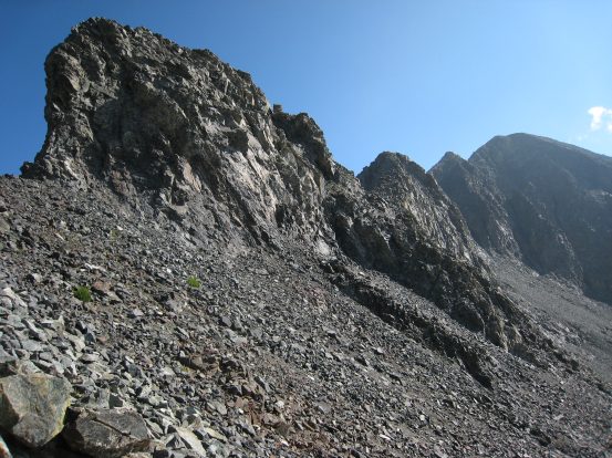
A look at some of the terrain above the Hourglass. A picture of me heading up to the ridge top in the wrong direction...
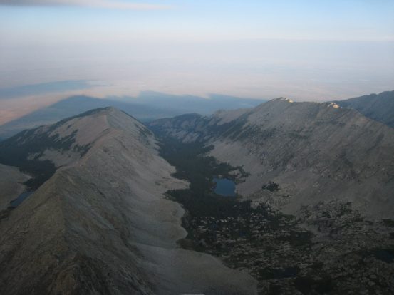
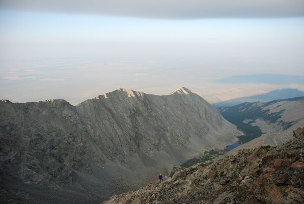
The view from atop the ridge before I had to turn back and downclimb some sketchy spots. The shadows of Little Bear and Blanca can be seen in the valley. We started out near the lake below, 2hr 20min ago...
I cut east and found a cairned trail leading up to the proper part of the ridge. Once there it was a quick scramble to the top of Little Bear. I summitted at 7:18am followed right behind by Ben, in just over two and a half hours since leaving camp. It was just a 1.1 mile hike from the lake, but with 2100' of gain, with most of the gain coming in steep class 3/4 sections. I realized I had climbed the whole thing without a sip of water.
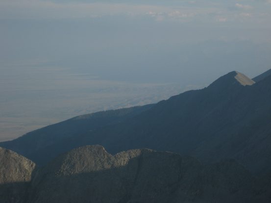
A look north to Blanca as I peaked Little Bear. Also a look to the Sand Dunes, through the haze...
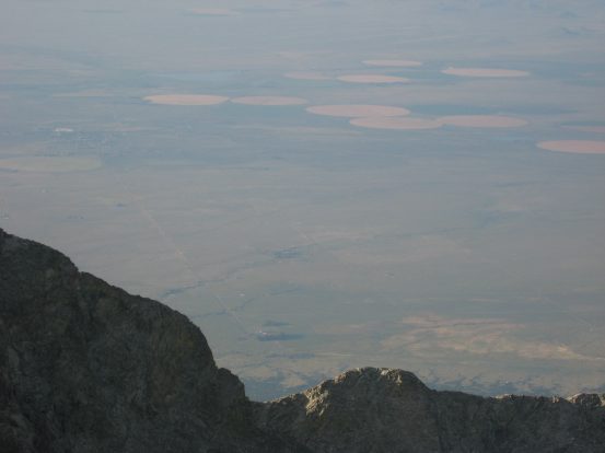
The views of the valley were similar to looking out of an airplane window at over 6,000' above...
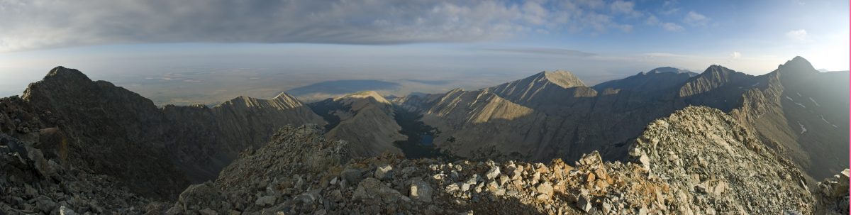
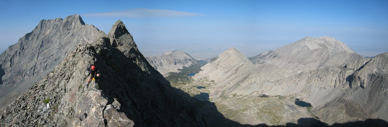
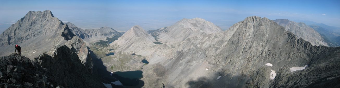
Ben took this sweet panoramic shot with the LB ridge on the right and Lake Como in the center...
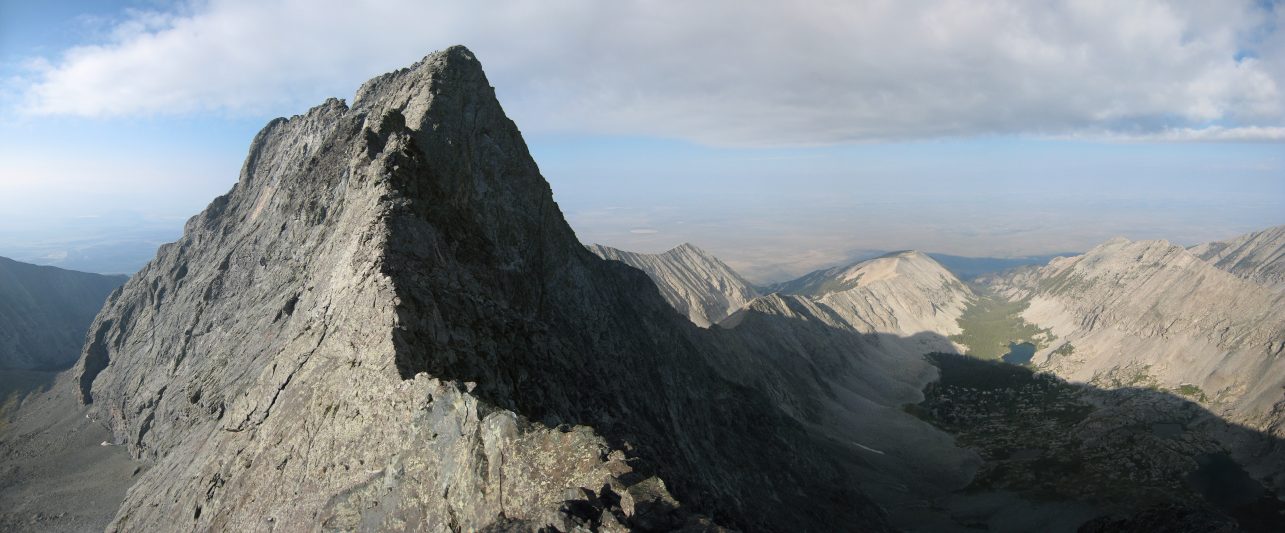
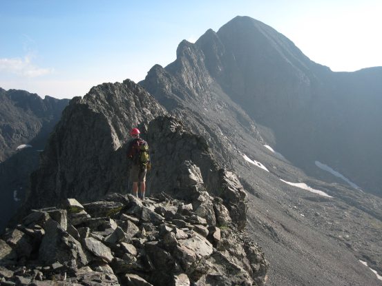
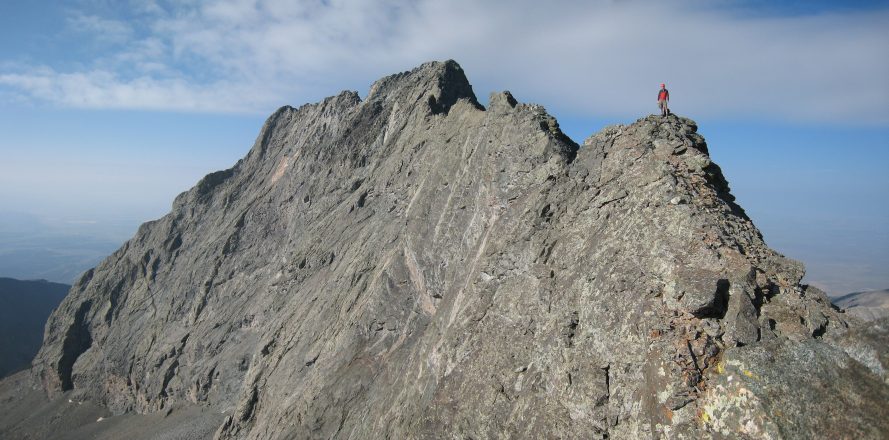
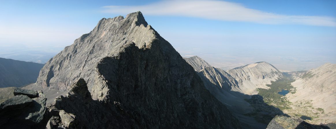
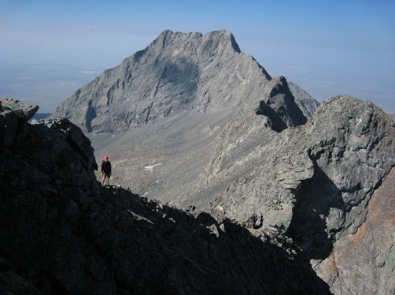
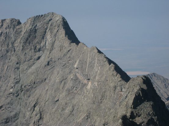
It was on Little Bear that we got the first view of the imposing ridge traverse to Blanca. The weather was gorgeous, the wind was negligible, and it was only 7:30am.... Perfect conditions for the traverse! Ben and I were psyched.
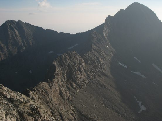
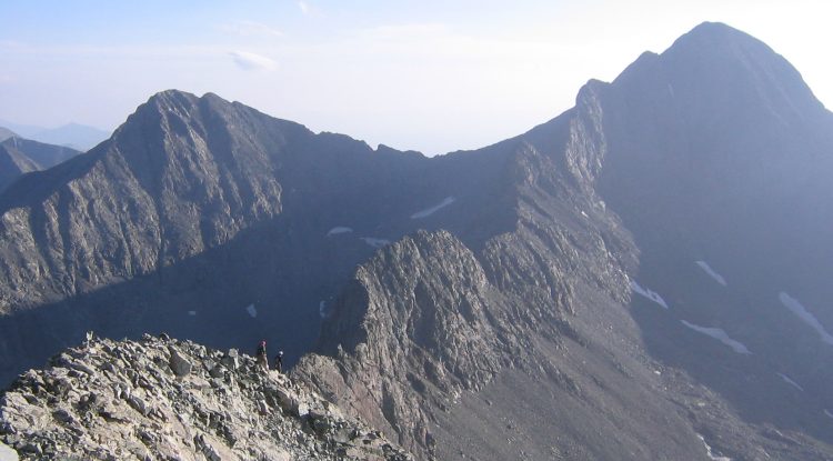
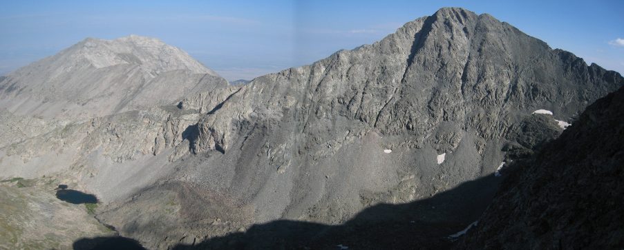
The full ridge from Little Bear to Blanca, followed by a zoomed in look at a portion...
As we rested at the top, took pictures, and were joined by Dave (who chalked up Little Bear as his 43rd 14er!), we could hear loud shouts coming from down below. "ROCK!!! ROCK!!!", followed by the sound of tumbling rock, followed by "ROCK!!! ROCK!!!" from another voice, followed by tumble-tumble-crash! This happened twice, and we hoped the bowling pins below avoided the ball.
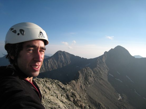
A self-portrait in front of the ridge...
Now was the time to choose our fate. I desparately wanted to traverse the ridge, Ben was eager to do it as well. It was hard to gauge how bad the inital downclimb to the ridge was from our vantage point, but it was considered to be one of the cruxes of the ridge. Dave's recent history of knee problems were a significant risk going across such a dangerous and ardous 1.5 mile stretch of ridge with steep down and up climbs over massive exposure, and so it was decided that just Ben and I would attempt the traverse. Even though the weather was ideal, storms are known to develop quickly among 14ers, and this ridge was about the most dangerous place to be in a storm, so maintaining good speed would be important.
I felt bad about leaving Dave to down climb Little Bear solo, but at least their would be others on the trail should emergency arise, and after all, Dave is a hiking legend at work and had the experiences of hiking 43 other 14ers, many solo. Ben and I strapped on our packs and started heading towards the traverse. After turning around once more and giving a thumbs up to Dave, we descended down towards the ridge, out of sight of Dave.
Dave stands atop Little Bear after we depart for the ridge. Dave ended up hanging around until the CMC group reached the peak, and descended with them, coordinating safe passage down the Hourglass with other hikers ascending...
Dave takes a picture just before Ben and I disappear on our way down to the ridge at 7:45am. Ellingwood and Blanca are seen left to right in the distance...
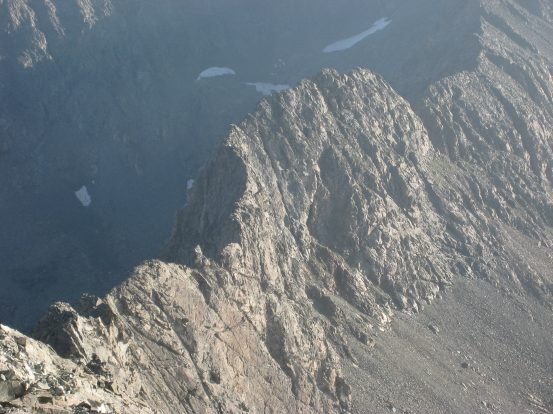
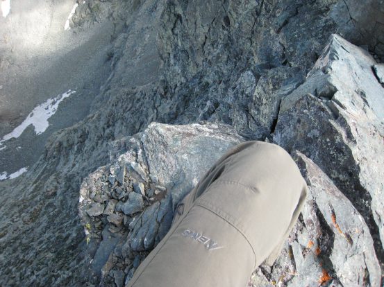
Some views from the beginning downclimb from Little Bear...
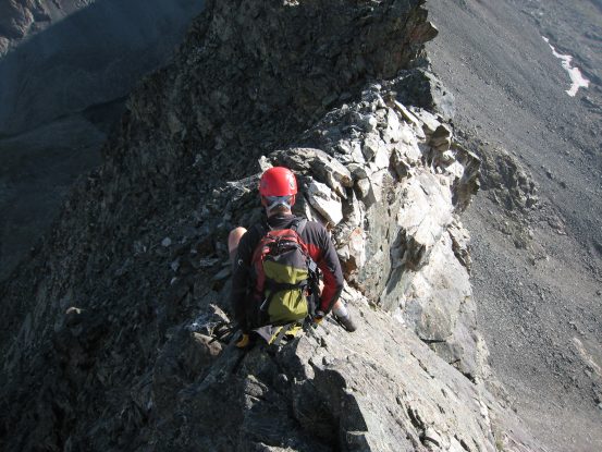
The initial down climb from Little Bear was supposed to be a crux of the traverse. While there was always a sharp drop off to one side or the other (usually the left), it was fairly straight forward and not too tricky. Basic class 4 down climbing. Easier than my descent from the wrong ridge earlier this morning. Not to say that the down climbing was trivial. There was plenty of butt-scooting, and I down-climbed just one section, but overall it wasn't as bad technically as I was fearing. There were narrow parts just a few feet wide though, where if you descended too fast you could go tumbling off into danger.
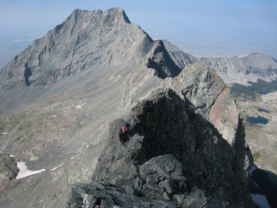
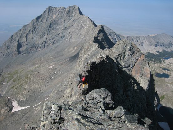
I've seen this exact picture on a lot of other trip reports, and everyone is always scooting on their butt here. Guess it's the natural way down...
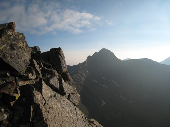
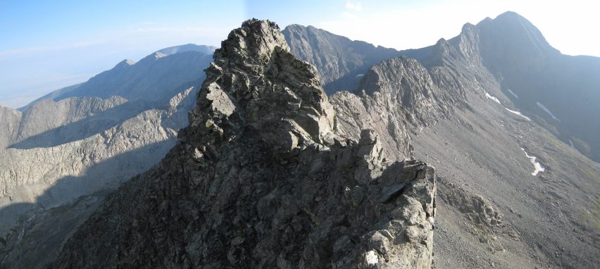
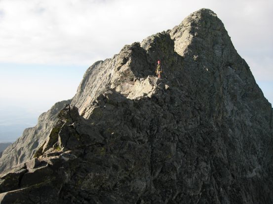
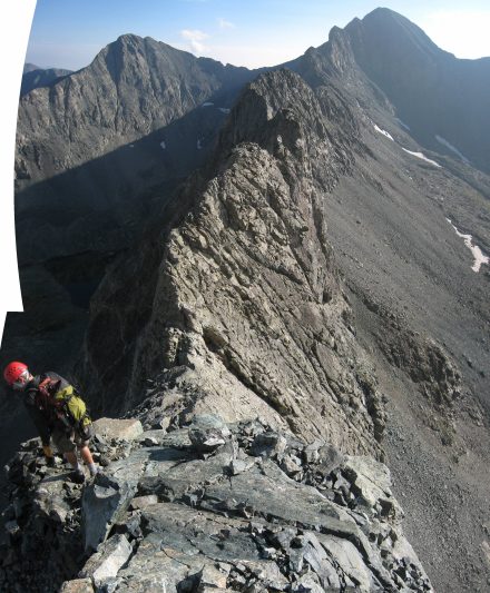
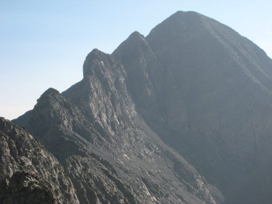
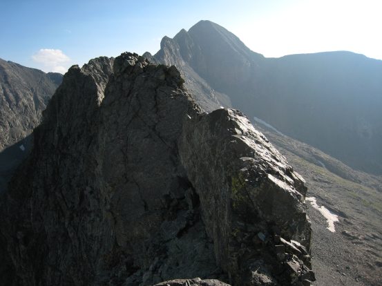
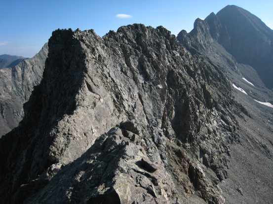
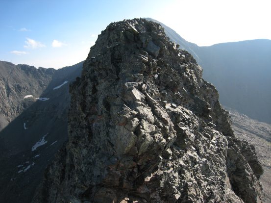
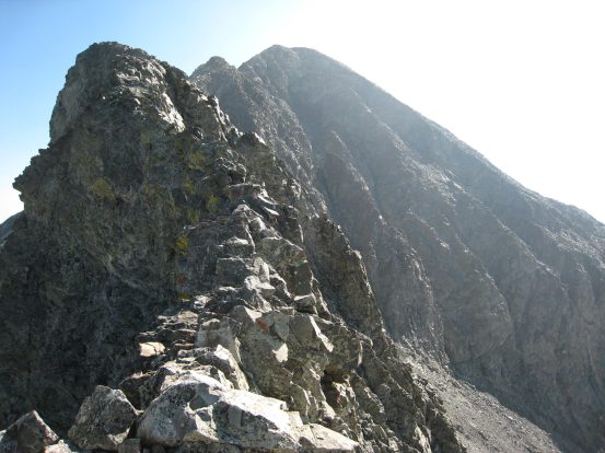
Almost done with the initial down-climb. Up ahead is the first tower on the ridge, another crux of the route...
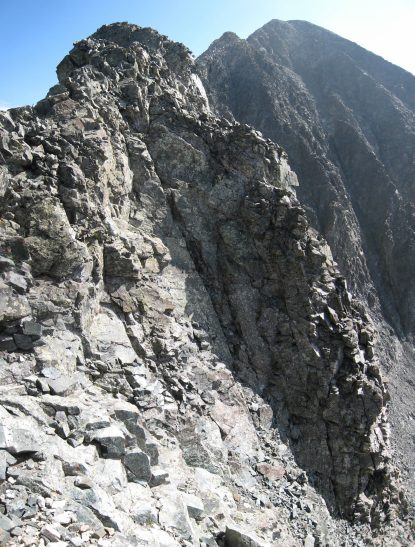
Immediately following the down climb was another crux of the traverse: Bivwacko Tower. Visually it's spectacular along the ridge, and would have been more intimidating if I hadn't had read so much about it. Much is written about this obstacle, and the consensus agrees that you want to circumvent it up on the left across a narrow ledge with good holds (over large exposure). Once you get up close, you realize it's really the only practical way. It looks possible to climb up top, but there's no telling how steep the downclimb is on the other side.
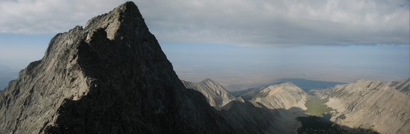
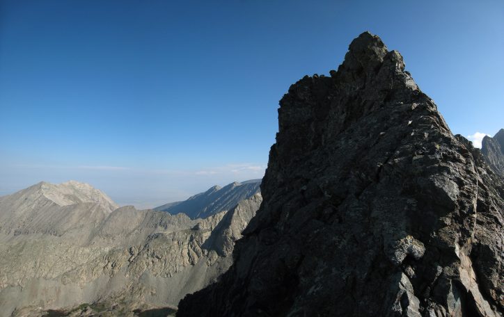
Bivwacko Tower splits Ellingwood and Blanca in the distance...
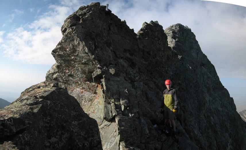
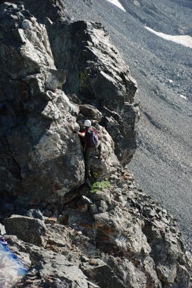
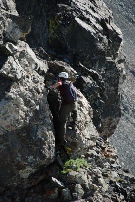
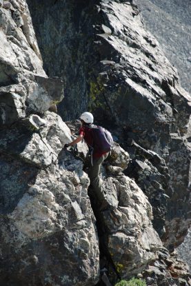
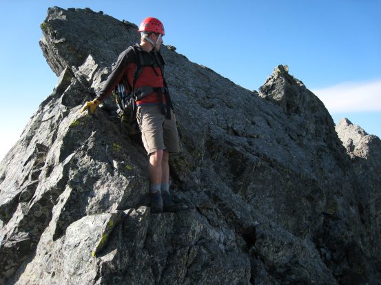
This tower is enough to stop you in your tracks, and for good reason. Believe it or not, the best route is to climb up a bit and circumvent on the left, where the good hand and foot holds are...
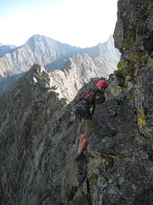
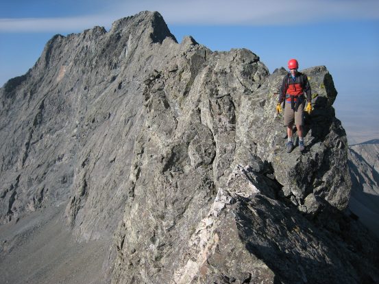
Ben shows us that one must not be scared of 1000' drop-offs below to master Bivwacko Tower. Be prepared to do this move if you attempt the ridge. Ben considered this the most intense move of the traverse...
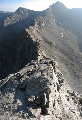
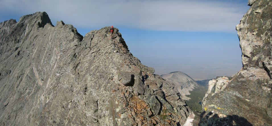
Beyond Bivwacko the ridge was still sharp and heavily exposed. The views were outsanding today, though the haze in the air was thick...
Looking back towards Little Bear, this notch in the ridge was bypassed by climbing down on the left...
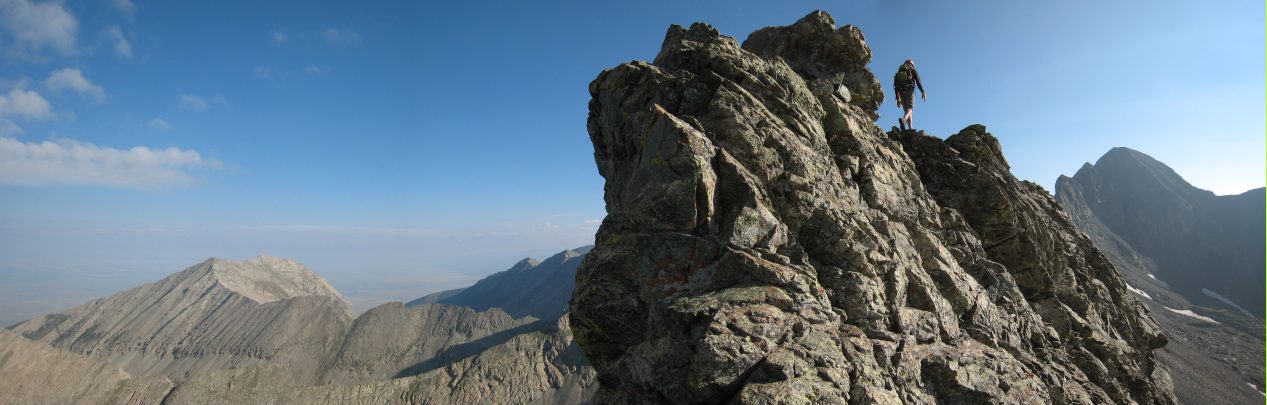
More knife edge trail ahead, big surprise. Seemed like over half the time you end up walking with your arms as you straddle and scramble with your legs...
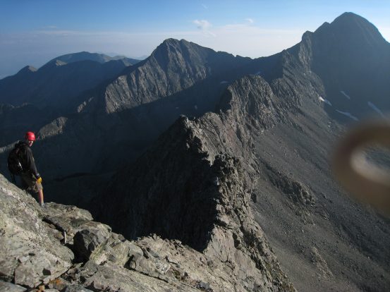
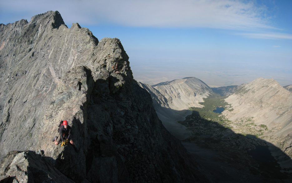
Turning around from where I took the above picture, Ben stands on the ridge below Little Bear. All that work just to get down to here...
A look back at Little Bear after a couple more minutes on the ridge. I marveled at the serpentice discs jutting up from the ridgetop...
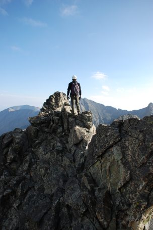
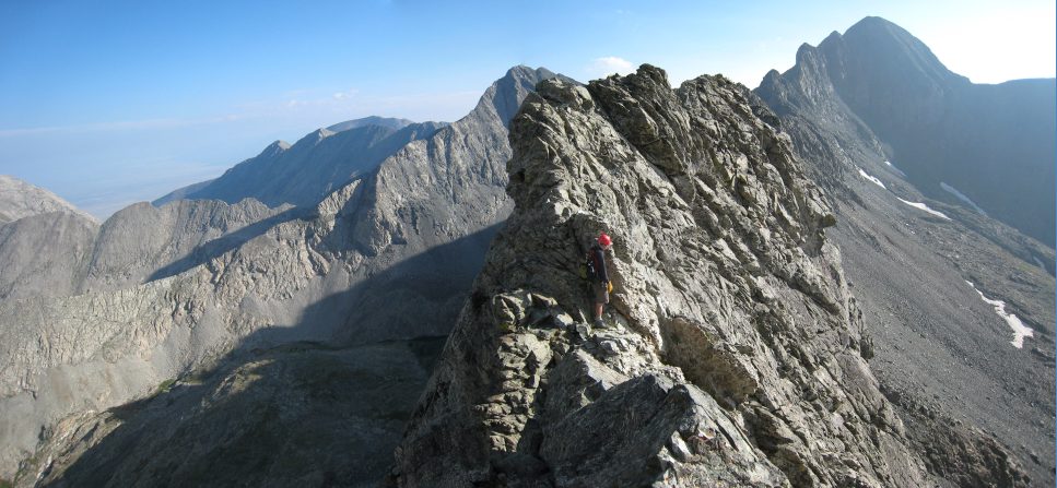
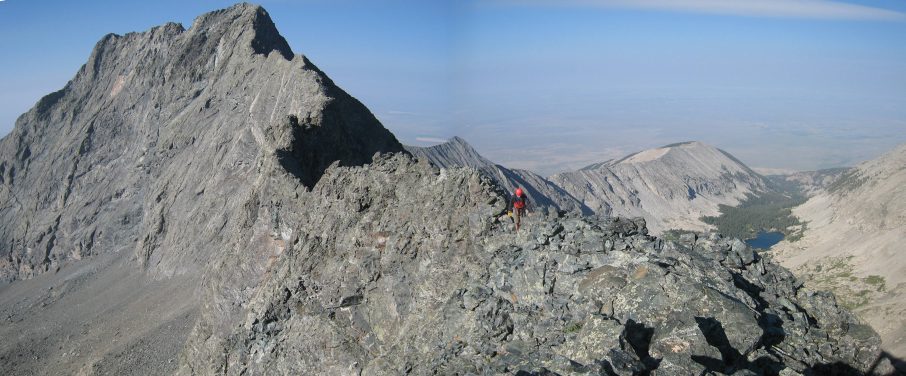
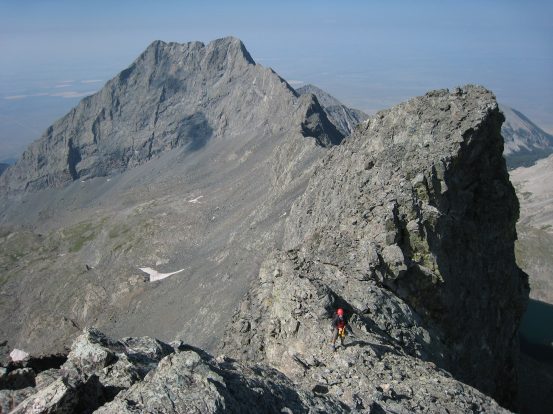
Me working across a typical knife edge portion of the ridge. The ridge had offered so many technical elements already, but after looking at Blanca, it seemed like we had hardly made any progress so far...
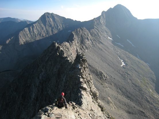
The ridge kept throwing challenging knife edges, climbs, and down-climbs at us with unrelenting exposure. But nothing was too technically hard. There were always good holds if you looked for them. It was important to be patient and find the "easy" move. I was very comfortable and felt like velcro on the rock.
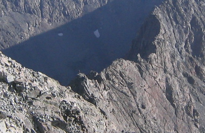
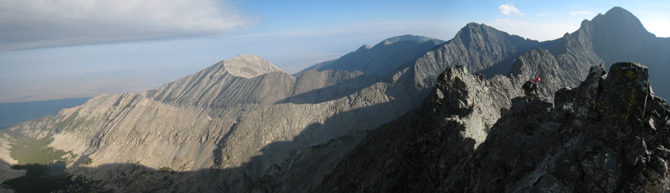
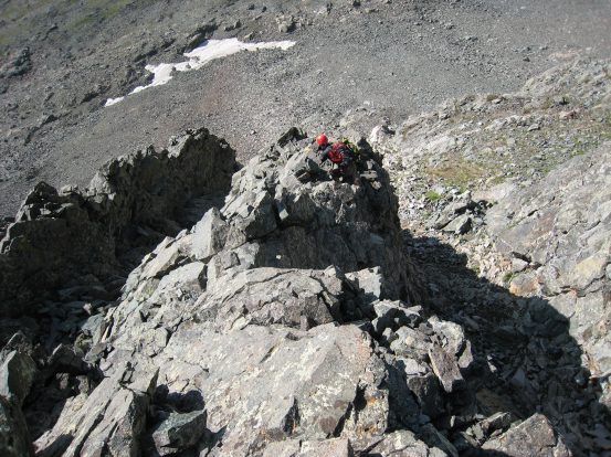
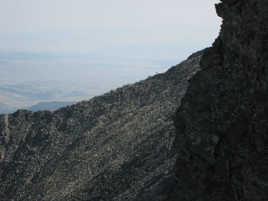
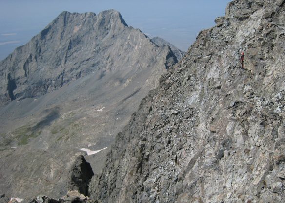
At some point around here, Dave, still up on Little Bear, snapped a picture of one of us on a tower along the ridge. Look for the tall dark skinny guy on the first ridge tower...
Ben balances across this sharp ridge stretch...
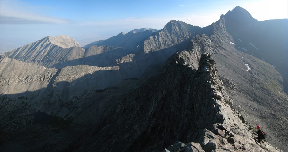
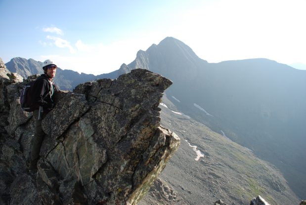
We took a break on a fairly wide portion of the ridge, about 35 minutes since we left Little Bear...
From our break point, if you look closely you can see a few people at the top of Little Bear, just left of the top of the ridge. At 8:20am, the sun had just cleared Lake Como, our camping area, in the valley below...
Even out this far on the ridge, and beyond, occasionally we'd hear voices that sounded like someone was on the ridge right behind us, but we could never spot anyone, and it became clear that the voices were from the top of Little Bear. Somehow the sound carried perfectly, and you could hear individual voices. I yelled at Little Bear a few times, to get people to see us on the ridge.
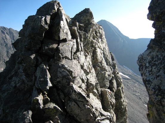
Yes, more knife edge ahead, believe it or not.
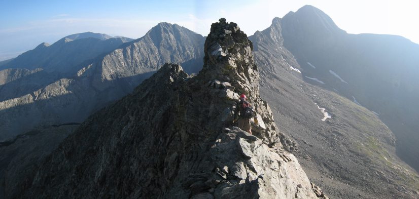
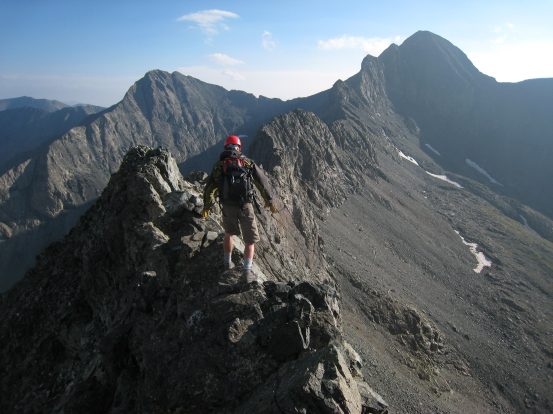
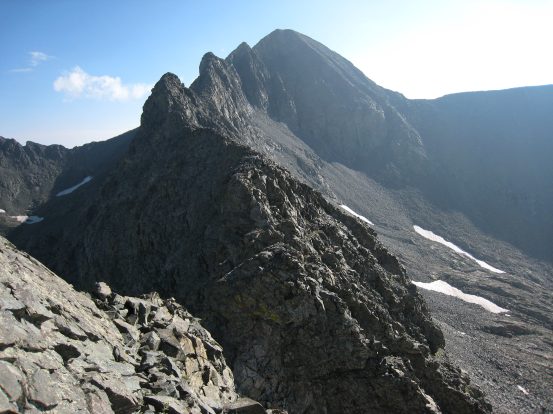
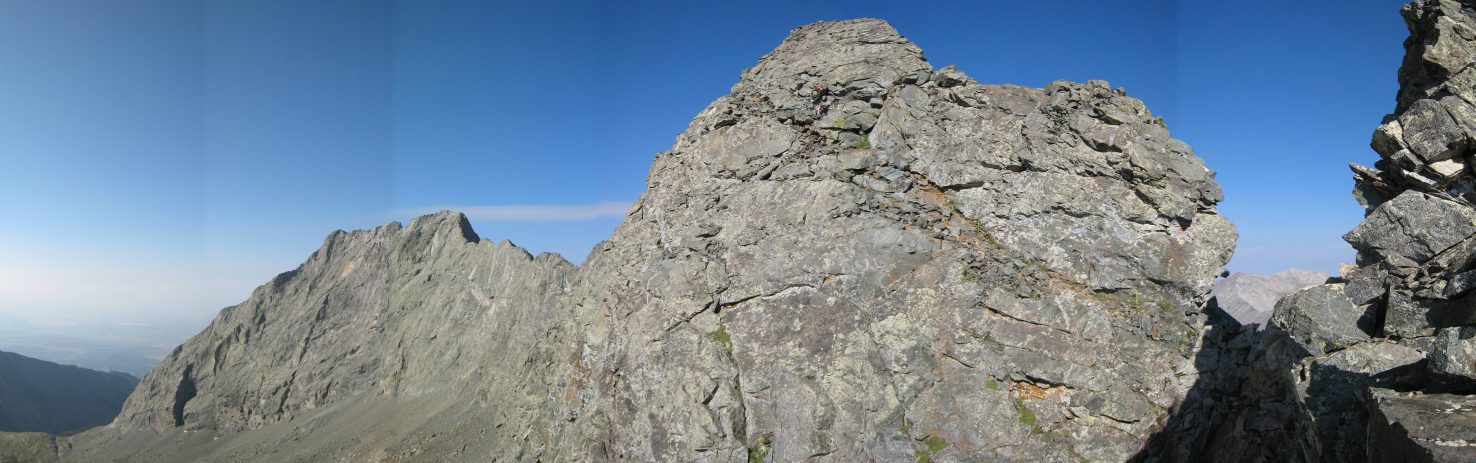
Looking ahead to Blanca, the three big towers on the ridge looked impressive. However, there was still plenty of ridge to deal with before arriving there...
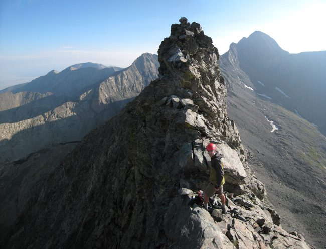
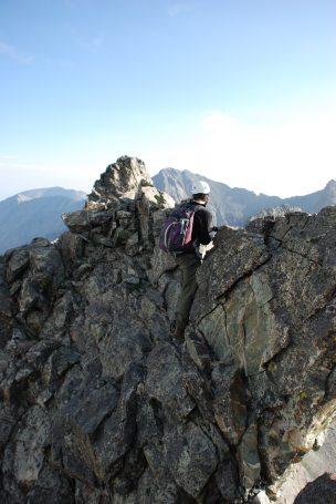
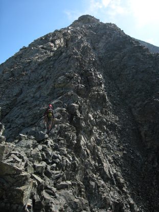
Ben checks out the latest obstacle along the ridge. We need to skirt to the right a short ways, and then climb to the top of the ridge...
A closer look at the approach up this rock, as I prepare to follow Ben up to the ridge...
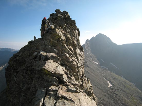
And what do we see beyond the rock we just passed? More sharp ridge ahead, of course...
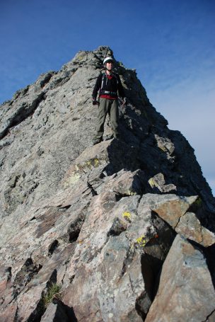
A pic of me on some not so scary stretch of the ridge...
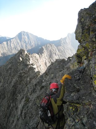
The next big rock along the ridge to figure out how to pass...

Ben takes some pics of me climbing up along the crack in the right side of the rock, to gain the ridge again...
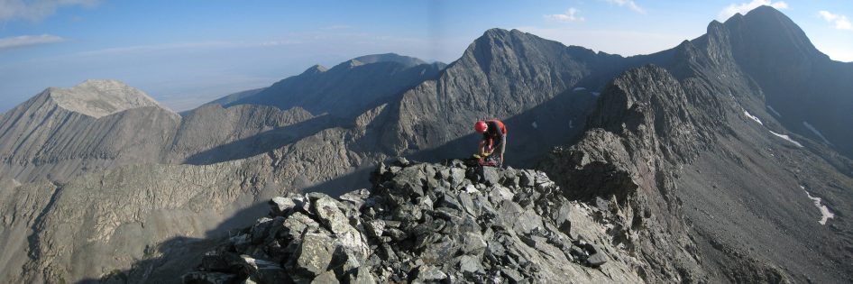
From midway up that rock, I take a couple of sweet panoramas of Ben with Little Bear behind. #1...
and #2...
With so many knife edges and challenges on this ridge, they all seemed to get muddled together in my memory. I'm spending a good amount of time piecing the order of all the pics together, from various sources, to preserve continuity. All the trip reports I read gave the impression that the non-stop exposed stretches become blurs in your memory. It's hard to distiguish any particular section (with the exception of 2 main big ones - Bivwacko Tower, and one of which is still to come) after spending 2-3 hours in constant exposed conditions. Fortunately, all these pictures I took remind me of the individual challenges there were along the way.
One of my favorite pics... Straddling the ridge, Little Bear behind, and Lake Como in the valley from where we began this morning. This pic was taken 3 minutes after the last pic. The wide ridge from before didn't last long...
The following pictures were taken every couple of minutes in each direction. It's all more of the same, but gives you an idea of the ongoing ridge obsticals, and gorgeous views:
The above six pictures range from 8:47-8:55am. I love how the dark shadows outline the "S" like curves of the ridge. We had covered a good distance since leaving Little Bear at 7:45am...
A look back and Ben and ridge a bit further on. This looks like the one flat wide part that was so nice and friendly for 200' or so...
And a look in the opposite direction from the same point as above. This big rock was an easy and fun scramble...
Just beyond the above pictured rock was a dip to the saddle of the ridge. After a downclimb to this point we'd be starting up the Blanca side...
I climbed down to the notch ahead of Ben and took this pic of the scaling we'd need to do around the right side, to climb back up to the ridge. Also took a pic of Ellingwood to the northwest from inside the notch...
Before I made my way completely around the rock, I took this panoramic pic with Ben making his way down to the saddle point (don't miss him - the dark spot on the rock face in the center). We needed to cut the east side of that rock to reach the saddle...
Ben follows the same path as I, around and up to the ridge...
Just another casual knife edge to straddle once up the ridge. You're probably bored of these by now... It's 9:16am, an hour and a half into the ridge...
A good look to the west at Ellingwood. We planned to hike up the class 3/4 ridge leading up from the left of Ellingwood (14,042') tomorrow...
From the saddle, there are 3 large towers on the ridge leading to Blanca. I remembered we were supposed to bypass one of them to the right, but couldn't remember if it was the 1st or 2nd one. The first one looked easy to skirt around, so we cut down to the rock slope on the right. This is the only safe way off the ridge, should you need to escape a storm. But unfortunately, your camp is on the other side of the ridge, and there is no way to get back without finishing the ridge, or ascending Blanca via the east side.
The three huge towers leading to Blanca. After refueling with a bunch of Twizzlers, we cut down to the right to bypass the first tower...
We cut back up to the ridge between the 1st and 2nd tower, cause it was apparent that a huge cliff existed from the basin up to the 2nd and 3rd towers. Also pictured is a look at people climbing up Blanca's west ridge. We were getting close to Blanca...
As I climbed up along the ridge to the top of the 2nd tower, I finally saw a sight that made my stomach squirm. Up ahead was not your everyday knife edge with steep slopes that we'd grown so accostumed to that we hardly noticed them anymore. If a knife edge is an upside down "V", then what I was looking at was a capital "I". This was the famous "catwalk" section of the ridge, where the ridge is a couple feet wide and flat, but both sides of this walkway overhang 1000' cliffs on both sides! Concavity on both sides! Yes, the sight of this catwalk made me squirm, and I finally had a mental challenge to overcome.
This picture doesn't at all reveal the scariness of the catwalk as seen when approaching it in real life. In fact just skip down to the next pics...
I approached the beginning of the catwalk. It was probably no more than 35' long, and fairly level. As soon as I began the crawl across, my body resumed auto-pilot, and it was a simple matter of manuevering across flat rock. My brain was not to be bothered by needless details about 1000' cliffs. The rock was extremely solid, and passage was straight forward. But I really wanted to try to capture the uniqueness and awesomeness of this particular location, so I tried taking some pics and a video from a secure spot along the catwalk. Enjoy!
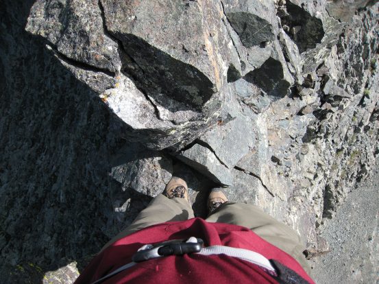
A couple of views straight down while on the famous catwalk of the LB traverse. Though the rock was solid, I remember the rock next to my left foot, in the 1st pic, being completely loose. I could have kicked it over the edge (but didn't). Check out the vertical drop and overhanging rock in the 2nd pic, off to the left. Click any picture above, or this link for a 14 second VIDEO from here (4.5MB)...
A couple of pics looking back and Ben, who just finished the catwalk portion. The catwalk is the shaded wall just behind Ben. Too bad we didn't get any pictures of us on the ridge from a distance, but hopefully I've captured enough to convey the coolness of it...
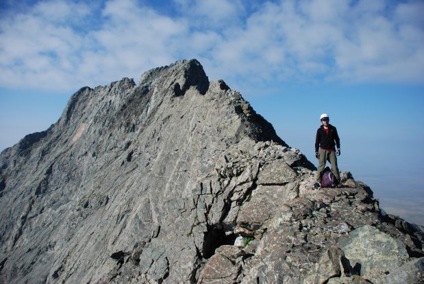
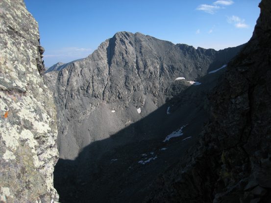
Turning around and looking towards Blanca we can see we are almost at the top of the 2nd tower. The third tower has a noticeably steep cliff, which would be unclimbable if one tried to skirt around tower #2. Also a zoomed in look back at the beginning of the traverse. Doesn't quite look as sharp and dramatic from afar...
Still climbing up towards tower #2, the catwalk is the curved rise not too far behind on the ridge. A number of lakes are visible in the daylight, now at 10am. This is another great shot at the ridge leading off from the left of Ellingwood that we planned to ascend tomorrow...
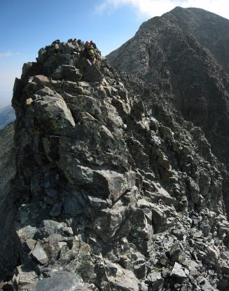
Finally reaching the top of the 2nd tower. Ben leads the way up, and down across the saddle to the final tower and ascent of Blanca. After the 2nd tower, it's an easy class 3 scramble up to the top of Blanca, with zero exposure the rest of the way...
A scrambled a head, and took this pic looking back at Ben and tower #2. From here Ben took a route up along the left, and I explored up to the right. The rock was wide, and the scramble was easy. Play "Where's Ben?" in the 2nd pic (hint, upper right)...
From this point on the route was simple: go up until you can't up up anymore. I summited at 10:25am, which made the traverse time 2hr 40min from Little Bear. Ben was up a couple minutes later, and we rejoiced in completing the LB traverse!
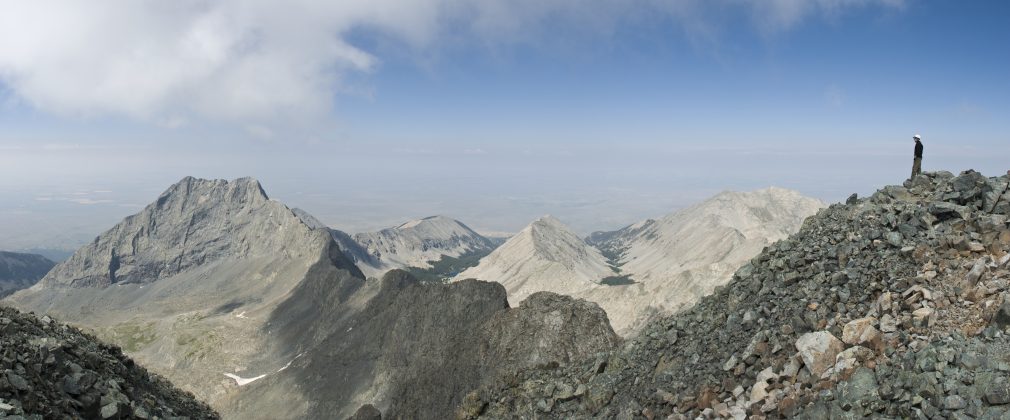
Ben took a sweet stitched pic of me on Blanca looking out over the entire ridge to Little Bear...
A look northeast from Blanca yielded Mt Lindsay, another 14er, and a few lakes. I read about people wanting to Traverse from Little Bear to Blanca and continuing down and up to Lindsay in one day. Pretty crazy...
We'll we hung out on Blanca, a few other people summitted, via the west ridge. One lady had a daughter that went to CSU, and asked us if we knew of the Which Wich restaurant in Ft Collins. We hadn't been there before, but she explained that if you bring in a picture of yourself on a 14er, holding one of their menu-bags, then you can get a free sandwich. Conveniently she had a few bags, and let us pose with them. I gotta print out a copy of this photo now. :-)
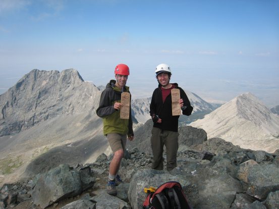
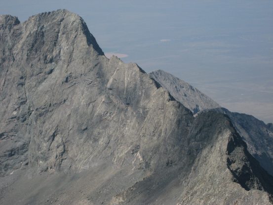
Ben and I atop Blanca (14,345') with Little Bear and the ridge behind (read above to explain the bags). A close-up of the Little Bear and the initial part of the ridge as well...
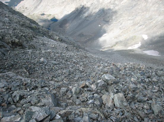
We stayed on the summit for 25 minutes before beginning our descent down the west side of Blanca. We thought the difficulties of our hike was over, but cutting down the super long rocky slope, with patches of loose rock, was not all simple and easy. I felt like I was working hard coming down this slope then across the ridge. And this time, all the weight was on my legs, versus spreading it out through my arms with all the crawling and scrambling earlier. I remember the return trip from Capital Peak also being surprisingly taxing.
Ben heads for the ridge in search of a trail leading down. We eventually just decided to cut straight down to the valley, to save some distance. It didn't look any better on the ridge...
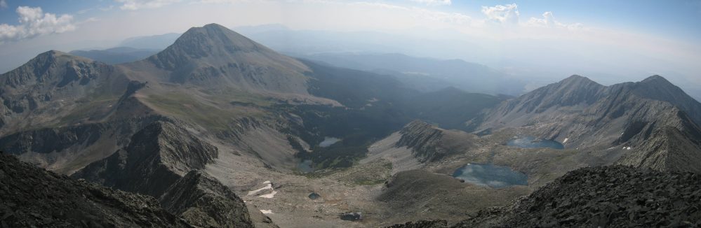
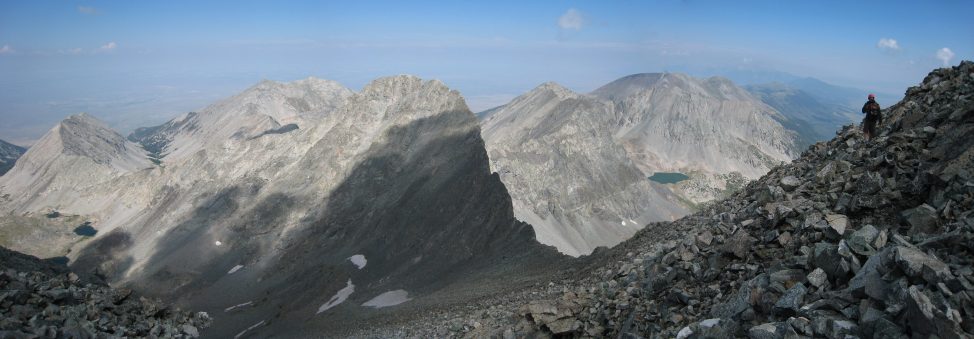
A look down at the long rocky downclimb. This reminded me of the descent down the west face of Snowmass last year. Ben and I could have gone for the "Grand Slam" by summitting Ellingwood straight ahead, but we wanted to ascend via the west ridge, and with Dave, (and we were tired)...
Down past the Ellingwood-Blanca ridge (with Ellingwood in front). I'm ahead on the left (Ben's pic). Still a good chunk to go...
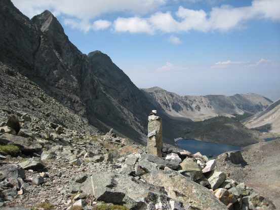
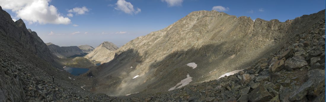
Soon we found a cairned trail, with easier footing through the rock. A particular photogenic cairn stood out, as Ben takes a rest (Blanca's peak up the slope behind him)...
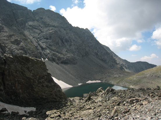
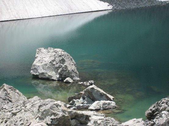
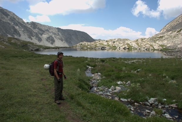
After a lot of switchbacks across the rocky cairned trail (which was a bit confusing to follow), we reached the first lake, with the LB ridge above on the left. The water was extremely green...
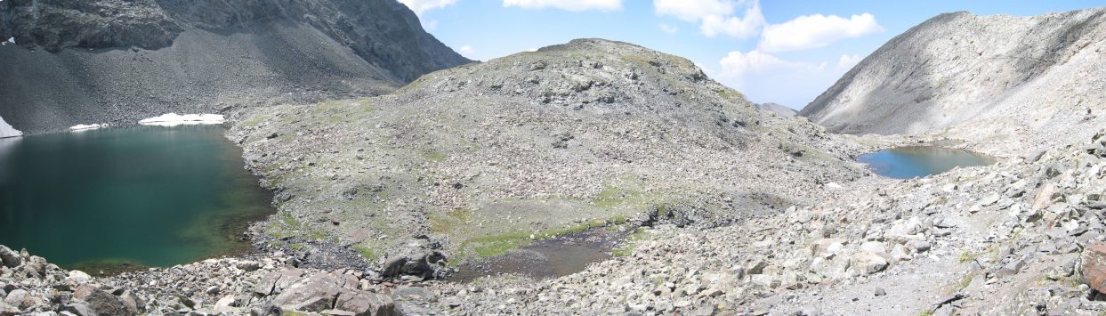
This green lake poured into a nearby blue lake...
Here we made a wrong turn and got off trail. We were supposed to go to the right of the right-most lake in the picture above, but we wandered to the left side of the mound pictured above. As we rounded the mound we saw a steep dropoff of a couple hundred feet, so we scaled across the tundra and rock covered mount all the way to the other side of the basin to catch the trail.
A look back and Ellingwood and Blanca, left to right, before cutting across the mound to hook up with the trail again...
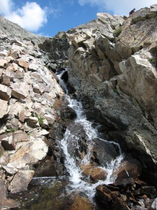
We had to cross across this waterfall to rejoin the trail on the other side. The pic of the waterfall is from the point where we crossed the stream...
The trail passed another lake before descending deeper into the valley...
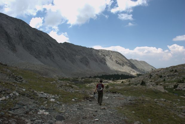
A look back at the big mound we had to cross along the front to join up with the path on the left. It was a drop off on the right side. Ellingwood and Blanca appear left -> right in the background...
Soon we were near camp, and were anxious to meet up with Dave to see how the Little Bear descent went. But we arrive at camp (1:10pm) to find it empty. We went to Chris's camp in search of Chris and Dave, but learned that Chris had been very ill all night, and ended up hiking out this morning and driving back to Fort Collins. This was sad news, and we also learned that the CMC Little Bear party hadn't returned yet from this morning, which was also slightly distressing, as it was just a 2.2 mile roundtrip hike from here (with lots of elevation gain).
But we learned that Dave ("Your friend, the tall one") had arrived safely, and had "left to hike up Blanca, if the weather stayed nice". Wow, Ben and I were pretty shocked, as it's a 2500' gain hike from here to Blanca, after coming off or 2100' gain from Little Bear. Dave was really feeling hardcore today apparently. I was a bit worried though, cause the descent down Blanca was very long and hard on the knees, especially after taking a beating from Little Bear. But Dave was tough, and no doubt could handle it. Just needed the great weather to hold all afternoon. Ben and I hung out at camp for a bit, enjoying the views of the water cascades nearby. Then we took good naps in our tents.
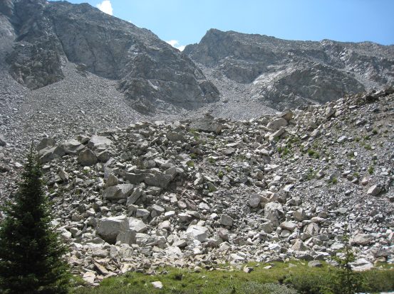
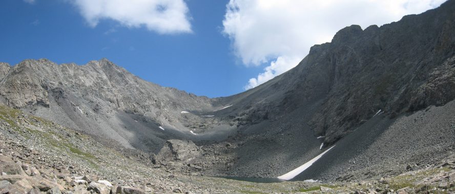
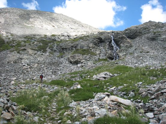
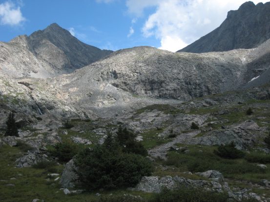
A look up at the notch we began our climb to Little Bear this morning, now in the light...
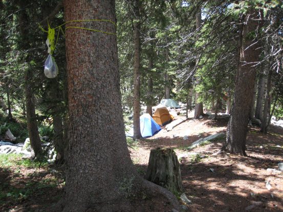
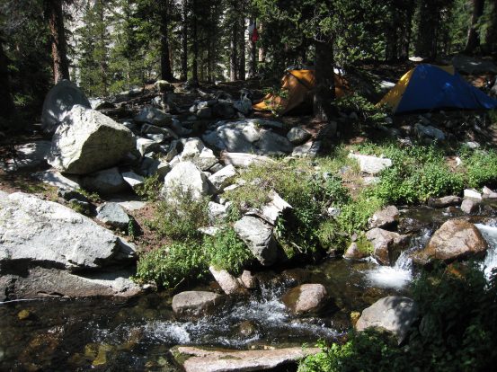
Some views of our camp in the afternoon...
Shortly after 5pm I was up again, and Dave hadn't returned yet. We learned that the CMC Little Bear group was back, they had spent a long time repelling down the Hourglass with rope. When Dave wasn't back at 6pm, we packed our dinner supplies, and walked back up the trail towards the lakes, planning to eat someplace nice, and catch Dave coming back on the trail. Sure enough we met up with him on the way, and we walked to a nearby lake to eat dinner. He agreed that the down-climb from Blanca was very unpleasant and slow. Good thing the weather stayed beautiful from morning through the evening. Evidently when Ben and I took the wrong turn coming back from Blanca, Dave had passed us on the trail, while we were taking an accidental long-cut off trail.
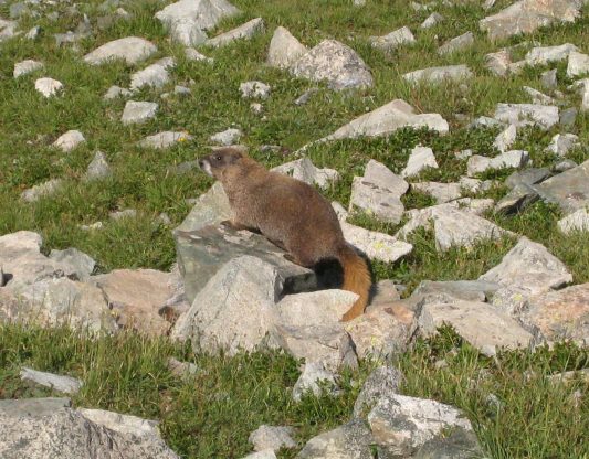
Found some marmots on the way to our dinner spot near the lake...
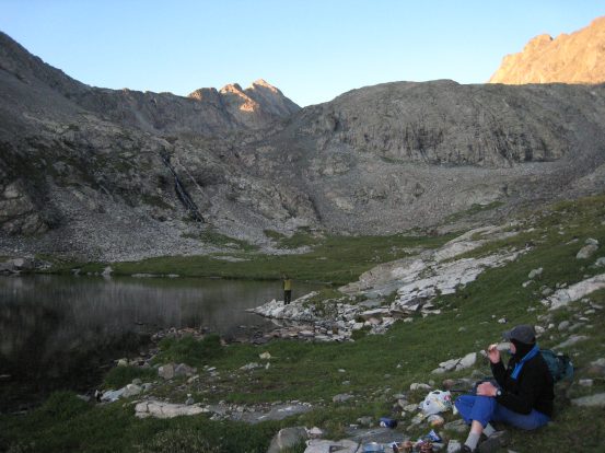
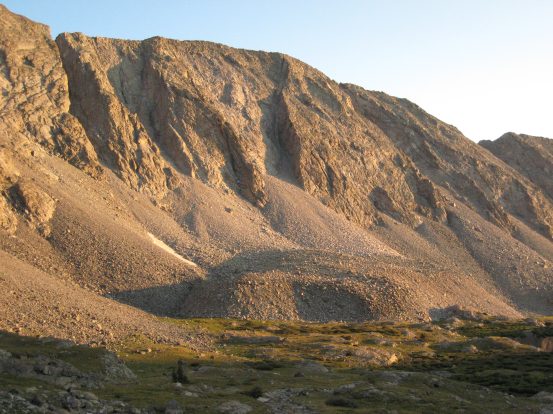
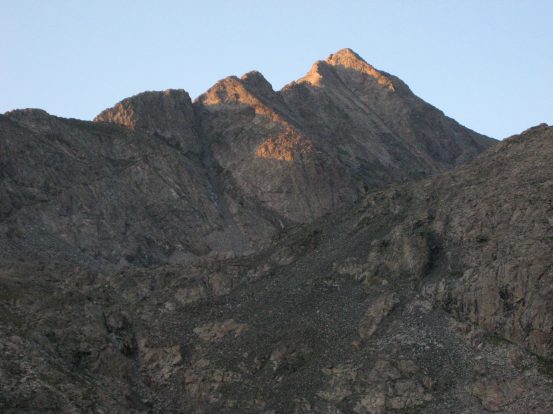
Behind us, the ridge leading up to Little Bear is lit through the opening of the valley...
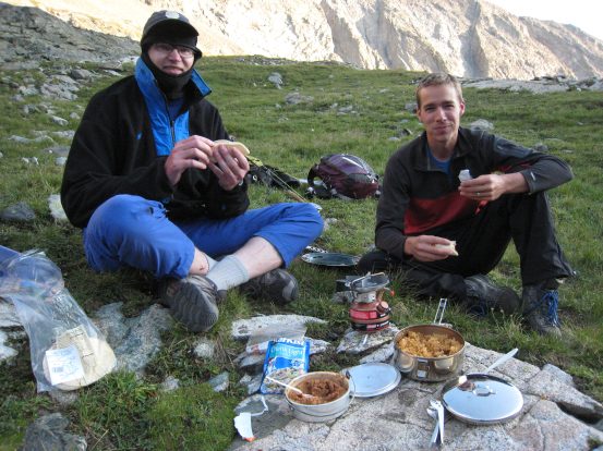
We had dehydrated refried bean and couscous burritos for dinner, as a golden glow fell over the ridge. Dave bundled up to avoid mosquito bites (I still see some exposed shins Dave!)...
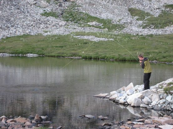
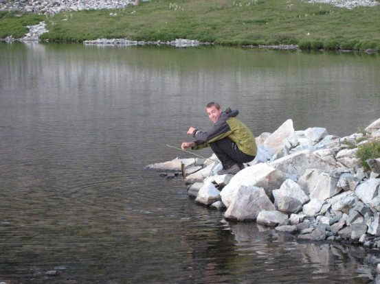
Ben made use of his fly-fishing skills after dinner. He caught a bunch of 8-12 inch cuthroat in the evening...
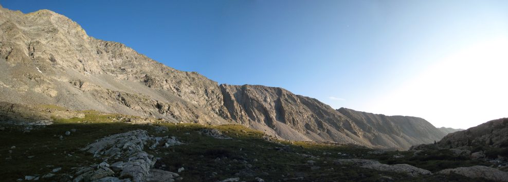
We ended dinner with a sunset view of the Little Bear to Blanca traverse. We traveled the ridge line from right to left this morning. Hard to distinguish any heavily exposed obsticales from this vantage point..
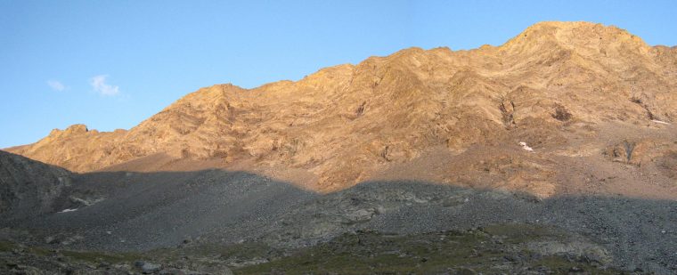
A look up at the last rays of light on Ellingwood before we head back to camp. Ellingwoodh was tomorrow morning's 14er agenda...
Dave and I headed back to camp around 7:40pm while Ben hung back to fish and take some photos. We planned to get up at 4am again and hike the west ridge of Ellingwood. Both Ben and Dave weren't 100% their legs would be re-couped for tomorrow morning, but given all the hard work to make it to Lake Como, I had a feeling we'd all be up for it in the morning, as it might be a very long time before any of us would be back in this amazing area again.
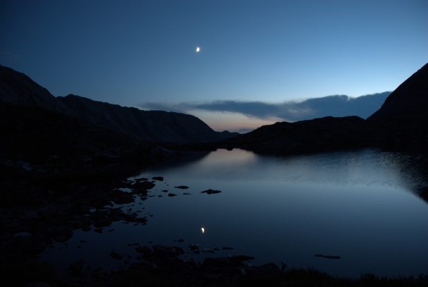
We end today's journal with a fantastic photo Ben took with his SLR after sunset from the lake we ate dinner at...
I went to bed extremely satisfied with the day's adventure, and amazed at the great weather all day. There was little doubt that the clear skies would continue into tomorrow morning for the Ellingwood hike. As I closed my eyes, I had vivid visions of walking across scree slopes, where every step I took slid underneath, or visions of boulder hopping along a ridge, grabbing out with my hand as I went to lean on a rock during a down climb. Truly a day to remember, and I was extremely thankful for the perfect weather to allow such an opportunity.
Go to Day 3 (Ellingwood trip report)