Mt. Shavano (14,229'), Sawatch Range, CO, May 30th, 2009
(Maximize browser for best viewing)
Route: The Angel (snow climb)
Distance: 7.5 miles
Elevation Gain: 4600'
After originally planning for a snow climb of Conundrum the past 2 weeks, only to be dissuaded by stormy weather reports, I turned my eye to another 14er snow climb, Shavano's famous "Angel" route (a large snow patch shaped like an angel with arms outstretched). This popular and accessible spring-time route is mainly 30 degrees or less, with minimal avalanche danger. I wanted to take advantage of this unique route, on an otherwise un-notable 14er, before the snow melted away this year. The ~1300' of glissade-able snow on the way down the mountain would surely be a highlight.
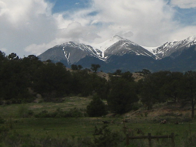
Tom, Wendy, Christine, and I left Fort Collins at 3:20pm Friday, and stopped in Buena Vista for pulled-pork sandwiches at Punky's 3hrs later. Along the way we noticed heavy clouds and wet weather in the mountains, and hoped they were just typical afternoon storms that would be dissapating later in the evening. After dinner, we drove the last 40 miles to Shavano's trailhead, admiring all the fresh snow from the past 2 weeks of heavy moisture, on the peaks.
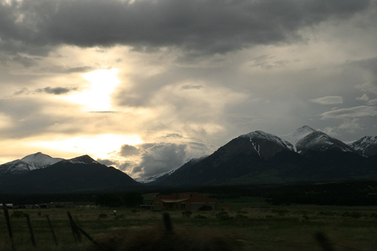
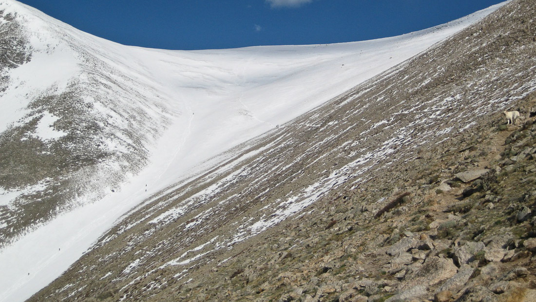
A view of snowy Shavano as we arrive and take the 9 mile dirt road towards the trailhead. Christine took the awesome pic from the car on the left. The Angel's head and arms were blended together, thanks to the recent snow storms covering the whole mountain top...
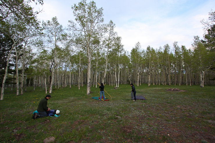
We followed the directions in Roach's book, and after driving by several groves of fresh leaved aspen, we arrived at the vacant trailhead parking lot. I had read there was dispersed camping just beyond the latrine at the trailhead, so Tom and I explored, but the slanty ground with a fire pit along the trail left us wanting more. So we continued up the road and found a huge field surrounded by aspens, with a few campers nestled along the perimeter. We delighted at this find, and found a spot for ourselves.
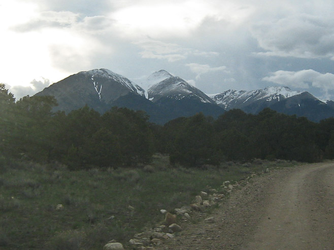
A look towards the dirt road, with the top of Shavano, draped in white, visible in the distance. Tom, Wendy, and Christine set up camp, careful to avoid the widespread cow-patties (this whole region is full of cattle)...
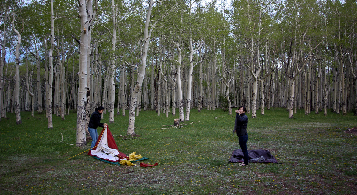
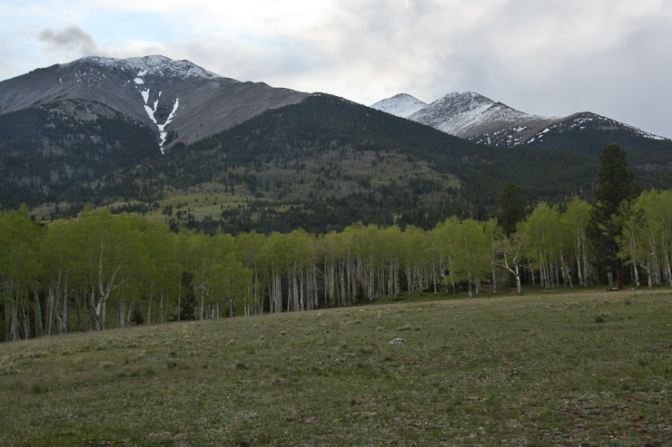
The aspen forest offered a scenic backdrop to camp. For anyone camping before hiking Shavano, this field is the place to be...
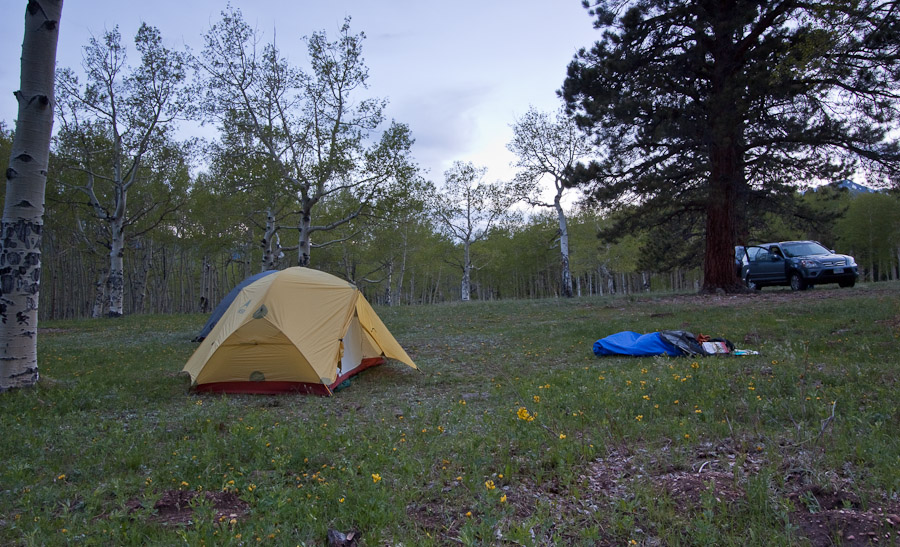
This would be the first time Wendy and I tried out our new tent (the Hubba-Hubba HP, by MSR)...
We set-up camp, and immediately got ready for bed (though I did fit in some time to play with my new camera and tripod). It was very chilly as the darkness grew. The clouds were thinning, showing the crescent moon and a couple of early emerging stars, which gave encouraged our hopes about the weather tomorrow. By 9:45 we were all in our tents/bivvys, having readied our bags as much as possible for tomorrow's 3:15am alarm. We wanted an early start to get as much time on the snow while it was still hard from the nights chill. Tom and I also planned to bag the 14er Tabeguache, another mile beyond Shavano, before the afternoon storms kicked in.
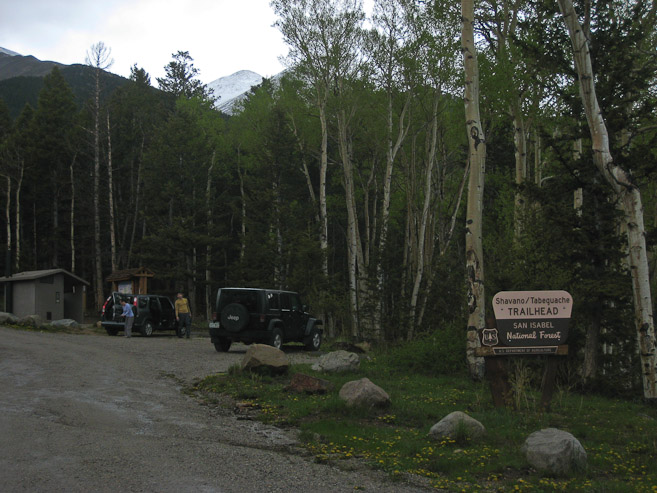
I often don't get much sleep, if any, on 14er climb eves, but this time I had three 45-75 minute snoozes, once waking to a barking dog. The tent was a success, with no condensation inside, though a bit cozier than our old tent that Christine was using. The temps probably dipped into the upper 30s overnight, and a chill air greeted us after Tom's wake-up call at 3:15. A sky full of crystal stars and the milky way reigned above; that greatful sight which frees the spirit to embrace the excitement of an awaiting glory on a mountain top ahead. After making final pack preparations, and snacking on some Twizzlers and blueberries, we left our tents and drove back to the trailhead, where a couple other cars were already parked. We hit the trail (elevation 9750') at 4:07am, donning headlamps in the dark.
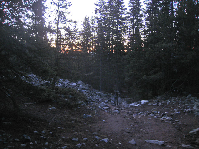
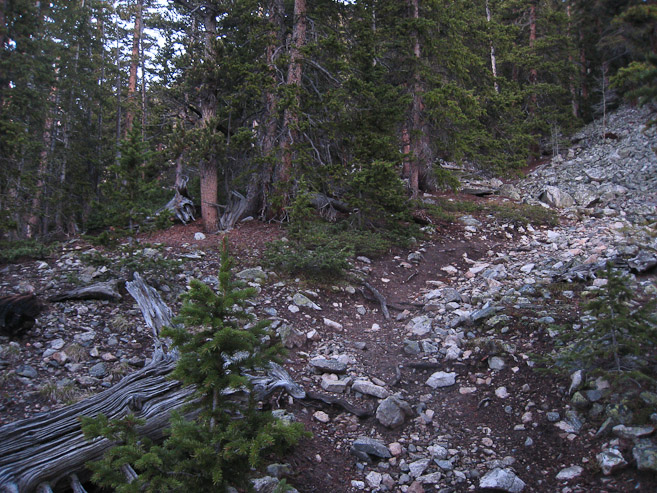
We quickly took a right onto the Colorado Trail, which passes a beautiful field of aspens (which we couldn't see in the dark), and soon turned left onto the main trail up to Shavano. The sign posts were clear to follow. The trail then began a mild climb through the forest up a wide rocky dirt path. We soon stopped to remove layers, as there was no breeze to cool us down. After ~1hr, the trail met a small stream, and we crossed and followed along beside it, eventually turning our headlamps off with the increasing light. The trail was a bit confusing to follow in the dark at times, and my GPS saved us a potential time consuming wrong turn early on, as we cut back towards the north to regain the trail.
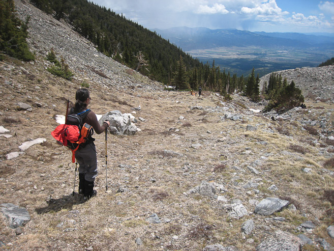
We kept on the lookout for a break in the trail to the left, for the angel route, and eventually found something that looked like a exit point.
The first pic of the day, after enough light seaps over the horizon, 5:30am. 2nd pic shows where we left the trail, to the left. I couldn't tell if this was an "early" or "late" point to cut over towards the gully/creek...
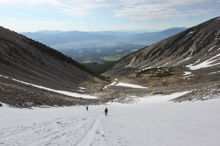
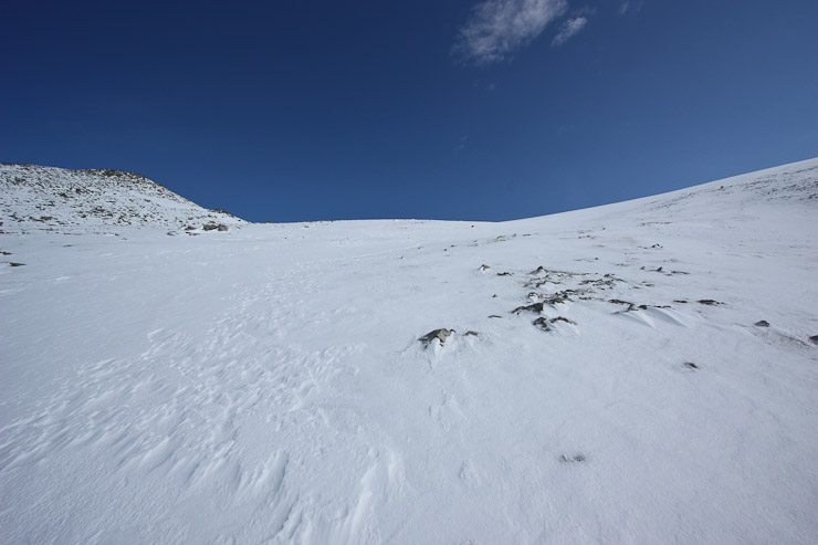
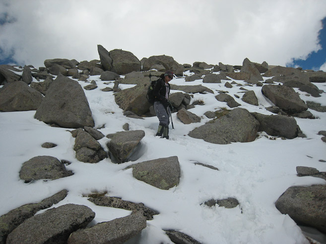
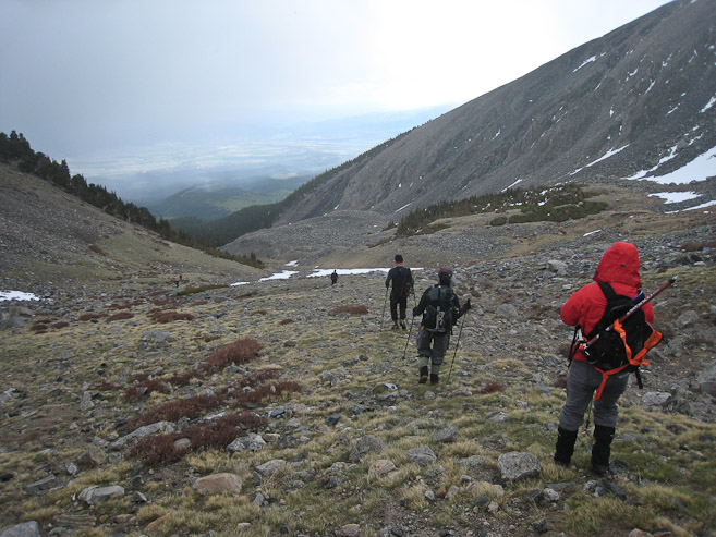
After this point, there was not much of a trail, and we simply headed west, around or over stray snow patches following a gully, and relying on the GPS for support. Eventually, we worked to the south, and spotted a cairn through the opening of some trees, and worked our way up the open drainage, along the forest edge.
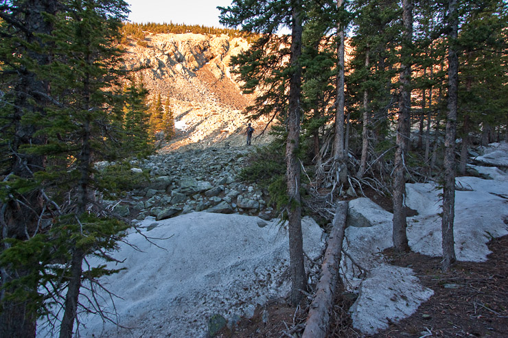
Christine stands near a cairn, where we left the forest and continued west along the rocky moraine, shortly after sunrise. The surface was a mix of rock and dirt, easily walkable...
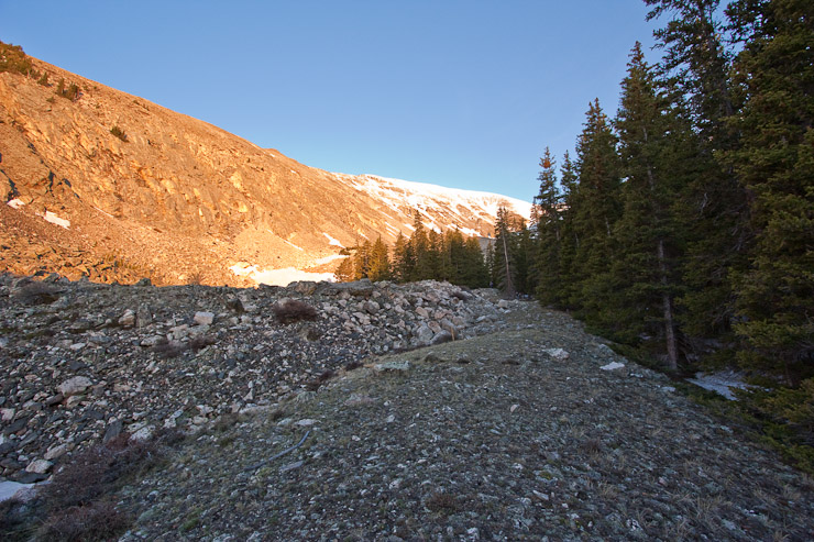
A look back at our path along the forest. The wind picked up a bit as we aimed for the snowy mountains ahead...
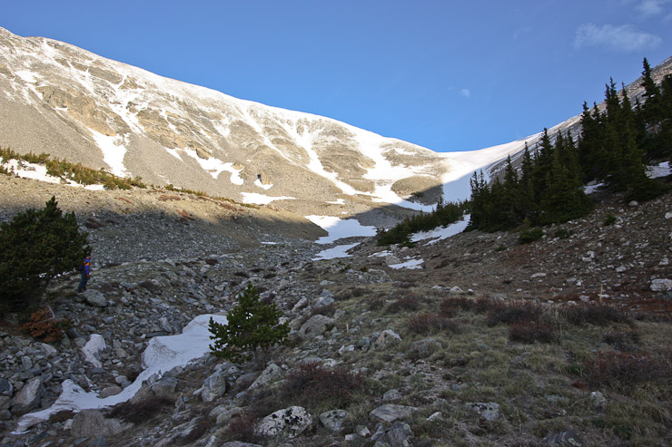
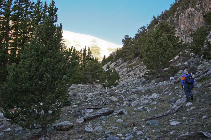
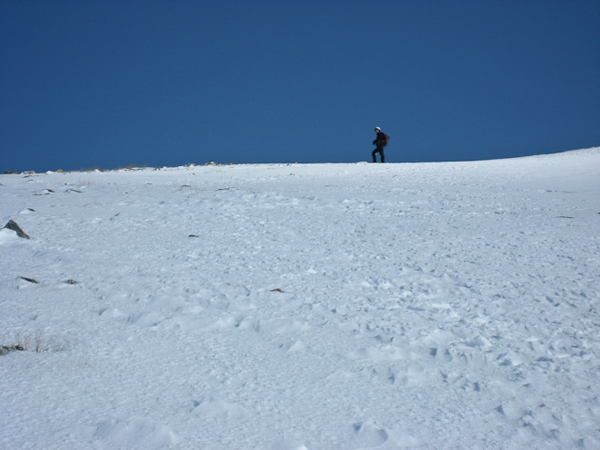
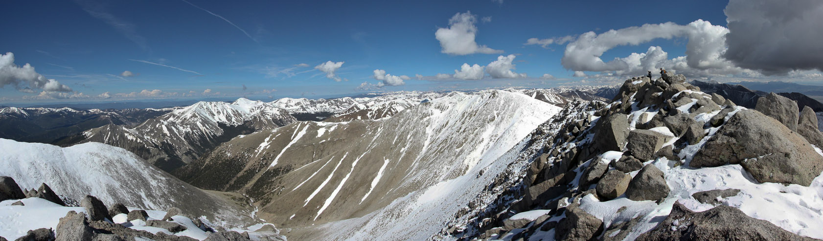
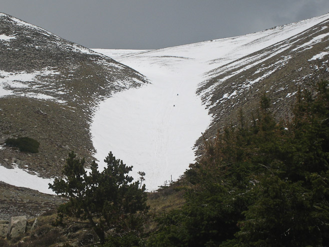
At last the long snow slope came into view, after a longer than anticipated hike to this point. The wind wisped the snow high up on the ridge near Shavano's summit. We reached the base of the Angel at 6:50am, 2.5hrs since we started. There was just one person ahead of us, who began the climb as we rested and put on crampons...
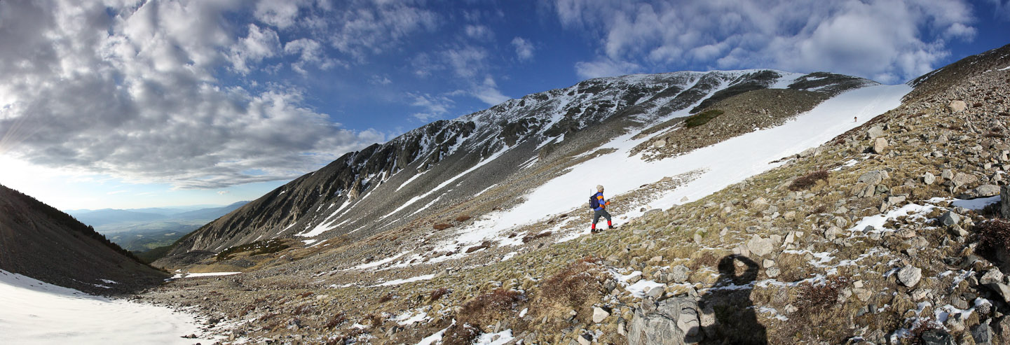
A look across the Angel's basin, with a stitched shot using my wide-angle lens. The clouds were gathering surprisingly quickly at 7am...
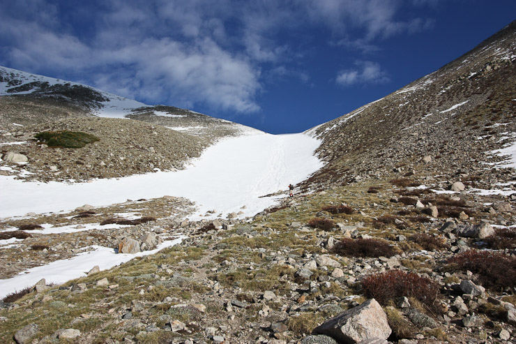
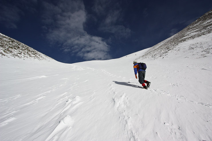
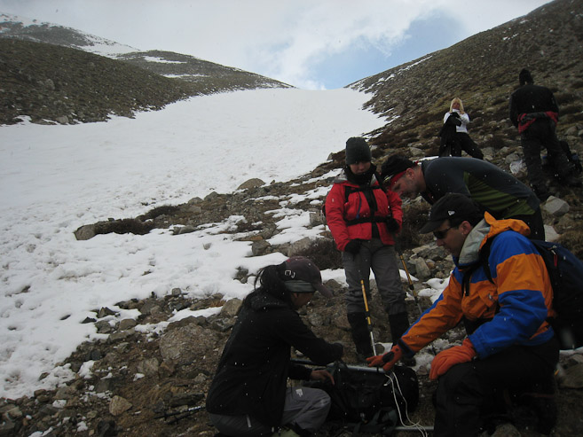
After a ~20 minute break to eat a late breakfast, and strap on our crampons, we took to the snow, ice axe in hand. The snow was firm, though not frozen solid. We dug in about an inch with each step, and the crampons gripped well. With about a mile left til the summit, we had ~2,500' to go.
A look up and down the slope soon after we began the snow climb. The steepness increased as we gained elevation. Fortunately, the morning clouds were starting to thin...
I noticed this picture on a 14ers.com trip report by mattpayne11, of the 4 of us climbing the body of the Angel. Tom and I in front, followed by Wendy and Christine. Very cool perspective!
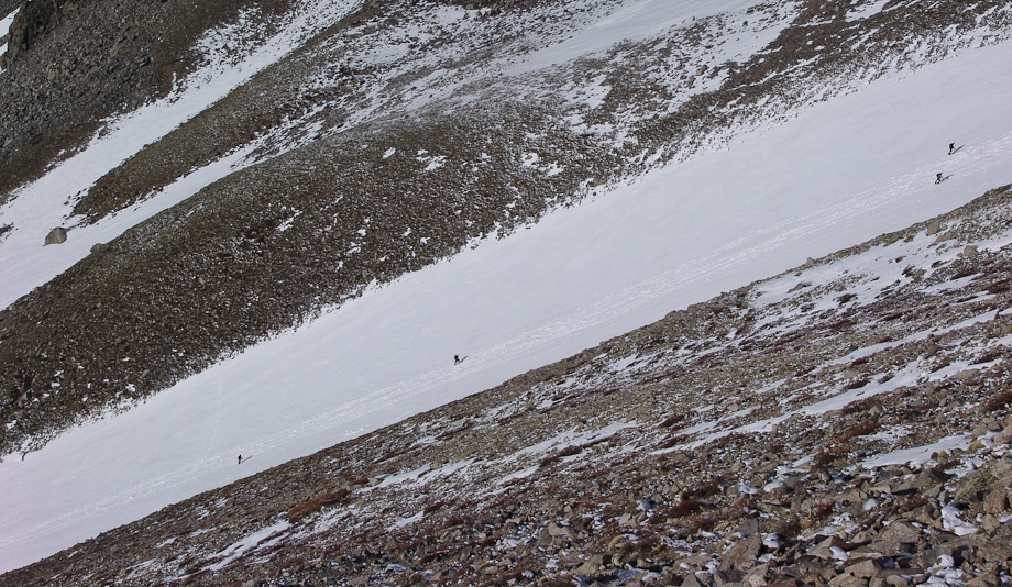
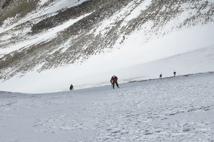
The steepest section of the route occurs at the narrowest part of the snow patch, during the 1st pic. A look back at Tom, after clearing the steepest part...
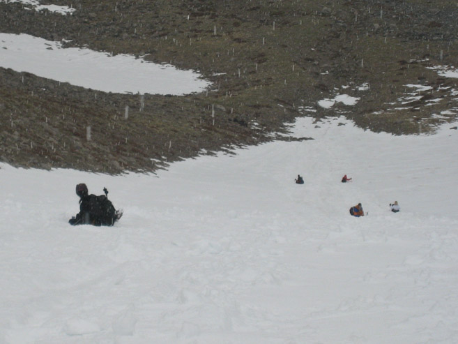
With more good fortune, another 14ers.com member, PDMeier, posted a pic of us in his report. You have to look closely at the four black specks in the narrow snow band, in the lower left. Turns out we crossed paths with this hiker and his dog, where the main trail enters the snow (see the 2 black specks in the center of the picture -- who are likely the people that took the previous picture).
Tom heads up towards the main trail, where a couple of hikers are crossing the snow. I waited for Wendy to catch up. Christine is emerging from the steep section behind...
We paused at the main trail to wait for Christine, and crossed paths with PDMeier, who took this pic below of us. His dog was enjoying rolling and digging in the snow to cool off. After Christine arrived, we came up with the plan for Tom and I to sprint ahead to try to bag both Shavano and Tabeguache while the weather was still good, and then meet back up with Wendy and Christine at the summit of Shavano, or further down the slope if need be. With that, we all set off, trudging up what would have been the right arm of the Angel had the whole area not been whited out with recent snow.
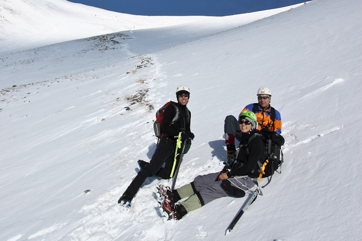
PDMeier took this pic of us, as we sit along the main trail. People were fine bare booting it on this route. The snow was packed and not too deep along the trail. We however took the steep more direct climb up to the right. A look back at Tom and Wendy fighting the gradient, as two skiers haul their gear up the main trail...
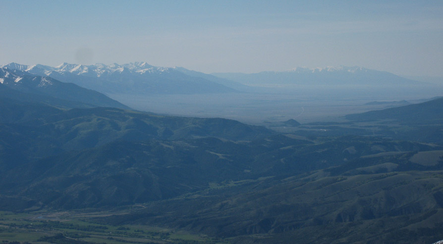
As we gained elevation, we could see the Sangre de Christo range, and even the hazy Sand Dunes in front of the Blanca group...
The snow in the right arm was softer, but still firm enough to support my weight after giving in an inch or two max. The climb was pleaseant, given these conditions. Tom is seen on the left...
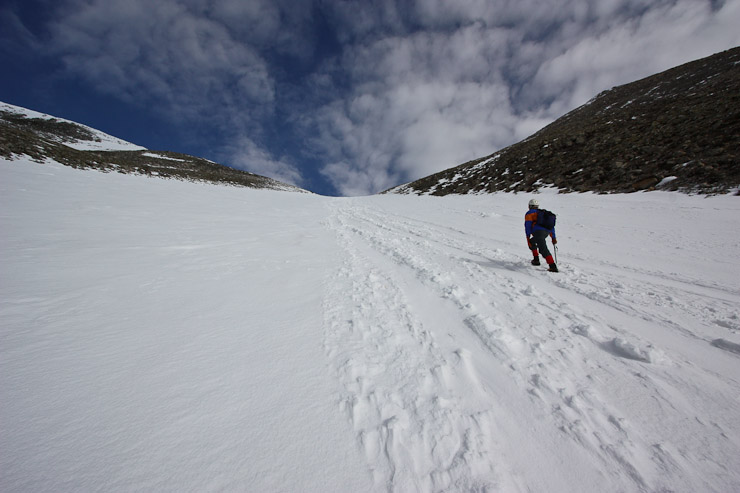
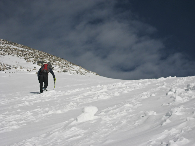
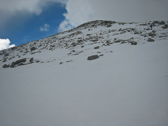
Looking up to the summit (on the left), the distance didn't look like much, but my altimeter was telling me I still had 1000' to go. I drew "1000' left" in the snow with my ice axe, as a message for my companions, and continued up towards the ridge. Tom takes a pic of me as I near the ridge...
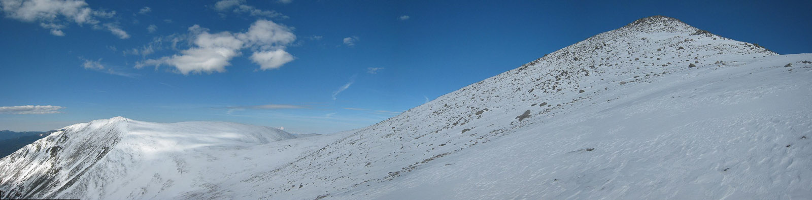
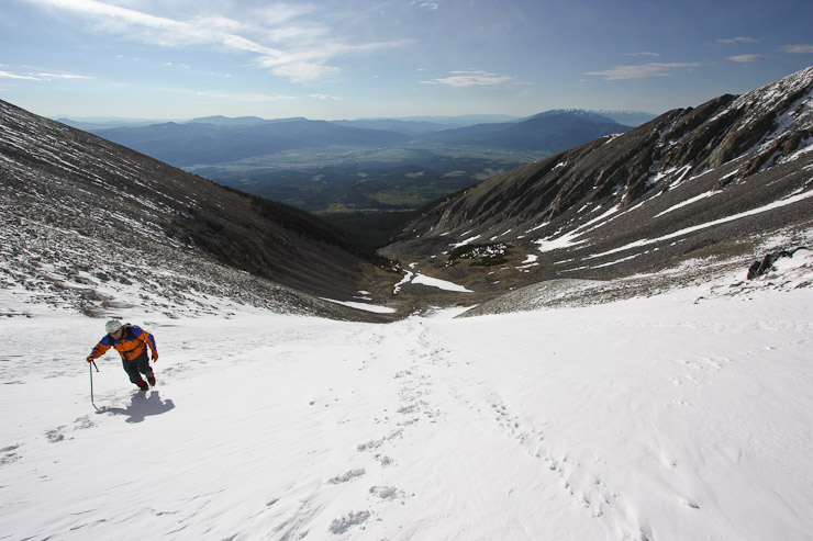
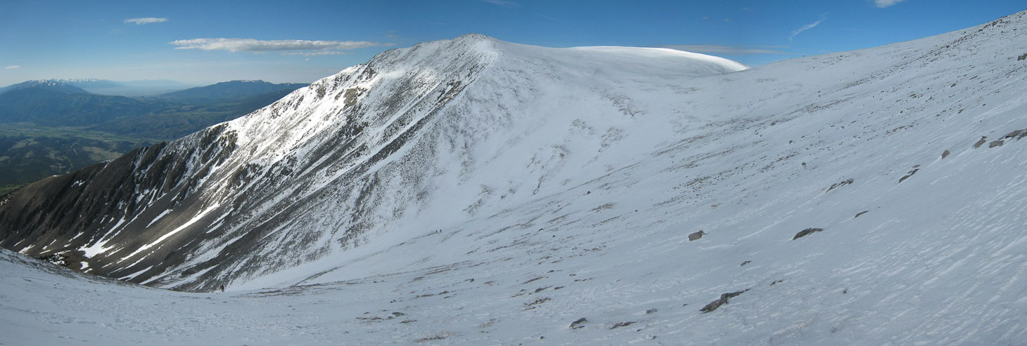
A stitched shot just before cresting the ridge. Shavano's summit looked so close, but this final stretch proved surprisingly longer that it appeared. So much snow up here...
Finally I reached the broad ridge and peered across towards more snow capped mountains. I had ascended via the right side of the pic, where Tom is a dark speck. A small cloud had been conveniently blocking the sun during the past hour, cutting the glare and heat for the past hour. The rest of the sky still looked friendly. The wind was completely still...
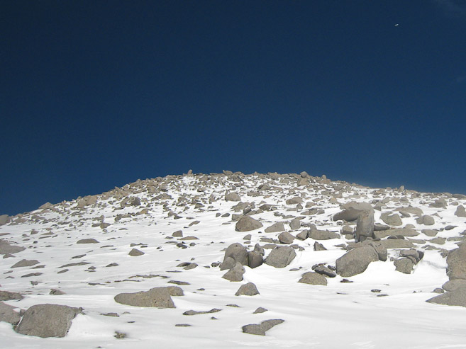
Airplanes don't look as small when you're ~14,000' in the sky. At about this stage, the snow was beginning to soften, giving in 3+ inches at times, causing the last 250' to be more tiresome. And Shavano still took it's time getting any closer, despite it seeming near at hand...
I was very happy with my fitness level today, and made great progress up the mountain, finally reaching the summit just before 9:30am, where 4-5 others were hanging out, some eating, some contemplating an attempt at Tabeguache. I had planned to immediately head to Tabeguache, but when I saw the completely snow covered slopes leading to the seemingly-much-further-than-hoped-for peak, I realized a HUGE amount of energy and time would be needed to fight the softening snow for another 1000' of gain roundtrip. Combine that with a grey, heavy cloud forming quickly near Shavano's summit, and it was an easy decision to stay on Shavano, and root on my companions instead.
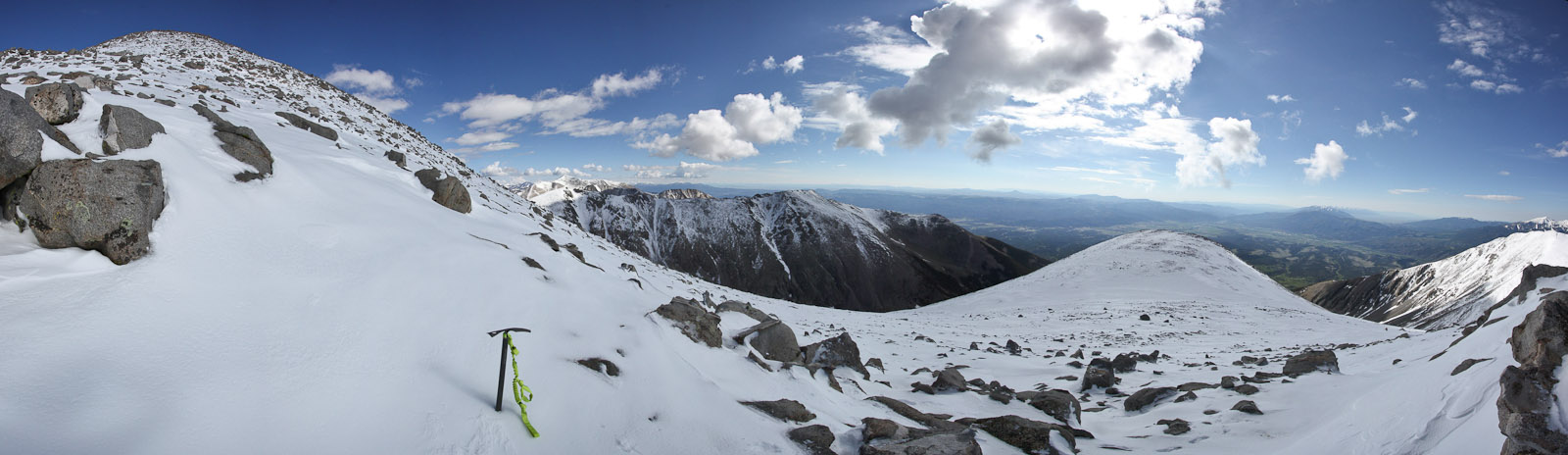
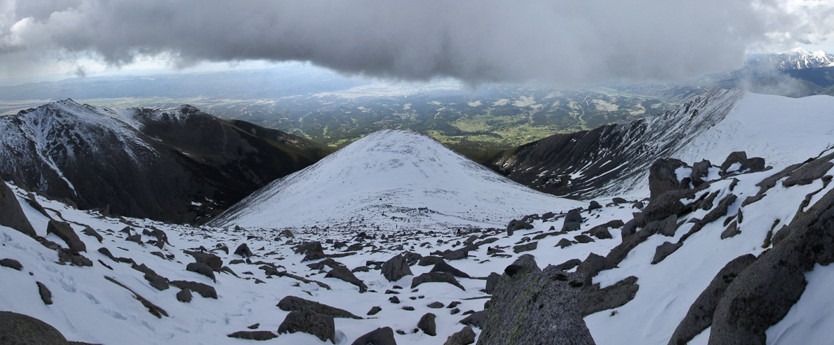
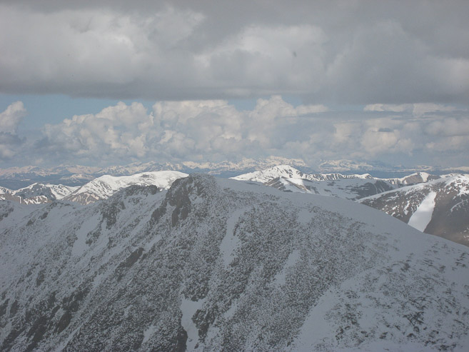
A view west from the summit of Shavano. Tabeguache, the snowy mountain just right of center, looked like a tremendous effort to reach in the conditions today. I felt exhausted just thinking of breaking a trail up the softening snow to Tab...
I checked back on the others, and saw Tom and Wendy far away, climbing the ridge, and respected the fact that they'd now have to fight the continuingly softer snow over more elevation than I...

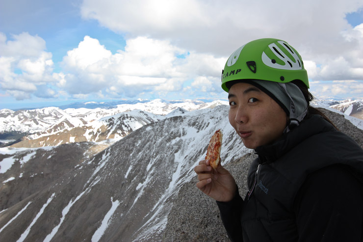
I talked with some guys on the summit, and they all decided to bail on Tabeguache as well. The bid for Tabeguache was doomed more so due to the threatening clouds, at a still early time of 9:35am, that just an addition battle against the snow. Notice the thick clouds brewing to the east, above our route up Shavano...
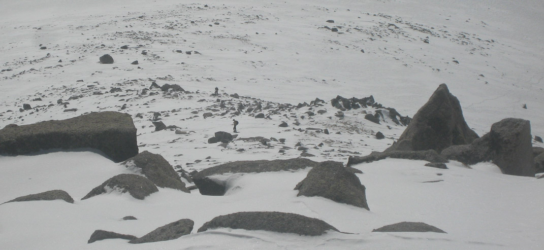
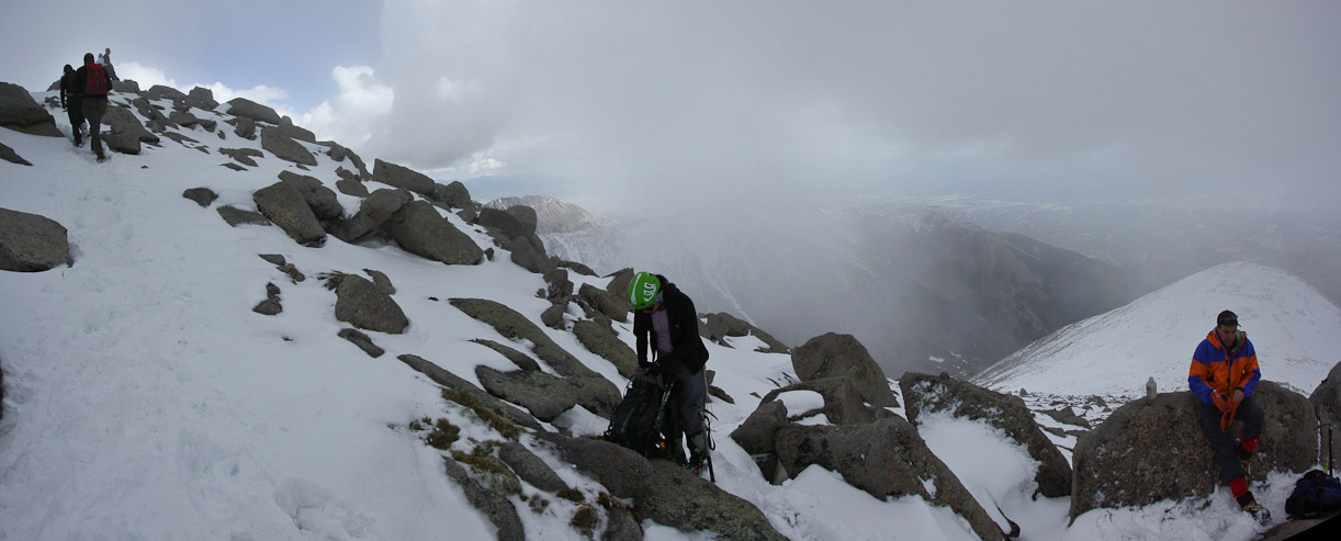
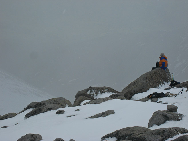
So I found a rock to perch on, just below the summit, that had a great view of all the climbers ascending the snow route under the billowing cloud. There were several parties making their way up...
This pic, 15 minutes after the pic three above, shows Tom and Wendy much closer, along with 2 others (one, a woman in a tank top), as well as a guy and dog on the right. Christine had decided to call it a day just prior to the ridge, which was still an amazing feat to gain 4000', half on snow, while (self-proclaimed) "way out of shape"...
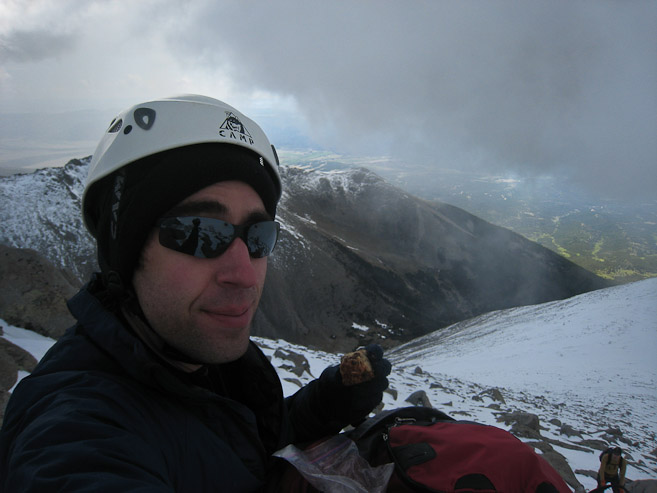
A self portrait of me, eating some of my grandma's date & nut bar (which I save and bring up on all my hikes), as Tom has nearly arrived (in the bottom corner). Wendy arrived 10 minutes later...
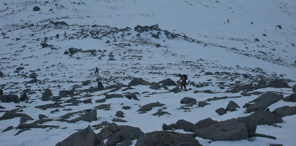
Hikers continued to arrive from the main trail, as the cloud began drooping onto Shavano...

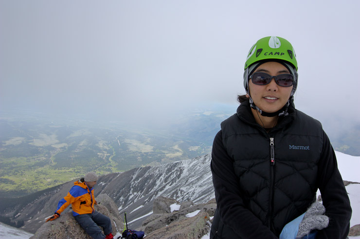
Wendy re-fuels with some Little Ceaser's pizza. It was probably ~40 degrees, but very pleasant on the summit, mainly from the almost surreal fact that the air was absolutely dead still. Not a hint of a breeze, as if we were inside...
Meanwhile, visibility was decreasing to the east, and it started sleeting lightly. It was time to head back. Here's one last look at Tabeguache, with more clouds now developing to the west...
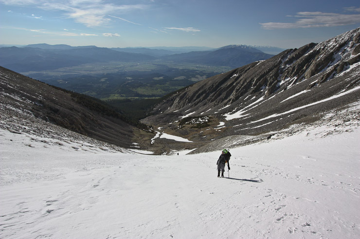
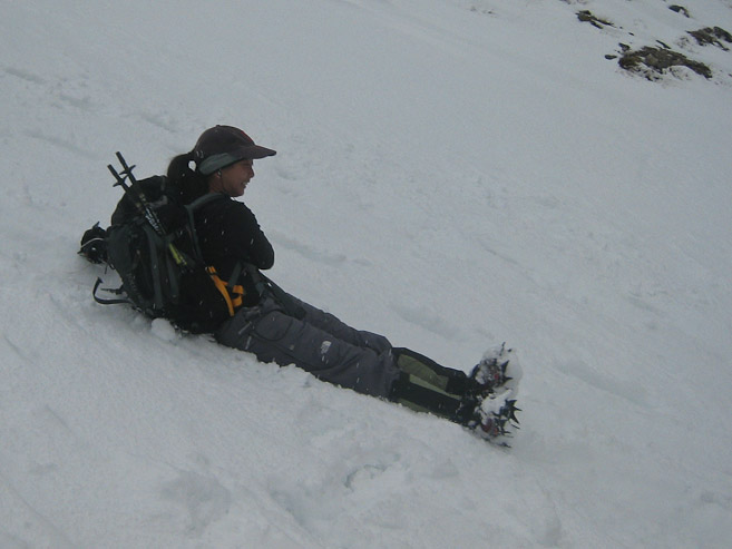
Now came the fun part: Glissade!
We manuevered around the rocks, and quickly made our way down to Christine, who was resting at the perfect spot to began the glissade down...
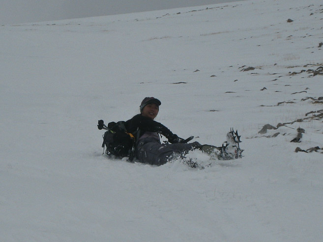
We ran into another group on the way down, and formed a glissade train, taking advantage of each others tracks. We passed a couple hikers still on the way up, who seemed to relish in the thought of sliding down instead... :-)
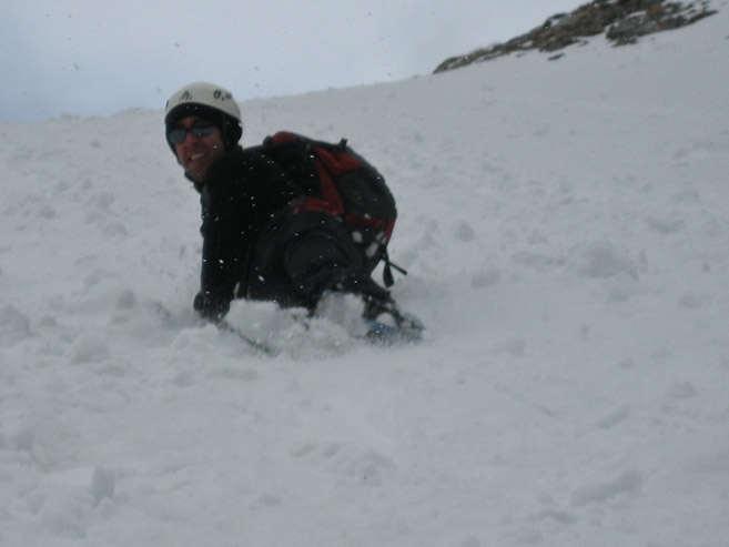
The snow was soft, and in a few minutes we had made it all the way down to the bottom of the angel. Gotta love that efficiency!
The light snow/sleet calmed our fears of a lightnening storm, and we enjoyed the variety of weather. At the bottom we packed up the crampons and axes for the hike out...
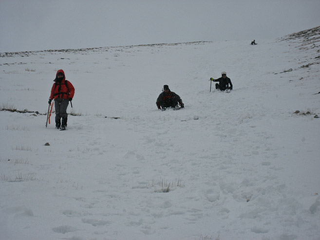
We headed back down the basin, and turned back twice to see more groups of glissaders descending...
The sun came out, and soon we were stripped down to a single layer. We took a slightly different route back through the forest, confirming with the GPS once, and soon found the main trail. We stopped for a snack break at a camping site with about a mile to go...
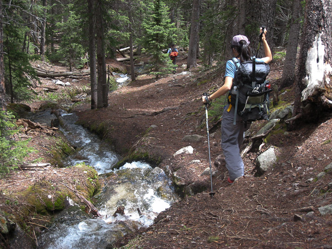
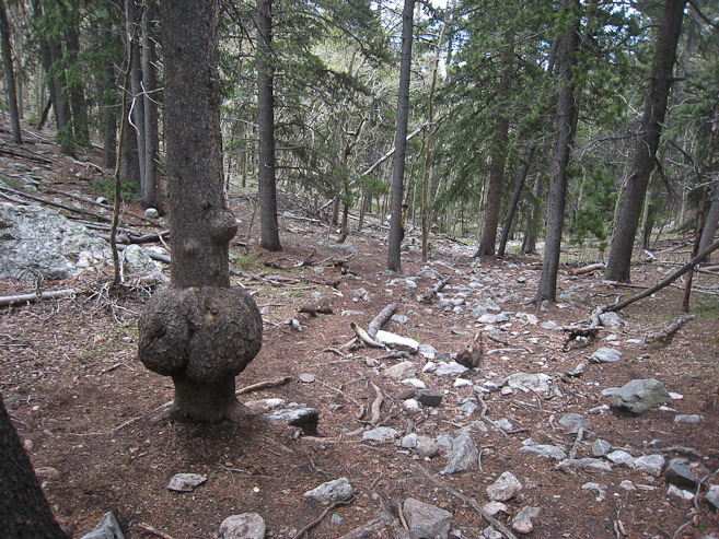
On the way back, we could actually see the pretty stream that flowed next to the trail. When we saw the funky looking tree with a pecular looking growth, we knew we were almost back...
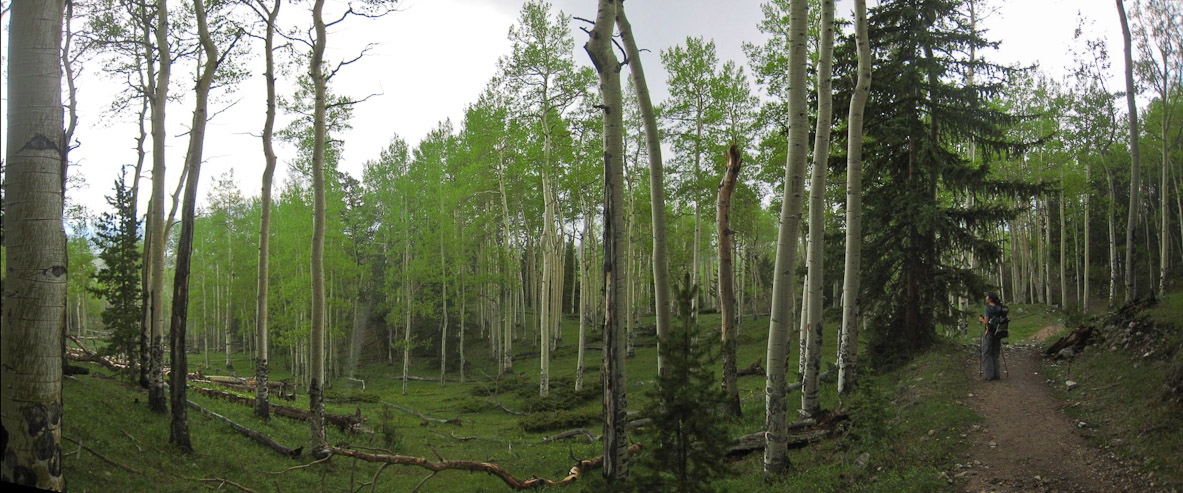
It started hailing on and off during the end of our hike, as we reached the aspen grove near the trailhead. Such a beautiful area...
The area was covered in dandelions this time of year...
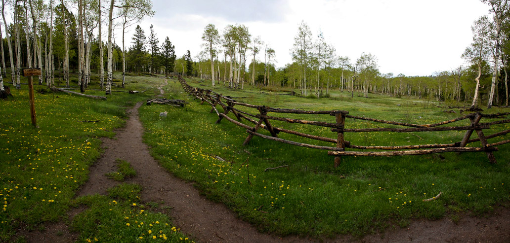
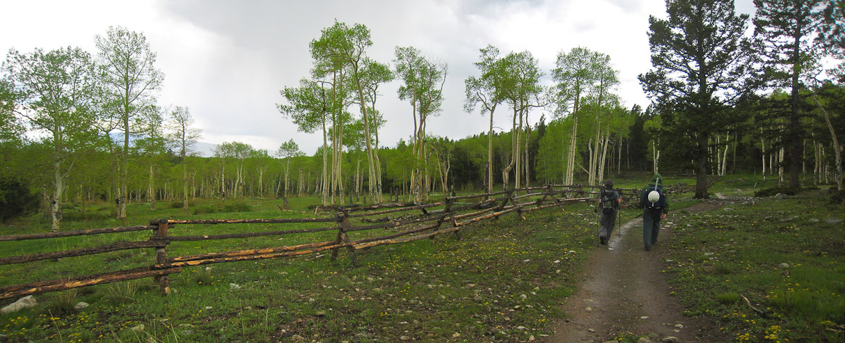
This scenic setting, at the junction of the Colorado Trail, is ~70 yards from the parking lot...
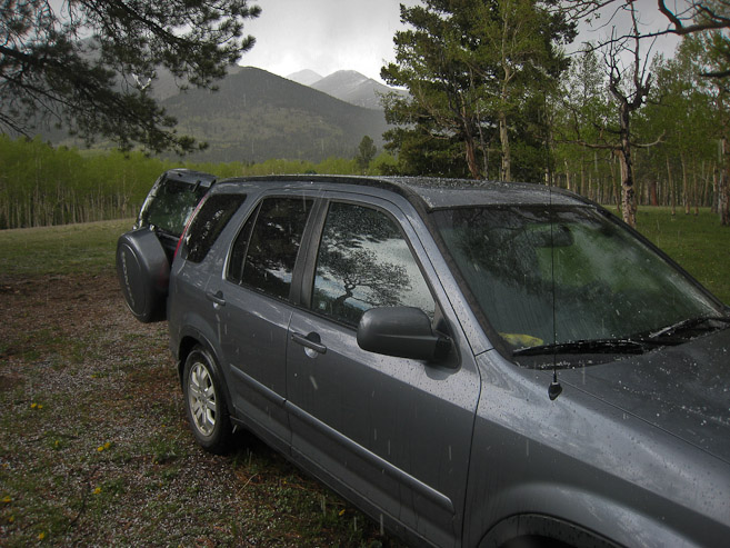
The summit of Shavano sticks up in the distance in both these pics. Once we all got in the car, I was about to drive back to Fort Collins before Tom and Wendy reminded me about the tents we left at camp. It started hailing again as we broke down camp...
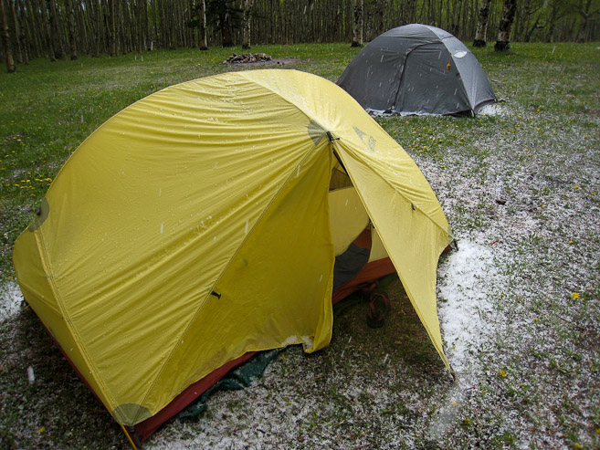
Wendy packed stuff up inside the tent, while I ran it over to the car. The tent stayed dry inside. A positive test run for our trip to Norway in July. A look back at the Angel of Shavano as we head back to Fort Collins...
It was a successful, fulfilling, and enjoyable outing for all. Our early start (4am on the trail) paid off, since hard snow is so vital for a pleasant climb. I'm also glad I brought the GPS for this one (I usually don't bother, but various trip reports led me to bring it on this one), as the trail is not always clear when cutting through the forest. If you aim in the right direction, you should end up in the right spot though. Took us 9.25hrs roundtrip, with plenty of breaks. The Angel route is certainly worth planning for, when pursuing Shavano.
Back to main page