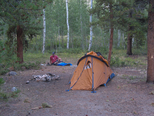
We found a pleasant campsite just off the road, and had set up camp at 7:25pm. With nothing else to do but wait til tomorrow, Tom and I played Scrabble on his iphone, passing it back and forth between rounds...
After a busy two weeks of traveling, I was greatful to escape to the mountains this weekend with Tom for a 14er adventure (and a much needed workout). The trip fell together quickly towards the end of the week, and after some late research on Yale, we planned to head down Friday to camp near the Avalanche Gulch TH, to climb Yale's less traveled, but "classic" (according to Roach's book), east ridge. It's 5.25 miles to the summit with 5000' gain, and we planned to return via the standard route to Denny Creek TH and walk back for 2.9 miles along the road to our car (grand total of ~11.7 miles).
We left Fort Collins at 3:15pm Friday, and made good time on the roads, arriving in Buena Vista at 6:15pm for a dinner stop at Subway (they really load up on the veggies if you ask). From the center of town, it was ~9 miles up Cottonwood Pass Rd (all paved) to the Avalanche Gulch TH, where we found several camp sites right across the road. We checked out the TH, which had a HUGE parking area for such a supposedly less frequently used trail.
We found a pleasant campsite just off the road, and had set up camp at 7:25pm. With nothing else to do but wait til tomorrow, Tom and I played Scrabble on his iphone, passing it back and forth between rounds...
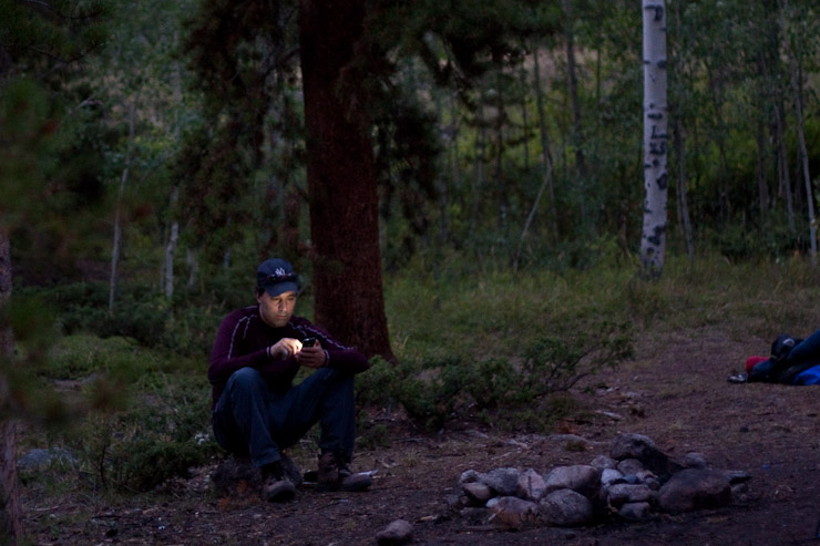
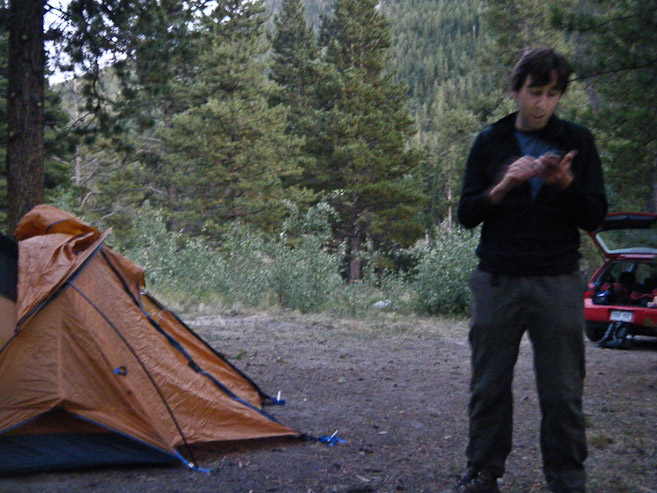
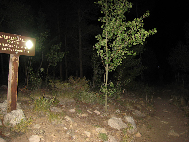
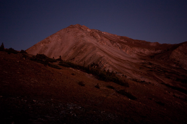
I tried out my new 50mm f1.8 lens in the low light, and got some good results. The Scrabble game took 2 hrs, as we alternating prepping for tomorrow between turns, and playing with cameras as the skies darkened. I ended up winning Scrabble by a small margin...
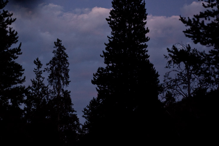
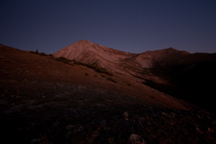
The skies were completely clear overhead, and the stars emerged without any moon to dampen them tonight. We set the alarm for 3:20am to be hiking at 4am tomorrow. I went to bed ~10pm, and eventually put in some earplugs to block the voices of some loud campers nearby. Lots of traffic continued to drive by along the road, but this was just white noise that combined with the nearby stream.
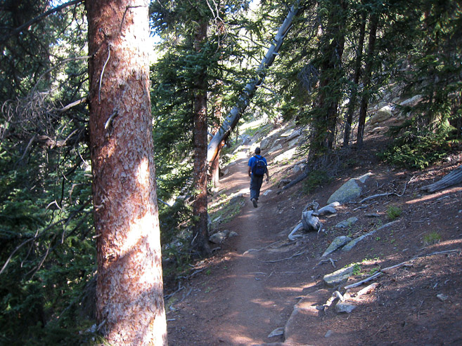
It probably didn't drop below 50 degrees over night. After being waked up by Tom four times in my dreams, each time leading to some absurd scenario (such as: a meteor crashing into the earth, alien spaceships landing in camp, and emerging on the set of a demented reality TV show), finally it happened for real at 3:26am. Guess I actually got in a good 4 hours of sleep, which might be my all-time record for camping before a 14er. We readied ourselves, hiked out of camp and across the road to the Avalanche Gulch trailhead (no cars in the huge vacant lot), and started hiking the Colorado Trail at 4am.
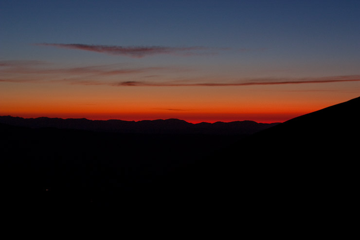
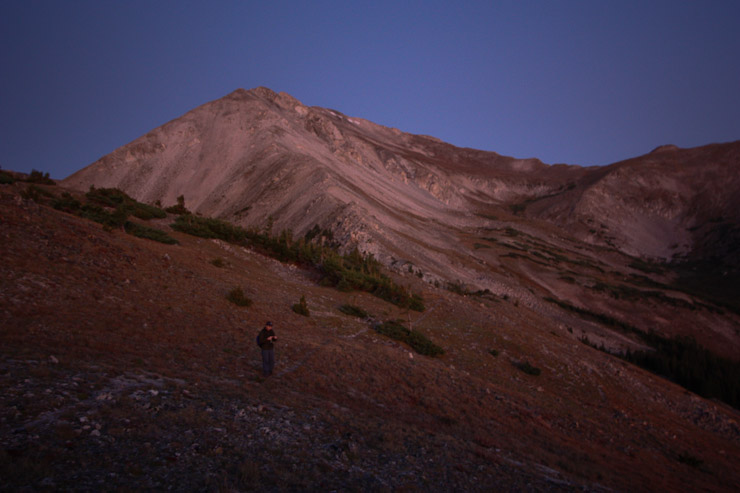
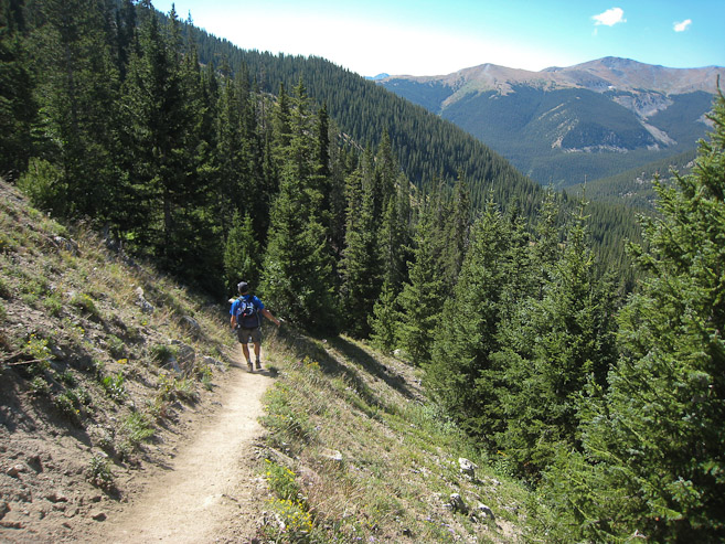
We started the hike at 4am, and I was hoping we'd clear treeline in time for sunrise (6:23am). We climbed many switchbacks through the forest (supposedly very beautiful in the light), reached the forested top of the pass after 75 minutes, and then headed west up Yale's east arm. At ~100' above the pass we broke treeline, and could see the red glow of pre-dawn along the horizen...
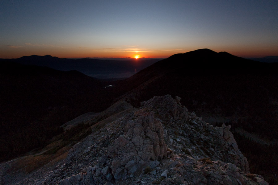
This was a good resting point, as I stopped to play with my camera. The most amazing colors always occur ~40 minutes before sunrise. 5:48am view in this pic...
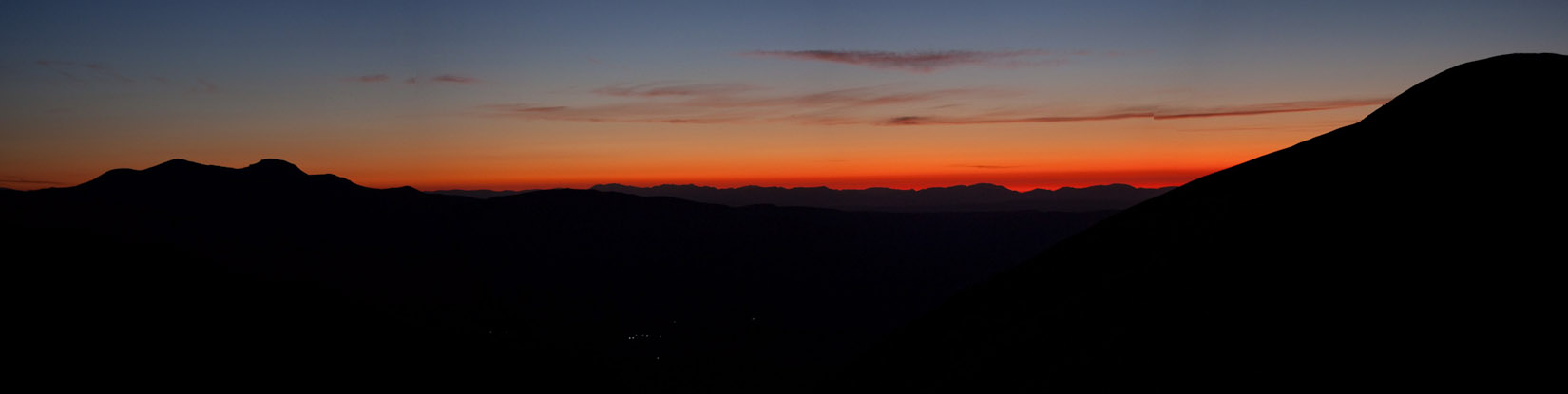
We could turn off our headlamps now, and then continued up the rocky/tundra slope. I stopped again 10 mintues later to take more pics. The deep red was turning more orange/yellow. I held up my ND grad filter in this shot, to bring out some of the terrain in the foreground...
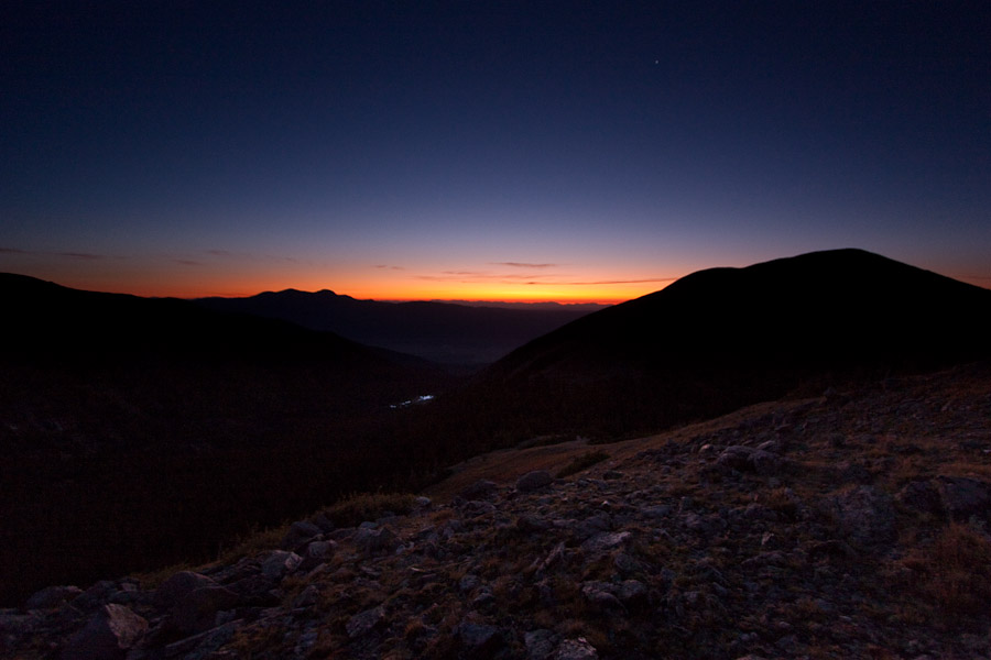
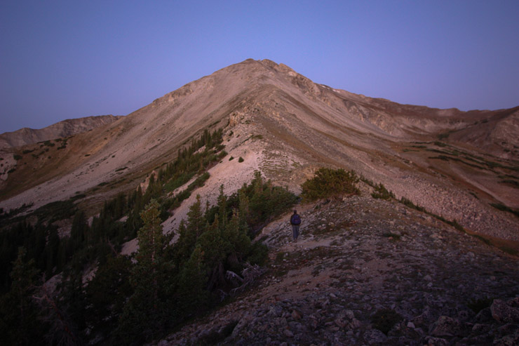
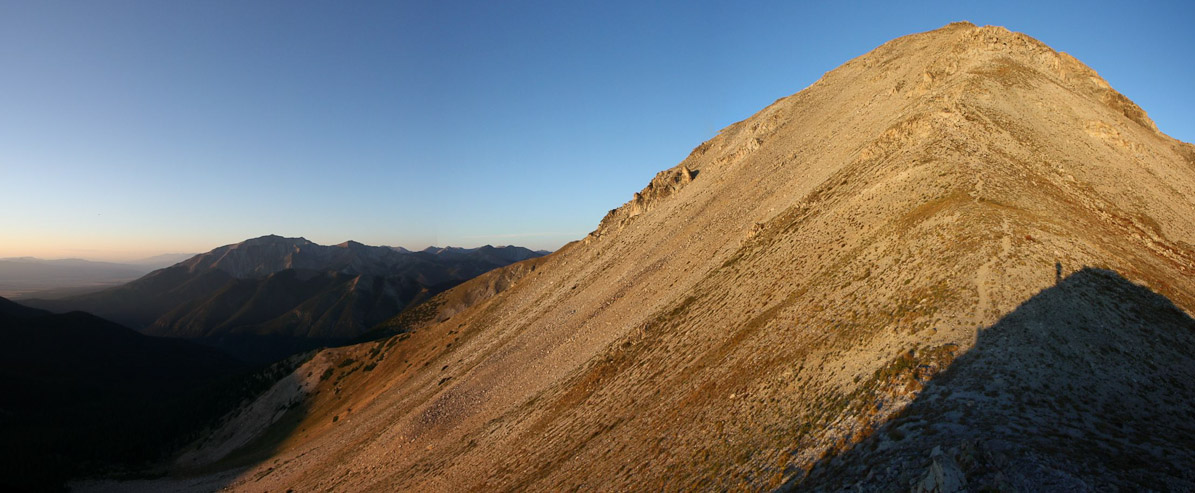
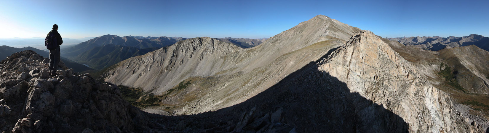
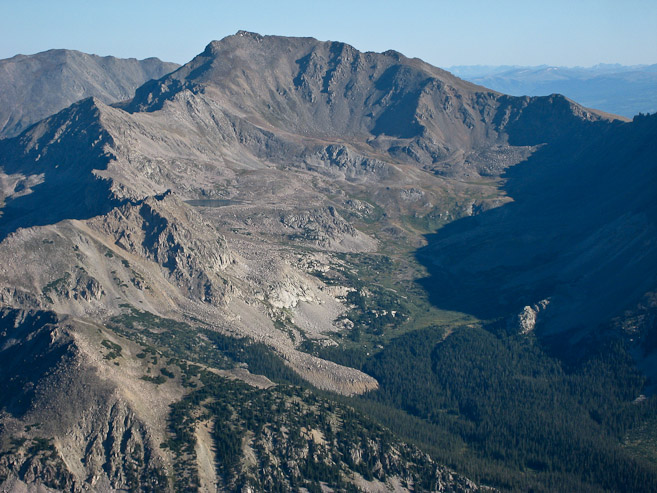
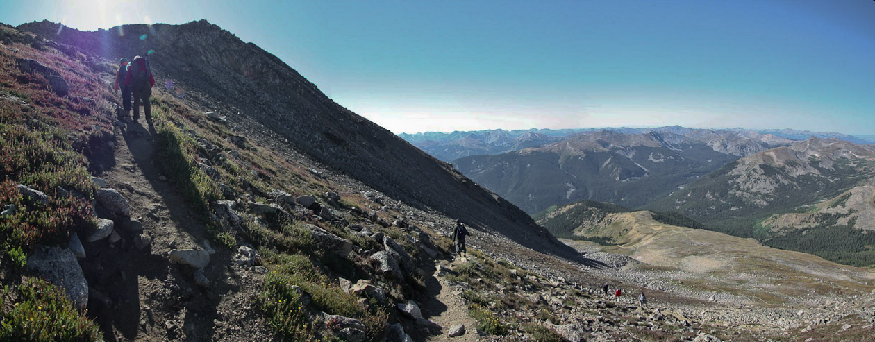
Looking up the ridge in the pre-dawn light, we could see the huge mountain, which looked big enough to be Yale, but I remembered reading that Yale is behind this 13,420' false summit. We were currently at ~12,000'...
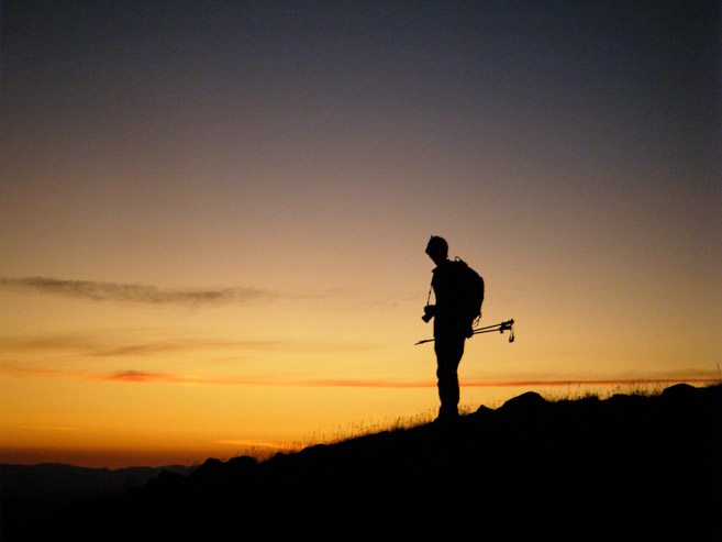
These 2 pics are taken 5 minutes after the group above (6:03am). Tom captures my siloute against the glowing horizen...
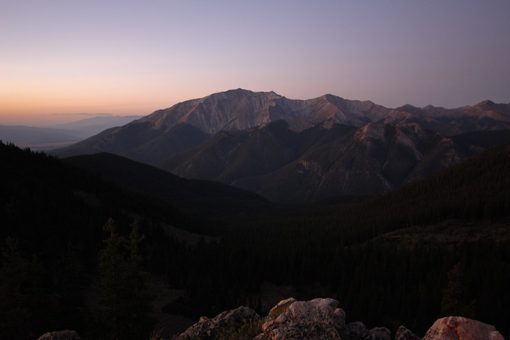
The trail stayed to the right of the ridge, and descended slightly before beginning the climb to the 13,420' false summit. A look south towards Mt Princeton...
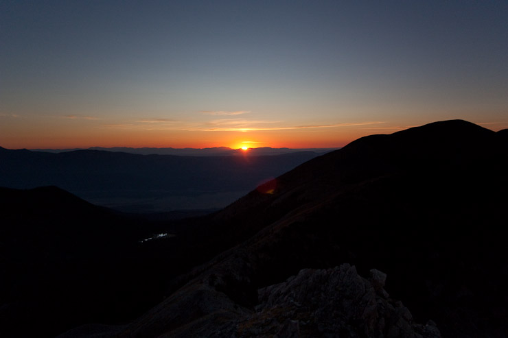
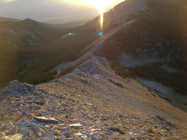
I had stopped again to take some pics of the horizen, when all of a sudden, the sun popped out. Glad I had been looking. I called up to Tom, who took a pic from his location further up (2nd pic)...
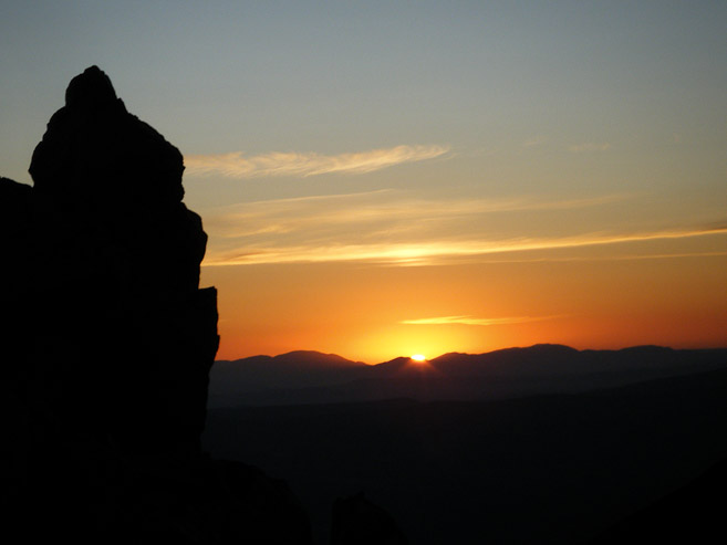
A really nice perk about this East Ridge route, besides the smaller crowds, is the open views of sunrise. Again I used my ND grad filter to bring out the ridge in the foreground here...
The ridge takes on some pink sunlight, just after sunrise. We hiked in on the valley to the left...
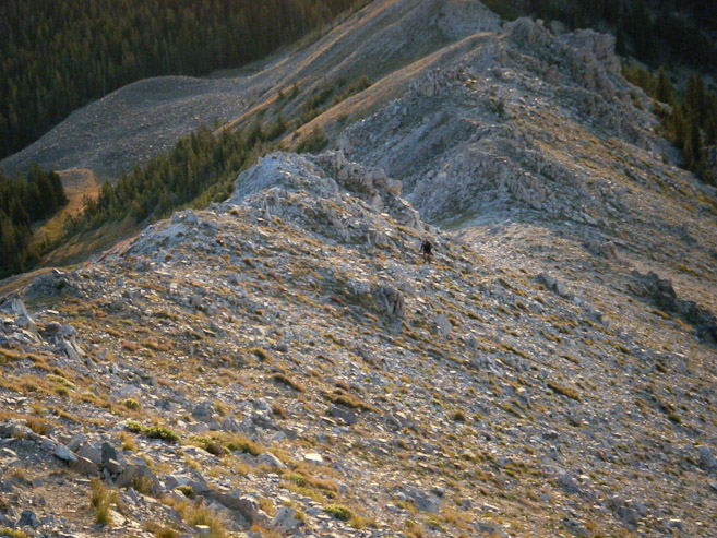
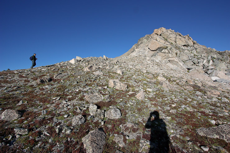
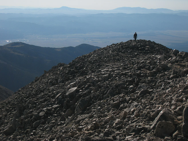
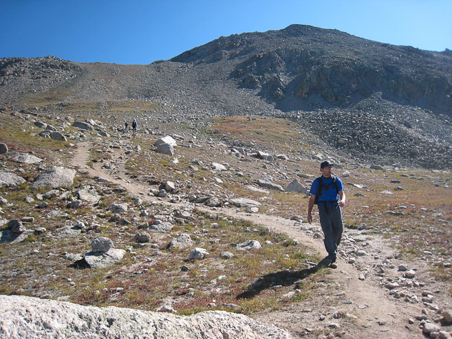
I had stopped for awhile taking pics, and Tom was way ahead. I'm the black spot further down the ridge...
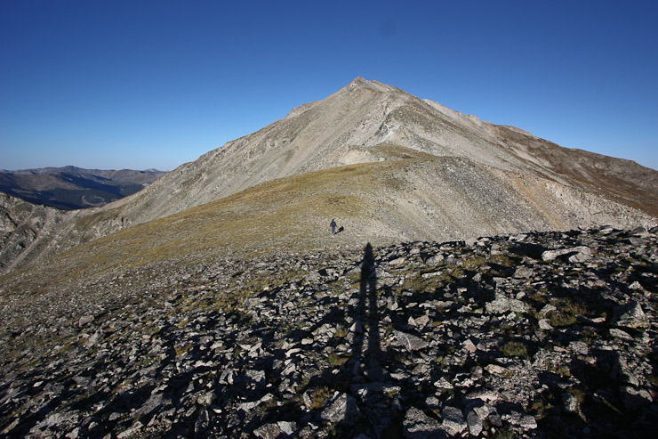
18 minutes after sunrise, the mountain is still slightly gold. Tom is still way ahead. Just my shadow in this one...
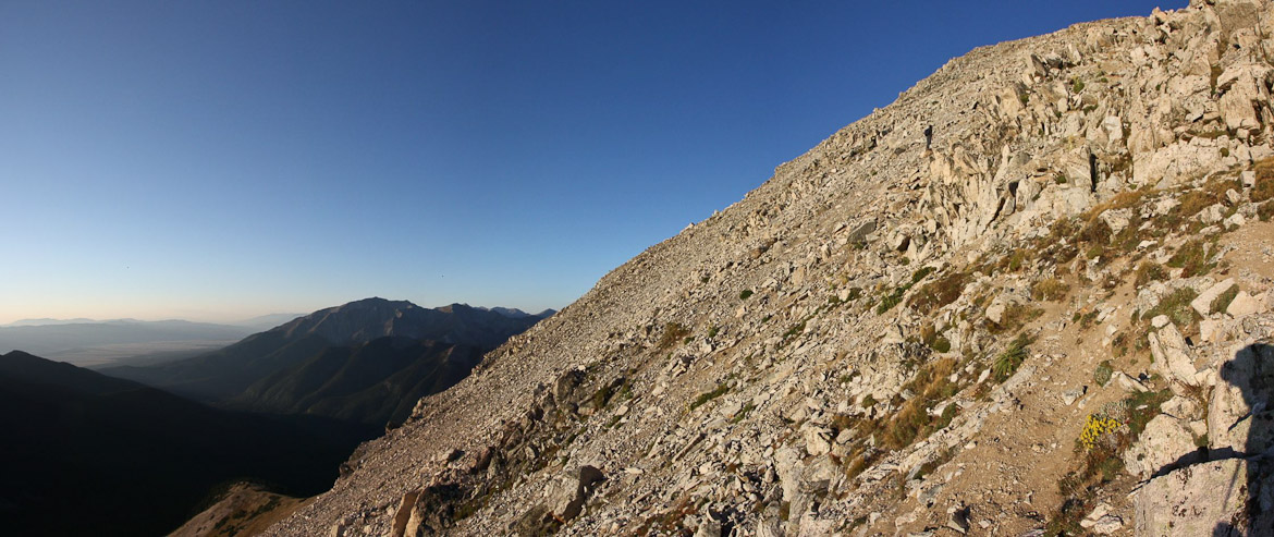
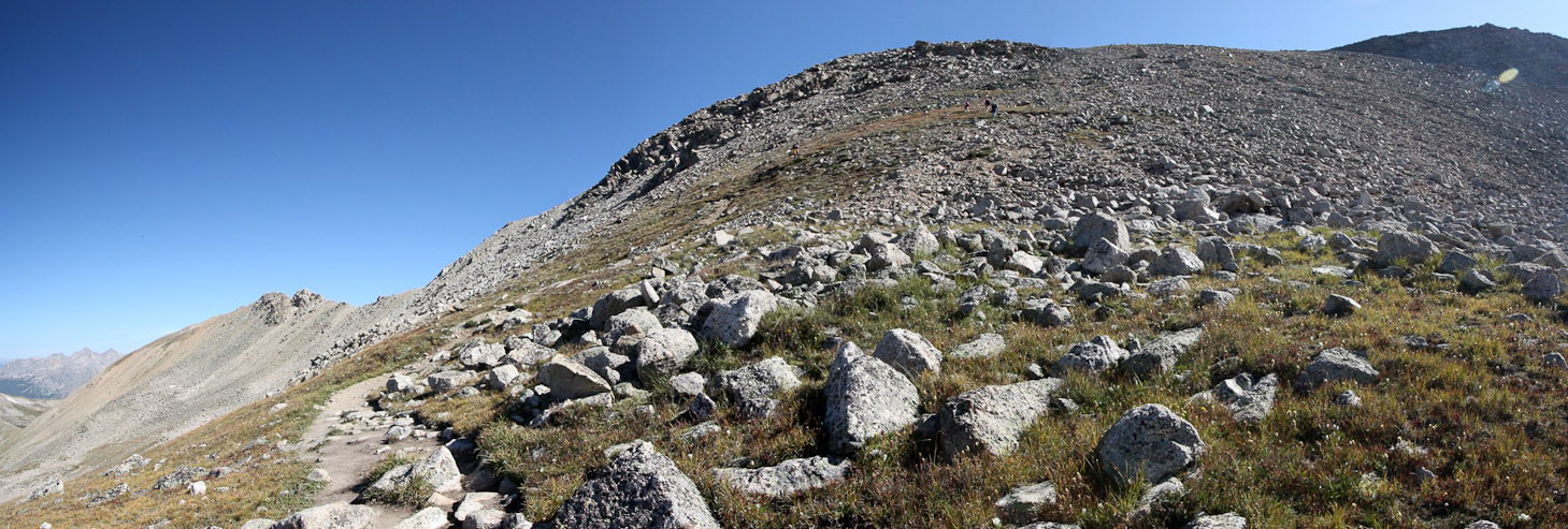
We followed a dirt trail to the left of the ridge, which was slippery and not fun. Prickly weeds were scattered around, often here places you'd want to put your hand near to help climb. We wondered if would have been possible to stay on top of the ridge to avoid the slick dirt...
I caught up with Tom ~7am, and we rested here 3 hours into our hike. I used the ND filter again here to try to bring out the horizen...

After another ~20 minutes on the trail, Yale started to appear to the left of the 13,420' false summit...
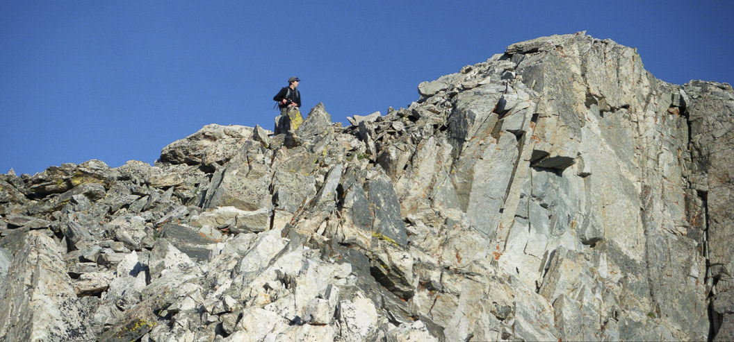
Tom grabs a few pics of me climbing towards the 13,420' false summit. This was his 1st trip with a new camera...
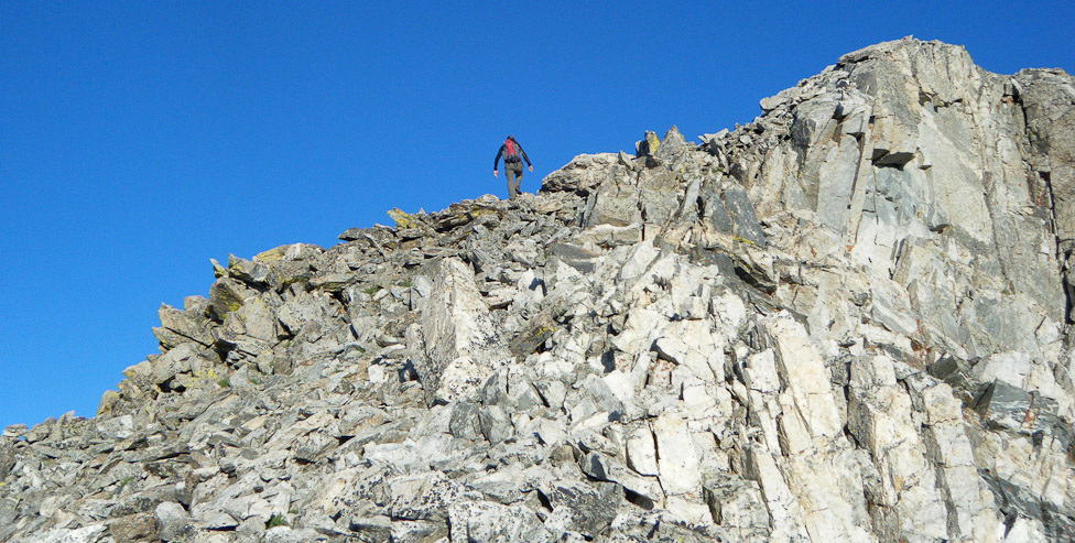
The ridge actually looks kind of cool and exposed from this angle, but it was actually a very plain ridge...
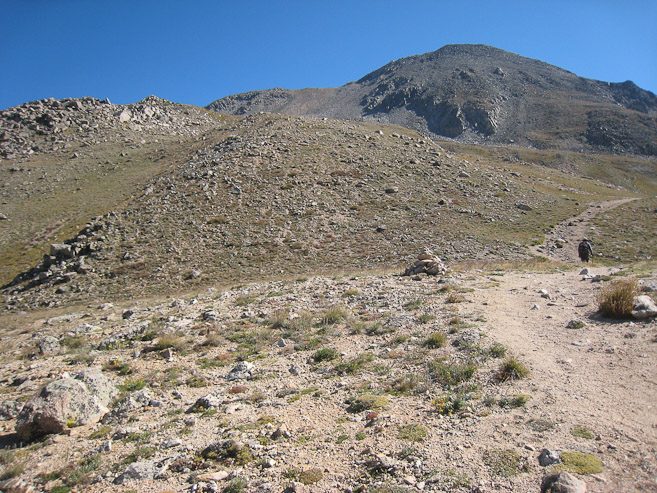
We reached the 13,420' false summit at 7:30am...
A look back down at Tom, as he climbs to the false summit. It was nice having the sun at our backs all morning during the climb. Didn't need sunglasses...
From the 13,420' false summit, we could see another false summit immediately ahead, followed by Yale rising another 800' beyond. It had been a 4200' haul already, but our legs were still going good. Tom proposed naming these two false summits Tom and Matt (we didn't actually figure out which one would be named which)...
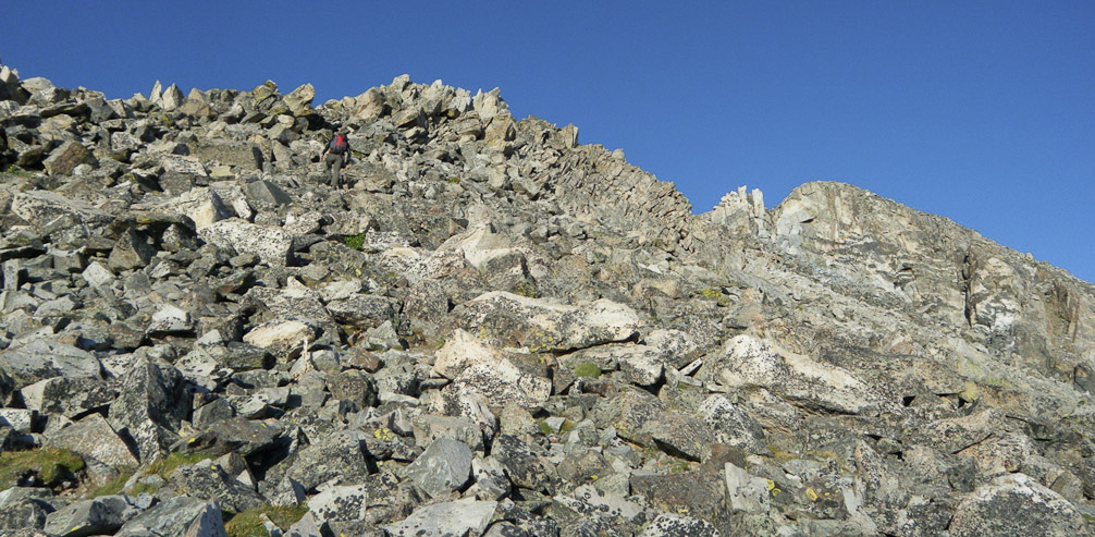
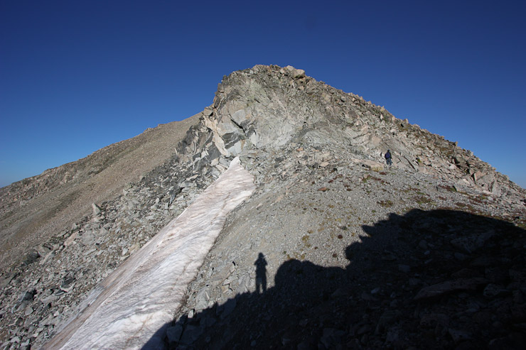
Having cleared the false summits, the ridge flattened, before the final 800' climb to the summit...
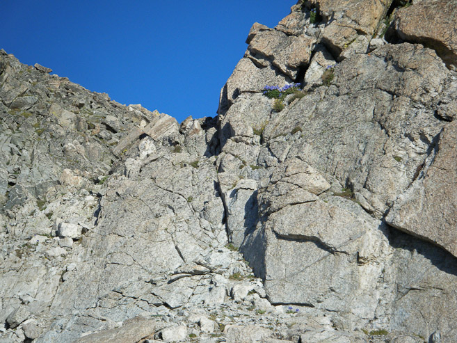
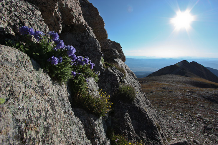
Tom and I took pics of a group of purple flowers nestled high in the rocks, which we climbed by...
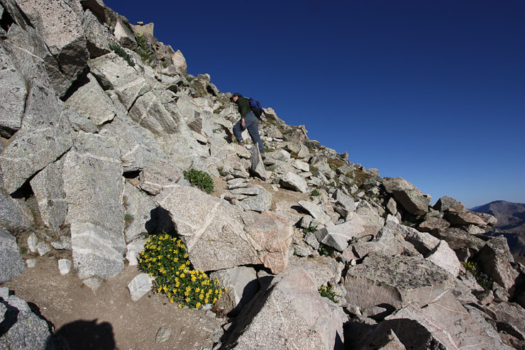
We passed by a "very determined", south facing snow patch (surprised it could last this far into August), and worked out way up past a group of pretty yellow flowers...
The weather had been great all morning, with hardly a breeze. The ridge offered few surprises, and soon the top of Yale was in sight, just 5-10 minutes away...

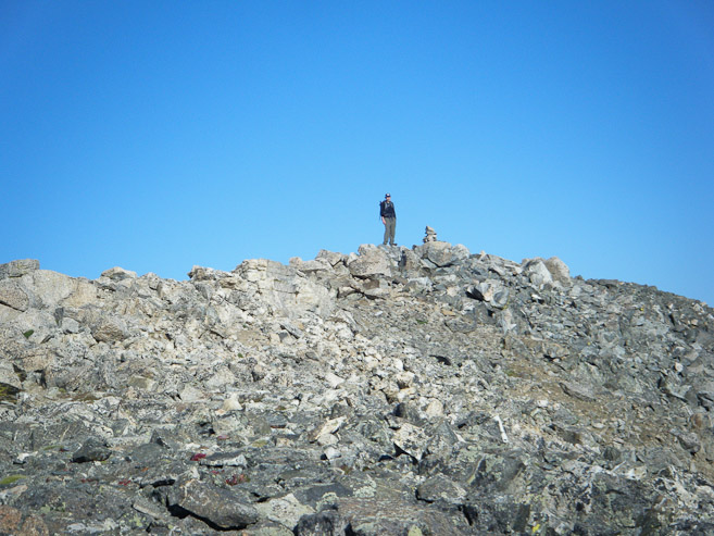
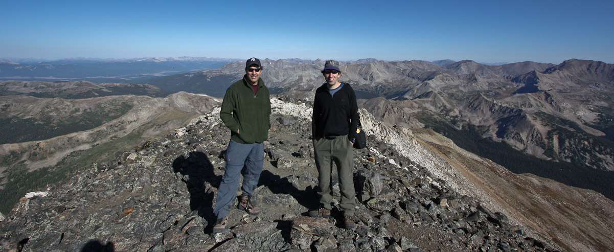
We made the summit by 8:30am, and were a bit surprised to have the whole place to ourselves. Tom reaches the peak here...
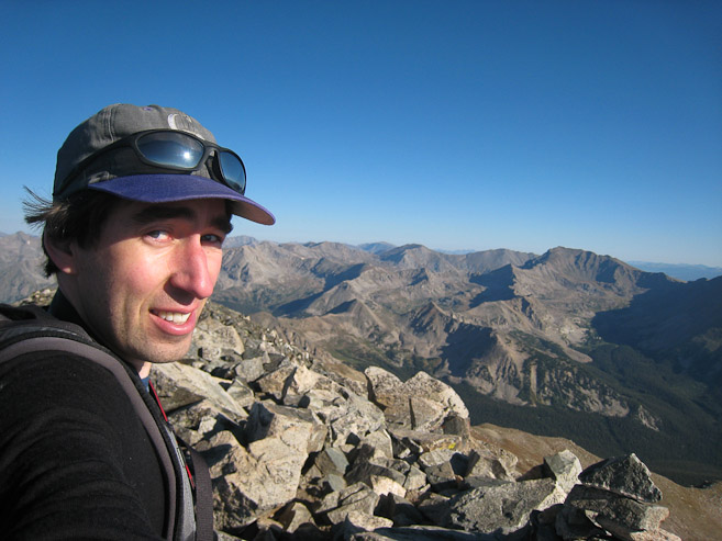
Tom and I take pics of each other from across the wide summit stretch...
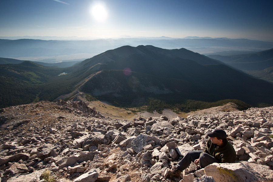
We could see a few hikers coming up the standard trail to the west. We started counting all the 14ers in view. Tom read that there are 30 14ers visible from Yale...
We took a seat facing northwest, admiring the Sawatch Range, as well as the Elks, while snacking. Here's a close look at Harvard. Tom and I have been considering the Harvard - Columbia Traverse (hoping to do it in the coming weeks)...
~30 minutes after we summitted, we were joined by a hiker from the Denny Creek trail, who took our pic. He said he had hoped to hike the east ridge, but didn't see any cars in the parking lot ~4am, so he continued up to the main route. He must have just missed us (though we had left our car at camp)...
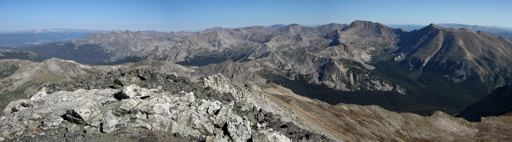
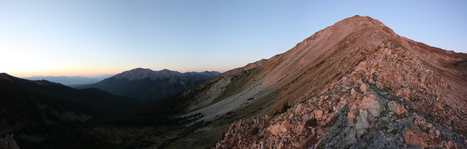
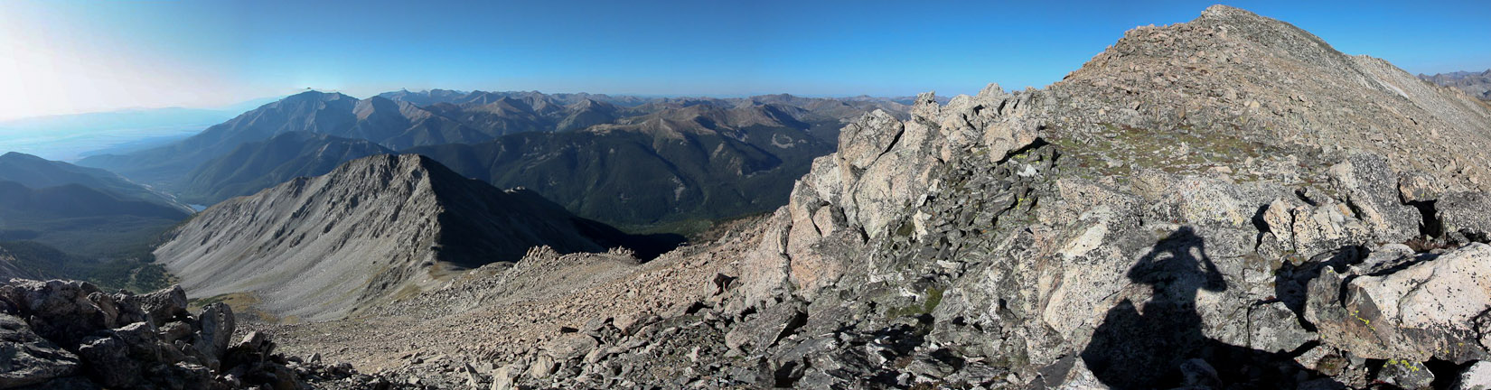
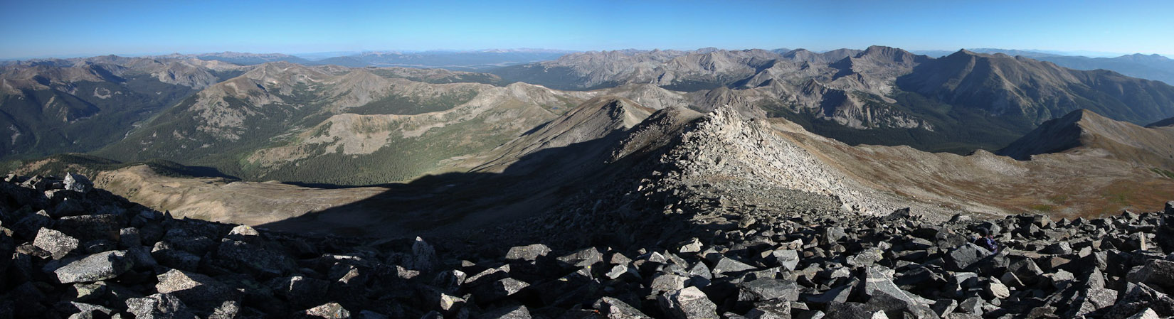
A pano view of the Sawatch Range to the north, with the Elks further off to the left...
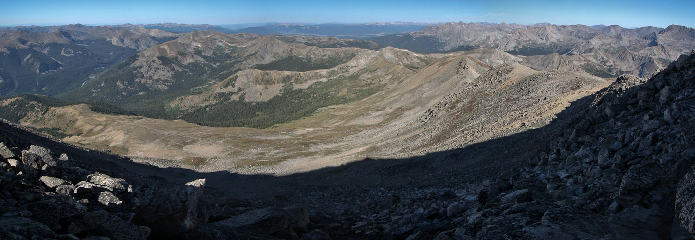
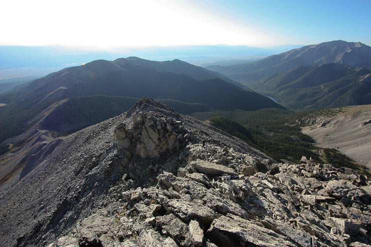
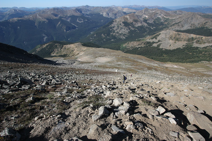
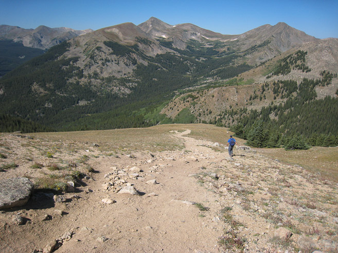
After hanging out on Yale for 45 minutes, we headed down the west ridge, along the standard route, immediately encountering hikers. We could see the trail snaking down from the ridge to the forest, with many "ants" working their way up...
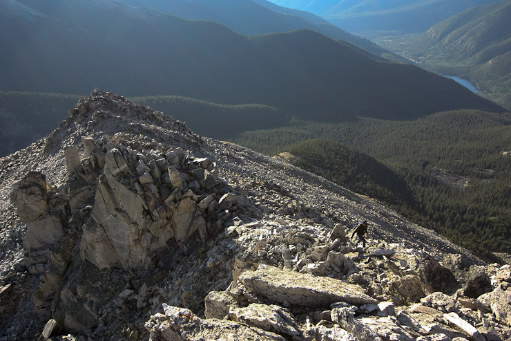
The dirt trail down from the ridge was very slippery. It took a lot of effort to keep your feet from sliding out from under you. I brought out my poles, which seemed to help a bit...
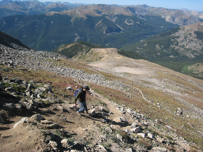
We passed many people on the way down, but the trail wasn't jam packed by any means (compared to Democrat/Linoln a few weeks ago). Tom greeted everyone with a boistrous "Goooood Morning!". Here Tom does some side stepping down a slippery section...
A look back up at Yale. Yup, if you want sunrise opportunities while Hiking Yale, you'll have to consider the East Ridge...
We made great timing during the descent. It helped to be "sliding" in the right direction...
After a solid hour of constant descent on slippery dirt, we rejoiced at a small flat section just before treeline...
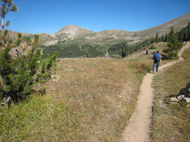
The trail bounced in and out of trees briefly, before staying in the forest for good. The shade was nice! We crossed a couple of streams, paused to rest once or twice, and emerged at the full Denny Creek TH parking lot at 11:30am...
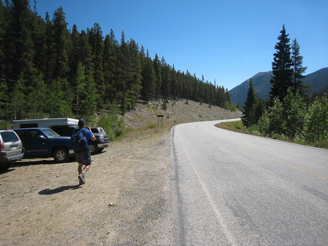
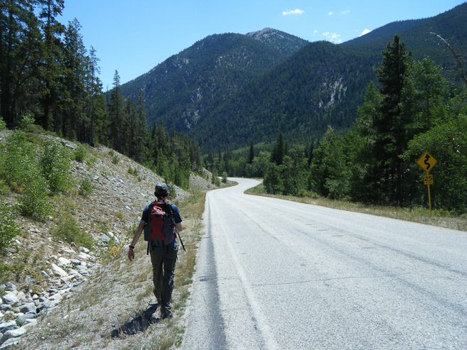
From here it was a 2.9 mile walk (600' loss) back to the Avalanche Gultch TH, which we had camped near. We debated about trying to hitch a ride back, but decided to stretch our legs, and add a little more exercise to the day, along the easy surface. The sun was brutal though. I applied sunscreen 3 times in the 45 minutes it took for us to reach our campground...
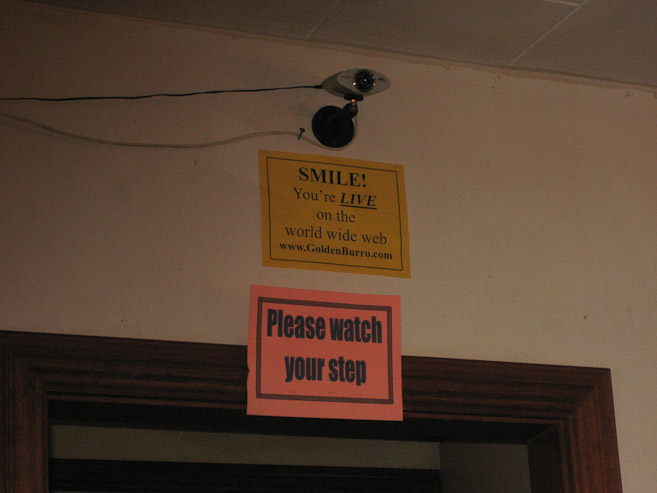
We reached camp at 12:13pm (8hr 13min round trip for the 11.7 mile, 5000' gain hike), and we packed and on the road ~30 minutes later. Tom suggested stopping at a diner in Leadville for lunch on our way back, which I agreed with. We ended up at the Golded Burro, and whe we sat down I found my self staring at a sign for a live web cam. Tom logged into the site with his iphone, and sure enough, I was front and center in the picture. I ran back to the car to get my cell phone, and called my parents in NY to see if they wanted to see me on the web. They had fun tuning in. There was only a few seconds of delay on the feed.
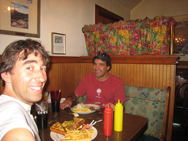
Tom was happy to find a place with an open-faced turkey sandwich. I tried the "Bandito" burger (jalapenos/cheese on Texas Toast). My parents saw me take this pic on the web cam, and called, laughing at how they could see me taking pics.
Traffic back to Fort Collins Saturday afternoon was minimal. It was 96 degrees and toasty on the Front Range. A good day to have been up in the mountains (or in an air conditioned car).