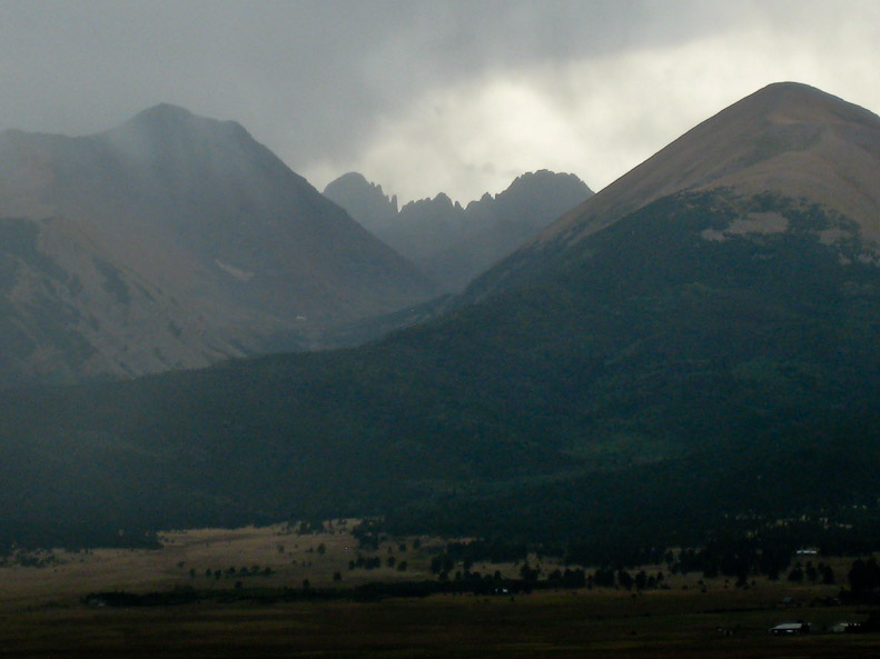
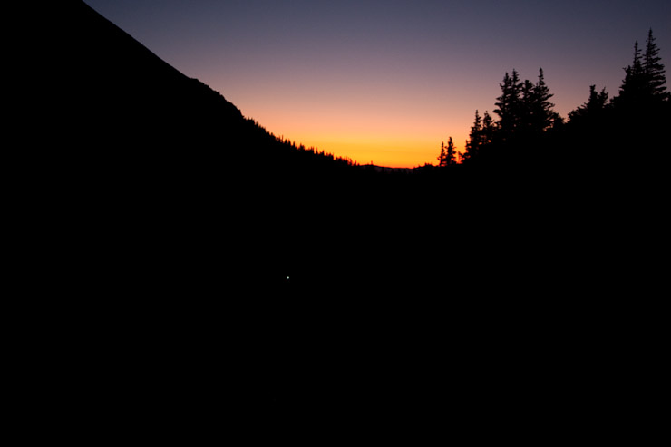
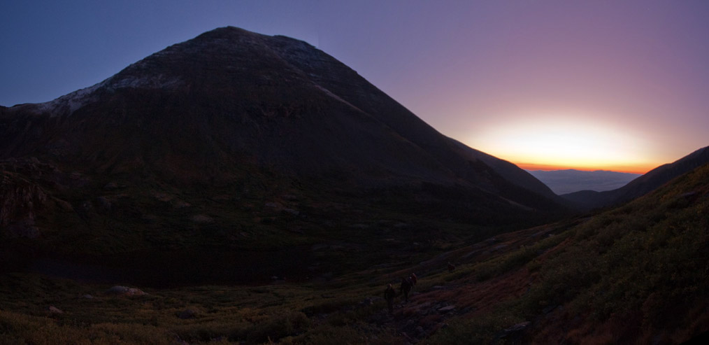
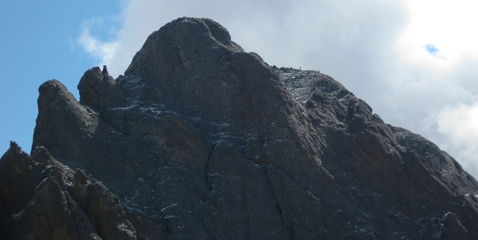
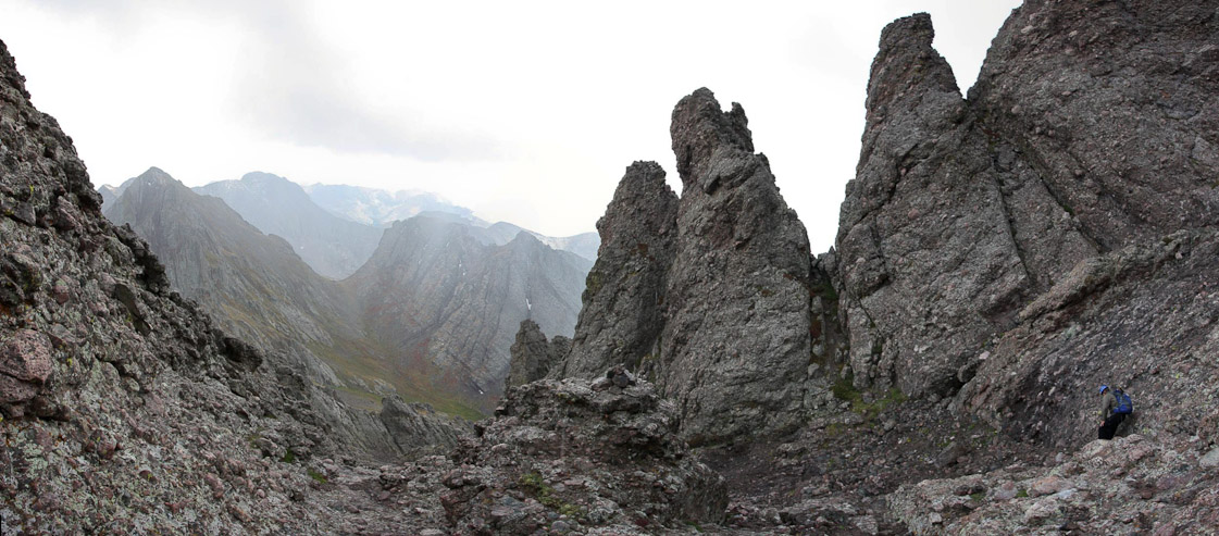
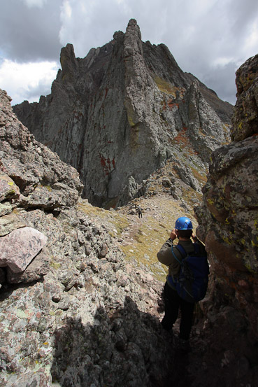
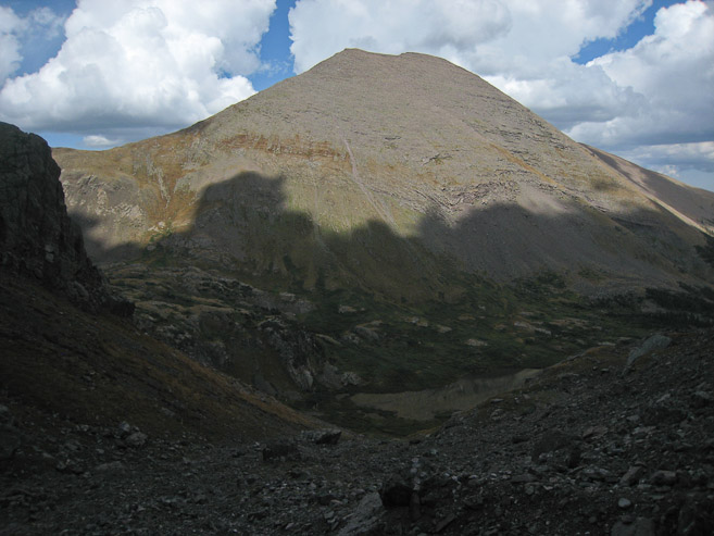
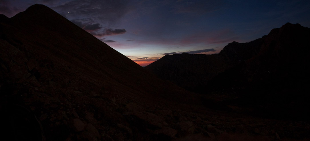
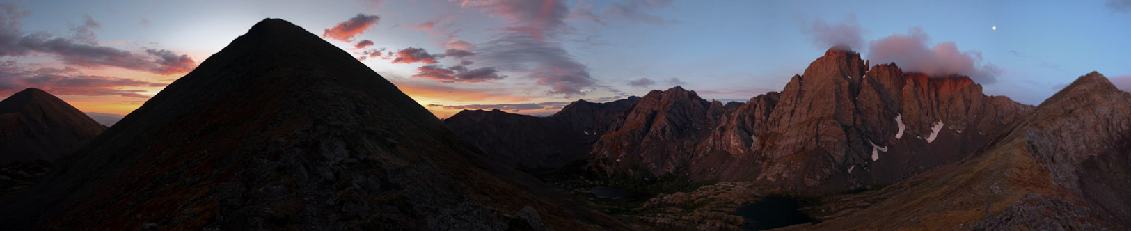
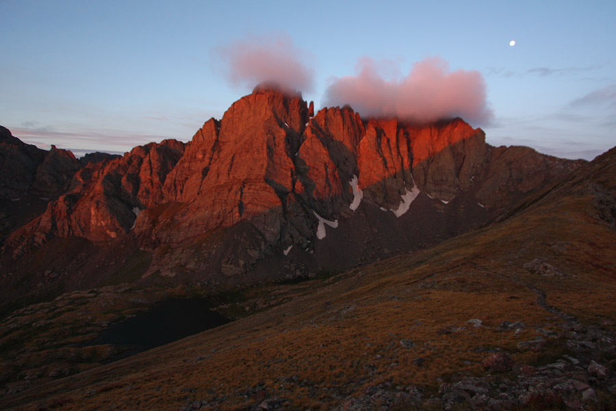
During the drive, we were treated to a view of the Crestone Traverse through a gap in the mountains, and rain clouds. The Peak is on the right, and the Needle on the left of the impressive looking ridge...
Chris had been planning to hit the Crestones peaks this weekend with a CMC (Colorado Mountain Club) group, but was on a "waiting list". Since I was free, and interested in taking advantage of the 4x4 South Colony Lakes TH before it closed after this year, I told Chris, cancel you trip with the group, I'll join you instead. I was interested in the famous Crestones Traverse, a challenging route known for its 100' 80 degree class 4 scramble, and difficult route finding between the two Crestone 14ers. Chris was not interested in that much exposure/excitement, but I guessed there might be several others in the area over a popular Labor Day weekend that might be interested, and wililng to have me tag along. Chris and I could hike Crestone Peak together, and split up during the descent if I found another party for the Traverse.
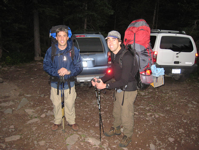
We left Fort Collins ~noon on Friday, stopped at Denny's in Canon City for dinner, and took an unintended 45 minute "long cut" to Westcliffe (rt 50 from Pueblo, down to rt 69, rather than rt 96 from Pueble). As we neared the mountains we observed plenty of rain and clouds, and hoped it would pass by the time we arrived. The drive up the the 2.5 mile 4x4 road took 30 minutes, but was relatively stress-free compared to most other 14er 4x4 roads I've been on. We reached the TH ~6pm, under dry conditions, packed our bags, and hit the trail at 6:20pm.
During the drive, we were treated to a view of the Crestone Traverse through a gap in the mountains, and rain clouds. The Peak is on the right, and the Needle on the left of the impressive looking ridge...
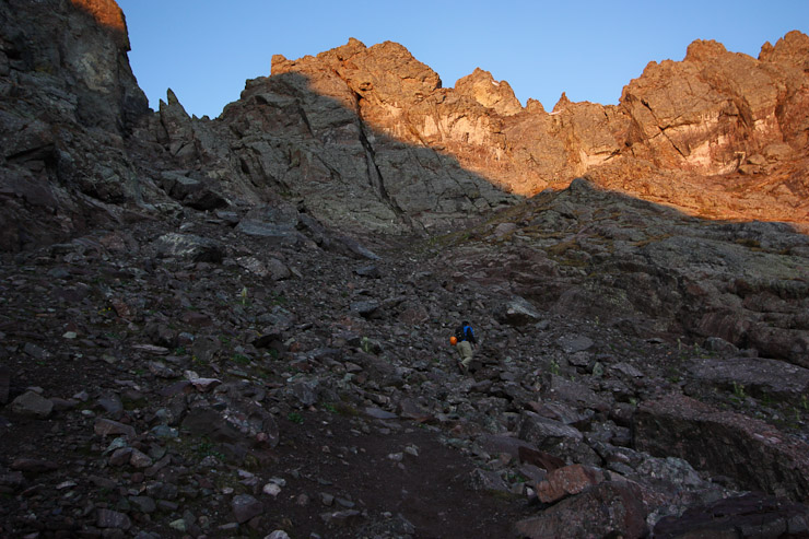
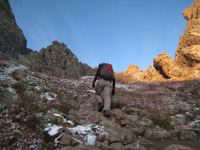
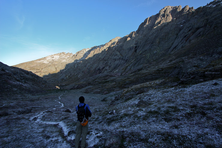
Since it was just a 1.5 mile hike to the lake, I carried 2 full water bottles (to save time pumping water later), a bottle of 90 Schilling for dinner tomorrow, my laptop (to get a head start on pics tomorrow night), and all my camera gear. We set out on the trail, glad it wasn't raining. Unfortunately, it started raining ~5 minutes into the hike, and didn't stop for several hours. My poncho and rain gear didn't keep me very dry, and caused more sweating. Both of us had wet clothes by the time we found a decent campsite in the growing dusk 45 minutes later. There was enough light to set up our tents before dark on semi-dry turf underneath some pine trees. Once our tents were up, I was ready to escape the rain and call it a night at 7:30pm. I just hoped I wouldn't need a bathroom visit later in the rain. I hung up my wet clothes in the tent, and was glad to have brought a complete change of clothes to use tomorrow (a last minute addition after we extended our planned stay to 2 nights). Chris set the alarm for 4:30am. I realized how spoiled I was with the great weather and 24 hours of light I had in Norway this summer. Fortunately, I was dead tired from so much traveling recently, that I fell asleep quickly by 8:45pm (after figuring out how to maneuver around a sharp root under the tent), to the constant pitter-patter of rain on the tent fly.
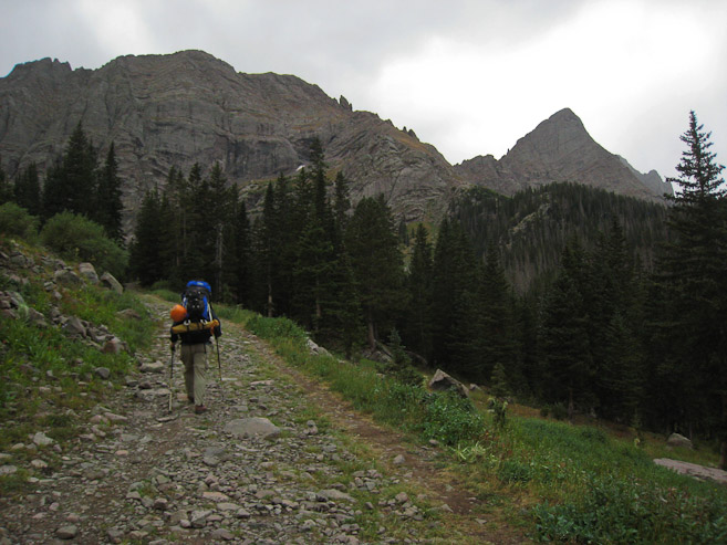
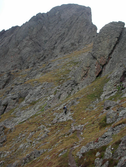
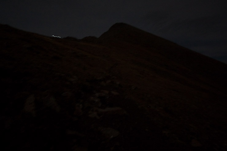
My pack was extremely top heavy (the laptop certainly helped). The Needle came into view in the first couple minutes of the hike. A couple minutes later, it started to rain, making for a less than pleasant hike in...
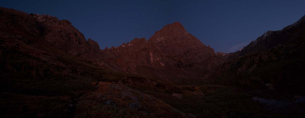
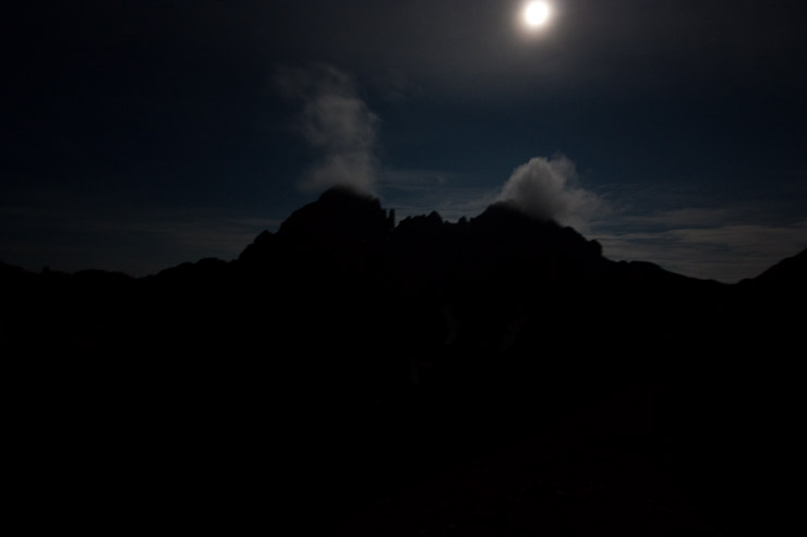
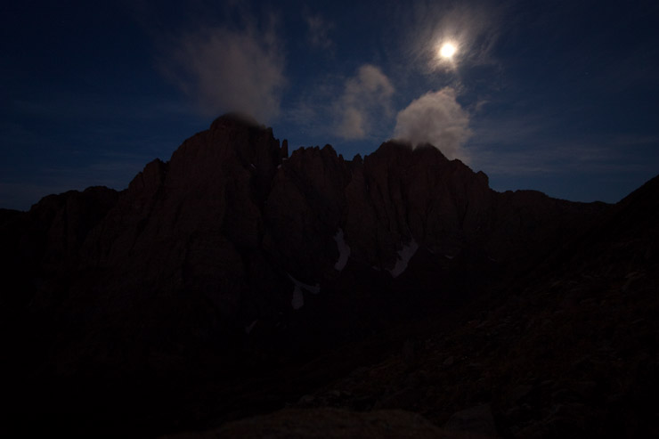
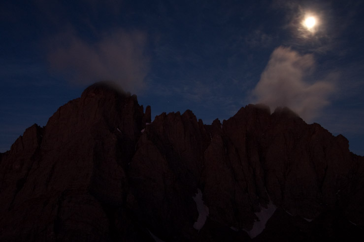
It was a full moon tonight, and I noticed the sharp shadows inside my tent when I woke up a couple of times during the night. When I woke up at 1:30am, I heard some noise in Chris's tent also, and told him I was going to check out the moonlight and take some pics. He had already been outside, and said it looked like snow had fallen in the mountains. A full moon is awesome to experience. No headlamp was necessary as I setup a tripod in a clearing near camp to play with my camera.
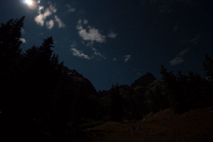
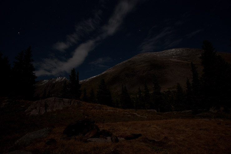
Some photos of the Needle, and Humbolt at 1:45am, under a full moon. The rain had stopped ~11pm, and I was surprised to see some snow on the peaks. I wondered if the skies would stay clear come morning, since I noticed the clouds increasing slightly during the 20 minutes I was outside...
I went back to bed half expecting cloudy skies in the morning, and slept well again, awaking occasionally to roll into a better position. I heard some voices from a camp nearby, but figured they must be REALLY early risers, since our alarm hadn't gone off yet. I continued to doze, content to take advantage of my "record-breaking sleep performance when camping before a 14er". I finally checked my watch, when it seemed like this was going on for too long, and it was 5:40am, 70 minutes past the alarm! I heard movement in Chris's tent too, and he had also come to the same realization, so we quickly gathered our gear, and hit the trail at 6am.
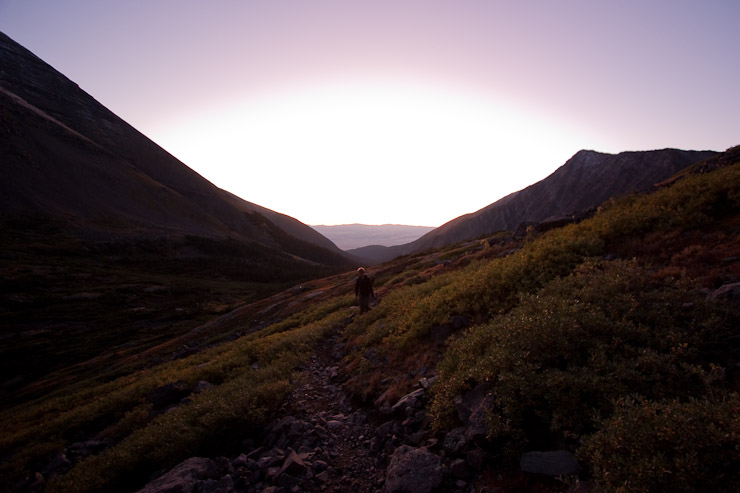
Our accidental late departure at 6am meant I only used my headlamp for a few minutes before the predawn light was luminent enough. Would our 70 minute sleep-in, due to a missed alarm affect our chances of hitting the peaks today? I didn't worry, and felt that for whatever reason, it was just meant to be this way...
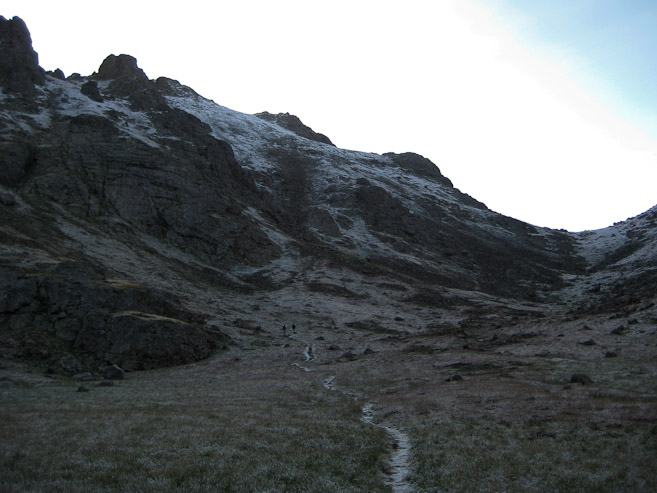
We could see traces of snow from last night's precipitation on the mountains. Chris and I saw some headlamps much further up the trail, and also some from a group that started right behind us...
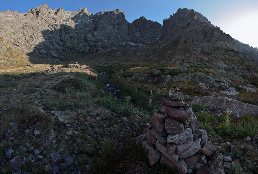
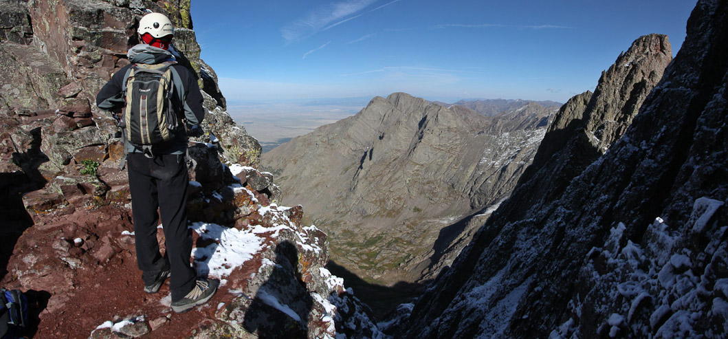
A look at the Needle. Our path would lead us to Broken Hand Pass, the lowest saddle point to the left of the Needle in this pic (about where the brown rock starts turning reddish)...
Sunrise was ~6:30am today. The wind was calm this morning, and the skies were joyfully clear...
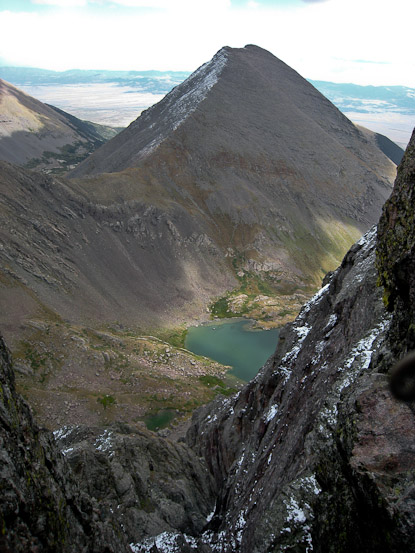
A look back at the 14er, Humbolt, across the valley. A group of teenagers and a leader were making their way up behind us...
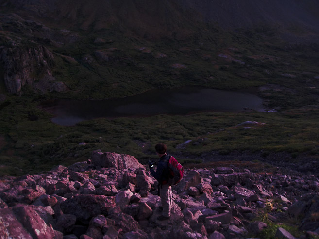
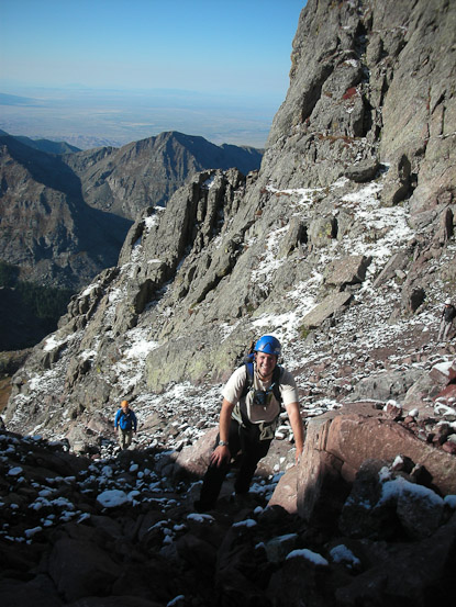
Chris takes of pic of me, with South Colony Lake below. The trail was well marked, and pleasant class 2 for the beginning...
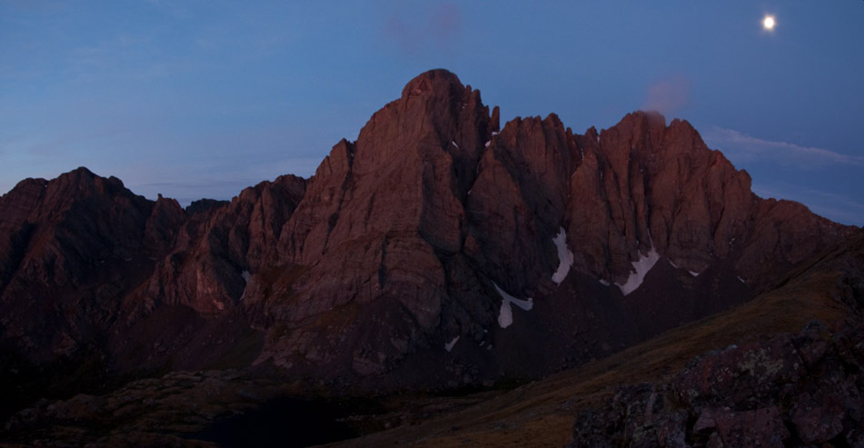
A stitched shot from a couple of Chris's pics that show the new snow on Humbolt...
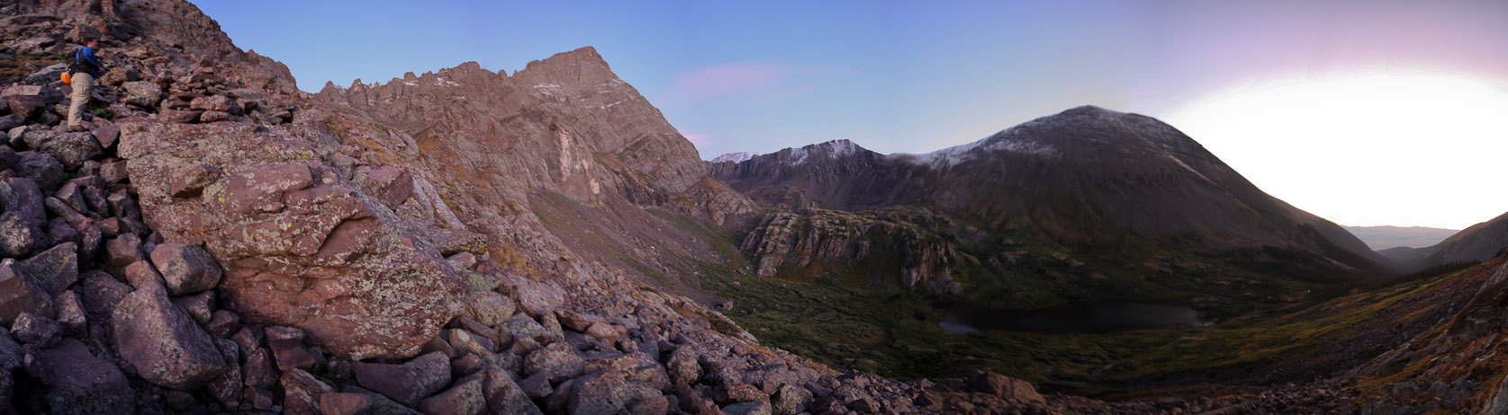
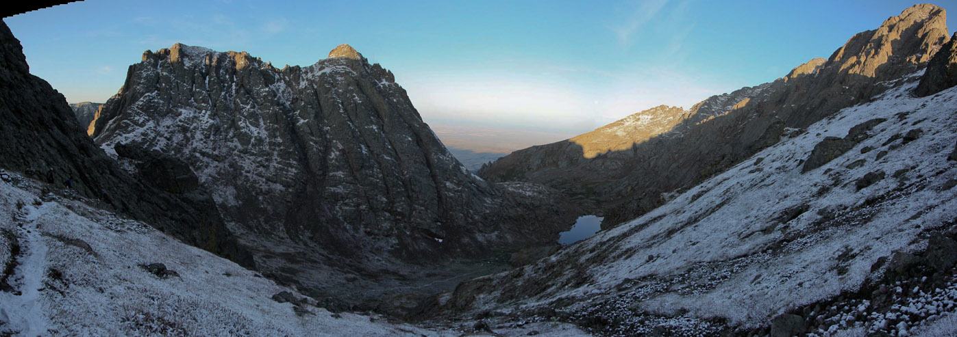
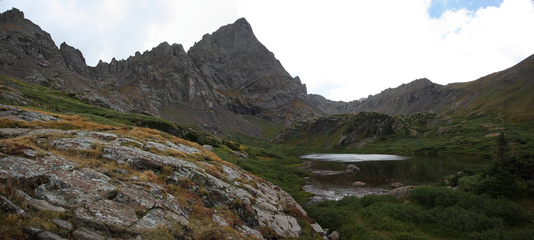
A wide view of Crestone Needle and Humbolt, with Upper South Colony Lake below...
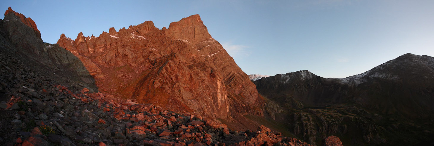
Shortly after 6:30am, the sun painted the Needle red, as we headed towards the lowest gap on the ridge in this photo (far left)...
A look back at sunrise, and Humbolt. Soon we would be starting the steep climb up Broken Hand Pass...
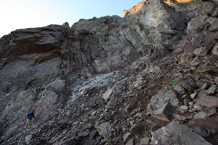
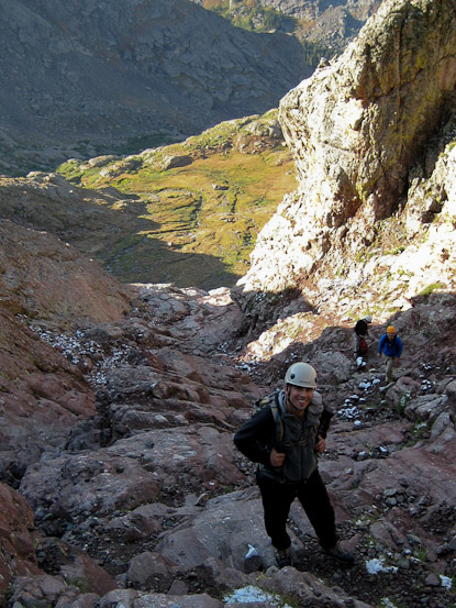
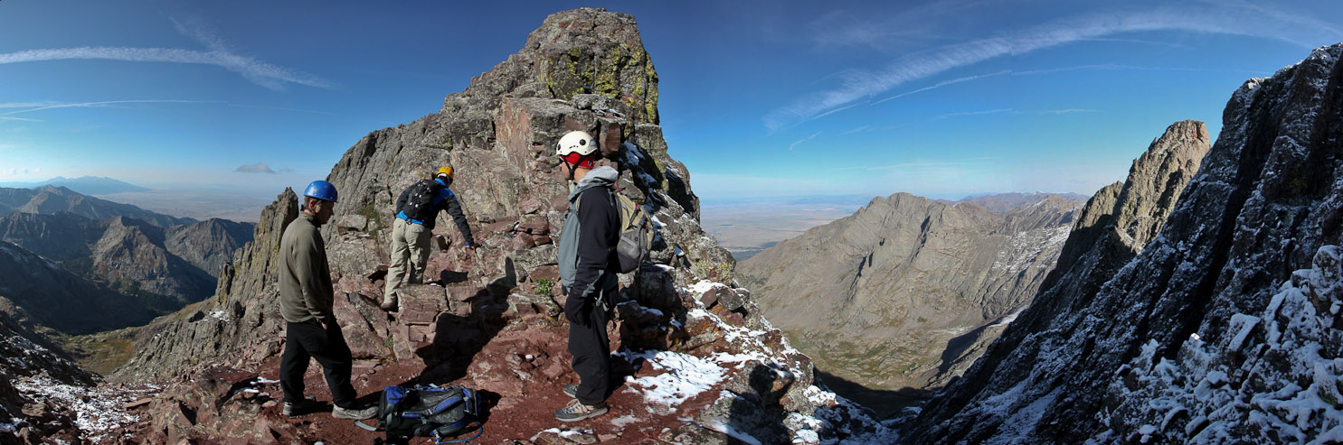
Chris heads towards the pass on the left of the 1st pic. The way was steep, and it helped to stay near the side to use the rock for support...
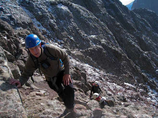
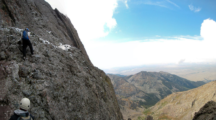
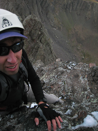
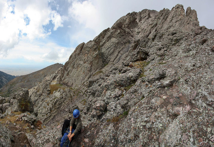
Chris takes a pic of me, taking a pic of him. I climbed up the other side. There were some scrambling moments in this gully. Fortunately the trail wasn't of the "slippery" variety...
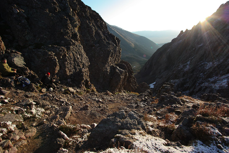
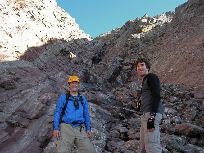
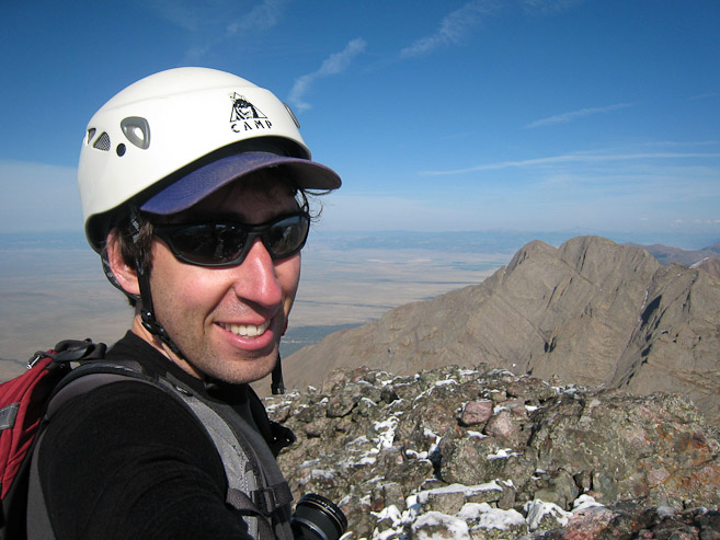
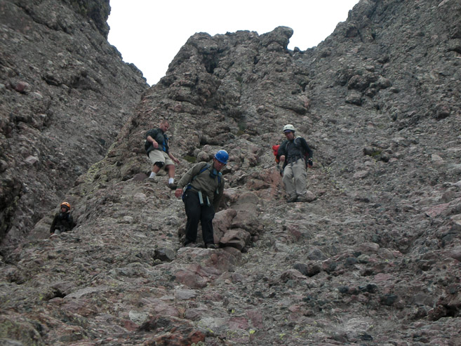
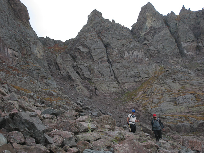
We reached the top of the pass at 7am, where we met Aaron and Cobb, who were resting and snacking. They had started from the 4x4 trailhead at 5am this morning, and were planning to do the Traverse, Peak to Needle, as I had hoped to do. They welcomed me to join their attempt...
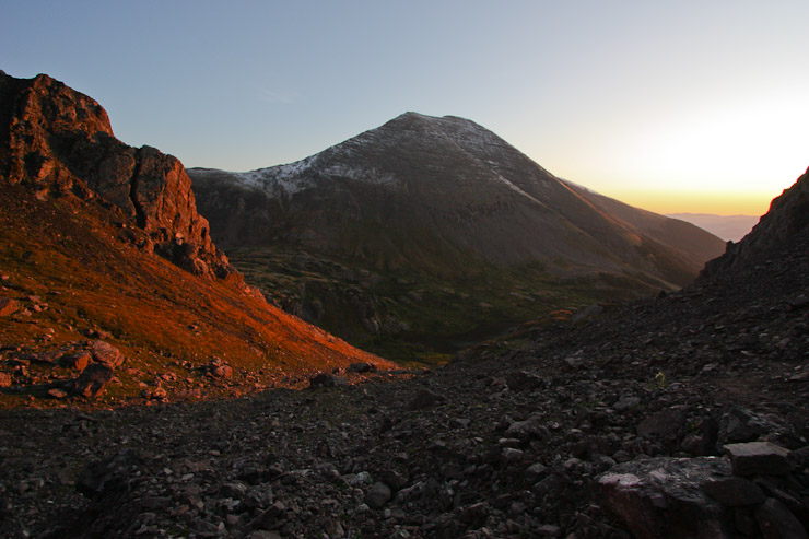
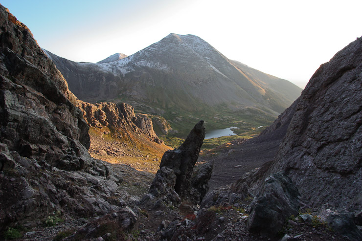
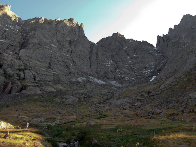
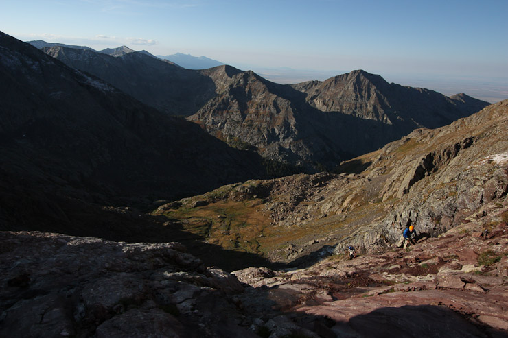
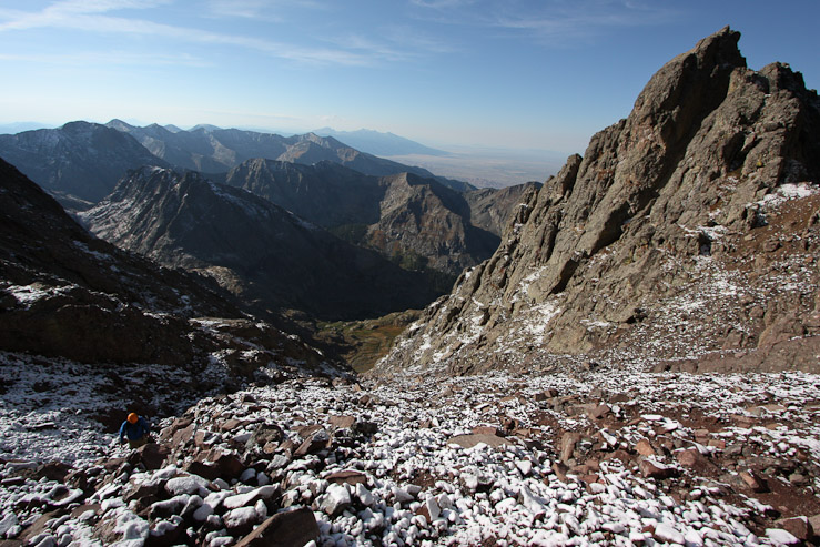
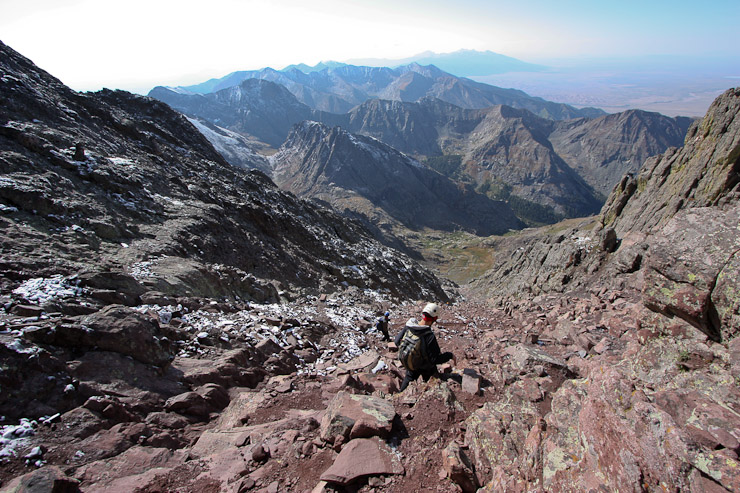
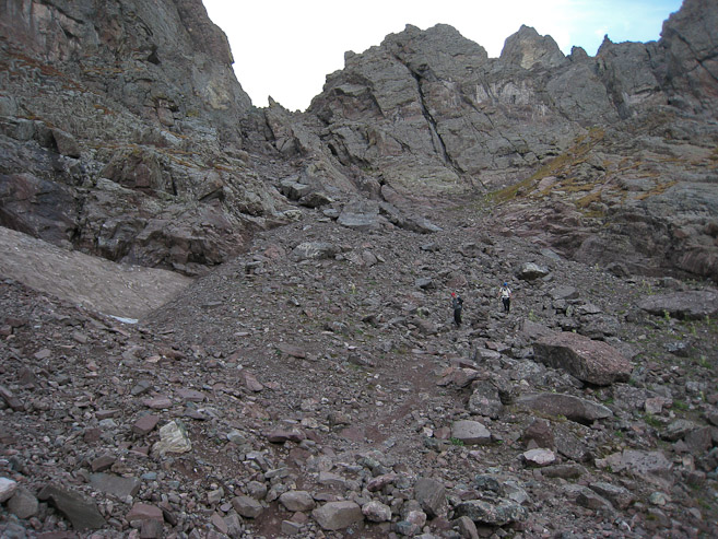
The west side of the pass was dusted with snow. We'd need to descend 800' and them make it up again to reach Crestone Peak. Not fair...
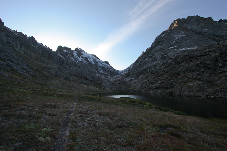
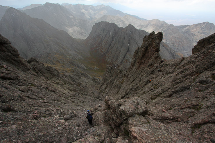
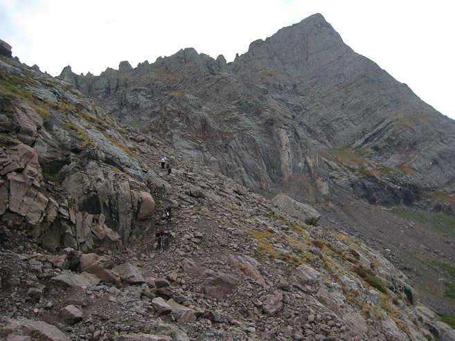
Shortly down the pass, Crestone Peak came into view (upper right). The trail strings down through the valley below, leading to the lake...
Chris looks up at Crestone Peak from the valley floor. A look back from Cobb's camera, of Chris and I in the distance. The trail descended from the left of the 2nd pic...
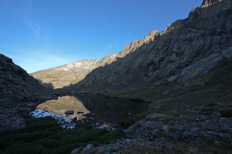
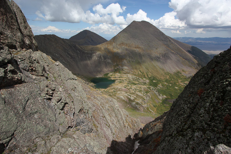
A look across the lake as we approached, and a look back after we passed it. Aaron and Cobb filled up their water bottles at the lake...
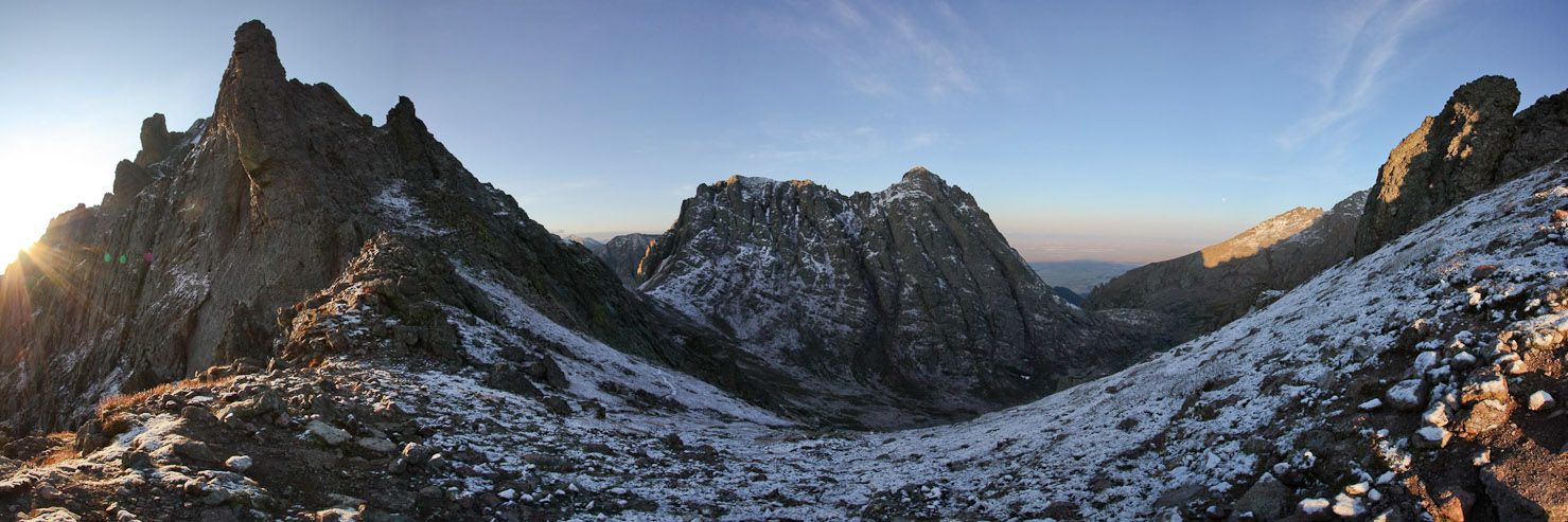
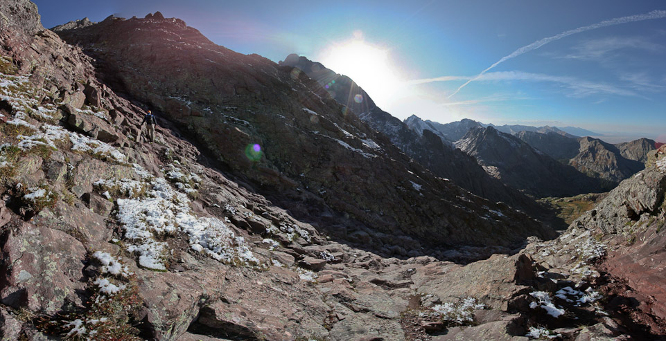
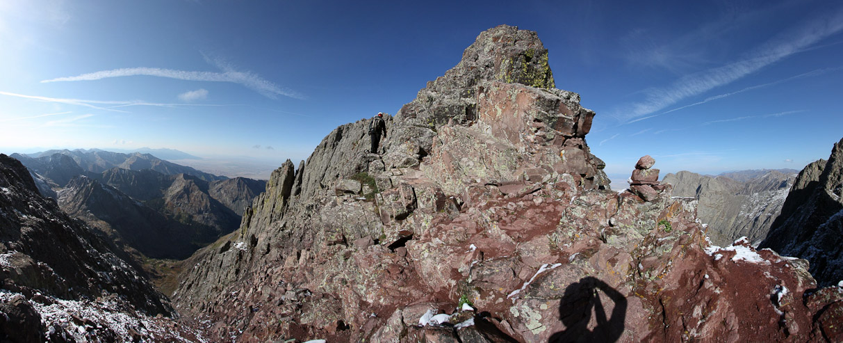
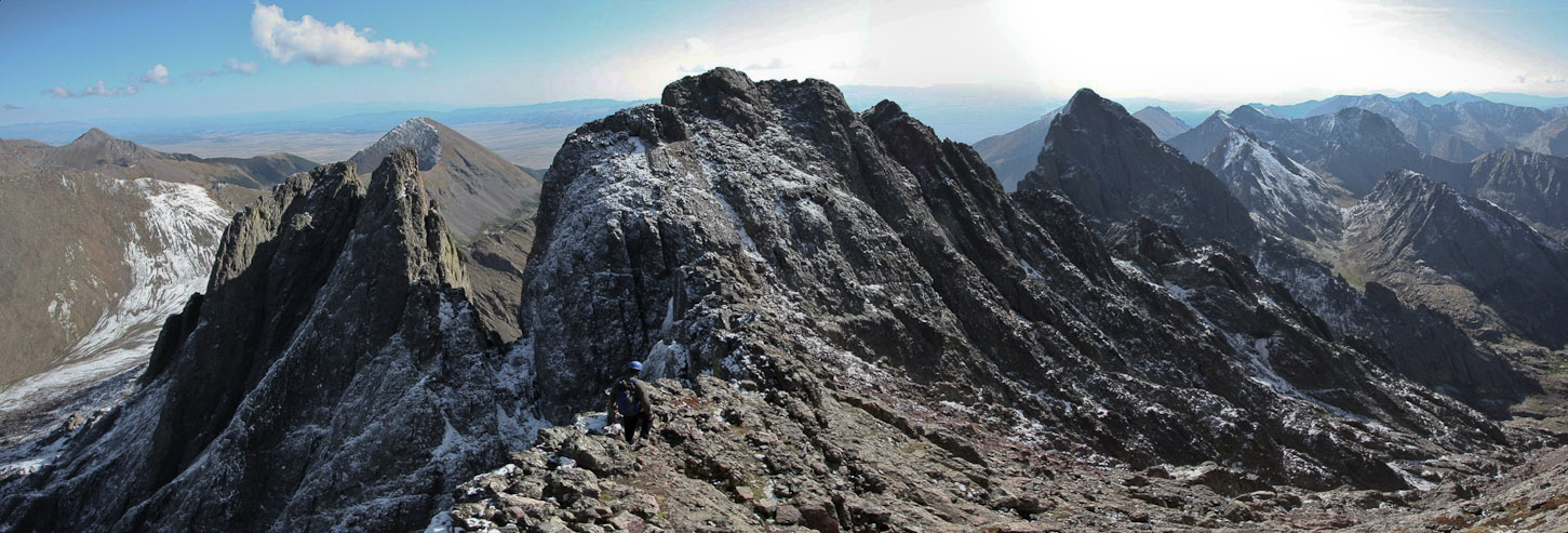
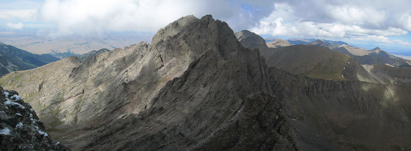
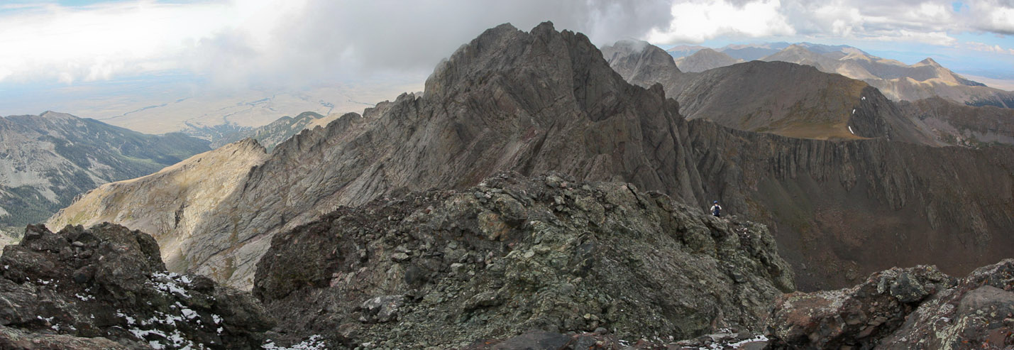
Just before the start of the climb, we had a view of the full traverse from Peak (on the left) to Needle (on the right). We tried to scout out the route, which stays well under the ridge until the last notch before the Needle...
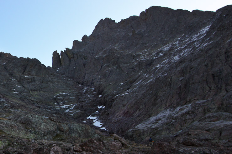
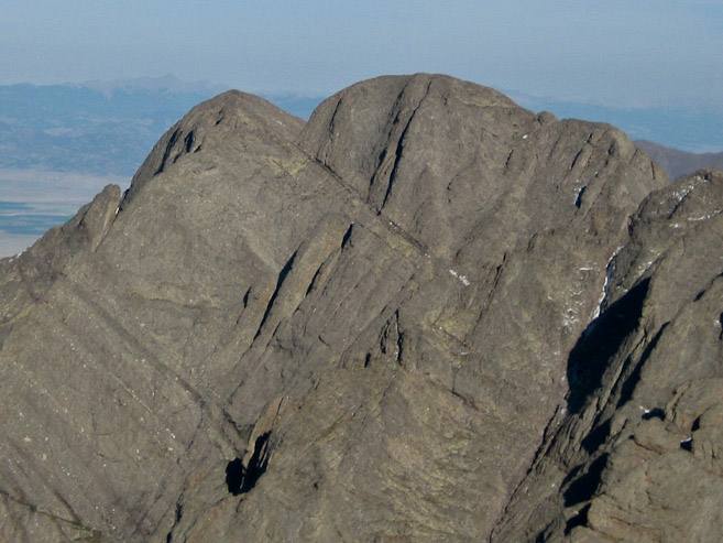
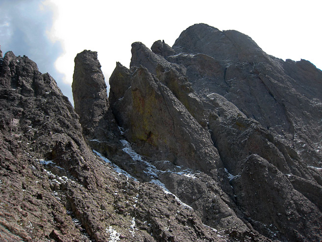
This 1st pic (by Cobb) shows the "red gully" (the dark vertical crack on the left side of the pic) that we would take to Crestone Peak (in the extreme upper left corner). The 2nd pic is a zoomed in pic of ridge leading up to Crestone Needle. We hoped to be very intimate with those gendarmes soon...
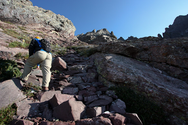
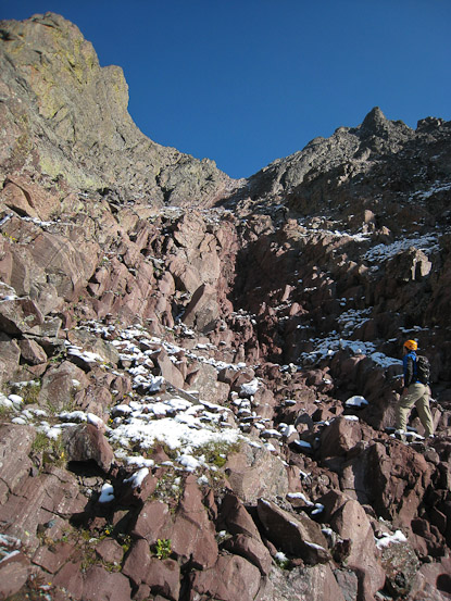
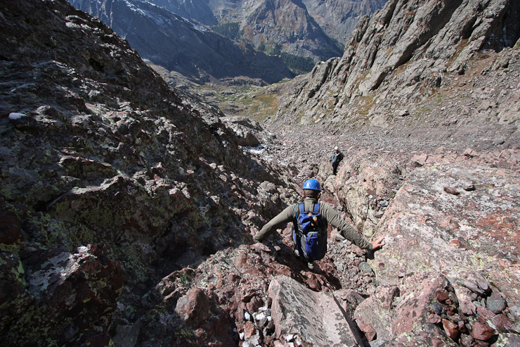
A good rock trail lead up to the start of the red gully...
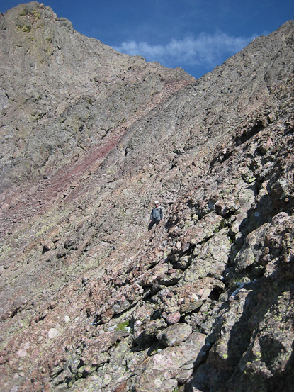
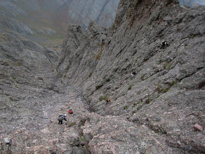
We had wondered if there'd be snow in the gully to make things slippery, but the gully was largely dry, and the rock was textured enough to still keep a grip even when a bit wet...
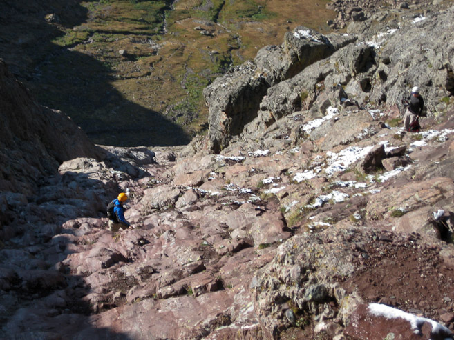
We spread ourselves out in the gully, in case of rock fall, though rocks didn't usually tumble far. I hiked up along the left edge, and would recommend checking that side out if you like a scramble (and totally free of rock fall, since they would funnel towards the middle)...
A 2x5 stitched pic from the left side of the gulley, still early in the climb...
The gully was ~2000' of gain, and consistently steep, but relatively basic class 3 with little exposure. We made good progress, gaining elevation quickly...
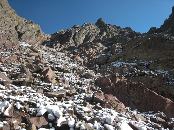
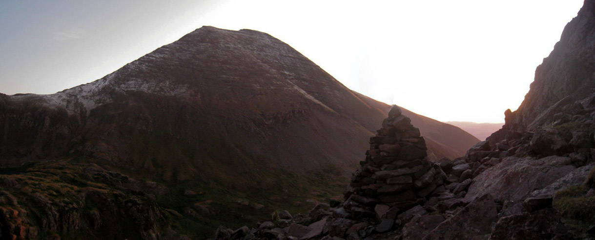
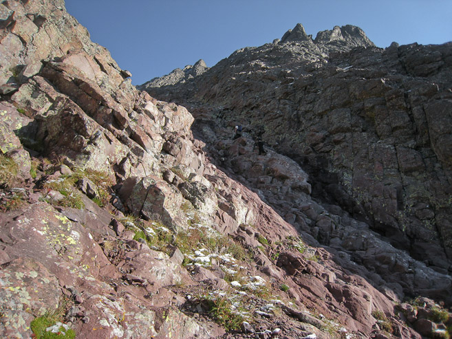
We were on the lookout for the gully exit to the Traverse. Roach said to look 300' below the top of the gully. We thought this spot looked like a decent exit point, and planned to check it out on the way down. A look down from this wide rocky spot in the gully...
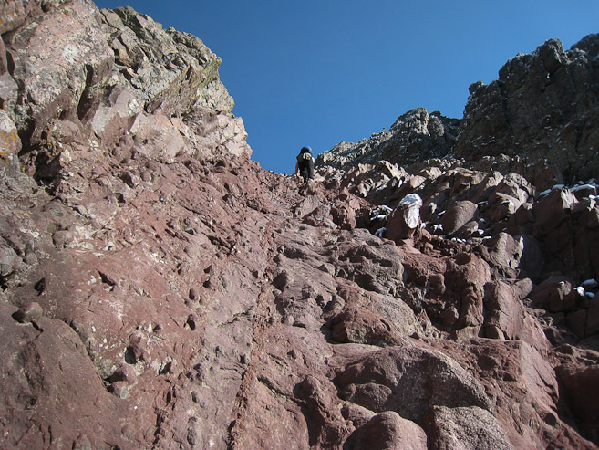
The red gully lived up to its name. Chris was starting to feel some altitude sickness, given the quick elevation gains, but managed to rally after rests...
Pics from Aaron near the top of saddle, and from Chris looking up at me and Cobb. Finally at 9:20, almost 2 hrs from the lake at the bottom of the valley, we reached the saddle at ~14,150'. Chris triumphantly tops out on the saddle...
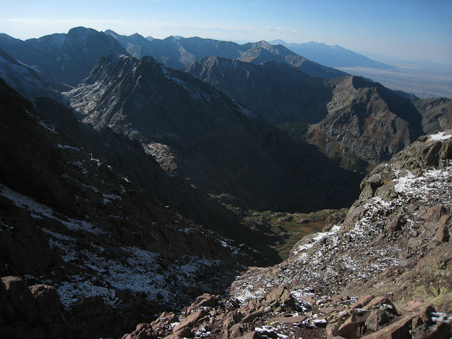
A look north from the saddle to the 14ers Kit Carson and Challenger...
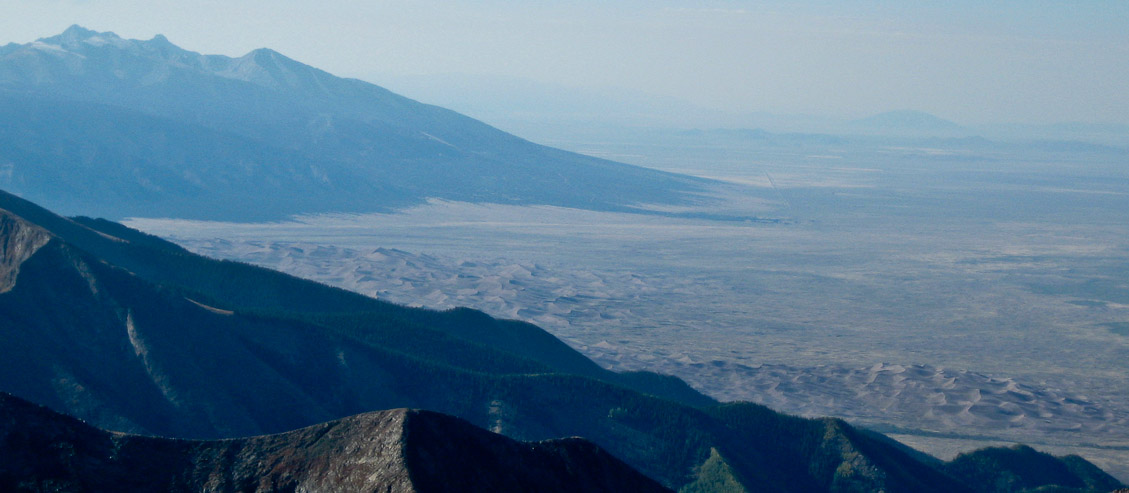
A cropped shot of the sand dunes, and Blanca peaks to the south (taken by Cobb)...
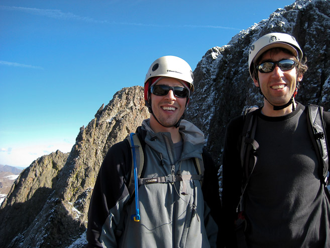
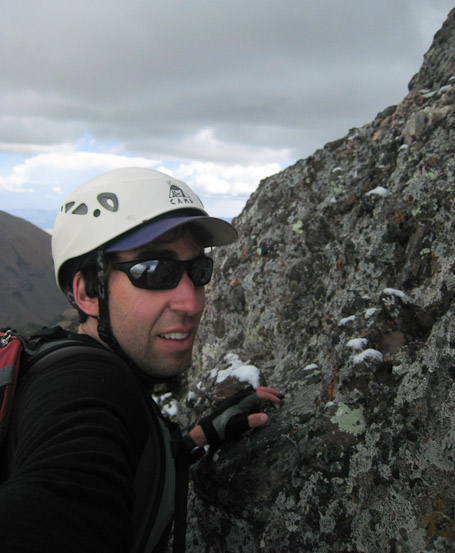
Pics from Cobb: A close-up of Kit Carson's south facing ledge (fun to admire since I climbed it last year). And a pic of Aaron and me at the saddle...
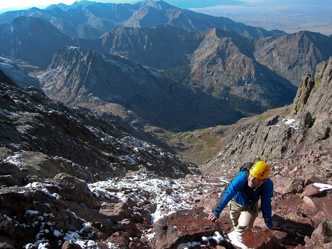
After a short rest at the saddle, we were happy to begin the final ridge hike to Crestone peak. Chris led the way...
Aaron continues on to the peak...
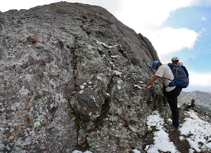
The trail scrambled up the side of the peak, avoiding drastic exposure...
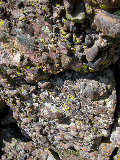
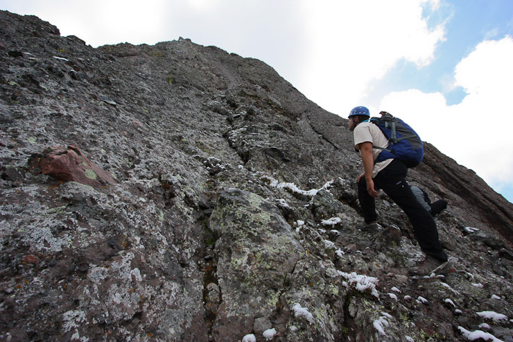
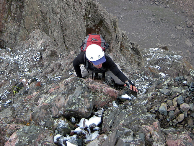
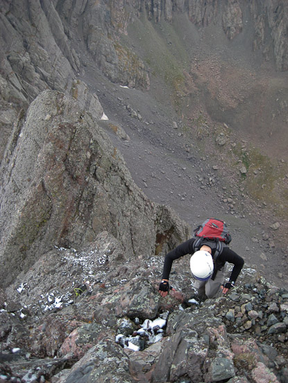
Cobb took a picture of the incredibly enjoyable conglomerate rock. The rock was solid and knobby, perfect for climbing. Chris gets a shot of us making our way up the final approach...
We're moments away from the summit of Crestone Peak (14,294'). Drum roll please...
The summit area split into two stretches. I went out on the slightly lower stretch, and took a close-up pic of the Needle, my next destination (hopefully)...
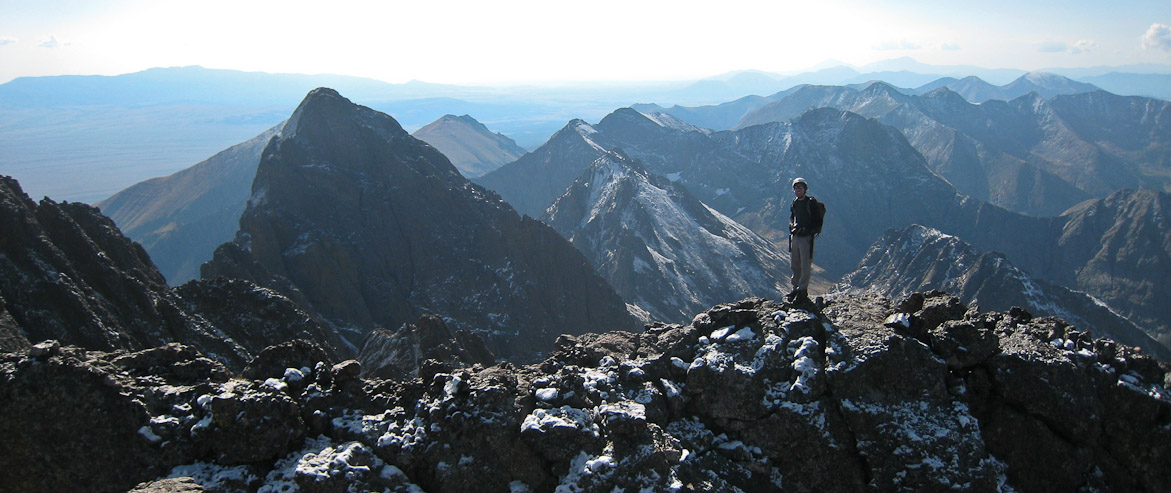
Me on Crestone Peak's "side branch", with the Needle beyond...
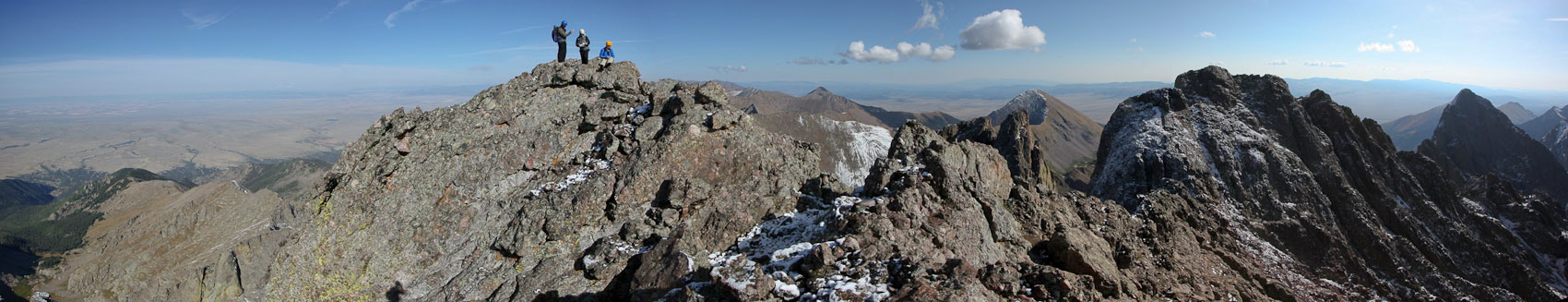
A wide view of Crestone Peak with Chris, Cobb, and Aaron, and the Needle on the right...
I made my way over to the true summit to join the gang. This stitched pic wasn't kind on Cobb's lower half. Crestone's have some impressive jagged features...
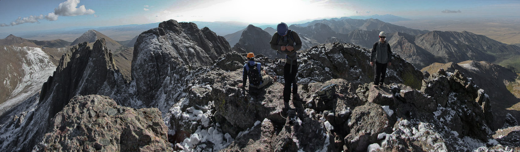
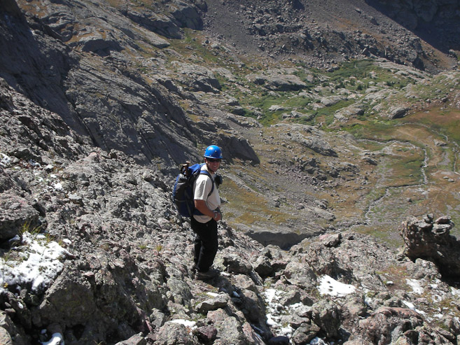
Chris and I on the peak. Chris was anxious to get started on the descent, and began the trip back along our route from this morning. Aaron, Cobb, and I spent some time trying to view the proper exit of the red gully to start the traverse to the Needle...
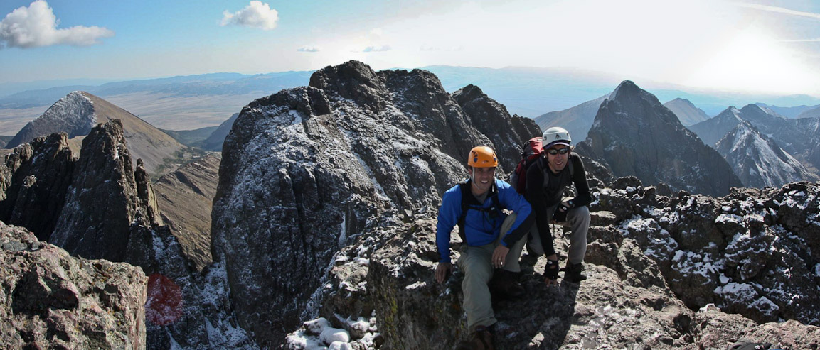
Based on my camera time stamps, we spent 18 minutes at the summit before heading back. The skies still looked promising for an attempt at the traverse...
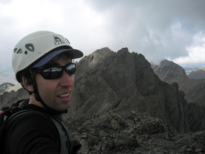
A token self portrait at the Peak before heading down the red gully...
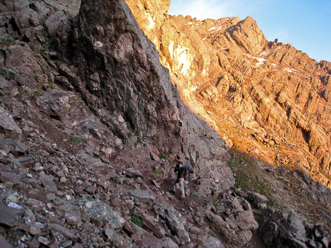
Roach's book said to leave the gully 300' below the saddle, so we headed for the spot we identified on the way up. We caught up with Chris, who took the 2nd pic of the three of us on the far side of the gully...
A look at the area we thought led to the start of the Traverse. I went ahead up the snow slope to the left to scout. Chris is on the right of the pic...
I made my way up the snow covered rocky trench and found a perch to look back at the red gully (Chris grabbed a pic of me). Aaron and Cobb decided to descend the gully further, think we were still too high up to cut over. I told them I'd go a little further to check, and either meet them on the other side, or return. When I reached the top (see 2nd pic), I saw Humbolt through the gap. When I descended a bit further, I saw the Needle to my right! I was on the wrong side of the ridge! I didn't waste any time taking a pic, and hurried back to catch up with Aaron and Cobb...
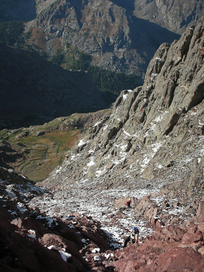
Meanwhile, Aaron and Cobb had continued down, and tried the next slight opening off the red gully, but turned back. The soon found some cairns, and ran into a group that was hiking the Traverse in the opposite direction. I caught up to them, and we scrambled out of the red gully, following scattered cairns...
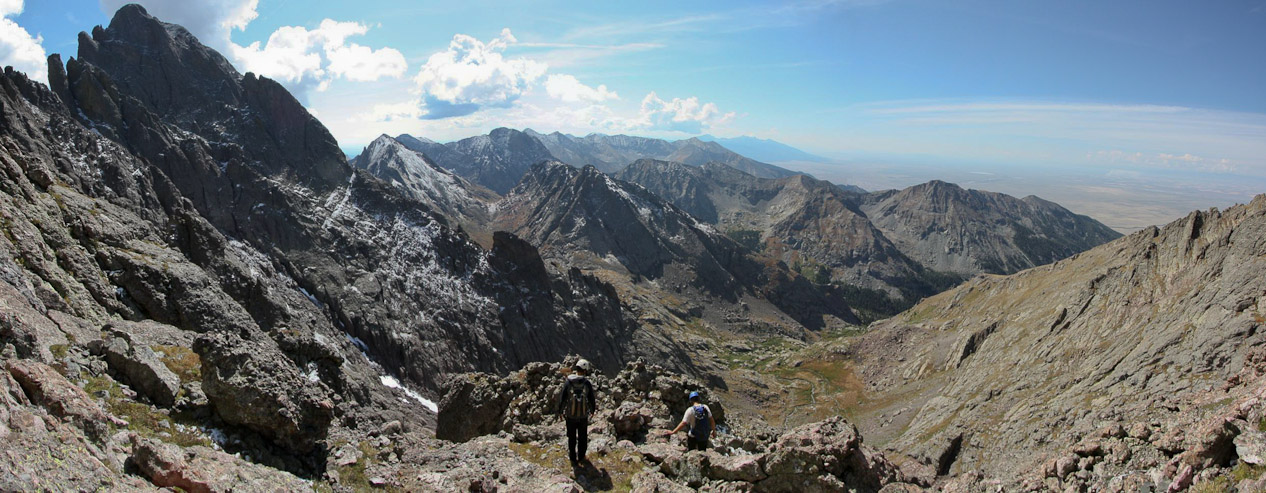
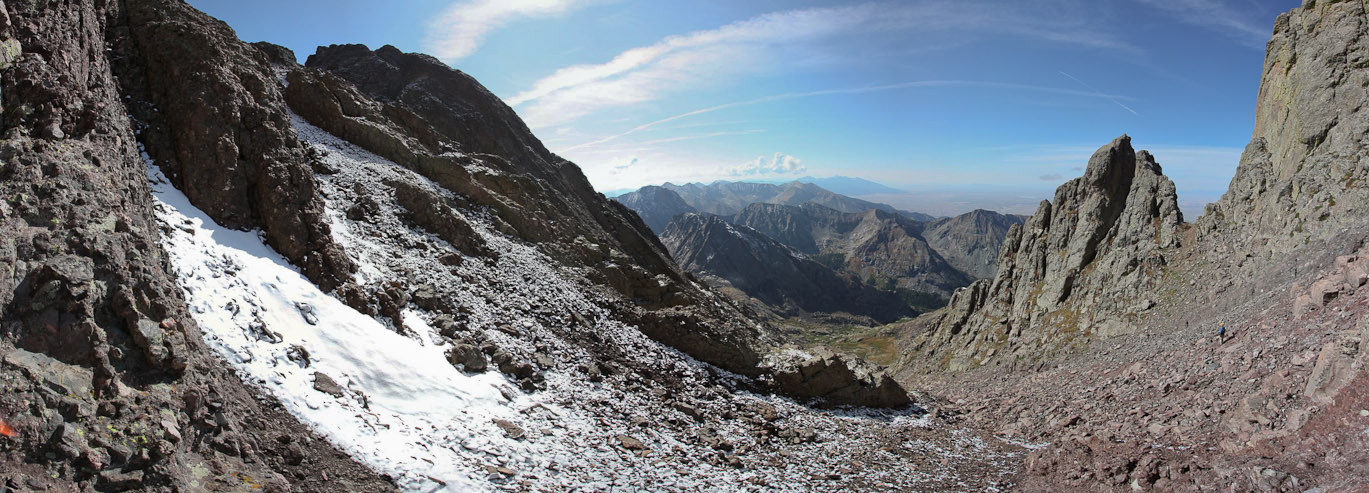
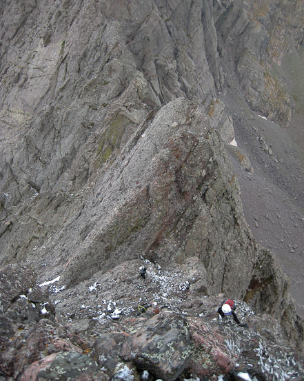
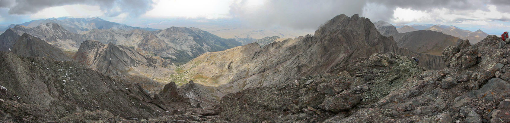
Once out of the gully, the path was more obvious, and we hiked along a grassy slope full of boulders. I had intended to document the Traverse path in detail this trip, but it was getting late in the morning, and the building clouds meant speed was of most importance. In this pic at 10:50am, we're almost half way towards the Needle, and were seriously considering the situation. We figured it'd be another hour or so (at least) to get to the summit, which would put us in ~noon, and with the clouds starting to build, we started to question our attempt. In the end we all wanted to continue at least to the Black Gendarme (first pinacle before the peak), and re-evaluate there...
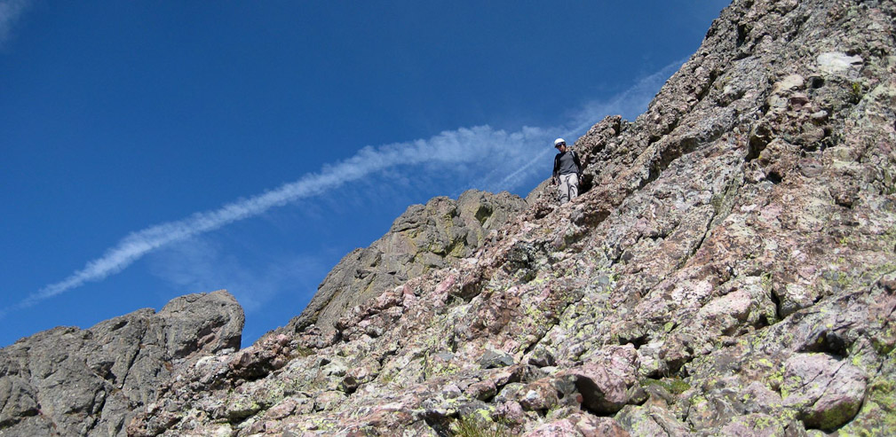
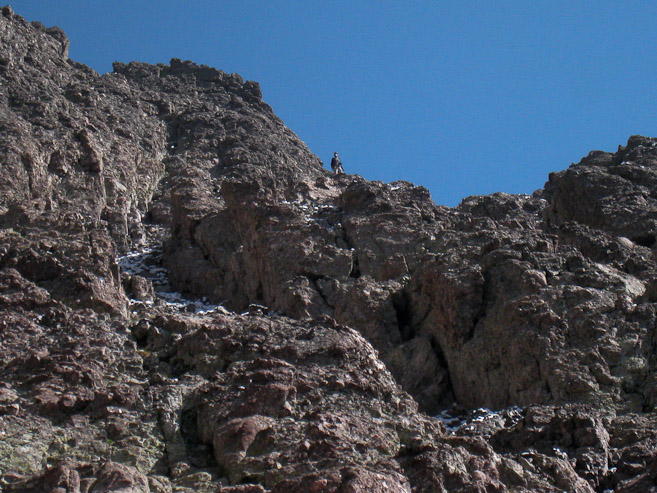
I seemed to be doing a bunch of extra scrambling today, looking for short cuts, but often had to back track to Aaron and Cobb...
Cobb got this great shot of the impossing Needle, with a couple of hikers on the south ridge (leading down to the right). Our route would be up the more challenging left ridge...
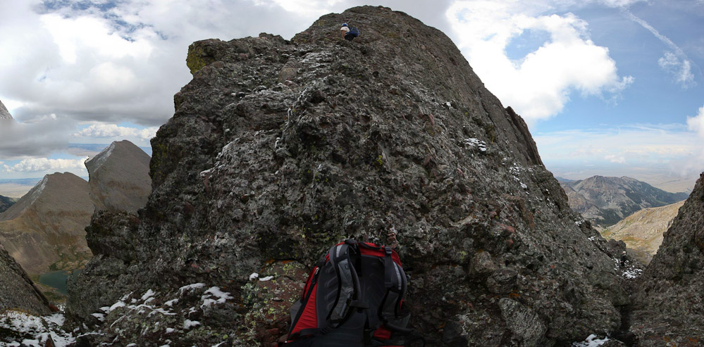
For the final approach to the Black Gendarme, we had to descend down to a cairn below, before climbing to the base of the giant rock pillar. We headed for the crack on the right side of the Black Gendarme...
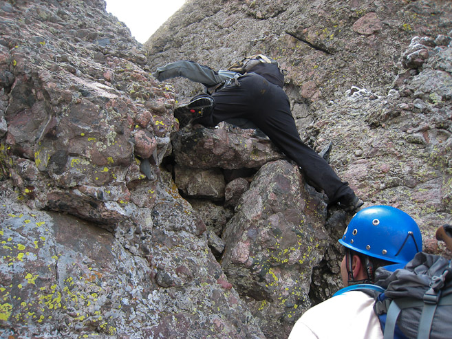
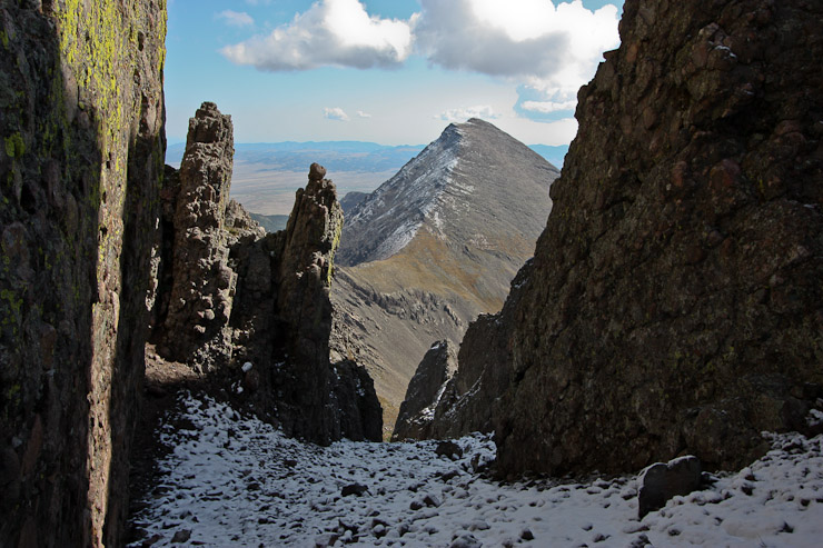
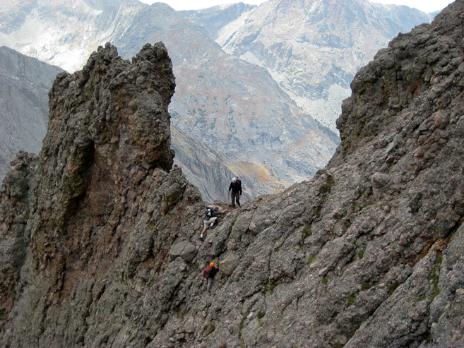
We were all surprised at the tricky move needed to ascend past the base of the Black Gendarme. Aaron's info said this was a 5.5-5.6 move. Look for a great hold underneath the rock with your left hand, and a hold above it with your right. Supposedly there is a class 3 ledge to get up here too, but we didn't see it, and didn't mind the 5.6 move, since there was no exposure. Beyond the initial move, we found more scrambling, and a view of Humbolt through a gap in the ridge...
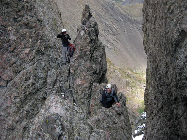
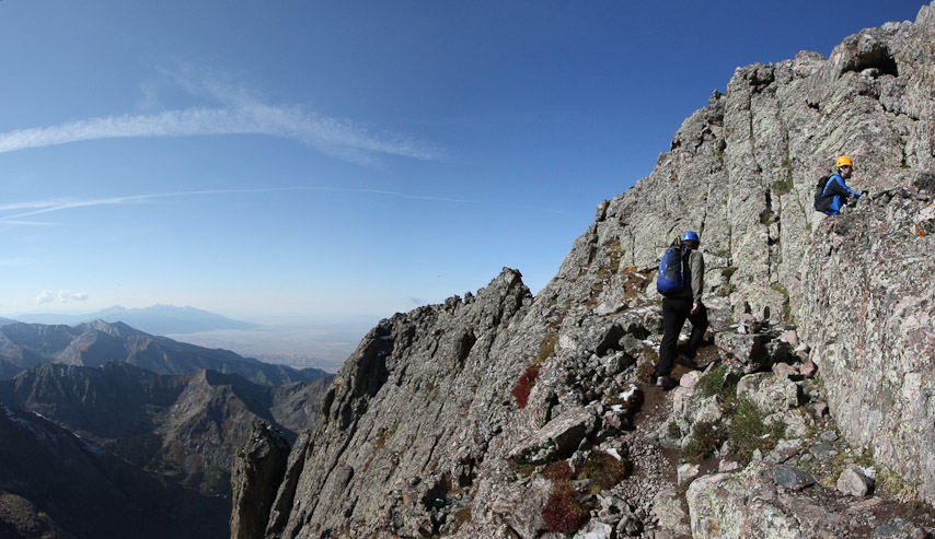
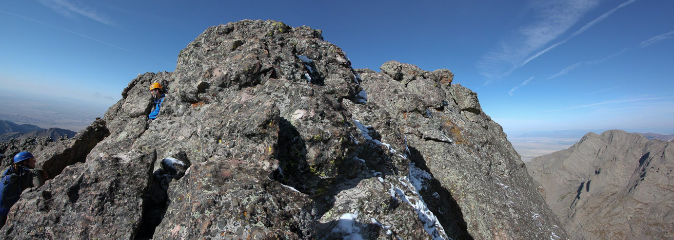
When we reached the top of the ridge and turned, we saw an exposed knife edge leading to another ledge. Cobb and I took simultaneous pics from both sides, of Aaron crossing the knife...
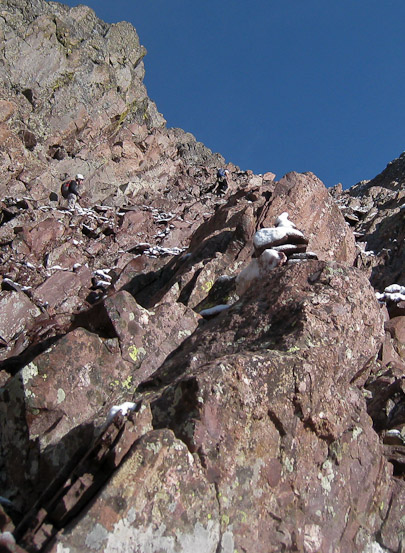
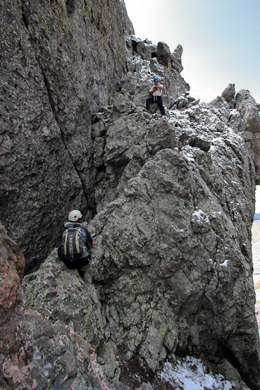
After the knife, we traversed around the side of another gendarme. We were making good time...
We scrambled up higher, and kept to the right of the crest until...
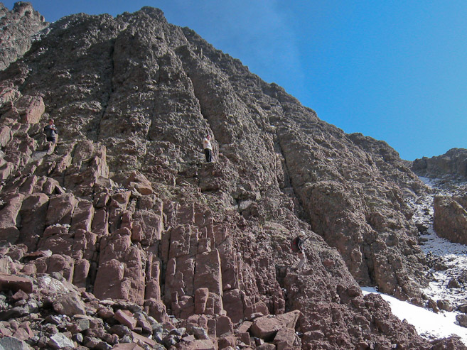
...we reached the base of the final climb to the summit. The class 4 crux lay ahead, with a 80% 100' wall with lots of knobby holds (from what I'd read). Cobb started first...
Cobb is about to start the final crux climb, Aaron watches from below on the right. Something got screwy with with 2x6 matrix merged pic, with Humbolt appearing twice...
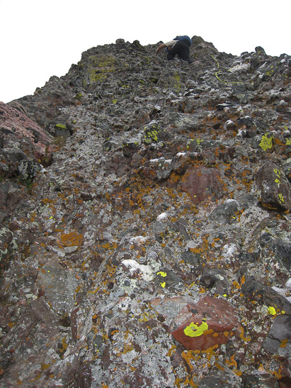
Aaron moves quickly up the crux, and I shortly follow. I was looking forward to this climb, anticipating a relatively easy and fun climb, given the reported "bomber" holds...
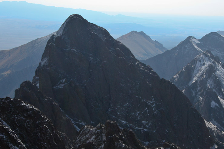
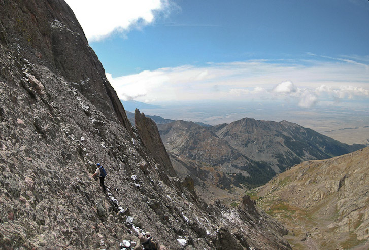
A look back at Crestone Peak at the start of the final climb. The clouds were building, and it was just past noon...
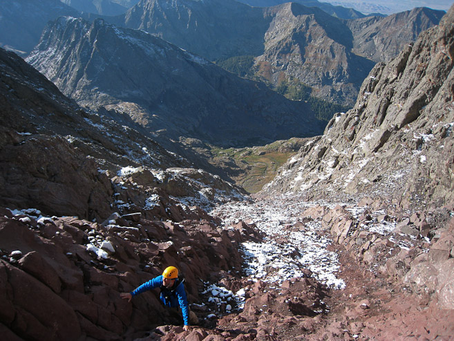
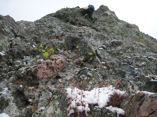
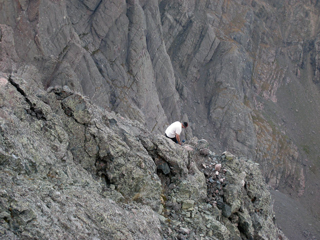
Midway up I found a good spot to lean on and take a couple pics. I found myself climbing quickly, with solid holds available, and was heading up to the left, where the wall curved into a cliff. This looked and felt kind of scary, and I realized I better scoot back towards the right. Cobb gets a pic of me from the top...
The dusting of snow seemed to have pooled on many of the good holds, and as a result, my hands were getting cold (note to self, buy climbing gloves!). The sustained climb was a bit tiring, and I was considering finding a good spot to rest when I heard Cobb rooting me on from the top, just ~12 feet above. So I kept going, topping out at 12:08pm...
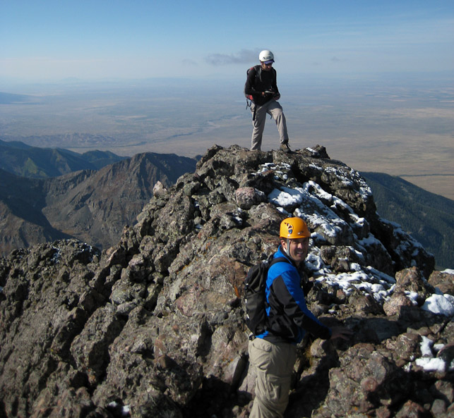
A view from the summit, where Cobb is waiting at the top of the crux for Aaron...
A token self-portrait on top of the Needle, and a look towards Humbolt...
Another wide view from atop the Needle...
A zoomed in shot of Cobb sitting at the top of the crux, and a pic of Crestone Peak with some hikers on the east and west summits. Not that it makes you any safer, but seeing other people on peaks during "questionable weather" somehow makes you feel more comfortable (or less "foolish"?) should conditions turn bad...
After a very brief time on the Needle's summit, we followed cairns and started the descent down the East Gully... A few small sleet pellets fell as we began. In these 2 pics, Cobb takes a pic of Aaron, and I take a pic of them both, from the same position. Meanwhile a group of hikers are descending from the west gully in the distance...

In this 1st pic, Aaron takes a pic of Cobb and I, at the same time as the 2 pics above (completing the trifecta). The East Ridge was supposedly class 4, but we had no problems descending it. Just one part was moderately difficult, near the junction with the west gully...
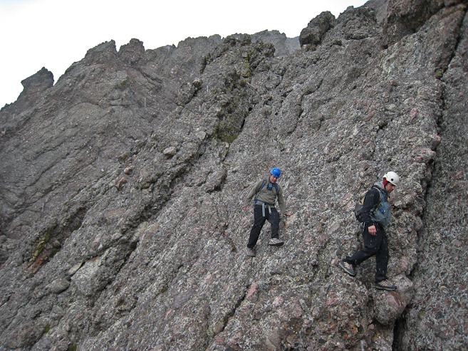
Here are a couple pics of other hikers descending from the west gully to the east gulley. This section is considered the crux of the standard route up to the Needle (just class 3). We questioned whether it was any easier than the East Gulley, which didn't see too bad to us...
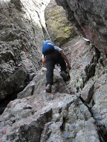
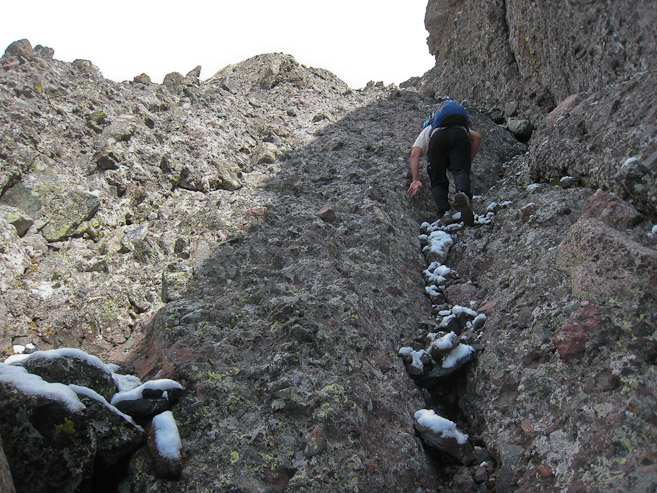
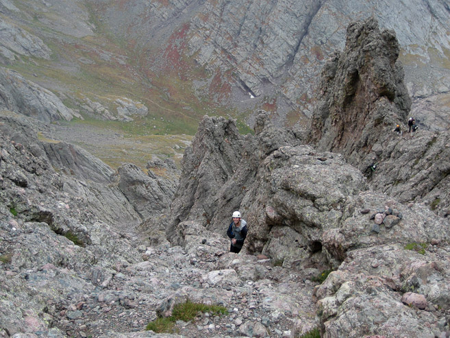
Cobb and I, among others, continue the descent down the solid rocky gulley...
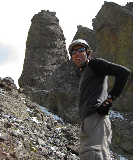
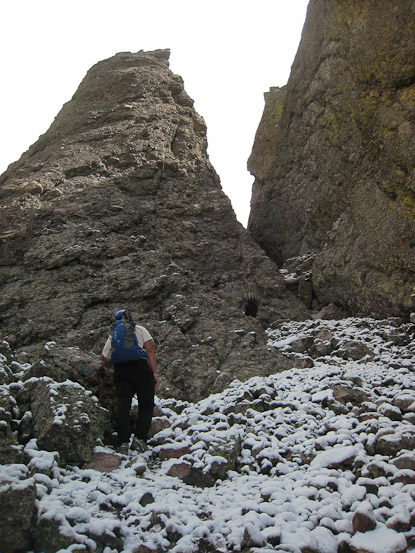
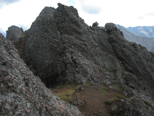
The Crestones are full of interesting rock formations...
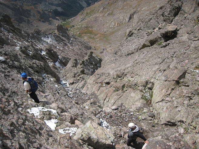
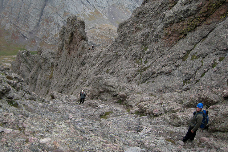
We followed some cairns that led out of the gully and across some class 3+/4 traversing, which didn't seem like the main path. It turned out to be a "short cut" to the path leading down the ridge. The hail/sleet had picked up a bit, but was still gentle. The 2nd pic shows the start of the trail on the ridge...
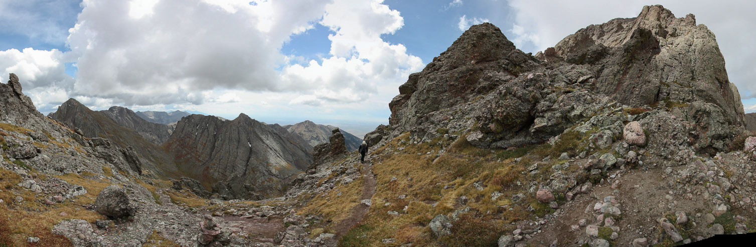
It had been a steep descent, and our knees were aching a bit, but Broken Hand Pass was getting nearer...
A look back up towards the Needle, where half of Cobb is gone, in the stitched shot. A look across the ridge at Humbolt...
A wide view of Aaron coming down the trail, with the Needle off to the right...
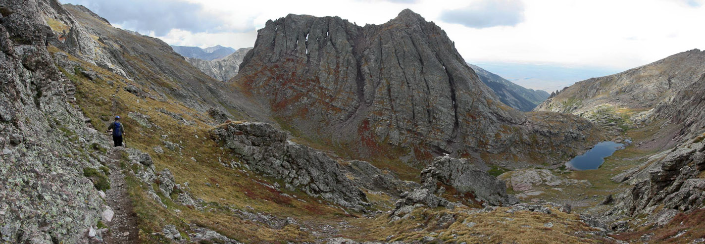
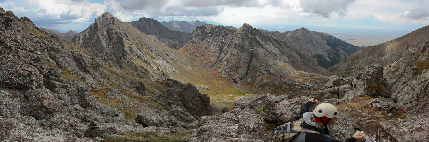
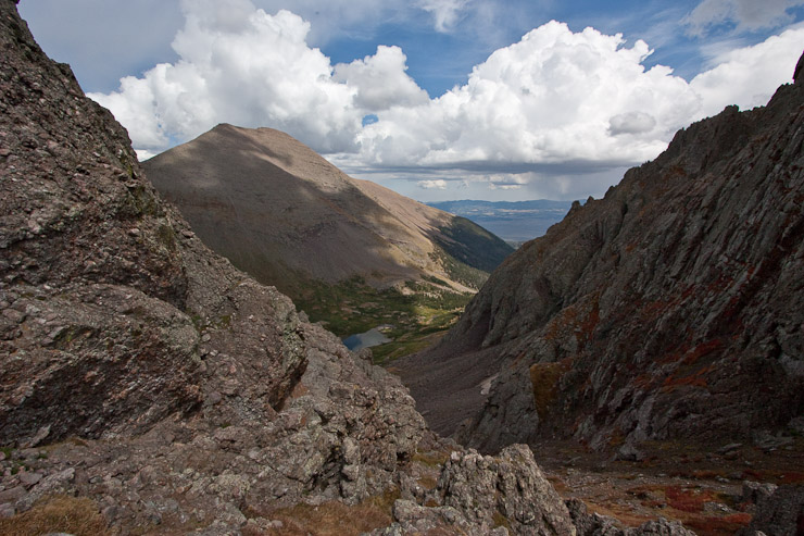
As we neared Broken Hand Pass, we saw the valley with the lake we had passed by this morning on our way to the Peak...
Aaron ran down the final stretch to the pass (and a bit beyond before we yelled for him to turn back). He took a pic of us coming to the pass, with the Needle behind. Also a look at Humbolt and puffy clouds. We were very lucky with the weather this afternoon. We arrived at the pass at 1:37pm...
The descent down Broken Hand Pass was uneventful. I reflected and was greatful that the alarm didn't go off this morning, which allowed me to sync up with Aaron and Cobb to do the traverse. And I was greatful for the favorable weather...
Making our way back down towards South Colony Lakes. The Needle pops into view...
A wide view of South Colony Lake and the Needle at 2:15pm...
I arrived back at camp ~2:30pm, and was able to download the pics from Cobb and Aaron's cameras onto my laptop, to use in this web journal. A rain cloud was visible in the distance, and the weather was turning cold. It seemed only a matter of time before the rain would converge here. I wished Aaron and Cobb well, as they headed back to the 4x4 parking area, hoping to beat the rain. Chris (who had weathered near golf ball sized hail on the way back to camp earlier) and I quickly headed over to a nearby stream to pump water, and got back to camp with just enough time to eat a quick tuna salad before the rain started. I hopped into my tent and lay there looking at pics on my camera, and warming my laptop in my sleeping bag (hoping for better battery life). The rain lasted 2 hrs, and I downloaded my pics onto the laptop before getting out for dinner ~5:45pm.
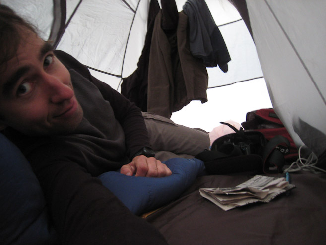
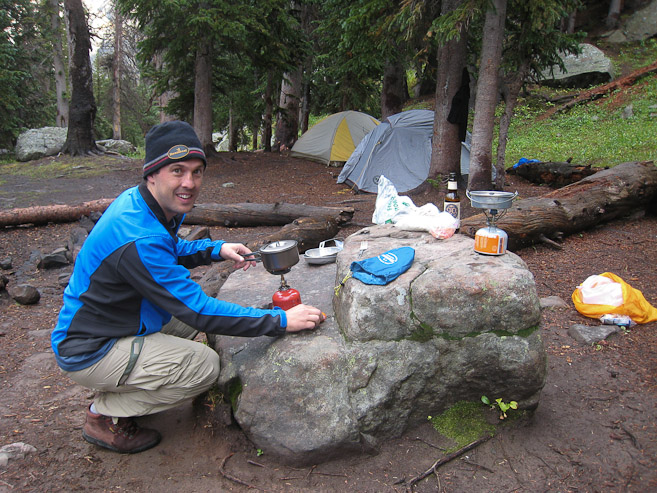
A pic inside my tent while waiting out the 2 hr rain storm. Oh yes, there was loud crashing thunder too. Afterwards, it was time for dinner. Chris had some ramon, and I gave him some extra salami I brought to mix in...
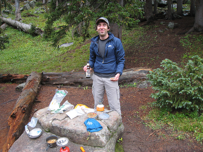
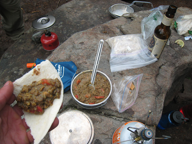
I made up some dehydrated refried beans with some red pepper and cheese to eat with a tortilla. I ended up shredding the torilla and mixing it in the pot. Also had the 90 Schilling I packed in. It was a great dinner!!!
With dinner over by 6:30pm, there wasn't much left to do but go to bed and wait for tomorrow. Given the full moon, we planned to try hiking Humbolt early tomorrow to catch sunrise at the summit. Chris tested and set the alarm for 3:40am. I readied for bed, and started stitching pics on my laptop until the battery died (~1hr 40 minutes worth). I tried to fall asleep, but didn't have it in me tonight, so just rested, re-living todays hike in my mind. I dozed a bit here and there but didn't get much sleep.
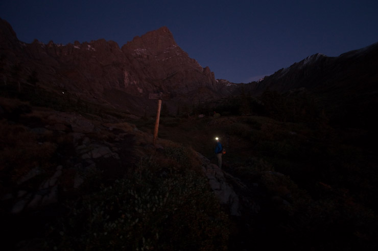
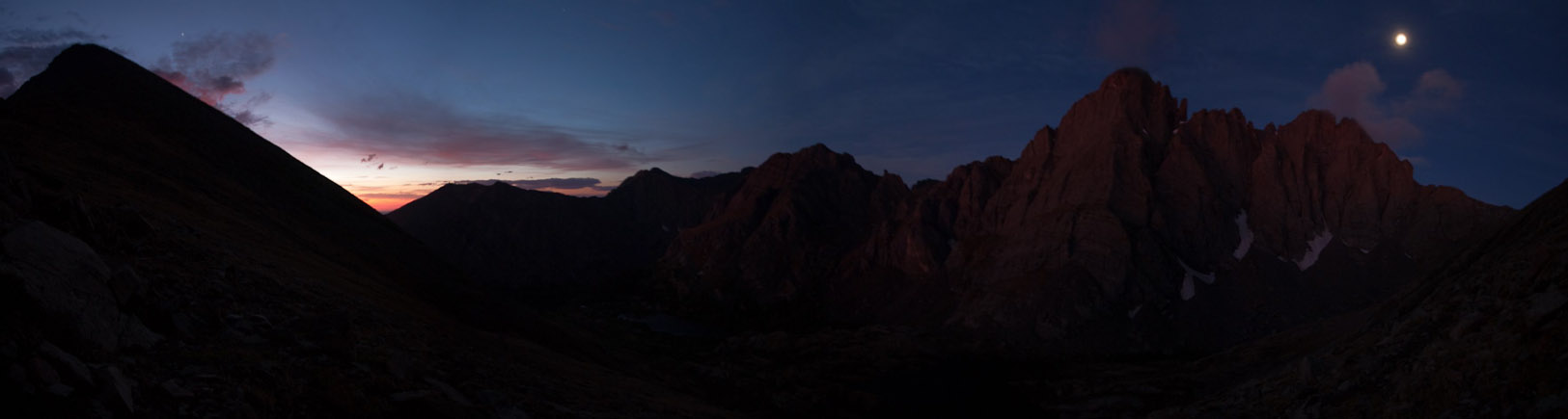
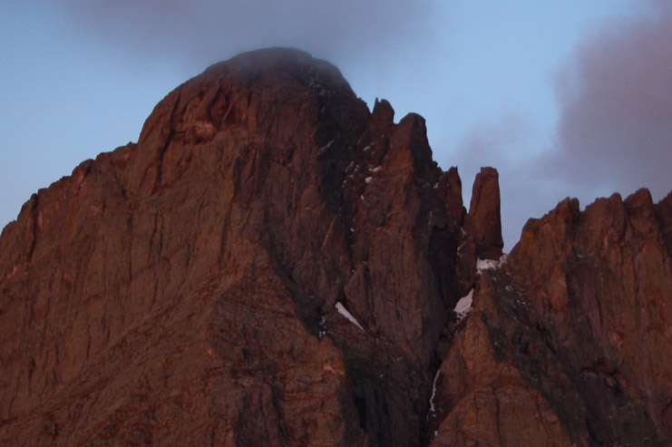
We took a slow pace up to the ridge, arriving on the saddle at 5am. Chris's headlamp is streaking in this time lapse shot looking up at Humbolt. The moon hung above the Crestone's, illuminating the Needle on the left, and the Peak on the right. The Black Gendome is clearly visible just to the right of the Needle...
Once on the ridge, the wind picked up a bit, and we continued up the trail further. A short ways up, the wind kicked up a ton, and we hunkered behind some rocks for a bit ~13,100', contemplating what to do. Chris was getting very cold, and started coughing badly. He said he felt like he was getting pneumonia, and that the altitude was a big factor. It was still way early (5:30am), and sunrise was still an hour away, to long to wait for, so we started heading back down to camp. Once we dropped below the saddle, the wind stopped, and Chris felt a ton better. He said I could wait here for sunrise, since we'd still be ahead of schedule, and they he'd be fine on his own back to camp. So I searched around for a good tripod/rock to hang out near.
Chris was feeling better below the saddle, so I hung out to take early morning pics while he headed back to camp. Notice the bright headlamp speck on the other side of the valley? Some hikers are heading towards Broken Hand Pass...
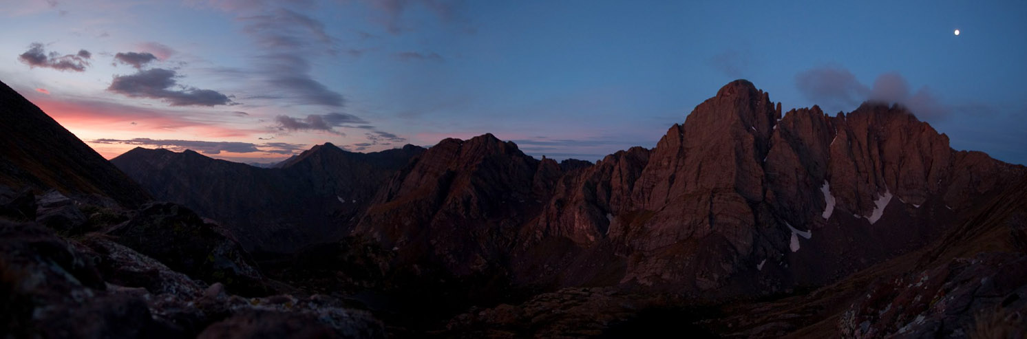
I took TONS of pics of the Crestones and moon while waiting for sunrise (these at 6am). The clouds didn't seem to want to leave the peaks...
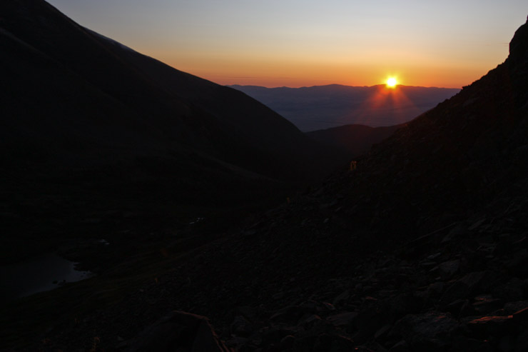
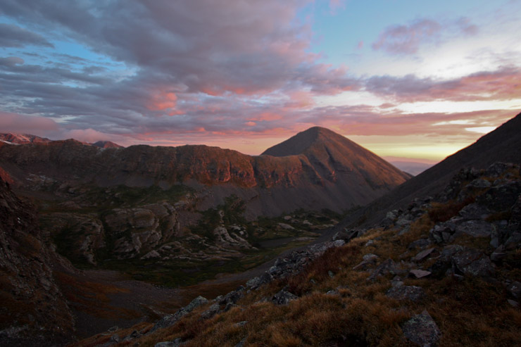
At 6:10am, the light was growing on the horizen, Humbolt on the left, Crestones on the right...
I decided to hike back up to the saddle of Humbolt for a better view. Light on the horizen is visible on both sides of Humbolt...
Brighter skies at 6:20am, with the moon still shining above...
It was beautiful watching the light creep into the valley and mountains...
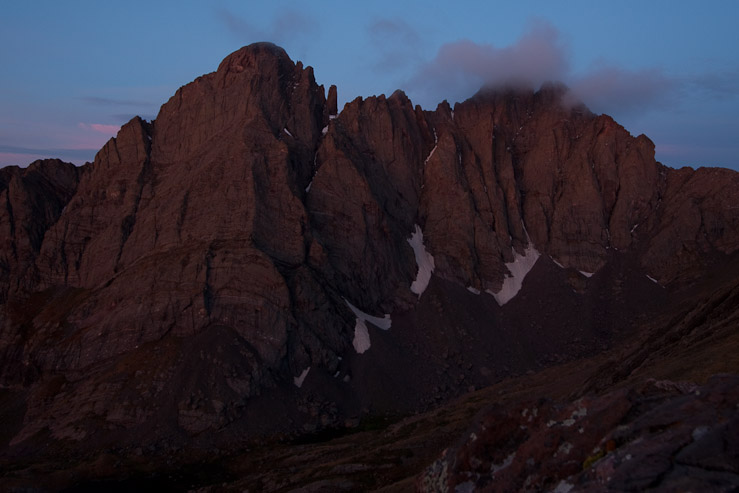
The Needle is almost cloud free. I wished I had taken a close-up shot with my telephoto lens of the Needle, to see more detail of the traverse, but this cropped pic will have to do...
A stitched shot at 6:27am of Humbolt, the valley, and Crestones...
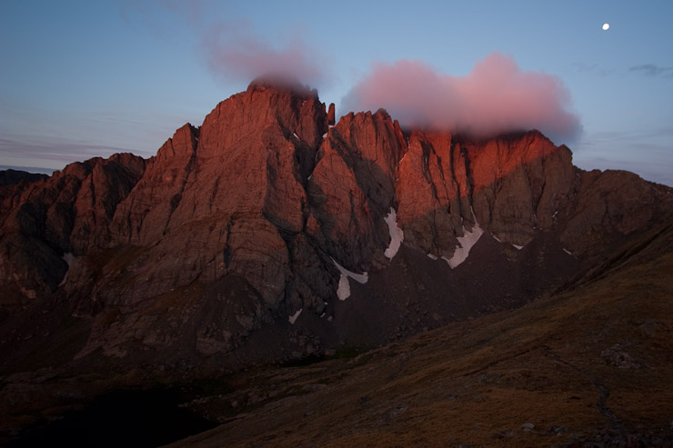
Finally sun drenches the Crestones in red (6:36am). Also a look northeast towards pink clouds, north of Humbolt...
A last shot of the Crestones, now covered in growing clouds, before I put the camera away, and hike back down to camp...
Half way down to the valley I started crossing paths with people. They all asked if I already bagged the summit. Not today I told them, but had a good view of sunrise. When I reached the lake area, I must have missed a turn, and found myself headed down another well built trail with tons of camping. I had to back track and bushwhack a bit (including a small stream crossing) to get back to camp. Turns out Chris did the same thing, and only returned to camp ~15-20 minutes before me. We packed up our gear, and hiked out to the car. The skies were already full of clouds at 8:00am, and the Crestones were socked in. Wow, I was really thankful for the great weather yesterday. I almost expcted it to start raining on our hike out. But we made it back to the car in ~30 minutes from camp (1.5 mile hike). The drive out was uneventful (aside from the bumpy 4x4 road), and this time we took route 96 back to Pueblo, which saved us 45-60 minutes compared to our route in on Friday. Clouds were packing in the mountains all along the Front Range today. After a stop at Subway near CO Springs, we made good time back to Fort Collins, arriving ~2pm.
These spectacular peaks will likely be the highlight of my 2009 14er season. Much thanks to Chris for proposing this trip, and driving his 4Runner up to an otherwise inaccessible (to me) 4x4 trailhead. It was a bonus to visit this area before the 2.5 mile 4x4 road is closed next year, which will add 5 miles round trip to these peaks.