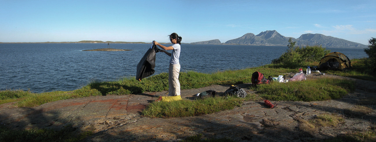
Wendy folds up the ground cloth. Our ground pads proved to be plenty comfy over the rock...
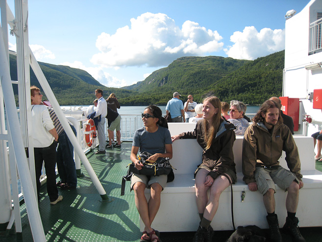
The 4th ferry of our trip turned out like the 1st one. We arrived just as it was departing, so we have a 70 minute wait for the next one...
It was very bright last night, though that didn't amount to much of an sleep impediment, given my face mask. What did cause a disruption in sleep was something I hadn't anticipated. Turns out, when the sun rises at 1am (or never sets), by 4am the tent has been baked by the sun long enough to make the heat uncomfortable inside. I had to spend the last hours sleeping out of my sleeping bag, and we tried opening the doors to get a cool breeze circulating.
I slept well, and was very comfortable, despite setting the tent up on a (flat) rock surface. All 4 of us were up ~7am, and cooked breakfast outside, under beatiful blue skies, and a cool but pleasant gentle breeze. Wendy and I cooked oatmeal, and ate Dulce de Leche (saved one of the cans from our Patagonia trip last year, to bring to Norway) on bread. We packed up the tent, cleaned dishes in the kitchen, refilled all our water bottles, and left camp ~9am.
Wendy folds up the ground cloth. Our ground pads proved to be plenty comfy over the rock...
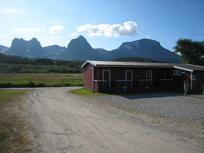
Breakfast, after having packed up the tent. A look at the building with the kitchen and restrooms, with the Seven Sisters Mountains in the backdrop...
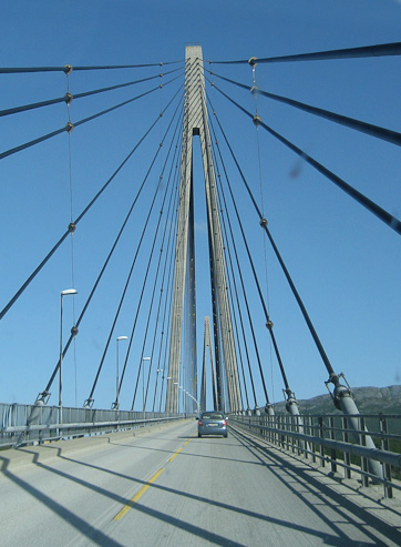
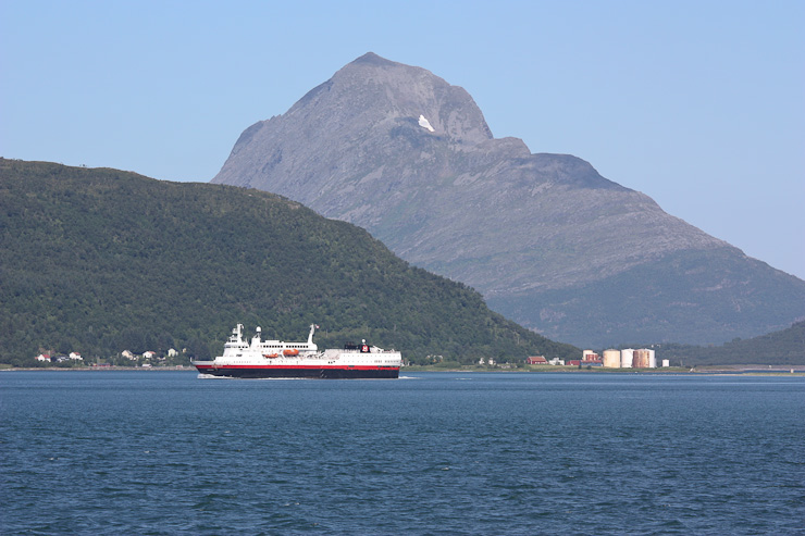
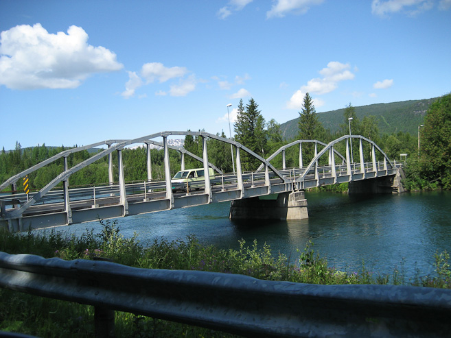
We stopped for gas in Sandnessjoen. It was 300 miles from Trondheim, and I had averaged almost 50 miles per gallon! At $8/gallon for gas, the fuel efficiency was much appreciated (I also hyper-miled to help out). Great little car. Mariann bought a cell phone charger car adapter at the gas station. Just north of town, we crossed a scenic bridge, before driving another 30 minutes to the ferry terminal.
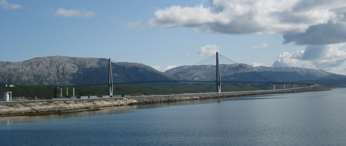
Very cool looking bridge, just north of Sandnessjoen...
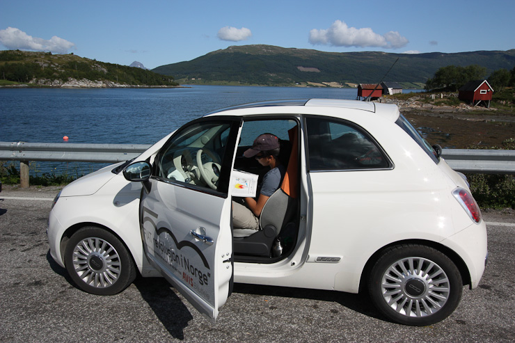
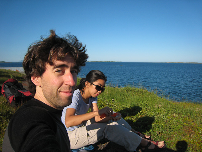
~30 minutes after the bridge, we found ourselves just missing the ferry again, so we parked, got out, and checked out the area...
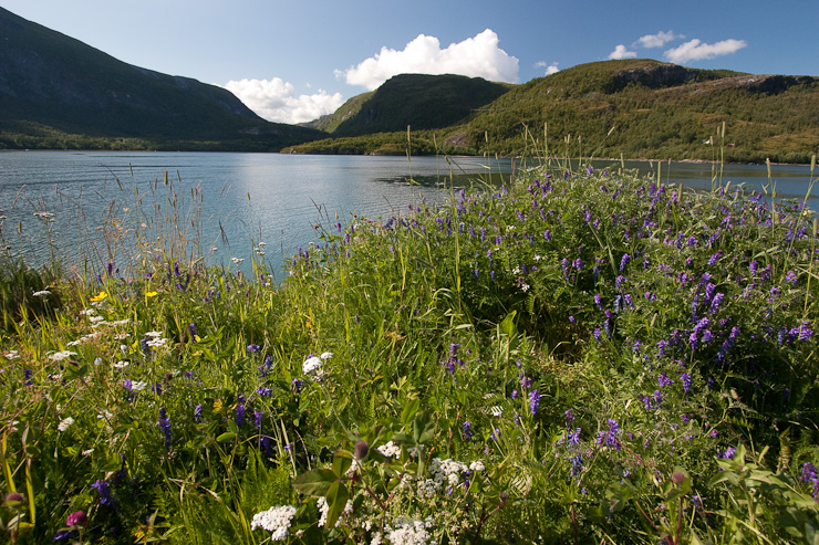
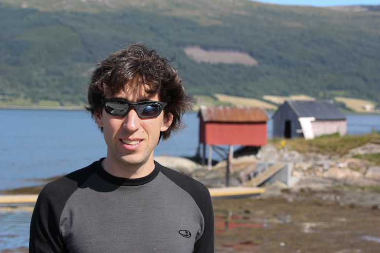
I worked the camera on some flowers nearby, while waiting for the next ferry. In the meantime, Wendy gets a shot of my puffy hair today...
Sunny and hot, waiting at the ferry terminal...
~ 11:59pm, 1st Campground north of Mo I Rana on E6
Still just below the Artic Circle tonight, but it's as bright out as a cloudy day right now at midnight.
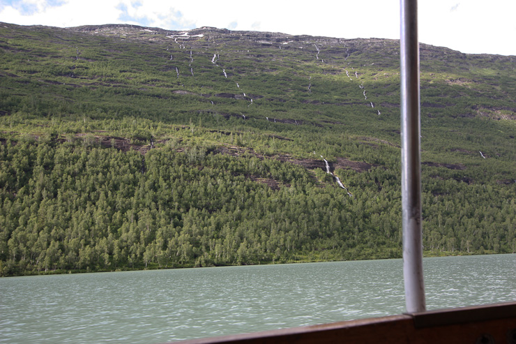
The ferry crossing was scenic, and led to an even more scenic mountainous portion of rv17. We stopped at a vista point to take some pics, and explore briefly. From here, we decided to split up, and meet back up at the Svartisen glacier in the late afternoon, since K & M had some errands to run in Mo I Rana, the last big city for awhile. And they were hoping to find a beach to let Darwin do some swimming. Wendy and I planned to head straight to the Svartisen glacier to catch an earlier boat across the lake, allowing for more time there today.
I played with my telephoto lens on the ferry again, snapping this waterfall and boat...
More pics of the fast moving boat, as it headed out towards the ocean...
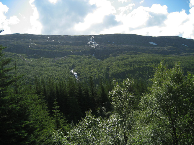
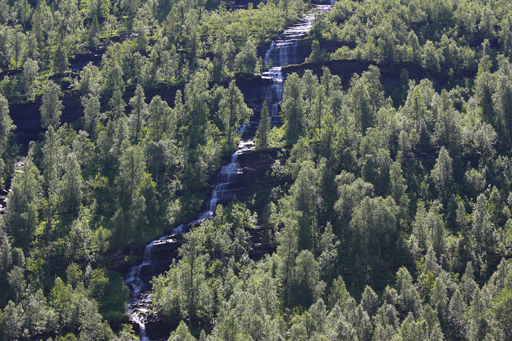
The crew rests on the deck during the voyage. Back on the road, we drove by a towering cascade of water. Wendy managed a pic from the car...
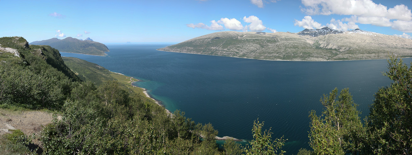
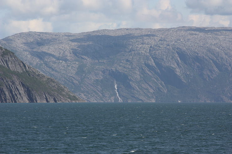
A pano (using my wide angle lens) looking west and north, from the vista point we stopped at. Can you make out the island in the gap, out in the ocean...
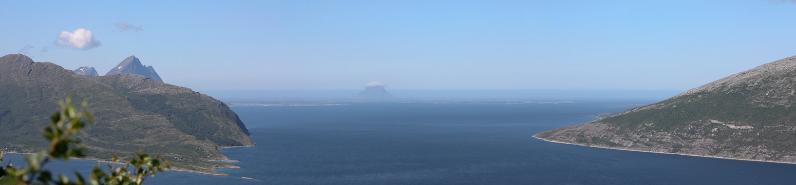
A pano (using my telephoto lens) of the open waters out to the ocean. The little island in the middle appears to have a which cloud on it's head...
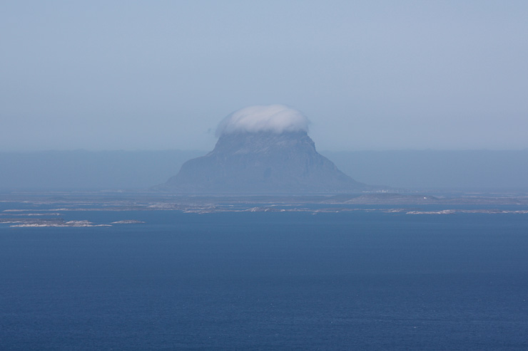
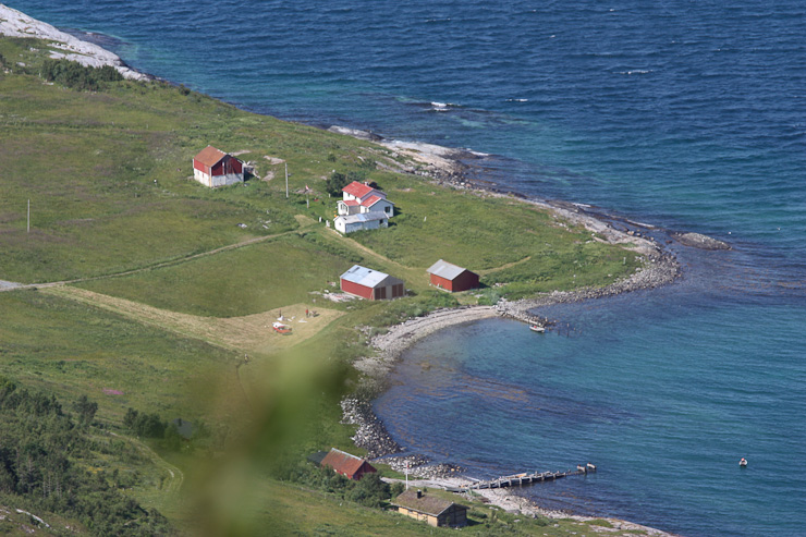
A super close-up of that island shows a white tupee. Quite spectacular. Lots of little flat islands around it too. Also a look down the cliff at some houses along the fjord below...
Shortly after this vista point, we left the coastal rv17 road, and made the 25 minute drive to the inland E6 highway at Mo I Rana. Just before reaching the city, we saw a pull-off for a beach, and stopped to investigate. Not that surprisingly, we saw K & M & D, swimming water. The water was pretty chilly, and we decided to continue on to the glacier.
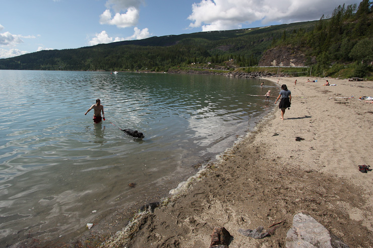
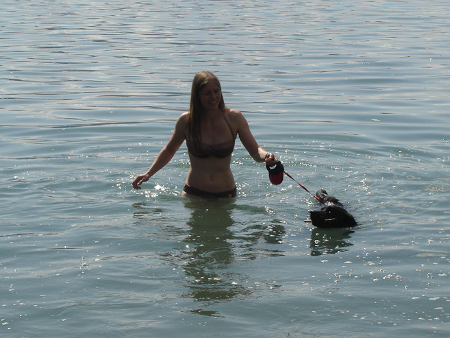
We met up with Karl, Mariann, and Darwin at this beach off the road. Karl and Darwin in the water on the left. Karl's pic of Mariann and Darwin on the right...
A couple of pics from the road as we reached Mo I Rana...
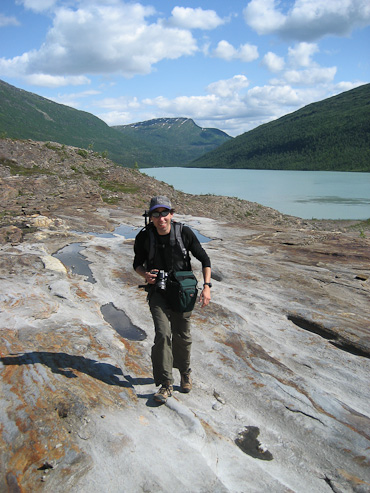
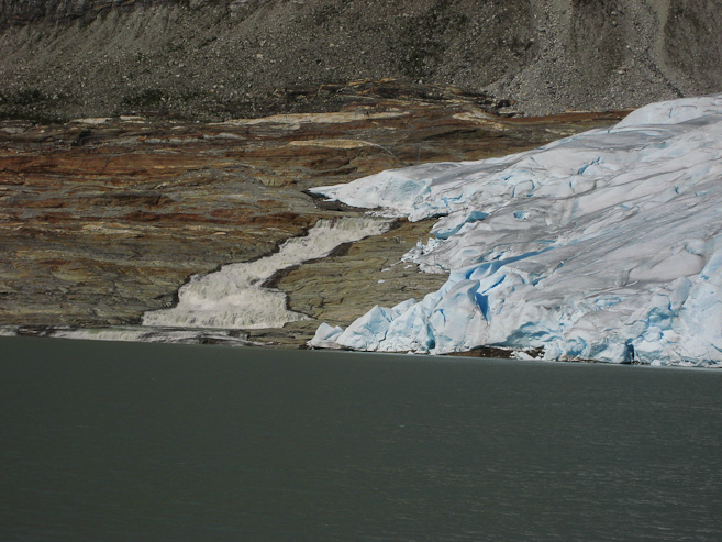
The Svartisen glacier is Norway's 2nd largest, and is most accessible on it's east and west arms. Today we would be visiting the east arm (Austerdalsisen), and planned to visit the west arm during our return south 10 days later. We arrived at the glacier parking lot at 1:45pm, just enough time to ready our daypacks for the 2pm boat. I was surprised to see a large river tumbling down the rock on the far side of the lake. I had only recently found this glacier activity online, after noticing it on a map near the caves we would be exploring later tonight. Most of the online info on Svartisen was for the west arm, so I didn't know quite what to expect today. We hoped on the small boat, along with a few others, and in 12 minutes, we reached the far side of the lake and started the 2 mile hike to the glacier.
The road to the glacier hugged a green river. Wendy and I caught the 2pm boat to the glacier...
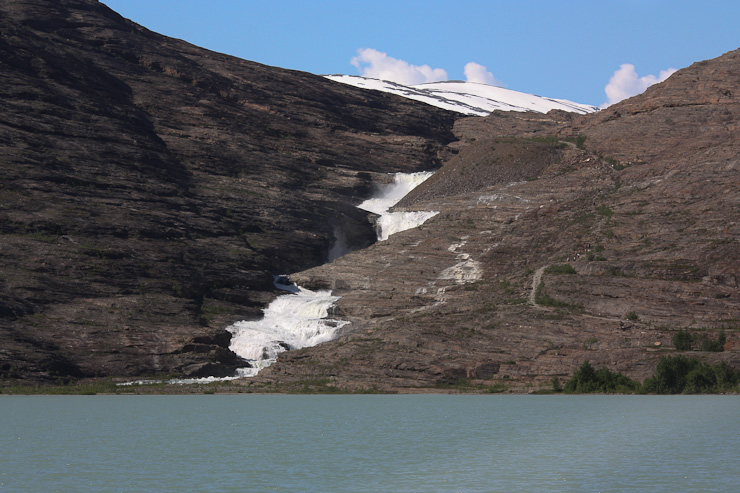
A zoomed in shot of cascading water down a mountain, as we pass by on the boat. A look ahead at the gushing river, fed by the glacier, crashing down to the lake. I was curious what the glacier would look like once we hiked up and around the corner...
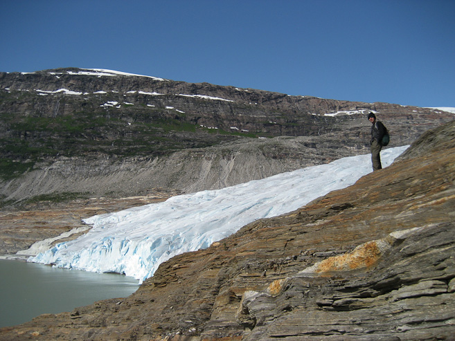
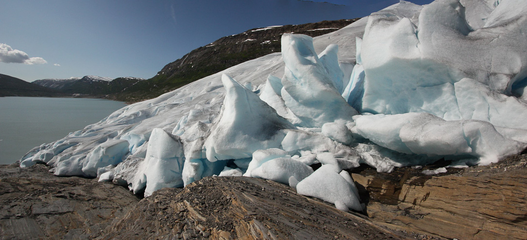
After following the flags among the orange slick rock, we reached the very huge and impressive looking glacier. We tried to find some shelter from the wind to eat fish cakes for lunch. With plenty of time available, I proposed climbing to the top of a nearby mountain. However, there was no trail, and the terrain consisted of rocky ledges, forcing us to abandon our scrambling after 20 minutes, when I realized we were getting cliffed out. So we made our way to the edge of the glacier, and hiked up along side, admiring the deep blue ice, and enormous jutting ablong pillars of ice.
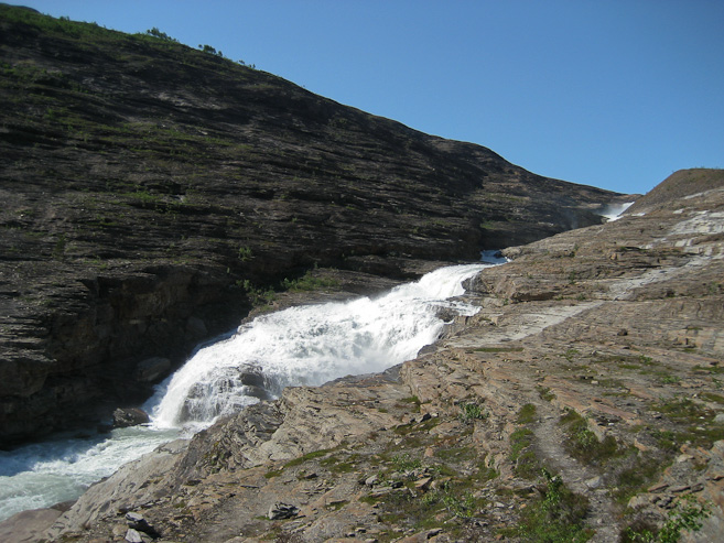
We took a detour from the main trail, and cut over close to the falls, where we felt the cool mist of water in the breeze. We scambled up along side for awhile, before cutting back up to the trail...
Wendy climbs up along the river. A look back at me, with the lake we boated across in the distance...
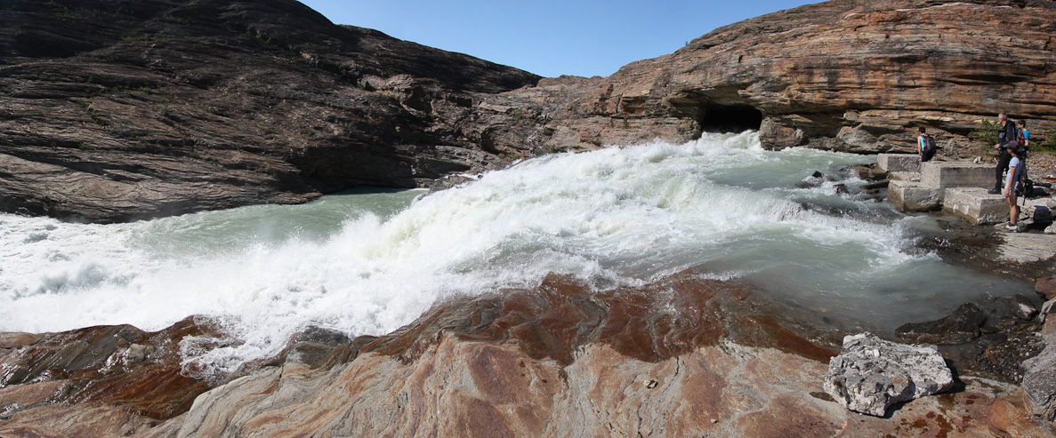
Soon we reached the source of the river. A giant man-made hole channeled the water down this side of the mountain...
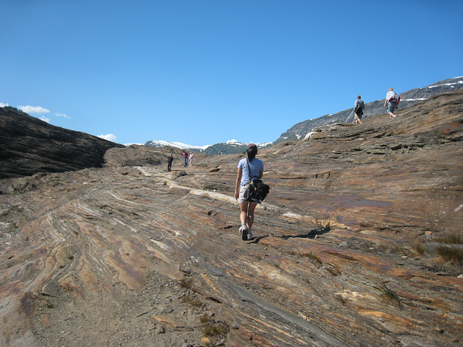
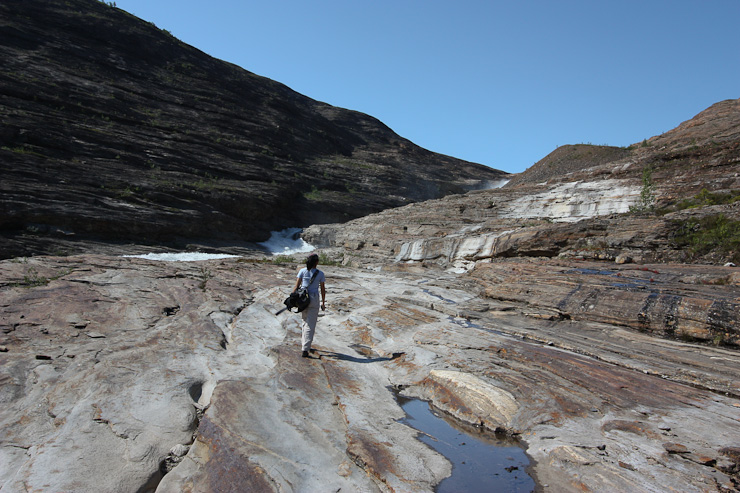
The rock itself was quite attractive. Orange/red, and very smooth, with good grip...
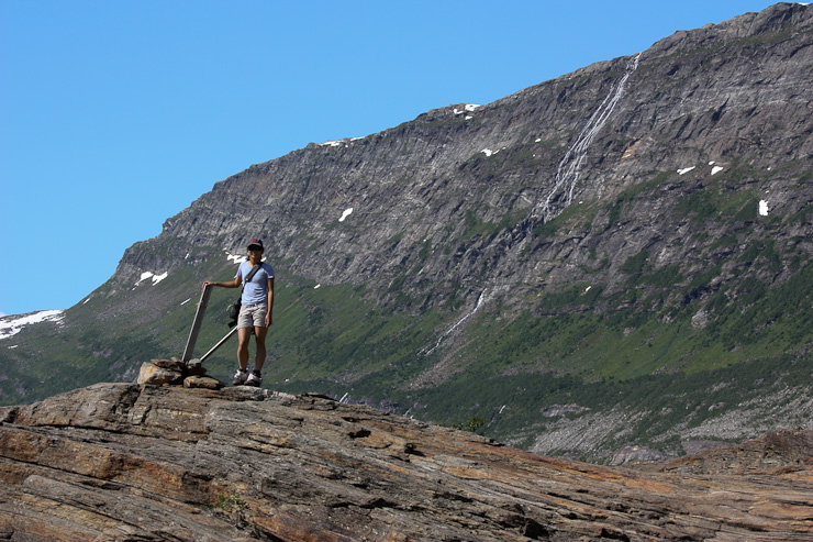
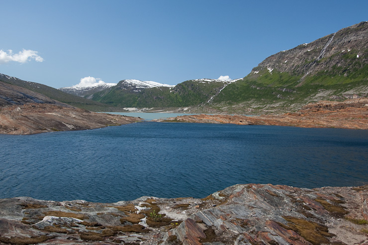
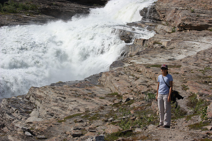
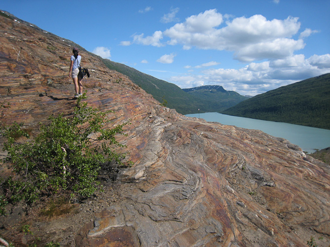
Wendy stands next to a path marker, with a long waterfall in the distance. In the 2nd pic, notice the two different colored lakes. The blue one most be snow melt, and not from the glacier (which has extra minerals to give it a milky green)...
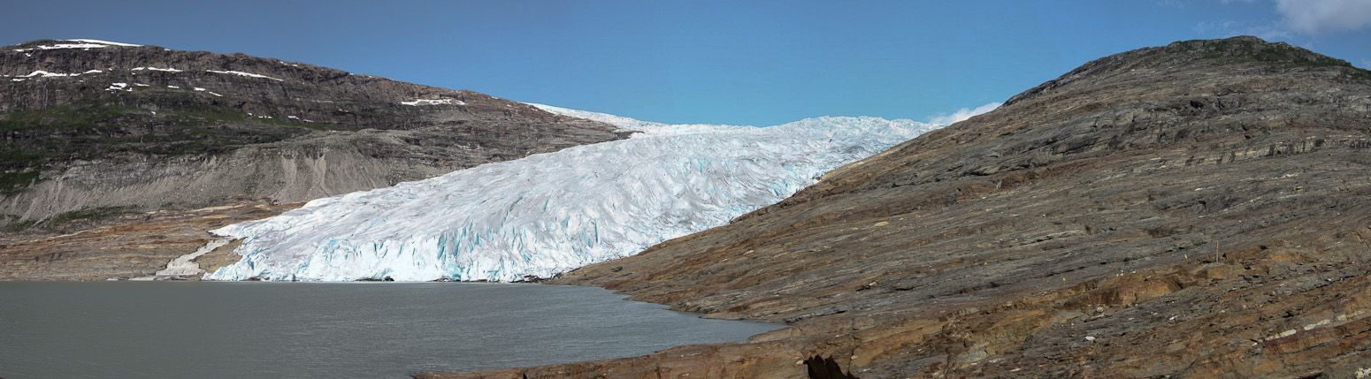
Once we rounded the corner, we got the jaw-dropping view of the enormous glacier...
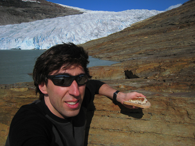
There was water cascading down on the left side. We ate fishcakes with brown cheese for lunch...
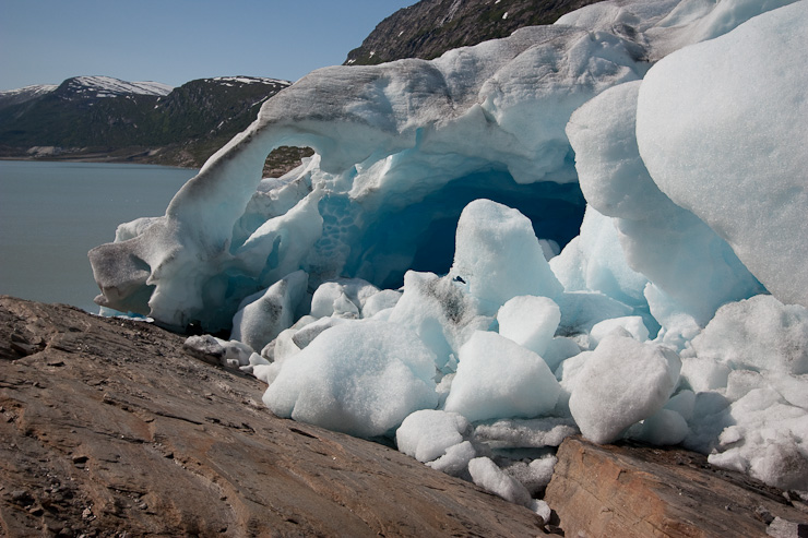
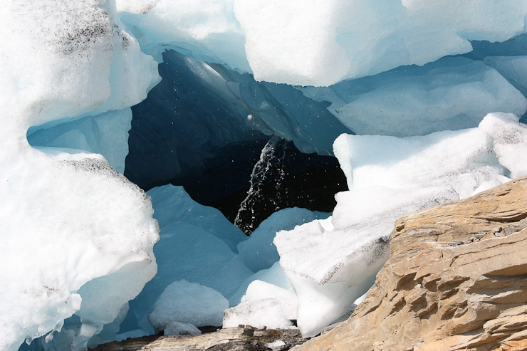
After an attempt to climb the mountain to the right of the glacier, we opted to cut over to the glacier instead, and were fascinated by the warped ice structures. Check out the arch of ice in the 2nd pic (look for the rock through the hole on the left)...
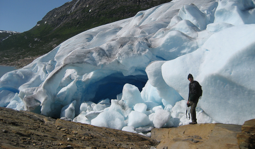
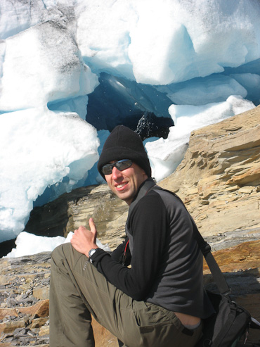
Me, near that arch, which also had a deep blue cave...
More stitched views, as I walked up along the glacier...
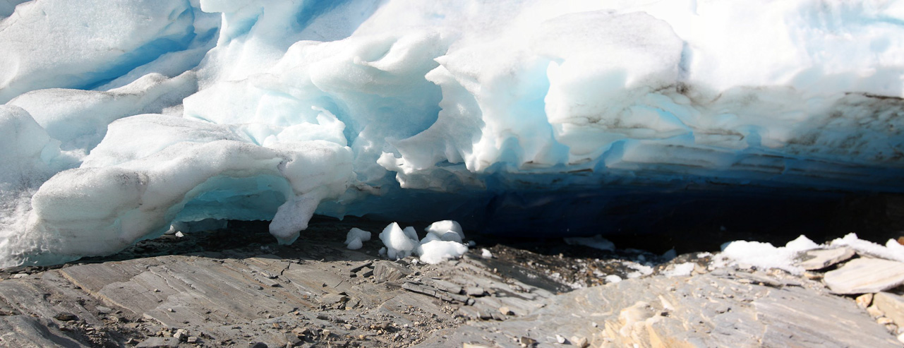
A look at some deep blue ice under the glacier...
I decided to climb further up, and while walking up the slabs of rock, I slipped on some loose pebbles, and fell down, smashing my new DSLR camera that I had been holding hard onto the rock surface. I got up, with just a small bump on my forearm, and went to check out the camera, not knowing what to expect. The impact had been forceful, but I noticed the LCD was still working, and the camera was functioning. I looked next at my wide angle lens, and wondered if it might be damaged. No scratches from the base, but as I got to the end of the lens, I saw that the Hoya HD Circular Polarizer filter (known to be EXTREMELY scratch resistent and unshatterable), which had been screwed on to the end, was bent in several places around the rim, and had a few very small scratches on the surface. Better a $120 filter taking the damage (which had been designed to be indestructable), than the $700 lens, or $600 camera. I tried taking a picture, heard the familiar clicking noise, and saw the pic pop up on the LCD. I wondered if the impact had broken the lens interface to the camera, and tried removing the lens, have expecting it to be stuck on forever, but it came off just fine. Next I tried taking the polarizer off the lens, to make sure the glass looked good, but the crushed rim of the polarizer made it difficult to twist off. Eventually I managed, and the lens looked fine. I could work to stick the polarizer back on too, despite it's bent form. Looked like I had escaped without any serious damage, though I couldn't know for sure without looking at pictures later in high detail (which would have to wait til the trip was over). It's possible something internal could have been offset, and I'd get blurry pics, or artifacts showing up, but based on the LCD display, I didn't see anything obviously wrong. With some relief, and still some unease, I decided to rest, and hung out with Wendy (who had hiked up, thinking I had stopped a long time for something very interesting in the glacier), enjoying the views.
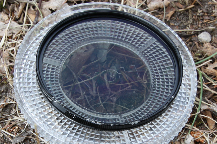
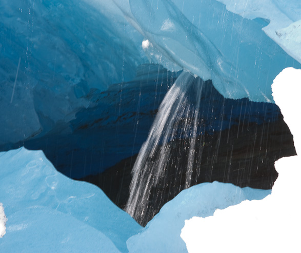
We spent some time gazing at this waterfall from an opening in the glacier. A look at my scoffed up and bent polarizer filter, after my fall (pic taken later). I was lucky I had this filter on at the time to absorb the majority of the impact...
A couple looks at the water, with varying shutter speeds...
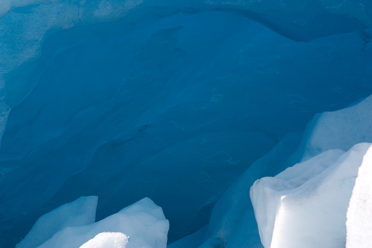
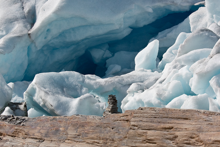
A zoomed in pic of the blue ice cave (same one pictured earlier). No color editing, that's the raw capture. Amazing color! Also a shot of a cairn in front of the ice...
Shortly before 5pm, we started walking back to catch the 6:20pm return boat, wondering if we'd meet up with Karl and Mariann, since they had planned to take the 4pm boat to the glacier. However, they were unseen among the small wave of hikers that we passed on our way back. We arrived at the dock about 30 minutes early, and waited on a shaded bench, among others, who were lying out in the sun. I tested out a few more pics with my camera, and didn't notice anything concerning. The small scratches in the polarizer didn't appear to be noticeable in the image either. Perhaps I could still make do with all my equipment, though attatching the filter would be difficult each time. When the boat arrived, there was a healthy crowd of hikers ready to take this last return ride of the day.
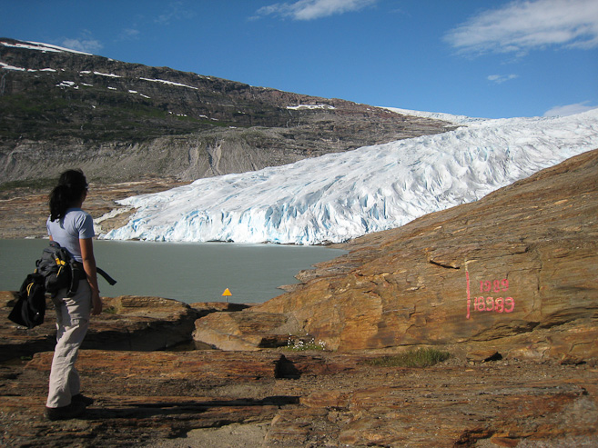
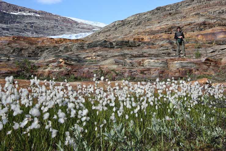
20 years ago, the glacier reached the red mark here. Wendy uses the DSLR to take some pics of the cotton-y flowers, on our way back...
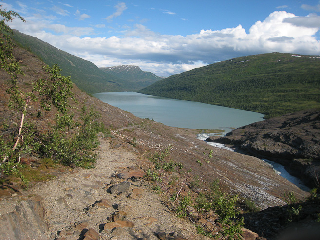
A look back at the lake, with the river feeding it on the right. Also a pic of more water cascades during the boat ride back...
Karl and Mariann weren't at the boat dock when we returned, so that meant we'd meet up with them at the cave tour site, just 15 minutes away from here, for our 8pm tour. We made the short drive to the Setergrotta cave site, and found them eating dinner at a picnic table, where we joined them, cooking up the last of our salmon, with more tomatos and asparagus. K & M didn't have any cash on them when they arrived for the 4pm boat, so instead went back to Mo I Rana, and bought a fishing pole, for later use in Lofoten.
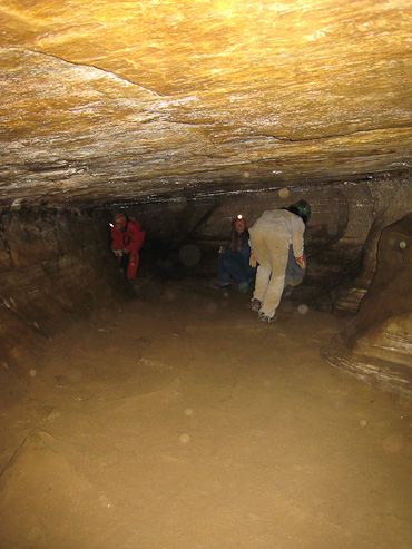
This place gives daily tours at 11:30am and 3pm, but I had arranged for an 8pm tour for the 4 of us, which allowed us to conveniently fit in the glacier and cave in one day. Our cave tour guides arrived ~7:30pm, and outfitted us with overalls, helmets with lamps, and gloves. After a 5 minute walk through the woods, we arrived at the entrance of the cave. Cave stuff:
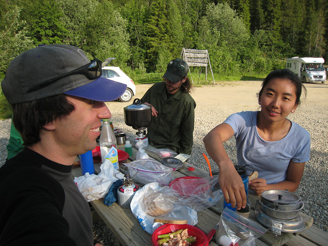
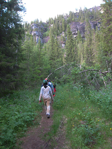
Salmon, asparagus, and tomatoes for dinner again, cooked on our stove this time. A walk through the woods to the cave afterwards...
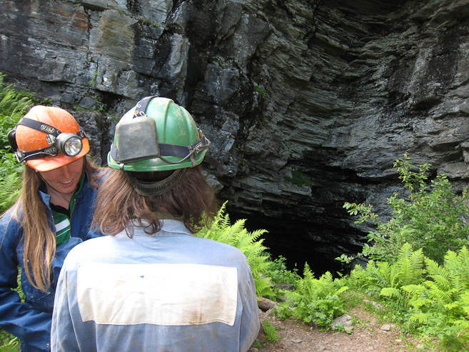
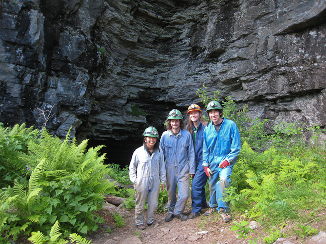
Karl stares into the dark opening of the cave. Our guide took a group shot of us, prior to our descent, in our jumpsuits...
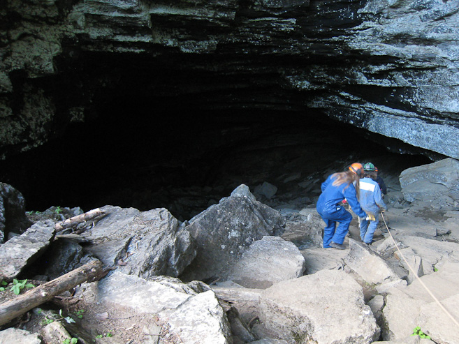
The descent begins into the cold and darkness. A rope was convenient, given the smooth rocks. I decided to put my DSLR back in the car at the last minute, and just use my pocket cam. Turned out to be a very smart idea, given the strenous route ahead...
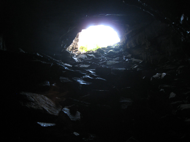
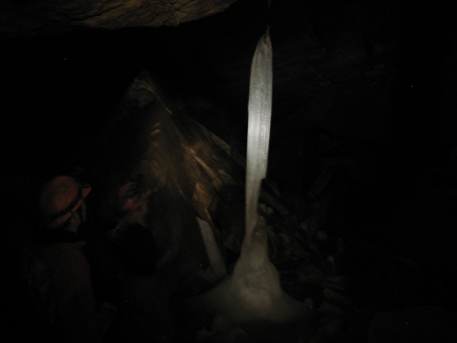
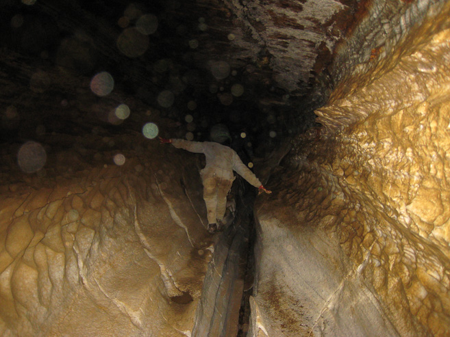
A last look back out towards daylight. Once in the gave, the temps got as low as the freezing point, where we saw this ice pillar, that stretched up to the ceiling. Amazingly the pic came out pretty good with just our headlights shining on it...
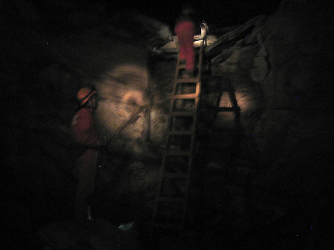
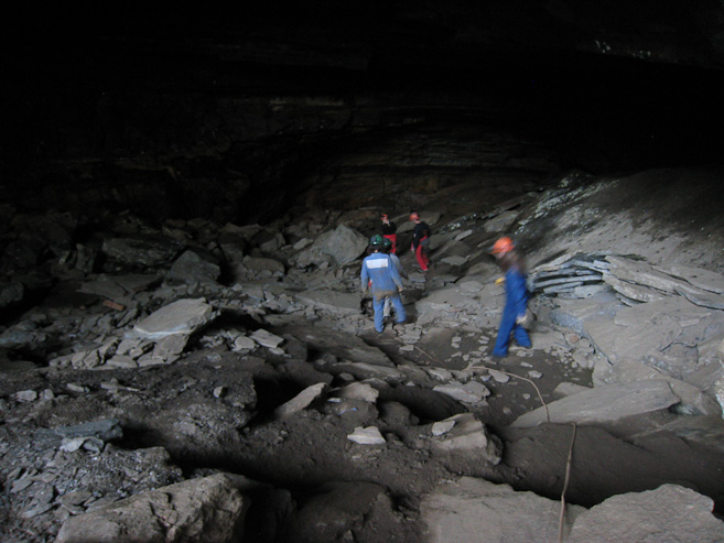
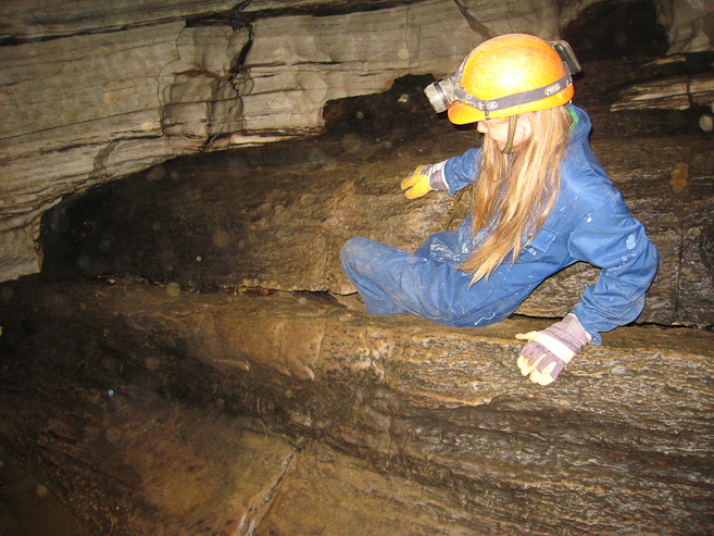
We scrambled around from room to room, and climbed a ladder. The temps were ~42 degrees for most sections. Several long corridors were very shallow, and we had to walk hunched or tilted to the side a lot. I banged my helmet quite often...
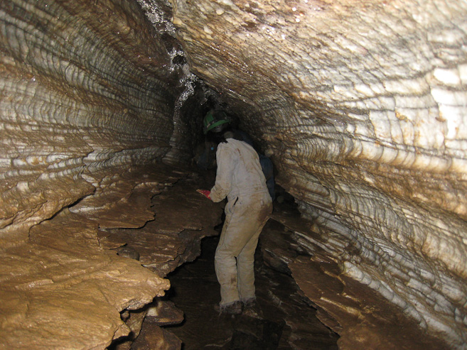
Another couple of looks down narrow, cramped corridors. I needed to use a flash to get useable pics. It was rather exhausting scrambling in a contorted fashion for so long, especially having just hiked around the glacier a few hours ago...
At the end of one passage way, we were shocked to realize that we had to crawl under a 2 foot high ledge that led to a hole above, barely bigger than my waist. We almost thought it was a joke when our guides said we were to go through. I volunteered to go first, and mananged to squirm through without feeling claustraphobic. Everyone made it through just fine, but I guess there's a reason why this cave tour is geared for "fit people".
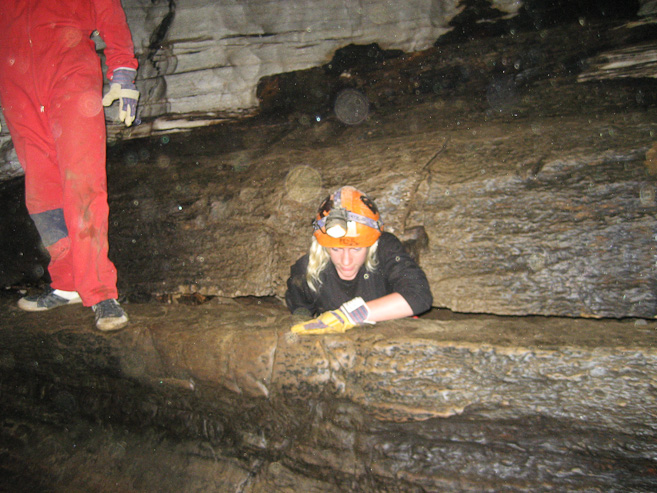
Pics of Mariann, and our guide, climbing through the "pigeonhole". I suppose it would have been more awkwards to try going through in the opposite direction...
The cave tour was an exerting full body experience, as frequently we were crawling, or ape-walking with our hands to stay low. I was getting a headache from so much head tilting, and was looking forward to our exit. After ~1hr in the cave we reached an underground pond (but no fish around today), it was time to head back, though that meant revisiting many of the low ceilinged corridors. The tour was pretty hard-core, and I'm glad we choose this cave, instead of the more popular, family-oriented, and shorter Grongrilotta cave tour, a bit further up the road. It was certainly a memorable experience.
We left the cave place at 10pm, and found a campground a short ways to the north on E6. We're in a valley, so the sun shouldn't be as bright tomorrow morning (hopefully not as hot). Showers cost 10Nkr (~$1.50) for 5 minutes. We have a 430km drive north to Lofoten tomorrow!