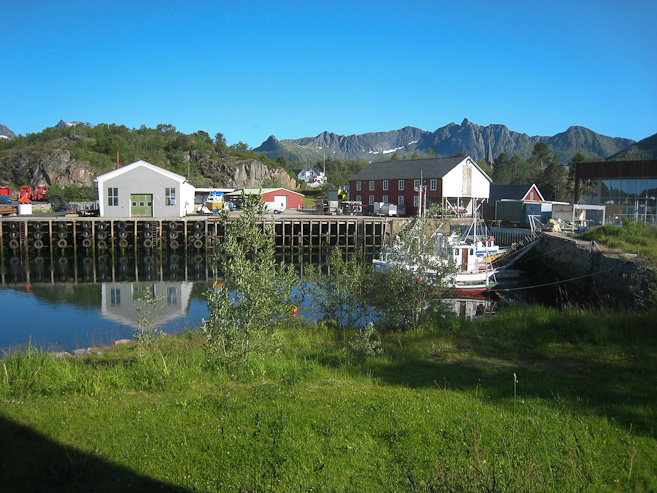
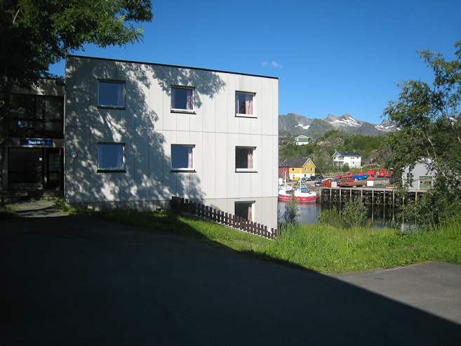
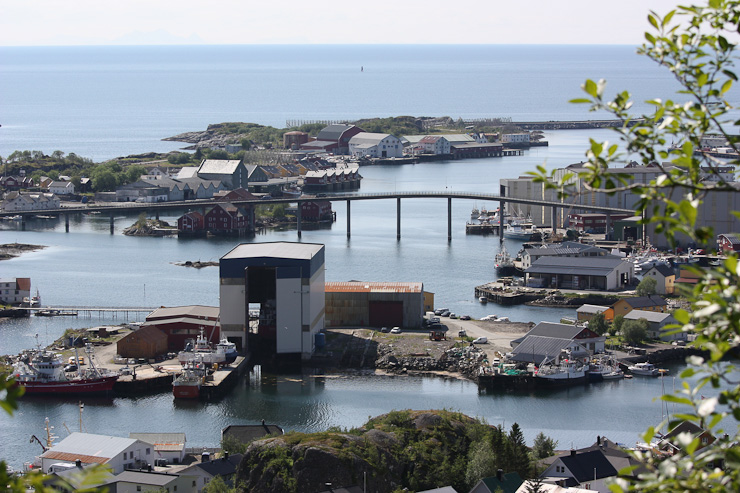
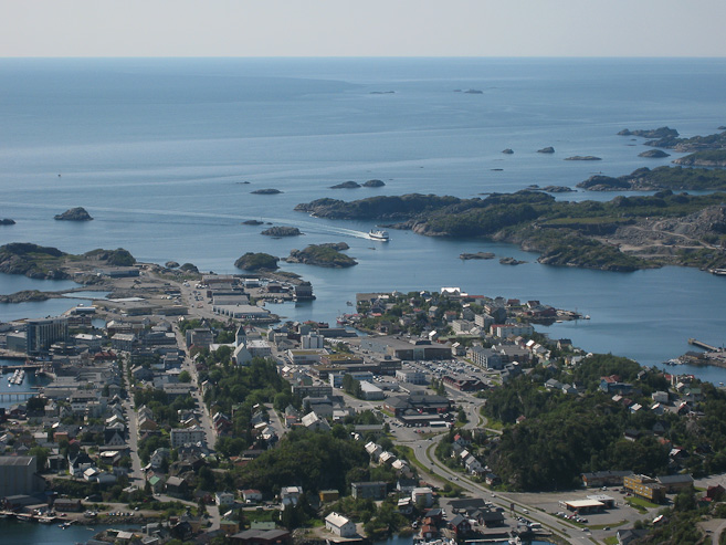
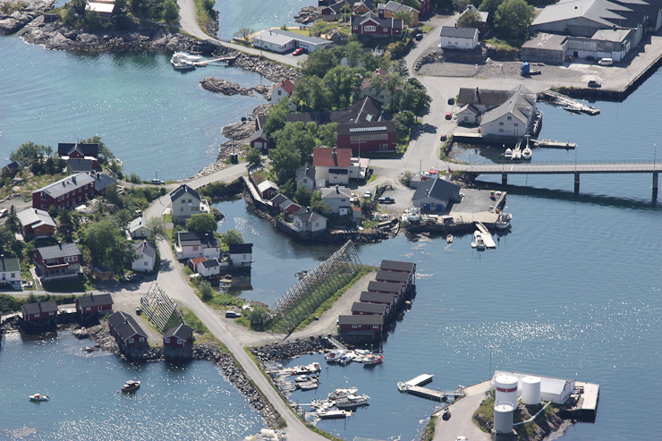
The view outside the hostel in Kavelvag. Our room was the lower right most window (semi-below ground) on the dorm building...
My lower body is settling into a dull ache as I lay down in my sleeping bag after getting back from the 2nd hike of the day an hour ago. It's a good ache though, that reminds me of the worthy endeavours that caused it.
The 8:35am alarm was accidently set for 7:35am this morning, but it didn't matter, since I was up at 7am, once the building came alive with other resident's activity, though slept solid otherwise. I lay awake in bed til 8:30am trying to figure out the best course of plans for the next few days. The few articles of clothes are had washed in our sink last night, and hung up in the closet, were mostly dry. We walked back to the main office, and checked out the breakfast in the cafeteria at 8:40am. They had a buffet of assorted dried meats and cheese, bread, and cereals. It was a very satisfying and hydrating breakfast. We certainly took advantage of the breakfast, filling up, and trying everything on the table.
The view outside the hostel in Kavelvag. Our room was the lower right most window (semi-below ground) on the dorm building...
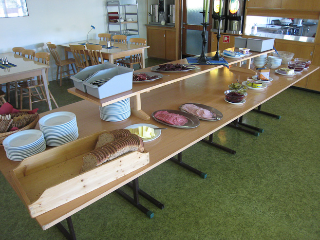
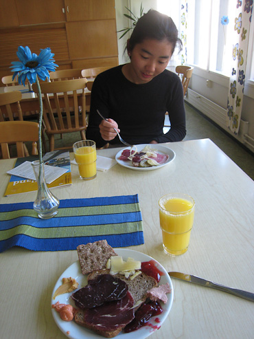
The breakfast buffet was a great opportunity to try a bunch of dried meats, cheeses, and fruit spreads, and experience a spectrum of a Norway breakfast. I had several bowls of muesli mixed with corn flakes, with some tasty fruit preserve spread mixed with the milk...
After checking out at 10am, we drove to the Co-op grocery store in Svolvaer, and bought some bread, an onion, and squash. The skies were blue, and the weather was perfect. We arrived at the gas station early, to prep our bags, before meeting up with Karl and Mariann to climb Svolvaergeita. At 10:45am, K & M met up with us at the gas station. They had camped at a crowded campground last night, with lots of mosquitos, and after days of rushing to meet ferries, and setting up / breaking down camp each night, where everything takes more effort with a dog, they really wanted to find a central place to put up their huge louvo tent, to serve as a base for the week. So it wasn't a big surprise to hear they planned to skip the hike today, to explore the south islands, looking for a desirable location to set up camp for the week. They still wanted to do the backpacking trip to Bunes tomorrow night, so we agreed to meet in Reine at 3pm for the 4pm ferry to Vindstad.
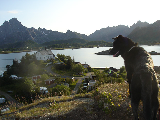
Darwin looks out over Kabelvag from Karl and Mariann's campsite last night (their pic). We'd be meeting up with them tomorrow at 3pm in Reine, while they found a good camp base...
Wendy and I would be on our own today. Climbing up the horns of Svolvaergeita was out (Karl had the gear and expertise to lead), but we were already thinking of just climbing TO the pillars to admire the view anyway, so now we had our easy decision. It took us a couple of wrong turns in the neighborhood before finding the correct location of the trailhead. We began the climb up the steep rocky path at 11:45am.
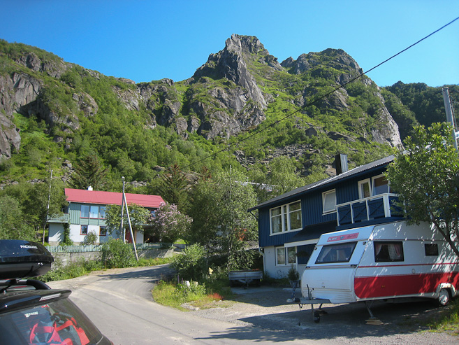
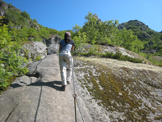
A look up at the goat from our parking spot at the trailhead. The trail immediately traverse across some boulders, then ascended a rock slab with chains...
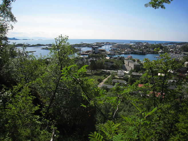
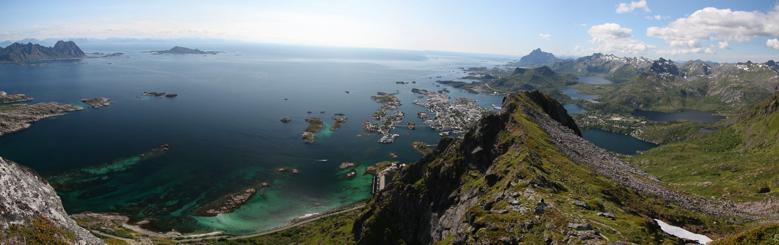
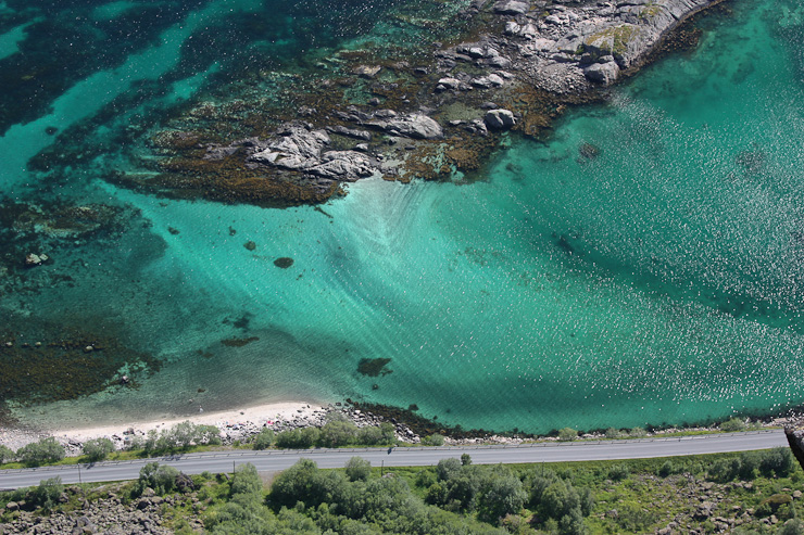
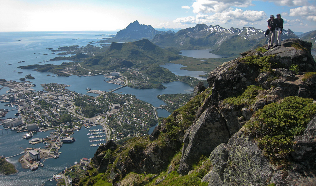
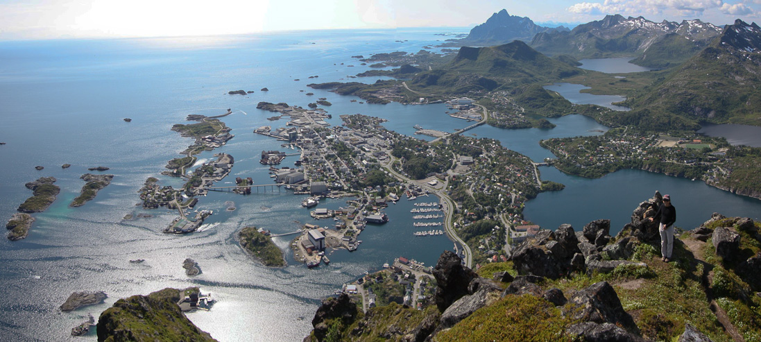
Very quickly the views looking down at Svolvaer were attractive...
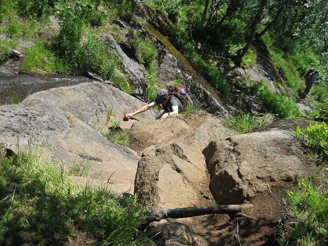
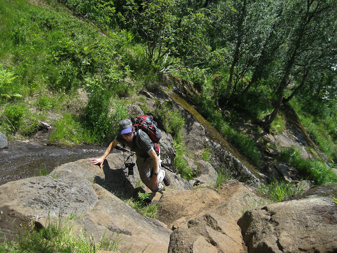
The hike was steep, with plenty of hands on experiences. Sure was glad the rock/dirt was dry, else it would be slippery and miserable. Hikes in Lofoten are generally short and steep, straight up a mountain, with limited switchbacks...
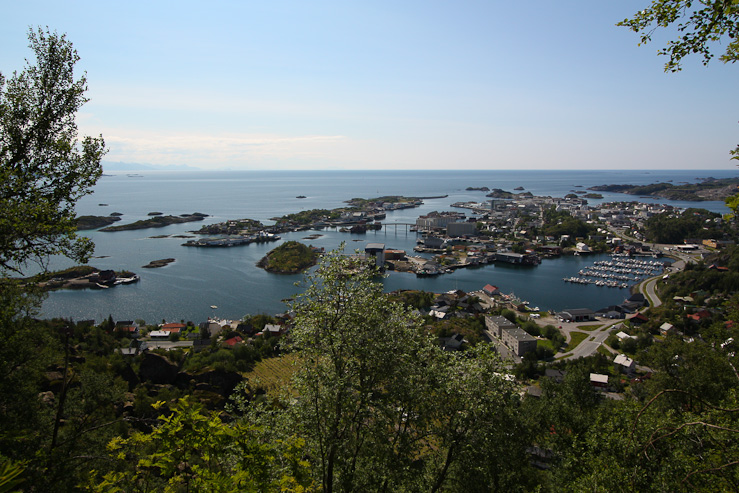
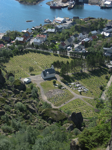
We gained elevation fast, and everytime we looked down, the buildings in Svolvaer were becoming tinier. A look down at the church and graveyard, which I had thought marked the trailhead, but it's a few blocks in from E10...
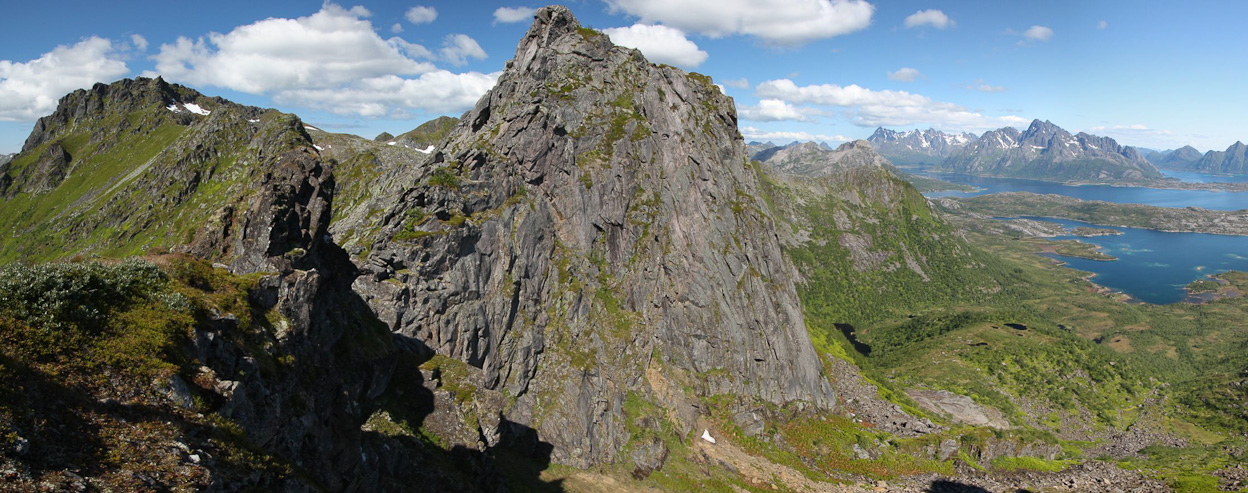
The path had been fairly well marked with red painted "T"s, but we found it odd that it led so far to the left of "the goat". I kept expecting the trail to slice hard to the right towards "the goat", which was our destination...
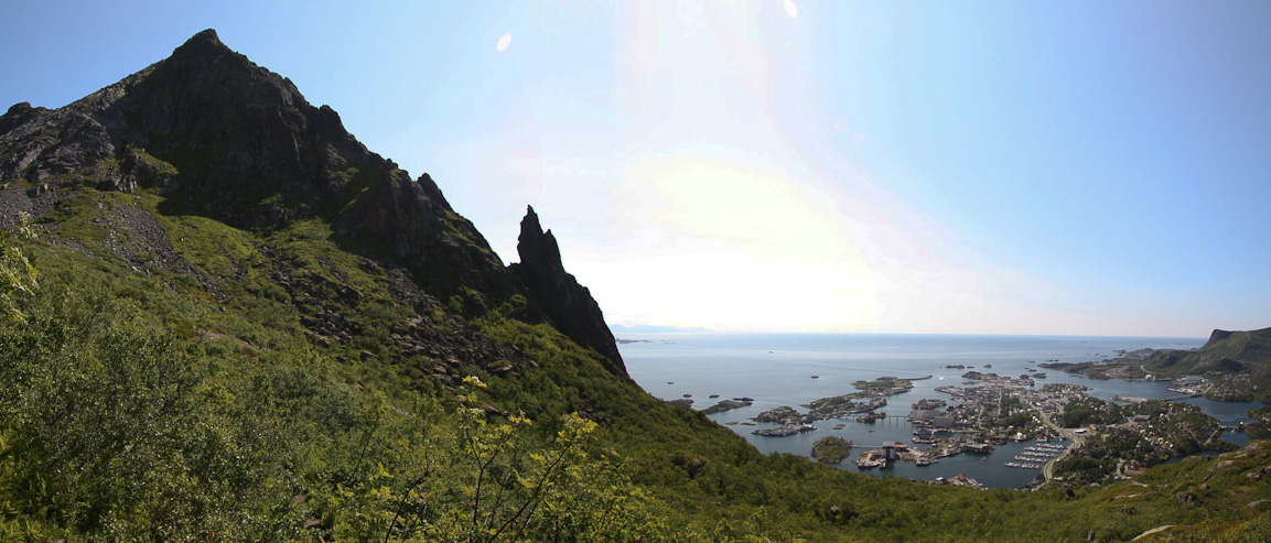
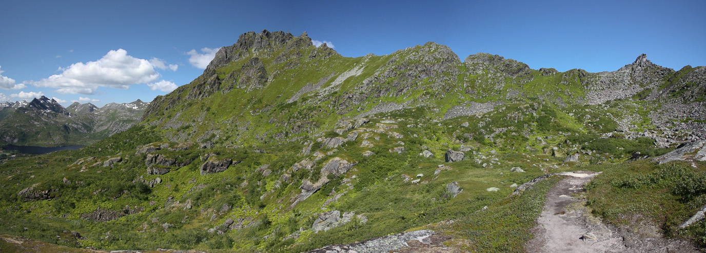
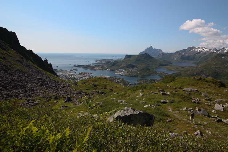
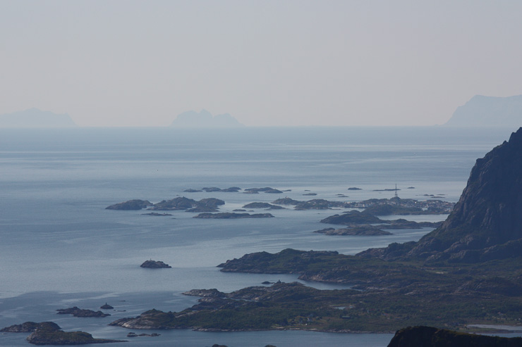
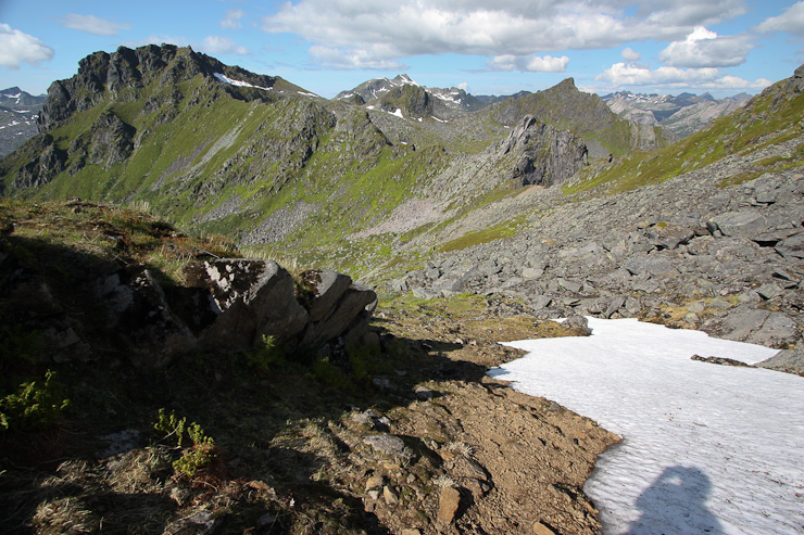
The mountainous island chain towards the south emerged as we continued to climb...
By this point, I realized the trail was not leading to "the goat", whose pointy spire base was now below us. However the trail was still "T" marked, and we continued up, deciding against backtracking and looking for a missed turn-off...
Wendy took this pic of a ferry arriving to Svolvaer...
~1hr into the hike, we reached a basin, where we took a break on some large flat rocks, and contemplated what to do next: 1. Either call it a day, and return to the car, to get a jump exploring more of Lofoten. 2. Descend, and try to find the turn off to "the goat". 3. Keep following the trail, which must lead up to one of the peaks on the ridge...
We choose option 3, since we had already done a large amount of the climbing, and we had plenty of time and good weather. It was a question of whether the trail would lead to a peak on the right (as in the previous pic), or to a peak on the left (in this pic)...
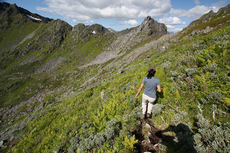
The trail grew more faint after we crossed the basin, and started the climb up to the ridge. The extreme-green vegetation that covered these steep mountains was certainly unique, especially compared to Colorado mountains. In the 2nd pic, Wendy walks across the basin towards the climb to the ridge...
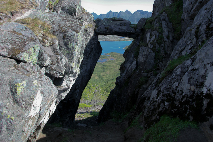
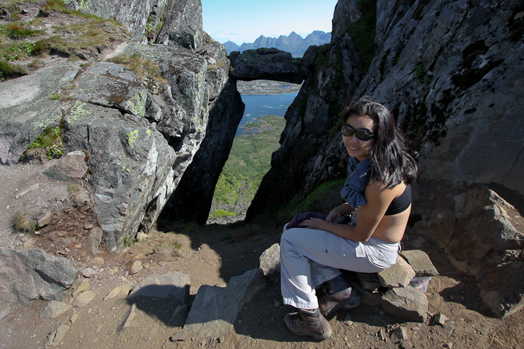
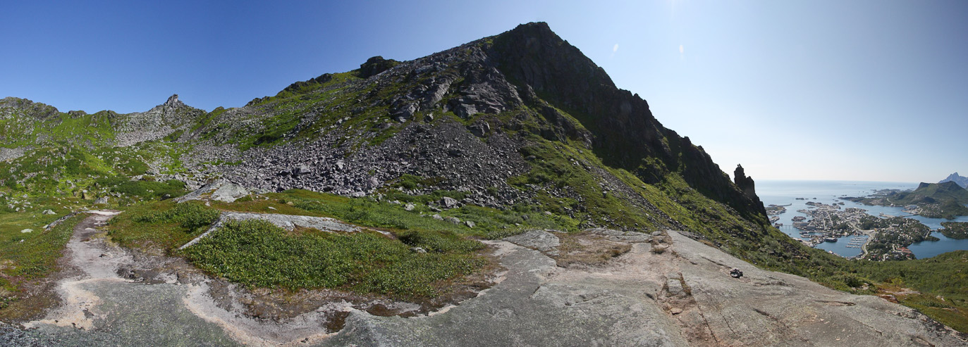
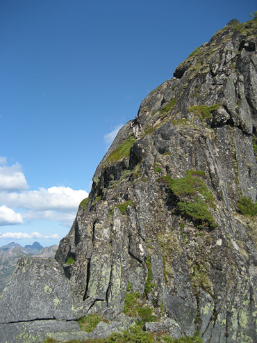
It only took 20 minutes from the basin to reach the ridge top, where we were stunned to see a framed archway, leading to a cliff beyond. Through the doorway was another magical world with blue seas and sharp peaks. I wanted to climb up and sit in the notch at the top of the arch, but it was in shadow, and I opted to wait til our return for better lighting (hopefully)...
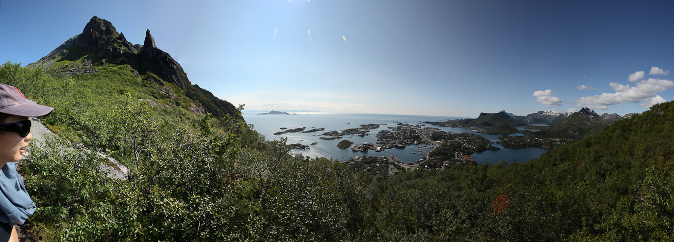
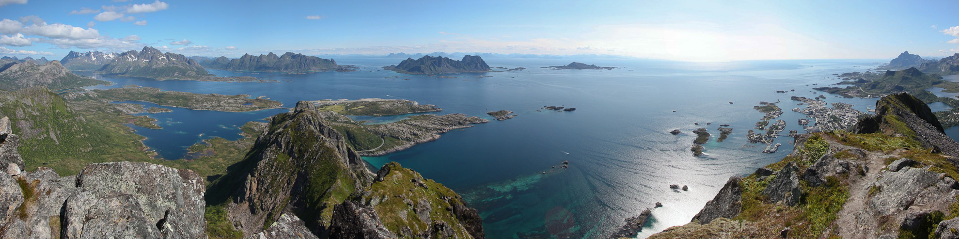
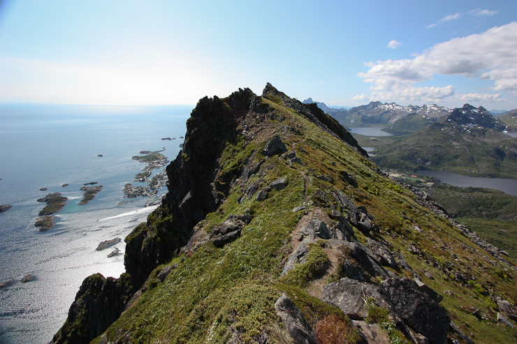
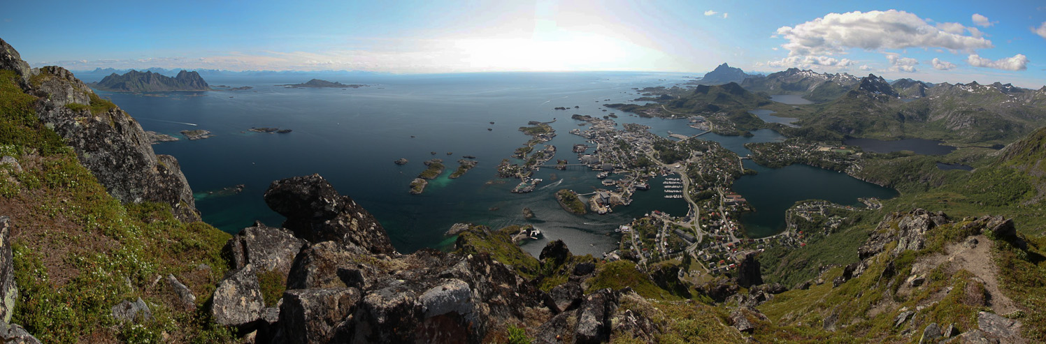
We walked up the ridge to the right a short way, and came to a clearing where the northern islands displayed their dramatic presence. This hike was becoming one for the books, with stunning views of the mountainous island chain and picturesque fishing towns. Add in PERFECT weather, and suprising solitude as well...
From here, a look west (left side of the ridge) shows the scraggy ridge. The arch was down in a gap in the ridge...
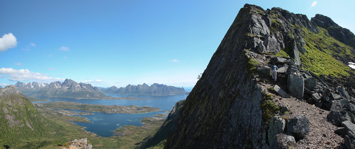
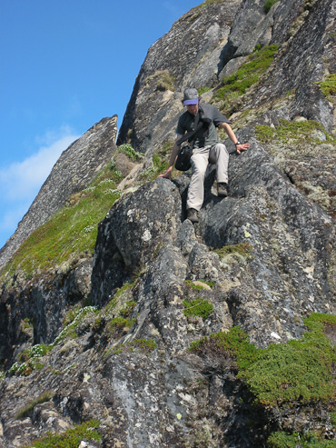
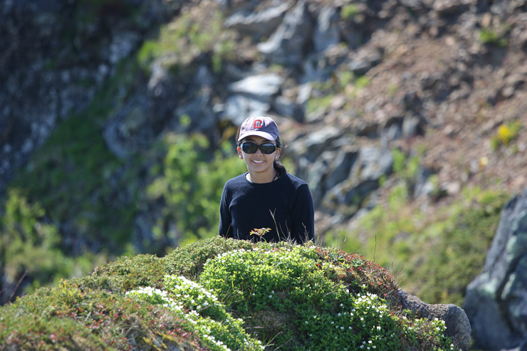
We continued hiking up to the right, which was an easy scramble along the ridge. We hadn't planned to be up here today, but figured we might as well keep exploring, and see where we end up. Be sure to spot Wendy in this pic...
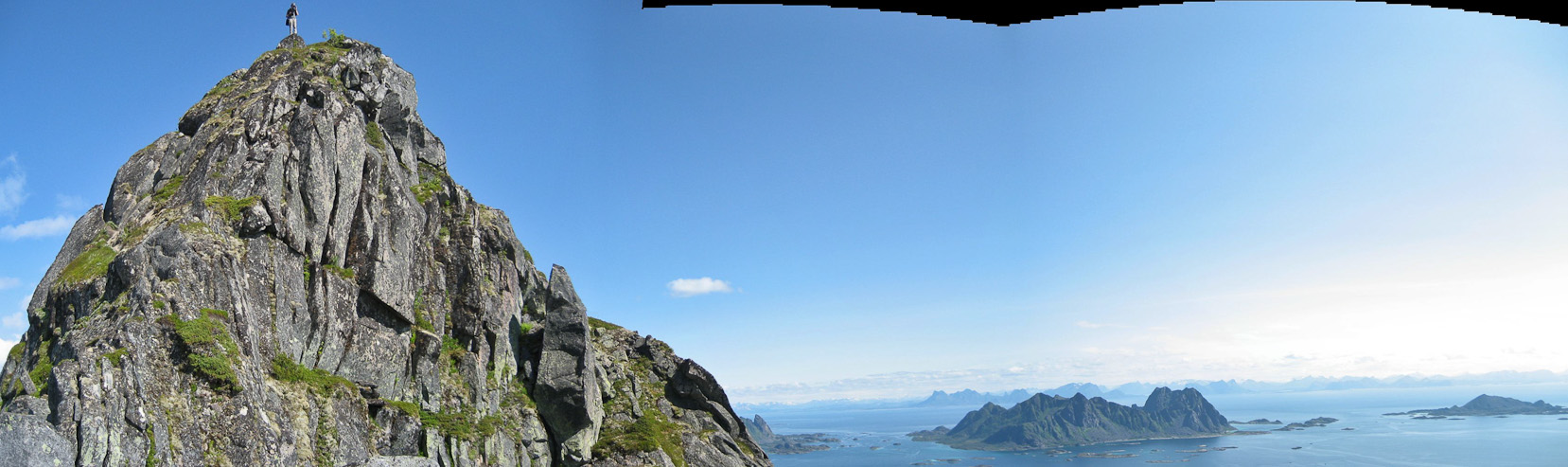
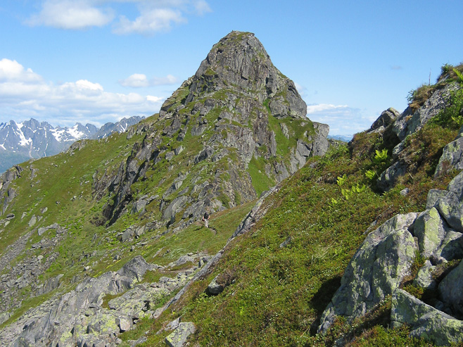
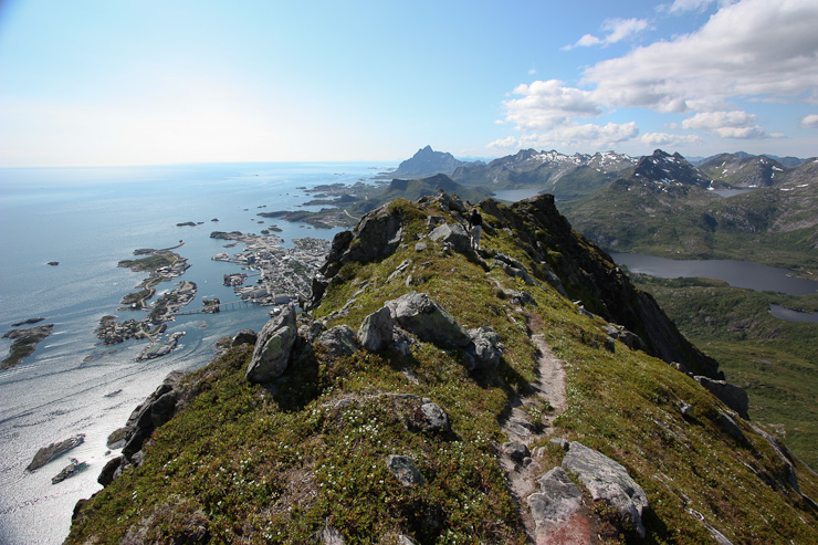
Soon we reached the crest of the ridge, where a pointy peak (Floya, on the map, 2000') looked like an inviting place to scramble...
We rested here a bit, near the peak, admiring the views. Then I scoped out the scramble, heading up first, with Wendy following...
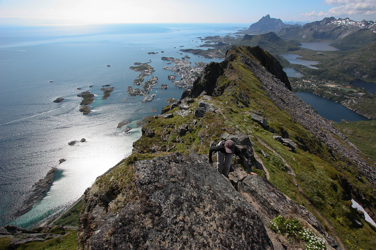
The climb had a couple of airy portions, so Wendy turned back, and took a pic of me on the peak...
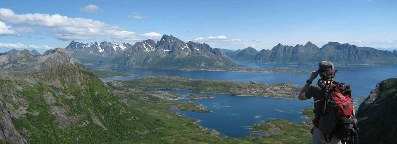
From the top I had this fantastic view to the north...
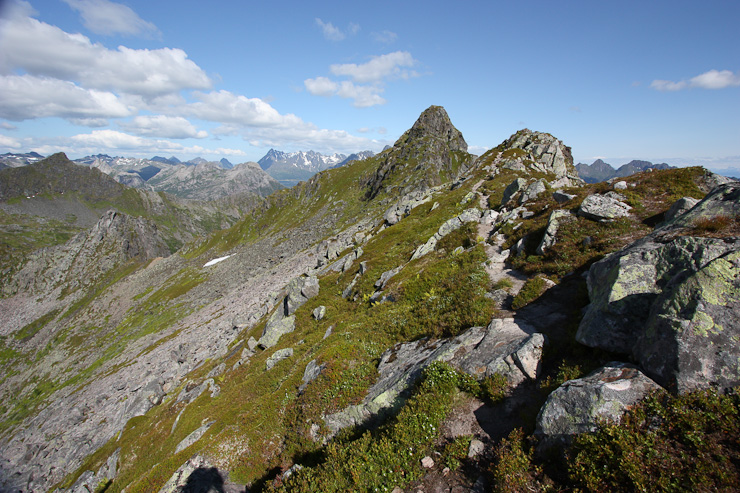
And this fantastic view to the south. Wendy is the black spot, sitting on a rock near the trail below. You can see the basin we hiked across on the right...
Ok, this pic is pretty much the same as above. But with a view as spectacular as this, I can stand another version. The water was really green in some areas. Fascinating to stare at...
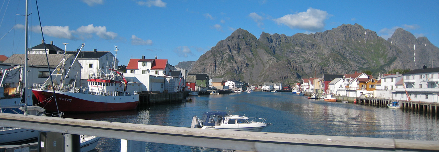
I didn't stay up there long, and down climbed back to Wendy. It's annoying scrambling with a DSLR dangling around your neck. Wendy took a pic of the bridge in Svolvaer in the meantime...
When I returned to my pack, I used my telephoto lens to snap a pic of the restaurant we ate at last night (which is the white building just above the bridge we walked on last night). Then took a pic looking out towards Henningsvaer, a town we planned to stop by later today...
Wendy went ahead a short ways, and took a pic of me on the trail, below the peak I had just scrambled. I took a pic of her, with my telephoto lens still on...
A close-up of the wild, tropical, green waters. Since the rest of the ridge was flat, it was a no brainer to traverse across, and check out the view over Svolvaer...
Wendy nears the end of the ridge. A look back at the peak, and the saddle on the ridge where we climbed from the basin...
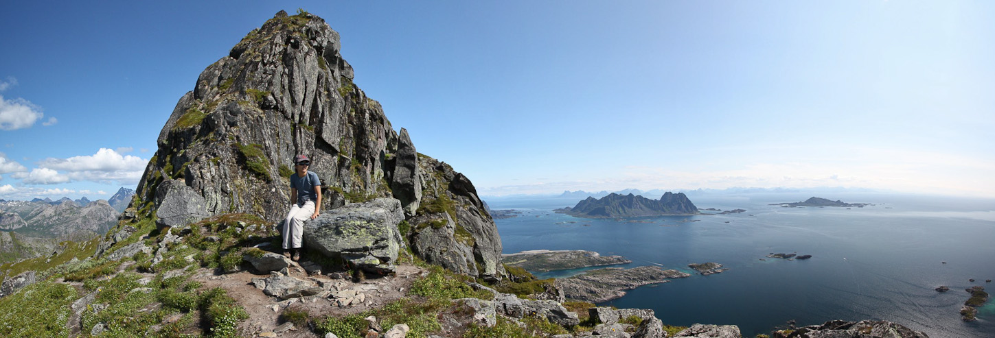
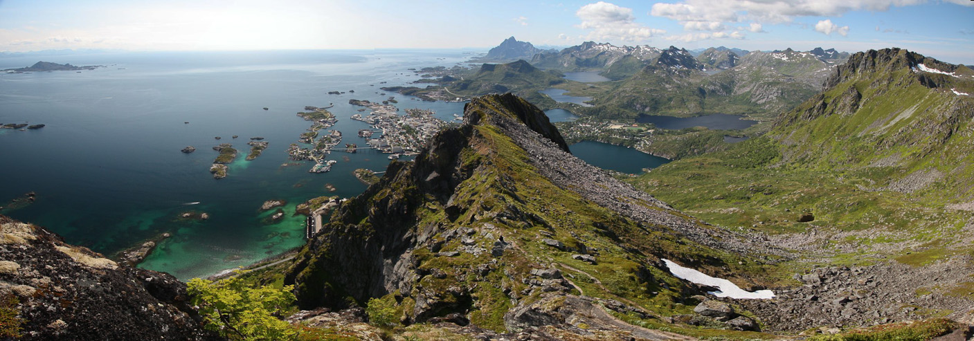
At 2:10pm, we reached the end of the ridge, where a 62 year old, bearded, former mountaineer, was hanging out, and took our pic. He was on his cell phone chatting to his wife, "You better not take of all your clothes to sun bathe, or I'll see it from up here". This guy had hiked a more direct path to this lookout, and said that we took the route via "Devil's Gate" (the cool arch). What a view from this lookout!
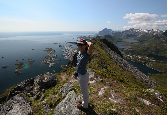
Wendy heads down to get a better view below...
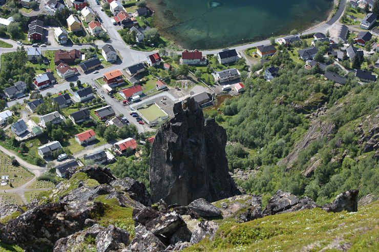
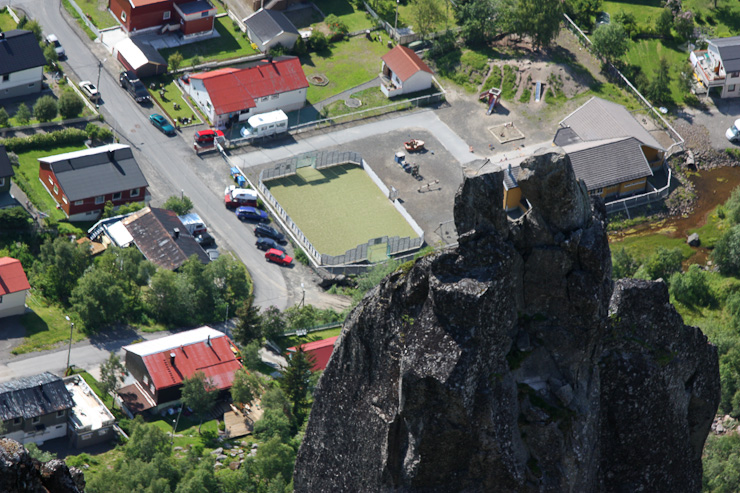
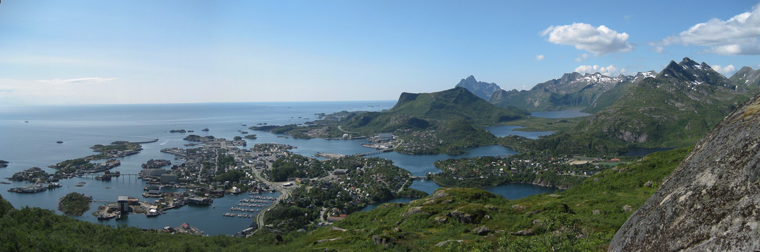
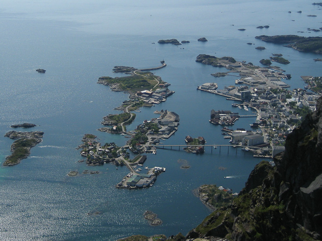
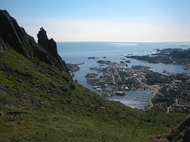
Looking down, we could see "the goat" (Svolvaergieta), and our car (parked diagonally along the fence of the small field). We had only intended to hike to the base of "the goat" to admire the horns, but instead ended up with an even better view of it (and much more). Too bad there weren't any climbers to watch...
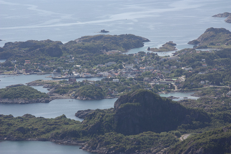
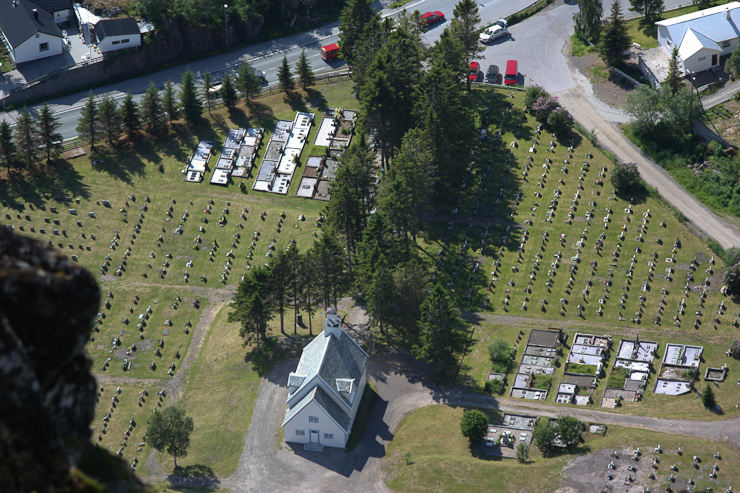
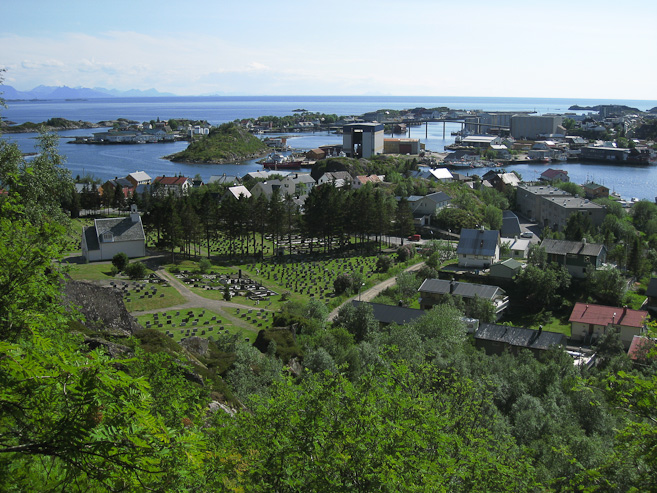
A close-up of Kabelvag, where we stayed last night. Also another look at the church and graveyard below...
A last view before beginning the descent...

We spotted a fork in the trail, and decided to take the "short cut" down, the way the old guy had come up, to save time...
The trail got pretty rough and indistinct. Eventually the trail disappeared, and we just aimed down towards the basin. Unfortunately, I didn't get my chance to sit on "Devil's Gate" (I'm sure my mom isn't disappointed at that)...
We made great time descending, arriving at the car an hour from the lookout, appreciating the views on the way down too...
Having just finished a spectacular hike at 3:30pm, it was time to drive southwest to new destinations. We took a 30 minute detour to Hemingsvaer, "the Venice of Lofoten", though didn't get out of the car as we quickly scoped out the town. There was a one-way bridge connecting the town to the mainland. We then left the island of Austvagoy over a scenic bridge, and entered the island of Vestvagoy.
A look down Henningsvaer's scenic canal, as we made a brief drive-thru visit of the town...
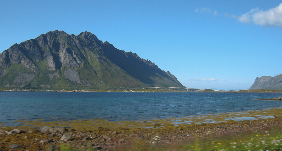
The bridge between Austvagoy and Vestvagoy approaches, across the blue water...
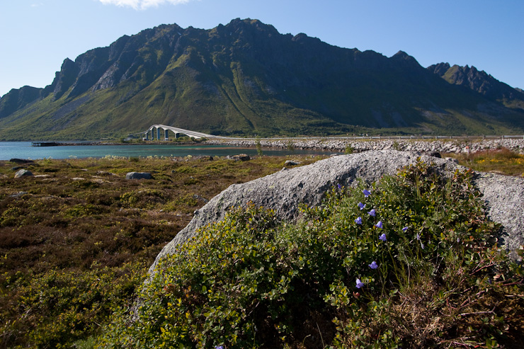
We stopped at a vista point just before crossing the bridge, to grab another pic, and have a bite to eat...
Go to Part II of Day 5 (July 8th, 2009)...