Norway 2009, Day 11, Vaeroy (Lofoten), July 14th, 2009
9:11pm, Gammelstua cottage in Vaeroy
It's the darkest and coldest it has been in Lofoten at this moment (9:11pm in the evening). Glad to be in a warm and cozy place.
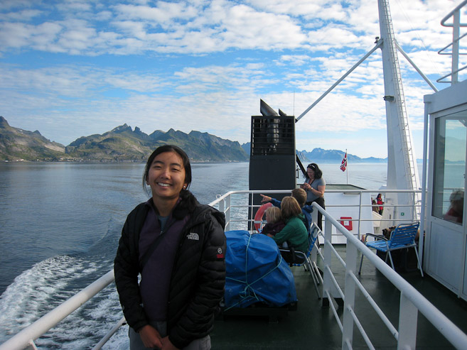
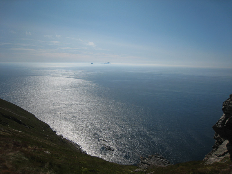
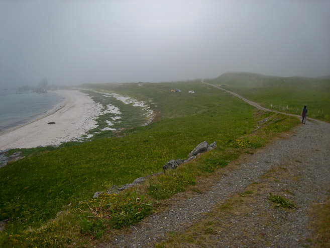
I woke up to a 6:35am alarm this morning. My earplugs worked great, with no interruptions overnight, even in a crowded campground. We packed up, ate a quick breakfast, and drove down the driveway to the ferry terminal across the street for our 8:15am trip, arriving 25 minutes early. We lined up in the "reservations" queue, and waited for the loading to begin. There weren't many cars in our line, even though this was the only trip to Vaeroy today, which was surprising, since reservations are recommended and hard to get. After visiting the restroom, and checking out a gift store, it's time load onto the ferry. All cars had to enter the ferry in reverse (trunk first), since there was just one door to this boat, which would make for an easier exit later. Every car waiting in line makes it onto the boat, with no additional cargo room to spare. We spend the 70 minute voyage on the deck taking pics of the islands. Plenty of blue sky, and no wind... Looks like another scorcher today...
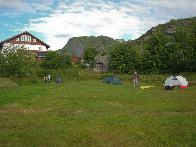

Wendy stands near our tent, with the fly on the ground, as we breakdown camp early in the morning. When it was time to load the ferry, each car had to turn around, and back in. Those of us getting off at Vaeroy entered last, so we could exit on the 1st stop of the ferry's Vaeroy-Rost-Bodo route...
A couple of looks at the coastal houses with my telephoto lens shortly after departing Moskenes. I found the telephoto lens got the most action on ferries over the course of our trip...
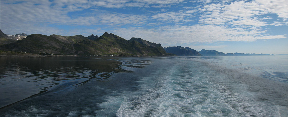
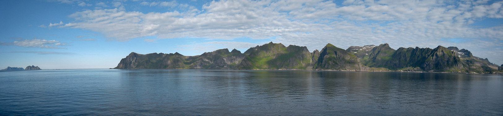
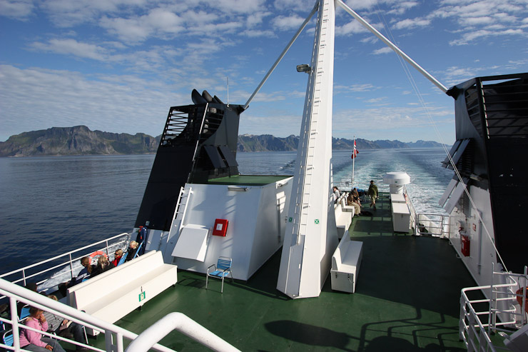
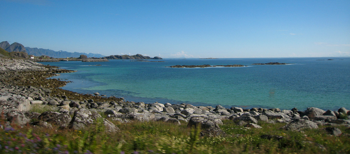
A look back up the Lofoten coastline. Such a beautiful archipelego to have explored...
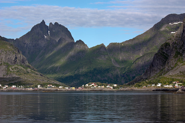
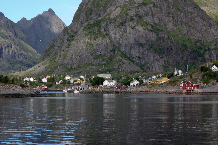
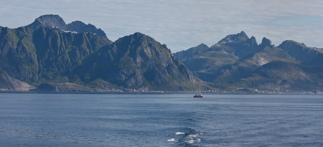
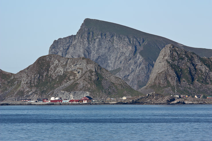
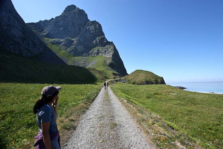
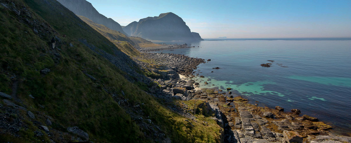
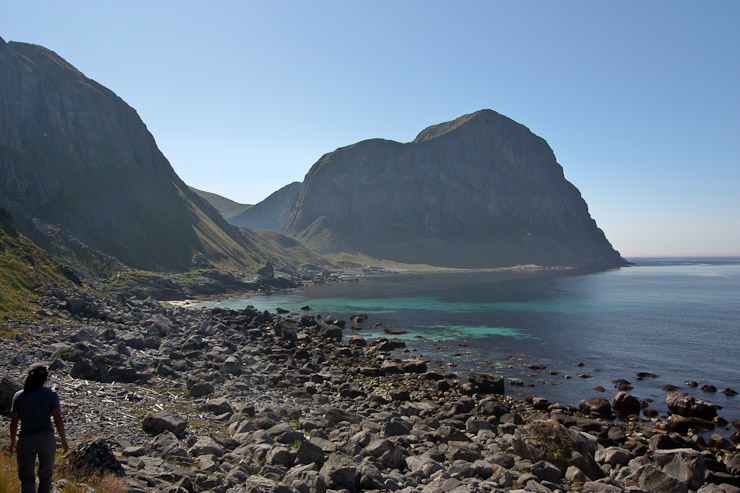
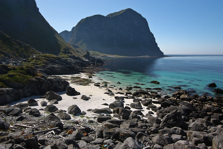
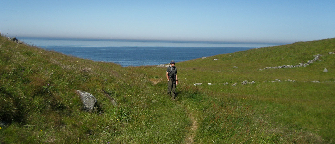
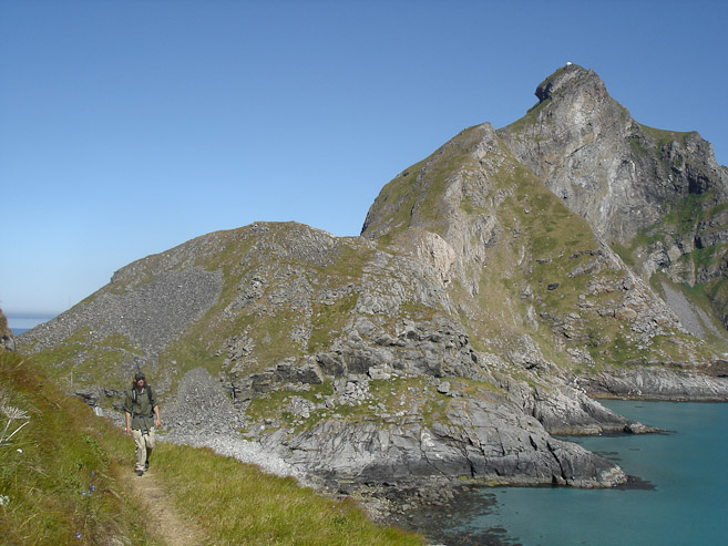
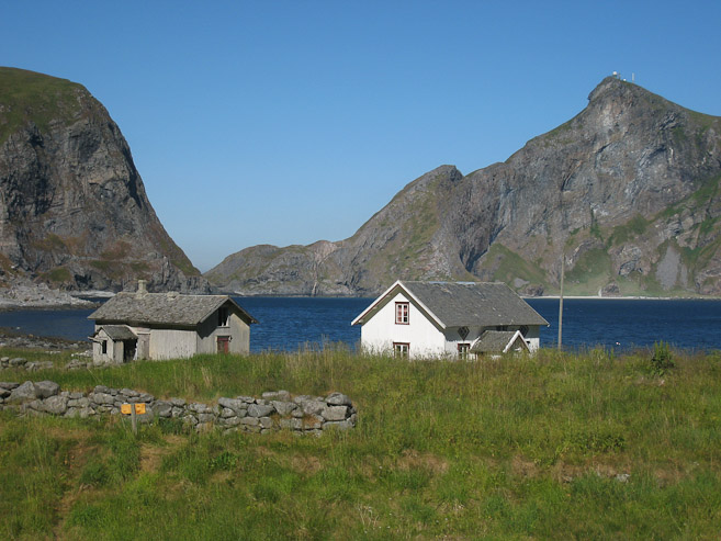
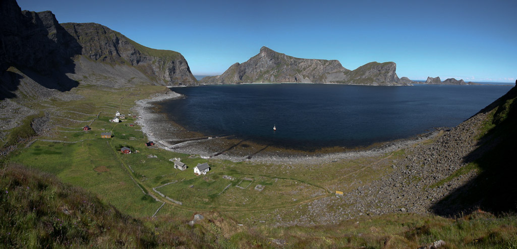
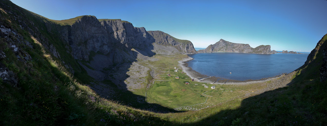
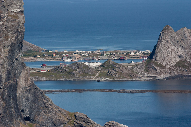
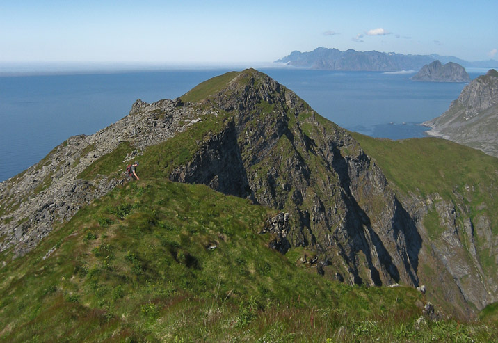
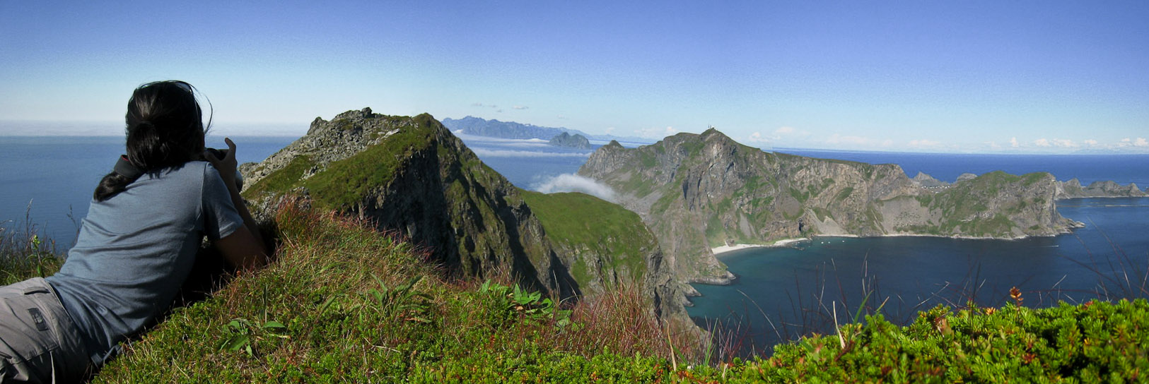
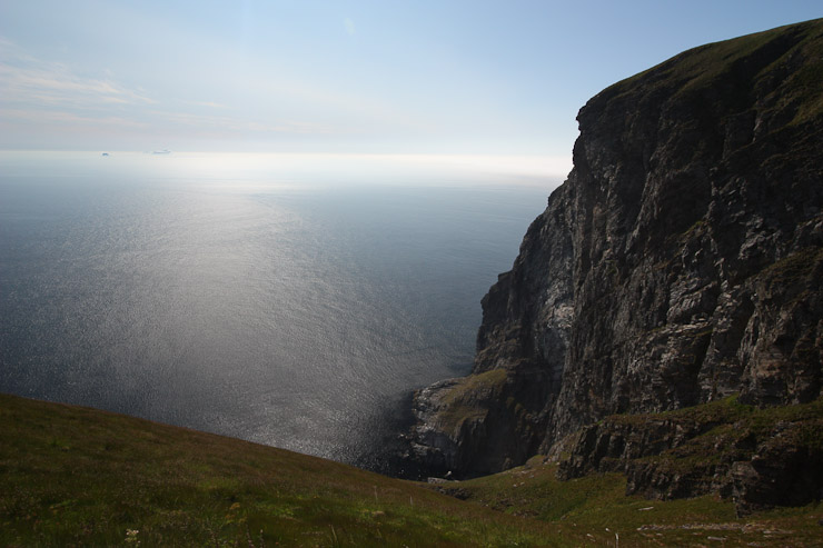
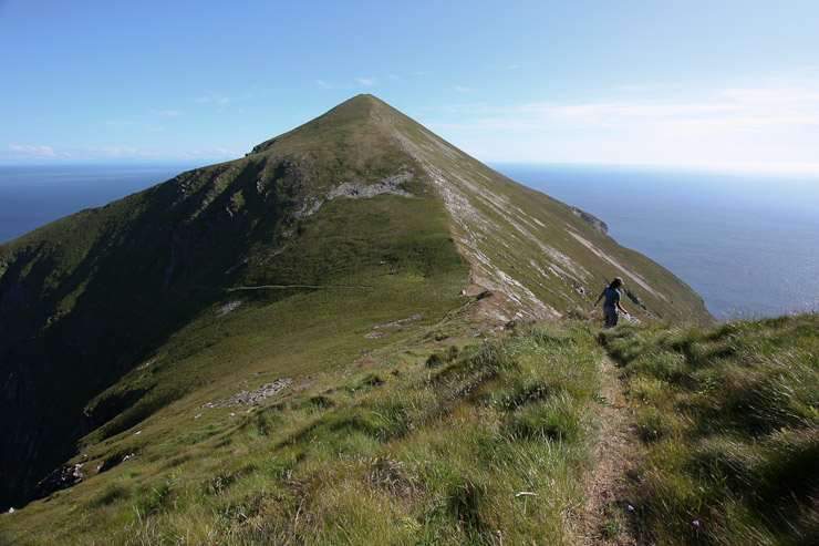
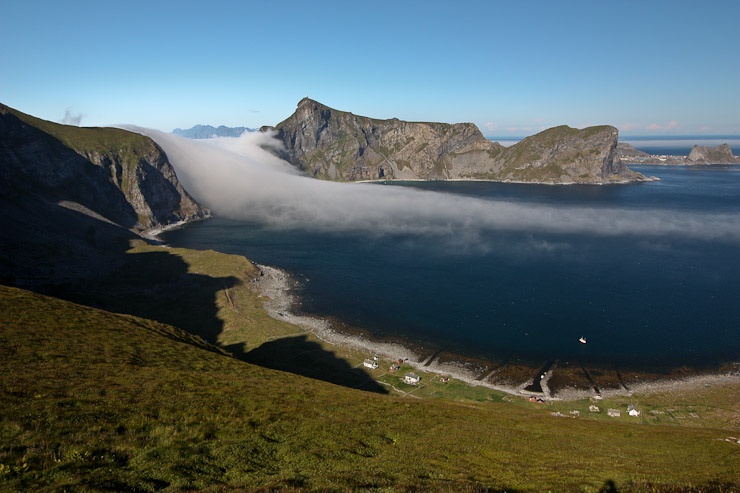
1st pic: A look over the village of A, to the ridge we climbed yesterday afternoon. Wendy and I climbed to the lowest "V" in the ridge, and then up to the right before the next notch. The water was calm, and the wind was still today (aside from the boat's self generated breeze)...
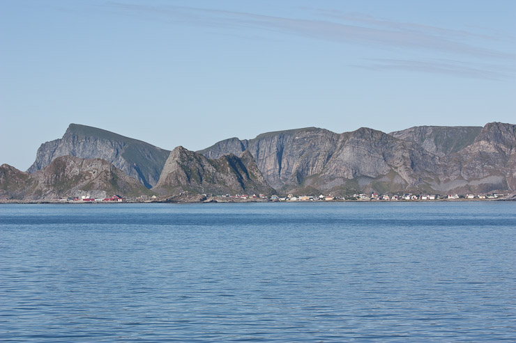
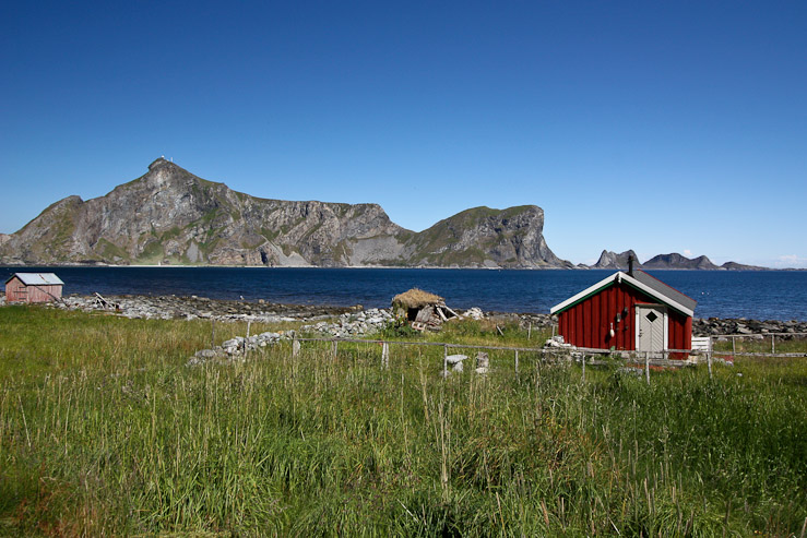
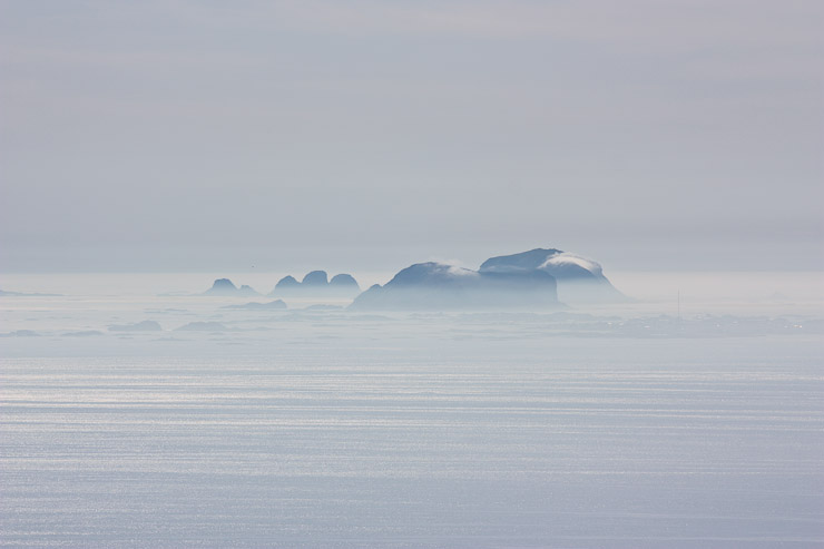
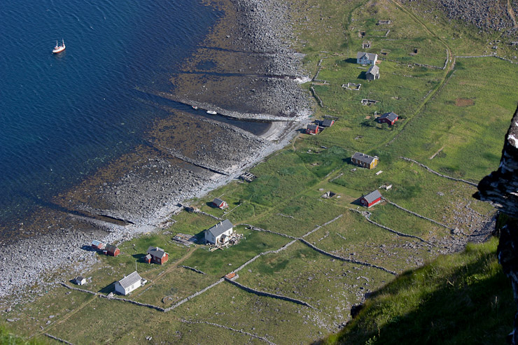
A wide zoomed-in look at Vaeroy, stretching across, with the small (but impressive) island of Mosken in the foreground on the right. Some settlements can be made out on Vaeroy's north shore...
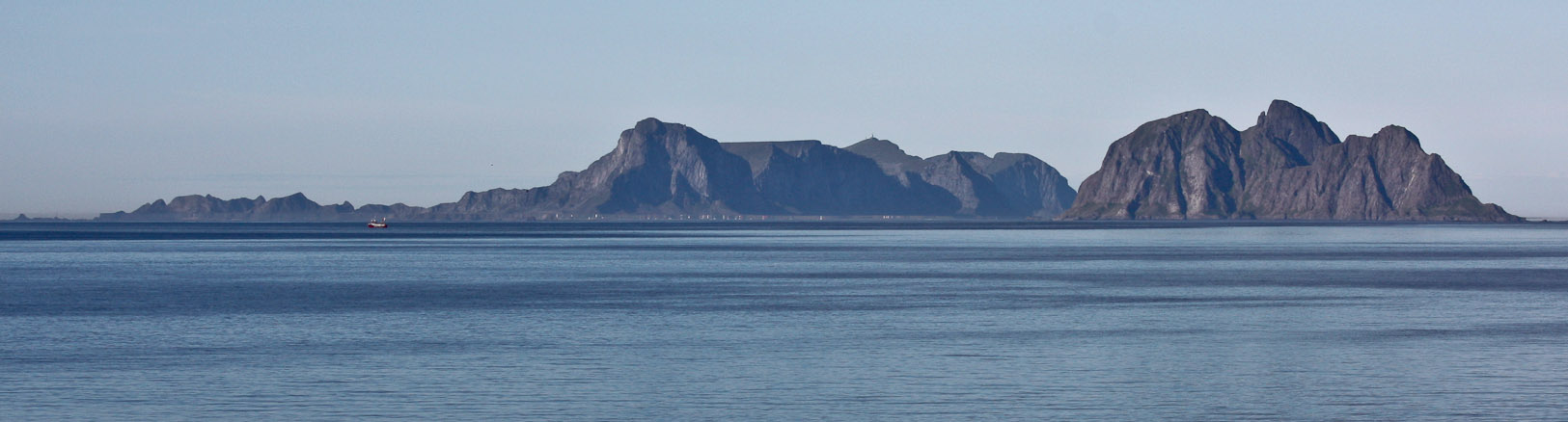
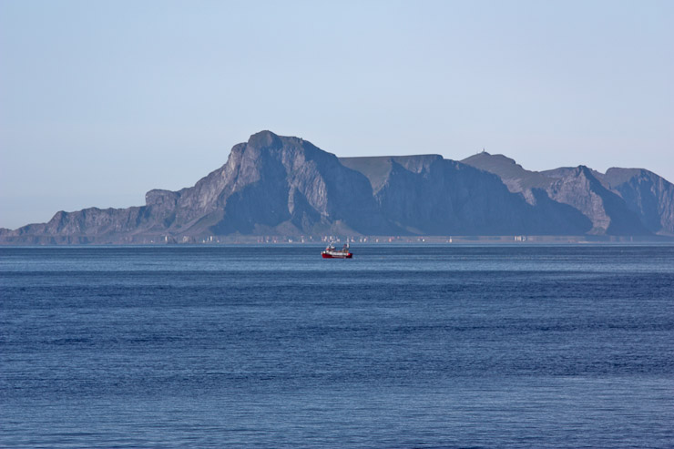
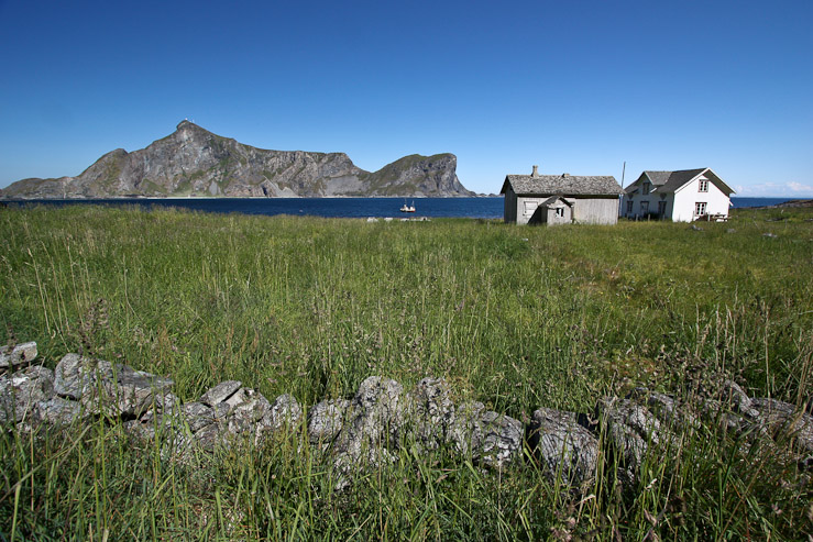
A really wide look at the southern, uninhabited stretch of the Loften Islands, with Vaeroy way off on the leftt...
There were sparse clouds back over the Lofoten islands, but none to be seen towards Vaeroy. I couldn't believe how fortunate we had been with the weather this entire time in Lofoten. Looks like we were set for one more beauty. The forecast called for clouds tomorrow, but all that mattered was today...
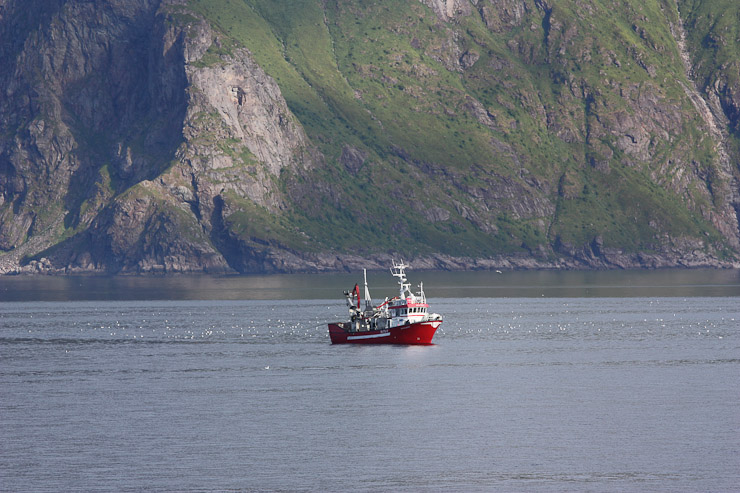
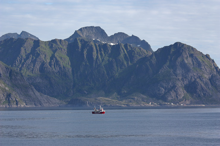
A couple shots of a boat, looking back towards the main islands...
The towns of A (on the left) and Moskenes (on the right of the boat). Such impressive peaks in southern Lofoten...
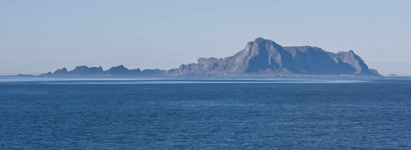
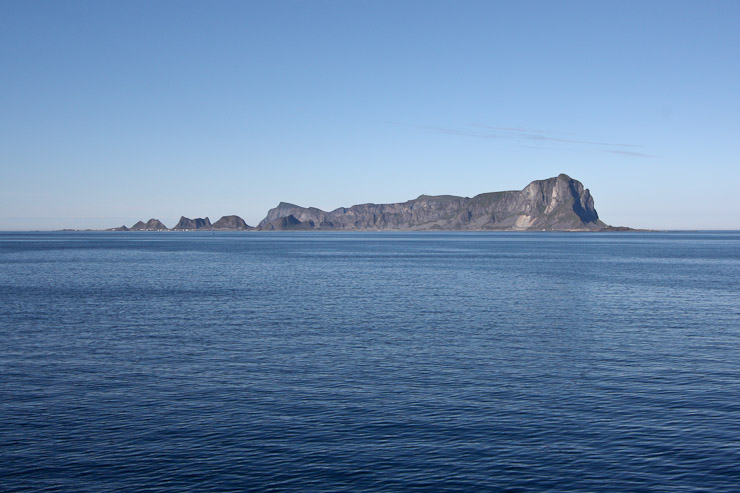
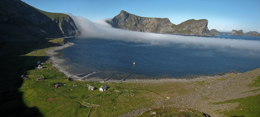
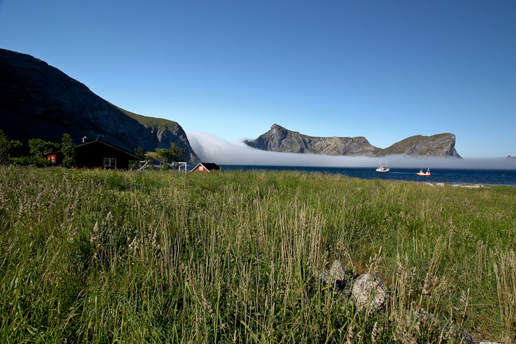
A wide shot of Vaeroy across the blue ocean. The main town of Vaeroy lies on the other side of the small spine of rock running to the left...
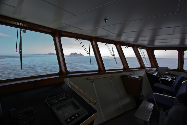
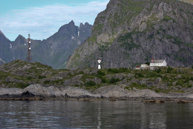
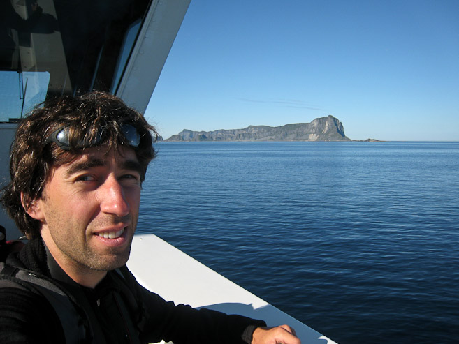
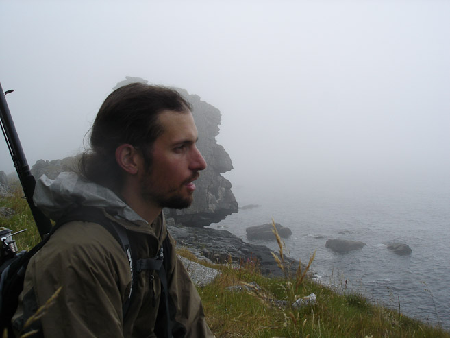
We found the door to the cockpit was open, and peaked inside. The captains welcomed us in, and let us look around. Also a look out over the deck, where Karl, Mariann, and Darwin are sitting near the end...
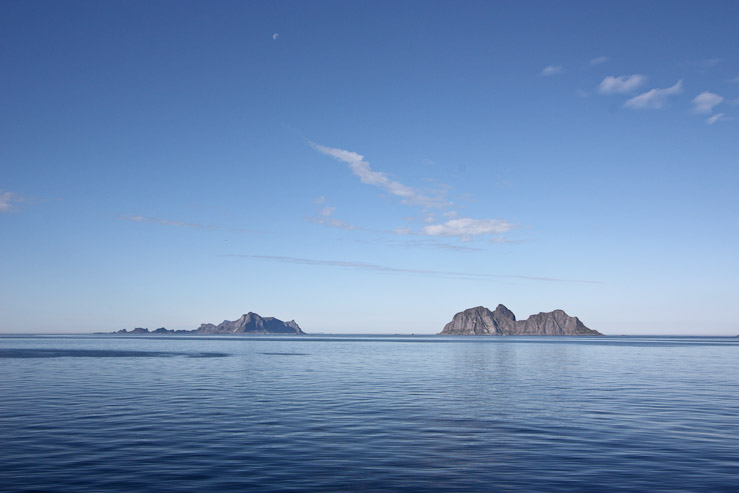

The moon appears above Vaeroy and Mosken in the 1st pic. A close-up of the village of Nordland on Vaeroy's north shore. We'd end up staying in this area tonight, below the cliffs...
On most ferrys with a voyage of 20+ minutes, everyone is forced out of their cars, and into the lounges/cafe/deck. The cargo area is then locked. I didn't understand why at first, but then became aware it was for security purposes, to keep everyone's car locked from everyone else...
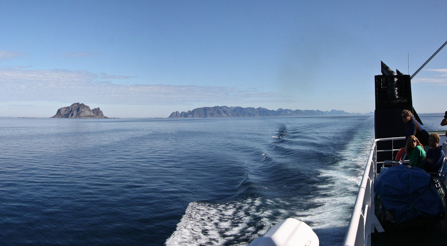
A look back towards the Lofoten islands, ~1hr into the voyage. We had passed the uninhabited island of Mosken too...
We were approaching Vaeroy, rounding one of it's long penisulas to reach the harbor on the other side...
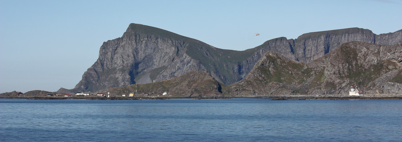
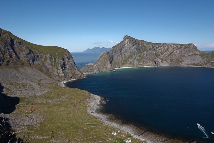
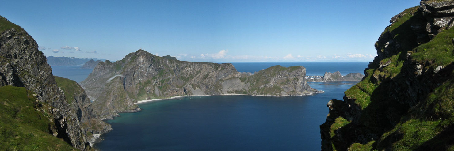
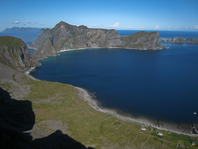
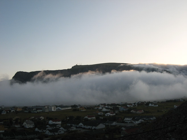
The main town is on the other side of this arm. In this view, you can see the mountain we planned to climb later today. We'd ascend up to the saddle, and hike on the ridge to the right. There's a helicopter above the saddle too...
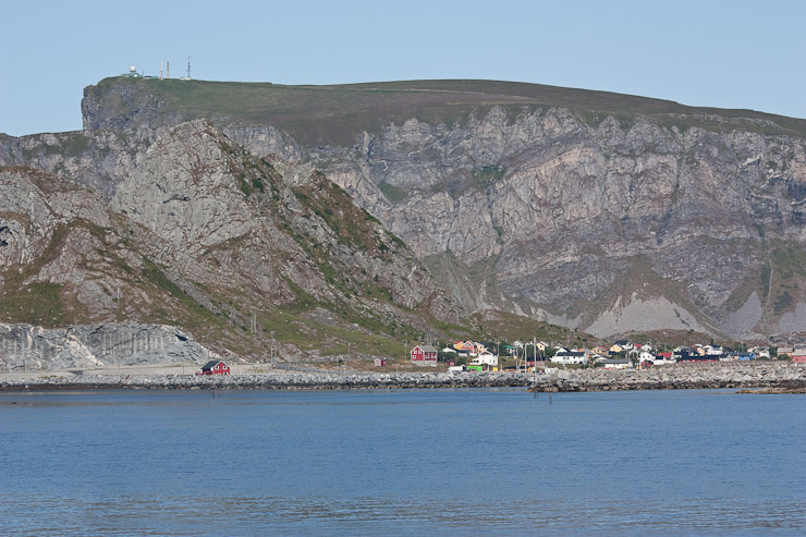
The curvy U-shaped grassy slopes reminded me of Scotland. In the 2nd pic, a NATO installation sits on Haen, the highest point of Vaeroy (~1450'), which is also the target of hike #2 on my list for today...
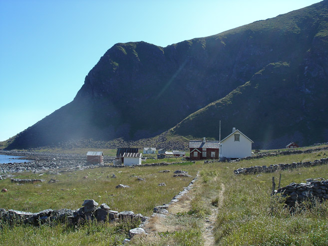
The ferry arrived at the terminal ~9:30am. After exiting the boat we took a coastal road into town, where we stopped at a grocery store to buy some bread. The first item on the agenda was finding a place for the night. There were no campgrounds with facilities on the island, so Wendy and I decided we'd look for a nice place to stay on our last night in Lofoten. Karl and Mariann would be happy to pitch their tent along the beach on the north side of the island, and let Darwin play in the ocean. So we agreed to split up while we each handled our lodging issues, and meet up at noon for the hike to Mastad.
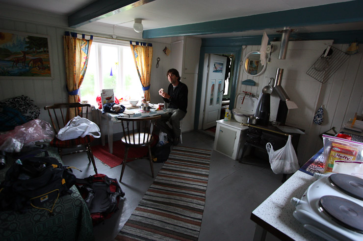
Wendy and I searched pamphlets for rorbeurs and B&Bs on Vaeroy, and called a number of places. We found a 2-person room at a B&B for 695 NOK ($110), which included breakfast. It looked like this would be our best option, and we decided to check it out, but got confused by their directions. After driving around the island for 15 minutes, unable to track down the B&B, I pulled out a flyer that I had picked up on the ferry, which listed a place not on the main pamphlets. We called them up, and they were offering 200 NOK/person to stay at their house. This certainly was worth investigating, so we drove to Nordland (on the north side of Vaeroy), and eventually found the unlocked, empty cottage. The place was a cozy two story, 3BR cottage, with 2 living rooms downstairs, and a kitchen. It felt like a beach house, and featured all sorts of cool antique furnishings. The most noticeable feature was the low ceilings everywhere. I had to hunch inside, to avoid crossbeams, especially under the doorways. Wendy loved the place, and we called back the lady, who said we could pick a room, and she'd stop by to collect the money later. So we dumped our sleeping bags in a bedroom upstairs, and made lunch in the kitchen, wondering if any other people would be crashing at the house later.
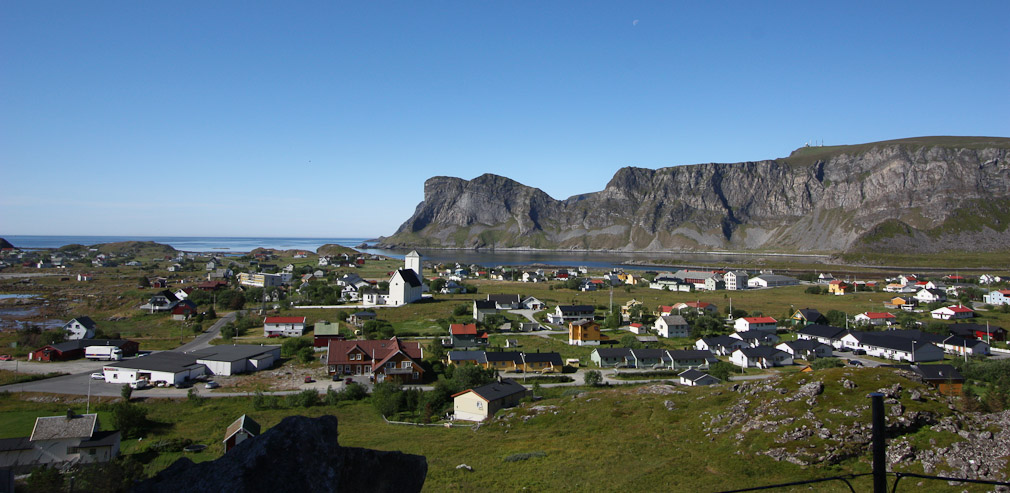
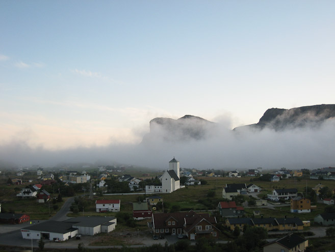
A view of Sorland, Vaeroy's main town. Didn't know if there'd be a gas station in town, but we saw one...
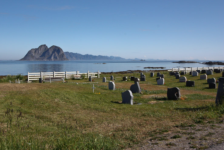
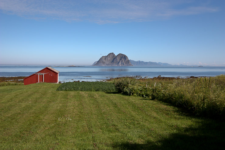
After driving over a mountain pass we reached Nordland on the north side of Vaeroy. We saw a white sand beach near a bend in the road. Soon we had a full-on view of Mosken and the Lofoten Islands to the north (past a scenic graveyard too)...
Some blue tropical-looking ocean on the drive to Nordland...
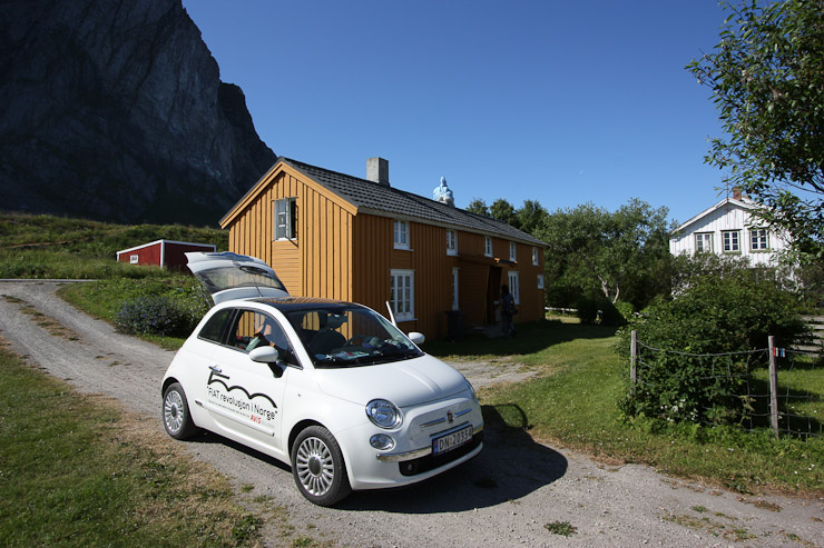
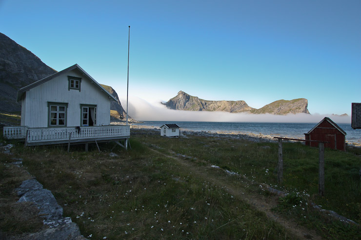
After many phone calls, we finally found a place to stay, and it's location. We arrived at the Gammelsua cottage (orange building), located just off the north shore...
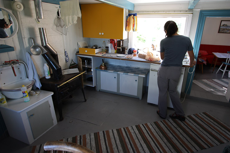
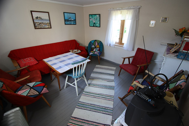
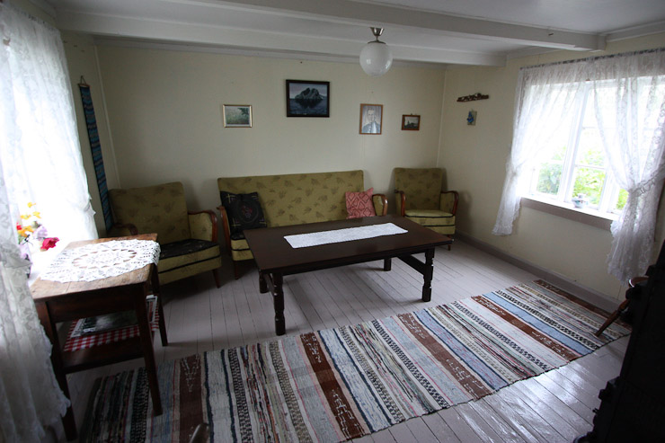
The cottage had an old-fashioned beach house feel, with low-ceilings. A period of head bumping by me was about to begin, but the cottage was sweet, and seemed worth it. A look at the kitchen, and one of the living rooms...
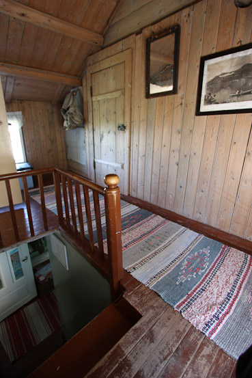
The house had some cool wood stairs. Two bedrooms upstairs were linked in serial. We choose a bedroom on the other side of the stairs (not pictured here)...
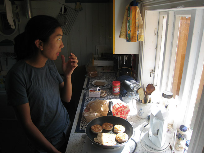
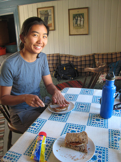
Wendy cooks up some fishcakes on a burner. I put some brown cheese and shrimp cheese on mine. Wendy loved this cozy cottage...
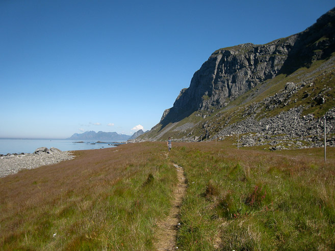
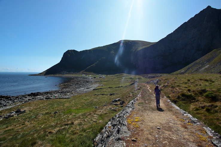
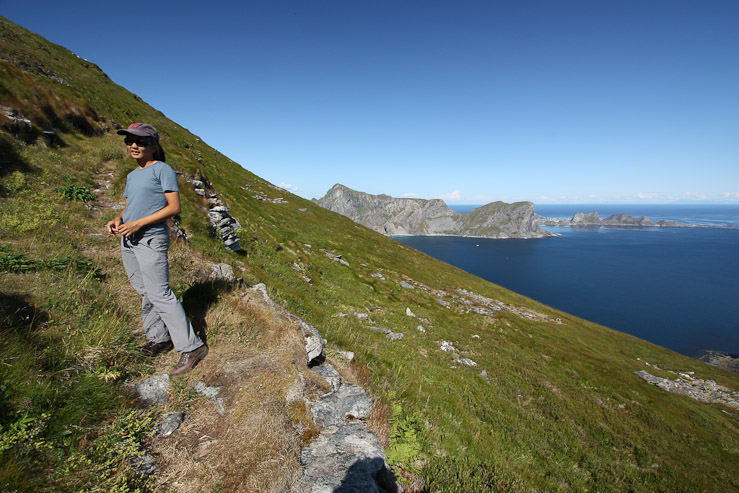
After lunch, we made the short drive up the road to Vaeroy's old airport (closed years ago because it was too dangerous), which marked the start of our hike to Mastad, and happened to be near a popular place for campers such as K & M. The hike to Mastad, an abandoned puffin hunting village of old (no more puffins anymore), was "highly recommended" by my Norway hiking e-book. It's a 5 mile long (one-way), but fairly gentle trail that traverses across a large portion of the island, crossing it's mountainous spine in the middle (at a low pass). From Mastad, there is an optional scramble up to some ~1300' peaks that overlook the island. I was eagerly looking forward to this hike, and glad to have such fine weather. We hit the trail at 12:15, from K & M's campsite.
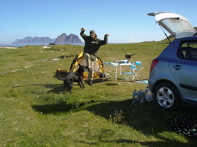
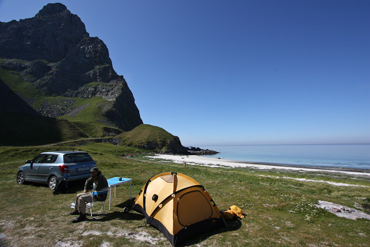
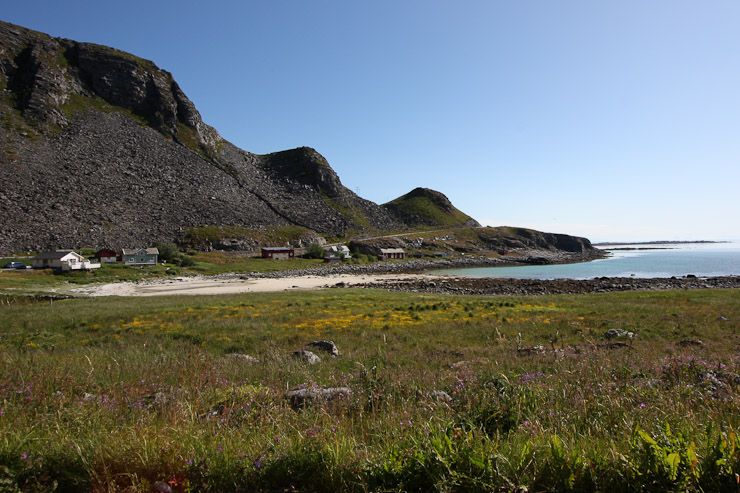
Karl and Mariann found a great spot for their tent along the beach. 1st pic is from Mariann. The trail began just beyond the Karl in the 2nd pic. So we left our car here too, and hit the trail at 12:15, right after Darwin took a last cool-down splash in the ocean...
Views of the road near K & M's camp. The slanty green slope in the distance reminded me of the Quirang in Scotland. We followed the road a short ways before it disapeared into a trail around the corner...
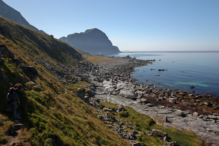
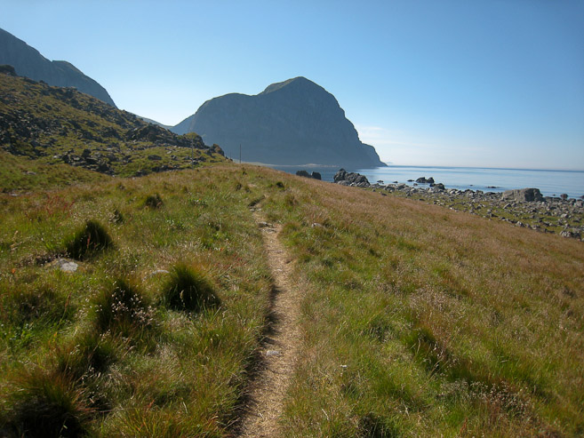
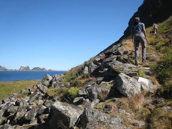
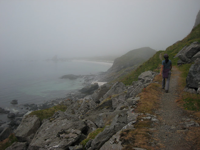
1st pic is a look back at the beach near K & M's camp. Pretty sweet! As the trail rounded the island, the coast became rocky. Lofoten in the distance in the 2nd pic...
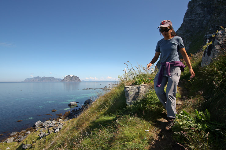
Wendy rounding the corner of the island, with Lofoten across the sea...
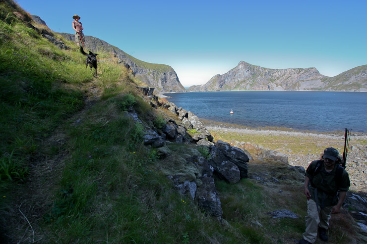
The trail stayed high across the mountain side, avoiding the rocky coastline...
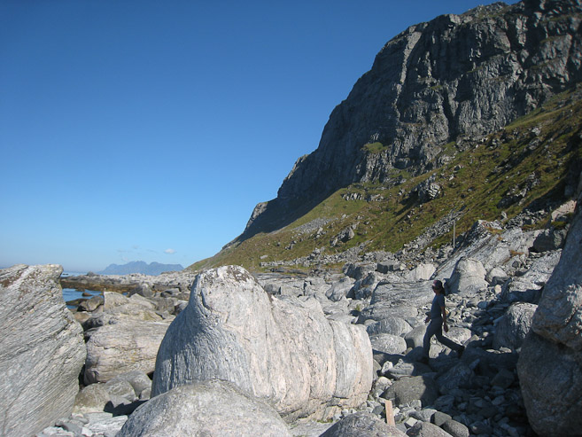
Eventually the trail descended to the rocky beach area, where we followed cairns among small boulders...
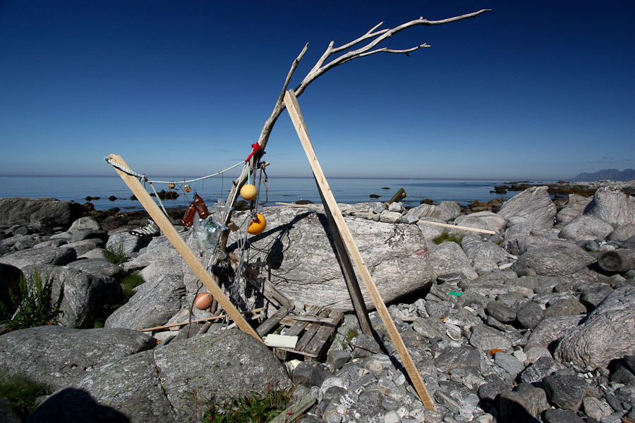
Someone turned wreckage and driftwood into art...
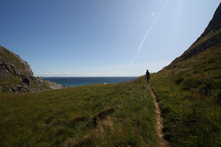
The path brought us to a flat grassy field. A look back, and ahead...
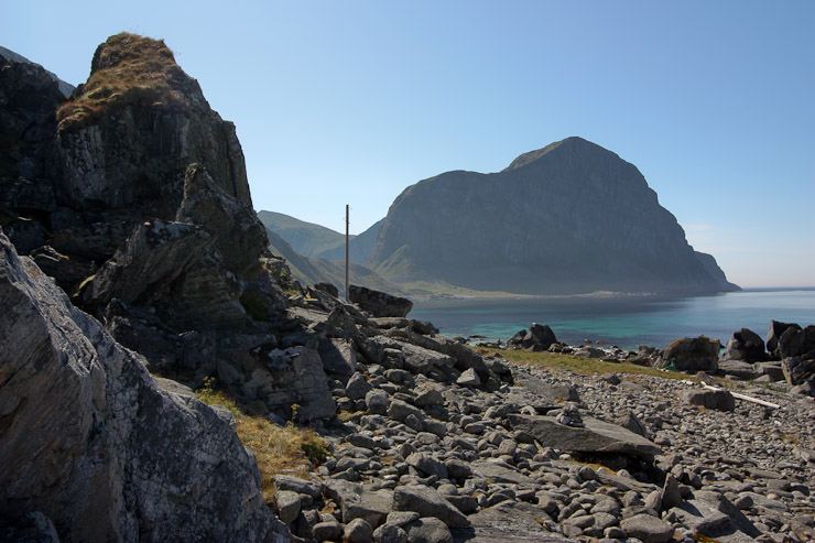
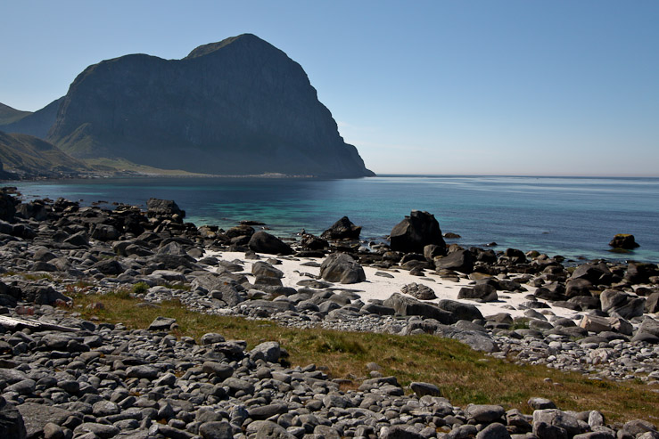
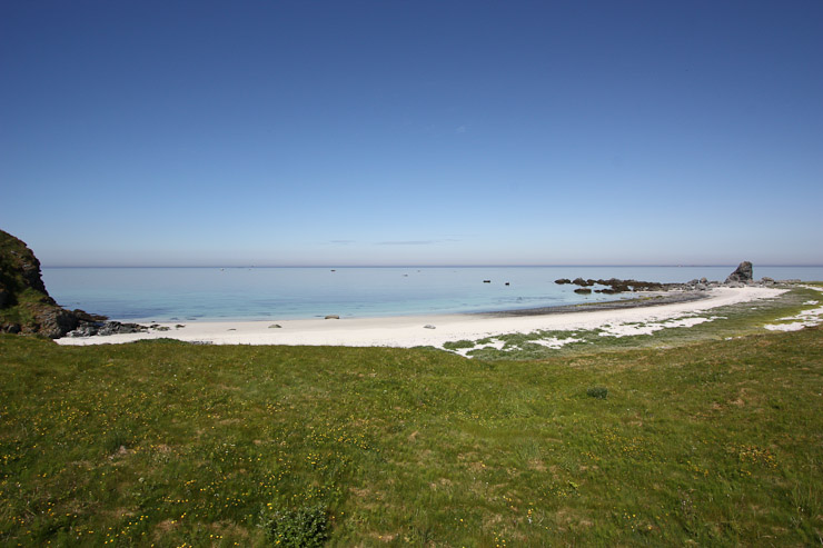
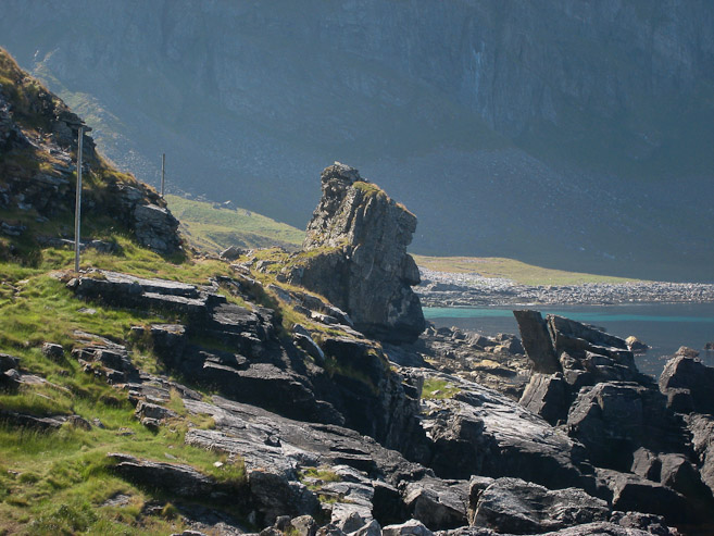
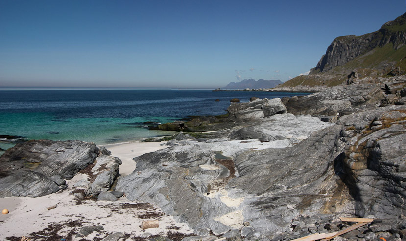
Several poles lined the path, which at first I thought were trail markers, but later realized they were old electric/telephone poles for the once populated town of Mastad. Scenic pockets of white sand appeared along the shore...
These pics are ~1hr into the hike. Ahead we could see the gap in the mountains where we were cross to the other side of Vaeroy (1st pic)...
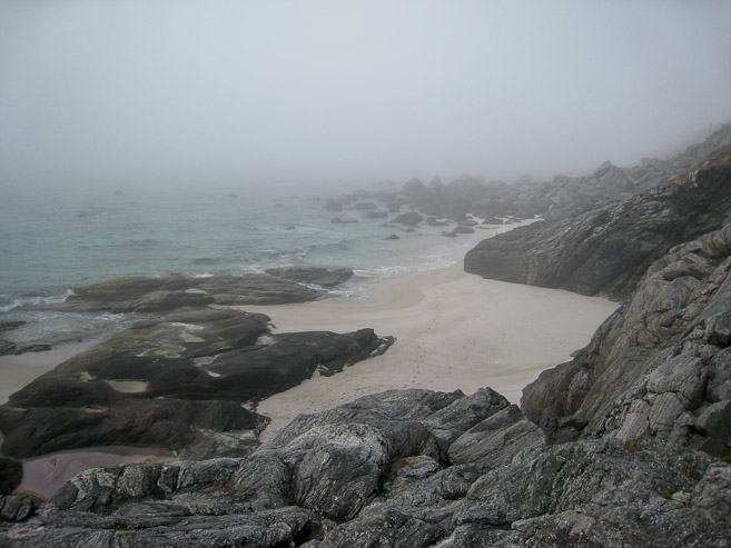
Soon we reached the most scenic, secluded beach I've ever seen (more pics ahead). A look back at Wendy arriving to the scene, with another electric pole behind...
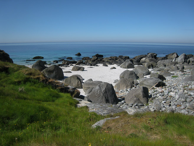
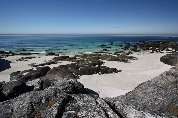
A couple looks at the broad sandy beach. Quite a hike to reach here, but lots of privacy and beauty...
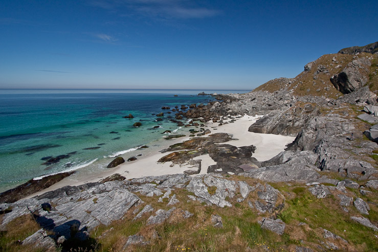
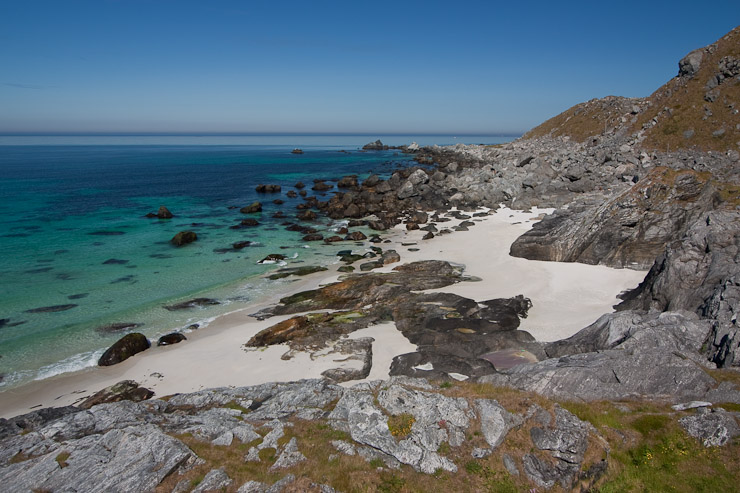
A look back at that cool beach. So BEAUTIFUL! If only we had the time to stop and hang out here, but there was a long way yet to go. Maybe we could stop on the way back...
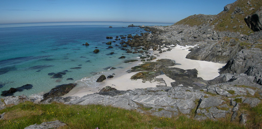
I took tons of pics of this beach. I have to keep reminding myself that the water is very cold...
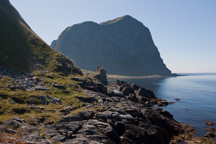
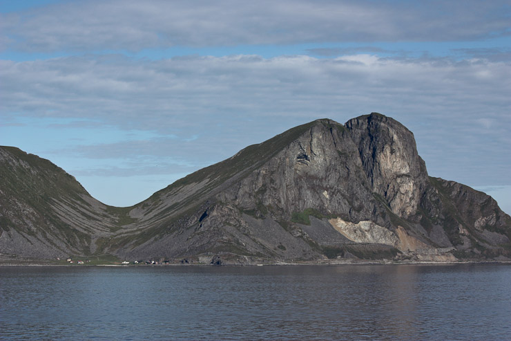
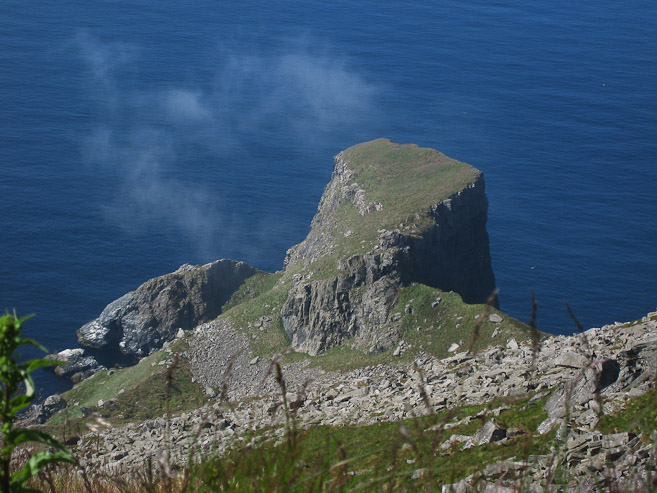
Up ahead, just before the mountain gap, was this large profile rock. I had read about it, and was wondering when it would pop up...
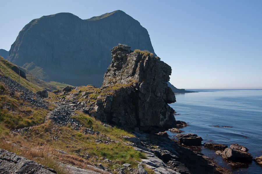
I debated briefly about trying to climb it, but figured it'd be best to keep the trail progress going for now. Maybe there'd be an opportunity on the return...
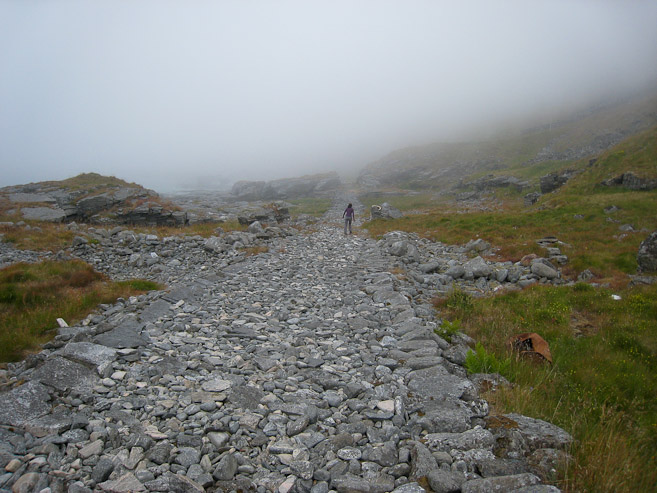
After passing some more patches of sand, we reached a broken stoney road. Mariann takes this pic of Karl and Darwin. They were way ahead of us...
A look up and back along the "ancient" road. Felt like something out of The Dark Tower or Return To Oz...
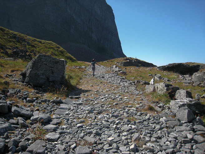
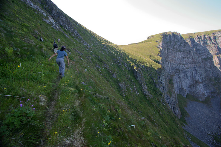
The trail turned and ascended up to a grassy pass. Wendy looks back and takes a photo of me...
My view from the pass, looking ahead at Wendy. The trail then curved to teh right, and hugged the mountain side, above the sea...
A look across the wide cove at Haen, the highest point on Vaeroy. Wow, great scenery on this hike. Mariann takes a photo of Karl after having just crossed the pass...
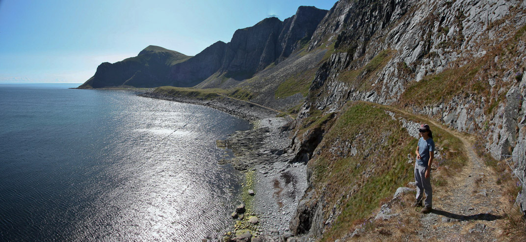
The trail widened into a road. It was hard to imagine carriages traveling on this precaroius route. No guardrails here. Mastad lies ahead at the end of this peninsula, under the cliffs...
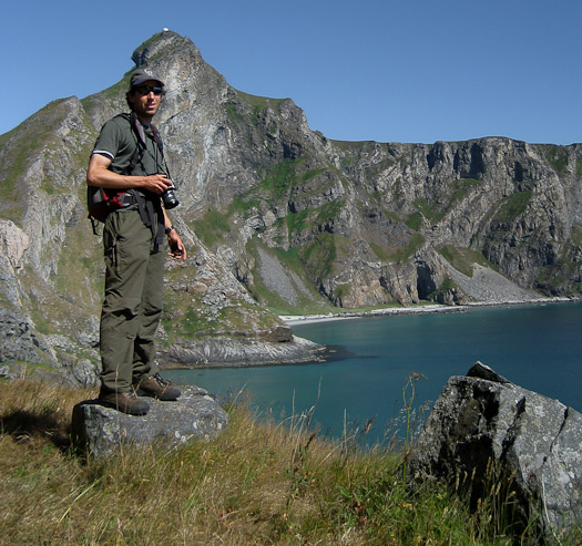
Wendy gets a pic of me, with Haen right above my hat. Darwin leads the way to Mastad in this pic from Mariann...
2hrs into the hike we had made it to the final flat stretch of road leading to Mastad. Several houses occupy the village, and a few were in the midst of construction. Not a bad place for a summer house/hut...
Some houses were very well kept. Ruined old stone fences were plentiful here. I wondered if any of these houses had running water or electricity. Likely not...
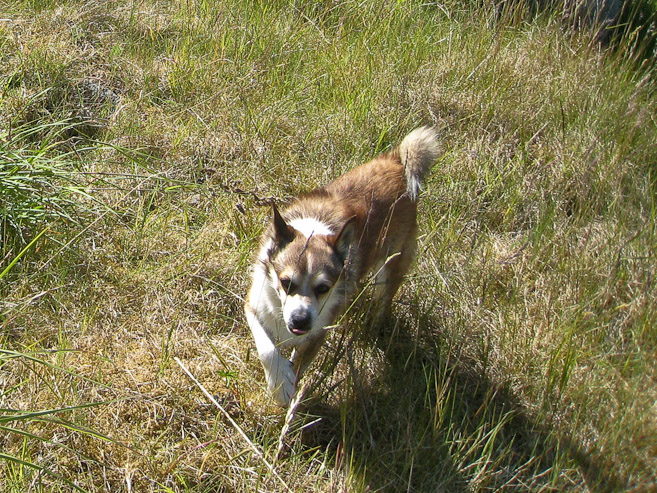
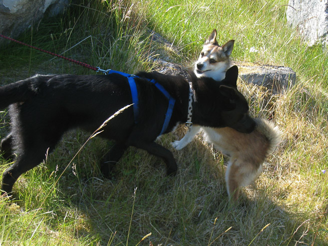
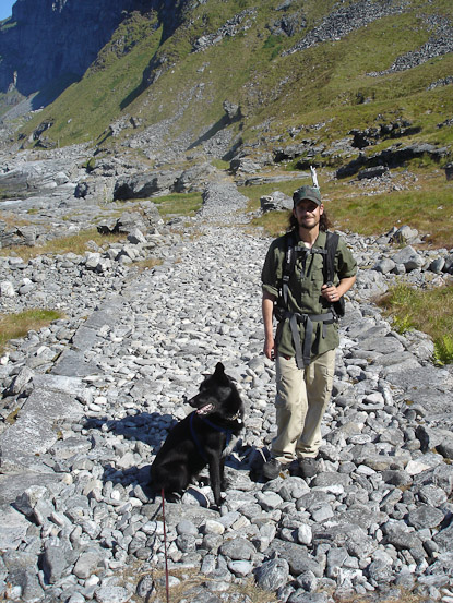
On the way through town, we ran into a special breed of dog that was used to hunt puffins in the old days. Their eyes were very creepy, like Alice Coopers. Young Darwin got to practice some social skills with this dog, who was very territorial...
K and M had stopped at the end of town to wait for W and I. We rested here a bit, snacking, contemplating whether to scramble up to the peaks above, and watching the dogs interact with each other...
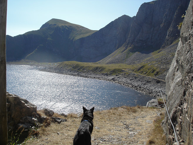
A look back at Mastad, and the gap in the mountains that we had crossed. We saw a sign for water to the right, and Karl and I both filled up our bottles with the pump there...
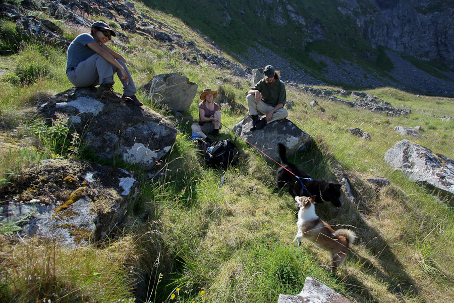
Wendy and I met up with Karl and Mariann at the end of Mastad, and debated about continuing on the trail up to the 1300' summits above. All along I was 100% going to climb to the summit over Mastad, but since there was still another hike on the agenda today (or even late tonight), which would be a big climb (Haen), I didn't know what the others were interested in, and if Darwin was up for the climb. Wendy thought she only had one climb in her today, and wondered if she should save it for Haen later, waiting for me at the bottom here. K & M debated it, and ended up deciding on climbing to the summit now, and likely passing on a later hike. Wendy decided to join in on the summit now, and play things out later. So at 3pm, we began the climb up the very steep-looking mountain side.
A look past a couple of houses to the gap where we crossed the island. The road can be seem cutting across the cliffside. At 3pm, we all started the hike up to Mahornet...
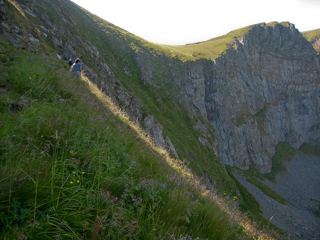
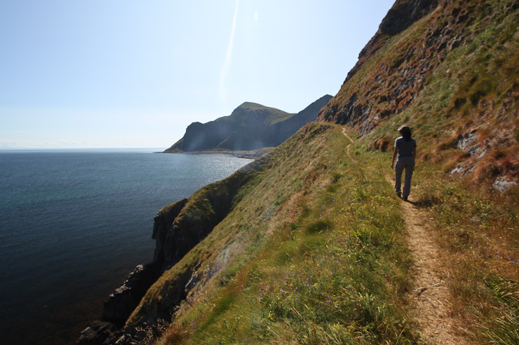
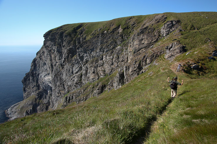
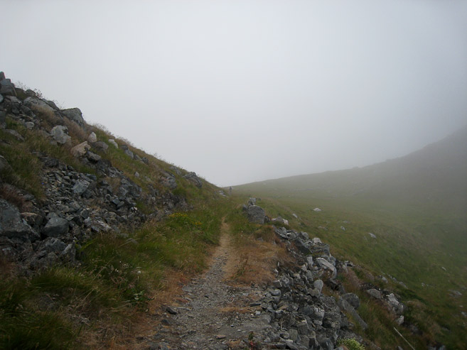
The dirt trail, carved in the mountain side, was surprisingly solid amidst the steepness. It was one of the best mountain trails I've ever been on. We made good time on the climb, slicing back and forth up the mountain...
A look down at the town of Mastad. The weather continued to be ideal, with pleasant (if a bit hot) temps, and barely a breeze...
Another look at Mastad from further up. You can see some of the stone fences below...
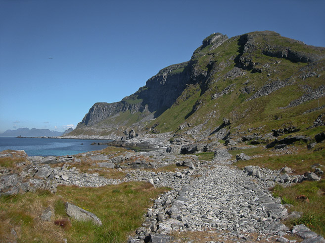
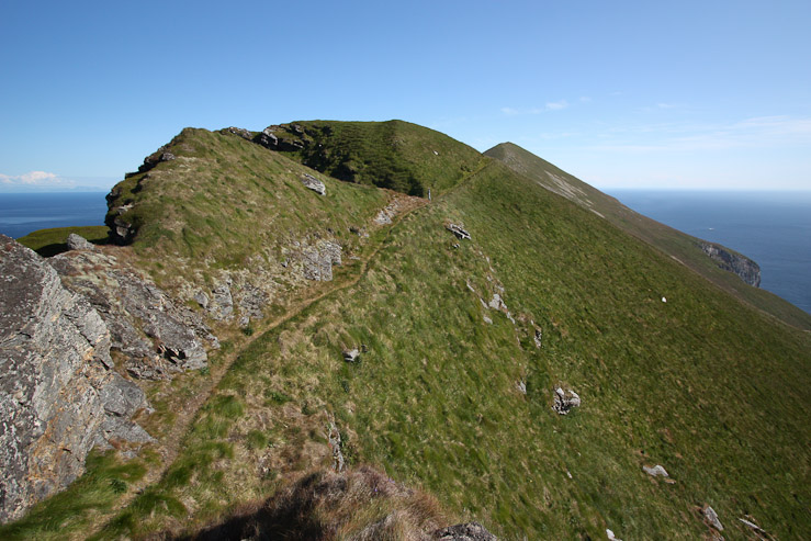
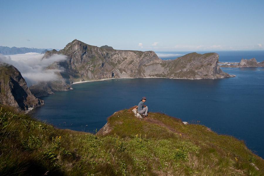
We continued our surprisingly pleasant climb up to the ridge. Such a great trail on a steep slope. Below the summit of Haen, there was a huge beach (barely visible from 2nd pic) with many people, which must be a popular destination. We observed boats shuttling people there...
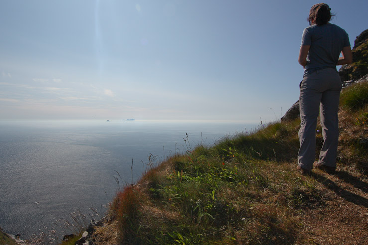
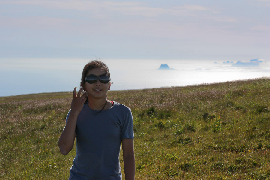
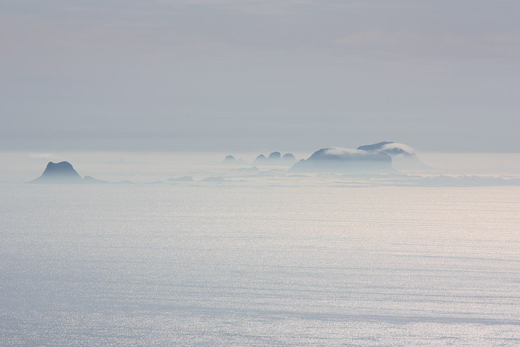
After 35 minutes, we had reached the saddle, and could see the islands of Rost to the southwest...
From the saddle, we opted to take the well worn path north, rather than scramble to the southern peak (Mahornet), which didn't have a trail broken in. I figured the well worn path must be the more popular, and therefore scenic, peak. But I also wanted to hit Mahornet if I could...
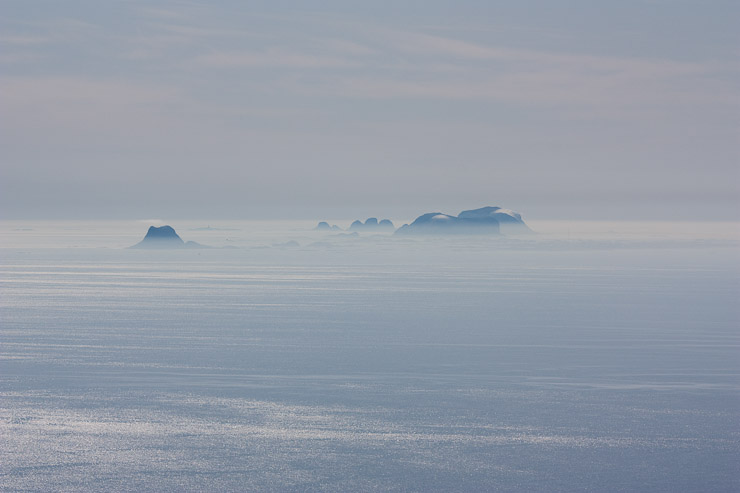
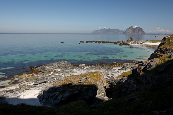
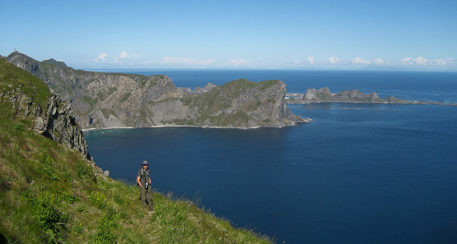
I got out my telephoto lens, and took a pic of Rost. These islands are known for there dense bird colonies. Also a look back at Sorland, the area where the ferry dropped us off...
It was simply gorgeous on the ridge. In this shot you can see the beach below Haen a bit better. The boats deliver people from Sorland (on the other side of the peninsula, on the right). There is a tiny bit of fog draped over the shoulder of Haen too...
Some houses in Mastad below. A look back at Wendy, with Mahornet rising behind. I hoped to climb that one after returning to the saddle...
Another shot of Rost, with a bit of fog draped there too. Karl is feeling energized on the ridge, as we head for the flat-top peak ahead...
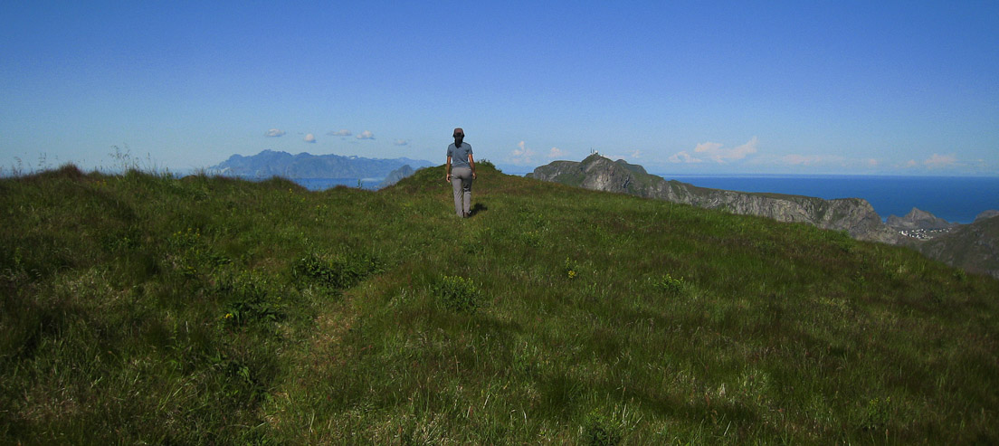
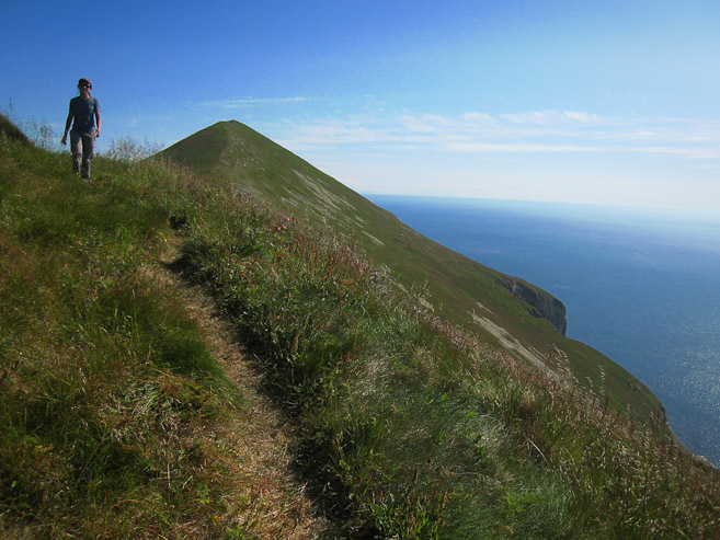
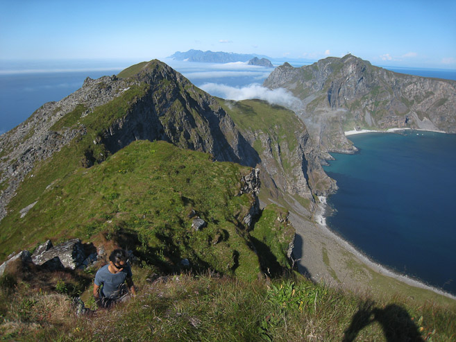
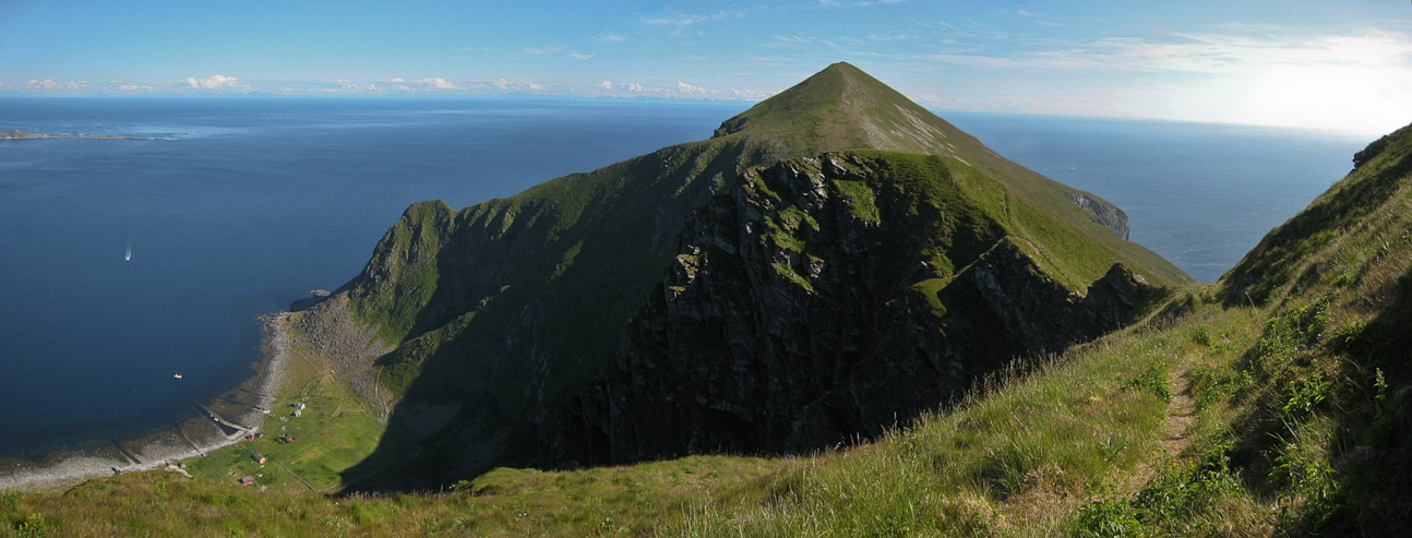
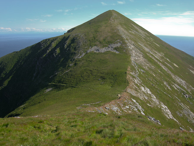
Wendy arrives at the grassy summit at 4:04pm, an hour from starting the climb at Mastad. Haen on the right, Lofoten Islands on the left...
Talk about a quality view! This one surely did not disappoint, even after our week of supreme hiking in Lofoten. Ocean in every direction, green mountains, distant islands, and clear skies. I was glad we all decided to hike up here...
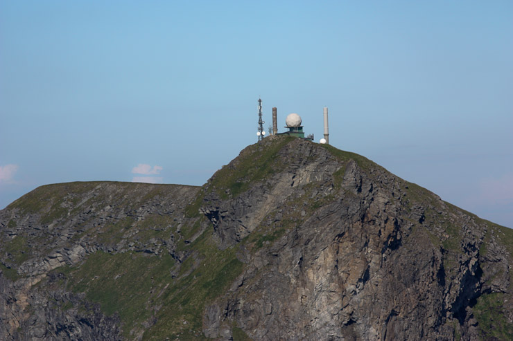
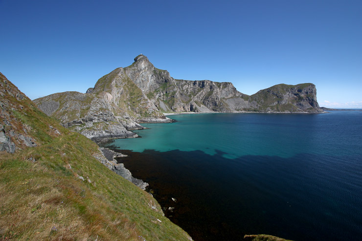
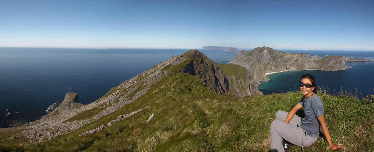
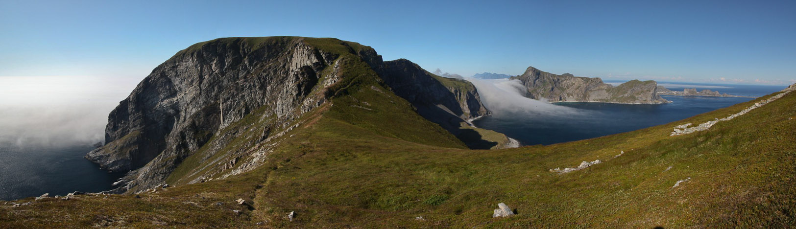
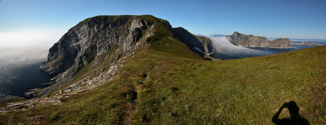
I ventured further ahead, curious if there was a better view near the notch (1st pic). A shot of the NATO base on top of Haen. There's a road that leads to the top, but it's closed to the public...
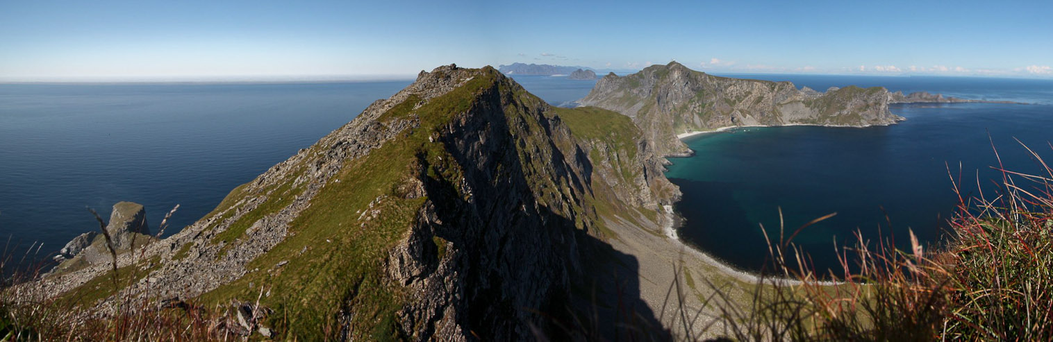
The view from the notch wasn't all that different, but it was enough for me to yell out to Wendy to come check it out. This pic is taken while laying down in the grass along the edge. We started the hike beyond the visible area of the opposite side of the island...
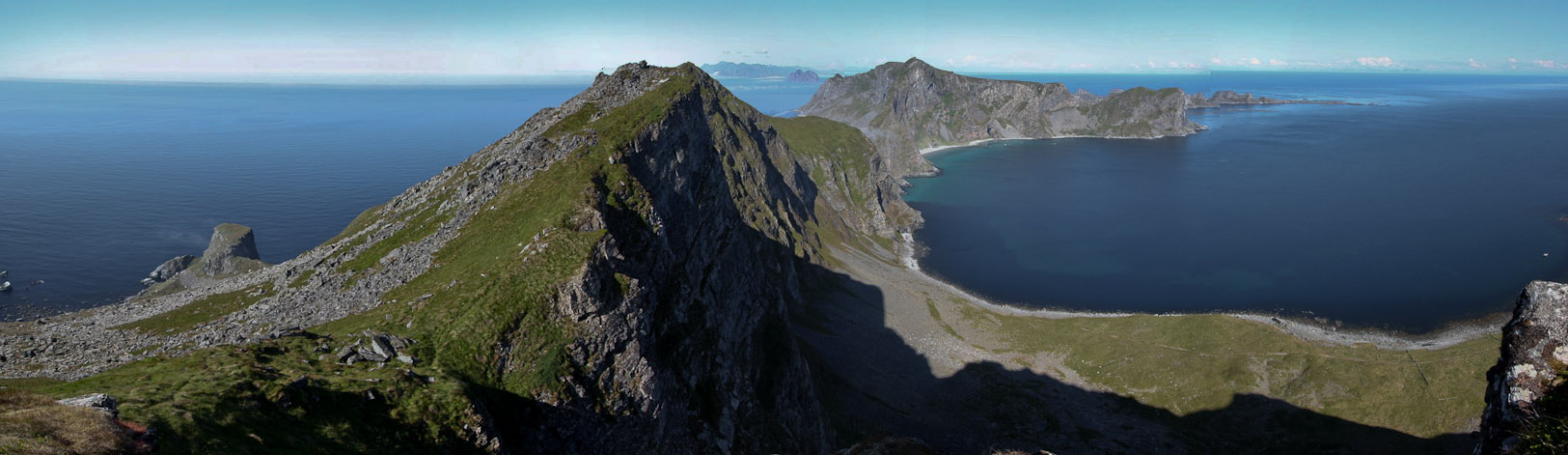
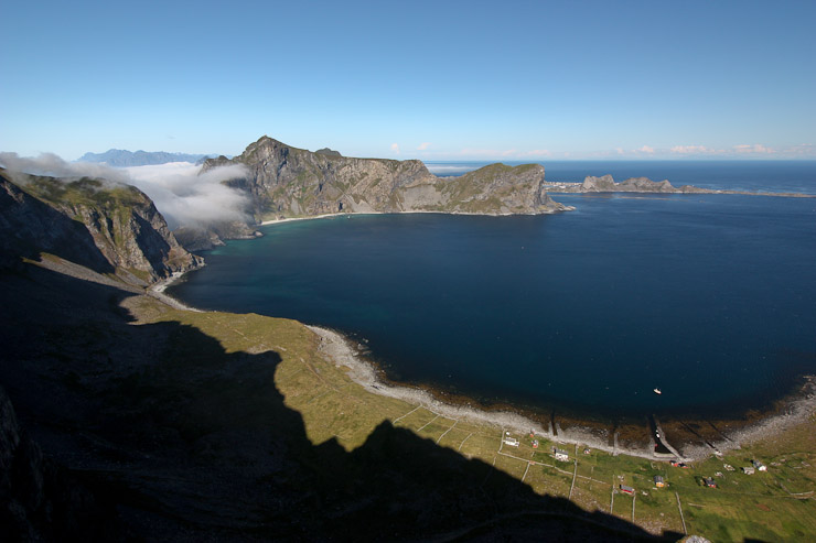
Another pano from here. Similar shot, but too pretty to not use. You can see some of the road to Mastad in the field below, and just before the pass too...
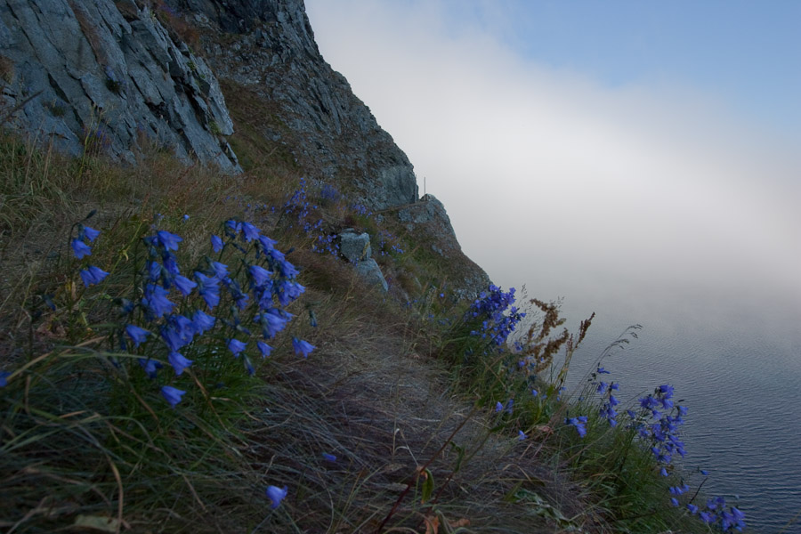
Wendy lies on the soft grass and admires the view. This was a sweet spot to hang out. Some fog is collecting near the pass...
A zoomed in shot of the terrain below. Bands of fog were developing over the sea...
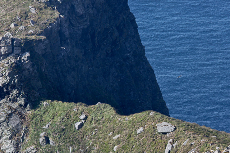
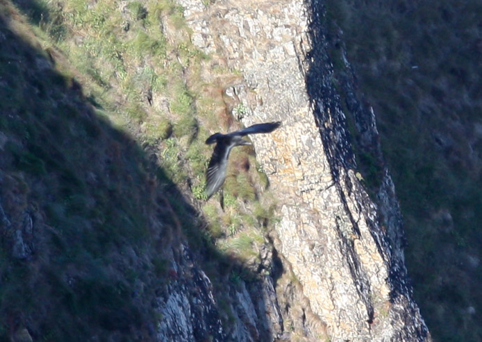
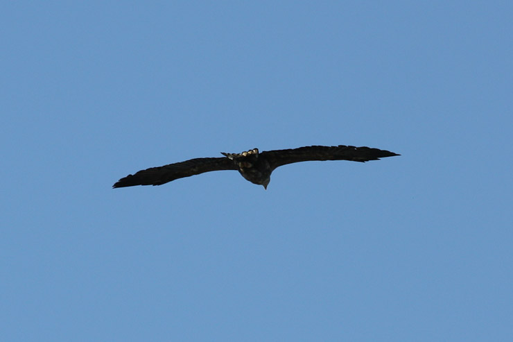
We could see large birds flying along the cliffs below. This must be some kind of eagle. I wonder how large the wingspan is...
After 20 minutes on the summit, we started our descent. Karl and Mariann had already left the summit, seeking shaded areas for Darwin, who gets very hot with a black coat in the sun. More fog was building below...
Me, heading back down to the saddle..
A look down at the town of Mastad. A harbour had been cleared from the rocky beach. A bird...
A great shot of Wendy and the islands of Rost, with my telephoto lens...
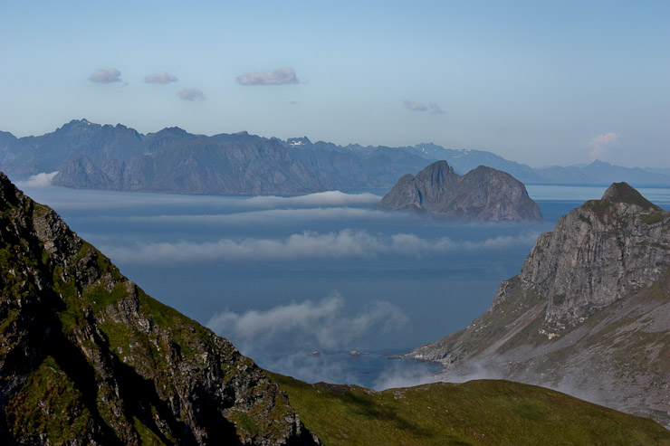
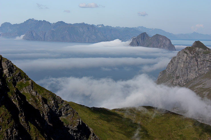
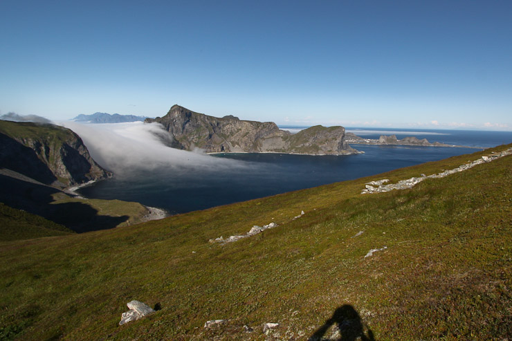
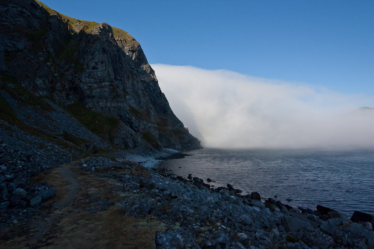
In the north, the fog was thickening quickly, and collecting in the coves along Lofoten, in these zoom shots...
But to the south, all was sunny and bright. Mastad sits on the left, with Mahornet peak in the center. The trail stays to the right of the ridge-top ahead, leading to the saddle...
Fog was colling around Rost too. We continued on the ridge towards the saddle...

A peak north at a notch in the ridge...
A look west from the ridge. Someone was camped at the saddle. What an amazing place to stay! That's a long pack-in, though an excellent trail for a heavy pack...
Wendy checks out a lookout point as we near the saddle. That fog was not dissapating like I had hoped...
Mahornet didn't seem too far away from the saddle, and I considered running up to steal the view, and hustling back to catch Wendy later. However, my legs and brain knew that I wasn't in the same shape I was years ago, and this wouldn't be a "quickie"...
Still, I wanted to give it a try, and Wendy was ok meeting me at the bottom later, so I started heading up the slope. Spot Wendy in the 1st pic, just before leaving view. After a short ways up, I looked back, and saw the impressive, and a bit frightening looking, fog...
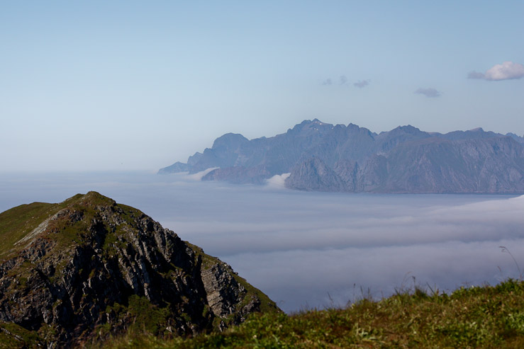
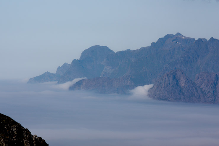
A wide view from above the saddle. We had hiked to the flat-top peak shown. The fog was becoming a force, and looked ready to swamp Vaeroy...
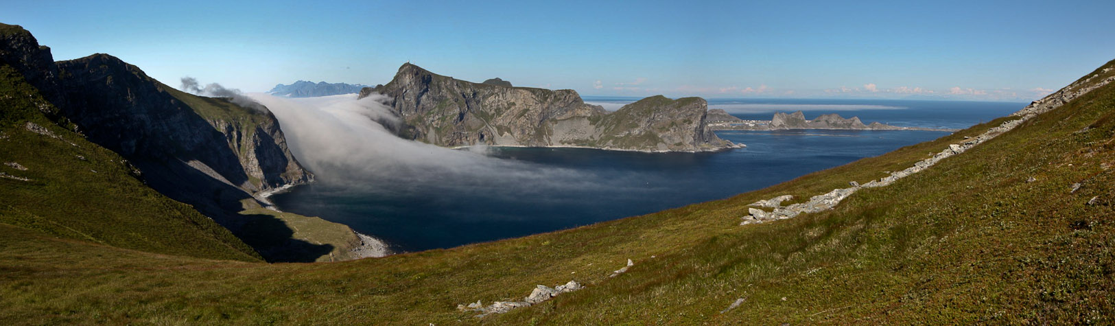
The pass we had to return across was completely subdued by the fog. The fog was noticeably expanding every minute now, and I realized two things: #1. The fog was not going to dissapate, and it was kind of scary looking, so I should probably head back down ASAP. #2. It sure would be an amazing view from the top of Mahornet, looking down over the fog funneling through Vaeroy...
I decided to forego the summit and head back, in case the weather turned for the worse. Still took a bunch of pics though...
The fog was growing a long tail across the bay...
The tail grew longer and thicker, as I hurried down the mountain. I caught up to Wendy just before the bottom...
We were back down at the bottom ~5:15pm, and headed towards the pouring fog. The water pump appeared to be turned off, and the construction workers had all left town...
I wondered if the beachgoers on the far shore were calling for their boat return trip about now...
As we neared the pass, the air was still fairly calm, but it certainly looked foreboding ahead....
When we rounded the corner and reached the pass, a blast of cold moist wind knocked into us. It was time to put on another layer for the hike back...
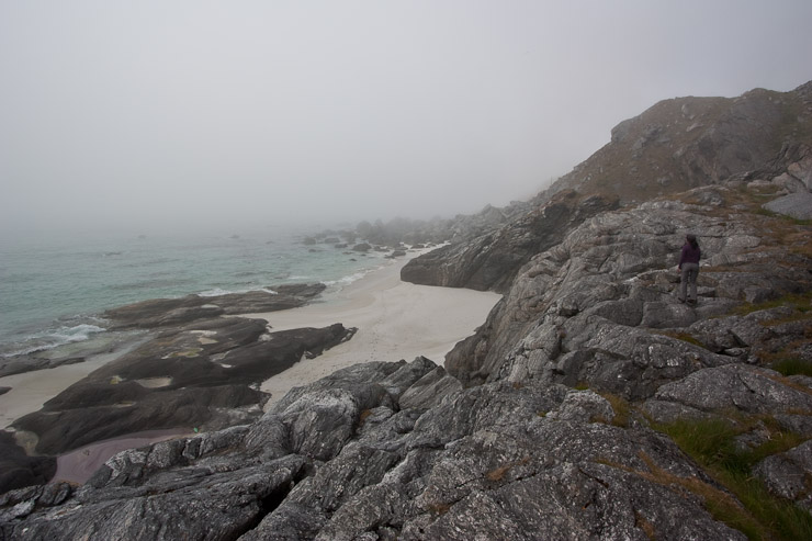
Once we descended along the shore, the wind died down, but the fog was ever present. The super sweet beach had lost it's luster, but I still had to include a couple pics of it...
Karl mimicx profile rock, in this pic from Mariann. It was a LONG hike back along to the trailhead, and we lost the trail for a bit, staying low on the rocky shore, before cutting back up to join the trail on the mountain side. We head lots of bird calls along the way...
After 2hrs on the trail, since leaving sunny Mastad, we arrived back at K & M's camp at 7:15pm. The fog put a damper on our return hike, but at least we had prime views of the spectacular shoreline during the 1st half of the hike. I suppose the fog helped me save a ton of pics on the way back...
We met up with Karl and Mariann at their foggy campsite, and agreed to meet up tomorrow morning at our cottage before heading to the ferry terminal. I guessed that my 2nd hike today would be scrapped, given the weather, but every once in awhile I could see some sun on a nearby peak through a thin patch of cloud. It may still be sunny on the other side of the island, where the trail starts...
We drive back to the cottage (only a couple minutes away), and are HUNGRY! I have some instant potato mix and a tuna fish sandwich, while Wendy cooks up a Pasta Sides salad. We boil the rest of our carrots too, and eat bread with spreads. Later I open a bag of Chex mix brought from the States.
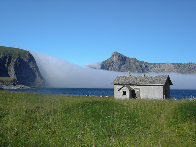
Before our hike to Mastad, I had left a note to the owner saying that we would leave the 400 NOK at the house, if she missed us when dropping by this afternoon. She wrote a note back, saying that we could leave the money, and that it was too bad the fog came in, but this is a common phenomenon on the north side of the island, while the south side stays sunny. That gave us a little hope for our hike to Haen.
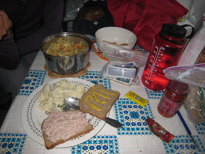
Our dinner of tuna fish sandwich, isntant potatoes, and a pasta salad...
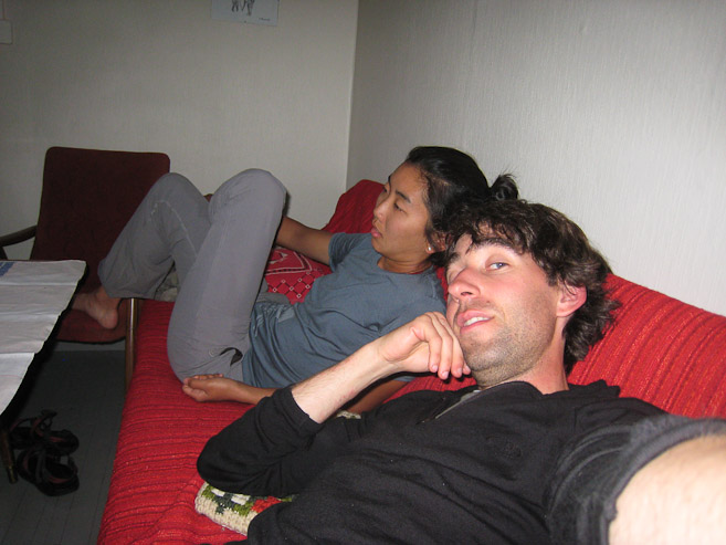
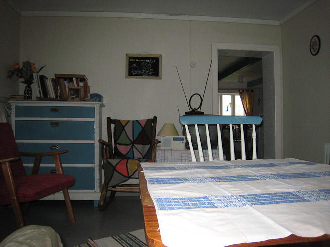
Wendy and I are totally wiped out from our 11 mile round trip hike this afternoon (not to mention all the hikes over the past week). A look at a living room in the house...
Back in the kitchen for bread with spreads, my favorite way to end a dinner. A look in the other living room...
My legs are tired, but it's a long ferry ride tomorrow with zero hikes planned, so may as well attempt hike #2 tonight. I will try. Wendy is considering it too. We can sleep on the 4hr ferry tomorrow. I'm resting now, as I write this journal, but need to decide for sure in the next 15 minutes. One last Lofoten hike? The house thermometer says 10C (50F). I hope there's sun on the south side...
12:10pm, Gammelstua cottage, Vaeroy...
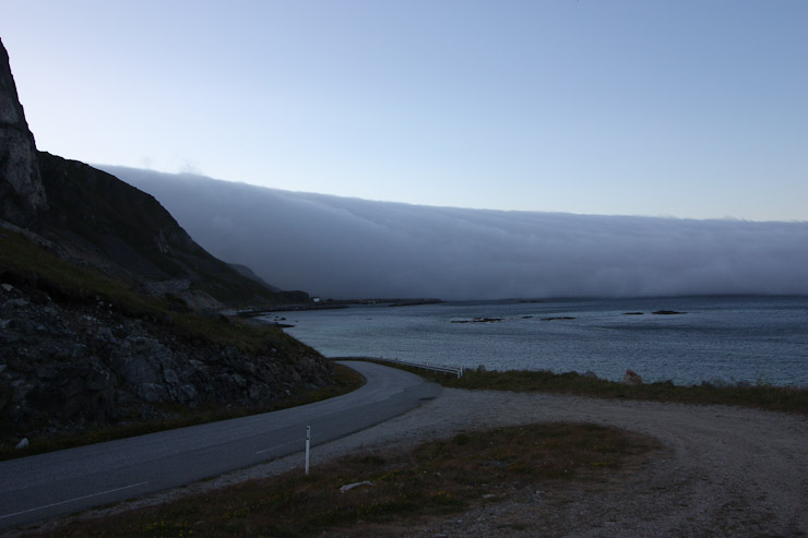
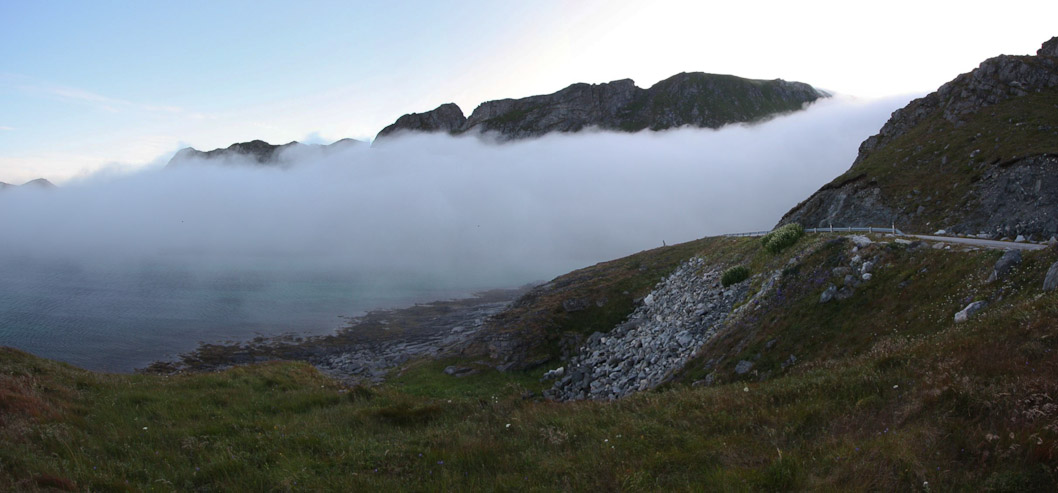
Alas, I would not be doing a 2nd hike tonight. Wendy and I decided to give it a try if the weather looked good on the south side of the island, and at first it looked promising when we emerged from a giant wall of fog to blue skies as we rounded the island, but then soon saw more thick cold fog pouring in fast over the main ridge of Vaeroy. The wind in the fog was strong and cold with heavy humidity. Haen was visible atop the ridge, but the intire trail up was swamped with fast moving fog crawling down the side of the ridge. So we just drove around the island, exploring the town, and noticing all the kids riding bikes, or rollerblading in the empty streets.
A look at the wall of fog that we emerged from while heading to the south side of the island...
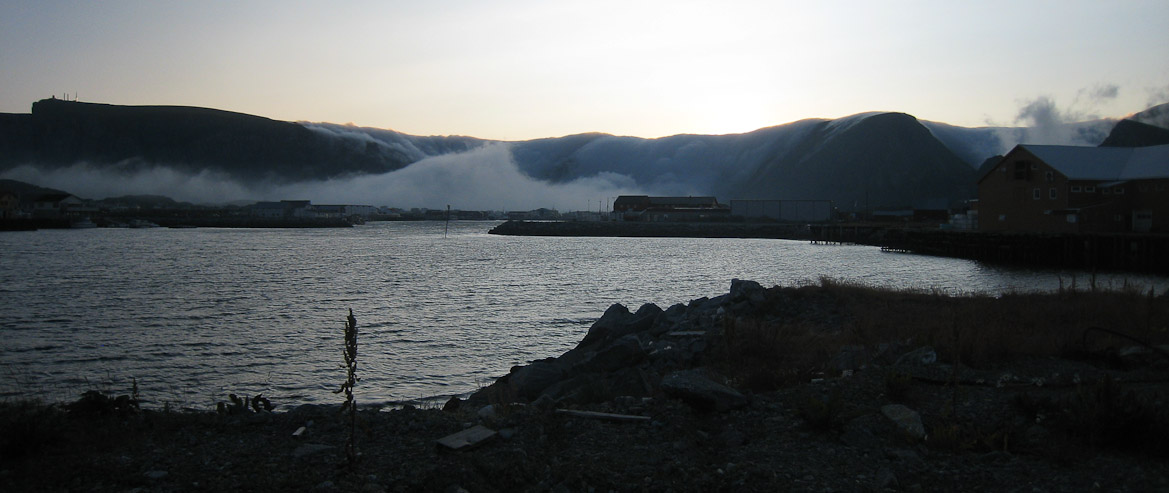
As we continued to round the island, a shoot of fog breached the ridge. We drove through it and on towards Sorland...
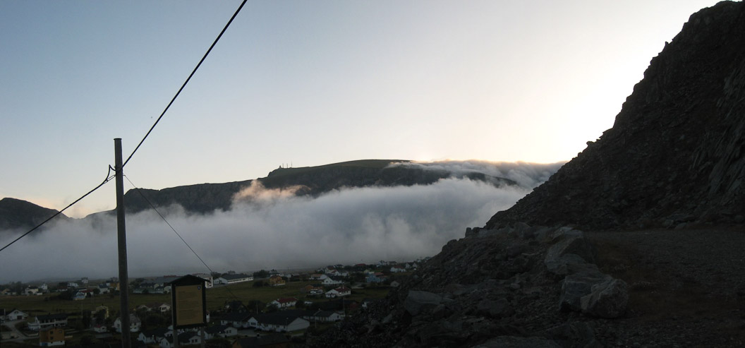
Sorland also had a stream of fog pouring through town. You can see Haen on top of the mountain, but lots of fog in the valley...
More pics of the fog in town...
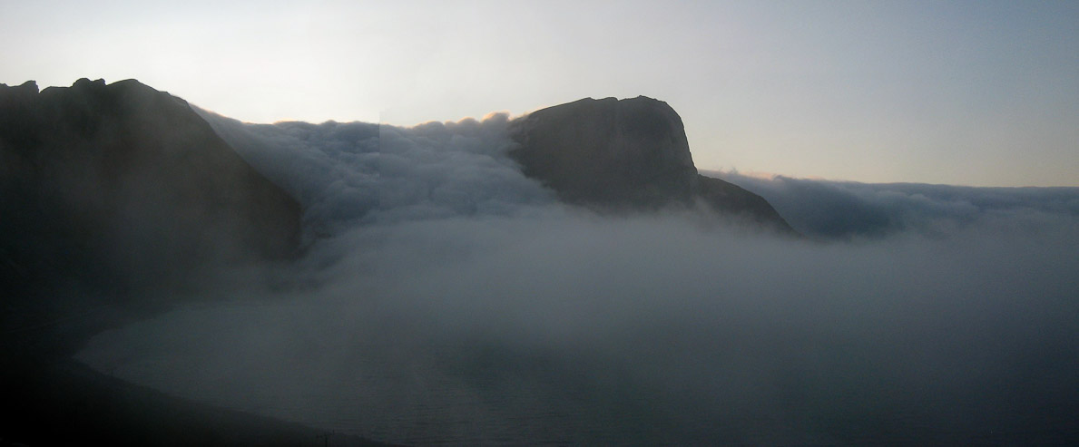
From town we drove to the Haen trailhead, which was socked in amongst the wave of fog pouring down the mounatin. It was very cold and windy in the fog. We bailed, though surely the view from Haen, just above the fog, would have been astounding...
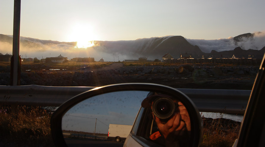
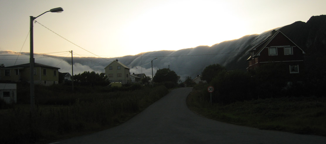
The sun is just above the ridge of fog in this 10:15pm shot from the car. The crawling fog was fascinating...
We drove around town, checking out the ferry terminal. There isn't a lot of road on the island to explore, so we soon headed back to the cottage. Haen sits atop on the left side of this pic. The trail starts from the center, in the middle of the fog.
A look at the pouring fog as we head back to our cottage on the north side...
The foggy weather may have been for the best in preventing the late night hike. My legs aren't in the same super shape they were 5 years when I was last in Norway (as I felt the ache of walking upstairs just now). Time to try out the shower here. Wondering how the fog treated Karl and Mariann this evening on the beach.
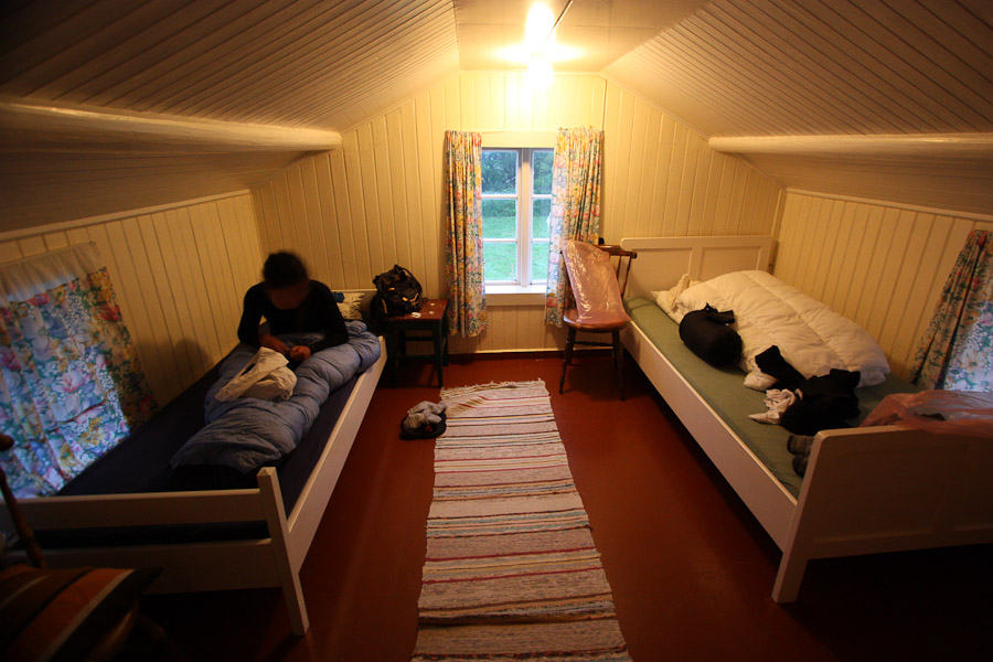
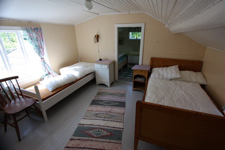
A look at our bedroom upstairs at 1am (still light outside). Turned out we had this entire cottage to ourselves, for just 400 NOK (~$65). Amazing deal! Totally worth all the bumps on my head from the low ceilings...
This is the last night in magical Lofoten! In three days we'll be back in Trondheim. I'm not exactly sure how these last days will play out...
Go to next day
Back to Norway 2009 Trip Home