So. California trip: April 14th, 2010 -- Telescope Peak (11,043')
Maximize browser for best viewing
I was up at 5:18am, despite my 5:15am alarm not going off. Slept great in the driver's seat of my Mazda 3 rental car. Had lots of dreams, including a volcano erupting from the mountain and burying me with flaming debris as I ran down the hill. Active headlamps near the other 2 cars in the parking lot told me that we all had similar time frames to begin today's hike. The car thermometer read 32 degrees when I woke up, and dropped to 31 by the time I got out of the car. I took a quick look at the Charcoal Kilns, and began the hike up the closed 4x4 road to Mahogony Campground at 6:15am. One hiker had already left 20 minutes ago, and 2 other hikers were prepping their packs with skis.
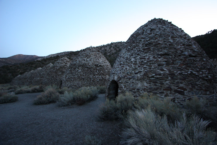
The charcoal kilns are a scenic tourist spot, and also marked the road closure point on the road leading up to Mahogonay Campground, the true trailhead start for Telescope peak. This meant an additional 4 miles and 1100' gain to the official 12.5 mile, 2900' roundtrip hike. It'll be a few more weeks before all the snow melts on the road...
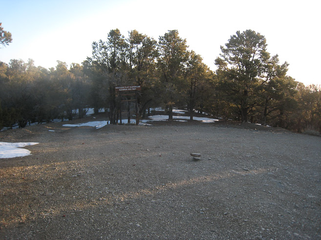
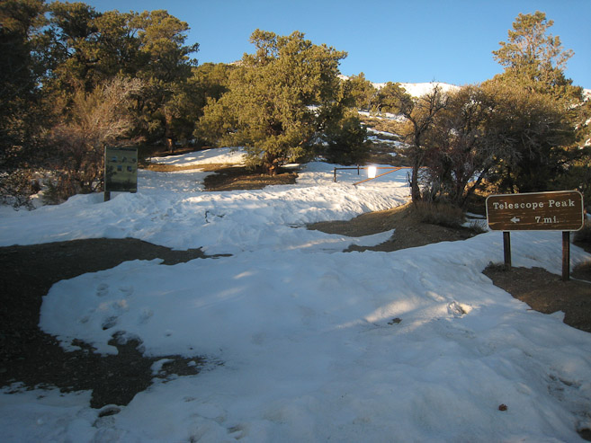
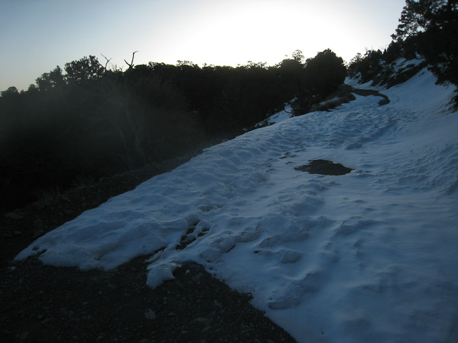
I reached Mahogonay campground at 6:50am, and found the official trailhead for Telescope peak. I followed footprints that led up the service road on the right, however, later found out the official trail through the gap near the sign on the left...
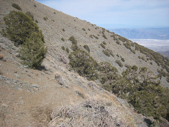
I followed the service road, thinking I was on the trail, but after 15 minutes I checked my map and realized this road led to Rogers peak. So I cut up to the ridge, in an effort to pick up the correct trail...
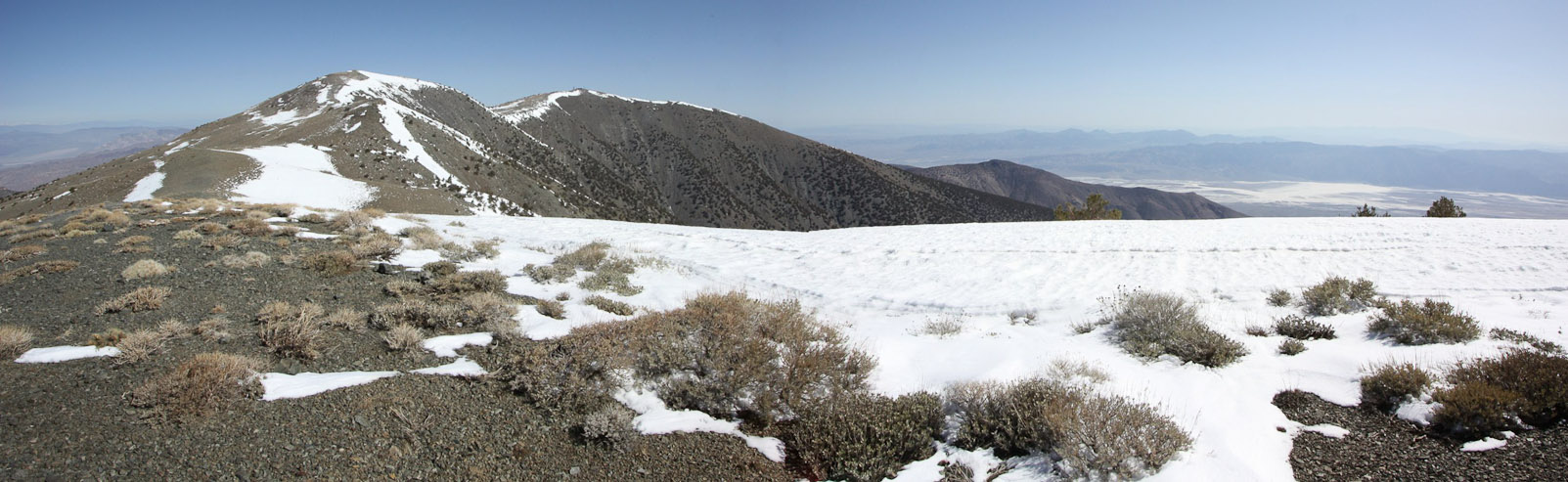
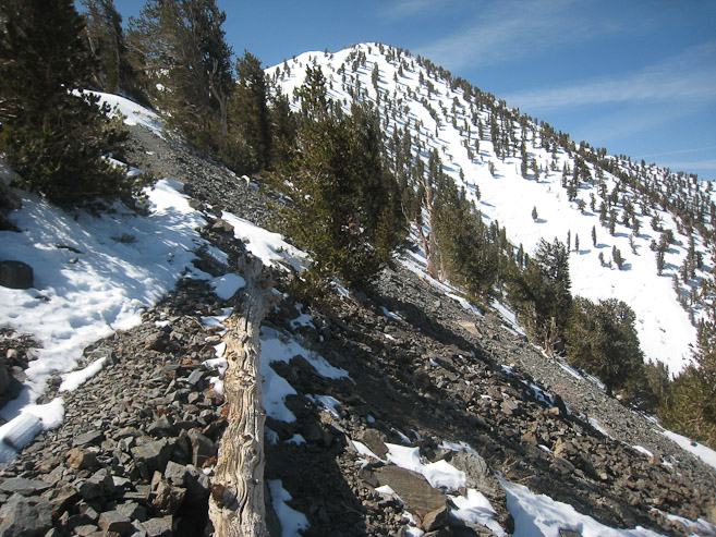
When I crested the ridge, I saw Telescope in the distance, Roger Peak in front of me (with the radio tower), and Bennet Peak in between the two. My best course would be to climb Rogers, and descend down the ridge towards the saddle with Bennet. The true trail bypasses Rogers on the south, heading straight to the saddle with Bennet...
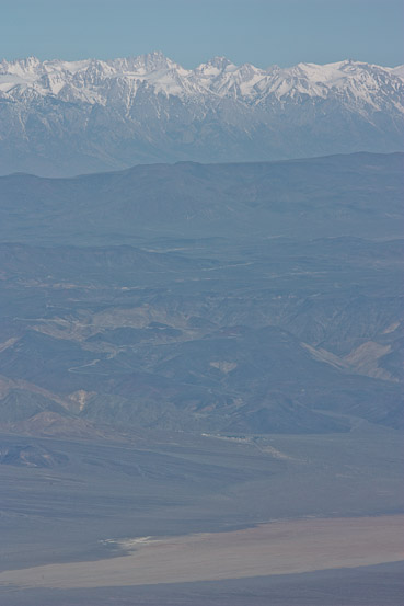
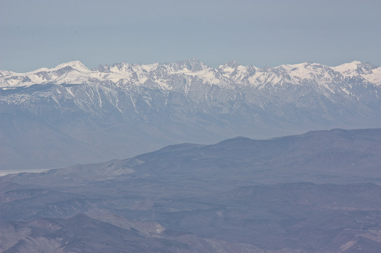
Rogers Peak wasn't on my agenda, but made for a nice detour, and even a short-cut (at the expense of 300' additional gain). It was very windy on Rogers, so I sat behind a cabin, and took pictures of Mt Whitney to the northwest...
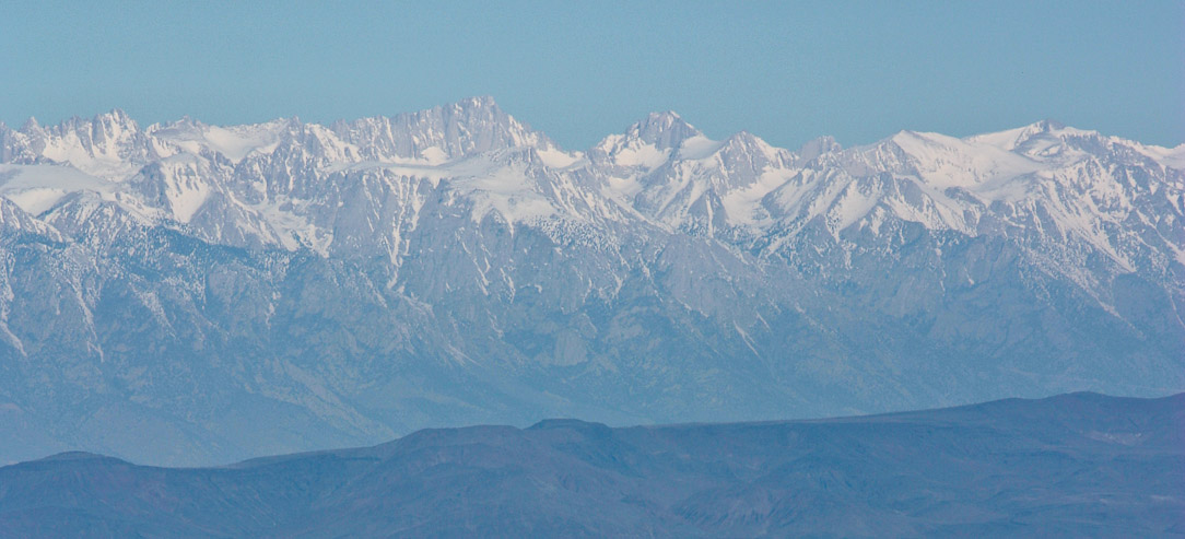
A close-up of Mt Whitney (14,494') from Rogers. I planned on summiting Whitney on Saturday...
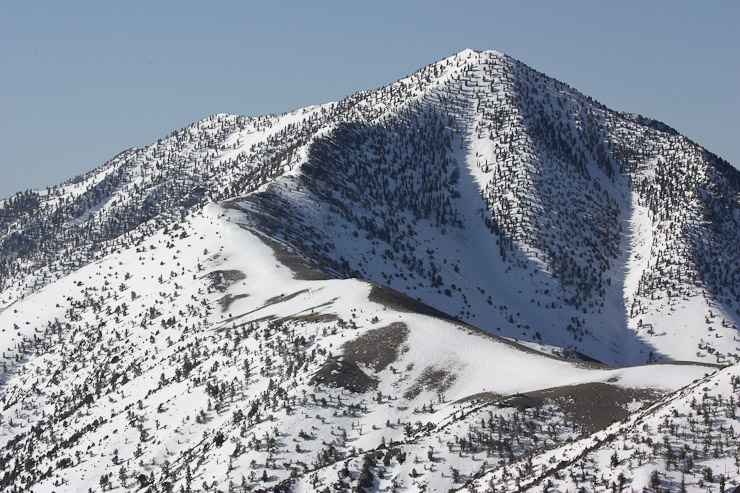
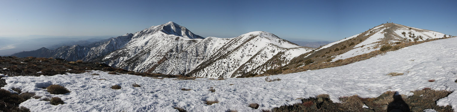
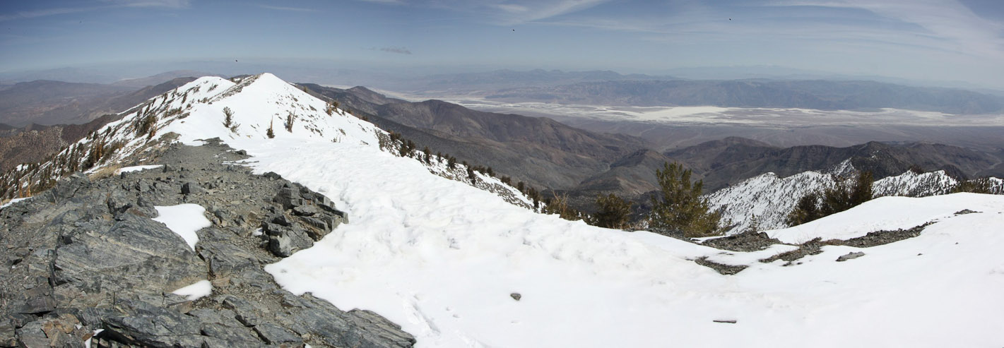
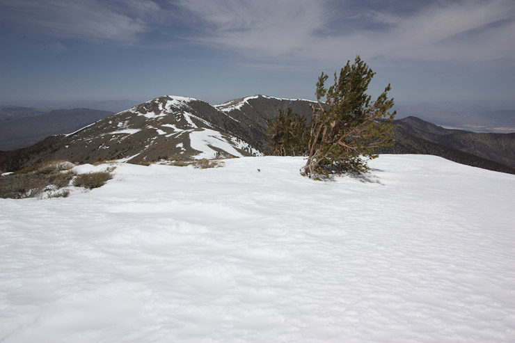
A look at Telescope Peak from Rogers. After a snack on Rogers, I descended down to the saddle, converging with the true trail...
At the saddle, I decided to stick to the trail and bypass Bennet on the right side, rather than climb straight over...
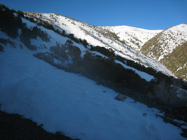
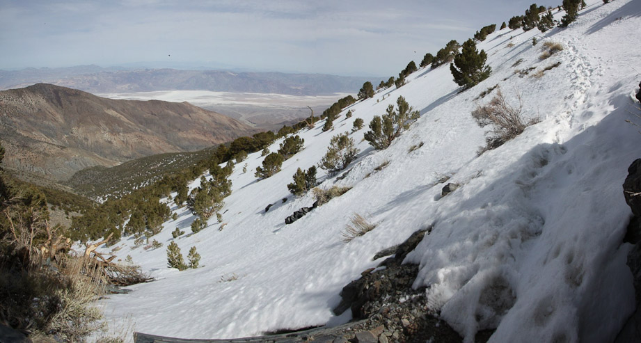
The west side of Bennet had lots of snow...
I had been fine wearing boots and using poles so far, but this section of steep snow slope was ice hard, and I put on my crampons to cross safely...
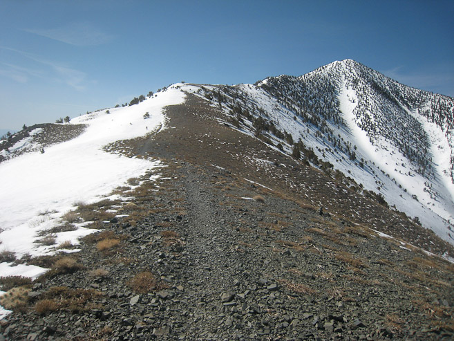
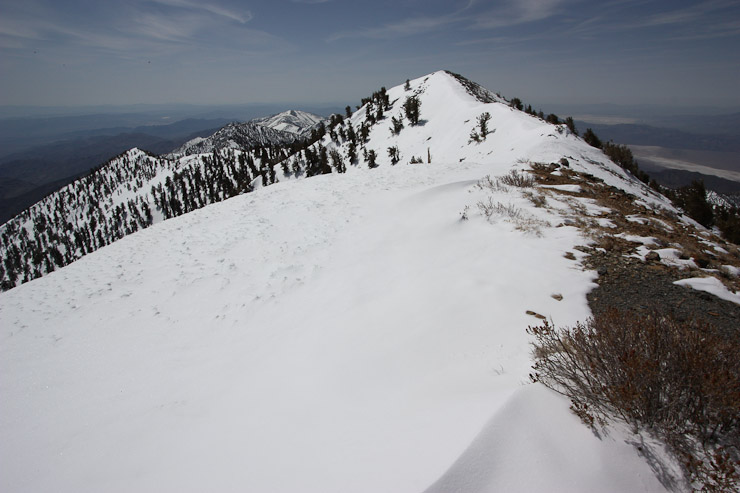
As I rounded Bennet, Telescope re-appeared ahead on the ridge, and the snow dissapeared, so I removed my crampons...
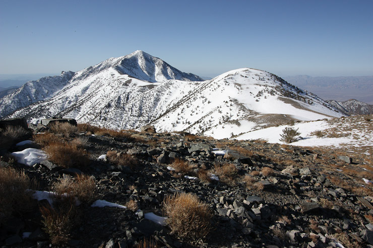
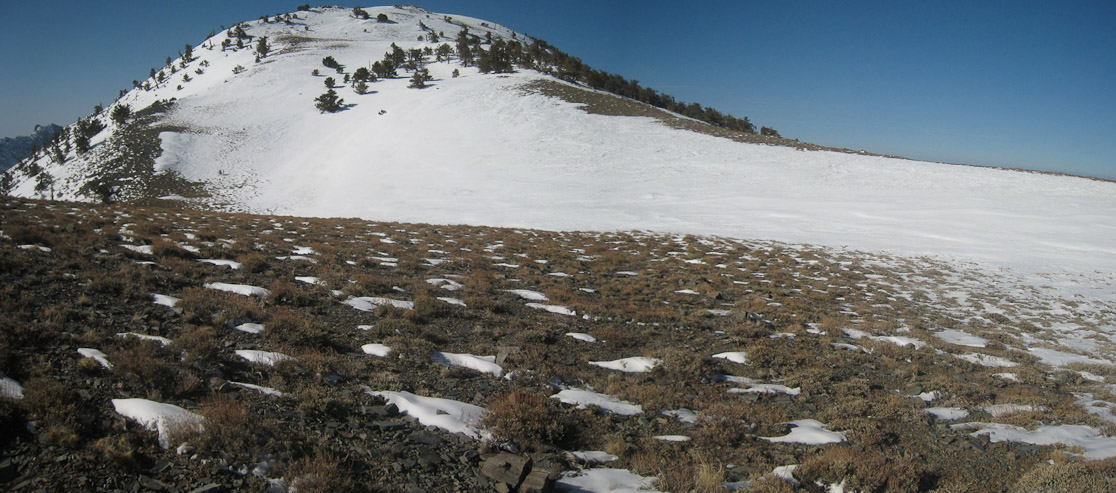
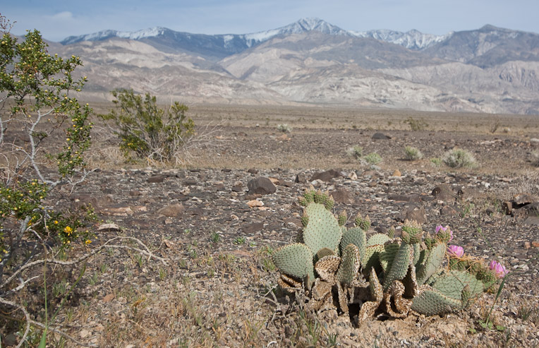
Looking back at Bennet (which I skirted to the left of) and Rogers (which I summitted). Badwater is in the valley to the right...
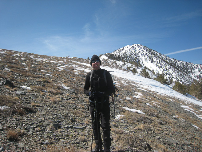
It looked like Telescope was just an easy, fairly gentle, ridge walk to the top, but my map said there was still 1300' gain to go. I caught up with the hiker who started earlier today, Trevor, who took my pic. He bypassed Bennet on the opposite side, hoping to avoid snow, but said it was time consuming, and would return on the main trail...
The wind was gentle on the ridge, and soon snow took over the crest. The snow was still firm enough to avoid post-holing, and soft enough for me to get away without using crampons...
I stuck to the right of the ridge, following a partially dry trail. Trevor stuck to the snow, as he had on crampons...
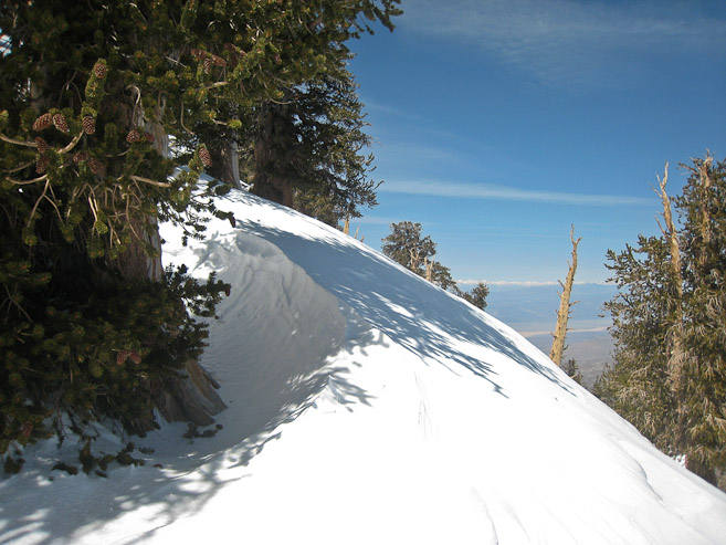
Eventually, the snow thickened, and I climbed back along the ridge. There were some cool small cornices along the ridge...
At this point, the snow firmed up a bit, and the slope ahead became steeper, so I laced up my crampons...
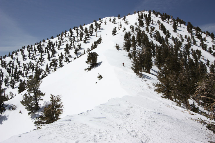
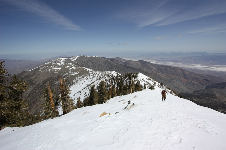
Trevor starts the final climb ahead. I soon caught up, and took a pic looking back at him. This ridge was sweet. Plenty wide to feel comfortable, and very scenic...
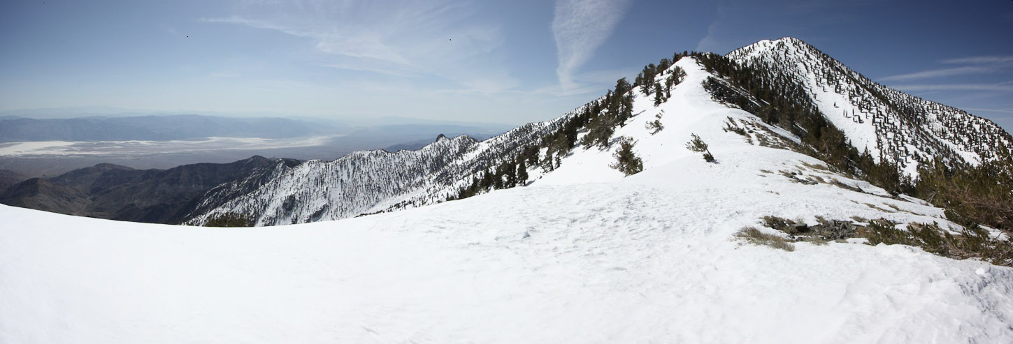
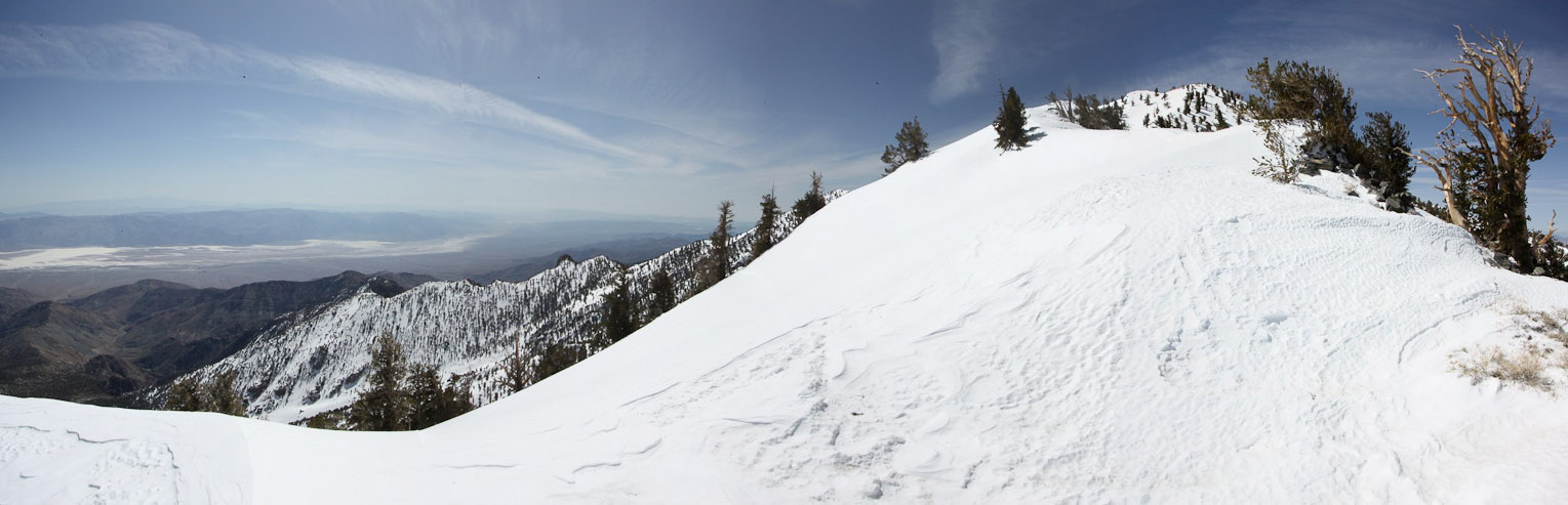
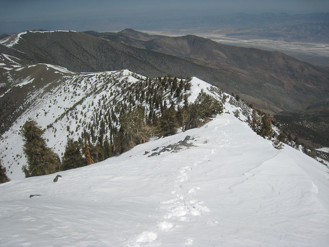
Lots of snow up here ~11000', and no foot prints in the snow. Trevor said the true summit was only 100 yards after the false summit ahead. The final 700' of climbing was a slog up the snow...

After cutting across the top of a bowl under the false summit, I reached the final 100 yards to Telescope. Looking back, Trevor is entering the final snow climb of the day...
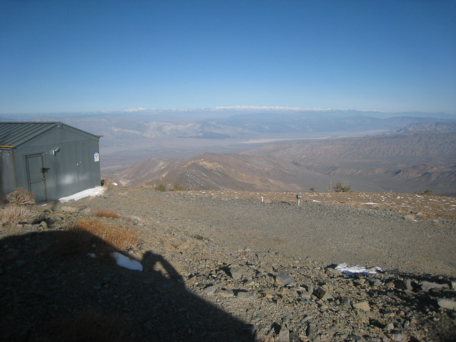
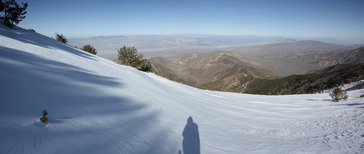
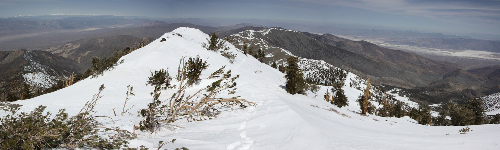
I reached the summit at 11:35am, 5hr and 20 min from the start, including a side trip to Rogers Peak. This look to the north shows the false summit and Badwater in the valley to the right...
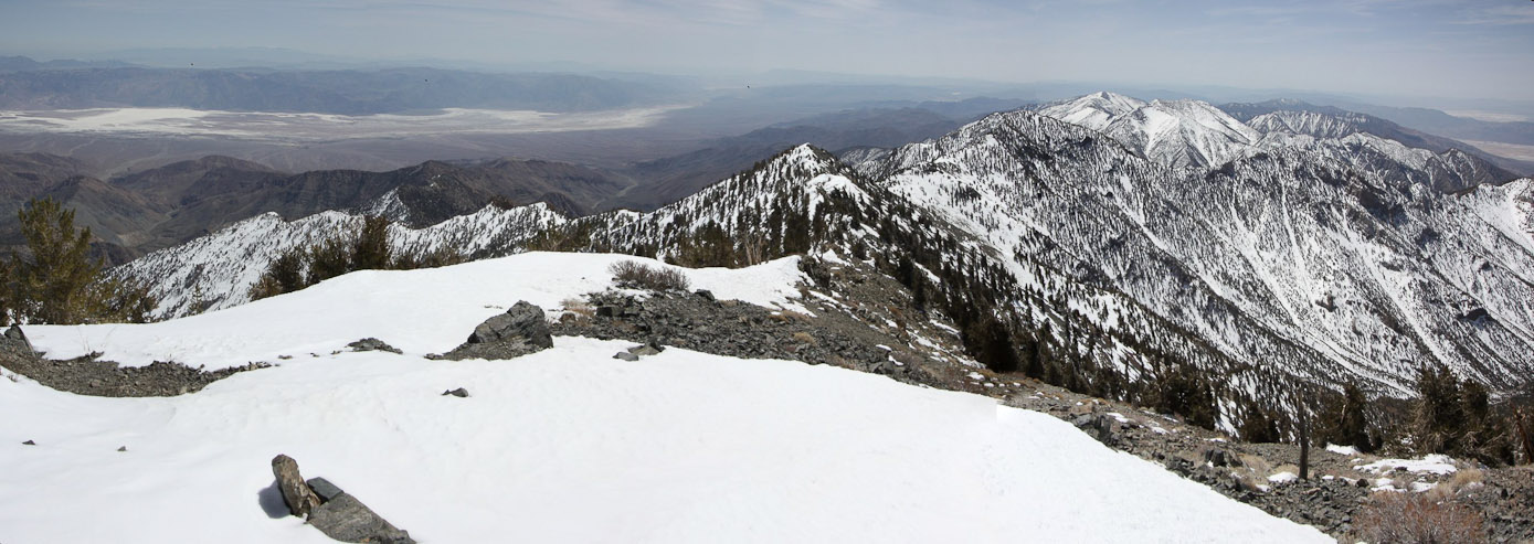
Here's the summit view to the south (with Badwater on the left)...
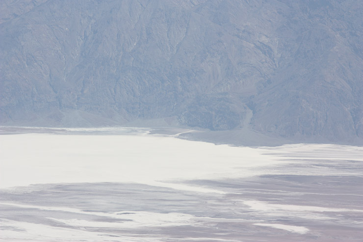
A close-up shot of the lowest point in N. America, and the highest point in the 48 states, while standing on the highest peak in Death Valley...
Trevor joined the summit shortly, and we both relaxed for awhile. The wind was light and temps were probably in the low 40s. Trevor had been up here in dry conditions before, and came from Las Vegas yesterday to give it a go under the great spring weather conditions today. The summit register was only signed by 6 people in April (including the 2 of us), and no other names since January. This must not be a popular winter peak.
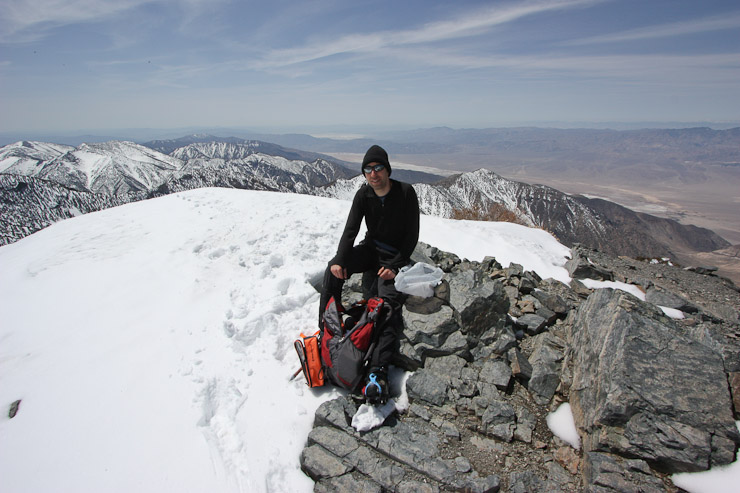
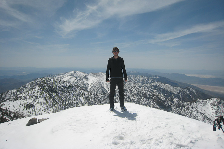
Trevor and I each took summit pics of each other...
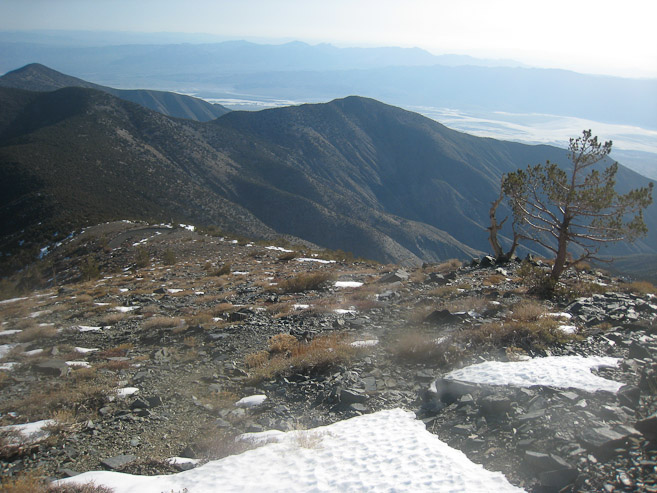
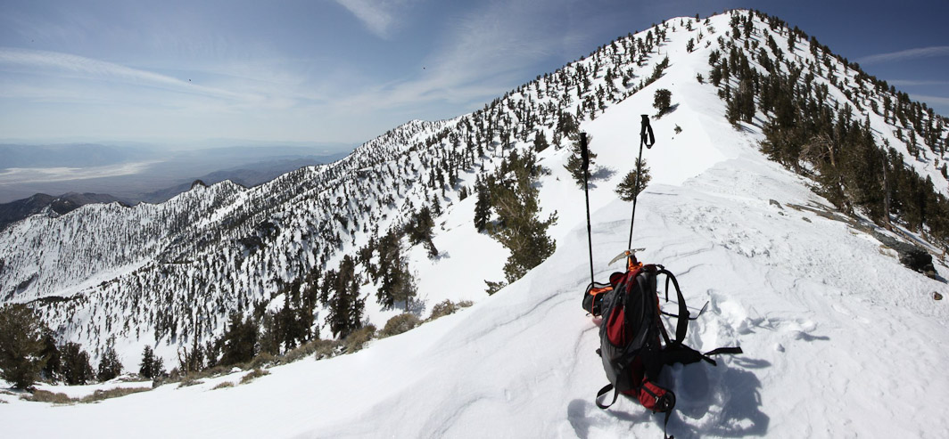
After eating some snacks and a peanut butter & trail mix tortilla roll-up, and started the descent at 12:05pm. Ahead I could see our footprints across the bowl. Bennet and Rogers were small bumps far away on the ridge, which I'd need to re-visit on my descent...
Hiking down the ridge was great. The snow was soft enough to heel step down the ridge (sometimes a little extra kick needed to break through)...
I passed the other 2 people on the trail, about 1000' down from the summit. A man and woman had ski's strapped on their pack, which looked heavy. We chatted a bit, and agreed the backside of Bennet was icy this morning (where I used my crampons). Didn't seem like many good ski opportunities on this hike, since the ridge was pretty narrow, but I wished them luck and continued down.
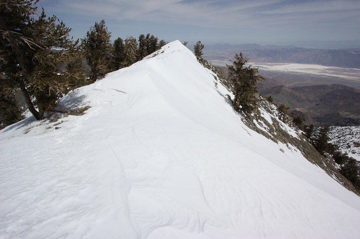
I decided to hike over Bennet (mound in first pic) on the way back, to avoid the snow, and take a more direct route. I thought it was just 200' of extra elevation, until half way up when I checked my map again, and found it was 400' extra. A look back at Telescope from the summit of Bennet...
Ahead I could see the main trail cutting below Rogers peak. Long stepped down the snowy gently north side of Bennet towards the saddle to sync up with the trail...
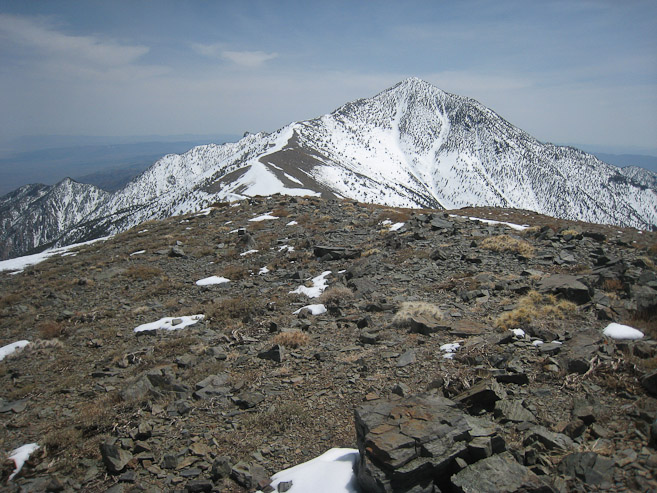
A look back at Telescope after reaching the main trail. The trail cut across the side of Rogers Peak...
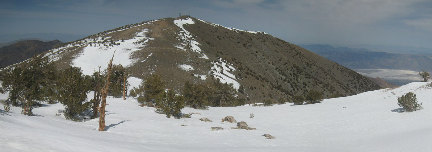
So this would be the first view of telescope if ascending the main trial. Bennet is the large bump on the right side of the ridge...
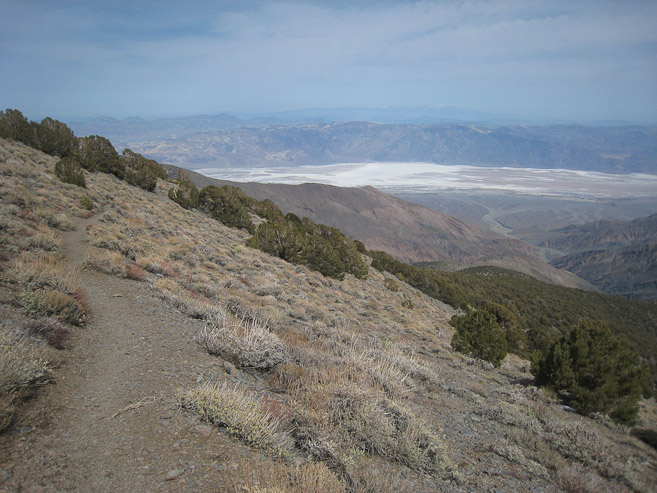
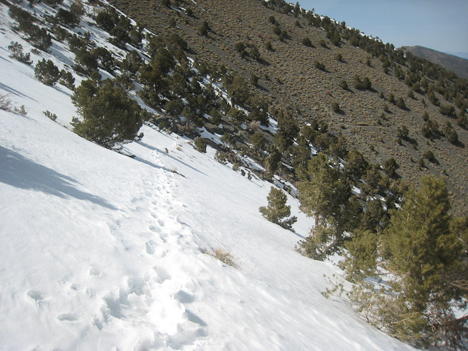
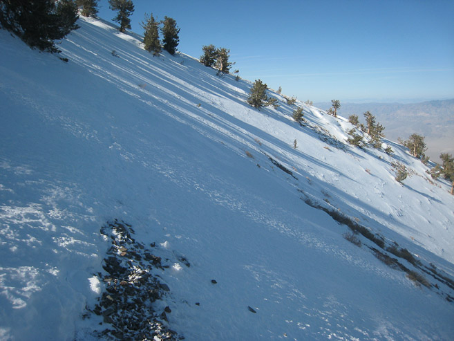
The trail took a long time to bend around the long arm of Rogers, and have good views of Badwater. I was surprised to run into large snow patches here after a long stretch of dry trail...
These snow slopes were fairly steep, and I imagined they might need crampons when frozen in the early morning. I managed fine in my boots, with my poles...
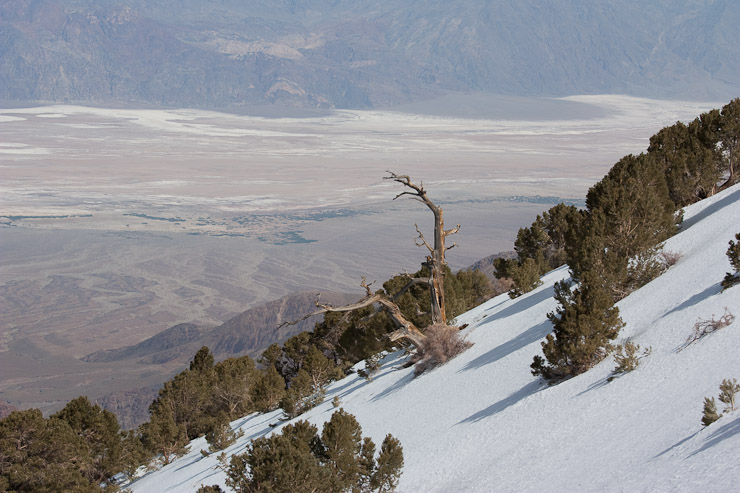
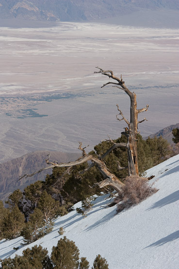
I caught this cool looking tree out of the corner of my eye, and tried to turn it into a photo-op...
I arrived back at Mahogony Campground at 3:15pm, and sped down the 4x4 road to the Charcoal Kilns, jogging at times, reaching my car at 3:38pm. A 9hr 23 minute hike with ~16 miles and ~5,000' gain. I felt good, and my infected blister on my heel from the past week caused no problems. Triumph! I'm all warmed up and ready for Mt Whitney!!!
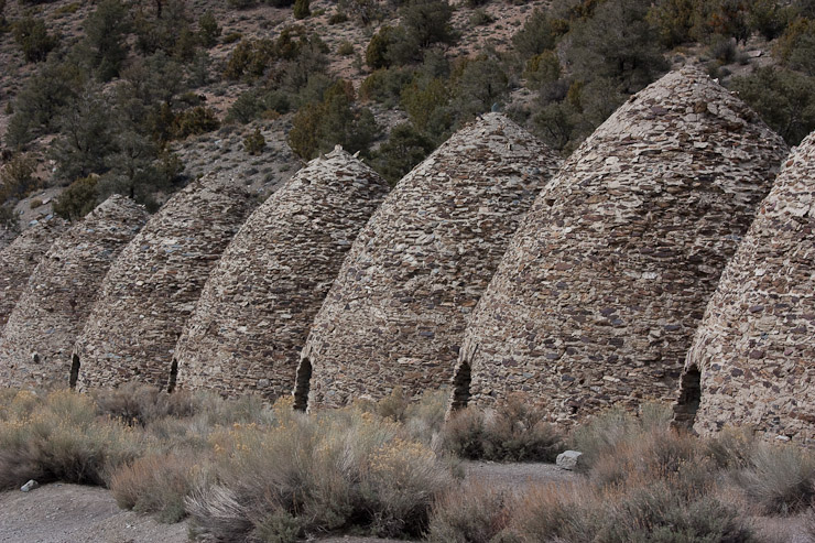
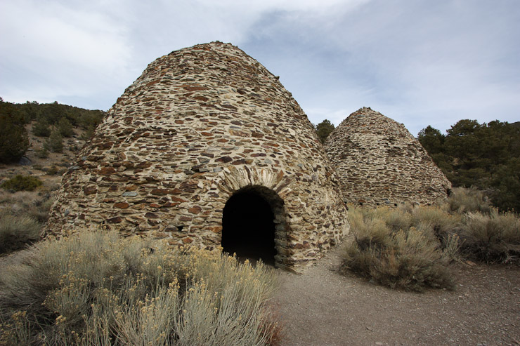
A couple shots of the Charcoal Kilns...
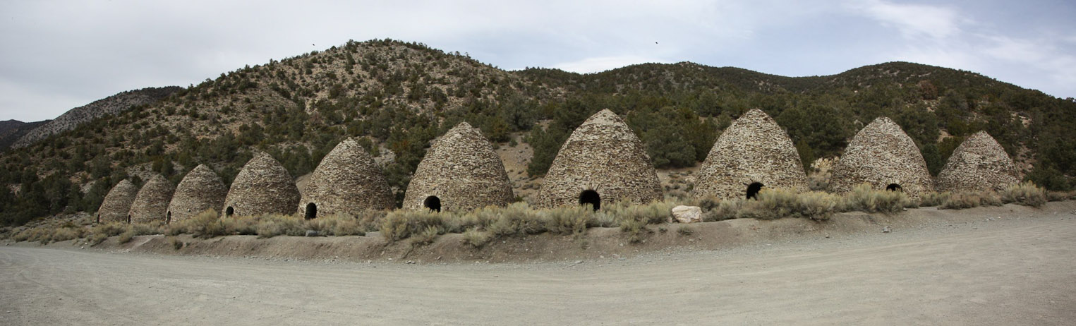
A wide look at the ten Charcoal Kilns, from near my car..
I was pumped from such a succesful and enjoyable hike, and even more excited to head towards the Sierras, which looked so impressive from atop the ridge. I had planned to spend another day in Death Valley, but decided to head straight to Lone Pine tonight and get another day in the mountains there. After storing my gear, and changing into flip-flops, and took off down the gravelly road towards the Sierras, with incredibly high spirits. Little did I know, that I made a VERY BAD mistake at the time, which I wouldn't find out til the next day, when I looked for my hiking boots, and COULDN'T FIND THEM ANYWHERE! I think I left them on the ground, or had them on the roof of my car when I drove off. I'm hoping Trevor found them and picked them. I had mentioned I'd post this trip report on 14ers.com, where he could check it out, which means there's hope of re-connecting with him (if indeed I lost my boots in a noticeable spot that he assumed were mine, and knew how to reach me this way).
Trevor, if you happen to have found my boots at the Charcoal Kilns after I left, can you email me at mjtracz20@hotmail.com?
Obviously this mistake of mine would result in repercussions the rest of my week, but for now, I'll continue this web journal oblivious to this dreadful occurance.
The drive to Lone Pine was gorgeous. I found pretty flowers along the road, and stopped many times to take photos of Telescope peak from the west side. The road led down to a valley, and then up a large scenic mountain pass that was chock full of Joshua trees. I stopped a dozen times for pics, and enjoyed the late afternoon sun.
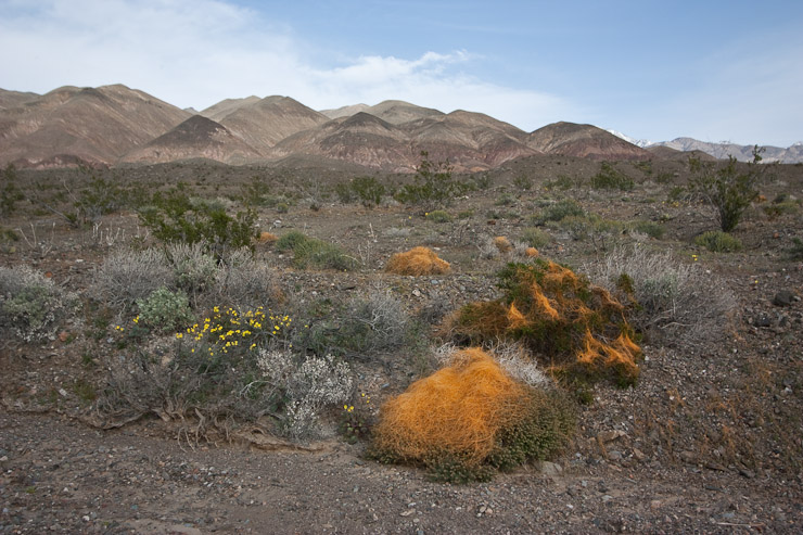
I'm still not sure what this orange fuzz is. It looks like it was blown around and collected on top of a plant, rather than grown straight from a plant. Regardless, it was pretty... UPDATE: I've been informed the orange growth is a parasite called "Dodder", and tends to get spread around on vehicle tires (thanks jimqpublic).
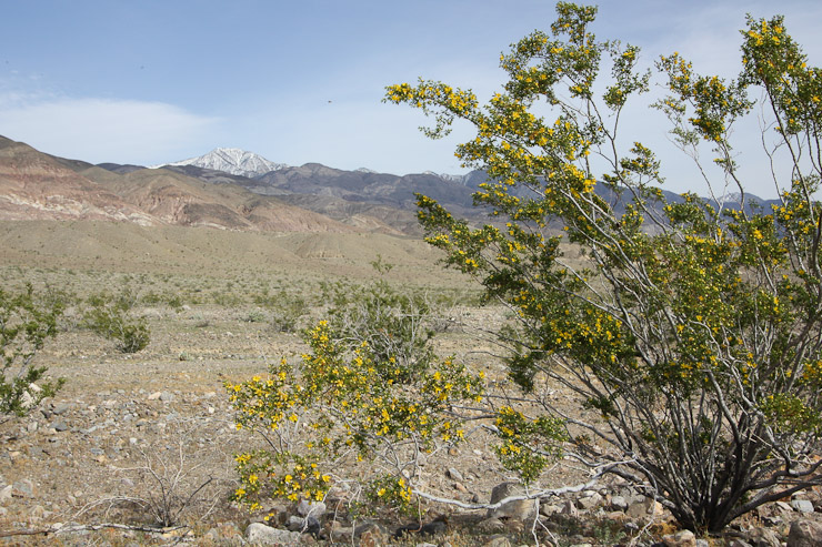
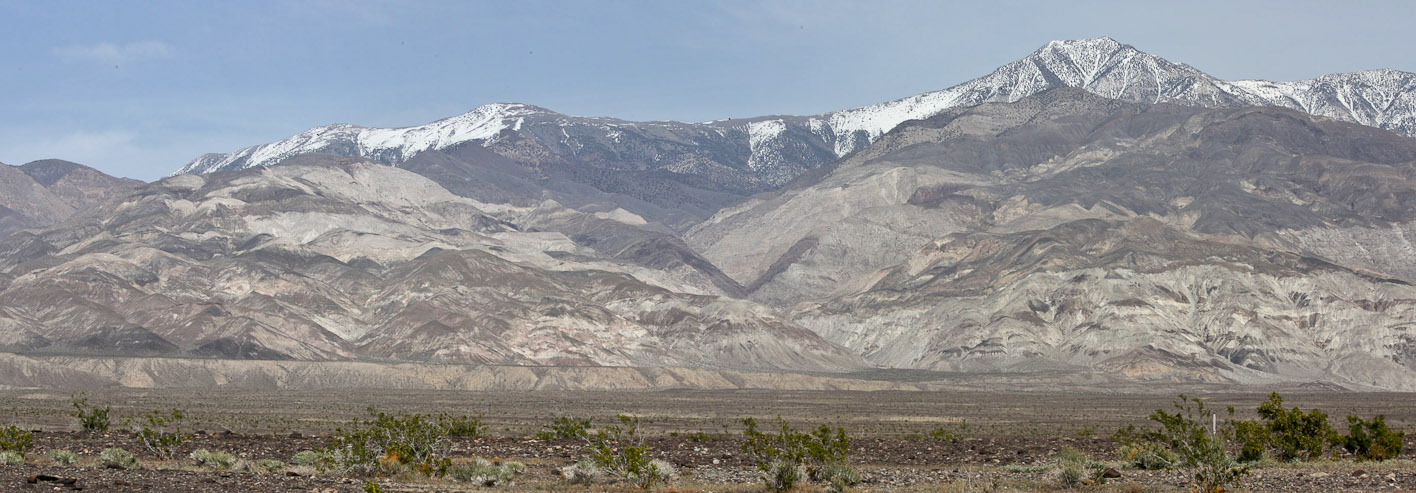
A couple of pics of flowers along the road, with Telescope Peak in the backdrop...
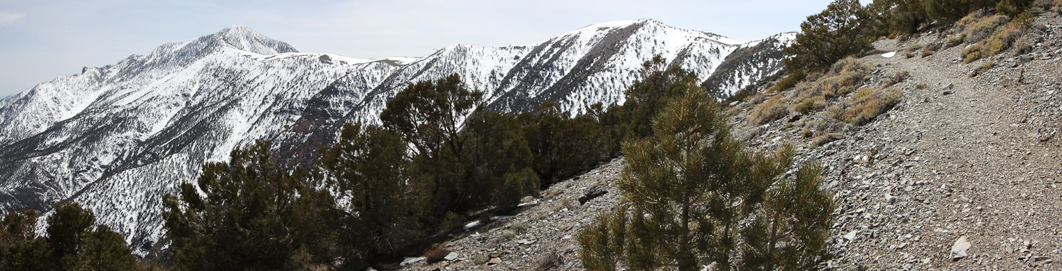
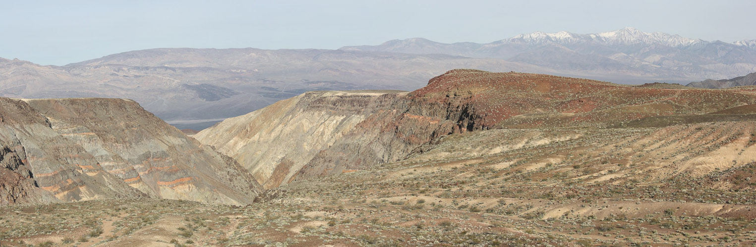
A zoomed in pano of the ridge containing Rogers, Bennet, and Telescope Peak, from the valley floor...
A very scenic road climbed a mountain pass, offering many opportunities for me to stop and takes pics of Telescope Peak...
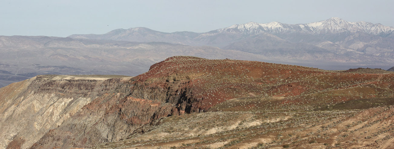
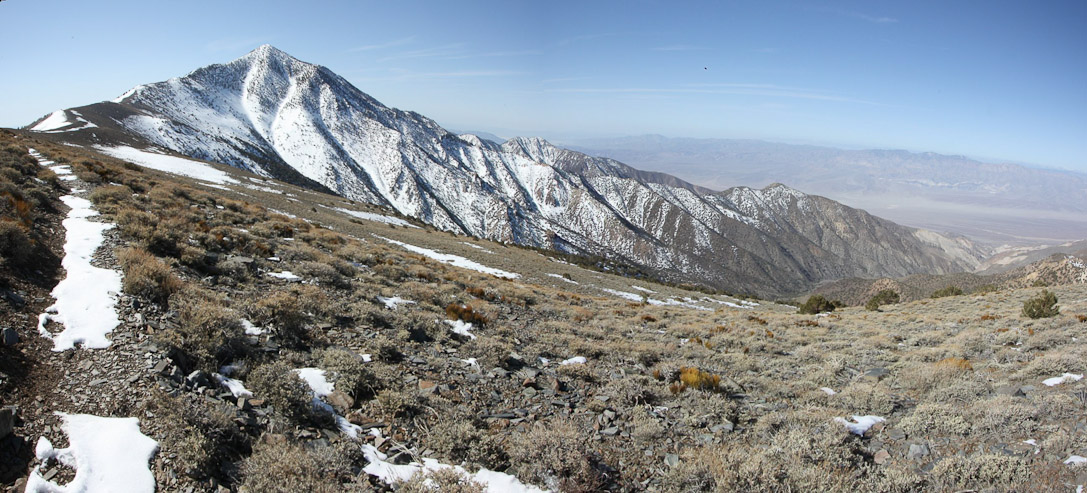
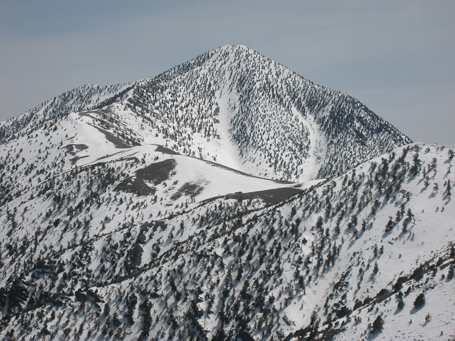
The colored rock was fascinating too. Rogers and Bennet Peak are the two smaller bumps to the left of Telescope...
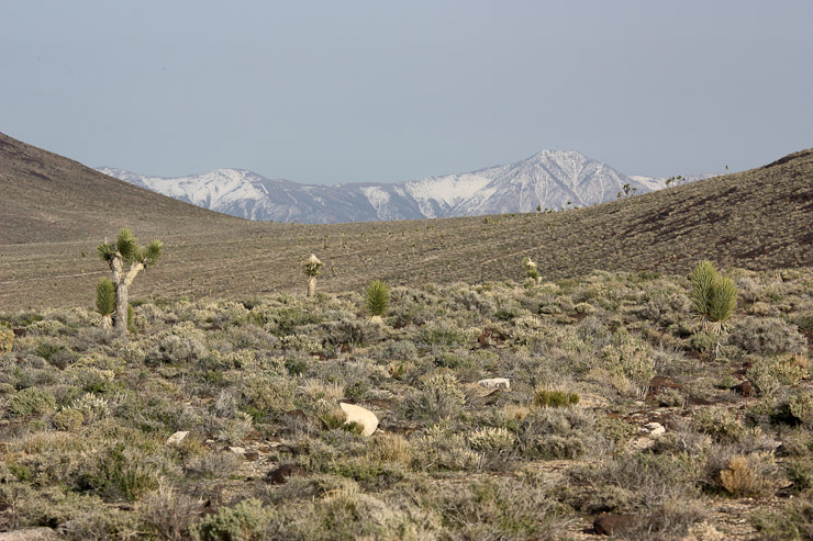
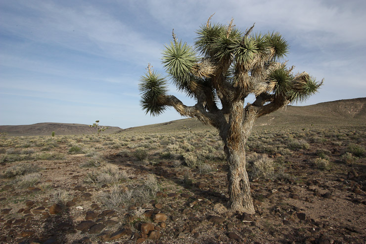
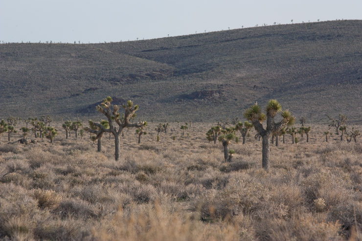
At the top of the pass, I noticed some odd shaped plants, and soon realized they were Joshua trees. I stopped several times to take photos, most of the time not leaving my car. Telescope Peak is visible in the first pic...
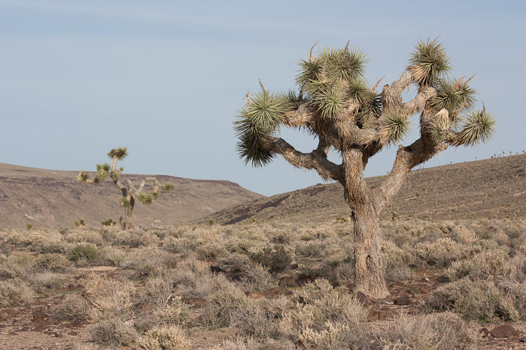
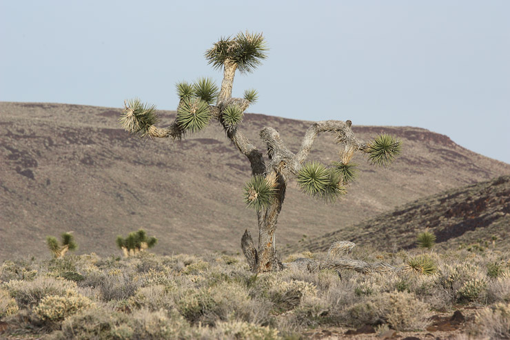
For this tree I stopped and walked over. The first pic is using a telephoto lens, and the 2nd pic is using my wide angle lens. Notice our much farther away the tree and horizen is with the wide angle (and how much more background fits in)? Interesting comparison...
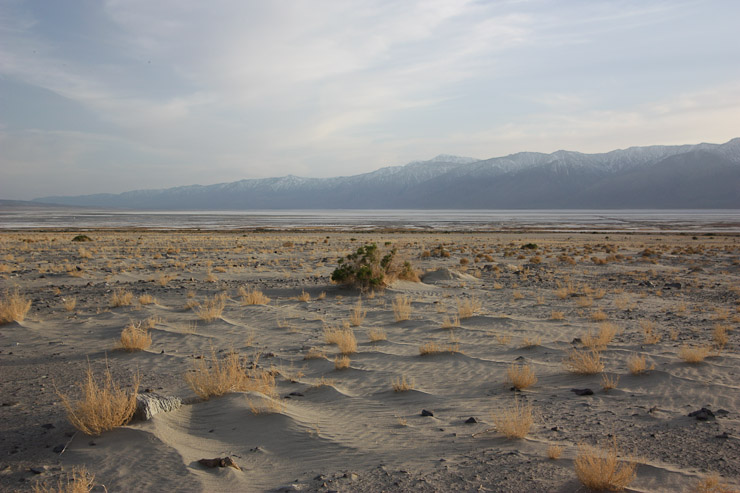
After getting my fill of Joshua trees, I drove down into a valley and found myself staring straight into a wall of Sierra mountains. I pulled over and setup my tripod in the sand to take some sunset pics...
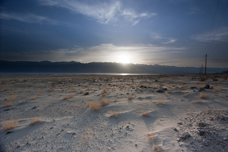
I used a ND-grad filter for these shots. Couldn't figure out which one was better, so posting both. I was on a constant lookout for rattlesnakes when running back and forth to the car for camera supplies...
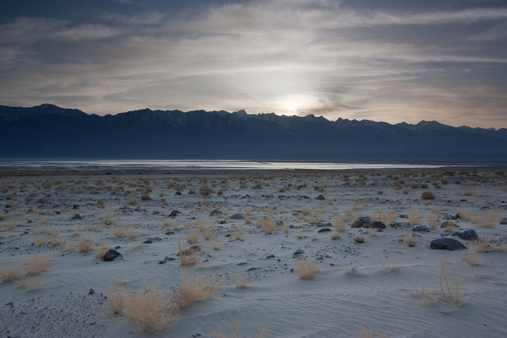
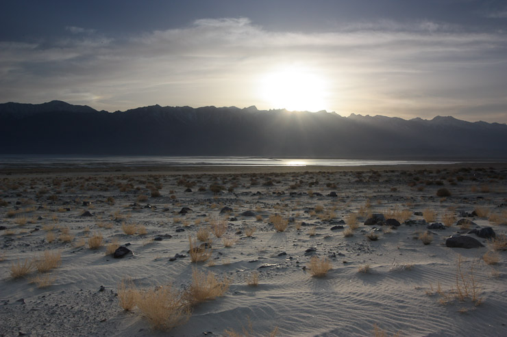
The sun dipped below the mountains at 7pm in this shot. I spent ~20 minutes here taking pics while the sun set...
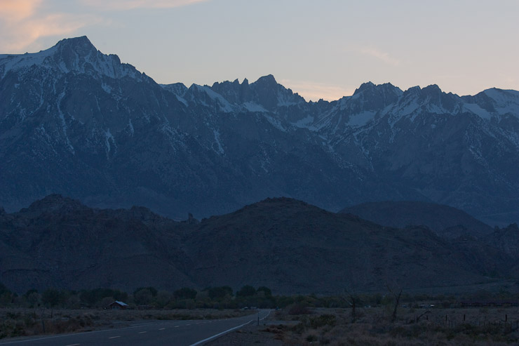
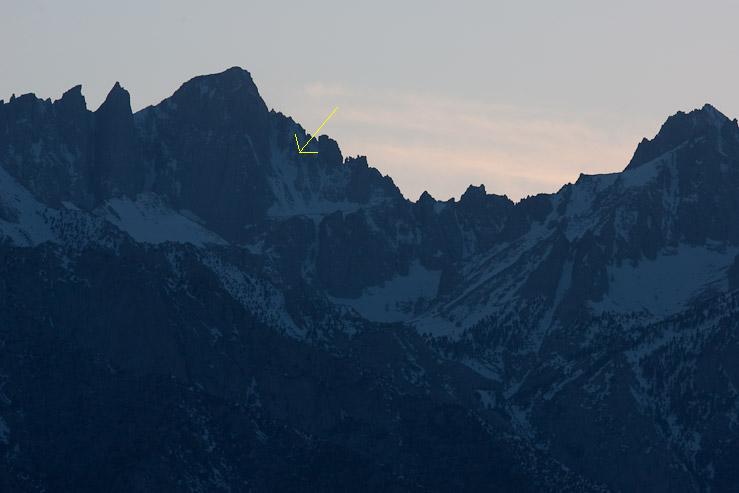
With the sun set, I continued the drive to Lone Pine. The road pointed straight at Mt Whitney, before turning right to the town of Lone Pine. In this close up, I point out the snowfield for the Mountaineers Route, leading up to the ridge just to the right of Whitney's peak. I planned to take this route on Saturday. Sure looks steep!
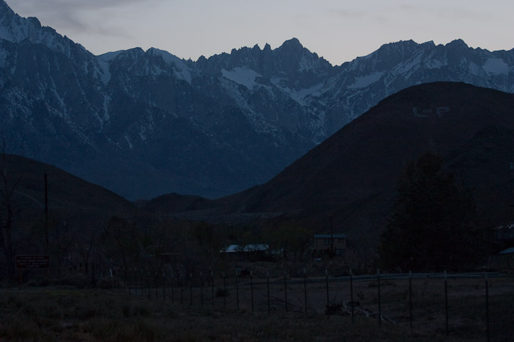
Wow, the scenery in Lone Pine is top notch! Gigantic moutains just a few miles away make the Front Range of CO look tame in comparison...
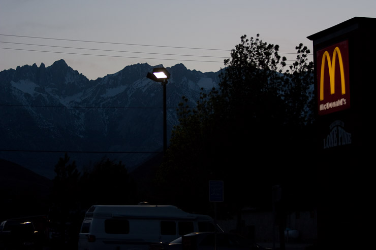
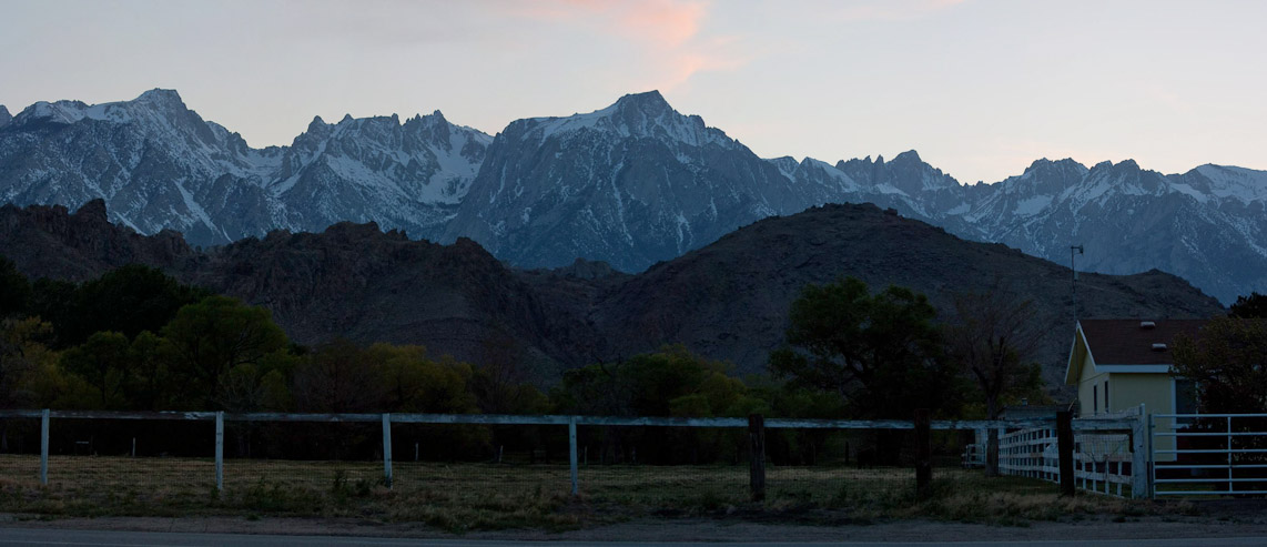
Another couple of views from town. This is the McD's where I planned to meet up with the Whitney group on Friday morning. Mt Whitney takes center stage here...
I stopped at the Whitney Portal Hostel, which I had read about on the Whitney forums, and signed up for a bed. The roomas all have private baths. I shared a 4 bed room (2 bunks) with 2 other nice travelers. One (Robert) had just started on a cross country bike trip (more on him the next day). I was a bit dissapointed to find there was no kitchen here, just a microwave, fridge, and hot water pot, but managed to make do and have another tuna wrap, with some oatmeal for dessert. The "kitchen" and common room closed at 9pm, so I soon left for my room. The free wifi was excellent. The hostel also had a store with all sorts of gear, books, and maps. It wouldn't be until tomorrow that I'd meet Doug, the owner of the hostel, whose great wisdom, character, and generousity helped define my Whitney experience.
I went to bed without an alarm, and no set plan for tomorrow. I was tempted to get up early for sunrise, but figured there'd be other opportunities for that, but not to sleep in. I'd ask around for some day hike suggestions tomorrow...
Go to next day
Back to Southern CA Trip home