

Having bagged 27 14ers so far, including many of the more challenging ones, I've had many opportunities to hear stories of Mount Sherman, mainly about how "easy" it is, since you can drive to 12,000' and there is a gentle class 1 trail to the top. I even read that a 4 year old climbed it. So I had some pre-conceived notions that this peak amounted to a "walk-in-the-park", to a degree. I knew that given spring snow conditions, the route would be more challenging, so this seemed like a good time to spice up a visit to Sherman. I came mentally and physically prepared to tackle a tough 14er (as we all should for any outing), but I still expected a fairly easy day on the "hill". To my surprise, the Shermonator put me to shame for my assumptions, and left me with great respect for this impressive mountain.
Having poured over the weather reports all week, it looked like Saturday had the most favorable conditions (mostly cloudy, but clear the previous night, cold with 10% rain/snow after noon, and a lot of wind, but less windy than Sunday). Based on winter trip reports, it is quite manageable to avoid avalanche danger on Shermon (mainly avoiding the cornice at the Sherman/Sheridan saddle). On the 14ers.com forum, I read of a few others planning to hike Sherman on Saturday, so I knew I wouldn't be completely on my own if I hiked solo. After several weekends of nasty weather, I figured there'd be a bunch of people other people achin' to hit the mountains too. So I decided the time was right to give Sherman a visit.
I woke up at 4am Saturday, and was driving from Fort Collins by 4:25am. When the pre-dawn light finally gave the sky some hue, I could see feint blue above the newly etched mountains to the west. Clear skies this morning! The drive to Fairplay was smooth, as I watched the landscape awake with the sun over 2.5 hrs on the road.
There were a couple of cars parked at the Four-Mile Creek trailhead at Leavick, the 2WD parking area (11,240'), at 7am. A group of 4 women were prepping for the hike (14er.com-ers probably?). I tied up my boots, put on gaiters, and finally hit the trail, under bright blue skies, at 7:20pm. My pack was loaded with snowshoes, crampons, and ice axe, but slightly lightened by the fact that my DSLR was in the shop for repairs. I'd just be using the trusty ol' pocket cam today. I kind of hoped I wouldn't miss the DSLR at all, encouraging me to stay 2lbs lighter in future hikes too...
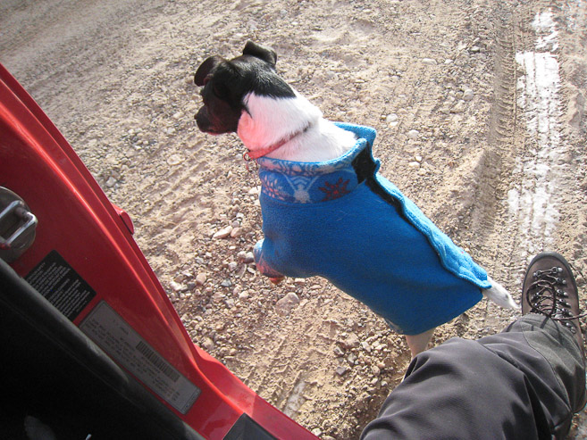
A dog came by to inspect my brand new boots (having lost my last pair in Death Valley 3 weeks ago)...
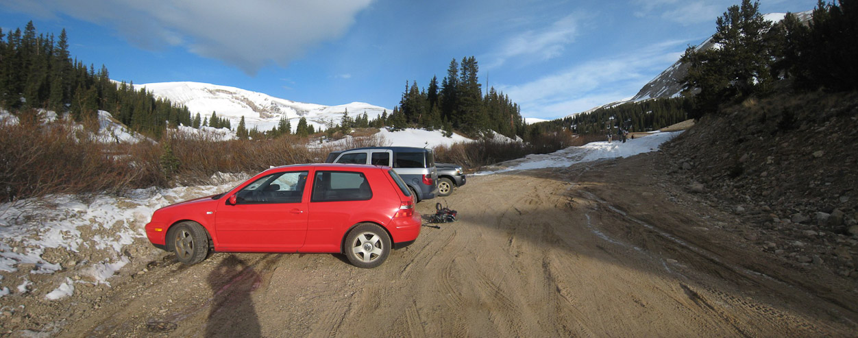
A look at the 2WD parking area at Leavick. A large snow drift blocked the 4x4 road ahead, though some tire tracks led through...
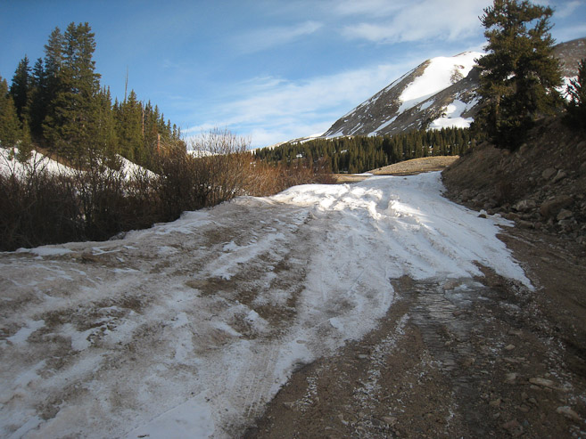
A close-up of the snow drift blocking the road at Leavick. Further up, the road had more snow coverage, so I walked along the edge to avoid it, if possible...
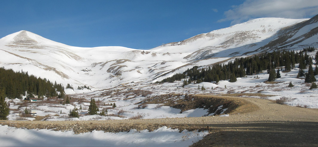
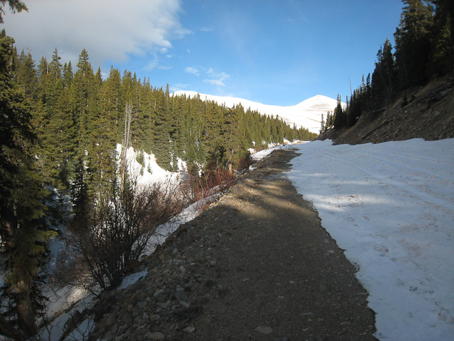
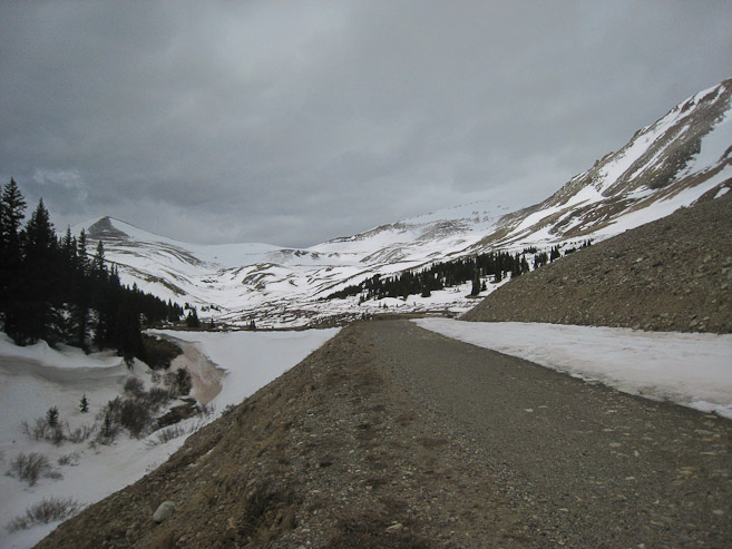
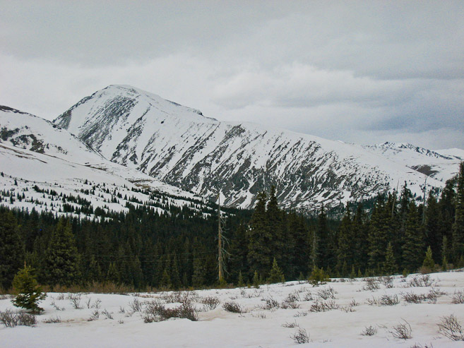
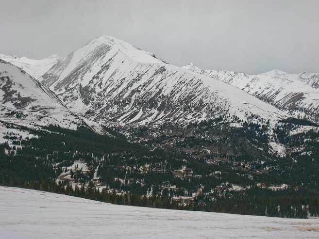
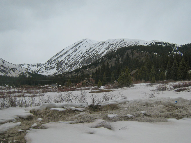
After ~20 minutes on the road, I got my first look at Sherman, the large mound on the right. Sheridan (~13,700') is on the left. The road was dry here...
Another look 10 minutes later, with snow on the road...
I crossed paths with a group of 4 hikers who had summitted Sherman early in the morning. They said snowshoes were useful, so stopped considering stashing my snowshoes. I wonder what time they started hiking this morning... There were 2 other hikers way ahead of me on the road too, as well as a group of 4 women, and their dogs behind me.
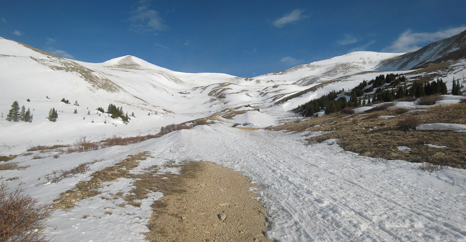
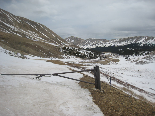
At 8am I reached the gate at the end of the 4x4 road (1st pic). A look back at the road, from the same spot as the 1st pic...
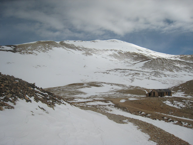
Beyond the gate, the road was completely packed with snow. I followed the tracks up to the ruined mine structures. The snow was soft enough to cause 1-2 inches of "sinkage". I kept the snowshoes on my pack, and continued. The wind had been pretty light so far, and the sun was toasty. It was probably in the upper 30s, but felt pleasant while keeping a pace.
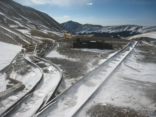
I caught up to some hikers near the abandoned mine structures. I ended up trailing these hikers for much of the route up...
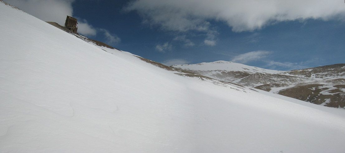
Above the first set of mine ruins, the snow thinned, and the trail disappeared to the north. The wind kicked up strongly, and it was time to put on a jacket. I could see the cornice on the saddle, and headed north towards Sherman, to gain the ridge at a gentler grade. Clouds were gathering fast to the west.
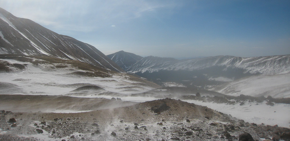
A look back down the valley, as the wind whips snow and ice crystals across the terrain...
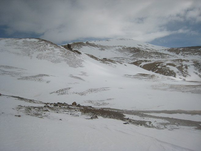
Looking north towards Sherman, and another mine structure...
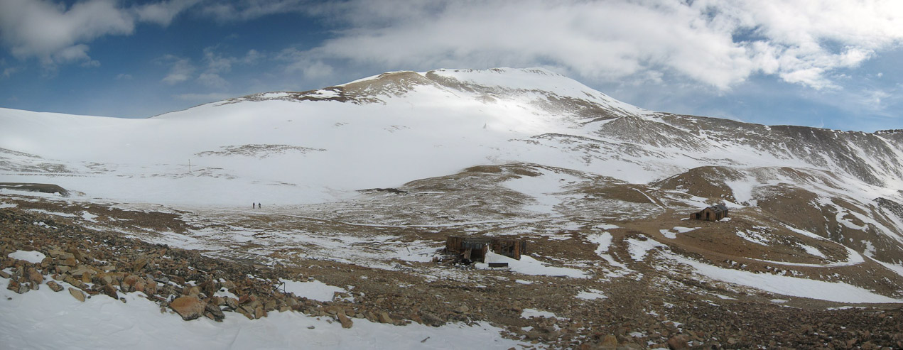
I followed the other hikers across a slanty snow field towards a mine ruin. Sherman in the distance...
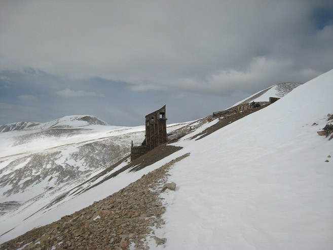
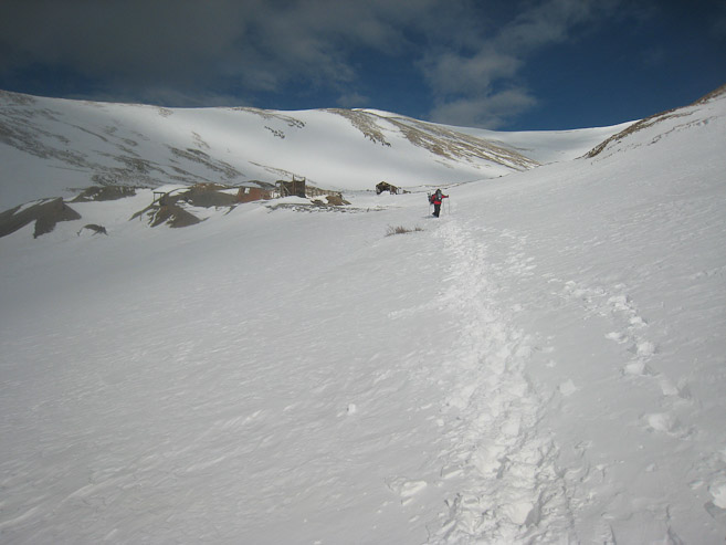
A look back at a mine ruin, and a look ahead at other mine structure below Sherman...
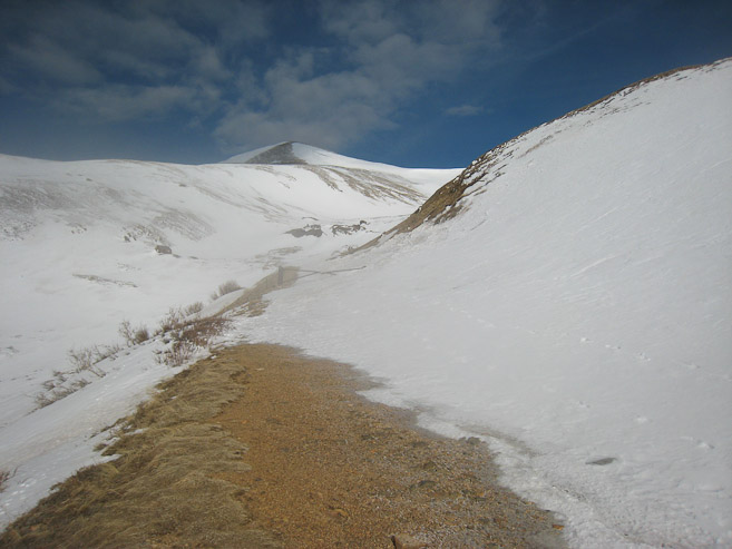
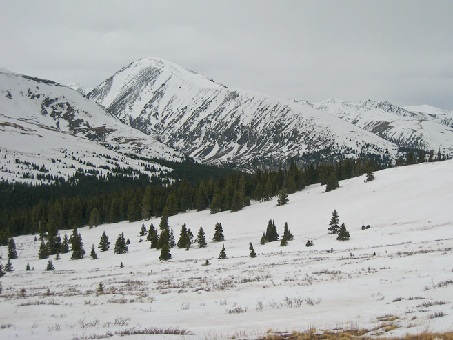
The rest of the path is clear from this point. The corniced saddle is on the left. I aimed to gain the ridge further up a short ways towards Sherman...
The snow maintained the 1-2 inch "sinkage". About halfway up I decided to try using snowshoes (since I had carried them this far). It may have helped a little, though I mainly walked on my toes. Perhaps my crampons would have been just as effective. The hikers in front left their snowhoes on their pack...
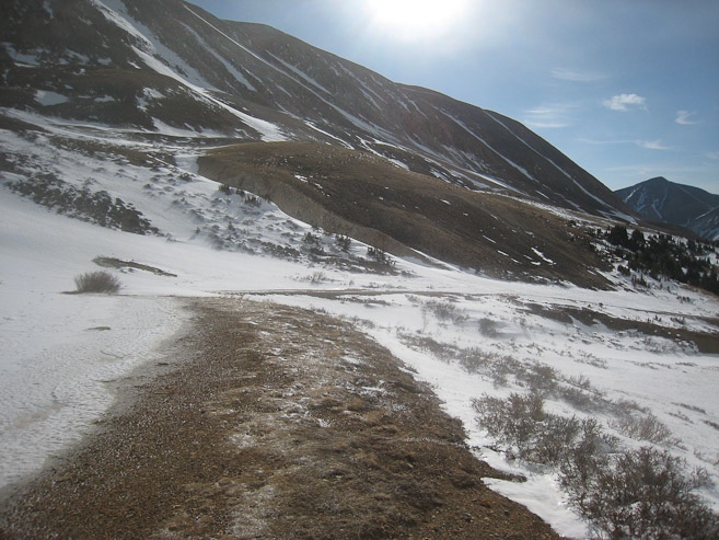
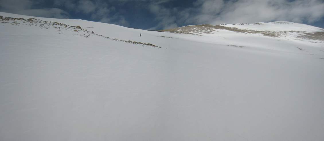
A look back towards the valley, and at the saddle. I aimed for the ridge top a bit higher than the others, thinking it'd be easier to stay on the snow longer. But as it turns out, I had to deal with more loose rock, once the snow dissapeared, so gaining the ridge earlier would have been easier...
A look up at Sherman, and later back towards the saddle, as I gain the ridge...
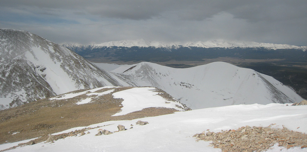
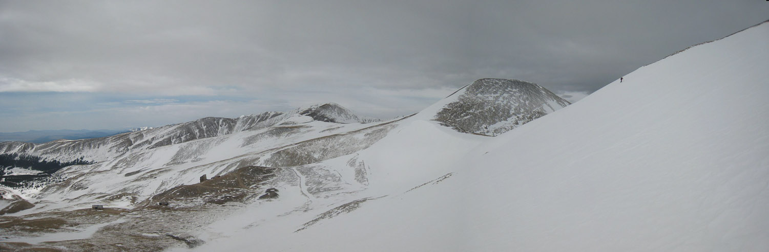
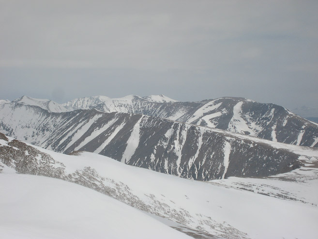
From the ridge top, I was surprised to see heavy clouds to the southwest over Elbert and Massive...
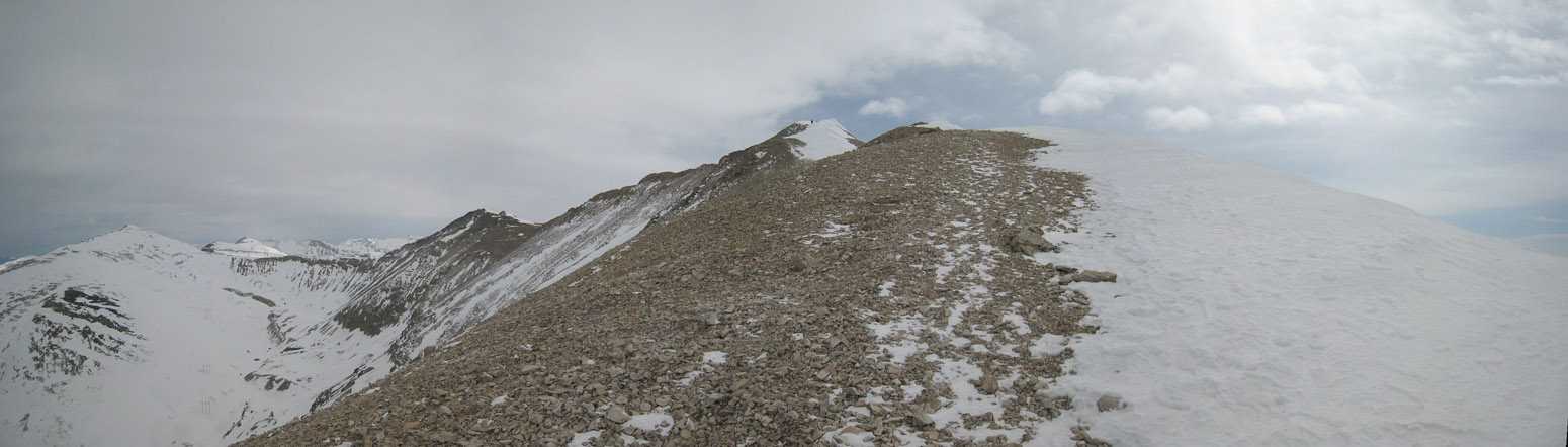
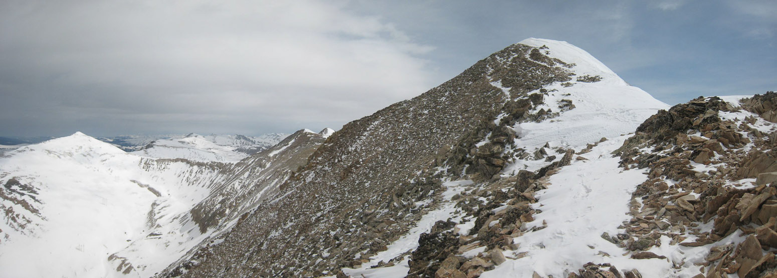
A look up the ridge showed several false summits, along with overcast skies...
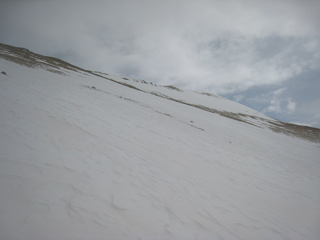
The ridge was fairly gentle, with snow on the right, rocks on the left...
It was a scenic ridge. No exposure. However, I was tired from climb to the ridge, and took my time ascending the final 400'...
The wind was whippin' real good, and conveniently, from behind, pushing me up the hill (and a little towards the valley). Gotta love tail wind on the way up. I was staying warm, but noticed my water bladder tube was freezing at an increased rate the higher up I climbed...
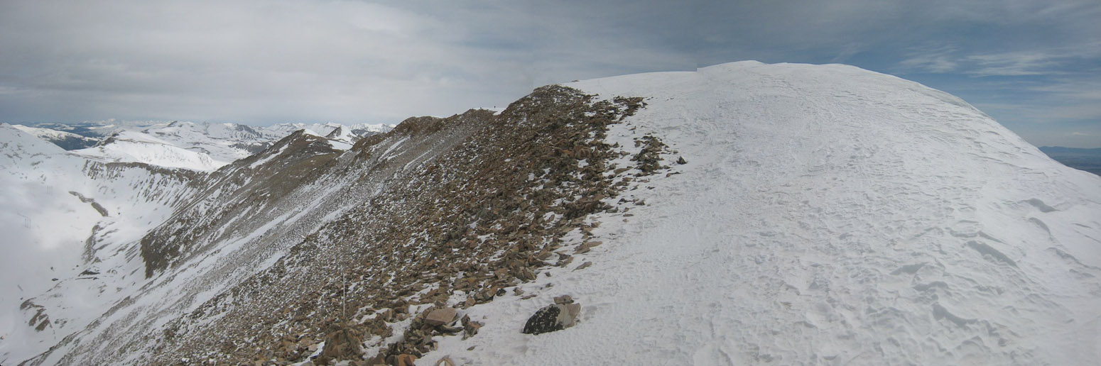
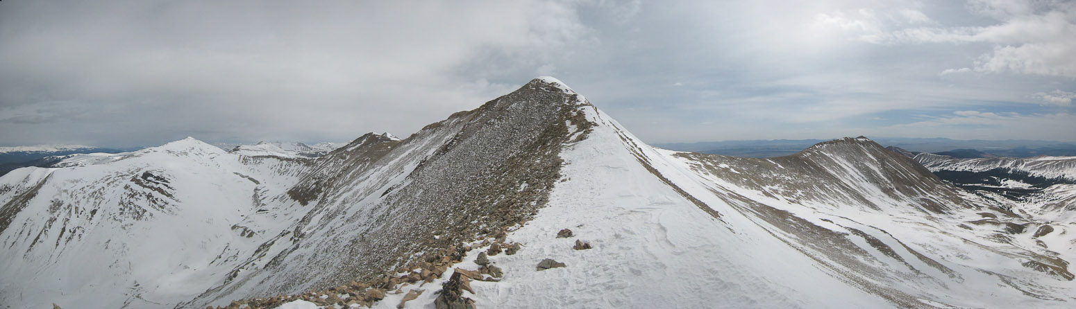
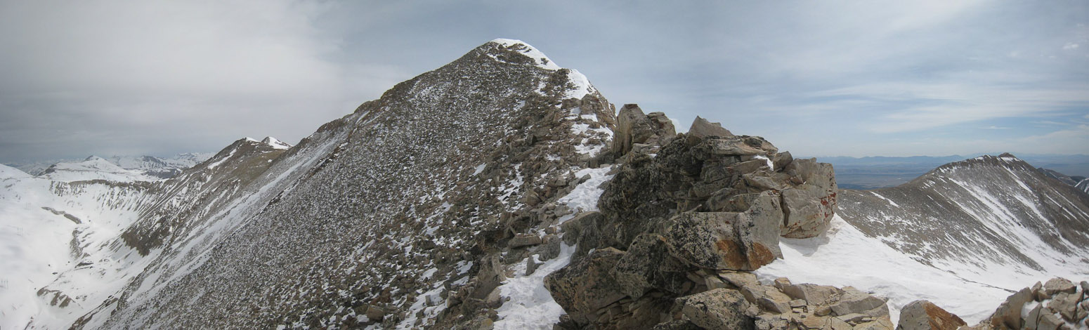
It looked like the summiti was just ahead...
...but turns out Sherman has a long bumpy summit, with the true summit on the far northern side, where I could see the other hikers resting...
Had there been no one else up here, I may have been tempted to turn back from this first false summit, thinking it was the true peak, but since there were witnesses (who apparently knew the real peak), I felt compelled to keep hiking across to truly bag the summit. Plus, I wanted a good look at Decalibron and Quandry to the north. I reached the summit at 10:20am.
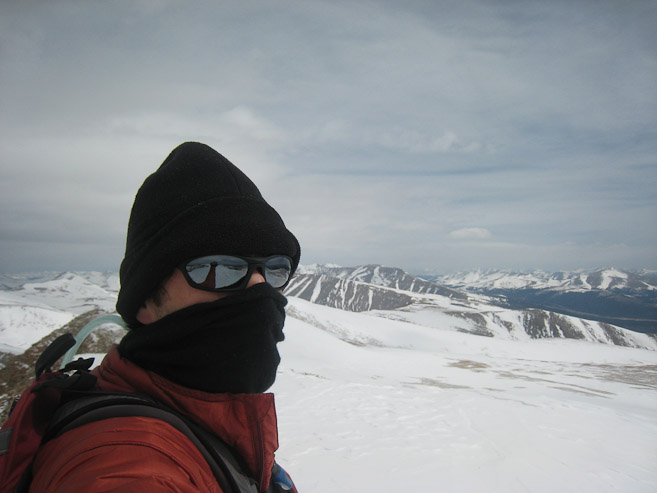
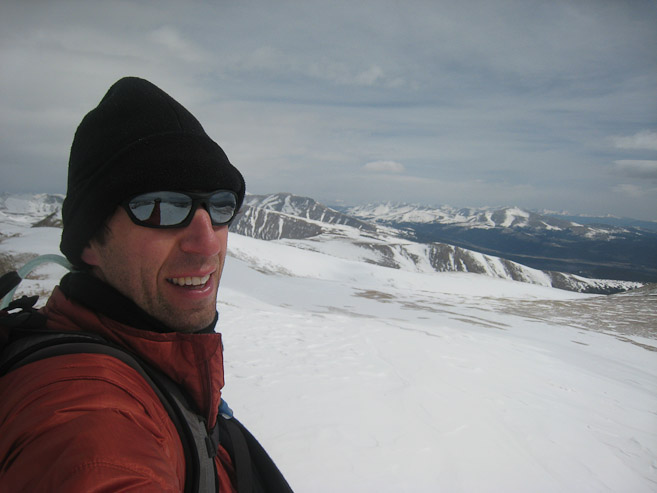
A couple token self-portaits from the summit. My merino wool scarf worked wonders on the windy ridge today...
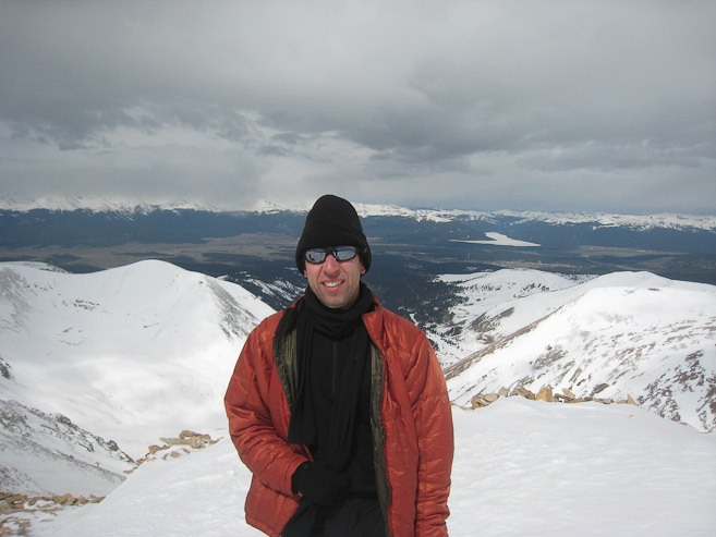
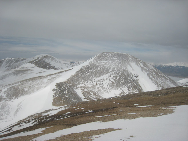
A look north towards Bross/Lincoln/Cameron/Democrat. I was very impressed with my new REI synth jacket. Kept me warm, even with the wind. It was a great REI garage sale find...
I rested at the summit for a few minutes and ate a snack, but it was REALLY windy, so I decided to head back down after 10 minutes of pics/rest. My water tube was totally frozen solid, so I looped it back inside my pack to warm up, as I headed down...
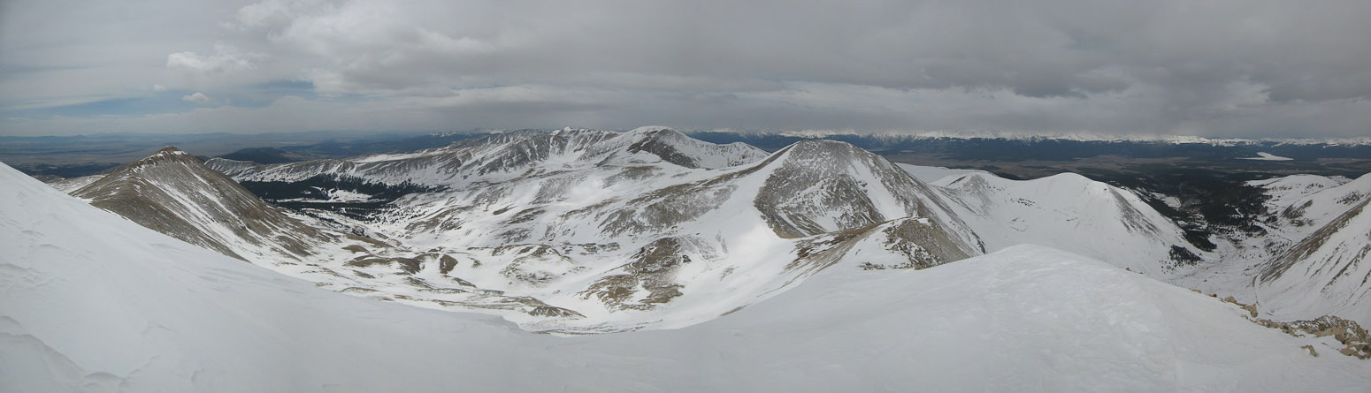
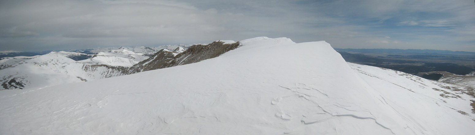
A look back down the ridge and valley, as I start my descent. The other hikers must have continued to Gemini peak, since I didn't see them again...
I didn't know Shermin had such wonderful views of Elbert and Mammoth. Unfortunately they were hazed/clouded over most of the day. When I saw them started to emerge, I paused on the ridge for awhile, at a non-windy spot, hoping for a good view. During this time I noticed my cell phone had reception, and made a couple calls.
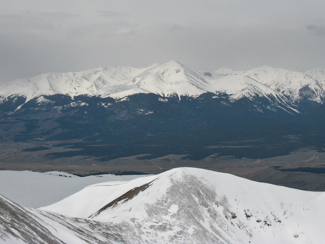
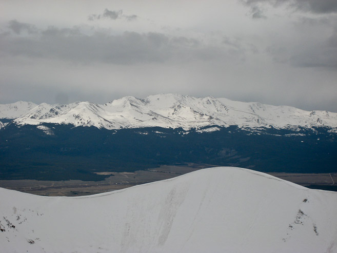
These were the best pics of these 2 14ers I could get today. Would have liked some blue skies and more color. Elbert (1st pic), Mammoth (2nd pic)...
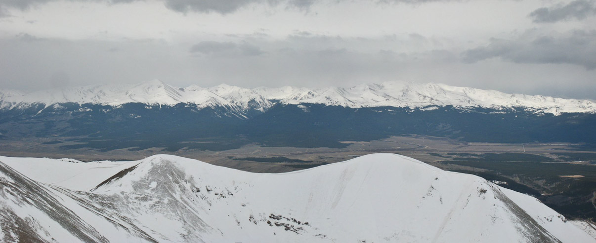
Elbert and Massive together, with Leadville in the valley below...
After a long break, hoping for a bit of blue sky over Elbert/Massive, I continued my descent. Snow descents are always great and speedy. I made long heel kick strides down the snow, re-tracing my steps. Didn't see any others on their way to the summit.
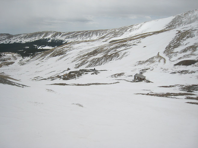
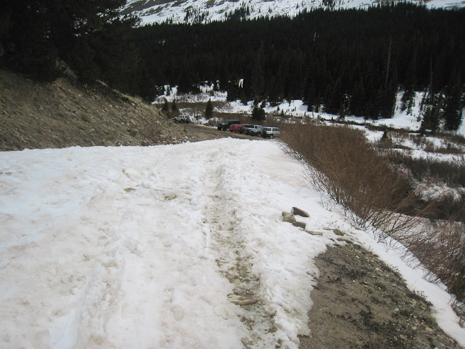
A look down at some of the mining structures, during the descent. I made it back to the gate at noon...
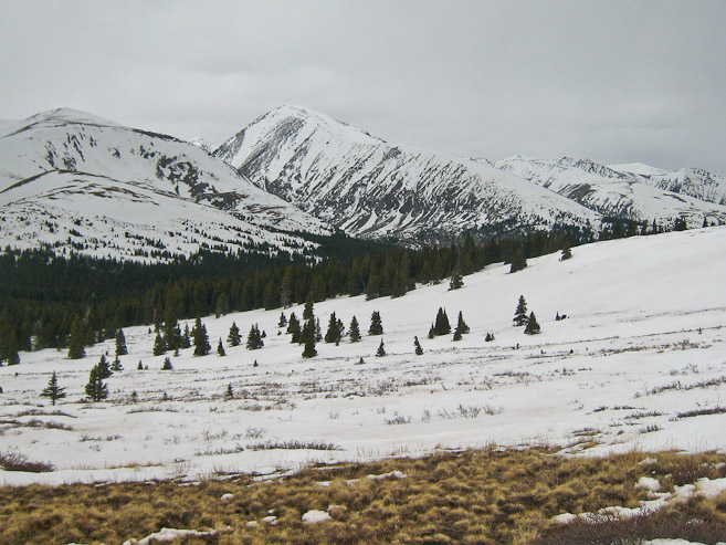
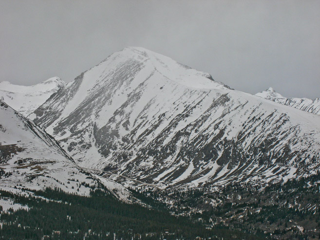
Skies were all overcast, but it was fairly warm, with no wind during the 4x4 road walk back to Leavick (a last look back at Sherman - 1st pic). I was back to the snow drift at 12:30pm...
There were a few more cars at the trailhead, but overall traffic was very light on the mountain today. Sherman, with a little help from Mother Nature, had proved to be a challenging and memorable mountain experience today. I'm proud to say I climbed Sherman!
In addition to Sherman, I had hoped to check out Hoosier Pass today. From a distance, the area looked blanketed by dark overcast skies, but I figured I'd make the short drive anyway, and return to Fort Collins via I-70. Turns out Quandary was "in the clear", and the overcast skies didn't look precipitous, just really gloomy. I was hoping to get a good pic of Quandary today, so I hiked up Hoosier Ridge a short ways. I ran into a few people coming down, who smiled and said "hi", but were probably thinking, "why is someone starting a hike up with ridge at 1:30pm, with all these clouds and wind?"
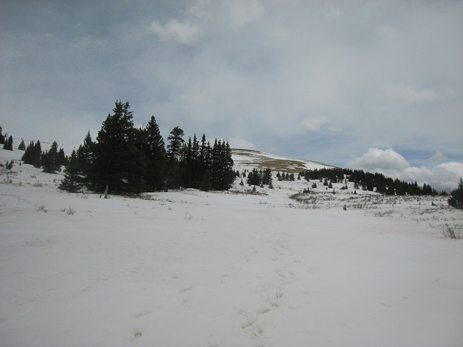
I hiked up the east side of Hoosier Pass, along a very wide and gentle sloped ridge, which soon gave good views of Quandary. This would be a great place to snowshoe next winter...
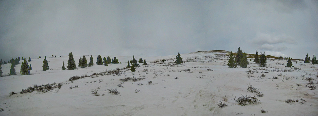
The snow pretty thin and soft. Infrequent post-holing wasn't enough to make me put on my snowshoes though, and I soon worked my way off the snow...
More looks at Quandary, as I gained elevation. The wind started picking up...
Quandary's peak went in and out of view, based on the wind and cloud. I decided to stop here, after ~500-600' climb from the pass, and rested for a while, back against the wind, snacking and taking pics when conditions were favorable. Too bad no blue skies today...
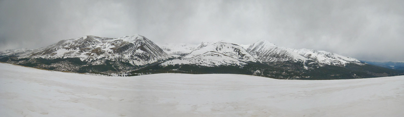
A wide view from ~500' up the ridge, after I started my descent...
I got back to the car at 2:45pm, and changed out of my boots, making EXTRA sure I didn't leave them outside the car, or on the roof (like I did in Death Valley 3 weeks ago). I stopped to take a pic of Quandary from the road on the drive into Breckenridge.
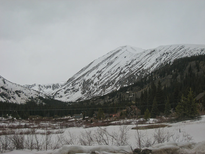
A look at Quandary from Hoosier Pass road...
Traffic was good all the way back to Fort Collins. Successful day in the mountains, though not the greatest for pics. Still, Sherman surprised me with a quality winter/spring climb, and character (the mines). A great 1st CO 14er of 2010.