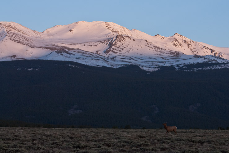
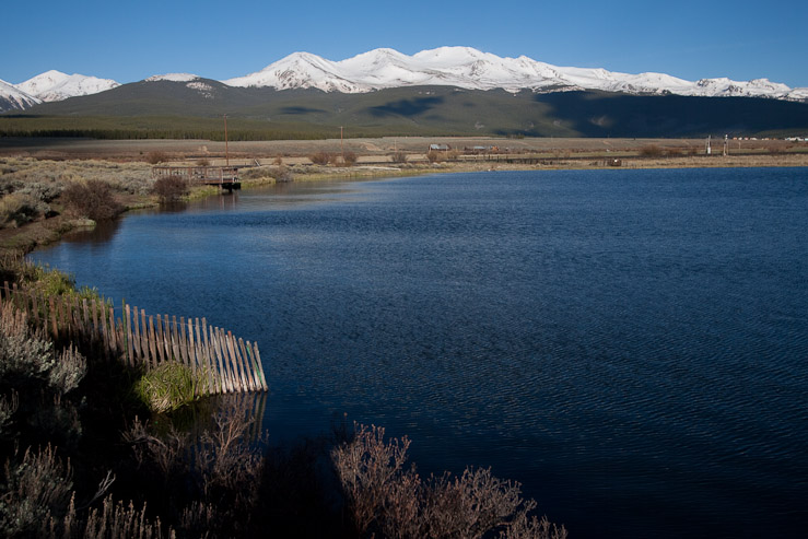
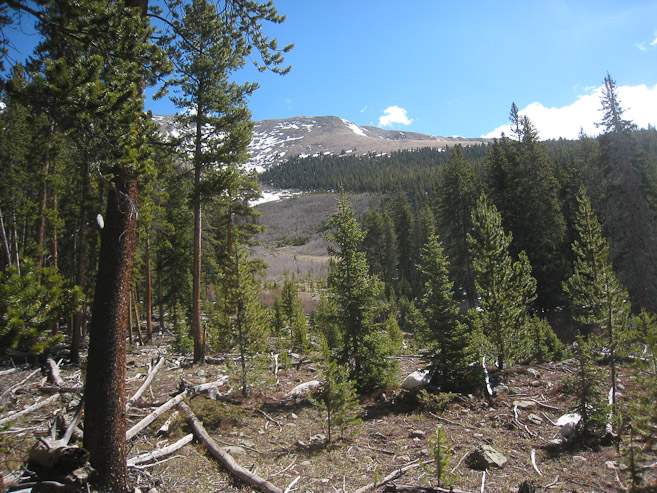
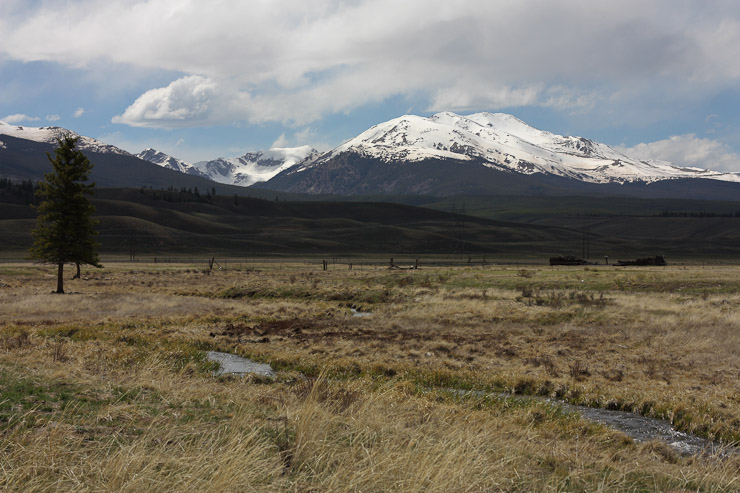
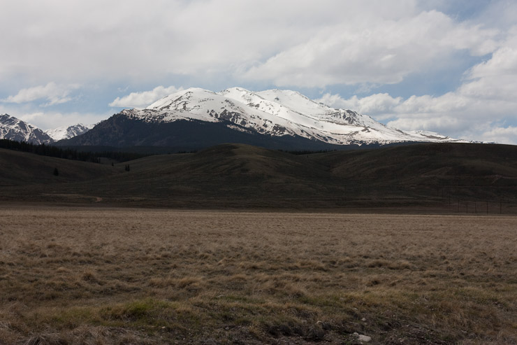
An elk made for a good photo op, with Massive catching the first rays of sun. The area around country road 300 is gorgeous for Massive/Elbert viewing...
After spending the previous day driving around the Tenmile, Mosquito, and Sawatch Range, photographing the mountains, and making a couple of small side hikes on a beautiful spring day (sheltered from the high winds), my plan had been to hike Mt Elbert's northeast ridge Sunday. However, given the super windy forecast (25-35mph with gusts 55mph+, for 13,000'), and experiencing the heavy winds in Leadville Saturday night, I wasn't so sure being on the highest point in CO (14,433') would be enjoyable. So I decided I would likely just stick around for morning photo ops before heading back to Fort Collins.
I spent the night parked at Turquoise Lake, and awoke ~4:30am to clear skies, and no wind at all. Maybe the high winds weren't supposed to kick in til the afternoon? After trying to take some low-light pics across the crusty-frozen lake, I decided to head to the North Elbert TH, and see if any other groups were around and up for the hike (didn't want to be the only one on the mountain). While driving in on the dirt road, I passed through a couple of intense dust devils, and eventually reached the empty, trailhead at 5:40am. Guess no one was planning an early summit from here today. I decided to head back towards Leadville and take sunrise photos of Elbert and Massive.
An elk made for a good photo op, with Massive catching the first rays of sun. The area around country road 300 is gorgeous for Massive/Elbert viewing...
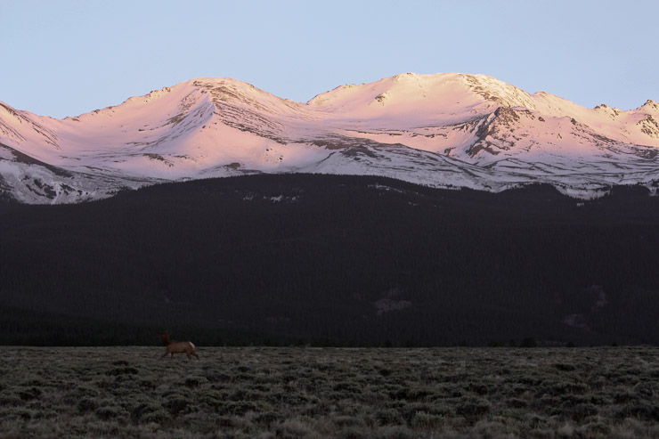
I followed the Elk in my car as they moved towards the forest. A horse later started chasing one of the elk...
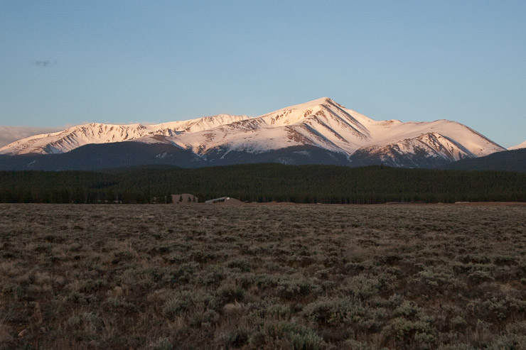
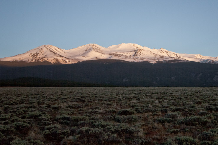
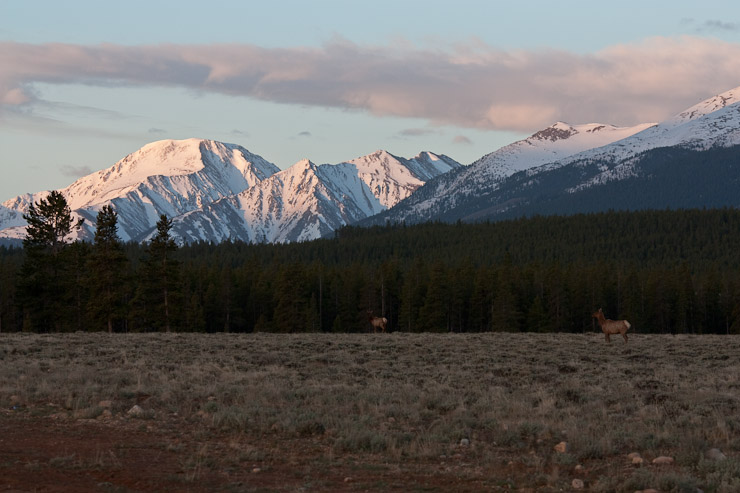
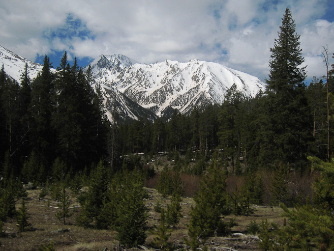
Sunrise on Elbert (1st pic), and Massive (2nd pic)...
As the morning grew, I drove around, exploring the area, searching for dramatic shots.

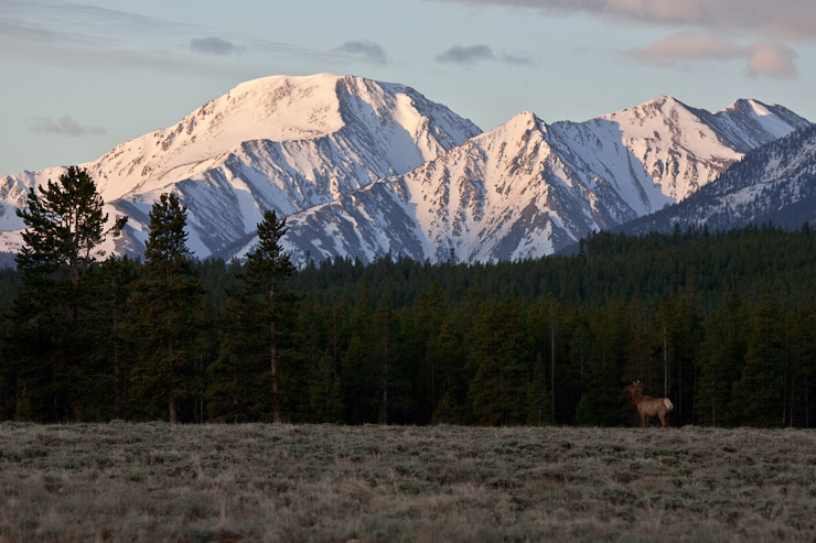
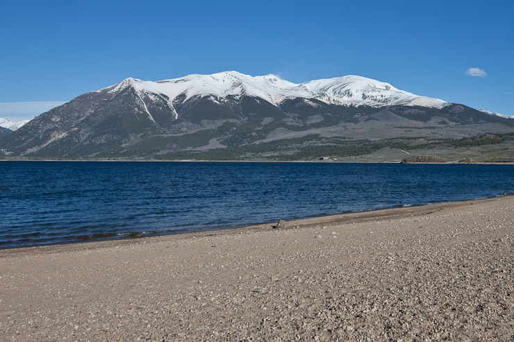
A pic of Elbert, from somewhere on CR 300. A pic of Massive from Crystal Lake, off of Rt 24...
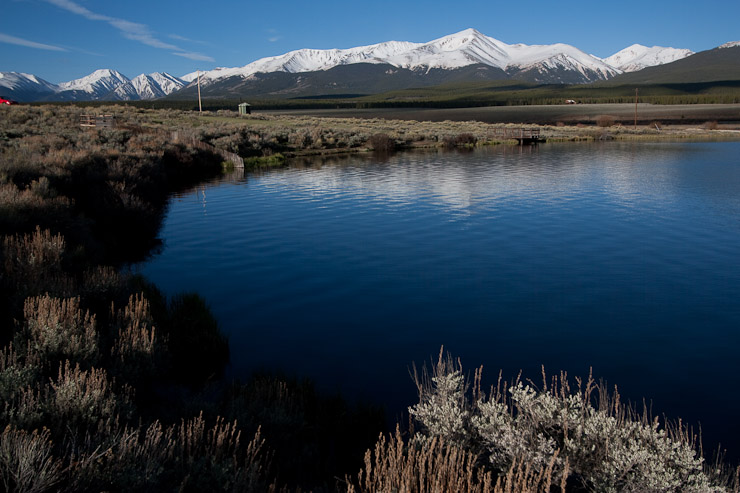
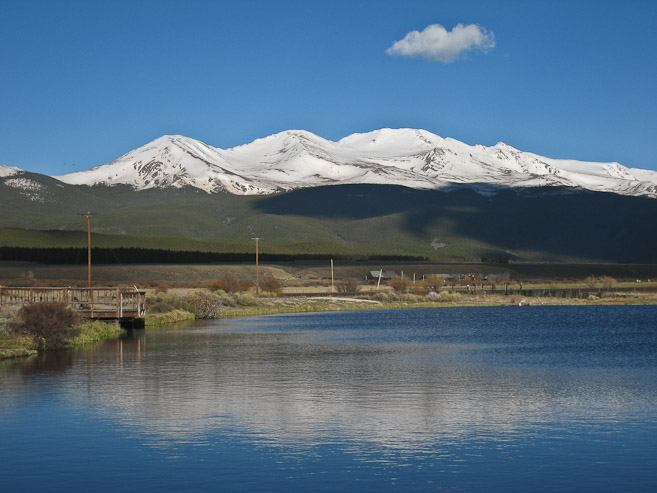
Another couple pics from Crystal Lake (should be called a pond, since it's quite small). Elbert (1st pic), and Massive (2nd pic)...
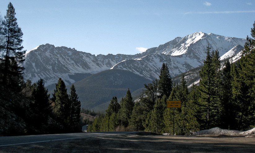
After reaching my fill of Elbert/Massive sunrise pics, I decided to drive up Independence Pass (still closed til Memorial Day, next weekend), since I heard there is a good view of La Plata from somewhere there. Heck, it was just a short drive from Leadville, so might as well explore...
A look across Twin Lakes of Mt Elbert from the south...
I reached the La Plata trailhead ~8am, and saw a group of hikers starting down the trail, and almost considered hiking here, hoping to catch up to them, but it seemed kind of late to be starting a 14er hike, with the high winds and 20% afternoon storms forecast, so I continued up the road a couple more miles until I reached the road closure.
A look at La Plata on the right, with the Ellingwood ridge stretching to the left...
I then decided to check out the Black Cloud TH, for Elbert's southeast approach, which is the much less accessed route I wanted to use to hike Elbert all along, but given the 5300' gain, with a long stretch above 13,600', and unknown spring snow conditions, I had ruled it out as a solo option this weekend. But I figured it'd be worth exploring today as a short day hike (needed some exercise after all), and at least I'd become familiar with the trailhead and approach.
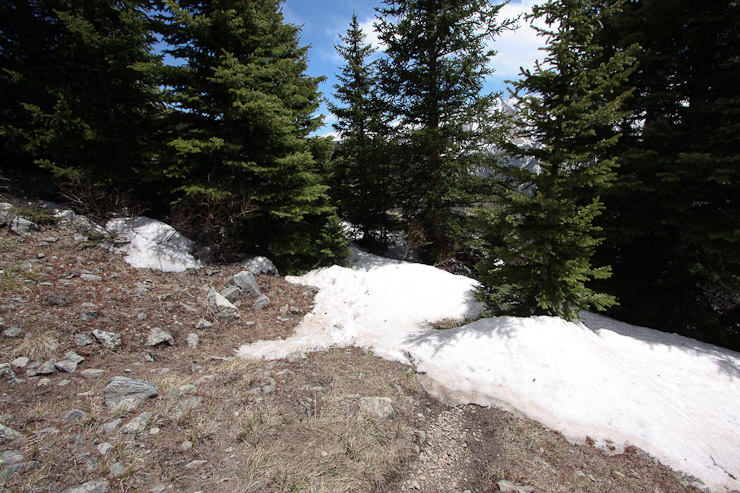
Finding the Black Cloud trailhead was no easy task. The non-descript dirt road turn-off was marked with a sign ~6 inches wide (it seemed), and at first I mistook a different dirt pull-off area, higher up on RT 82, as the trailhead (since I knew it was non-descript). A tree lay across the pulloff to the trailhead, which gave the impression of "CLOSED". It looked like a fresh fall, probably from the high winds last night, and fortunately I was able to pivot it to clear the entrance.
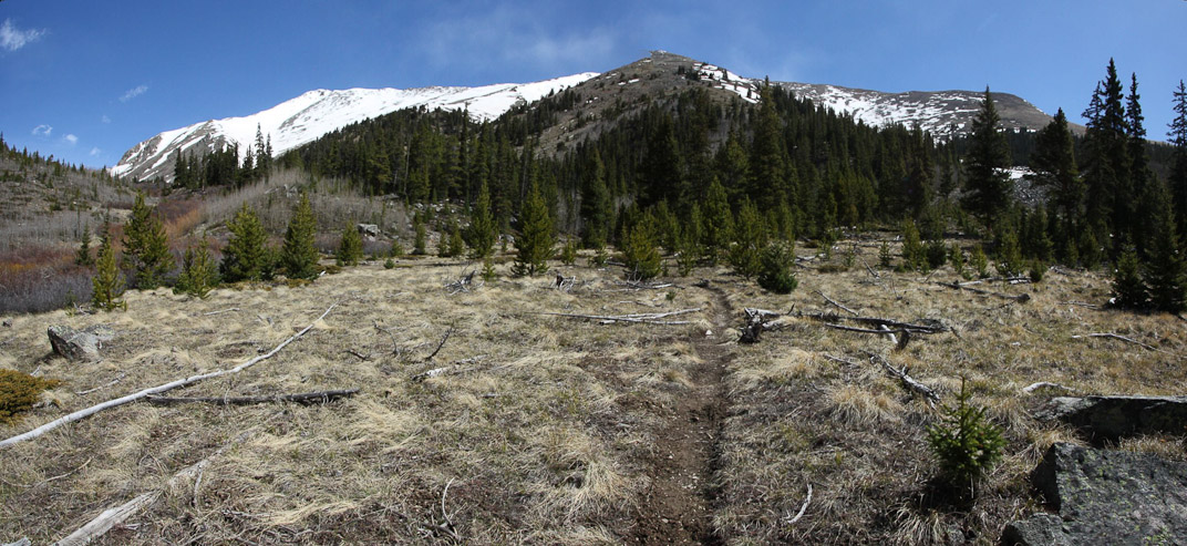
Once situated at the TH, I took my time packing my bag, and jotting down some notes from Roach's book. The TH is at 9700', and I planned to hike to an old mining cabin at 11,600', just for some exercise and hopefully to get a good pic of La Plata. Luckily I had phone service, and texted a message, informing Wendy where I would be (just for added comfort). I eventually started up the well marked trail at 9:15am, with hardly a breeze in the air.
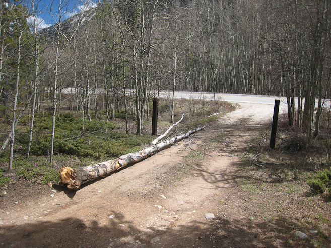
This tree was lying perpendicular to the road in the morning, almost thwarting my hike attempt today. After a couple attempts, I successfully swung it out of the way. A look at the well defined trail, switching back up the mountainside... (both pics taken later during my descent)
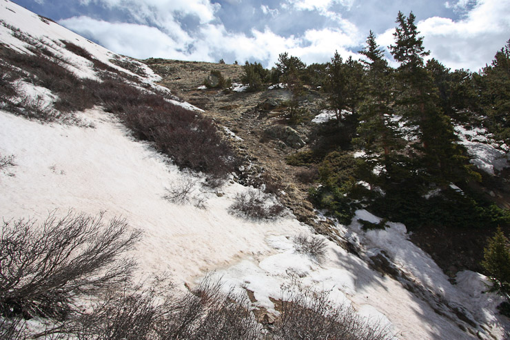
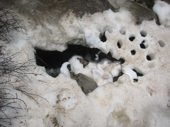
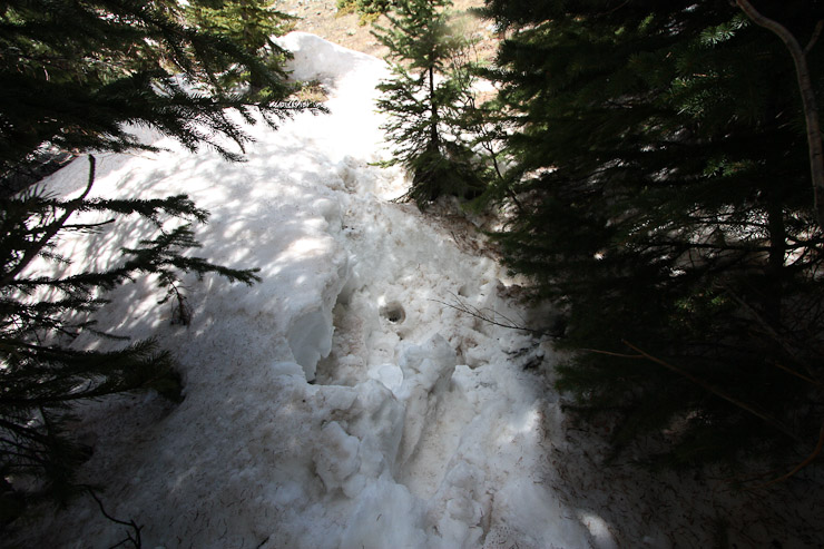
I made quick time up the switchbacks, but felt some burning on my right heel, and decided to stop to put on a bandaid and tape, in hopes of preventing a blister. After this first aid, my foot felt great, and I reached the first stream crossing at 10,860' in just over 30 minutes from the trailhead. Once across, I started running into sizable snow banks amongst the trees that covered the trail at times. There were no footprints in the snow, so the trail become harder to deciphor, but I managed to stick to it, bypassing larger snow banks (on my return, I kicked through all the snow on the trail, so it should be very obvious now).
Roach's book says the next stream crossing is at 11,200', but it's actually at ~11,000. I got quite confused, cause the trail led to a downed pine tree which blocked the stream crossing at 11,000'. But I couldn't find a trail leading further up, and eventually I crossed the small stream a short ways up, and re-joined the trail through open terrain on the other side.
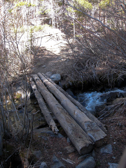
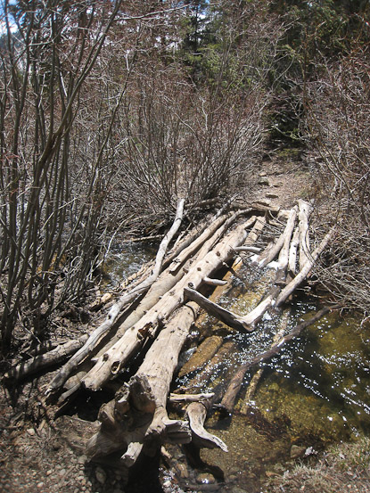
1st pic: The first stream crossing at 10,860'. 2nd pic: A look at the downed tree blocked the 2nd stream crossing. 3rd pic: The 2nd stream crossing (take from other side)... (pics 2 and 3 taken during my descent)
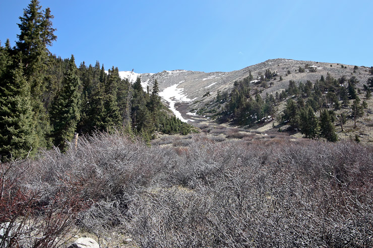
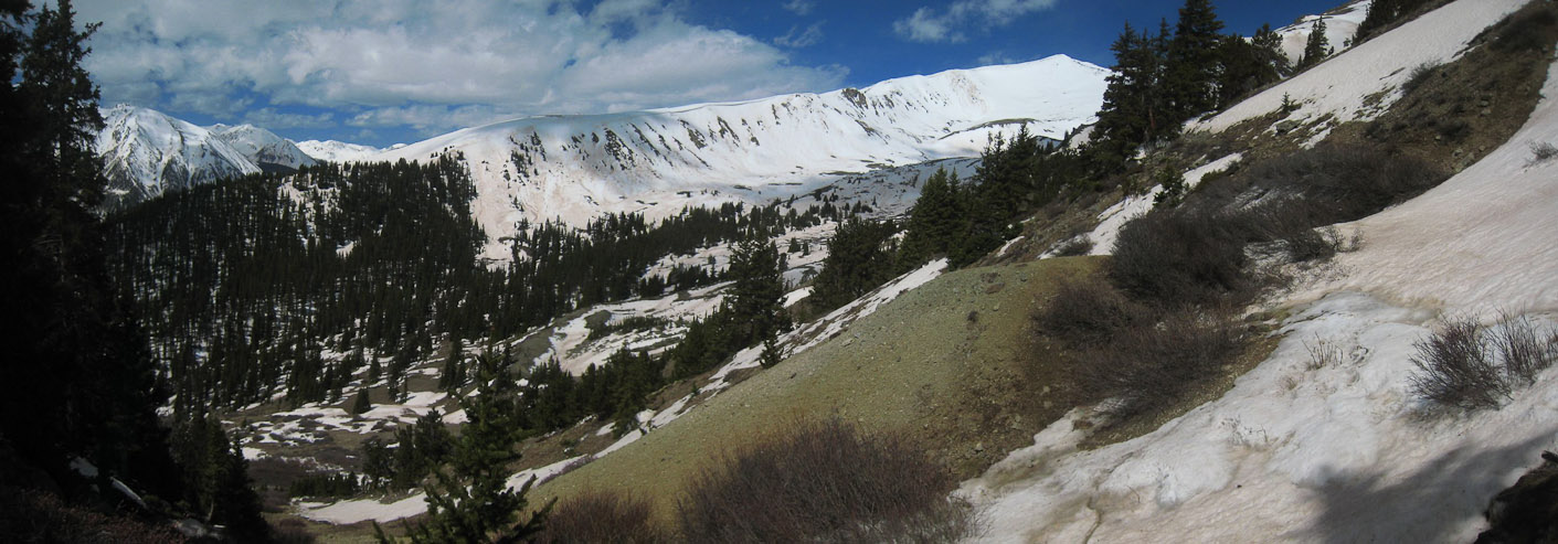
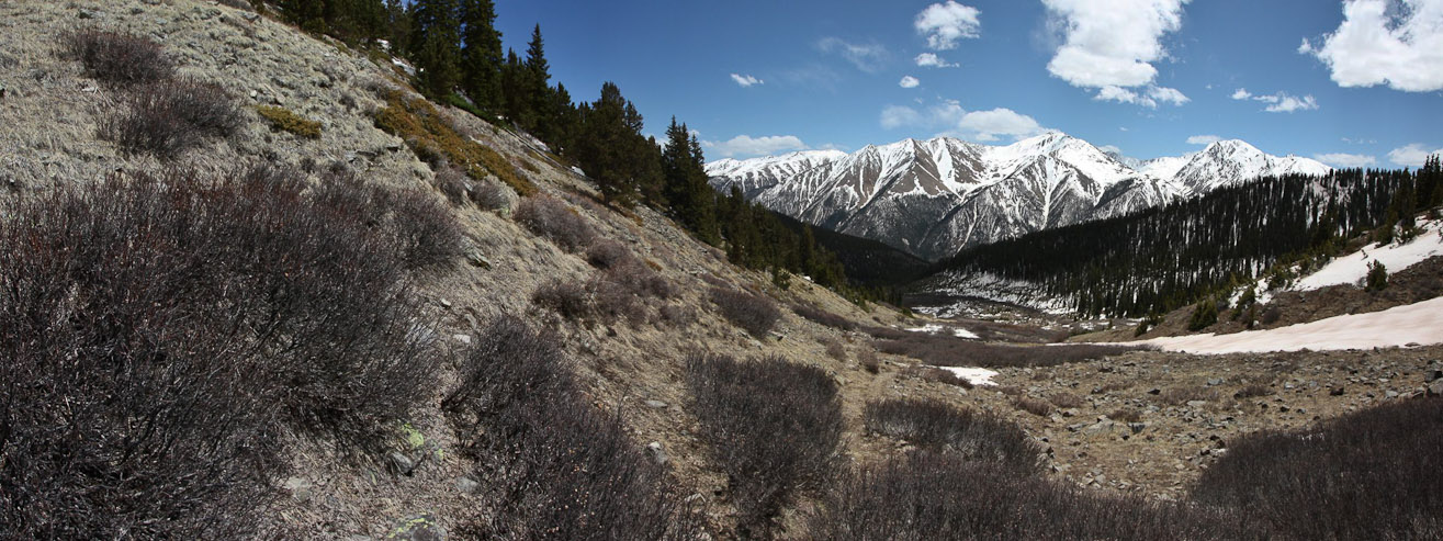
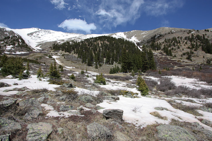
The trail opened up after the 2nd stream crossing, and I got my first glimpse of the ridge, as well as a look back towards La Plata...
I was making good time, and seeing the ridge without too much snow gave me hope of safely reaching the crest today. I'd just have to see how the weather/wind/energy/safety played out. Still no significant winds to report.
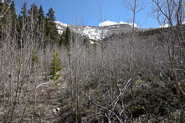
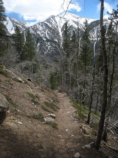
The trail passed through some thickets. A look back at La Plata over a clearing...
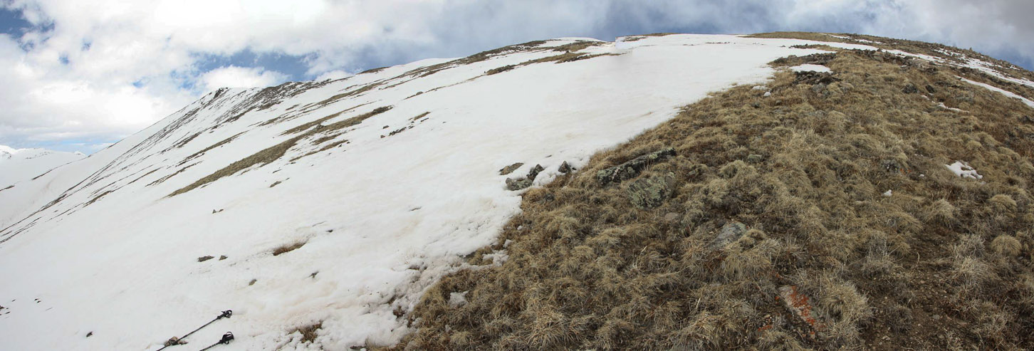
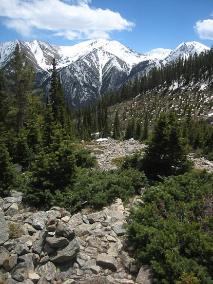
A clear view of South Elbert on the left. The trail leads towards the left, in front of the forest...
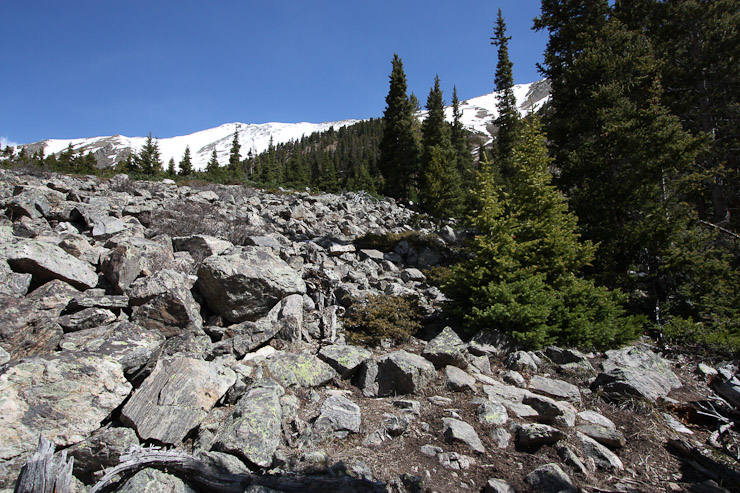
After crossing a rock field, I had a good look up at a gully that looked very approachable and tempting, since I just wanted to reach the ridge at this point, but I decided to stick to the trail...
The trail eventually cut back up into the forest for a bit, where frequent snow banks gave me problems following the path. Eventually I popped back into the clearing, with the forest on my right. I was expecting to run into the old mining cabin any minute, but it never appeared by 11,700'. I kept waiting for the trail to turn up towards the ridge, but it wasn't til around 12,000' that it cut sharply up.

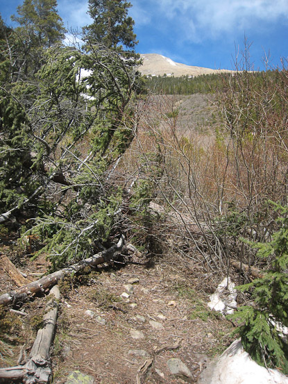
A couple of looks from ~11,700, before the trail cuts to the right to climb the ridge...
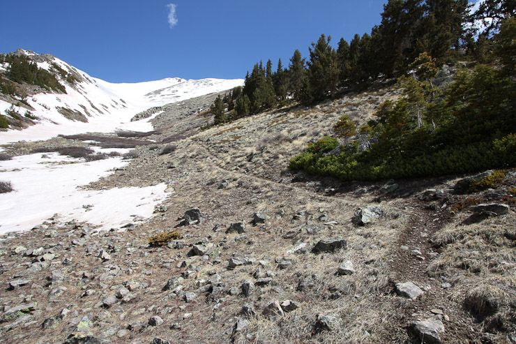
Finally, ~12,000', the trail turns and heads up the ridge beyond this snowbank (which hid a small stream). Another look back at La Plata...
Crossing this snow patch without crampons would have been tricky if it was frozen, but it was soft enough to go by boot (I did have crampons in my pack). At the far end, I was surprised to sink and hit an air pocket above a stream. The stream was only 1.5' wide, and I used my pole to clear the snow, so I'd see the true gap on my return. The trail entered the forest beyond, and the snow banks were too numerous and deep to follow. I choose to hike staight up the ridge where it was dry and rocky, and later rejoined the trail.
A look back after crossing the snow patch. There is a hole in the snow in the bottom-right, where I stepped into a stream, and later cleared the snow over it...
At ~12,200', there is a "road of snow". With the ridge above at ~13,500', there was still a lot of climbing to be had. But at 11:05am, with still just a healthy breeze in the air, and without much of a cloud threat, I continued towards the ridge...
A look back from the same spot as the above pic...

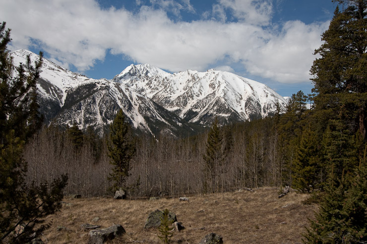
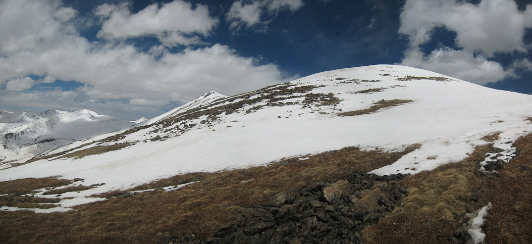
A close-up of La Plata, and a look up the trail, with South Elbert on the left...
The trail switch-backed up the slope, often getting covered by snow patches. I stayed close-to or on it the whole way. What a scenic trail!
I only packed food and water thinking I'd turn back at 11,600', but I was now targeting 13,600' if the favorable weather conditions held. Good thing I'm like a camel, and don't need much to get by while on the trail. I took some breaks on the way up, eating most of my food and water, since I'd need the energy most on the ascent. The wind was picking up some, but was at my back, and not a big factor.
The snow cover continued to expand. I saw a glissade track on the slopes below South Elbert, but had no intentions of glissading from there today...
It was a grueling climb, and the ridge continued to reveal more of it's elevation the higher I climbed...
But eventually, it ran out of elevation, and I could see the crest...
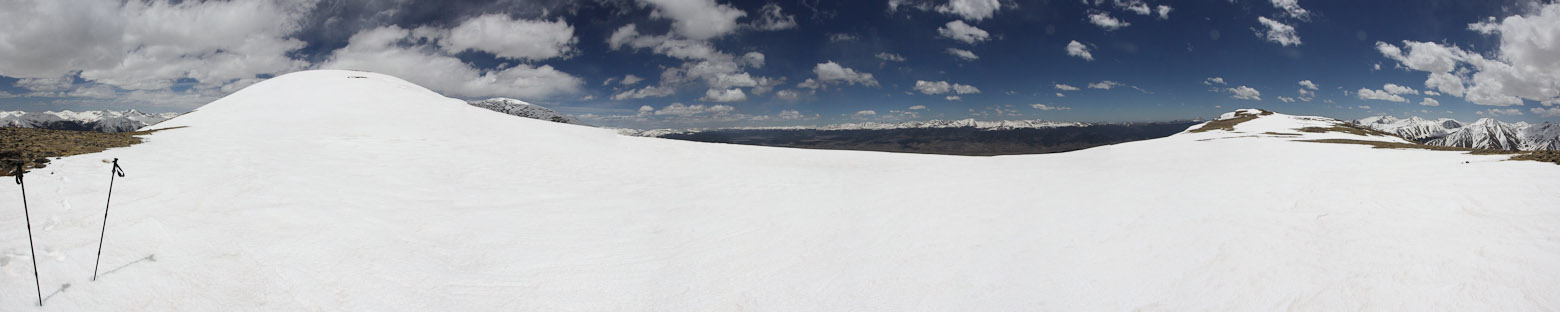
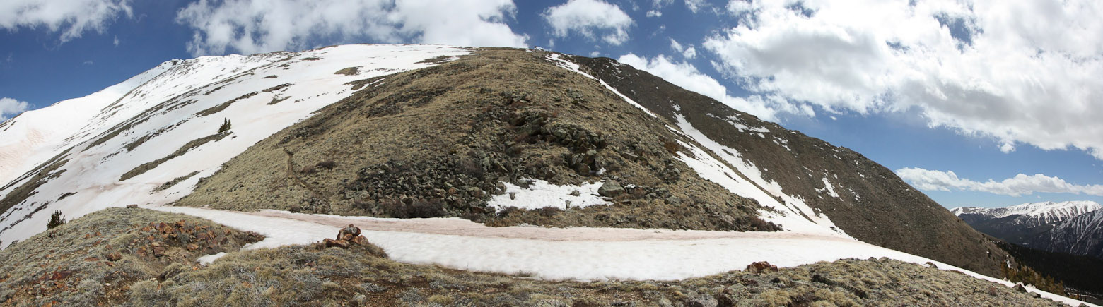
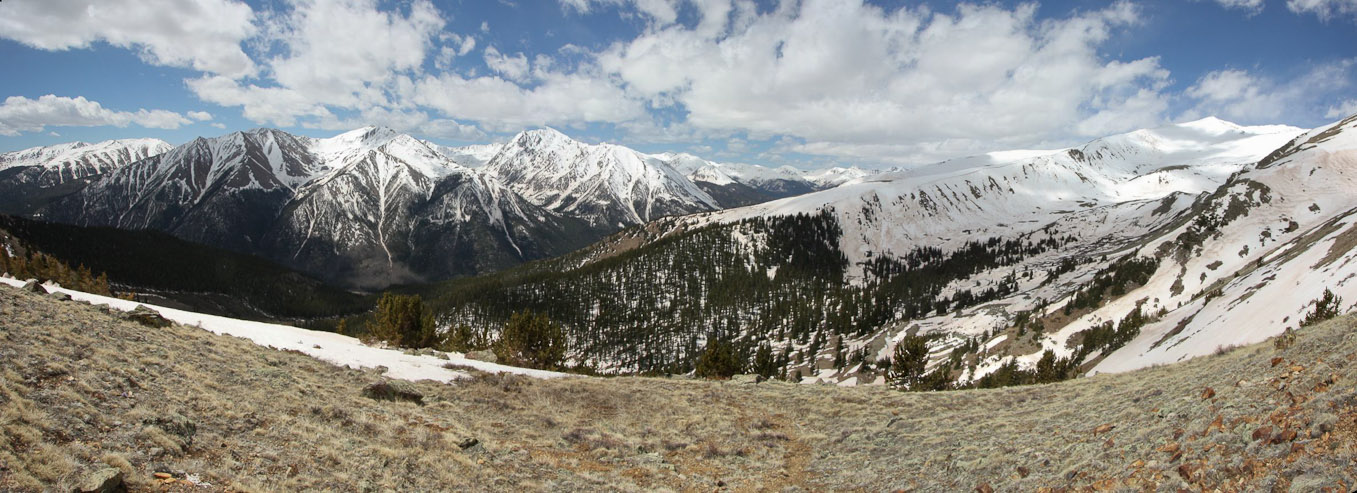
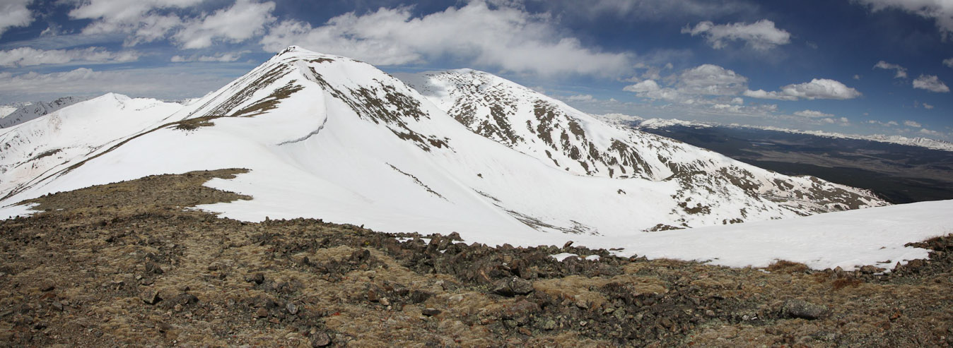
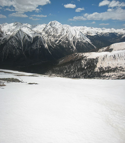
Finally, at 12:10pm, I reached the snow covered ridge crest (180 degree view)...
As I excitedly made my way across the broad ridge to look down the other side, a huge gust of wind slapped me, and I wondered, "Did the ferocious winds suddenly turn on this afternoon, or is it just the very top of the ridge which is crazy windy?" There was a sub-peak a short ways up the ridge, which I HAD to reach, having come this far, so I leaned into the wind (to the west), and hiked up the final ~50' of ascent today.
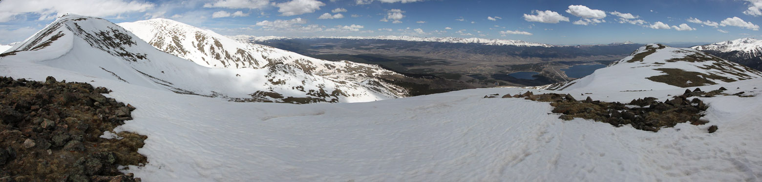
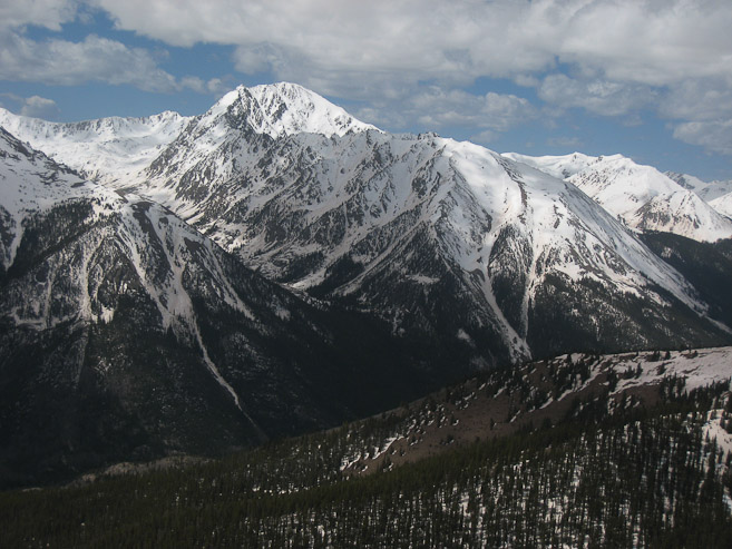
The view from ~13,600' on the southeast ridge of Elbert. South Elbert (14,134') is on the left, with Mt Elbert (14,433') in the sunlight beyond...
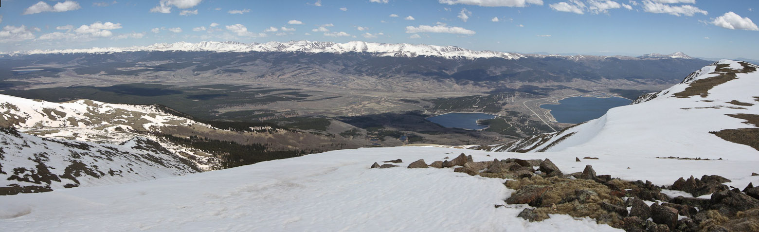
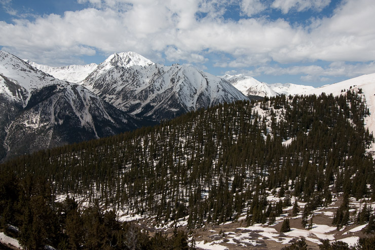
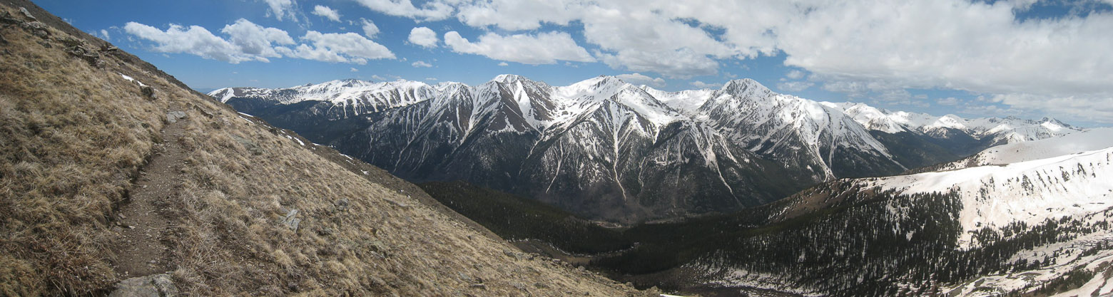
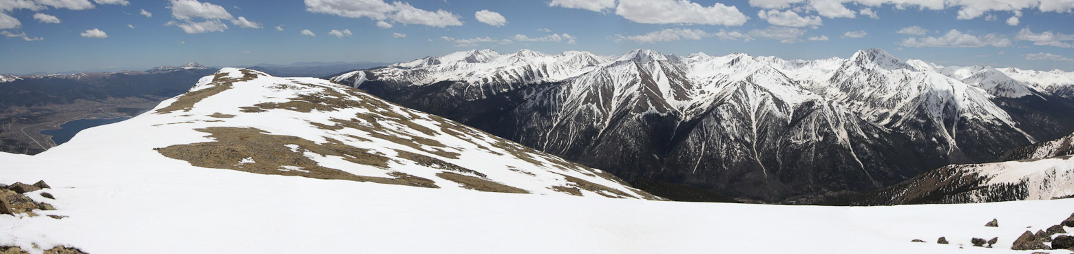
A look down at Twin Lakes, and across to the Mosquito Range...
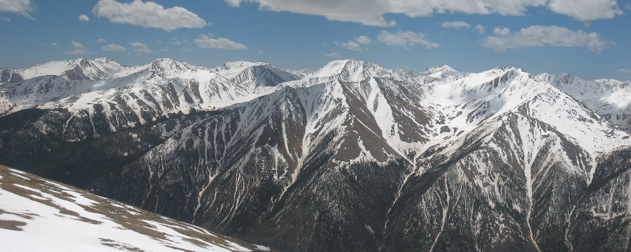
A look south at the Sawatch Range. I spotted Oxford, Belford, Missouri, Harvard (all on the left half of the pic)...
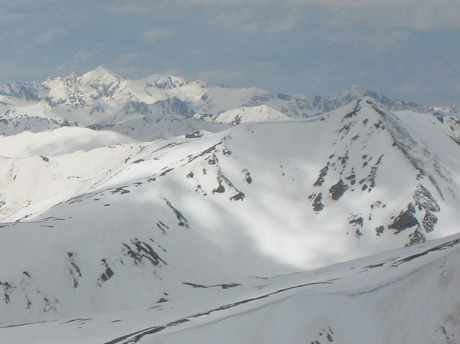
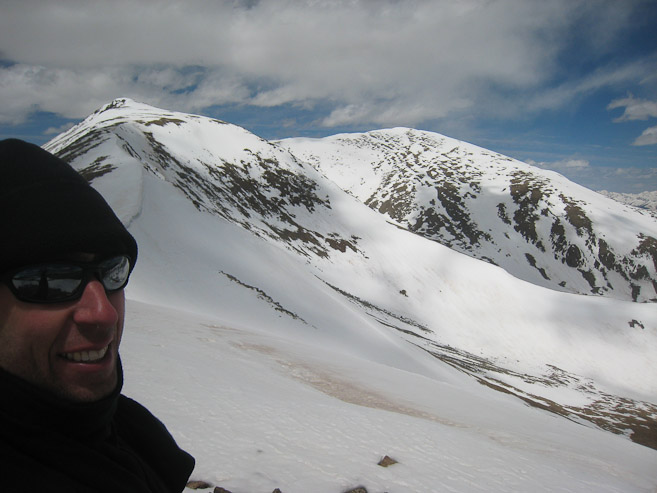
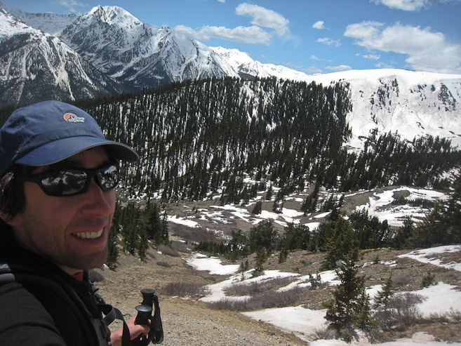
A look at Castle and Conundrum to the west. A self portrait with Elbert in the background...
The wind was blasting, and I looked for rocks to hunker behind, but there weren't any. Fortunately, the wind diminished significantly on the east side of the broad ridge, so I was able to sit down and relax comfortably, enjoying the views. I'd brave the wind off and on, taking pics from the crest. The skies were beautiful, and in rare form, the clouds were actually thinning this afternoon. Still, I had no inkling to head to South Elbert, which required another 500'+ of gain along the wind torn ridge.
South Elbert and Elbert from the ridge. There was some dry patches...
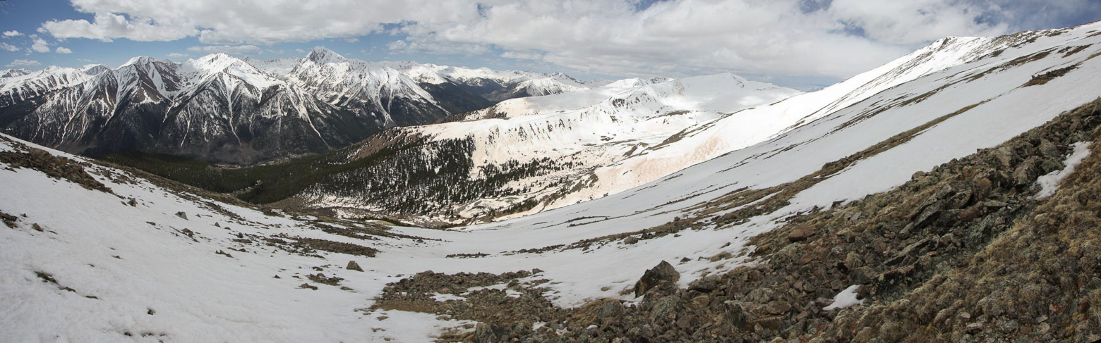
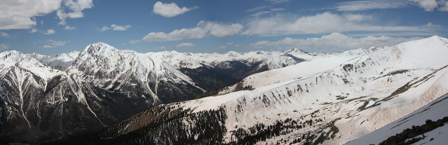
A look down the ridge, and the southern Sawatch...

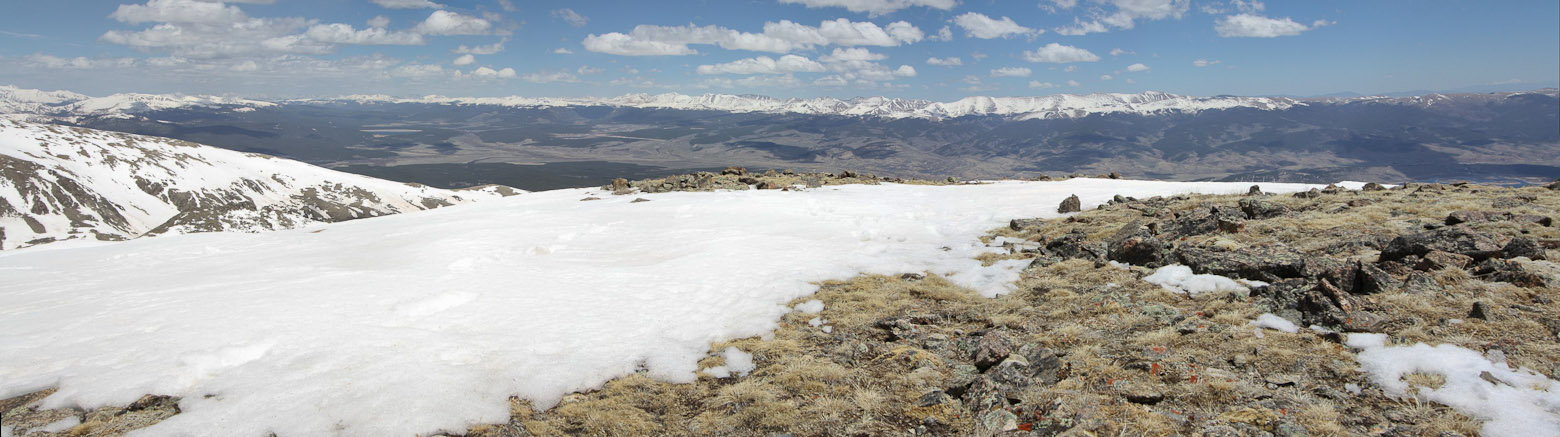
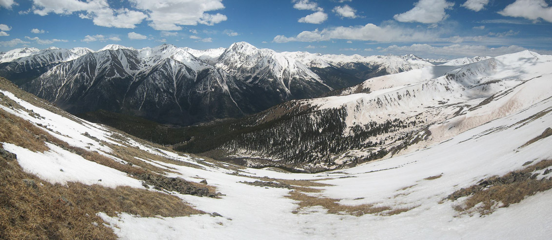
A wide view from the 13,600' summit...
The ridge was very broad, and somehow was a ton less windy on the east side, despite not having a wind shield...
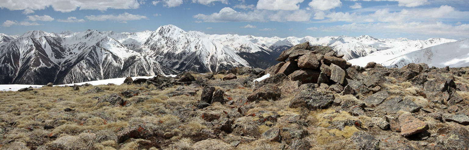
Gorgeous views of La Plata was the theme of the day, on the south slopes. Here it stands next to my "summit" cairn...
After 30 minutes at 13,600', reflecting on how awesome it was that this simple "workout hike to 11,600'" turned into a beautiful and memorable 3,900' gain solo hike to Elbert's ridge, I stood, turned to face the wind, and quickly headed back down the western slope. The gusting wind diminished soon after I dropped some elevation.
I heel-stepped down the snow fields early on in my descent, before the post-holing became too much. The view was spectacular during the entire descent...
I stuck to dry ground and the trail, as best I could...
Another wide pic of the view, with La Plata taking center stage...

Time for another self portrait, from ~12,400'. Around here I realized I could take off my jacket and winter hat...

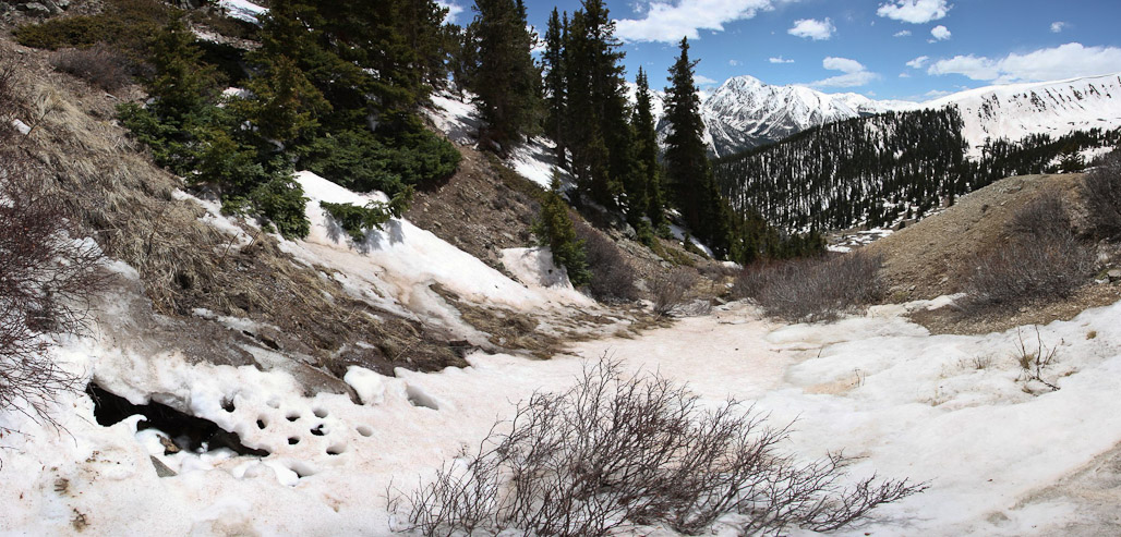
The trail leads back down to the valley...
Again, the trail from 12,200' to 12,000' was heavily obstructed with snow through some trees, and I made my way down the path of least resistance, back to where I had stepped into the stream. I crossed without issue on the return...
A close-up of the small stream, and another self portrait...
Back to the point where the trail starts descending down the valley...
As I followed the trail back into the forest, I stumbled upon some old rusted cans, and a metal wheelbarrow. This must have been the site of the old cabin (no longer in existance). From here I totally lost the trail. There was a lot of snow amongst the trees, and I decided to head down into the valley, hoping to meet up with the trail eventually. But the valley led to dense thickets, and no trail, so I returned back to the camp, and inspected the snow blockage between trees, and remembered bypassing it on the way up (not conveniently). I decided to plow through the snow this time, making an obvious trail for anyone coming here in the future (before it melts). As I stepped atop the large snow bank, I got quite a surprise when my whole body sank to my waist, and punched into another airpocket, where I sensed a stream was passing below. I instantly did some doggy-paddling in the snow (best description I could think of), to climb out, without planting my feet into an unknown stream. It made for a smile and excitement, and I was quickly on my way, back on the trail. I ended up plowing through most of the snow drifts on the way back, trying to help speed up the meltage, and make the trail obvious.
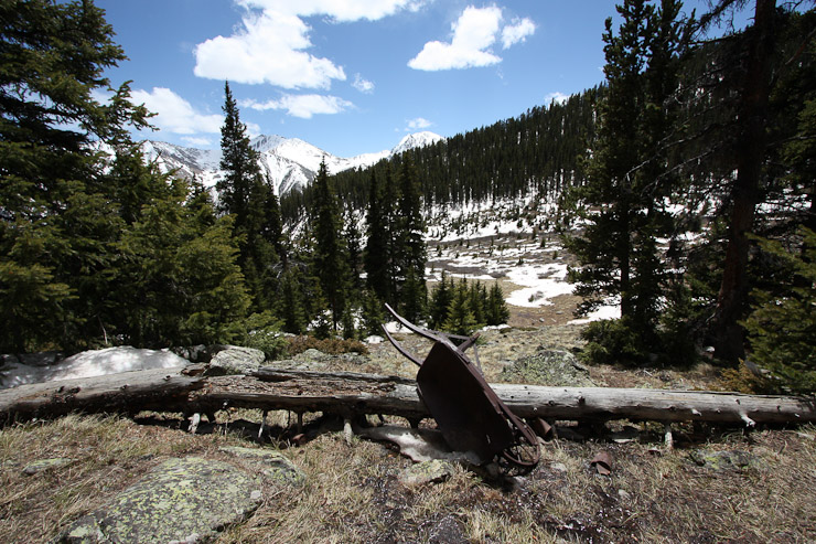
A rusted wheel barrow marked an old mining cabin location. I lost the trail (which ends up going down to the left of the wheel barrow), and cut down to the valley (2nd pic), only to realize my error, and return to the trees. The valley was filled with dense willows/thickets, and would have been a pain to bushwack through...
Here's the path leading into the snow bank. I headed over the snow on my return, and sank deep to my waist...
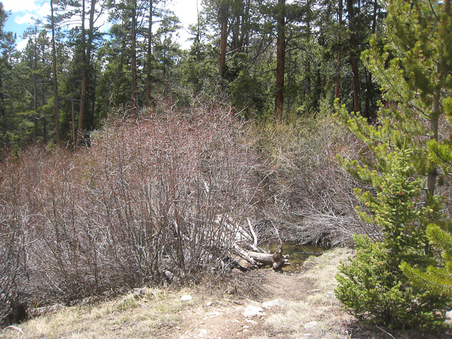
I followed the trail back down the left side of the valley, and eventually found the stream crossing amidst the thickets...
I plowed through the snow in between stream crossings (it was very soft and easy), and jogged some portions down the gentle switchbacks, arriving at the trailhead at 2:50pm, for a 5hr 35min roundtrip, ~3900' gain hike. This hike exceeded all expectations I had for today, and felt like a great bonus, even though I didn't bag a 14er. The solitude on the trail the entire time was wonderful, and really helped build the intimacy with nature.
On the way out I took some pics of Elbert and Massive, before heading back to Fort Collins.
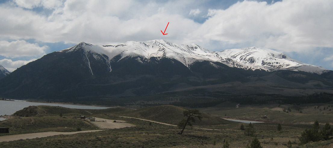
A look at Elbert (broad peak on the right), with South Elbert to the left, and a red arrow pointing to my 13,600' peak...
A couple pics of Mt Massive from the south...
The southeast ascent of Elbert is certainly a beautiful way to reach the peak, though I can only speak of it til 13,600'. The ridge walk to Elbert and back is another 1400', with a long time spent above 13,600', so start very early in the morning. I still need to bag Elbert, and may considering this route again in the summer, though tempted to explore from the north, having reached the ridge from the south already. But the isolation and beauty on this route may be enough to return again.