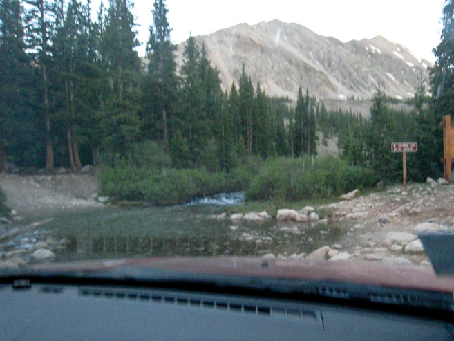
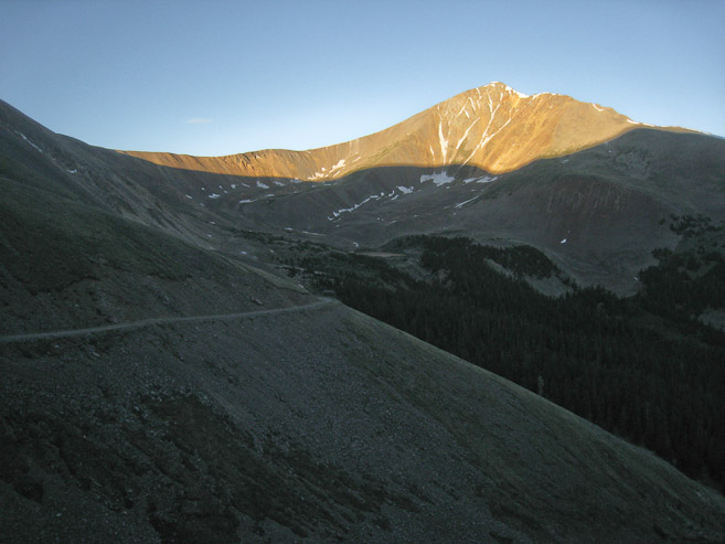
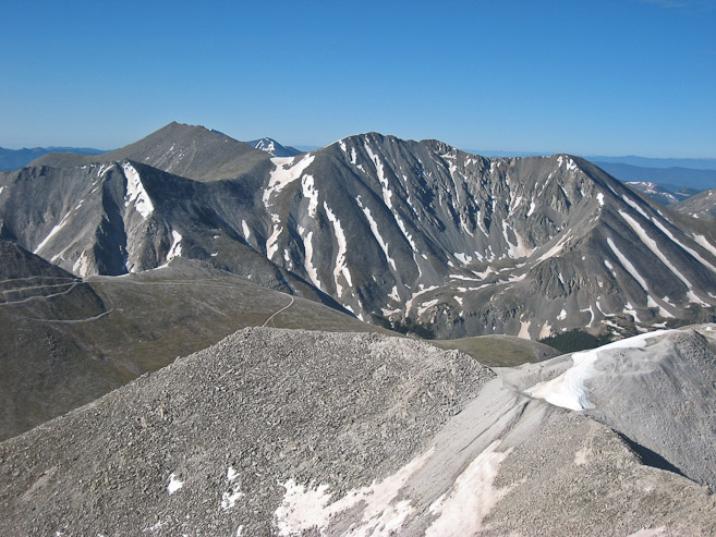
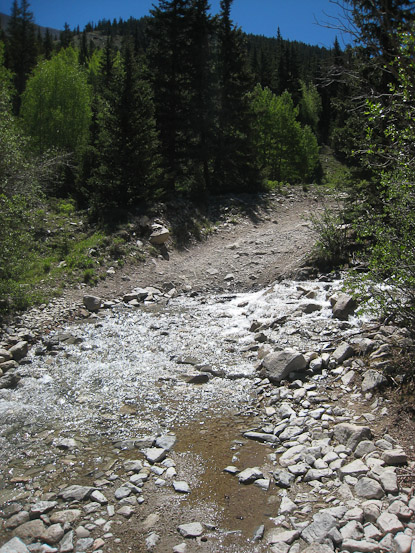
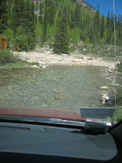
A look at the stream crossing ~3 miles up the 4x4 road. The sun was still illuminating the high west facing peaks...
Trail stats:
distance: ~9 miles roundtrip (from camp at 1st stream crossing, 10860')
elevation gain: ~3500'
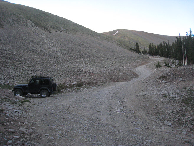
A 4pm Saturday departure from Fort Collins, in Tom's Jeep Grand Cherokee, led to a 7:45pm arrival at the Baldwin Gulch 4x4 road just south of Buena Vista. With Tom's Jeep Grand Cherokee, we were fully equipped to handle the steep rocky road during the day's last hour of light. Our destination was a campsite, on the other side of a stream crossing, ~3 miles and 1420' up the road. This 4x4 road was fairly tame (stress-free) compared to others I've been on (Como, Rockdale, Winfield, Lead King), though only with a high clearance 4x4 vehicle. The stream crossing was a breeze (glad the massive melting from 2 weeks ago is over), and we found a place to camp at 10,860', just beyond the stream. By 8:30 we were setting up our tents.
A look at the stream crossing ~3 miles up the 4x4 road. The sun was still illuminating the high west facing peaks...
All week I had been excited to try out my new 1-man tent that I bought for cheap on REI-OUTLET last week. After staking it out over a soft, flat, sheltered patch of ground, it looked beautiful. I unrolled my ground pad, threw in my pillow, and then had the sinking realization that I didn't pack my sleeping bag on this trip. How did I overlook this, when I've brought it on trips 4 times over the past 6 weekends? My mind was trying to figure out what this meant, and how to compensate. I could sleep in the car instead, which might be warmer, and wear all my layers... Tom had brought his bivy, as well as his tent, and offered the unused bivy as a make-shift sleeping bag. I decided to give the bivy-bag a try, thinking I could stay warm enough in my tent with the bivy and all my layers. Turns out this would end up being the biggest drama, and most memorable event, of the weekend for me, which I'll attempt to capture (so I can "fondly" relive the moment)...
The temp was supposed to dip into the upper 40s tonight, which doesn't seem terribly cold at 10,860' (could certainly be worse). By 10pm, I was ready to sleep, wearing long underwear, pants, and 3 upper body layers. I then stick one leg into the sleeve of my synthetic "down" jacket (feels like a sleeping bag), attempting to cover as much of my torso with the remaining material and sleeve. With my merino wool scarf, I stick my other leg down the center tube, and use my fleece hat as a booty. This seems alright at first, but for a light sleeper like me, who prefers to be a little too warm at night, I was always noticing a part of my body that seemed a bit too uninsulated. I re-adjusted constantly, trying to figure out how to stretch my jacket to cover the most body area, or even fake my mind into believing it was touching a sleeping bag. The bivy didn't provide the sleeping bag vibe (or insulation) I was hoping for, but I'm sure I would have been much worse off without it. Despite my expectation of zonking out after a long tiring week, I couldn't attain sleep comfort, and soon accepted the realization that I'd be in for a long night. By now, lack of sleep on a hiking trip was "old hat", and I knew it wouldn't be a threat for tomorrow's performance. I wasn't COLD, but just couldn't get quite warm enough for my liking (and maybe just not tired enough too). While lying in the void, I neglected to look at my watch, preferring to keep my mind free from the stress of knowing how much sleep I had missed out on, or how little potential sleep I had remaining. I wrapped my rain jacket around me, and put my "scarf" leg into another pair of pants. I know I dozed briefly at one point, as a discontinuity occured in my shifting and over-analysis of my body temp. I could only hope that hours had passed by, but knew I'd be very lucky to have chalked up 45 minutes. After an unknown length of time, I finally checked my watch: 2:30am. I re-adjusted my clothes, to maximum coverage, but the night combatted back by dipping a few degrees cooler over the wee hours of the night. Now my synthetic jacket wasn't feeling all super warm and cozy anymore. I gave up any hope of sleep. The rest of the night involved paying attention to what part of my body felt least warm, and adjusting. I checked my watch at times, being sure to wait long enough for significant amounts of time to have passed, helping me think the night was moving swiftly. Evenutally, 4:45am popped up, and that was close enough to our 5am wake-up call for me. At least Tom slept well, which was for the best, since he'd be driving back home today. On a positive note, I got to spend a lot of time in my new tent, almost entirely while being conscious, to deduce that it was comfortably sized...
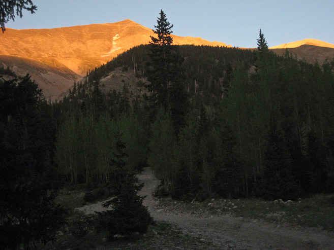
We began our hike at 5:30am under the clear pre-dawn skies. We'd be hiking in shadow most of the morning, up the west side of Antero, but still slathered on some sunscreen, prior to our start, to be prepared for later. The majority of today's hike would be along the 4x4 road, which switchbacks up the mountain to 13,700'! Trailfinding should be trivial today.
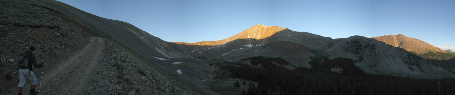
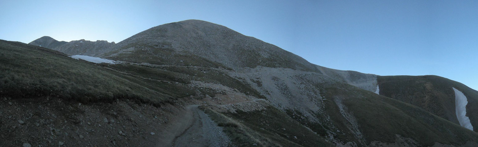
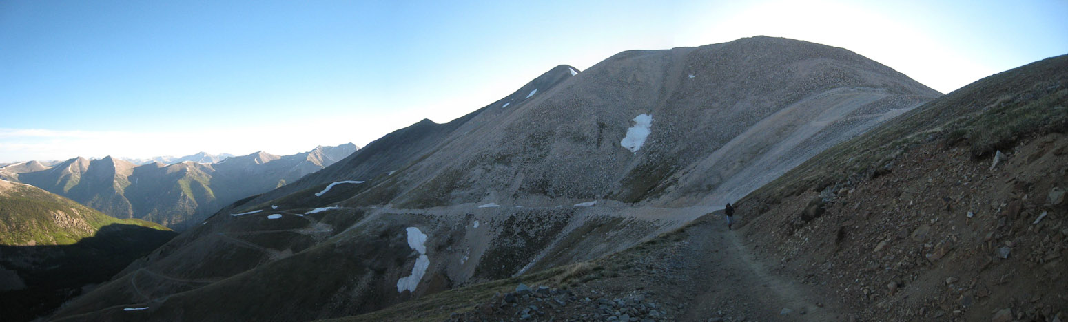
A look up the 4x4 road from our camping spot, at the start of our hike ~5:30am, with Antero's peak in the distance. After 30 minutes on the trail, we reached treeline...
The road cut it's way across the mountain, while the sun lit up the peaks across the valley...
Class 1 hiking doesn't get much easier than this...
Tom heads north after a bend in the road, with Antero appearing above...
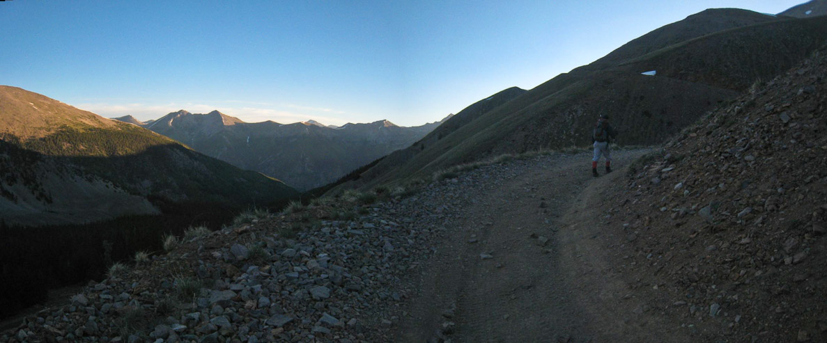
The road was dry the entire way. I wonder who plows this road??? :-) A look across the valley at Cronin Mountain...
Elevation gain was painfully slow, as it seemed like a mile of walking would only net a few hundred feet of gain. Antero appears on the left...
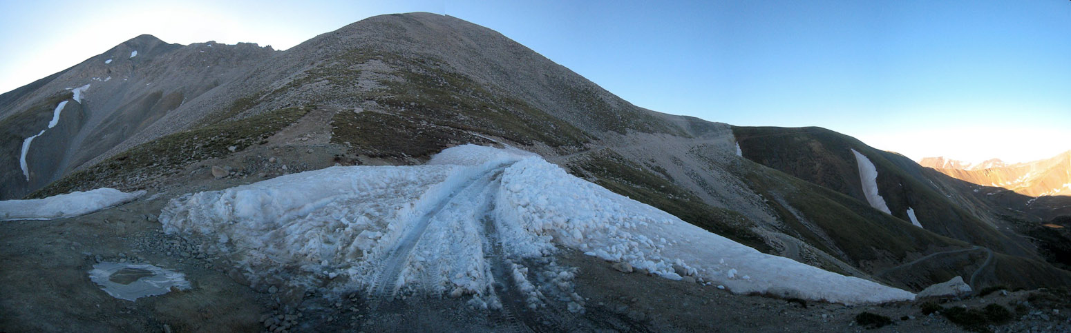
I guess the road was ENTIRELY dry the whole way, but this snow patch was easily passable by man and machine...
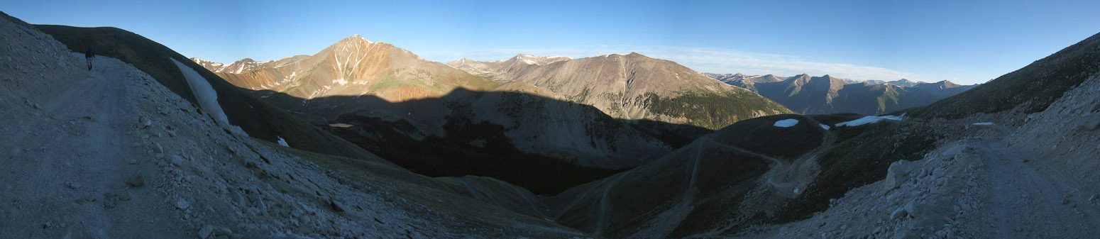
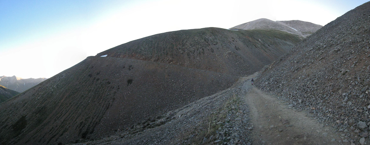
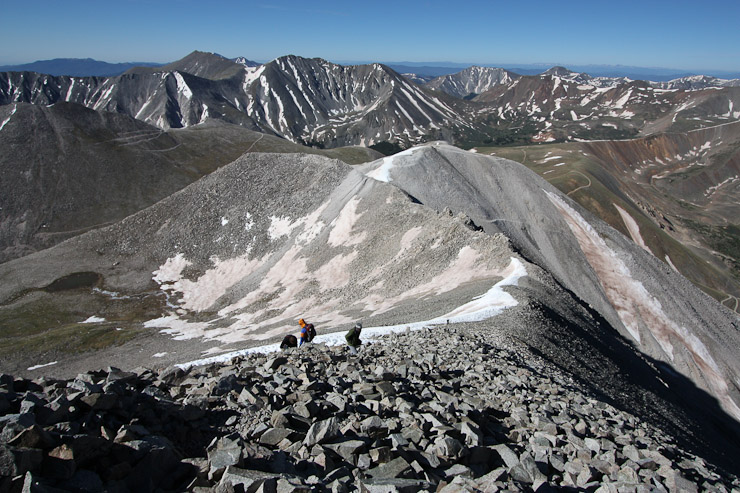
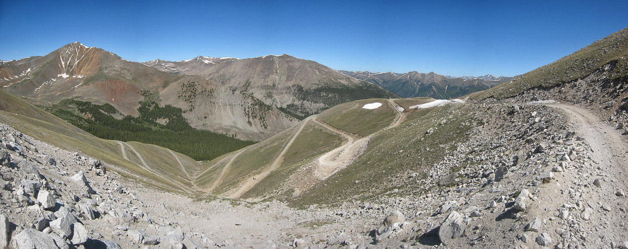
A look down the valley at several of the switchbacks from near the top of the ridge...
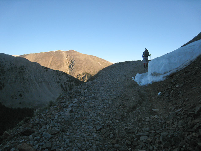
Just beyond here, the road reached a saddle on the ridge, where hikers can opt to climb along the crest towards Antero (instead of following the road up the backside of the mountain)...
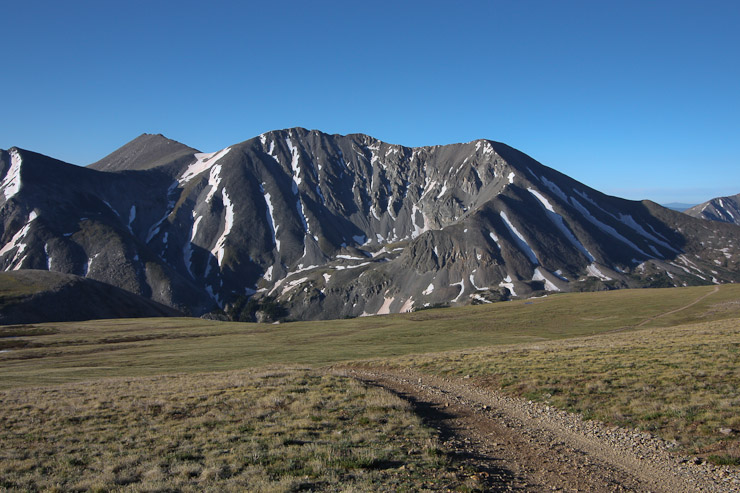
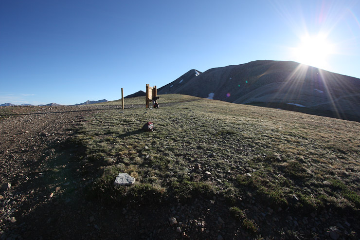
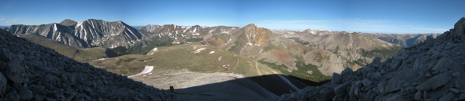
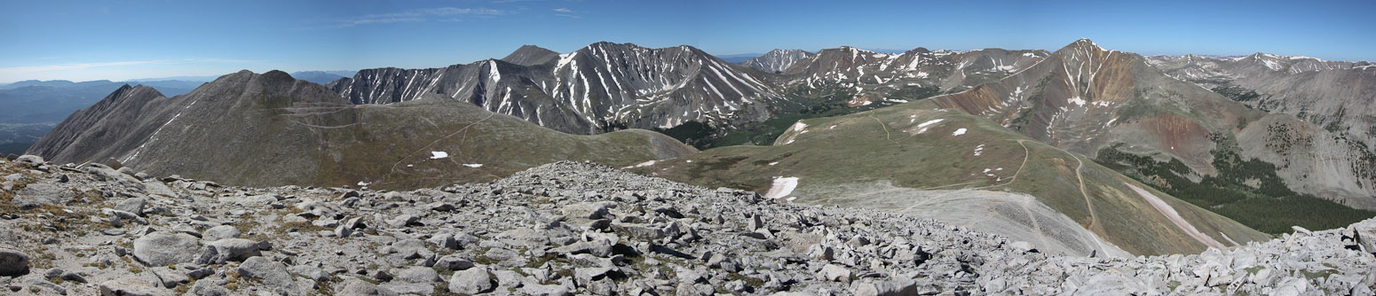
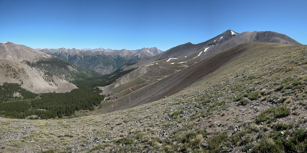
A look at Shavano and Tabaguache from the broad ridge. Multiple roads headed in different directions. We rested at the sign post a few minutes, before heading up towards the rocky ridge...
After a brief moment in the sun, we were back in the shade, climbing north up the ridge. There wasn't much of a trail, but it didn't take much thought to know which way to go...
A look back down towards the saddle. We had ascended via the road from the valley on the right...
A look north after the ridge leveled off, with Antero's tip rising beyond...
Tom hikes up the ridge, with Shavano and Tab on the left...
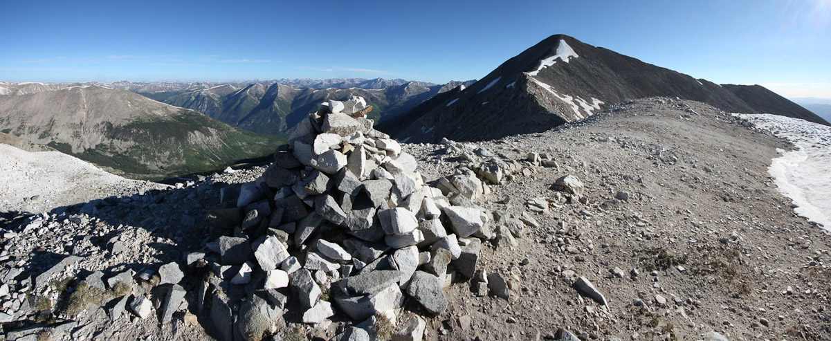
I saw this cairn atop a bump in the ridge, and climbed up to it, but later found that the road bypasses this false summit. However, I was glad I checked it out, as it was a fine photo op...
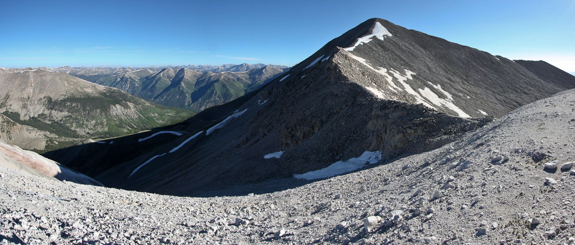
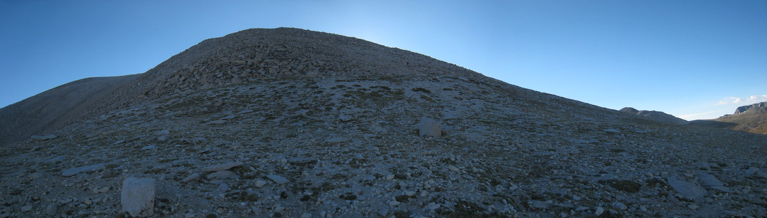
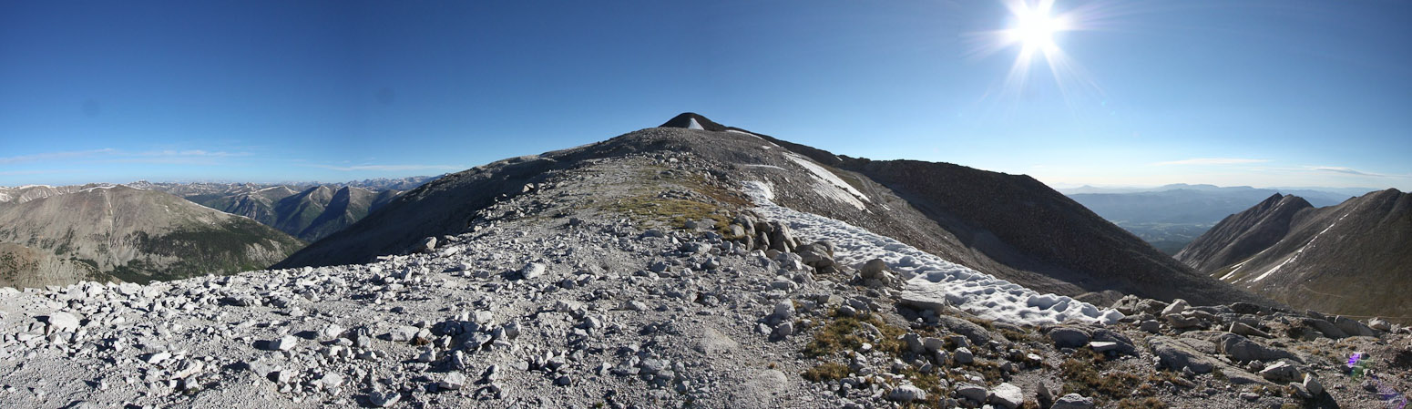
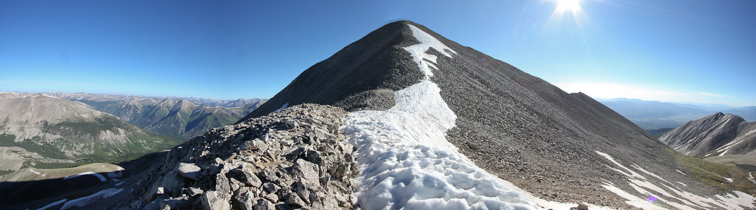
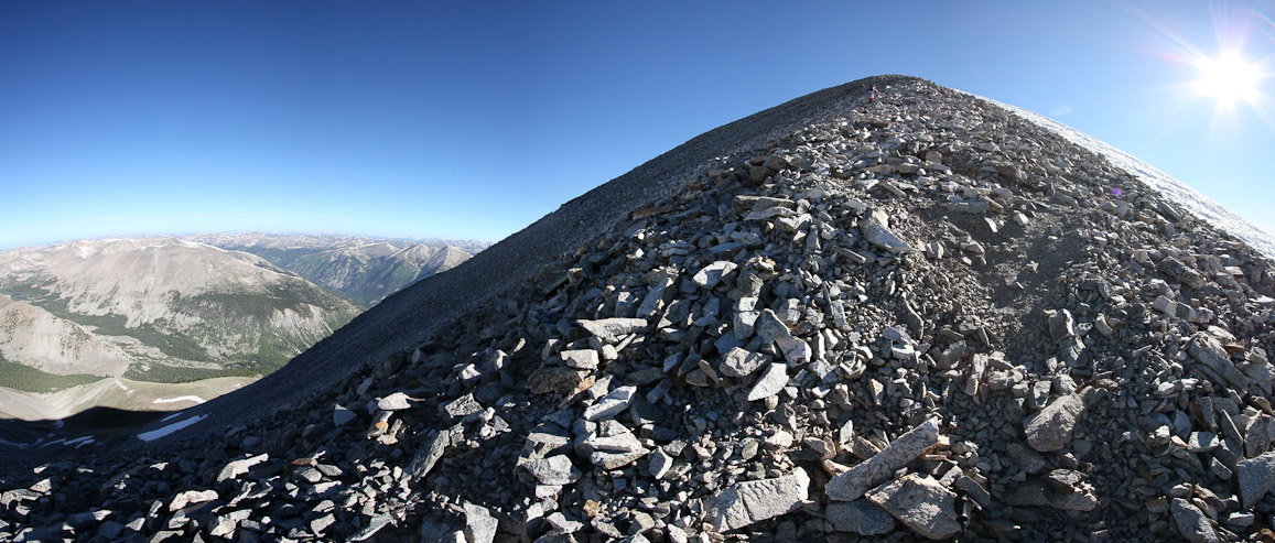
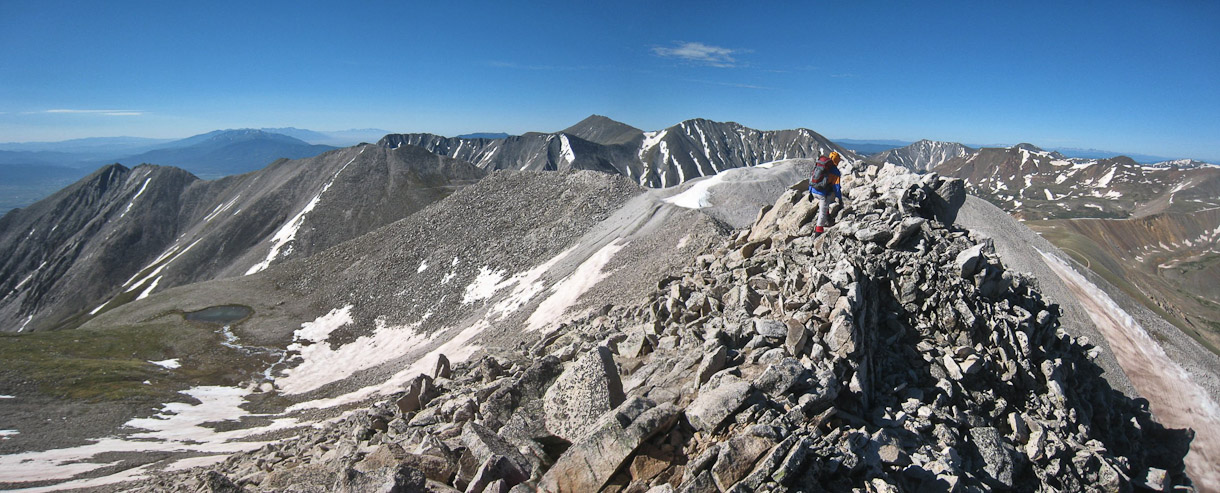
A look at the remaining ridge hike to Antero. The ridge managed to display some character finally...
After descending from the "bump" ~50', I was ready to hike the "dramatic" section of the ridge...
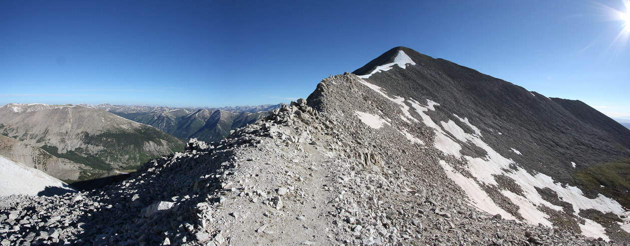
Not much snow on the ridge. The wind was blowing at a fair clip at times, but mainly from our backs...
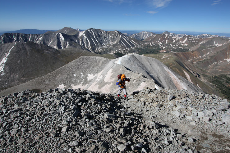
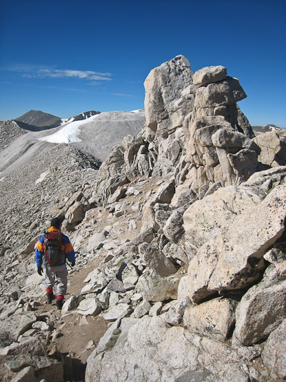
A look ahead at the final stretch shows Tom crossing the first snow patch on the ridge...
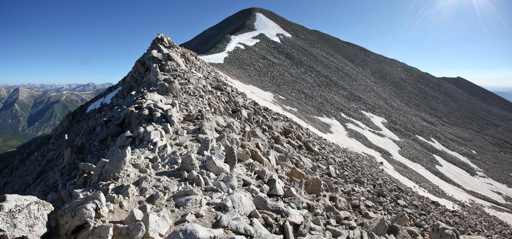
The snow was hard, and easy to walk on over the flatter parts...
But it was easier to stay on the rocks, as the slope increased. A look up and back...
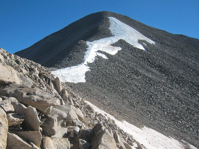
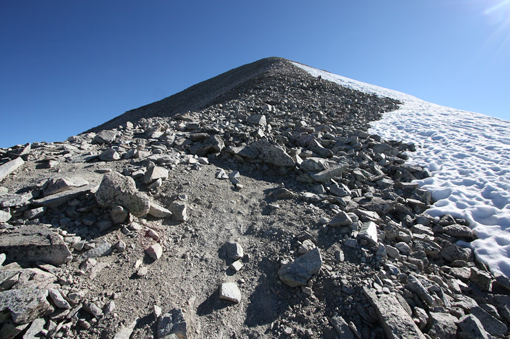
The final climb to the summit. It was chilly enough that I wore my winter hat during most of the ascent, and gloves 100% of the time...
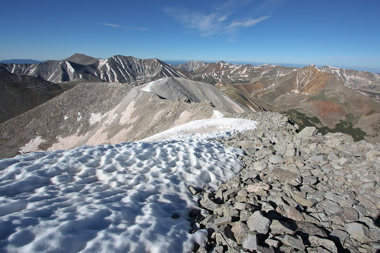
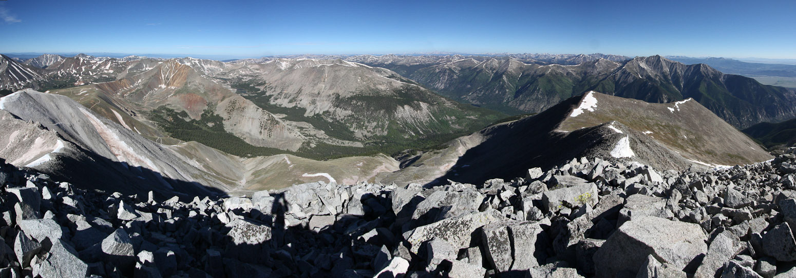
I reached the summit at 8:30am, 3 hours since our start. A look at Shavano and Tab from the summit, and at Tom moments from reaching the peak...
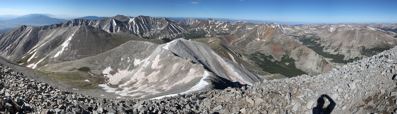
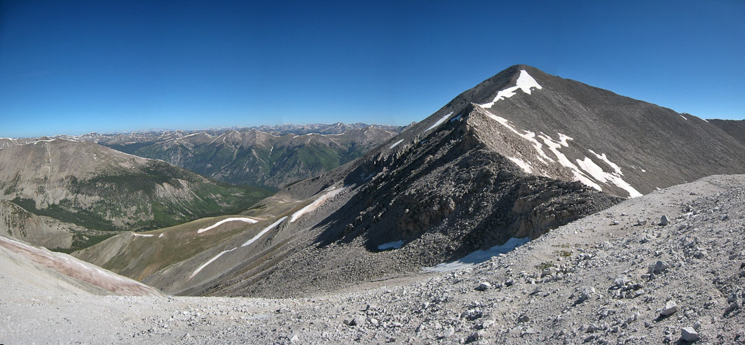
A wide view looking south at the ridge we climbed. Part of the road can be seen in the valley to the right...
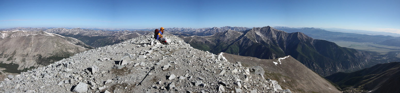
Tom on the summit, with Princeton on the right...
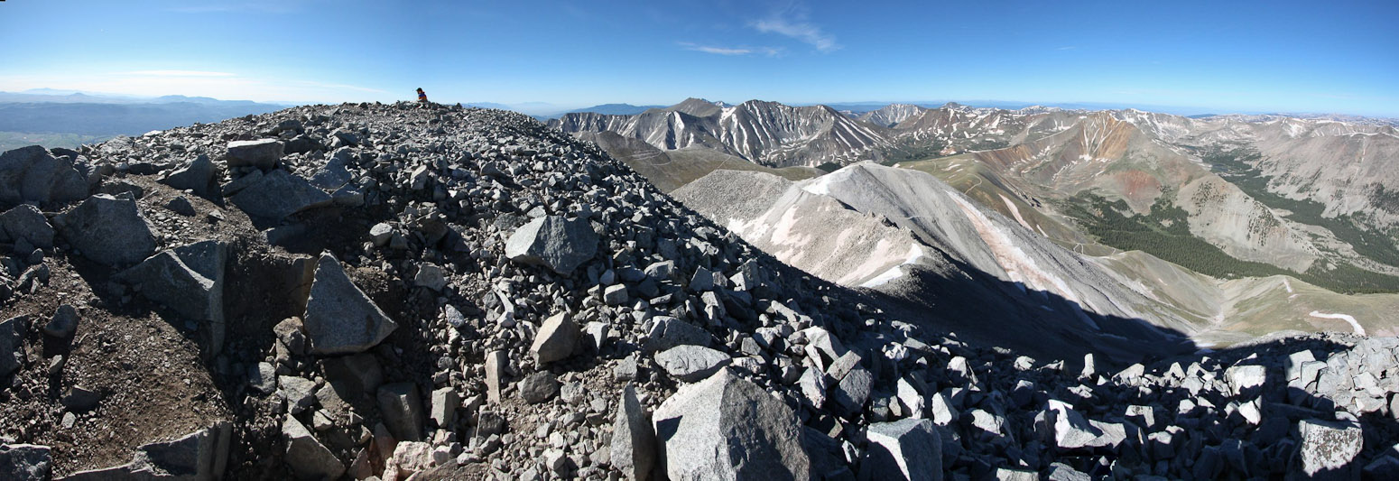
A look northwest at the valley we camped in, with the ascent ridge on the far left...
Tom sits on the summit. We were the first to the top today, and could see others on their way up the ridge...
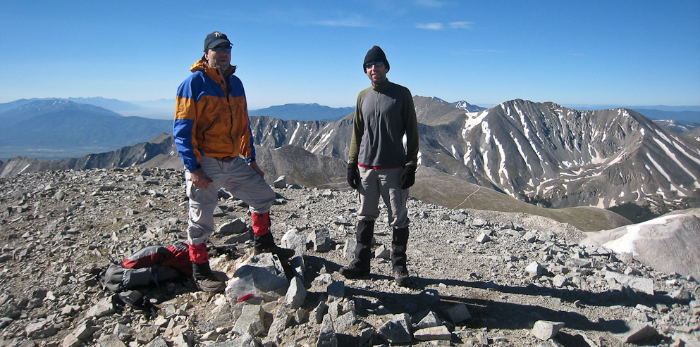
Shortly before we left, another group arrived, and took our pic...

After 25 minutes on the summit, we started our descent, passing a few hikers on their way up. No more than a dozen hikers on the trail today...
Tom crosses a "rugged" looking part of the ridge on the way back...
Tom bypasses the sharp ridge on the east side...
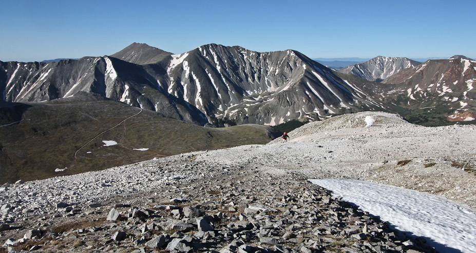
A last look back at the mighty Antero, from the "bump" with a good photo-op that I reclimbed...
I spent a long time taking pics on the ridge, and when I started the descent to the saddle, I saw Tom walking among the grass below already. I scurried quickly down to catch up...
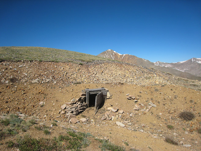
I noticed a mine shaft along the saddle, near the beginning of the road descent. I wonder if this was an aquamarine mine...
I told Tom I wanted to explore further down the saddle, in hopes of a photo-op of Antero, and that I'd try to catch up with him on the road later. I didn't make it too far down the saddle towards Cronin, before realizing it would take too much time and energy to make my desired destination. I back-tracked to the road, and started jogging back, eventually reaching Tom at treeline. From there it was a quick return down the road to camp, where I arrived at 10:47am (1hr, 50 minute descent).
A look at Antero, and the road, from my short hike along the saddle between Antero and Cronin...
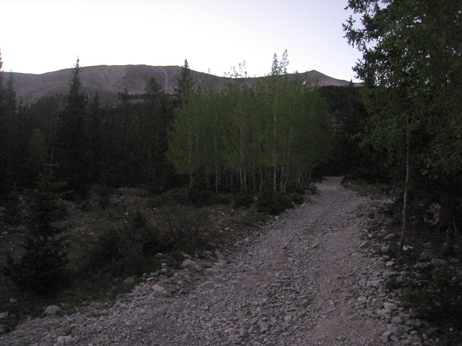
I jogged most of the road back to treeline, trying to catch up with Tom. There are a pair of hikers in the middle of the pic, on the road...
A pic of the 2nd stream crossing, which was manageable to cross by foot, though helpful to have waterproof boots. And a pic of the 1st stream crossing, during our drive back down the mountain. Glad we didn't have to cross this one by foot...
After packing up camp, we started the 3 mile drive down the 4x4 road, encountering several ATVs and a Jeep headed in the opposite direction. These crossings required us to back up into pullout areas. All in all, it took us ~45 minutes to descend back to County Road 162.
Antero makes 14er #32 for me. I'm very greatful for Tom and his 4x4 Jeep to make this Sawatch 14er a manageable climb, cutting out 6 miles roundtrip and 1420' gain of road hiking.