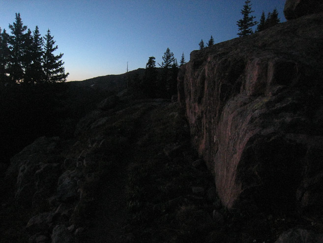
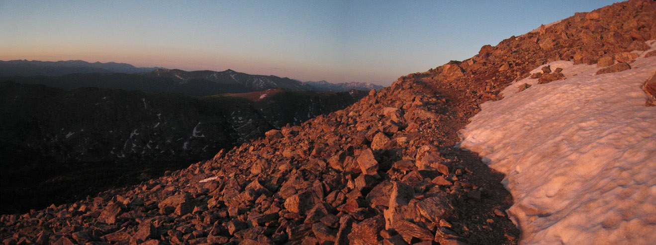
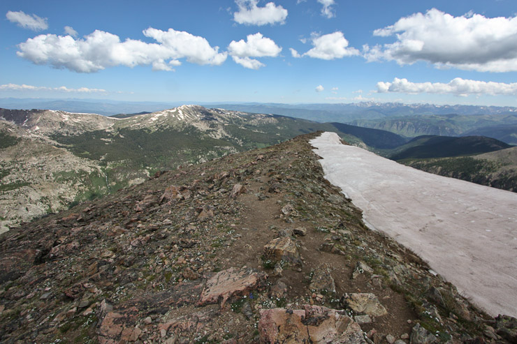
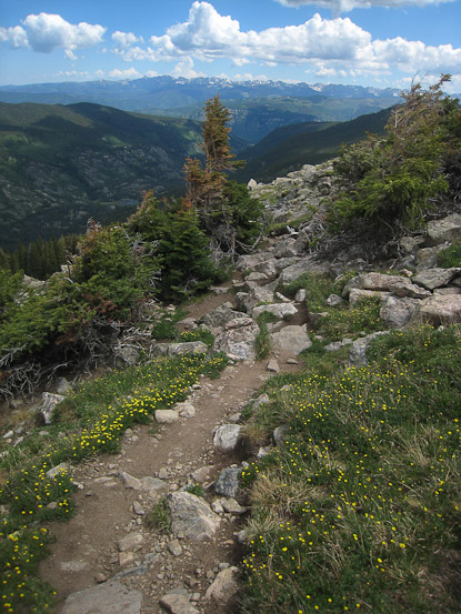
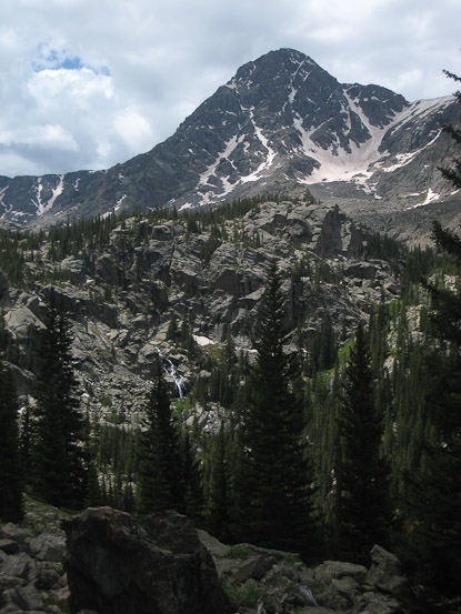
A pre-dawn look up the Notch Mountain trail shortly after 5am...
Trail stats:
route: Halo Ridge via Notch Mountain Shelter ascent, return via standard Halfmoon Pass.
distance: 15 miles roundtrip
elevation gain: ~5500'
time: 4am - 12:48pm = 8hr 48min
Solo climb.
I left Ft Collins at 7:40pm Saturday night, having packed my gear after the US loss to Ghana in the 2nd round of the World Cup earlier that day. The drive up Tigiwon Rd was much slower than I anticipated, as I was limited to 15-20mph up the rough (for 2wd) dirt road in the dark. Fortunately there was no other traffic. After a good 30+ minutes to cover the 9 miles, I took one of the few parking spots left at the trailhead, and was surprised to discover I had cell phone reception in this remote location. Must be the close proximity to Vail...
I wanted to catch sunrise on Notch Mountain (best viewing location for "the cross"), and considered an early start, given the full moon. As I packed my bag before going to sleep, I realized I forgot to bring my synth-downie jacket, but fortunately brought an extra fleece sweater and rain jacket, which would have to make due. I finally decided on a 3am alarm, and slept in the back of my hatchback.
With only a 3.5hr window for sleep, I surprisingly made the most of it with a quality 3+ hr doze. I happened to wake up at 2:50am, just before the alarm, as always... Given my early start, I worried that I might be cold, waiting for sunrise on Notch Mountain, and decided to bring my sleeping bag, since I didn't have my normal jacket. After eating half a peach, prepping my pack, and visiting the latrine, I hit the trail at 3:35am, Having just watched another group start their hike (to the Cross Couloir). I was a bit confused by the trailhead signs, since supposedly there were 2 trails, but I only saw one. The signage made it look like the 2nd trail split off a short ways ahead, so I followed it. But the direction and elevation gain seemed wrong, and I went back and forth a couple of times, before finally returning to the parking lot after deciding I was on the wrong trail. It was now 4am, and since I was back at the car, I decided to dump my sleeping bag, thinking I wouldn't be waiting much for sunrise anymore (this probably was for the best, in the end). I walked down the parking lot towards signs for a campground, and found the Fall Creek Trailhead. Finally I was on the right path, after a 25 minute delay.
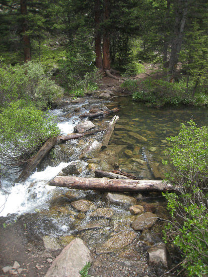
I followed the Fall Creek Trail for 2.5 miles, ~800' gain, and 45 minutes later reached the junction for Notch Mountain trail. The Fall Creek Trail was well marked, and the one stream crossing was uneventful. I whistled now and then, just in case any 4 legged creature would care to hear me and vacate (didn't see anything). I constantly headed south towards the bright full moon beacon that shined through areas of less dense pine trees. The Notch Mountain Trail was long and madly full of long switchbacks for 2000' gain over 2.8 miles. As the trail climbed above treeline, I admired the pre-dawn views, and kept a close eye on my watch, wondering if I'd reach the ridge before sunrise.
A pre-dawn look up the Notch Mountain trail shortly after 5am...
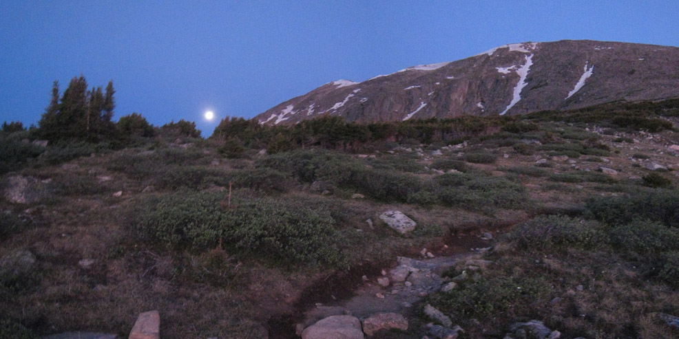
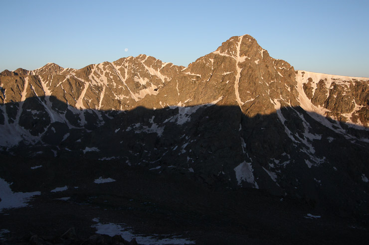
The full moon had not yet set, and I hoped to reach the ridge before it completely disappeared behind Holy Cross...
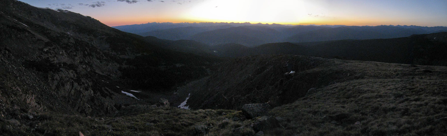
Looking northeast from the Notch Mountain trail. I didn't turn back much, determined to make the ridge as soon as possible...
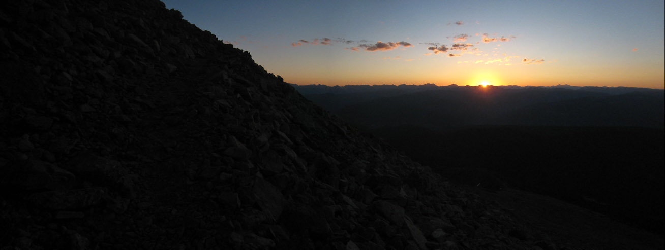
Alas, I noticed the rocks around me starting to glow red, and turned around to see the sun rising at 5:40am. I still had a several hundred feet to go...
A look at the switchbacking stone trail during sunrise...
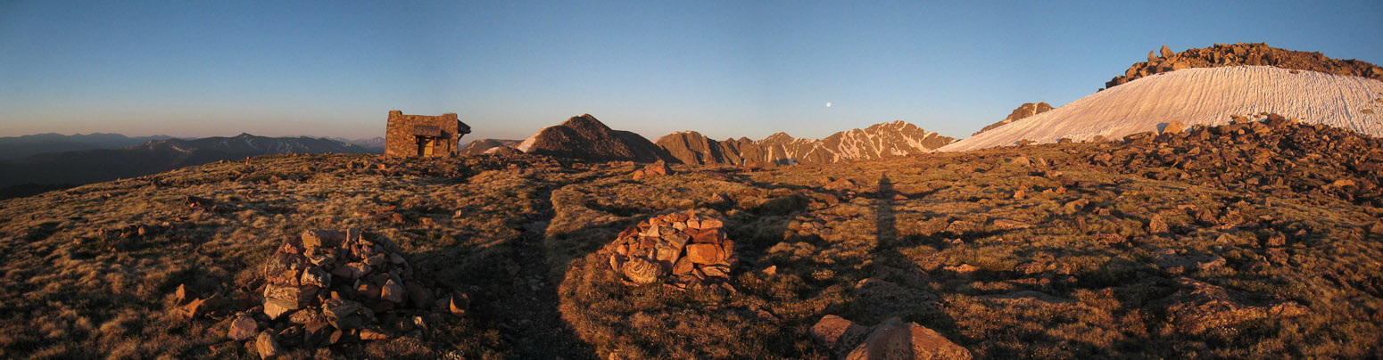
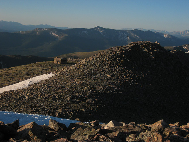
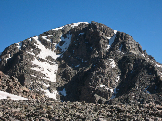
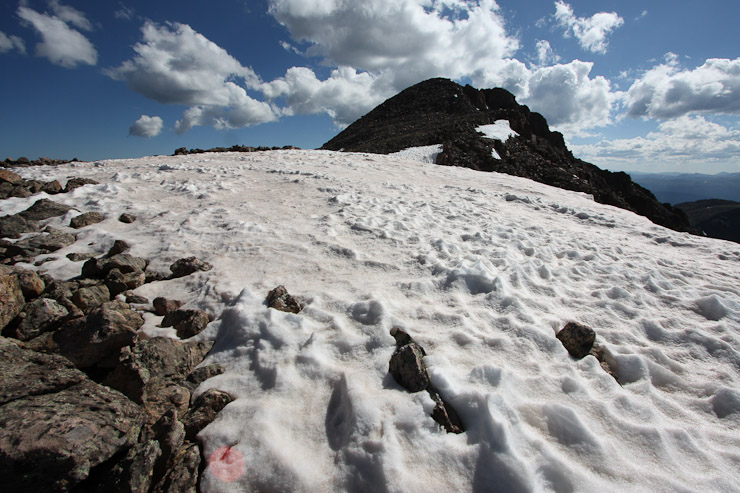
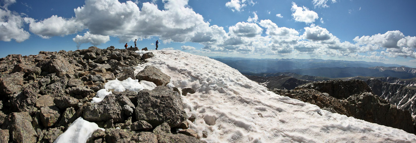
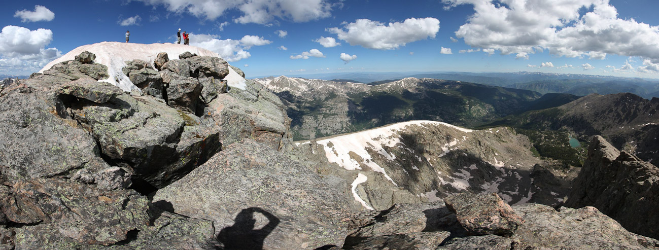
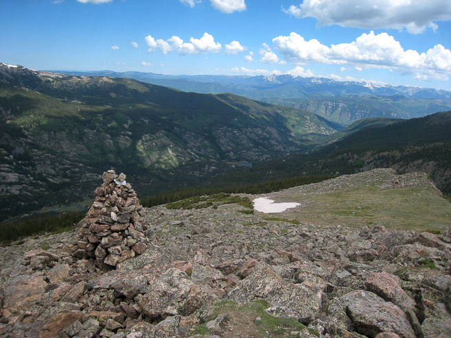
At 6am I topped out next to some cairns, near the shelter...
The Cross was mostly intact (with snow), and I was happy to see I caught the moon...
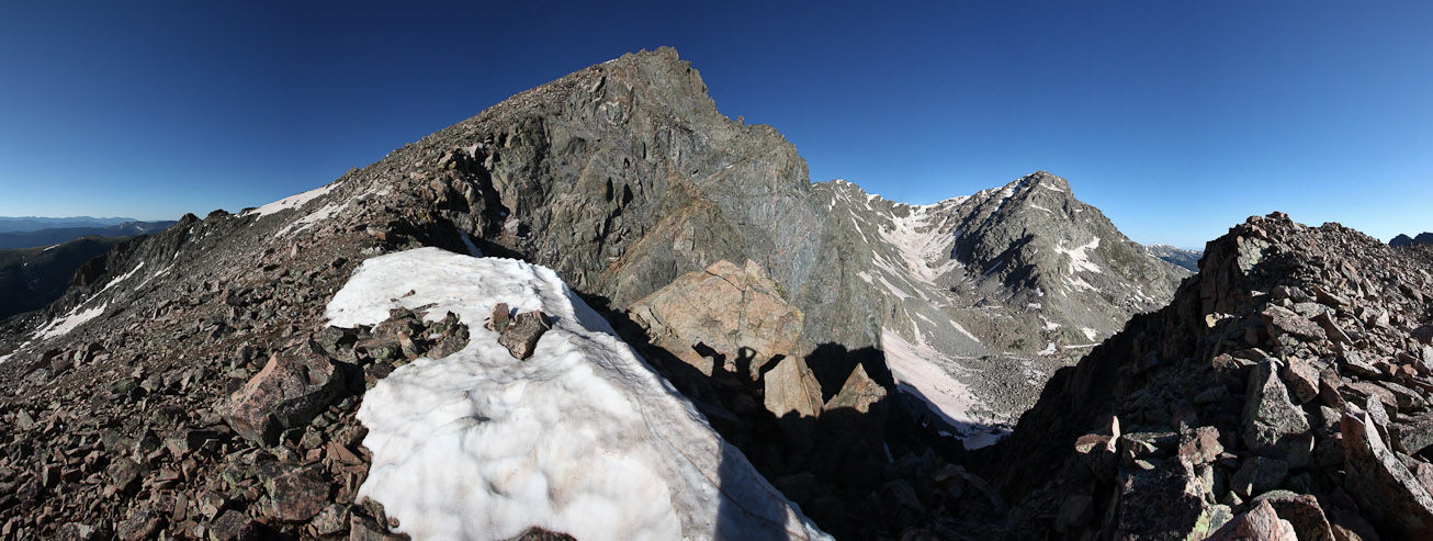
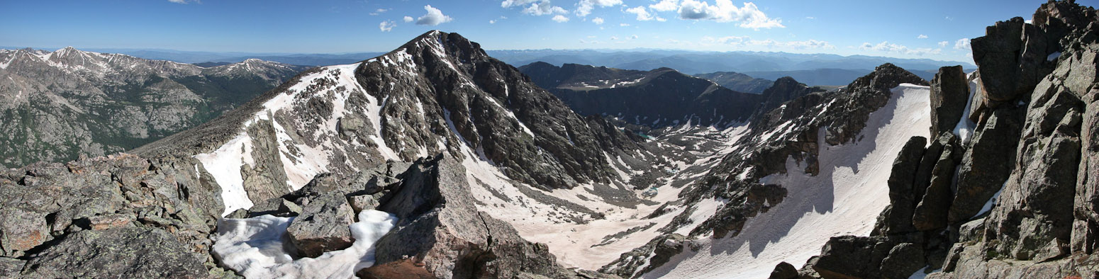
I approached closer, to view the valley below, and hiked further up the ridge to the right for a better vantage point. This pic shows the halo ridge route, wrapping from the left and around to Holy Cross...
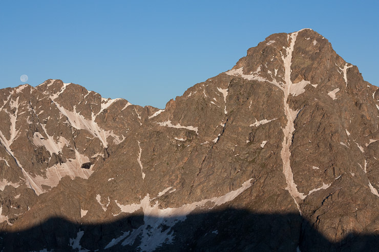
Pics of the Cross, with the moon about to dip below Holy Cross Ridge (13,831'), which I'd climb on my way to the summit...
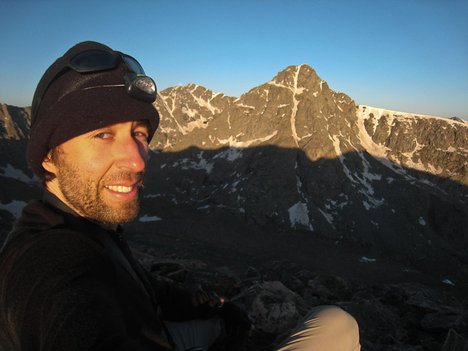
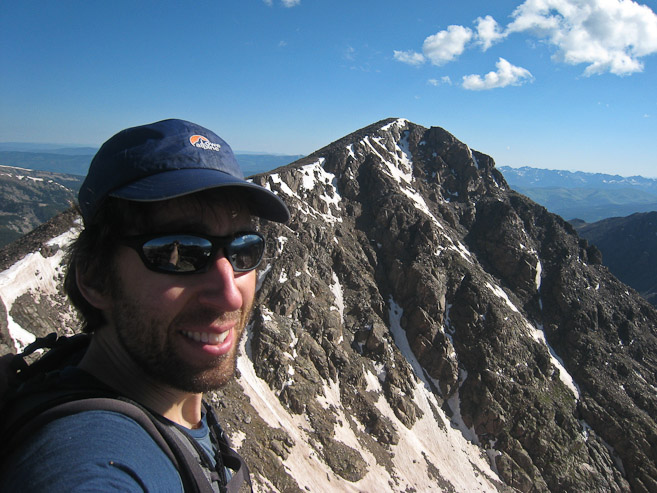
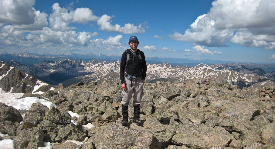
A scruffy self pic from Notch Mountain...
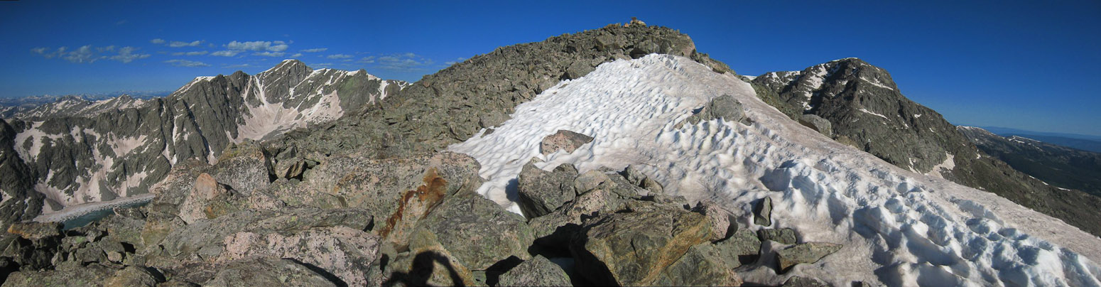
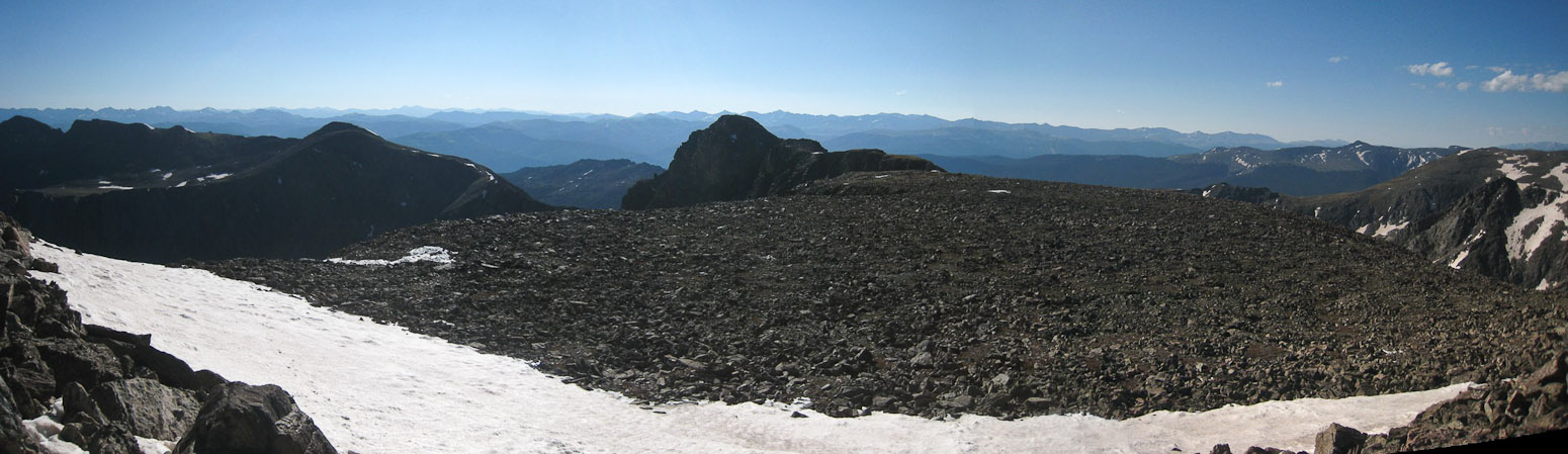
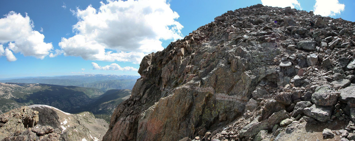
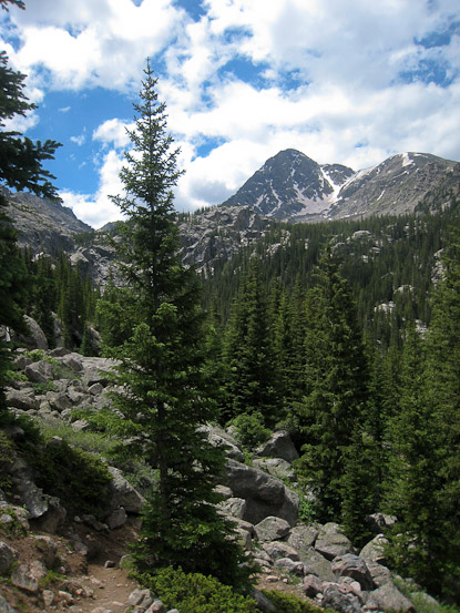
I hung out near the south summit of Notch Mountain for a good 15 minutes, taking pics, and eating a snack. The forecast for today was "mostly cloudy", but there were no clouds to be found this morning. Glad I didn't have a sleeping bag to haul around, since I was plenty comfortable in my layers. I wandered around a bit more, and returned to the shelter (which is closed for repairs this year), readjusted my boots, and took more pics before starting the Halo Ridge portion of the hike. 1st "bump" on the ridge was 13,248', a small gain from the 13,060' Notch Mountain shelter.
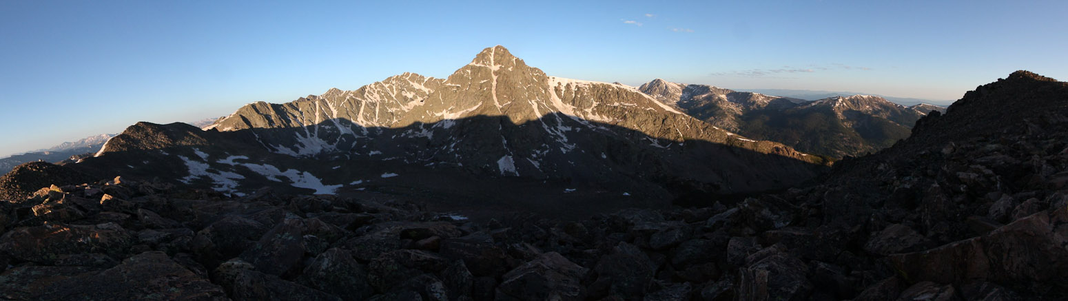
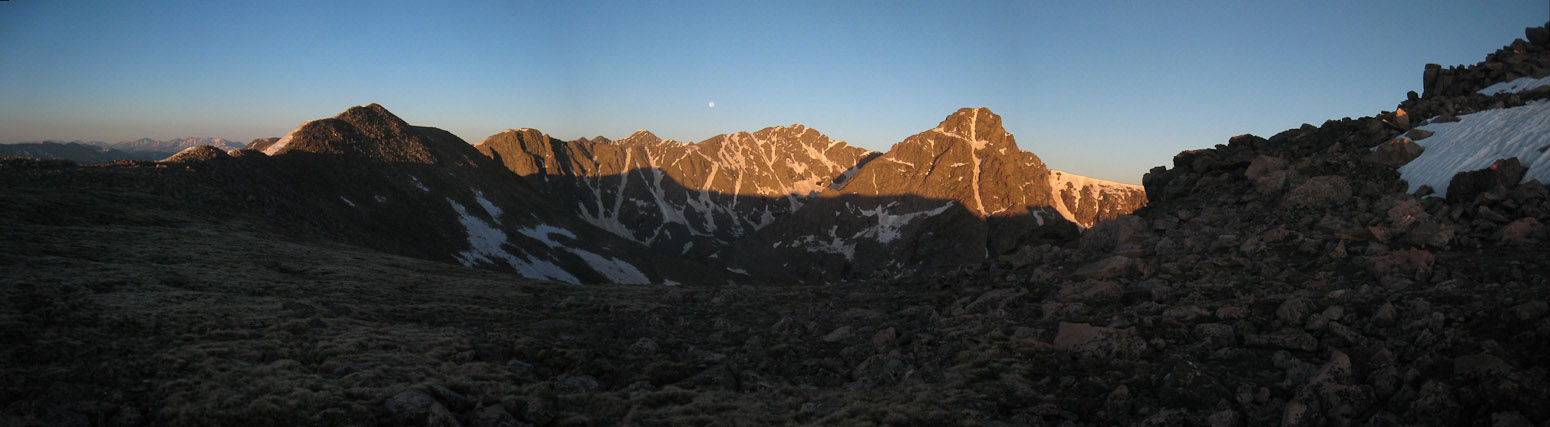
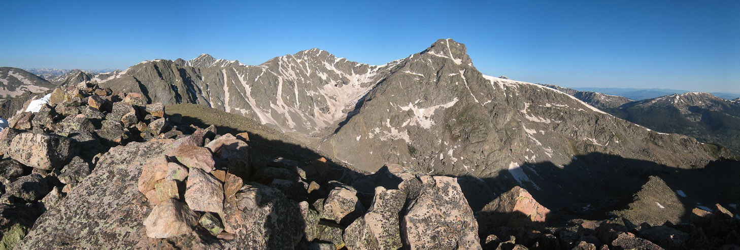
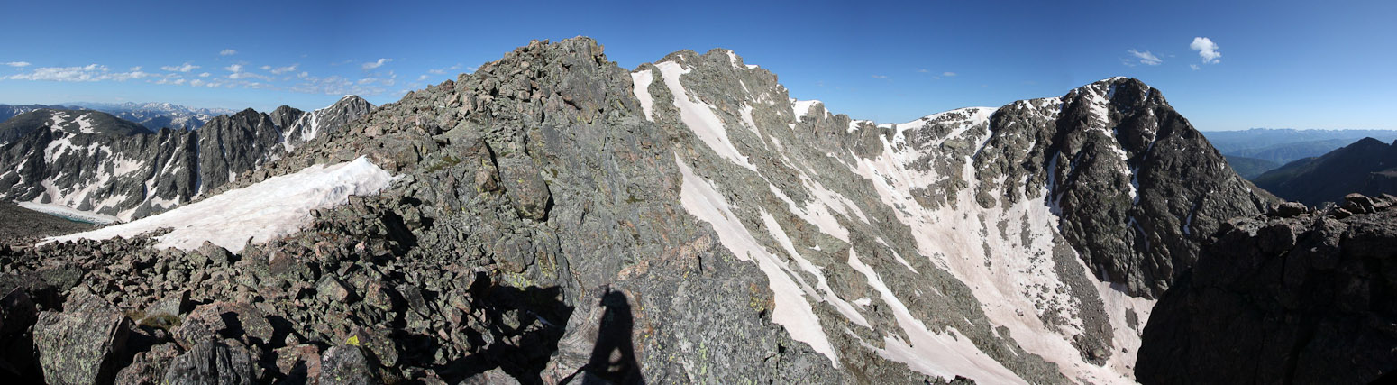
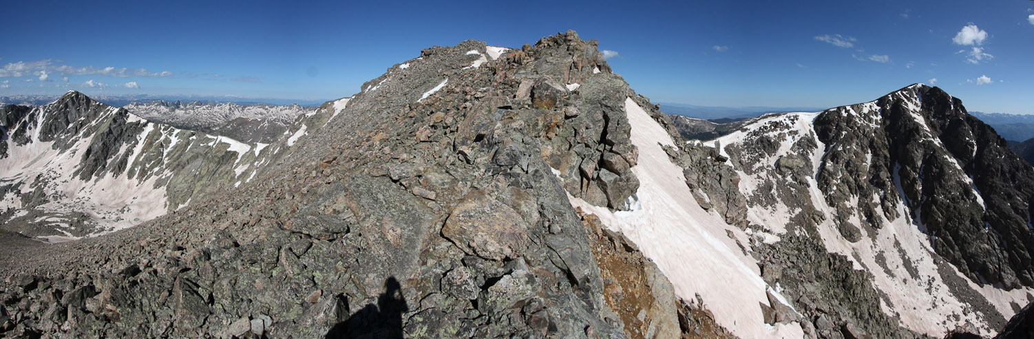
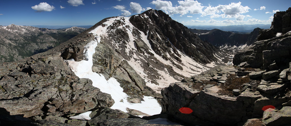
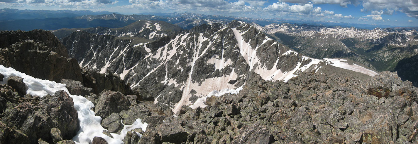
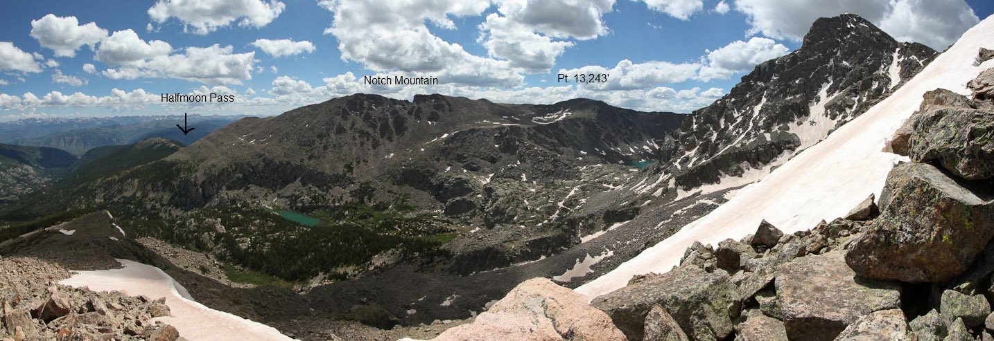
This view from South Notch Mountain shows my complete ridge route today. Everything lit by the sun from left to right would be on my route. The left half is the Halo Ridge, then right half is the standard route towards Halfmoon Pass...
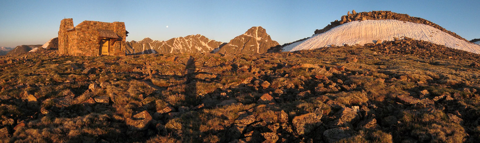
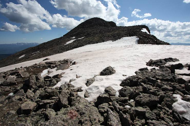
I headed back to the shelter, and took another look at the Cross as I started the ridge traverse...
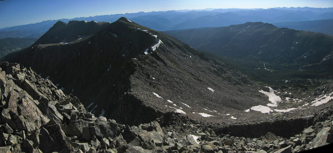
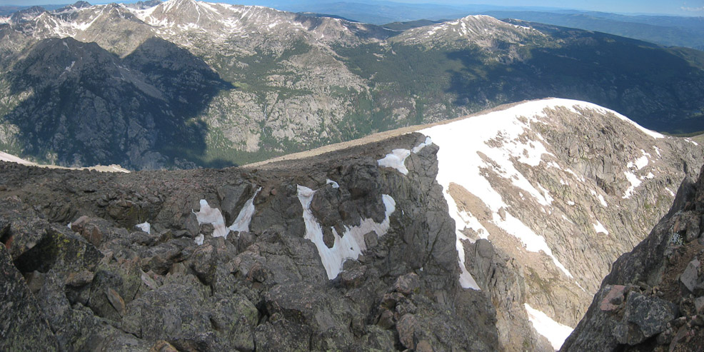
A look down the valley, with the first sub peak on the left, and Notch Mountain shelter on the right...
The climb to Pt 13,248' had a lot of snow on the east side of the crest. It was pretty solid, though I stayed off of it for the most part...
The view from Pt 13,248', which I reached at 7am...
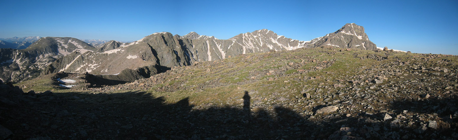
The trail then descended ~300' down rock and tundra to a saddle between the next 13,373' sub-peak. I was expecting more of a worn trail here, but it was largely unmarked. Guess this isn't as well traveled as I thought...
The view from the saddle between Pt 13,248' and Pt 13,373', with Notch Mountain on the right...
The lack of trail meant lots of rock/boulder hopping along the ridge. The view from the saddle of Pt 13,248' and Pt 13,373'...
My pace was slow across the rocks, and I stopped for pics and snacks along the way...
It was ~450' from the saddle to Pt 13,373'. Occasionally I encountered portions of a dirt trail, but it was largely an easy class 3 rock scramble...
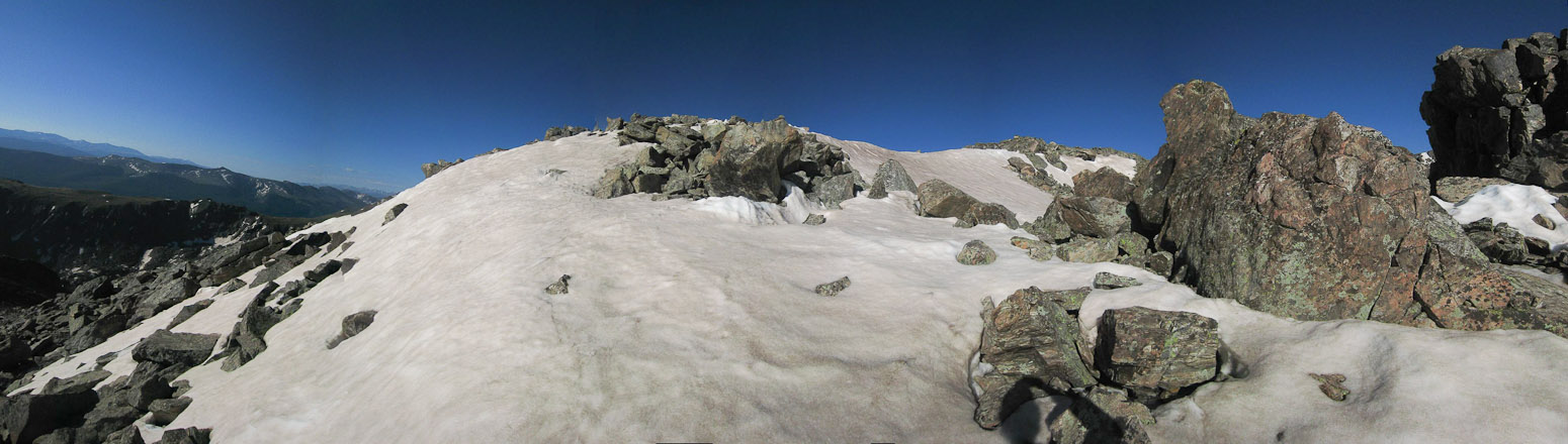
A bit of snow along the way to Pt 13,373'...
Looking back at Pt 13,248' and Notch Mountain...
Finally the summit cairn of Pt 13,373' emerges. It took me an hour to reach this subpeak from Pt 13,243'. I labored much more than I had expected to reach this point, and was very glad I wasn't hauling my sleeping bag...
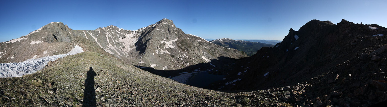
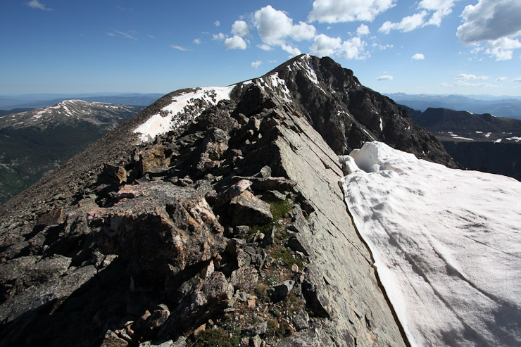
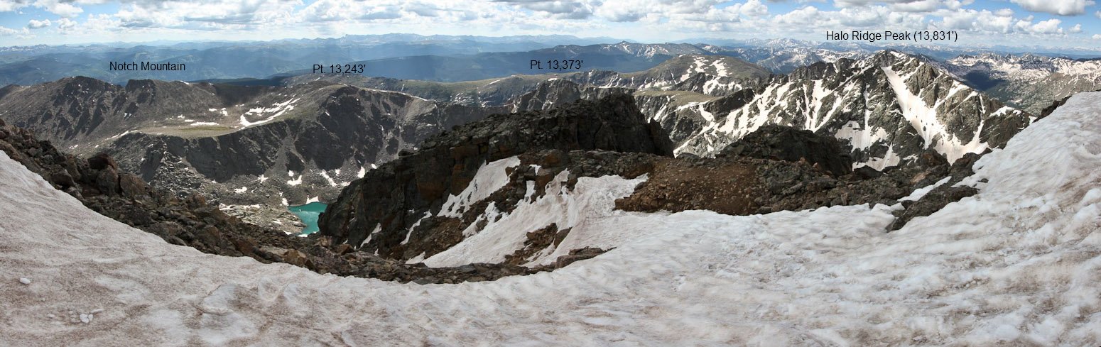
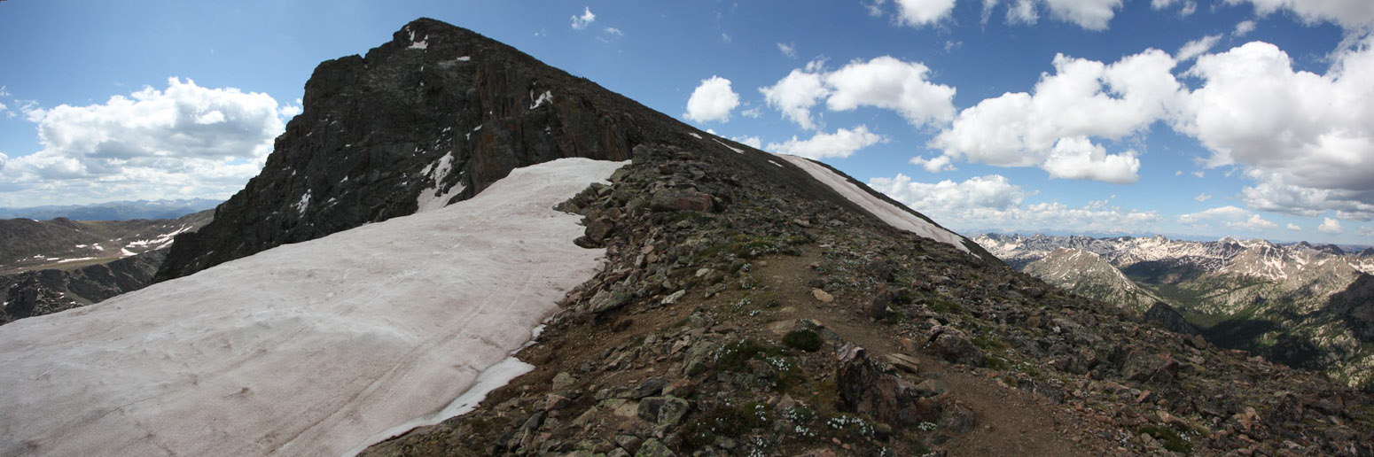
Beyond the summit, the ridge descended to a relatively thin neck. Views were impressive...
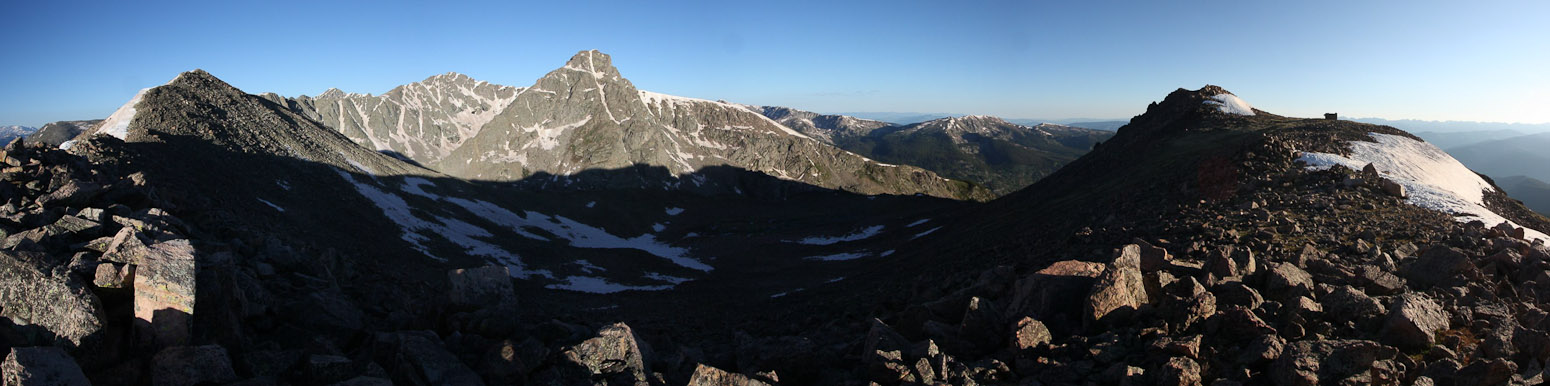
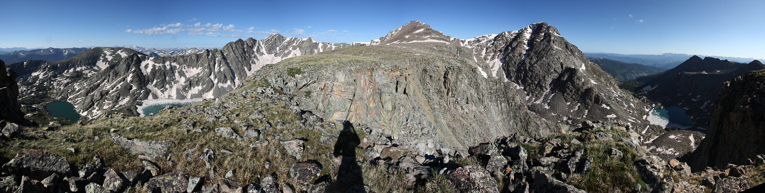
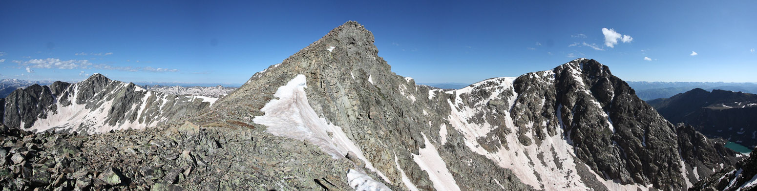
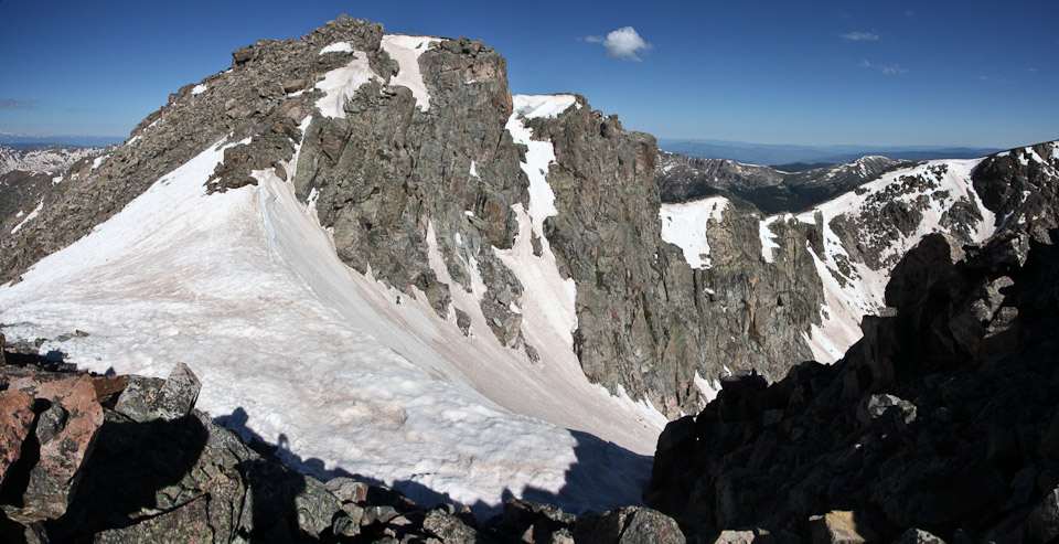
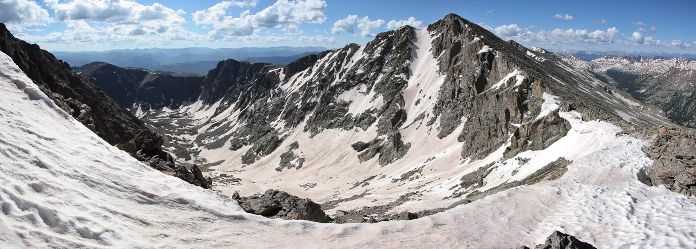
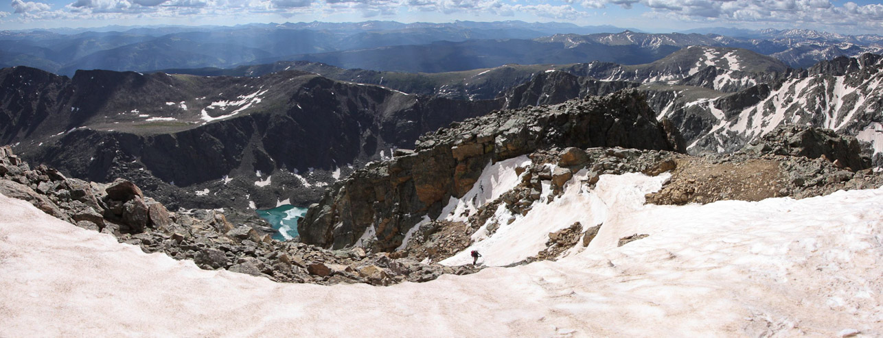
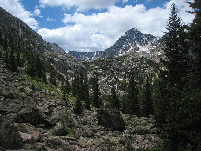
A couple of blue/green lakes appeared in the valley to the left. Holy Cross towers to the right. The summit of Holy Cross Ridge (13,831') appears in the center of the ridge...

It would be another 600' to reach the summit of Pt 13,871, also called Holy Cross Ridge, which is one of the highest 100 peaks in Colorado...
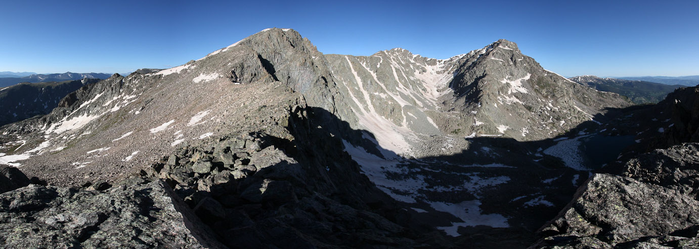
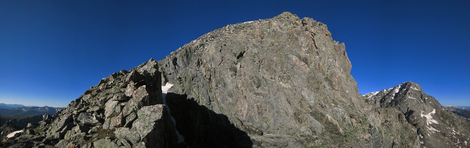
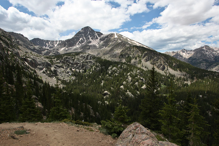
A look back at Pt 13,248' and Notch Mountain. The shelter is the small bump on the ridge. I noticed some people standing on the summit of Holy Cross to the north...
Notch Mountain on the left, along with Pt 13,248', and Pt 13,373' in the middle...
I could hear voices occasionally from here, and wondered if anyone was climbing the nearby snow chutes...
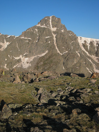
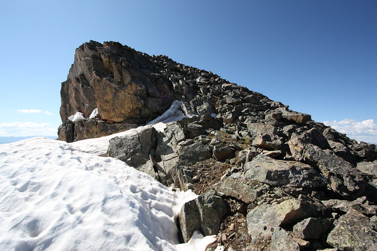
The summit of Pt 13,831' lies just beyong this sharp false summit...
There's the summit of Pt 13,831'. The wind was gentle today, and I was down to just a t-shirt at this point...
A small snow crossing just before the summit...
I reached the summit of Pt 13,831' at 9am. A self portrait with Holy Cross summit next on the list...
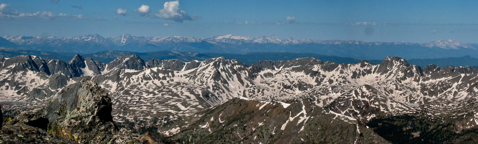
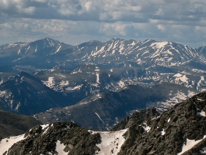
It was unique to view the Elk range from this northeast vantage point. I picked out Pyramid, the Bells, Snowmass, Capitol, and Sopris...
After a brief rest, I continued on Halo Ridge towards the next saddle...
A look up and back at some of the rock character on the ridge...
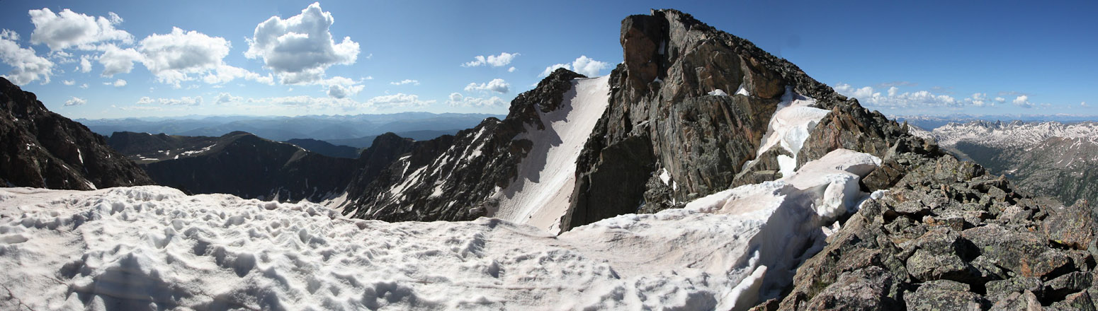
Pt 13,831' has an impressive north face...
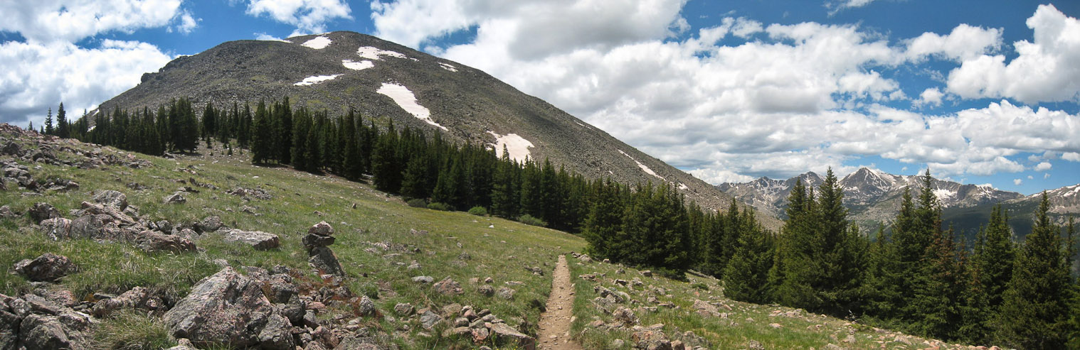
A look up Holy Cross from the final saddle on Halo Ridge. ~600' more to climb for the summit...
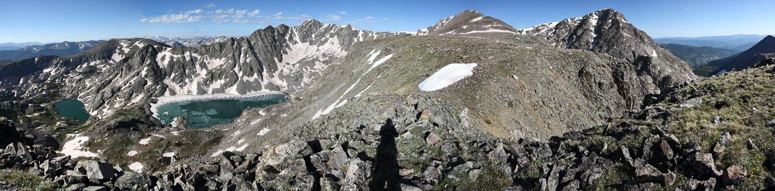
The views were fantastic all day, and I enjoyed looking back at Pt 13,248', Pt 13,373', and Pt. 13,831' throughout the hike (all visible in this pic), to admire my progress...
There were some snow patches along the final stretch of ridge to Holy Cross. They looked easily passable, but after post-holing on their perimeter, I choose to bypass them...
As I was nearing the top, I saw some people descending in my direction, and thought I'd have my first encounter of the day with another hiker. However, they ended up veering to the north (which I later discovered is part of the standard route approach). It wasn't until I reached the summit at 9:55am that I greeted a fellow hiker today.
I topped out on Holy Cross at 9:55am, joining three other hikers who had ascended via the standard route and the Cross Coulior...
A fourth hiker makes his way up the top of the Cross Coulior. Conditions on the Cross had been great today, though the snow was starting to soften up (as reported by a hiker)...
I walked down to the entrance of the Coulior for this pic. You can see snow all the way down, with Notch Mountain on the other side of the valley. I also took this pic of Mt Elbert and Mt Massive...
A view of the summit, with the north ridge extending to the right. I'd be completing my loop ridge hike down that path (the standard route)...
Whoo Hoo! 14er number 33!
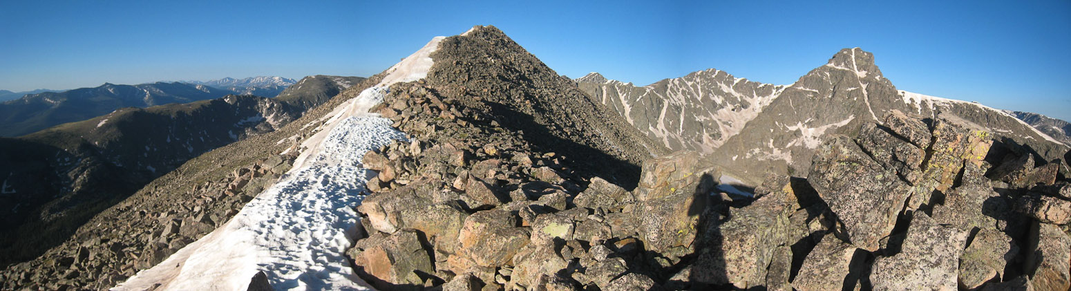
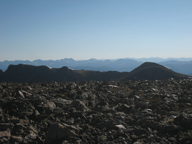
Here's a look across at all the sub-peaks on the Halo Ridge route. I couldn't see any other climbers on Halo Ridge today. I may have been the only one...
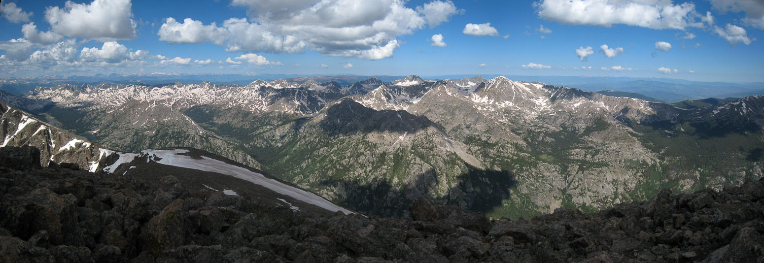
The view northwest from the summit...
The views from Holy Cross were tremendous. It was unique to be in such a northernly position, where all the 14ers sat to the south, while the north melted away towards Wyoming. I chatted with some folks at the top, and pointed out some of the peaks. I could have hung out at the summit without being bored for a long time, but eventually started the descent ~25 minutes after my arrival, knowing there was a lot of trail remaining. I had covered 9 miles on my way to the summit, but still had 6 left on the return loop, including another 1000' climb on the way back.
A look back down at Pt 13,831' as I start the descent. The standard route descends down the west side of the summit, before turning north along the ridge...
The long north ridge of Holy Cross would lead me down to the valley floor. Oddly, there wasn't much of a marked trail, which meant lots more boulder hopping today...
A look back at the fairly steep boulder hopping below the summit. The ridge flattened out after this...
Clouds were emerging, but in non-threatening fashion, casting shadow on the summit...
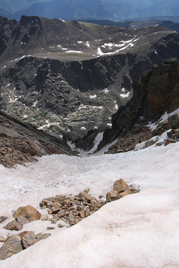
A look down the north ridge. The snow was too soft for me to stay on top of, so I kept on solid ground (more rock hopping)...
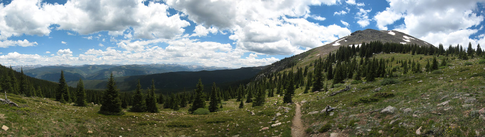
A sweet view of the valley between Holy Cross and Notch Mountain. I climbed up the backside of Notch Mountain this morning, and would return via Halfmoon Pass. Unfortunately, this means a 1000' gain from the left edge of the pic to Halfmoon Pass...
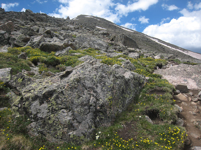
A couple of scenic shots on the way down the ridge. Cairns (one of the few), and flowers...
Once the rocky ridge merged into the alpine vegetation, a geniune trail emerged, and I was able to jog down much of it, until I reached a mildly tricky stream crossing at the bottom of the valley...
The trail then began a steep climb up to Halfmoon Pass. The first 600' climbed up steep switchbacks, but amazingly, my legs seemed eager for the newfound brutal challenge. Views of Holy Cross opened up to the south...
A couple last views of Holy Cross, before heading off to the final, more gradual, 400' to Halfmoon Pass...
A look up at Notch Mountain's Ridge, from the north, near the top of Halfmoon Pass. One can climb to the north peak of Notch Mountain from here...
A wide view, during my descent towards Halfmoon Trailhead, with Notch Mountain on the right....
I jogged down much of the way from Halfmoon Pass to the trailhead, on the gentle dirt trail. I knew I was close when I recognized a couple landmarks from my "wrong trail start" this morning. I popped out at the parking lot at 12:48pm, for a round trip time of 8hrs, 48min. Total hike: 15 miles, ~5500' gain.
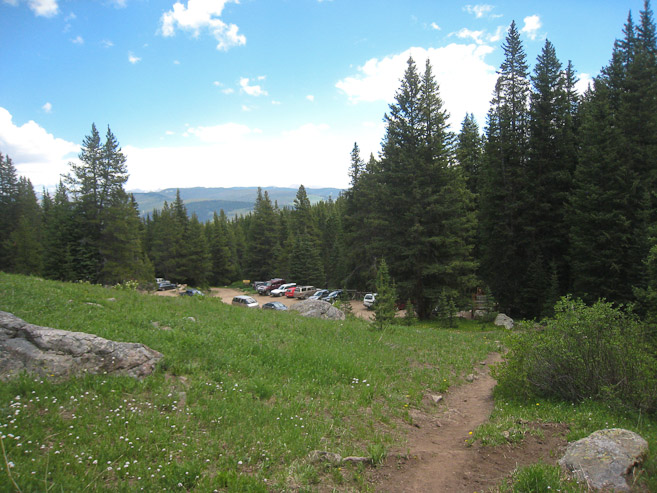
Arriving back at the crowded parking lot at 12:48pm, on this first weekend that Tigiwon Road opened for the season...
The Halo Ridge to Halfmoon Pass loop was certainly a long and strenuous hike, but once up on the ridge, the surrounding beauty distracts you from the tiring trail. Some people hike this loop in the opposite direction, which eliminates the 1000' gain at the end of the hike, but I would recommend the clockwise approach, since you get to see the Cross in the morning sunlight glow, and you're constantly admiring Holy Cross during the Halo Ridge hike. The less scenic north ridge (standard route) is the time to keep your back to the summit. Keeping a good pace on the Halo Ridge was a tough battle, but despite my focus to keep pressing, I couldn't help but be aware of something very special originating from the engulfing beauty of the Holy Cross wilderness, especially during such gorgeous weather. When the exhausting hike was over, and I had time to reflect, I realized that this hike was truly beautiful and a memorable/intimate experience with nature. Reviewing the pics later only confirmed the beauty of this hike.
Colorado, keeps on delivering top quality adventures, and I have yet to scratch the surface of all it has to offer. I love you Colorado!