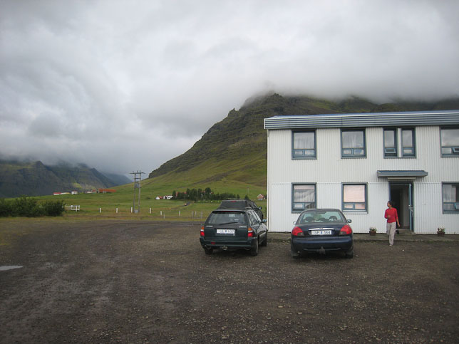
12:14am, Hotel Lundi, Puffin Guesthouse, Vik
Woke up at 7:30am, with the noise from the hall, 15 mintues before the alarm (seems like a consistent pattern). A look out the window showed cloud reaching down to the ground. After finally getting up 20 minutes after the 7:45am alarm, the view out the window did not improve. Not a very inspiring start to a day centered around a big mountain hike. I had already come up with contigency plans, involving shorter walks at lower elevations, and more sight-seeing from the road, but was still prepared for a 6-7 hour hike. Wendy cooked up some eggs and veggies for breakfast. Some of the fog was beginning to thin as we hit the road for Jokulsarlon glacier, located just ~15 minutes up the ring road.
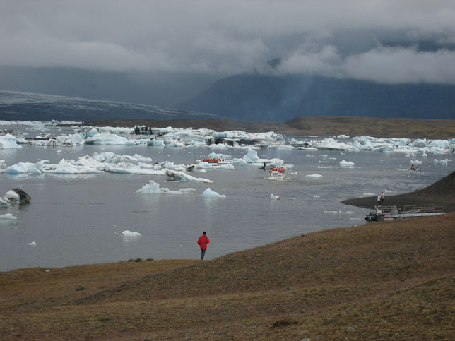
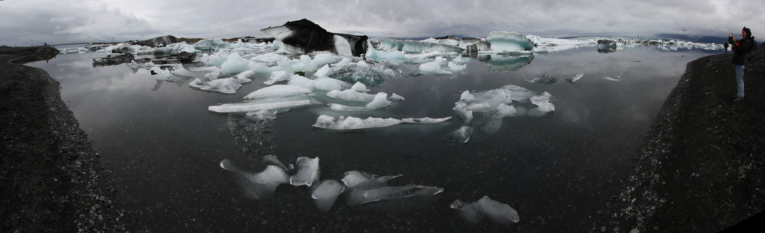
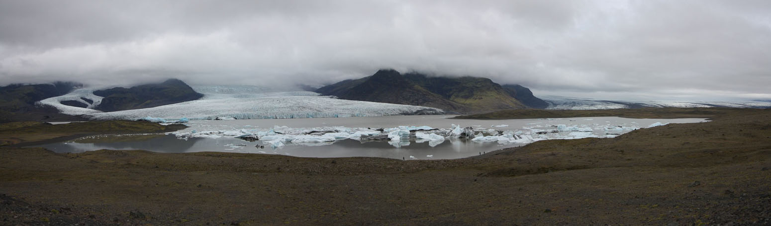
The Jokulsarlon glacier is famous for its iceberg filled lagoon. It's a tourist hot-spot, with several buses and tons of cars at the parking lot.
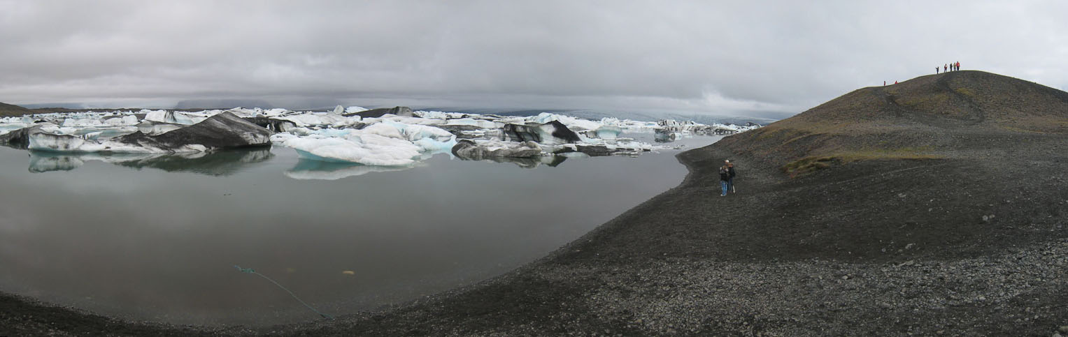
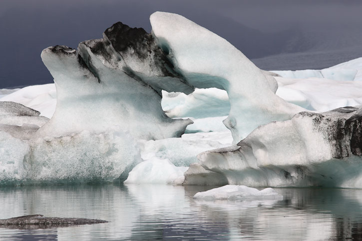
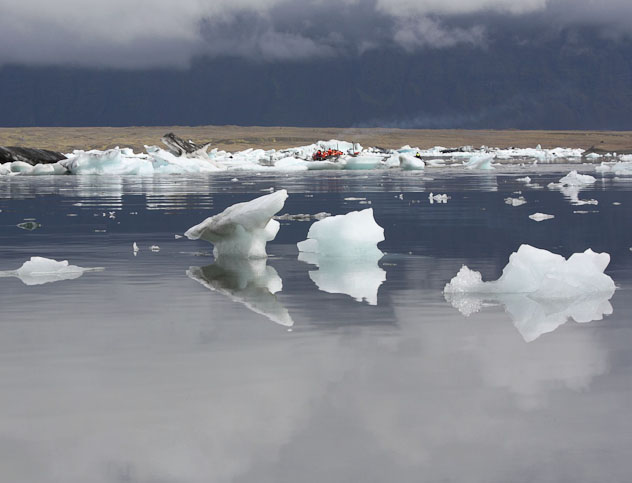
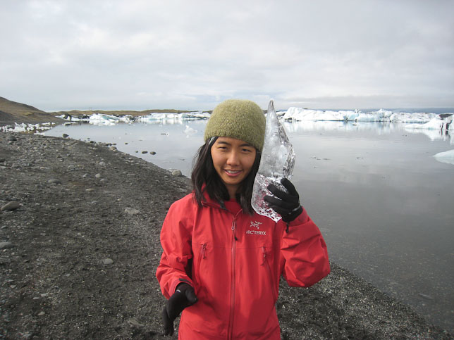
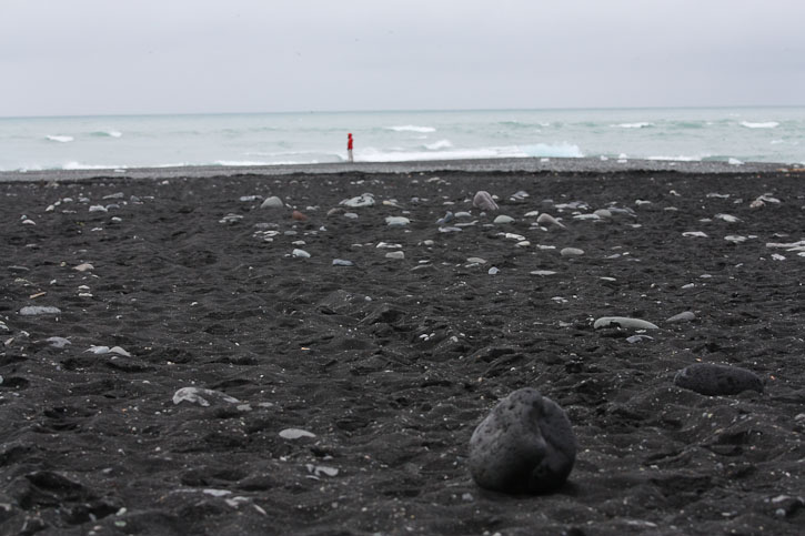
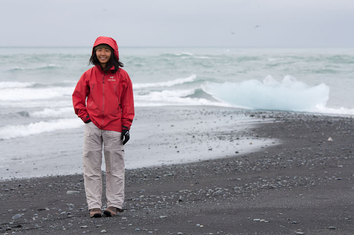
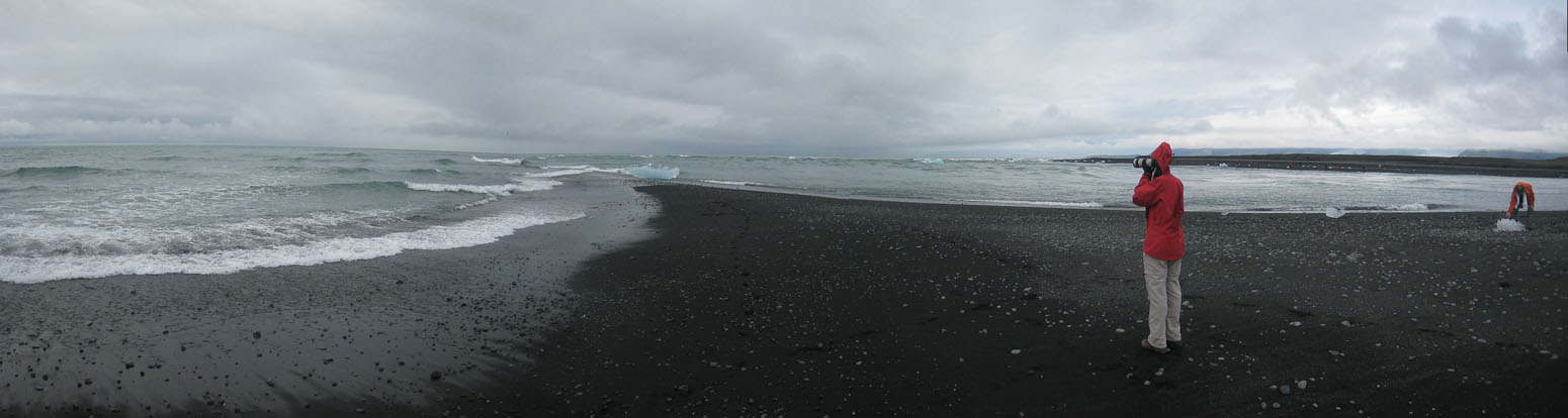
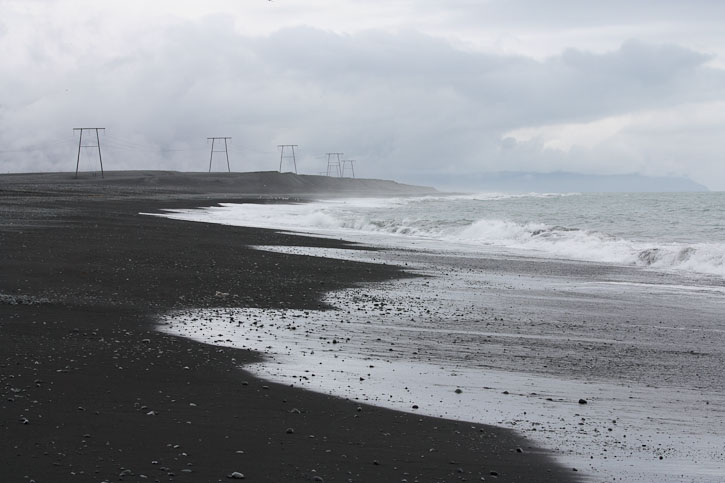
We walked a short ways along the lagoon, taking pics of the more cool looking icebergs, but didn't stay long. Instead we walked to the black sand beach on the other side of the ring road, where we had a huge south-facing beach, and the grey seas, all to ourselves. That is, until a few cars and a tour bus arrived 15 minutes later to unload a horde of tourists. Wendy saw a seal in the ocean.
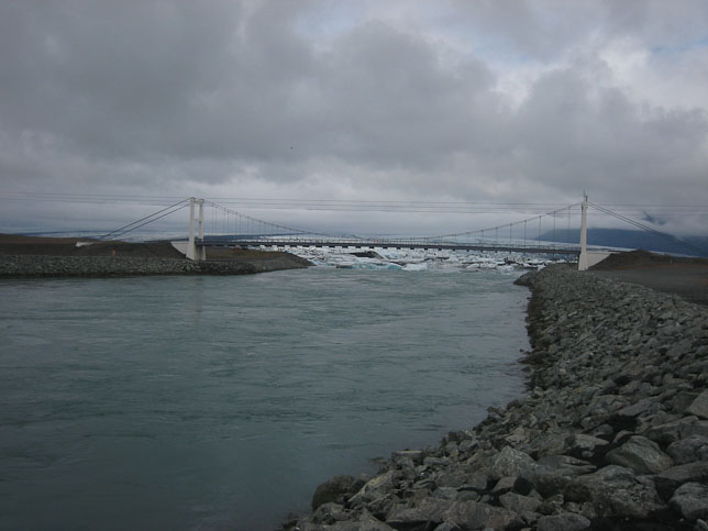
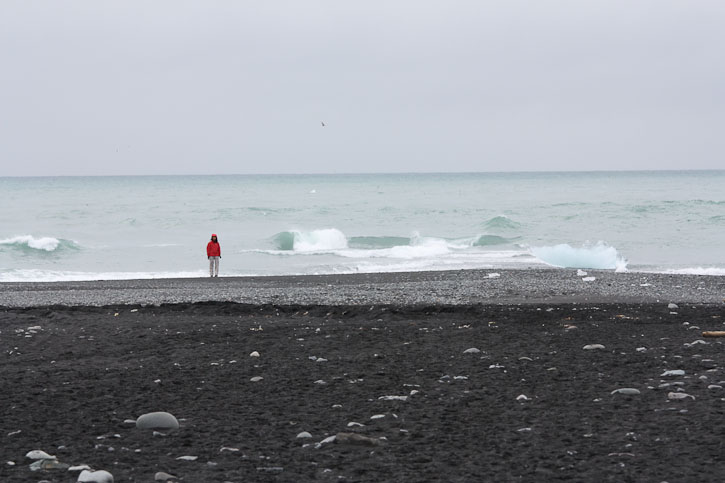
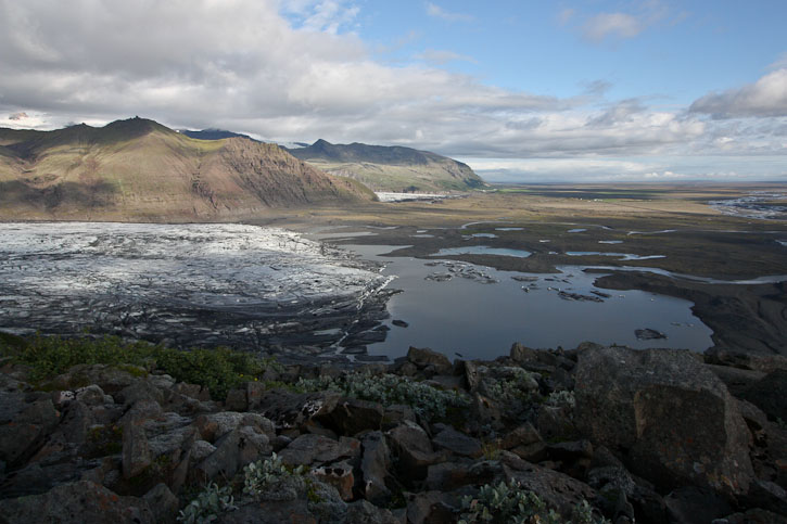
The icebergs from Jokulsarlon can be seen on the other side of the bridge. We explored this black sand beach...
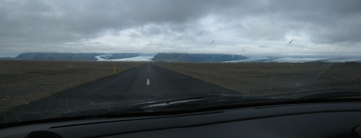
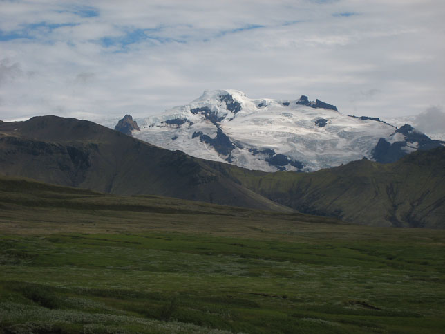
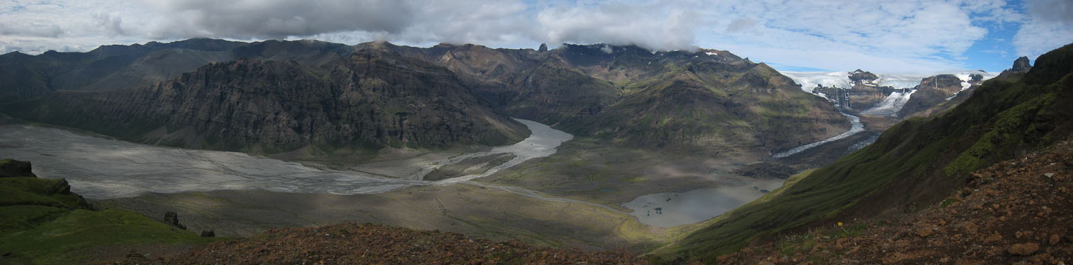
The skies were still grey, and kept the mountains under wrap, as we headed west on the ring road to Skaftafell National Park ~50 minutes away. A strange thing happened on the way. The clouds began to lift as we rounded the island, and we found ourselves staring up at the top of glaciers, pouring their long jagged icy bodies down to the plains. Wow! The weather was cooperating at Skaftafell Nat Park! We might just fit in this big hike to kristinartindar! Or at least have reason to attempt it.
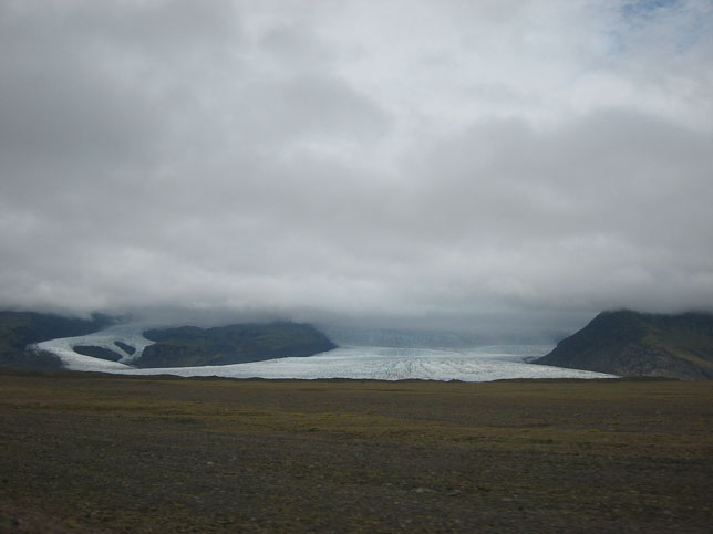
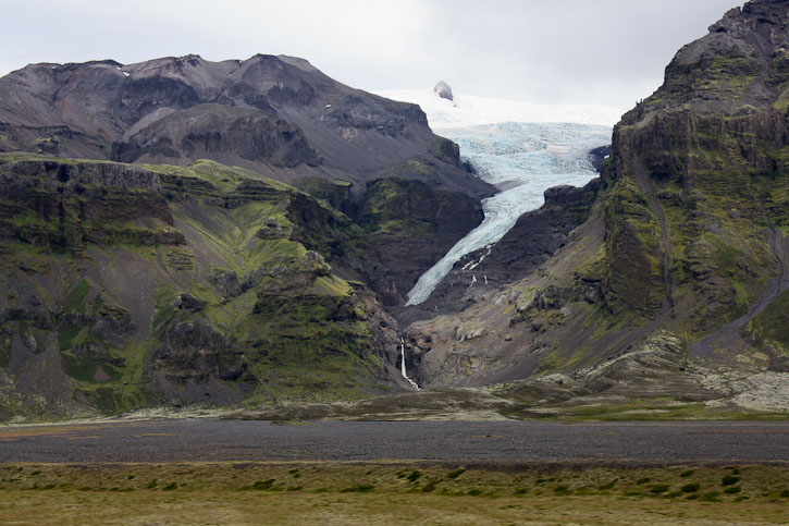
On the way, we stopped at this impressive looking glacier...
We got out of the car for a few minutes to admire...
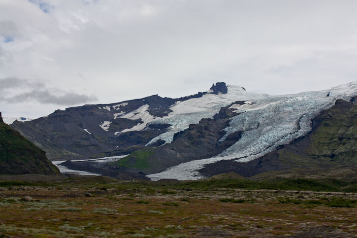
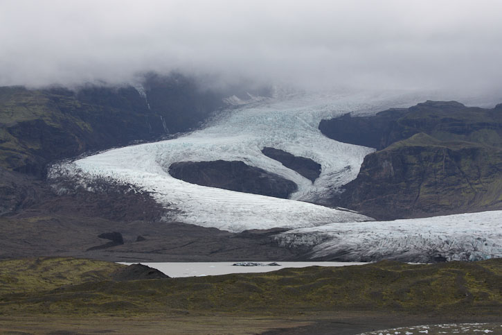
Over the next 45 mintues, the clouds began to lift, and we could see more of the glaciers...
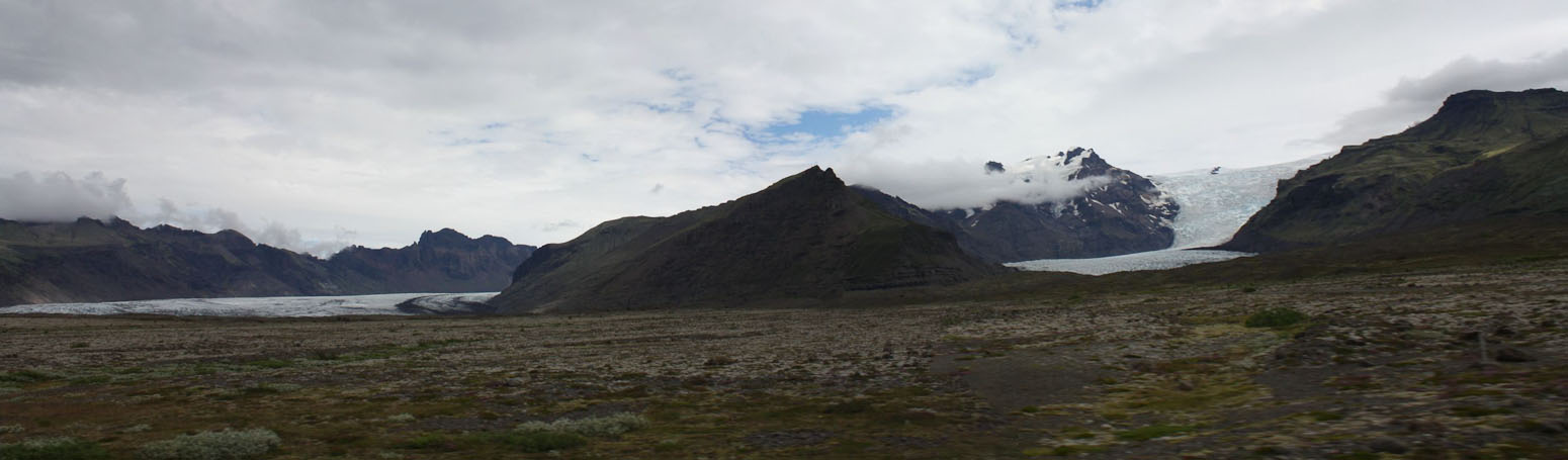
Wow, even some blue sky as we approached Skaftafell Nat Park! Looks like the big hike today is a "go"!
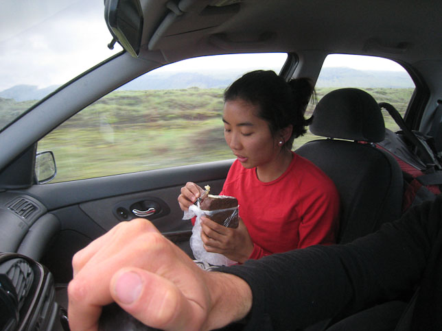
We pulled into the park, and entered the busy visitor's center, where I bought a park map for 300isk. After eating a snack/lunch in the car, we started the hike ~1pm from the large, scenic campground.
First up on our hike was Svartifoss, famous for it's black basalt columns. There was a lot of foot traffic to this famous waterfall.
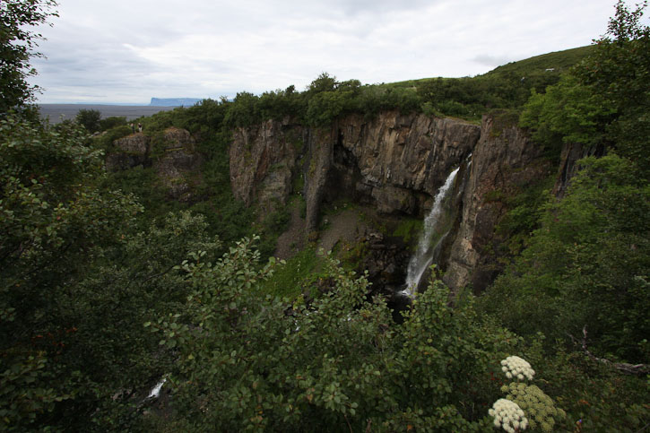
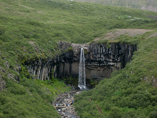
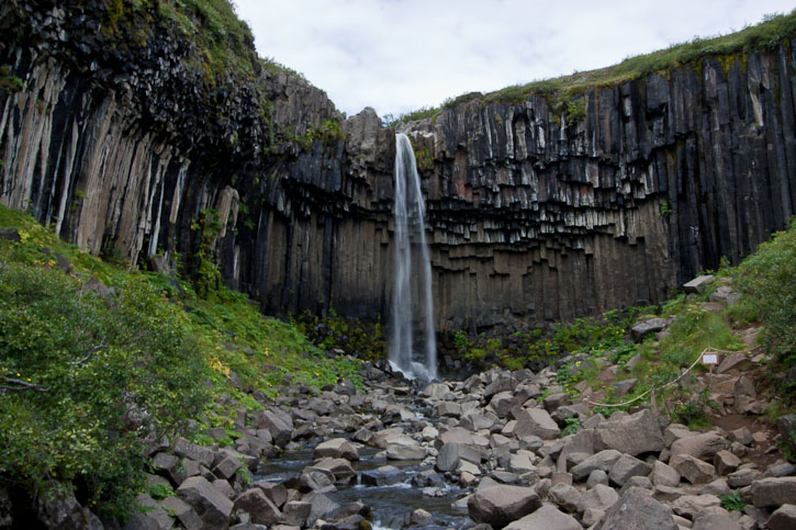
The black basalt columns give it quite a character...
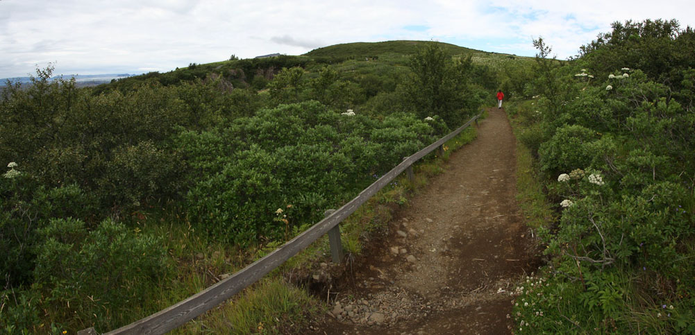
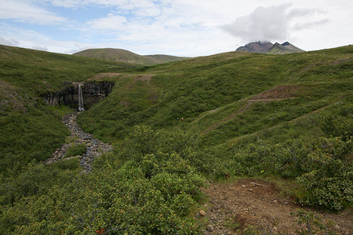
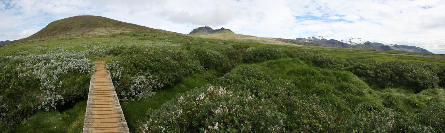
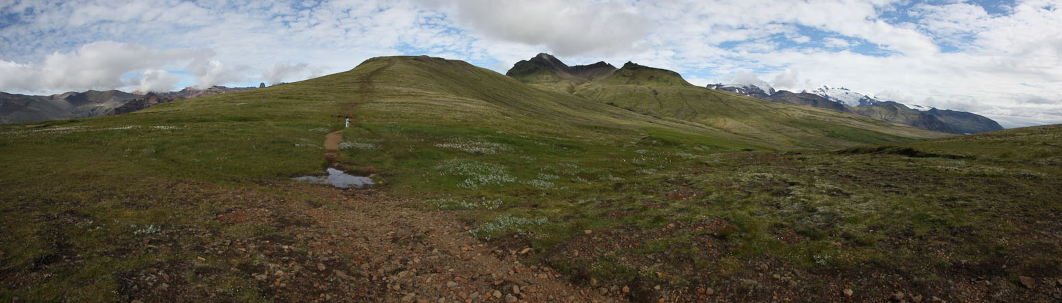
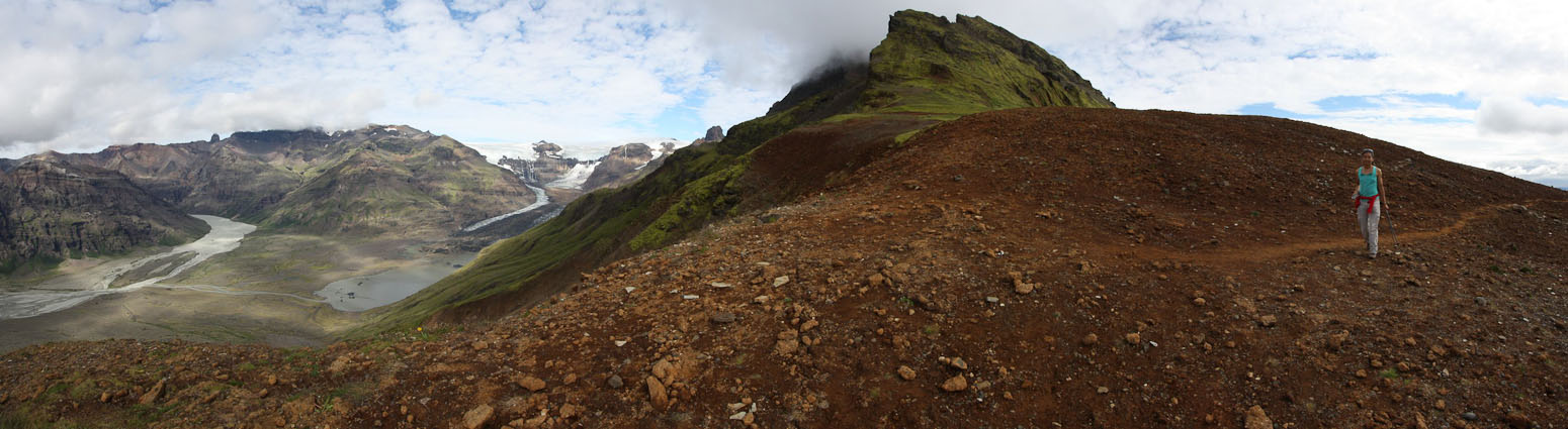
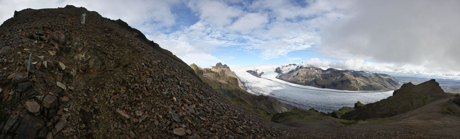
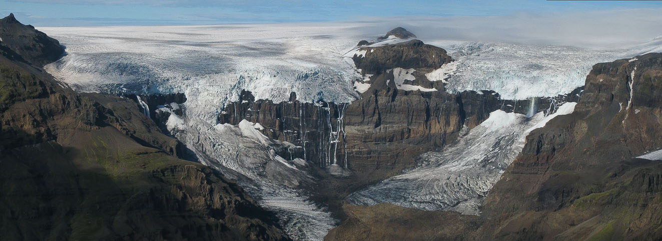
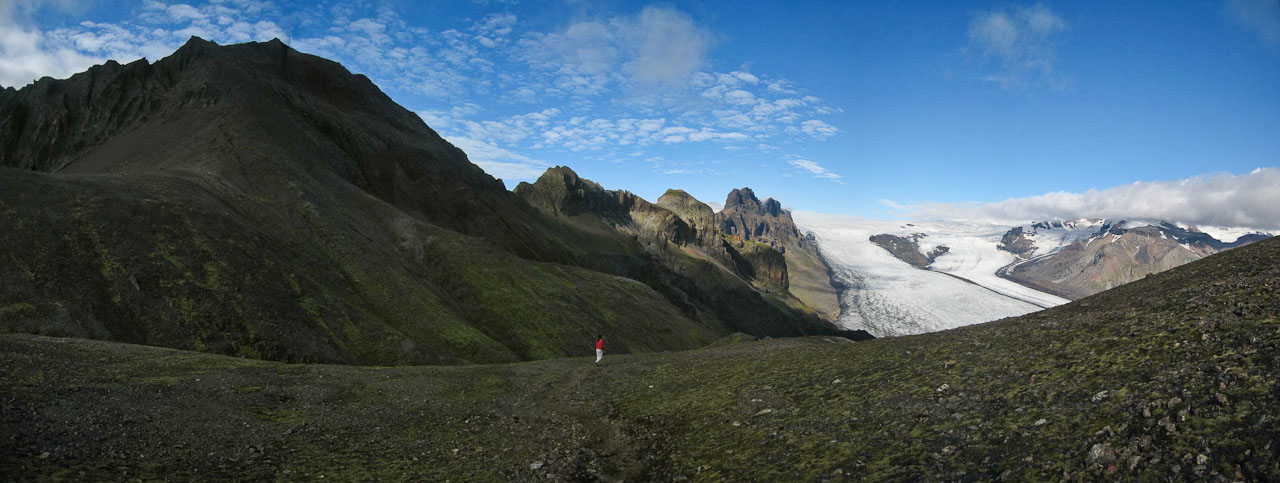
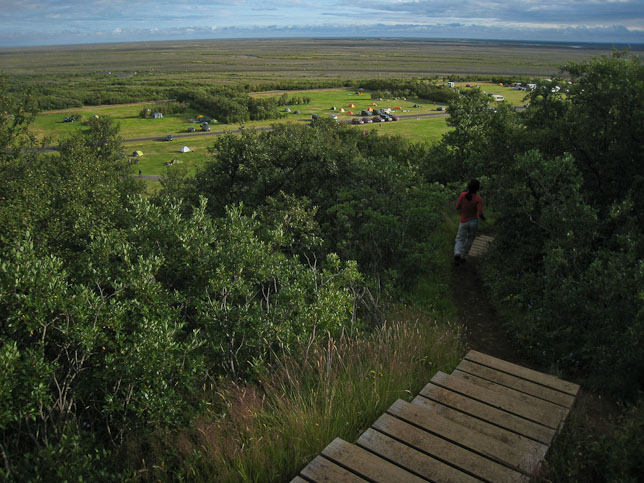
Most people just hike to Svartifoss, and return to the visitor's center, but we continued north towards Kristinartindar, whose high peak was partially covered in cloud. However the rest of the sky was cooperating, giving us great views at some glaciers.
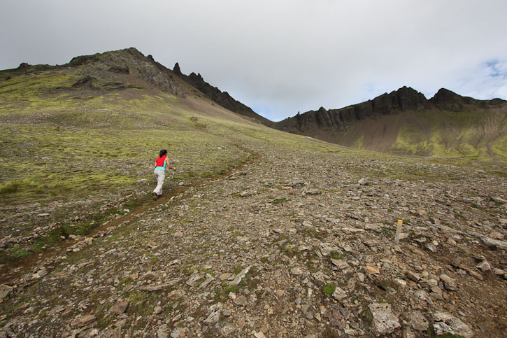
Sherpa Matt carried our puffy jackets, rain jackets, hat/gloves (all of which we didn't end up using), and food, while Wendy hiked without a pack. I managed to stay close to Wendy, who was flying up the long approach fueled by ipod tunes. The mountain looked close, but the map, and length of time on the trail, said otherwise. We didn't see many people past Svartifoss.
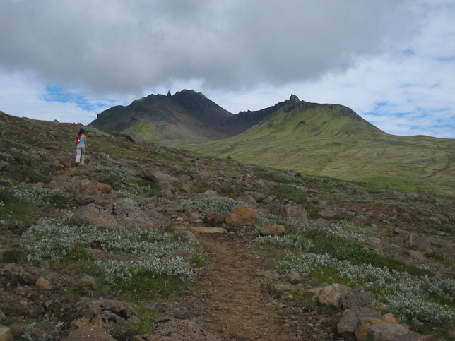
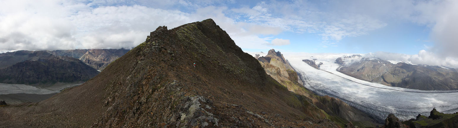
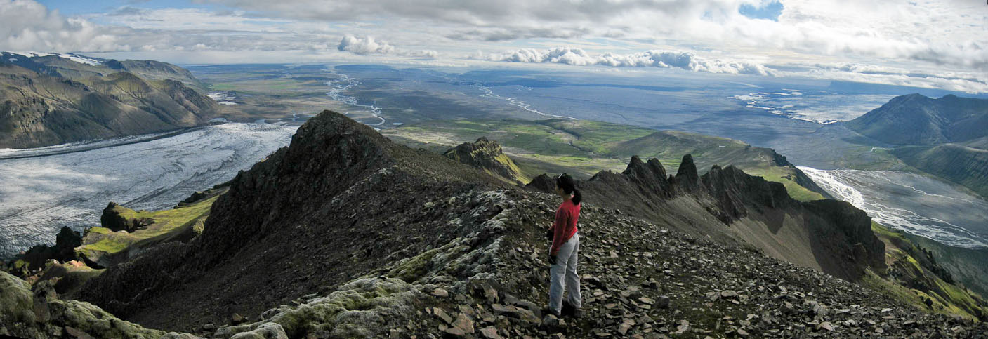
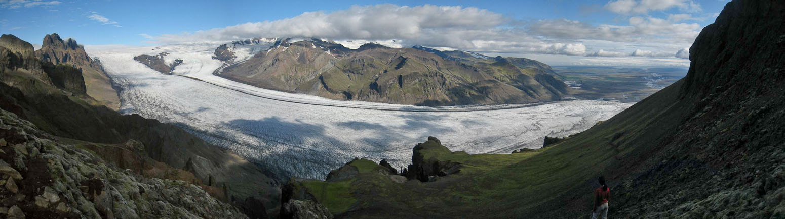
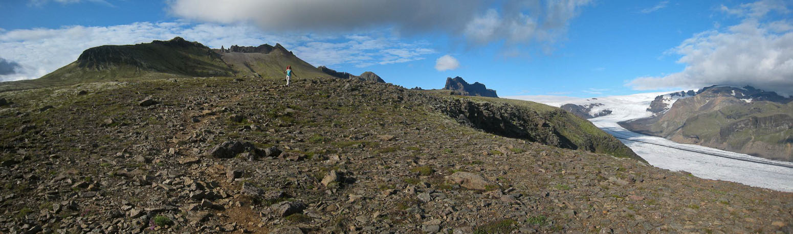
Making our way up towards Kristinartindar, the distant mountain in the center of the pic...
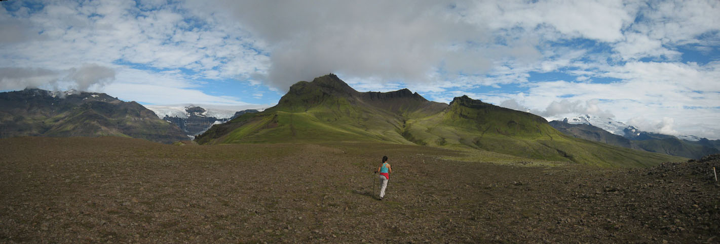
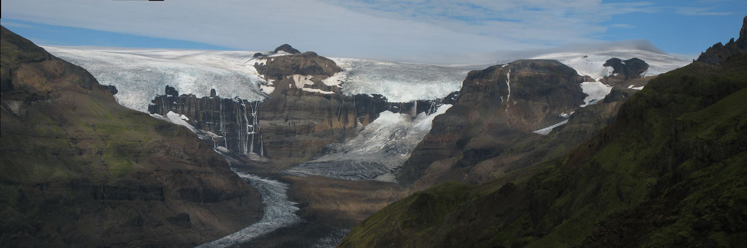
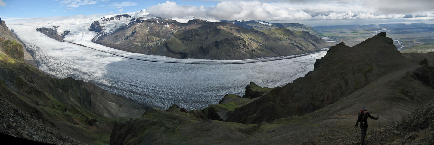
One descending hiker we met said that the view from the red rocks on the ridge was stunning. We continued on, eager for a glimpse of that view, before the clouds would have a chance to rebuild. Fortunately, the sky only improved, and after a long, sweaty hike, we indeed discovered a "stunning" view of a glacier high on a mountain with several 1000' waterfalls streaming down. Wow! We rested a bit here, eating some food, before continuing on towards the peak. The peak was loosely covered in cloud (at least on one side), but we figured a trip to the saddle would also be good, even if we didn't climb the final 450' to the summit.
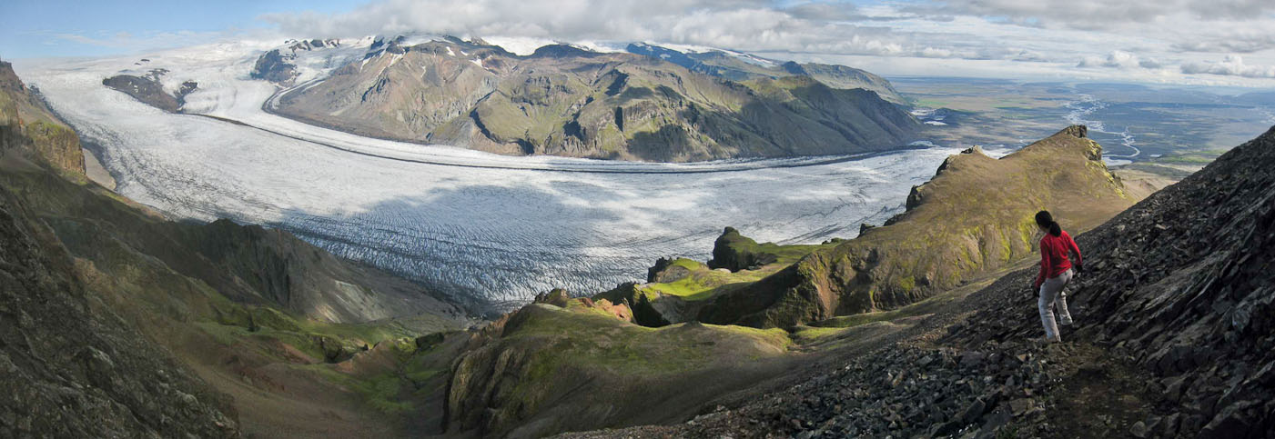
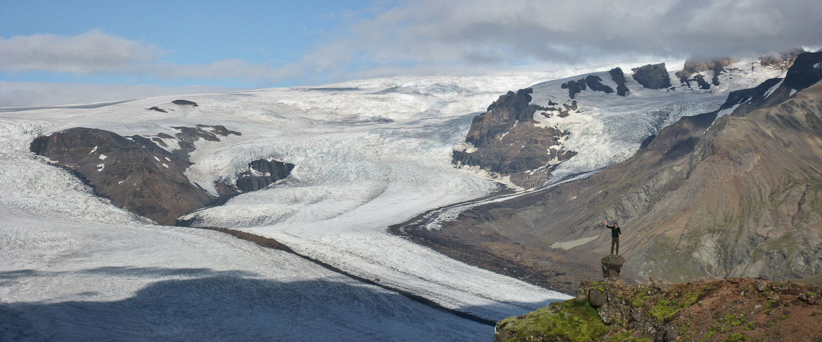
Sweet view of the glaciers...
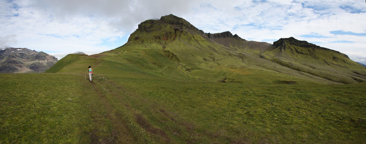
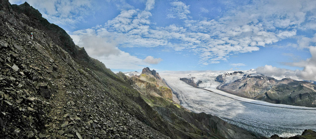
The path to the saddle was steep, but the loose rock offered enough traction to maintain a steady pace. We saw a few other hikers descending.
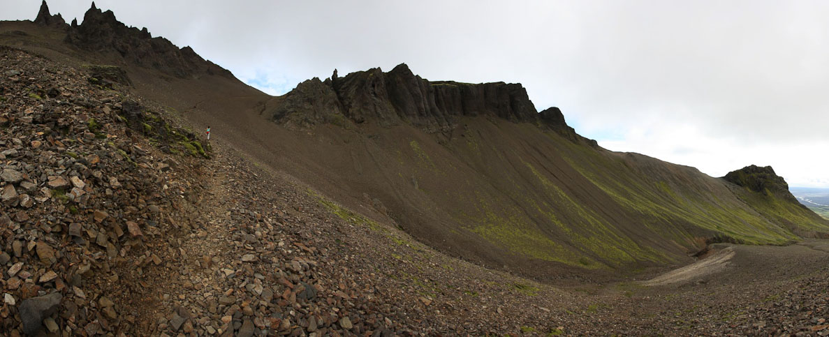
Making our way up to the saddle in the ridge...
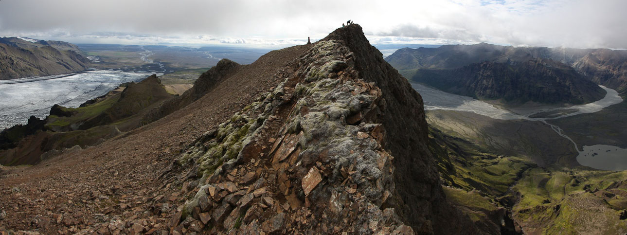
At the saddle, we rested a bit before tackling the final 450'. The trail was steep, and slightly exposed. Halfway up, we ditched our poles, and scrambled the rest of the way, reaching the knife edge ridge summit in 20 minutes from the saddle.
Onward and upward...
A pic of me hauling the backpack...
The trail starting to become interesting, as we head towards the peak...
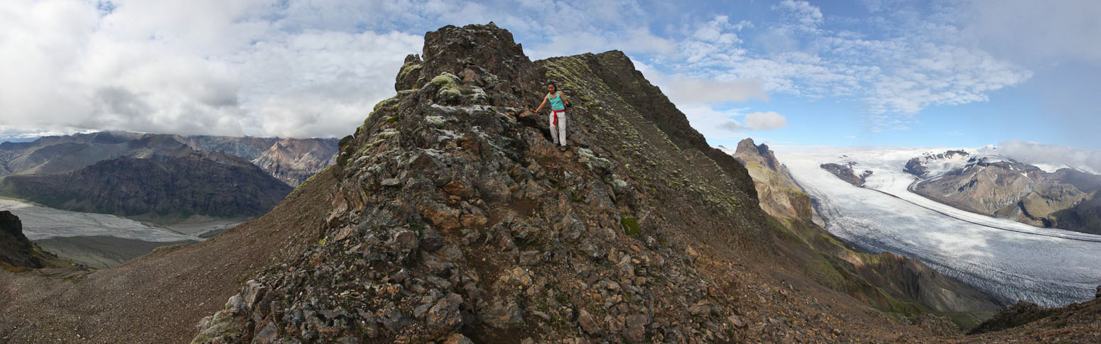
We dropped out poles and scrambled the rest of the way...
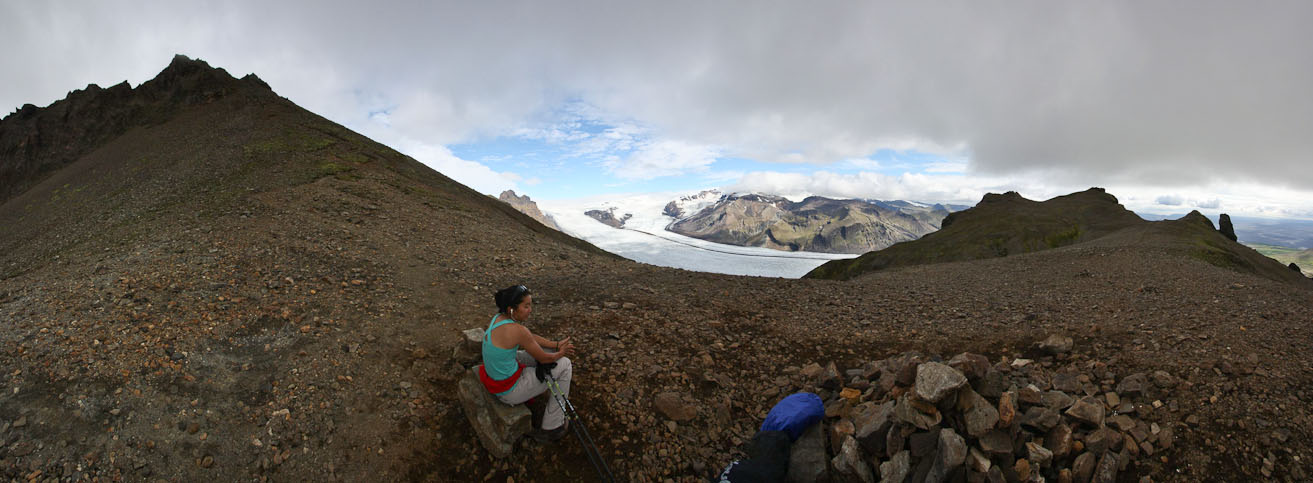
The views were amazing! More waterfalls opened up on the left, and 2 more glaciers appeared on the right. We took lots of pics, and hung out for at least 30 minutes. The weather was amazing. No wind, and pleasant temps. The sun periodically escaped from the clouds, triggering photos at each occasion. What luck with the weather! We overhead someone say that it rained here yesterday, so we lucked out with conditions today.
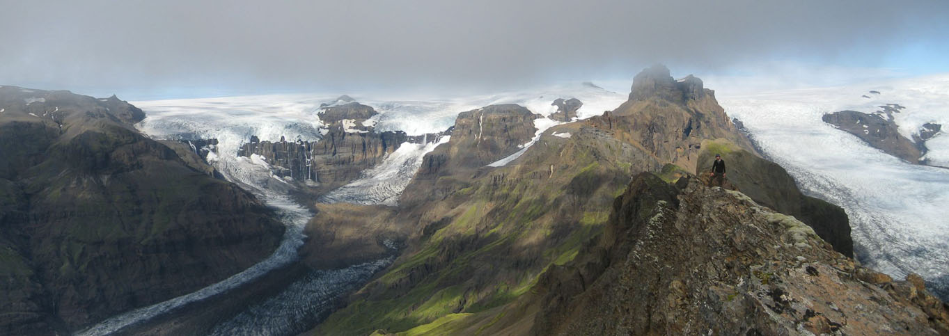
A look back from my position in the pic above. Pretty sharp drop-off to the right...
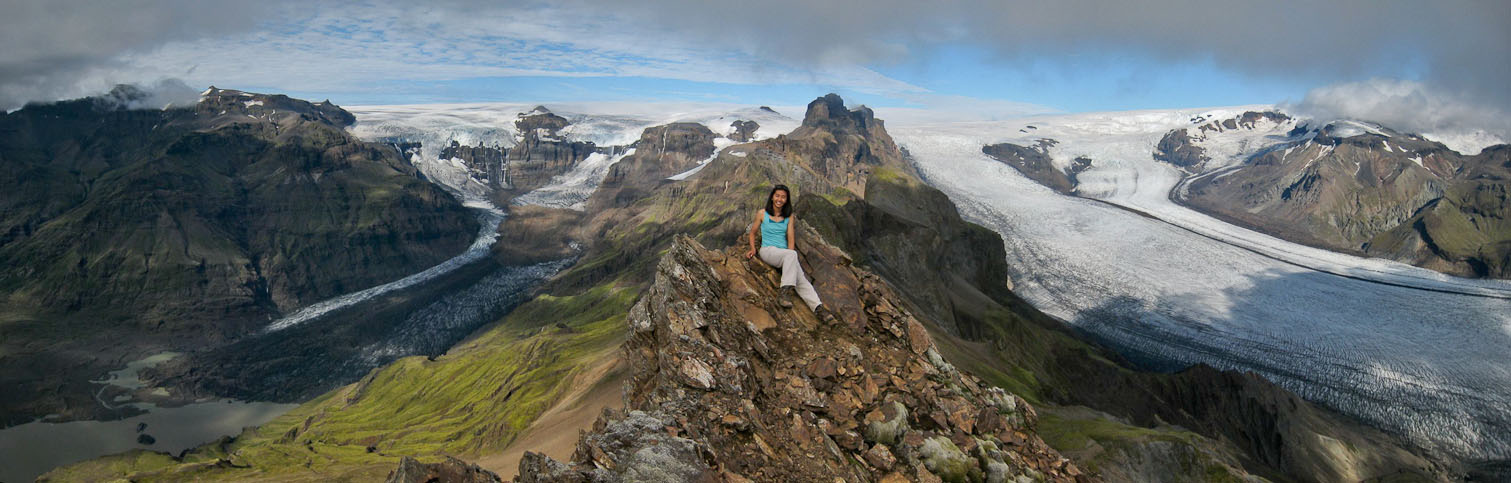
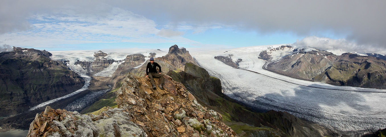
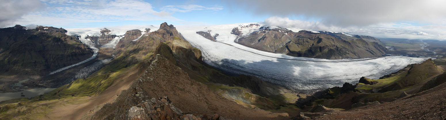
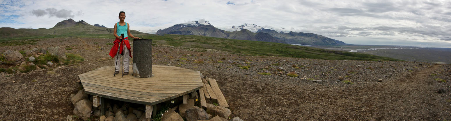
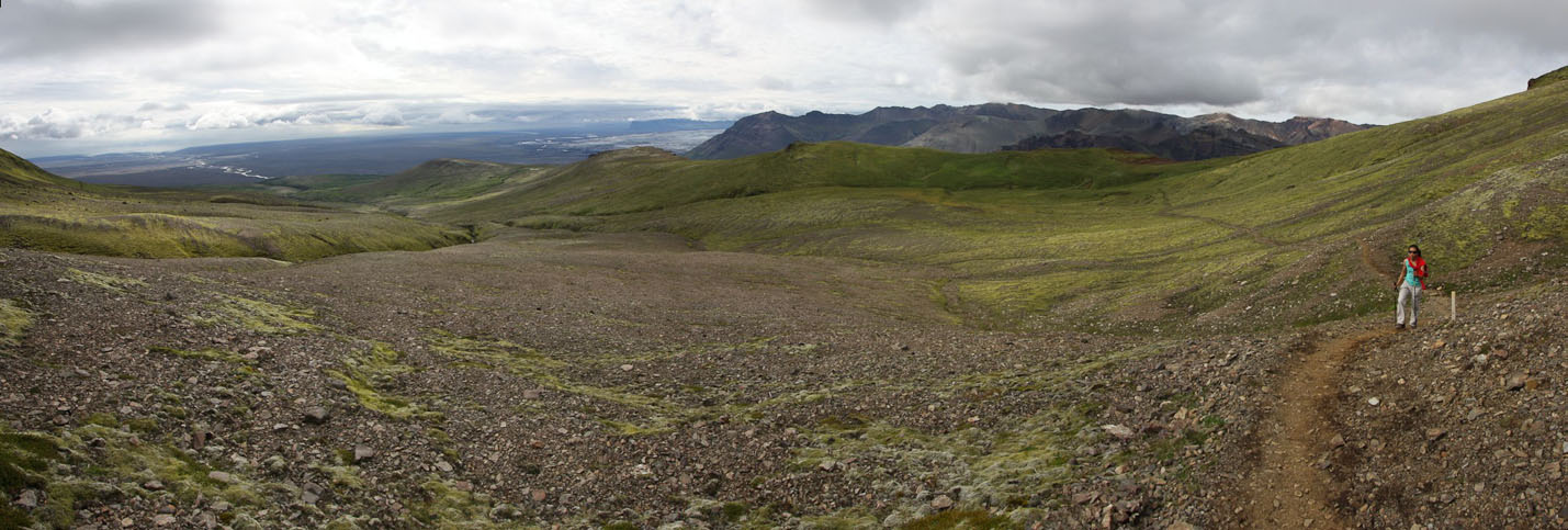
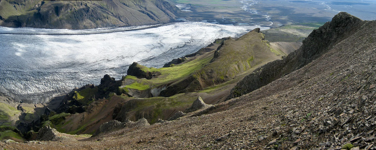
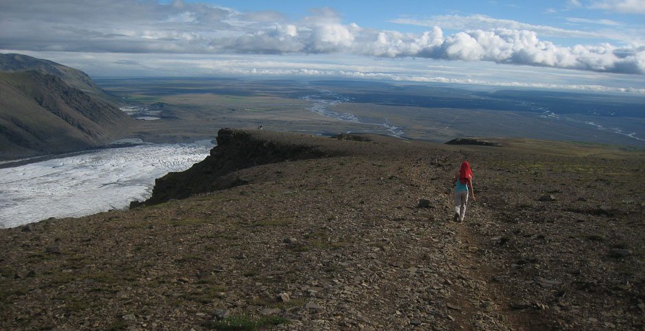
After spending a good 20 minutes at the, and taking tons of pics of this dream-like view, it was time to head back. The descent to the saddle was steep, but not too slippery. We followed a trail around the lower peak, and then cut down to an existing trail along the east slope, with glacier views the whole way. All told, it was ~12 miles with ~3300' gain. Tougher than several CO 14ers! My legs were feeling it.
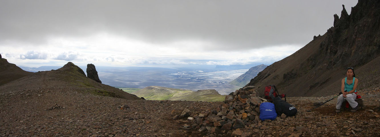
Back at the saddle. This time we took a path around the left side of the mountain (we came up from the right)...
I ran ahead to pose on this rock thumb...
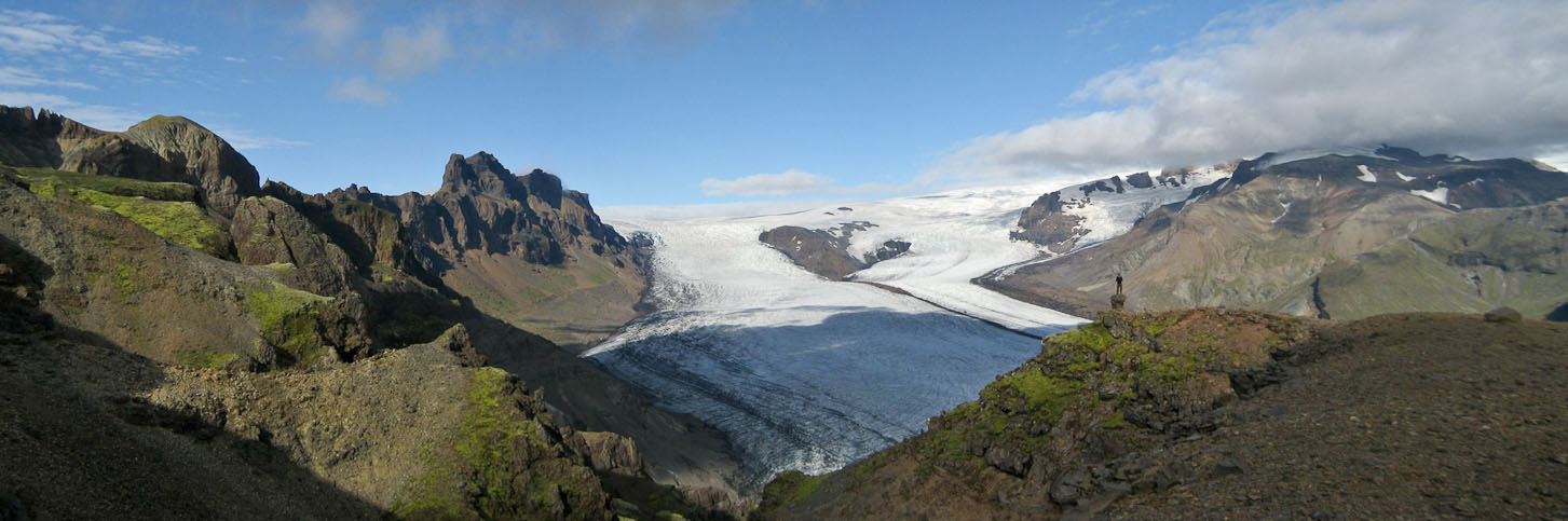
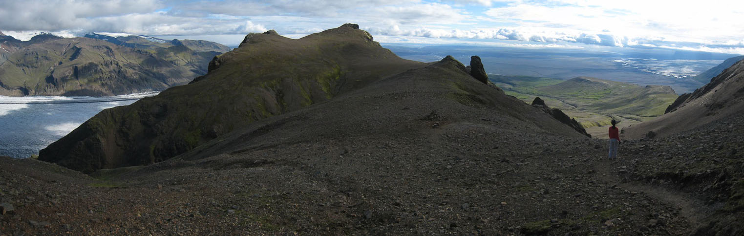
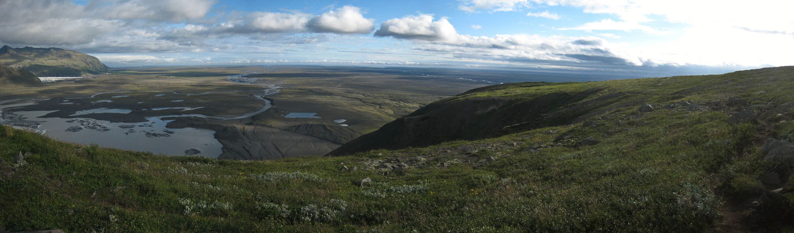
We stopped for a snack at a trail junction. The peak we climbed is in the upper left corner of the 2nd pic...
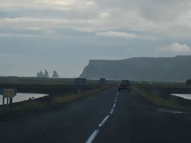
As we reached the parking lot, 6.5hrs since the start (7:30pm), the clouds were thickening again, and Kristinartindar was back in the clouds. On the drive out, towards Vik, we encountered rain briefly. It was amazing we caught a gorgeous pocket of weather for our hike today.
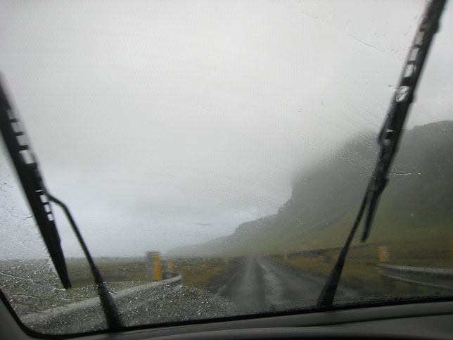
We drove through vast flat brown plains with the ocean to the south and glaciers to the north. Several long one lane bridges, with periodic buldges for passing, forded the glacial rivers. Eventually the terrain turned grassy, and I was once again reminded of Scotland's sheep covered picturesque green mountains. Several waterfalls were scattered about. The sky grew more misty, and it rained for several minutes.
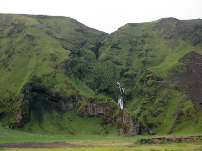
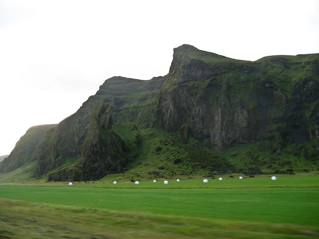
Pretty grass covered mountains to our right...
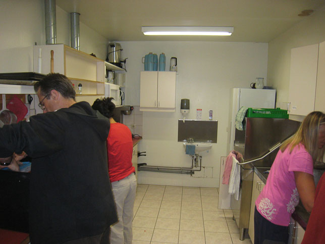
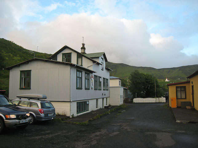
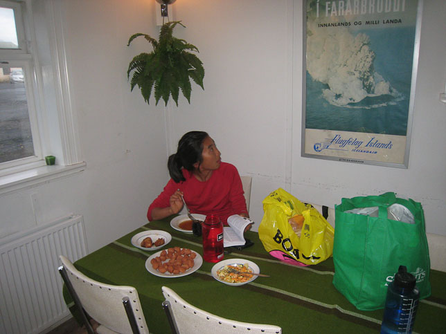
~9pm, we reached Vik, the town of our guesthouse for the night. The restaurant at the hotel was closed, so we ended up creating our own buffet from our cooler. The kitchen's fridge here was broken, which gave us even more incentive to eat up our stores. Plus, tomorrow is our last day here, so no point holding on to food much longer. Wendy ate fish cakes, chicken, dehydrated eggplant, and some veggies. I searched for a way to eat my lamb-hotdog-nuggets, and ended up making a dehydrated yam, hard boiled egg, tomato, onion, spinach, tarter sauce mix, which worked surprisingly well. I also tried an Applesin soda, which sounded like apples, but was actually an orange soda. Wendy jokingly suggested making a skyr float with it. I decided to try it, and it ended up tasting like an orange creamsicle. Not bad…
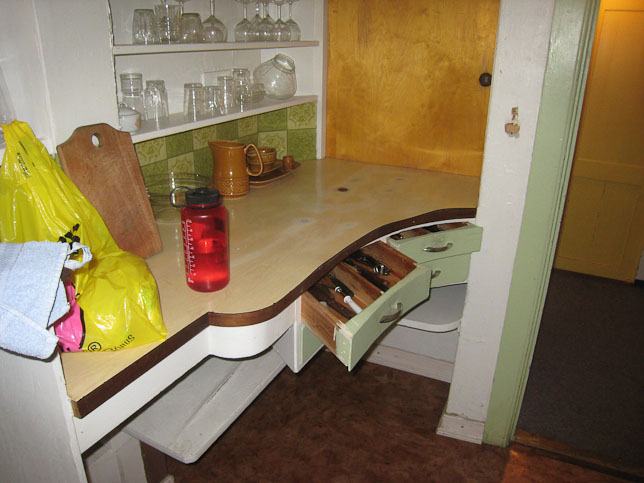
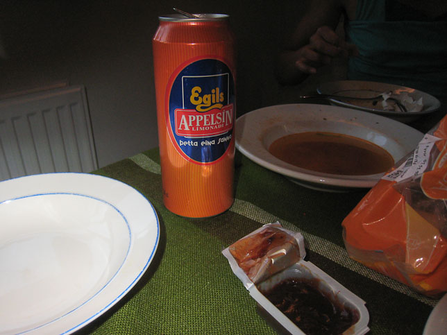
Pics from dinner. Appelsin sounds like a unique applel soda, but it's just orange soda. Fake out!
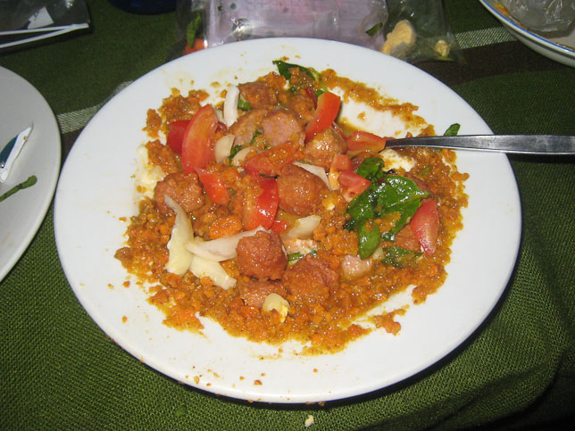

I tried to come up with a way to eat my lamb-hotdog-nuggets. Turned out ok. A pic from our room...
Room has really low doorway. Tight spiral staircase. Doh! Left my shampoo and soap in the last hostel's shower…
One day left in Iceland tomorrow. No doubt it will be a late night tomorrow as well, repacking all our bags. It's already 1:21am here now, and is genuinely dark outside. The first time I can say that. 8:30am alarm tomorrow.