I hiked up the east side of the basin, keeping an easy pace, as I had targeted catching sunrise on Wetterhorn from this vantage point all along. The tip of Wetterhorn glows red in the alpine glow...
Some notes regarding the road leading to the 2WD trailhead, taken from yesterday's journal:
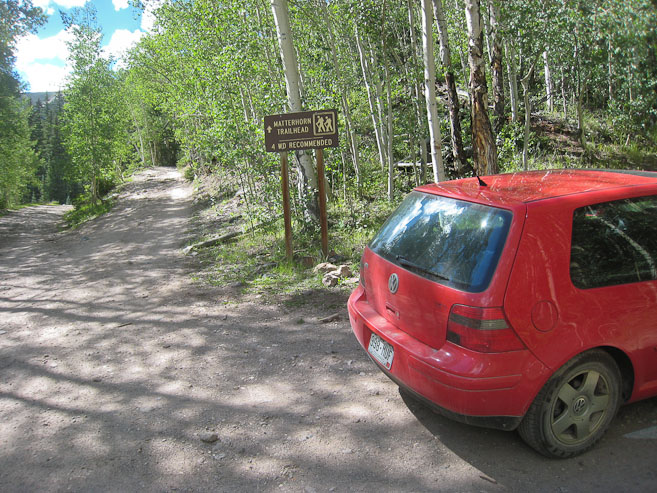
It was 10.8 miles from town, on a dirt road, which got progressively worse. The final 2 miles, on North Henson Creek, where particular slow going for my VW Golf, and I couldn't avoid 2 gentle scrapes in the last mile, over a couple of washout areas. There wasn't much parking available at the 2WD TH, but fortunately only 2 other cars were there, and I pulled into a slanty available spot.
Good thing I had 3 alarms set for 4:15am, because my phone alarm ran out of battery, and I can't hear the high pitch beep of my watch. A portable digital clock, with thermometer, woke me up after only ~2 hours of sleep (took me a long time to find a comfortable position in the car parked on slanty ground), and I noted it was 55 degrees in the car. My backpack was still damp, but everything else, aside from my nylon ball cap and a fleece glove, where dry from last night's water bladder leak. The sky was full of stars, just as expected. I repacked my bag, ate some fruit and a bar, drank a bunch of water, and topped my water blatter off, tightening the lid/hose (no more leaks), and finally hit the trail a couple minutes before 5am, wondering where I'd end up for sunrise.
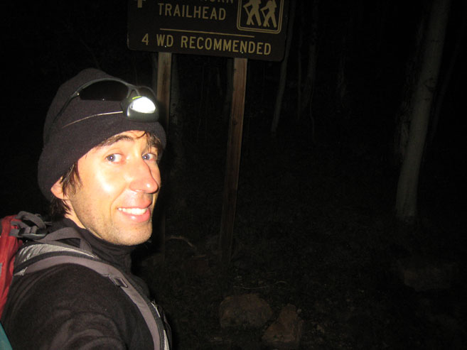
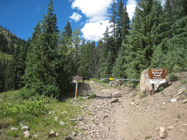
Today's itinerary was to bag both Uncompahgre and Wetterhorn, and would require over 16 miles and 5850' gain. I also was interested in climbing Matterhorn, located in-between the two 14ers, if possible. Matterhorn Creek TH is the location to attempt this dual 14er quest, as it sits between the two peaks, though is much closer to Wetterhorn. It's recommended to hike Uncompahgre first, probably since it's further away, 300' taller, and requires a much longer time above treeline during the descent. Should an afternoon storm brew, it'd be quicker to retreat from Wetterhorn.I brought the poles with me today, knowing I'd need every resource available to complete this hike in a timely manner. From the 2WD trailhead, it took me 15 minutes to cover the .6 miles and 320' gain to reach the 4WD trailhead, where I was the 1st to sign the register today, specifying "Unc/Wet/Mat" as my destination. Shortly after, I crossed the creek and saw two headlamps in the darkness along the trail, belonging to a couple of hikers heading to Wetterhorn today. I told them of my plan to hit both 14ers, and they said it was smart I started early.
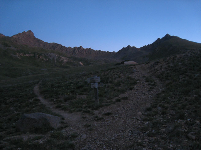
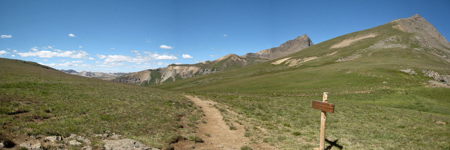
In another 15 minutes I reached the first trail junction, between Matterhorn Creek Trail and Ridge Stock Trail, and knew to keep to the right on Ridge Stock. Whether you're heading to Wetterhorn or Uncomp, you need to take Ridge Stock (though Matterhorn Creek sounds more appropriate a destination). 35 minutes later I was at the fork for Wetterhorn's trail and Ridge Stock (continuing towards Uncomp.) at ~12000'.
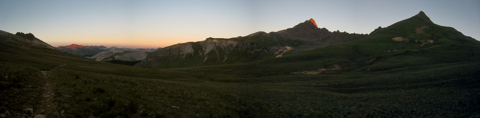
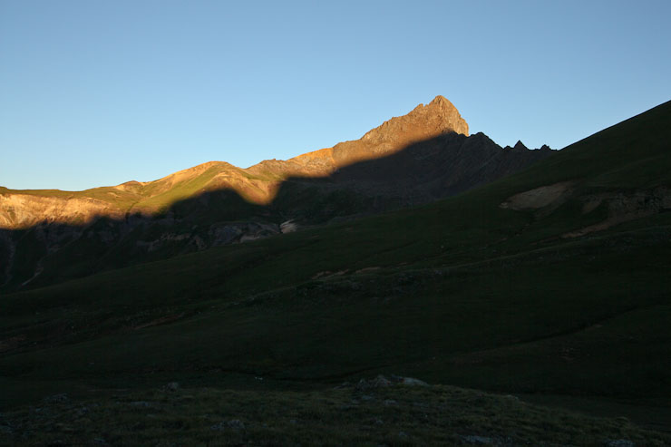
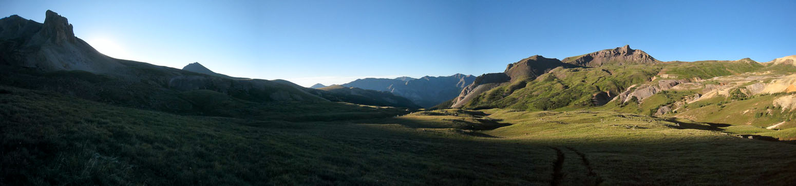
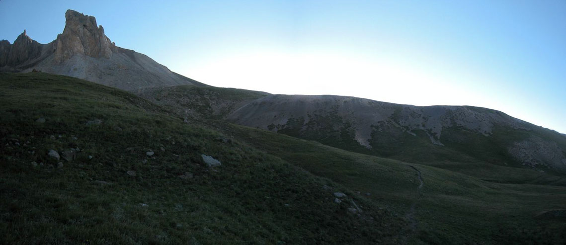
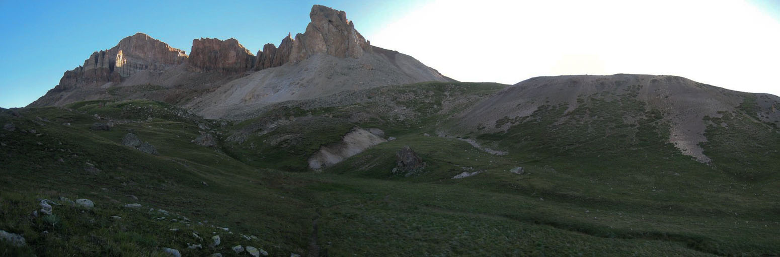
I hiked up the east side of the basin, keeping an easy pace, as I had targeted catching sunrise on Wetterhorn from this vantage point all along. The tip of Wetterhorn glows red in the alpine glow...
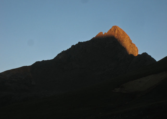
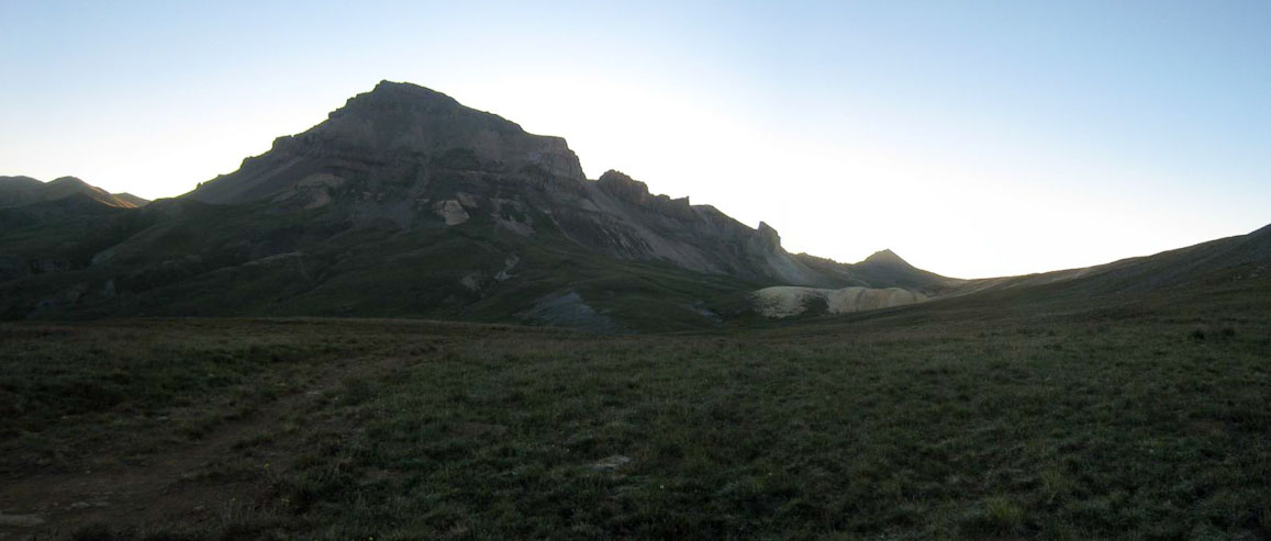
I stuck around for quite awhile, hoping to watch the rest of Wetterhorn emerge into daylight, but it stayed in shadow. I couldn't wait forever if I wanted to bag both peaks today, so I continued over the pass towards Uncompahgre, but just as I left Wetterhorn behind, the sun was starting to rise high enough to bathe more of the mountain...
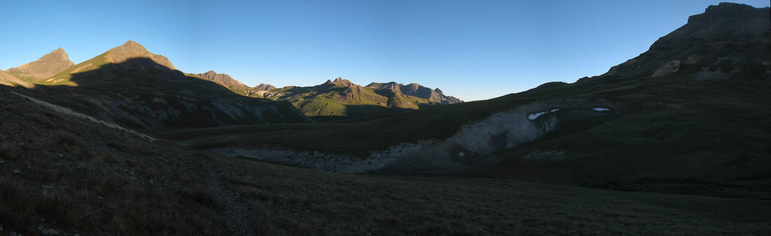
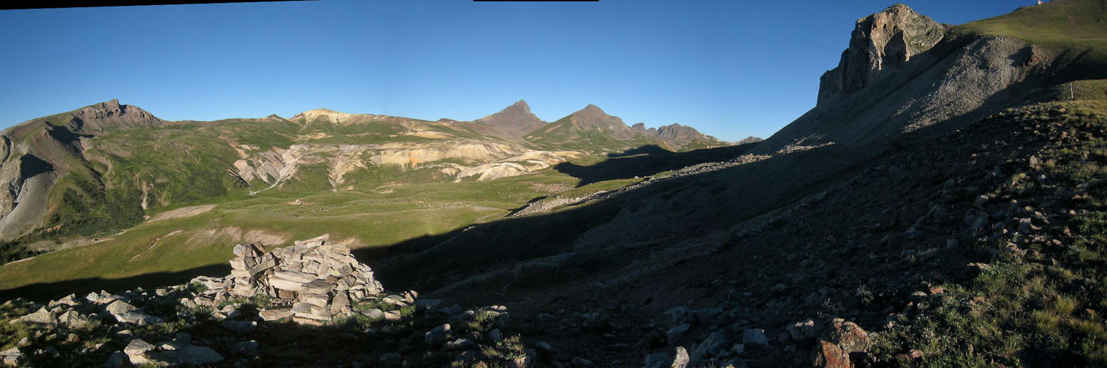
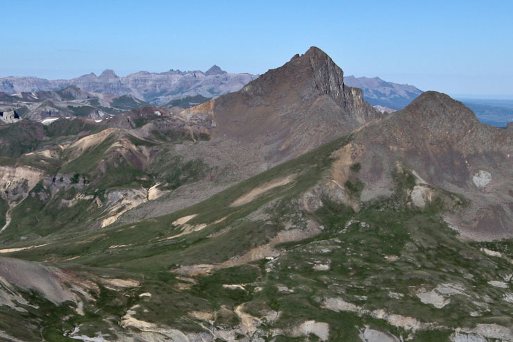
From the 12,500' pass, I could see Uncompahgre ahead, completely blocking the rising sun with it's 14,309' enormity. Check out the ridge line in this pic, and compare to the shadow line in the pic above. Looks like a perfect match! Now I know why Wetterhorn stayed in shadow this morning...
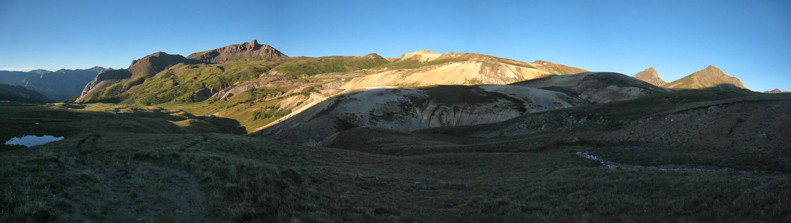
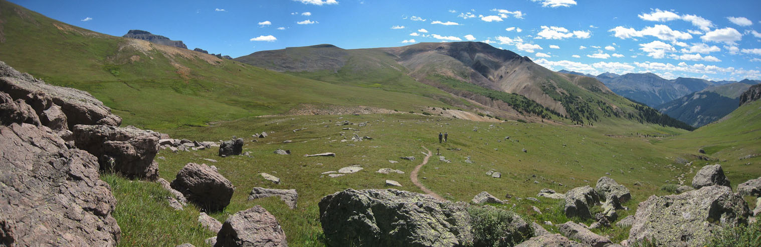
I followed the trail down into the valley below Uncompaghre (on the right). Wetterhorn and Matterhorn are on the left...
Traveling across this valley proved to be longer and more hilly than I anticipated. It was pretty watching the golden light fall upon the east side of the valley...
Several times I looked at my map, thinking (optimistically) that I was close to gaining Uncompahgre's ridge, only to realize I was a few bends in the trail behind still...
The 2nd half of the valley had a bunch of ups and downs, much more than I had hoped for. I had hoped to jog across the valley on my return, but didn't think that would be happening much now...
Finally, ~7:15am, I was at the last dip in the valley (~12,200'), and could start the real climb towards Uncompahgre (14,309')...
A look back across the valley after starting the climb. Notice the well built chair made of rocks. I didn't stop to test it out, determined to keep my progress going. Wetterhorn in the peak in the center of the pic, and the pass I crossed is right in front of Wett, to the left of Matterhorn...
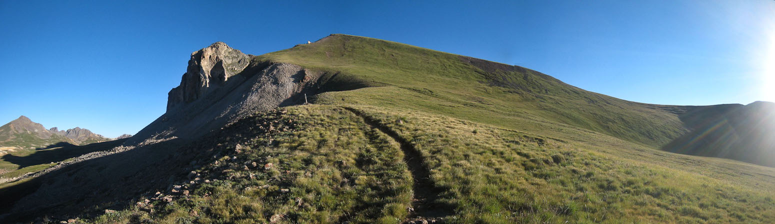
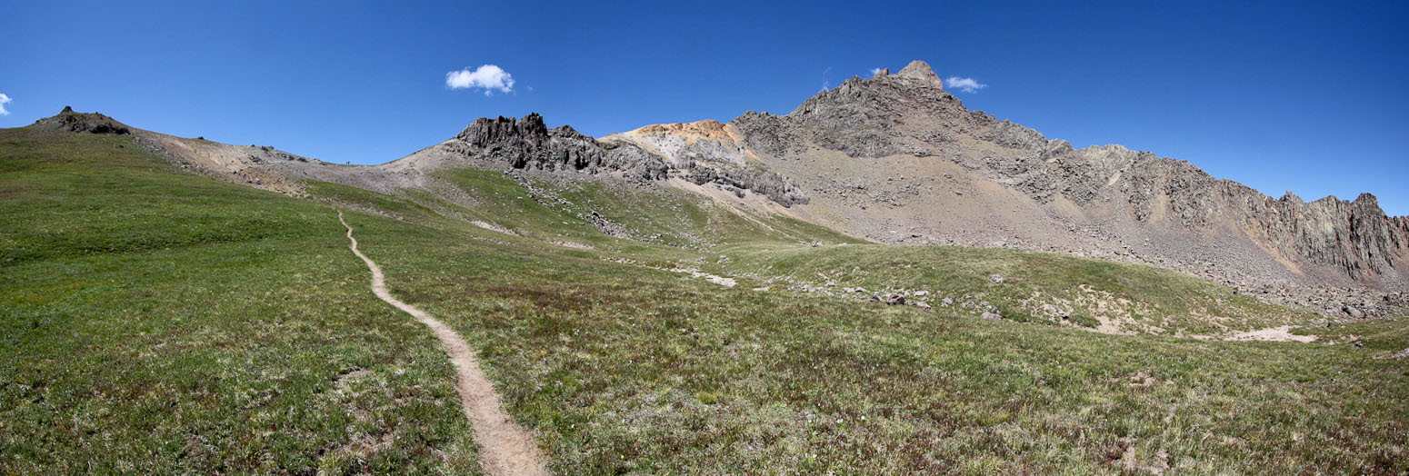
After 20 minutes of climbing from the bottom of the valley, I reached the grassy slope below Uncompahgre's ridge. The trail wrapped all the way across to the saddle on the right of the pic. I couldn't help desiring to see a shortcut trail leading strait up the steep grassy slope ahead (I would later find out on the way down)...
At 8am, I reached the main ridge ~12,900', where I merged with the Nellie Creak Trail (Uncompahgre's standard route). I'd get good views of the summit for the remainder of the ascent...
I took a moment to rest and snack, before beginning the final 1400' to Uncomp...
The trail stayed close to the top of the ridge, leading past various rock buttresses and cliffs...
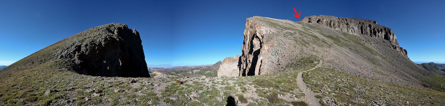
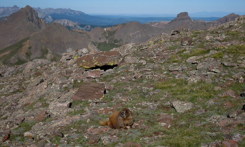
Check out the brown furball in the middle of this cliff gap. The arrow points where the trail crosses to the other side of the mountain...
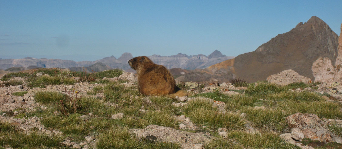
Here's a close-up of the marmot, with Wetterhorn on the right...
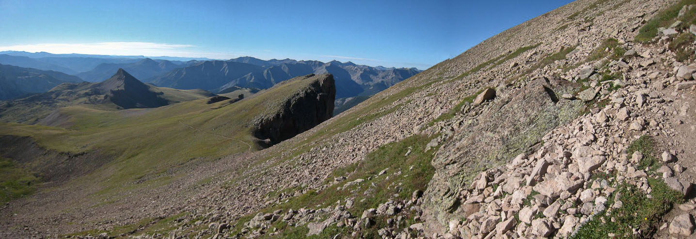
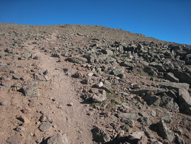
A well made trail switchbacked up the steep-looking slope, consisting of a grass/rock mix...
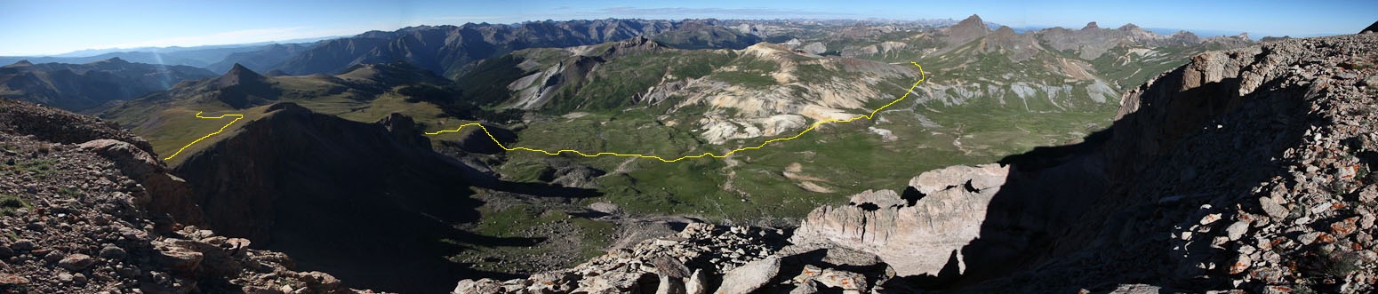
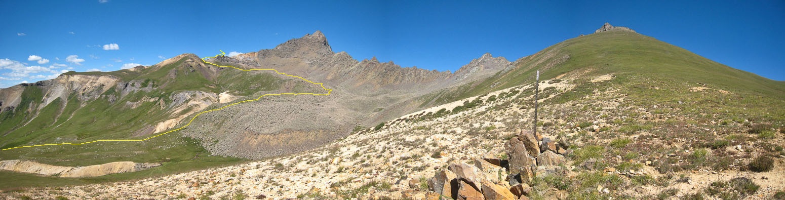
At ~13,800', the trail crosses to the northwest side of the peak. I dropped my poles and walked down a short ways to this lookout. The yellow line shows my path from the pass below Matterhorn (with Wetterhorn in the distance). I'll need to retrace those steps shortly...
A cropped shot of Wettherhorn, Matterhorn, and the pass. The 2nd pic is a look back at where the trail crosses to the northwest side of Uncompahgre, taken from the lookout point, below the trail. I ascended from the right side, and would continue into the shadow side...
At the ridge crossing the wind was gusting a bit, and continued to blow as I entered the shadow, where I chill took over, and I stopped to put on my jacket, hat, and gloves. I was surprised to see 2 hikers approaching on their descent, since I hadn't seen anyone on the trail all morning (since 5:30am). They said I had 10-15 minutes left until the summit. I looked at my watch, and had been targeting reaching the summit by 9am, but only had 12 minutes left til then, and was starting to slow up, having taken few breaks all morning. Still I pressed on to give it a try...
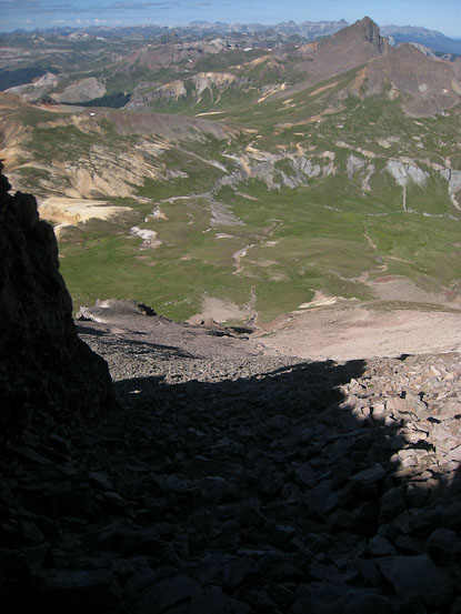
A look down the steep ~50' gully I ascended to reach the ridge...
At 8:56am, the summit block was still a couple hundred feet higher, and I realized I was unlikely to top out by 9am, so I took it easy across the rocky trail...
Another marmot was out eating some grass this morning. I saw a ton of marmots all day. They certainly thrive in this area...
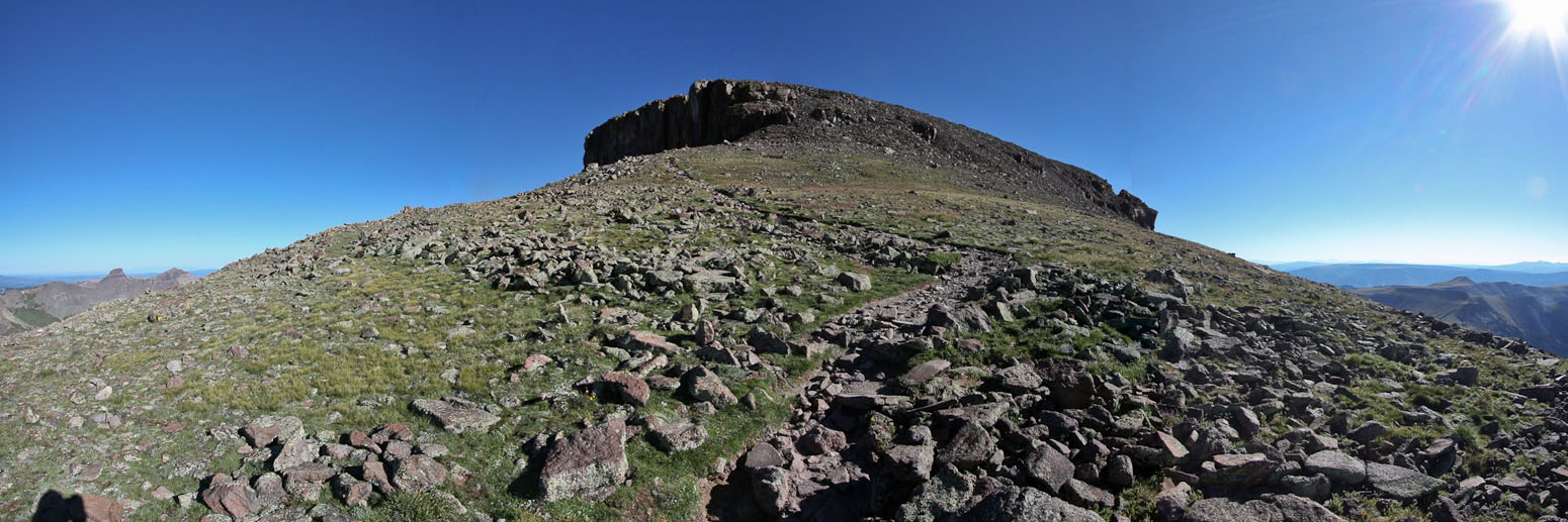
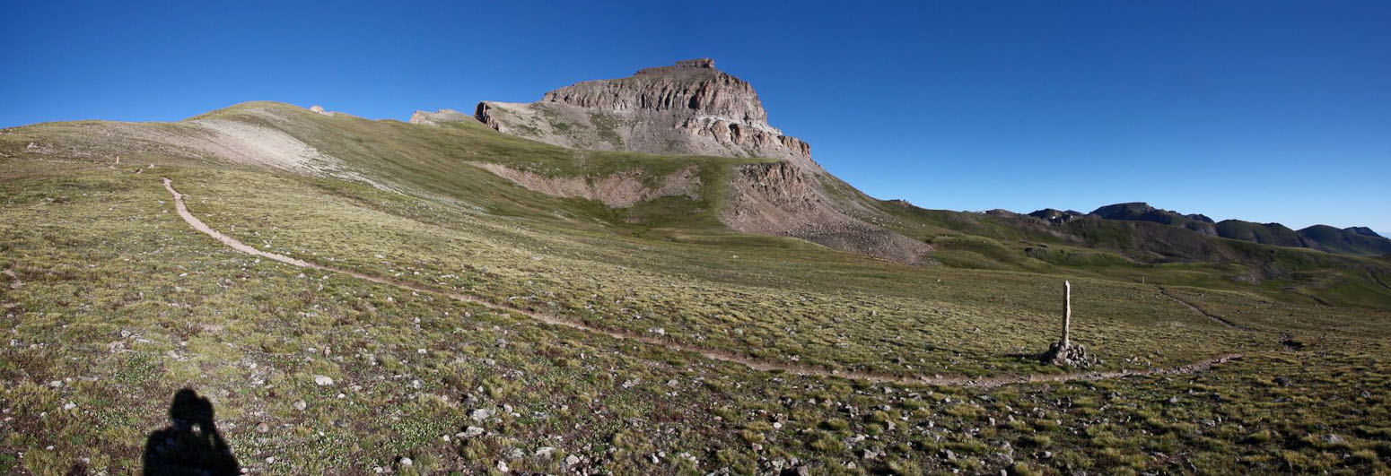
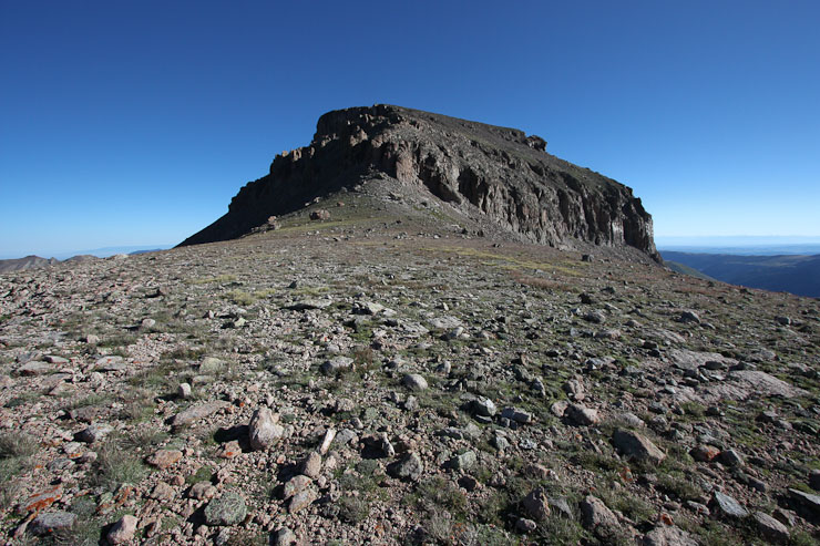
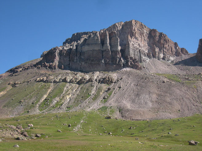
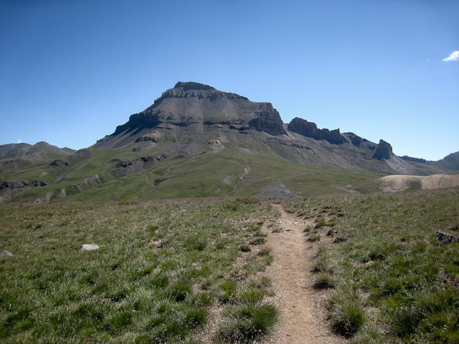
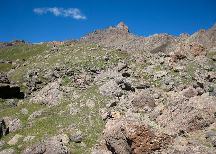
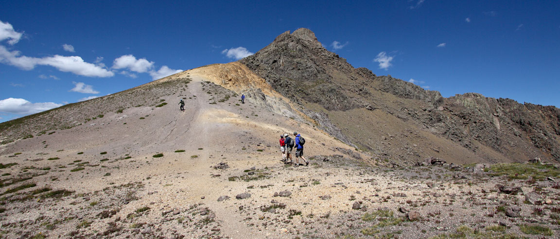
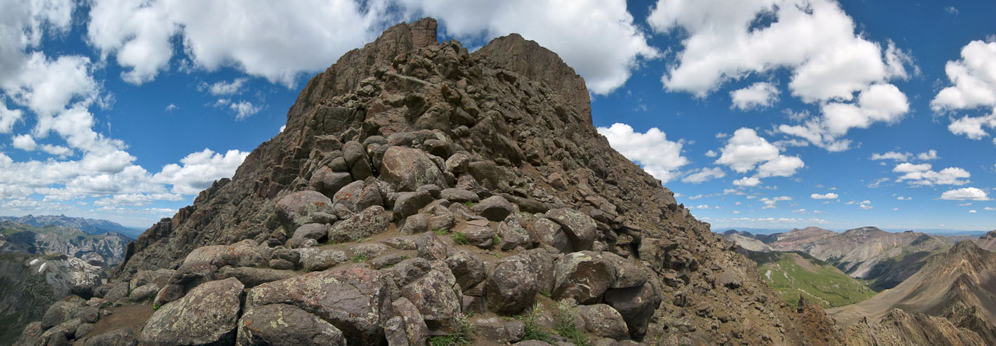
Here it is, the final approach to Uncompahgre, though the peak is still hidden from view, and requires a little more effort than is visible...
I reached the summit ~9:05am, and took off my jacket, as the wind was more calm, and the sun was toasty. I had the summit to myself, and didn't expect anyone else to arrive for awhile, as the nearest climbers were still below the crossover point on the ridge. It took me just over 4hrs to cover the 7 miles and 4100' gain to reach the peak from the 2WD Matterhorn Creek TH.
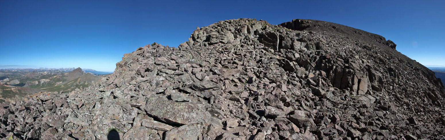
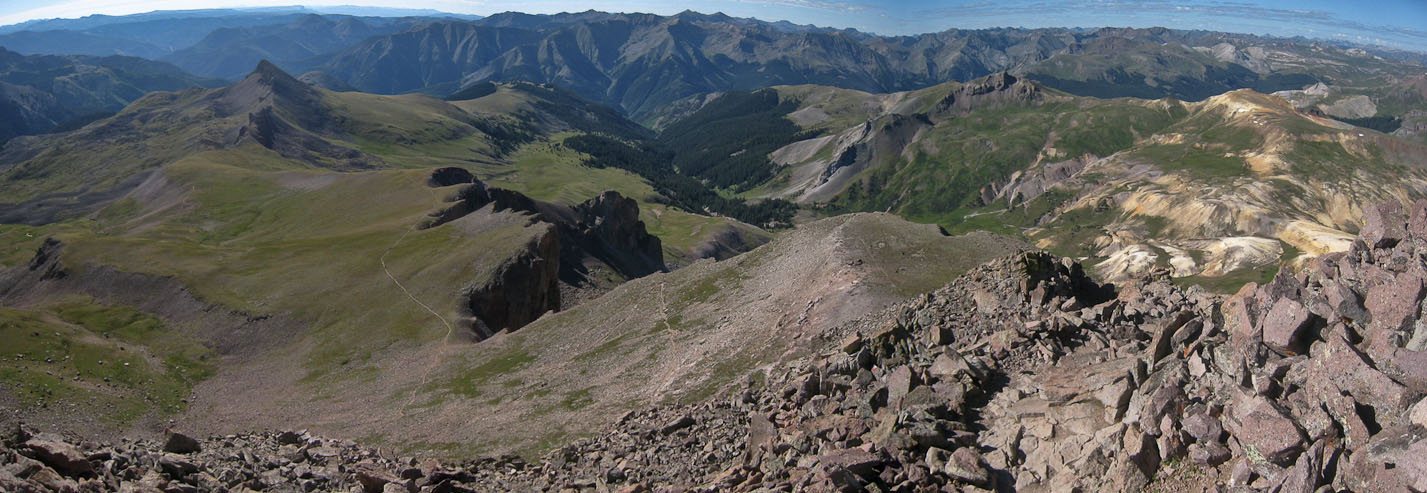
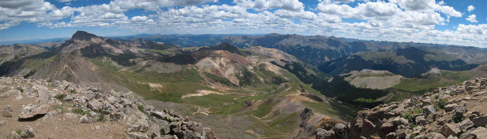
A look to the southeast from the summit of Uncompahgre...
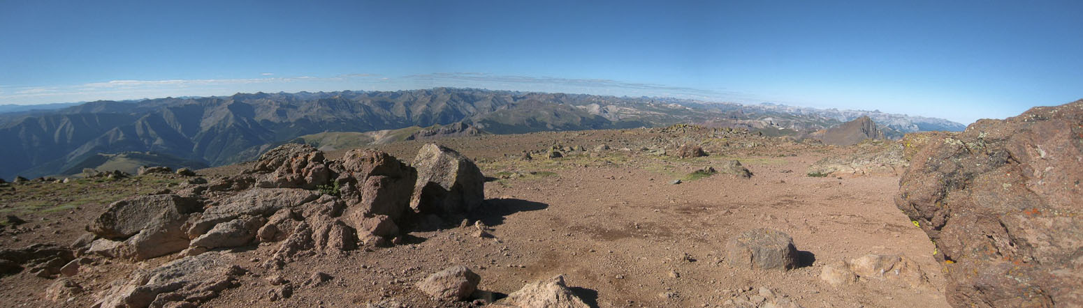
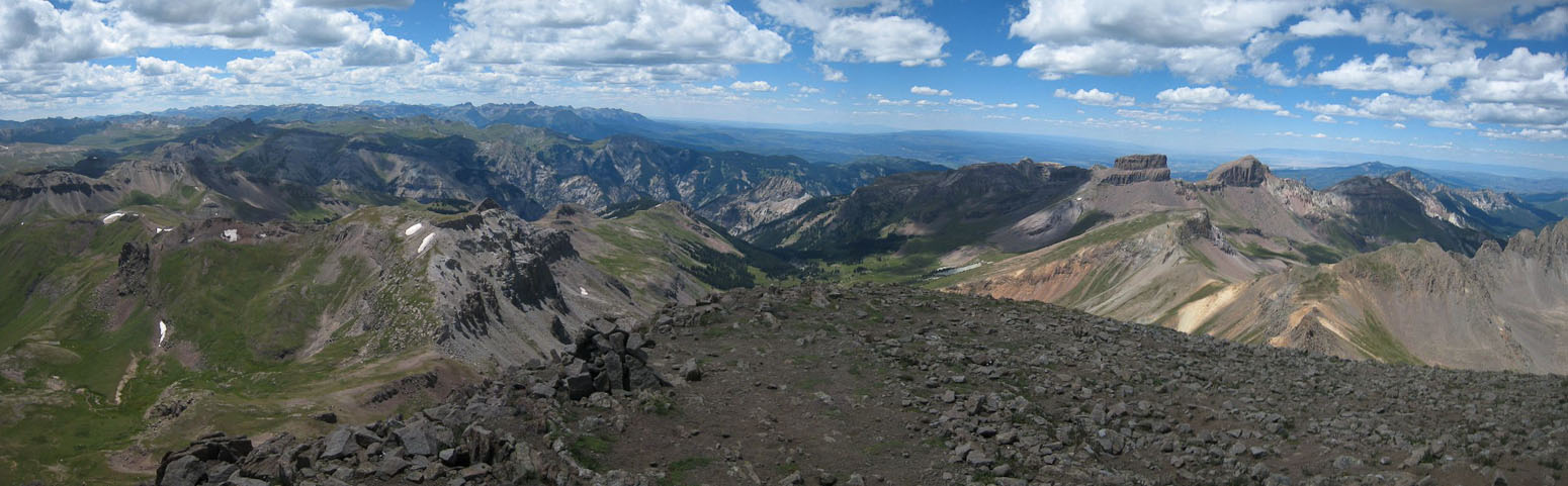
A look southwest across the broad summit block of Uncompahgre...
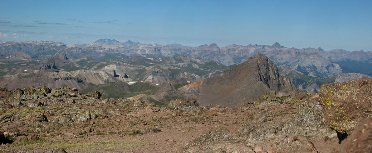
Another look at Wetterhorn to the west...
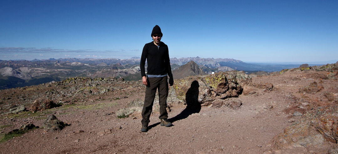
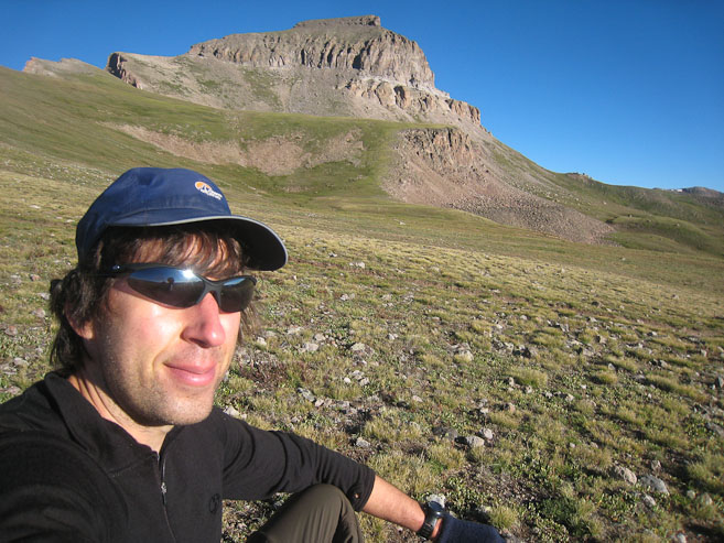
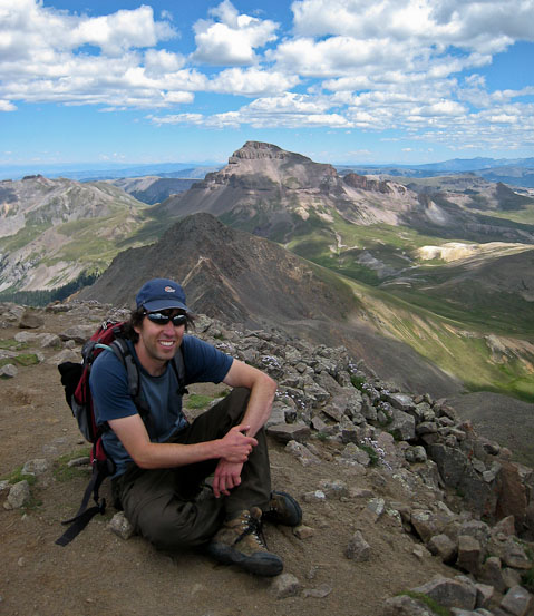
A pic of me, using a boulder as a tripod, with Wetterhorn above my shadow (and Sneffels above Wetterhorn, far in the distance)...
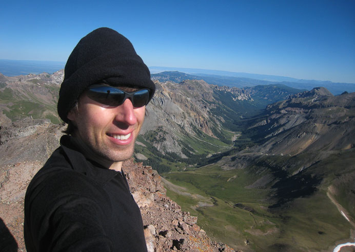
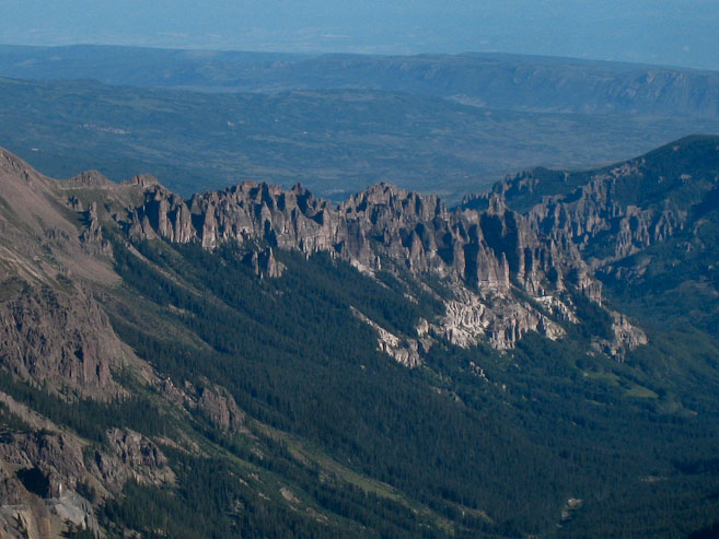
Self portrait on the summit, and a zoomed in shot of some spiky pinnacles, seen to the right of my head...
After ~20 minutes on the summit, all to myself, I had eaten half my almond butter and rhubarb jam sandwich, taken my pics, and rested enough to begin the long trip back towards Wetterhorn. I could see several hikers making their way up the mountain, all from Nellie Creek, as I never spotted another hiker in the valley I took this morning. I strapped my poles to my pack and hiked/jogged/skirted/danced my way down the mountain.
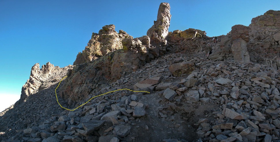
This time I found a slightly easier way down from the ridge (1st pic), and found some hikers climbing up the trickier gully that I had ascended also (2nd pic). I told them that I had followed their footsteps on the way up, but that there was an easier way to the left (yellow line). They seemed ok continuing up the right gully...
I made quick work on the ridge descent, as the trail wasn't too slippery...
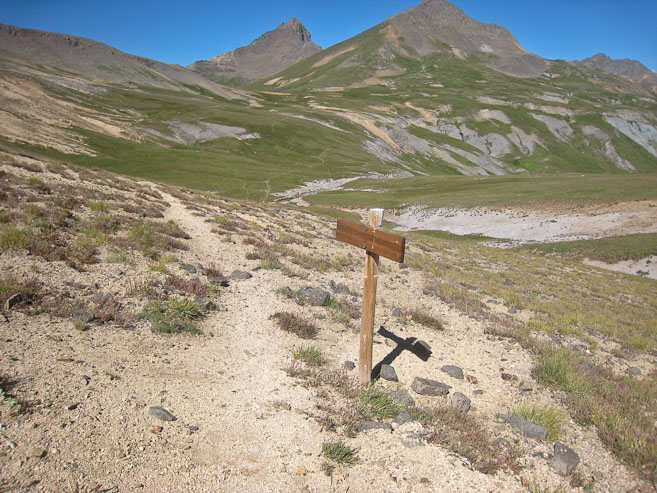
When I neared the end of the ridge, I looked for a short cut trail leading down to the valley to the east, and found one, which saved me a good .4 miles (I think)...
At 10:05am, I was nearly the bottom of the valley, and facing a couple miles of ups and downs to reach the pass. I didn't jog much during this stretch, as there was a lot of ascent. A look at the steep cliffs on the ridge from southwest of Uncompahgre (2nd pic)...
20 minutes into the valley, I was over halfway across, with the final dip and ascent to the pass ahead (1st pic). In another 20 minutes, I had reached the pass, and took a pic back towards Uncompahgre...
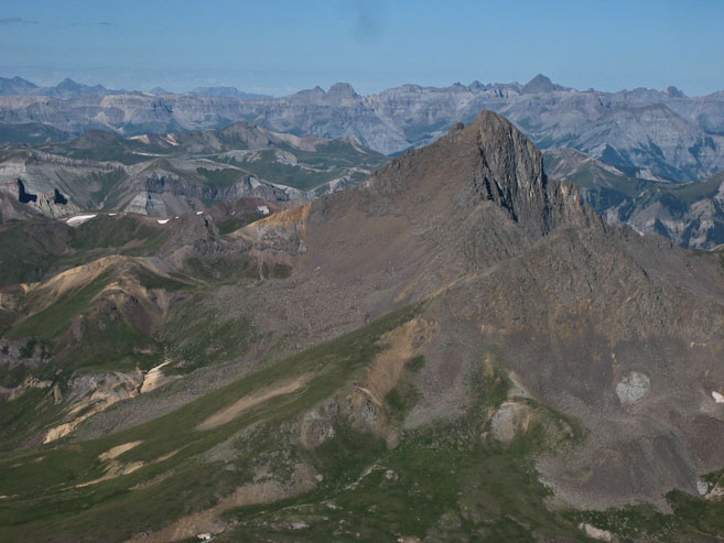
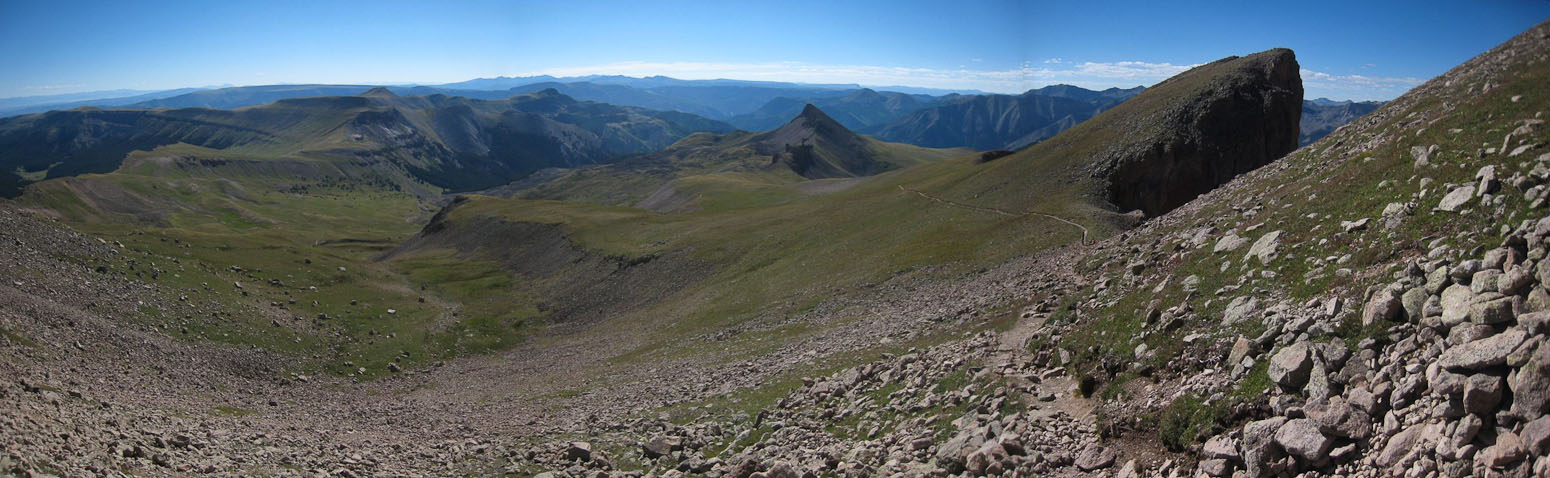
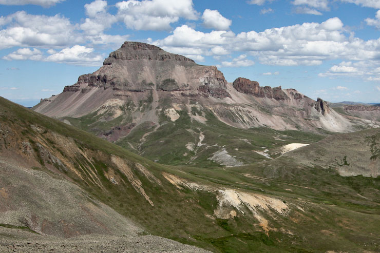
A look across the pass at Wetterhorn, with Matterhorn looming on the right...
From the pass below Matterhorn, I paused for a good 10-15 minutes to take pics, and decide on my plan for the rest of the day. If I wanted to hike both Wett. and Matt. today, then now would be the time to climb Matterhorn. But it was already 11am, and I was feeling tired after yesterday afternoon's long haul up San Luis, and today's jaunt to Uncompahgre. I easily decided to be content with just Wett and Uncomp today. My next quandry was choosing whether to drop down into the basin to intersect the Wetterhorn trail, or contour towards the ridge between Wett & Matt to preserve my elevation. I debated for quite some time, while watching hikers on the trail below (still a few going up, I was happy to see). In the end I decided to hike down to the trail, since there were plenty of previous tracks heading that way, and hiking on a trail would be a lot easier than boulder hopping.
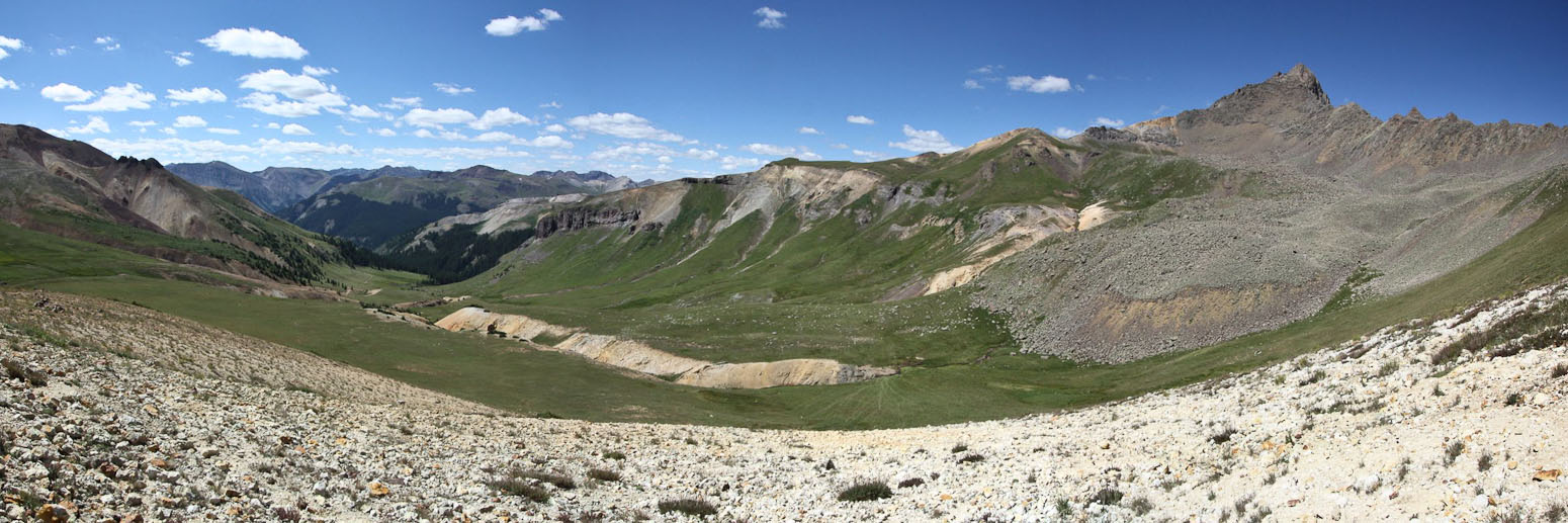
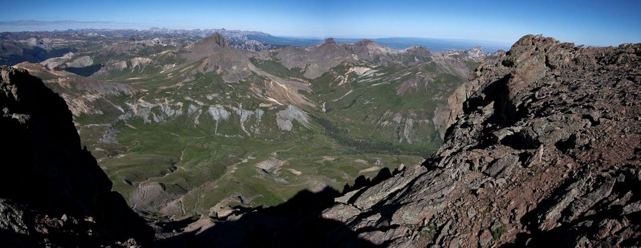
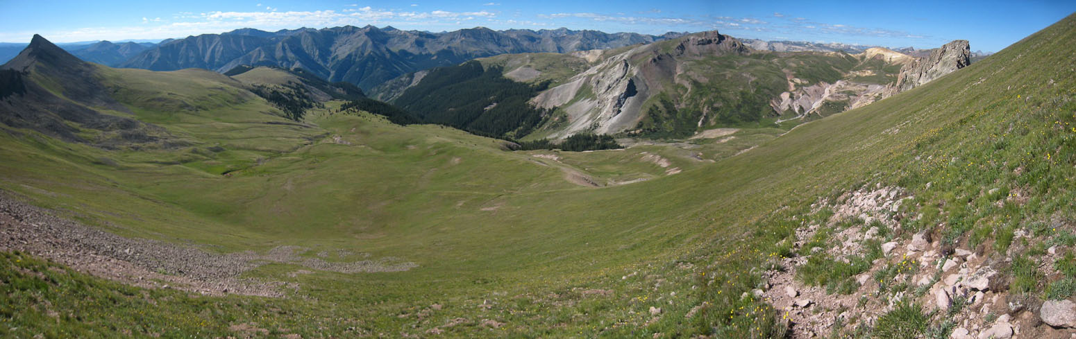
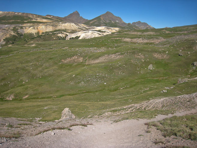
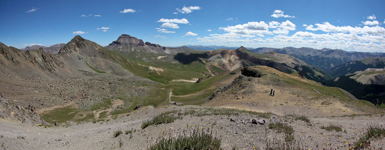
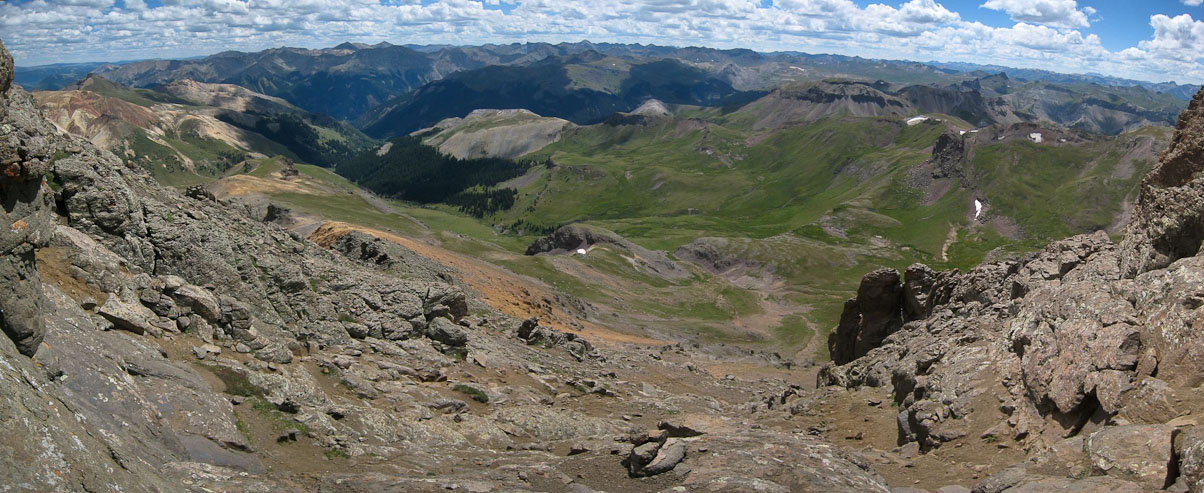
Another look at the basin below Wetterhorn (while I was still debating which way to go). The trailhead lies in the valley on the left. Uncompahgre is behind me. The multiple light streaks in the grass (evidence of dual peak hikers like me) leading down to the valley helped make me think this was the popular course to take...
After dropping down, I joined the trail, and looked back at hikers on their way out. It was now 11:20am, and I was back on the standard route to Wetterhorn, with ~1700' gain left and no more than 1.5 miles to the top. However, having climbed over 8000' and 23+ miles in the past 24 hours, I was expecting a tough battle to finish this final ascent. Fortunately, the weather was still beautiful...
The trail climbing up to Wetterhorn's upper basin was in excellent shape, and made for easier hiking than I expected, over the mixture of (mostly) rock and grass...
Once in the upper basin, the trail flattened and led to the base of Wetterhorn's ridge. I was struggling to keep my pace, but wanted to stay near the group ahead of me, which might be the last of Wetterhorn's visitors today (besides me). I'd rather not be the only one on the class 3 ridge...
Another look across the upper basin of Wetterhorn, with Uncompahgre in view on the right. Judging from this vantage point, I made the right decision to avoid contouring from the pass below Matterhorn into the boulder fields. Though I had read about people cutting across the boulders from Matterhorn, it certainly looked longer and a lot more draining than dropping to the main trail...
At the top of the ridge, I caught up to the group ahead of me, just as they were finishing their rest. However, I badly needed a rest, and would have to let them go ahead. I was feeling pretty dead, and wouldn't mind following a group, and letting them do the trail finding up the ridge, but wasn't sure I could keep up with them.
A couple of hikers passed by on their descent, and one asked if I made it to Uncompahgre today. I recognized them as the two hikers with headlamps I saw on the trail this morning. I filled them in on my day, and mentioned how dead I felt. They said it was a tiring 800' remaining to the top. Just as I expected...
A look back down the ridge, just before reaching the colored rock, with Uncompahgre in the distance. I sat on the ground, and considered if I had the energy to make the summit of Wetterhorn today...
I slowly climbed up the ridge, taking notice of hikers descending past me, and trying to make sure I didn't separate too much from the group ahead. The trail started to dissolve into several dirt threads up the left side of the ridge. With 600' to go, and some significant trailfinding work ahead, I found myself wondering if I should turn back. I know that after a hike, the memories usually favor the glory of the day, rather than the struggles, but even with that perspective, I was thinking this might be the biggest struggle I'd faced while hiking that I could remember. Of course, given that I was hiking solo, I had been constantly pushing myself, with few trail breaks all day (and yesterday). I probably just needed a good rest, but again didn't want to be the only one on the ridge too. I sat on a rock to contemplate.
I had plenty of food and water, but neither seemed to give me the energy I needed. Then I remembered reading online how someone said that "runners" can have problems at altitude, cause they "breath too slow" (there's less oxygen available but their slow heart rate doesn't make them breath faster). So I decided to concentrate on breathing fast, rapid fire breaths. To my surprise, I felt a boost of energy, and could keep moving up the ridge. Whenever I forgot to breath fast, I felt my energy disappear. With this new found boost, and the friendly skies, I kept my pursuit of Wetterhorn.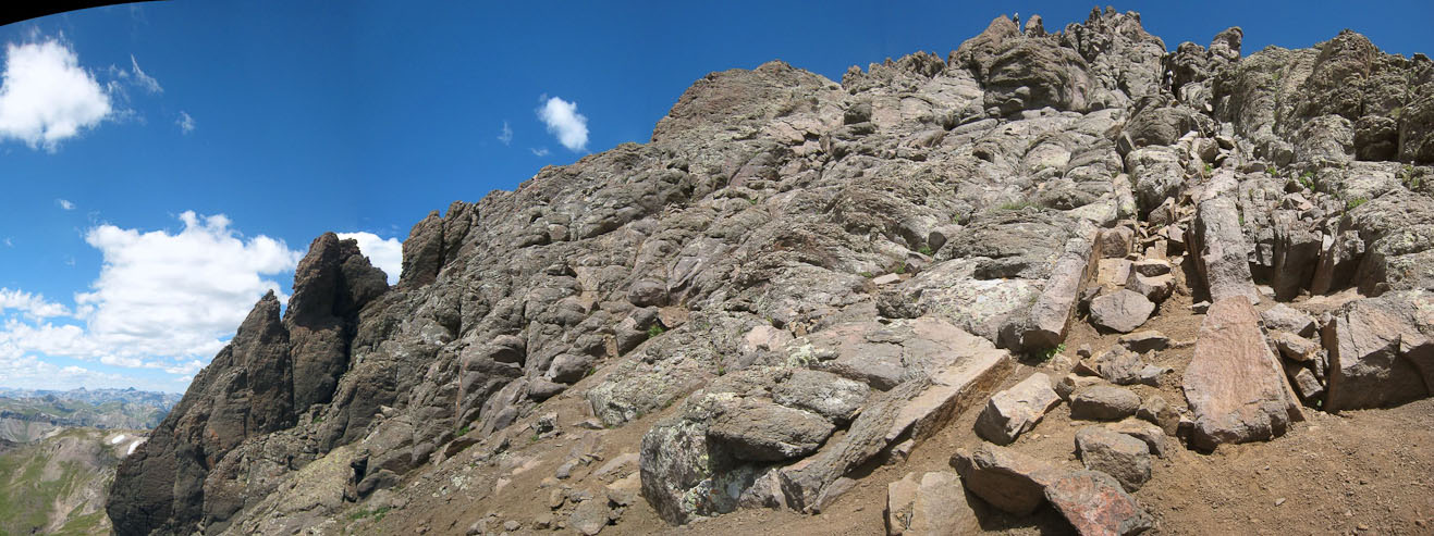
This area stumped me for a bit. I followed some cairns to the top of the ridge, but the ridge was more than class 3, so I retreated, and looked for a different way across the rock ribs, which I eventually found...

More dirt threads along the west side of the ridge. The trail finding and slippery dirt surface was annoying, especially this late on a big 14er day...
I made my way up to the ridge again, only to have to turn back and continue up the west side a bit more...
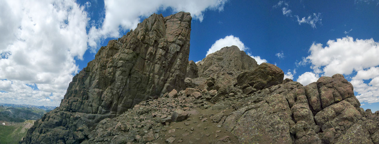
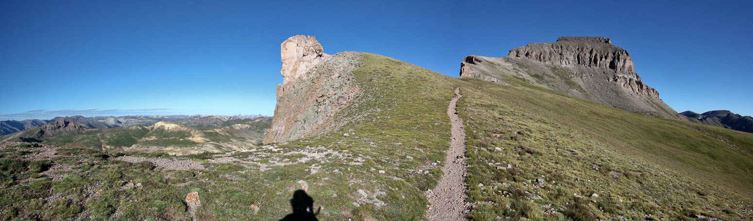
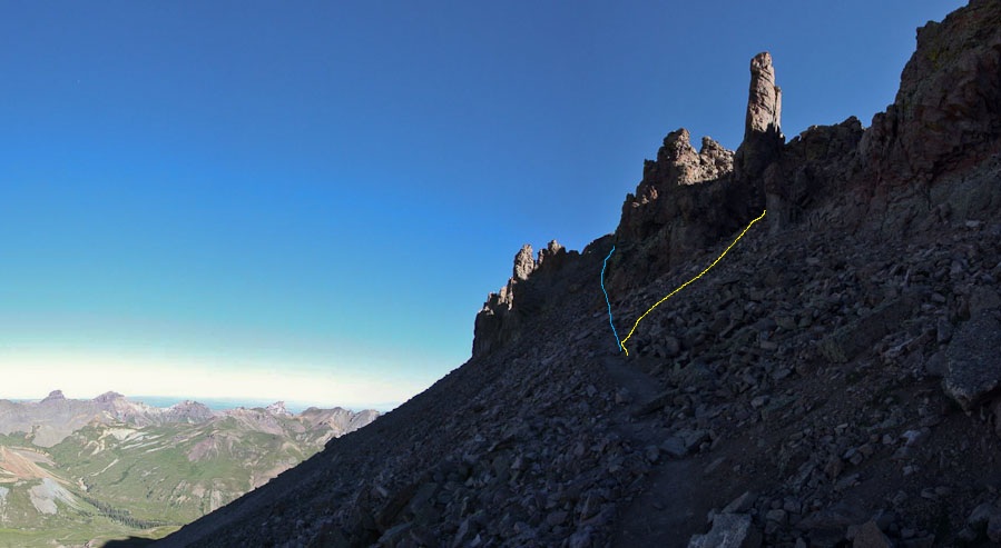
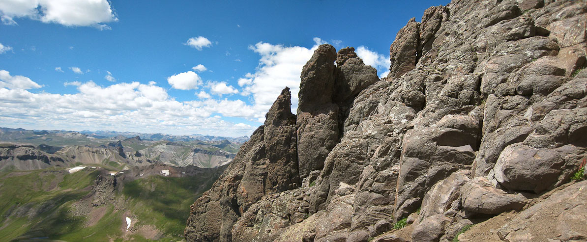
Finally I reached an opening leading to the Prow, and passed it on the east side...
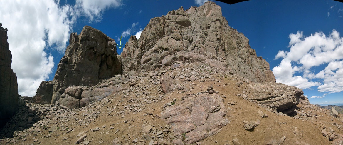
Having passed the Prow, all that remained was the final ~140' class 3 climb to the summit, which lies past the gap to the left. I followed the trail and climbed over the ledge near the yellow arrow. It's harder than taking the gap on the left, but apparently there is a nasty move on the other side if you take the gap...

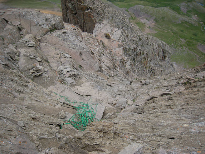
I was delighted to discover the group ahead of me finishing up the class 3 scramble to the summit. They had set up a rope for one of their party. I sat down and watched as they made the final climb. The easiest way to the top, after the initial climb (where the 2 hikers are standing above the rope), is to traverse to the left on a ledge, and follow an easy path to the summit...
I followed the guy in white, and had no difficulty on the scramble. It was like a steep staircase with solid rock and monster holds everywhere. I summitted with the party ahead of me, and enjoyed a nice chat about 14ers, in particular, the Little Bear - Blanca Traverse. I was surprised to see another party summit 20 minutes later, consisting of mega-athletes who flew up the hill. I was so exhausted on the summit, I could hardly think about taking pics...
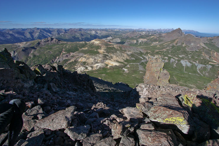
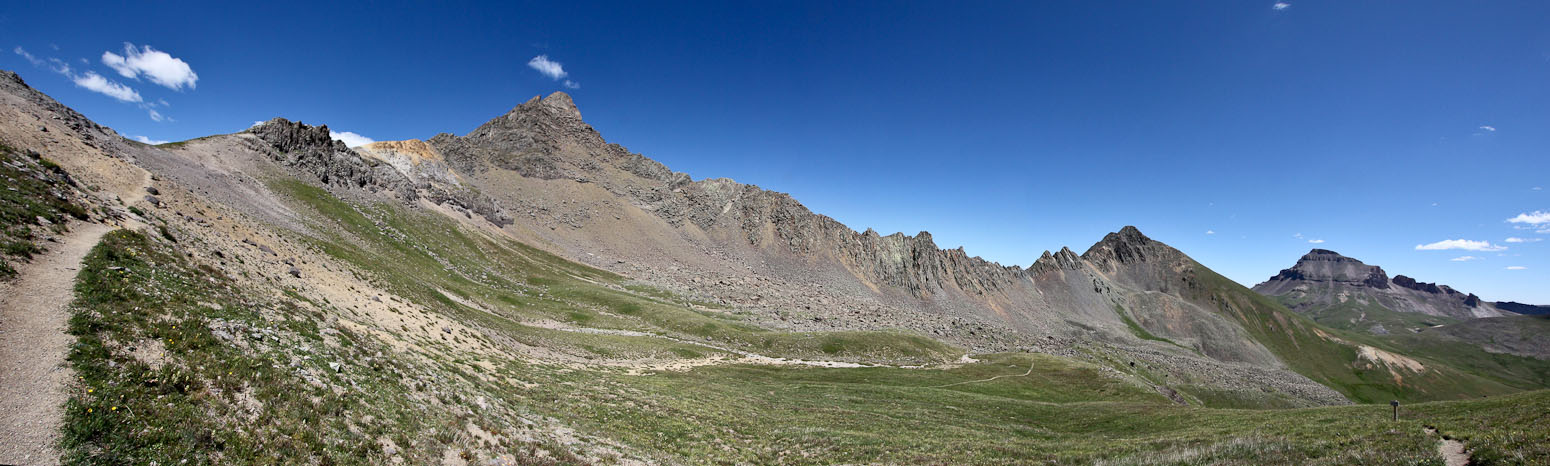
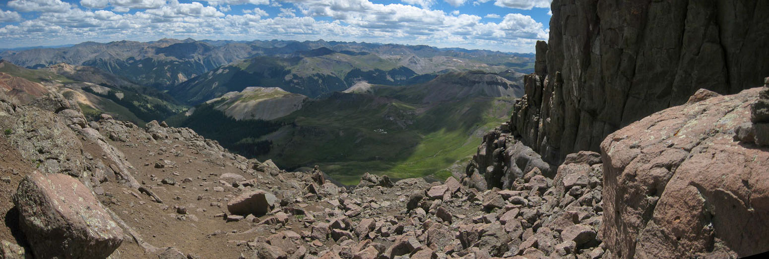
A wide view of Uncompahgre, and the valley to Matterhorn Creek Trailhead (taken from my seated position). Most of my hike today can be seen from here...
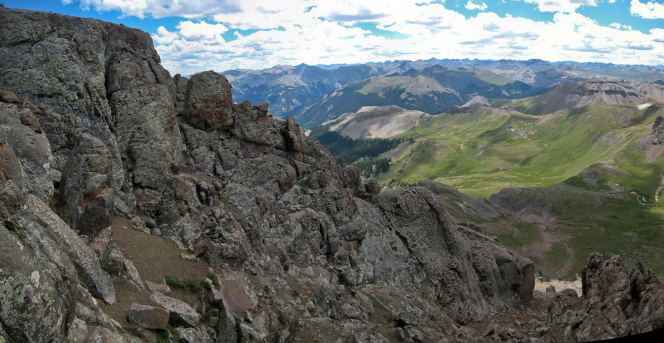
After 30 minutes, I was fairly rested, and was eager to get back to the car, to get started on the 315 mile drive back to Ft Collins tonight. A look to the west as I start the descent...
Downclimbing the final pitch was quick and easy, but soon I was back on the dirt/rocky west side of the ridge. However, from up high, it was much easier to see the path down, and didn't present much of a problem...
A look across a rock rib I had to cross on the way down...
The multi-color rock can be seen below, but still more dirt to descend...
A look back up at Wetterhorn and across to Uncompahgre, before heading down into the basin...
I jogged several portions of the trail down to the lower basin, and was surprised to see 2 of the athlete-guys run right past me on their descent. I kept up with 2 others for awhile, until the trail flattened out, and I decided to walk the rest of the way back to the trailhead.
Despite my struggles ascending the ridge of Wetterhorn, I felt great during the descent, and was on the road back to Fort Collins by 3:45pm. The 10.8 miles of dirt road back to Lake City took ~30 minutes in my car, much of the time spent on the rough 2 miles of North Henson Creek Rd leaving the trailhead. I managed to avoid scraping the under carraige on the way out.
From Lake City I drove straight to Gunnison, filled up on gas, bought a sundae at McDs, and drove non-stop to Fort Collins, arriving just before 10pm. Man, what a weekend! 810 miles in the car, 29 miles and 9750' gain in the mountains, and three 14ers in the bag! The Wett/Uncomp combo will certainly be a memorable experience, both from the beauty of each mountain, and the hard work to reach them.