

All week Tom and I had been targeting a weekend visit to Lindsay and Humbolt, but when Chris (a very experienced technical climber at work) proposed leading a climb up Longs Peak via the classic 5.4 Kiener's Route on Thursday, we gladly took advantage of the opportunity to partake in what Roach describes as "perhaps the finest mountaineering route in all of Colorado". The Kieners Route offers a big snow climb up Lambs Slide, exposed ridges across Broadway, technical class 5 climbing up the chimney near the Notch Couloir, and plenty of class 3/4 scrambling. Oh, and stunning views the whole time.
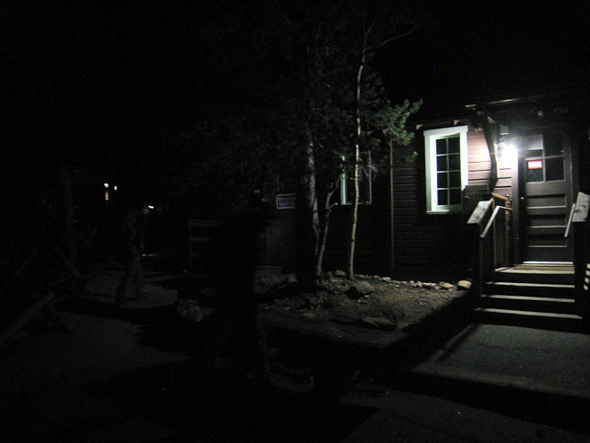
We met at a gas station in Fort Collins at 2am, noticing others still wrapping up their Saturday night out. I had managed 2hr 45min of sleep at home, which ain't bad given a 1:30am alarm. Chris drove us up the empty Big Thompson canyon, arriving at Longs Peak Trailhead ~3:10am. The large parking lot was nearly full, and several vehicles had trunks popped open, with hikers preparing their gear. We took the last parking spot in the lot, and quickly readied ourselves for the trek. In addition to our axes, crampons, helmets, and harnesses, there was "the rack", Chris's bag of climbing gear, and a 70 meter rope to carry. Somehow I got lucky, as Chris carried "the rack", and Tom volunteered with the rope. I suppose my 2lbs of camera equipment counted as group gear too, but regardless, I had the easy yoke to start the hike.
We departed from Longs Peak Trailhead at 3:17am, amidst many other groups of hikers. Early on we passed many hikers on the trail, with Tom leading us at a fast pace. In 45 minutes we reached the bridge before treeline, and continued up to the junction for Chasm Lake and the Keyhole Route. The trail of bright pin pricks (headlamps) in the distance, ahead and behind, gave evidence of the popularity of Longs Peak in August. We headed towards Chasm Meadows, and up to Chasm Lake, a trail I've treaded on several times. I could picture the towering cliffs under Mt Meeker to the left, the enormous curved rock slope leading down from The Loft, and of course, the shear face of Longs Peak's east face, the Diamond, which we'd be heading straight under.
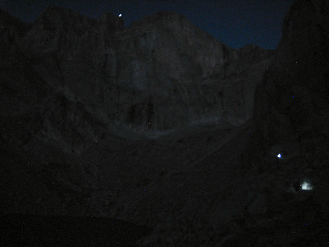
We reached Chasm Lake ~5:20am, and circled across the rocky bank on the north, following parts of a trail, and doing a fair amount of boulder hopping. The winds were gusting near the lake, giving the a brisk chill to the darkness. There were a few other climbers in the area here, who were planning various routes on the east face. It looked like we were the only ones attempting Kieners so far today. The horizen was starting to glow red, yielding enough light to make out the 2400' cliffs under Longs Peak. We reached the snow at the start of Lambs Slide shortly after 6am, where we had a long break to put on crampons/harnesses and setup the rope. The snow was very solid. I was actually surprised to find so much snow here in August, but Lambs Slide is nicely protected from the sun most of the day.
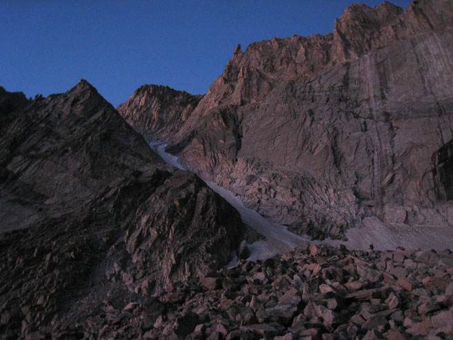
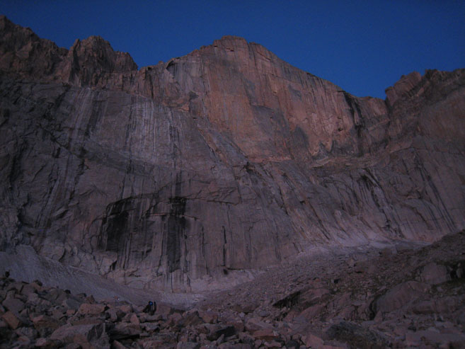
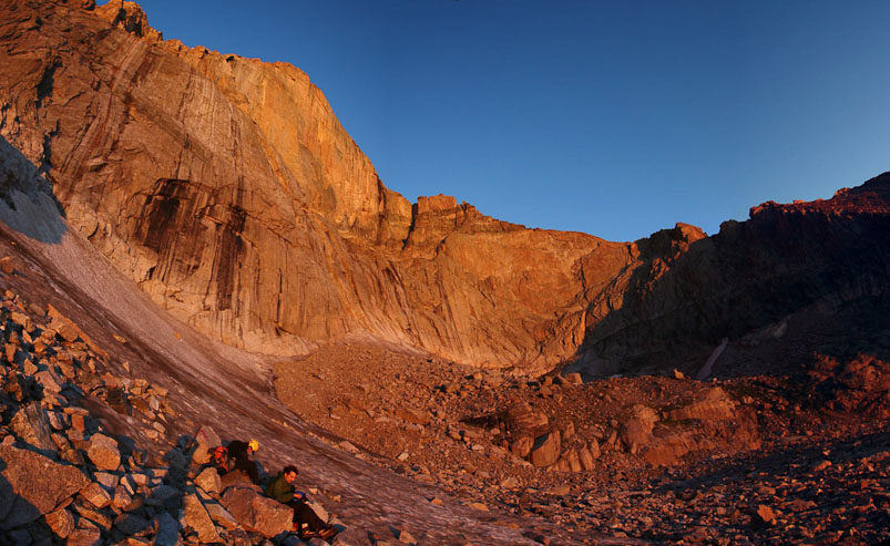
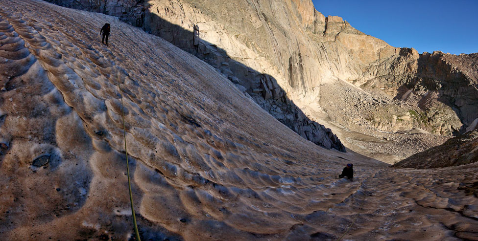
By 5:55am it's light enough to go without a headlamp, AND take a pic. Lambs Slide, our snow climb is in the 1st pic. Later on, we'll be climbing the ridge along the left edge of Longs Peak's diamond...
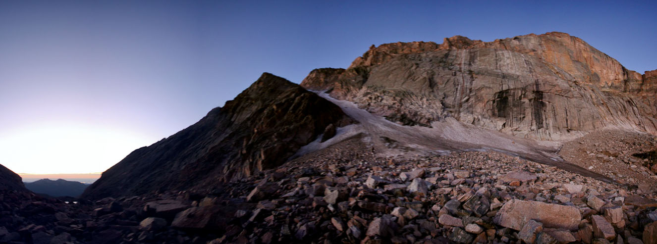
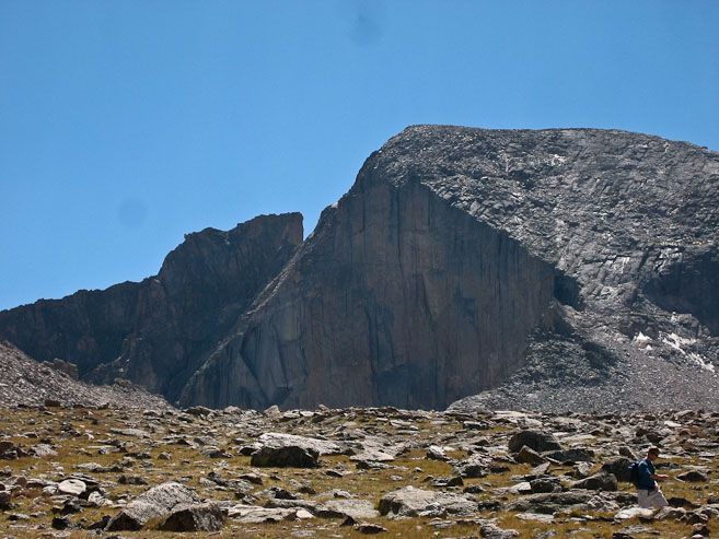
A look at both Lambs Slide and Longs Peak...
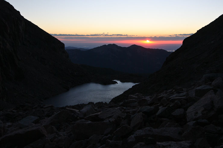
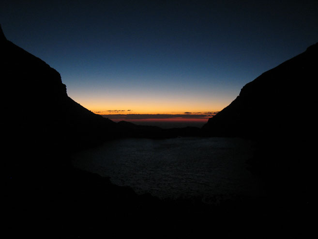
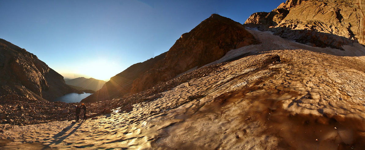
The sun rises over Chasm Lake and Twin Sister at 6:20am today. Tom and Chris prep their gear for the snow climb...
The sun clears the low clouds and drenches us all in gold...
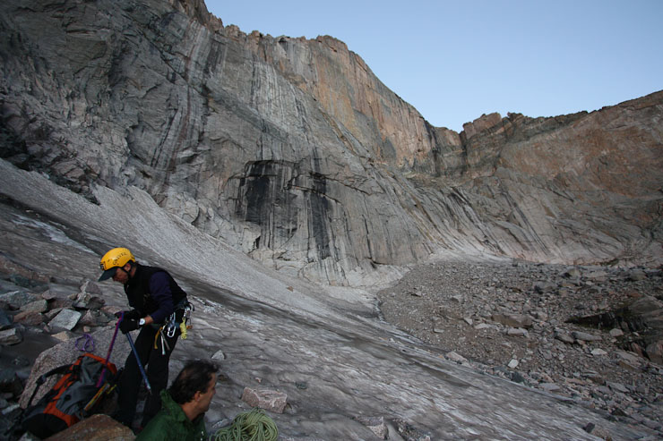
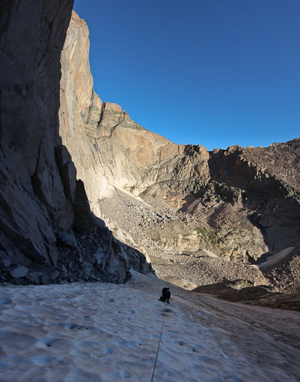
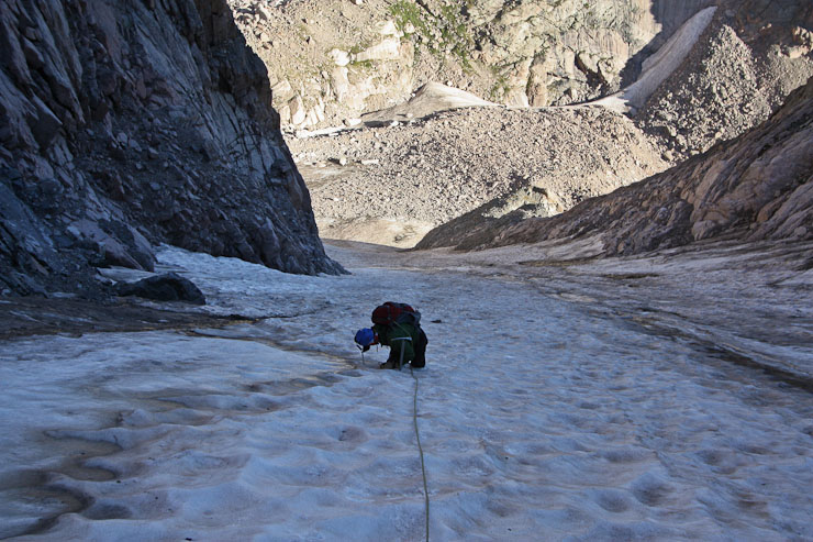
I take a peek up Lambs Slide, as Tom and Chris finish prepping the rope at 6:35am. The snow was quite solid, with some glossy-icy parts...
This would mark the first time I'd be roped up during any outdoor mountaineering climb. Both Tom and Chris had climbed Kieners Route before (separately), so I was certainly in good hands here. In fact, Chris has climbed all over the country and internationally, and is full of mountaineering experience, to which it is no surprise that he led the climb, followed by me in the middle, and Tom in the back. Again I happened to luck out, in that Chris and Tom carried the leftover coiled up ends of the rope, as we decided to keep our separation to 50' (on a 70 meter rope). Being in the middle also gave me the best vantage point for pics (which is why I suggested it). Finally, ~6:40am, we headed up the inclined snow sheet, keeping the rope taut with our spacing, and zig-zagging up the gulley.
On a side note, to quote wikipedia: Lambs Slide is so-named because of the Reverend Elkanah J. Lamb's nearly fatal tumble down it. The most recent fatal tumble was November, 2006.
A few minutes into the hike, we heard a cry from Tom, and looked back to see his yellow water bottle sliding down the frozen slope, picking up speed. I hadn't realized we'd gained so much elevation already, since it took several seconds for the speeding nalgene bottle to reach a rock at the bottom, where it shattered upon impact (I thought Nalgene's were supposed to be strong?). It was gone. Fortunately the loss didn't affect Tom too much, as he had another bottle in his pack, having re-filled both at Chasm Lake. I was glad I had a water bladder today, and didn't need to worry about stuff falling out of my side pockets.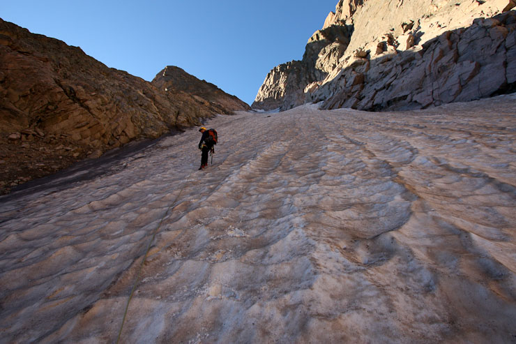
As middle man on the rope, I could take pics of Chris ahead, and Tom below...
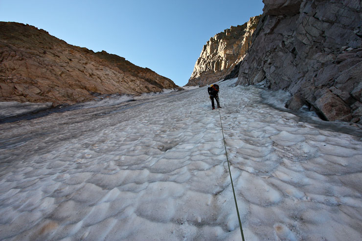
We criss-srossed our way up the snow, pausing every few minutes for rest (and photo ops)...
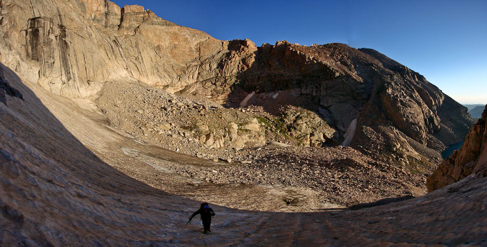
Despite the shade, it wasn't very cold, and we were shielded from any wind. A look back at Tom, with the top of Longs in the upper left...
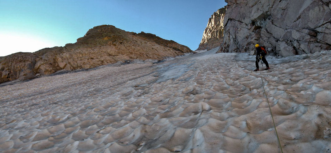
Lambs Slide got steeper and more icy the higher we climbed, convincing Chris to set a couple of ice screws into the slope for protection. We paused for Tom to unscrew them as he cleaned the route (2nd pic)...
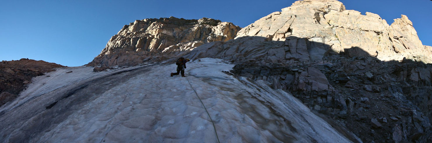
Chris is moments away from exiting Lambs Slide onto the black rocks to the right, having just set the last ice screw. There was a solid steep ice patch to cross before reaching the rocks...
Tom cleans the last ice screw, with Mt. Lady Washington in the backdrop...
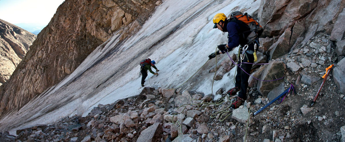
Chris belayed Tom as he crossed the icy, using 4 points for traction...
We were all back onto solid rock and 7:30am. The books say Lambs Slide is 1000', but Chris and I both measured only 700' on our altimeters. We gladly removed our crampons, and stowed our axes for the next task at hand: the ledges of Broadway! The trail didn't warrant any rope yet, so Tom packed it up, and we eventually continued on the trail at 7:50am, after a short rest...
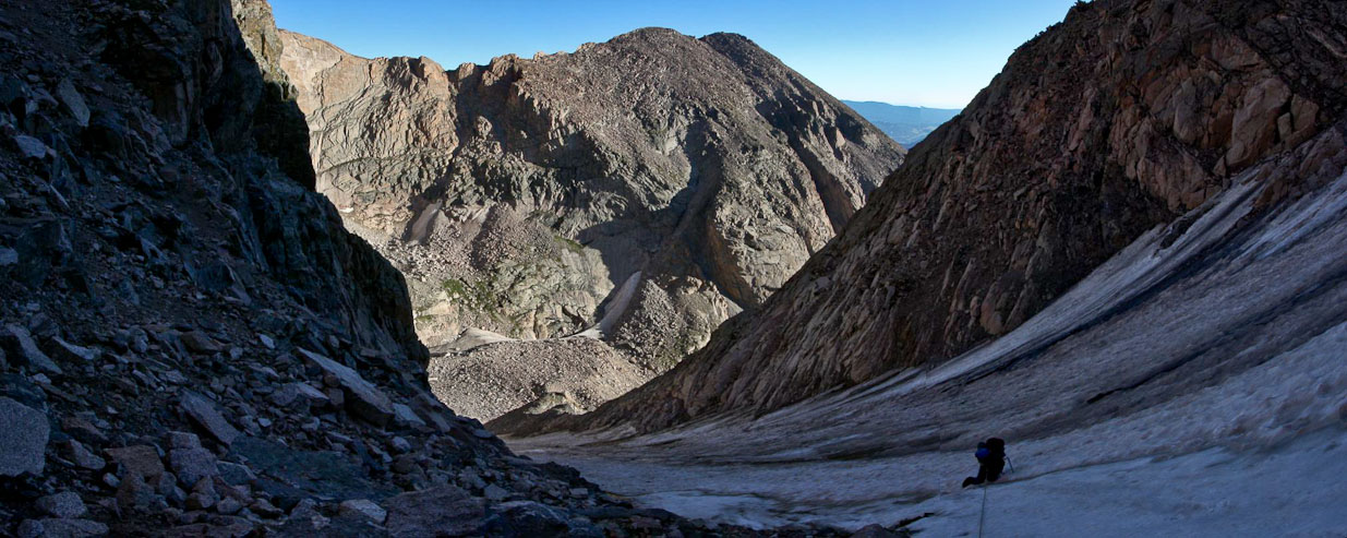
A look back at Tom, with the top of Lambs Slide (looking crazy steep) and Chasm Lake in the background...
The broad ledge would disappear around the next corner...
The ridge narrowed around the bend, but it was still wide enough to comfortably hike it without rope protection for a bit longer.
Tom and Chris head up Broadway. The ledge around the next corner will make this section look like a huge runway...
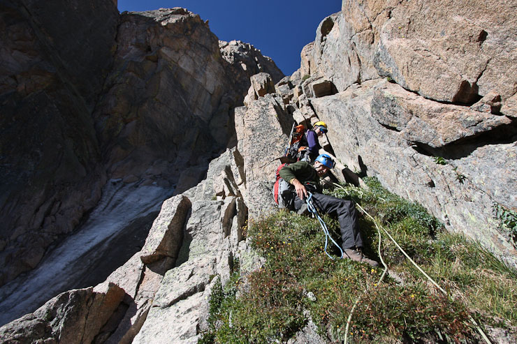
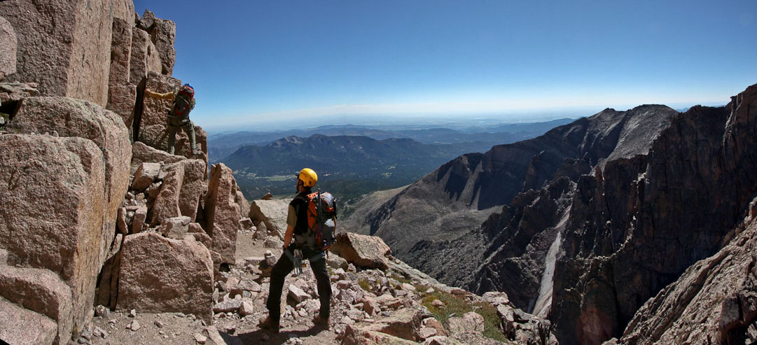
At the next corner, Tom and Chris both knew what to expect, having climbed this route before, and started prepping the rope. I peeked around the corner, and gazed in awe at the seemingly razor thin grassy ledge pointing straight to the diamond of Longs Peak. After roping into our harnesses, in the same order as last time, Chris led the way, setting anchors along the way. When the rope became taut, I rounded the corner, and followed the trail downward, crawling under a low hanging rock, careful to stay on the 2.5' wide ledge. It wasn't too difficult, but had some great exposure on the right. I hiked back into the sunlight, and waited for Tom to start moving.
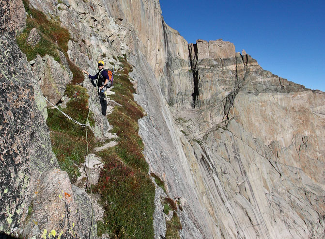
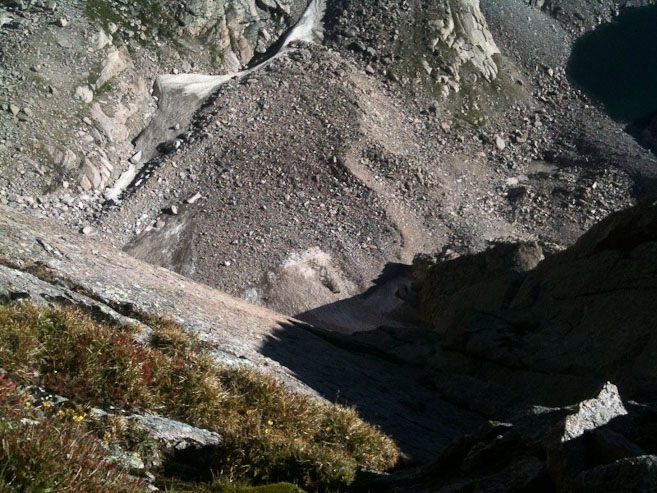
Chris and I wait on the exposed ledge while Tom cleans an anchor. Tom managed to capture a pic looking over the edge of the ledge on his iphone (2nd pic). Pretty shear...
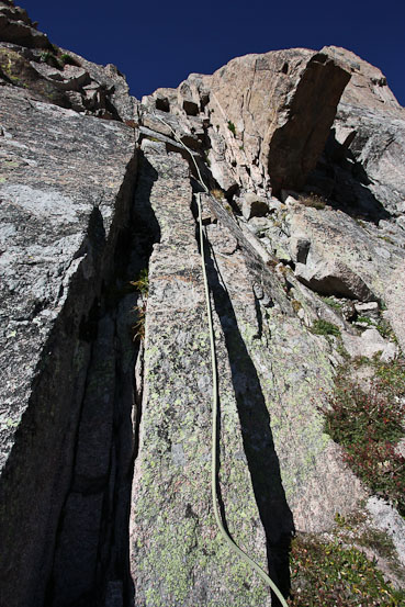
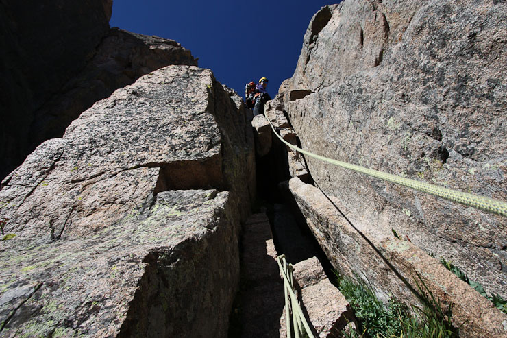
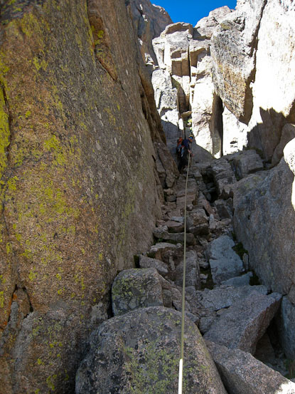
After reaching the end of grass in the pics above, we stopped at an unexposed rock pile, just before the Notch Couloir, to prep for the next stage of the climb. Up ahead we would say goodbye to Broadway, and begin the class 5+ climbing up the Chimney. Roach says the easiest line to the Chimney is 50' up the couloir, however, we followed Tom's suggestion stay on the ledge a bit further, and climb up the lower chimney, given his sharp memory of this particular area from his last trip. For this stretch, we lengthened the rope distance between us to the max. Chris led and set anchor pieces along the 1st class 5.4 pitch. In fact the rope distance was so long between us, that be cleared the first pitch, and found a comfortable place to belay from before I started my climb.
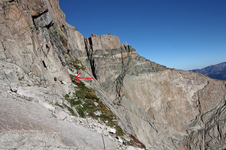

The ascent up the lower Chimney is where the arrow is. Chris explored a bit further (2nd pic), to be sure he didn't see anything else that looked more appropriate...
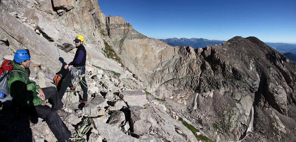
Meanwhile, Tom and I waited until the rope became taut. Not a bad view to kill some time. Mt Lady Washington, Chasm Lake, and Twin Sisters in the distance...
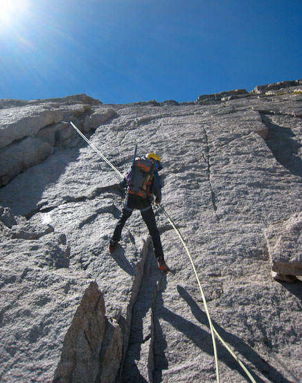
I actually didn't know that we were starting the crux portion of the climb at the time, and began climbing with my DSLR dangling around my neck. Once I was part way up the rock, there was no convenient way to stow the camera. This extra object hanging at my side made the climb seem much more difficult, in addition to wearing bulky hiking boots. I would have guessed it was a 5.7 (though i'm mainly used to indoor climbing). But I made it up fine, if a little slow. I cleaned a couple anchors on the way up, and satisfied my years of wonder at how these clamps attatch to rock. Once above the pitch I sat down and watched Chris belay Tom. Tom popped up quickly.

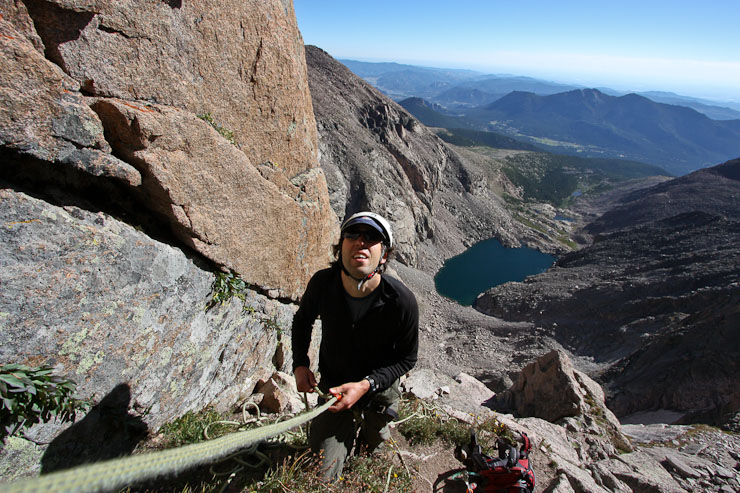
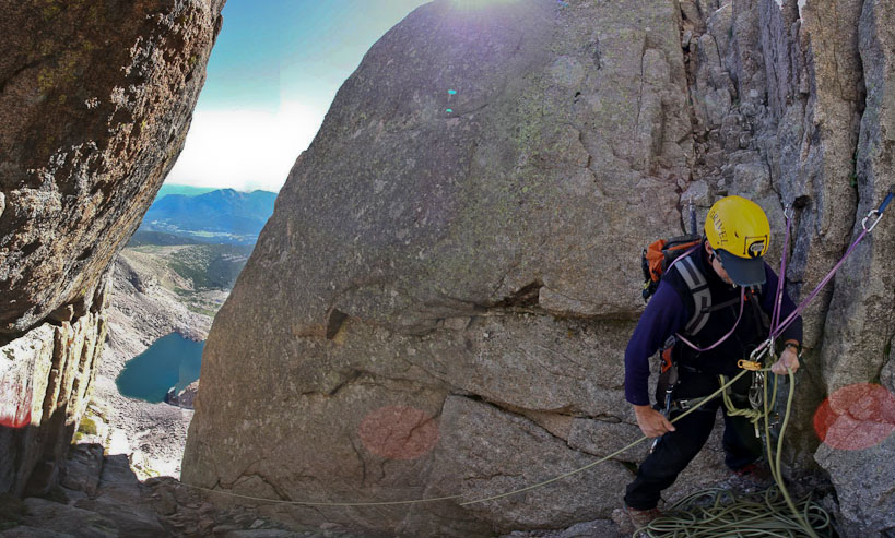
Tom takes a rest, while Chris prepares to lead the next pitch. I belayed Chris, which was the first time I'd belayed someone climbing lead (as opposed to top rope)...
Tom worked the camera while I belayed Chris up the next pitch. He soon anchored himself, and told me I was on belay, and that I could clean the route. This class 5.4 pitch was also an interesting puzzle. I had some trouble reaching to remove the 1st anchor, and was a little careless, lunging a bit to pinch it free, when to my surprise, I lost my balance and started to fall backwards. Of course, since I was roped up, I merely extended the ~1' of slack in the rope before being caught. No doubt I wouldn't have put myself in that scenario without a rope, but regardless, it was enough of a reminder that I should focus harder, both to avoid embaressment, and work on climbing skill. I started again, with more measured effort, successfully cleaning the anchor, and gaining the top of the pitch.
Chris belays Tom up the 2nd pitch. The class 3 exit from this area is directly behind me (from this point of view -- unfortunately I forgot to take a pic of it)...
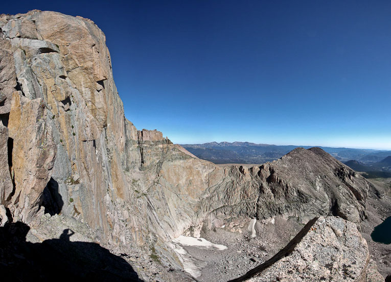
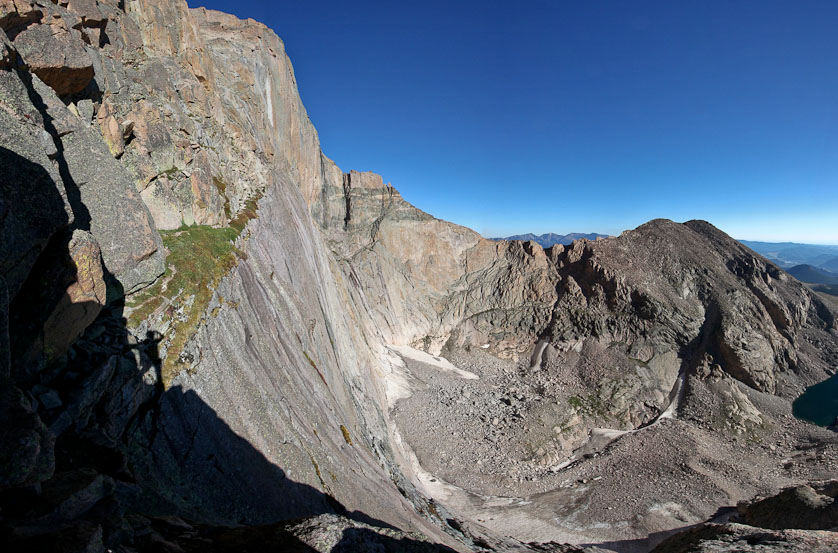
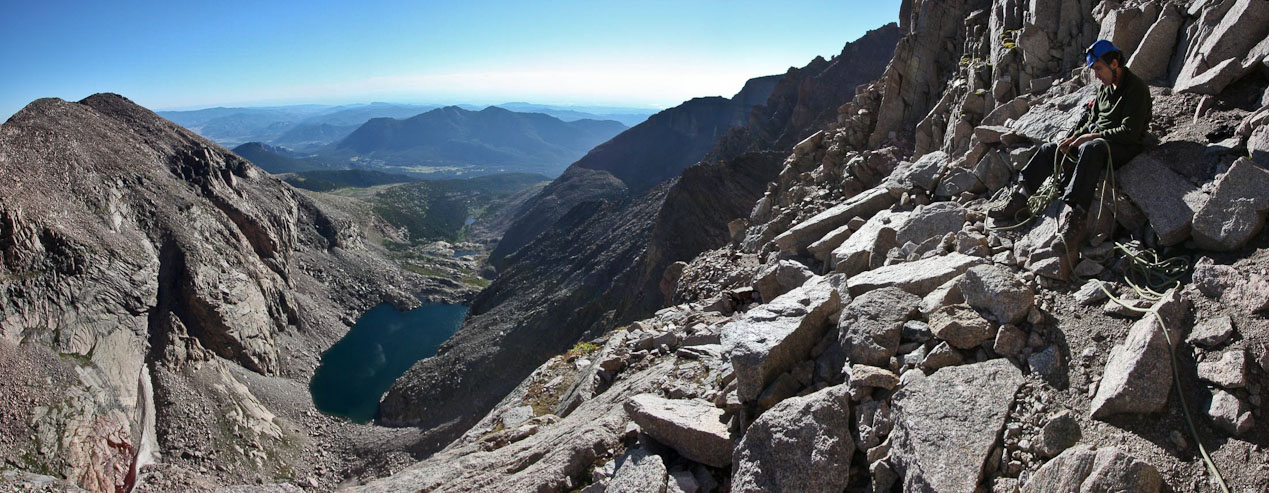
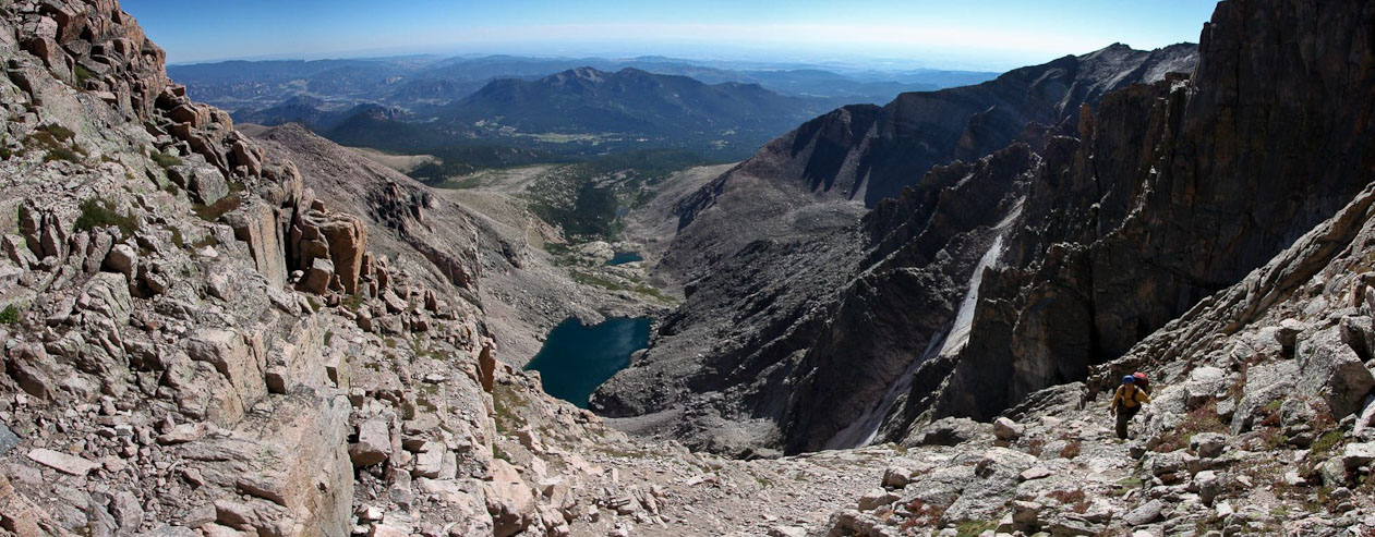
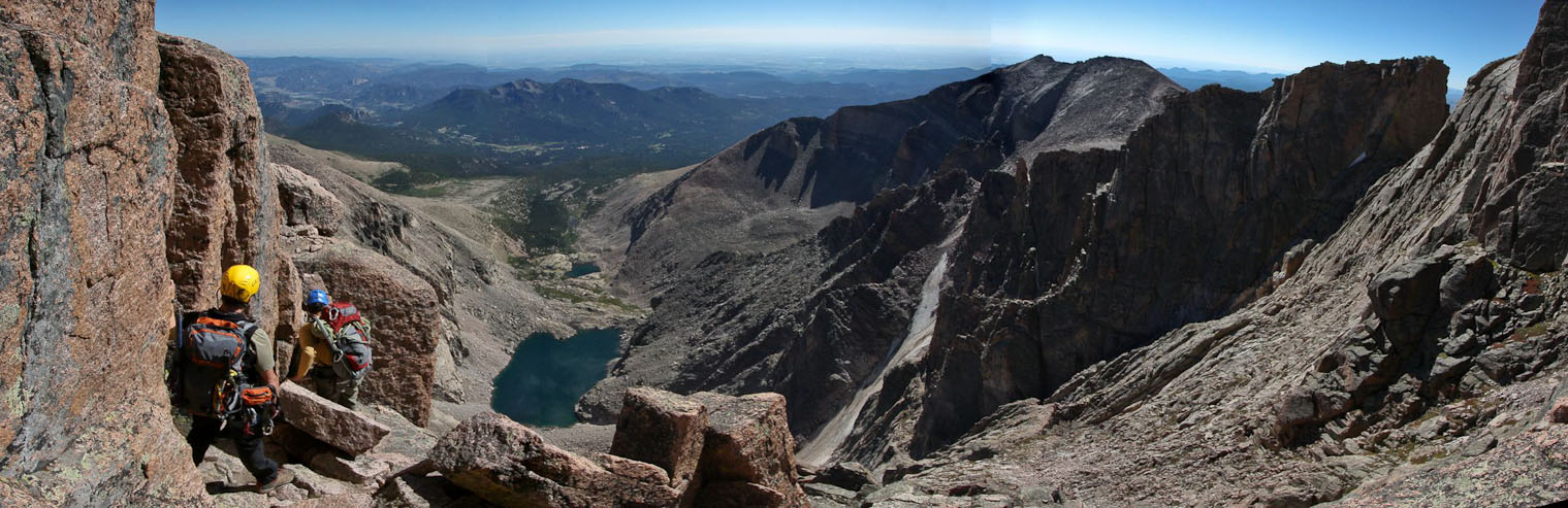
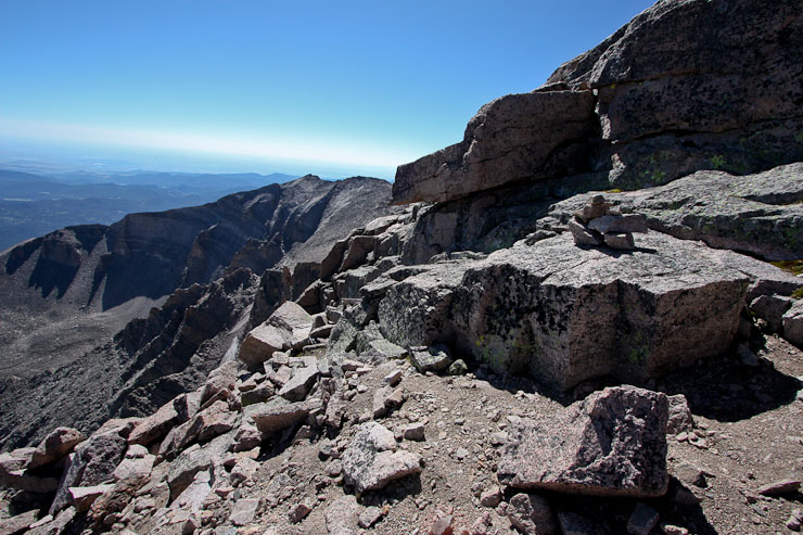
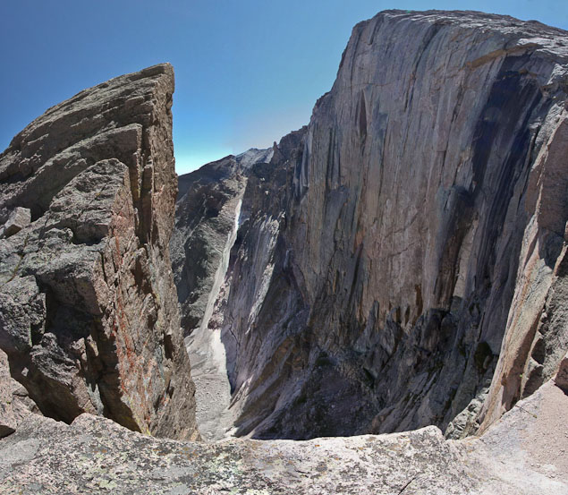
While Chris and Tom were finishing up with the 2nd pitch, I scrambled ahead, and found a precipice with a fine view of Longs' east face...
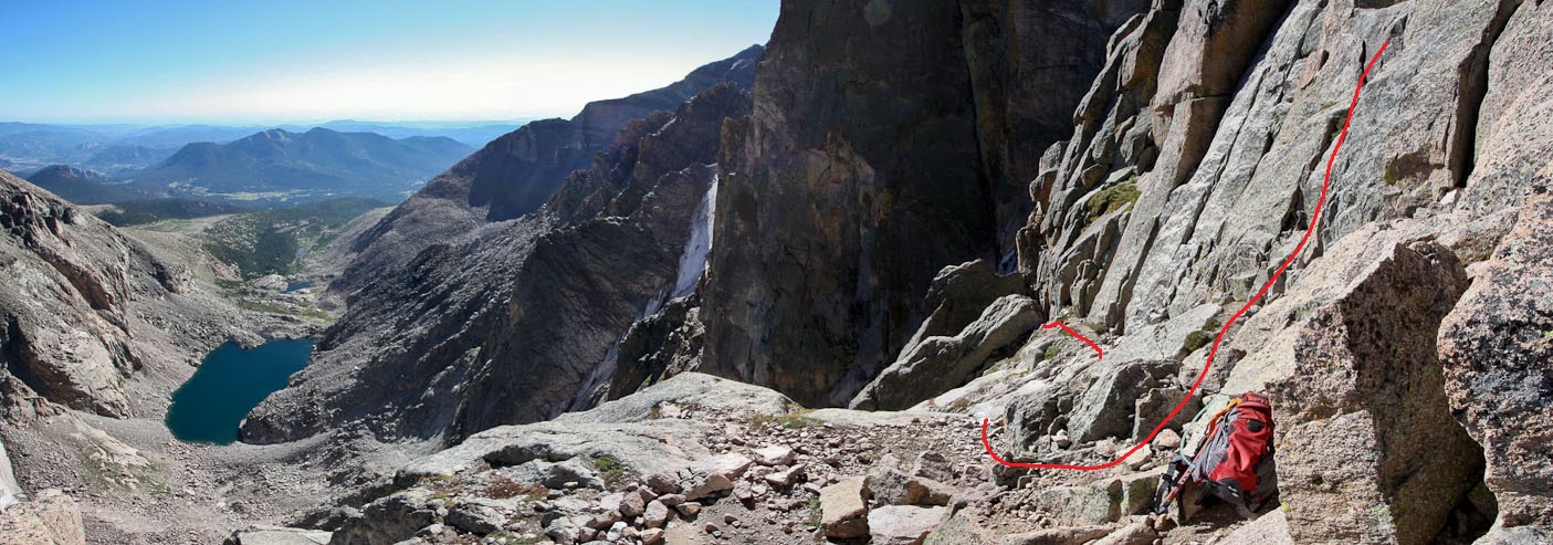
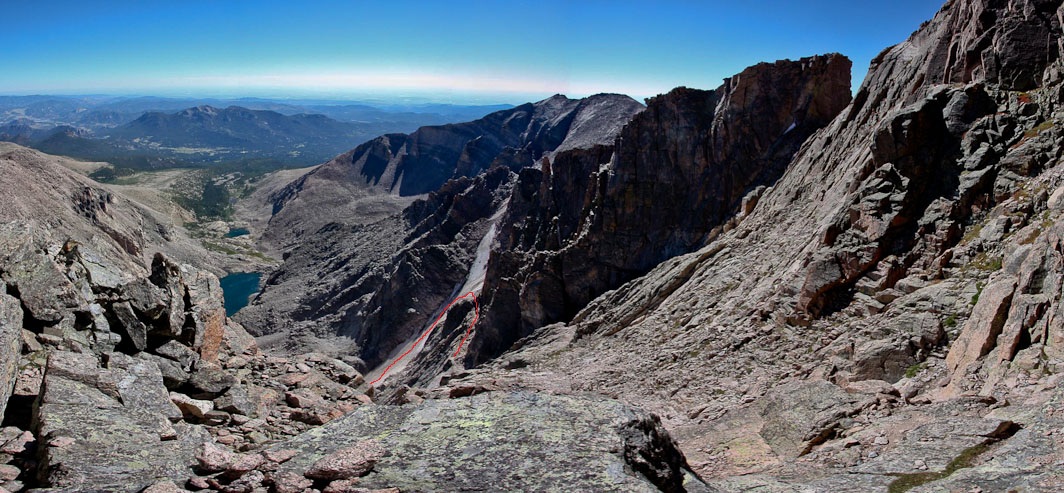
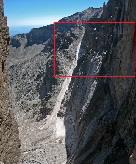
A look back from this vista point in the above pic. The path out of the chimney, and up to the next series of pitches is marked in red. Lambs Slide and Chasm Lake in the backdrop...
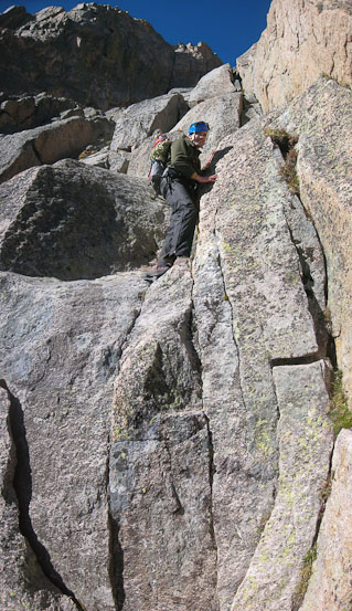
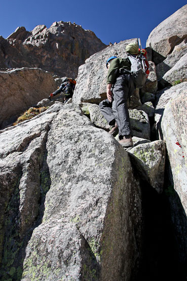
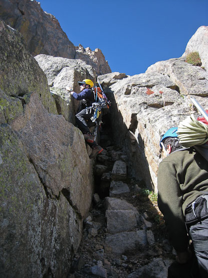
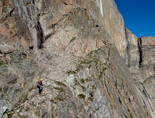
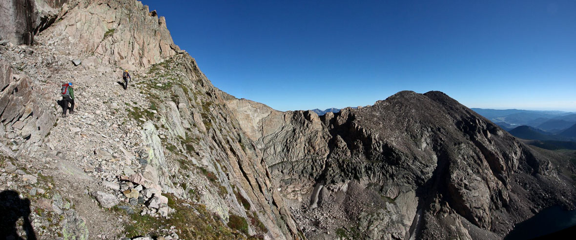
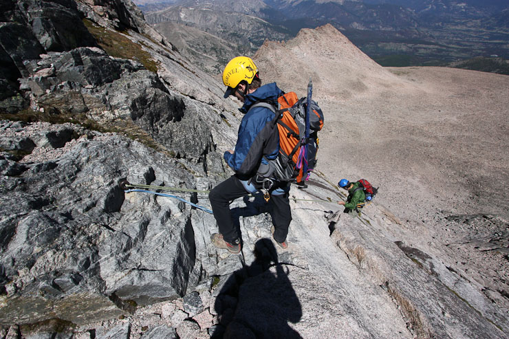
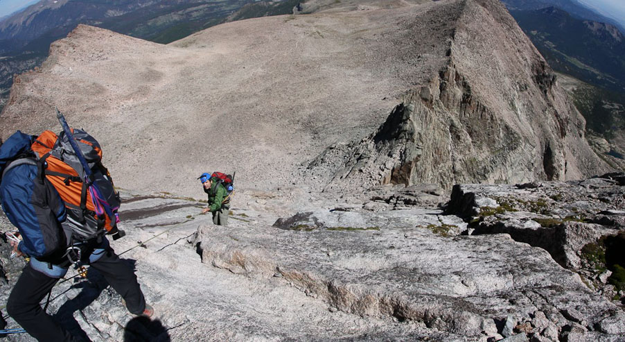
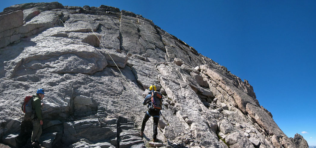
This section seemed like class 4, and we kept the rope in Tom's pack. I was very observant of the exposure, while unroped. Certainly felt like a different ball game. These 3 pics show the major obstacles before reaching the base of the Staircase. Some people rope up for this section...
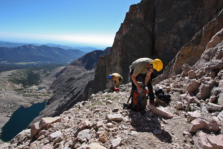
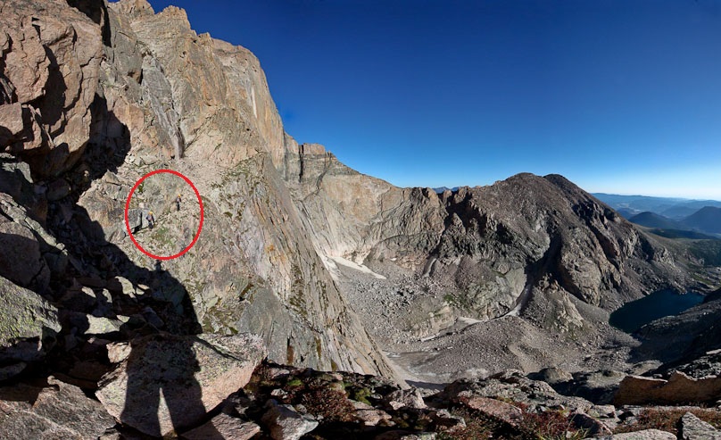
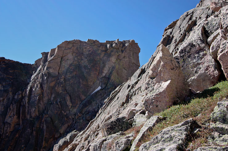
After reaching level ground, we took off some layers, as the heat was kicking in ~10am. We spent some time looking at a photo of the route Chris had, and eventually found the sync-point circled in red. This big triangular rock, atop a dark horizontal rock stripe is the target. The trail eventually wraps around the right side of it...
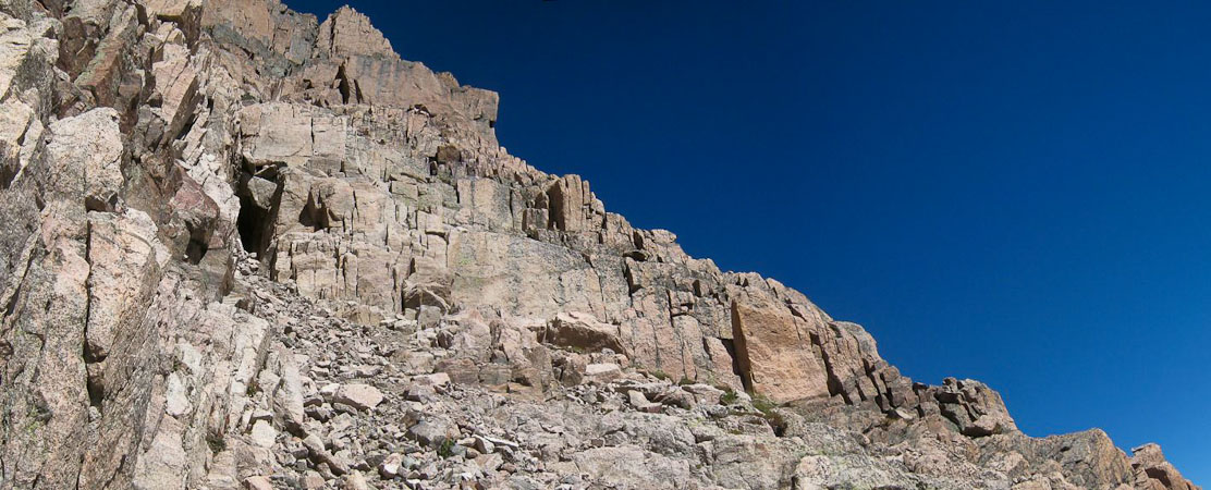
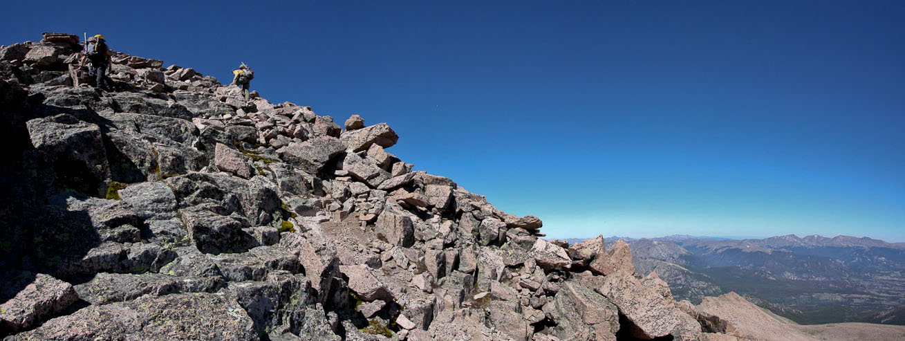
We had cleared all the major hurdles, and all that remained was a lengthy class 3 scramble on The Staircase to the top.
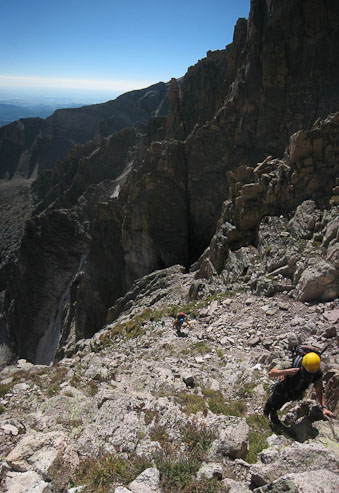
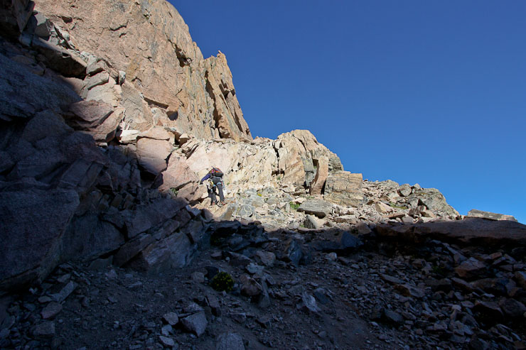
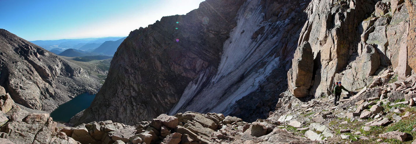
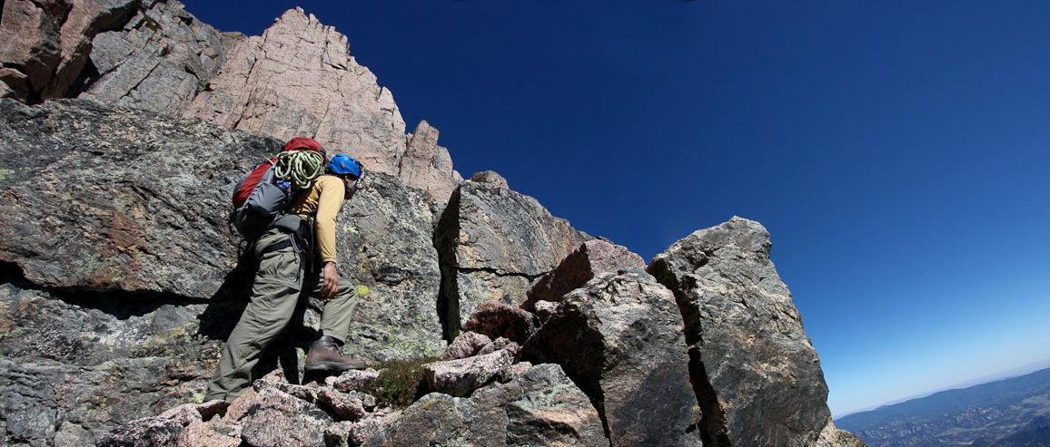
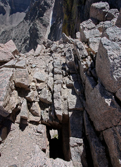
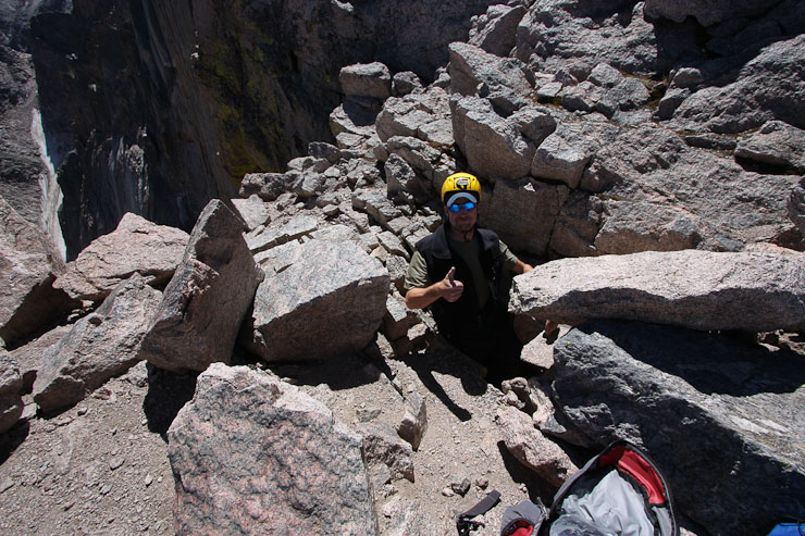
Tom approaches the cave area, and follows us up on the west side of it. Lambs Slide sure looks steep back there...
When I took a break from focusing on the trail, I looked up and saw the Notch. I remember hearing a story about some guys from work that hiked from Meeker to Longs, and didn't know about the Notch, and were quite surprised to huge cliff in their path. They turned around...
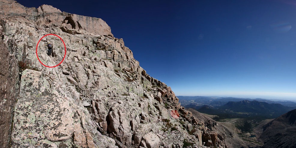
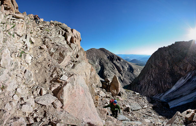
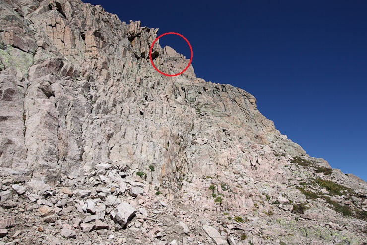
Above the cave, the rocks got difficult to manage on the left, so we hiked up the gulley in the middle. Chris is circled in red. That black band of rock we were aiming for is getting closer...
At 10:30am, we had reached the black band of rock, where we rounded a very exposed corner...
Looking back down from the black band of rock, I could see where we left Lambs Slide to begin Broadway (marked with a thin red line)...
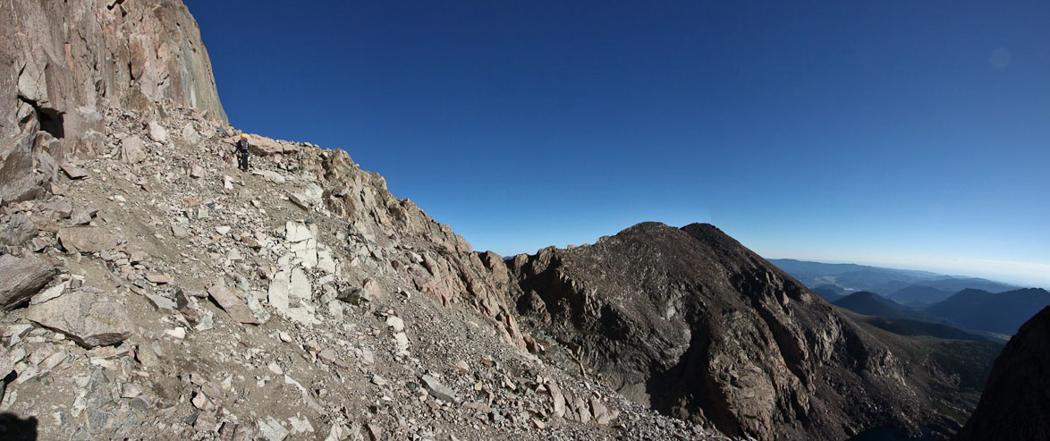
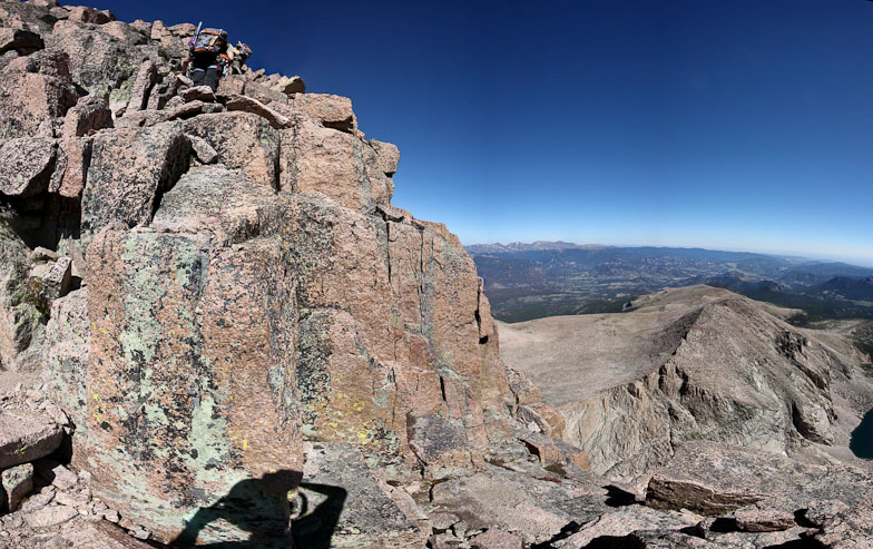
Immediately above the black band of rock was a shelf at the base of the big triangular rock we had spotted at the beginning of the Staircase. Tom was the guinea pig to see if there was a way up in this direction. The answer: yes. Climb the rock Tom is grabbing...
Chris and Tom continue heading east, as we had to wrap all the way around the big triangular rock...
As we turned the corner and began the final 10 minute class 2 scramble to the top, little did I know that we were directly above the top of the Diamond. Wish I had peaked over the edge to admire the 2400' drop...
The slope was easy, and there was little mountain left to stare at, so we knew we were getting close...
Both Chris's and my watch said we were still at 13,900', which mean over 300' til the peak, but when we looked over and saw Meeker (13,911') looking way below us, we knew our watches were wrong...
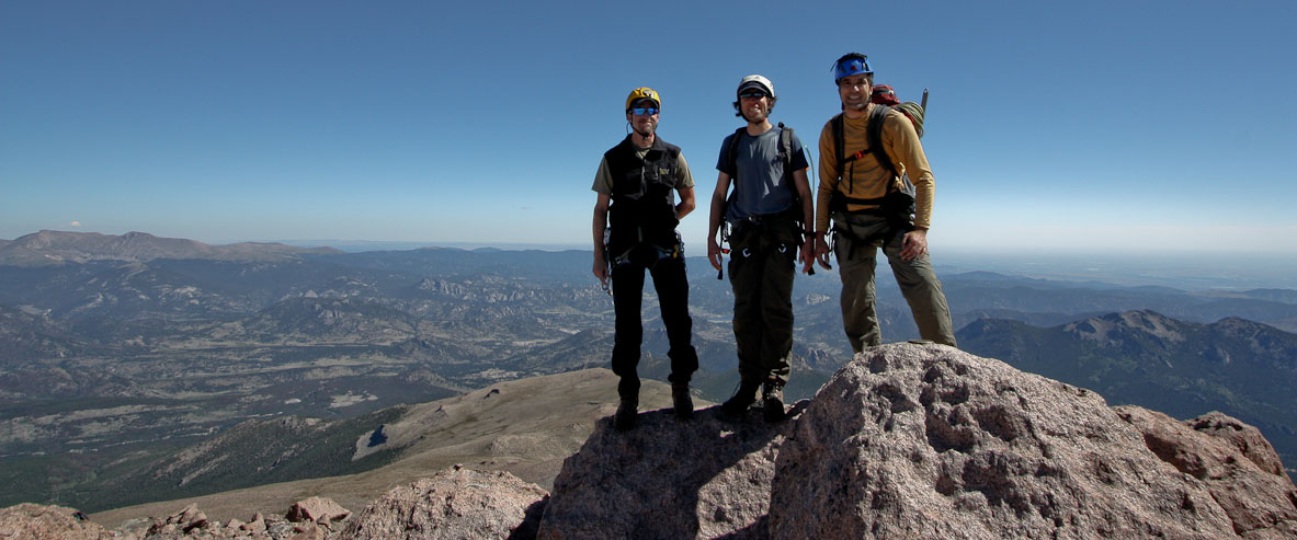
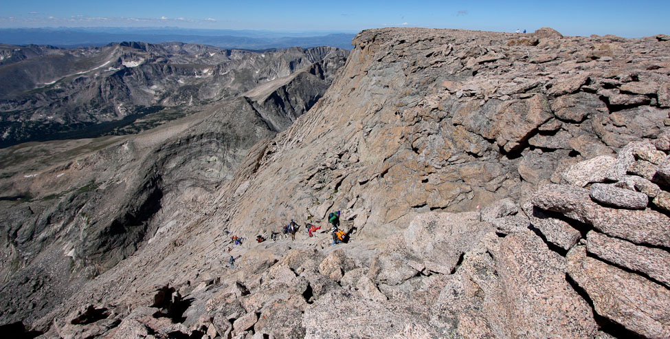
Sure enough, the bodies of other hikers started to appear over the top of the rocks, and we found ourselves at the summit ~10:50am (~7.5hrs from trailhead), under perfect weather conditions...
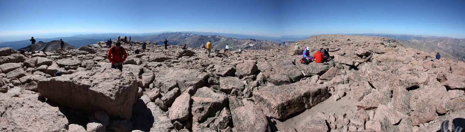
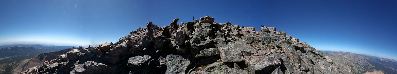
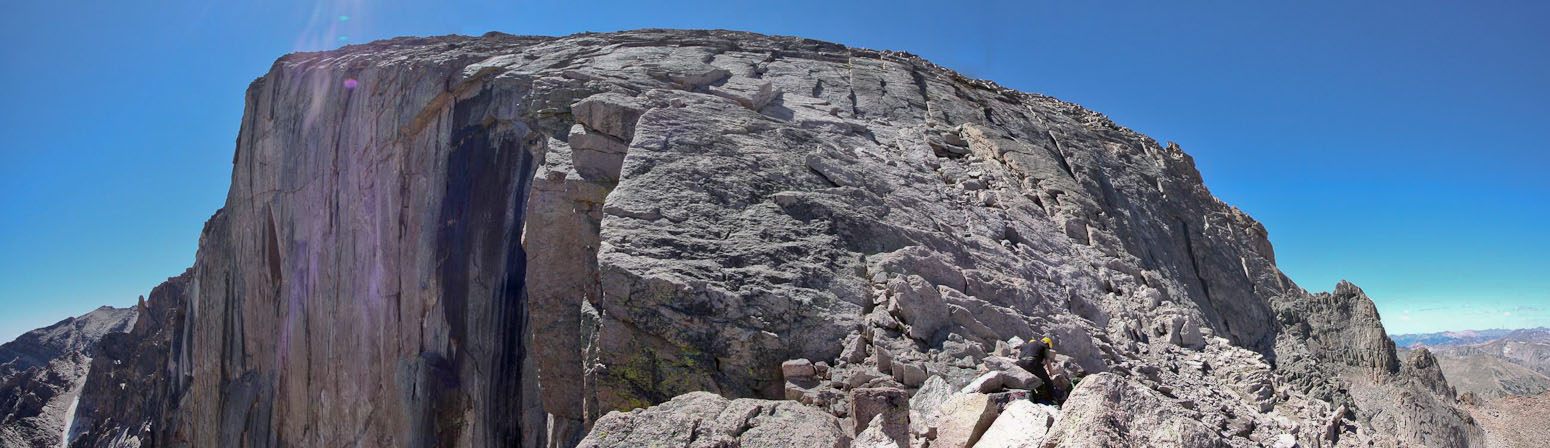
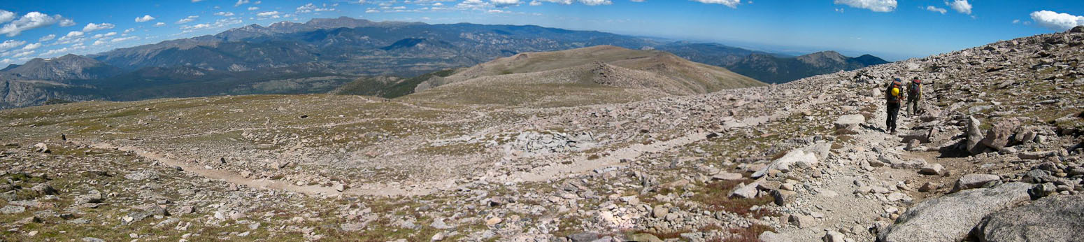
This stitched pic (with a bad seam), shows how broad, and heavily traveled, Longs Peak's summit is. At least the size of a football field...
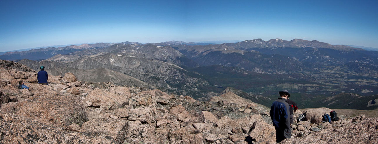
A look north across RMNP and the Mummy Range...
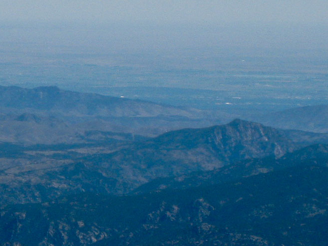
I picked out Horsetooth Rock (small bump on the left), but couldn't quite make out my house in Fort Collins...
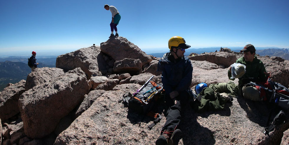
We relaxed on the summit, eating a lunch (a banana, rhubarb jam, tortilla wrap for me). Tom looked all over for his sandwich, but couldn't find it. He had lots of other food to eat though...
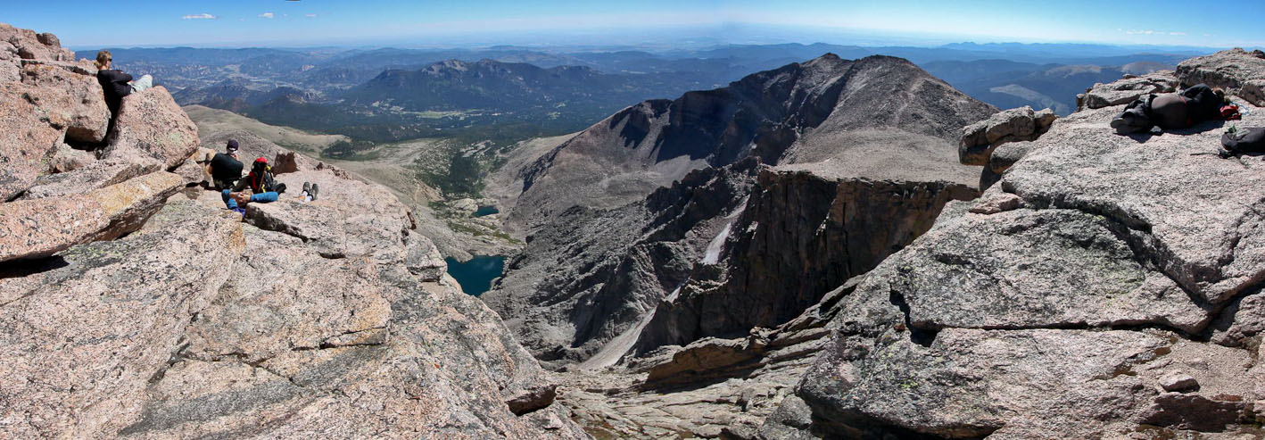
After awhile, I decided to check out some of the views on Longs. The peak is so huge, it takes a lot of effort to hike from one side to the other. I looked down the Keyhole Route (standard route), and saw a train of people ascending/descending Homestretch. For such a busy mountain, we were the only hikers on Kiener's Route today, and enjoyed hiking crowd-free...
I counted 36 people on the summit (that I could see). Several people were taking naps (look on the left and right of the pic). In the center is Lambs Slide, from our climb 4hrs ago, and Mt Meeker above. The notch sure looks huge...
We still had a long way back down, and started our descent after ~20 minutes on the summit. We headed north towards the ol' Cable Route, to take advantage of our rope by rappelling straight down to the boulder field...
There was plenty of loose rock on the North Face. Despite my efforts to avoid it, I sent a couple of small rocks down, which ended up tumbling over the north edge of the diamond...
After ~30 minutes of descent, we found iron ring that was bolted into the rock, and set ourselves up to repel. Tom went first...
This route used to have cable railings installed all the way to the summit, back in the 30s, and was the standard route up longs. Certainly steep rock!
With our 70m rope, we hoped to rappel the entire rock slab with one length of rope. However, the steep slabs went on much longer than our rope. Our length of rope delivered us to a landing next to another iron ring. There was a brief scare when Chris's rope got stuck when trying to pull it down, but then 2nd tug set it loose, and we rappelled down a 2nd time, going as far as we could to the base of Chasm View. We saw another group rappelling down behind us as we left...
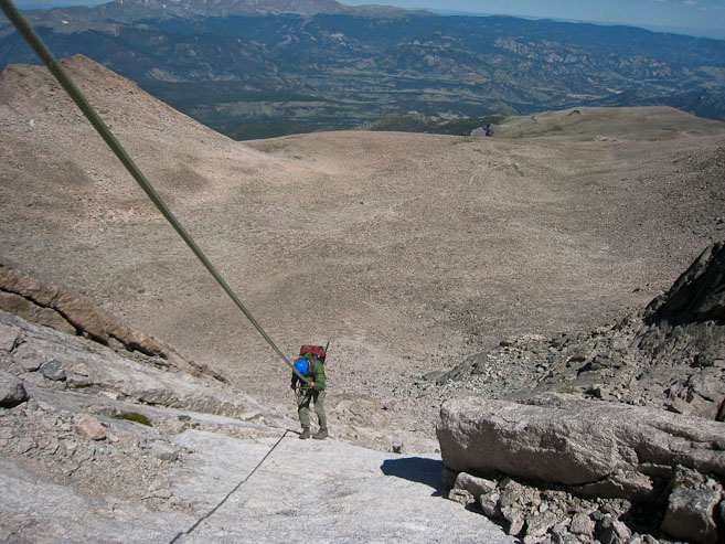
Chris finishes his last rappel...
The rappel dropped us out right next to Chasm View, a spectacular vista point overlooking the Diamond, Lambs Slide, and Chasm Lake.
Chasm View in it's entirety...
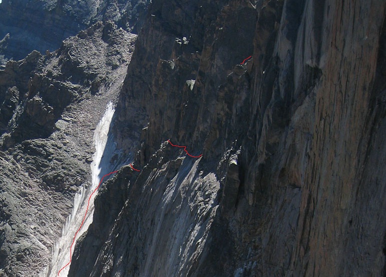
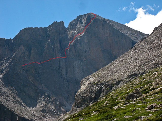
This is cool. I spent a LONG time cross referencing pics, and managed to track our route in red in the 2nd pic, which is a blow up of the 1st pic. The short red line at the top of the 2nd pic is where I took the photo of Longs Peak's Diamond after the 2nd class 5+ pitch ...
A wide view of Longs Peak, and the rock slabs we rappelled down...
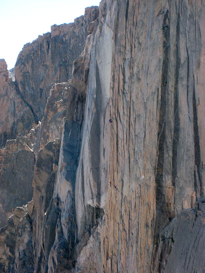
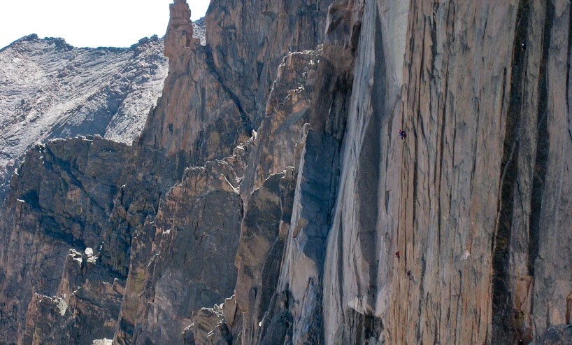
Lots of climbers were still making their way up the Diamond...
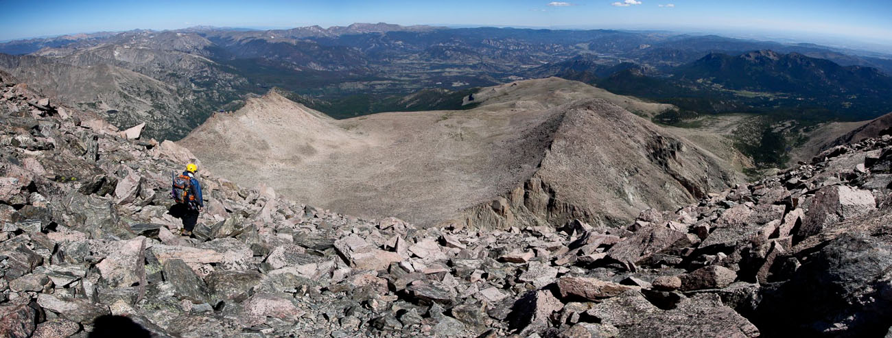
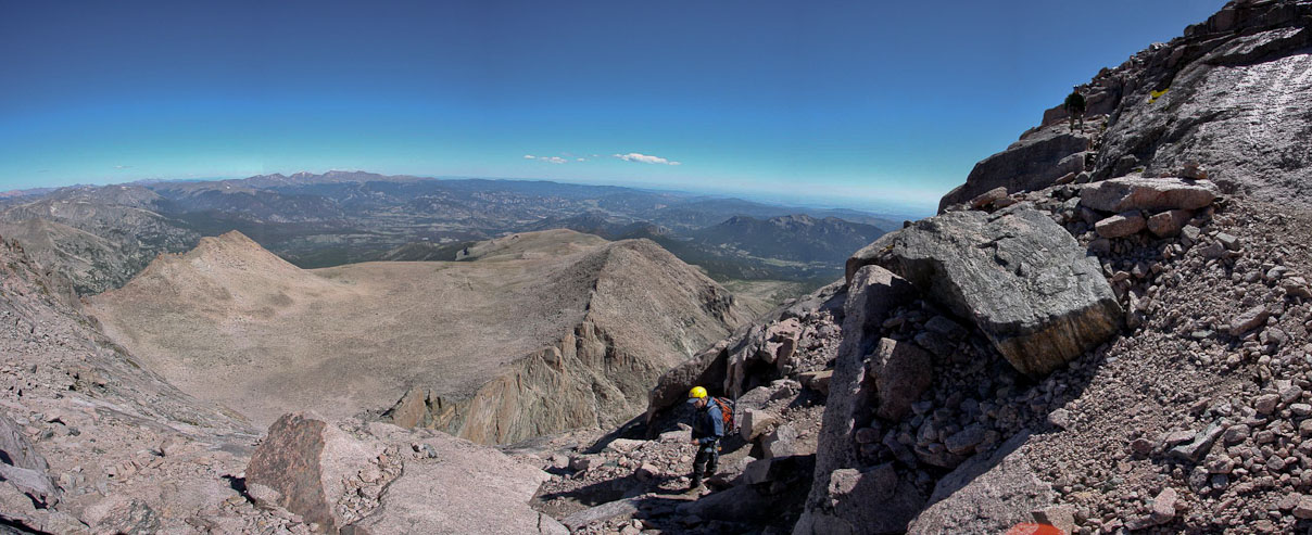
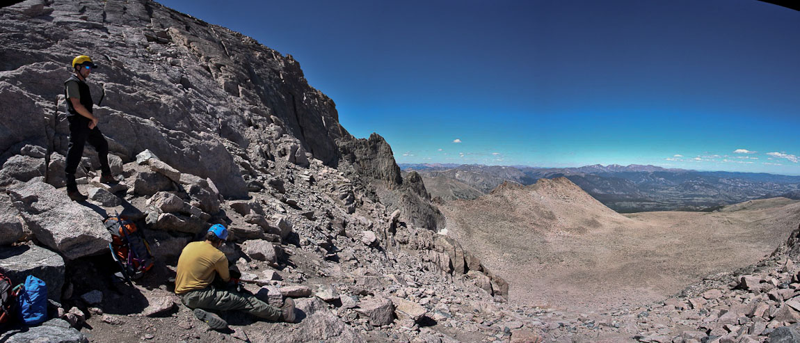
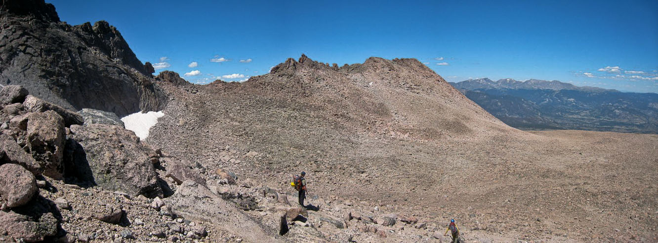
Having finished the rappel, we could take off our harnesses, and stow all the climbing gear. I carried "the rack", barely fitting the heavy stuffsack in my backpack. We started down the rock slope, aiming for the boulder field campground.
Since this was my 1st time on Longs I marveled at seeing the Keyhole from a distance (on the left)...
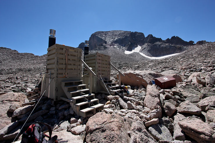
Impressive they built a campground with privies up here. We made use of them. A look back at the north face of Longs...
From the boulder field, the trail was full of long gentle switchbacks, which took "forever" (well, 65 minutes from the boulder field to Chasm Lake junction). Lots of people were spread out on the trail today...
I outlined our route in red on this pic taken at the Chasm Lake junction. We wondered if we could make it back before 3:20pm, for a 12hr day, and nearly did, reaching the register at 3:25pm...
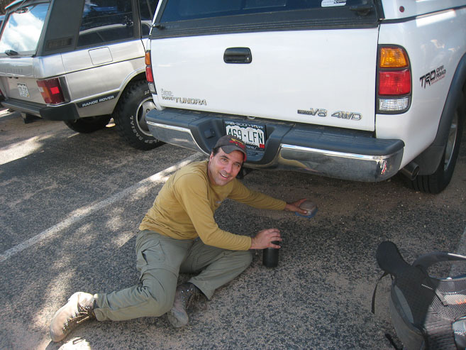
Back at the car, Tom was reunited with his sandwich, which was keeping cool in the shade under the car...
Wow, what a day! Despite Longs Peak being only ~1hr from my house, and having now hiked 44 14ers, this was my 1st visit to Longs, and boy was quite memorable. Special thanks to Chris for proposing, leading, and providing gear on this mountaineering expedition. And thanks to Tom for supplying additional route knowledge that helped make the day smooth and glitch-free. Longs Peak sure has a lot to offer, and no doubt I'll be back to explore another route in the future.