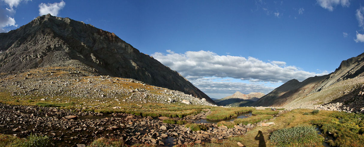
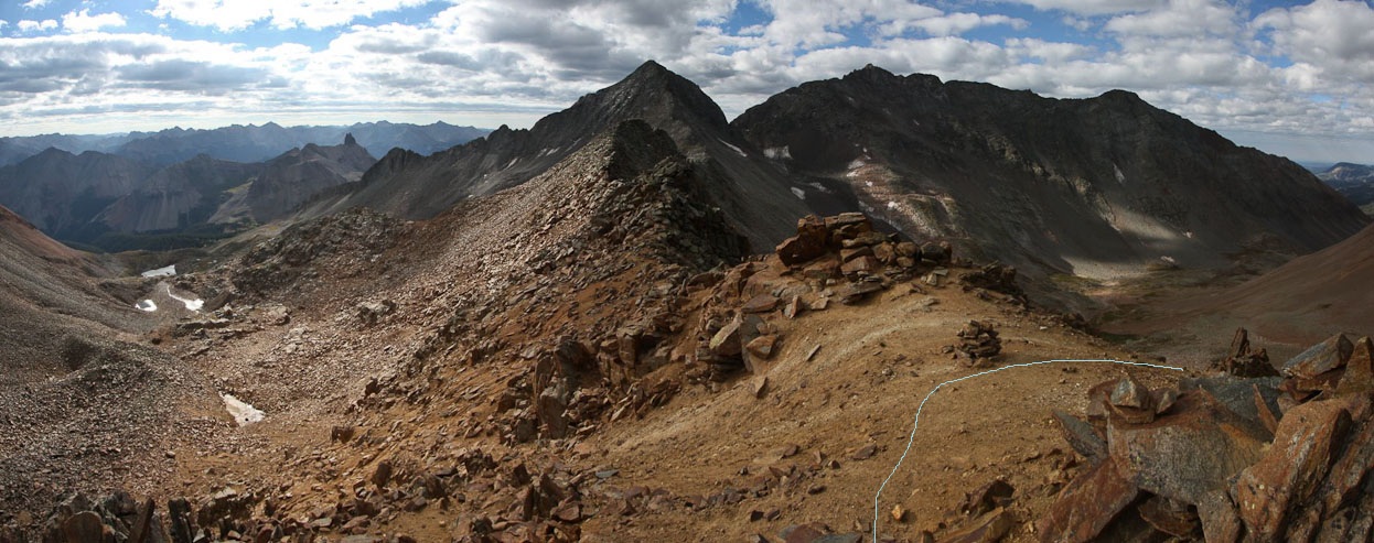
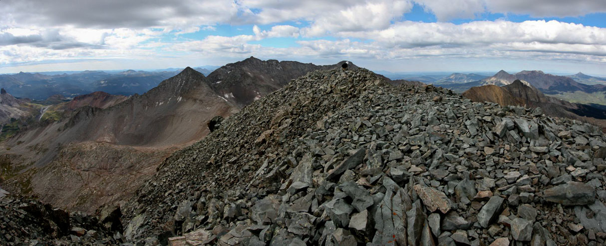
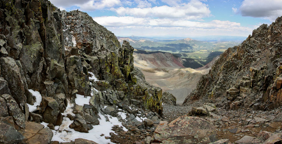
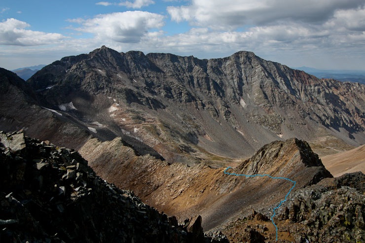
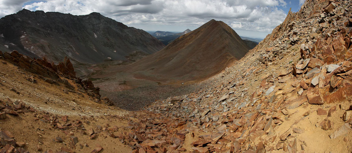
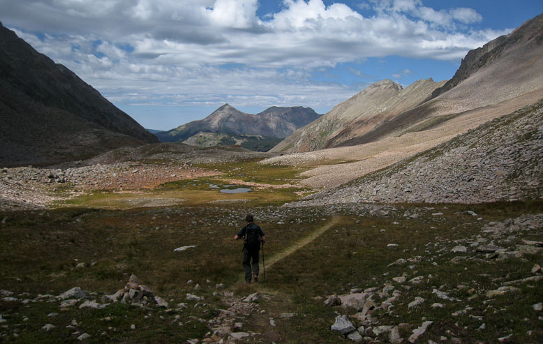
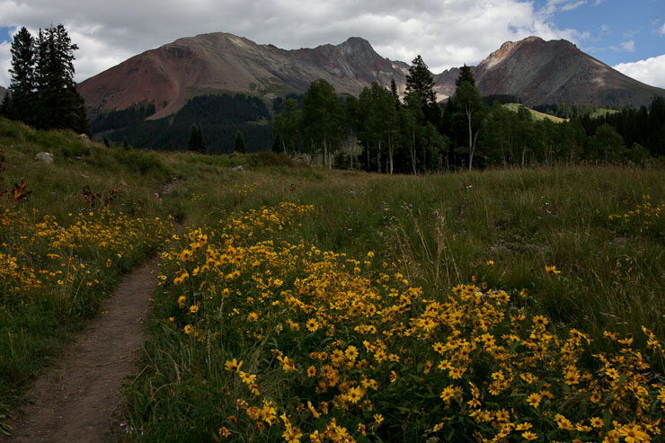
A wide look from the start of the upper basin. El Diente on the left...
I snapped out of my sleep, when Chris woke me up at 6am, asking if I was still up for an adventure today. I certainly was, despite getting only a couple hours of sleep after yesterday's huge day (pack in from Navajo Trailhead & the Traverse). The sky was already filled with pre-dawn light, and I was surprised to see ~50% cloud coverage, given the clear skies all last night.
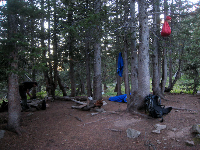
I pumped water from the stream, filling up enough water bottles for the rest of the day. Chris, who lost his nalgene bottle on the trail yesterday, used his (recently found) bladder today. Tom, who had already hiked Wilson Peak 10 years ago, was feeling achy from yesterday, and decided to join us during the hike up the basin, but would forego the peak, and instead search for his lost water filter. After a breakfast of oatmeal, we re-hung our food, and hit the trail at 7:30am.
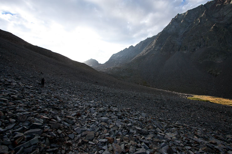
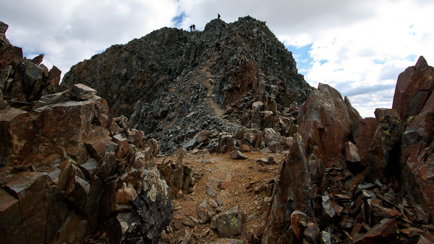
We retraced our steps from yesterday's hike, passing the turn-off to El Diente's north buttress, and continuing up the basin to where we descended from Mt Wilson. At ~12,300', the trail left the basin and gently switched back up to the Rock of Ages saddle, passing an old mining cart and shelter along the way. The hike to Wilson is largely class 1 & 2, but has a 150' final class 3 pitch before the summmit.
A wide look from the start of the upper basin. El Diente on the left...
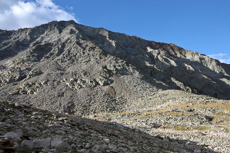
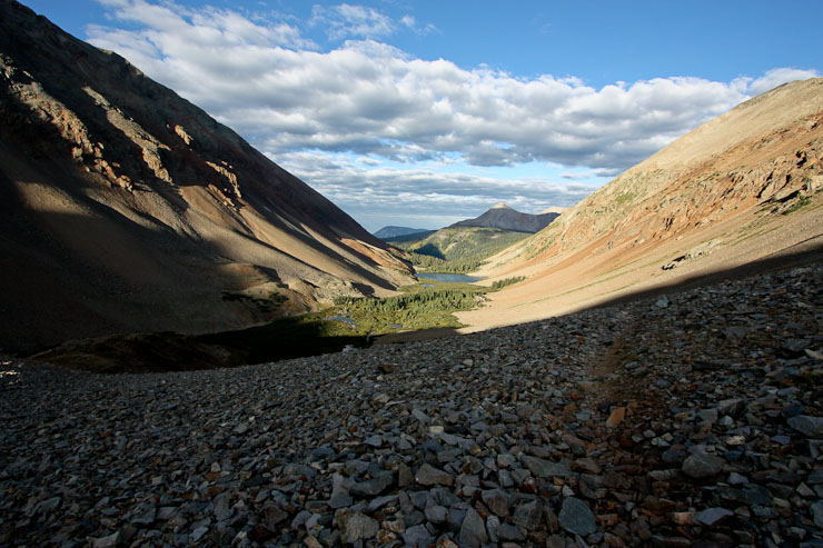
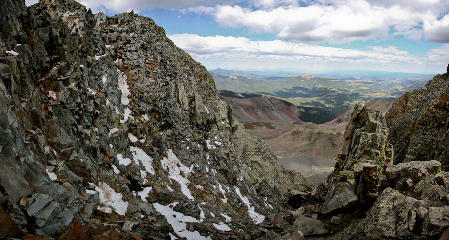
Another look at the north buttress of El Diente in the morning light (1st pic). We continued further up the basin, due east...
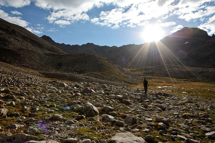
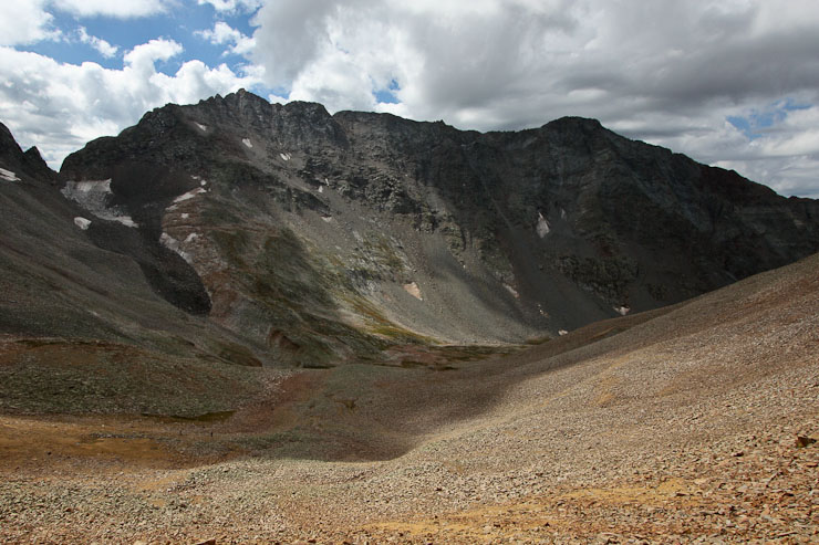
Soon Wilson Peak entered our view. We headed for the Rock of Ages saddle, located on the ridge to the left of Wilson Peak...
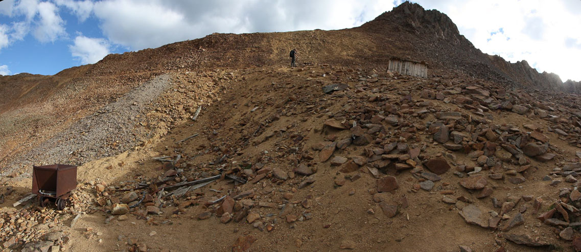
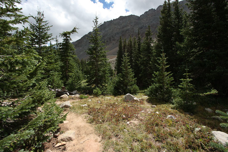
The trail was very easy and smooth, winding past some old mining artifacts...
The last switchback leading to the Rock of Ages saddle (1st pic). A look across at the traverse between El Diente (right), and Mt Wilson (left). With all the clouds this morning, I was constantly on the alert to snap a pic whenever sunlight would hit the earth...
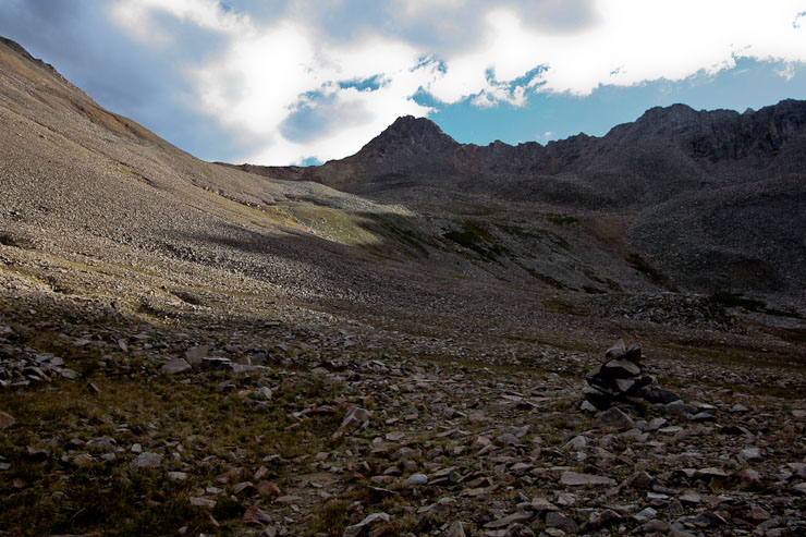
We arrived at the Rock of Ages saddle, ~13,000', at 9am. The closed (to be re-opened in 2011?) Silver Pick trailhead ascends to this saddle from the north (left side)...
From the saddle, we followed the ridge, before heading to the right, to wrap around a sub-peak...
We met our first hikers of the day, who were coming down the mountain. They said there was a party of 4, and a solo hiker ahead. The trail from the saddle started to get a bit rougher as we approached the sub-peak.

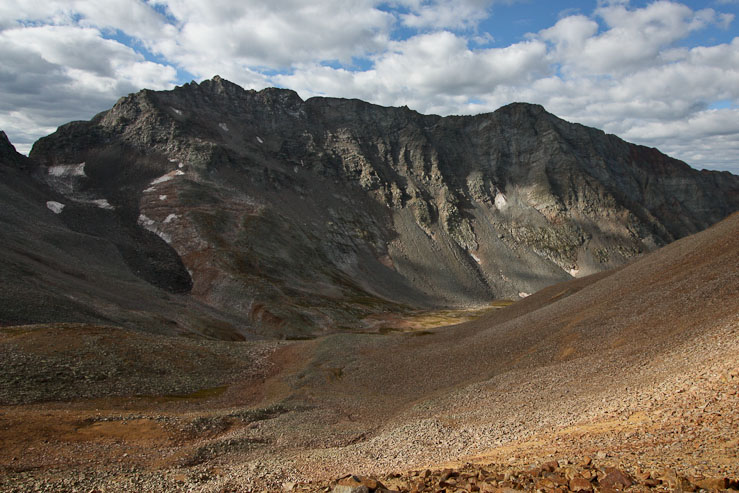
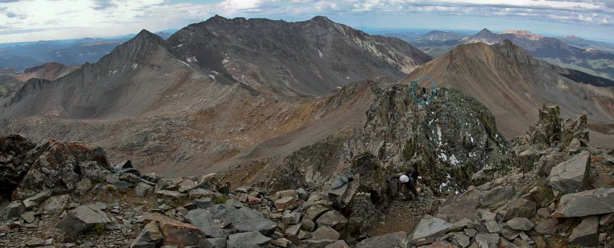
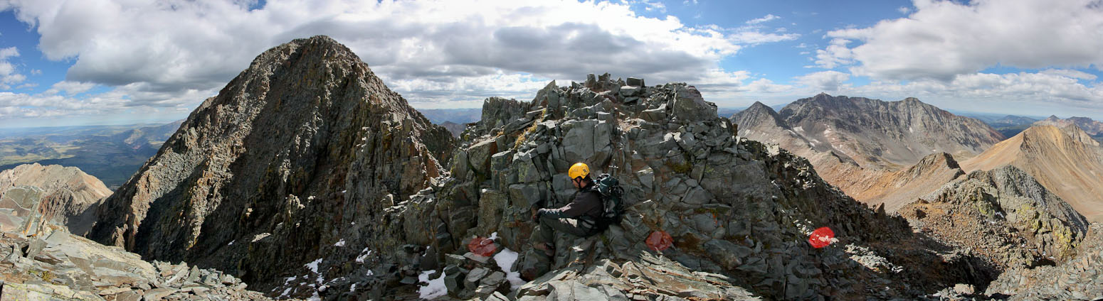
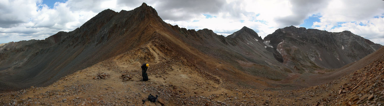
A look back at the ridge connecting to Gladstone Peak. Mt Wilson and El Diente in the distance...
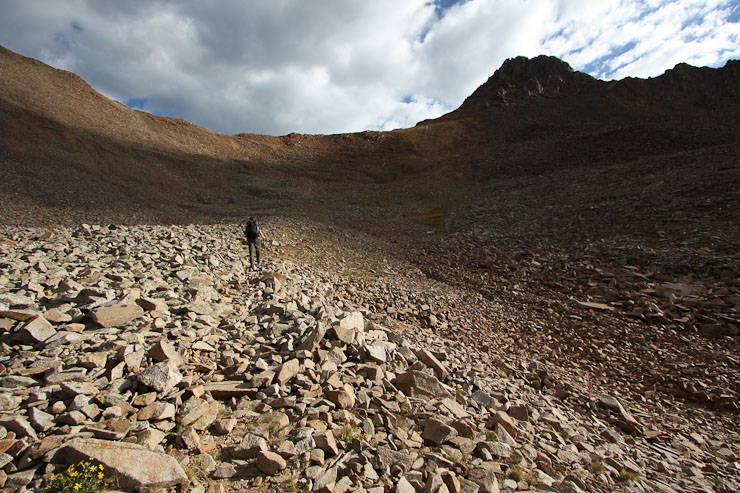
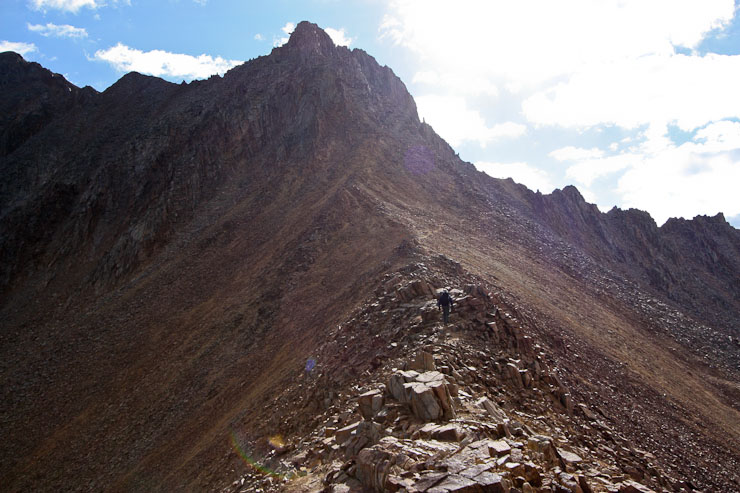
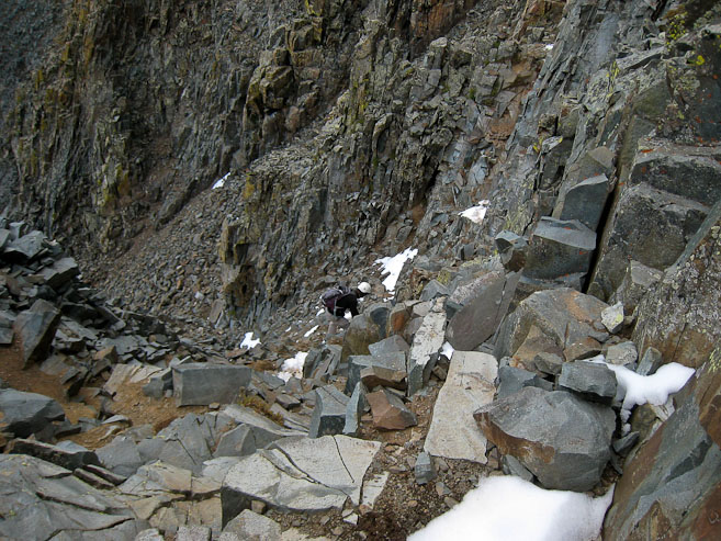
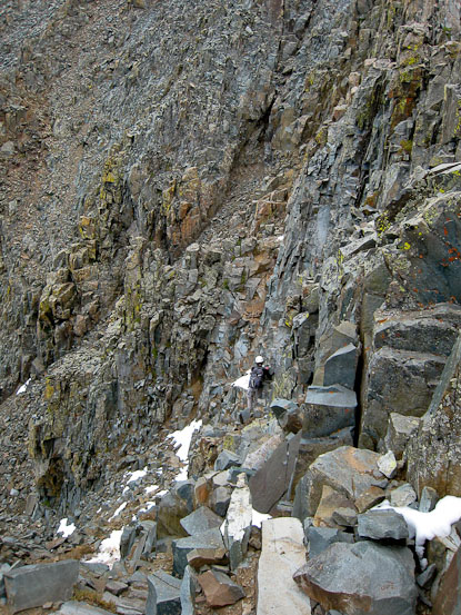
After rounding the corner of the sub-peak, the path led around the backside of the ridge. There was a high and low trail (that dropped down a ways). The high trail was the most obvious to follow, but had some class 3 moves over ledges. We took this cairned route, but eventually found ourselves rock hopping without a trail. I found a feint trail up towards the top of the ridge, that led to the real trail, which we somehow missed at some point earlier on.
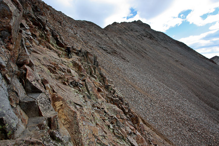
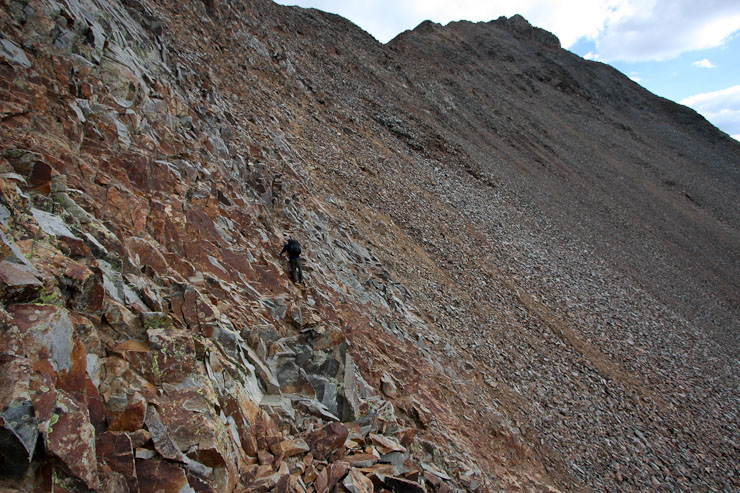
We cut across some slanty slopes/ledges on our way towards the ridge crest, and lost the main trail...

Eventually I climbed up to the ridge, where I rejoined the trail...
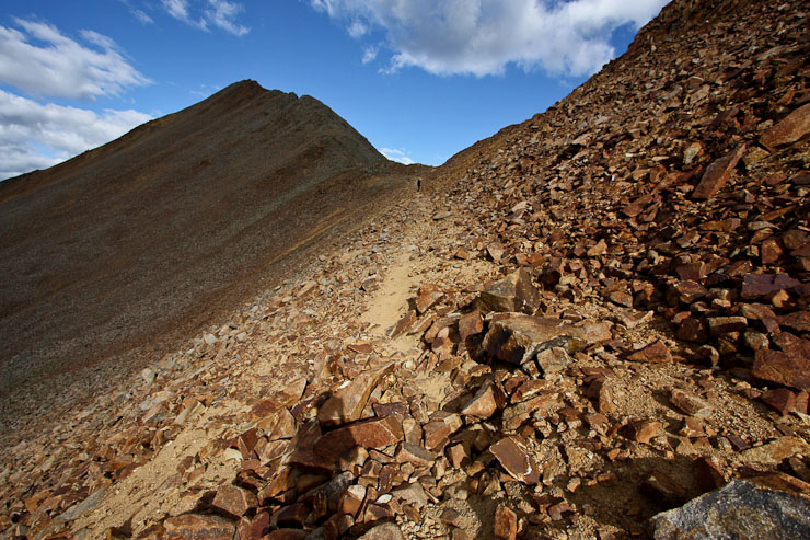
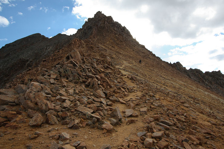
The trail along the ridge was well built and easy to hike...
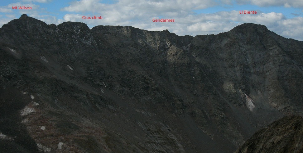
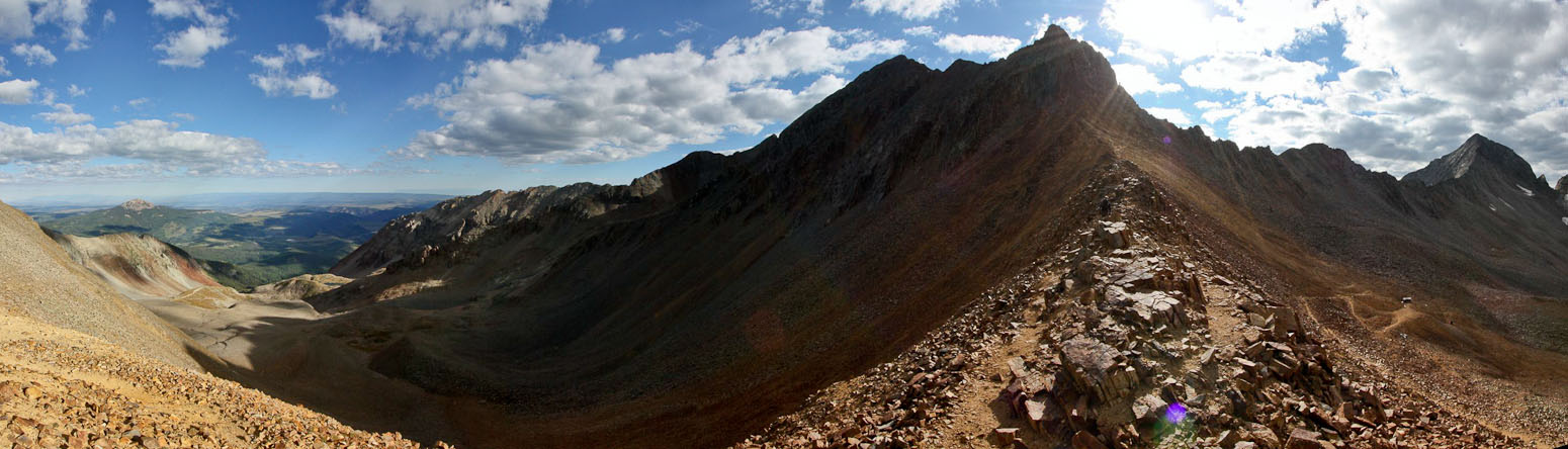
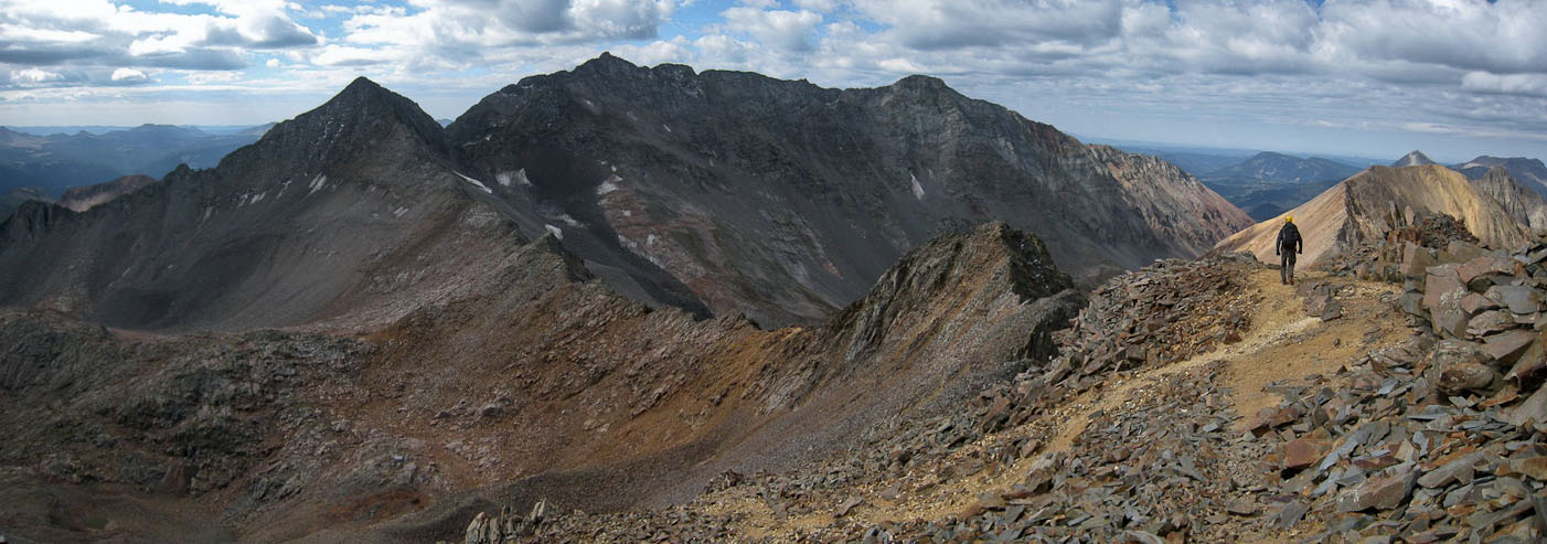
A look back at the traverse from El Diente to Mt Wilson, with a couple of key points noted...
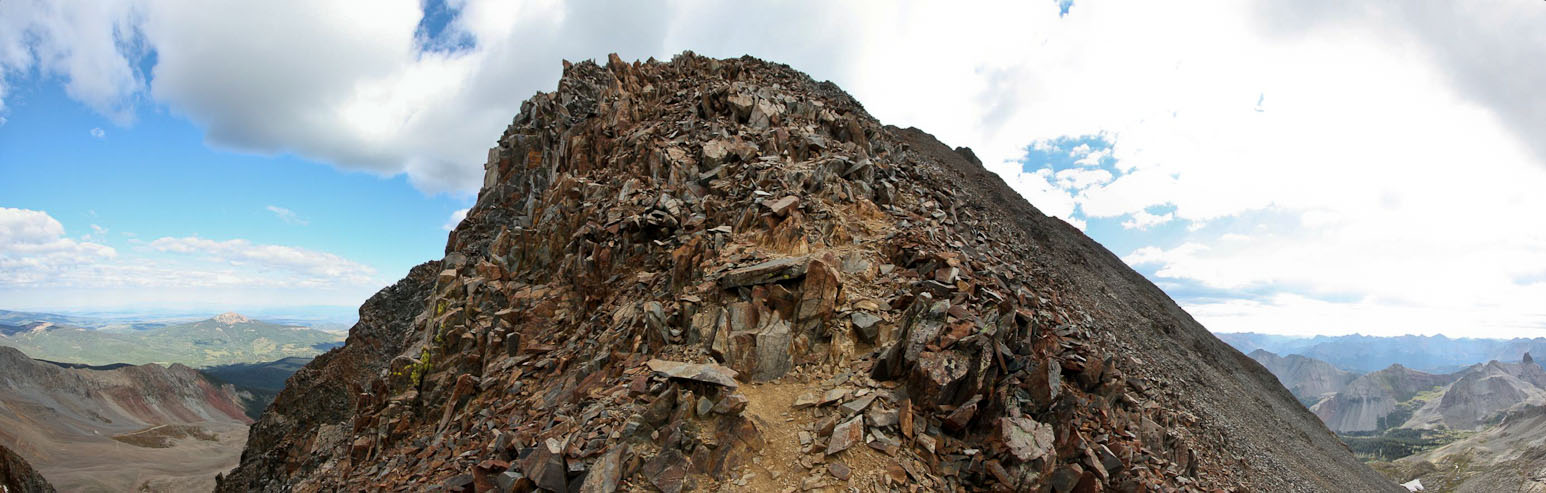
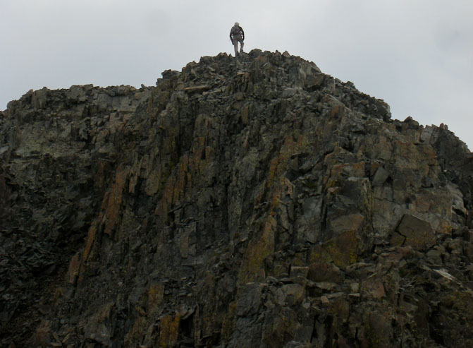
At the end of the ridge, a summit with several hikers appeared, and I knew the end was near...
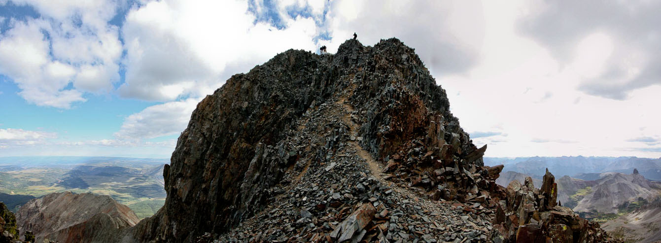
This must be the final class 3 pitch leading to the summit? I easily ran up it....
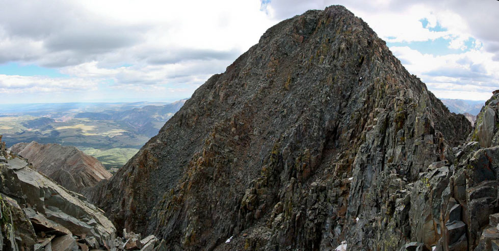
...and discovered that this was a 13,900' false summit! The true peak was just ahead, and looked intimidating from this vantage point...
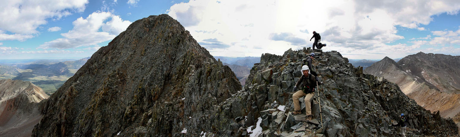
There was plenty of activity at the false summit, which Chris and I both had mistook as the real summit initially. The party of 4 was on their way back, and one of them gave me the scoop on the easiest route up to Wilson Peak. The solo hiker was here, mentally preparing himself for the final pitch. There was also a couple inches of recent snow along portions of the steep 50' descent leading to the final 150' pitch to Wilson Peak, that added to the anticipated difficult finish. Chris decided his worn shoes were not up to dealing with the snow, and said he'd be happy to stop here and watch me finish it. Though the finish looked intimidating, I knew the final pitch would probably look easier up close, and felt confident in my abilities to climb it, or at least know if I was going in over my head. I donned my helmet, gave Chris my pocket camera to capture my climb, and slowly down-climbed into the gulley, almost over-acting with each deliberate reach for a hold, as I lowered myself. The solo hiker, Hamid, was happy to see someone ahead of him climb the course, and soon followed me.
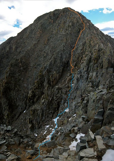
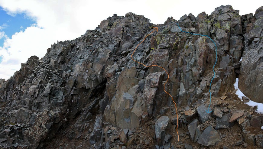
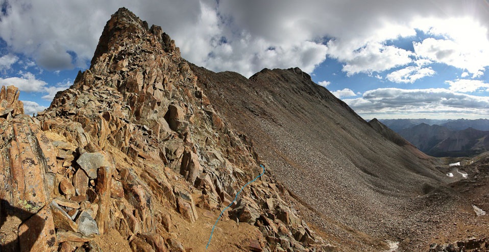
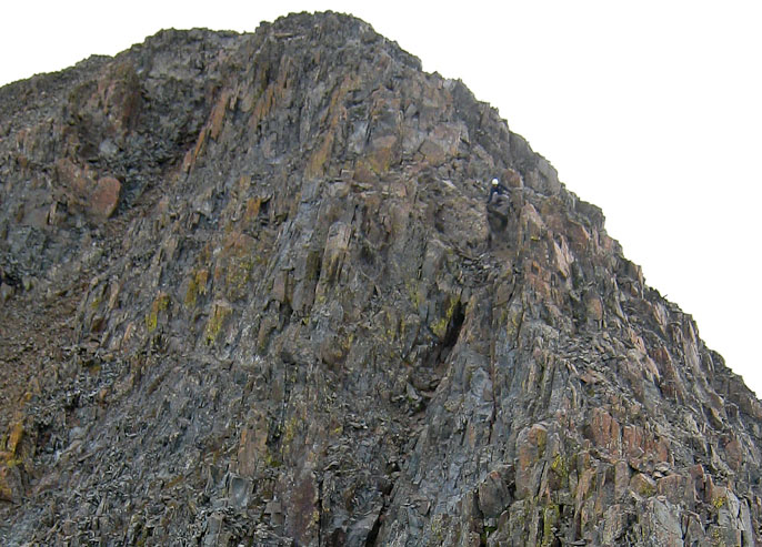
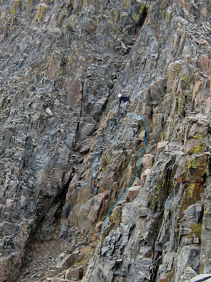
Here's a look from the base of the class 3 pitch. I followed the orange line up (recommended by on the hikers in the party of 4), but found myself naturally taking an easier path down on the descent (in blue)...
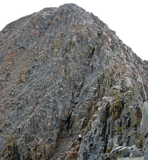
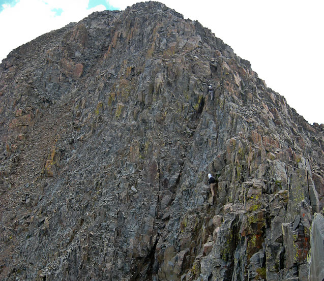
Chris takes a couple of pics of me on the final pitch, with Hamid climbing below...
Hamid tops out of the class 3 climb. Chris is sitting on the false summit, in the blue circle...
The climb up the final pitch was fun. There were plenty of holds, and more than one option at many times along the climb. A classic scramble. Above the pitch was another 50' of scrambling left before topping out at the summit at 10:08am, to mostly cloudy skies. I realized it was very fortunate we opted to do the traverse yesterday, when the weather was splendid all day. The heavy cloud cover, increasing wind, and chillier air would have made the traverse a more serious undertaking today.
I took some pics from the summit, but didn't stay long, as Chris was waiting in the cold on the false summit, and the earlier we returned to camp, the earlier we could finish the drive back to Fort Collins tonight. After 10 minutes at the summit, I was back at the class 3 pitch, starting the descent. Climbing down was without incident, and I found easier terrain on the left side, near the bottom, that I had missed on the ascent. Again, the trickiest part was manuevering across the (partially) snow covered ledges at the top of the gulley, before climbing back up to the false summit.
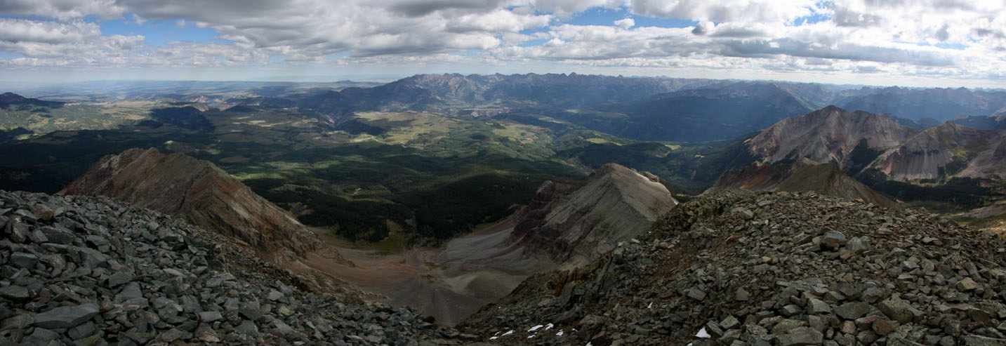
A look northeast from the summit of Wilson Peak...
A look south across the long summit of Wilson Peak...
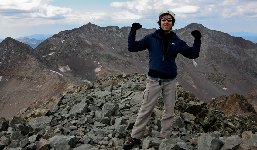
Hamid and I took victory photos of each other on the summit. 14er number 47 for me, and 20th of the year...
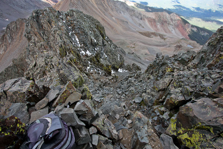
Time to head back. A look down the crux (and Chris sitting on the false summit in the upper left of the 1st pic). Chris takes a pic as I start the descent...
From halfway down the descent, I realized the blue path looked much easier than the orange path I had ascended (1st pic). A look across the unpleasant snow covered ledges at the top of the gully (2nd pic)...
Another look from half way across the top of the gulley. At one point, my foot slipped on the wet rock, but I had both my hands flat on rocks at my waist, and mantled to regain my footing. This stretch was definitely the most challenging part of the day...
I joined back with Chris at the false summit ~10:30am, and waited while Hamid descended the crux. He wanted to follow me down the crux, so I said it'd be best if he waited for me to go first (to avoid possible rock fall), and then I'd wait to make sure he made it down ok. After he safely descended, Chris and I started the hike back to Navajo Lake. This time we stuck to the trail all the way to the saddle on Gladstone's ridge. We passed many hikers on their way to the summit.
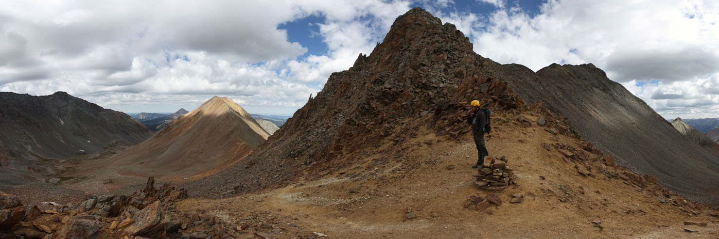
A look across at El Diente and Mt Wilson, with part of the trail (roughly) outlined in blue...
A last look at the summit, from the false summit, before heading back down the trail...
The clouds continued to gather as we descended down the ridge. Nothing threatening, but the sparse sunshine today, along with the wind, added a chill to the air...
Back at the corner, around the sub-peak, with Rock of Ages saddle on the left, and Wilson Peak on the right. We made it from false summit to here in 30 minutes...
Whenever the sun briefly lit up the earth, I whipped my camera out for a pic. On our way down to Rock of Ages saddle...
Back at Rock of Ages saddle, in just 10 minutes since the corner of the sub-peak. Chris headed down to the basin, while I waited around, hoping for some sun to light up the basin for a pic...
I watched the clouds, and waited for 15 minutes, but this was the most sun that would emerge. I started a jog down the easy trail to the basin...
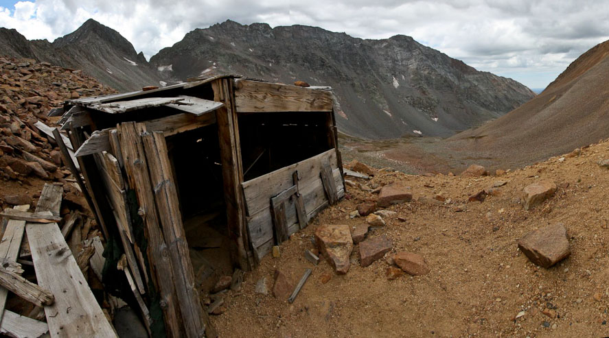
Had to stop at the mining shelter for a pic on the way down, with Mt Wilson and El Diente in the background...
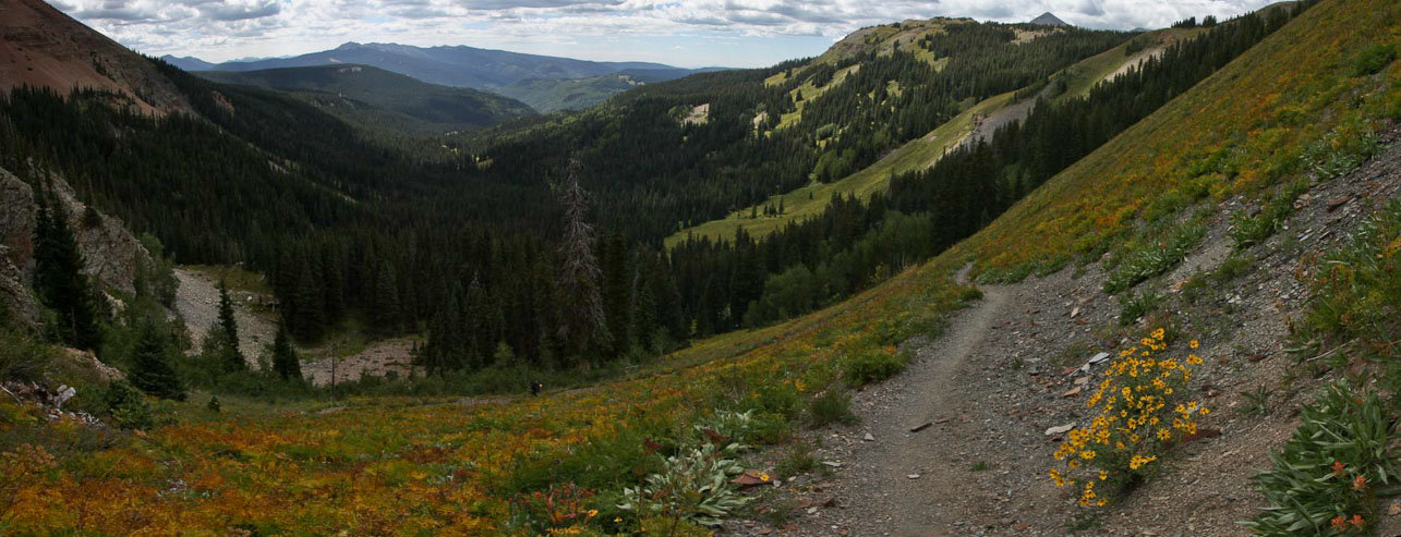
I caught up with Chris, and headed back to camp, arriving ~12:15pm (4hr 45min round trip hike time to Wilson Peak, 2900' gain, ~4 miles?). The 2nd pic shows the weakly visible trail leading to our prime campspot, from the perspective of hiking up into the basin a few mintues past Navajo Lake...
Back at camp, Tom was waiting, fully packed. Unfortunately his attempts at finding his lost water filter this morning came up empty. While Chris and I broke down camp and packed our gear, Tom got a head start on the hike back to the car. By 12:45pm, Chris and I were on the trail with our heavy packs, and hiking past Navajo Lake on our return to civilization. I had forgot there was a ~150' of gain to get over the lip of the basin, before descending back to Navajo Trailhead. That ascent with a heavy pack, after climbing Wilson Peak, was undesired (to say the least), but can't be too picky out in the wild. :-)
A look back up towards Navajo Basin (located above the tree lined saddle)...
On the way back I stopped in a daisy filled meadow for 5-10 minutes taking photos of the flowers with El Diente in the backdrop. Unfortunately the sun didn't come out, except when a family of 6, spread out over a long distance on the trail, were in my picture. I jogged back down the trail for stretches (not as easy with a heavy pack), and caught up to Chris right before the parking lot. We arrived back at the car ~2:30pm, 1hr, 45min from leaving camp (~4.75 miles, 1850' loss).
We changed into our street shoes, and Tom offered us a celebratory organic fuji apple from his cooler. The parking lot was abuzz with day hikers and climbers who were starting their approach to Navajo Basin to camp. We gladly fielded all questions about the mountains and traverse from several parties. Lots of people (including us) had planned to hit these peaks over the Labor Day weekend. It was 2:50pm when we pulled out of the parking lot to begin the long drive back to Fort Collins.
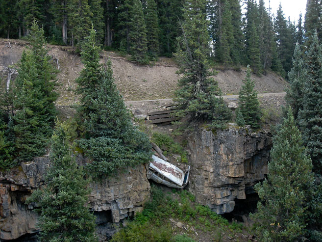
A couple miles from the trailhead, we noticed the road was paved over a bus that had fallen off the cliff. We actually turned around to go back and get a better look.
On the drive out, Tom offered to make a short detour to Telluride, so I could get a flavor of the town. It was crowded due to the Film Festival happening over the weekend. I didn't realize Telluride was such an expensive, luxuries place, comparable to Aspen.
After our short drive through town, it was time for the long haul back to Fort Collins. We retraced our route on the road, opting for I-70, knowing the traffic wouldn't be too bad by the time we reached the front range later tonight. Tom drove to Parachute, where we stopped for dinner at Wendy's and gas. Chris drove to Dillon. All the while, I worked in the backseat, stitching picture from the trip. From Dillon, I drove ~50 miles, before Tom finished the drive. We arrived back home just before 11pm, and now had all Labor Day to relax. I was happy to have stitched over 200 pics in the car, helping me get a jump on my web journal.
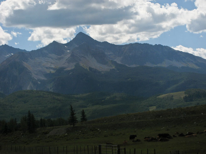
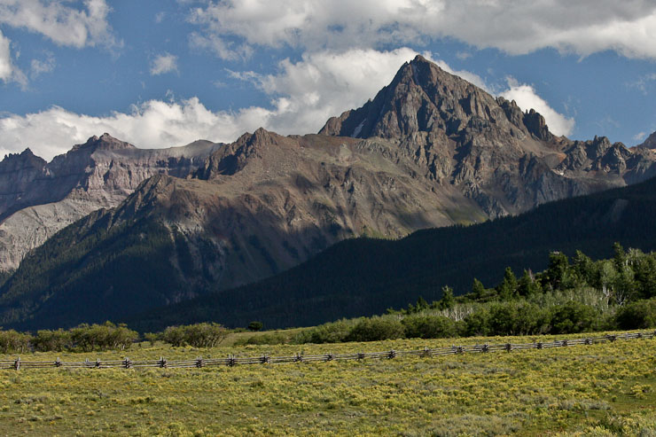
Got lucky to catch some sunshine on Sneffels as we passed Dallas Divide...
Thus concludes a most excellent and successful trip to the most remote group of 14ers in the state. After starting the year having NEVER visited the San Juan's, I now feel well versed in the area, having made 3 trips to the region this year, climbing 12 of the 13 14ers (only Sneffels remains unvisited).