


9:45pm, National Park Village, Howards Lodge
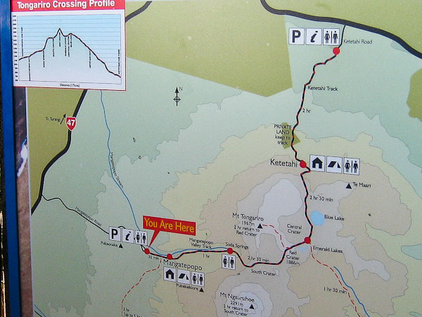
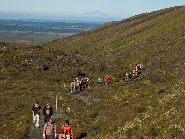
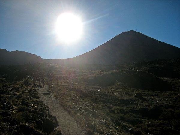
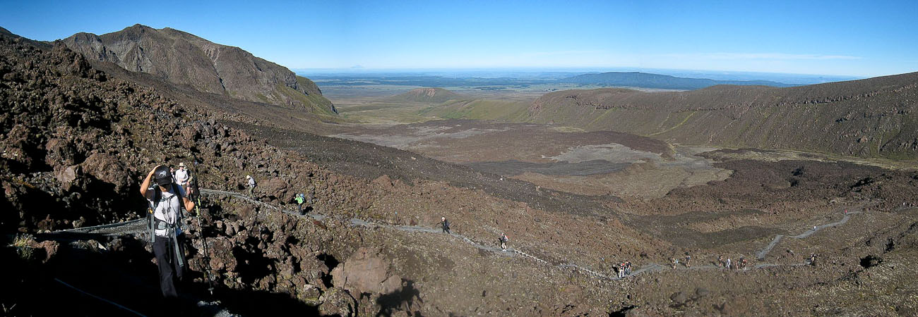
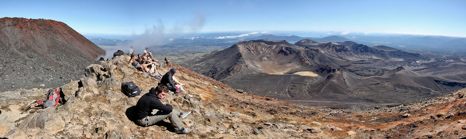
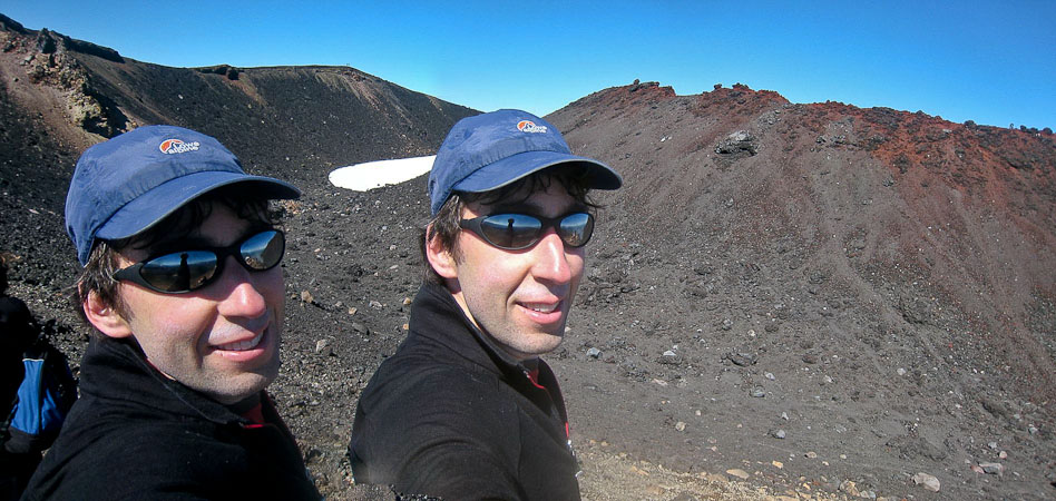
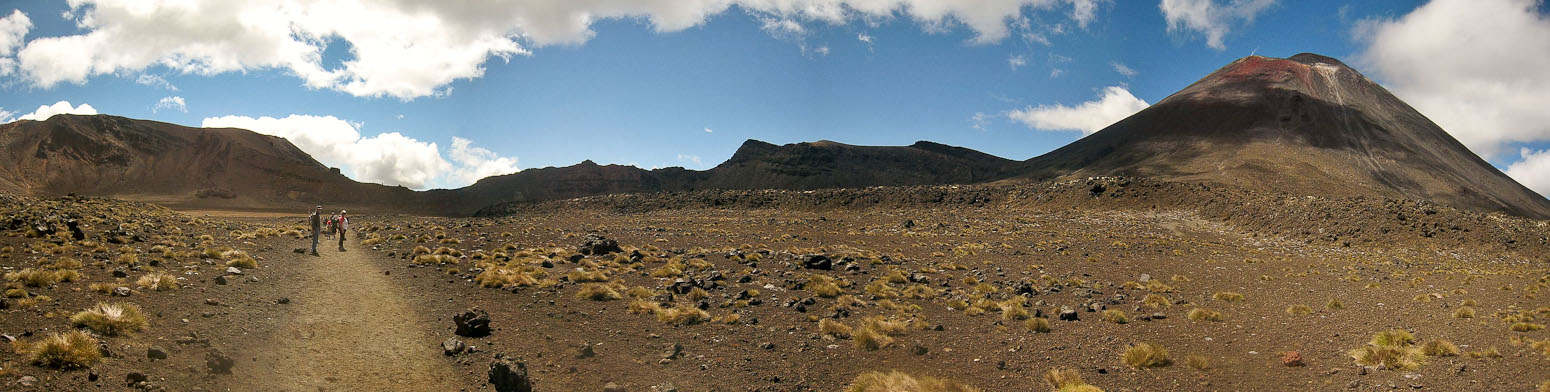
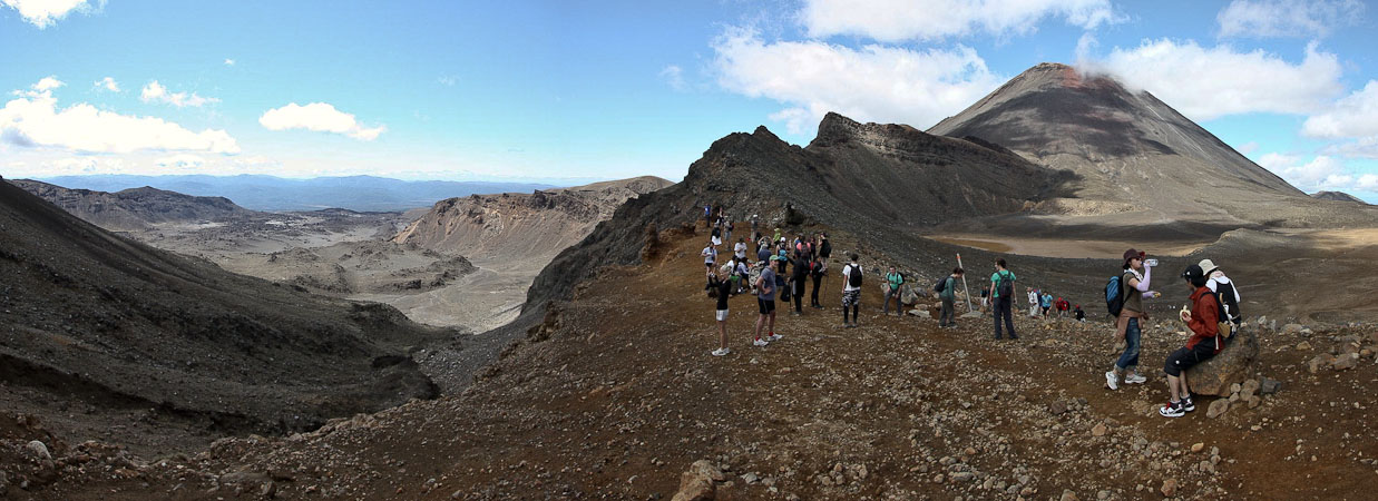
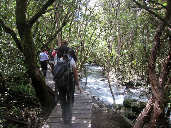
I was up occasionally during the early morning, hedging against the 5:50am alarm not going off. It reminded me of the often restless nights before a 14er hike. I sure didn't want to be late for "The greatest dayhike in New Zealand", as it's billed everywhere.We were up with the alarm, and cooked up some cereal blends for breakfast. Our hostel had a free shuttle (EDIT for those researching: I was wrong, I'd find out later it's NOT free) to the Tongrario Crossing at 8am (returning at 4:30pm), but I wanted an earlier start to try to fit in a climb of Mt Ngauruhoe, aka Mt Doom from LOTR, and had arranged for a 7am shuttle at a lodge down the road. The sky was clear this morning, a good a sign. The shuttle was late (7:10am), and we arrived at the carpark ~7:30am, amidst 7 other large buses dropping off hikers. This is the most popular dayhike in all of NZ. The ranger said there would be 1000 people on the trail this Saturday in summer. Indeed, we were marching down the trail like a herd of cattle. It didn't matter how fast you could hike, since there were so many people in front, that you had to hike with the crowd, at least for the first 30+ minutes.
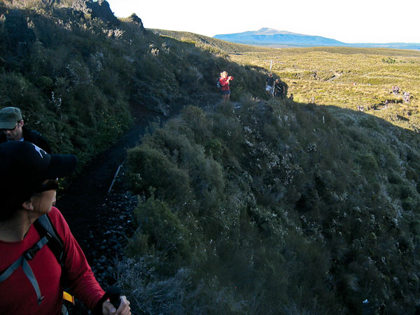
30 minutes into the hike, there was still a line of people on the trail, but we were beginning to get some separation...
We were walking straight into the sun, and could barely see our surroundings, which were pretty surprisingly drab for this highly acclaimed hike. The shady side of Mt Doom was ahead of us, a black silhouette under the low hanging sun. In an hour, we reached the pit toilets at Soda Springs, just before the start of the climb to south crater. We had heard great things about how most of the toilets on NZ trails are flush and well kept. Not so here, as there was no toilet paper (guess it's hard to provide with up to 1000 people on the trails). We made good time on the ascent to South Crater, and reached the fork to Mt Doom at 9:20am.
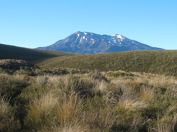
A look west reveals Mt Taranaki (also called Mt Egmont). Our visit there yesterday was thwarted by cloud/rain. Looked a little like a lion...
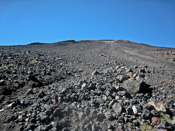
The well built trail climbed up the lava field....
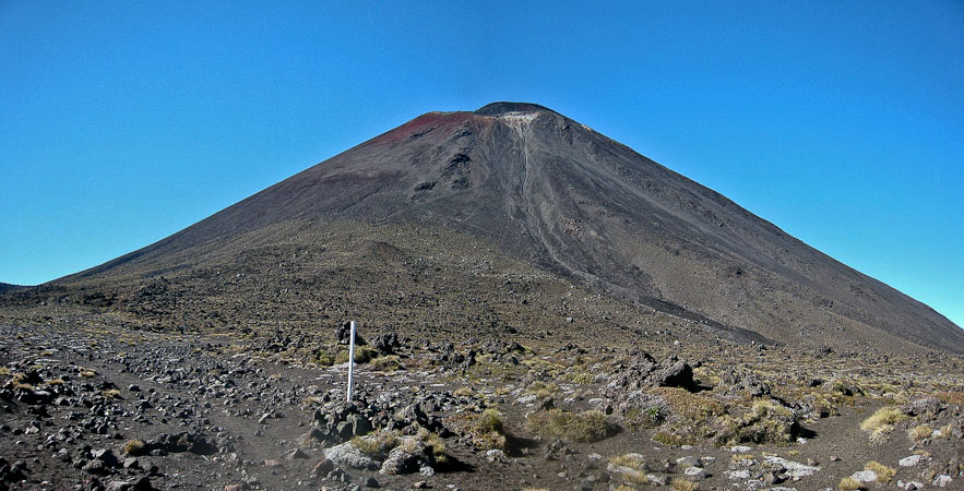
...until we topped out at the edge of South Crater, just below Mt Doom...
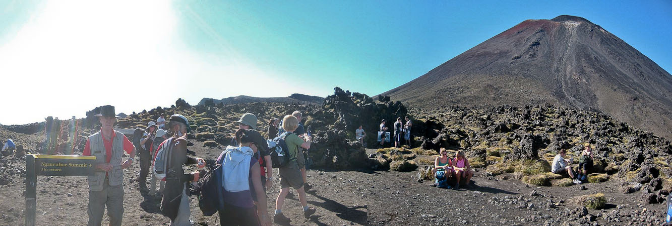
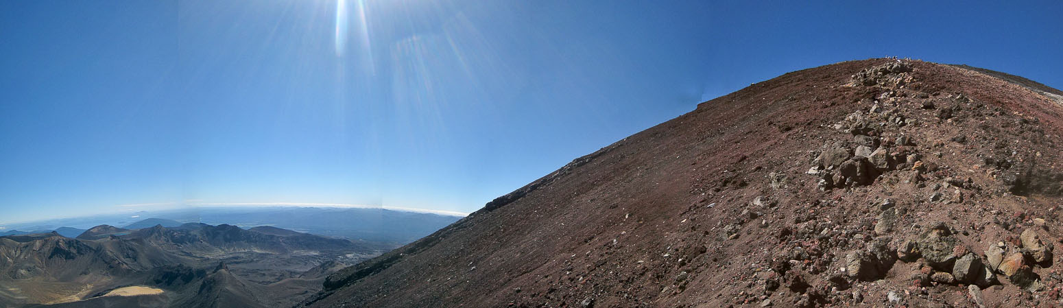
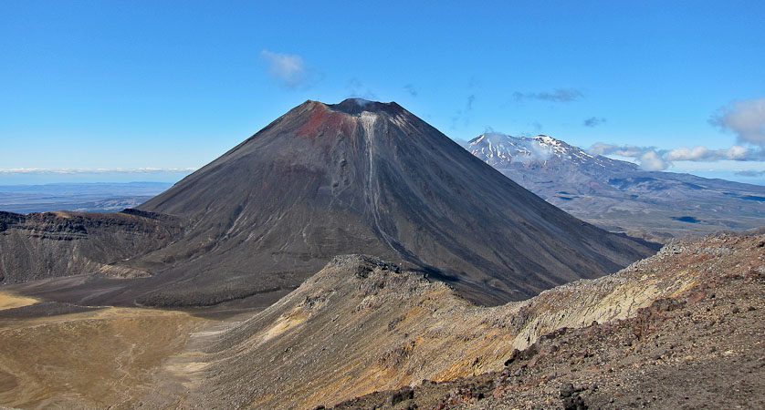
It was a ~1800' climb up a vast, steep, scree field to the rim of Mt Doom; not a particularly enjoyable hike, but I felt compelled to give it a go, considering how much of a LOTR fan I am. Wendy, as well as most sane people, had no desire for a scree slog, so I told her we'd meet up at the next summit on the trail (Mt. Tongrariro). If didn't meet her on the summit in 3hrs 15min, then she'd start hiking back, so we'd keep to the bus schedule. Then I charged towards the grey slopes leading up to the red rimmed volcano of Mt Doom. I could see several others far up the mountain ahead of me.
This was my first hike since Oct 2nd, 2010, so I didn't quite know how strong I'd be on the mountain. It was indeed a brutal slog up scree, and I kept an eye on the people above, who sent a few rocks tumbling down the slopes on occasion. I could see some steam emitting from the lip of the volcano above, and continued climbing, searching for stable rock whenever possible.
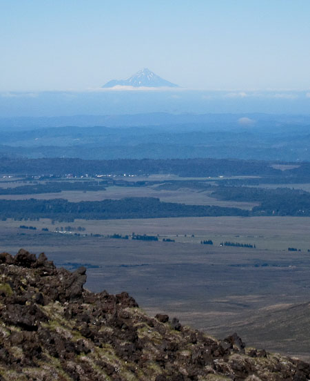
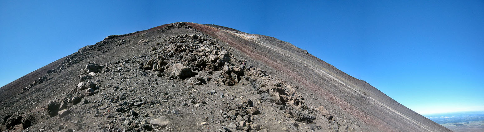
I take another photo of Egmont in the distance, and a pic staring straight up the crumbly mountain. The color around the rim is visible at the top...
A look down the slopes, early into the climb...
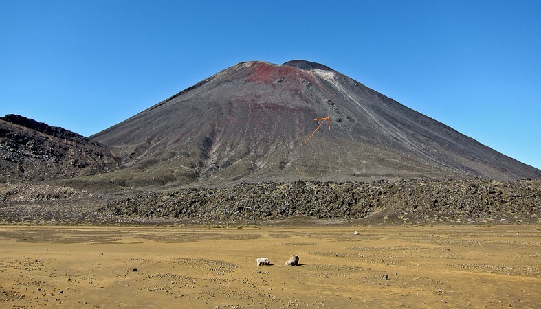
Wendy gets another good shot of Mt Doom while walking across the South Crater. Refer to this pic after looking at the pic below...
The scree was almost like sand. Eventually I worked my way towards the porous clumps of solid rock, which were mildly helpful. If you look for the thin orange arrow in the pic above, I believe this is the line of rocks (the red and white tailings from the rim match)...
BTW, they didn't film the slopes of Mt Doom here. Just the likeness of the mountain was used (and altered in CGI, since the native Maori consider the mountain sacred, and didn't want it in the movie). The Morder footage was filmed on the slopes of Mt Ruapehu, nearby...
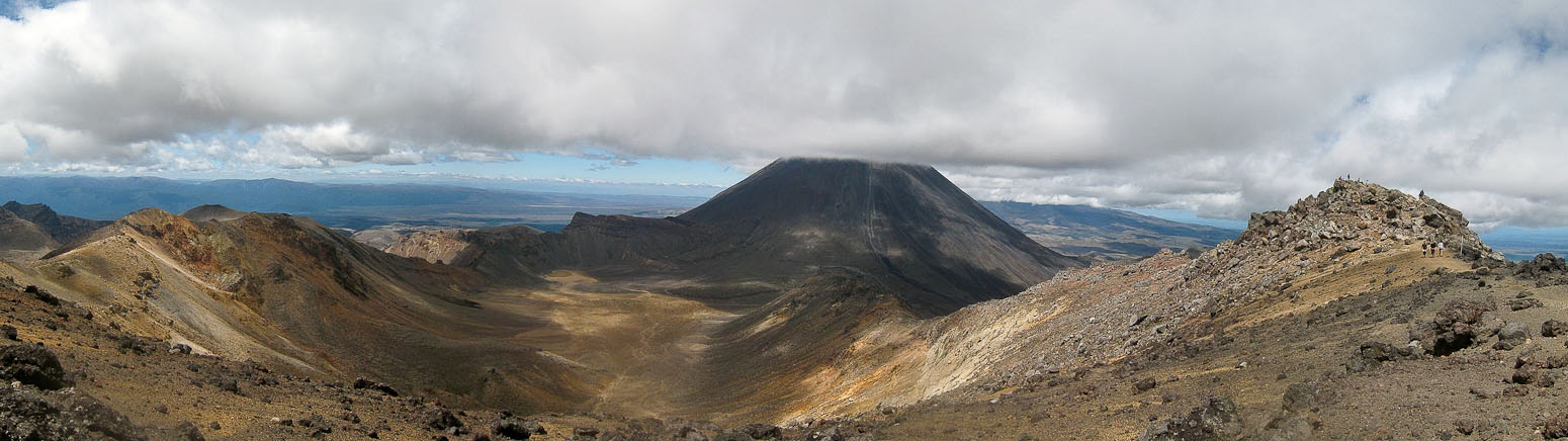
Wendy worked her way up to the fork for Mt Tongrariro, capturing this magnificient view of Mt Doom and the South Crater below it...
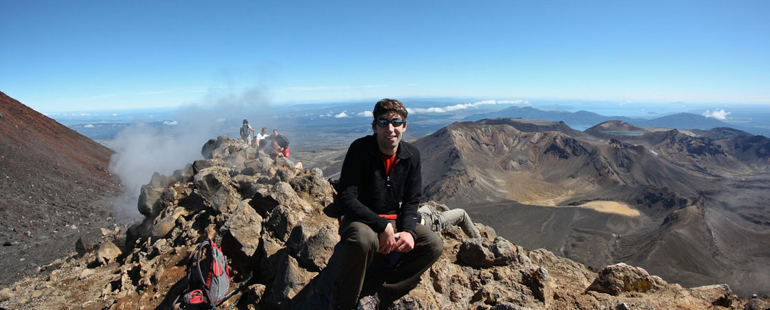
With just a few breaks for pics, I covered the loose 1800' in 60 minutes, where I joined several others near some sulfuric steam vents on the lower lip of the Mt Doom. The views were great! It would have been fun to walk around the entire rim, but I wanted to catch up with Wendy, and had to be down for the 4:30pm bus later, so I didn't hang out long. One guy asked if I could take his pic, using my camera with his SD card, to take advantage of the wide angle. I thought that was a clever idea.
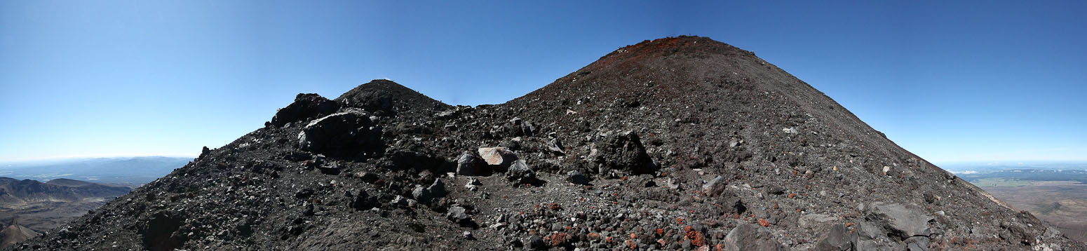
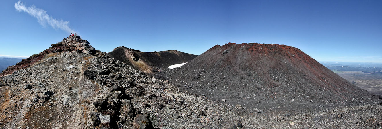
There were several sub-peaks along the rim. I choose the one with sulfuric steam rising from it (and it conveniently was the closest)...
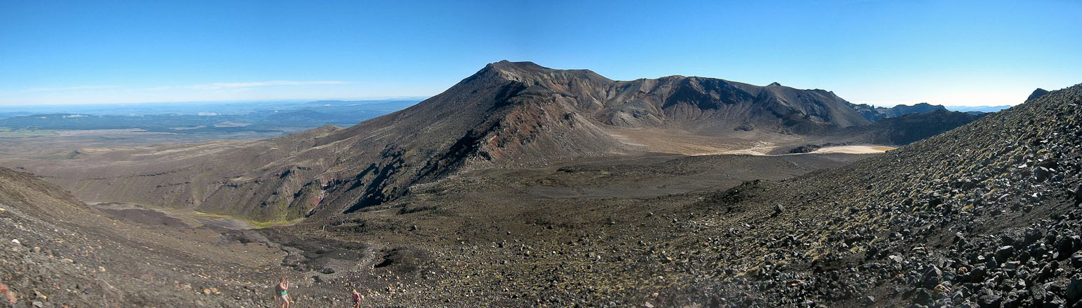
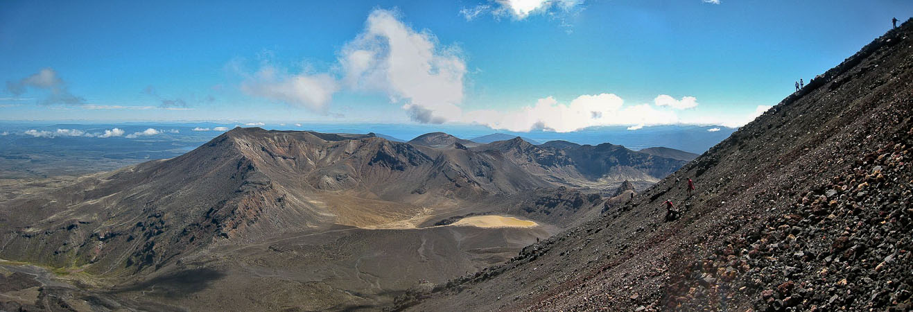
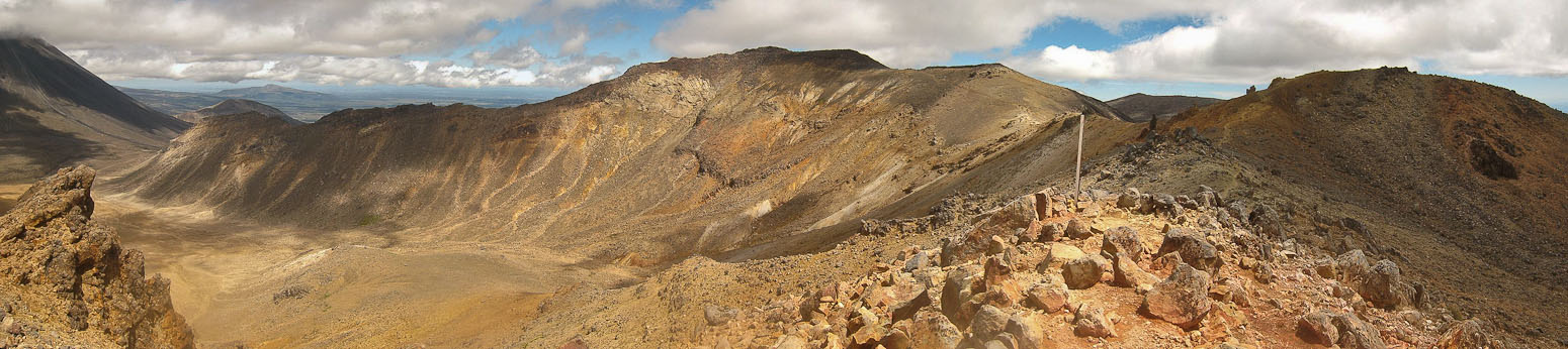
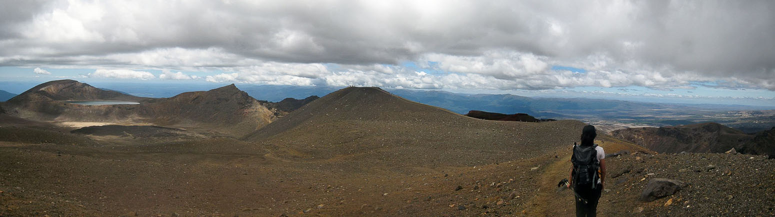
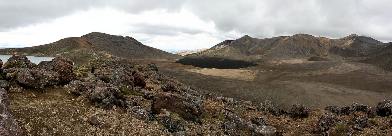
A look across the Tongrariro Crossing. The end destination for today lies on the other side of these mountains below...
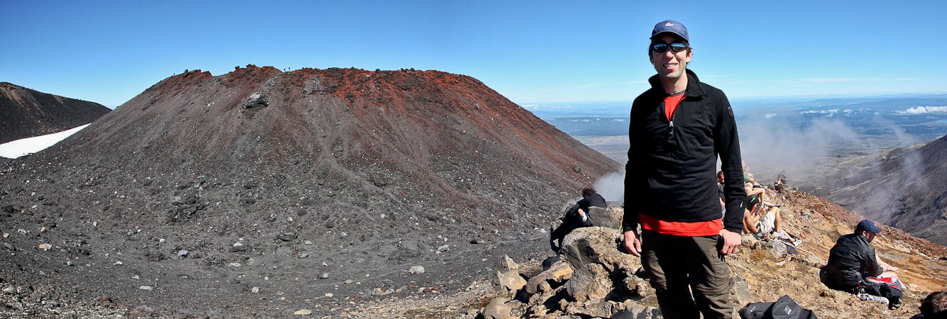
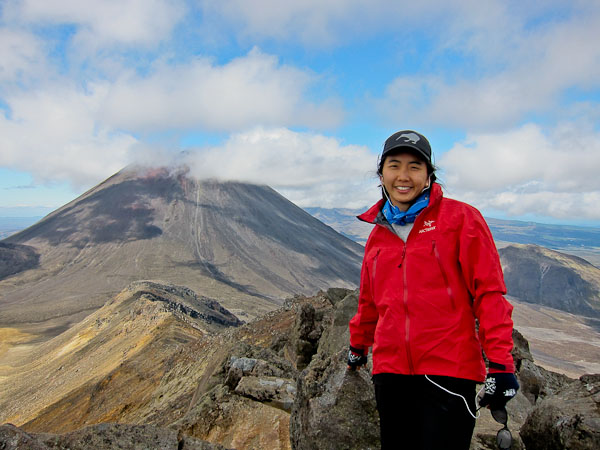
Me on the rim of Mt Doom. You can see others on the red summit behind me. That is the true summit, but I was plenty satisfied with this vantage point...
Another pic of me on Mt Doom (fun to say)...
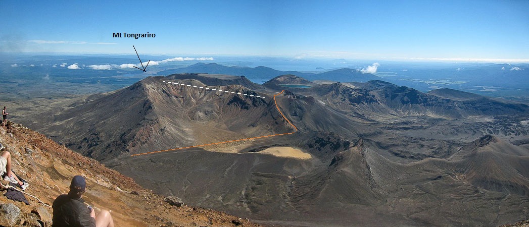
The view from Mt Doom was splendid. The orange line marks the main Crossing track, and the white line marks the side-trip ridge walk to Mt Tongrariro (tonga: south wind, riro: carried away), where Wendy would be waiting for me (should have a GREAT view of Mt Doom from there)...
A couple of self portraits seemed to stitch together pretty well. Oddly enough, my face was fat in one pic, skinny in the other. Wasn't a stitching artifact...
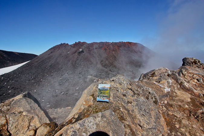
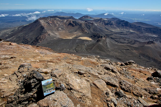
I brought my deck of 14er cards ("it has become 'precious' to me"), and took a pic of it from the rim, then started my descent down the scree slopes, having spent 10 minutes on the rim. It was easy and fun scree-skiing down the slopes. I arrived back on the track after an enjoyable 30 minute descent.
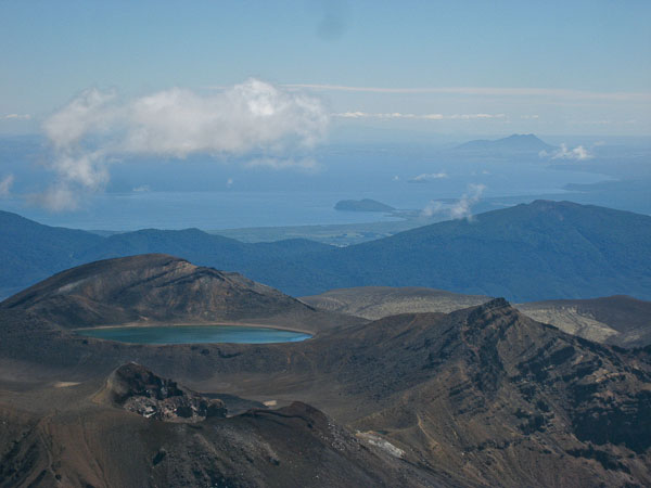
1st pic: A zoomed in shot of a volcanic lake, with the large Lake Taupo in the distance. 2nd pic: Wendy takes a photo of Mt Doom from near the summit of Mt Tongrariro...
On the way down, I stuck to the soft scree, and heel stepped down. Fun times...
Plenty of others were still working their way up the mountain, along the rock band...
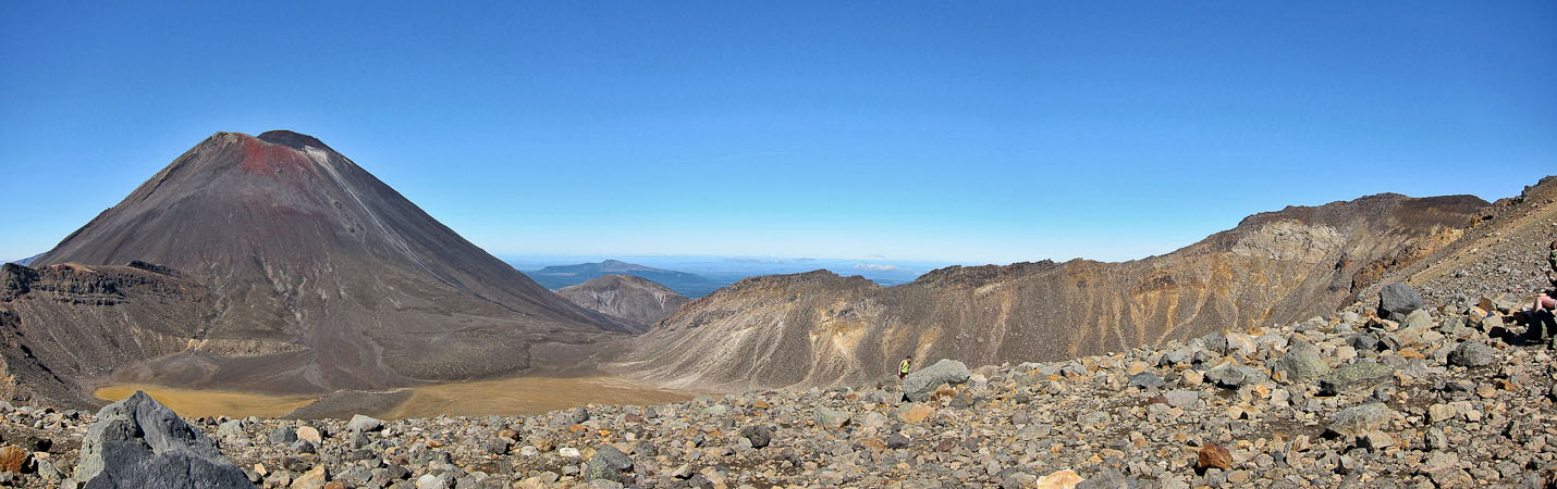
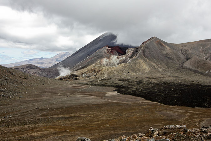
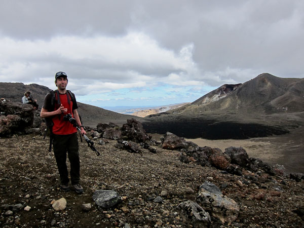
After a 1hr 40min round trip hike up to Mt Doom (wow, that was fast), I hiked across the south crater, joining people from the 8am buses, and climbed up to the Red Crater. My legs were getting tired, but I pushed on to catch Wendy, who would be waiting for me on Mt Tongariro, the other side quest today. I reach the turn-off for Tongariro, and was dismayed to see a lot of up-and-down on the ridge line. Plus, clouds were forming over Mt Doom, blocking views of the summit, which was the main reason for hiking on this side quest. But I continued all the same, and met up with Wendy, who was chilling out, listening to her ipod, and snacking on carrots, tomatoes, and ham ~noon.
A look ahead with Mt Doom off to the right...
Meanwhile, Wendy is listening to itunes on Mt Tongrariro, while I'm climbing up to the Red Crater. On the way, I glance over the side of a ridge, and swear I'm looking into Mordor...
I sucked some color out of the pic to help picture Mordor better, but I totally could see an army of Orcs walking through this terrain. Maybe you had to be there...
Clouds were starting to gather around Mt Doom...
Wendy was on Mt Tongrariro, in the middle of this pic. Wished I could have signaled her to meet me back on the trail, but it would be faster to hike out there and back, rather than wait another 1hr 15min for her to start heading back...
The trail had a few dips, leading out to Mt Tongrariro, but was cake compared to Mt Doom, which was now swamped in cloud. Good thing Wendy snapped some pics while it was clear...
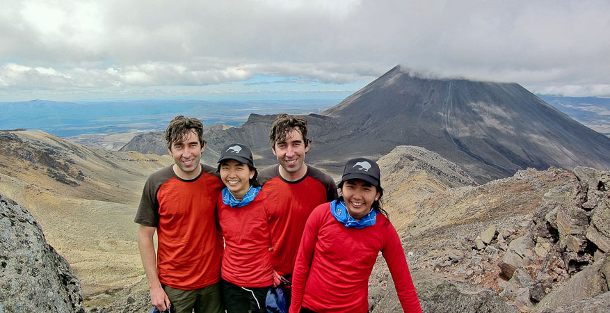
I found Wendy at the summit (1,967m), relaxing in a cozy rock nook, listening to tunes ~noon. Yikes, must be some foul magic from Mordor... Evil twins grew out from us!
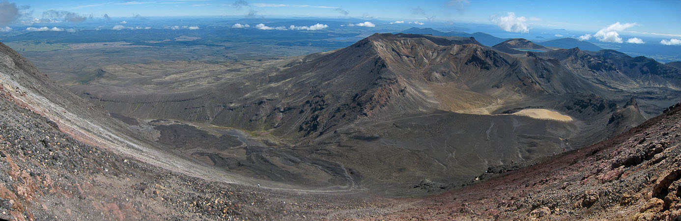
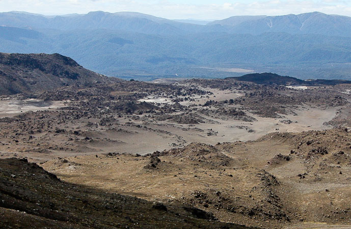
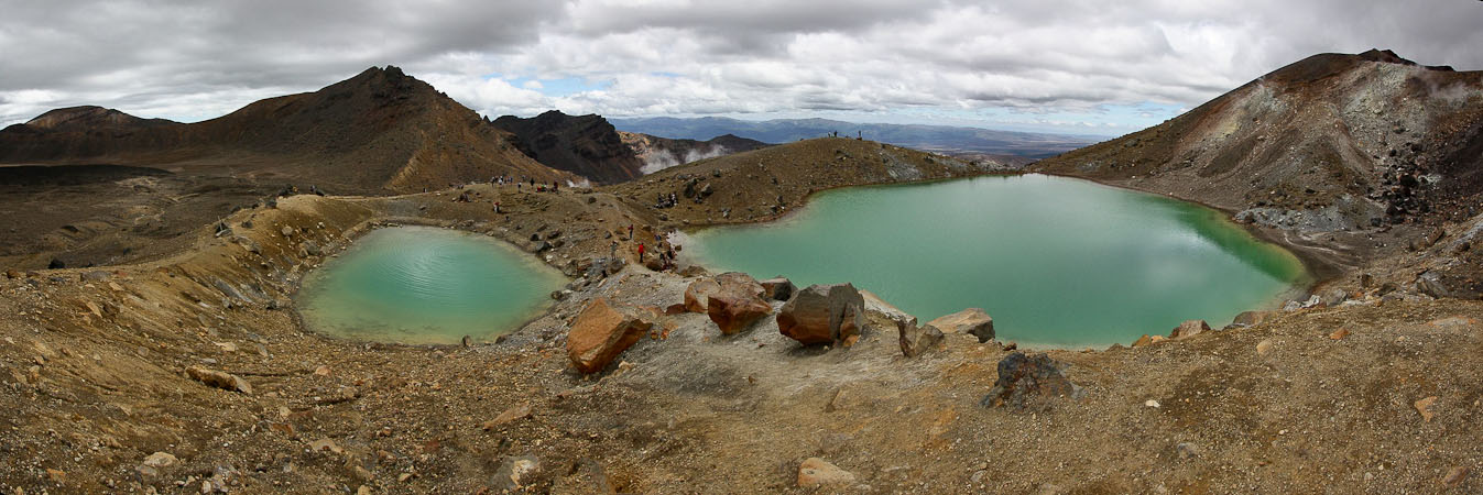
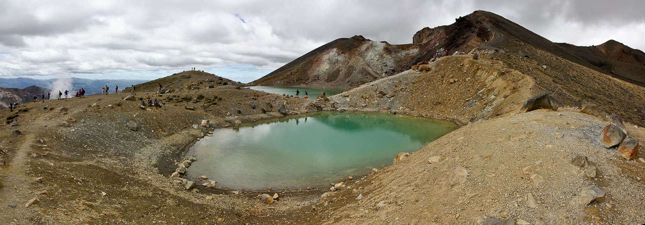
We returned back to the trail, with the clouds increasing all the while, and continued down the red crater to the deep green Emerald Lakes. This was pretty. So far we hadn't been too impressed with this "greatest hike", though Mt Doom was pretty cool too. The lakes were pretty, and several steam vents were sending off smoke.
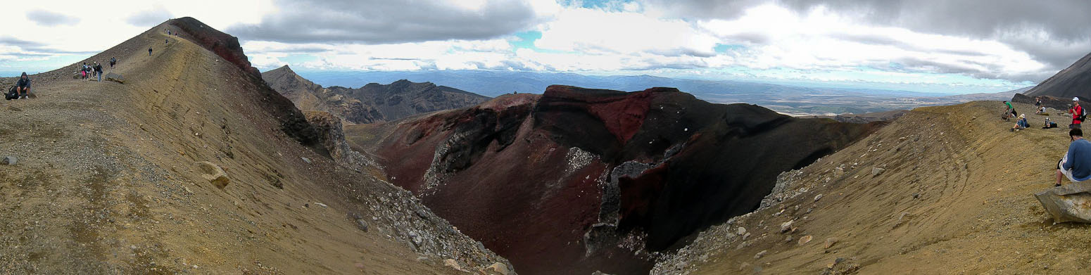
Soon we realized what exactly the "Red Crater" was...
Another look at the Red Crater, as we reach the highest point along the Crossing (minus the two side-trip summits)...
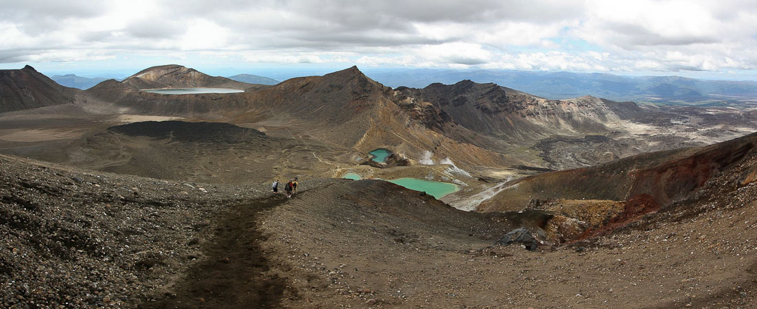
As we descended, milky green lakes appeared below. Beyond the green lakes, the trail would rise back up to the lake on the left...
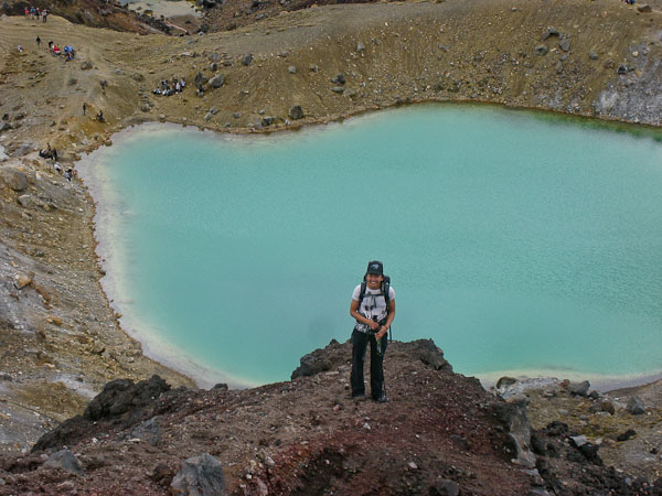
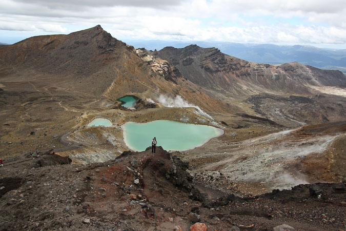
Wendy and the Emerald Lakes...
The trail was like chocolate cake mix. Pretty cushy...
People were exploring around the lakes...
A look back at the lakes, and the slope we descended (to the right of the Red Crater)...
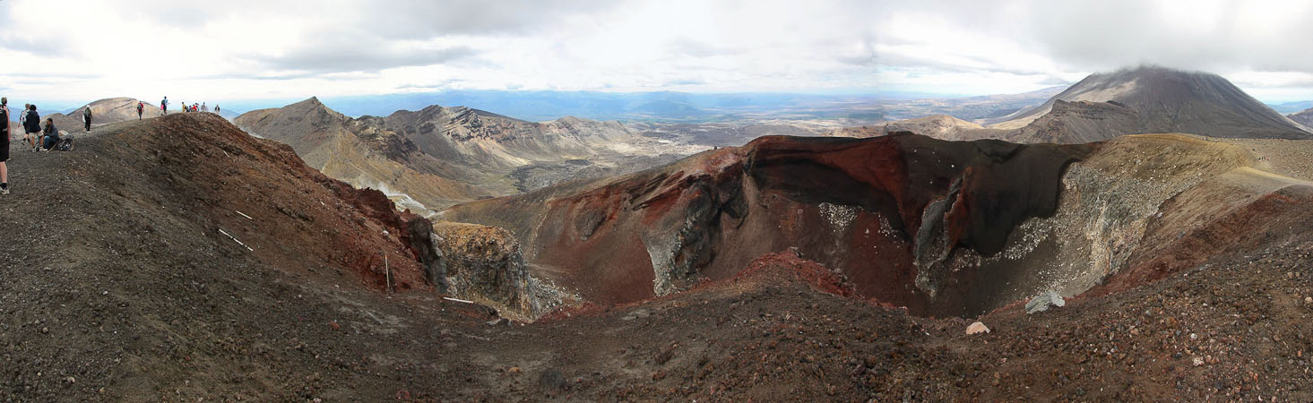
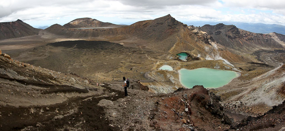
A look back across Central Crater, where you can see Red Crater directly in front of Mt Doom (which is obstructed by cloud). The trail can be seen along the right side of Red Crater. I wonder how amazing this must look on a clear day?
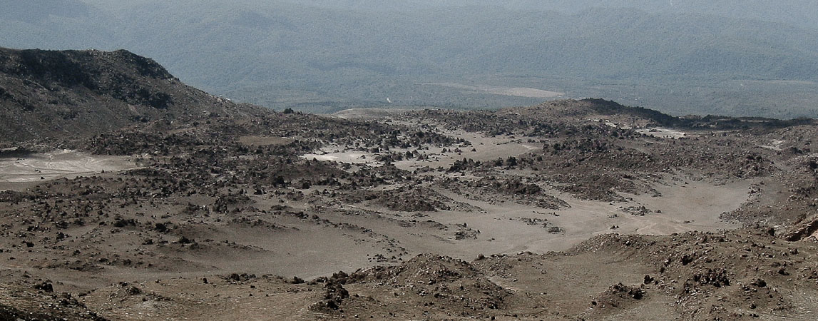
A wide view looking across Central Crater. The lake can be seen on the left...
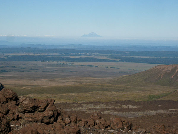
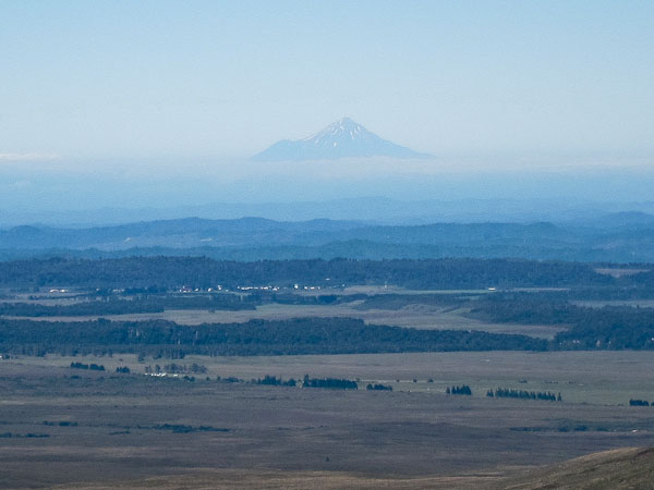
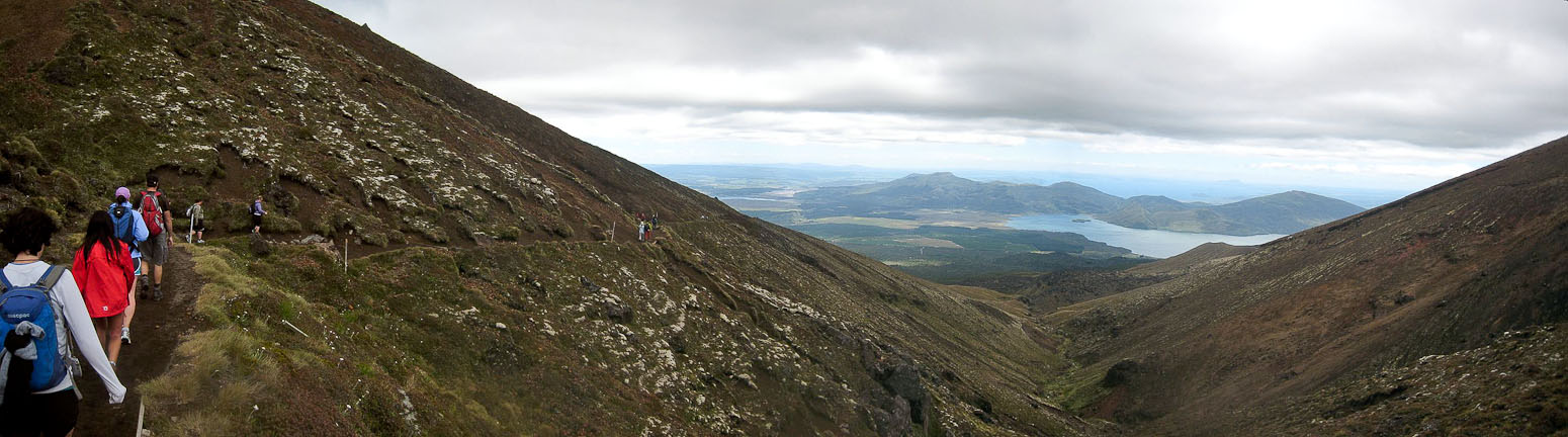
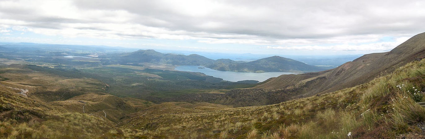
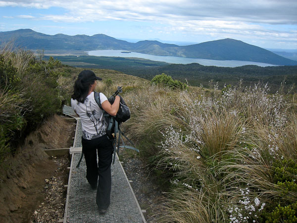
Then rest of the hike was a long (3.5hr) hike on a gently descending, well built trail down the north side of the volcano massif, with views of Lake Rotorua and the enormous Lake Taupo in the distance. We were ready to be back waiting for the bus, as our feet were beginning to ache. Eventually we arrived at 4pm, and rode back to our hostel, where we took advantage of their hot tub to relax after the hike.
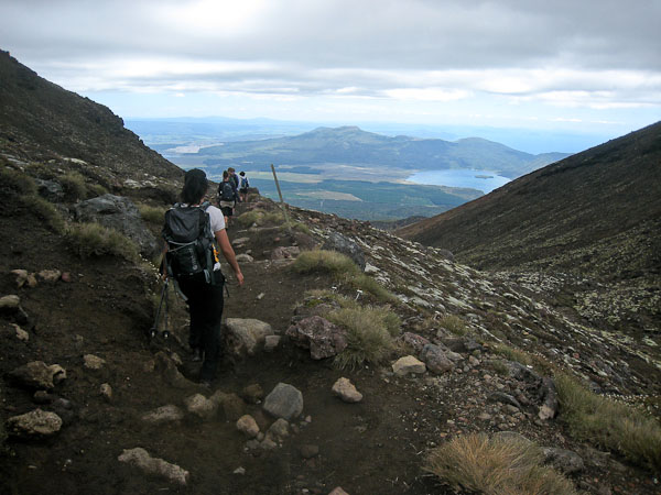
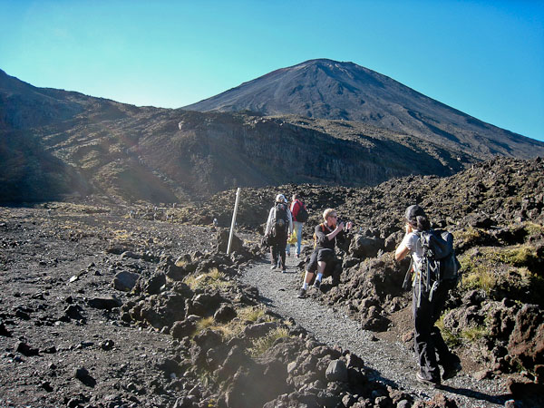
We were on schedule to arrive at the trailhead with good margin for our 4:30pm bus. Plenty of people on the trail still...
You can see the trail below on the left side. It was a LONG way down and out, and we only stopped once at a hut for a bathroom break (the line was ~20 people long!)...
Some white flowers on the trail... Eventually we reached the forest, and hiked at least another 40 minutes before finding the trailhead...
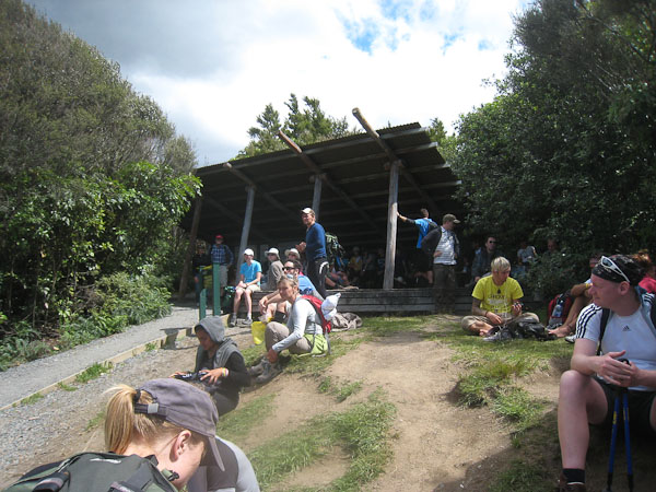
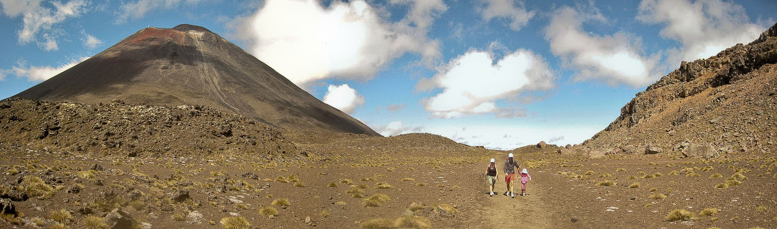
Everyone was waiting for buses at the trailhead. Fortunately, there weren't any bugs, and we found a place to sit. A pic on bus ride back, of Mt Doom in the distance...
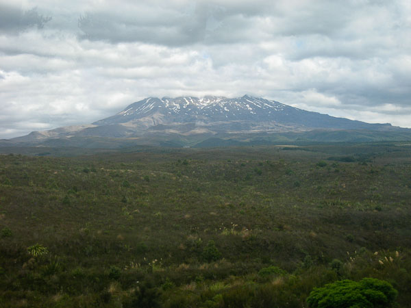
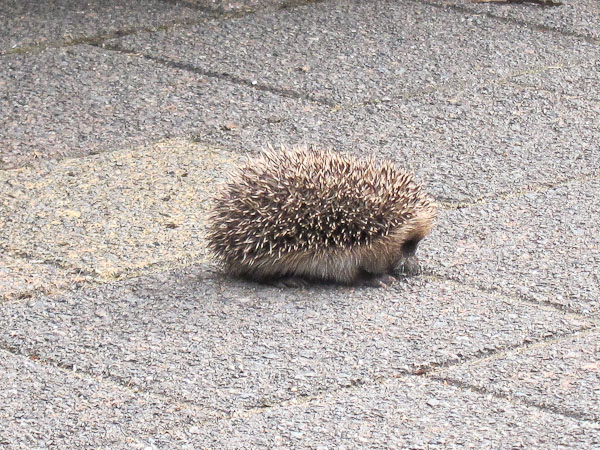
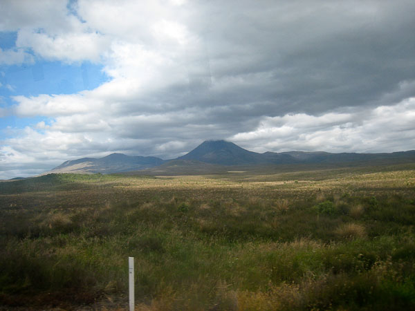
A pick of Mt Ruapehu, the largest mountain on the North Island, from the bus. Back at the backpackers lodge, Wendy found a hedgehog in the parking lot...
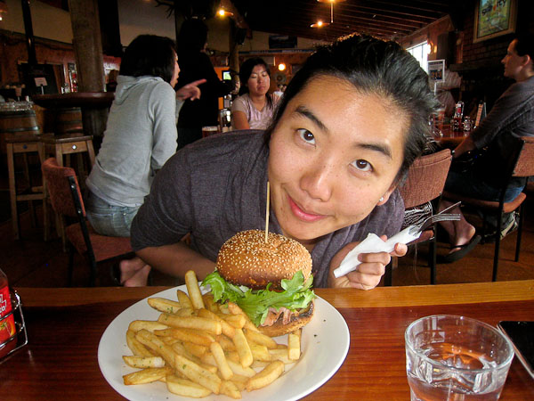
For dinner, we went to Schnaps, a pub, and ordered Mountain Burgers (we couldn't resist after seeing some delivered to another table). In NZ, you have to give your order at the bar, rather than wait for service. The burger was spiced with oregano, and had a beet as a topping (NZ specialty).


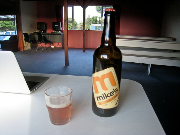
Later I opened the IPA from the brewery near New Plymouth. It was ok, but had me pining for the Fort Collins brews back home...
We bought 50mb of internet at the lodge, but it turned out to be a bust, since email attachments ate our entire allotment before we could do anything.
Exhausting day. Plans are up in the air for tomorrow, but will likely head to Taupo. Lots of time for sleep tonight.