

8:56am, Routeburn Hut
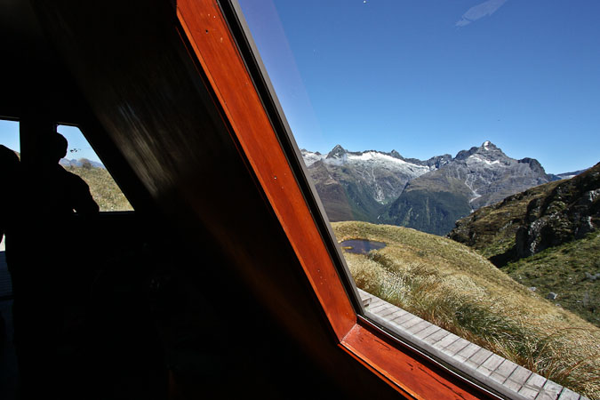
Still in bed, resting weary eyes, while rain and wind continue to pound the hut. Too many door slams and boots stomping to sleep any further now. Some people must be in a hurry to move out. Got lots of sleep (didn't need to go to the bathroom till 8am). The waterfalls are very big today. It was chilly last night, but I woke up in the middle of the night sweaty, and unzipped my bag. It's much warmer out this morning. The bugs sure haven't been much of a problem on our tramps so far.People bring lots of "big" food on this track, and large bins of stuff, fruit, steaks, mince meat… My throat is still feeling thick, and sinuses are semi filled, but no runny nose today. I think I'm fighting a cold pretty well. Wendy is reading in her sleeping bag. We may not leave here till ~noon, or whenever the skies start clearing. It's a 4.5-6.5hr hike to the next hut, and we trend to the fast end of the spectrum. There's also a 1.75hr side strip to Conical Hill we want to do. My window view hasn't been any use here with all the rain. Still not hungry after last night's big meal. 10:17pm, Mackenzie Lake Hut We finally get out of bed ~9:40am this morning. The weather update still calls for a clearing in the afternoon. It was still raining as we ate breakfast (cereal, hard boiled eggs, cheese). The temperature was 70 degrees on the thermometer last night during dinner, and 38 degrees out this morning. The clouds gradually started thinning, and people were lining up, ready to start the hike ~11:00am. A little kid in the kitchen looks out the window and shouts, "Blue sky!" in a thick Kiwi accent.
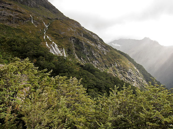
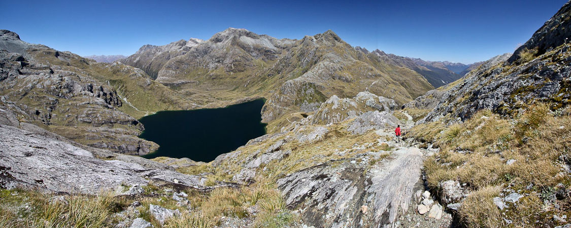
We hit the trail ~11:45am, and find the Routeburn waterfall to be gushing compared to yesterday. We climb up into a basin, and continue climbing up and around to a deep blue lake. It's windy out. Wendy is wearing shorts and gaiters. My windjacket is working perfectly in the conditions, keeping me warm with a short sleeve icebreaker underneath.
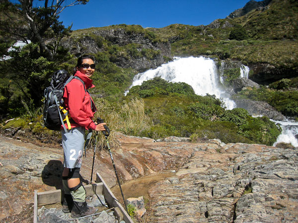
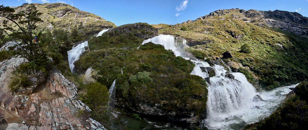
Routeburn Falls is looking healthy after the storm...
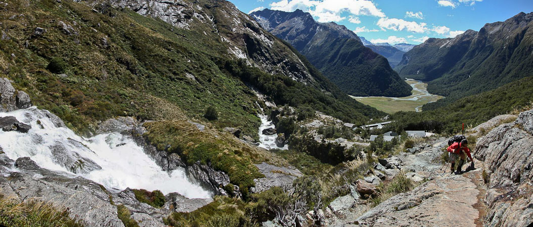
Wendy works her way up alongside the falls, with the roof of the hut seen below...
We reached a windy basin above the falls...
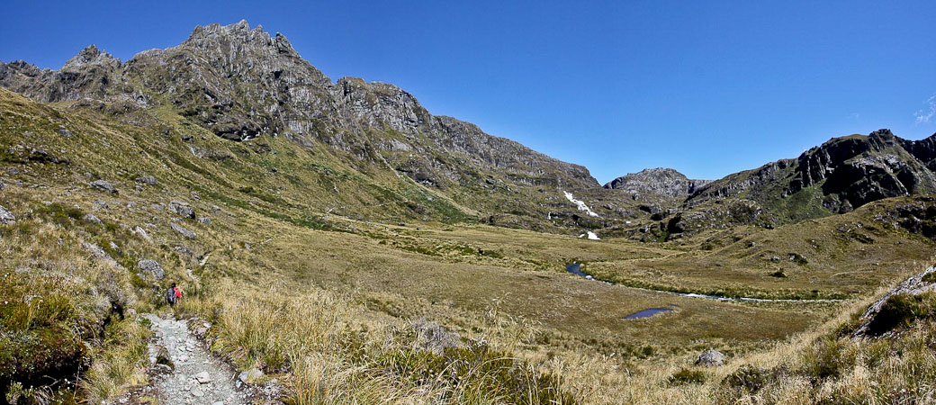
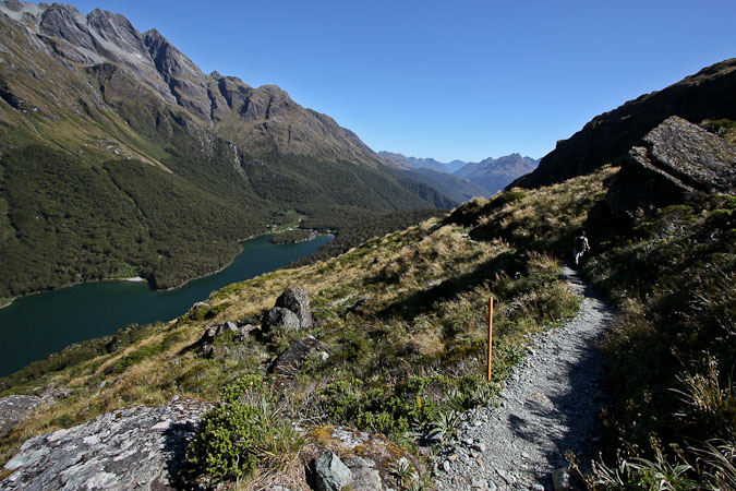
...and cirlced around towards a lake...
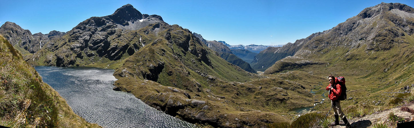
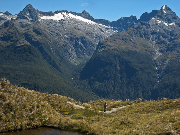
I stand infront of the valley we climbed up this morning...
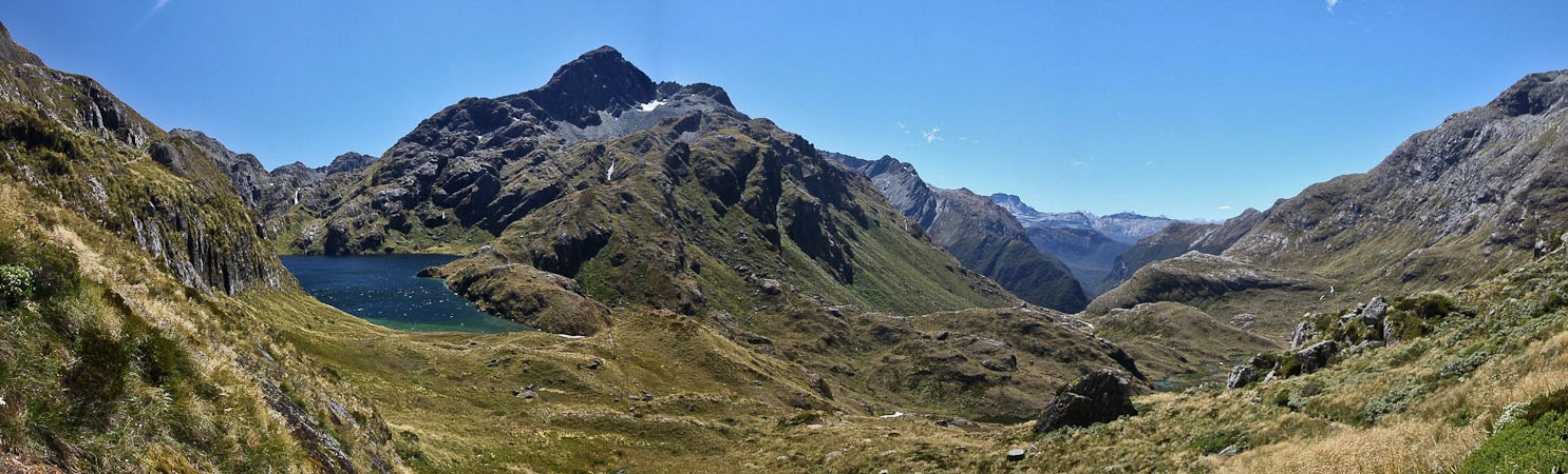
The weather report was right! The skies were all blue, with no sign of last night's big storm, though the wind was a reminder...
We reach the Harris Saddle shelter in 1hr, 25min, where we take a rest and drink some hot water from our thermos with a snack. Inside the small shelter we happen to meet some of the Israelis that were on the Rees-Dart tramp with us. Small world! They were camping last night, and got pretty wet, and were anxious to hear about the weather for tonight.
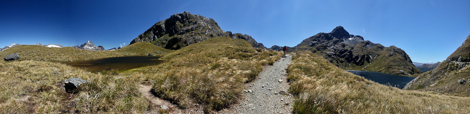
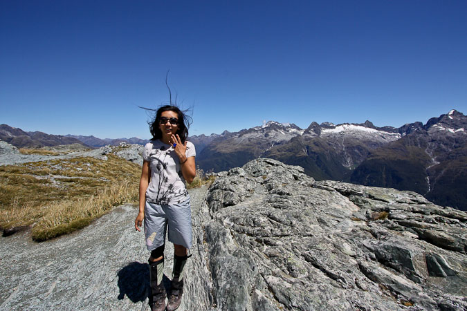
The Harris Saddle Shelter comes into view, with Conical Peak, our side trip, to the right. You can see the trail slick up the mountain...
We left our packs inside the shelter, and took the side trail leading up to Conical Mountain. The ~40 minute path was steep and rough in parts. I carried a water bottle that was latched to the back of my hood with a beaner, near my neck.
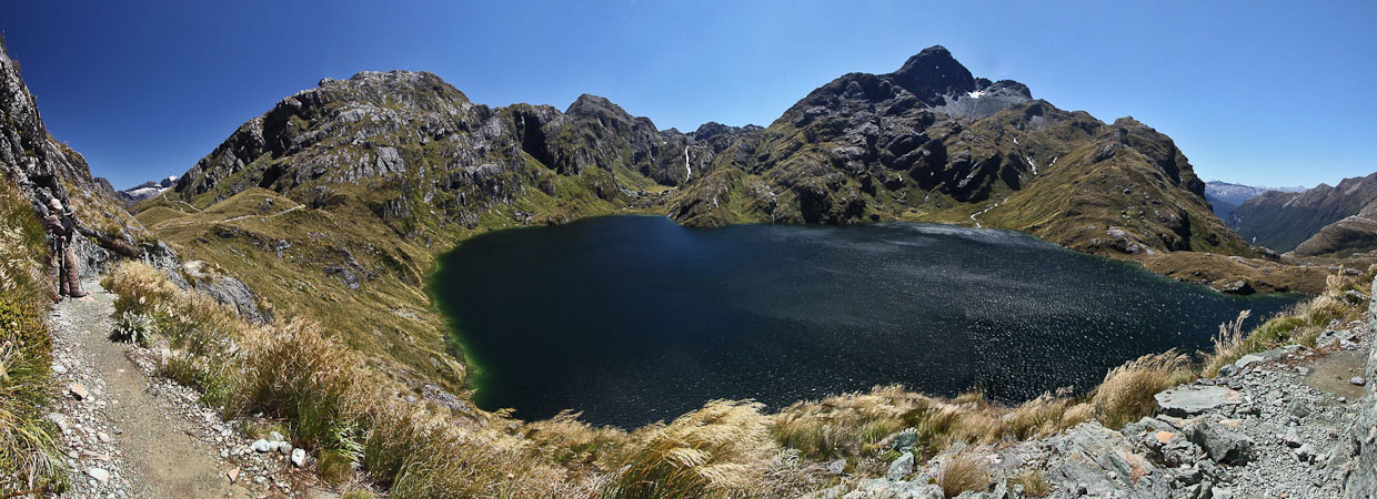
Wendy takes a pic of me in front of the lake...
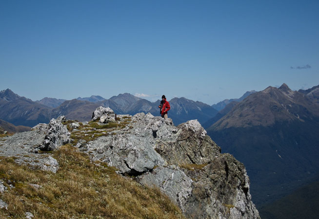
There were nice views from the top, but having just been to the jaw-droppingly beautiful Mueller hut, the vista from here was fairly pedestrian. This was supposed to be the highlight of the Routeburn, but the Rees-Dart had several more impressive vistas too. We were a bit let down by the hype building around the Routeburn.
I realized I had lost my polarizer and lens cap during the hike up, and was about to head down to look for it, when some people happened to arrive and have it in their hands. Excellent!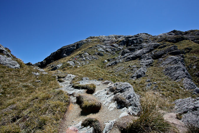
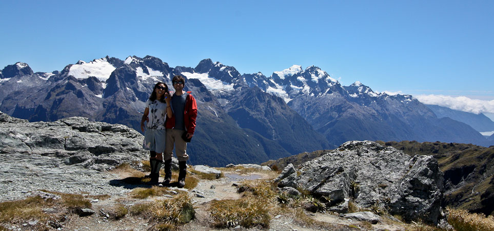
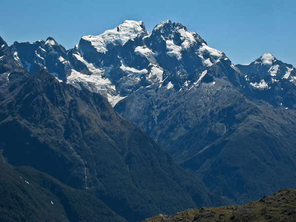
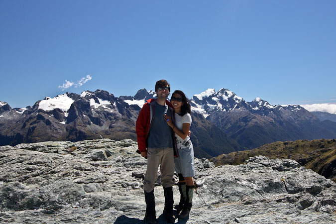
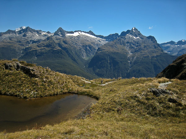
The highest peaks in Fjordland National Park are in the background behind us...
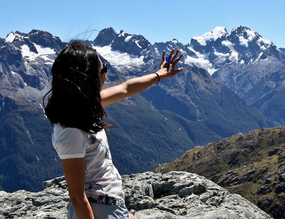
Wendy poses with the blue ring, in front of a heavily glacier covered peak...
More pics from the summit...
A wide view from the summit. Based on the hype surrounding the Routeburn, we were a little "let-down" by the views, but only when compared to the Mueller Hut and Rees-Dart Tracks...
It still was quite scenic...
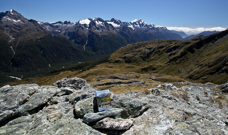
14er cards ($6.95) make an appearance on Conical Peak, to add to the 14ercards.com Travel Page...
We ate a snack, and posed with the blue ring. The winds were dying down as we descended back to the Harris Saddle Shelter, which was now very crowded with backpacks and hikers. There was a separate shelter for the "guided hikers", which no doubt had plush seats and hot food…
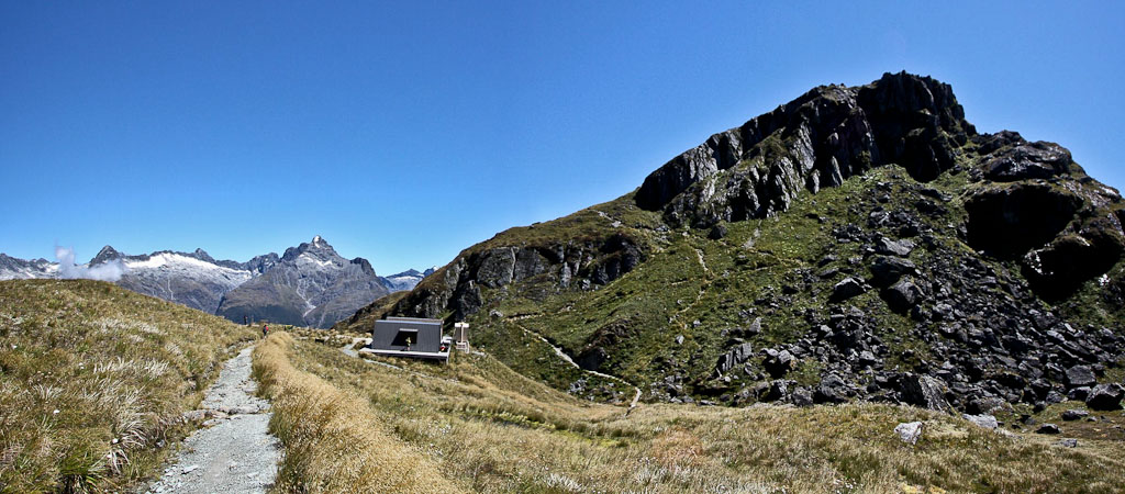
...back down to Harris Saddle Shelter...
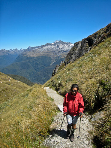
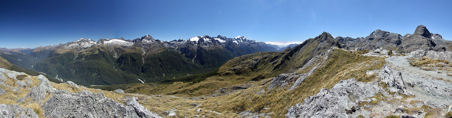
We continued on the trail ~3:30pm. It was all sun, and little wind, making us quite toasty. We traversed high up the side of a valley overlooking the Hollyford River, and several hanging valleys and peaks on the far side to the south. We crossed several small bridges, and filled up the water bottle in a stream. The water was a bit silty, and I tried another stream, which tasted great.
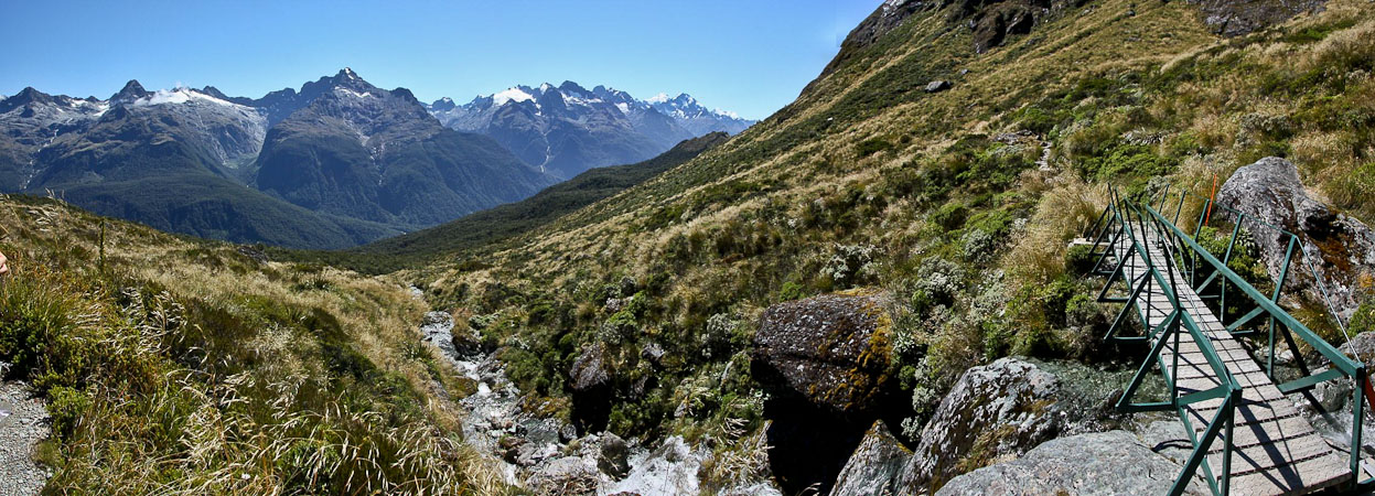
We traverse above the valley, crossing several streams...
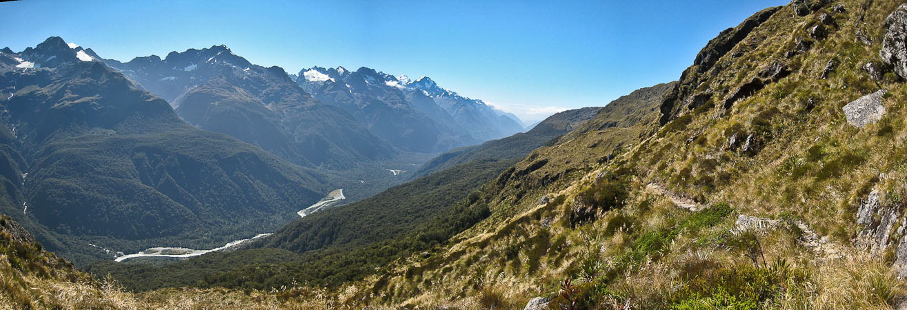
Day 2 of the Routeburn is supposed to be the "money day" with the best views, but we were relatively bored on the trail. However if I stopped to turn around, the views were quite scenic. The Hollyford valley made it's way out to the ocean in the far distance. Sadly, this view was at our backside the entire hike. I have no idea why this hike is recommended to start from east (Glenorchy) to west, when hiking it in the opposite direction would be quite beautiful.
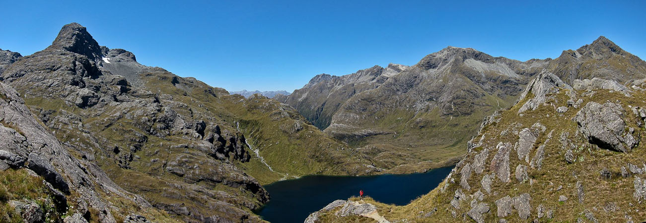
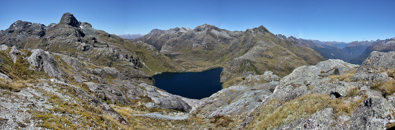
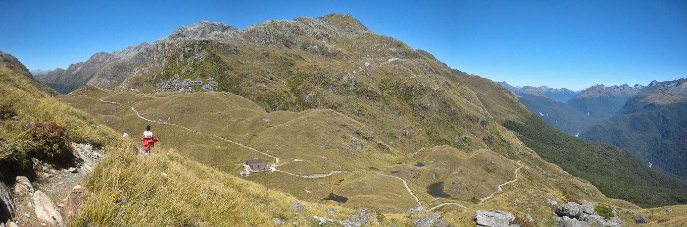
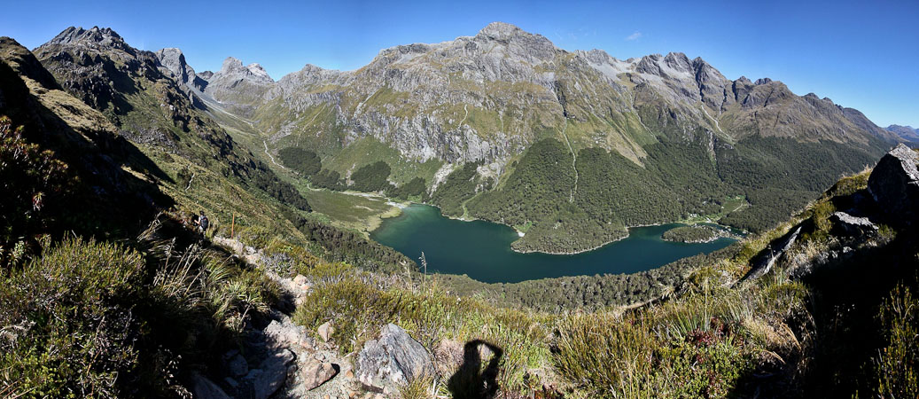
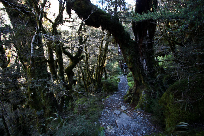
After we traversed high up over the valley, we climbed up to a pass that unveiled a large green lake far below, with a hut on the far side. We eagerly hiked down the switchbacks that eventually "meandered" (to quote Wendy, who thought there was a little too much meandering going on) through a beautiful forest, and arrived at the hut 40 minutes from the saddle. Turns out that section of forest is known as "Fairie Patch".
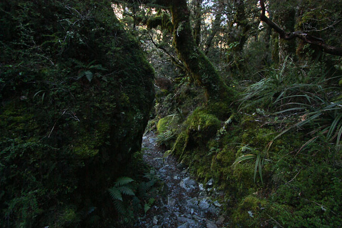
After lots of "zig-zags" (as the warden called them), we "meandered" through an enchanted forest...
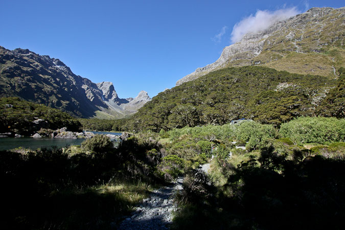
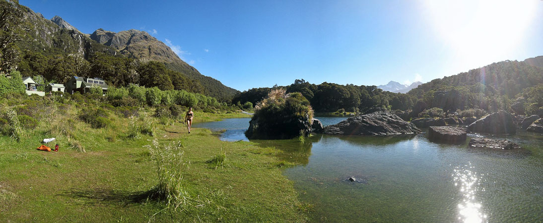
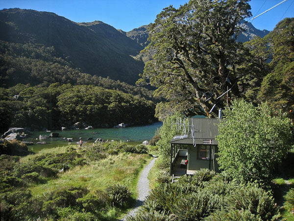
Eventually we reached a clearing, and found the hut at the foot of Lake Mackenzie...
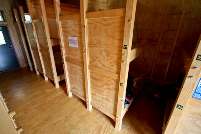
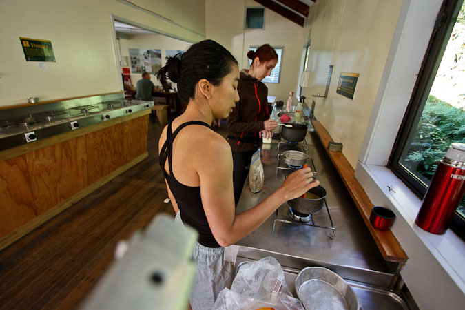
When we arrive at the hut, the bunk rooms are mostly full, so we take a bunk pair next to the wall like at the Mueller hut. Wendy really wants to bathe in the lake, so we find a path leading to a idyllic "putting green-like" beach, and walk on the soft turf into the lake. It's absolutely freezing!! Much too cold for us. We see two brave souls wade into the waters and plunge all the way under! Impressive. Wendy decides to visit the sink at the bathroom and take a sponge bath instead.
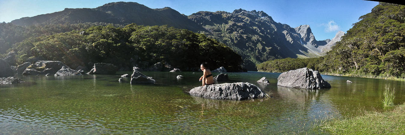
Wendy ventures out to a rock...
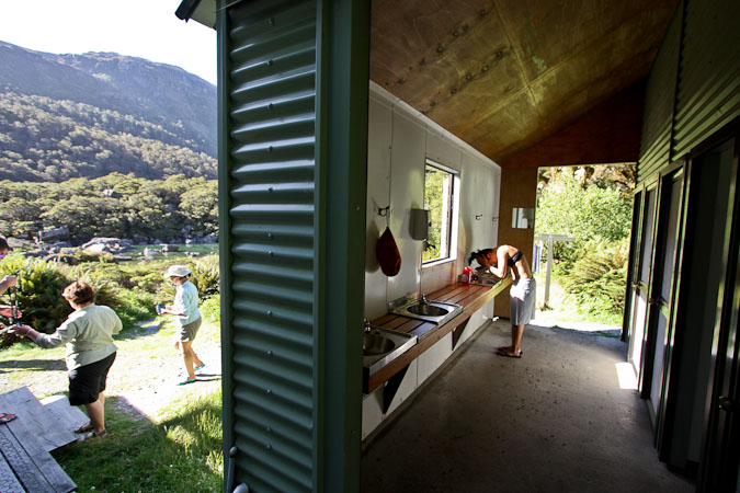
In the end, she settles for a sponge bath at the sink. A look at the warden's house, above the lake...
For dinner we had WG, tons of yams, tuna, asparagus soup, sausage, eggs, pumpkin pie, and PBJ (good to eat up lots of food on the last night of a hike). With full stomachs, we played Rummy 500, and sipped hot honey water.
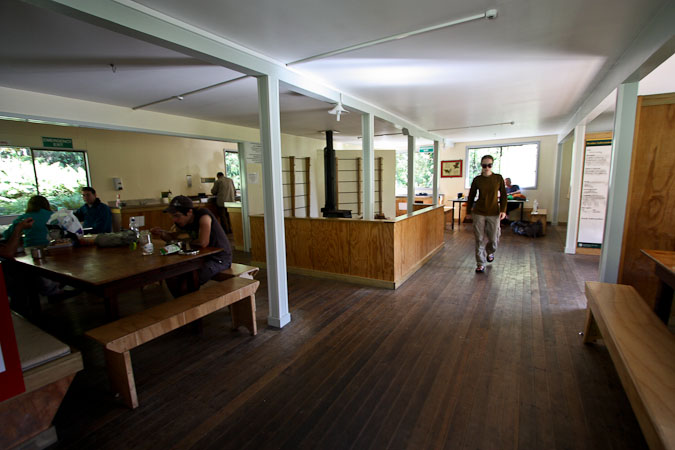
The warden enters the common room, and collects hut tickets. Then he starts the "hut talk". I start out with the impression that he's a simple guy, kind of meek, and a slow speaker, as he's talking about safety regulations, and the usual hut details. Then he goes into a 1+ hour long speech, which is almost like a stand-up routine, telling stories relating to the history of the area (including a story about the last moa (giant ostrich sized native bird, thought to be extinct in the 1600s), seen by a 9 year old girl in a secluded cove in the early 1900s. Wendy and I continue to play cards in the corner while listening. He tells of ghost towns, and comical encounters with possums. Quite a dry wit. He gets a rousing applause be everyone when the show ends ~9:40pm…
We clean up our dishes, and ready for bed. The fog is filling the sky above the lake. Guess there will be no stars out tonight. The solar light timer just went out. Gonna make one last stop at the bathrooms before bed. 6am alarm for an early start tomorrow. Maybe we'll make a drive to the Milford Sound tomorrow if the weather's nice when we finish the hike…