
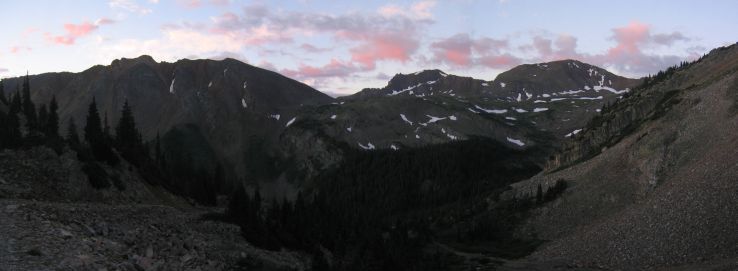
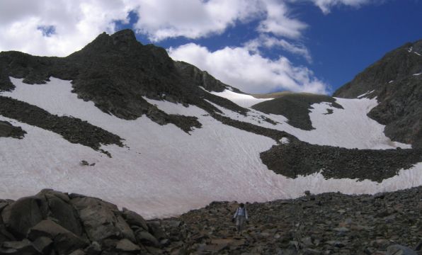
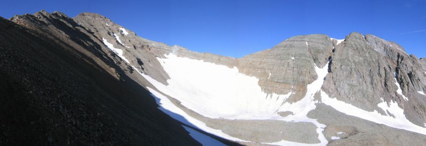
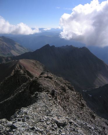
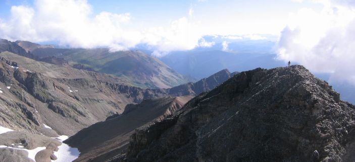
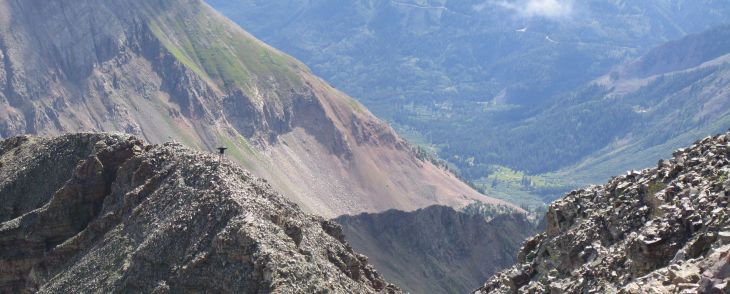
The view from the start of our hike, at ~5:45am, 11100' elevation
Matt wakes up early in the morning, after having a dream that the zipper on his tent was left open, and scores of mice, spiders, and snakes are inside it. He isn't sure he'd be able to get back to sleep right away, and is glad to see it is 4:43am, and the light is on in Chris/Wendy's tent. It is time to start the day.
We pack up in the dark, and by the time we're ready to continue the drive up the 4x4 road, there's a hint of the sunrise yet to come along the horizon.
As we start the car and begin the ride, Matt is silent for awhile in contemplation of todays adventure. His thoughts and feelings gather together, and he proclaims to all in the car: "There will be glory today."
Chris affirms this proclomation with a well considered, "Yes, there will be."
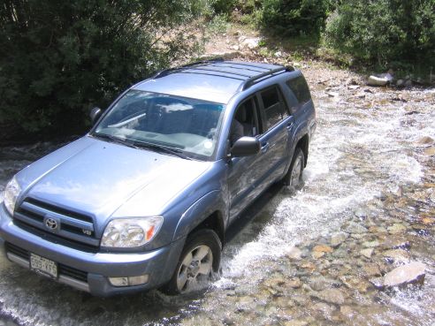
Immediately on the road we encounter a stream crossing, which Chris's car handles quite well (probably 6 inches deep). Then we continue on, until we stop at ~11100' elevation, so that we can hike at least 3000' to the summit (we could take the road up to 12200').
The view from the start of our hike, at ~5:45am, 11100' elevation
Trail stats:
distance: ~7 miles roundtrip
starting elevation: ~11100'
summit elevation: 14265' (12th highest in CO)
We begin the hike by following the road up the mountain side. It's smooth and gentle. As we walk up the switchbacks, we watch the clouds turn pink, and then see the sunlight touch the mountain tops and spread down towards the valley.
A look back down the valley where we started. The sun has yet to touch the land...
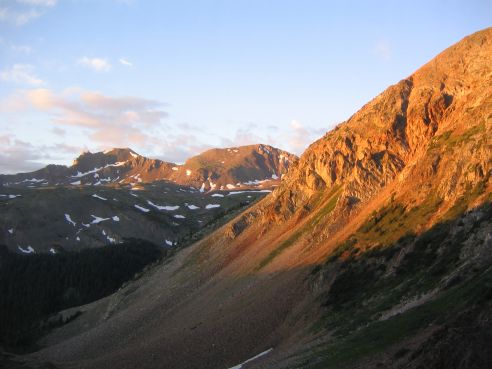
The sun illuminates the mountain tops in gold...
More of the green and brown clad terrain sees the light of dawn...
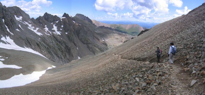
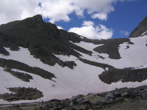
We continue up the road, until it ends at the foot of a boulder field, with several large white snow patches decorating the jagged gray field.
A look down the dirt road, used for mining 100 years ago...
At the end of the road, the climb up rocks and snow begins, at ~12200'...
The trail is indistiguishable, so we pick what looks to be the easiest path up the rocks, and through the snow.
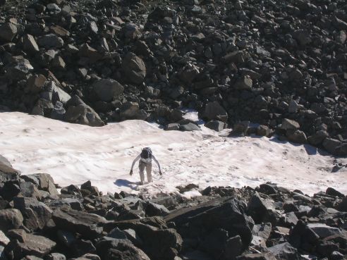
The snow patches are surprisingly slick and icy, meaning it must have been below freezing up here last night...
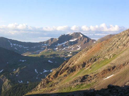
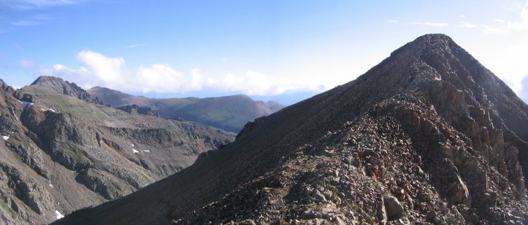
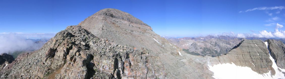
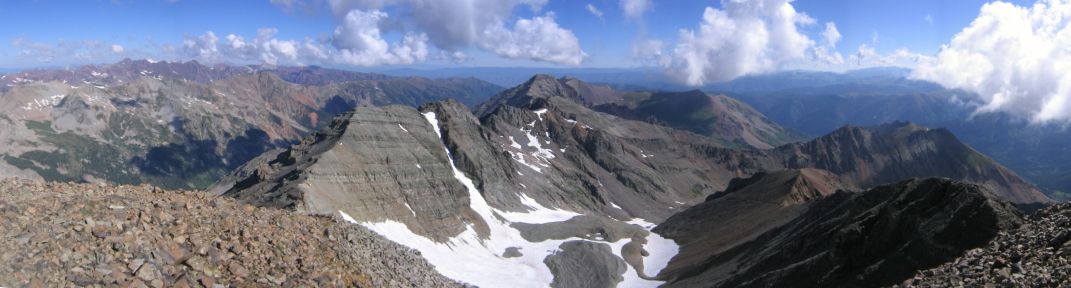
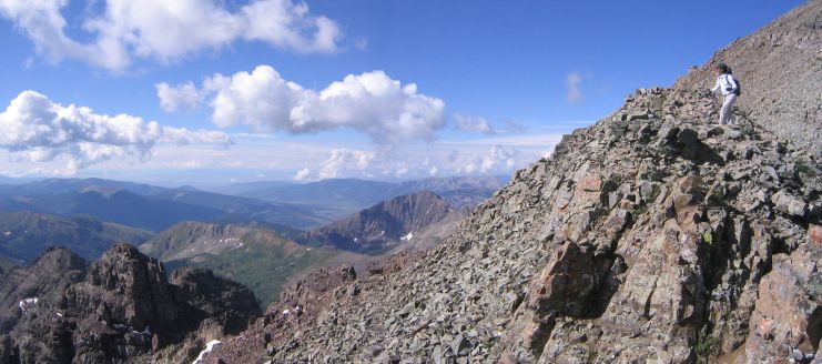
After a lengthy climb up a boulder field (with sharp edged rocks), to avoid crossing a wide snow field, we get a look at Castle Peak, and the long ridge running to the left.
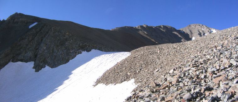
Castle Peak is the summit on the right, and we'll get to walk along the ridge to get there...
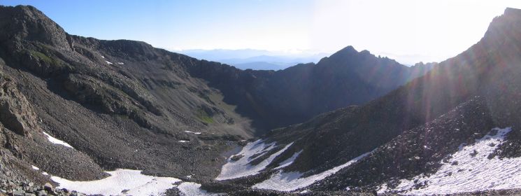
A look back northeast, from where we started. Chris thinks we might be able to "glissade" (or slide) down the snow to get back down later...
After we cross the last snow field, it's time to hike up to the ridge, along a steep, soft dirt/rock path, with quick switchbacks.
Halfway up to the ridge. Castle Peak is on the left, Conundrum Peak is on the right.
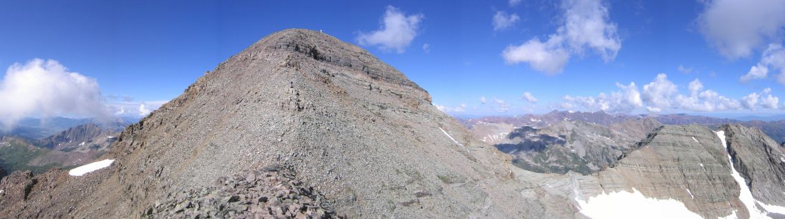
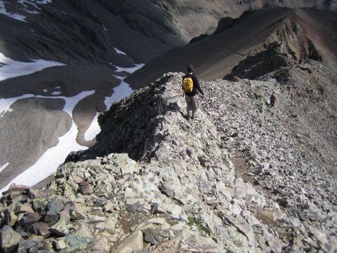
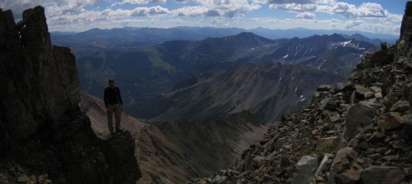
We arrive at the top of the ridge, and start the walk along the rocky and sometimes sharp crest.
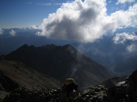
The first look along the ridge, but in the opposite direction of Castle Peak. This summit is just a puny bump, relative to Castle...
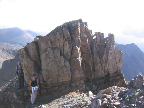
Wendy and Chris stand near a large rock on the ridge. The rocks here seem to split easily, and form sharp edges, so be careful when using your hands to manuever...
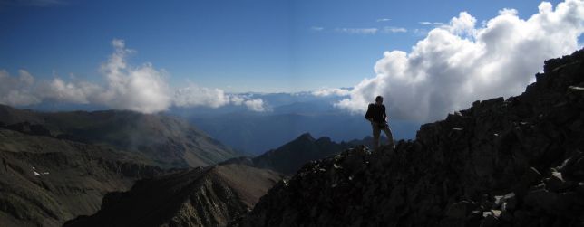
A few looks down the ridge. The pic on the right is from a little further up...
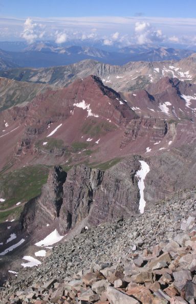
Castle Peak in full view to the southwest...
Matt seems to be working so hard that a giant cloud has formed from the sweat off his back...
It seems like Wendy is hovering in the air to take this picture of me walking the ridge...
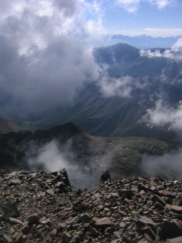
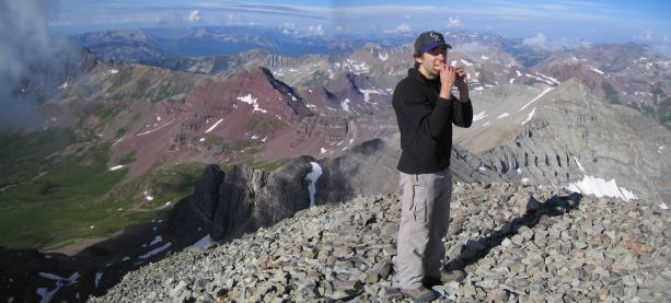
Wendy reaches a high point along the ridge, while Matt takes this picture from the ascent of the actual summit...
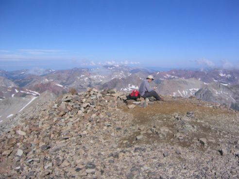
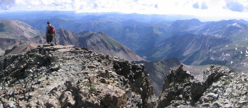
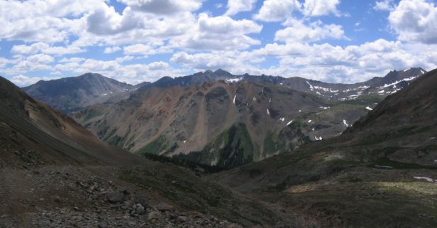
Finally, at around 9:15am, we reach the top of Castle Peak. The view to the west is stunning! There are red and purple rock mountains, lush green valleys, and blue skies with white clouds.
Left: Wendy has just another 15 feet to go to attain 14265' elevation...
Right: This was my favorite direction to look atop Castle Rock. The color is astounding...
We are the first people to ascend the peak today, and we relax, admire the views, and eat lunch. After ~20 minutes, 2 other guys reach the top, and we find out they are from Fort Collins too, and this is 14er #47 for one of them.
Chris calls his wife from his cell phone. He's been able to get cell phone reception on all 27 14ers he's hiked so far...
Peanut butter and banana sandwiches taste the best at high altitude...
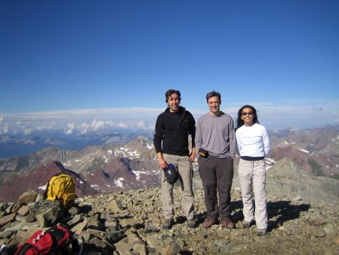
The Heroes: Matt, Chris, and Wendy (and their sidekick backpacks)...
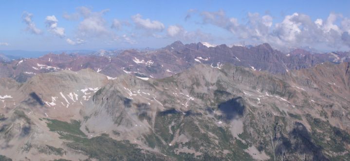
A look northwest to the Maroon Bells, a purple 14,000' mountain range with horizontal lines etched across...
A final look northeast before starting the descent. Conundrum is the peak on the left. Time to head back down to the snow...
We consider hiking further down the ridge and around to Conundrum, but decide to try it another day. We start to head down, and Matt scoots down quickly to reach the rise on the ridge in hopes of a good photo op.
This picture taken by Wendy from Castle Peak...

This picture taken by Clint, one of the Fort Collins guys, from half way down to the ridge. We exchanged photos...
Here's my view back at Castle Peak. Wendy is the white speck up top...
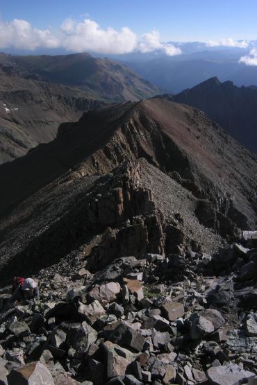
Matt waits on the spectucular ridge for the rest of the gang, and we all walk the ridge back. The ridge does remind us of a ruined castle wall, with slits for cannons/arrows, and crumbling lookout posts...
Matt prefers to take the highest path along the ridge...
Chris heads down, after passing a slit in the ridge wall...
Wendy kept saying she was feeling very "Colorado" today...
It's been awhile since I posted a scary looking pic...
We pass at least 10 people who are heading up to Castle as we descend the ridge. Good thing we started early, and got to ascend and summit all to ourselves. After we finish hiking down the ridge, we cut back down the soft gravelly slope, and pass another 10 people or so.
This part of the trail is a bit more plain compared to the ridge...
After the fairly easy descent down the soft trail, we hit the rocks and snow. Chris proposes "glissading" down, and we agree it would be a lot faster and easier and probably safer, than negotiating down 500+ feet of rocks. There was even a worn slide track in the snow, and so Chris goes first, and within a minute, is waving from ~200' below.
Wendy goes next, and Matt waits for Wendy to get her camera out before sitting in the snow and scooting forward. Having seen two previous "glissaders", successfully complete it, Matt takes it a bit faster, snow flies everywhere as he slides down.
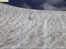
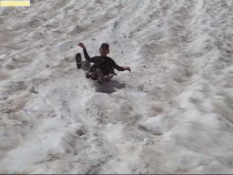
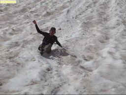
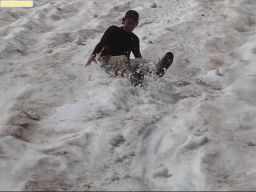
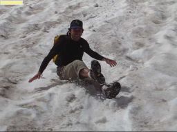
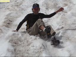
Yeah, this is August 6th, and we're sliding down snow. These last 5 pics are frames from the final 2 seconds of a video Wendy took.
In total we do three stretches of glissading, and make it all the way down to the 4x4 road with only walking a few short flat rocky stretches. It took about 10 minutes instead of a good 45+ minutes if we had stuck to the rocks. Chris vows to come back here again and do a snow ascent to Conundrum, with crampons and an ice ax. Matt volunteers to join him.
A look back at the snow we slid down. We went down the snow slopes in center of this pic...
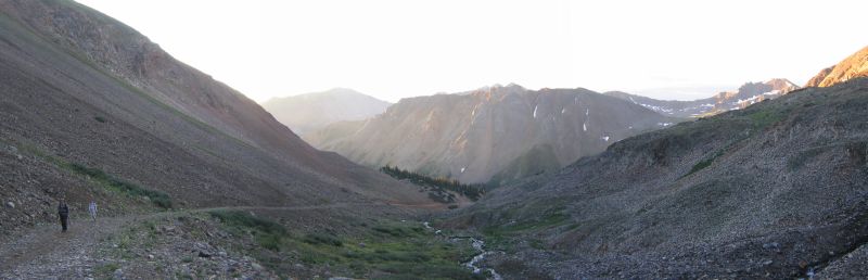
All that's left is the hike back down the trail. It's an easy walk, and most of the talk consists of real estate and loan financing.
The view back down into the valley...
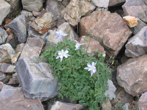
We see a Columbine flower, the state flower of Colorado...
We get back to the car shortly after noon and see some people starting the hike as we get to our car, and hope they don't run into any afternoon thunderstorms.
We load up, and head back along the bumpy road, and across the stream.
Thank goodness for Chris's monster car, which enabled us to hike this 14er...
Chris says the views from Castle Peak were among the very best he's seen in his 27 14er hikes. It certainly is a hike that shows off Colorado's vast beauty, and inspires one to seek more advenutre in it's magnificent outdoors.
We headed south from Aspen as the sun set, and arrived at the 4x4 access road for the hike. Chris's Four-runner car handed the bumpy road just fine, and we found a campsite to tent for the night. We had just enough twilight left to set up the tents with ease, before heading to sleep, excited for the early start tomorrow morning.