5 hours sleep last night. Yesterday was an easy day (if you call 3 hours hiking on ice easy), so didn’t zonk out like Tuesday. Blue skies this morning.
7/1/04
8:10am
Trollvegan rest stop
Thermometer reads 9 degrees C. Chilliest I’ve felt this trip. Filled up water bottle at spout. Took some pics.
7/1/04
11:30pm
Camping ground at Eidsal
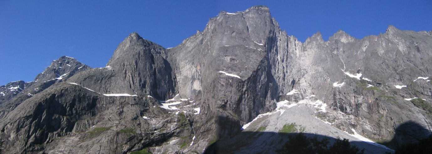
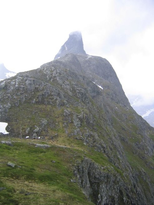
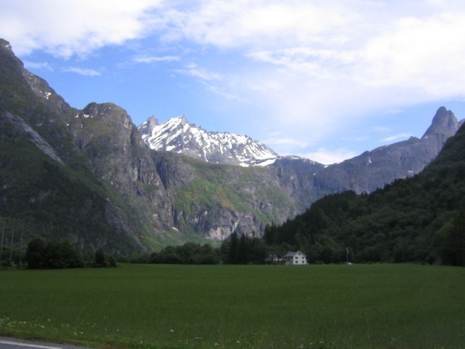
Drove to Andalsnes today, ~20km from where I slept. Passed towering cliffs of Trollvegan. There is a 3000ft cliff with a jagged ridge that looks like crooked teeth, or a little like Bart Simpson’s head. They call these oddly shaped points “trolls”. Cool looking.
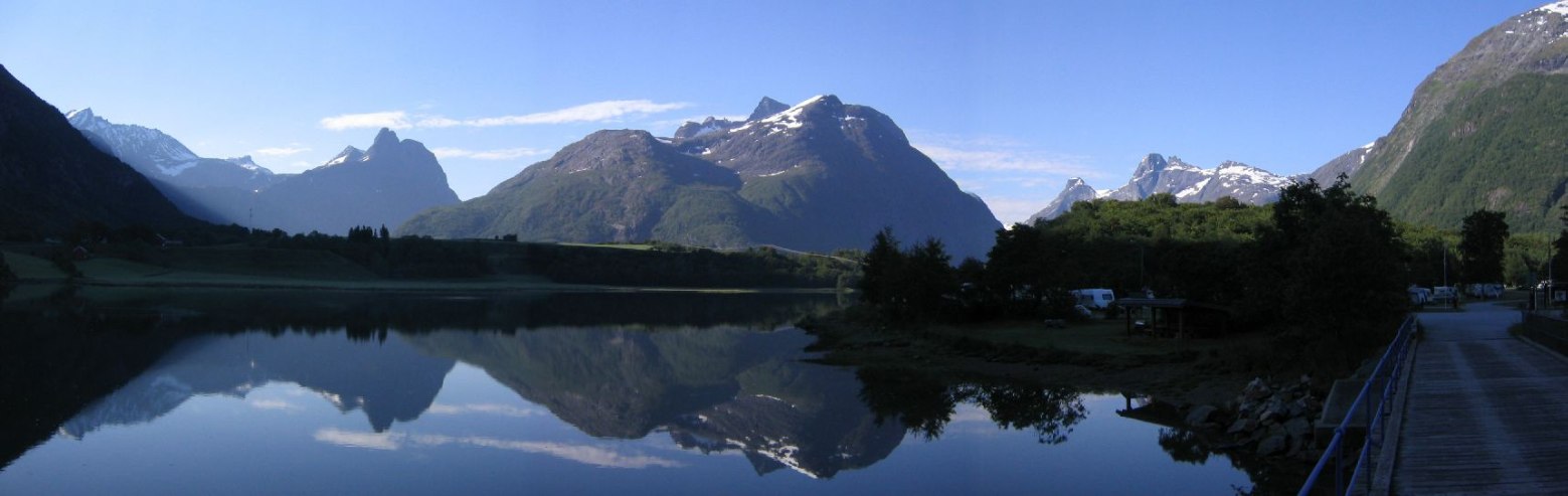
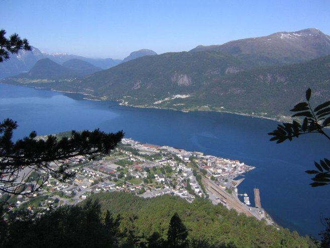
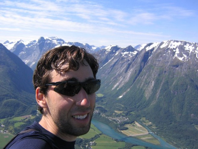
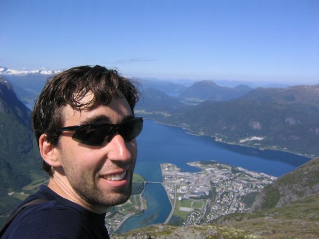
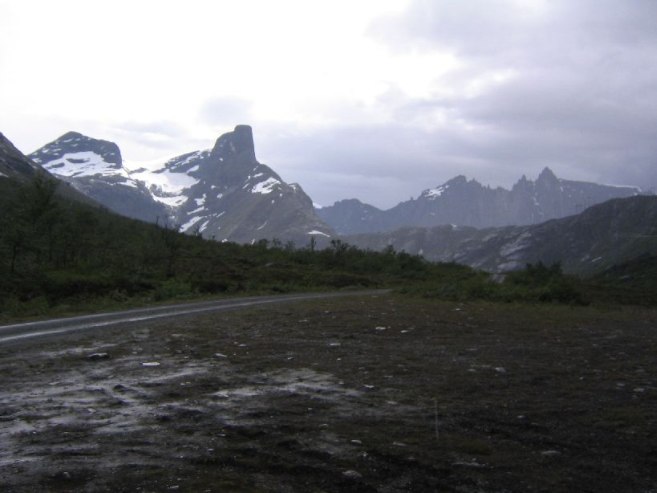
In Andalsnes, I drove to the train station, used a pay toilet, and washed up. Went to the info booth next door for info on the Nesaksla hike, which was the mountain above town. (pic taken after the hike)
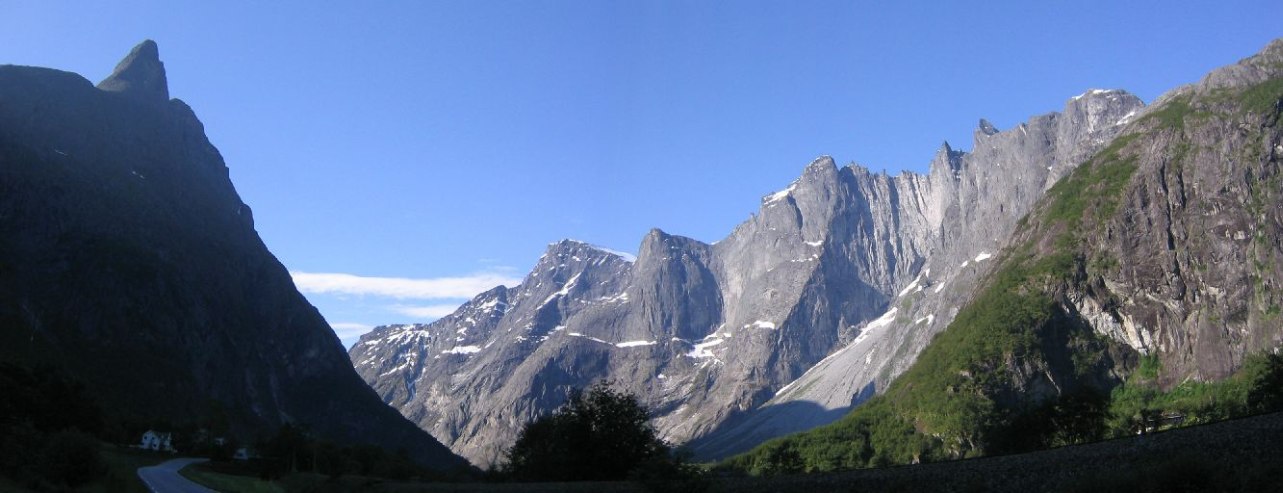
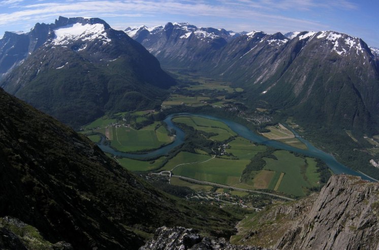
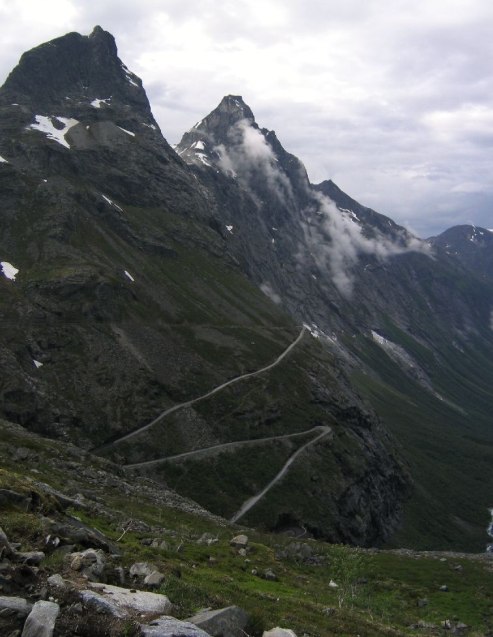
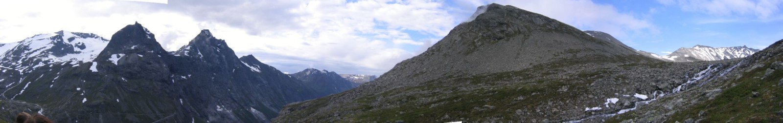
Started the hike at 9:43. A very steep climb without many switchbacks. Got to top and saw perhaps the most amazing view of my life. Saw the Trollvegan ridge, complete with trolls standing guard on top, the Trollstigen ridge, the town of Andalsnes (right on the water at 0ft elevation), and the Isfjord with white mountains in the back drop.
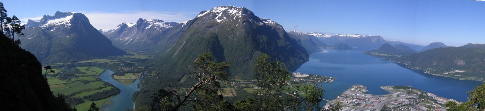
I continued to the next peak on the ridge. Figured I’d go until 11:30, and turn back to return to the train station. Followed a “T” trail down a wrong path, and cut back up to the ridge. Made it to a false peak at 11:13am, saw the real peak well into the distance, and gave it a hard shot. Total blue skies everywhere, with tremendous view of the alpine mountainous terrain. I can’t believe I didn’t read more about this hike. It’s truly one of the most amazing sceneries.
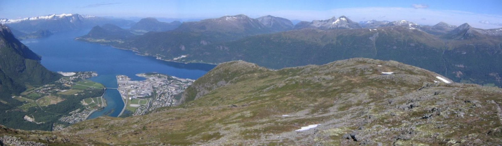
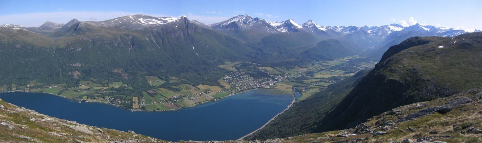
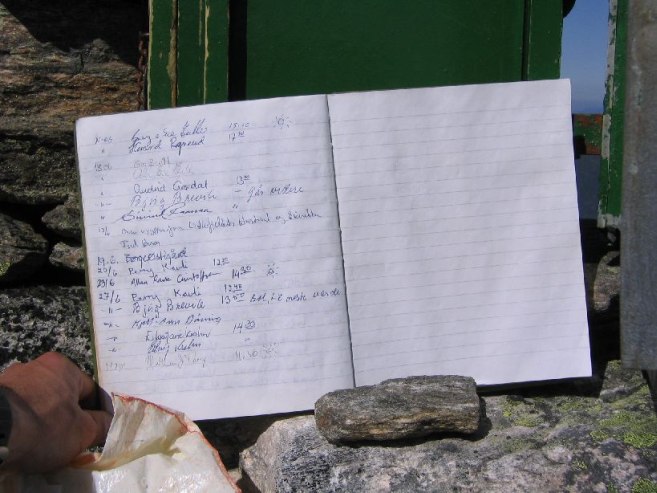
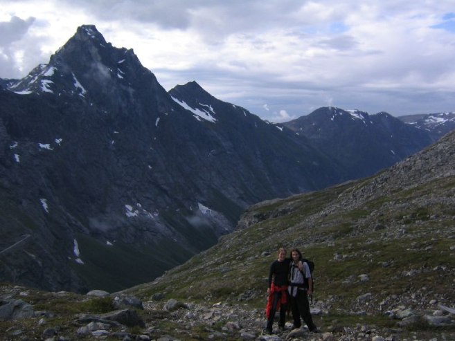
Made it to Hognosa (3280ft) at 11:30! Signed the visitors book that was kept in a box on the peak. Jogged back on the ridge. It was my kind of trail, not too steep descent, not too rocky, quick and easy for a run. I met hikers who gave me some info on Litlefjellet, the hike I planned to do later today with Karl & Mariann, and I took a picture of their map. The woman said she had a classmate who died walking on the ridge up there, and that young people die up there every year. Well, we’ll be careful of course.
Made it back to the car at 12:48. Just over 3 hours for a nearly 3300ft climb from sea level. So hot out too!
Drove to the train station. Ate lunch, and cleaned up the car to make room for Karl & Mariann. They arrived at 1:30, and had lunch, and I filled them in on my travels. Unfortunately, some clouds followed them into town, and the blue skies were moving out northwest to sea.
We went to Litlefjellet, not far from Andalsnes, though it took awhile to find the right road. Luckily the pic of the map I took on my last hike came to the rescue. Sure was helpful to have a navigator too.
We started the short hike to the ridge, and when we got to the top, we saw heavy clouds pouring over the trolls, and then huge raindrops, and we were caught off guard in the rain. A quick contrast in weather.
We dashed back to the car on the trail that was now becoming a stream. Too bad we couldn’t take in the tremendous views on the ridge, and explored a bit. The last rain drop fell just as we got to the car, and as we drove out in wet clothes with the car fan on full blast to try to dry socks and shirts, some blue sky appeared where we just were. Err…. Nature toyed with us on that one. Disappointing start of the trip for Karl & Mariann.
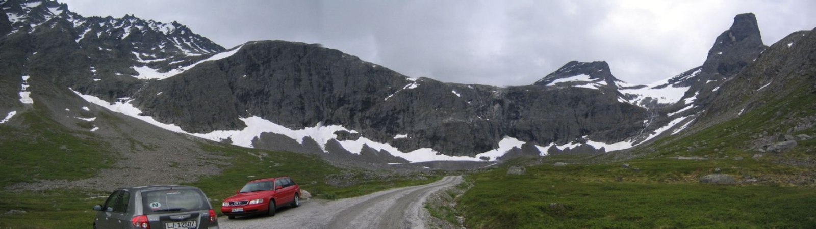
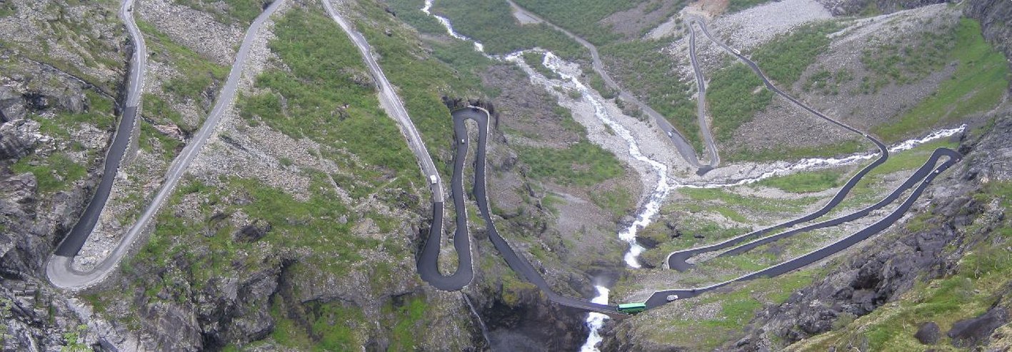
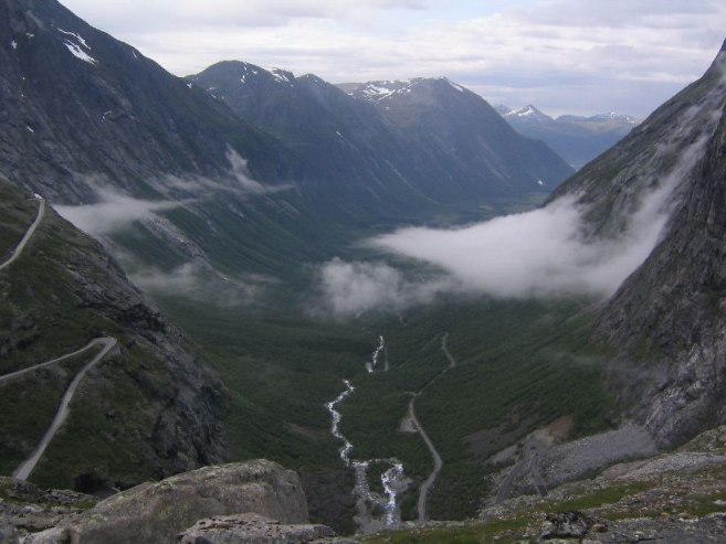
Next we drove to trollstigen, just south of Andalsnes, which is a 11 hairpin scenic road up a steep mountain, with menacing “troll” mountains on each side of the valley. As we got ot the top, a fast moving fog from Andalsnes came pouring in and we were fogged over for the upper half of the drive. Our plan to hike around here looked at risk. We waited awhile and the fog thinned, and disappeared.
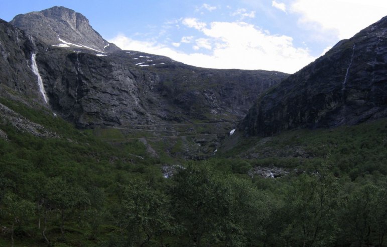
We set out to the east side of the valley and hiked up to a rock path with pretty views of the troll mountains and troll road. It almost started to rain again as we headed back.
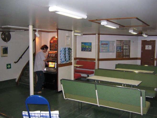
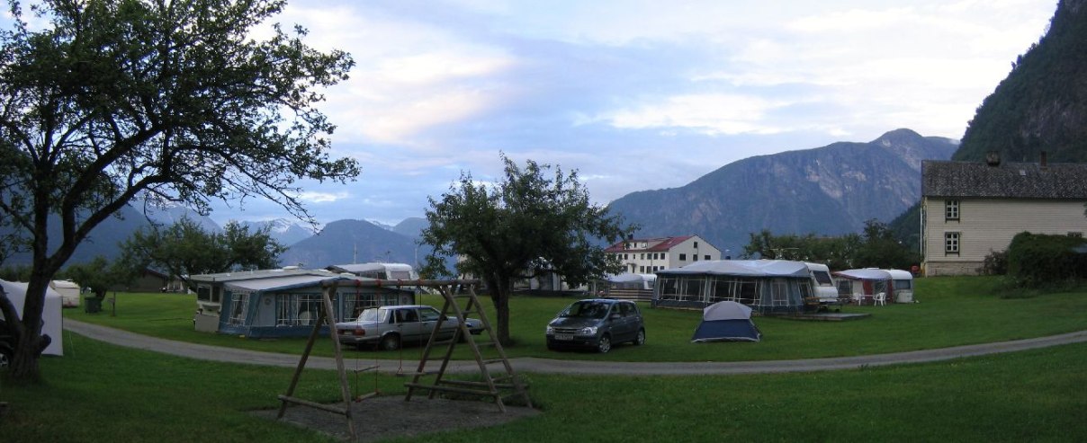
After we got back, we drove to Liege to take the ferry to Eidsal, and then find camping and have dinner. We got to the ferry port at 8:30, but had to wait til 9:15 for the next boat. Discussed plans for the next days. Then made the ferry (ferries have cafes and slot machines on board) and went to the first camp site in town. We were hungry. It was 100Nkr for a tent and 3 people. Karl brought a disposable grill and hotdogs with peppers and ketchup/mustard on the side. What a treat!
Now we are off to sleep in the tent I brought. First time used. It’s a cheap $30 3-man tent from Target, so hopefully there will be no strong storms tonight. Tomorrow the plan is Geirangerfjord, and hopefully Skala (6000ft), if there’s decent weather.
Over half way through one awesome adventure.
Daily Totals:
Distance Driven: 138km (86 mi)
Elevation hiked: 4592ft (3280ft Hognosa, ~512ft Litlefjellet, ~800ft Trollstigen)