-Stats-
Distance hiked: 20 miles
Hours on the trail: 14 hours, 43 minutes (4:06am to 6:49pm)
Accumulated elevation gained: 11600' (according to my watch's altimeter)
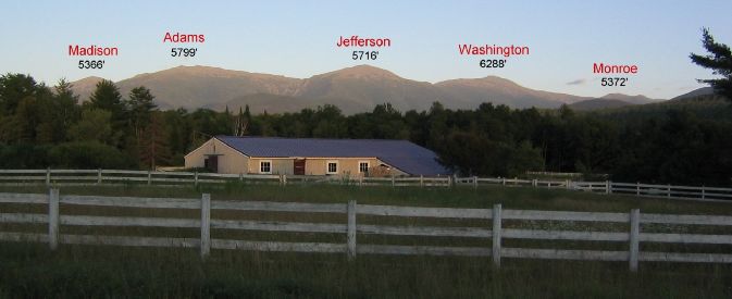
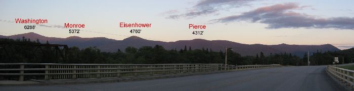
Mountains bagged: Mt Madison (5366'), Mt Adams (5799'), Mt Jefferson (5716'), Mt Washington (6288'), Mt Monroe (5372'), Mt Eisenhower (4760'), Mt Pierce (4312')
The Log:
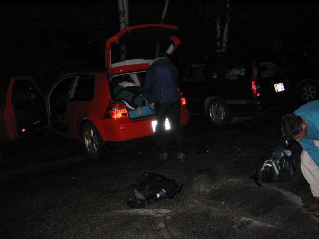
We drove up Friday night, dropped off Amit's car at the ending point of Saturday's hike, and drove my car to Gorham, NH, planning to camp in a tent. But with the heavy rain not forecast to stop until Saturday morning, we decided to stay at a hostel ~10 minutes from the trailhead. We didn't go to bed until 11pm, and planned to get up at 3am, so we could start hiking at 4am. I don't think I actually fell asleep that night, but the 3am watch alarm beeped a bit earlier than I expected, so perhaps I got a little. I was used to hiking on little sleep, so I had no concerns.
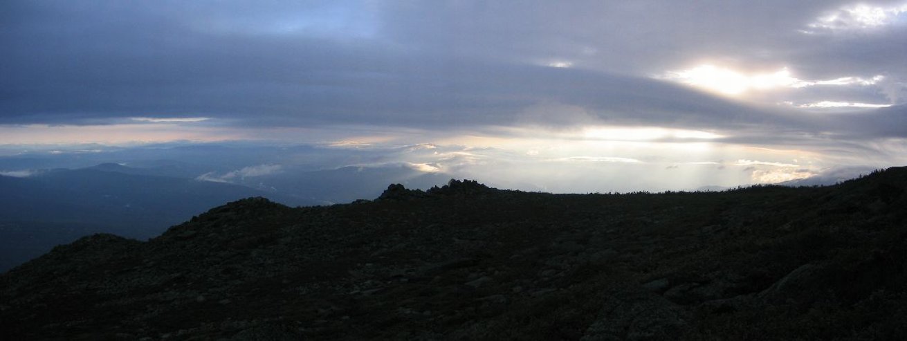
I woke up Ilan and Amit, and we ate, packed, and drove to the trailhead. The weather forecast called for showers ending Saturday morning and for mostly cloudy skies in the afternoon. We weren't expecting to see any views today. But to our fortune, it wasn't raining at 4am. However, it was still completely dark out, and we packed rain gear just in case, unsure if dark clouds, heavy fog, or mostly clear skies were overhead. At 4:06am we starting the hike wearing head lights.
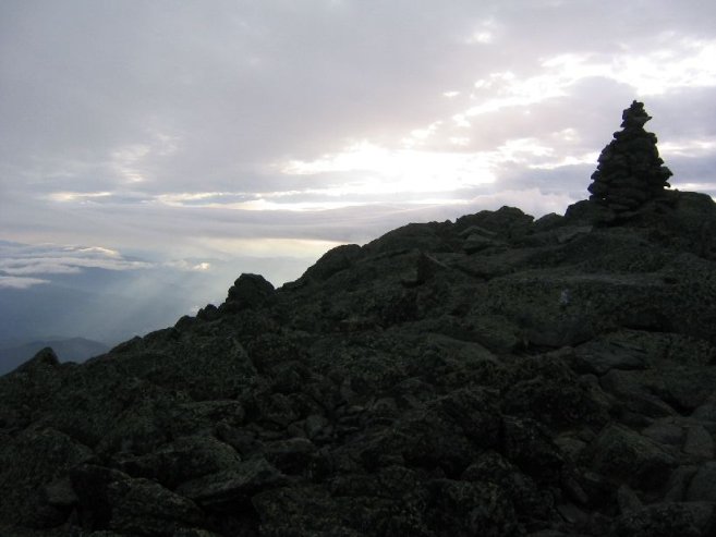
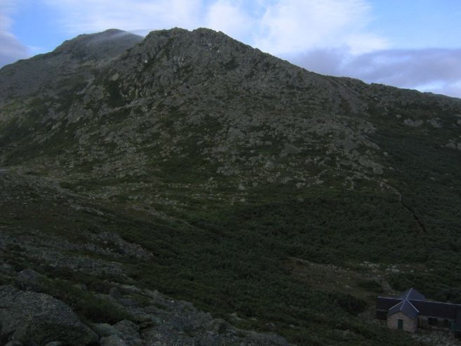
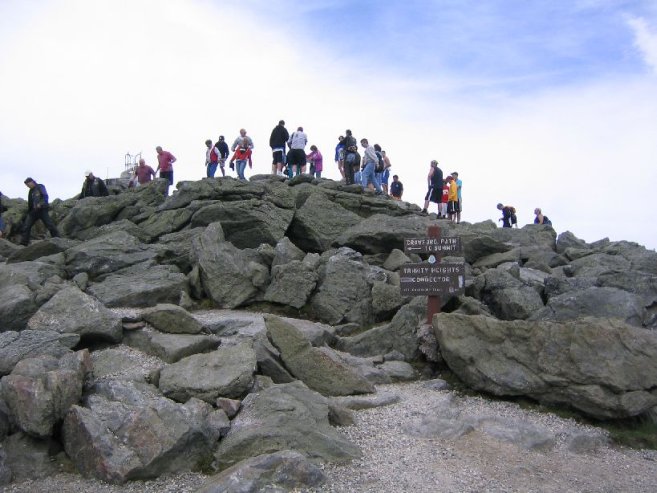
Sunrise was at 5:25am, but it was light enough at 4:55am for us to turn off our head lights. Ilan and Amit had done this hike in the past, and didn't plan on climbing Madison this time, but I wanted to hit all the peaks, so a couple miles into the hike, I split off to take a trail to the Madison summit, and would meet up with them at the Madison hut on the other side (a 2 mile detour). This trail was very steep and challenging. And eventually I came to this sign as I approached the tree line:

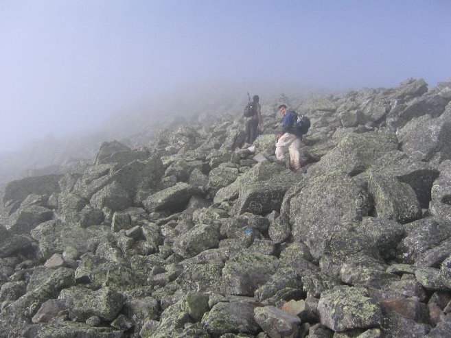
It was 6:00am, with a little wind. Surely good enough to continue on. The path became completely rocks and boulders the rest of the way up the mountain, with an ever increasing wind. Fortunately it was clear enough to see the valley and morning light breaking through the clouds. Unique to see a 6am view. I made it to the top, and the wind was howling! Strongest winds I've felt since a Boston Harbor cruise 2 years ago. Glad I brought a hat and gloves, cause it was getting chilly.
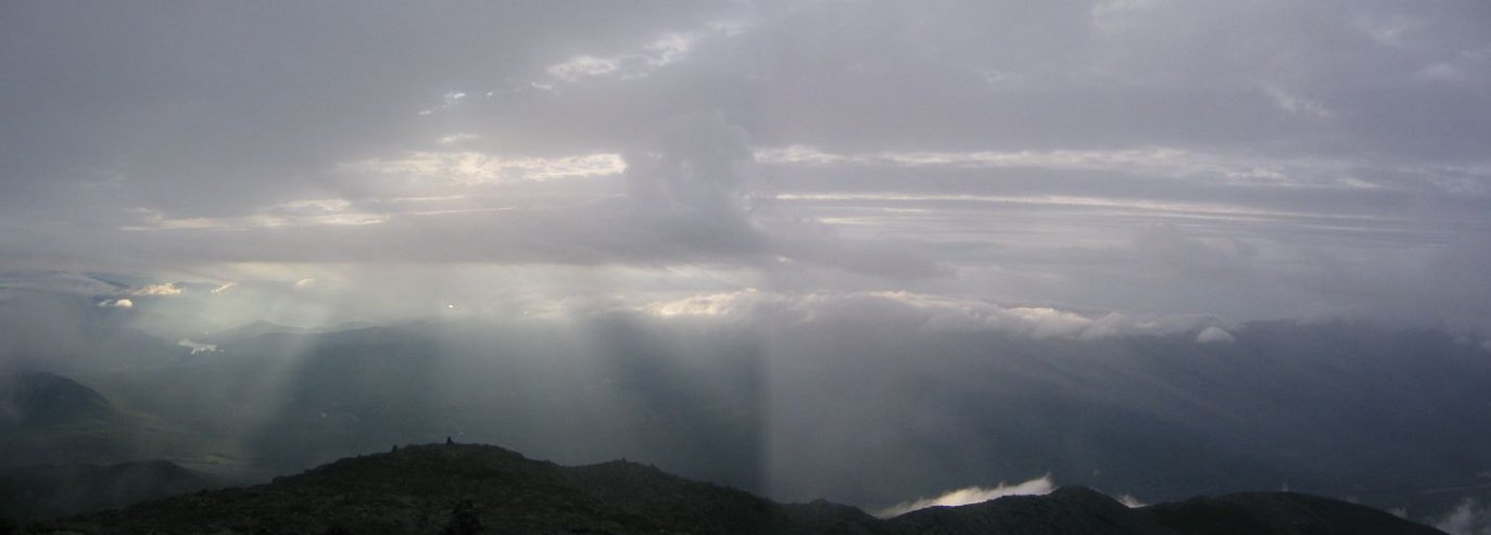
The view alternated between foggy and clear in split seconds as the wind whipped clouds up and past me in a fury. Took a little patience to get some pics. I could see Mt Adams ahead, with clouds spilling over the peak. It was slow going in the cold and wind, but soon the trail descended down a more protected side of the mountain, and I met up with Ilan and Amit at 7:06am. They had been waiting a half hour, but at 3 hours, we were on a good pace.

I later consulted my guide book and found that the trail I took "in bad weather is potentially one of the most dangerous routes in the Northern Peaks". So think twice about taking the Watson Path...
Next on the route was Mt Adams (the peak in the upper left with the cloud wisp).
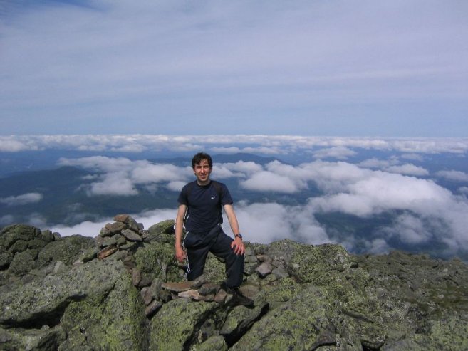
It was a rocky climb up Adams, through the cloud, and a bit windy, though nothing compared to Madison. We arrived at the top at 8:05am. The view from the top again alternated between cloud and clear, and I managed a few pics of Mt Washington, and Jefferson (to the right). It was odd to think I had summitted two 5000ft peaks by 8:05am!
After a brief snack, we descended Adams, passed Mt Sam Adams, and followed the ridge to Mt Jefferson. It was excellent having Ilan and Amit as guides, as they were familiar with all the trails. Each mountain had a trail to the peak, and a path along the side, should one wish to circumvent the elevation. Amit choose to conserve the wear and tear on his Achilles tendon and take the side route by Jefferson, while Ilan and I climbed to the top. What a view!
 (360 degree view!)
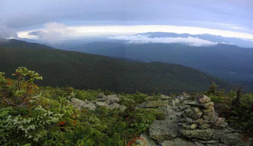
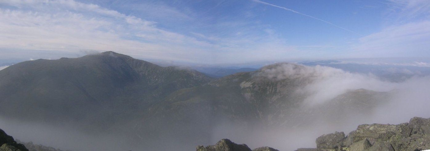
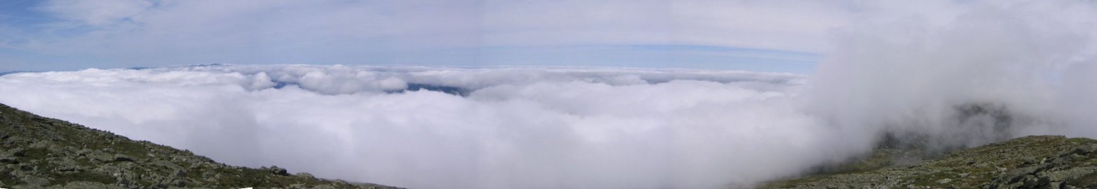
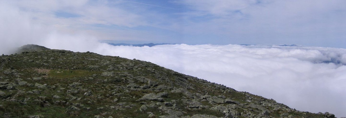
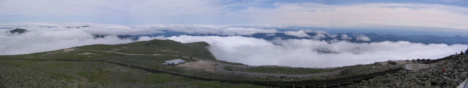
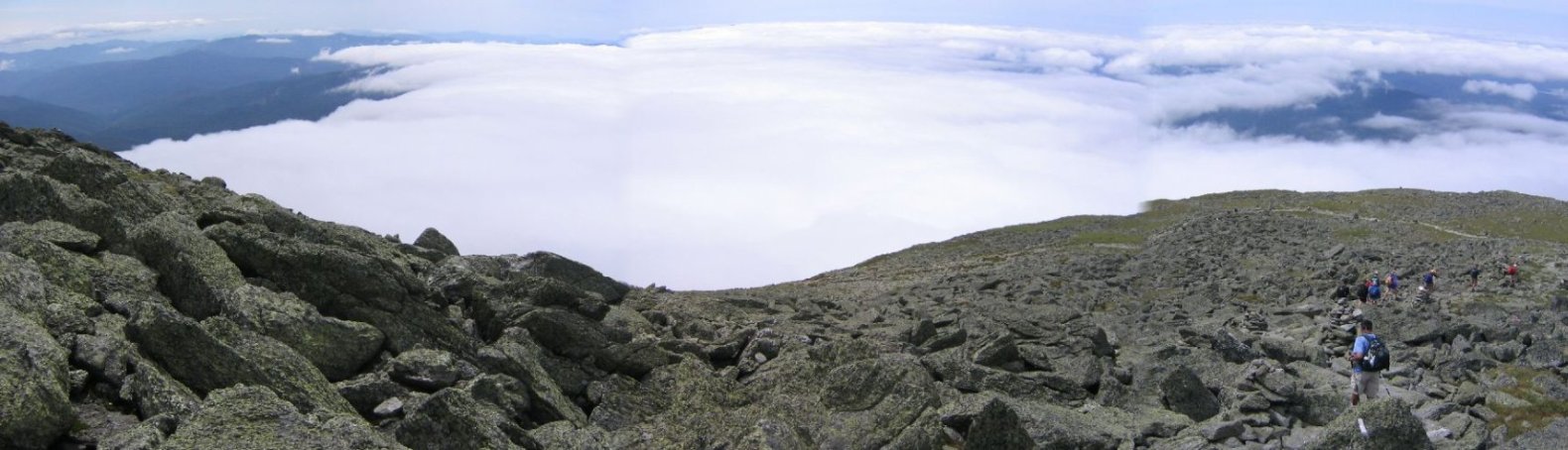
It was like looking out an airplane window. The clouds seemed about 4000ft, and we were at 5700ft. Looking back we could see Mt Adams surrounded by clouds.
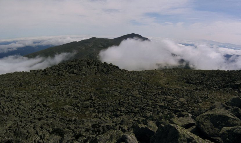

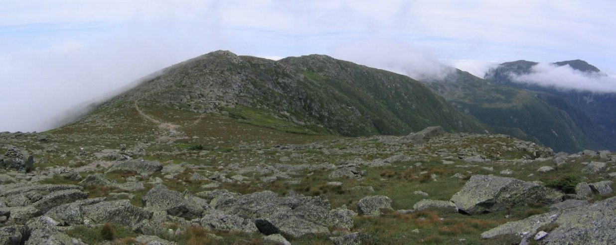
Never did we expect such fine views, and now that the wind had completely died, the weather was incredible. After relishing the view, we descended and joined back with Amit to continue on to Mt Clay (5533'), the small peak before Washington. It looked like the clouds were rising as we approached, so I ran ahead to the peak to catch some pics before clouds could over take us. Sure enough just Mt Lincoln and Mt Lafayette (both above 5000') were the only peaks breaking the clouds.
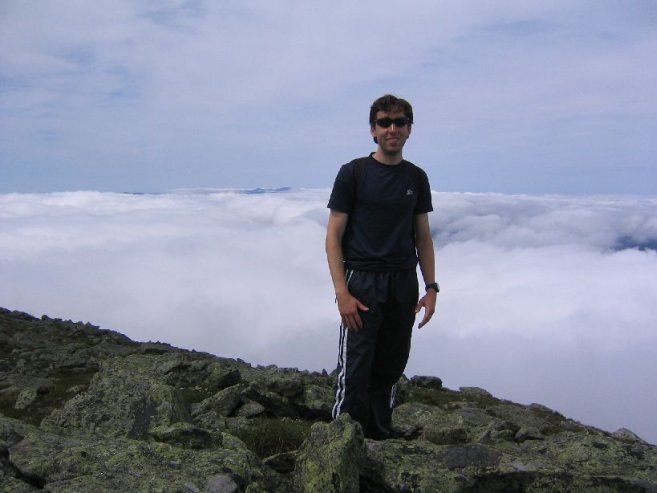
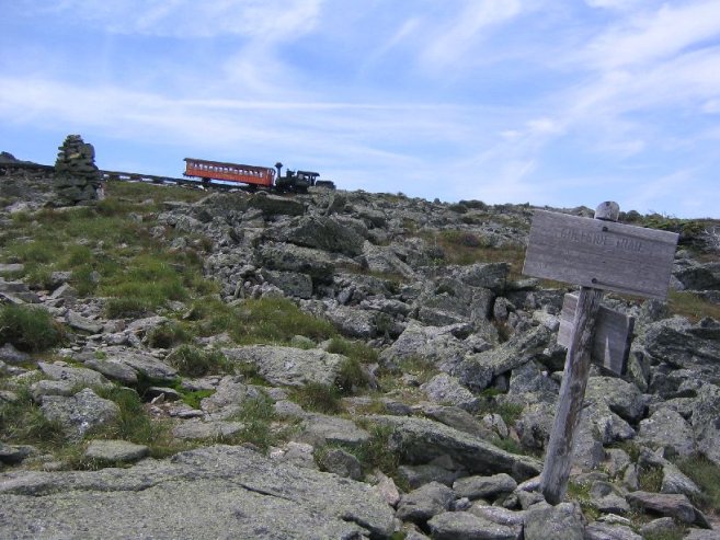
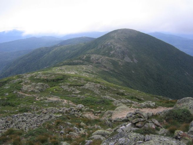
Next up, the biggie, Mt Washington (6288'), the tallest U.S. mountain north of the Carolinas, and east of the Mississippi. From a distance we could see, and hear, the cog railway cars chugging up the mountain. And looking back, we could see Mt Clay, Jefferson covered in cloud, and Mt Adams on the right.
We pushed hard at the end and made it to the peak at 12:30pm. The summit was full of tourists who took the train, or drove their cars along the autoway. The clouds had continued to rise, and now Jefferson and Adams were the only peaks poking through the clouds.
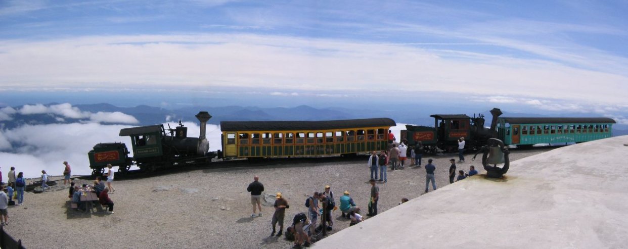
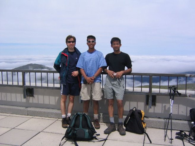
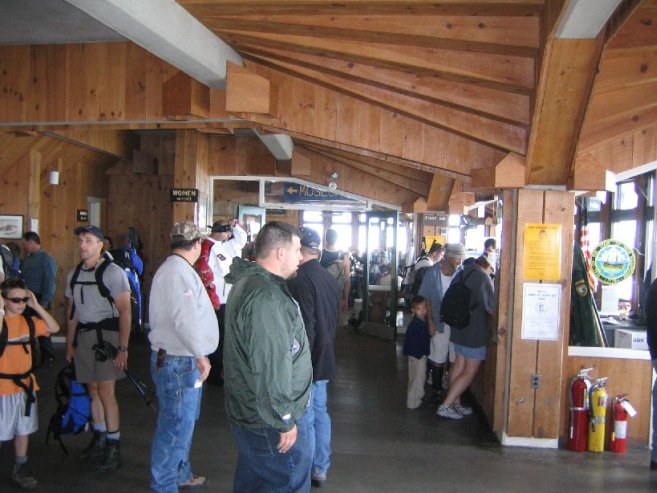
We stayed at the summit for about an hour, and ate lunch. I bought some chili in the cafeteria. It's really a small town on the summit with a restaurant, transportation system, post office, weather station, and radio tower. I didn't feel like competing with all the tourists (who primarily trained or drove) swarming the official 6288' sign to get their picture taken. There's even a 20 foot trail to the summit, and they can all say, "I climbed Crawford path to reach Mt Washington's peak!"
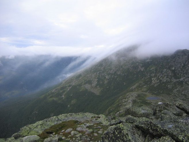
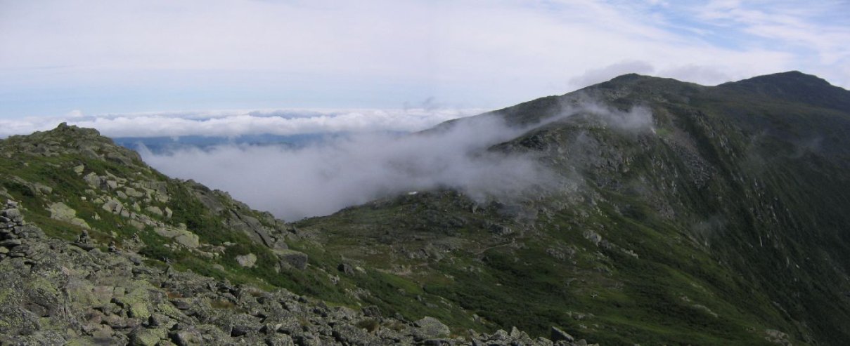
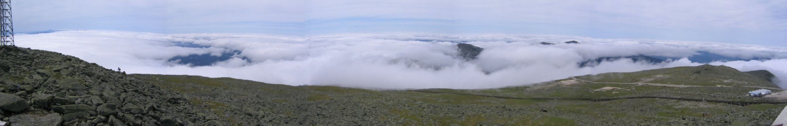
At 1:30pm we started the descent. We hiked down towards a sheet of cloud. We figured that the rest of the hike would be in the fog and clouds.
At about 5500ft, we entered the cloud, but within 200ft we came out underneath and had an open view below the clouds. We continued to Mt Monroe. Too bad we couldn't look back up and see Mt Washington.

It was around 2:45pm, but it seemed like it should be 5:45, with just a final descent to the car. But we still had 7 miles to go, and 2 more peaks. Mt Eisenhower was next on the route, the first peak with some vegetation.
We rallied and made it to the top of Eisenhower for our 12 hours of hiking point at 4:06pm. From the peak we could see Mt Pierce, our final mountain to summit.

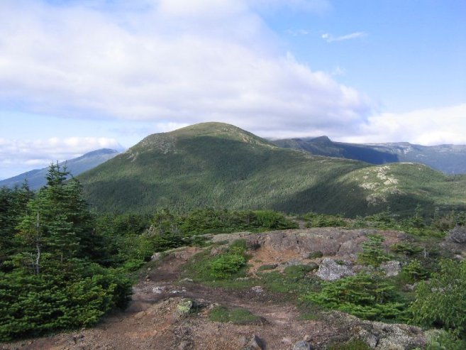
There was now 4.5 miles til the end of the hike. The path to Pierce was easy going, with just 200 feet of acent. From Pierce we could see Eisenhower, Monroe, and Washington (capped in a cloud). It was clearing up almost completely now.
From Pierce, it was a 3.2 mile gently descending hike through the forest back to the car. It took us 1 1/2 hours for this final stretch, and we arrived at Amit's car at 6:49pm. Time to relax.

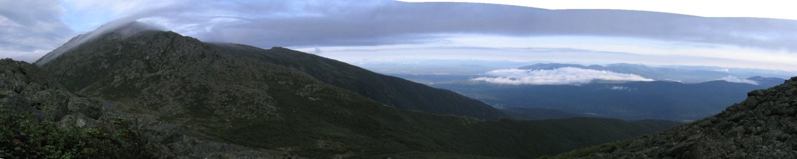
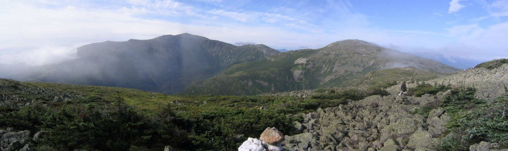
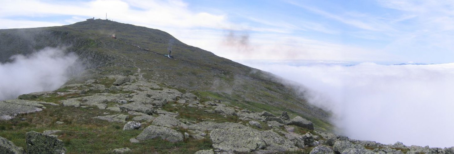
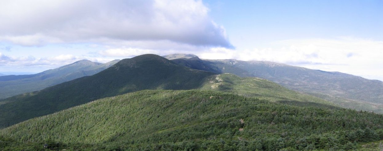
Amit drove us back to my car at the start of our hike, and we drove back to MA. I stopped to take pics of the ridge we hiked, that are found at the top of this page. It was amazing to see the long range we traversed. Quite an enjoyable and successful hike!