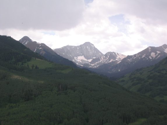
Karl and Mariann pose. We could see Capitol Peak far off in the distance to the northwest...
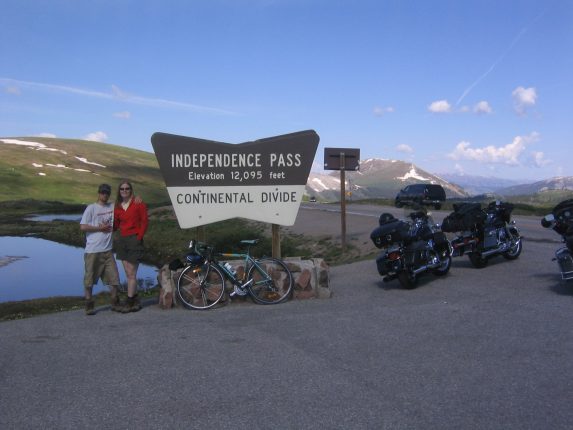
I decided to drive via Independence pass, a slower but scenic road past countless mountains and mines, and around some of the tallest 14ers in the state. Got just a couple of radio stations, and listened to a radio host argue against the firework ban in CO, and even saying that if someone were to die due to a firework accident, "it would be an ok way to go...".
Karl and Mariann pose. We could see Capitol Peak far off in the distance to the northwest...
The drive down Independence Pass was slow, and fortunately there weren't too many cyclists. It's popular to bike from Aspen to the top of the Pass. There was a parade going on in Aspen (oh yeah, it's the 4th), and we had to take a slow detour.
After a 20 minute drive northwest of Aspen, we hit the turnoff for the trailhead, and followed a dirt road. A lady with a dog was walking by, and we asked for confirmation on our destination. She said we were on the right path, and asked for a ride on my hood.
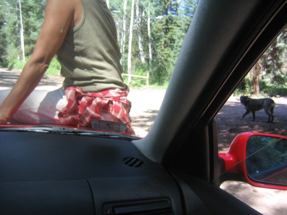
Picked up a hitchhiker on the drive to the trailhead. The dog followed in the dust behind...
The lady hopped off eventually and said the road gets rough ahead. It certainly did! It got steep and bumpy, and I bottomed-out twice before Karl and Mariann got out to lessen the load while I nervously continued up the hill. Turns out this was a 4x4 road, and my car was working hard to manage. By the time I got to the top, my engine was smelling nasty (though my temp gauge was normal). From that moment on, I dreaded the thought of driving back down when we got back. On top of that, we got our first view of Capitol looming in the distance, and looked massive and daunting.
View from the parking area (9440'). Capitol Peak (14130') is still a long hike away. Man, I sure hope my car makes it down that road ok... In fact, I sure hope my car is ok after making it up...
Zoomed in view of Capitol Peak. Man, that's a sharp looking ridge. Boy, sure hope I get my car out of here in one piece...
There were two trails to take to our camp destination near the lake, and we had read that the slightly longer path (Capitol Drift Trail) that hooked to the right of the valley was more pretty, and avoided a 400' drop that the Capitol Creek Trail took to the valley in the beginning, so we headed straight to that trail with our packs, and started out ~11:45am.
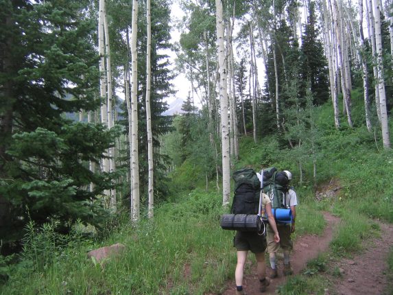
The trail hooked around the side of the valley, through some Aspen groves. The bugs were annoying...
It started raining not too long after we had started. It was just enough to make us stop and get out our rain gear, but it didn't last more than 15 minutes. We saw maybe 13 people on the trail that day, most were day hikers coming back from a hike to the lake.
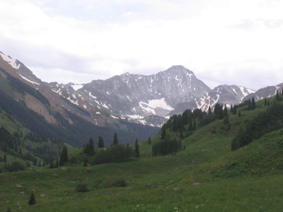
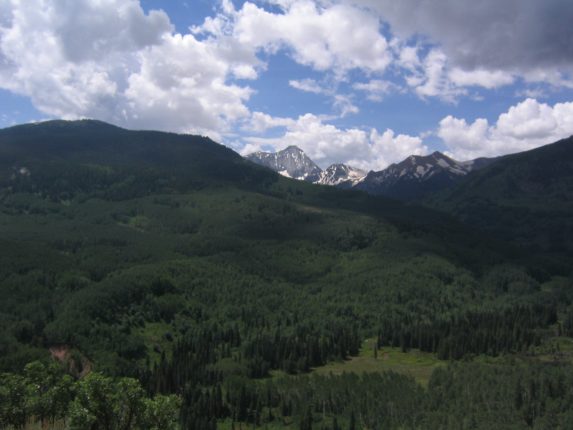
The trail stayed high above the valley, with views of an occasional waterfall, and Capitol Peak ahead. You can see this spot on the right side of the above picture (2 above)...
After 3.3 miles, the trail turned toward the rising valley, crossed a creek, and joined the Capitol Creek Trail. The flies got worse in this stretch, and every so often we'd swat at each others backpack, killing some of the 20-30 flies that were taking rides on our backs.
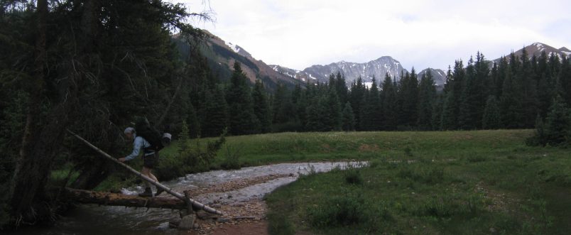
An easy stream crossing, thanks to a log bridge with a log handrail...
Wild flowers were out in force. The green vegetation here was refreshing compared to the dry brown vegetation along the front range back home. The mountains here seemed to have a lot more snow left than back home too.
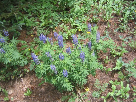
Some blue and yellow flowers line the trail...
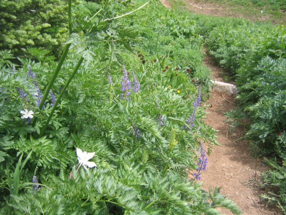
... as well as some white and red ones.
The valley started rising more steeply and the well worn trail switched back a few times. At one point I bent over to touch a small stream running across the path, and my water bottle fell out and tumblbed down the rocky stream. Fortunetly it got caught on a nearby and I scooted down to retreive it, but it very easily could have ended up 100+ ft below.
The campsites near Capitol Lake were 7.3 miles from the parking area, and soon we saw signs indicating where to camp. The trail was still rising steeply to reach the lake area.
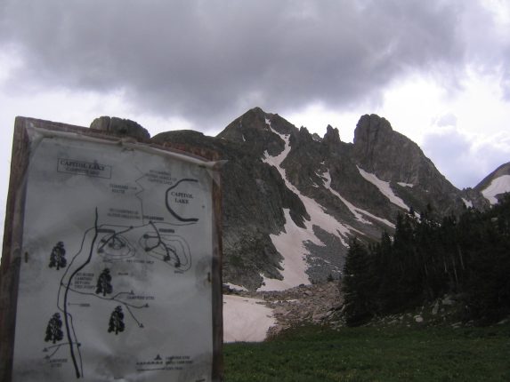
A signpost outlines the available camping locations, and some jagged rocky spurs make a cool background. Almost there...
We crossed a snowpatch shortly before we reached the camping area, at around 3:30. The camping spots are all on a knoll that looks over the valley we came in on in one direction, and straight up at Capital peak in the other direction. We find a camping area that has 2 tent spots, and set up our tents. We notice 2 other camping parties in the area, and the sites are well spaced for perfect privacy.
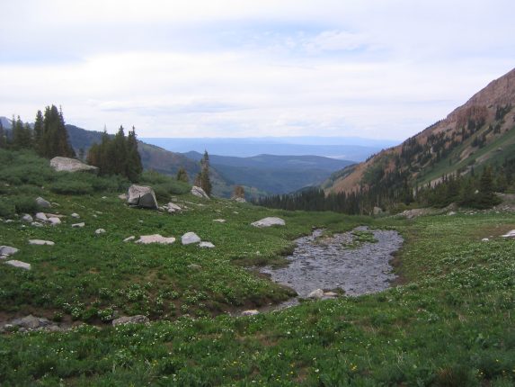
A look back up the valley. We started out on the far hill straight ahead and down the valley. Our camping site is located on the knoll rising to the left (out of picture)...
Even though we never had a proper lunch on the trail, we decide it's too late for their to be 2 meals left in the day, and so we make dinner. Freeze dried spaghetti with meatballs for Karl and Mariann, freeze dried pasta primavera for me (it was so-so).
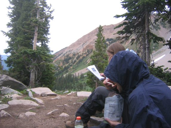
Karl chows down, while Mariann reads a trip report on Capitol Peak, preparing for what lies ahead tomorrow...
We read more of the Capitol Peak information, and it becomes clear that this is no simple climb. Many people train for this, and it is arguably the most challenging 14er in CO. Many people turn back because they take too long to make it up to the ridge, and can't risk weather hazards the rest of the way. So we decide we'll get up at 3am to ensure plenty of time to hike in good morning weather before afternoon storm threats arrive. That said, it's time to fill up the water bottles, and ready for bed, even though it's only 6pm. Karl and I hike over to Capitol Lake to get water, while Mariann stays in camp making sure a couple of "pesky" marmots don't cause any damage.
The lake is .25 mile from the campsite, surrounded by a lots of boulders. My legs, tired from a heavy pack all day are a little slow hopping over the boulders.
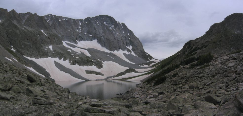
Grey skies, grey rock, grey water. Capital Lake sits at (11,600') in front of the steep walls of Capital Peak (14,130')
Back at camp we talk about our chances of making the summit tomorrow. We decide that if we only make the ridge, at a point called K2 (the high point on the left side of the ridge in the pic above, 13664') and have to turn back, it'll have still been worthwhile and spectacular. Many people turn back at this point. We're well aware it'll be a long journey to cover the ~2.5 miles to the top tomorrow, full of class 4 climbing.
We hang our food in a tree to prevent the marmots and chipmunks from snacking, and head to bed at 7pm with an alarm set for 3am. It's a bit odd to go to bed 2 hours before sunset, with birds chirping and marmots squeaking, but getting up at 5:20am and driving 4.5 hours, and hiking 7.3 miles with a heavy pack made it surprisingly easy for me. We all woke up around 10pm to the sound of fireworks coming from Aspen, and remembered it was the 4th of July. Then I went back to sleep, with thoughts of that inevitable trip back down the 4x4 road, should we survive Capitol Peak.