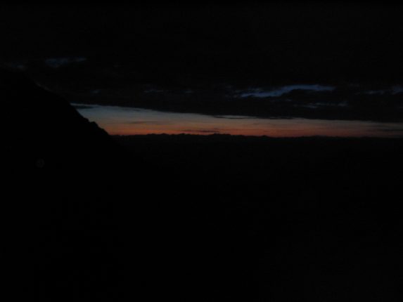
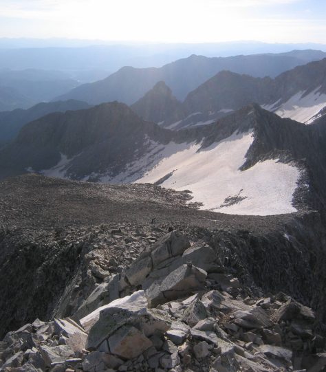
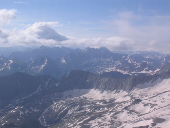
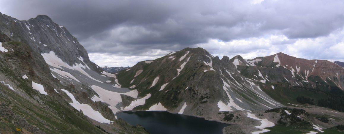
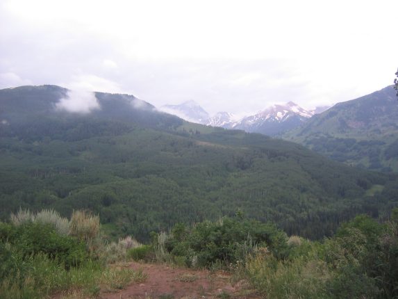
Early morning light ~5am, from the other side of the ridge...
The stars were out, which meant clear skies! The weather report mentioned a "slight" chance of morning storms, which is pretty rare for CO, so we had to be extra attentive to the weather. The afternoon forecast was "mostly cloudy with a 40% chance of storms". That usually means 100% chance of a storm, and it's just a matter of if and when it moves over you.
We had a quick breakfast, packed our bags with the essentials for the climb, and hung the food up again before leaving camp with our headlamps leading the way. It was 4am when we descended the knoll and arrived at the trail to start the climb. A glance toward the northeast sky showed a slight "less darkness" indicating the sun under the horizon. Above, the skies were now blotted with huge black globs of cloud, yielding an occasion open star.
Sorry for the lack of pictures here. They all came out as black rectangles.
So we began the climb southeastward, up a solid dirt trail that rose up 900' to a saddle at the low part of the ridge. It was a pleasant walk in the cool and still air. I kept a strong pace and found myself 100 feet above the other two silent hovering pin-points of light below. It was a bit eerie in the dark, and the unknown of what lay beyond the saddle kept me anxious and excited. I kept a constant watch on the skies, and never realized how incredibly dark and menacing clouds seem to look in the pre-dawn. Further west I saw a clearing of lighter sky against a wall of dark cloud, and tried to find movement indicating that the clearing was heading my way. It gave me shivers to think of a lightning bolt suddenly striking out from darkness, lighting up the outline of the sharp ridge above. I pondered the incredible weakness of man vs nature, and how incredibly small man is compared to the enormities of the universe (and this upcoming ridge). I also thought of how my car would be waiting to be manuevered down a nasty road, should all the upcoming battles with nature be successful. I said a prayer, and continued on...
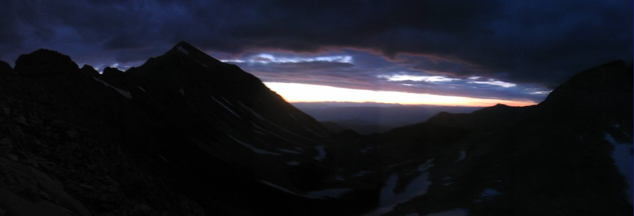
By 4:45am we had all reached the saddle and saw the faded blue/red/orange pre-dawn colors on the eastern horizon. We took a snack, and decided to continue in the dark as long as the trail was navigatable without daylight.
Early morning light ~5am, from the other side of the ridge...
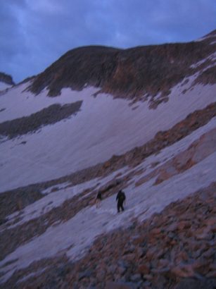
Immediately we hit a wicked looking snowfield. It was narrow, but pretty steep, and looked like a slip could put a man quite far out of the field of view. Dangit! I had left my ice axe at home. But Karl and Mariann had theirs, so they each crossed, then Karl came back with both, and I used it to safely cross the field.
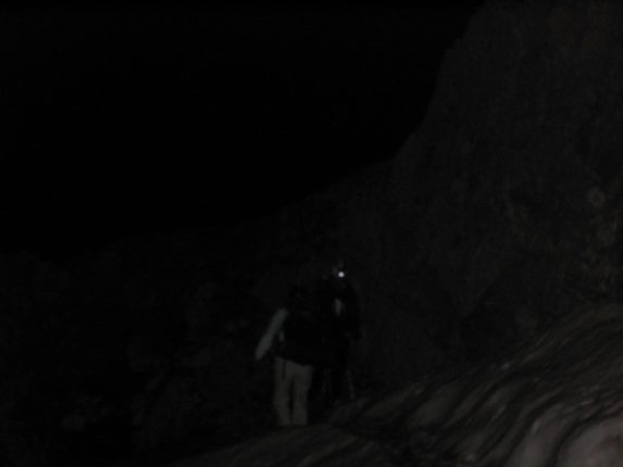
Karl readies to shuttle back an ice axe for me to use on this sloping snowfield...
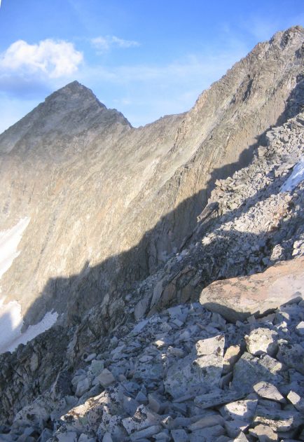
Around the next corner their was a steep rocky descent (~15') with a simple snowfield to cross at the bottom. Our first class 4 moves of the day were required to make it down. There was enough skylight to see our surroundings adequately.
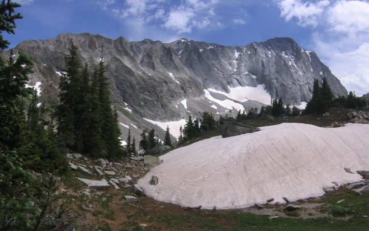
Here begins the sunrise pics. This view to the east is in the opposite direction of our trail. The clouds look dark, but not too menacing anymore...
Looking down the back side of the ridge, we saw loads of snow fields over a boulder field. But they weren't too steep thankfully. The snow was still a bit hard without the sun to soften it, so it was tough to dig in a good foothold. I used a plastic shovel in one hand, and a pocket knife in the other, and did a 4-point scramble across the snow. This crawl felt more efficient and speedy than using a lone ice axe.
You'll have to mentally stitch this one. Move the left pic down and to the right a tad. The path took us to the far snowfield on the left, and up behind the righthand ridge...
The sun was still working it's way towards the horizon, and the skies were turning golden. I rushed ahead to try to get a better vantage point for sunrise, but the opposite rock arm of this basin blocked my view. This is the best I got:
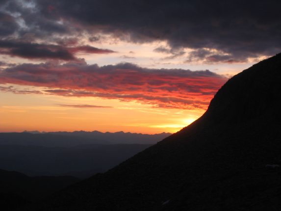
Beautiful red clouds... A more jagged ridge in the foreground would have been more photogenic, but you take what you can get...
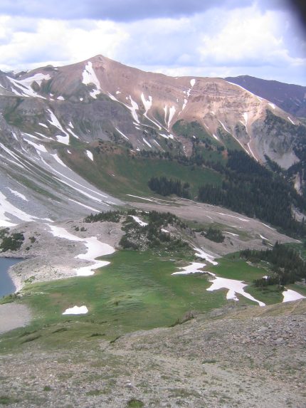
I was a little dissapointed to have an obstructed view of sunrise, but then again, it could have been cloudy. The peak on the left is Mt. Daly (13305')...
I had scrambled up a stretch of rock to try to gain elevation for these pics, and either had to go back down and cut across more snow fields, or climb a short snow field and cut over across more boulders. I chose the latter, and as I pulled out my pocket knife it caught the side of my pocket, popped out of my hand, and fell down a gap between some boulders, never to be seen again. The trusty plastic shovel was good enough, and I continued on. Karl and Mariann followed this path too.
A look back down as we continue climbing up the boulders...
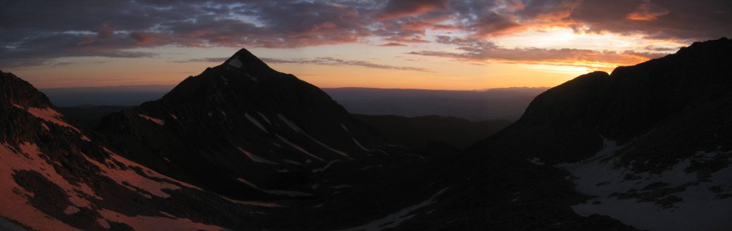
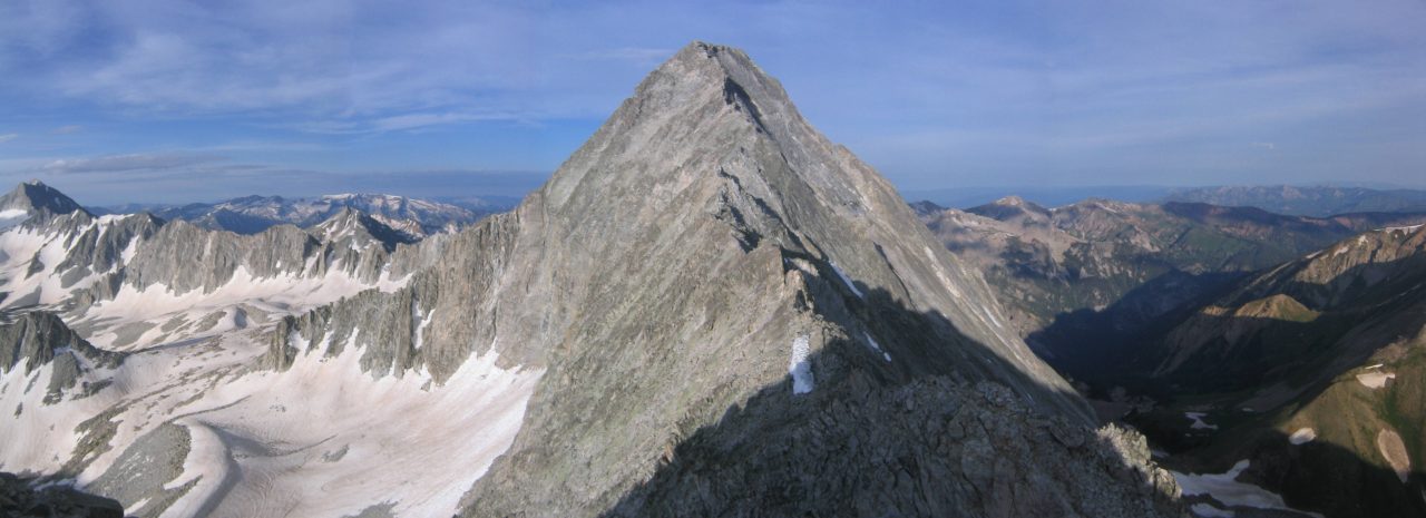
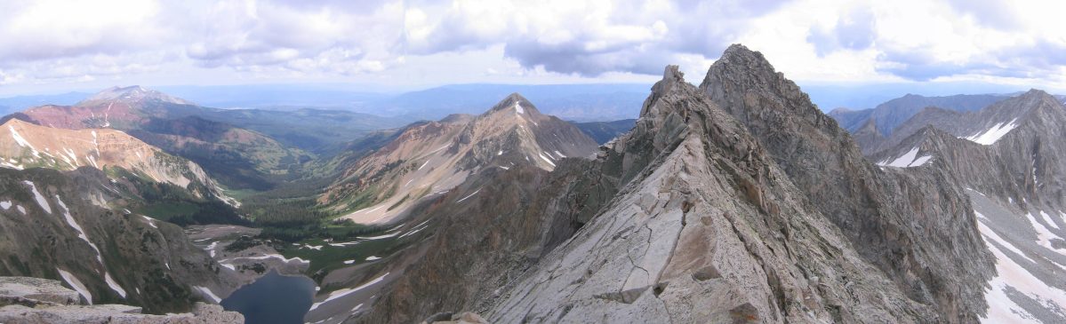
There was lots of boulder hopping that took us to a snowfield that rose to the top of a ridge. We followed the boulders alongside the snow, and when we reached the lip of the ridge, we finally saw our end goal of Capital, along with its massively sharp ridge! The boulder field continued to rise on our right up to that crazy looking ridge at a point called K2 (13664'), which is a popular "bail-out" point.
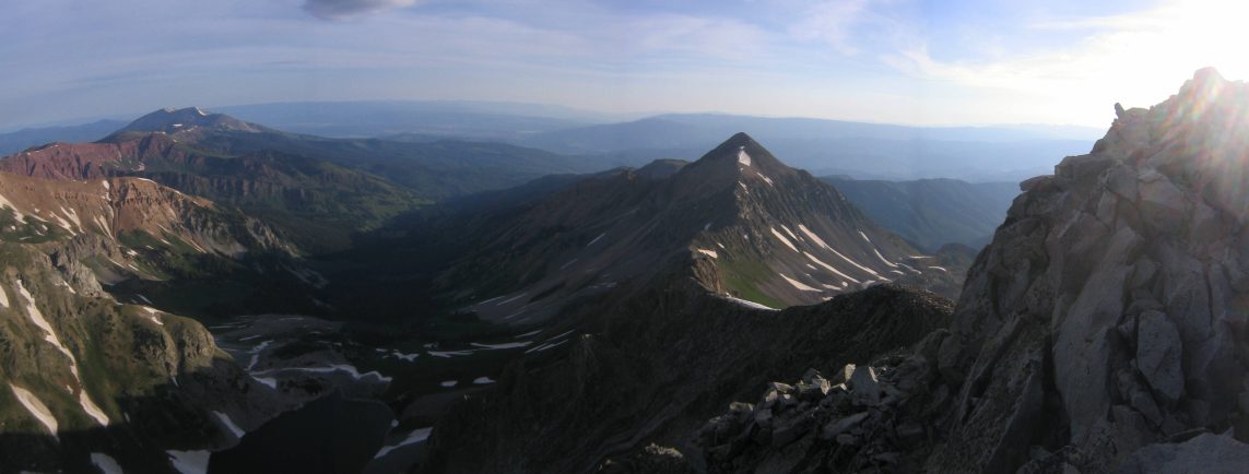
There is Capitol Peak (14130') and it's razor sharp 1.2 mile ridge that connects with K2 on the right...
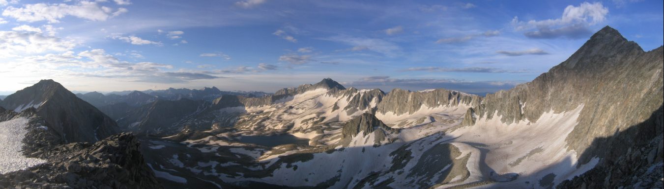
A panaramic view from this point, with Capitol on the right (scroll to the right). Snowmass Mountain (14092') is in the center of this pic...
We continued up the boulder field towards K2, and as we neared it, the rock became very steep and approached a class 5+ wall. I started to scale it, but didn't feel safe, so I explored around the left side of this peak, and found an easier but still tricky class 4 path to the top.
The sharp point of K2, where the ridge hike begins. This point of ascent was too steep...
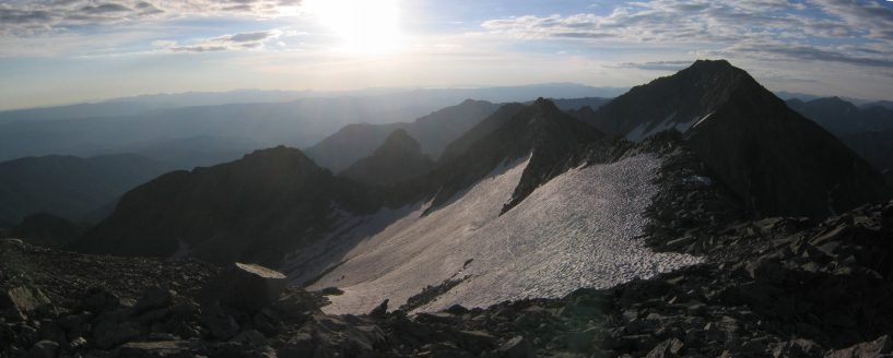
Once I got to the top, ~7:15am, I saw the ridge, and a glimpse at the valley where we started from this morning. The ridge was quite a site!
At the top of K2, which is casting a shadow on the ridge. There will be a descent first along the ridge, before ascending to Capital peak.
I looked back from the path I arrived on, and saw Karl and Mariann continuing in the boulder field. Still plenty of sun, and few clouds this morning.
A look back at the vast boulder field that narrowed as it arrived to K2...
Another view from K2 looking towards camp. We started out just above the lake, and hiked up to the ridge near the grassy spot (on the right side of the ridge), then hiked along the back of the ridge and up to K2...
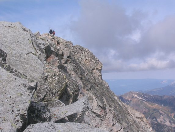
K2 is certainly an amazing location, and anyone who stops their progress here certainly leaves without a sense of disappointment, cause the views from here are awesome. I hung around up here for awhile, and decided to scout out the next part of the path while Karl and Mariann continued their quest for K2. Capitol Peak, and the ridge lay to the west, though there were signs of a trail down the north side of K2, so I followed, and found myself cutting across cracks in the rock along steep walls. I could barely reach the lower rocks when I lowered myself down (back side to the rock). It was steep and tricky to get down to where the ridge trail picked up. Later, we noticed that there was an easier way coming down the east side of K2.
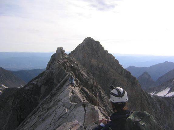
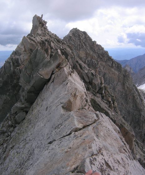
Now it was time to start hiking the ridge, and I was excited! The first thing I noticed was that K2 had an amazingly sharp 1000'+ cliff on it's west side. No wonder we had to descend via another side. I was on level with the ridge, and was very fascinated with its sharp teeth. There was plenty of climbing opportunites either up along the top, or along the sides, without too much danger. Very soon I reached the knife edge section, and waited for Karl and Mariann to arrive so we could analyze this obsticle together.
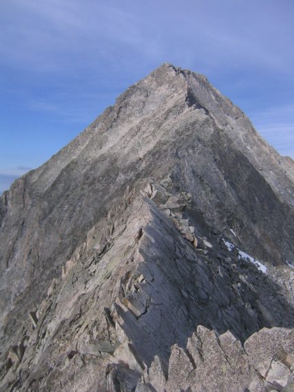
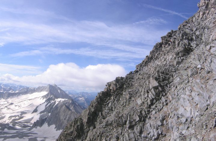
The knife edge section starts here, and runs ~100 feet...
The natural instinct response (aside from turning back) would be to straddle the ridge on all fours, and shimmy across. Karl remembered reading that some say it's easier to keep both feet on one side and look for cracks to stick your toes in, while grabbing the top and then shifting across. I went first and tried the "straddle" approach.
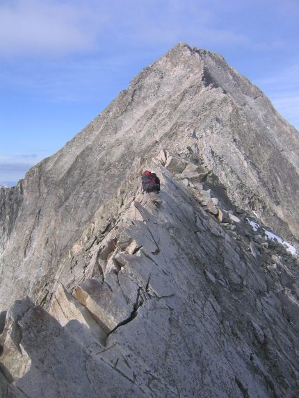
My arms got surprisingly tired pulling myself across the knife edge. Towards the end I used my legs more to crawl...
I made it across safe and sound, and a fairly out of breath. This was after all at 13,500'. Karl went next, and found success trying the "two feet on one side" approach, using cracks on which ever side of the knife edge looked best at the time. Next came Mariann, who did the "straddle" approach, like me.
Mariann scoots across the knife edge as Karl offers support. K2 is the peak in the background, which we had to descend to reach the ridge...
The knife edge was thrilling, but not that technically tough. Some people use ropes to cross it, and it takes them 30 minutes. Someone said that if you don't feel confident to do it without ropes, then you shouldn't be doing it at all, and I agree. As long as you don't let the sheer steep walls on each side get to you, it's pretty straight forward. Everyone says that if you were to fall off the knife edge, it would lead to a certain and definitive death. It is a steep surface, and if you lose ALL your holds, then gravity is gonna make it near impossible to give you enough friction to stop you from tumbling down several hundred feet of rock. However I never felt at all uncomfortable, and couldn't feel any scenario that would lead to that end. However, if the weather was wet, icy, or stormy, this would be the last place I'd want to be.
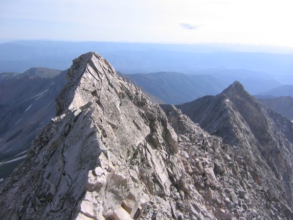
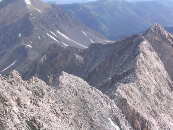
There was still plenty of ridge left and a good 500-600 feet to gain, so we continued on. The trail largely kept to the left of the ridge, though every so often the rock would get too steep on one side of the ridge, and it would cross up and over to the other side. It was also possible to hike up on top of the ridge, as it wasn't all completely sharp. It was around here where I realized that yes, I would summit this 14er. The weather was holding, and I felt that I could surely make it to the top and back before any storms.
I wandered off ahead, and decided to ditch my huge backpack, that would brush against the rock at times when I was climbing in a tight place. I felt like the only possible way I would fall victim to tragedy would be if my pack got caught someplace and threw me back. So I disconnected the top compartment of my backpack, and used it as a fanny pack, and filled it with enough water and food to make it the rest of the way and back. I left my pack near the trail and under a rock so it wouldn't disappear on me.
A look back at K2 looking small in the distance. You can see some dirt in the trail to the right of the sharp ridge...
In several places there was loose rock, and on a few occasions some small rocks under my footing dislodged and tumbled all the way down the cliff until I couldn't see or hear them. It was good that I was out in front of Karl and Mariann, and not sending stones down on top of them. The last portion of the ridge was very steep, with constant class 4 move, and wound far to the left of the ridge. I was excited to reach the top, and I abandoned the trail (which was getting difficult to follow), and had fun figuring out a route up to the top. There was always a secure path to ascend, and was happy to use my experience on the bouldering walls at the gym in Ft. Collins. I climbed quickly and reached the summit at 8:45.
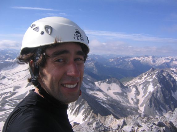
Triumph! A self portrait at the top of Capital Peak!
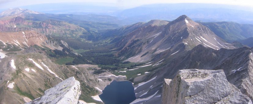
A look down at Capitol Lake, from Capitol Peak. We started the hike at 4am in this valley...
A look southeast, to the Maroon Bells (14ers which I plan to hike in Aug)...
The weather was still beautiful, and I took in the scenery while snacking on Twizzlers. I saw Karl and Mariann still far away on the ridge, and wasn't sure if they'd make it to the top, given that the morning was getting late, and clouds were starting to form. I hung out for awhile and then started my retreat, as they ascended the summit. Success! We all conquered Capitol! However there was still a long hike back, and I was starting to worry about the weather. And there was still a 4x4 road to maneuver before I could relieve all my worries.
Karl and Mariann at the summit. Clouds are starting to form...
The hike back down from the peak was steep and involved lots of lowering from rock to rock. It was a lot easier without my big packpack on.
Still a long ridge to hike back. K2 is in the upper right...
Looking back towards the south side of Capitol, near the top. Karl and Mariann are indistiguishably small in this pic, near the upper right...
Eventually I found my backpack, and continued on to the knife edge. This time I found a snug spot and took some video of the ridge, and more pics.
A view from the knife edge, heading back, eventually to Capitol Lake, below...
A pic from on the knife edge (found a nook to sit in comfortably). The jaggedness ahead shows how wild this ridge is...
The clouds were gathering more and more (see above pics), and I was anxious to get passed K2, and down into the valley on the other side. When we reached K2, we ascended it along an easier path then when we came down earlier. We took our final views of the ridge, and headed down to the boulder field. The descent off of K2 was loaded with class 4 steepness and some loose rock.
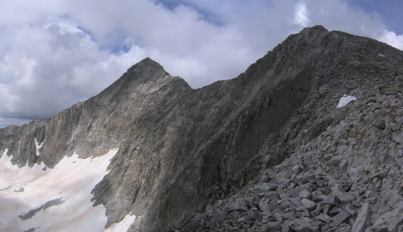
A last look at K2, the ridge, and Capitol on the left, before heading down to more boulders and snowfields. Mariann is on the very right edge of this pic...
At this point, we thought out difficulties were over, as we were off the ridge, and away from danger, but walking across lots of boulders, and slippery snowfields, with tired legs is not easy. I had a couple of slips on boulders that were near the snow (wet feet), but resulted in nothing more than some bumps and scratches. However, near the end of this stretch, I realized my nalgene bottle had fallen out of my side pocket at some point. It was too late to go back and search, as it was probably .3 to .6 miles back somewhere. Fortunately my other bottle had some water left.
There was a tough (and felt like the toughest part all day) 15' climb just before reaching the saddle, where we crossed back over to the side we started out from this morning. The clouds were everywhere now. All that was left was the descent down the steep dirt trail, back to camp.
I had seen no one else on the trail all day. Karl said he spotted a guy on the ridge, while we were at the peak, who turned around at K2 or the knife, probably cause he started out too late and the weather was turning threatening. We were the only summitters today.
Looking down the trail, back to the knoll with trees, where we camped. Didn't get to see this view in the dark this morning...
A look towards Capitol Peak (and lake), coming down the slope. Those clouds sure look bad...
I hustled down the slope, looking forward to finishing the hike, and also wary about the clouds. As I reached the floor, it started hailing lightly, ~1:15pm. I saw a couple of people on the trail to the lake, and they said that they watched us hike along the knife edge from 2000' below. They even told us the order we went in. Must have been a cool site! The hail started picking up, and I ran up the knoll and into my tent, and laid down, thankful to have not been caught in a hailstorm at any point earlier in the hike. I heard Karl and Mariann come into camp a short while later, and we all took naps for about an hour. There was one loud crash of thunder, but just rain. As I lay there, thrilled to have triumphed over the hike, I knew there was still that 4x4 road ahead, and REALLY looked forward to getting my car down safely. Until then I couldn't call trip an incredible success... When I woke up, it was sunny, and super hot and humid in my tent. I got outside to see how the weather was looking.
Blue sky over Capitol! A view from our campsite...
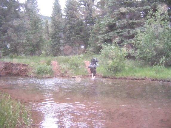
There was debate about whether to stay here for the night and hike out tomorrow, or leave now. We decided to pack up and leave, hoping our small rest would be enough for our legs have the strength to bring us back the 7 miles to the car. We left around 4pm, shortly before it started drizzling, and in 3 miles, when we got to the split in the trail, we saw tons of cows along the path we had taken on our way here. So we decided to try the path that stayed in the valley this time. We knew it was a little shorter, but had a 400' climb at the end. So we hiked along this beautiful trail, through Aspen groves, and on soft red clayish dirt, until we hit a creek crossing, and we saw that the log bridge had been cracked in half.
We searched up and down the creek, but couldn't find any other bridge or place to stone hop across. The creek was very high, given all the snow melt. So we resorted to taking off our shoes and wading across. The water was surprisingly refreshing on our feet. I found a long stick to use while I crossed.
Mariann arrives at the opposite bank. The water didn't quite come up to our knees...
We thought our troubles were over, but soon we ran into more water. The trail turned into a stream/pond. There was a beaver dam that was flooding the valley. We had to negotiate lots of mud and water. We found walking sticks, and made our best efforts to walk on branches that were lying in the water. We were wishing we had taken the other path back to the car.
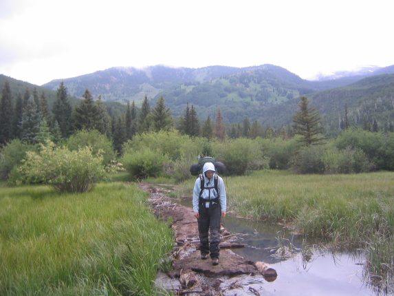
This stretch was annoying. The field and path was flooded...
But eventually we made it to the 400' climb. At this point I charged ahead, knowing the car was close. I wanted to get the car ready for its descent. Karl and Mariann would be walking down the road, to hopefully give my car a little more clearance. I kept a strong pace along the steady climb, and arrived at the car ~7:30pm, breathing hard. I saw a sign at the trailhead saying, "Bridge out, use the the Drift Trail". Too bad they didn't have that sign for reverse direction... From the parking lot I could see Capitol way out in the distance, shrouded in some cloud.
Capitol is the far peak in the center. We were at the top just 10 hours ago...
As I got the car ready, and turned it around, Karl and Mariann had reached the parking lot. It was time for the moment of truth. Karl suggested staying hard to the left on the road, trying to avoid the hole/dips. So I began the descent, with Karl and Mariann walking behind. Coming down was A LOT easier than going up, cause I could go slower and still have traction. I ended up clearing the troublesome section without any problems (the relief was complete!), and we drove into Aspen for a bite at McDonalds, before finding a campsite at Difficult Campground, just east of Aspen. We planned to visit the Maroon Bells the next day.
Capitol Peak was my 2nd 14er, and will certainly be a hard one to top.