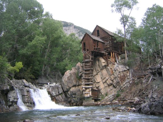
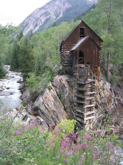
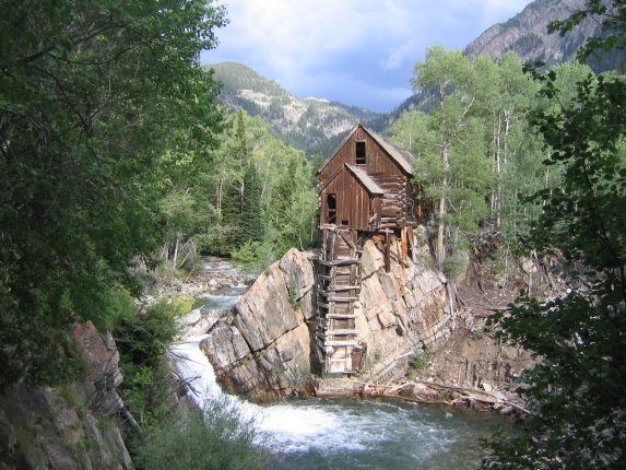
The famous mill in Crystal, CO. This mill was built in 1892, and still has it's original construction materials...
The road was paved until we got to the town of Marble. Not sure why this small old town didn't put in paved roads. This town was once a great marble mining town, and many of the marble monuments in D.C. were mined from here. There are huge blocks of white marble laying all over the sides of the road like discarded refrigerators. There was only one store in this town, "Elk Sandwich Shop", and like all the other buildings on the main road, it was made of wood, wild west style.
We passed thru town on the dirt roads, and soon began the 4x4 portion. Right away, a Hummer came screaming down at us as we rounded a corner up the steep bumpy road. Fortunately the road wasn't ultra narrow at this point and there was room to pass.
Rather than take the 5 mile road straight to Lead King Basin (our trailhead), Dave offered to take the scenic route and head to Crystal, a small old ghost town with a very famous mill that is in every CO guide book. I was excited to get a chance to see it. The road followed the river, from time to time climbing up over 100' above it (with steep drop offs along the passenger side), and then descending back down along side. The road was SUPER bumpy. High clearance is a must on this road. It made the capitol creek road that I had fretted about so much seem trivial. I rather violently bounced around in the passenger seat, feeling like I might get flung out the window down to the river if not for the seatbelt and a door handle to grab. (Note to self: Bring sandwich in car and eat AFTER traveling on 4x4 road next time).
After 5.5 miles on this road, we reached Crystal, where a surprising number of people and cars were parked near the beautiful mill sitting over the river. This was a good time to take a break and let Dave's car cool down. We had been blasting the heat with the windows down to try to cool the engine, and had stopped once already for cool-down rest.
The famous mill in Crystal, CO. This mill was built in 1892, and still has it's original construction materials...
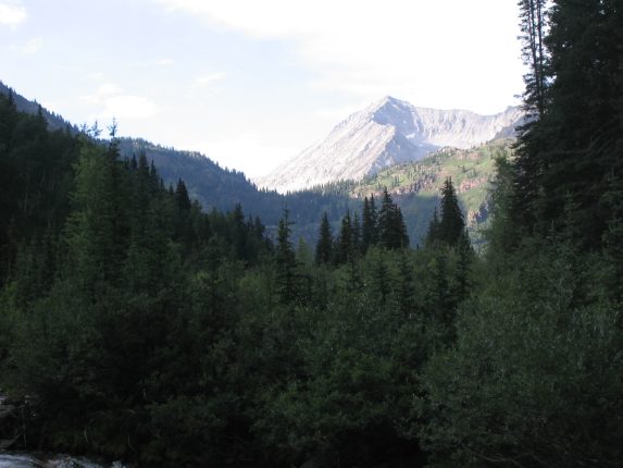
Amazing it survived untouched for over 100 years. We saw tons of avalanche gullies in this valley...
The sun came out! This must be spectacular site when the surrounding aspen trees turn golden in the fall...
It was time to finish our drive. There was a ~2 mile stretch to go, all up hill. The road was even bumpier as we headed up, and Dave had to use super low gear several times. He bottomed-out only once on the whole trip, and did a good job (along with his high clearance car). Only a couple of times did we spin our wheels and have to back up to get going again.
Dave was telling me how the person going uphill has the right of way on 4x4 roads, since they can't see the road when backing up. Yet these guys were trying to persuade Dave to back up into a 3 foot wide section of dirt that slanted up towards the cliff. It seemed pretty clear that we wouldn't be able to fit the car there, and have room for another jeep to get around, but we tried it, and didn't come close.
So we backed up past this area, and the jeep directly in front of us tried pulling into this small sloped dirt spot. They had a thinner, smaller, Jeep Wrangler, compared to Dave's (and the other Jeep's) wider Jeep Cherokee. One guy got out and walked sideways next to the Jeep with his hands on the car's roof, offering support as the Jeep tilted up on the side of the mountain. It didn't tip over, and there was enough room for Dave to pull on ahead. One down, but now two big Jeeps left.
The other big Jeep tried to do the same thing, but it was too big to fit on the tiny dirt stretch. It's butt still hung in the road. Dave drove with one tire off the road, sloping down to the valley, but there was still not enough room. It looked like it might be possible for both cars to pass each other if they both moved at the same time, as the other Jeep would pull it's back up and out, as Dave did the same thing with his car on the other side. I stood next nearby to help guide cars so that they were a few inches apart, with each car's front door alongside the other. Then they both floored it, and somehow, I still don't know exactly how, they passed each other, coming to within an inch, but not touching. Whew!
So finally we could continue off of this hillside and into the woods ahead. I was a little nervous about this "aweful" part ahead that these guys wouldn't back up into. But we saw a pull off spot immediately, and the road was not at all bad compared to what we had been in before. Man, we shouldn't have taken their word for it, and scouted up here, cause it would have been a whole lot easier to back up here.
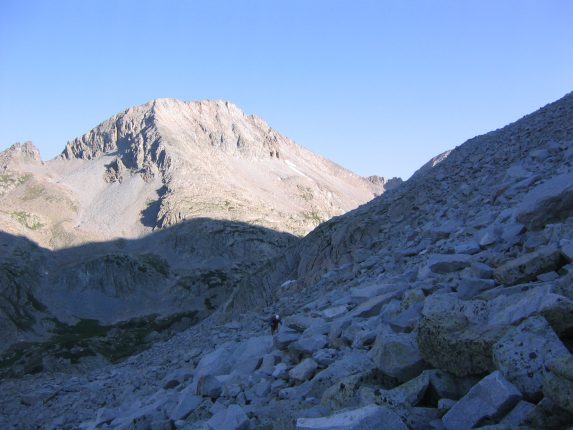
Our first look at Snowmass (not sure if this pic was before or after the Jeep incident)...
A closer look at Snowmass (kind of whited out). Notice the shadow of the S-ridge. We would be hiking that ridge tomorrow...
I had been hoping to sleep under the stars, to avoid having to pack up a tent in the morning, but decided I'd probably sleep better in a tent, so we both set up our tents under a group of pine trees near the parking area. The ground was soft with a cushion of pine needles. We started to hear some thunder, and noticed gray clouds above the mountains heading our way. We figured that we could hang out in the car if there was a storm, since these trees might attract attention. Sure enough the storm came, and we hopped in the car.
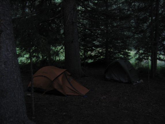
Our camping spot, before the storm came...
We were inside the car at 7:15pm, listening to the thunder and rain, then it started hailing pea-size ice pellots. We watched them collect on the windshield wipers and heard the thunder crack in under a 2 second count from the lightening. The lightening was striking around the valley. We waited, and waited. We looked at maps, re-read trail reports, tried to prep for bed, hoping the storm would let up soon. I had wanted to be in bed by 8pm, but it wasn't til after 8:45pm that the storm let up enough for me to get to my tent. The thunder was at a 12 count by now. When I got to the tent, there was over an inch of hail accumulated around our tents. It was melting and running under the tent. Yuck...
Half my tent was wet inside. I put my poncho over the wet part, and my ground pad covered the rest, and I went to bed dry as possible. It still rained, or at least dripped from the trees most of the night. Dave later likened the constant dripping noise to chineese water torture. I drifted to sleep pretty smoothly, considering the circumstances, and wondered how I could have considered sleeping under the stars a few hours earlier...
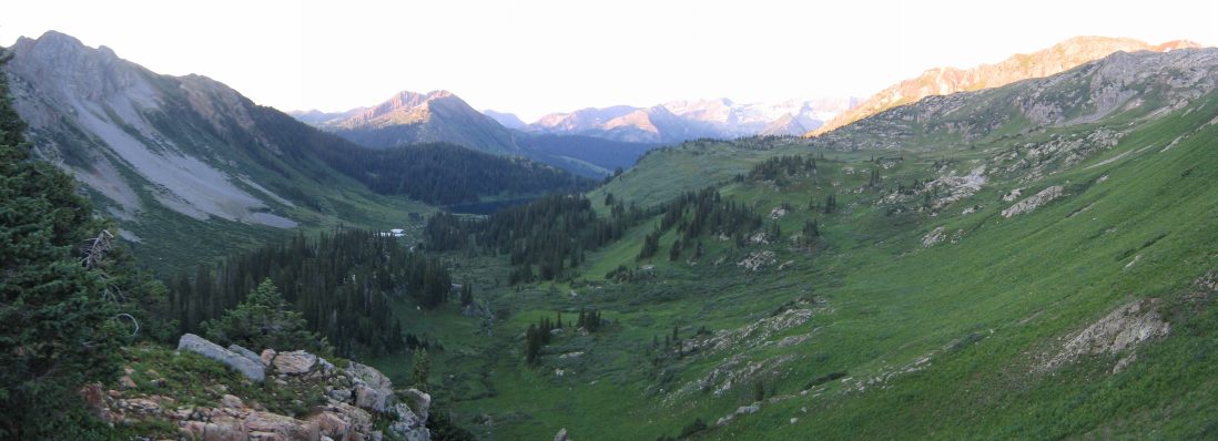
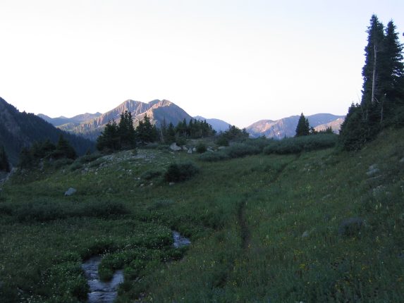
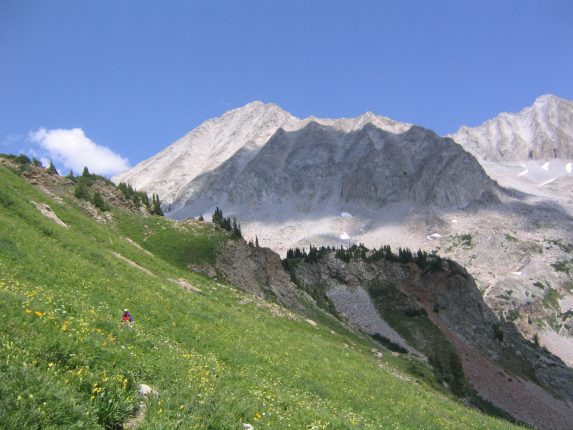
It took us about an hour to break down camp, eat, and ready our day-packs. It was 5am when we left the parking lot to begin the trail. It would be 8.8 miles roundtrip with 4400' elevation gain today, assuming we didn't get lost. The first 2 miles would lead us through this lush valley, up past a couple pretty lakes until we reached the rocky base of Snowmass.
I lead the way, and instantly noticed that the vegetation along the trail was heavily wet from the storm last night, and hung across the pathway, brushing up against our legs. I had on pants, and thought that they would keep me dry, and didn't consider it a big deal. But the vegetation got thicker and it was like plowing through a guantlet of wet bushes. My pants were soaked within 15 minutes.
The waterproofing on my shoes was powerless against all the water running down my legs into my socks and shoes. Within 20 minutes, my shoes were water-logged. I might have well just walked thru a stream. Every step was filled with the annoying sensastion of water filling the bottom of my sock as I lifted a foot, and then feeling the water squirm thru my toes and around the inside and outside of my arch, back to the top of my foot, as I stepped down. Repeat 1000 times... There was no sense stopping to wring out my socks until we cleared the vegetation.
We gained some elevation along the valley, and caught a glimpse of the Maroon Bells silohetted against the morning sky.
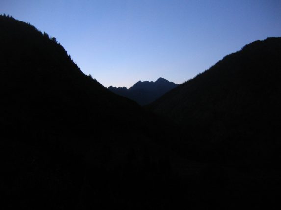
A look east, toward the skyline of the Maroon Bells, prior to sunrise...
In a little over an hour we passed Geneva lake, and continued up towards Snowmass. We began to see the wildflowers as the skies lightened. We also saw a deer and fawn along the trail.
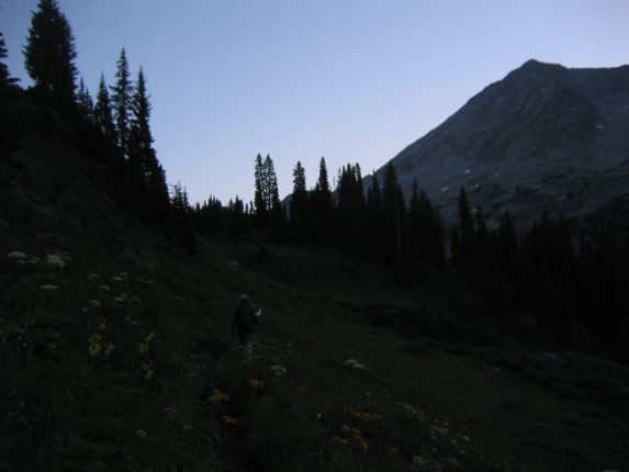
Dave takes the lead. Snowmass dominates on the right. Some flowers are becoming visible with the increasing light...
After reaching Little Gem lake, we stopped and were ready to head towards Snowmass for the rock climb. We spent some time ringing out our socks (and shoes even), before scouting out the best creek crossing, to reach the rock climb. We had to descend about 200' to reach the creek.
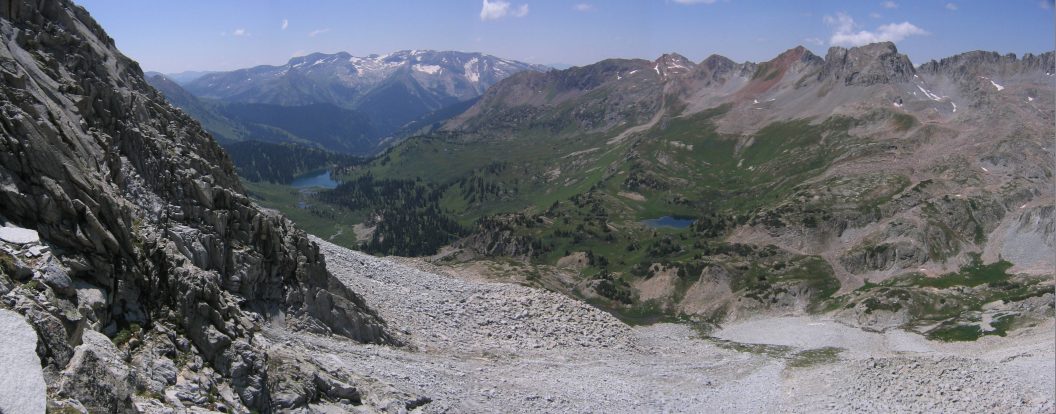
A look back down the valley. Geneva Lake can be seen towards the middle...
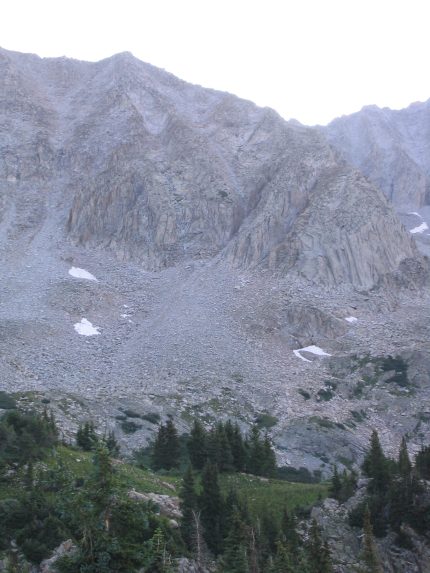
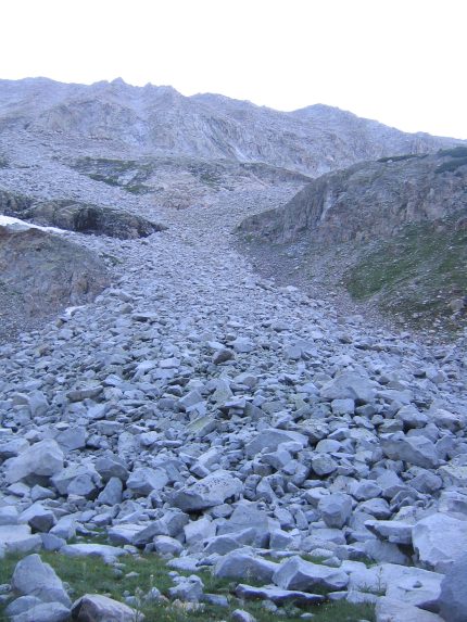
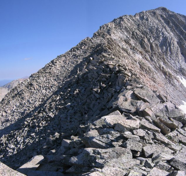
A look towards the ridge we would be climbing. Notice the gulleys on the right. We would need to climb to the ridge through them...
A small stream crossing before we stopped to wring out our socks...
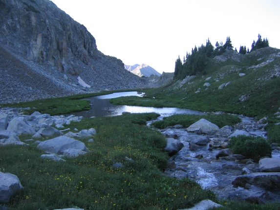
The bigger stream we had to descend down to, and cross before beginning the rock climb...
A look up to the top of Snowmass. Still 2600' to go...
Once we crossed the creek, we started climbing the boulders, and had to work our way back south to reach the gulleys that led to the S-ridge. Perhaps we should have looked to cross the stream earlier to avoid this backtracking. Now began the serious climb. Eventually we reached the couliers that we had read were the best place to ascend to the ridge.
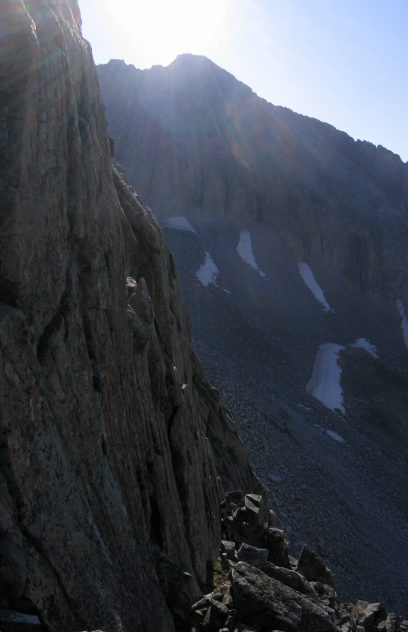
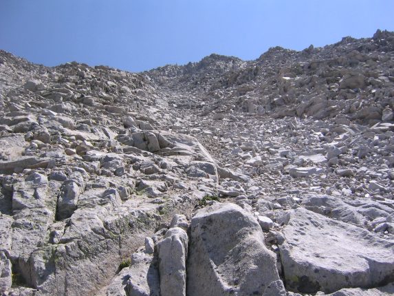
These gulleys are the gateways to the ridge. We read that the one on the right was easiest to ascend...
A look back at Dave working his way across the rock...
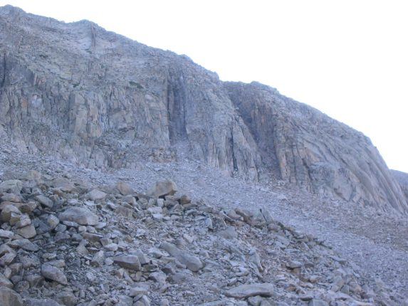
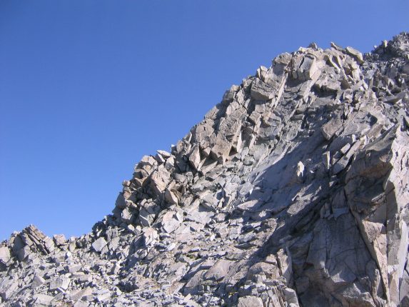
Here is the opening of the right most gulley. Dave ascended on the right edge, I on the left...
Climbing up the gulley was strenuous, but no more than class 3. The rock in the middle was loose, so staying near the edges offered better support. When I reached the top, I saw the sun for the first time today.
After rising to the ridge, I'm greeted by the sun...
Once on the ridge, the fun began. It's much easier to climb along the top of the ridge, which is the top of the huge rock pile that makes Snowmass. And the views are amazing. This ridge was pretty solid on top.
On top of the ridge, looking back down at Dave, and the valley we hiked...
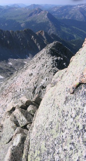
The ridge had some sharp points and exposed dropoffs, but they were easy to avoid...
Climbing the ridge was very enjoyable, and I worked along the top as much as possible, opting for class 4 moves, over simpler class 3 bypasses. There was time to enjoy the ridge, and I moved fluidly over the ridge, careful to keep my weight spread out across multiple rocks, just in case.
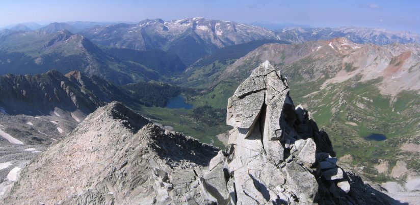
A look up the ridge to the top of Snowmass. Still plenty to go...
At one of the bends along the "S" in the ridge, there was a steep buttress, with a notch to the left where the easiest path lies. Since I was ahead, I decided to take my time and try climbing the buttress along the ridge. It was probably the hardest part of the climb, with some exposure to the east, but there were enough holds to make it up.
The buttress at the curve on the ridge. It's a tough climb to stay on the ridge, but there's an easier path in the notch to the left...
A look back down the ridge, after passing the buttress...
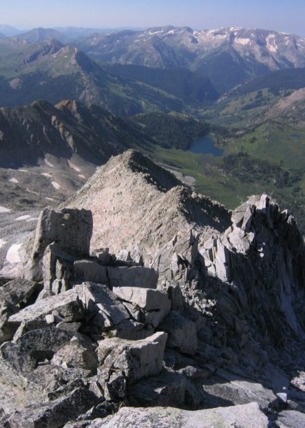
Another look back. We hiked along the entire ridge in view...
This ridge line wasn't a gradual slope, but would consist of pitch to climb, and then a short flat part, followed by the next climb. After an hour I wonder how many different class 3/4 climbing sections I'd hit, and thought it must have been 15+. It became routine.
The Maroon Bells popped up behind a ridge to the southeast as I gained elevation. Pyramid Peak is on the left...
On two occasions, big warning signals flashed off in my head during the climb, and I realized that it was when I'd start to use both hands on the same rock. Instantly I felt great danger, as this meant my safety was about to be based one rock. I guess I instinctively always distribute my holds on as many unique rocks as possible, which keeps me feeling safe. It's important to never rely on just one or two holds (including feet), so that if one fails, the others easily support you.
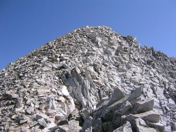
Finally, the top of Snowmass is near. Just a big pile of rocks after all...
The final stretch was easy boulder hopping, and I quickly reached the summit at 10:25am, anxious to take in the view to the north, where Capitol Peak lies just 5 miles away. I hiked Capitol earlier in the month, and was curious to see how sharp the ridge looked from here.
I saw a bunch of other people on trails from different directions, and plenty of people had signed the register already.
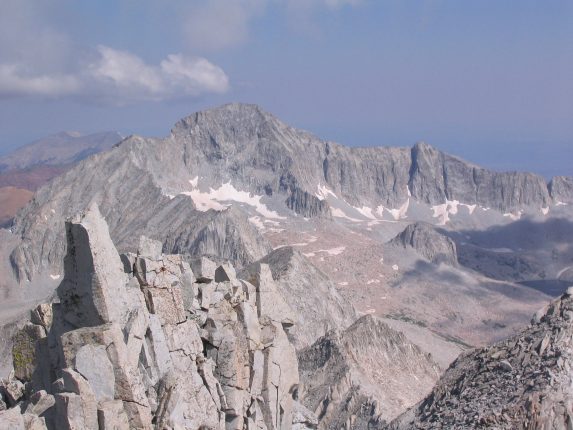
There's Capitol Peak (14,130') to the north, and the sharp ridge to the right leading to K2. With binoculars, I saw some people on Capitol's summit...
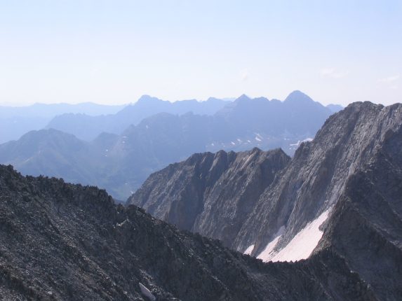
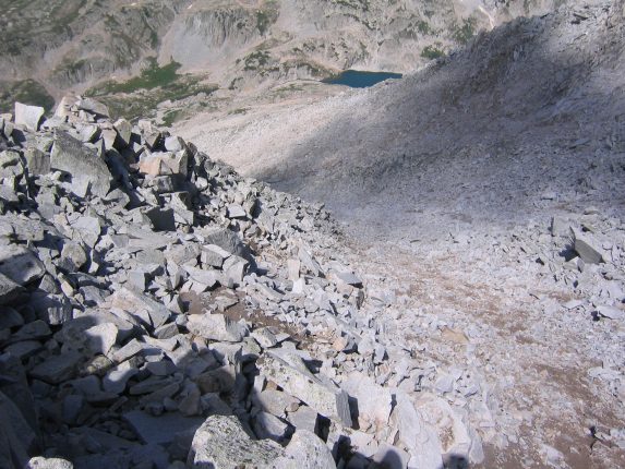
To the east was Snowmass Lake. The easiest way up Snowmass is via this direction. It's a 16 mile round trip hike with the final ascent coming across this snow/rock field. It usually involves backpacking in and camping at the lake in order to summit the 14er in the morning before the storms. I could see many people hiking towards Snowmass from that direction. Gotta love the solitude of the S-ridge though. We were the only people to use it today.
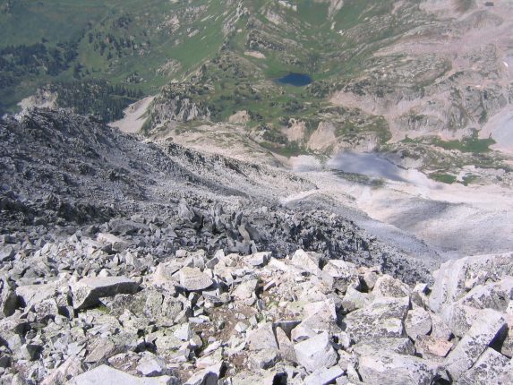
A look east to Snowmass Lake. This side of the mountain is covered with snow all year, and gives Snowmass it's name...
Dave soon joined me at the top, and we had some lunch.
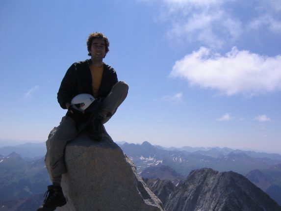
Me on the VERY top of Snowmass, a six foot rock at the top...
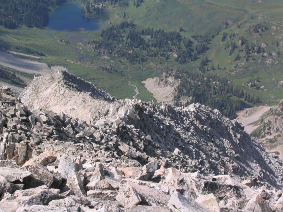
A look back down the windy S-ridge. We were it's only travelers today...
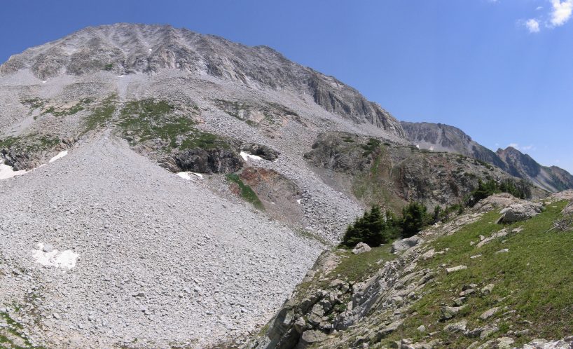
It was time to head down, and we decided to try the west slope, which is supposedly an easier path down than the S-ridge. At least it's more direct. We could look straight down the mountain and see the entire path. Looks like lots of loose rock ahead...
That's 2600' of rock to scoot down now, back to where the stream crossing is...
So we found an arm in the slope, and hiked down along side it, where the rocks were a little bigger and more stable. There was lots of loose rock over loose dirt, which made footing difficult. Too bad there wasn't snow here to just slide down.
Hanging next to the edge of this rock arm. Too bad there wasn't snow here to slide down instead...
Not too far down the mountain, I heard a some rocks shifting far above, and heard Dave shout, "Rock!", and I watched a (small) watermelon sized rock tumble down the slope along the middle of the gulley. I was still hard on the left, and was no where near danger. It's important to keep distance and avoid crossing paths under someone.
A look back up the mountain, after descending oh, say 800'...
The going was slow, and the rock was REALLY loose. The going was also really LONG. Dave was falling far behind, and was having trouble with his knees. Eventually we reached a green grassy section, which was a surprise, and an even bigger surprise was a pair of waterfalls coming out of the rock.

A waterfall appeared ~2/3rds down the mountain...
It seemed like the end was so near, but distances are mis-leading coming down a large rock pile. There would always be a lip hiding more of the descent.
It felt like just a quick rock scree stretch to go at this point, but it was still a good 700' to go probably...
I rushed down at the end, and then waited for Dave. I spent a long time looking up at the monstrousity of rock we just climbed down. 2600' of rock, and not all the pleasant kind.
The rock scree at the bottom looks large in this pic, but the upper inch of mountain consists of ~3/4th of the total height...
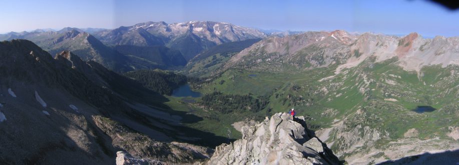
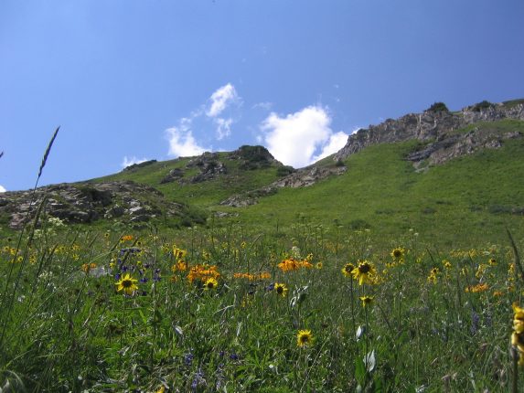
After we rested for awhile at the bottom, it was time to walk back along this lush valley, in the daylight this time. The wild flowers were out in full force! I haven't seen such a flower filled valley. Dave considers this valley his most favorite in all of CO, and I agree it is the most beautiful and unspoilt that I have seen in this state.
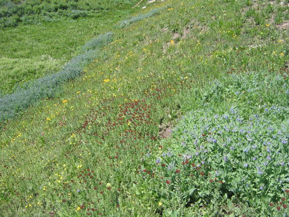
Check out the patches of blue, red, and yellow wild flowers...
Dave walks up the trail amid scores of flowers, and the S-ridge arm of Snowmass in partial shadow...
A scene from the trail, full of yellow and orange flowers...
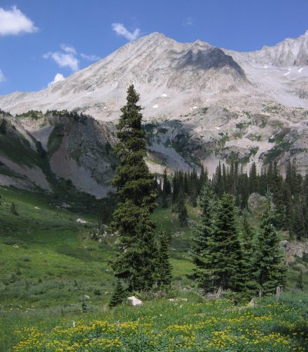
I love this pic. Snowmass and the S-ridge on top, the flowery valley below. Could appear in a future calendar...
I had found a FAIRY FOUNTAIN!

The fairies replenished my heart pieces, and I scooped one in a nalgene bottle to give to Dave...
The fairies said I could return anytime during my journey, and they would restore my health.
By the time I caught up to Dave, we were back to the spot where the Maroon Bells shown through a gap in the hills. Dave and I marveled at their beauty.
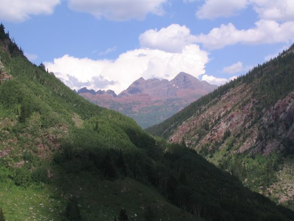
The purple straitions of the Maroon Bells are clear here. Dave and I talked about doing the Maroon Bells Traverse, which covers the entire ridge between the two Bells...
Soon we were back at the car, and prepared for the drive out. There was still the 5 mile 4x4 road in our path before we were home free. This was the quick way back to Marble, rather than heading back to Crystal. The road turned out to be a lot gentler, though there was an occasion bump that required high clearance.
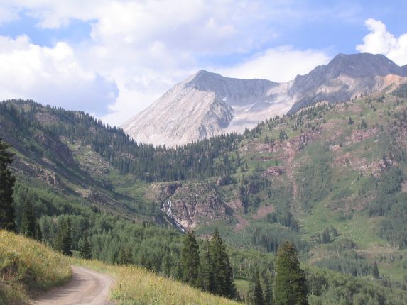
A last look out at Snowmass and the S-ridge from the jeep road. The Fairy Fountain was located in the woods above the viewable portion of the falls...
We were anxious to get back to smooth pavement, but we had to be patient. One our way back, a ranger truck had stopped in the road, and 2 people were chainsawing a fallen tree, no doubt hit by lightening last night. The tree was from a small group of trees in the valley, not unlike the group that our tents were under last night. Good thing we stayed in the car for the storm.
After a 20 minute wait, they finished, and we continued on back to Marble, and finally back to the paved road. 30 minutes later, Dave dropped me off at my car in Carbondale, and I started the 3 1/2 hour drive back to Fort Collins.
Snowmass was my 3rd 14er. I'm so glad I got to try the S-ridge ascent, as it was a lot more thrilling and convenient that the conventional approach from Snowmass Lake. I owe Dave a big "thanks" for taking me to Crystal and up the harrowing 4x4 roads to this incredible valley. The S-ridge is a fun ridge hike, and has surprisingly stable rock. It doesn't need to get harder than class 3 on the ridge, and serious exposure can be avoided. Just be prepared for a lot of loose rock if you descend down the west face.