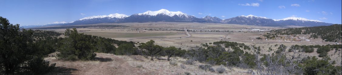
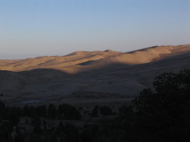
The Collegiate peaks are snow-capped. Several 14ers exist in this range just west of Buena Vista...
Wendy and I had the car packed and started the drive at 7:15am Friday. Intel was moving into a new building today, and we couldn't go to work, so we decided to take a quick vacation to Great Sand Dunes National Park. We took the scenic drive on rt 285, into Buena Vista, and down south to the Sand Dunes.
The Collegiate peaks are snow-capped. Several 14ers exist in this range just west of Buena Vista...
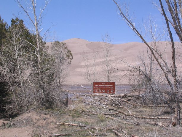
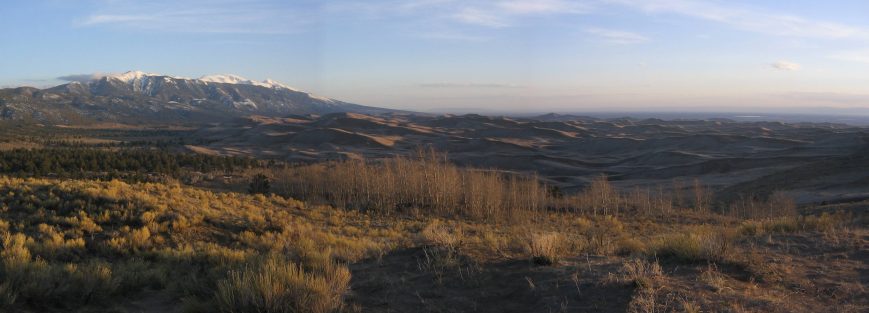
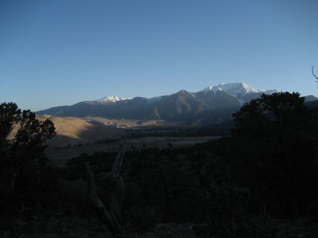
About 285 miles after leaving Fort Collins, we arrived at Sand Dunes Nat Park, a little before 1pm. The park is in the middle of nowhere, ~20 miles from the nearest tiny town. We hit up the Visitors Center and got a permit to camp at the Indian Grove backcountry campsite, a 4.9mi hike from the trailhead.
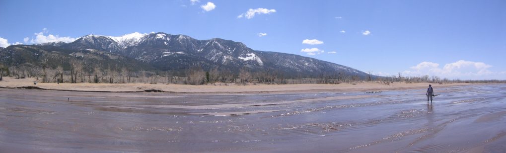
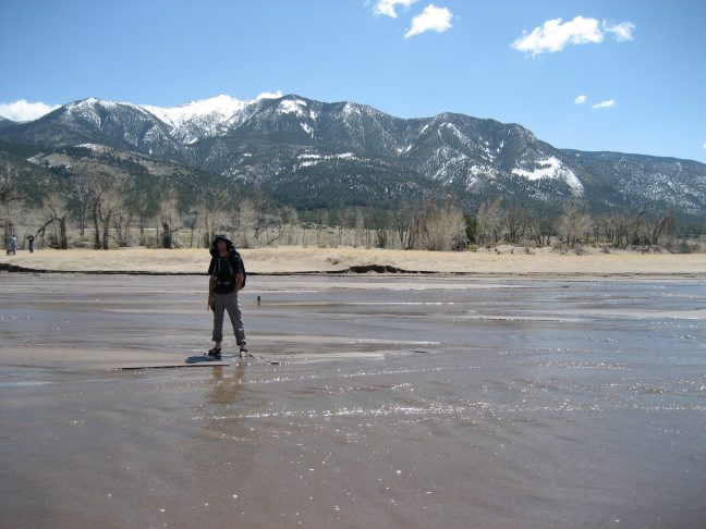
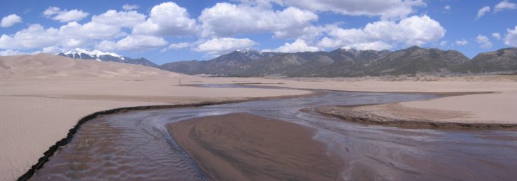
First we checked out the beach and sand. During the spring and early summer, there is a shallow but wide creek that runs in front of the dunes. It's almost like a resort setting.
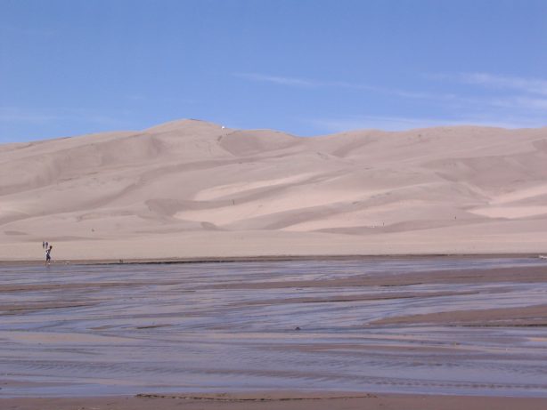
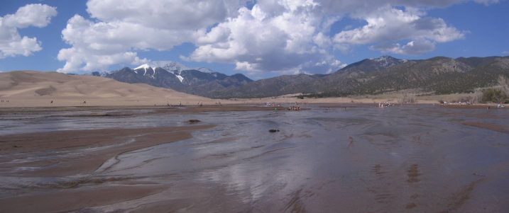
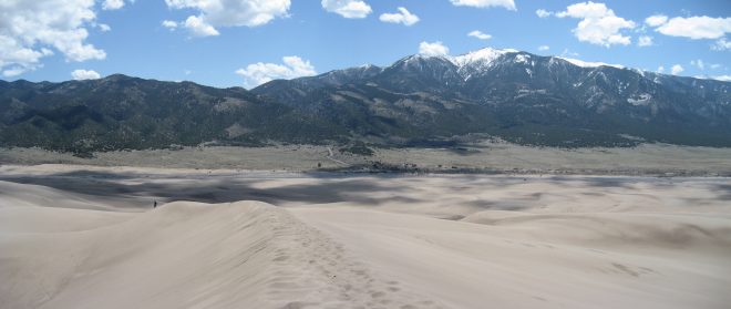
A first glimpse at the dunes from the beach parking area...
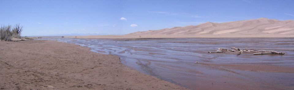
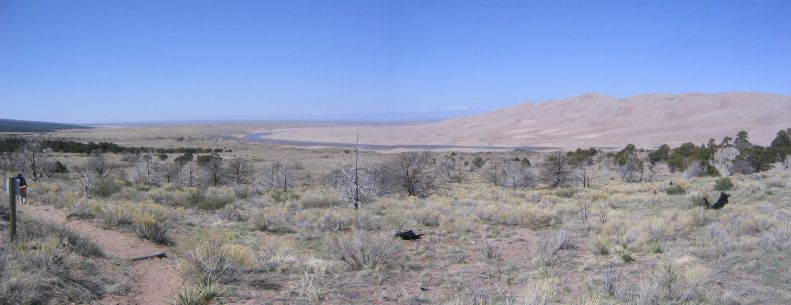
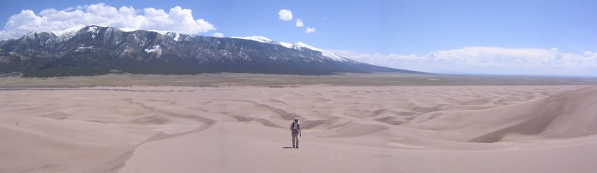
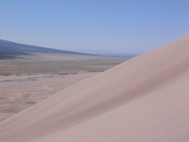
A view west, of the creek and dunes...
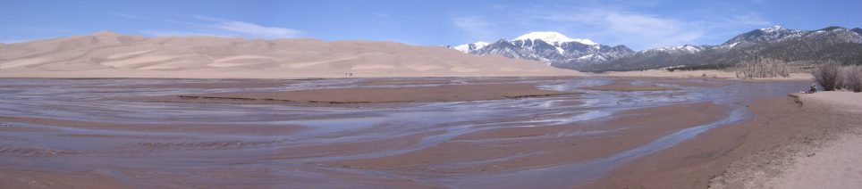
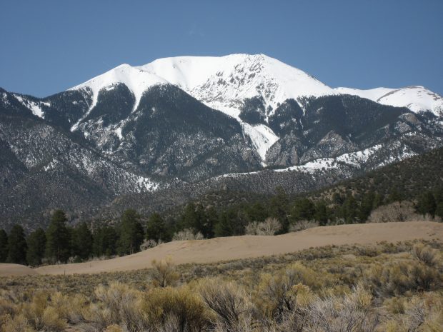
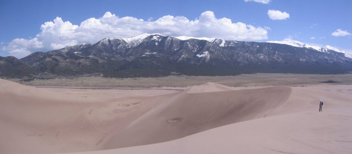
A view east, of the creek, dunes, and mountains...
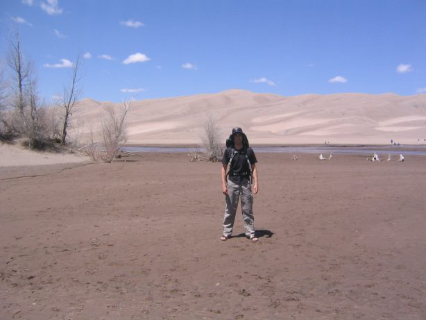
The beach sand is very soft, and the water is warm, probably mid 80 degrees...
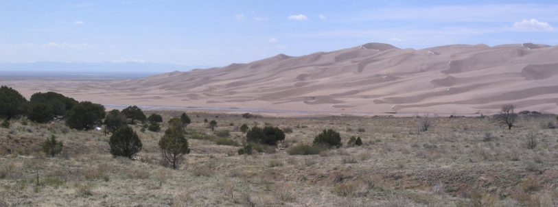
This looks unlike anything I've seen before, and certainly a surprise just a few hours from home...
We decided to start our backpacking hike right away, and would hang at the beach/dunes tomorrow. The weather was supposed to be wonderful all weekend, sunny and around 70. For now we were anxious to backpack, set up camp, and hike further while it was still light. We parked at the large campground in the park, and began hiking the Sand Creek trail. I whistled some Zelda theme music as we became immersed in the wilderness.
The Sand Creek Trail led us just east of the dunes, through brush and a few trees...
The trail mildly gained elevation, occasionally dipping down to (and back up from) sometimes wet, sometimes dry, creeks. The trail was mainly sand and silt. Nice and soft on the feet, but giving way with each step.
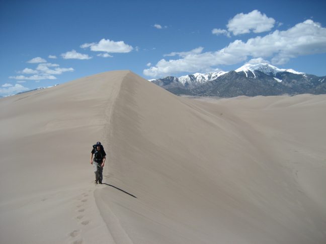
A look up the trail shows an arm of sand stretching out from the dunes. Hiking on a sand trail requires extra effort each step...
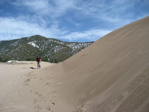
Ahead was Mt. Herrard, a 13,297' peak, jutting ~4,500' higher than the sand dunes...
We experienced our first taste of "dune" when we crossed a short sand stretch on the trail...
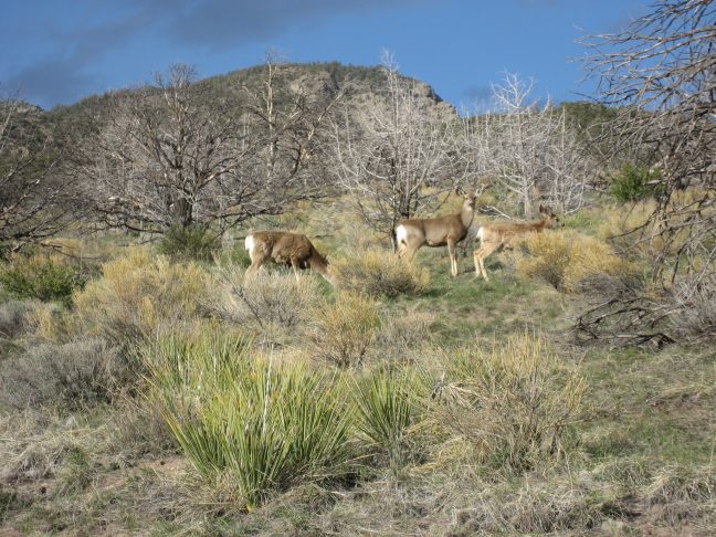
There were plenty of animal tracks, mainly deer, in the trails and sand...
After hiking 4.5 miles, we arrived at an open field of brush and took a 0.4 mile side trail towards the dunes to reach Indian Grove campsite.
Wendy (on the right) heads towards the dunes on a side trail to our campsite. We saw lots of deer (and deer droppings) over this field...
We hiked almost to the edge of the dunes, where a creek separated the dunes from the forest. Our campsite was in a 20' bowl, which we hoped would protect us from any winds. We set up the tent, had a snack, and prepped for more hiking down the Sand Creek Trail, without the heavy packs.
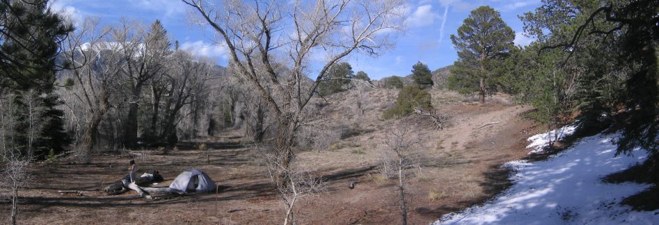
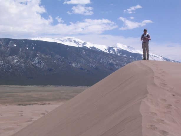
Our campsite, Indian Grove. The only backcountry site with a solar powered latrine too. Mt. Herrard is seen through the trees on the left...
I ran down to the creek, and found a sideways grown tree to cross, and scampered up some of the nearby dunes for a few minutes. But the dunes were a few hundred feet high before I would be able to gain a view, so I didn't pursue very far.
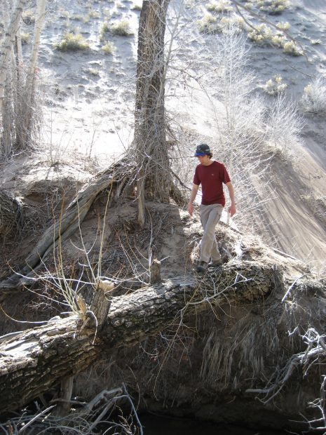
Wendy took a pic of me returning across the log "bridge"...
We packed food and a stove and decided to look for a place to eat further up the trail, north along the dunes. I had originally wanted to camp at a site called "Aspen", a high point further up the trail, but it was already taken, but we still wanted to explore further, so we headed out to check out that area.
We saw 6 deer near some trees in the brush as we returned to the main trail, and headed north, towards the gigantic, white-topped, Mt Herrard. The trail dipped down to the Medano Creek, where long grass, some dry and the color of hay, some light green with spring's regrowth, draped itself down over the eroded earth, coming up just short of the water. It was an enchanting place, worthy of a location in a Zelda game. (sorry no pics, cause it was all in shade).
We decided to forgo dinner, as we weren't that hungry, and wanted to hike as much in the light as possible. We could eat back at camp. So we continued to gain some elevation, as Mt Herrard grew closer, and the dunes continued to proceed past us on the left.
As we reached another dip to a creek, we debated about going back, as the sun would be setting soon, but I scouted it out, and found a dune with beautiful views on the other side. The wind was picking up, and we put on our jackets, and walked across the wide stetches of firm ridged sand.
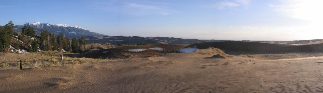
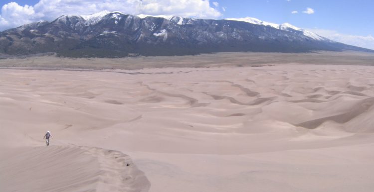
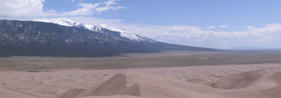
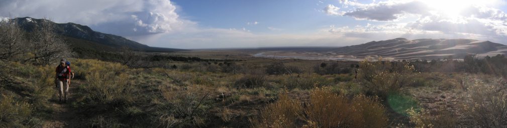
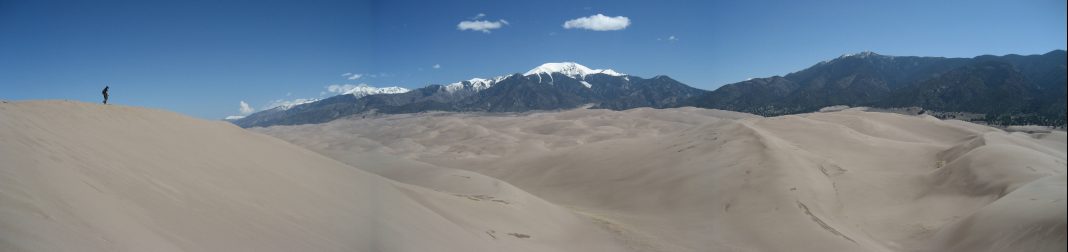
We reached the edge of the dunes again, towards the north of the park. Looking south we could see more white-capped 14ers...
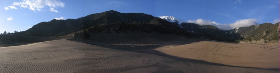
A look north, where Herrard barely tops the nearby foothill. The sand was very firm and hard packed here...
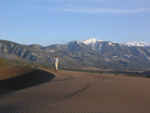
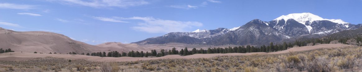
The mix of desert sand, and snow-capped mountains is quite marvelous to behold...
We crossed the stretch of dune and climbed up further into more vegetaion, and watched the last rays of sun fall across the dunes.
Our turning around point, as the sun sets...
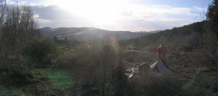
We made our way back across the sand, turning our heads away from the blowing sand. The wind was picking up. This time decided to walk back on part of a 4x4 road, that would be a little shorter distance back to camp. To our surprise, the road passed through a wide creek over a foot deep (probably 15' wide). The light was dimming fast, and we were thinking we might have to back track to the foot trail, but we found a spot up stream where some sticks laid across the creek, that looked passable. I used some long walking sticks to help get myself across the narrow wood. Wendy decided to shimmy across. It was pretty simple, but we were glad there was just enough light to find this crossing.
Back at camp we ate, and headed to bed. The wind was howling, and constanting flapping the fly of our tent. It kept us both up very late. The rustling of the tent due to wind also made us wonder if perhaps an animal was repsonsible for brushing up to our tent. Not the most relaxing evening, and I probably managed only 4 hours sleep all night.
We got up about 6:45, well after sunrise, without a great night's sleep. But the weather was calm and sunny, and we were excited to explore the dunes later today. We heated up some water in my stove and made oatmeal for breakfast, and broke down camp and packed our bags. The tent fly was wet with dew.
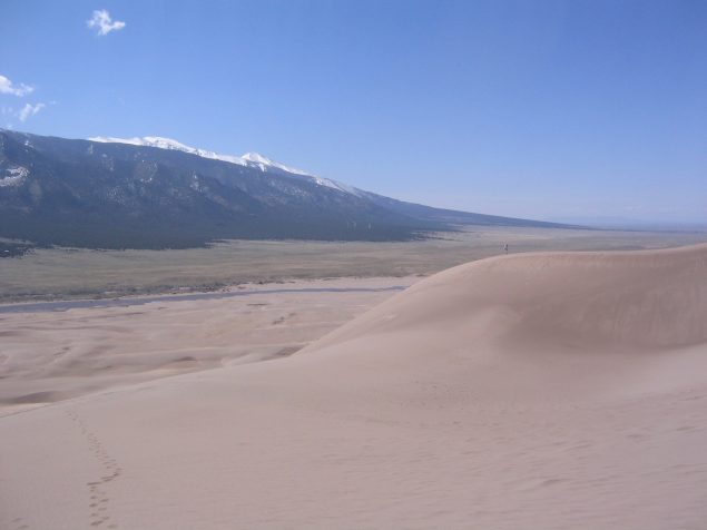
We hiked back the 4 miles to the car, noticing more deer on the way. The dunes had noticeable dark blotches, due to dew, and the last melted snow from earlier in the week.
We head back towards the car, amid clear blue skies. All the white specks of snow on the dunes are gone today...
On the way back, we noticed a backpacking campsite just 0.5 miles from the main campsite, and we decided to try to camp there tonight, rather than deal with the loud families and college students at the 88 site main campground. Fortunately the spot was still open when we returned to the visitors center, and we claimed it.
Now it was time to hit the beach and hike some dunes. We decided to avoid the crowded High Dune area, and search for Star Peak, further away from the crowds (and a little higher). We started our hike ~12:30pm.
I wore sandals, and a pair of light shorts on my head, to help stay shaded in the sun...
The water was warm, as the sun had ample oppurtunity to warm it as it flowed a few inches deep over a couple miles of sand...
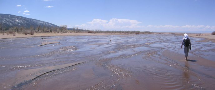
We overheard a college kid say, "whoa, it's like walking through pee..."
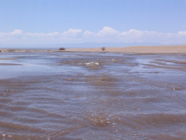
The water would pulse with ripples every so often...
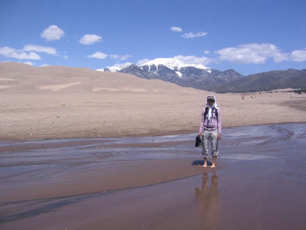
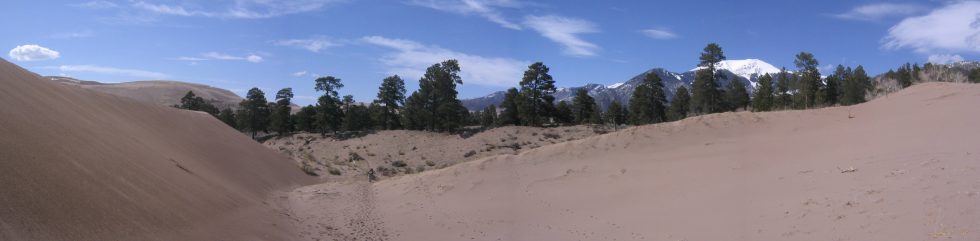
It was still surreal to see huge sand dunes along with white capped mountains...
We walked down a long way, and kept looking at the dunes to find Star Peak. We saw several points, and picked the most high and pointy peak, and started to head towards it.
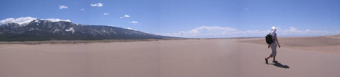
There was a long flat stetch of sand between the water and the first rises of sand...
We made for the point in the upper left. Now began the work of figuring out which dune ridges to ascend to reach it...
We made our way to this arm of sand, which headed toward the high point...
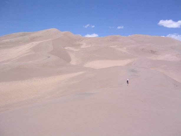
What seemed like sizable dunes in the beginning of our hike looked like little sand ripples as we gained elevation...
The trick is to hike up the crests of the dunes, rather than up and down the slopes...
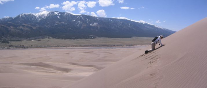
It was steep going to reach the top of this dune. I stayed in sandals the whole hike...
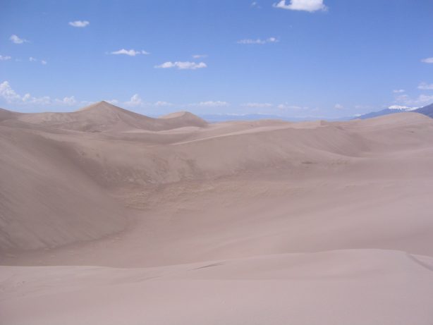
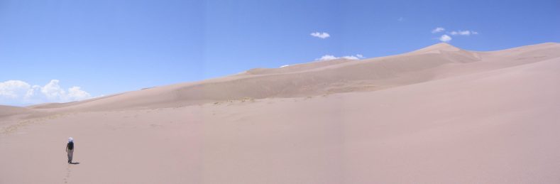
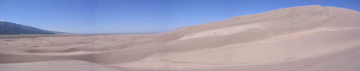
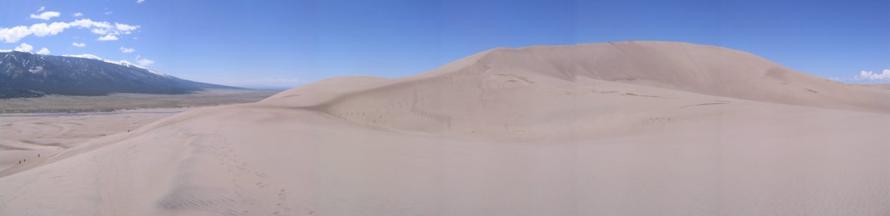
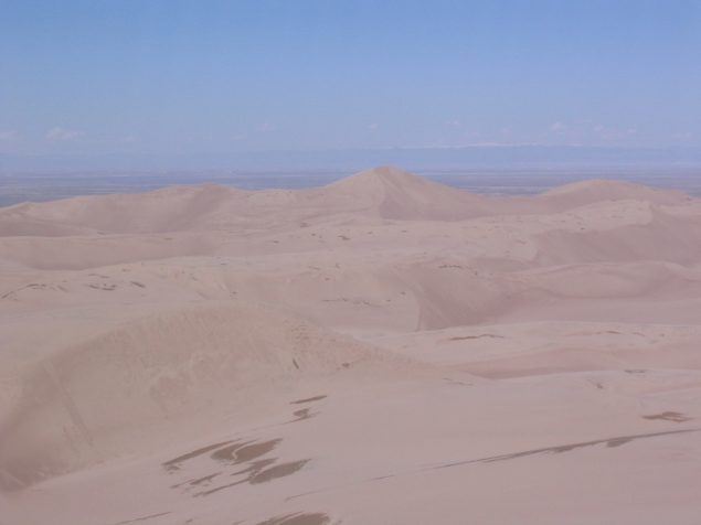
When we reached the top of the point, we saw a vast dune field, and also Star Point further away (pictured on the left)...
We roamed across a few more dunes, looking for an easy path to Star...
But it was still quite a journey, and we decided to just head back to the beach and play in the beach. We also needed to get back and hike in to camp...
The sand was a bit toasty, but the sandles were enough to keep them cool. Wendy opted for boots on the sand...
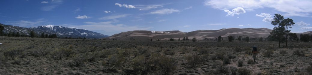
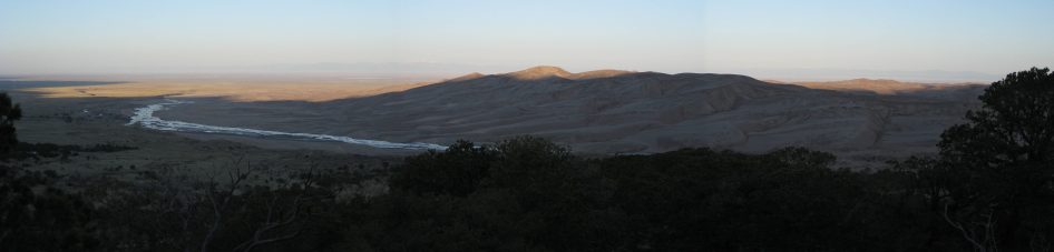
A look south shows how the 14,000' mountains smoothed out down to the 7,500' valley...
We made our way down to the creek, and headed back...
The creak was crowded with people near the parking area. Plenty of kids rolling around in the water, and playing in the sand...
It was slower and more tiring walking back against the stream, feet still sinking into the sand. By the time we got back to the parking lot, we were tired, and decided to eat an early dinner in the picnic area. The ranger at the visitor center had mentioned that a bear was spotted at the big campground last night, so we planned to eat our food before hiking (leaving all food in the car), so we could sleep easier.
After dinner we packed just the bare essentials, minus the food, for the 0.5 mile hike to our campsite. We looked forward to observing sunset...
The hike was short, and the pack was lighter today. It was totally worth it to camp away from the crowds...
Again we saw more deer...
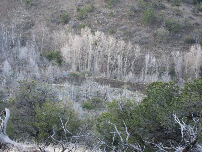
The campsite was off the trail aways, and overlooked the dunes...
After we set up camp, we found a shortcut to the Dunes Overlook point, and watched sunset from there. It was a bit of a dissapointment though, as the clouds blocked it.
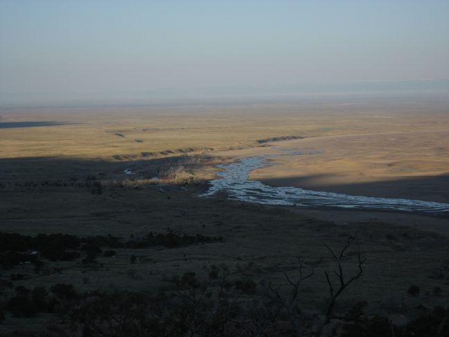
We waited as the sunlight gradually slid nearer to us, across the valley and dunes...
It was impressive to see the sharp spikes of the 14er's shadow across the valley (in this pic it would be shadow in the top left of the pic)...
Sand dunes emerging into the light...
A look to the north as the sun shines on Herrard. The shadow is almost reaching our camping spot from the night before...
A look back at our tent, the grey blob in left center. It was a sweet site...
We walked back to camp and packed up for the short 0.5 mile hike back to to the car. We cooked up oatmeal at the picnic area where we ate dinner the night before, and contemplated what to do today. Options where to hike 7-14 miles up in the mountains, or try to make it to Star Point (after we missed yesterday), or take it easy, play in the sand, and hike up to nearby High Dune. We decided on the last option, so we readied for another sand hike.
I opted for sandals again, and brought the frisbee along. High Dune was probably just a 1.5 mile hike, up 750'. It was around 11:00 when we started, and there weren't many black dots (people) out on the dunes. We followed some of the many foot prints as we approached the first rises of sand.
Wendy and I split up at a fork in the sand ridge, and decided to see who would pick the easier path.
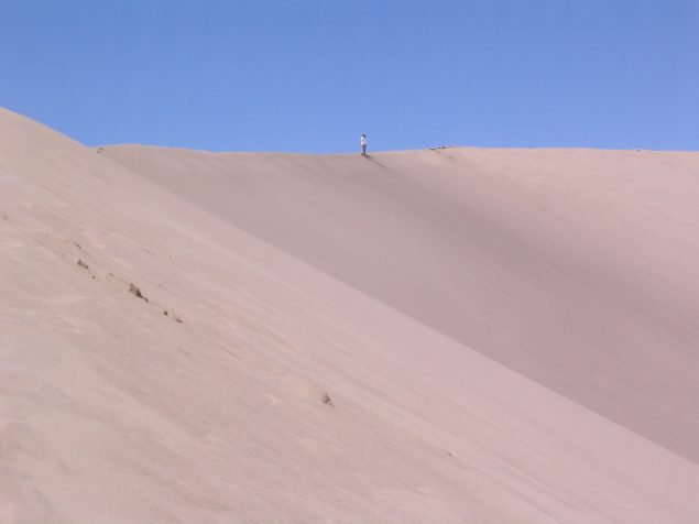
High Dune rising on the right. Wendy took the path along the sand arm where the tiny black specks are...

I hiked up a sand arm off towards the right (that's me)...
A look back at Wendy (a small white-ish speck) on her path up to High Dune...
A pic of me, stopping to admire the views ...
Another look back at Wendy, reaching a ridge on the way up. My footprints on the left...
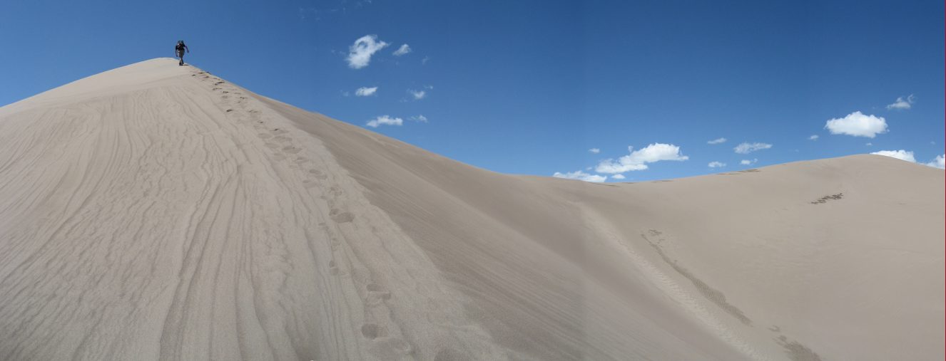
Finally the top of High Dune is in view...
Wendy tries to start a sand avalanche on way to the summit...
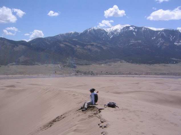
The peak was free of people, and we spent a good 30 minutes up there taking pictures, digging feet into the sand (it's nice and cool a couple of inches deep), and playing with the sand. Didn't have the guts to throw the frisbee, and have it hook all the way down a long sand slope.
A look west, to Star Point. Next time I visit, I'll try to hike there...
Wendy had a blast throwing gobs of wet sand. There was wet sand from the snow earlier in the week...
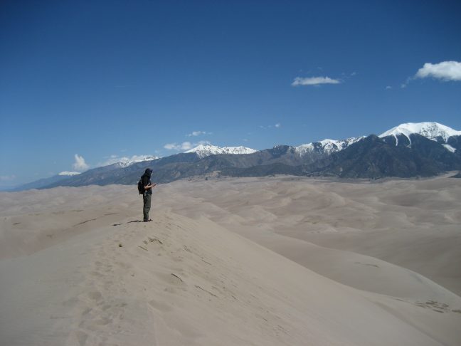
A look north shows several snow capped mountains, including several 14ers, including the Crestones...
After ~30 minutes, I started back down...
...while Wendy still played in the sand at the top.
On the way back, we took a different route, and ended up on a stretch too steep to traverse, so we ended up scampering straight down it...
After we reached the beach, we played some catch with the frisbee in the sand/water. Plenty of families were playing in the water.
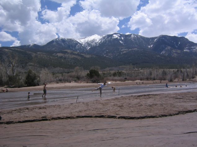
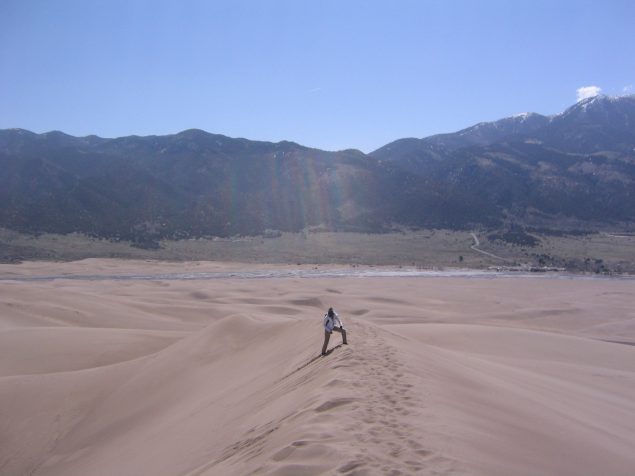
Wendy stretches out to snag the disc...
We hit the road around 3:45pm for the 5 hour trip back. As we drove out, black clouds were rolling in over the mountains to the dunes. Looked like rain. Good timing It was a gorgeous drive around and up the east side of the Sangre de Christo mountains, and I got to take a look at several more 14ers. We finished the audio book, Gunslinger, by Stephen King, and the in no time, we were back in Fort Collins.