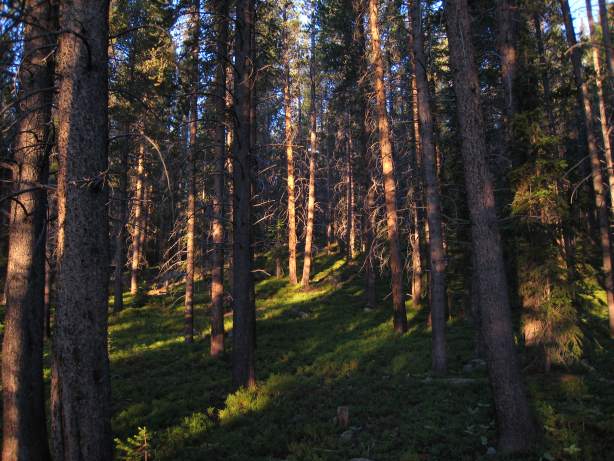
The green forest became illuminated with gold rays as the sun rose...
We started the hike about 5:45, and hooked up with the trail that crossed the creek entering the lake. Quickly the trail forked in several directions, and we took the steep path. Turned out this just merged back to the flat path that headed in the same direction.
The green forest became illuminated with gold rays as the sun rose...
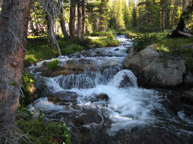
I used my new GPS device, along with Nat Geographic TOPO maps for CO to plot our course. This turned out to be a HUGE benefit, as the Blue Lake trail was unmaintained, and had plenty of downed trees across the path, and some places where the path was hard to distinguish. There was a gushing creek we crossed on a bridge, and several smaller outlets that required stone hopping.
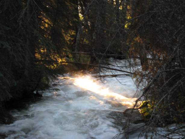
A healthy stream rushes down along the path. The golden rays make another appearance...
After about 2 miles, the unmaintained trail joined up with the main trail, and the fallen trees across the path came to an end. I had snowshoed this trail in March, and coincidently, ran into Dave unexpectedly, as he was cross country skiing on the same path.
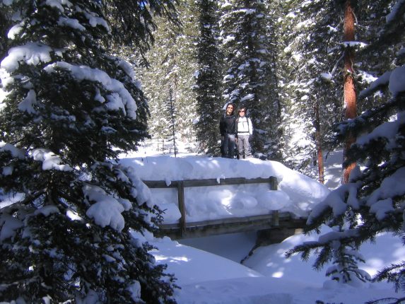
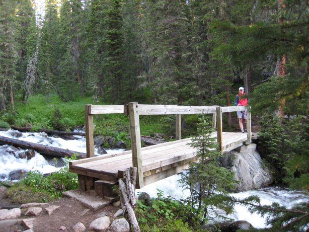
Amazing what 3 1/2 months will do. Mar 4th vs June 24th...
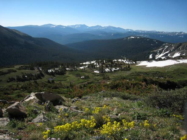
As we hiked, wild flowers started to appear. I was surprised to see them out so early in the summer. Here come the flower pics:
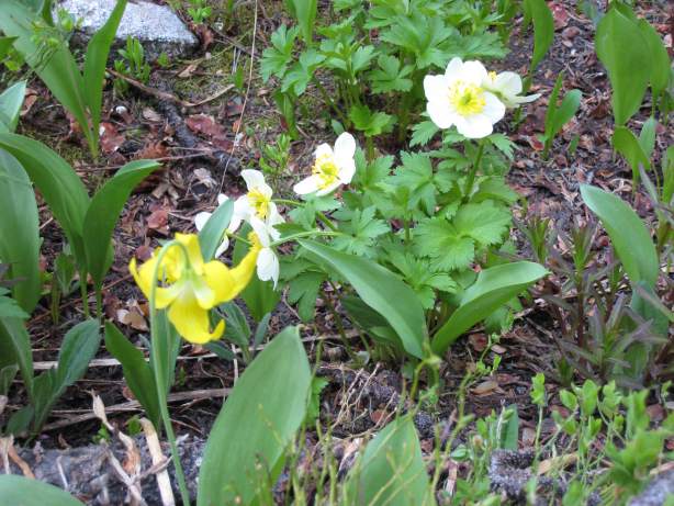
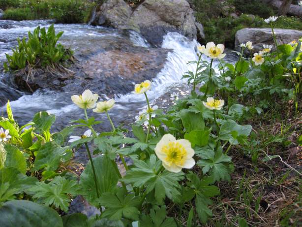
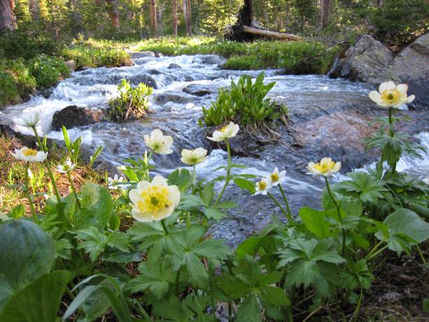
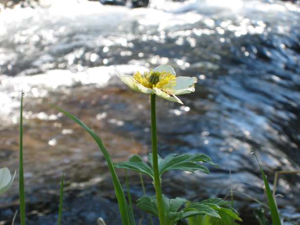
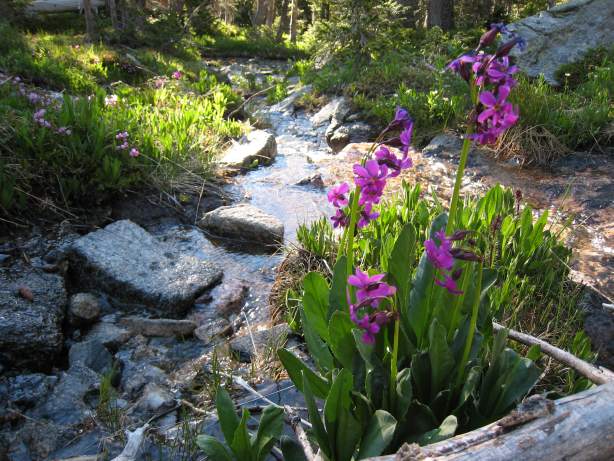
This area was so beautiful with fresh green vegetation, and crystal clear snow-melt creeks. I spent a lot of time taking pictures as you can tell.
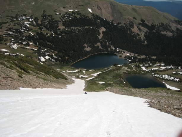
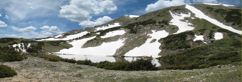
The trail continued to the north. When I was here in March, the trail was snowed over, and we couldn't find the path to Blue Lake from here. But now it was simple to see, and just as we caught a glimpse of Blue Lake, we cut off trail to the left to begin our climb to Clark peak.
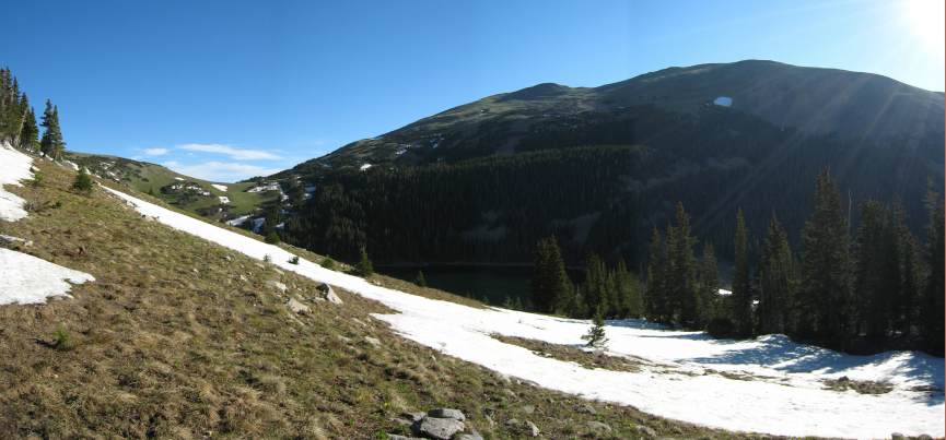
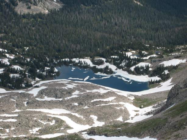
Once off the trail, there was plenty of snowpathes through the pine trees. Blue Lake is in the shadow of the valley...
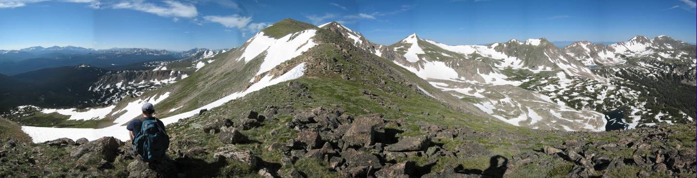
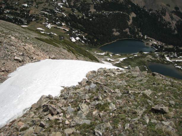
After a short climb, the ground leveled off, and we saw Hang Lake off to the right of the ridge we needed to climb.
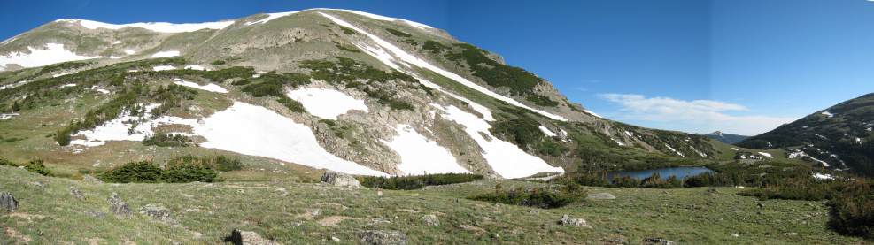
Hang Lake sits on the right. Clark Peak lies beyond the ridge on the left. We eye the long snow chute the slanted down to the right near the lake. A possible glissade down on the return???
From here we eyed the mountain for the easiest way up. We looked for the least snowy areas, and aimed there.
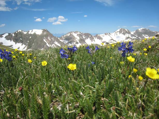
A look back down. The yellow wildflowers were plentiful on the tundra slopes. The Mummy Range of Rocky Mount Nat Park shaped the horizon...
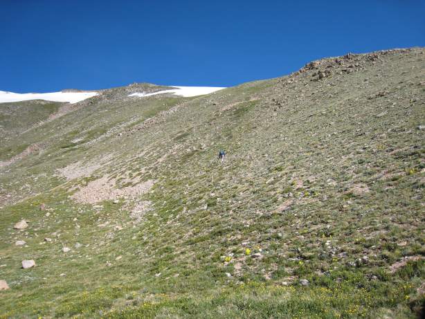
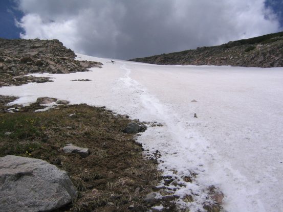
We made for the gap in the snow on the left along the top of the ridge. The tundra was steep. According to my map, it was a 1800' gain in 1.15 miles from the valley to the ridge...
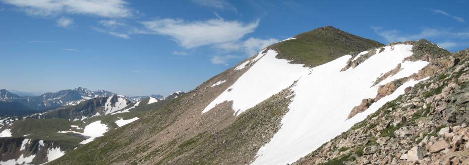
A look up the ridge, as I arrived near the top. Clark's peak was still another 600' higher, and hiding further ahead on the ridge...
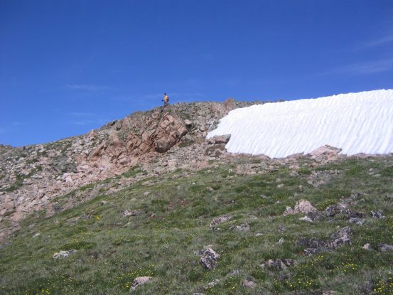
Me at the top of the ridge. It took a short easy scramble up the rocks, around the snow...
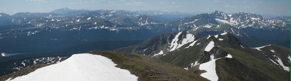
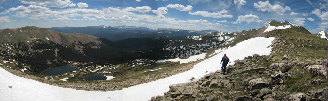
The view from the top of the ridge. A huge unspoiled valley and more mountains lay on the other side (to the right)...
The view from the top of the ridge was spectular. It's always fun to ascend a ridge for the first time and have an entire new world pop up before your eyes. The new seen valley had much more snow, and I spotted 5 pretty lakes.
A look at one of the gorgeous lakes. The mountain range of Steamboat Springs can be seen on the left side of the horizon...
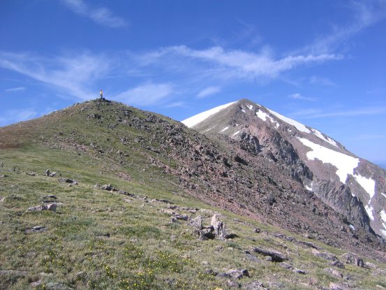
I stand on a mini-peak on the ridge. Clark Peak is the big one on the right, still over 500' taller, and about 2/3rds miles away...
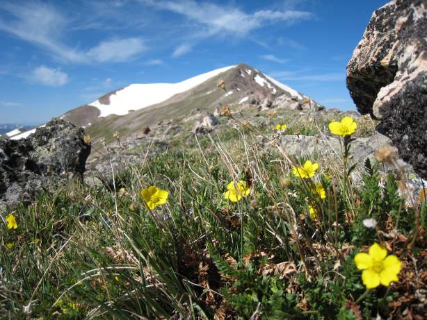
Little yellow flowers existed up on top of the ridge as well. Here pictured with Clark peak in the background...
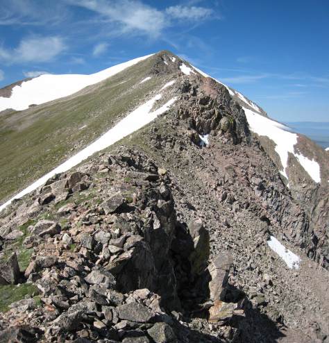
I enjoyed aesthetics of this mountain from this view. Looks like a soft served cone...
The ridge was pretty gentle for awhile, and soon we reach the final climb of Clark's Peak. This part of the ridge had a sharp rocky dropoff to the right. A slightly worn trail stayed clear of the edge.
Dave, went up ahead along the rocky ridge while I took some pics...
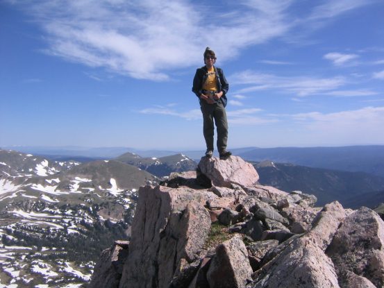
When I caught up to him he says, "Stand on that rock. It'll be a cool picture..."
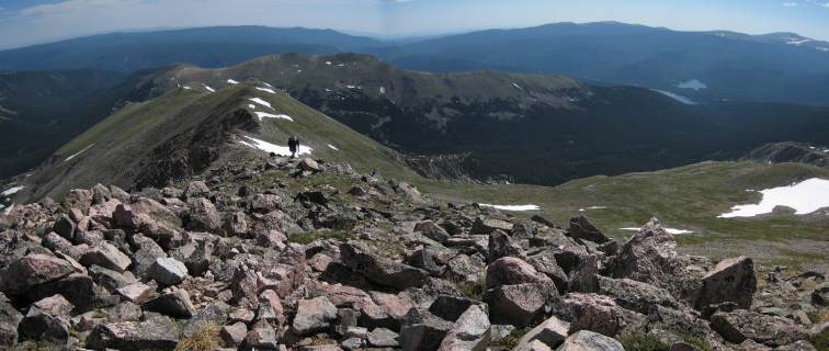
A look back down the ridge, as I neared the top. On the right you can see some of the lake that we started at this morning...
We summitted at 10:15am, amid beautiful skies. The wind had stayed pretty calm, even up along the ridge. I alternated between t-shirt and light open jacket along the ridge, mainly between resting and walking.
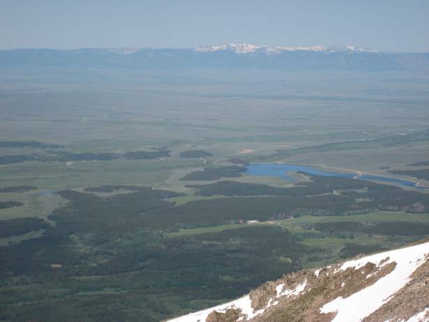
What a view from the summit! This view south yields Long's Peak jutting up in the distance on the left. To the right side are the mountains surrounding Lake Agnes, including Mt. Mahler, from a previous hike I did...
To the west lies the vast floor of North Park. The continental divide is seen in the distance...
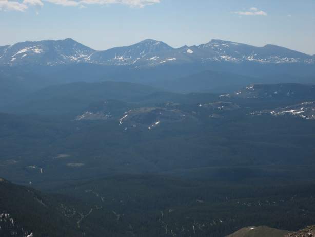
A zoomed in view of the Mummy Range. Not sure which end is supposed to be the head...
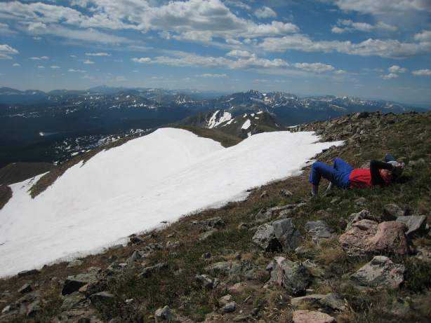
Dave takes a rest after eating lunch. What pleasant place to relax!
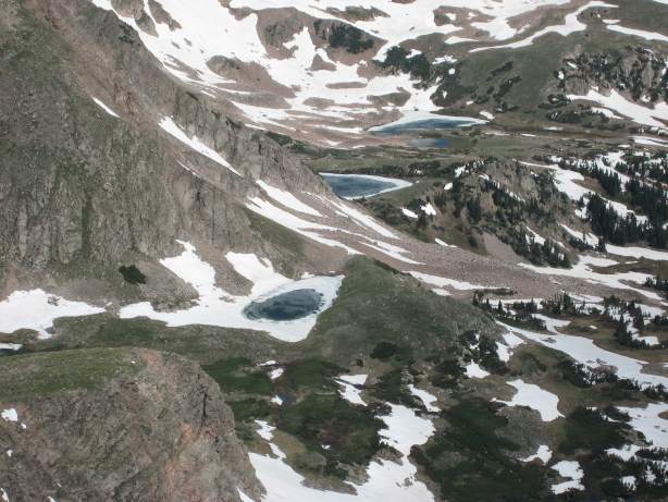
A closer look at some of the semi frozen lakes down in the valley. This valley must be incredibly unspoiled, as it would be a long 8+ mile trip, one way, to reach them...
After a good 30+ minutes at the summit, we turned back. The views from the summit and ridge were astounding. It was a 6 mile hike to the peak (1-way), with 3800' gain, but well worth it.
On the way back down the ridge, I experimented with more flower pics...
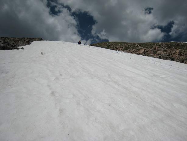
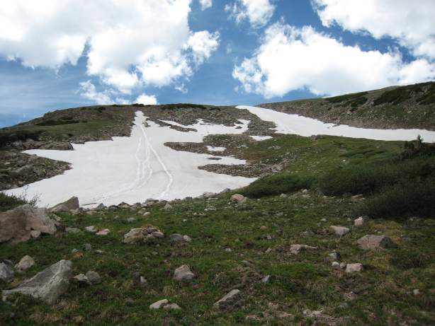
As we approached the point where we had ascended the ridge, we remembered that long snow field, and wanted to check out if it was glissade-able ("slide-able").
We scouted out for the long snow field back towards Hang Lake, and found what we thought was the top, and headed towards it...
Yup, this was it. That's looking a little steep...
The snow was quite soft, and just deep enough to slide down without scraping rocks. I had brought my ice axe on the hike, expecting more snow than there was. But I was prepared to use it as a break, as I slid down the slope. I went first, and slid for about a 100', before breaking and re-surveying. The snow was so soft that the axe went through like slush. I had to push down hard catch enough friction to break. But it was manageable, especially using your feet to drag against the snow.
After I stopped a short way down, and moved closer to the edge, Dave took off...
And he didn't stop. He went "wee..." all the way down...
I was a bit worried at the speed Dave had going down. He had a hiking pole, but no axe. But he was all thumbs up after he reached the bottom. I followed, careful to avoid picking up too much speed.
A snowboard would have been a bit more manageable...
We both looked back at our tracks, and realized that it was pretty darn steep. But it was also pretty fun. There was a second patch of snow on our right, which we headed towards, and slid down another few hundred feet.
A look back at the 2nd stretch of snow we glissaded...
This second stretch wasn't as steep. We hiked back down the rest of the way to Hang Lake, and marveled back at the mega-glissade tracks we left.
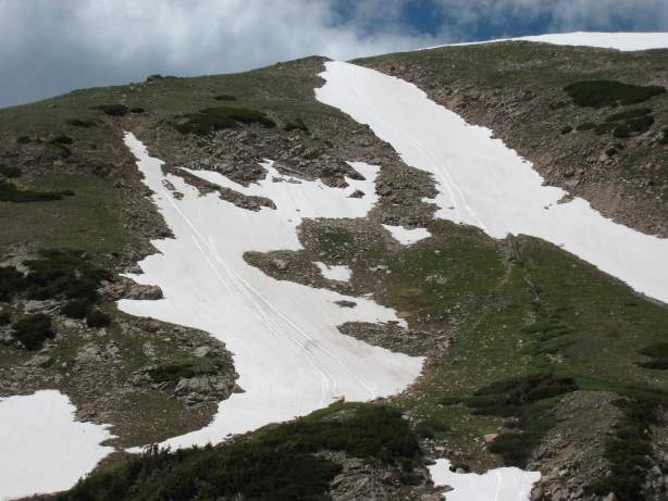
We started at the top of the snow field on the right, went a little over half way down, and cut across to the snow field on the left for a 2nd run...
All totaled, it was ~600' of quick descent. Now it was time to head back and rejoin the Blue Lake Trail...
The GPS turned out to be handy several times on the way back. It kept a bread crumb trail of our path up, and so we could aim towards our trail we "created" when there wasn't a real one to be found. This was particularly useful once we were on the unmaintained portion of the trail again. I'm glad I ended up keeping this GPS unit.
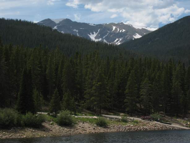
We return to the car a little after 3pm. The temperature was much hotter at 9100'. The forecast in Ft. Collins had been 98 today. The best way to beat the heat is to climb a mountain. We enjoyed the cool air all day on our hike. But it was time to return to the oven.
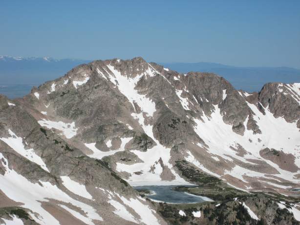
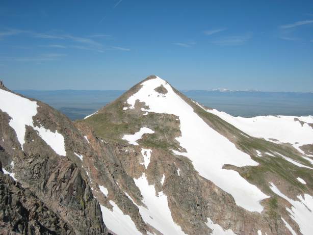
On the way out, I stopped near the lake to take this picture of Clark's peak. Throughout the hike, there wasn't a view of Clark's peak, except on top of the ridge. I remembered seeing the lake from the summit, and sought out a spot to grab a photo.
Clark's Peak is the high point on the left of the ridge, 3800' higher than the lake...
Clark's Peak offered some many impressive views, and abundant wildflowers. Definitely a good late June or early July hike. At 12 miles roundtrip, and 3800' gain, it's not a cinch though, but worth the effort.