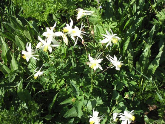
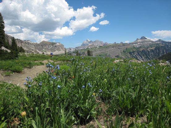
The columbine flowers at the Tetons were all white, unlike the CO variety with the purple pinwheel pedals...
I took down the successful bear bags, and we cooked up oatmeal, and broke down camp. It felt good knowing that our packs were a good 1/2 pound lighter after eating a dinner and cereal, but they were still mighty heavy, and had to sit on sore hips from the previous day.
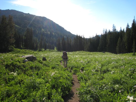
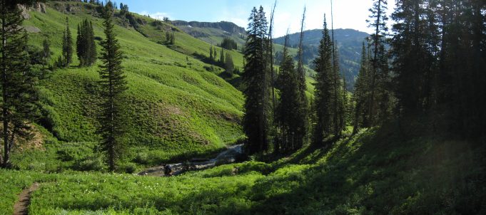
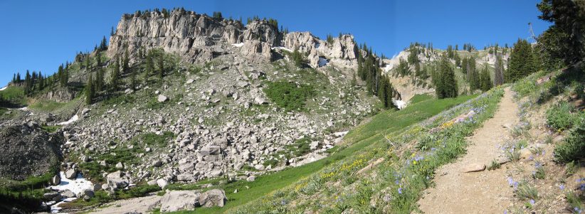
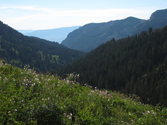
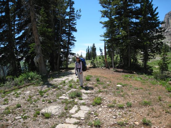
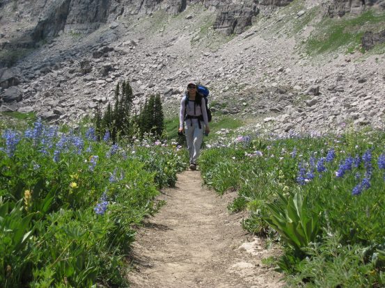
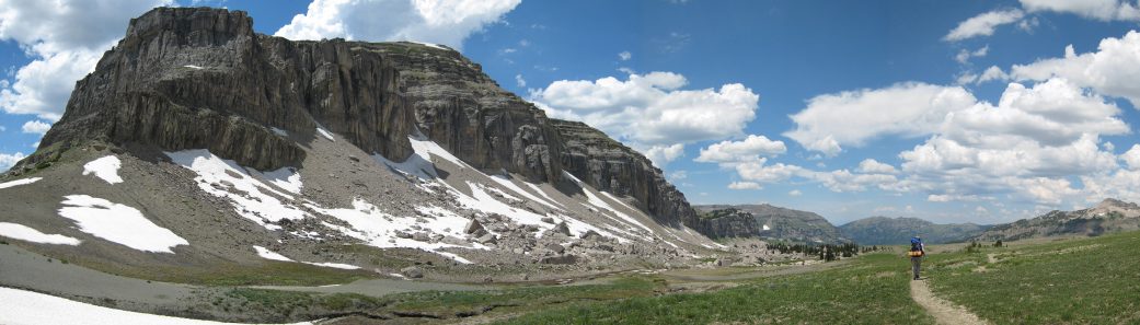
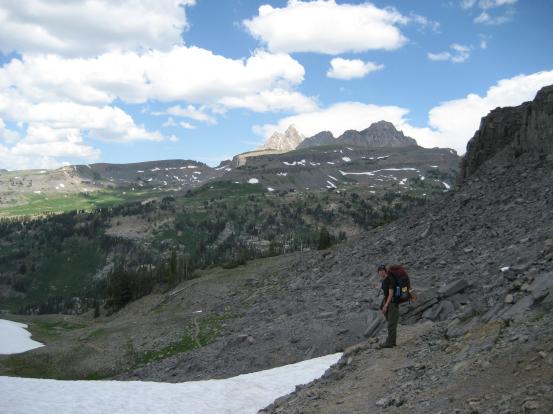
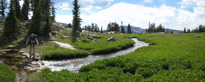
We hit the trail at 8:08am. From analyzing my map, I knew we had to climb 1200' this morning in the first couple miles. The trail stayed gentle for awhile, crossed a stream, and curved up and into a forested hill loaded with wildflowers. The surrounding vegetation was a healthy green, and the light rain from last night was apparent in the slightly softer, darker dirt.
The columbine flowers at the Tetons were all white, unlike the CO variety with the purple pinwheel pedals...
A field of white columbines close to where we camped...
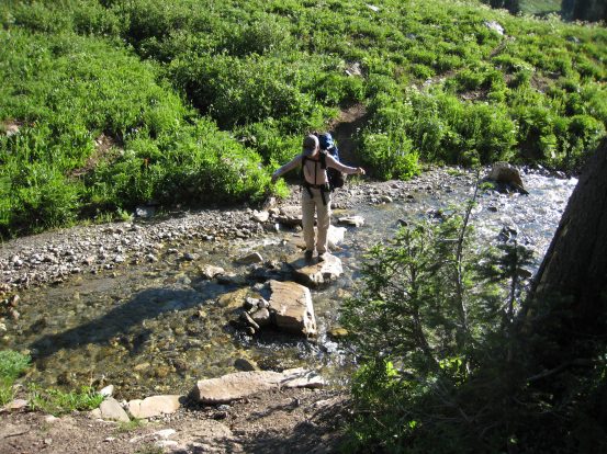
Conveniently located flat stones make for easier stream crossings...
The wildflowers were lit up by the morning sun through the trees. We took lots of pictures...
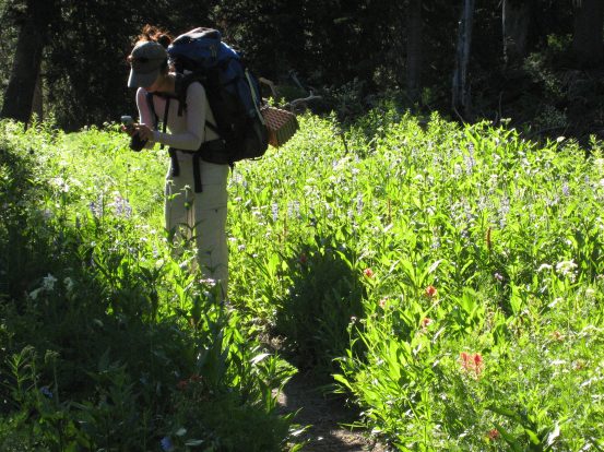
White and colored moths/butterflies scattered across the path, and over the flowers. Felt like I was walking through Hyrule (Zelda reference). I saw a marmot scamper up the trail ahead, and up a bank into the woods as well.
I was whistling the Hyrulian Field, and Faron Forest theme music from Zelda during this section of the hike...
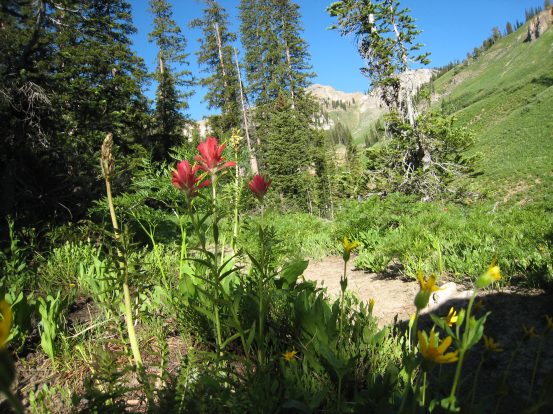
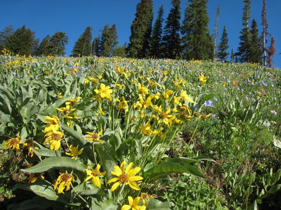
The colors varied from red, yellow...
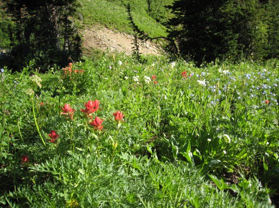
...white, blue, and also pink and purple...
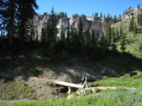
We climbed up switchbacks along the grassy and flowery hillside, and reached another stream with a bridge that was broken in two pieces, but still cross-able. We saw more marmots scampering up the rocks nearby.
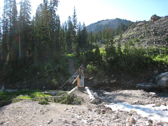
Wonder what destroyed this bridge... It was still passable, though required some balance with a heavy pack and broken hand rails...
A look at the rock face from where the stream was originating...
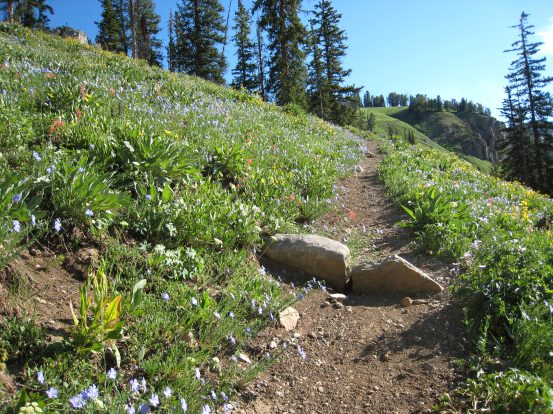
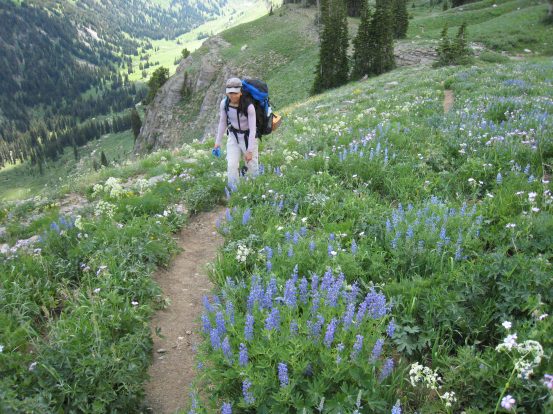
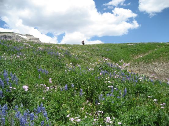
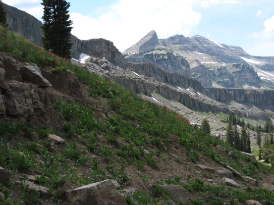
The density of flowers along the next set of switchbacks, up to Marion Lake, was even greater. It was a lot of uphill, but extremely beautiful.
A look uphill from the trail. Plenty of yellow and blue...
A look up one of the switchbacks, towards the valley we hiked up...
After the next rise, we crossed another stream (lots of blue wildflowers in the lower right corner)...
...And hiked up more pretty switchbacks, with pink flowers here...
After the next rise, we finally reached Marion Lake. I had originally wanted to camp here the first night, but it was a good thing the site was full, cause it would have been a long haul to reach here yesterday. We saw 3 marmots amid the rocks around the lake. There were plenty of small chipmunks scurrying up and across the trails also. And there were a bunch of mosquitos on the trail today, which weren't as cute.
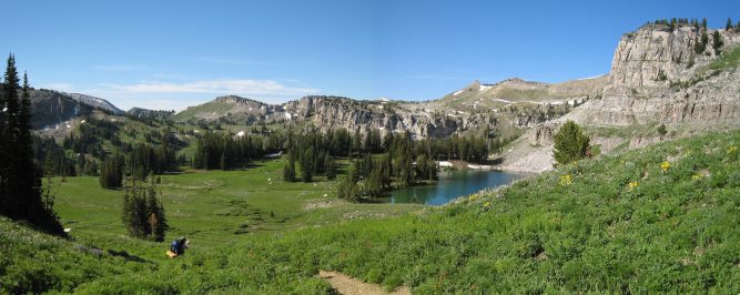
A look back after we had passed Marion Lake. Wendy takes a photo from further down the trail...
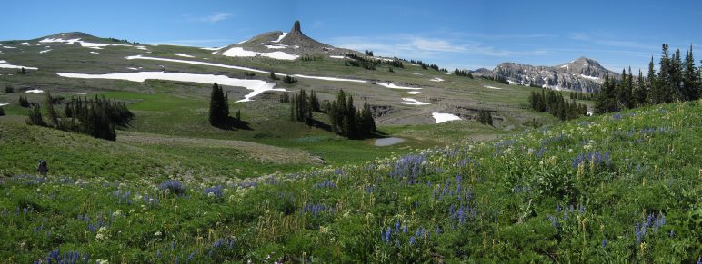
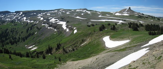
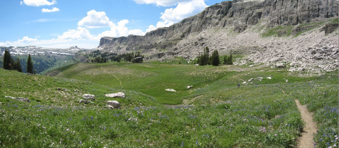
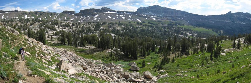
There was just one more rise before we leveled off at Fox Creek Pass. The flowers dwindled up here a bit.
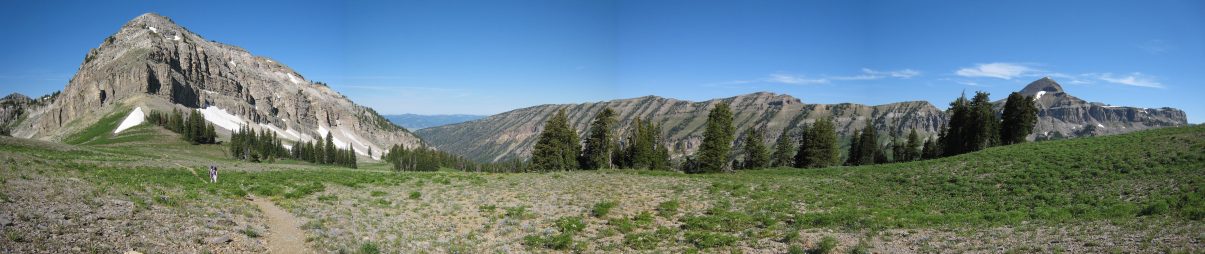
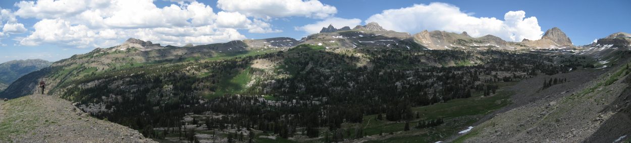
A look north over the expanse of Fox Creek Pass. The vegitation thinned out up here...
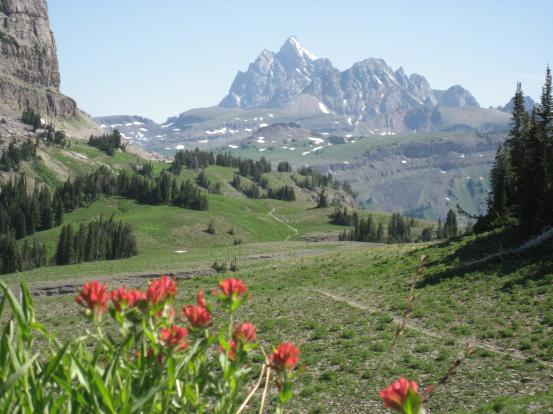
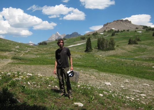
We got our first glimpse of the back of the Teton range from here (on the right)...
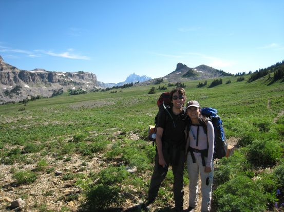
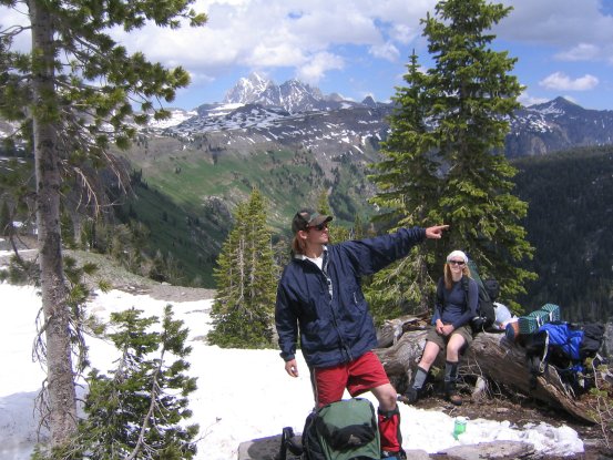
We met hikers on the trail for the first time since a couple miles into the hike yesterday. I asked if they'd take a picture of us.
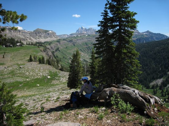
The Teton mountains are way off in the distance here, but we'd be getting closer, and eventually passing them on our hike...
Wendy framed this quality pic, from Fox Creek Pass...
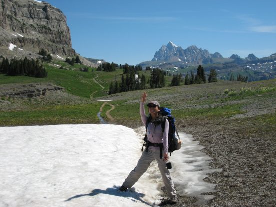
Wendy took advantage of the snow patches we passed to target practice on me. I just filled my hat with snow and let it melt down as we hiked in the warm weather...
A look back after we had crossed most of Fox Creek Pass...
At this point, we joined up with the Death Canyon Shelf trail, which was part of our route 2 years ago with Karl and Mariann. This time there was a lot less snow. There were still a couple of small snow fields to cross, but they were just opportunities to refill my hat with ice...
A look back as we head up the Death Canyon Shelf. This was familiar trail, and a joy to hike without snow...
The shelf was as even more beautiful than last time, now that it was covered in green. We hiked a short ways, and stopped for lunch at the same place we had lunch 2 years ago.
Lunch time July 6th, 2007 on the left, lunch time July 2nd, 2005 on the right...
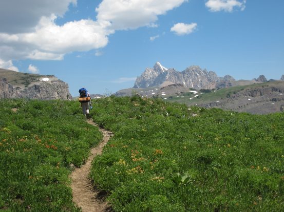
The flowers were out on the shelf as well. These shots captures the beauty of the trail pretty well...
I kept an eye out for the campsite we used on the shelf two years ago, and found it here.
The old campsite from last time. No sign of the "nosy marmot"...

Wendy noticed some cool looking "dinosaur skinned" rocks, with flowers nearby...
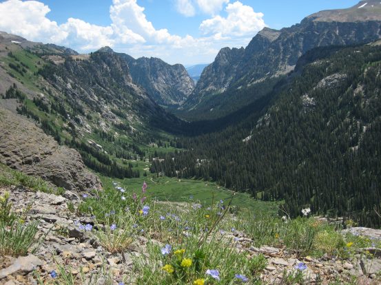
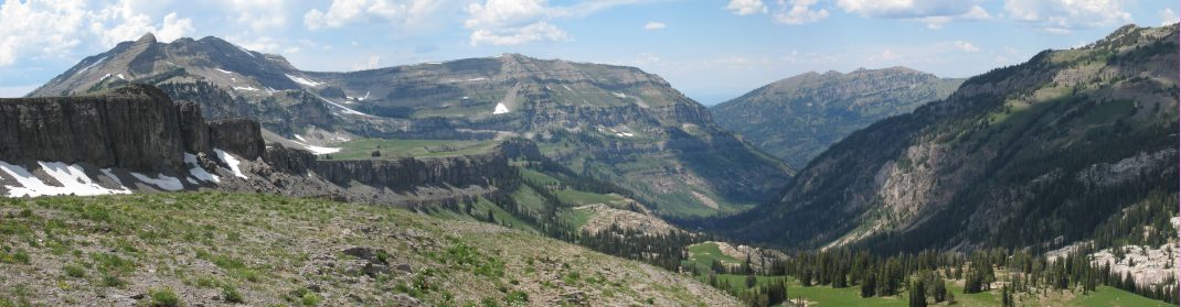
A look down Death Canyon. Death Canyon had more impressive cliffs and waterfalls than Granite Canyon, but the flowers in upper Granite Canyon were amazing. Guess I'd recommend Death Canyon if you had to pick one...
The trail was mostly flat or downhill along the shelf, but started to rise towards the pass to Alaska Basin. The wildflowers didn't let up.
Wendy walks among blue colored flower patches, as we gain some elevation...
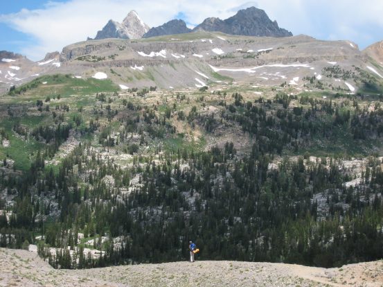
Me at the top of the rise, about to turn left towards Alaska Basin. And beautiful flowers...
A look back down the Death Canyon Shelf at the distance we covered...
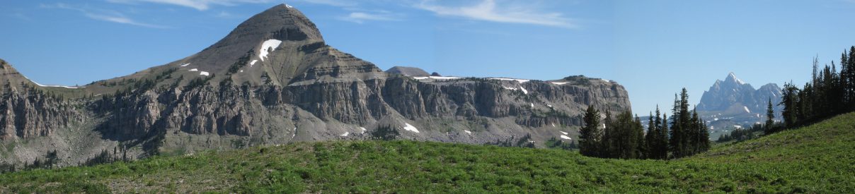
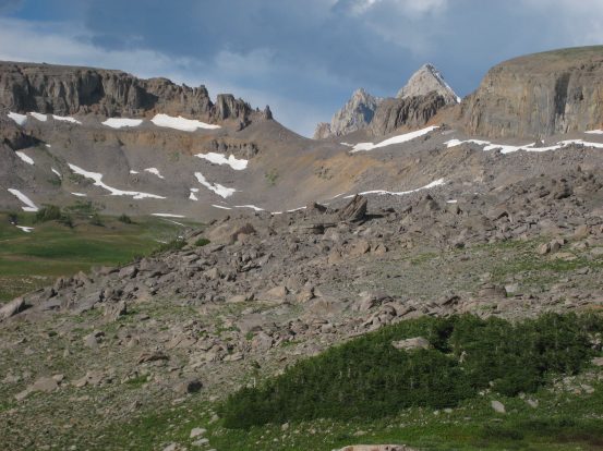
We approached Mt. Meek Pass (9732'), in front of "Anemone Mountain", a self-named peak that we all climbed up 2 years ago, which marked our turning back point of the trip last time. Ahead the trail descended slightly to Alaska Basin, a valley known for it's beauty and wildflowers. I had longed to check it out, since turning back just before it's edges last time.
Me in front of "Anemone Mountain", giving my best Beck hair-do impersonation...
Turning the corner, heading towards Alaska Basin. Death Canyon Shelf extends back to the left of this block of rock...
When we got to the edge of the valley, we were indeed sufficiently impressed with the grassy basin spotted with stretches of flat bare rock. There was a series of switchbacks along the rocky slopes leading us down to the valley. The switchbacks were called the "Sheep Steps".
I stand on the left over looking Alaska Basin. We would need to cross this valley and climb up Hurricane pass, the long slanty ridge across and to the left of the Teton peaks...
A close look north west towards the open of the basin. There were some terraced grassy fields along the valley...
Wendy stands at the edge of the valley, with the pyramid shaped Grand Teton rising ahead. Also a shot of me about to head down the rocky slope...
The profile of this mountain in the background fascinated me. The clouds were coming out, and darkened the red flowers in this picture...
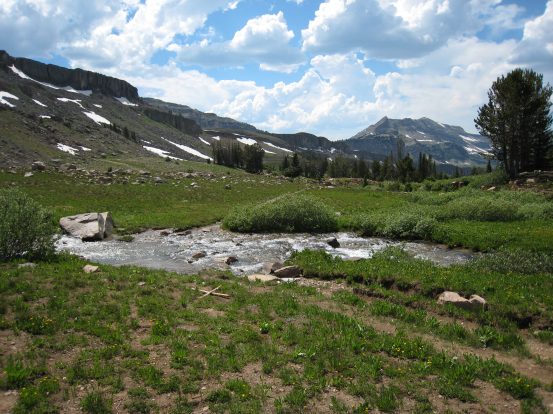
When we reached the basin floor, the sound of rushing water everywhere was loud. There were several creeks merging together to form a powerful stream crashing down the valley. We stayed on the trail though and didn't explore deeper into the valley. It would be fun to hang out in this Basin for awhile.
One of the first things to great us in the basin was a wide stream with no rocks to cross over. We took off our shoes and socks, tied the laces and draped the boots over our necks, and waded across. The water was painfully cold! The rocks were smooth except for a couple spots, but it was hard to tell if the rocks were painfully sharp over the extremely cold water. But we succeeded across.
Crossing this stream required barefooting it. The water was incredibly cold!
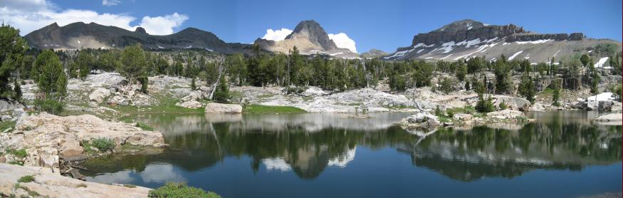
We passed our first lake of the Basin. Some hikers we met earlier said the swimming was good, and the nice flat rocks around the lake were good for a tent...
We were trying to decide were to camp. It was only ~3:45pm, but we didn't need to go much further today. We dropped our packs and explored the area for a bit. There were plenty of decent places to camp, but we decided to continue on the trail towards Sunset Lake, another .7 miles first. Plus we'd gain some elevation, and maybe the mosquitoes wouldn't be as bad.
We got good at crossing streams. The trick is to use the flat stones that are just a little underwater, rather than take long strides to try to only step on above water rocks. Your waterproof boots can handle it.
We had to climb 300' according to our map, and then descend 150' to where Sunset Lake lie. The climb up was full of switchbacks, and not too painful. The views back at the value were great. When we reached the top of the rise, and saw the lake below, we decided to camp at a spot on the rise, which had views to the north, west, and south.
A look back across Alaska Basin. We entered the Basin exactly half way across this picture on the far side
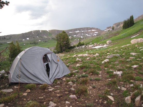
A look towards Grand Teton, from where we decided to set up camp. The sun was up, but there were dark clouds a-brewing...
There were some dark clouds to the northeast, and also to the south, and I told Wendy, "It looks like the clouds from the south and the clouds from the north are both moving towards us. This might be bad." We needed to fill up on water, and cook, so we gathered our water bags, and headed down towards the lake. We found a stream on our way, filtered water into our bladders and bottles, and found some nearby rocks to cook up dinner.
There was an incident involving spilled dehydrated pasta when Wendy opened the bag, and one of the unsealed internal packets spilled half its contents onto the ground. I tried to salvage as much as I could, but there was a lot of dried food, hard as a rock, left on the ground. We wondered what would happen to it. However, the dehydrated pasta primavera was excellent, especially with some left over smoked salmon from a lunch pouch.
A couple of marmots watched us eat, and relaxed on a nearby rock.
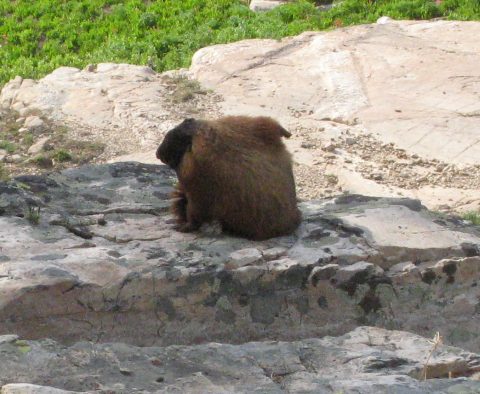
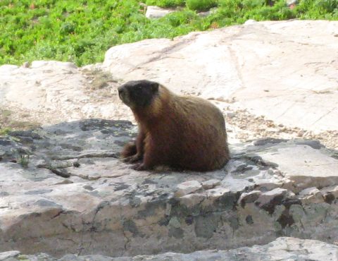
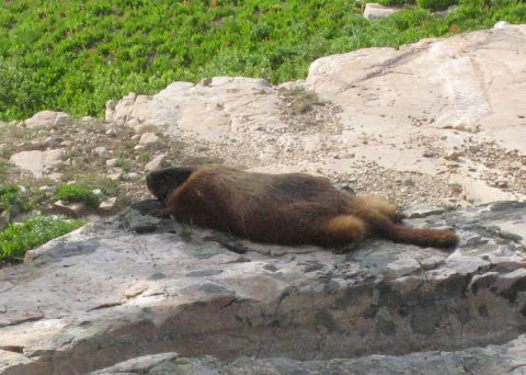
This marmot was busy scratching his side, and relaxing while we ate. Check out how flat they can get...
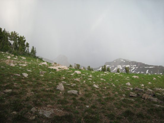
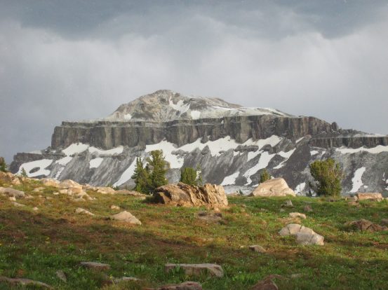
After dinner, we headed back up to camp, and found some other hikers asking where good sites to camp were. We pointed to a couple spots we found near where we ate. When we got to our tent and looked across the basin, it became clear that a storm was coming.
A couple of seconds after I took this pic, I saw lightning land on the near side of those peaks, inside the basin...
We debated about running to lower ground, or escaping into the tent to stay dry. Given there our camp was still low compared to the mountains rising up behind us, we took refuge in the tent, and waited. Sure enough the rain became extremely heavy, and the sky lit up with flashes of light, followed by rippling crashes of thunder. Then the sound of rain hitting the tent turned sharper, and we saw pea sized hail through the window bouncing off the tent and ground. We wondered if the other hikers got their tent set up in time.
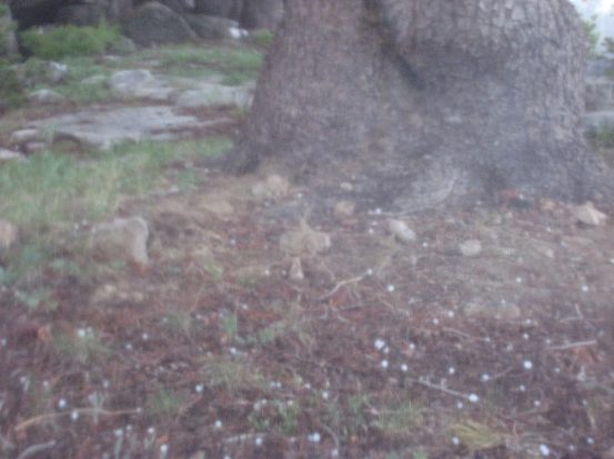
Some nice sized chunks of hail scattering on the ground as we stay huddled inside the tent... (picture taken through plastic tent window)
When the noise calmed, I unzipped the tent and saw the sun shining on the newly iced landscape...
There were a few waves of rain, but it cleared within 30 minutes, and we got out and assessed the situation. The hail melted fast, and it looked like cloudy skies for the night, though no more rain. We brushed teeth, and went to bed ~9:45, there was pretty lightning to the north far away.
A look north, with our tent in view, and Wendy peaking through the mesh...
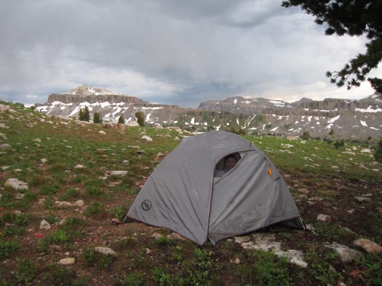
A look south, with our tent in view, and Wendy peaking through the mesh...