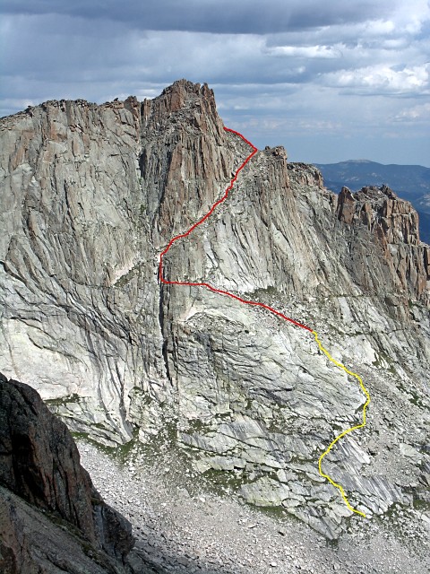
I found this pic online of the route up Arrowhead. This was our goal...
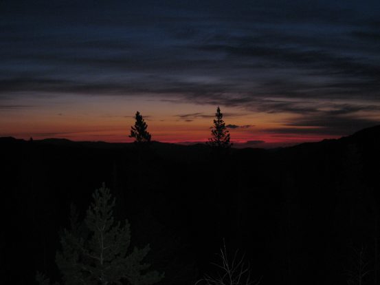
Roads were clear the whole way up to Glacier Gorge trailhead, and we started our hike at 5am, the skies still dark enough for us to don our headlamps for the first 10-15 minutes of the hike. The northeast horizon was a deep red with the rising sun.
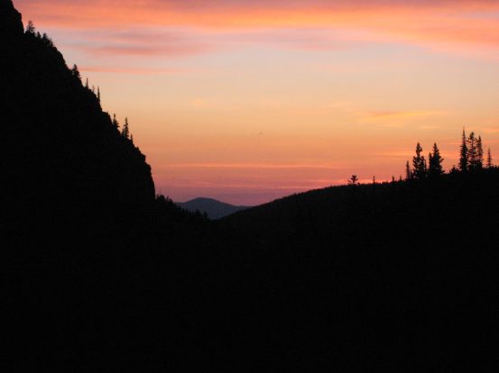
The trail didn't offer many views of the horizon early on, but I took advantage of the few openings in the forest...
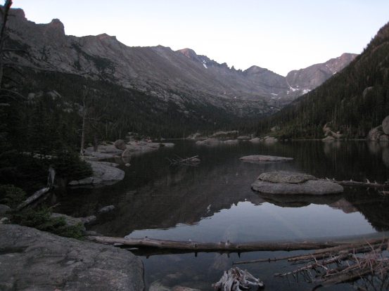
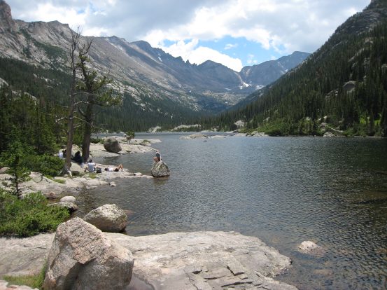
We saw a few other early morning hikers on the trail, most of home were carrying rope for climbing expeditions. Our pace was fast, and we reached Mills Lake quickly. Soon we could see the tip of arrowhead emerging.
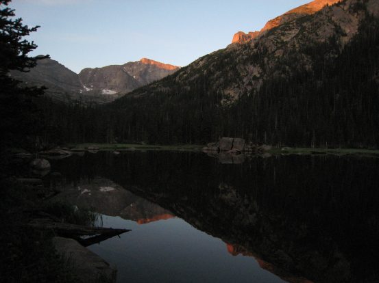
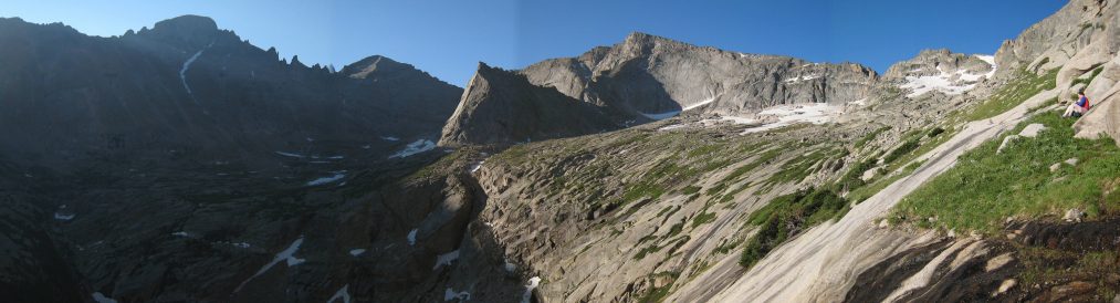
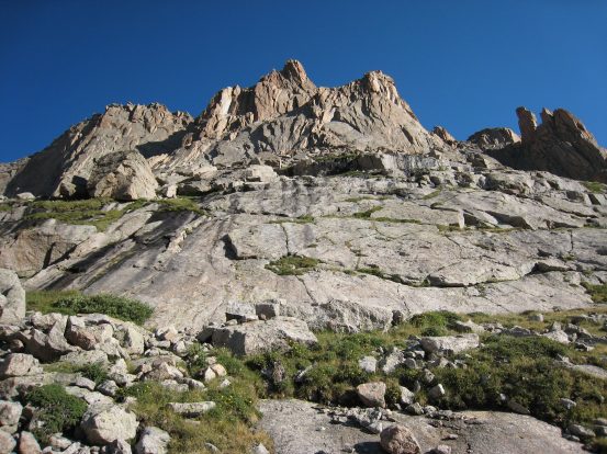
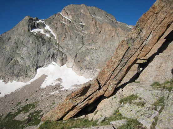
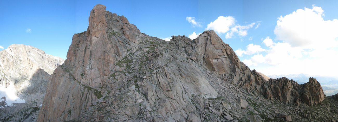
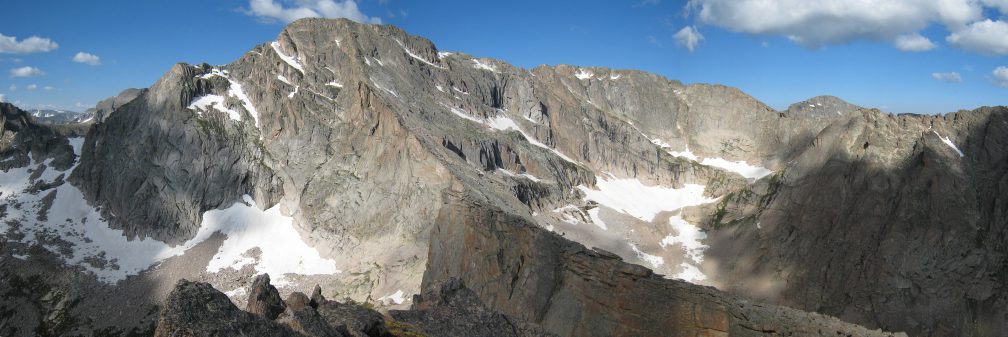
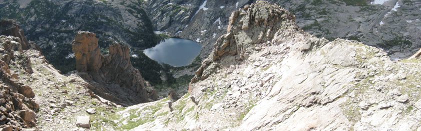
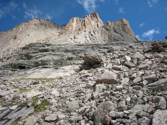
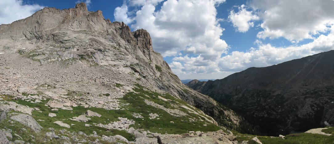
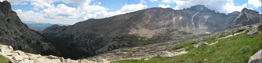
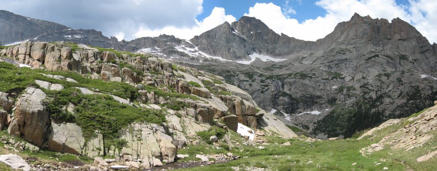
Glacier Gorge was an amaing place, with sharp cliffs ahead and on the sides. Arrowhead is the sunlit bump just right of the center, in the right pic...
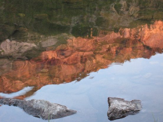
Some pretty reflections on Mills Lake, looking back...
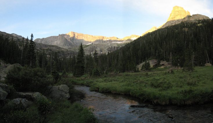
The further we went on, the more Arrowhead emerged. The trail was fairly gentle, and had serveral long stretches of railroad ties lying over marshland. The wood was wet in the morning, so had to be careful on the "balance beams".
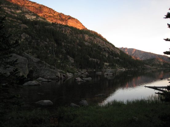
Arrowhead looking sharp, like an arrowhead, on the right...
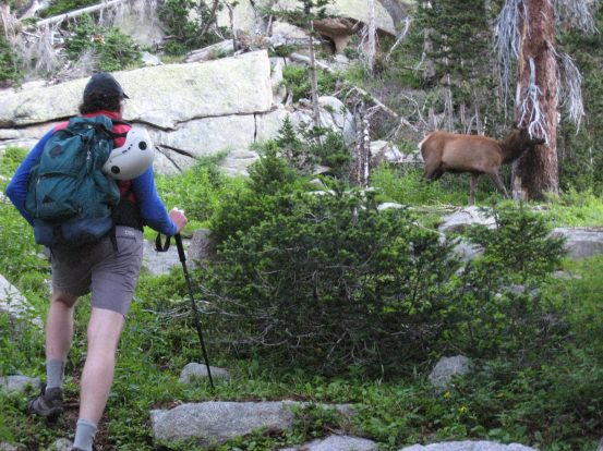
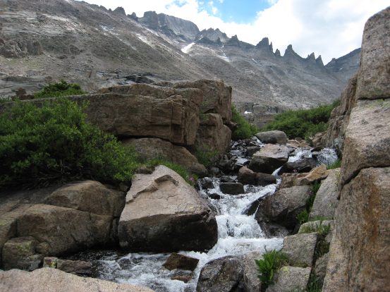
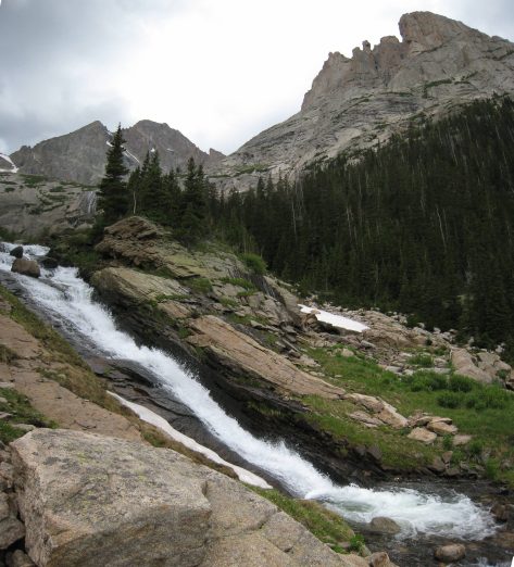
We headed for Black Lake, 4.5 miles from the trailhead, where we would need to begin our scamble off the maintained trial, up towards Arrowhead. There was a cascade of water leading up to Black Lake. When we reached the lake, an elk greeted us at the stream crossing. It hardly moved at all while we walked passed.
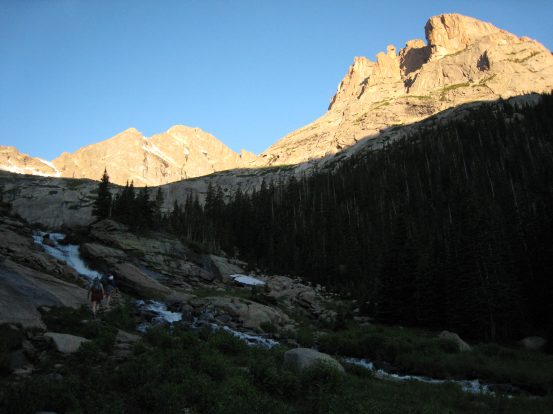
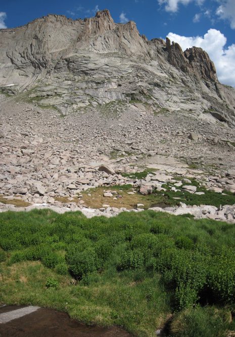
A cascading stream before reaching Black Lake. Arrowhead jutting up on the right...
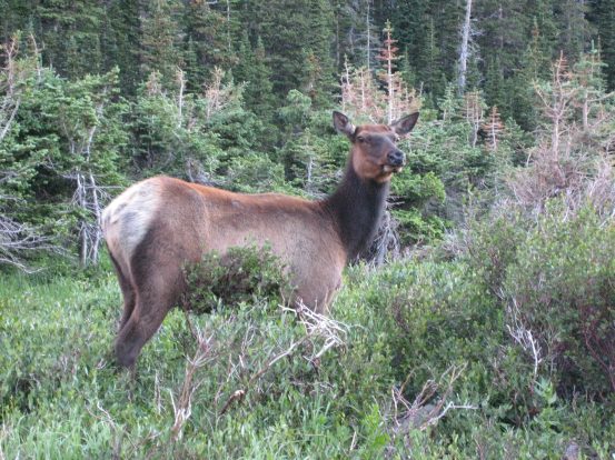
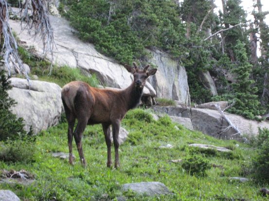
An elk takes a look at us during it's morning feed on some vegetation. We walked very close to it as we crossed the stream exiting Black Lake...
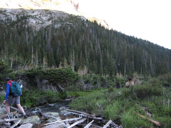
We had to bush-wack a bit once we left the trail, and cut over to the fairly steep wooded slopes leading to Arrowhead. I followed Dave, and very quickly we ran into two more elk. One of them had small antlers.
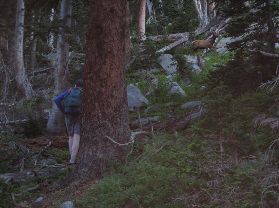
These elk weren't scared of us either, and only stopped to stare at us...
They can really crank their necks around...
Dave kept leading to the up and to the left of Arrowhead, looking for the avalanche clearing. Eventually we reached it, where the views opened up. We climbed up along the grass, until we reached steep rock, then Dave said we needed to traverse around the grass to the left. I tried to find a way up the rock at first, but turned back after finding that the slabs got too steep, and there was no way to cut over to the left from there. I caught back up with Dave, and we put on sunscreen, as the sun had broken over the east mountains.
Walking up the avalanche clearing, with Black Lake behind...
Along the sun/shadow line...
Above the sun/shadow line...
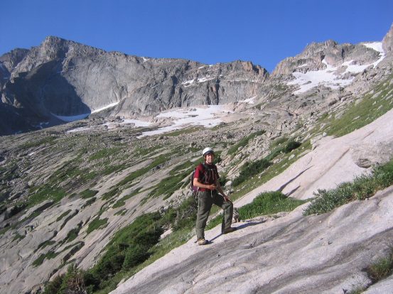
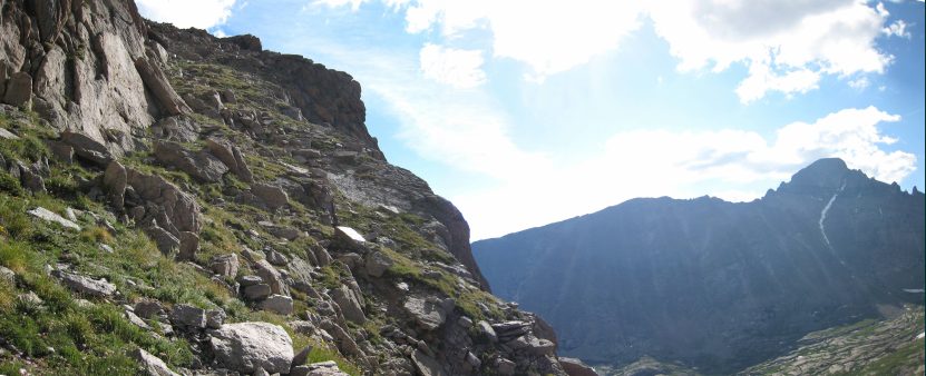
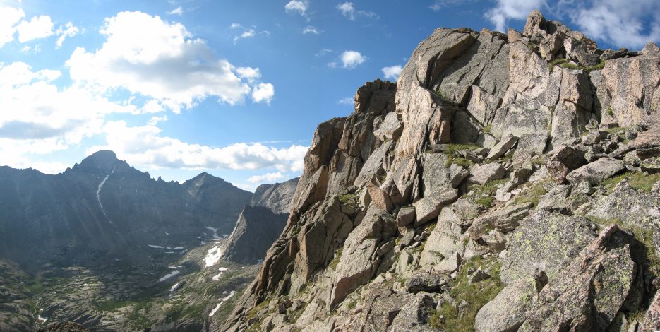
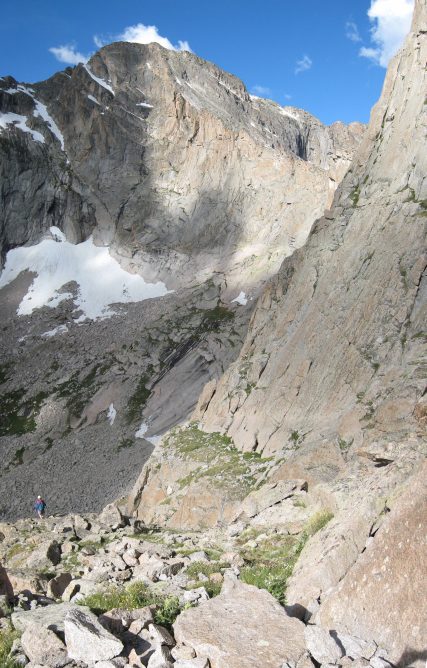
Dave putting on sunscreen after we reached the upper basin. The backside of Long's Peak is the large bump on the left...
We hiked into the basin along a somewhat grassy tier, with the slopes of Arrowhead on our right. Eventually we need to climb up to the next grassy tier, and switch back. Reaching the next tier involved scrambling up some steeper grass and rock. A found a pretty easy route, but looked back and saw Dave on a steep rock slab, trying to climb there. I told him to come check out my route. There were some beautiful wildflowers in clusters along the slopes.
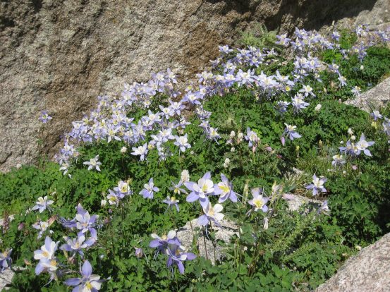
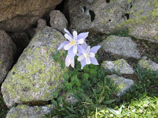
A dense columbine flower patch lay near a bunch of boulders at the basin's edge...
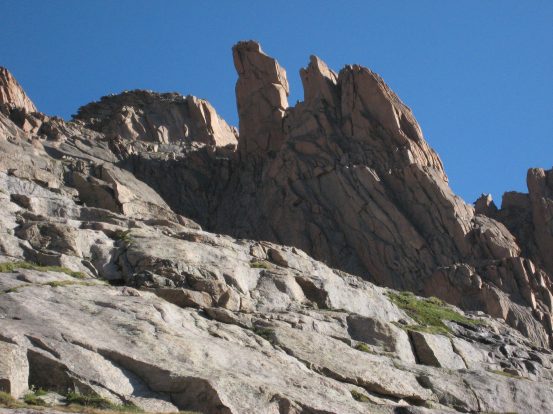
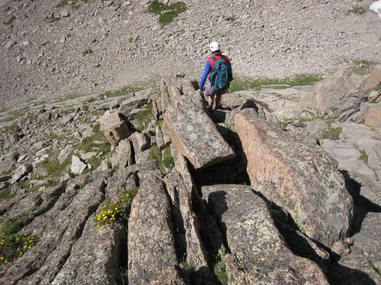
A look up at some of the rocky terrain to maneuver around to gain the summit...
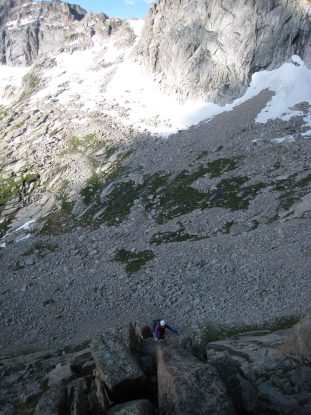
Yikes! When I turned back and saw Dave here, I told him to go back and come further before climbing up...
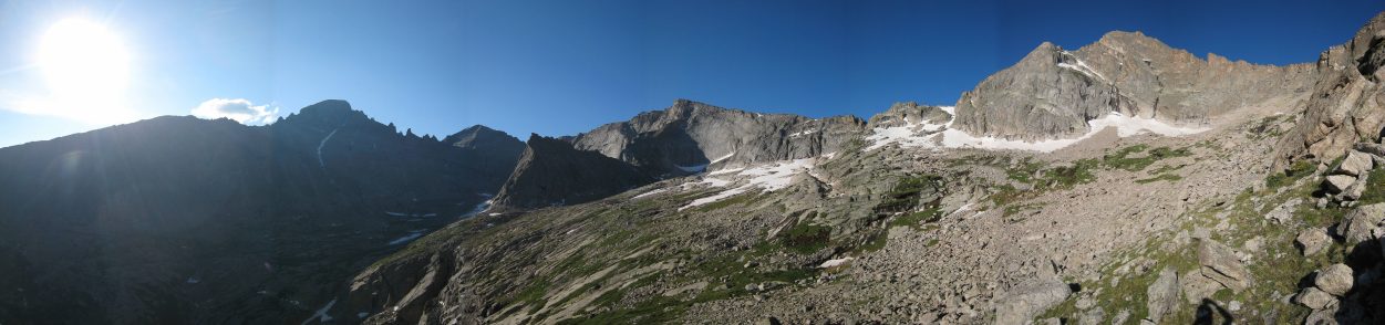
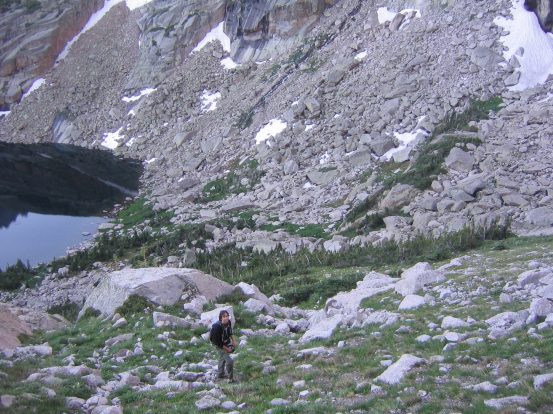
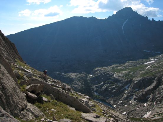
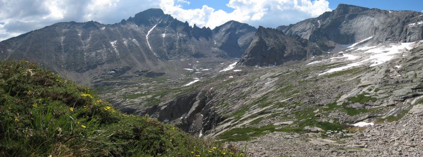
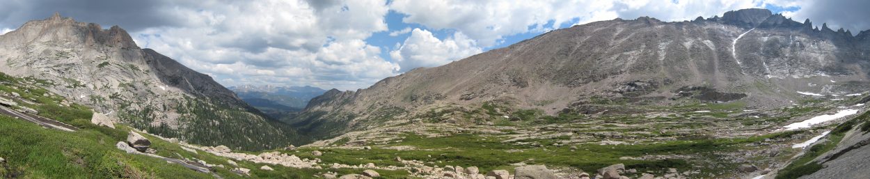
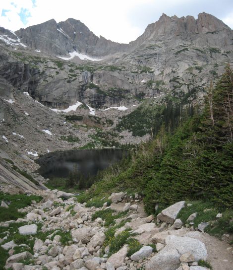
A view from "tier 2" of Arrowhead. We started from the dark recesses of the gorge...
Dave told me that if I went ahead, to stop at an arch that had fallen and cracked, which was where the rise to the next tier was...
I reached the slanty arch, with a crawl space on the right, and turned back to see Dave following on the grassy tier....

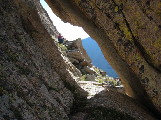
I crawled through easily enough, with my pack on. Dave threw his pack through the hole first, then crawled through...
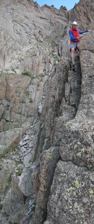
What laid beyond the arch was a shock. The trail disappeared. There was a wall up on the right, and cliffs everywhere else. I wasn't expecting anything class 4/5, but this looked pretty apparent. Dave had been up here twice before, and even he didn't remember it looking so challenging. He said the easiest way up was to take the outside rock, where there were easier ledges, but a sharp and deadly cliff. The other option was a trickier climb up some ~10' rock slabs with cracks (probably easy class 5 according to Dave), but with the advantage of having just the 3-4' fall if you slip.
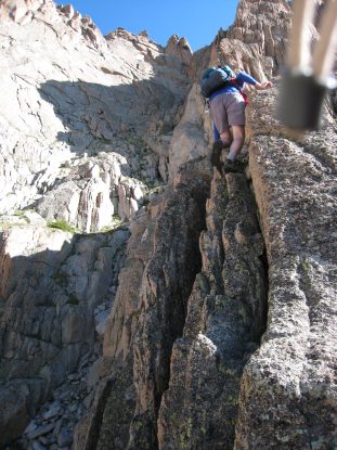
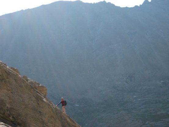
I choose the class 5 cracks on the right, Dave went up the exposed class 4 on the left...
It was actually pretty simple climbing up the cracks. Decent holds, and plenty of cracks to wedge your toes in. Dave said he was shaking a lot on his climb, mainly just nerves, and that it wasn't that difficult. There was some more easier scrambling up a narrow line of rock, before reaching "tier 3", some grass that bent and climbed up to the summit.
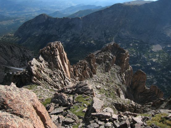
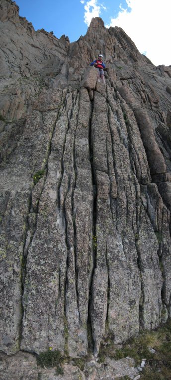
A look down at Dave climbing up to "tier 3", and a look up at the grassy/rocky stretch around to the summit (check out the top red route in the map at the top of the page)...
After climbing up that grassy stretch, a look back. The peak rises to the right. Dave is a red dot in the bottom right...
A look at the vortex-like ascent to the peak of Arrowhead (viewing from a side arm I scrambled to)...
Almost to the top now...
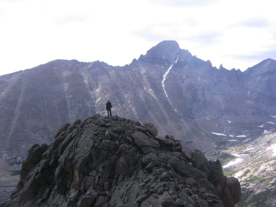
We summitted at 9am. Plenty of clouds were already moving in, though none too dark yet. The peak had plenty of interesting rock features jutting up and out. Quite spectacular. Reminded me of some of the warped landscapes of the Quirang in Scotland.
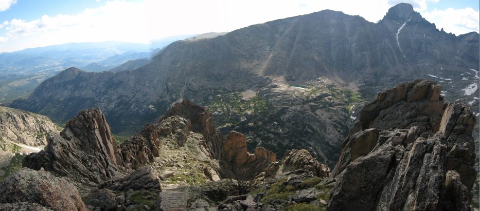
A look back towards the trail, from the summit. Long's Peak thumbs high in the upper right...
I wanted to try climbing the point on the left here...
To the south, a long sharp cliff leads up to McHenry's peak (a 13er)...
We ate some lunch and admired the views. The growing clouds made it apparent that we should head back down soon. We certainly didn't want to be climbing down the steep rock in the rain. I went down ahead, and scrambled up to a side arm of the peak, hoping for a cool looking picture.
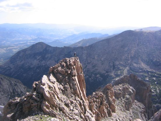
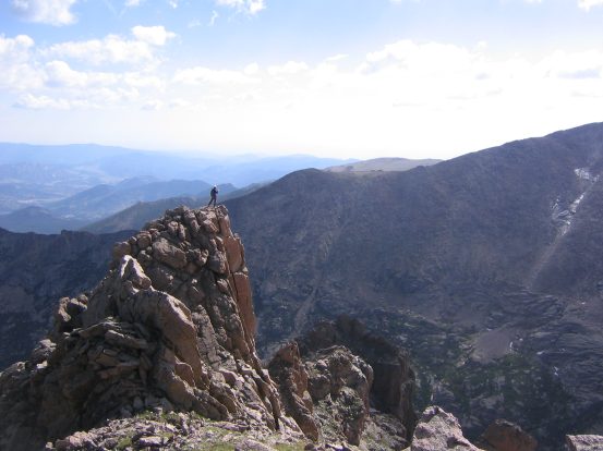
Couldn't figure out which pic I liked better, so I put up both. The climb was simple, just class 3, but impressive looking...
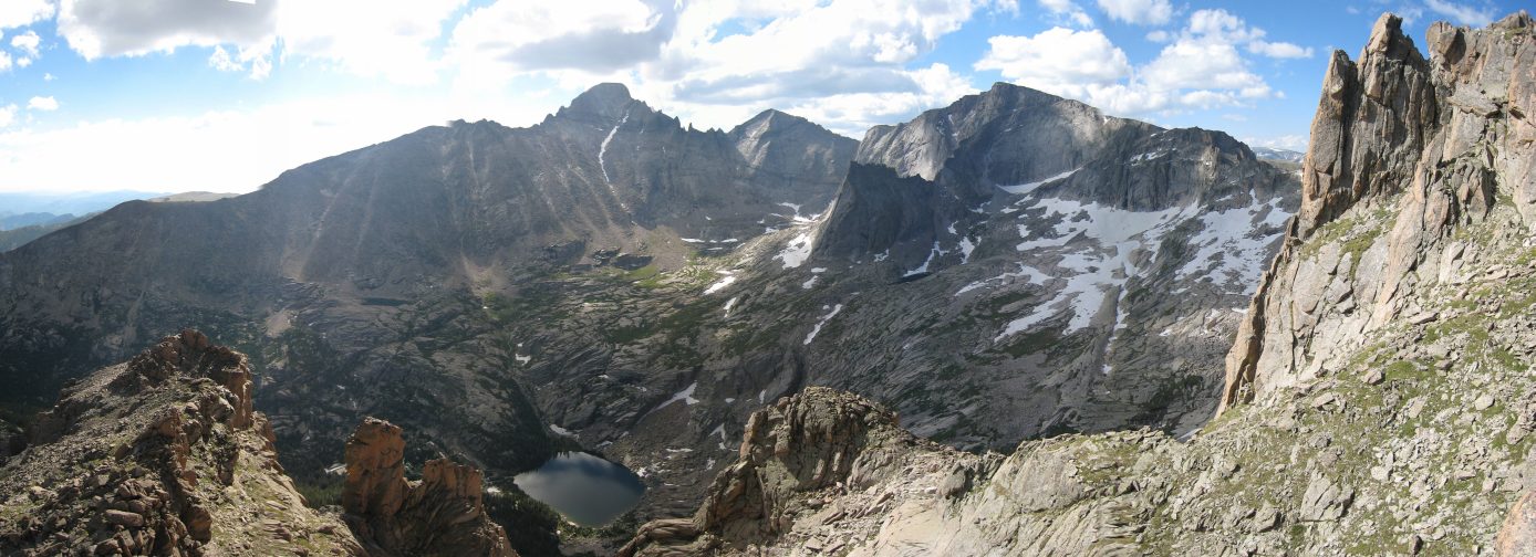
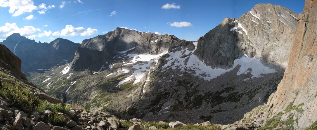
The view from here was excellent! Chief's Head, is the peak in the right-center, and the smaller peak connecting to it by a sharp ridge is called spearhead. Aptly named...
Same view looking down. Black Lake was a 1600' gain and 4.5 mile hike from the trailhead. From Black Lake to Arrowhead was probably just over a mile, and 1600' gain...
I climbed over to another arm, with Long's Peak in the background...
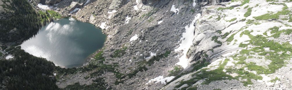
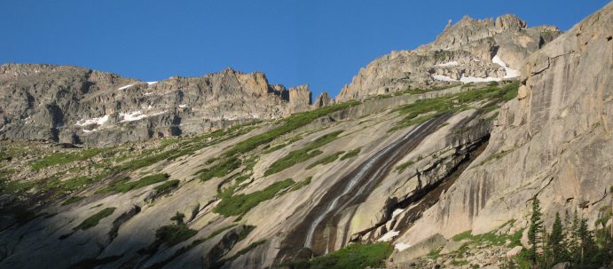
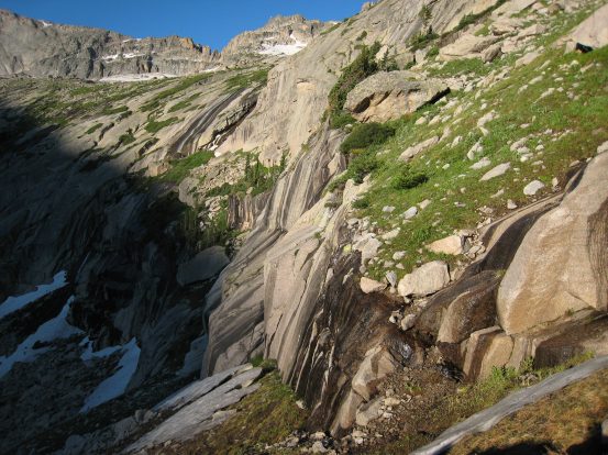
A look down at the lake, and the waterfall slope that seemed so high earlier...
Heading back down and arriving at the top of crux of the hike again...
Once again, Dave takes the route down the left, I take the cracks on the right. Definitely a bit trickier coming down. Really had to wedge my toes in the cracks as I downclimbed, but felt stable, and was ready to jump off on to the grass at any time, if need be, as I descended...
On the descent, we cut down down the rock in a more vertical fashion, rather than take the long switchbacks across each tier. Dave proposed hiking across the upper basin, and hooking up with a trail on the other side that led down to Black Lake. This would be less steep, though much longer, and easier on his knees. I was happy to checkout the lush green basin, and was happy for the extended trip.
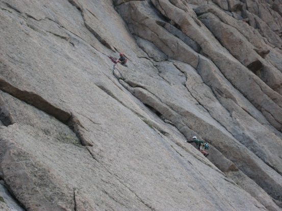
As we descended, we saw a pair of climbers taking a technical climb up to Arrowhead. We pretty much went straight down the rock, after the crux, though had to avoid a few too steep slabs of rock...
We decided to hike along the curved basin, past Spearhead, and back down to Black Lake on the far side...
We rested awhile after the steep descent, crossed the stream that made the waterfall over the basin edge, and continued across the basin...
There was no trail in this area, so we cut across the rock and grass, trying to stay off the vegetation as much as possible.
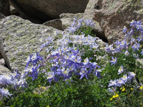
We saw another dense vein of columbine. It was the highest concentration of columbines we'd ever seen...
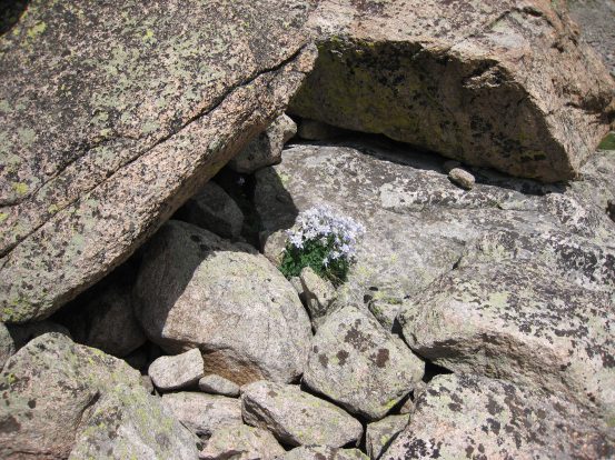
This cluster seemed to be growing from pure rock. It was odd to see all this columbine flourishing among boulders...
A look back at Arrowhead, and the opening of Glacier Gorge...
Dave leads the way across the upper meadow, the long spine that holds up Long's Peak ahead...
We cut over to Frozen Lake, at the foot of Spearhead, and saw some climbers ascending its front...
From Frozen Lake, a cairned trail somewhat appeared, though I lost it when scrambling to some spots to take pictures, but you can't get lost up here...
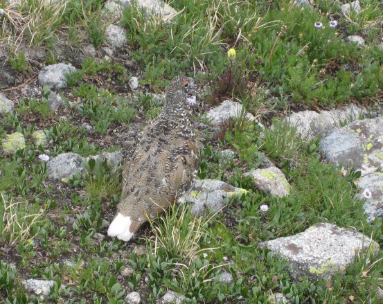
Dave pointed out a ptarmigan. They sure blend in like a rock...
We continued hiking until we crossed a stream, where a maintained trail led down to Black Lake...
The clouds darkened Arrowhead on the right, and McHenry's Peak on the left, as we began the descent down to Black Lake...
The shade was a bummer, cause this view was spectacular, and would be have sweet in the light and with blue sky. I'll have to come back...
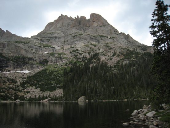
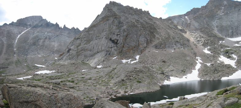
Black Lake looking very black, with Arrowhead behind...
On the way back, another look at the waterfall emptying from Black Lake, and Arrowhead above...
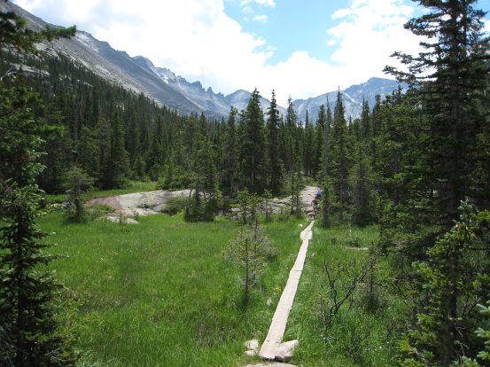
A look at one of the many wooden boards that cross over wet grasslands. A last look back from Mills Lake...
On the way back we took the "long cut" that passed by Alberta Falls. There were huge crowds along this trail. I tried running, but had to stop every 15 seconds to try to pass people.
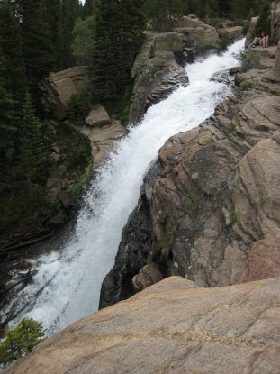
Alberta Falls, about a mile from the Glacier Gorge trailhead...
It was very hot at the parking lot, and tons of people were waiting for shuttle buses. Of course, since we had arrived at 5am, there was still parking in the small lot. We left at 2:30pm, and though the traffic was high in Estes Park, it moved fairly smoothly.
Arrowhead was an amazing rock, with lots of challenge and gorgeous views. I'd take any visitors looking for a 10 mile hike up to Black Lake. Such a beautiful area. Much thanks to Dave for introducing and guiding me to Arrowhead. Every time I do a cool hike in RMNP, I realize how much I love Fort Collins, in that I can get to world of top notch mountains in under 90 minutes.