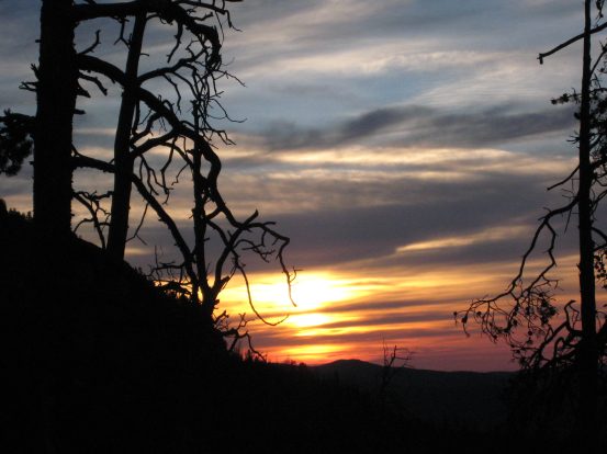
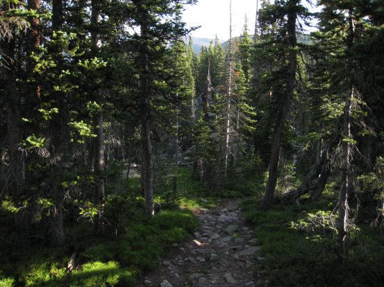
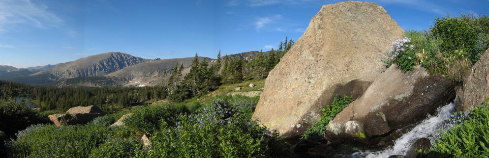
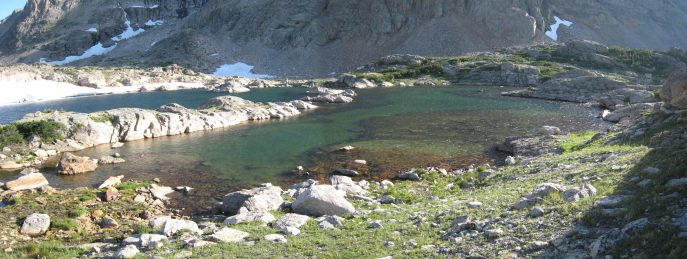
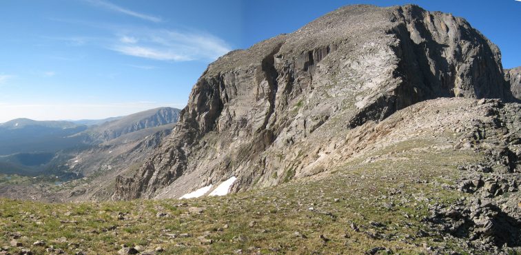
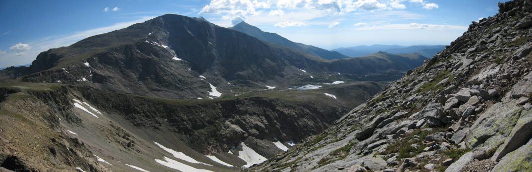
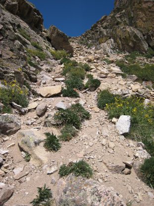
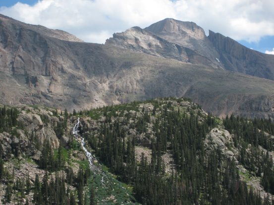
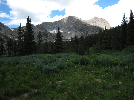
After a couple of miles in, a view of the morning light came into view through a clearing...
For the 5th weekend in a row, I woke up early for a big hike. This time at 3:15am, to check the weather. The forecast looked good for the morning, with a decent chance of storms after noon. I ate some cereal, grabbed my already packed bag, and hit the road at 3:47am, heading for RMNP's Wild Basin entrance. From my house to the parking lot there was not one car that I saw ahead of me the whole way, and I made incredible time on the road, arriving to the trailhead just after 5am.
With sunrise being 5:50am, it was still dark, but just light enough to get by without a headlamp. I planned to run quite a bit of this trail, and debated which shoes to wear. I ended up picking a sturdier soled, low ankle boot, rather than my trail running shoes, since there would be quite a bit of boulder scrambling, and I figured I'd appreciate the thicker sole. Turns out this was a good move.
I started the hike at 5:15. The trail from Wild Basin is very wide and gentle. I had been on this trail up to Lion Lake last year (6.2 miles in), which is near the foot of Mt. Alice, so I knew what to expect. The trail had very little openings through the forest, and though there were some pretty cascades nearby, I kept my camera in my backpack, and alternated walking and jogging, making good time.
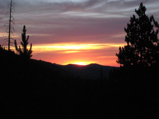
After about 30 minutes, I found an overlook where I could see the morning light on the horizen. I stopped and took pictures, debating about staying to watch the sun rise all the way, or moving on, and hoping for another opening later. I moved on, and found a couple other lookouts a few minutes up the road.
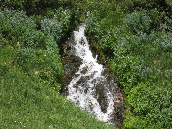
After a couple of miles in, a view of the morning light came into view through a clearing...
I packed the camera again, and continued walking and running stetches of the trail. Gradually gaining elevation. Soon I had reached Ouzel Falls, with the morning sun just breaking on the trees.

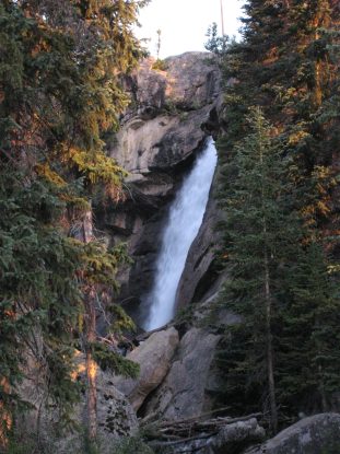
A glimpse of Ouzel falls, looking healthy, from a bridge over the cascading stream...

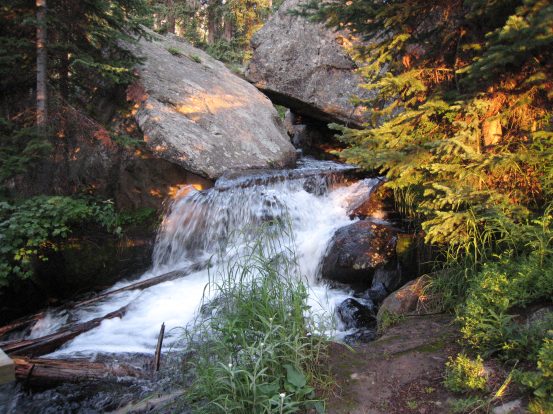
The morning sun casts some orangey-gold light on this cascade...
I continued on to a trail junction, and noticed that I had covered 3.5 miles in 62 minutes. Continued to the next trail junction, where I had covered 4.8 miles in 84min. At this junction, the trail to Lion Lake split, and I knew from the past that the elevation gain picked up, so the pace would be slowing down a bit. 2.2 miles to Lion Lake #1.
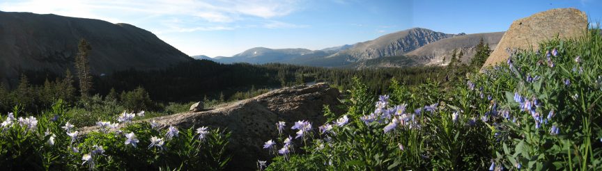
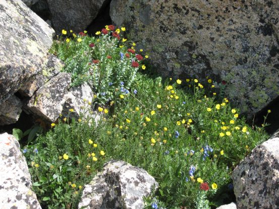
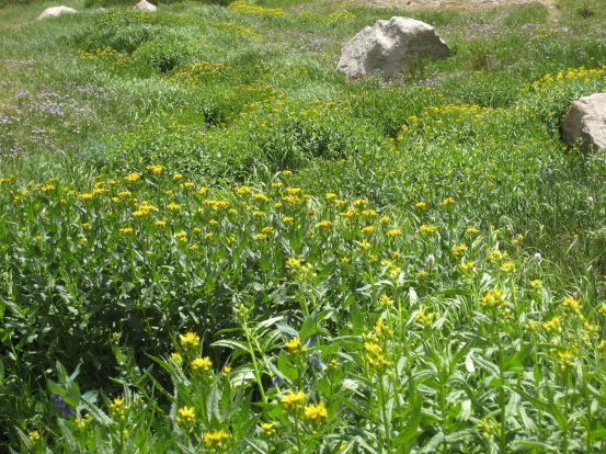
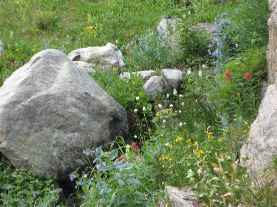
The trail went up through a gorgeous green forest, and eventually wildflowers started appearing. I passed a couple of people on the trail here, who must have started very early, or camped somewhere in the forest.
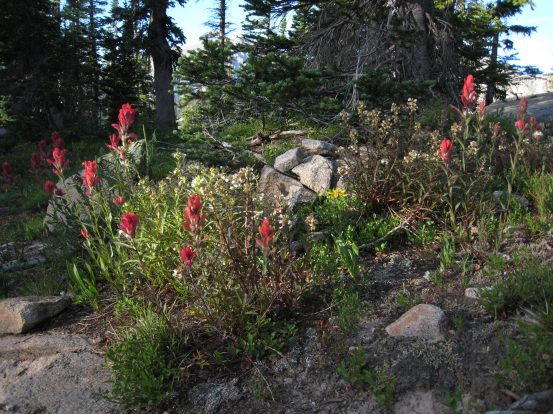
The trail up to Lion Lake was gorgeously green, and passed by red wildflowers...
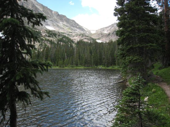
I reached Lion Lake #1 at 7:30am.
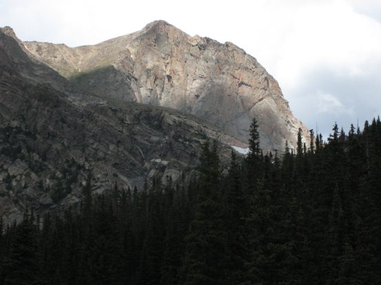
The sun still hadn't entirely cleared the mountains to the east, leaving Lion Lake #1 in shadow, while lighting up Mt. Alice ahead...
Pretty reflections of sunlit mountain over shadowed water...
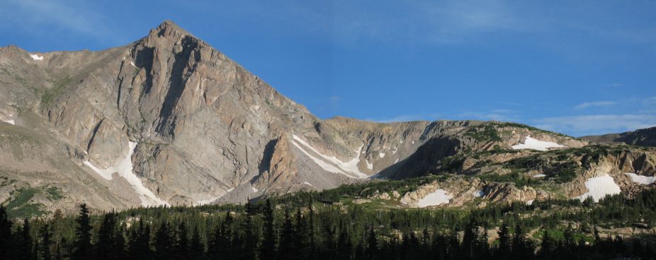
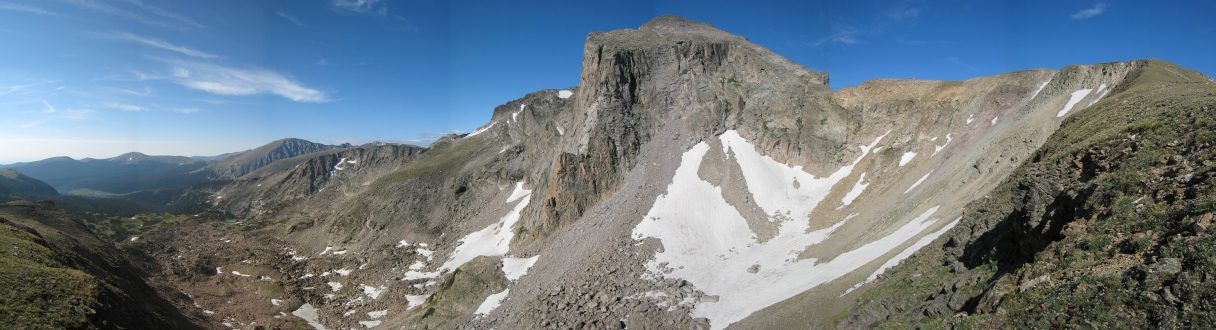
The path to Mt. Alice is revealed. Simply continue on up along the right, and across to the 45 degree-ish right face of Alice...
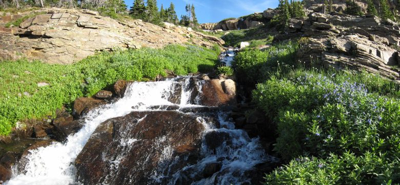
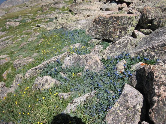
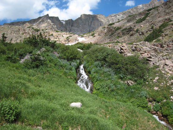
Just beyond Lion Lake #1 was a beautiful cascading stream through lush wildflowers. I took many pics here...
One of the most beautiful places for wildflowers I'd ever been, but a long 6+ mile hike to get here...
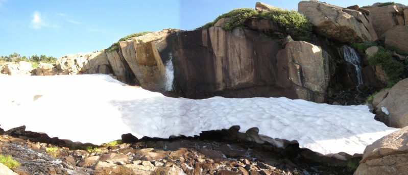
The waterfalls that fed the cascading stream. Still snow up here well into a hot summer...
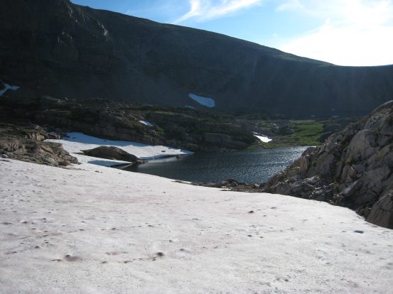
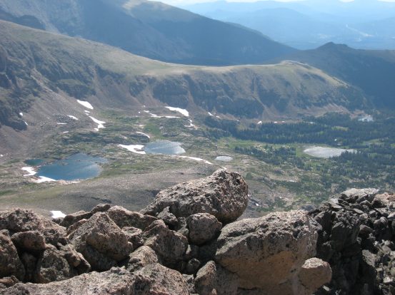
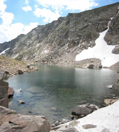
Above the waterfall was Lion Lake #2. I crossed a small snowbank above it...
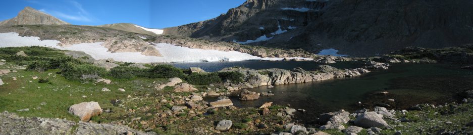
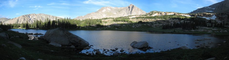
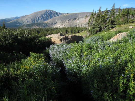
A bit further up was Snowbank Lake, in the above 2 pics. Mt Alice on the left. Wendy and I had reached this point last year on a hike...
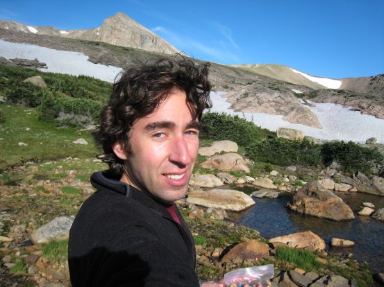
A self-portrain at Snowbank Lake, with Mt. Alice in the backdrop...
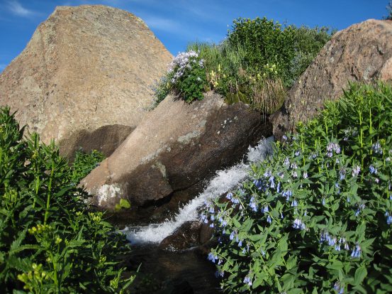
Snowbank lake was extremely clear and beautiful. I pumped some water into my bladder for the ascent up to Alice. This was the last water source until Lake of Many Winds, on the return trip back down from Mt. Alice. I left Snowbank Lake at 8:20am, excited to explore new terriroty.
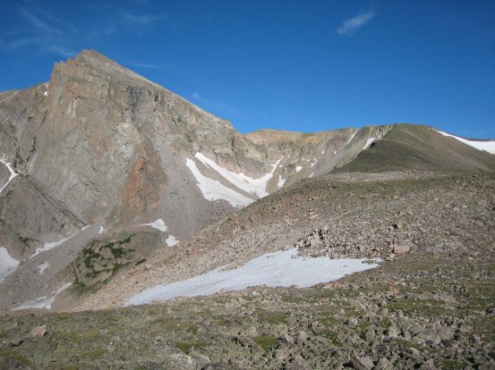
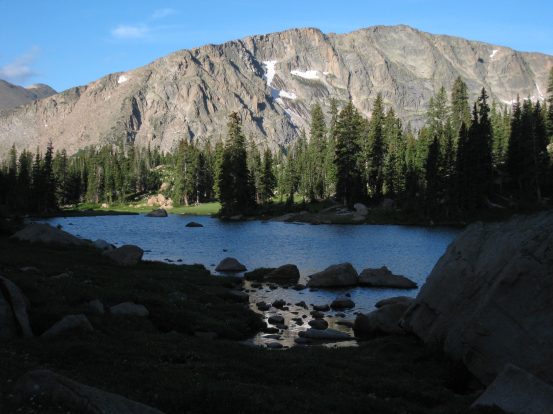
A look up towards Alice, the obvious route up entirely in line of site...
And a look back at Snowbank Lake and Lion Lake #2...
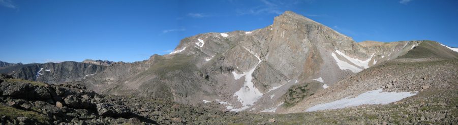
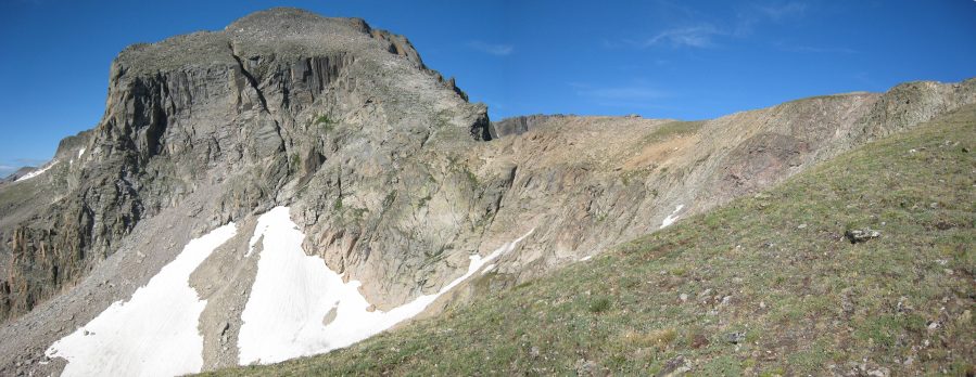
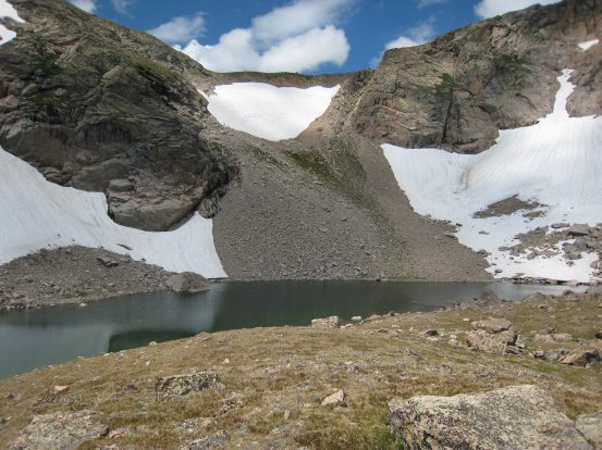
A look at the chasm in front of Mt. Alice. The route continuing to ascend on the right...
I noticed this "chink" in the ridge of Mt. Alice. It looked intimidating, but it turned out to be a fairly wide, slanty, ridge...
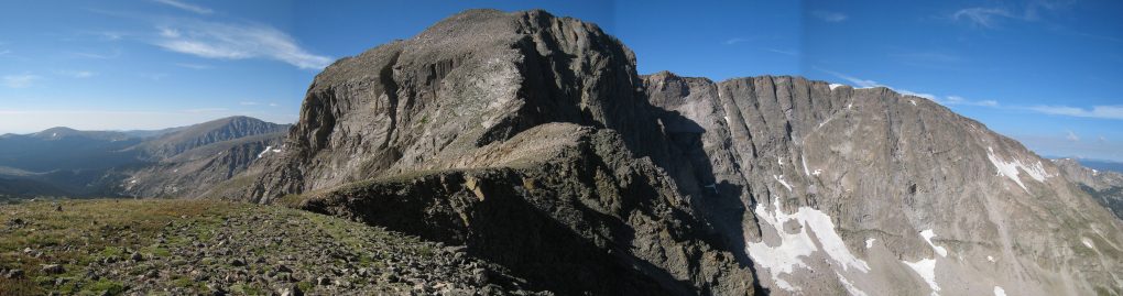
Another look up at the Alice. The north face of Alice coming into picture...
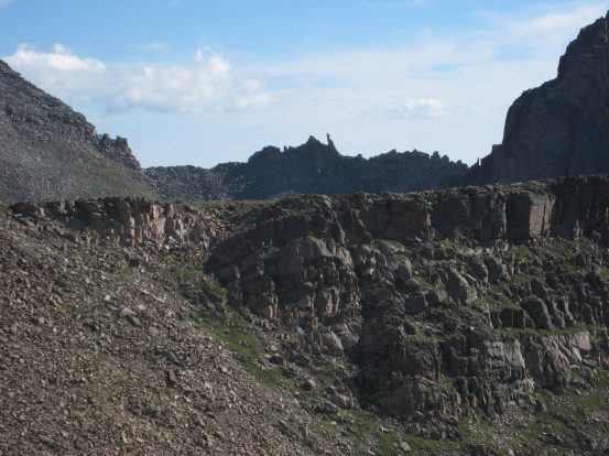
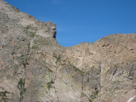
To the north, a jagged ridge appeared, where the "stoneman" stood...
Here come several pictures of the Hourglass Ridge, as I approached...
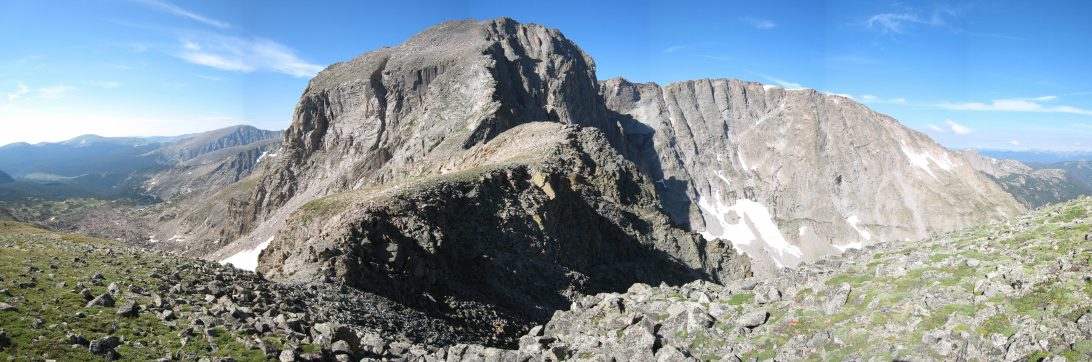
Several looks at the Hourglass Ridge, leading up the north face of Mt. Alice...
Half way along the Hourglass Ridge, I heard some falling rock ahead on Alice, and saw a guy coming down. We crossed paths at the bottom of the north face of Alice, and he said he started hiking at 4:30, up from the Thunder Lake side of Alice. I asked him to take my pic.
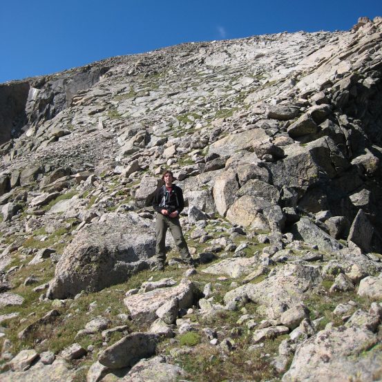
There's a small black spec of a guy just to the upper right of the center of the left pic. He took my pic before I began the steep ascent of Alice's north face...
The climb was steep, and it wasn't hard to send small rocks tumbling down the slope, but I tried to be careful and step on bigger secure rocks. I stayed on the right side of the face as I climbed. It was fairly slow going up the slope, not due to difficulty, but just tiredness. It was pretty low class 3 stuff.
Looks like a 45 degree slope up the north face. Chief's Head is the opposing mountain, and the tip of Mt. Meeker sticks up to the left...
Looking back down towards Hourglass Ridges, and the arm leading down to the lakes on the right...
I reached the summit at 9:55am, 9 miles in and 4,810' higher than the trailhead. There wasn't much of a breeze, and the air was cool and pleasant at 13,310'. Took plenty of pics, and ate a bean and cheese burrito.
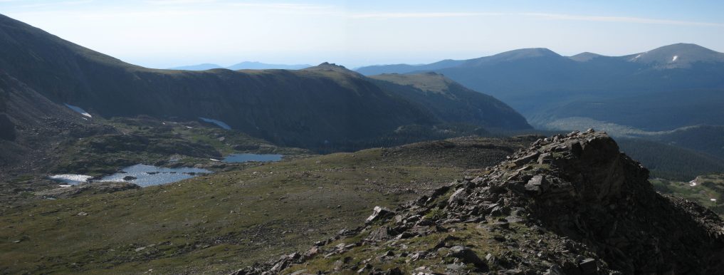
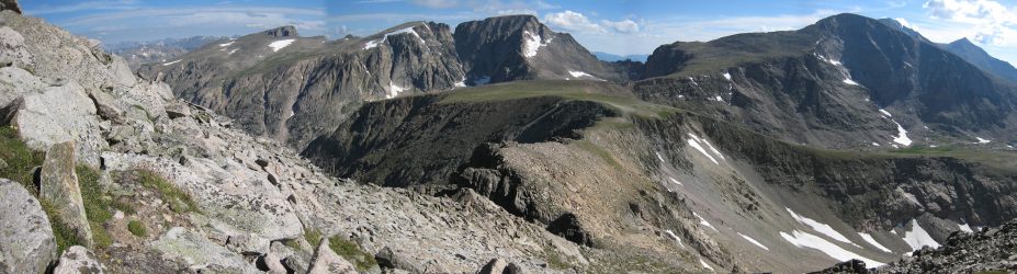
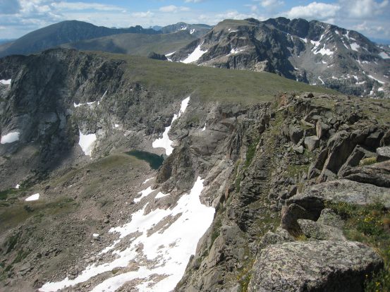
A look at Snowbank Lake, Lion Lake #2, and Lion Lake #1 from the top of Alice, and up at Long's Peak and Mount Meeker (left to right), visible from Mt. Alice, to the northeast...

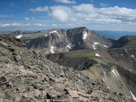
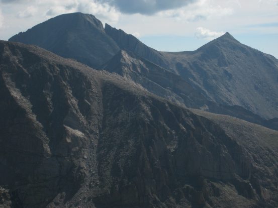
The top of Arrowhead, which I hiked last week, just barely clears this ridge to the north. Arrowhead is the bump on the ridge exactly in the center of the pic on the left. A zoomed out view appears on the right...
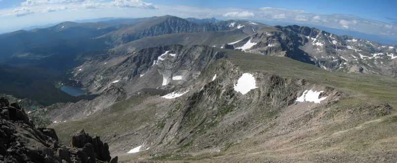
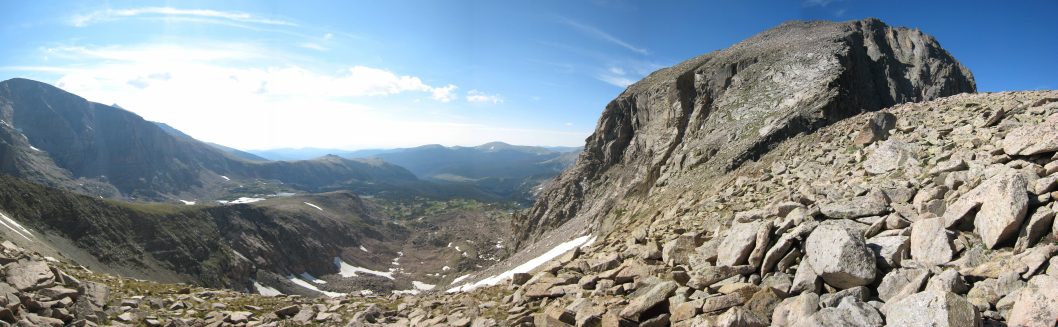
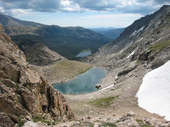
A look to the south shows my return path. I need to cross the tundra field, and find an opening in the cliffs that lead back to Thunder Lake on the left...
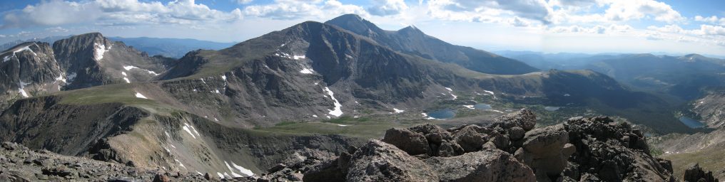
A panoramic view of the ridge leading up, Longs and Meeker in the center, and the lakes on the right...
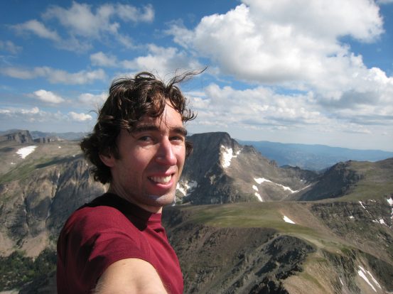
A self portrait before leaving Mt. Alice at 10:15am...
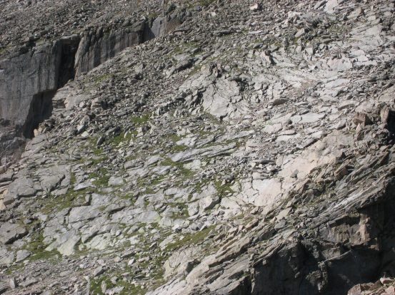
The hike down the bumpy tundra was not run-able. There were too many rocks, and the ground was uneven. There were occasional patches of flowers. Again the path was obvious. Hike down along the ridge, and look for the opening down to Lake of Many Winds.
Some of the flower patches scattered throughout the tundra...
A look down the ridge. There's supposed to be a path down where the lake is, a steep, crumbly path...
Eventually I made my way to the gap in the rock where a steep scree path led to the lake. A hiker was near the top as I reached it. He was heading to nearby Tamarisk Peak, further to the south. It was close by, but the clouds were growing dark, and I wanted to get out before it rained, so I just headed down the slope, rather than check out the view from there.
I passed another 2 hikers, who were climbing up, as I started my way down. I waited a lot, and stayed to the very edge, so as not to send any rocks tumbling down towards them. I made it down to the first lake at 11:30.
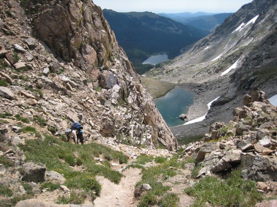
This guy crawls on all fours near the top of the steep trail. Lake of Many Winds is closest, followed by Thunder Lake in the distance...
A look back up the steep dirt/scree trail, and a look down the rest of the way towards the lakes...
A look into the clear waters of Lake of Many Winds, and then a look back across the lake at the steep scree trail I came down...
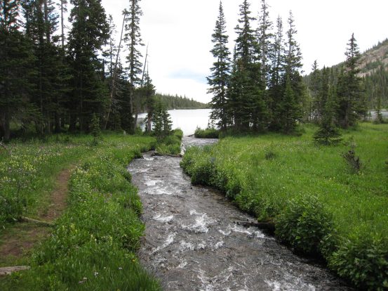
A real trail picked up again on the other side of the lake, that led down to Thunder Lake. This trail was gorgeous, surrounded by lots of green vegetation, flowers, and some meadow areas. I was able to run some of this trail.
The trail ran alongside a stream, surrounded by flowers...
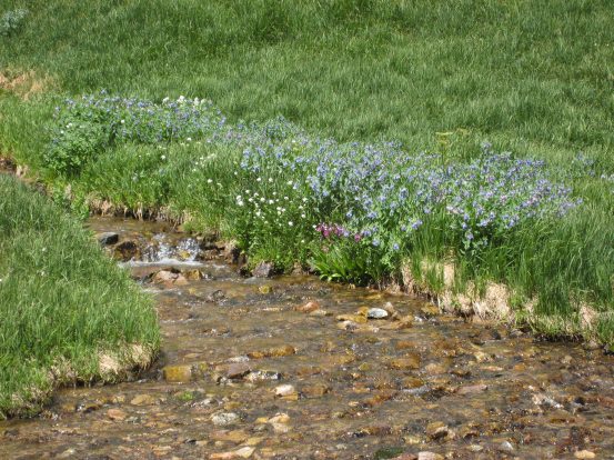
A look at some of the flowers nearby. This trail was worth coming back to...
I was surprised to see this lush waterfall across a meadow, with Long behind. More flowers all around...
I made it to Thunder Lake at noon, good speed from Lake of Many Winds. The rocky trail from the ridge is seen across the lake in the saddle...
A look back at Mt. Alice just before leaving Thunder Lake. A close of up Alice's steep east face...
I heard thunder as I passed Thunder Lake. It was just over 6 miles from Thunder Lake back to the car, on a mixture of flat and mostly downhill wide and clear trail, so I began the run back. Had to run and walk in stretches, but made great time. There was nothing else to stop and admire on the way back, so I kept moving. I left the lake at 12:15, and arrive at the car at 1:40pm, just as heavy raindrops began accumulating. It was a fun run, and I still had the afternoon to relax back at home.
Mount Alice was a pretty mountain, though a long ordeal to reach. The reason I wanted to hike this one solo, was to run the flat stretches, which comprised of probably 11 of the 18 miles. The steep stuff was definitely slow going though... All said, it was just under 8.5 hours for the 18 miles, 4810' gain. And a great memory. Lots of beautiful unspoiled areas with tremendous wildflowers.