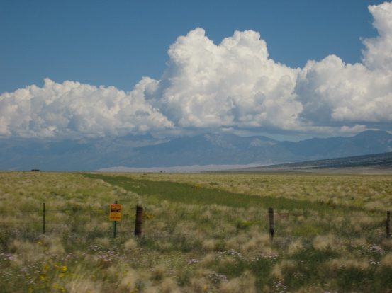
We took the scenic 285 highway past the Sand Dunes (appearing thinly spread out in this picture), and reached the Lake Como Road in 5 hours at noon...
We took the scenic 285 highway past the Sand Dunes (appearing thinly spread out in this picture), and reached the Lake Como Road in 5 hours at noon...
Along the way we had gorgeous blue skies above us in the valley, but noticed that the Sangre de Cristo Mountains had clusters of thick clouds among the peaks. The weather reports were calling for 40% chance of rain today and tonight, and some pinpoint forecasts had mentioned 50% chance from 5-11pm tonight. It seemed like a given that we would be wet hiking in to camp today. And it seemed likely that clouds would be lingering into the morning. I wasn't very optimistic about the weather this weekend...

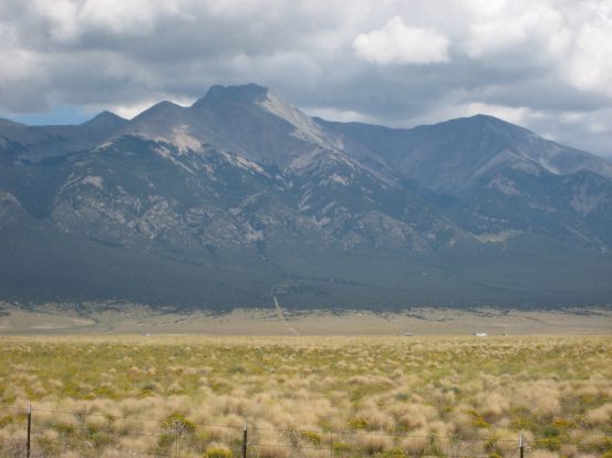
A pic of the massive Blanca group rising 6,000' from the field. A thin straight road can be seen rising up under Little Bear (14,037'). Bummer that the clouds only want to hang out in the mountains...
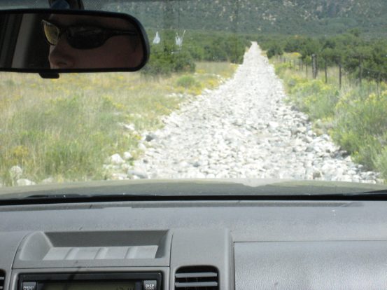
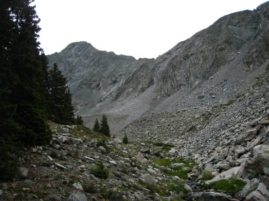
We turned off of highway 150, and began the bumpy drive. The dirt road was fairly flat and maneuverable for a passenger car for almost a mile, before the road surface turned into a creek bed full of rocks and began to climb straight uphill. We saw cars parked on the side of the road at varying distances, depending on how lucky the driver felt the odds were of getting their car up the road.
After another ~1.5 miles of rock, the road started to switchback up the hill. The road surface was a mixture of loose dirt and small rocks, with frequent big rocks, which made traction difficult, and travel bumpy. After one turn, some of the ground on the edge of the road gave way, and our left front tire lost contact with the road. We got out and help push the car back onto the road, and continued on a ways more.
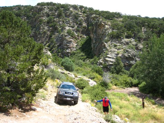
Ben drives straight up the initial rock-bed portion of the road. Dave helps direct over some tricky terrain...
I was having flashbacks of the Jeep ride to Snowmass with Dave last year. Though this road had a lot less exposure, and was wider, the surface was a bit tougher to grip and it was difficult just climbing the "easy" portion of the road before JAWS I (the first of a serious of "steps" in the road that only the most tricked-out Jeeps can pass). We did run into a Jeep coming down hill, but the passing was very easy, compared to the Snowmass Jeep crossing last year.
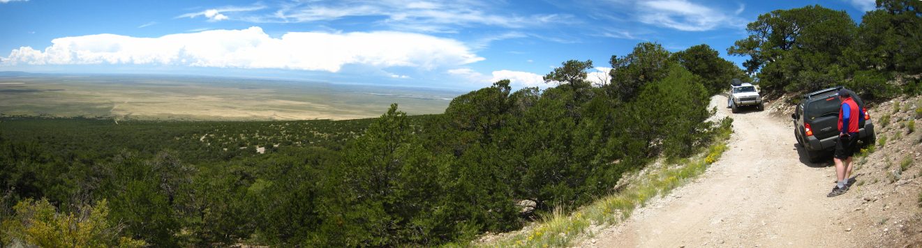
A thankfully non-dramatic Jeep crossing. We'd already covered ~3.5 miles and over 1,000' of elevation in the Exterra, from the trailhead off of rt 150...
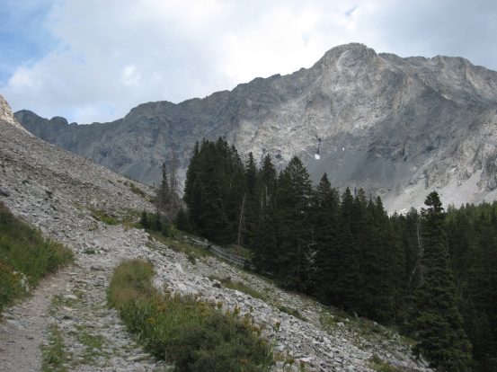
After another few switchbacks, and a particularly nasty section with big rocks, Ben was ready to find a parking spot. We had passed several other parked 4x4 vehicles along the way, and felt very good about our progress in the Exterra. We parked off to the edge of the road at a wide curve, and unloaded our packs. Ben's great 4x4ing got us to 9,550' (1500' from the trailhead), and 4.1 miles in from the highway.
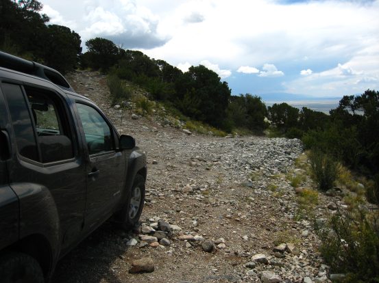
A look from our parking spot 1500' up from the valley. We donned our packs and began the trek up to Lake Como...
The sun was still blazing hot out in the hills leading up to the mountains, but the clouds hung over the peaks, some of which looked quite dark. It seemed like the quicker we got to camp and set up the tents the better. But for now I'll take the hot sun rather than wet rain.
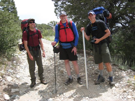
Just as we started out, we ran into a guy and girl coming down wearing packs. I asked them to take our picture (see above). Dave asked, "What peak did you guys climb." The guy answered, in a rather carefully measured tone "Well, actually, we didn't climb any," as the girl began walking down hill without him. I'm guessing there was some tension there...
The first switchback on the road after beginning our hike. Ben carries his fly fishing pole...
After a couple of curves in the road, we reach JAWS I (there are numerous JAWS points along this road), a seemingly insurmountable rock step along the road. Only mega 4x4 Jeeps, or ATVs can handle this, and even then we can't imagine quite how. Turns out that Chris, my boss from work, came up earlier in the day with a CMC group, and one guy planned to take everyone's pack up to the lake in his Jeep. However it didn't go as planned...
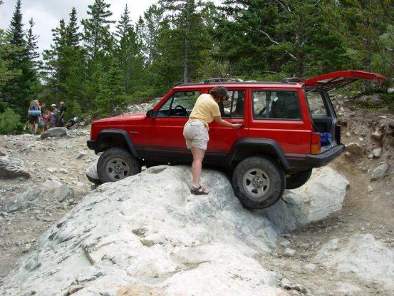
JAWS I was much easier passed on foot, as Dave shows us. Chris took the pic of the Jeep, and said people needed to rock the Jeep back and forth until its back tires gained traction with the rock and it could pull itself back down...
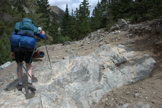
The hike to Lake Como from our car was 3.2 miles, and 2,330' gain (deduced from a map and GPS waypoint afterwards), which was quite a steep climb with a heavy pack on. I felt strong though, perhaps from some stairstepper exercises and 12% incline fast walking on the treadmill over the past week or two. I ended up pushing on ahead. I also wanted to get a tent setup before any rain fell.
A group of friendly faced college-aged hikers were coming down the trail, and I asked them what they had climbed. They said they started late, and made it up to the Lake before seeing lightening on Blanca, and turned around. I told them that you want to be summiting 14ers by 9:30am to ensure beating the storms. "Oh, guess we should have started earlier," one of them said. Then he added happily with a smile, "We're from Texas," which I understood he meant as "we don't know any better".
The road had a few dips, and there were several large puddles that looked like small ponds. They were easy to walk around, but I read how drivers see the flat water, and assume a smooth surface underneath, only to severely surprised at the big rocks hidden underneath.
Eventually there was a wide stream crossing, that was quite manageable on foot. The incline of the road increased after that, and became more rocky.
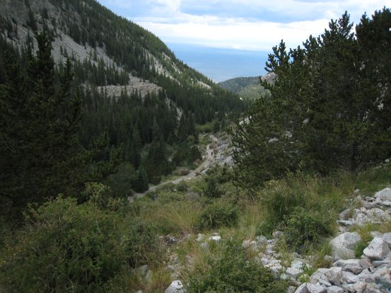
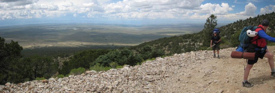
My legs were carrying me fast up the road. Ben is barely visible in the path looking down the valley. A bit further up I turned around and saw rain in the valley. How much longer til it covered the mountain too?
Soon some giant peaks came into view. I realized I was staring at Little Bear straight ahead, and the fabled ridge leading off to the left up to Blanca. There was some blue sky too! We just might make it to camp dry! The air was definitely cooler in the upper elevations, and the cloud cover helped too.
I trodded on up the road, past several more JAWS steps, and as I reached Lake Como I heard a distant rumble of thunder. Some dark clouds were gathering to the left of Little Bear, and I wondered how much longer we had before rain. I was looking for Chris's large group camped out near the lake, but there was no camp on the west side of the lake. After taking a bunch of pics, and have my first sip of water since we began the hike, I continued to the other side of the lake.
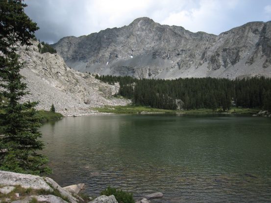
From the road I could see the entire LB Traverse, Little Bear on the right, Blanca just visible on the left. Again the ridge was visible over Lake Como. It didn't look THAT intimidating from here...
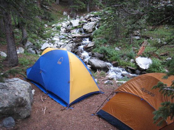
The road climbed steeply on the other side of the lake into a pine forested area. There were people camped along the east side of the lake, but not Chris's party, so I continued up the road into the trees. The wind started to pick up, the air had a humid chill, and it seemed like rain was imminent. We were planning to set up camp with Chris, but hadn't found him yet, and in addition to the pressing weather, tired legs were telling us it was time to setup camp. I found a thin and long stretch of campground to the right of the road, next to a narrow cascading stream. It looked good enough to squeeze 3 tents in, so I dropped my pack and ran back down towards the lake to consult with Ben and Dave. When they reached the site, they liked it too, so we set up camp while the dry weather held on by a thread.
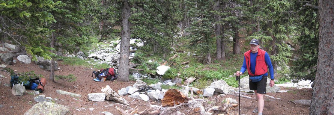
Our soon-to-be campsite at 3:50pm, in between the road/trail and a cascading stream...
We all began breaking out our tents from out packs and setting them up. Just as each of us were reaching our final touches on our tent, the rain began. I quickly stuck the last stake for the vestibule of my tent into the ground (rather some dirt in a crack between the stones around the fire pit, as we were pinched together a bit) and threw my pack, and all the supplies I had randomly tossed on the ground while unpacking, underneath it. I slipped into my tent and zipped down the vestibule and door before relaxing in my cozy tent on my sleeping bag for the 20-30 minute cloudburst.
When the pitter-patter on the tent ceased, we crawled out of our tents, and after we remarked how lucky we were to have set up our tents in the knick of time, decided to head up the trail in search of Chris's camp. After walking about 20 steps on the trail we found a bunch of tents in a raised clearing to the left of the trail. It was Chris's camp. We found Chris, and unfortunately he had some stomach sickness, and had a rough time making it to camp. He was hoping to shake it off over the night, and hike Ellingwood and Blanca tomorrow. Dave, Ben, and I then continued up the road to a clearing Chris mentioned where we could get a view of the three 14ers, and plan our route for tomorrow.
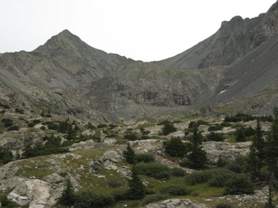
The climbers trail for Little Bear turned out to be about 75 yards from our camp. We continued further and saw both Ellingwood and Blanca to the north. The road climbed past the brief forest and into a tundra basin with several lakes.
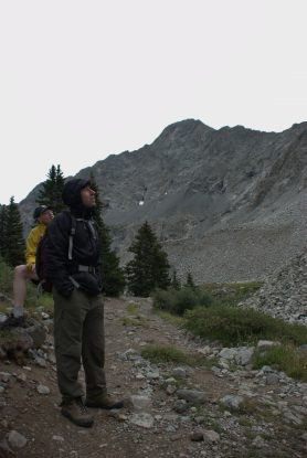
We looked up the turn off to Little Bear. We'd need to find this turn off in the dark tomorrow morning, and scramble up to the notch in the ridge...
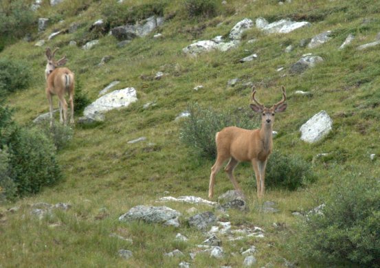
Some brown deer were out in the basin this evening after the rain...
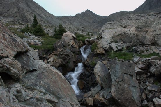
Ben brought his SLR camera for the trip, and captured some great photos, like this cascading stream with Ellingwood in the background...
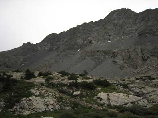
A look at Ellingwood and Blanca in the left pic, the LB traverse between Blanca and Little Bear on the right...
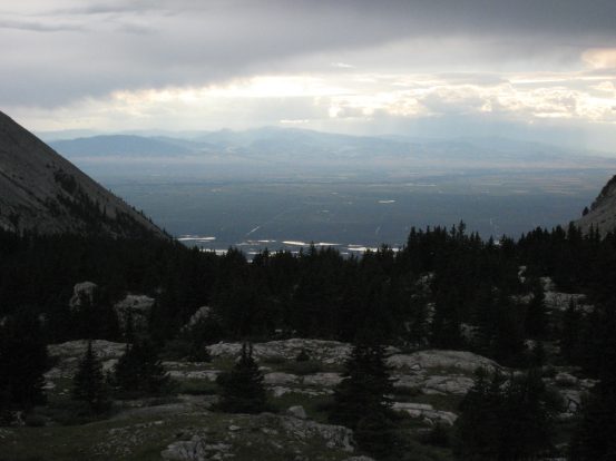
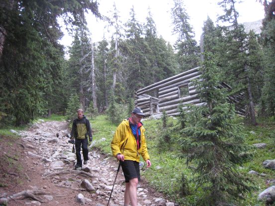
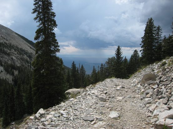
A look down to the San Luis Valley, 4000' below. We walked back to camp, past the remains of an abandoned cabin...
We got back to camp, grabbed our dinner supplies, and returned to Chris's camp to visit while we ate. Ben had prepared a rice stew with lots of spices and some dried veggies. As we ate we chatted with some of the other CMC people in Chris's group. Chris was still feeling awful, though was still hoping to hike the easy route to Blanca in the morning. After the stew Ben brought out some biscuit powder, which we hydrated and cooked up. After the fact, it became apparent we should have poured the biscuit dough on top of the boiling stew, instead of having it burn to the bottom of the pot afterwards.
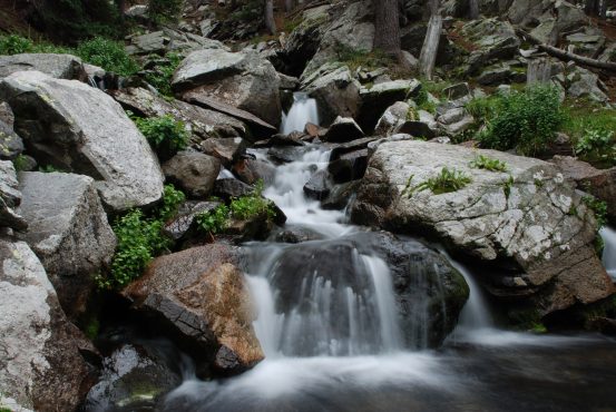
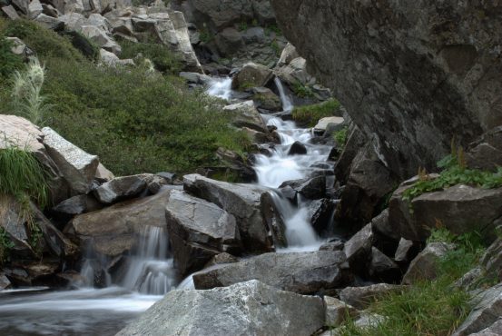
Ben and my tents sit along the stream. Ben took a great photo of the nearby falling water...
We headed back to camp, ready for bed, wondering what the weather would hold for tomorrow. We decided that we should hike Little Bear first, since it has a dangerous section where dislodged rocks from hikers funnel down along a narrow chute in the trail. We figured that less people may hike this peak on a Friday versus a weekend day. So we set our alarms for 4am, to be sure we'd be the first up the peak, and avoid having climbers kick rocks down on us during the ascent.
It was still to early to decide on doing the LB traverse tomorrow. We'd have to see what the weather held in store. We were wondering if we'd be able to see any stars in the morning, and what we should do if it was raining. Climbing Little Bear on wet rock was not at all desirable. We went to bed planning to hike up Little Bear, and if the weather was super nice, then we'd consider the ridge to Blanca.
It was easy to fall asleep that night, despite a fat root sticky up under the left half of my tent. The falling water just 10 feet away provided plenty of white noise. I had good tent sleep.