Mt Belford (14,197'), Mt Oxford (14,153') May 31st, 2008
Chris and I had originally been aiming to make this trip May 2nd, but had to push it out a week first do to a commitment, then again due to 20 inches of new snow in the mountains, and then another 2 weeks after reading reports about tons of snow there, as well as less than ideal weather forecasts. So finally, on the second to last day of May, we drove down to the Sawatch Mountains after work on Friday to prepare for a Saturday morning ascent of both Belford and Oxford.
Chris had been up Belford a couple times in the past, but had to turn back before reaching Oxford, due to weather. Oxford has remained elusive to him, and he hoped to make this 14er #30 on his list. For me, a relative newbie, this would be my 7th and 8th attempts at 14ers, and my first in the Sawatch range.
Friday, May 30th, 2008
We left Fort Collins ~4:30pm, fought some traffic on I-25 down to Denver, stopped at a McDonald's in Silverthorn off I-70 in the mountains, refueled in Leadville ($3.99 deep in the mountains, not bad), and arrived at the Missouri Gulch Trailhead ~7:30. I had never been in this area before, and was surprised at the beauty (and smooth dirt roads) in this valley. I had the impression that the Sawatch Moutains were ugly big mounds of rock, but at least the valley was beautifully lined with Aspen, a long lake, and still thriving lodge pole pines. There were many high quality free camping locations off the road, near the stream, but we drove straight to the trailhead, as we could both fit in Chris's Fourrunner to spend the night in the parking lot. I'll have to come back and explore this valley more later.
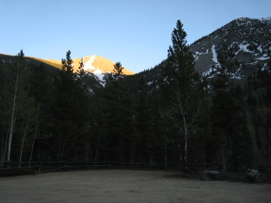
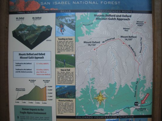
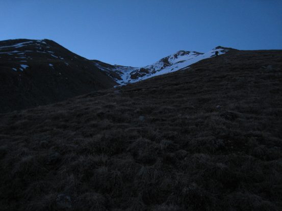
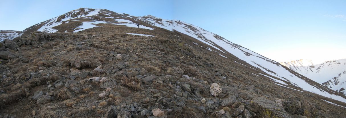
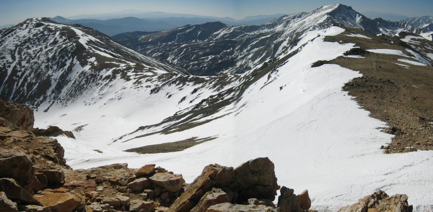
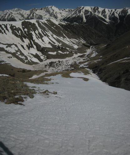
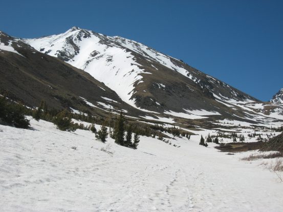
The view from the Misouri Gulch Trailhead. Our path will lead us up the steep valley between the mountain in the sunlight, and the mountain on the right. It will be a very steep climb tomorrow. 4600' gain in 3.5 miles to Belford, and another 2 miles and 1400' of elevation out and back to Oxford...
It was in the low 50s at 8pm, with no wind or clouds at this 9670' trailhead. Tomorrow's forecast for this region at 12,000' was mostly sunny, upper 50s, with just 5-15mph winds, and 0% chance of precipitation. PERFECT! It was obvious from viewing the mountains on the drive in, that there would be a lot of snow on the ground tomorrow, and we planned to bring snowshoes, crampons, and ice axes to be ready for any condition. The plan was to get up at 2:30am tomorrow, and be hiking at 3am to make the most of the hard frozen snow during our hike. When the snow heats up and softens later in the day, you're more likely to sink in with each step (known as "post-holing"), which is very annoying, tiring, and slow going.
Our car was one of three autos nestled in the corners of this large quiet parking lot. By 9:30pm we had set up the SUV into a cozy cabin. Chris slept in the trunk with one side of the back seat folded down, and I lay snugly in the front passenger seat, which extended nearly all the way back down flat. Both of us didn't expect much quality sleep, but we weren't concerned with it affecting the exciting adventure in store tomorrow.
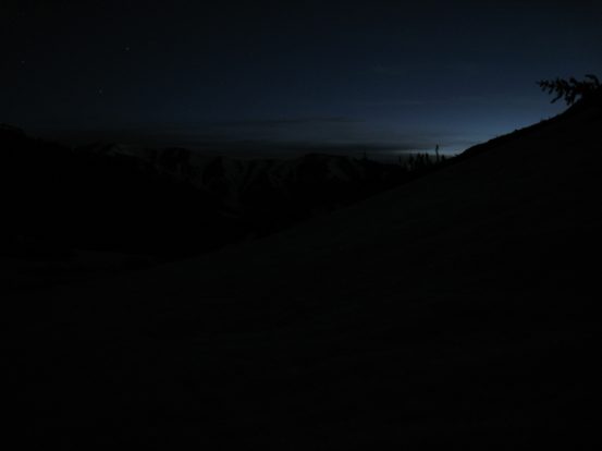
The night had arrived, showcasing it's array of sparkling wonders in the clear skies out my window...
Saturday, May 31st, 2008
The alarm went off at 2:30am, though I had already been awake and resting since 1:50am. I had managed some brief bouts of sleep, which served mostly as a convenience to pass the time. It felt about 40 degrees out in the still air, not quite as cold as I was expecting. Thanks to all our prep work from last night, and the fact that we weren't hungry yet for a breakfast, we were ready to hit the trail at 2:55am.
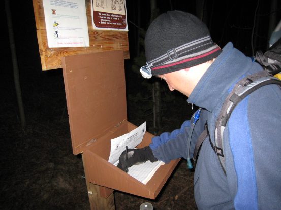
Chris signs us in at the registry as we begin the early morning trek. There hadn't been many visitors lately...
Our first steps lead us to a bridge across the stream, where we are immediately greated with today's aggressive elevation gain theme. The trail switches back and forth up through the forest on an easily followed trail for the first 45 minutes. Early on we encounter snow patches scattered on the trail, but manage fine with just our boots. As the snow patches increase, I bring out my ice axe, but find it not that effective, as it just slides down deep into the non hard-packed portions of the snow. I take off my Go-Lite pullover, as it's getting hot during this climb...
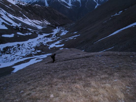
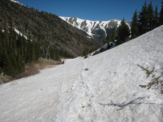
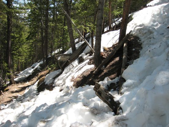
Soon the trees thin, the snow thickens, and the trail becomes much more difficult to follow. There are some footprints and post-holes, but they seem to dissapear on flat hard snow surfaces, or dry ground, and do not re-appear anywhere. We know we have to go up, and Chris has hiked here multiple times before in the summer, but the trail finding is tricky in the snow and dark. I was expecting a more well traveled path, but perhaps this is not a popular spring climb. However, with some scouting and careful tracking we manage to converge on the trail as we reach the treeline, though not without occasional bushwacking.
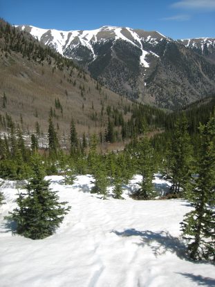
The next section of the trail is flat through the open basin. An extremely feint siloutte of Belford can be seen towering straight ahead a couple miles away. Again a trail is hard to find, but the path is open in front of us, so we head across a wide, sloped snow field, listening to the Misouri Gulch stream on the right. The ice axe is useful enough without the need for me to put on crampons. We stick to the open snowy area on the right side of the basin as we head south towards Belford. I hang back off and on to play with my camera, trying some long exposure shots with my tripod.
A look back at the horizen having cleared treeline, as the first signs of light begin. Pic taken at 4:38am...
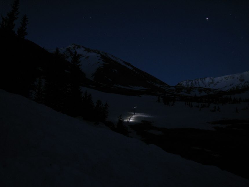
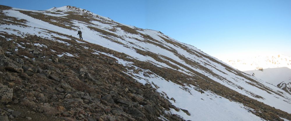
There's something magical about starting an adventure in the dark and watching the world wake up to the morning around you. This pic (15 second exposure) taken at 4:45am, captures Chris hiking up ahead under the stars, as Belford (on the left) begins to emerge in the pre-dawn light...
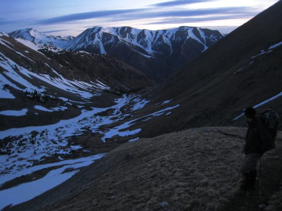
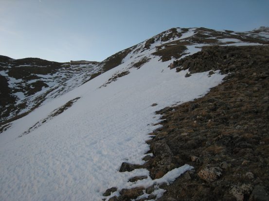
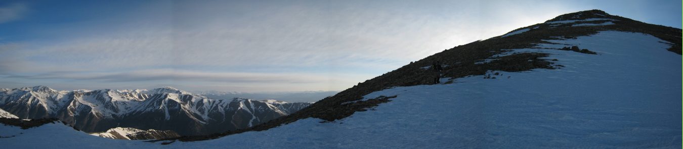
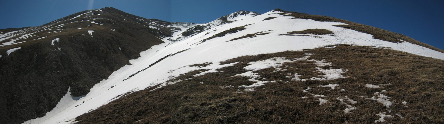
By 5am we had begun the mega steep climb up the shoulder of Belford (in the pic above, it's the arm with the snow slopes on the left). The last mile of the hike up to Belford contains 2200' of gain! Amazingly, this isn't a boulder scramble, but a long slog up the tundra on a well cut, switched-back, trail. However today there were frequent snow patches covering portions of the trail in the upper 3/4ths of the arm, which made trail finding a bit more difficult, and the going slower.
A couple of pics looking back down after we started the final 2200' gain up to Belford. Left at 4:59am, right at 5:15am...
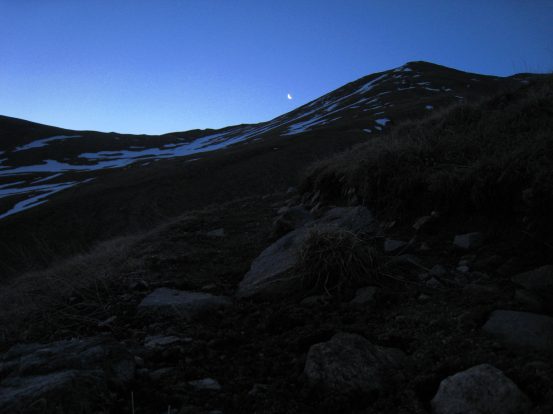
A crescent moon began to shine, climbing above the ridge to the east. A look up the unrelenting arm of Belford. This pic totally does not give scale to the size of the climb left to go...
Me trudging on up the trail, after taking the pic of the moon. Then another look back down after we started reaching some snow portions...
I had been hoping for a spectacular sunrise on this hike, but given that a big ridge to the east blocked the horizen, and there were clouds visible to the northeast, I had given up expecting anything photogenic. But the sun did make a rosy entrance on some of the high peaks at 5:45am.
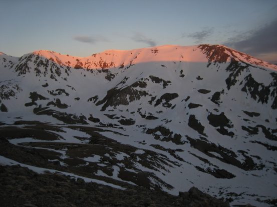
Some pink snow thanks to the sun's entrance...
We stopped to admire the brief alpenglow...
As we climbed the shoulder, the wind picked up, especially as we got near the west side. It was very cold out too, and I had to put back on my 3rd layer, as well as my 2nd pair of gloves. I stopped for a snack, pics, and to re-layer about half way up to Oxford. Chris plowed on, set on keeping up his good progress.
Lots of snow on the northeast side of the shoulder. I took a self portrait after adding back my layers. The wind was getting cold and strong...
Chris was far ahead...
I had done plenty of backpacking in Patagonia 3 months ago, hiked Crosier Mountain last weekend, and in general exercise daily to keep fit, but this moutain put up a good battle, and I found myself pausing frequently to catch my breath, and figure out the best path up. The main trail was covered with steep hard snow patches, and several secondary trails existed around them. I tried hard to do as little erosion damage as possible. A clear solid trail would have helped make the journey a lot faster and easier...
Another look up at the unending mountain arm. The other 14ers I've done all have rocky boulder scrambling, so it was a unique change to be on tundra. Must be beautiful later in the summer when it's all green...
I caught up to Chris right before we reached a false summit...
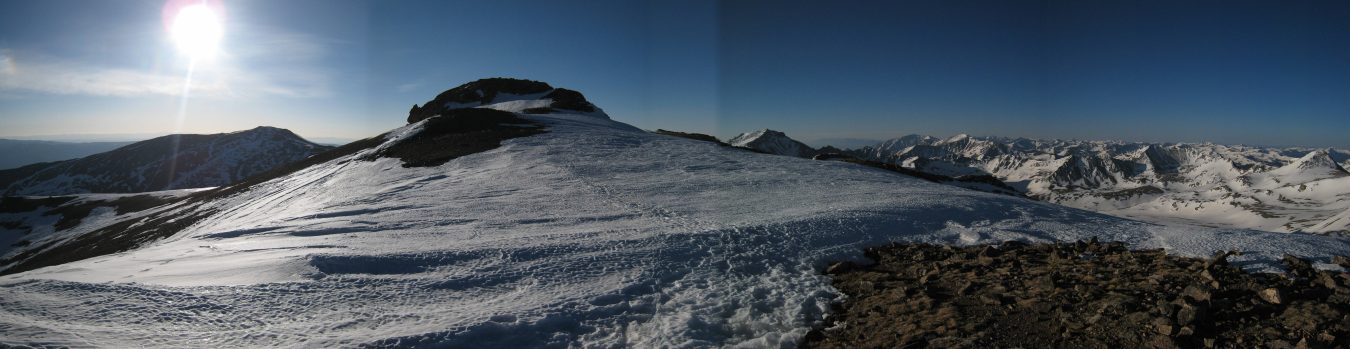
Finally we reached what looked like the top of the "shoulder", and I suppose it was, but then I found out there was still the ~200' "head" to climb nearby before claiming the summit.
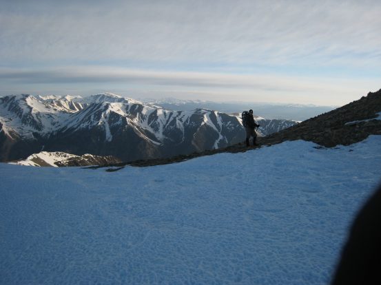
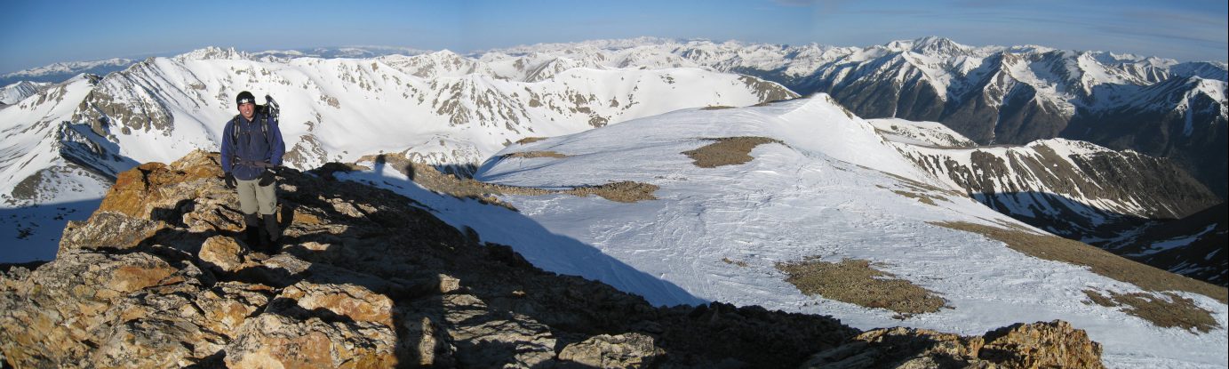
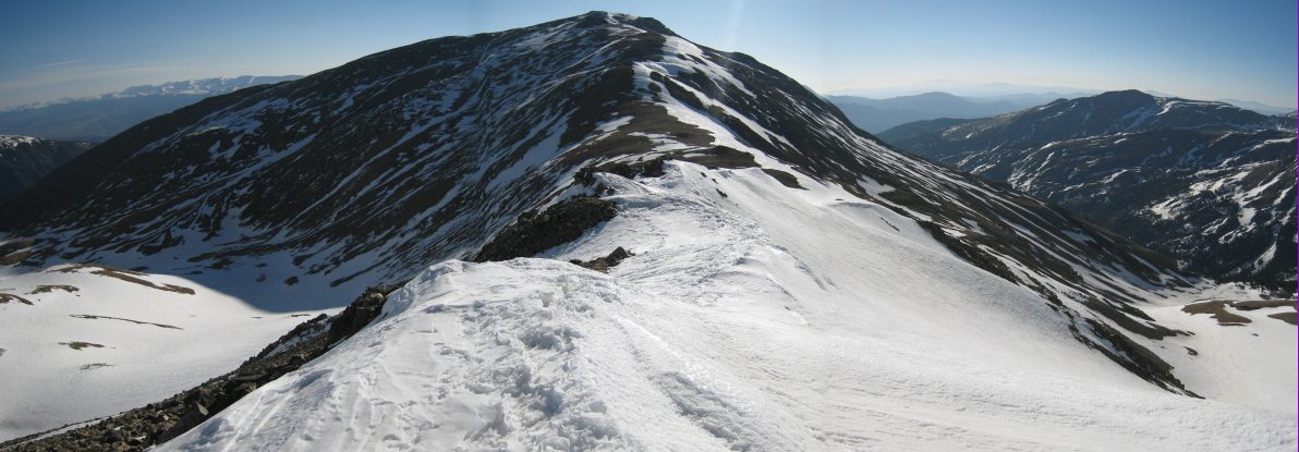
Chris reaches the saddle at the top of the shoulder, and we take pics of each other. I stand at the saddle with Mt Misouri, another 14er, in the distance behind me...
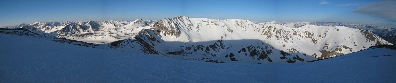
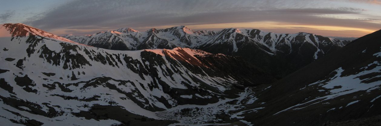
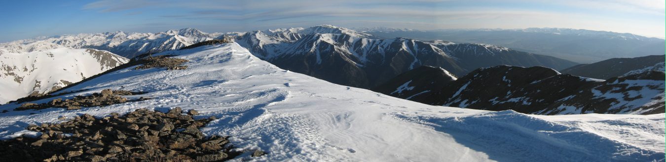
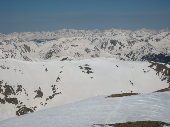
A stitched shot from the saddle at 6:40am, featuring the Misouri Moutain range on the west...
A look in the other direction up to Belford's summit...
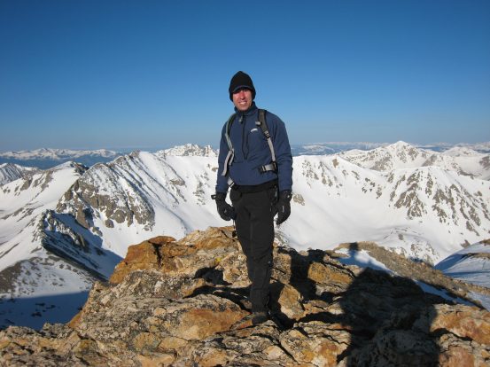
With the summit in sight, and a slightly gentler gradient, the last stretch to the peak was much more bareable. We reached the very windy and cold summit at 7am. We had both been expecting milder weather conditions, and I'm glad I choose not to skimp on carrying/wearing my warm gear today. It wasn't until the summit of Belford that we felt the first rays of sun warming up our bodies. I had paused to apply my sunscreen just before the summit.
When reaching the top of the next stretch, the summit was just a short ways off to the east. Oxford, our next destination sits beyond, under the sun...
A look to the north, from the same spot as the pic above, prior to the summit...
I make my way across the final snow patch before Belford's rocky summit, ice axe in hand, after stopping to apply sunscreen (and discovering my sunglasses had been smashed)...
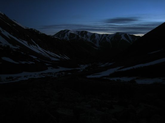
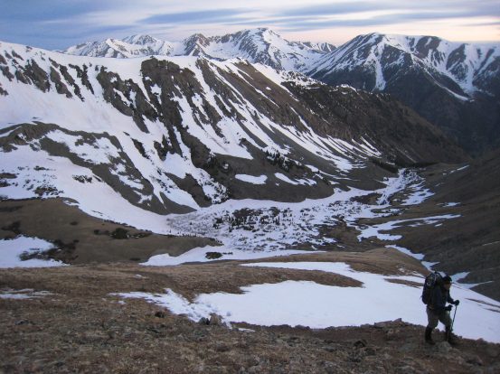
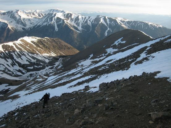
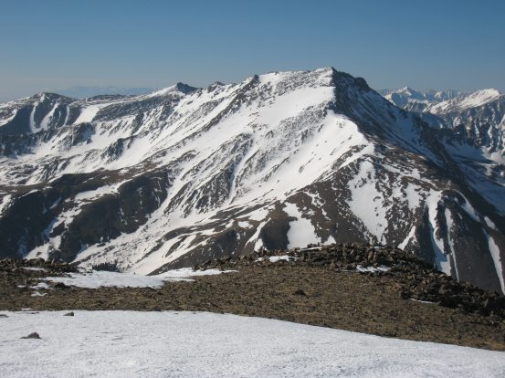
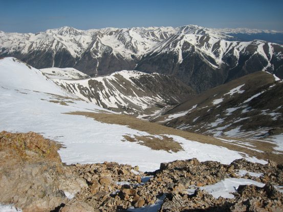
A look back down at the valley we hiked in on, from the summit of Belford. We started deep in the valley at the base of the mountain range running from left to right in this pic..
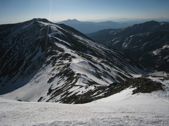
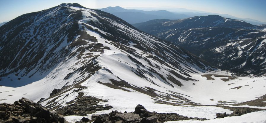
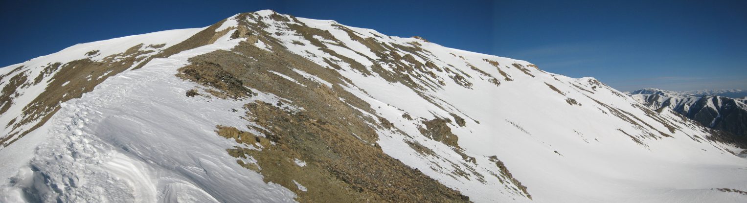
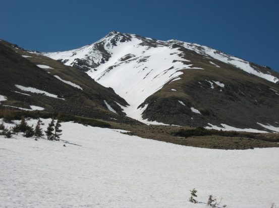
With Belford down, Oxford (on the left) was up next. The ~2 mile route on the adjoining ridge was readily seen from Belford, and looked to have more of the same mix of snow and tundra...
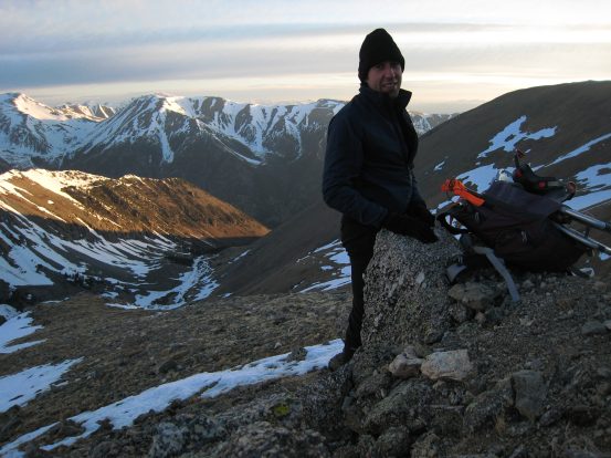
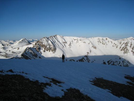
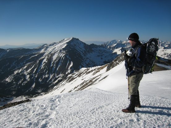
A pic of me on Belford, before we head down to take a closer look at the ridge leading to Oxford...
At Belford's summit, Chris started feeling sick, and considered heading back. He has some history of elevation sickness early in the season, and was kicking himself for not waiting til later in the season to attempt Oxford (given this was his 3rd try). While we waited at the summit for a bit, I found the nipple to my water bladder had frozen. Though after a crunchy bite, the ice broke up and got the water moving again. Chris decided to head towards the ridge, as it was fairly flat, and reconsider again. However when we reached the point of descent, Chris wasn't feeling any improvements, and knew better than to risk being very sick far from the trailhead. The trek to Oxford was a 700' descent/ascent each way, all above 13,500'. He still vowed to knock it off eventually, but it would have to be another day.
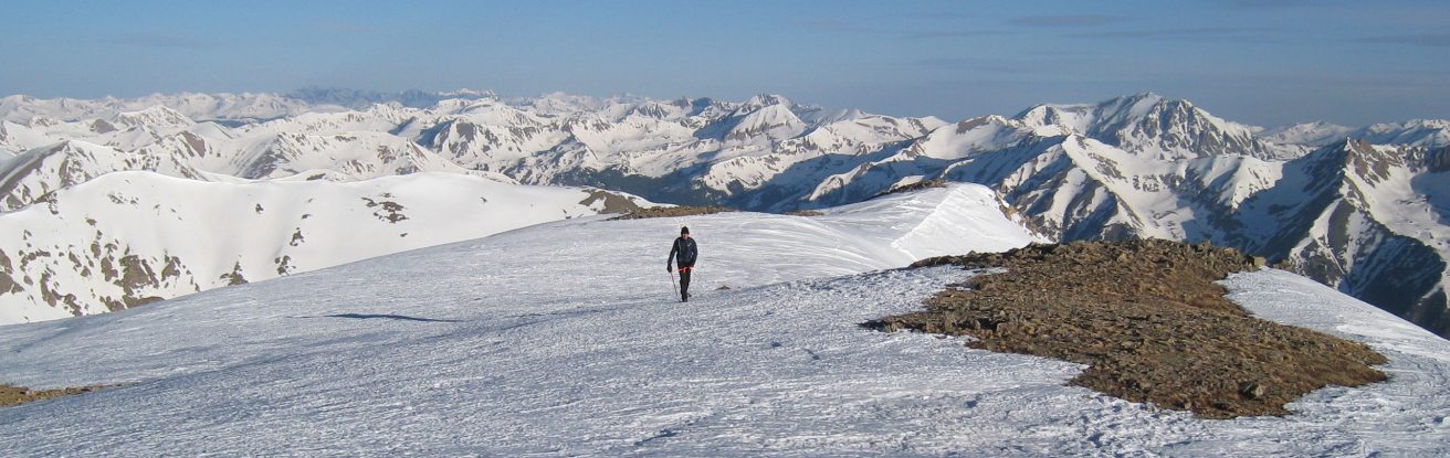
A great stitched shot of Chris on Belford...
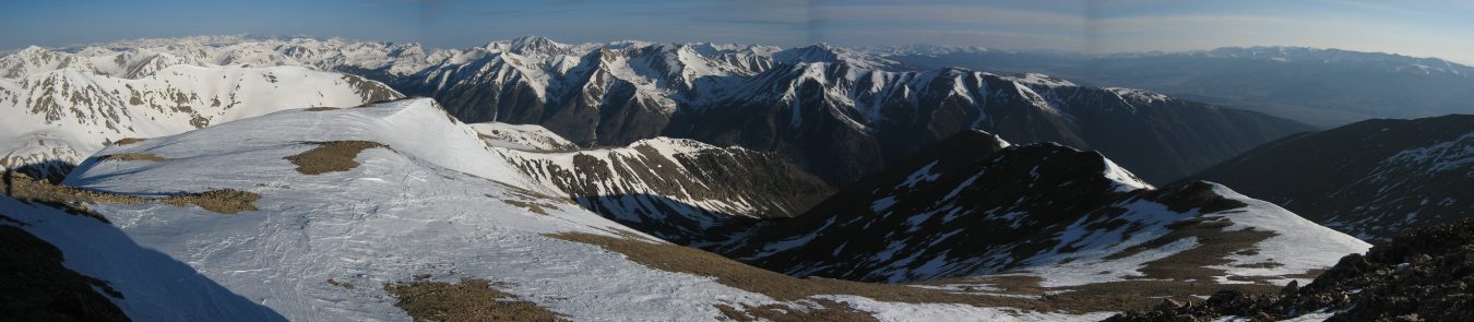
A look back at Belford (the rocky point on the right) after Chris and I walked down to the beginning of the ridge connecting to Oxford. Chris, battling altitude sickness, debates his options, as Mt. Harvard dominates the background...
With Chris opting to bail on Oxford today, I stared at the nearby 14er, seemingly within grasp. The ridge looked mildly intimidating with the snow, but it was just a class 2 trail. Chris called it "just a walk." Having completed the Little Bear - Blance traverse last August, I knew this would be cake walk in comparison, with no exposure, and so I considered attempting Oxford solo. I knew I had the strength to make it, and felt I could manage it in good time. I decided to continue on, as it was such an effort to reach this point already, and I felt confident in my skills and abilities. I estimated a very optimistic time of 1 1/2 hours to reach Oxford and return to Belford, and told Chris I'd meet up with him back at the trailhead.
Shortly after I started to make my way down (~7:30am), I heard Chris from behind, who was following me, trying to give it a go, but then he stopped, and said, "I'm not going to something stupid," before returning back to Belford. No doubt he made the right choice, and set a good example for all obsessive 14er baggers, about keeping the right priorities in mind.
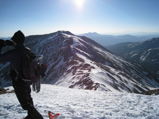
I take a few pics before heading off to Oxford solo. Chris gets a photo of me before I disappear down the ridge...
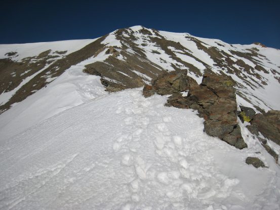
The descent down from Belford was fairly steep. It was either go down along the snow on the crest of broad ridge, or take the tundra/rock along the sides. I choose the dry ground, and it was an easy half-scramble down. I had considered leaving my pack at the top, to expedite my out-and-back to Oxford, but figured it might be useful to have my stuff. However once I reach the saddle, I dropped my pack, grabbed a snack, and put some rocks on it. I bit at a Twizzler and found it was frozen solid. After resorting to some chocolate instead and a sip of water, I continued up to Oxford with just my ice axe in hand.
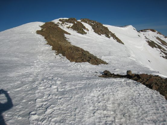
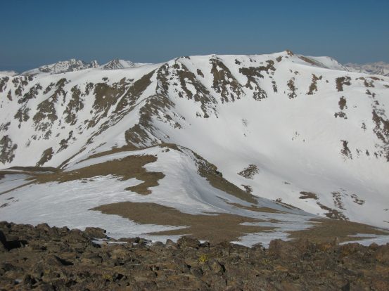
A look down the ridge to Oxford, shortly after descending from Belford...
8 minutes after the last pic, another look towards Oxford...
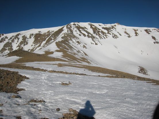
A look back up to Belford, from the same point as in the pic above. Belford is the small rocky bump on just to the right of center...
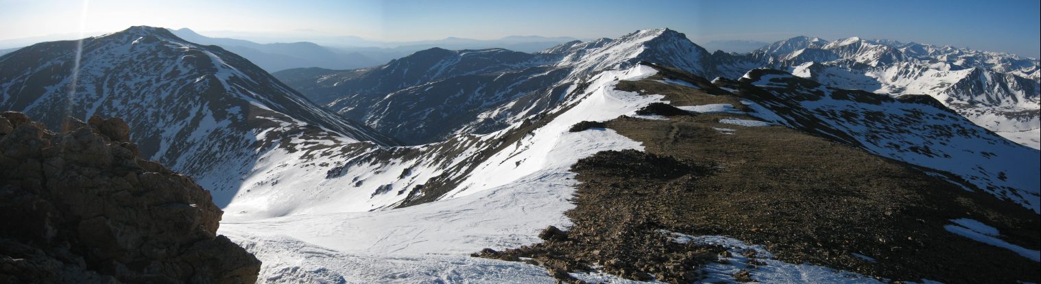
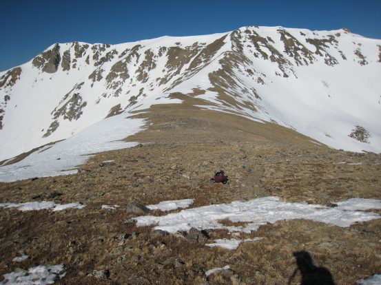
Pics from the saddle near where I left my bag. First back at Belford, then up towards a much less snowy Oxford...
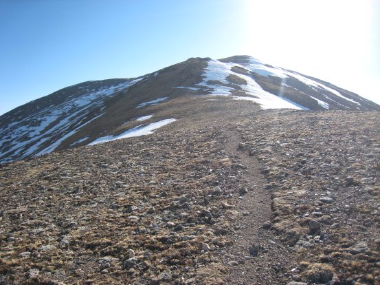
The hike up to Oxford was much more gentle, and soon a strong wind at my back helped push me up. There was less snow along this portion of the trail. After pushing hard to what turned out to be a false summit, I continued on over more tundra and snow, and reached the rocky peak of Oxford at 8:12am (25 minutes from the saddle). The wind was again fierce and cold here, and I didn't spend much time before heading back.

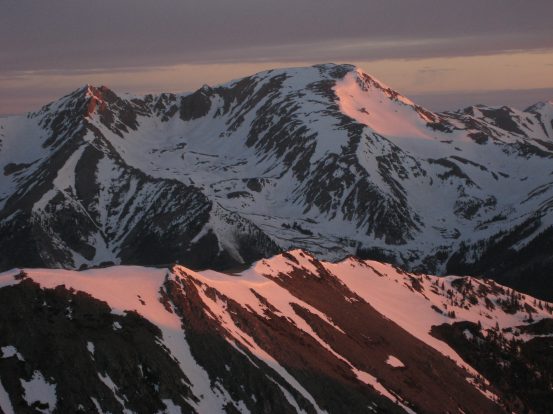
A close-up view of Mt. Harvard (14,420') from Oxford. A self-portrait with Belford in the background. My sunglasses had been smashed to bits in my backpack, so I made due with a ball cap and winter hat combo today...
I descended to the saddle very quickly, jogging some of the easy portions, and running down some of the softening snow. I held the bar of my ice axe tight against my stomach with two hands, perpendicular to my body as I sped down. There was a strong head wind initially, which faded about half way down from Oxford. I was back at the saddle 9 minutes after leaving Oxford (I'm going by the time stamps on my pics for all the time measurements, btw).
A look at Belford from atop Oxford, and then again from where I left my bag at the saddle, 9 minutes later...
Gone was the spendlid lightweight hiking, having reunited with my backpack. The hike along the flat saddle was simple enough, but when I took the first uphill step towards Belford, I was surprised at how much effort it took. I now realized this was going to be a brutal and slow climb to my "3rd" 14er of the day. All I could do was keep moving though, and I did, though soon I had to pause after every few steps. I was working on the last 700' of the 6000' gain today, 2100' of which was at 13,500' or higher. My cardio was fine, but my legs were getting weak, and my stomach felt a tad off, and I didn't want any water or food. Maybe the 3 hot n' spicy chicken sandwiches, and a sundae last night was too filling, or it was some dehydration, as I hadn't drank much today... I began dumping a little water, as I had tons left. Nonetheless, I made slow but steady progress, and scrambled back up to the ledge of Belford. Each step was the toughest I've taken in a long time, but I didn't want to rest. I'm glad Chris opted to turn back, cause this long brutal elevation gain would have wreaked havoc on his altitude sickness. Eventually I reached Belford at 9:15am.
The snow was softening up now, but I kept to the dry rock/tundra for the most part on the slow steep ascent back to Belford...
It took about 1hr 45min for the roundtrip of Belford - Oxford - Belford, a bit longer than hoped, thanks to the killer final ascent to Belford. It was still really windy and cold on Belford, and I paused just long enough for a few pics before beginning the steep descent down.
A look down towards my end destination from atop Belford. Also a view northwest, at what appears to be the Elk range, near Aspen, far in the distance...
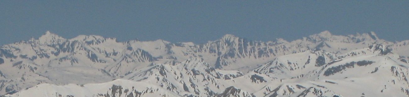
A zoomed in crop from the pic above. Looks like the Maroon Bells on the right, with K2 and Capitol Peak just to the left. Snowmass or Castle at the far left? Sure is lots of snow out there still...
One last look back at the route I just took to/from Oxford...
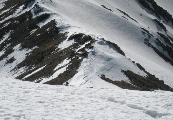
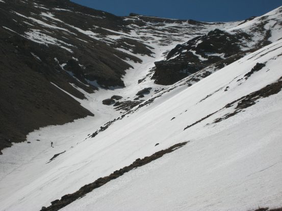
A couple of minutes down from the summit I ran into a guy on his way up, who asked if I "got both of them" today. He said he met Chris on the trail who told him I was on my way to Oxford. This guy's hiking buddy turned back at 12,000', due to the snowy conditions. He also mentioned that he summitted Belford last July, and it's a totally different ball game in conditions like today. The difficult trail finding was probably the biggest factor with all the snow. I wished him luck, continued on, and soon reached the beginning of the long shoulder down to the valley.
I wasn't looking forward to the steep LONG 2200' descent, but knew it would be a ton easier than ascending it. It was much easier sticking to the trail on the way down, and I found that the softened snow offered easy descents, as it was just soft enough to dig a heal in and walk straight down. The frequent snow patches were fun, and I noticed some glissade tracks, which I guessed were Chris's (and later confirmed), and likewise sat down for a ride, using the ice axe as a break. One time, on a small slanted snow patched I was trying to cross, I slipped, and got to use my ice axe to make a self arrest for the first time. It worked like a charm, and I was pleasantly surprised by the quick and effective outcome. Eventually I reached a long portion of snow near the edge of the shoulder, and followed Chris's glissade track down.
Soon the snow portions ended, and it was a long hike on a slightly muddy dirt trail that switched back constantly. I normally would have like to try jogging it, but my legs were still tired, it was muddy/slippery, and it was pretty darn steep. Later, Chris was thinking it might have been worth considering ascending or descending via the snow field on the inside of the shoulder. I saw a guy with skis climbing it on my way down.
A long stretch of snow that was glissade-able (at least if you stay away from the edge). A guy with skis hikes up a snowy coulier inside the shoulder. It looked too intimidating in the dark of the morning for us to decide to go that route, but it probably would have been perfect conditions to ascend it...
A wide look at the fun snow patches (fun during the descent, that is) coming down from Belford...
After plenty of switch backs, I finally reached the valley, where the snow was still firm enough to prevent post-holing. It took about an hour to descend the 2200'. Now it was time to cross the open basin, and manuever back through the snowy forest, where we couldn't find the trail earlier. It was easier to spot the trail now, but once it entered the forest, I completely lost it again. Some spots were familiar from this morning, when we were confused. Also, the snow was very mushy, and I started post-holing up to my thigh constantly. Immediately I put on my snowshoes, which 5 minutes ago I had just been thinking how I brought this extra useless weight the whole way up. My ice axe was surprisingly useful here as well, as it allowed me to get up a lot easier with the arm extension (imagine trying to push yourself out of the snow, when you arm sinks in past your elbow before you can find something to push against). Moral of the story, ice axes are extremely useful, and I used mine frequently today, much more than I anticipated.
A couple of looks back at Belford, for anyone interested on the snow conditions from May 31st...
This particular stretch before entering the forest would have been particularly slippery without an ice axe or crampons..
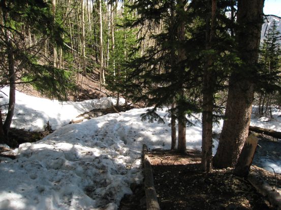
With snowshoes on, it was a mixed blessing. Instead of post-holing, I now had 2 small sleds strapped to my feet. The terrain was steep and the snow was very mushy on the surface, but impossible to dig an edge into without sliding first. I made my way down through the forest, forging my own trail unglamorously for a bit, eventually finding footprints, which I followed. Soon more and more footprints converged into a well worn trail, and I was back on the official path. There's really only one way out of this narrow valley, so if you keep heading down, you'll find the trail.
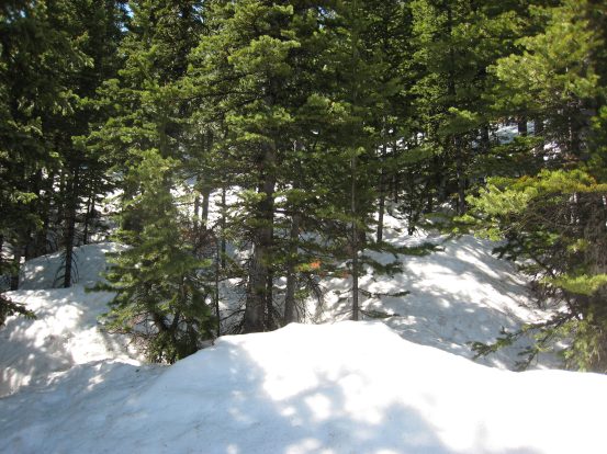
A look back at the snowy forest I had fought my way through before coming to this open area, where I spotted some tracks nearby. The snowshoes definitely came in handy today...
The trail was still difficult to track at times, as the snow patches thinned, but for anyone used to scouting out trails, it wasn't hard to follow. I kept my snowshoes on for awhile, even as the snow patches gave way to dirt/brush at times. Soon I reached the familiar bridge over a small stream, that we had reached ~1hr into the hike. The rest of the trail was mostly dry with scattered snow patches. I put my snowshoes back on my pack, and started jogging portions of the smooth dirt trail. Again there were tons of switchbacks, but the end was near, and I was challenging myself to finish as quick as possible. I wondered how long Chris had been back.
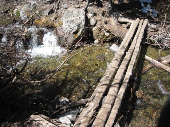
The small bridge over a creak. This bridge's elasticity was a little too high for my tastes. A look at a snow patch from the bend in a switchbacks...
I jogged quite a bit of the final mile, and soon the snow patches thinned, and I reached the grave site of an infant from settlers long ago that died in 1885, and I new I was almost back. I crossed the bridge and popped out at the parking lot to see Chris in his car waiting. It was 11:25am. It's always fun to look back at how much amazing adventure you can pack into a morning when you start at 3am. Chris had been back an hour ago, and took a nap. We recounted all the details from the hike back. I was surprised that Chris didn't use his snowshoes on the way back, but then again the snow may have been firmer earlier, and he found a more heavily traveled path back through the forest. He found the cabin at 11,300' that he had mentioned earlier (the 10' cabin was completely buried in snow, and he almost missed it). Indeed he enjoyed glissading down the shoulder of Belford. He met the companion of the only guy I saw on the trail, and chatted with him for awhile. I was surprised that we only saw 2 other people all day. No doubt this place is busy in the summer.
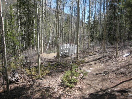
Another look at some of the snow on the trail. The site of an infant's grave, who died in 1885, is located at the beginning of the trail...
I threw my stuff in the car, and we were on the road by 11:45am. After a quick stop in Leadville for some caffeine, it was clear sailing all the way back to Fort Collins. I started downloading and stitching pics on the ride back. Chris got us back to Fort Collins at 2:45pm (less than 24 hours from when we left) where it was 80 degrees. Amazing contrast to the freezing conditions we experienced hours earlier. Colorado is an awesome place to live with such a wealth of accessible nature.
Chris says Oxford is now his bane, and that he'll save it for the last 14er he does. But his spirits are high, and he looks forward to the end of June when he's planning to hike Kit Carson and Challenger Point. I'm very greatful for Chris, who proposed this trip, took me on my first 14er when I moved to CO three years ago (Castle Peak), and invited me on a Blance-Litte Bear-Ellingwood trip last August.
Belford and Oxford were definitely a beast to climb, particularly in snowy conditions, but I'm very glad to have hiked them in the spring when the mountains were draped in a beautiful white. The snow also makes for more dramatic early morning pics. Though it's an extra effort to deal with the snow, I'm sure everyone would prefer a winter/spring summit view to late summer. For better or worse, this year's abundant late snow will mean a much longer "spring" season for 14ers.
Hike stats (according to Roach's 14ers book):
To Belford and Oxford: 11 miles, 5900' gain. 3am - 11:30am roundtrip.
Back to main hiking page