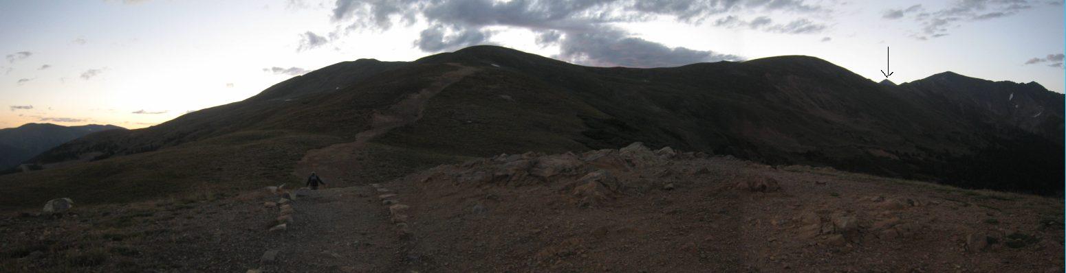
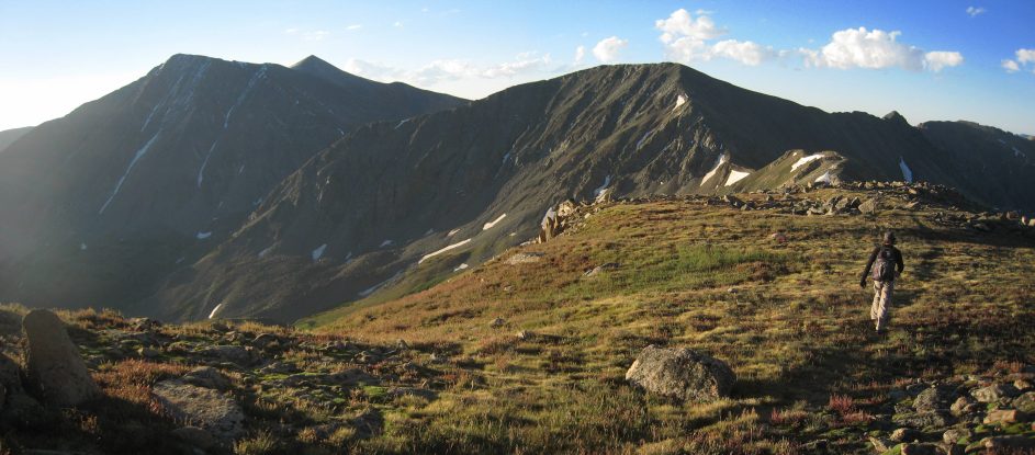
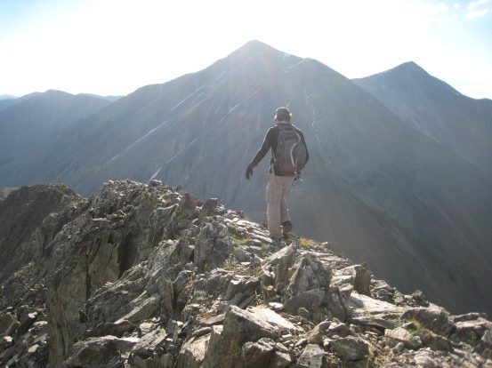
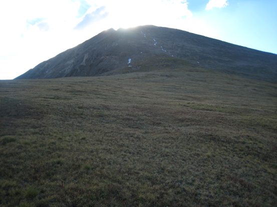
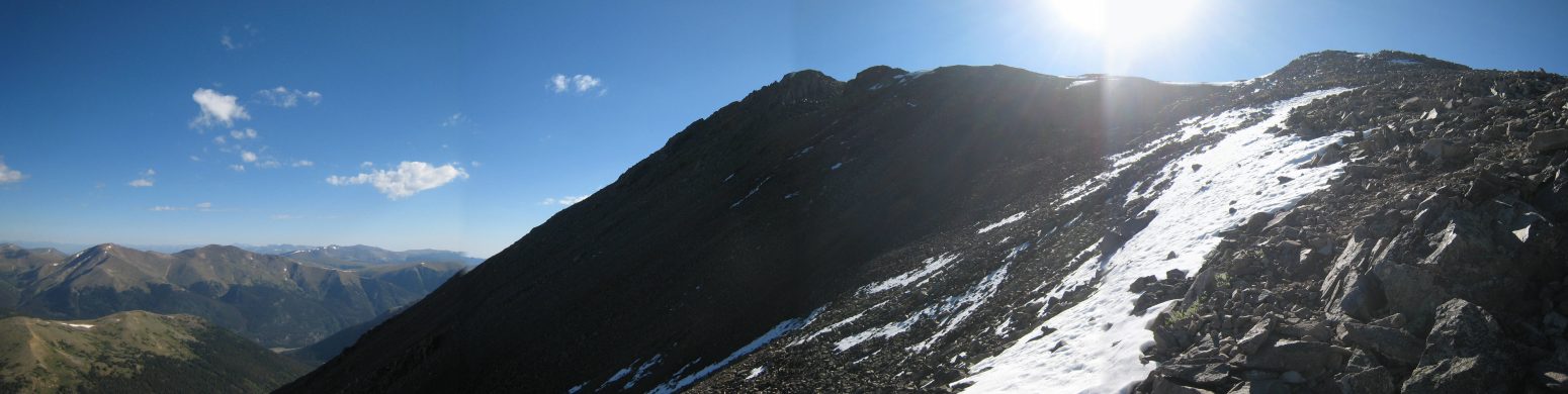
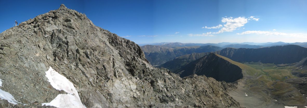
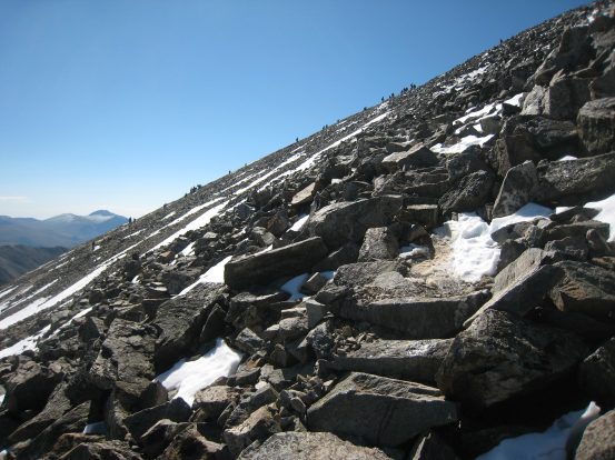
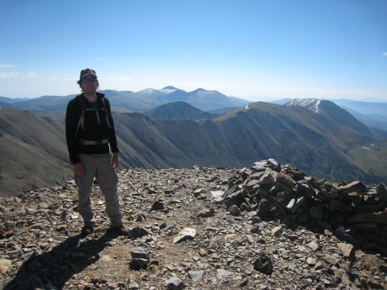
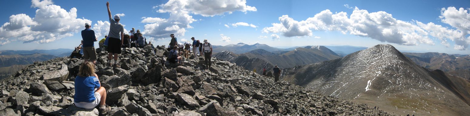
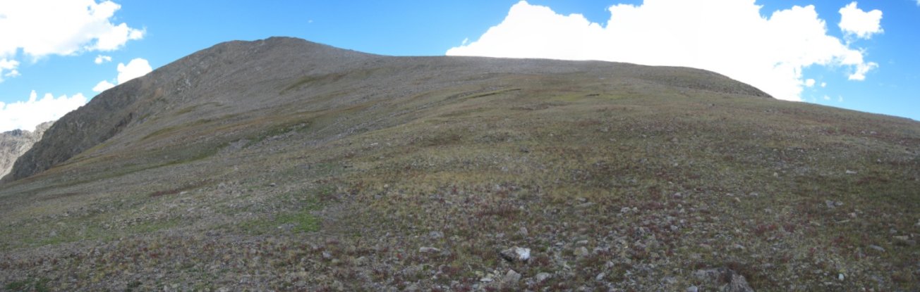
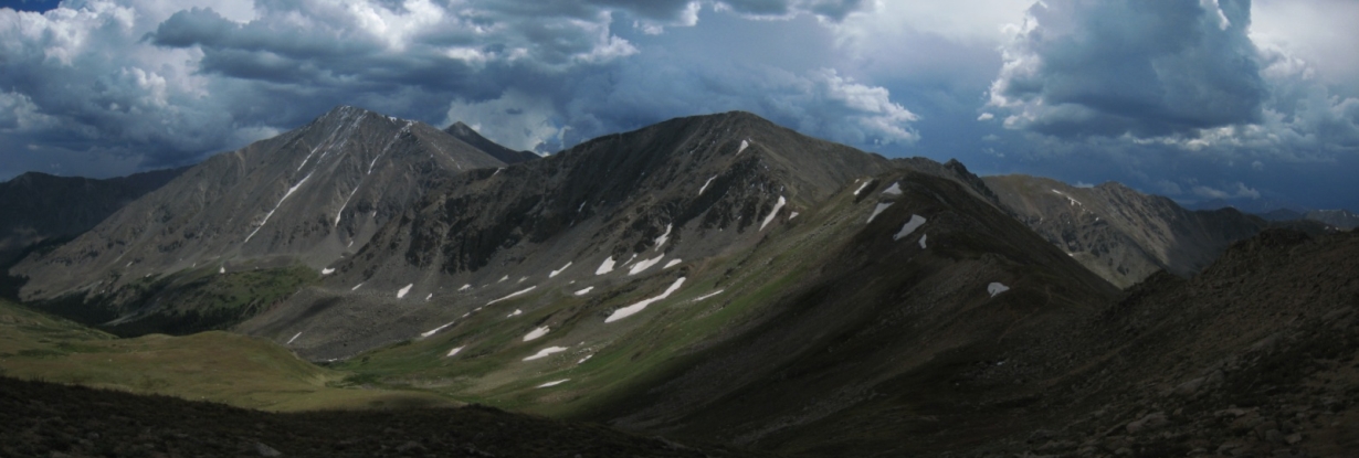
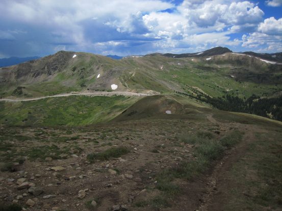
Another early morning hiker heads up the Continental Divide trail from Loveland Pass. The tip of Torreys Peak could be seen on the right (black arrow)...
I was looking for a good workout this past weekend, close by to home, that involved a 14er or two. Grays and Torreys, two of the most climbed 14ers in the state due to their nearby proximity to Denver, and relatively easy trails, were not high on my "to-do" list, but I figured there could be non-standard routes that would avoid the crowds and offer a good workout. Torrey's class 3 Kelso Ridge looked interesting, but given my low-clearance passenger car, I wouldn't be able to reach the trailhead on my own. The long, quiet, and "rolling" approach from Loveland Pass looked attractive (and killer - ~6300' gain), and would be a unique way to bag these two "easy" 14ers. I had always wanted to wander along the Continental Ridge at Loveland Pass, ever since my brother and I briefly stopped to explore the area 3 years ago on the way to Moab.
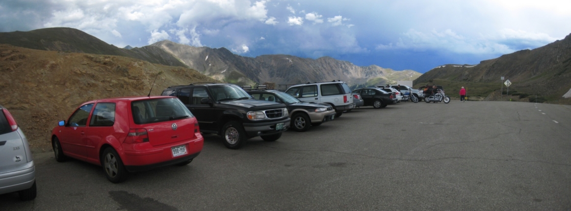
I left Ft. Collins at 4:20am, and joined the few other cars at the Loveland Pass trailhead ~6:10am. I was on the trail at 6:15am, just shortly before sunrise.
Another early morning hiker heads up the Continental Divide trail from Loveland Pass. The tip of Torreys Peak could be seen on the right (black arrow)...
Perhaps 200' below the first peak, I noticed a trail cutting across towards the saddle of the ridge. I took it, hoping it was a short cut to the ridge, and didn't lead down to the valley...
Indeed the trail led to the ridge, where a cairn marked the junction, which would be a useful marker for the return trip...
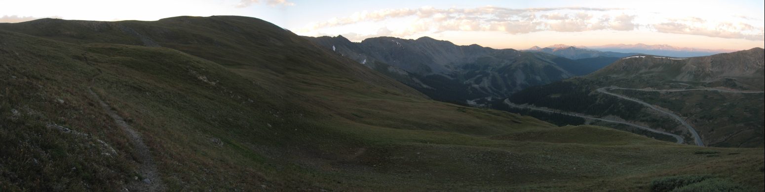
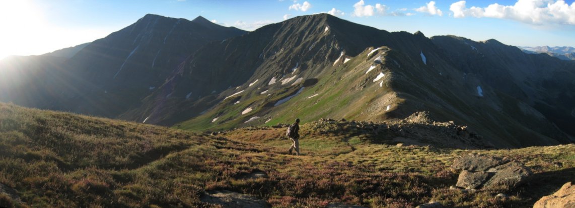
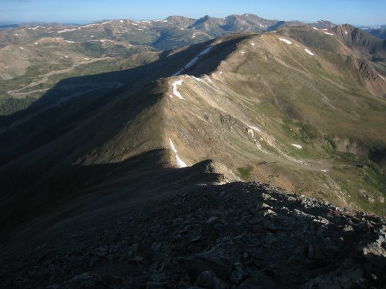
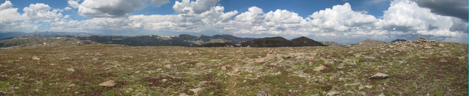
The early sunlight turned the tundra gold. This broad, open, rolling, ridge walk was exactly what I was hoping to enjoy today. The first mound ahead is Cupid Peak. Amazing how far I can get with a 10 second timer on a tripod...
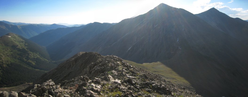
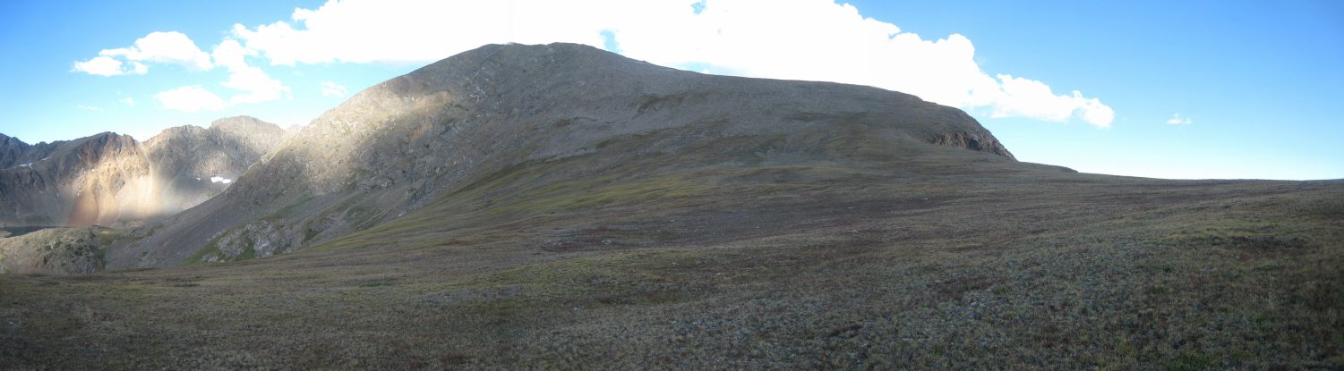
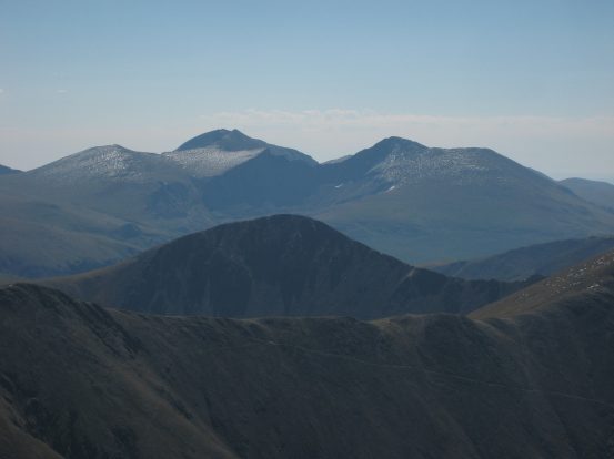
From the rounded peak of Cupid, I could see Torreys and Grays on the left, and Grizzly Peak straight ahead...
Another stitched 10 second timer shot of me heading down the ridge towards the next green bumps, before the big climb up the rocky brown Grizzly Peak...
On the descent from Cupid, the trail drifted to the left around some rocks and faded a bit. But regardless, it's hard to get lost, as you know what direction you need to end up going...
A look back after passing one of the bumps following Cupid. Still some big snow patches here...
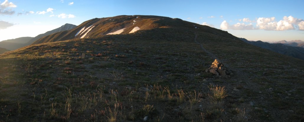
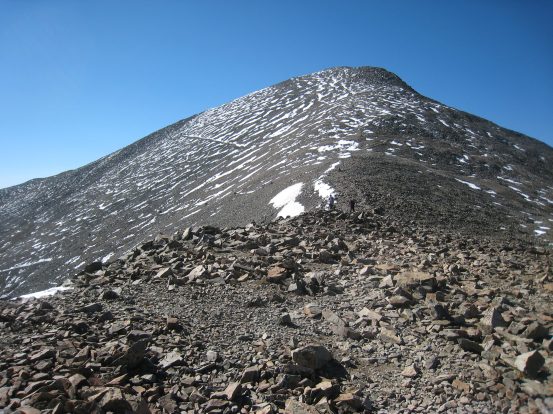
Here's a view of Grizzly Peak from the last bump on the ridge. This would be the first significant ascent of the day, though at just 700' of gain from the saddle, it would not be the largest. The pic on the right is a look back down during the ascent up Grizzly..
The trail was typical class 2 up a steep dirt trail, without much loose footing. I arrived at the summit at 7:50am. The parking lot for the trailhead is at the right end of the visible road in the background. Cupid is the mound at the right edge of the pic...
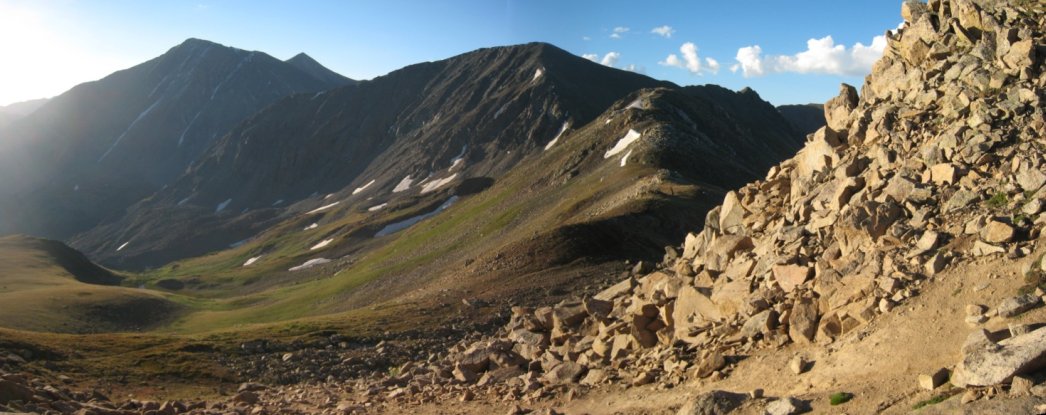
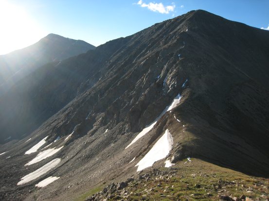
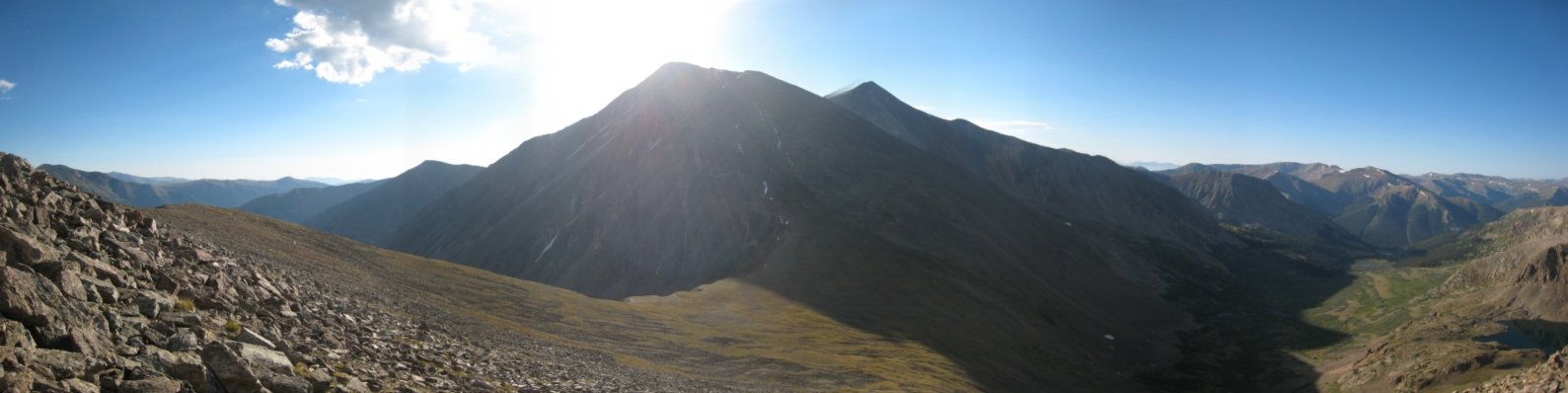
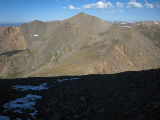
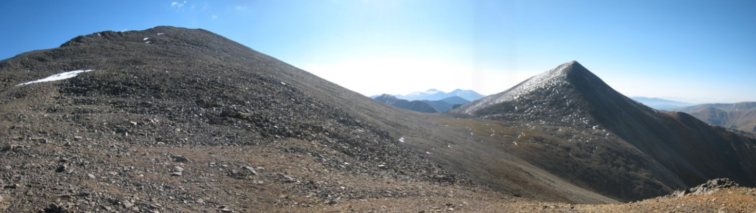
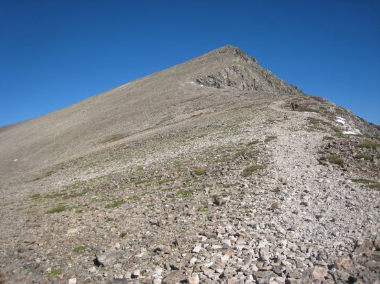
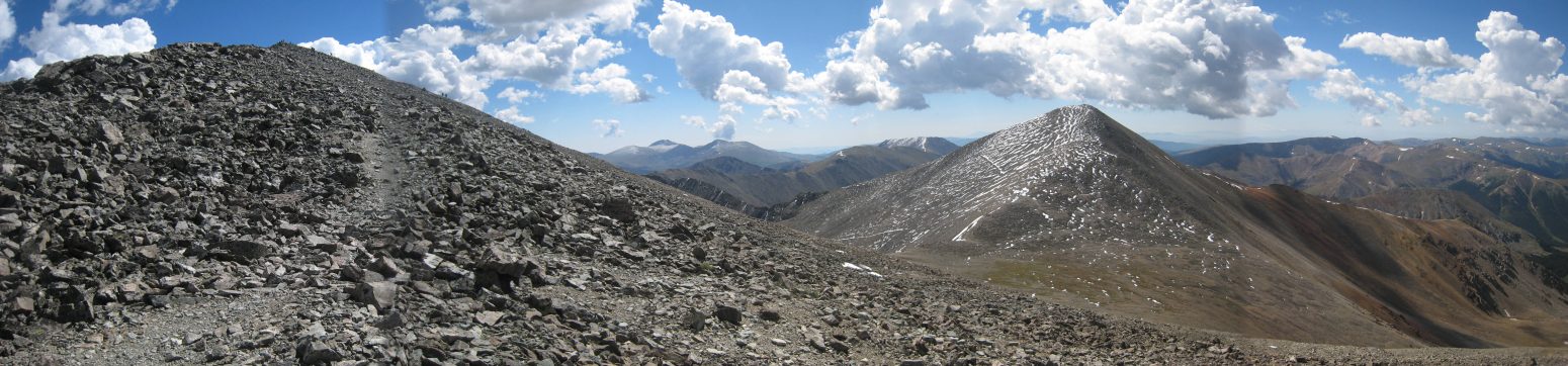
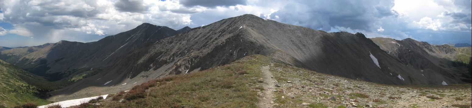
Grizzly's ridge near the summit was long and flat. Ahead were Torreys and Grays, paired from left to right. I walked along the ridge top, which had some cool sections with drop-offs to the left...
Soon I got a look at the wide, tundra covered saddle between Grizzly and Torreys. It's a 850' drop from Grizzly, followed by a 1,690' climb up to Torreys...
I walked on the ridge awhile, and it seemed like there were endless trails making their way down towards the saddle. Eventually I followed one, and when it faded, another would be nearby. Regardless, it's just a class 2 scramble, even if you don't find any trails...
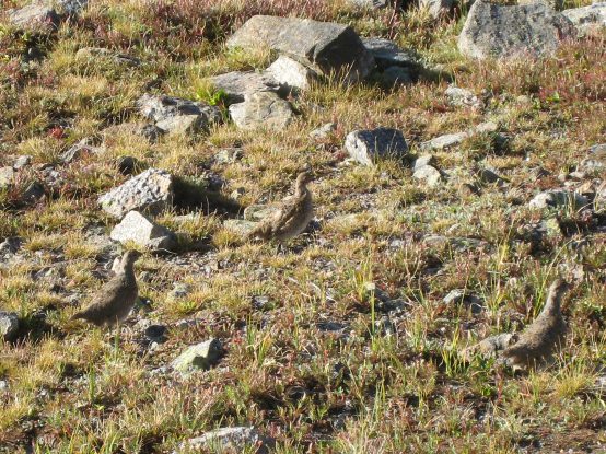
The descent down Grizzly to the saddle took longer than I expected, as the ridge stretches out far from the peak. Once in the wide saddle, I found a group of four ptarmigans waddling away. The sun was almost clearing the top of Torreys...
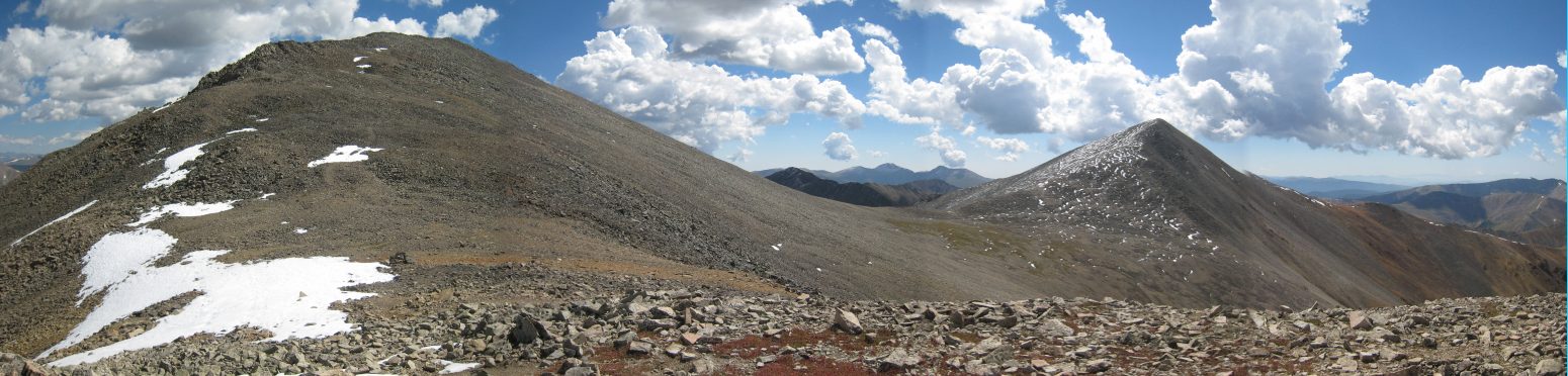
A look back at the long ridge leading up to Grizzly Peak from the saddle. No doubt this would be a pain to climb up later in the day during my return...
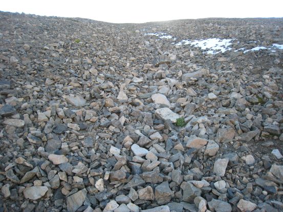
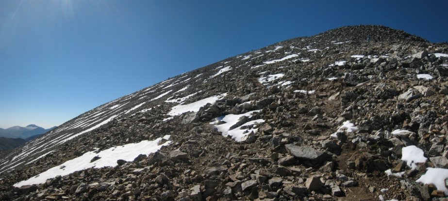
A look back at Grizzly as the sun reached the saddle. The climb up to Torreys quickly turned into a slog up a rocky scree slope. There was a slippery dirt trail leading up, but I found it easier to walk on the brick sized rocks in a shallow gully near the snow...
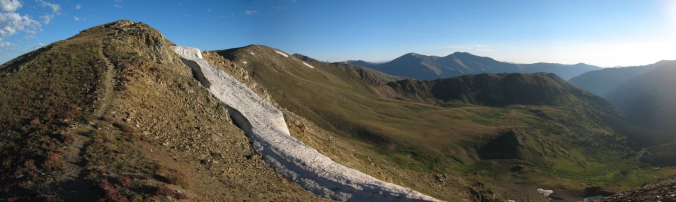
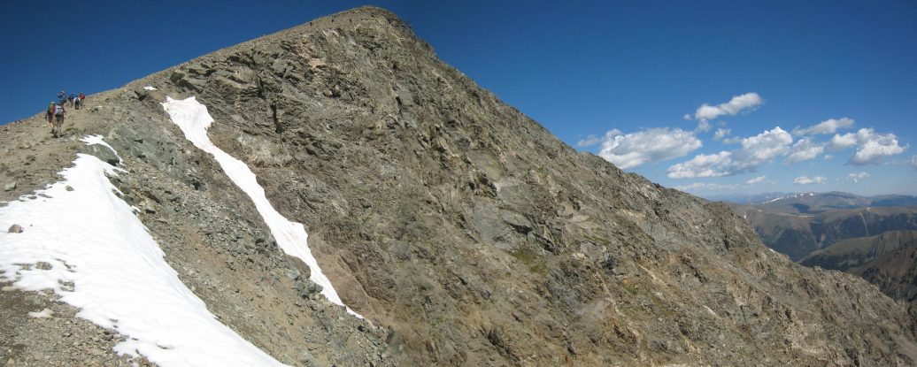
The trail up was uneventful, and I didn't take my camera out much. After ~1200', I could see Torreys' Peak to the left, and its ridge leading down to the arm I was climbing. There was still a good bit of snow left from last weekend's big storm on the front range...
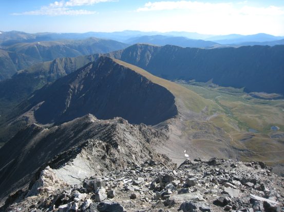
I reached the ridge, and just had a few hundred feet of elevation left. I could see the full route to Grays off to the right. Grays is just under a mile from Torreys, with ~600' drop between the peaks...
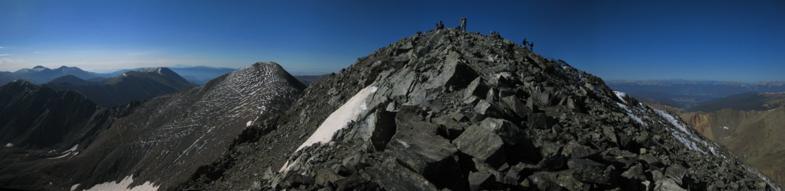
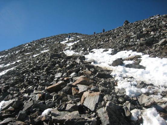
The trail to the summit wasn't very defined, but didn't need to be. I reached the peak at 9:30am. It took me 65 minutes to reach the top from the saddle of Grizzly. The peak wasn't as crowded as I expected, for such a popular 14er, but it was still early in the morning, and most people summit Grays before heading to Torreys...
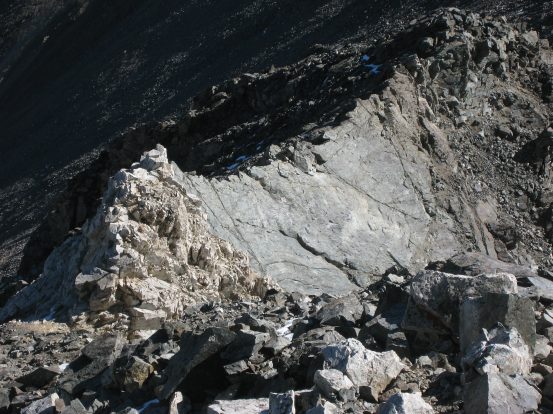
I walked over to the northeast edge of the summit to look down Kelso Ridge. Here's a close-up of the white rock knife edge...
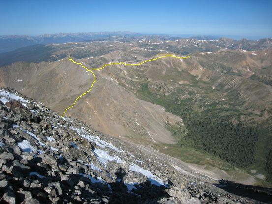
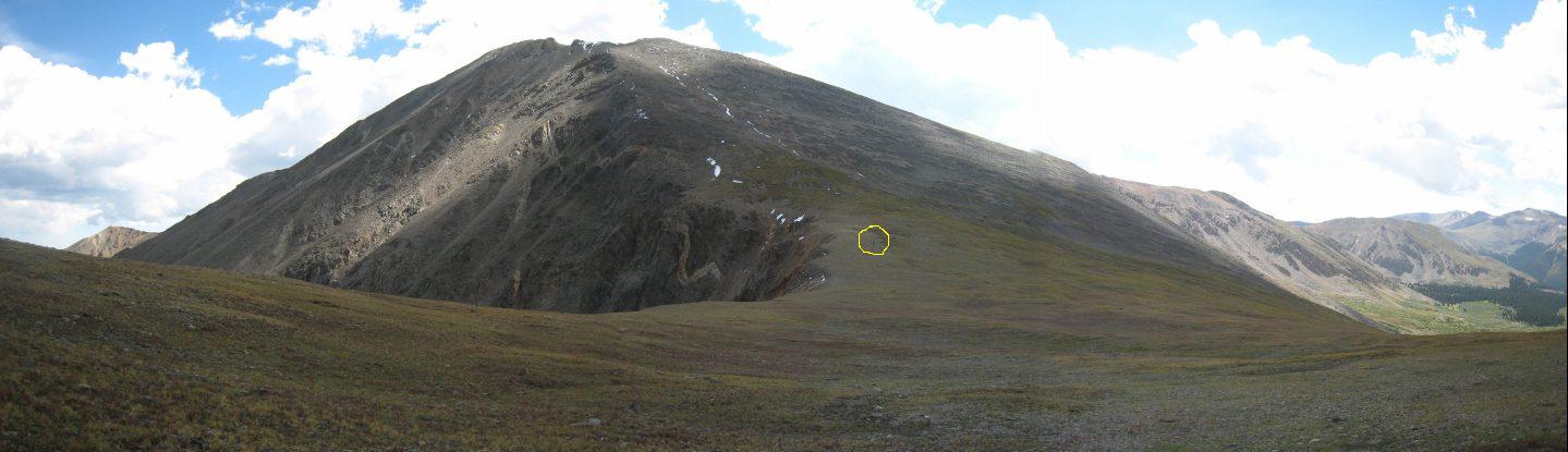
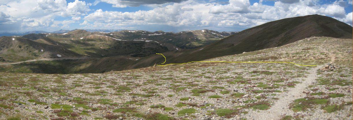
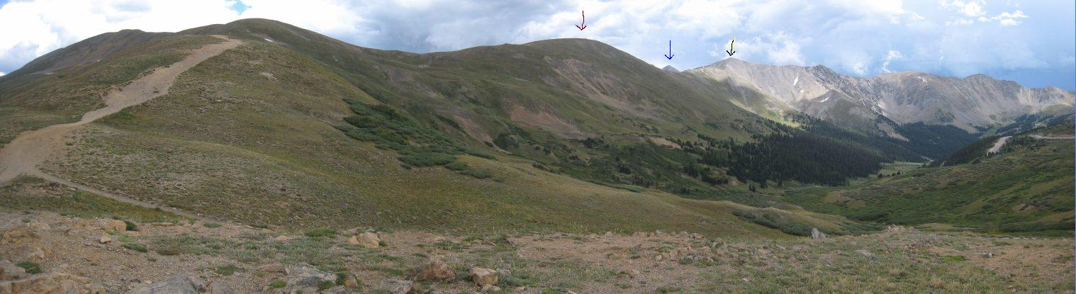
A look back at Grizzly Peak and Loveland Pass. A rough path of the hike is outlined in yellow. The parking area is located just off the right edge of the right pic...
Without sitting down for a rest, I decided to head straight to Grays. A well traveled path led down the south side of Torreys...
A look back up at Torreys a short ways down, and at Kelso Ridge leading off to the right...
After 12 minutes of descent, I reached the saddle. The pic on the left shows plenty of snow on the north facing side of Grays. The pic on the right shows the dry south facing side of Torreys...
The trail up Grays was a bit more rough than the trail coming down from Grays. This might have been aided by occasional snow patches...
I was surprised at the lack of people on this trail, and I was the only one going in my direction up to Grays. Then I realized that the main trail to Grays tapped off and ascended on the east side. I could see a swarm of hikers, like a line of ants, ascending to the summit. The snow on the trail made for a somewhat tricky descent coming back down...
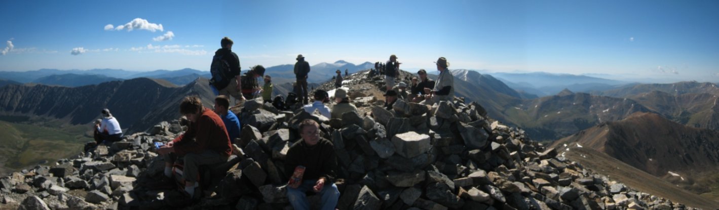
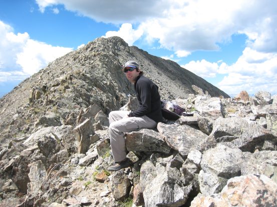
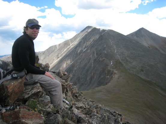
I reached the summit of Grays at 10:12am, ~40 minutes after reaching Torreys. The peak was packed with people...
However, the summit area was very large, and it was possible to escape the crowds to the southeast, where I sat down and ate some lunch...
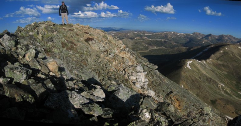
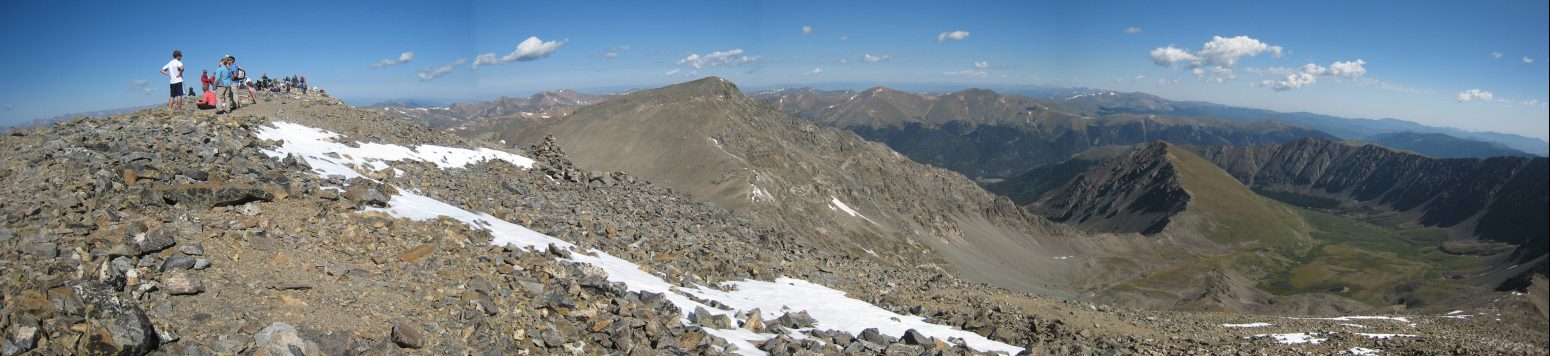
Me on Grays, with Bierstadt, Evans, and the Sawtooth ridge behind. Here's a close-up of the two 14ers and Sawtooth that I climbed last month...
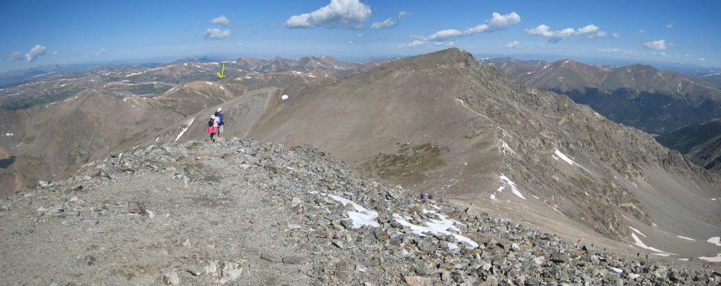
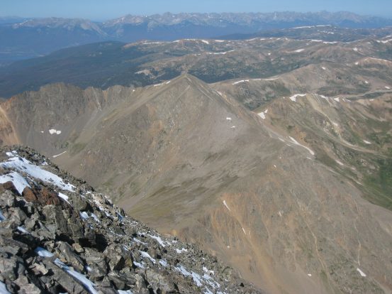
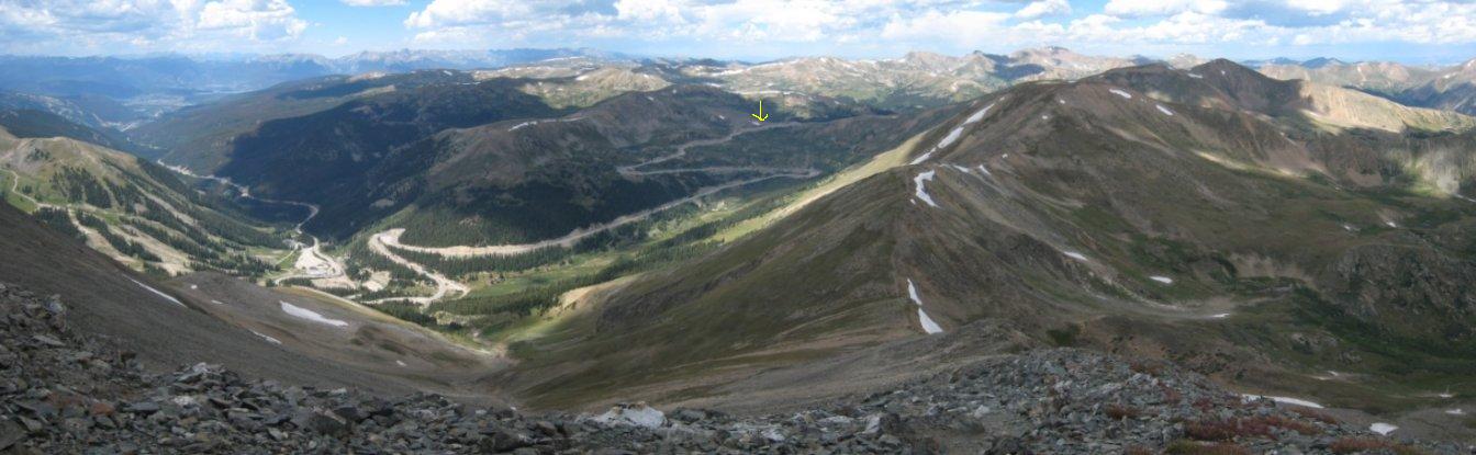
I began the return trip at 10:25am. It would be a LONG trip back with plenty of ascent to go to reach my destination, where the yellow arrow points...
The trail heading back to Torreys was more crowded now. Some hikers recognized me as I passed them on the way up to Torreys, and encouraged me on my long hike back...
I reached Torreys again at 11am, 35 minutes from Grays. The summit was much more crowded than at 9:30am. I realized I just summitted Torreys twice today. Doesn't seem like I should be able to count that as bagging it twice though...
I snuck out the west side of the summit, largely unnoticed, and began the solitary hike back towards Grizzly Peak, enjoying being away from the crowds again...
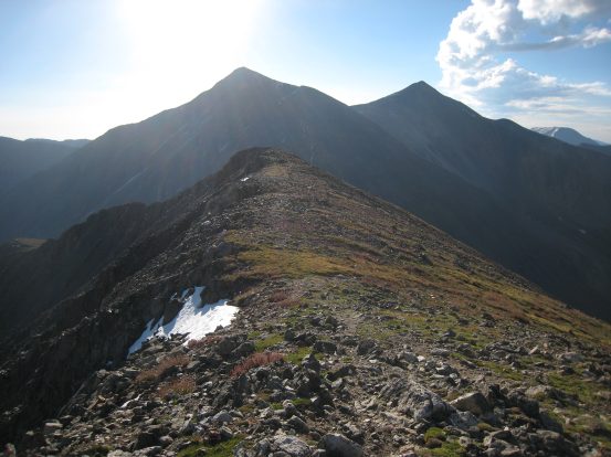
A last look at the west arm of Torreys and Grays before starting the steeper descent down to Grizzly...
The descent was fairly easy, and the dirt trail wasn't too slippery/steep. As I neared the saddle, I could make out some tiny dots on the far side, and realized there were two people making their way down to the saddle...
A 12 year old-ish looking boy and his dad (trailing behind) were making their way to Torreys, and would descend back via the standard route to a 2nd car. We were both concerned about the gathering clouds, but they decided to pursue it none-the-less. I refocused my thoughts on the 850' hike up Grizzly...
A look back across the saddle at Torreys. Circled is the black speck of one of the hikers who crossed paths with me...
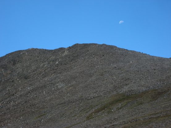
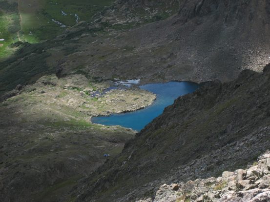
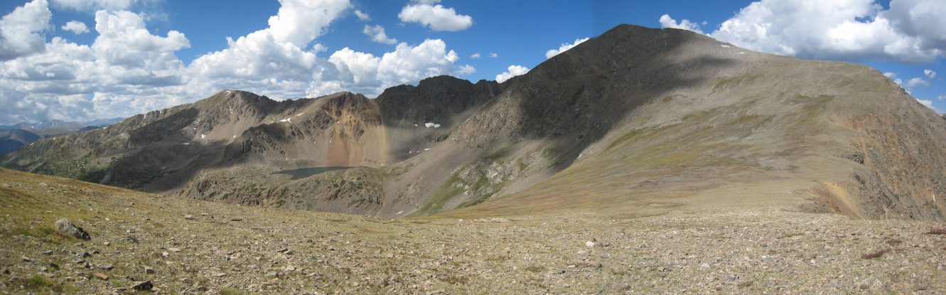
The climb up Grizzly was grueling after having already climbed two 14ers (three 14ers, sort of). I noticed the moon above the ridge, and saw two more people on the ridge making their way down. They too would be descending via the standard route of Torreys. The clouds were thickening and gray to the southwest, but they looked very experienced, and evidently felt comfortable to continue. A look down at a colorful lake below Grizzly...

Just when I thought I had reached the peak, it turned out I had just reached the ridge, and still had a ways to go. I stopped for a rest here...
A couple of tripod shots, first of Grizzly ahead, then back towards Torreys. I ate the 2nd half of my sandwich before continuing the final stretch to Grizzly...
Finally, at 11:25am I reached Grizzly's Peak, and could see the parking lot at Loveland Pass (arrow). It was time for another descent...
The descent was similar to that from Torreys, on a manageable dirt trail, but much shorter. After climbing the next 200' bump, I looked back to take this pic. Definitely some building clouds in that direction...
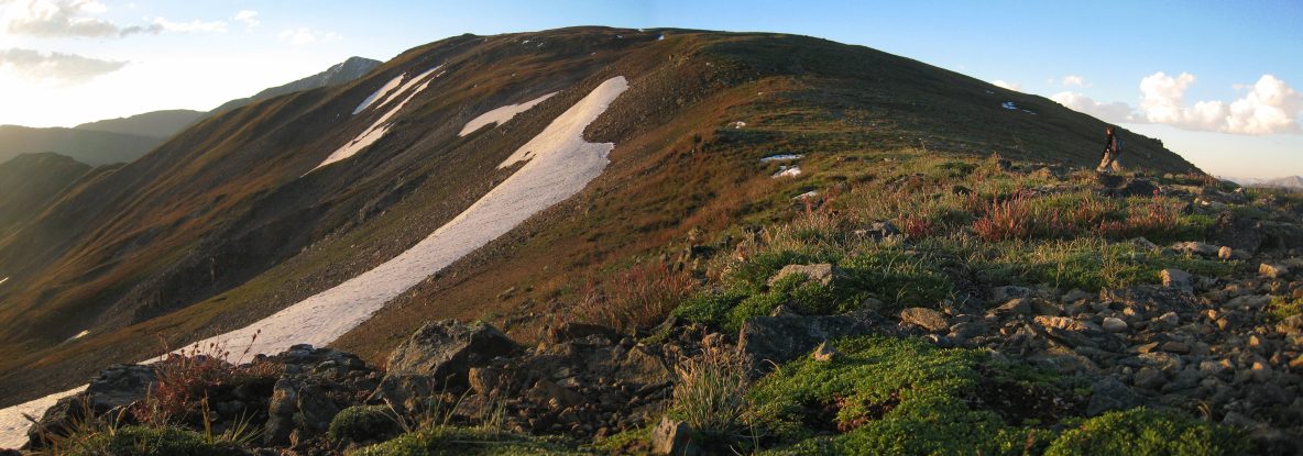
A look back from half way up Cupid. The clouds sure look more threatening with this camera setting. I kind of lost the trail going up Cupid, and wandered off on the right side amongst some rocks (saw a marmot). I had to scramble back up to regain the trail, near the summit...
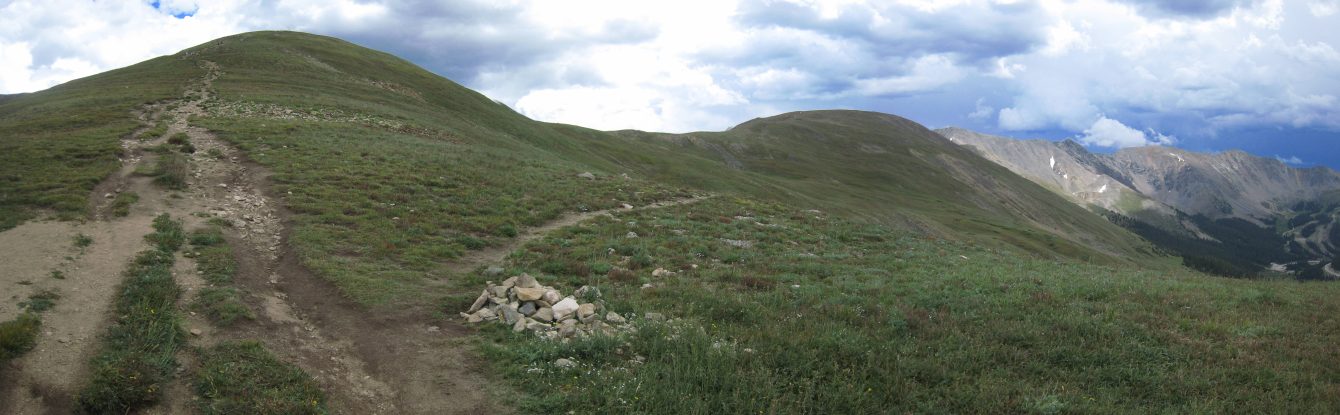
Back up on top of Cupid, the ridge was wide and open...
Having finished my last ascent of the day (360' up to Cupid), it was all downhill from here, finally! When I reached the next saddle, I found the cairns that marked the "short cut" trail back to Loveland Pass. Yellow roughly follows the side trail back to the main path...
Quickly I was back at the main trail, glad to still have decent weather all this time, and wondered about the people still heading to Torreys. Here's a look at the side trail breaking off to the saddle on the right...
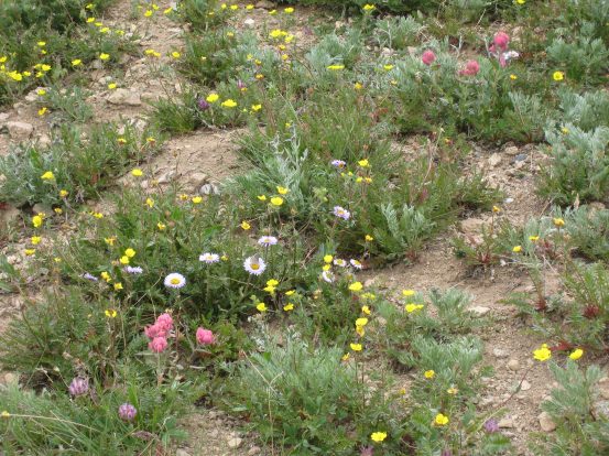
The only flowers I saw all day were on the side trail, just before joining the main trail. Here's a look back down to the parking lot...
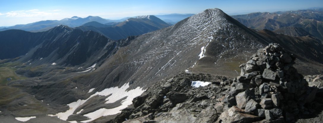
One last look at Cupid (red), Torreys (blue), and Grizzly (Black), from just above the parking lot...
Back at the trailhead, I recognized a man that started out at 6:15am, like me, and asked him about his day. Turns out he was a 14ers.com member (The Turtle), a site I frequent often, and post these reports on. He was getting back into hiking shape, and testing out how his prosthetic leg was working (an amputee just below one of his knees), after losing 60+ pounds this year. It was awesome to meet him, and see how active Coloradoans are, not letting certain handicaps get in the way of their outdoor adventures...
As I hopped in the car, and started to leave, a few rain drops fell. Great timing! I had finished the hike at 1:45pm, 7.5hrs after starting out this morning. I was now off to Aspen, to meet up with some folks and attempt Pyramid tomorrow! Hopefully my legs would recover quickly. I usually feel better the 2nd day of a multi-day hike, so I had intended this hike as a warm-up.
Grays and Torreys are now bagged. Not terribly impressive peaks, and this was not a very picturesque route, but I'll always remember the ongoing ascent/descent/ascent/descent of this route from Loveland Pass, along with it's solitude and open ridges. If you want a killer work out, without the crowds, this is a great option (11.5 miles, 6300').