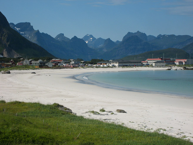
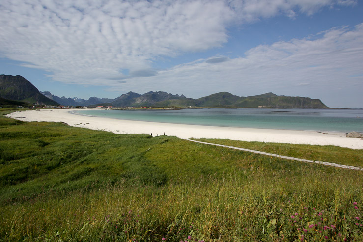
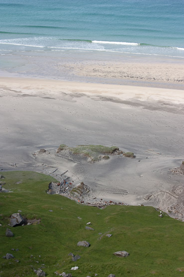
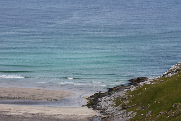
A look at the beautiful white sand beach along Ramberg. We drove through Ramberg at least once, each of the past 4 days. Today had the best weather for a pic...
It is HOT today. Car said 29 degrees C (~85 degrees F) in Moskenes a short while ago. 23 degrees C here at A. Sunny with haze as we prepare for our 2nd hike of the day...
Got up at 8am this morning, and had a bowl of cereal, though was still very full from yesterday's big late lunch buffet. It was cloudy, but with a warm south breeze. The construction noise from the mine across the road was very loud and intrusive. Glad we were happened to spend the vast majority of our time camping here on the quiet weekend.
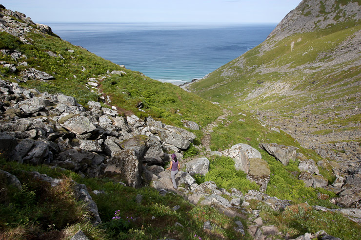
Wendy and I packed up our gear early, and set out for the Kvalvika beach hike, recommended by the campground owners, on our own. Karl and Mariann would take their time, dis-assembling the lavo, and head to Kvalvika later. We planned to all meet up at Moskenes campground later in the day. A short ways on the road, we realized Karl's cell phone (which we were borrowing) was locked, so we returned to camp once more for his help. Finally, we drove through Ramburg one last time, and on to Fredvang, where we found the trailhead to Kvalvika exactly as the maps specified. At 10:20am, we were on the trail, heading up the grassy slope towards the pass ahead.
A look at the beautiful white sand beach along Ramberg. We drove through Ramberg at least once, each of the past 4 days. Today had the best weather for a pic...
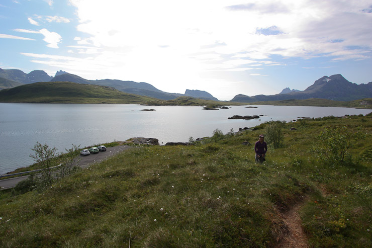
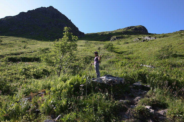
The parking lot at the Kvalvika trailhead was small (in 1st pic), but we were early and got a spot. The dirt trail was gentle, and led up to a grassy pass...
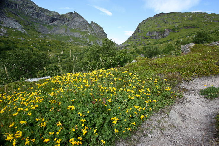
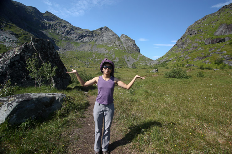
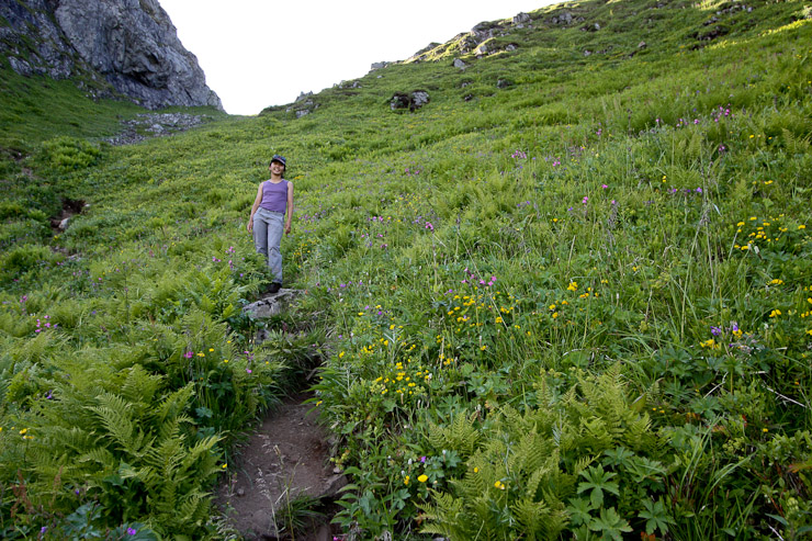
Yellow and pink flower patches decorated portions of the trail along the way...
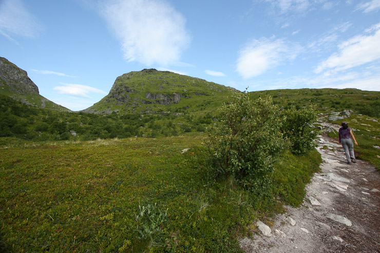
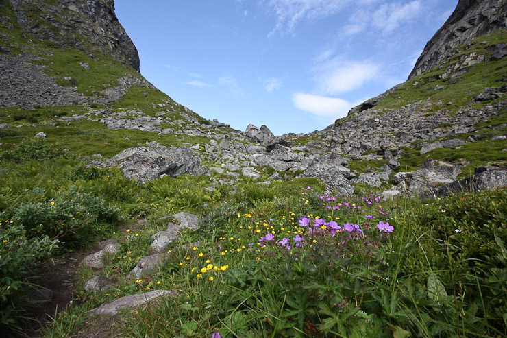
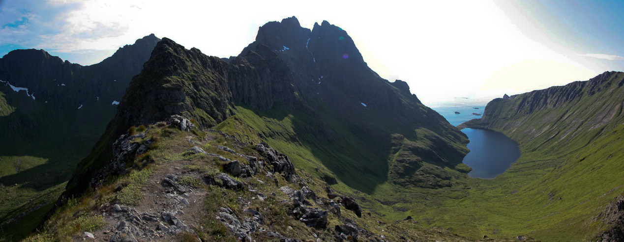
After ~30 minutes, we had reached the top of the pass. A look back towards the trailhead in the 2nd pic...
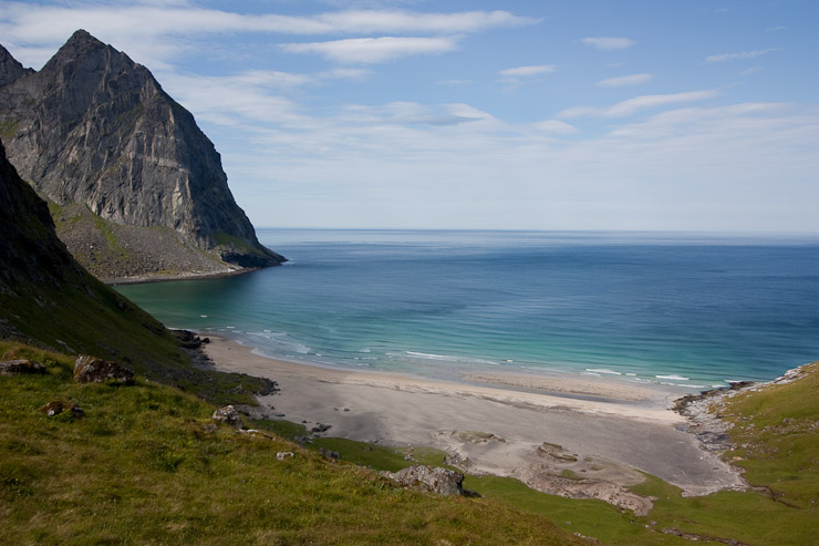
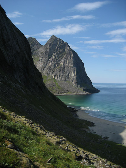
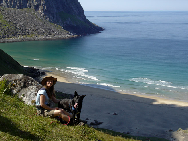
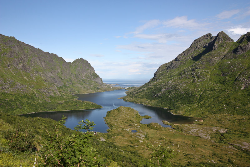
We followed the trail down from the pass towards the ocean, and quickly the view opened to reveal a spectacular beach surrounded by towering peaks!
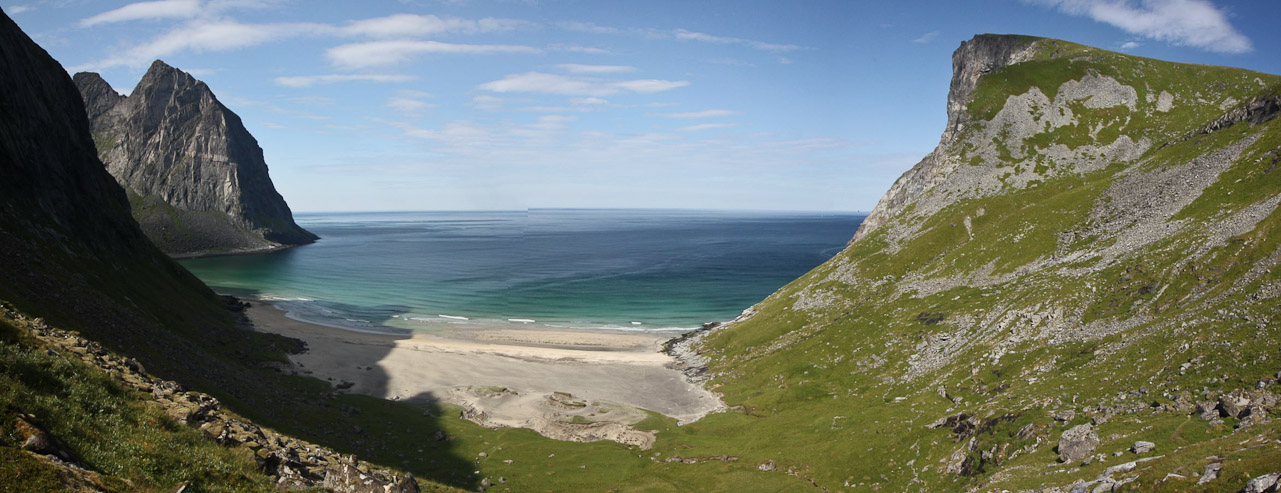
Wow, we were both amazed by the dreamy beach, and were very glad to have hiked here. The campground owner had said that the Queen of Norway visits here, and it's here favorite vacation place. The Queen is 60 years old, and still visits here. Can't blame her...
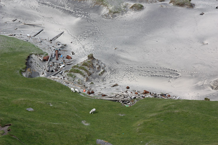
Way down, just above the beach, several sheep were grazing on the fine green grass...
There were lots of seagulls flying over the beach (small white specks in 1st pic). It would be great to spend some time, and camp near the beach, but since we only intended for a short hike this morning, the view from the pass would have to do. We didn't want to descend and re-ascend the 500' down to the beach, in order to save energy and time for an afternoon hike...
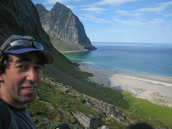
The peak on the left side of the beach was ~2000'. Karl and Mariann also hiked here later in the morning, and took this pic of M & D...
Wendy and I hung out at the pass and ate some snacks, admiring the amazing view, before returning back to the car. This ~35 minute walk to the pass is HIGHLY recommended. The weather was warm and sunny today...
Half way down from the pass, I was glad to see Karl, Mariann, and Darwin, hiking up the gentle dirt path, and told them the hike was well worth it. We were back at the car by 12:15pm, and made one last, VERY familiar (6th time?) drive south across the one-way bridges into Reine, stopping for some final pics of the grogeous town. I filled up another 6 liters of gas, in case gas stations were more expensive on the island of Vaeroy tomorrow. We then continued to Moskenes, just a few minutes south of Reine, and stopped at the campground across from the ferry terminal to scout for a good tent spot. After scouring the hills, we decided on a spot along the edge of a field near the road and facilities. 170 NOK per night here (~$27).
The view from Hamnoy, just north of Reine, as we traveled to Moskenes. This was a familiar, yet always gorgeous vista...
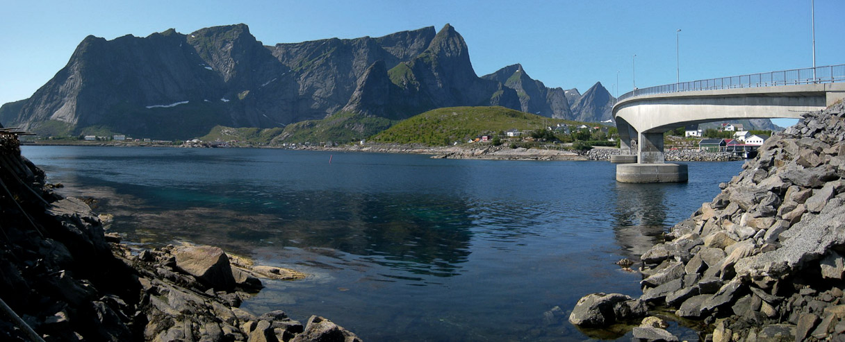
I stopped before a one-way bridge to capture this panorama that includes the Reinebringen ridge we hiked a couple days ago...

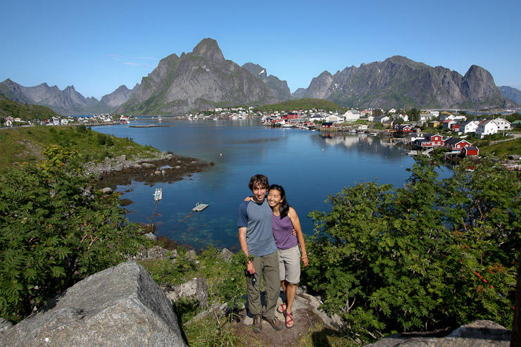
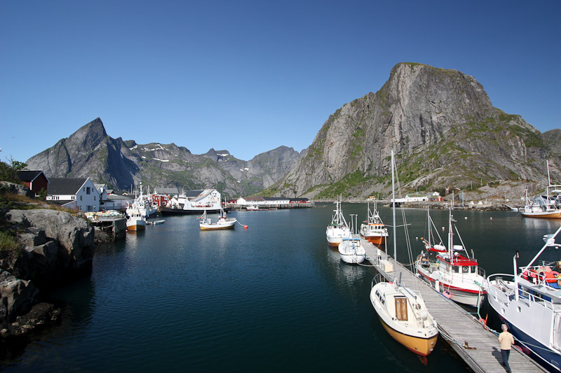
We also stopped on the southern side of Reine for one last photo-op, perhaps the most scenic town on the islands...
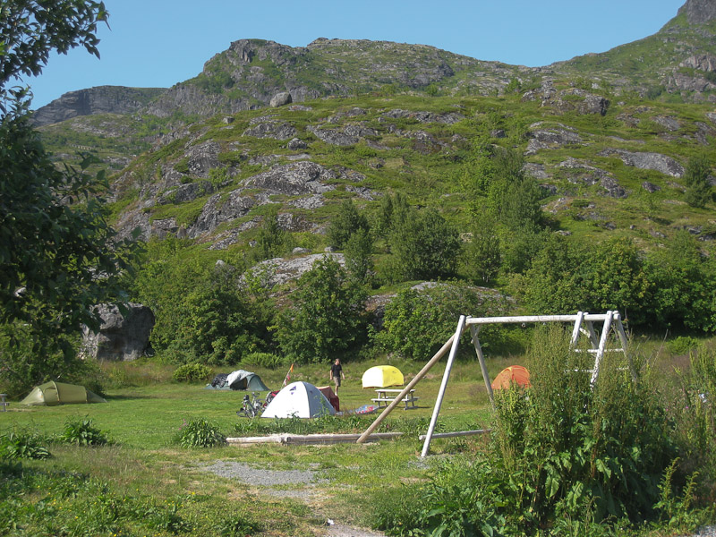
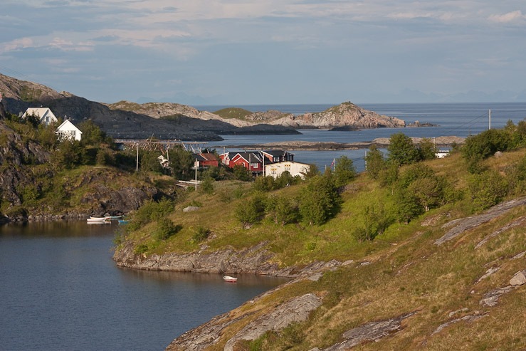
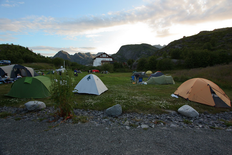
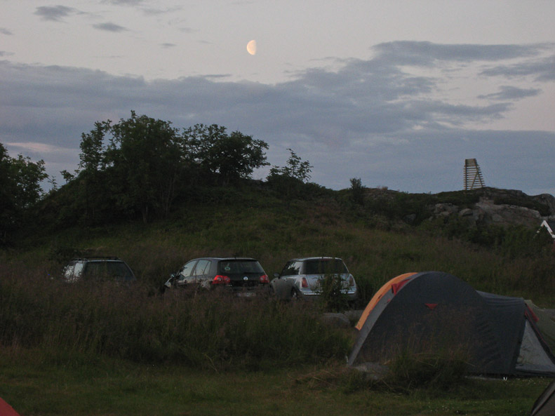
Our yellow tent sits in the middle of the pic, on the far edge of the field, in Moskenes Campground...
It was incredibly hot out today! Having settled our camp site duties, we drove to the vista point at the southern most point of E-10 to have lunch. We had stopped by here a few days ago after arriving back from Bunes also. We can't find the bag of brown cheese, which has Mariann's cool cheese slicer. It might have been left in the fridge back at camp.
A couple pics from our lunch spot at 2:30pm. We could look south to the island of Vaeroy, which we'd be ferrying to tomorrow morning. Wendy cooked up ramon for lunch, I ate some bread with peanut butter and dried cherries...
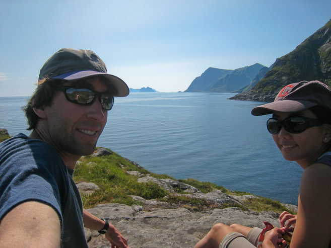
Vaeroy is the long island in the distance. It's a ~1hr ferry ride from Moskenes to Vaeroy...
After our short lunch break, we made the 2 minute drive up the road to the trailhead for our afternoon hike, where I'm writing this journal. It's 3:45pm now, and we're ready to get hiking.
10:33pm, Moskenes Camping
We're camping on the south side of the islands tonight, a first for us this trip. There is plenty of shade from the mountains, and also a ton of mosquitos...
We found the brown cheese hidden in the trunk just before our hike. A relief to have found Mariann's cool cheese slicer (we even wondered if it could be a family heir-loom, but later found out they are common all over Norway, and just $6).
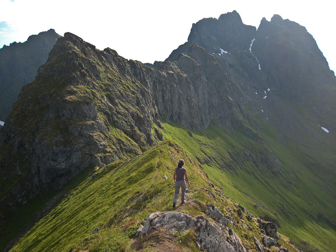
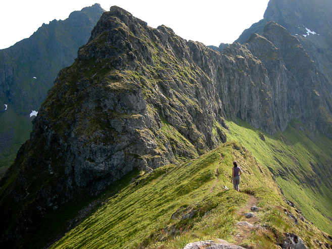
For our afternoon hike, we followed a path along the south side of a long lake, and then climbed ~1300' up a steep grassy slope to the top of a scenic pass.
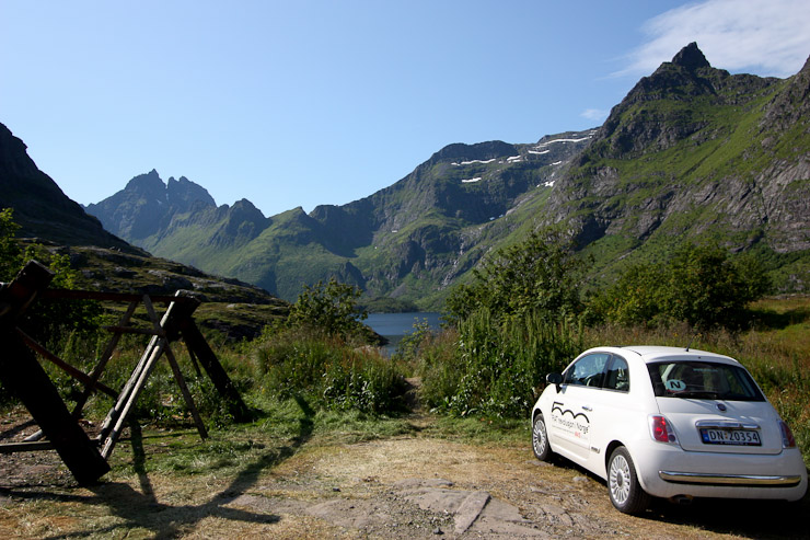
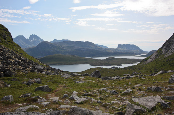
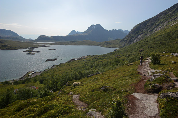
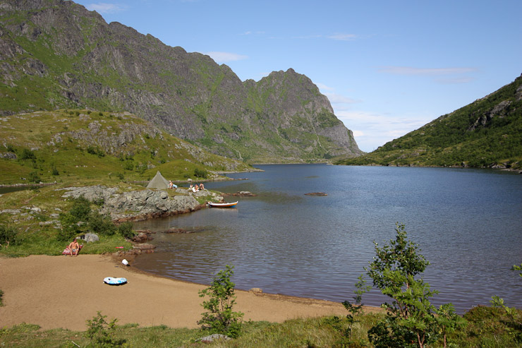
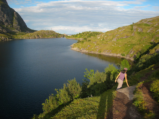
We parked near some fish drying racks at the end of a lake, and hiked to the low point on the ridge ahead (1st pic). A look back across the lake towards the trailhead...
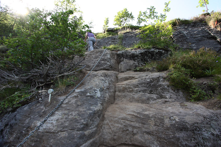
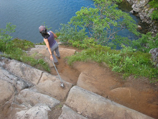
The trail had several ups and downs along the lake, including a section with a handy chain. There were several people camped along the far shores, swimming and boating in the lake...
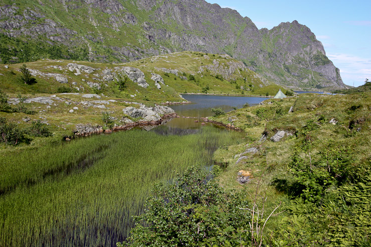
When we reached the end of the lake, 1hr into the hike, The trail crossed a grassy/swampy field, and it was tricky to find a path along dry solid ground. Up next, the 1300' climb up to the ridge, for a hopefully very scenic view...
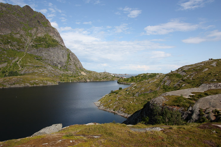
A look back east across the lake, and out towards the sea. I wondered if this was a drinking water resevior for Lofoten, since there weren't all that many lakes with fresh water here...
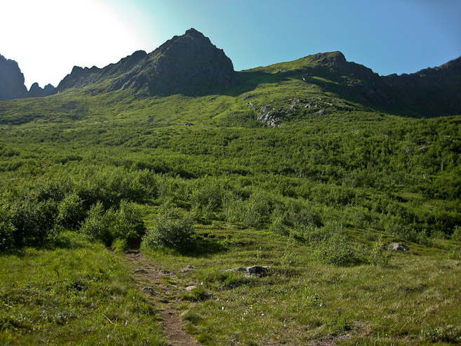
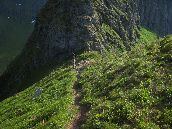
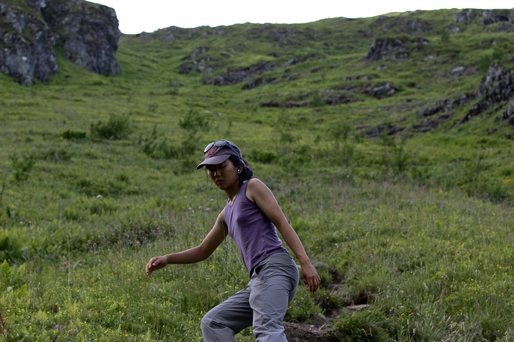
The dirt/rocky trail was steep, but sturdy. However, Wendy did dislodge a rock accidently, which tumbled ~700' down the slope (fortunately not along the trail). We crossed paths with 3-4 people on the trail during our ascent, but had the place largely to ourselves. It was super hot out, even in the shade, and there was no wind to cool us off...
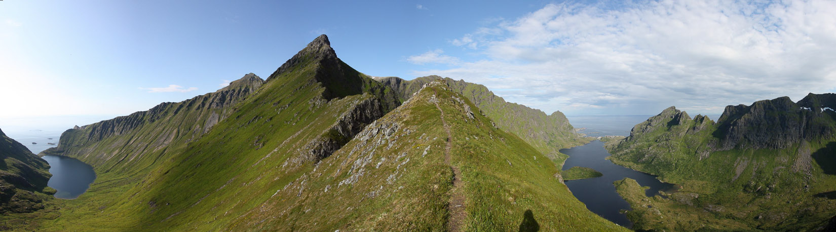
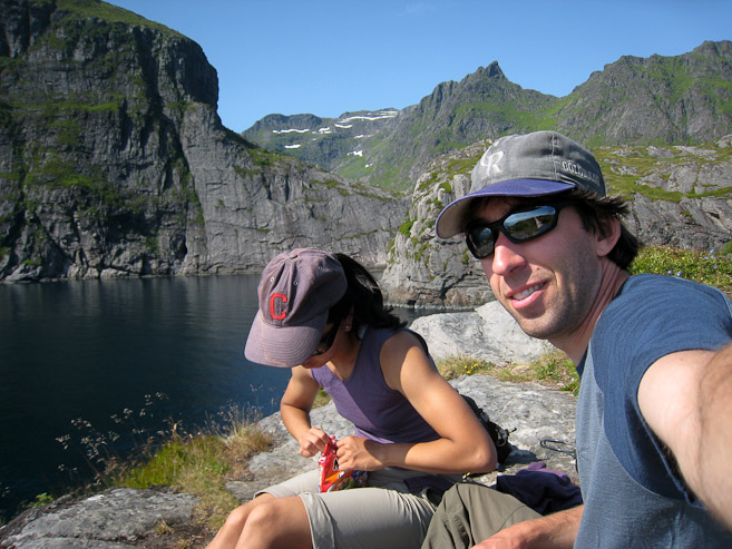
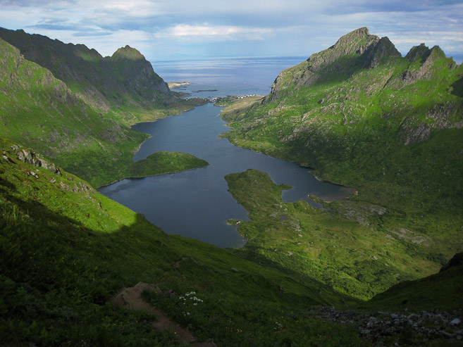
We reached the ridge at 5:50pm, 2 hrs since starting the hike. This is a look north from the pass. We hiked up a bit further, towards the first high point...
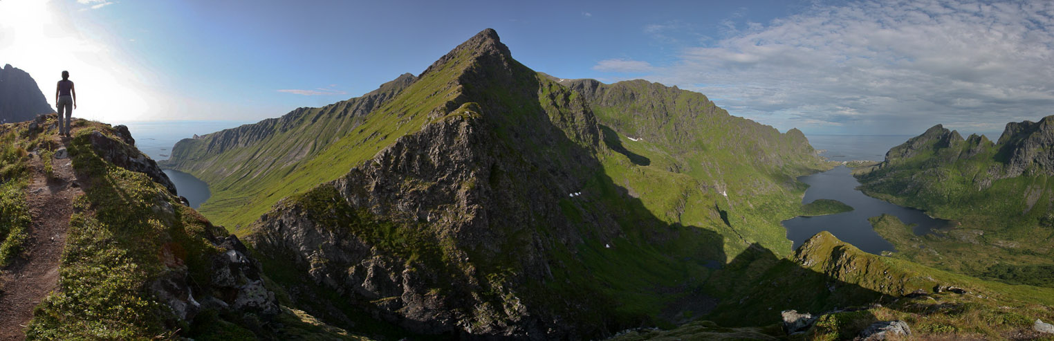
The views were decent, but not up to our high Lofoten standard that we'd been spoiled with the past week. I snacked on some twizzlers and grandma's nut bread while resting on the ridge a short while...
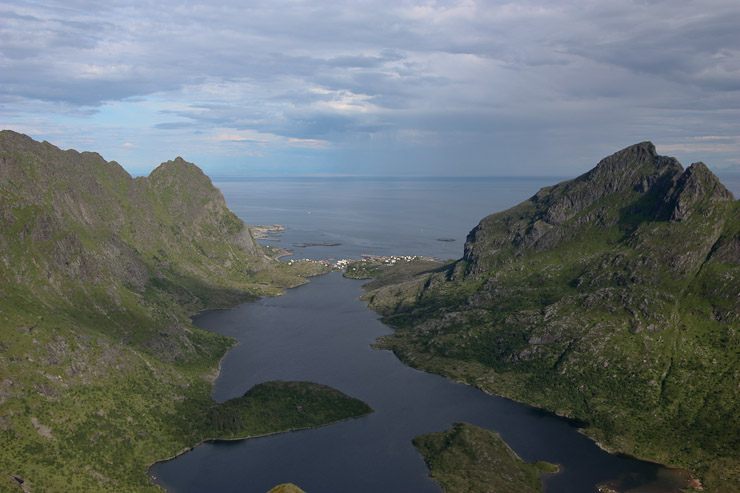
A couple looks back across the lake we hiked in from, and at the town of A.
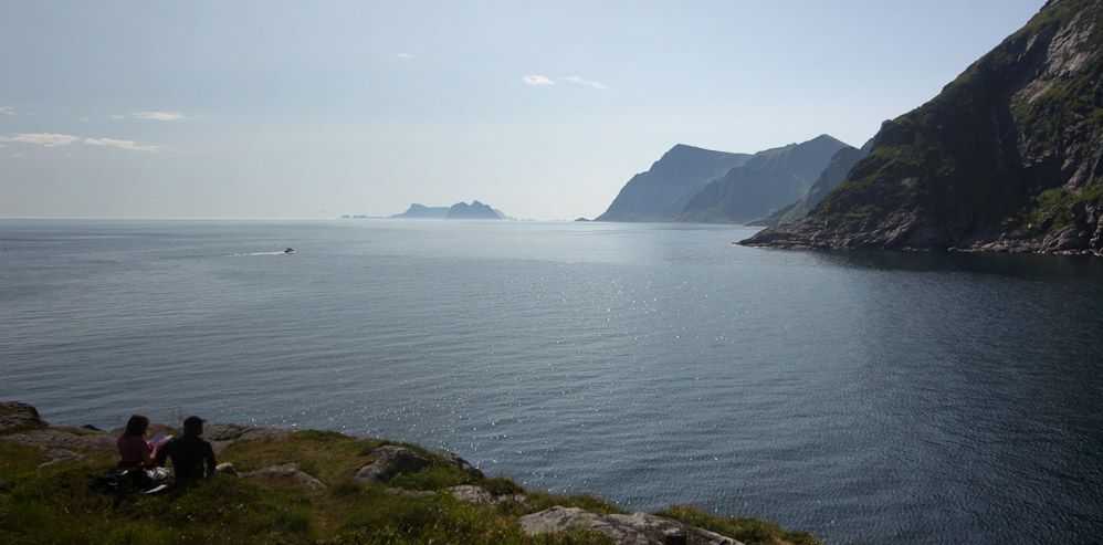
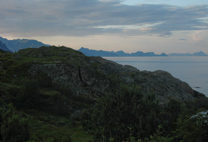
A look south from the ridge. One can continue hiking down to the right, and out to the ocean on the north. But that didn't seem worth the effort of 2x distance and elevation today...
More close-ups of the town of A, including a ferry boat in the distance...
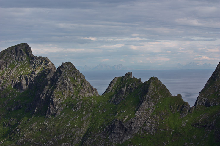
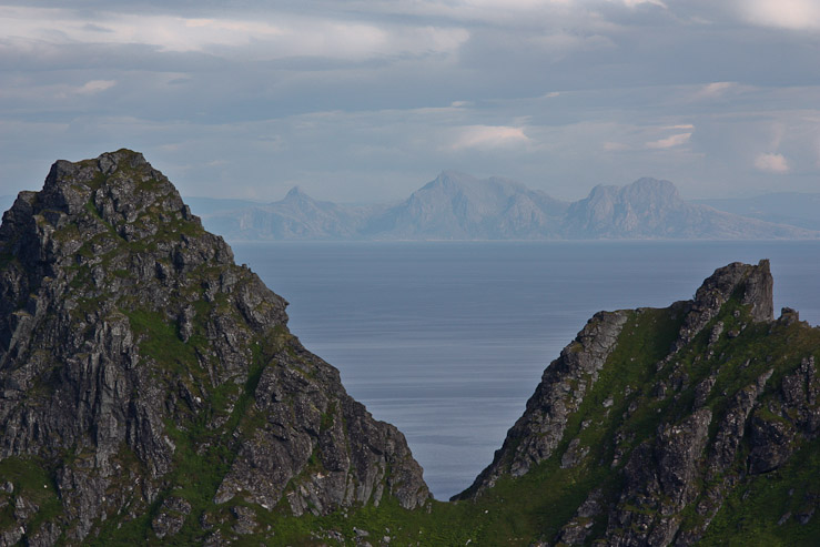
A couple zoomed in shots southward, which show the mountainous Norway mainland across the sea...
After ~15 minutes on the ridge we worked our way back to begin our descent...
Gotta love the prevelant grass all over the jagged mountains of Lofoten. So much more pretty than the typical grey/brown of Colorado mountains. I marveled that grass could grow on such steep cliffs...
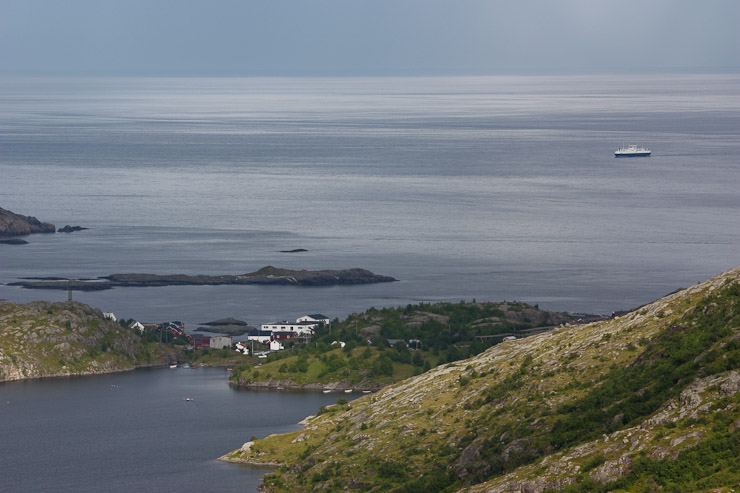
Another close-up of the town of A, and the ferry (likely heading from Bodo to Moskenes). We made it down the mountain, and back to the lake in 50 minutes...
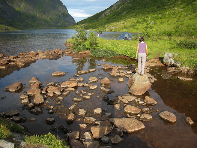
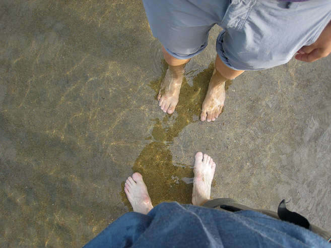
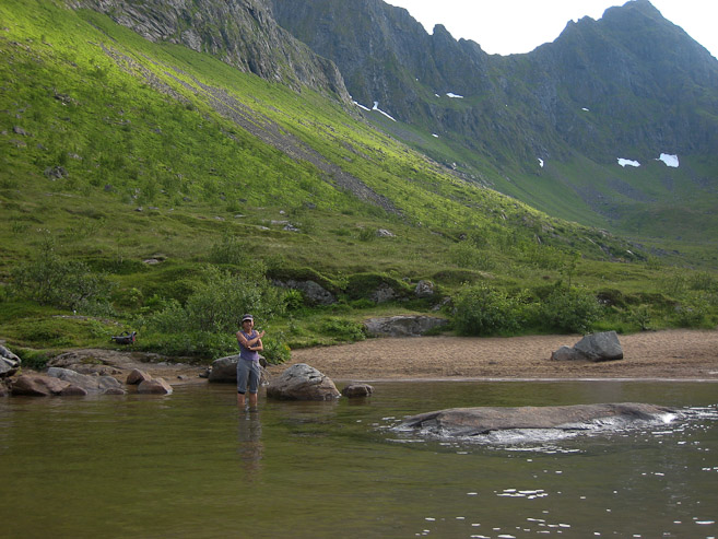
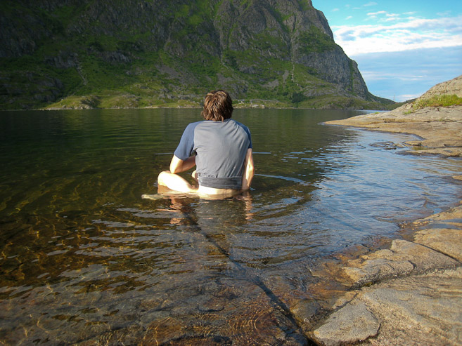
We re-crossed the swampy area, and hopped across rocks to reach the lake. I was feeling very hot, and proposed wading into the water a bit along the beach. The lake water was much warmer than the ocean, and pleasant...
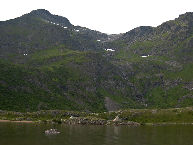
A look across the lake at some lavos, and a waterfall. Also a look at the beach where we waded into the lake...
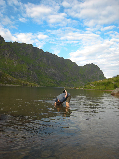
I was feeling extremely hot, and would have enjoyed going for a swim to cool off. Did my best, by dunking my head in the lake several times...
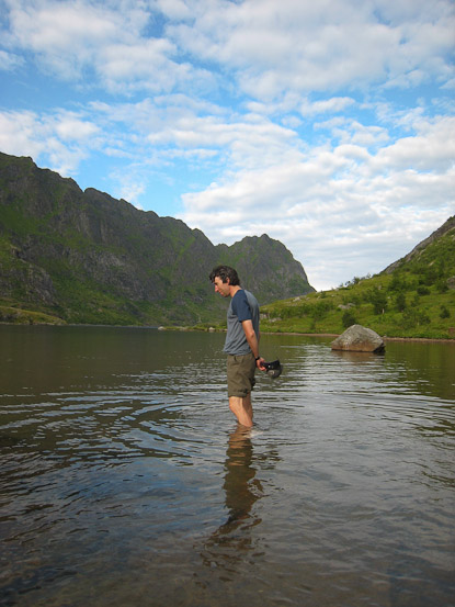
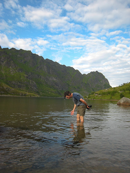
We worked our way back along the lake, and I was still feeling over-heated. My legs and butt were radiating like crazy, and so when we reached a flat rock along the lake, I felt the need to take a dip. The water here was colder than the sandy beach. Simply wading in would not suffice this time, so I took a seat on the slippery rock, feeling very European (or as Wendy describes it "I popped a squat in the cool water")...
Feeling refreshed, though still a bit weak and hot, I followed Wendy the rest of the way back to the car. Who would have thought I'd get some type of heat exhaustion in the Artic north? Very hot day today...
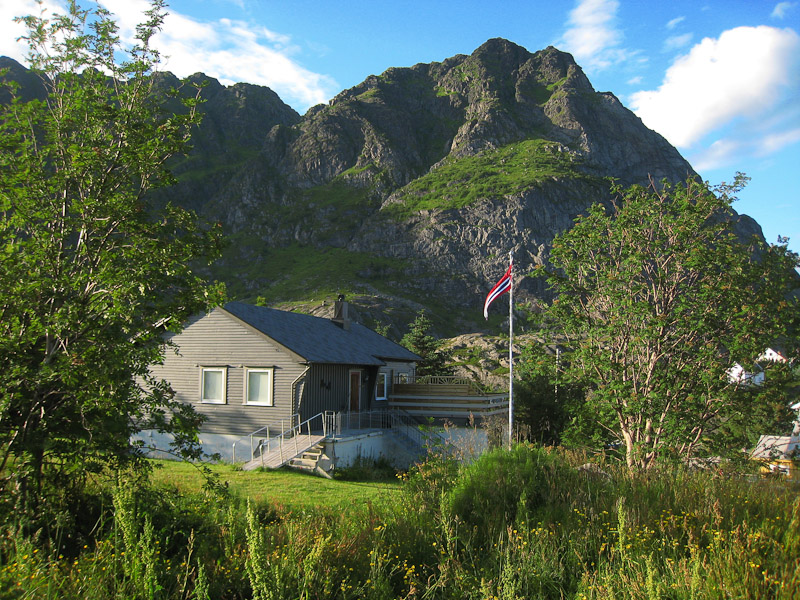
We arrived back at the car ~8:15pm. This house sat next to the trailhead...
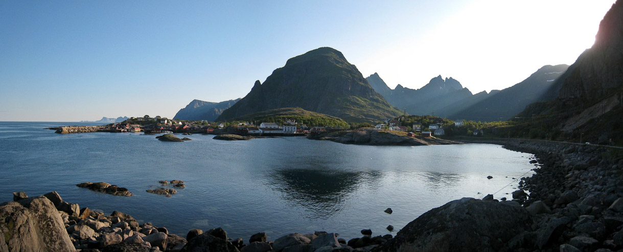
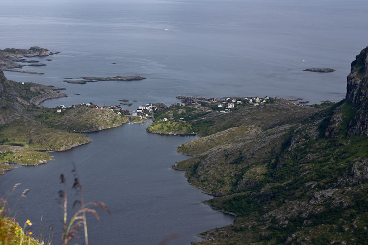
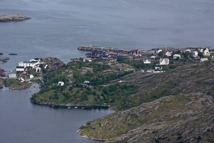
On our drive back to Moskenes, I stopped for a pic. The small town of A sits along the water, and the ridge we had just climbed is in the distance on the right...
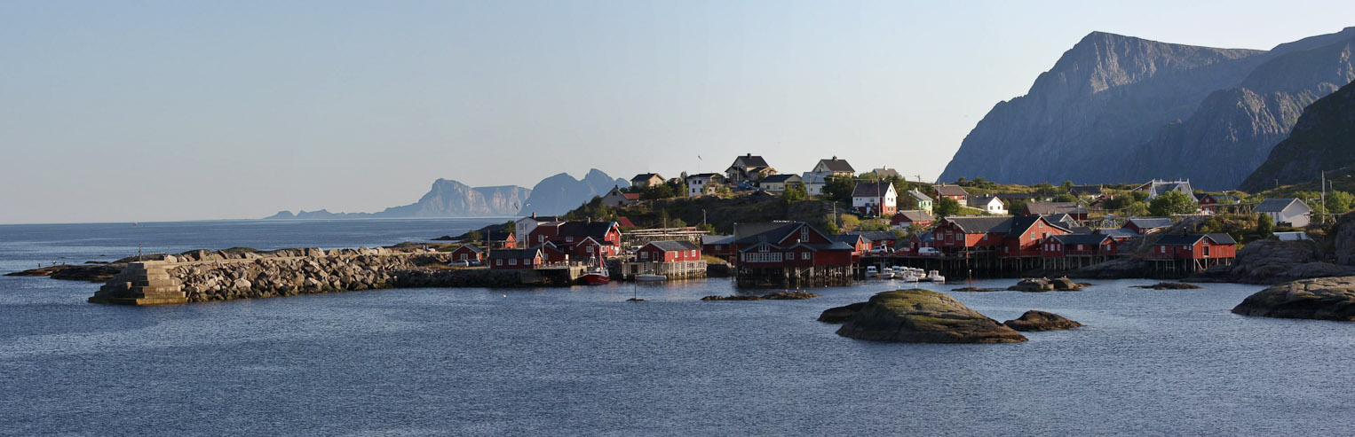
A closer shot of the town of A. There is a cod museum there, which we didn't visit. Cool little fishing vilage with a rocky pier...
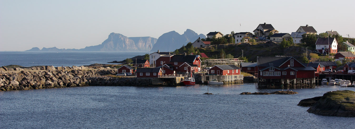
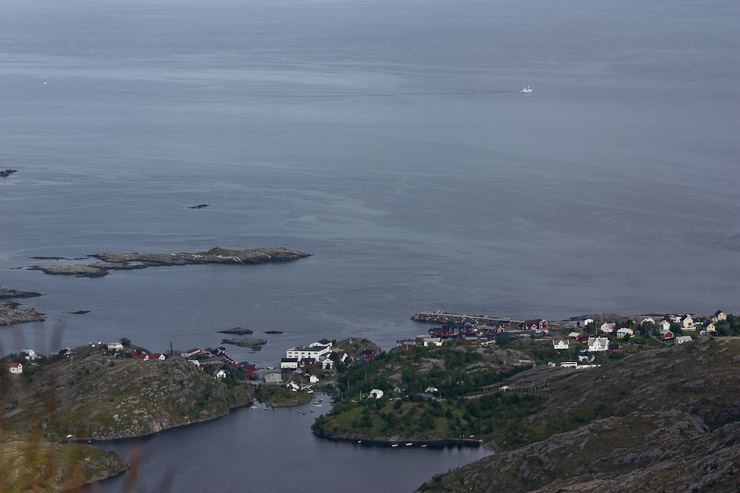
An even CLOSER shot of the town, with the island of Vaeroy in the distance...
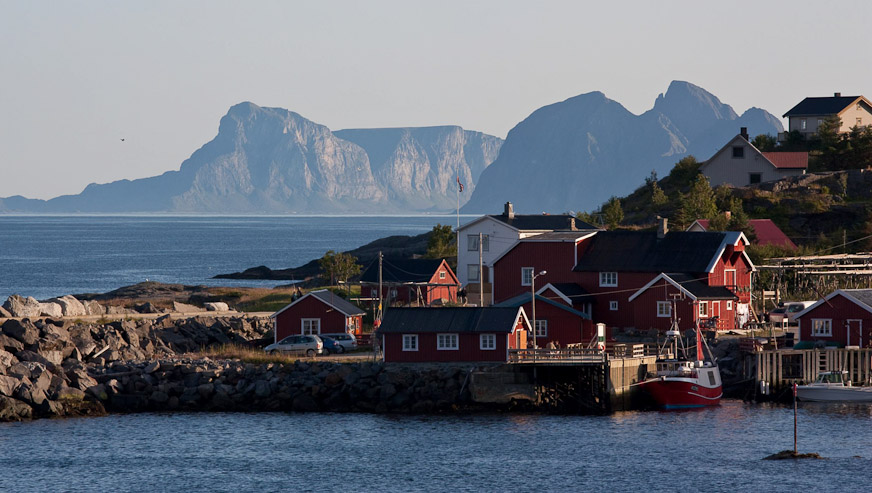
A final SUPER CLOSE pic (I have trouble editing out pics). Vaeroy is the long, most-distant island, stretching to the left. We'll be traveling there tomorrow morning...
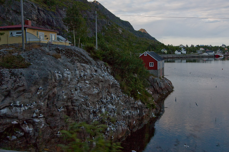
Wendy spotted a bunch of birds on the side of this rock, while driving back to Moskenes...
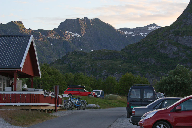
We stopped at a store on our way back to camp, and bought some more fish cakes. The campground had filled up since this afternoon, and we spotted Karl and Mariann's tent perched just above the field we had camped in. They wanted to keep some space so Darwin wouldn't get too excited about all the neighbors. For dinner, I eat a tuna salad with bread, and assorted spreads. Wendy eats .4 lbs of smoked salmon with bread, and accidently slices her finger while cutting bread, a small but annoying wound. Karl hangs out with us while we eat, discussing his Ph.D. studies. It's very buggy out! After dinner, Wendy attended to her finger while I do the dishes.
My tuna salad dinner was tasty, but the bugs were annoying. The secret to bug free camping in Lofoten appears to be: Camp on the north side of the islands. We didn't experience any bugs on the north. Our yellow tent sits far off on the right side of the field...
From outside the kitchen, the northern view of the Lofoten coast was beautiful. A look to the west shows some sunlight on the mountain tops at 10:30pm...
We take the 8:15am ferry to Vaeroy tomorrow, and will need an early start to our day. There are 2 hikes I'd like to do on Vaeroy, so it could be a big day tomorrow, and best to rest up tonight. Need one more day of amazing weather! Tomorrow is our last day in Lofoten!
11:55pm, Moskenes Camping
10 NOK for a shower here ($1.75). The bathroom facilities are very nice here. The American music playing on the radio in the bathroom made me feel nostalgic about the US. "Black or White", "Walking in Memphis", and "Night at the Roxbury theme" all played, and made me think how far away from home I was in this exotic land where it's light out at midnight. I actually see the moon in the south sky tonight, the first time I've seen the moon in Norway...
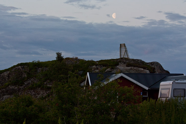
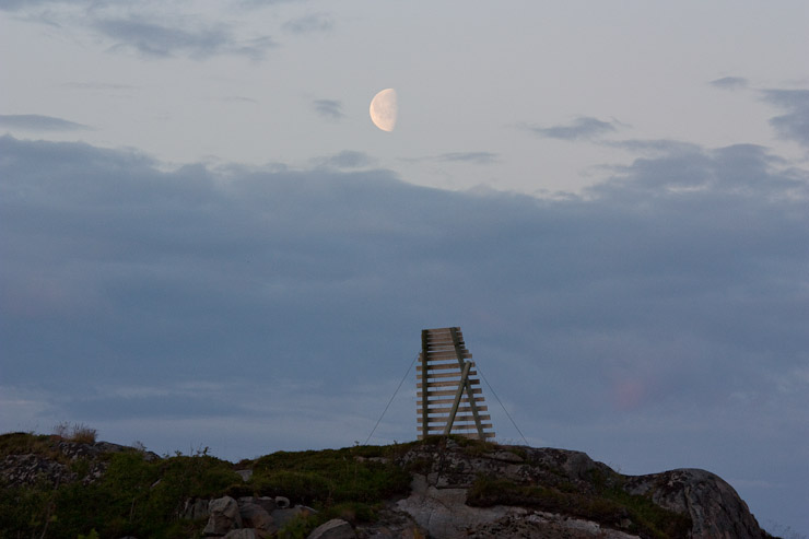
The moon appears over the camp facilities, to the southeast...
It's much more shaded on the south side of Lofoten, though the sun is still above the horizen behind the mountains. Pic taken at 12:15am, just before bed...