During the drive last night, I noticed the profile of some imposing mountains in the moonless skies that I drove past. From the motel parking lot, I looked south, and was impressed by the size of them...
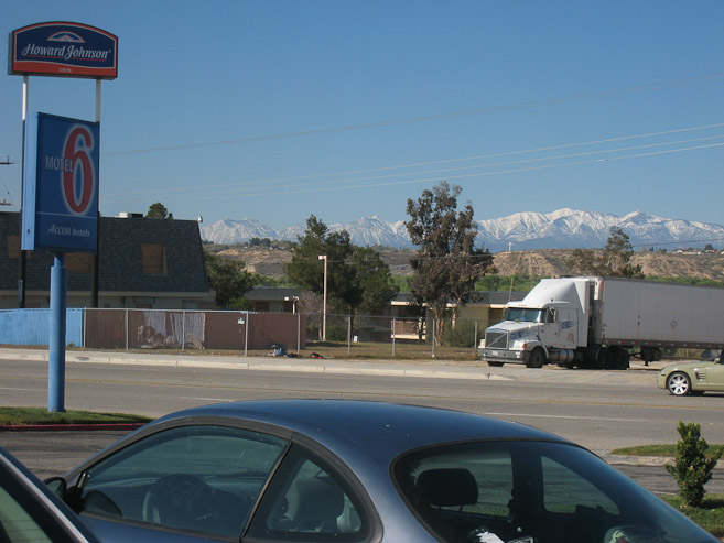
I was up at 8:15am, and departed the Motel 6 in Victorsville ~8:45 to hit up the Radio Shack in Bartlow that opened at 9am. Got there at 9:10am, and bought a battery for my watch (finally a CR1632!). Now I'll be able to use my altimeter this week. I gassed up the car and drove north to Death Valley's southeast entrance. The sun was blazing, the desert speckled with green vegetation among the beige land. I made good time on a long straight empty road, and to my unfortune, saw an oncoming car turn into a police vehicle, do a u-turn behind me, and pull me over for speeding on a unsigned 55mph road that should have been 65mph (and in fact changed to a 60mph and later 65mph road ahead). Not a good start to my adventure. Guess I'll be helping bail CA out of their fiscal problems...
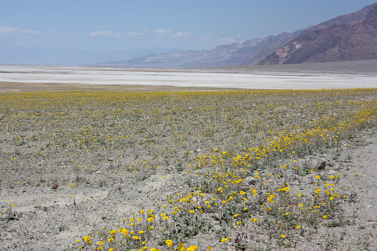
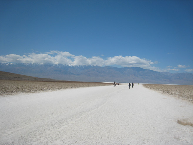
In another 45 minutes, I entered Death Valley, encountering a floor of yellow flowers that led to a sea of white salt in the distance. Clouds shrouded the top of Telescope Peak, declining me the opportunity to photograph the peak I'd be climbing tomorrow, though the sky was clear everywhere else. I made the long drive up the valley, arriving at Badwater, the lowest point in N. America, ~1pm.
During the drive last night, I noticed the profile of some imposing mountains in the moonless skies that I drove past. From the motel parking lot, I looked south, and was impressed by the size of them...
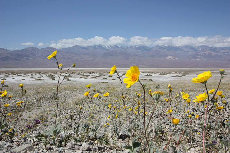
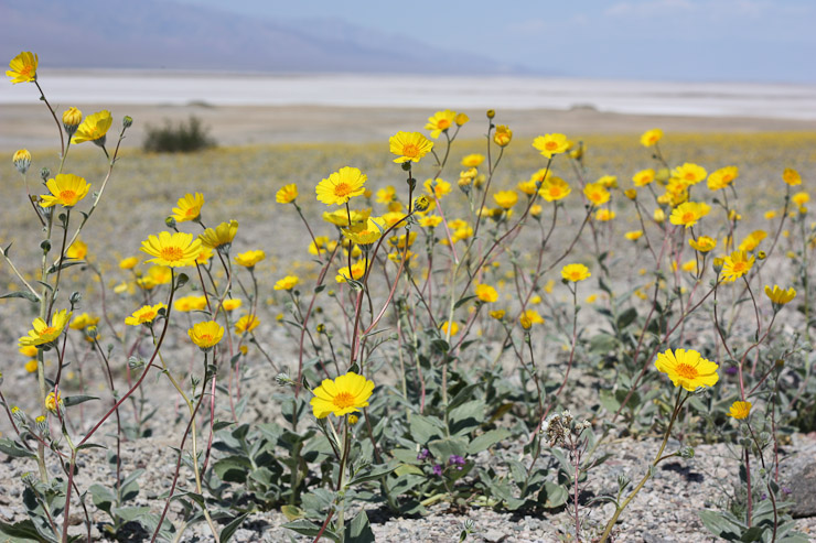
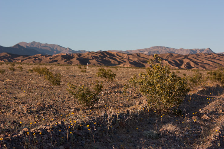
Death Valley had a very dry fall and winter this year, which delayed and limited the number of wild flowers this season. However, recent storms in the past month helped yield a decent showing, which coincided with my visit...
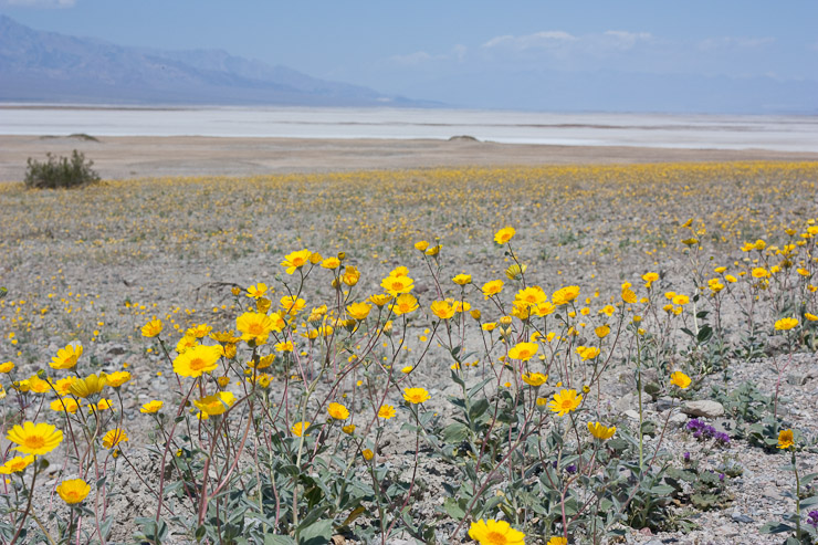
The white land in the distance is a large salt flat...
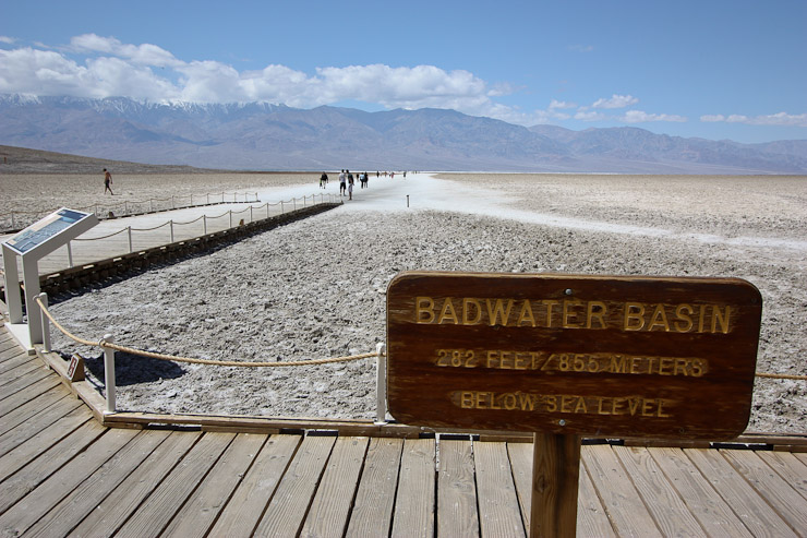
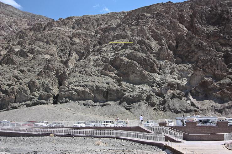
The car's thermometer read 73 degrees out, as I arrived at Badwater, the lowest point in N. America. In the 2nd pic, I marked a yellow line, signifying sea level (there was a sign posted up there)...
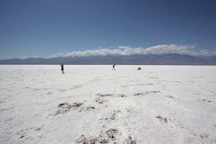
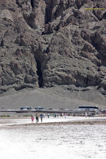
A wide trail of salt led ~.3 miles into the salt flat, which I walked in flip-flops. I didn't find any cool raised hexagons of crusted salt, like in the pics, and didn't spend long exploring here...
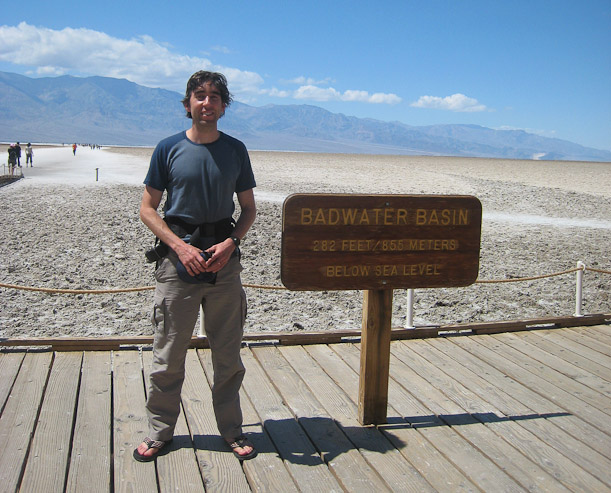
Another look back at where sea level is (yellow line in upper right). Couldn't resist the opportunity to get my pic taken next to the sign...
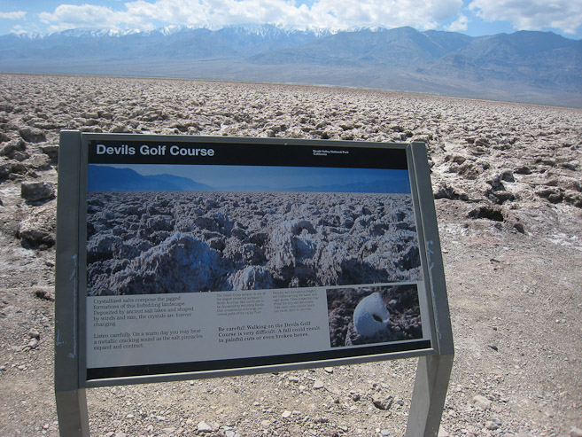
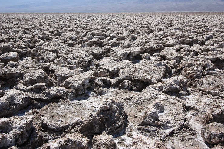
A short ways up the road lay Devils Golf Course, a very choppy terrain, and not a good spot to look for a tent site. I tried taking a few steps in flip flops, which was a bad idea, as I just slid and scratched my toe...
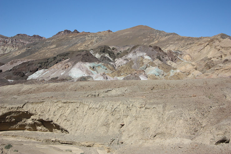
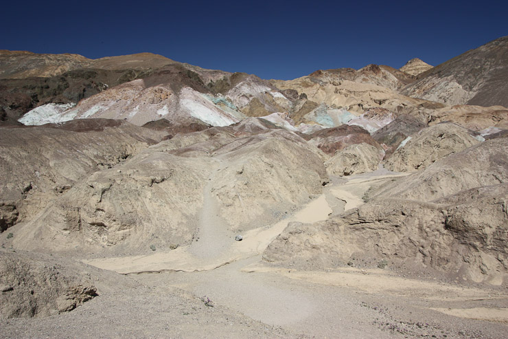
Next up was a one-way road loop called Artist's Drive. Of note was Artists Palette, which had some colored rocks...
Shortly after 3pm, I arrived at the main headquarters of Death Valley, Furnace Creek, which had plenty of green vegitation and even trees in the area. Gas was $4.09/gallon here. Lodges, some stores, and many campgrounds filled the area. I stopped at the visitor's center and bought a pass for the park. There are no entrance fee stations, so paying the fee is kind of voluntary I suppose, but I like supporting the parks, of course. I asked the ranger if cloud cover on Telescope Peak was usual, and he said it wasn't, and weather looked good for tomorrow.
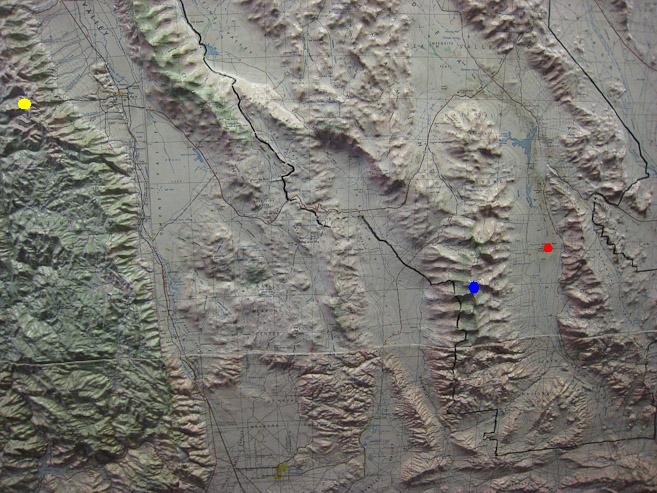
A relief map at the Furnace Creek visitor's center shows Badwater (lowest point -282' in red), Telescope Peak (my hike tomorrow, at 11,100' in blue), and Mt Whitney (my planned hike on Saturday, the tallest peak in the 48 states at 14,495' in yellow). Amazing to have such elevation differences across 80 miles...
To fill out my day, before traveling to the opposite side of Telescope Peak for tomorrow morning's hike, I made the long drive up to Dante's view. The road was gravelly, and lots of small rocks smacked my rental car, kicked up from the traffic in front of me. I stopped at the scenic Zabriskie point on the way up. Unfortunately, this entire stretch is best viewed early in the day, so I was staring at the shaded side this afternoon.
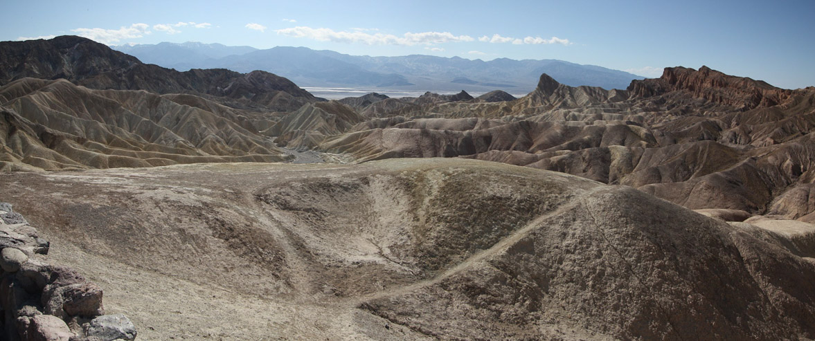
Zabriskie point is famous for the sharp peak on the right, which is best viewed at sunrise...
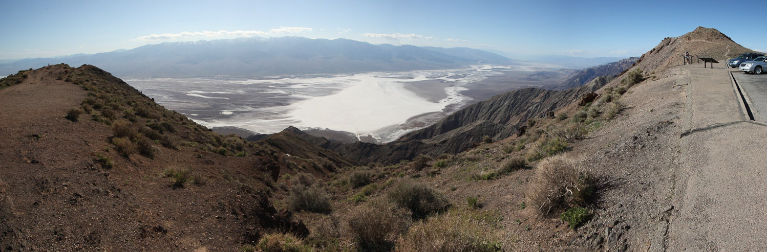
Dante's view overlooks Badwater below, and Telescope Peak across the valley. Also best at sunrise...
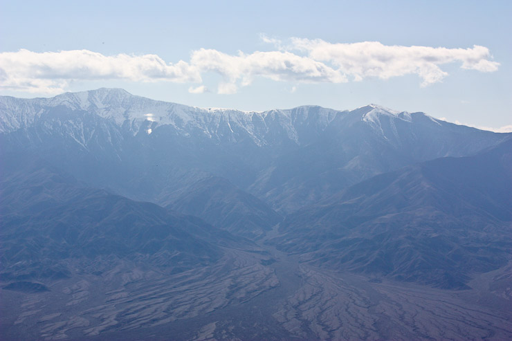
The clouds had finally lifted over Telescope Peak, the highest point on the ridge...
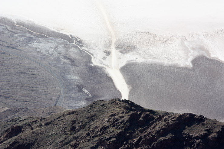
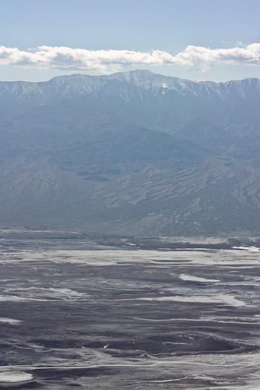
A look down at Badwater's walkway to the salt flat, and across at Telescope peak, which rises 11,400' above Badwater...
I was bummed I didn't get a good pic of Telescope Peak from the east today, but I was glad for the good weather in store. For the next hour, I took advantage of the cool air at 5600' in Dante's view parking lot, and re-sorted supplies in the car, readying my backpack for tomorrow morning, and preparing sleeping supplies for tonight stay at the trailhead. Having organized everything, I drove back down to Furnace Creek, and on to Stovepipe Wells, hoping to catch the sand dunes before sunset.
The drive from Furnace Creek to Stovepipe Wells was gorgeous with the evening sun drenching the desert in gold...
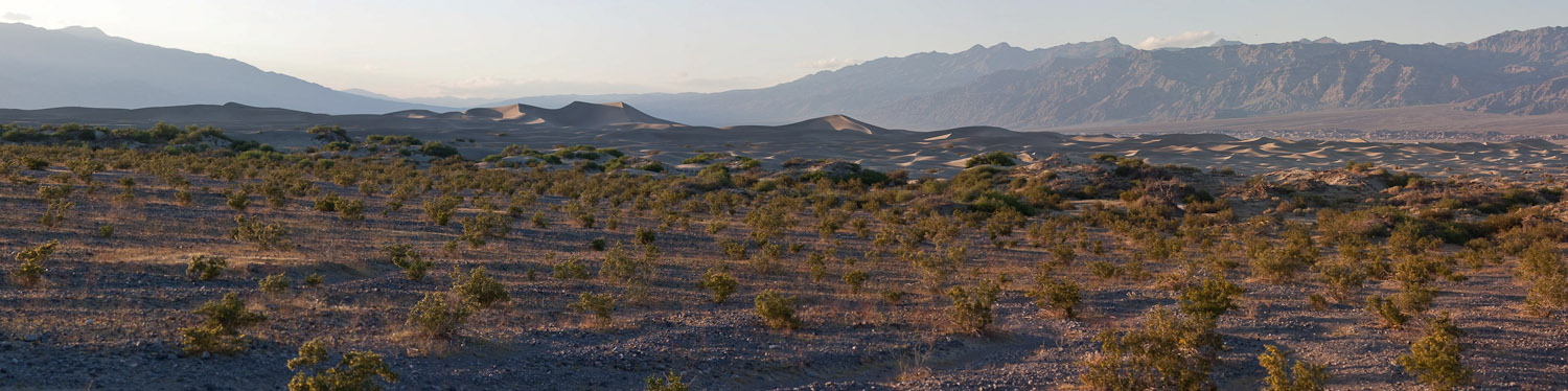
In the distance I saw the sand dunes...
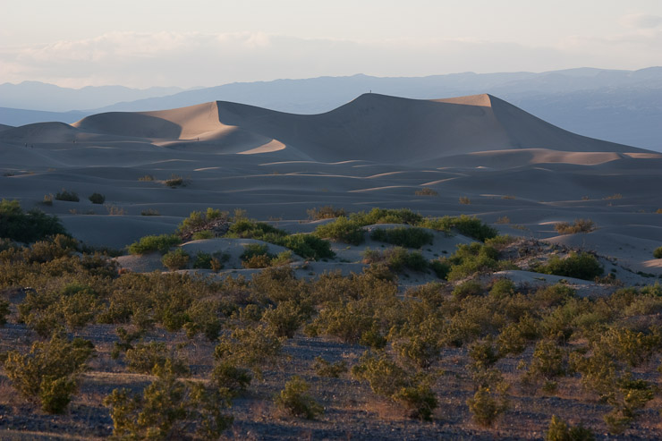
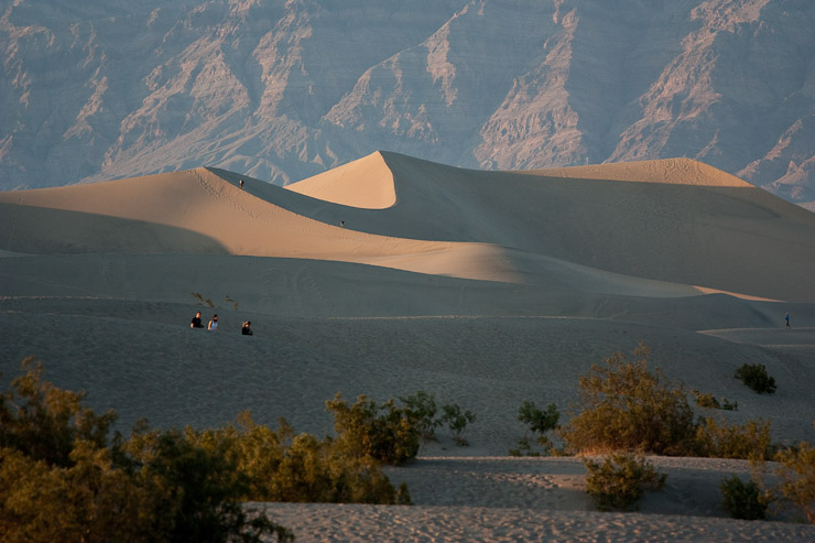
...and managed to arrive at the dunes with a few minutes of sunlight to spare.
I talked to a photographer near the dunes, who was telling me all the hot spots for pics. You really need to catch sunrise or sunset in Death Valley for good pics (true anywhere I guess). But this trip wasn't about sunrise/sunset pics for me. I had a couple big hikes in store, Telescope Peak, and Mt Whitney, and I optimized my schedule around them.
I stopped at Stovepipe Wells, filled up on some gas, and unsuccessfully tried to catch some wi-fi at the lodge. A picnic table offered me a dinner platform, where I made a tuna, avacodo, egg salad wrap for dinner, as dusk set in. No cell phone service here, or anywhere in Death Valley so far.
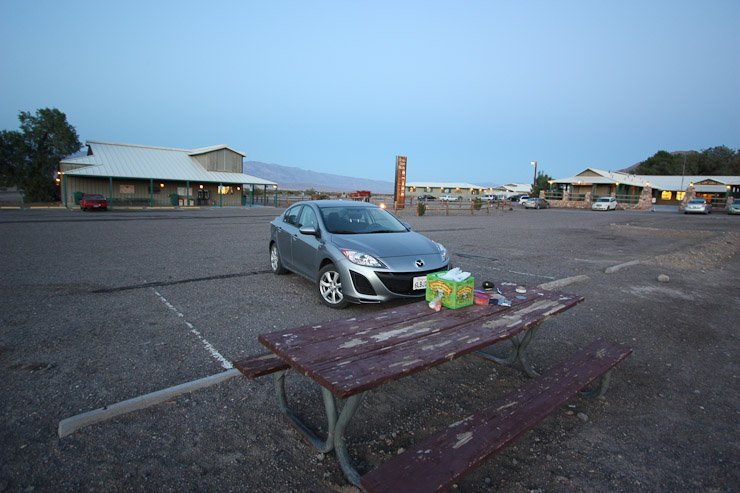
My dinner locale in Stovepipe Wells. I used the water fountain in town, but couldn't connect with the wi-fi...
After dinner, I brush my teeth, and hit the restrooms, in preparation for sleep once I make the hour drive to Telescope peak trailhead. I drive through the suffocating dark, with no moon tonight, past unknown terrain beyond my narrow headlights. There is no traffic. The SF Giants game on KNBR 680 keeps me company. The stars are out in force, but offer little help illuminating my surroundings. The road bends, with seemingly empty voids past the passenger window. No guardrails. I ride the middle yellow line. The Giants come back from 3-1 to 3-3 against the Pirates. The road enters a narrow canyon. My imagination sees towering cliffs above, with loose rocks tumbling down. Finally I reach Wildrose, and start the final 7 miles to the Charcoal Kilns. Some people are camped, with fire, at the Wildrose campground, and I feel less alone. My car climbs the road, and reaches the final 2 miles of dirt road, where I slow to 15mph. Giants are down 3-4 in 7th. I arrive at the Charcoal Kilns at 9:20pm. It's 37 degrees out at ~7000' elevation. I join two other cars at TH, where a bivy lies next to one of the trucks. I prep a bit for tonight/tomorrow, and set the alarm for 5:15am.
The Giants just lost 6-5. Time to tell Jon Miller good night.