

Despite my earplugs, I could sense a Mt Whitney fueled energy vibe in the room, and looked up at 4:25am to see the others in the group readying their packs for the big day. My 2nd night's stay at the Whitney Portal Hostel again resulted quality rest. The plan was to meet the rest of the group at McDs across the street at 5am, or at the Whitney Portal Trailhead at 6:30am. I took my time, got dressed, and drove over at 5am, to find McDs a hub of activity in an otherwise still sleeping town. Plenty of McGriddles and coffees were being consumed by the crowd of people that I was introducing myself to.
I stumbled onto this hiking party via the Whitney Portal Store Message Board while researching info on the Mountaineer's Route (MR). It was kind of a 14ers.com forum equivalent for CO mountains. The MR route is a "classic" snow/rock/ice climb up the tallest peak in the lower 48, with a notorious final 400' class 3 (CA standard) climb, which was something I did not want to solo. Coincidently, a big group hike for the MR was being organized during the same weekend I planned to be in town, so despite not knowing anyone, and the group being very large already, I asked if they'd be willing to take on a kindred spirit from Colorado, and posted my web page as a resume (so they knew I wasn't going to be a liability). To my delight, they welcomed me, which led me to McDs at 5am today.
I ate my last apple and orange for breakfast, and started learning peoples names and associating their handles from the forum. Richard, the unofficial leader/organizer of the group, had driven straight to McDs from L.A. at 11pm the night before. The group was diverse. Ages spanned between 19-60 (though all young at heart), some were first timers on the MR, and some were among the most experienced veterans in the Sierras. But one thing everyone had in common was passion for the mountains, love of adventure, and a sincere offer of friendship.
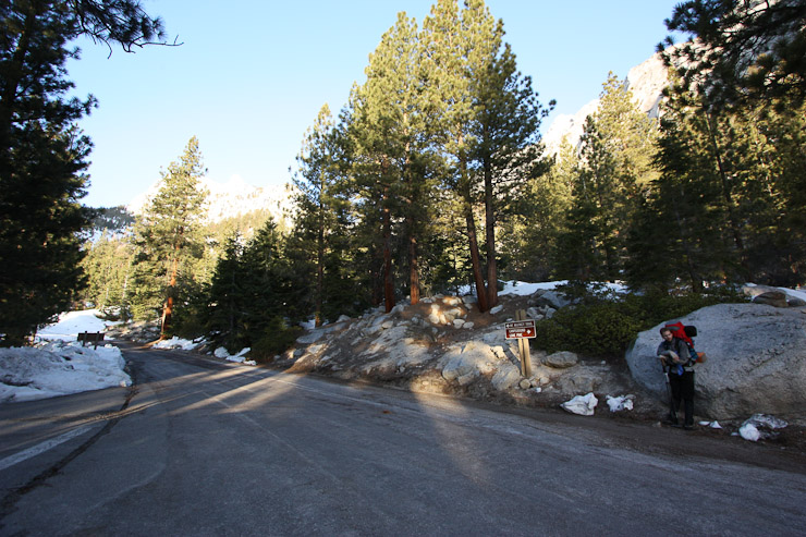
At 6am, I started the drive up Whitney Portal road, which starts at ~3000' and climbs to 8365' in ~14 miles. I paused at the ROAD CLOSED sign, and followed another car as they manuevered past the cones on the shoulder of the road. The road had suffered an avalanche blockage a couple months ago, which had only finally been cleared yesterday. The road was still officially close, but driveable. Driving the final 2 miles to the trailhead was a HUGE benefit for a backpacking trip.
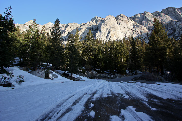
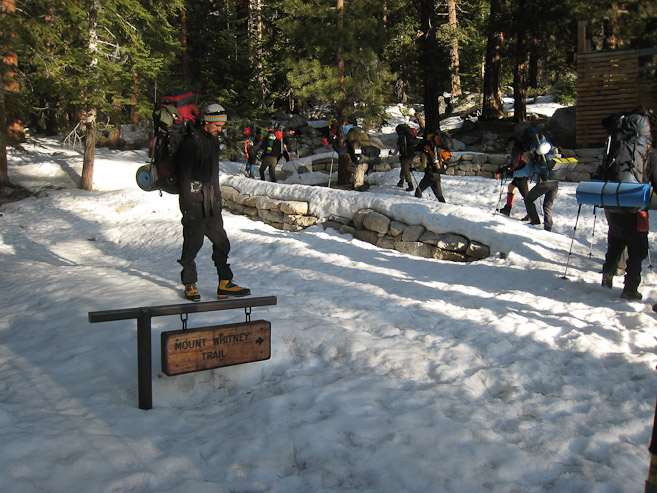
At the trailhead, I met up with more people from the hostel last night, and learned that I needed to store all my extra food in the nearby bear proof pins, instead of in my car. Everyone readied their packs and eventually gathered together to begin the epic climb.
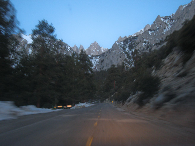
A look at Whitney while driving up the Portal road at 6:06am...
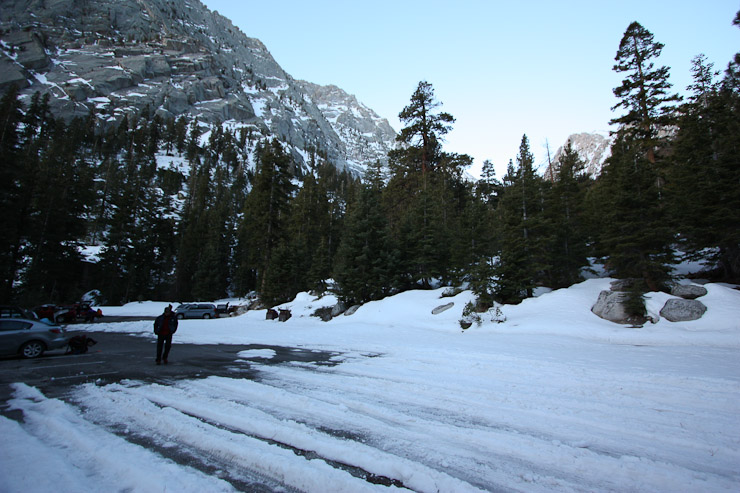
The parking lot had patches of snow, and some black ice that almost claimed a few people before the hike even started...
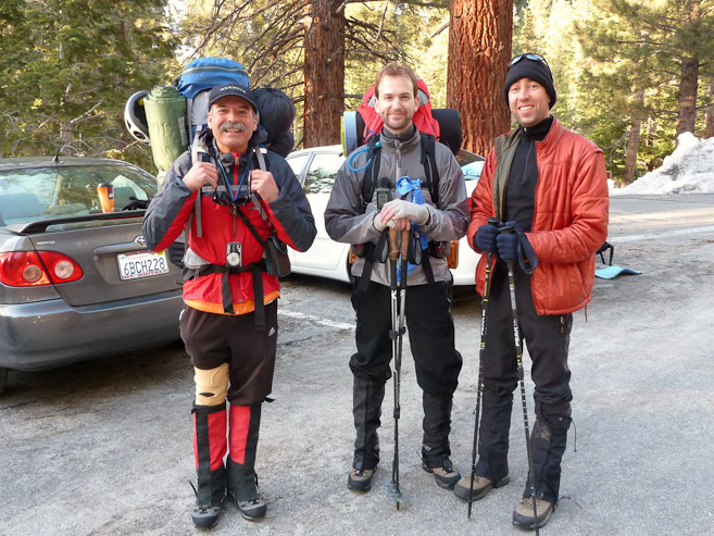
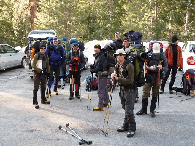
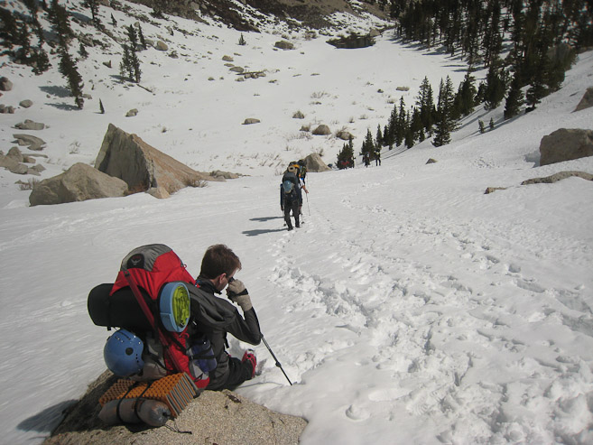
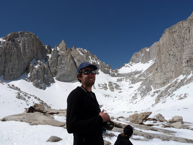
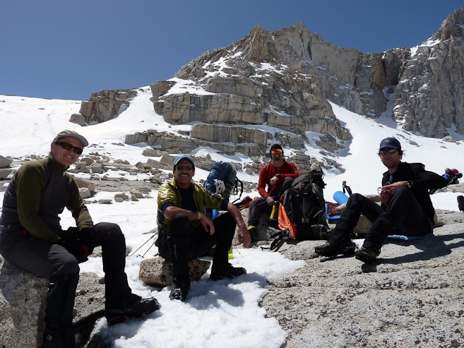
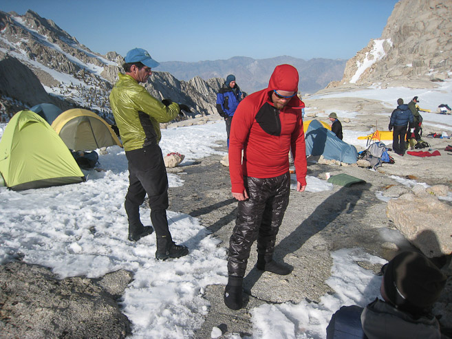
Richard, Dan, and I wait around as people gather. It was warmer out than I had anticipated this morning. I knew once we started moving, layers would come off fast... (Both pictures by Shin)
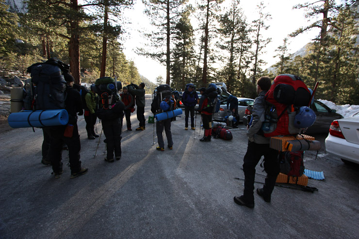
We waited around 20 minutes as people gathered. I was surprised most people kept their heavy packs on the whole time. I waited til the last minute to put mine on, before we started hiking up the road...
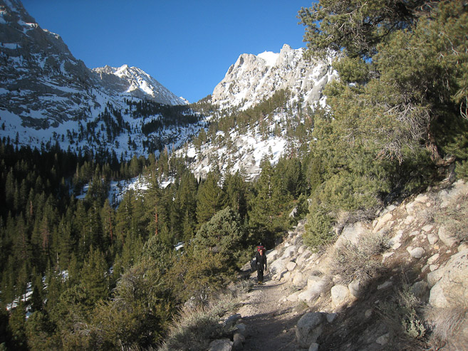
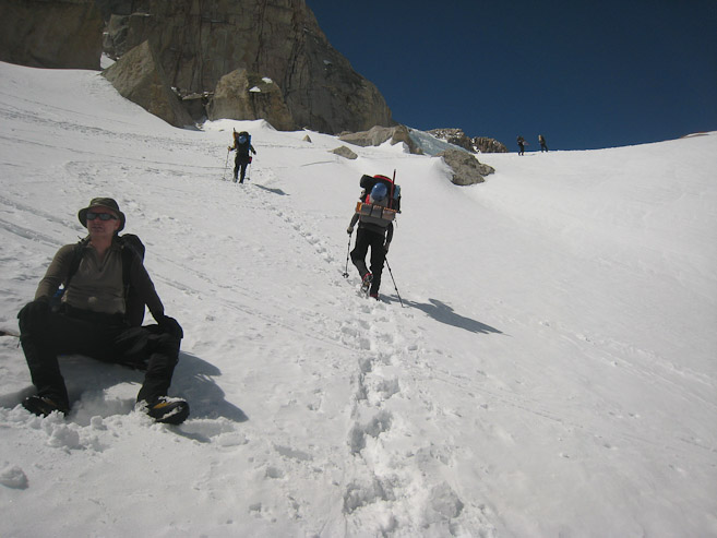
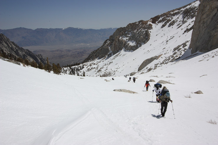
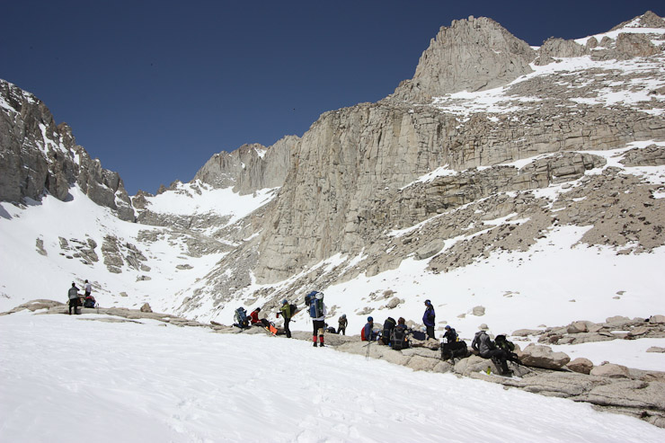
Here we are at the trailhead, 7:20am, where a scale was available to weigh one's backpack. Out of the 4 of us that stopped to measure, Mark was the lightweight at 34 lbs, Nick was heaviest at 48 lbs (narrowly beating me, at 47 lbs). The trail gradually meandered up the mountain...
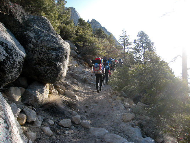
I hung back, took off some layers, and decided to wear my DSLR around my neck today, for frequent picture opportunities. The smooth trail switched back a few times through the forest. Look close at the 2nd pic to see the train of hikers cutting up the trail...
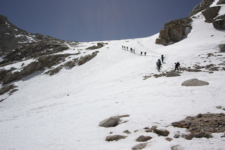
The weather was great today! I stayed back to capture the hikers crossing the mountaid side ahead. Look closely 1/3rd of the way up to see them...
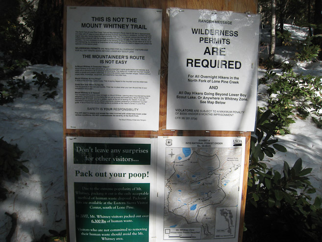
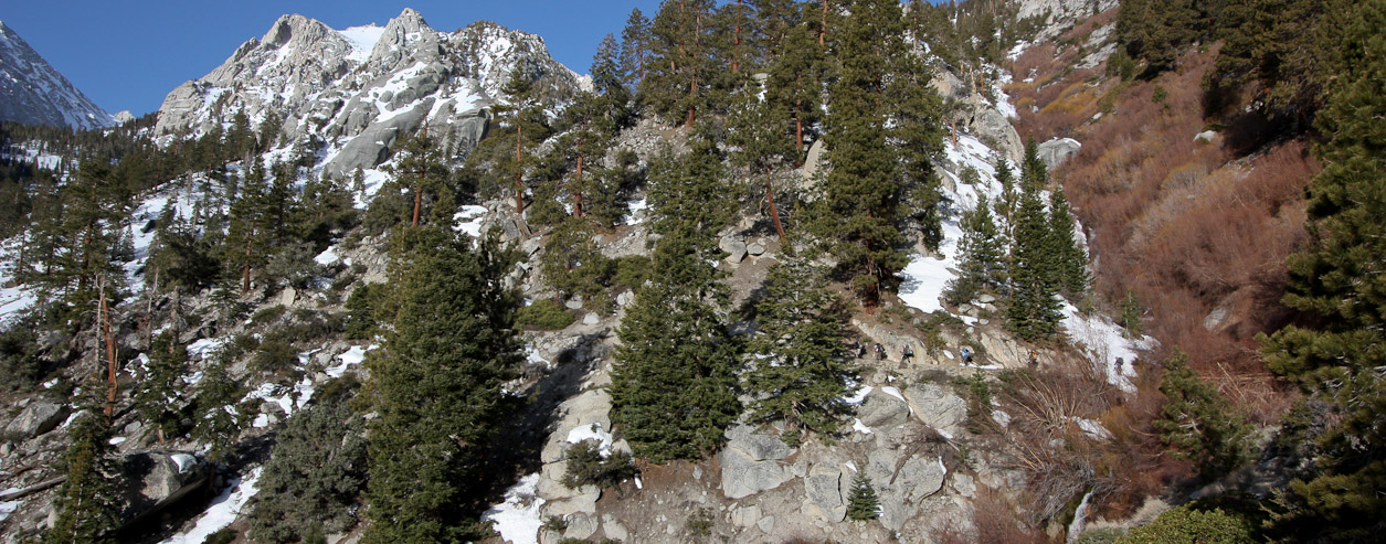
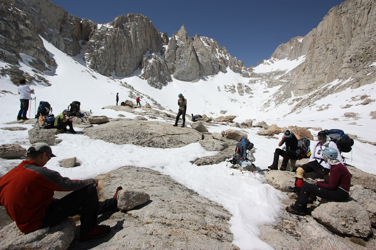
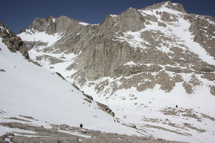
We took our first break of the day at the North Fork trail junction, where we would divert from the standard Mt Whitney trail to follow the Mountaineers Route (MR). Highlights of the sign: The MR is not easy (people die on it), permits are required (subject to 6 months in jail or $5k fine otherwise), pack out your poop (in a WAG bag)...
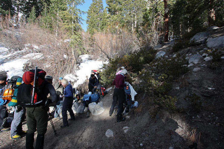
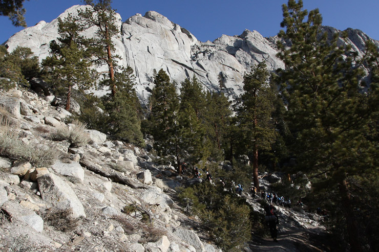
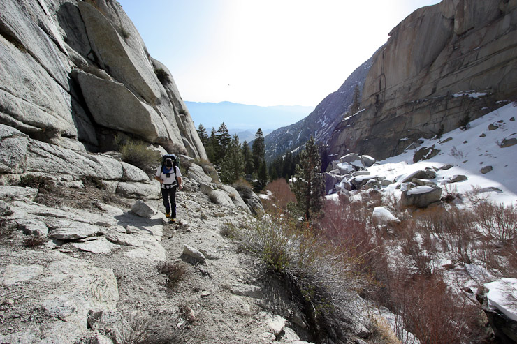
We reached the North Fork junction in 35 minutes since the start of our hike. I continued up the North Fork trail a short ways to take the 2nd pic...
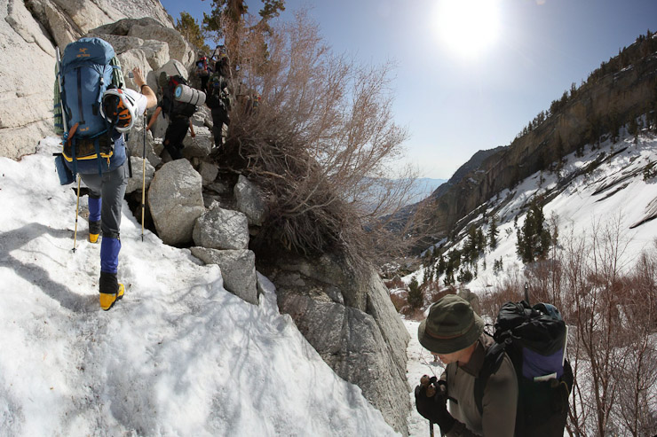
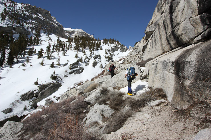
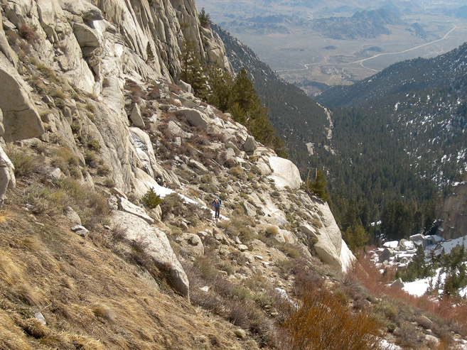
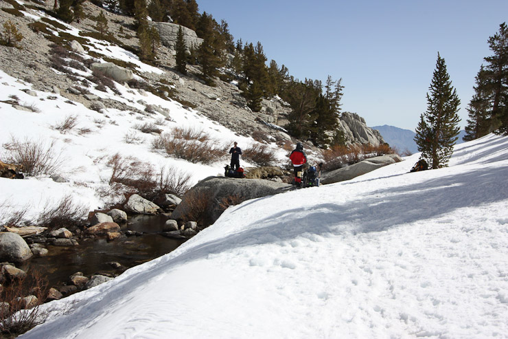
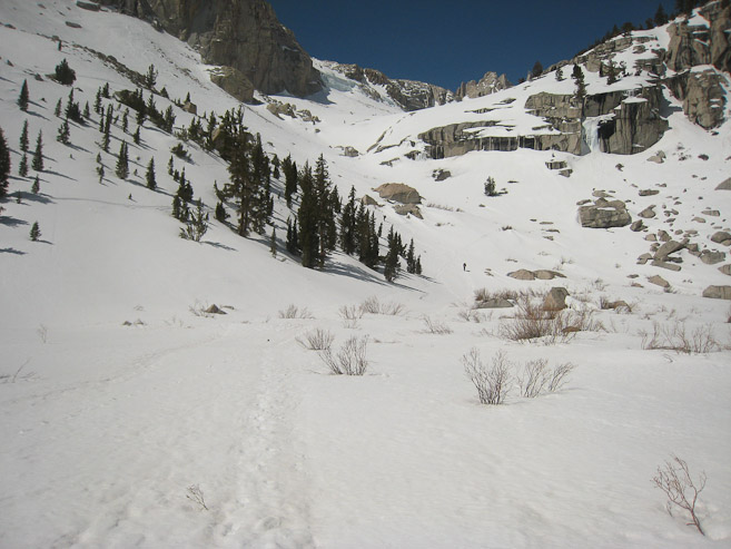
The trail continued on a dirt path on the right side of a streaming gully. The opposing side of the gully had impressive towering rock...
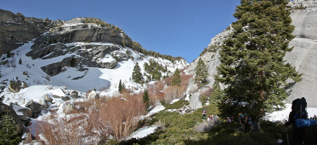
Across the gully, we could see prints in the snow, which is the alternative "willows route". It's best during the winter under thick snowpack, and requires crossing the stream, which can be unsafe when snow bridges are melting in the spring...
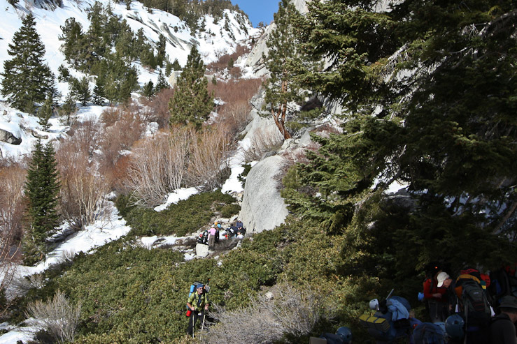
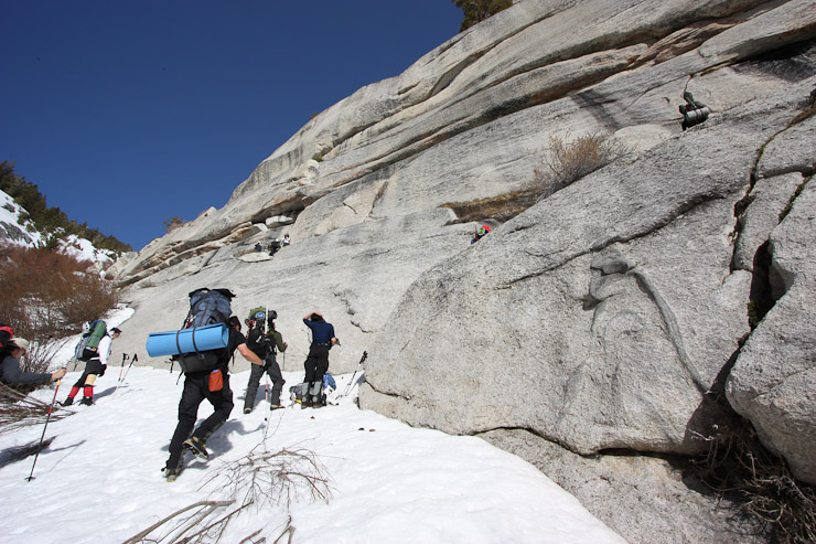
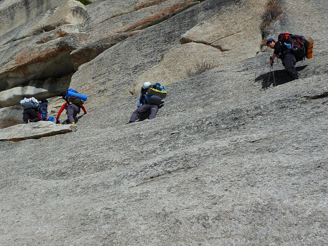
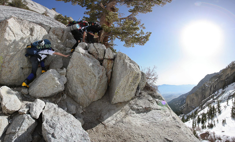
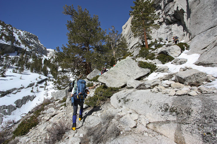
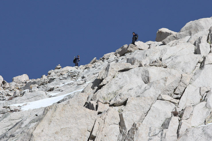
Up ahead we paused to decide about taking the willows or the class 3 Ebersbacher Ledges route. It would be the E-ledges today. I was greatful for experienced Whitney-ers to guide us up the slab route...
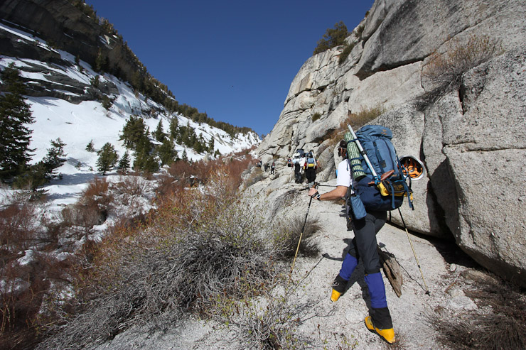
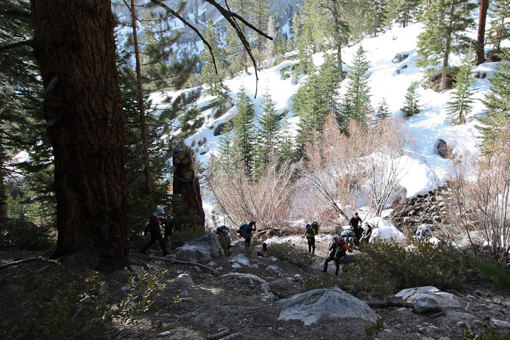
We started gaining elevation faster, as we ascended the slabs...
A look back at Arthur, and the elevation we've gained from the gully floor. The snow was soft, but hardpacked to prevent postholing (at this hour at least)...
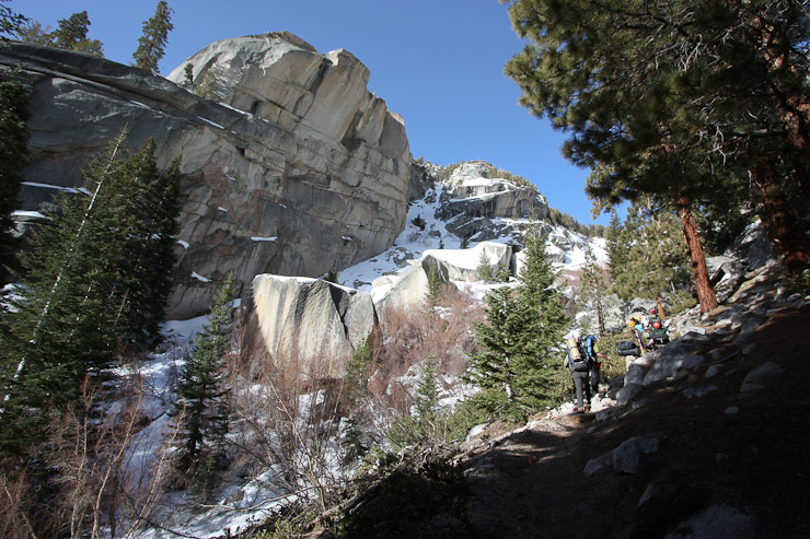
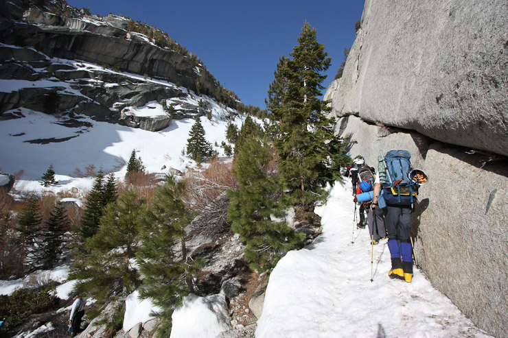
Up ahead was the famout "Elephant's Ear" slab section, a particularly exposed ledge...
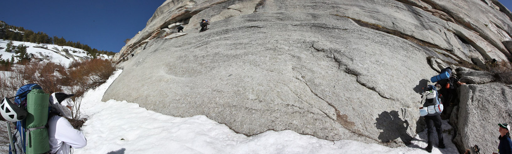
A stitched shot of the elephant's ear ledge....
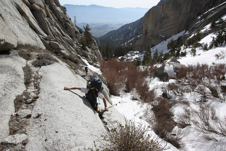
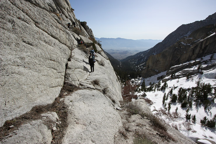
Here we go! When I saw pics of this online (and again in person), I laughed that this was the standard route up the North Fork, and common to hike while wearing a 47 lb pack! Man, these Sierra folk are hardcore to have these kind of standard backpacking trails. Ellen works her way across the narrowest section...
Richard stayed below while we all crossed, taking pics (pic by Richard). I took a pic looking back down at him. Even though the ledge was narrow, there was room to lean against the "cliff" to maintain balance easily. Still, I never thought I'd backpack across something like this...
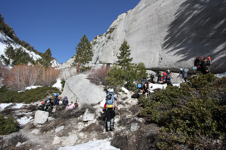
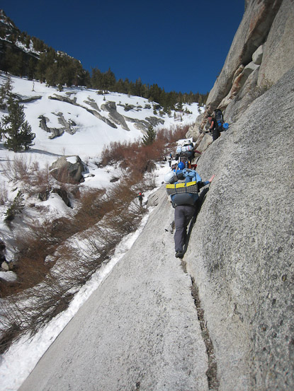
Above the "ear", the E-ledges involved a lot of scrambling. Fortunatley, my heavy pack didn't negatively affect my performance...
I was again impressed with everyone in the group for scrambling up a fairly difficult route with a huge pack. I wondered what it'd be like descending with a heavy pack too...
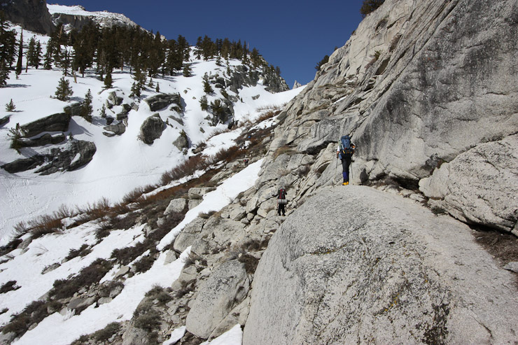
We continued to slice back and forth up the slabs...
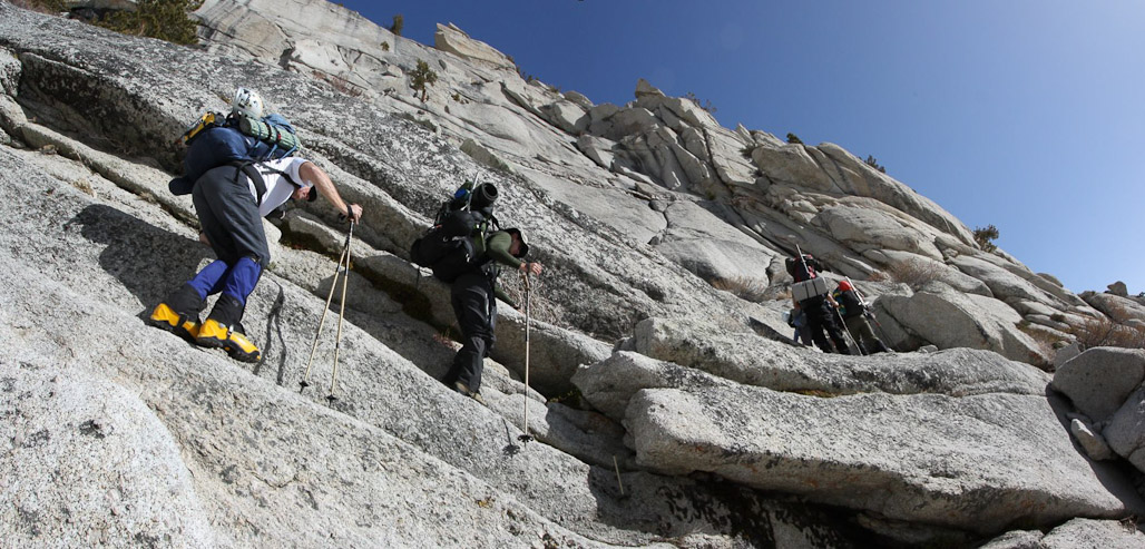
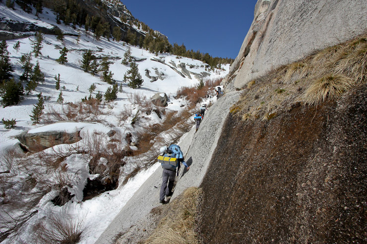
Another particularly steep section of the E-ledges...
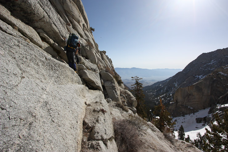
The 1st pic here is the view from the guy in the yellow shoes in the pic above it. After this tricky ledge manuever, the rest was pretty tame...
We were nearing the top of the gully, but not out of the ledges yet...
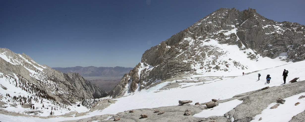
Nick stands on the snow at the exit of the E-Ledges. A zoomed in look from the same spot shows Ellen, and the Portal road down in the valley, near the trailhead. We had gained a lot of elevation in a short distance...
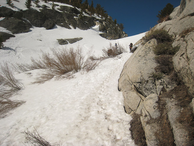
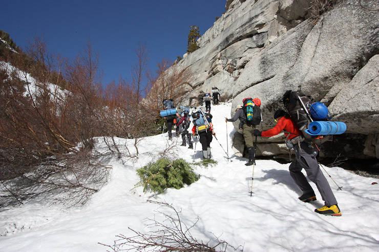
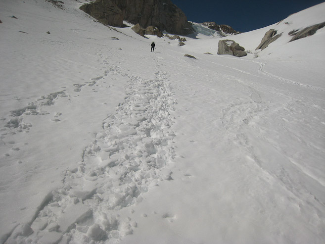
We climbed the snow along the ledges for the remainder of the gully...
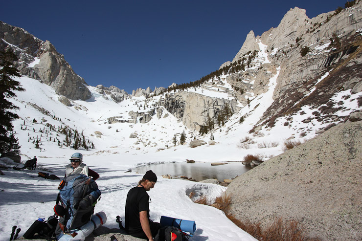
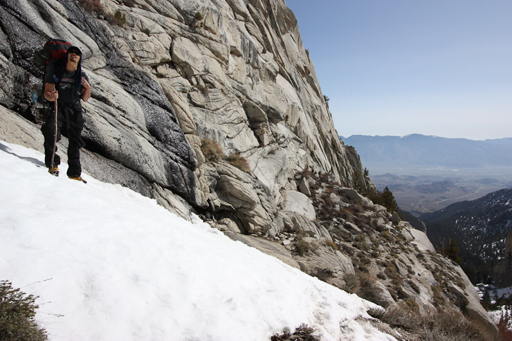
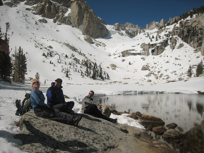
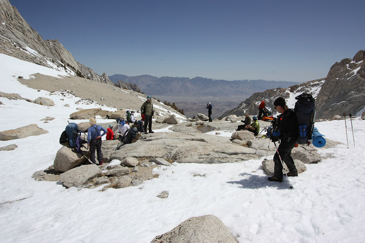
Once we cleared the gully, it was a fairly flat hike to reach Lower Boy Scout Lake (~10,300'). This would be our last source of liquid water, as the lakes higher up were still frozen...
The boots I borrowed from Doug were working perfectly! What a relief after losing my boots after Wednesday's hike at Telescope Peak! Thank you Doug!
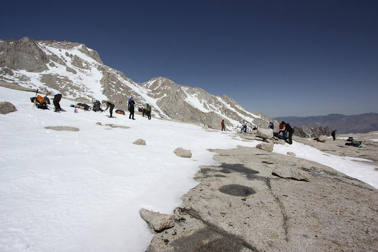
We had a lengthy rest here, snacking, and filling up on water from the stream. It was 9:55am when we reached this lake. I filled up 2 nalgene bottles with water, to avoid needing to melt snow later, pushing my pack to ~50lbs for the remainder of todays hike to camp...
We rested about 40 minutes here. Everyone was in great spirits, having conquered the E-Ledges. Next stop: Upper Boy Scout Lake, 1000' higher, located in the next basin up...
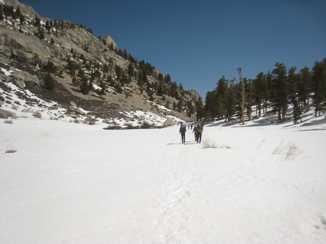
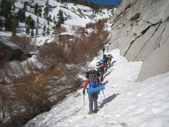
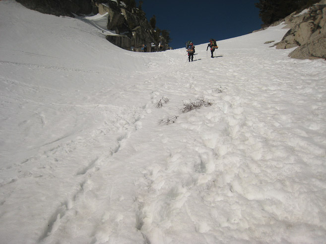
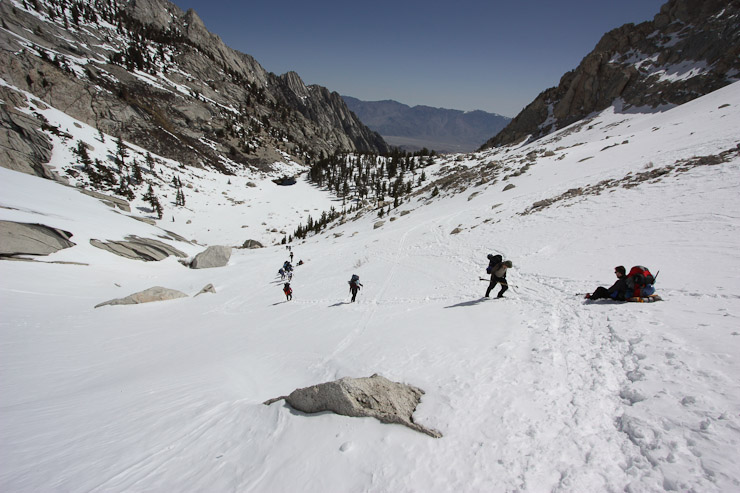
Our group of ~20 spaced ourselves out. Some people got a head start towards Upper Boy Scout, others rested a bit more. We rounded Lower Boy Scout and began the long climb up the snow...
It was grueling work, carrying heavy packs. Resting was common. The snow was softening, but still hardpacked enough to make good progress...
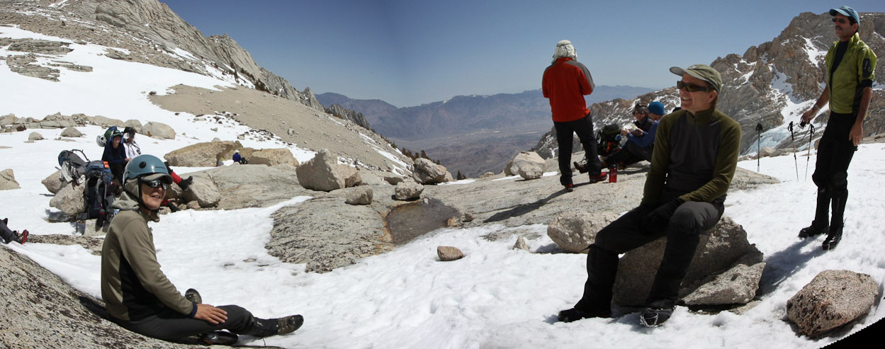
The combination of sun, no wind, and hard work, made it feel like 80 degrees out. I heard several comments from people saying they were glad they didn't wear the long underwear today (I shared that sentiment)...
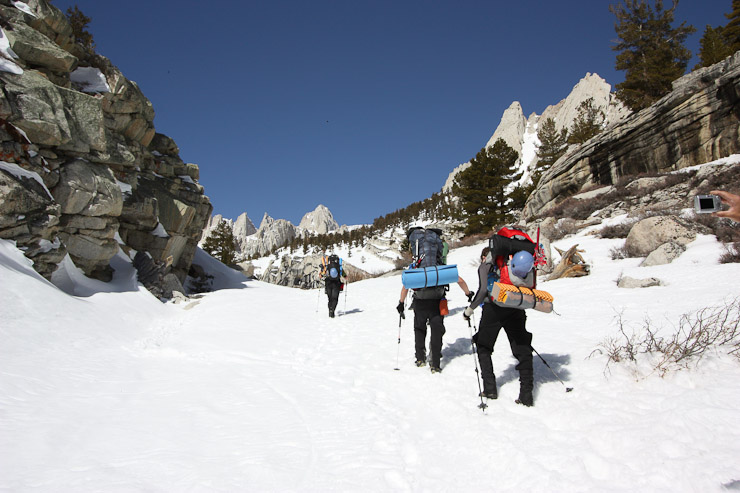
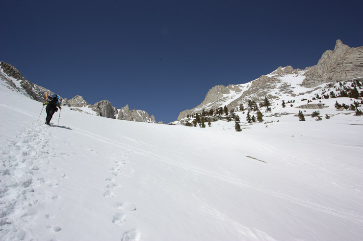
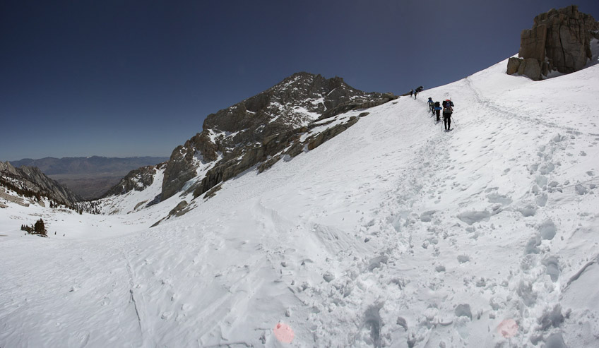
As we neared the next basin, the incline leveled off. Richard instructed to keep going til the pine trees (near my head), for our next break. I looked back at a long line of hikers arising from the Lower Boy Scout basin...
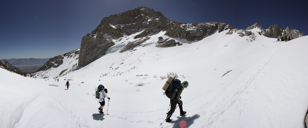
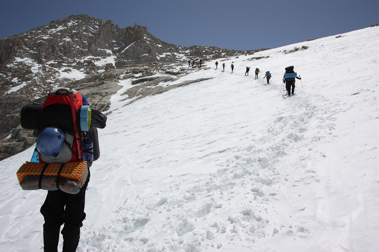
Mark and Richard pass by, while I take this pano shot. The snow tracks lead to Upper Boy Scout Lake...
Just past the pine trees lay Upper Boys Scout Lake, where a couple tents were setup (presumably Alan, Tony, and Adam, who hiked in yesterday). Those three were going to explore Mt Russell today, which I had planned to join them, until I found my boots were missing yesterday which cost me a day. We had a nice rest at Upper Boy Scout Lake, which is a common camping area, but since the day was still young, Richard suggested we continue a bit further before camping. An unnamed lake, which goes by many names (Girl Scout, Thor, Frog, Barney), was our destination, another 300' up the mountain. We'll call it Girl Scout Lake, to keep the theme, in this journal.
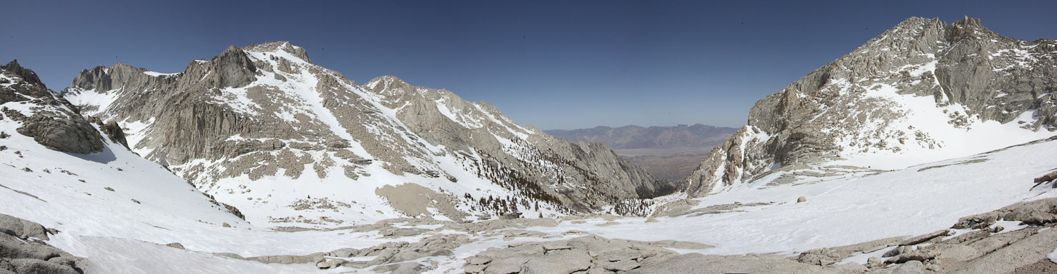
The group arrives at Upper Boy Scout lake, which sits frozen on the left. Girl Scout Lake, our camping destination, sits 300' higher on the right (2 hikers are headed in that direction near the top of the hill). Lower Boy Scout sits in the valley below. The long thin slanty snow chute leading to the top of the mountain on the left is the route leading to Mt. Russell's east ridge. We saw some people ascending it during our hike...
I returned to the lake, after taking the previous pic, and hung out with the crowd, snacking a bit more. We were all proud to have climbed 3000' from the trailhead so far. Shin took these 2 photos at the lake. James, Mark, Brandon, and I pictured...
We had arrived at Upper Boy Scout Lake ~noon, with plenty of day left to continue a bit further. There was a breeze here, requiring another layer...
Shin, James, and Mark hang out at Upper Boy Scout...
After a 25 minute rest, the group began heading up to Girl Scout Lake, the final 300' of elevation with our heavy packs...
I munched on twizzlers to keep me fueled during the final stretch of the day. It was feeling 80 degrees again...
The hiker train nearly arrives at the lake. A look back down at Upper Boy Scout Lake, from the top of the hill. Mt Russell sits on the left...
From the top of the hill, all that remained was a traverse to Girls Scout Lake, located just beyond the rise...
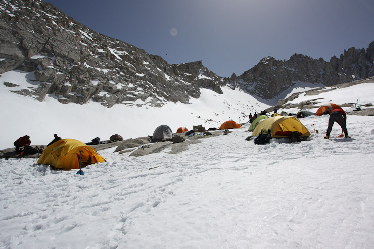
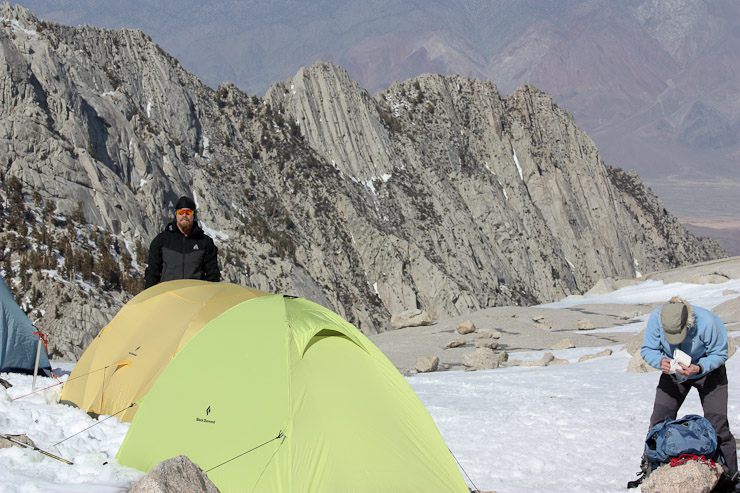
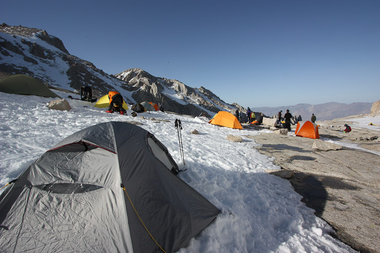
We arrived at Girl Scout Lake at 1pm. I was still feeling energized, given our fairly easy pace today, and wondered if it'd be possible to fit in a short day hike. But first order of business was to set up camp. I had never camped on snow before, so creating a flat tent pit would be a new experience. I began pushing snow with my feet, and later used my ice axe to help cut and sweep the snow. There were a couple of snow shovels being shared among the group too. Other people were starting to boil snow into water, to re-supply their stores. I carried a bunch of water up, and was in good shape, but still decided to mix in some snow and see if the sun could melt it this afternoon, saving on stove fuel.
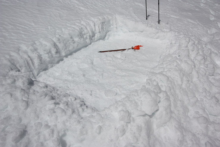
People were calculating where best to setup their tent/bivy. I had a large 2 man tent, and needed lots of space. I chose a spot close to some rocks, on the outer edge of our "village", which I also hoped was somewhat shielded from wind (not much shielding opportunity here). Fortunately, there was no wind forecast today/tomorrow. My first attempt at a tent clearing was too small...
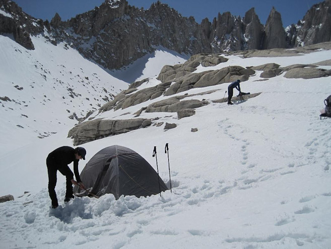
I worked long and hard at my pit. It wasn't until 2:30pm that my tent was pitched in the snow. Glad there was plenty of daylight and soft snow to create a clearing... (1st pic by James)
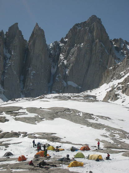
I decided to take a walk above our "village" and check out the views of Mt Whitney. In this pic, Thor Mountain towers across the frozen lake...
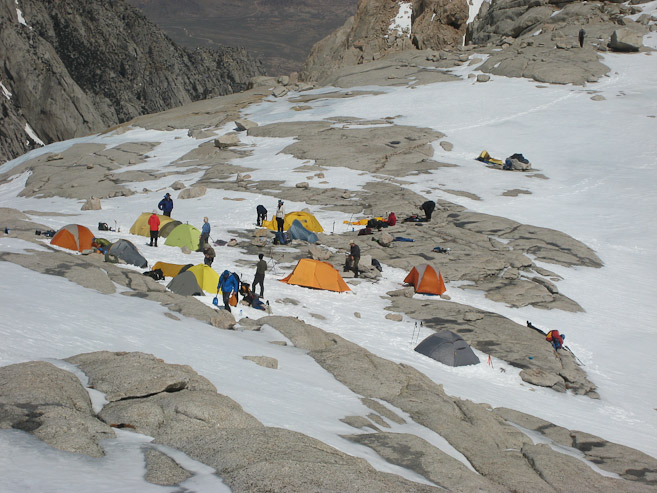
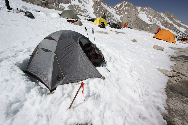
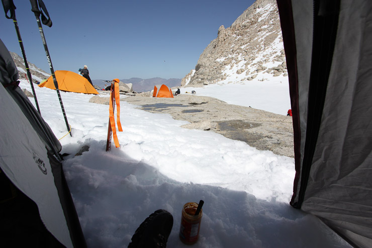
A couple more looks at our tent village. Doug would later point out to me that my tent was the grey one, which a rescue helicopter would easily mistake as a rock. Note to self, bright colored tents are advantageous...
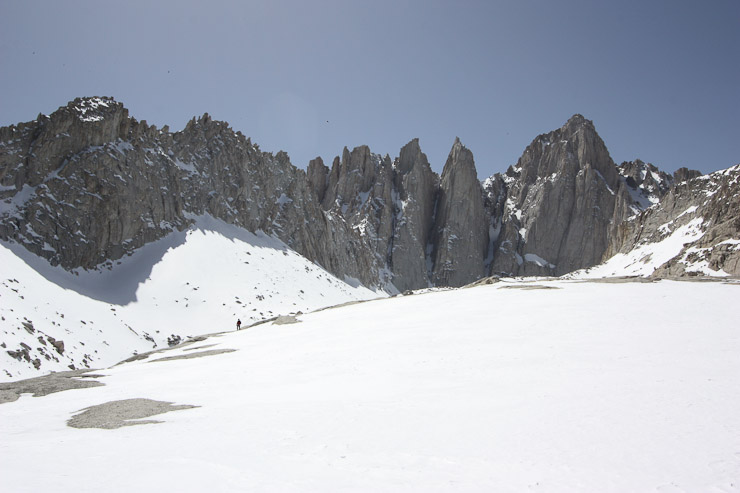
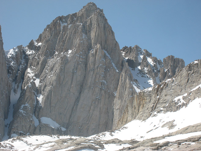
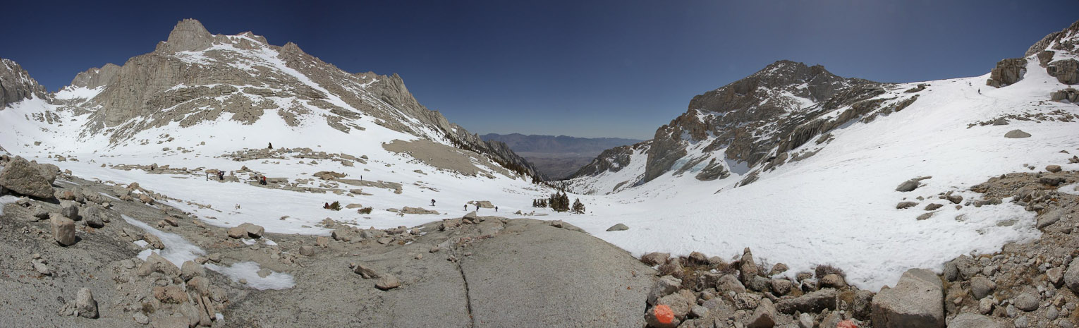
As I walked out along the snow covered rock, I saw Richard off in the distance surveying tomorrow's best route from camp. He was pleased to see there was easy access to the main trail from this rock expanse. Mt Whitney's east face towered 2900' above us...
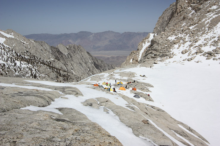
A pano from the rock expanse above camp. Upper Boy Scout is below on the left, Girl Scout Lake (and camp) on the right (behind the rise)...
I made my way back to camp, and continued on to the other side of the lake to check out the view...
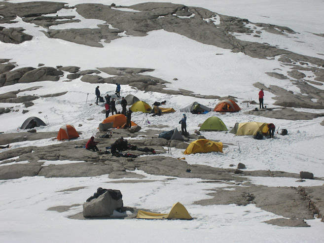
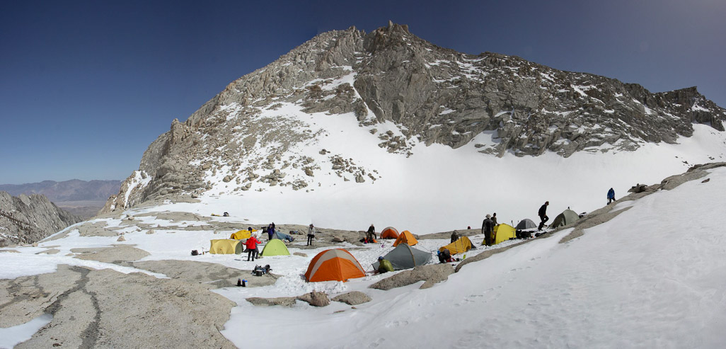
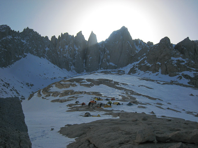
Our village looked impressive under mighty Whitney...
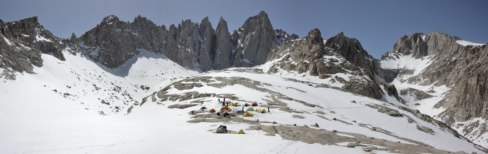
A wide view of camp, with Whitney center, Russell on the right. You can see our tracks leading up from Upper Boy Scout Lake...
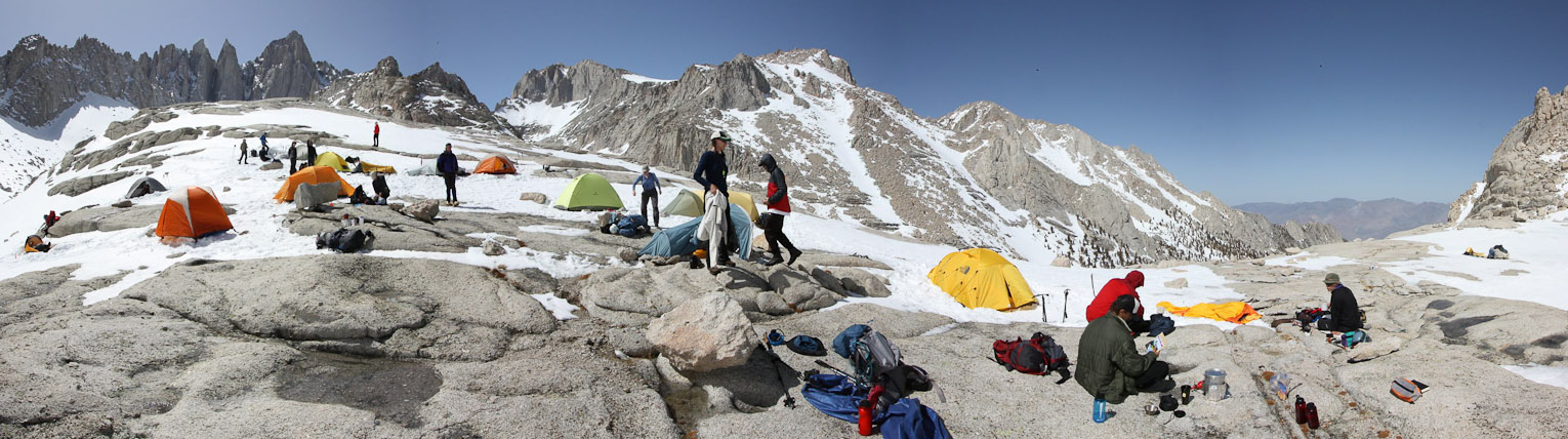
A wide view from the center of camp. My tent is the grey one on the left. I count 17 tents in our village...
When I got back to my tent, I overheard Mike and Holger talking about climbing Thor today. It would be a class 3-4 scramble up the mountain on the opposite side of Girl Scout Lake. Earlier I had been interested in another hike, but it was now 3:30pm, and I realized I was getting tired. Clearing my snow pit for an hour took a lot out of me, and after my short sight-seeing walk, I didn't have enough left in the tank for a tough scramble. Plus, I knew once the sun dropped behind the mountains, this place would freeze fast, so I wanted to get all my cooking, and prepping for tonight/tomorrow done while it was light out and warm. My plan was to stay in my tent from 6pm til tomorrow morning if possible.
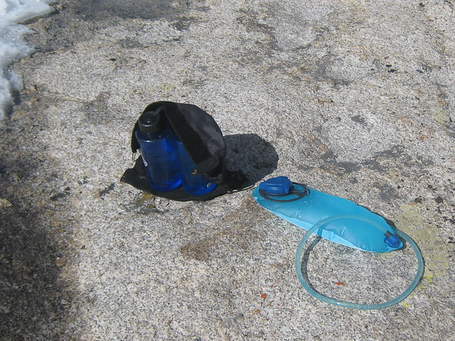
I ate a pre-dinner peanut butter wrap in my tent, and watched Mike and Holger scramble up to Thor across the lake. I also monitored how much snow was melting inside my nalgene bottles. My mix of water/snow had turned completely into water given the radiant sun. I draped my nalgenes with a black gaiter in hopes of generating more heat...
We all watched Mike and Holger climb to the ridge of Thor. I had brought my 2lb. telephoto lens on this hike, which turned out to be wasted weight, since there was no wildlife, and all the mountains were so close already. But I jumped at this opportunity photograph the 2 climbers, since I went through the effort of carrying it up 3300'. Also used it to snap a pic of Brandon looking out over his tent...
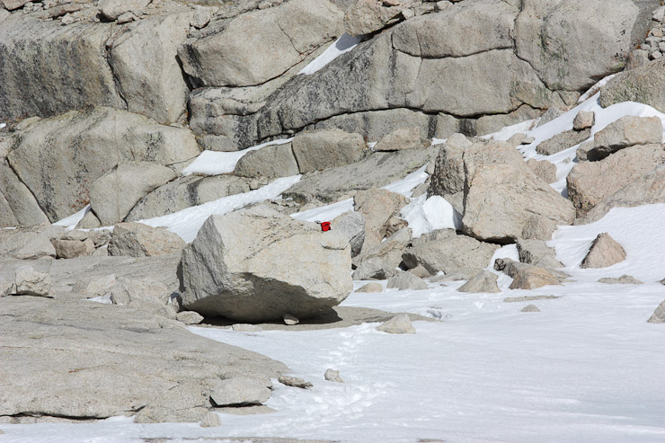
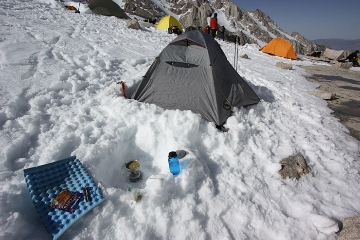
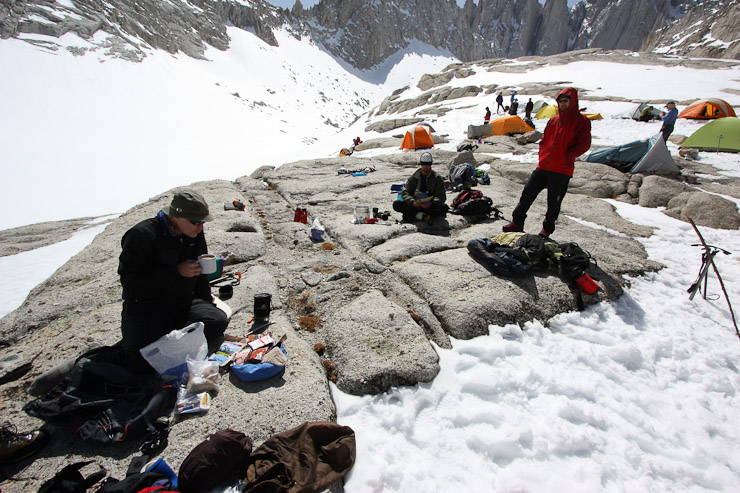
...and used my zoom lens on this pic of the "restroom". Basically, the rock offered some privacy from camp, and putting a token on top of it meant "occupied". I then went to business cooking up some dehydrated pea soup in my carved out stove pit (which would have been important if there was any wind)...
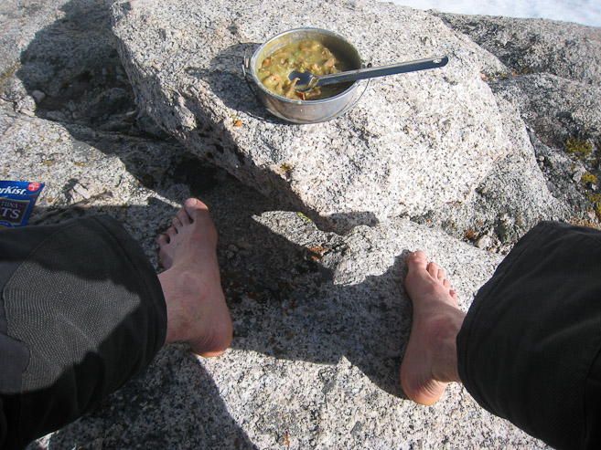
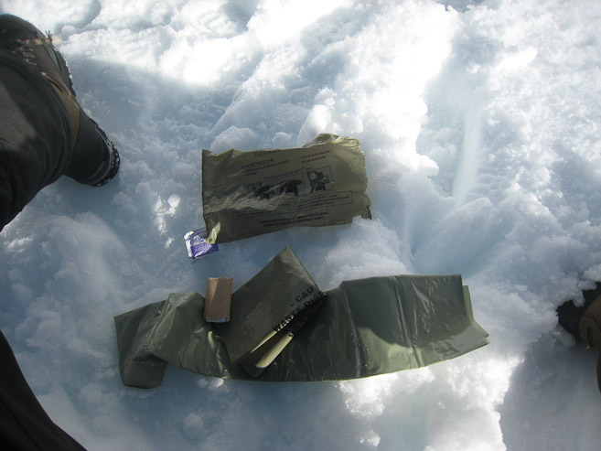
Many people were barefoot on the rock, letting their socks dry out in the sun. I followed suit. It was still toasty in the sun. Just don't walk on the snow barefoot... Next I investigated what a WAG bag looks like. The kit comes with toilet paper, a handi-wipe, a trash bag full of anti-odor chemical (which you do your business in), and a ziploc bag to put all the refuse in. Pretty well thought out...
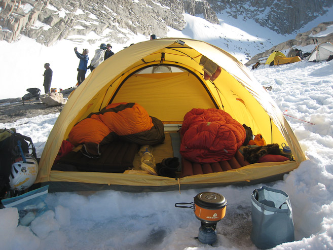
After dinner, I walked around camp observing everyone's cool gear. Brandon had awesome stuff, including 800 fill down pants, a Jet Boil stove and pot for super fast high volume snow melting, and a new 4 season tent. He and his wife are expert steepandcheap.com shoppers...
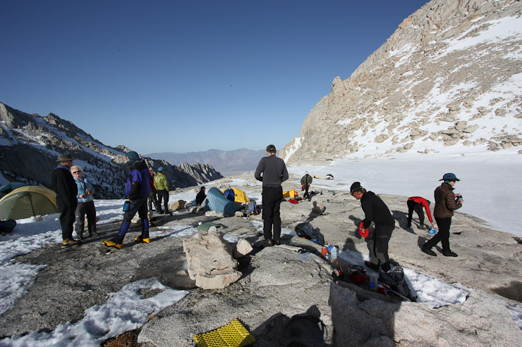
Most people had 4 season tents, or bivys. Mine was definitely the weakest looking, and I was greatful for the still air this evening. The shadows were growing long. Not much longer til we'd be in the shade of Mt Whitney...
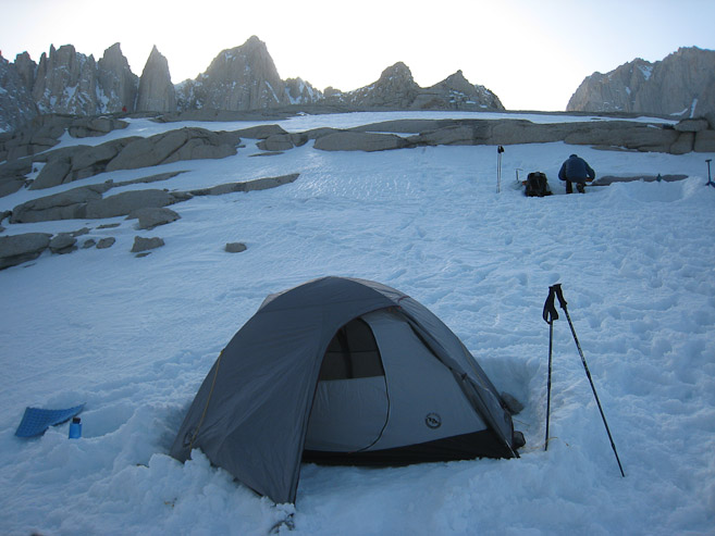
The view from the restroom area was excellent. I caught the sun dropping behind Whitney. Indeed it started cooling down fast. In fact the snow was already icing over. I was glad I cleared a flat landing under my vestibule so I wouldn't twist an ankle trying to get in my tent...
We watched Mike and Holger scramble down some tricky rock pitches, and return to camp. They summitted Thor, but said it was more difficult than anticipated, with pockets of sugar snow in the rocks. I wondered if these adverse conditions would be similar on the final 400' tomorrow, and if that would mean aborting the summit bid. I didn't worry about it. Either way, this would be a satisfying experience and challenge, shared with great group.
My fellow campers told me the trick to staying warm at night in the winter is to fill a nalgene bottle with boiling water, and use it as a hot water bottle in your sleeping bag (usually at your feet). I attempted this, but my little stove and 10 oz pot made for slow boiling of 32 oz. Still, I managed to fill the bottle with hot water, and would be ready try it out tonight.
With the sunlight gone at 6pm, I turned into my tent for the night, that is, until I soon heard some odd chatter going on outside. Someone was saying a girl had arrived at camp to deliver a pizza. I could here a female voice calling from a short distance, asking if a certain person was here. Everyone in camp was suddenly confused and intrigued. Then came laughs of wonder and exclaimations of astonishment. Indeed a young woman had hiked up 3300' to our camp with a pizza from town! She was friends of Mike and Holger, and I later found out her name is Corina. When I got out of my tent to witness this amazing occurance, she had just finished getting her picture taken, said good bye, and ran back down the hill! If this weren't enough, Mike said she was planning to be back here tomorrow morning at 7am to hike with us to the summit!!! Everyone in camp was floored. Certainly this will go down in legend. Holger and Mike shared the pizza with the group. I had a bite, and it was delightful. "She better get a good tip!" I heard a few people say. Thank you Corina for a trail story that we will never forget.
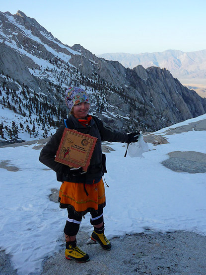
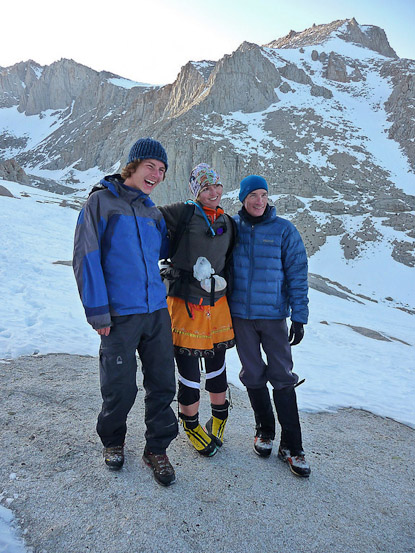
A mysterious woman showed up delivering a pizza, only to depart down the mountain a couple minutes later. I think she was some kind of mountain fairy, delivering us pizza to restore our health and spirit during our quest. :-) She poses with Holger and Mike... (Both pics by Richard)
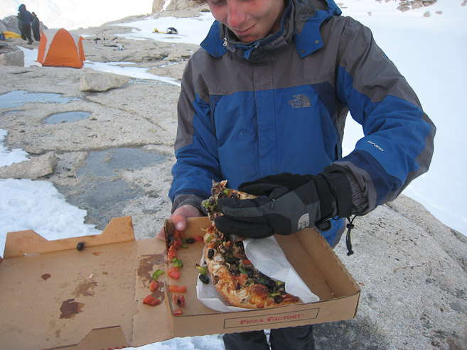
Holger passes around the pizza. Still sllghtly warm... Yummy!
It took awhile for everyone to get the astonishment of this pizza delivery out of their system. It certainly added another dimension of specialness to this trip. But now it was getting very cold, and I returned to my tent and crawled in my bag. I put the hot nalgene bottle in a plastic bag, and tossed it in my sack. I put my boots inside my tent, and kept my bladder of water, and camera batteries next to me to keep from freezing. I was snug inside my 20 degree down bag, along with a silk liner (10-15 degrees warmth). I was warm, but was I tired? Apparently not. I listened as the young and energetic Holger made a couple of sledding runs down the snow slopes opposite the lake. It was 7:45pm when I was ready for bed, but I couldn't sleep. I tossed and turned, looking for a window into sleep. Eventually I put on my snow pants for extra warmth on my legs. Amazingly there was hardly a breeze all night. In the end it was 1:15am before I finally caught some Zzzzzs.