

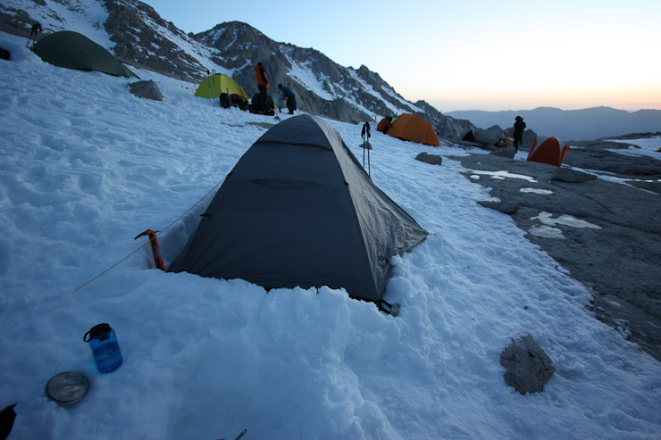
I didn't set an alarm for the morning, instead relying on activity in camp to let me know when it was time to arise for today's adventure. Camp was rustling by 5:30am. My hot water bottle in my bag was now about room temp, and my bladder hadn't frooze. Another water bottle in my tent had some thin traces of ice inside. After lying around a bit more, and organizing my pack, I was ready to enter out into the cold morning air, and take some pre-sunrise pics.
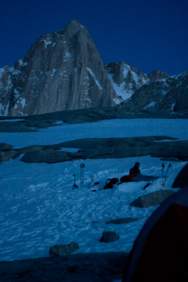
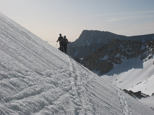
The low-light at 5:45am gave me an opportunity to use my 50mm f1.8 lens. I think I used my mini tripod too. Good to get some use after hauling them up 3300'. Whitney is in the backdrop of the 1st pic...
It was chilly out, but with all my layers on, I was quite comfortable. I heard Mike say his thermometer read 9 degrees presently!
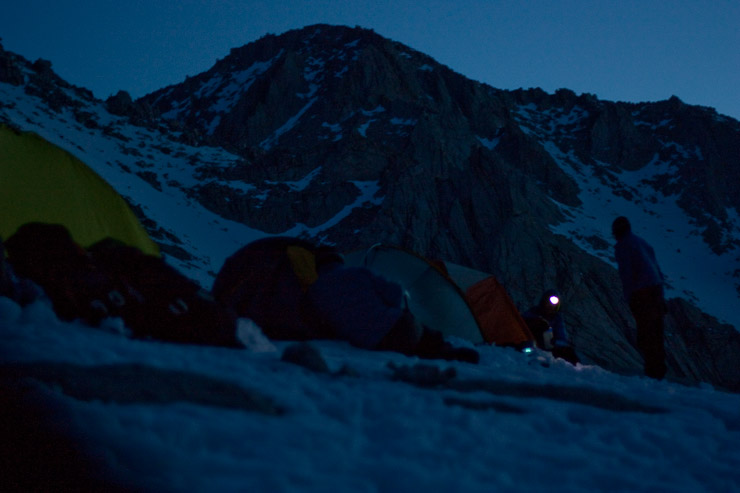
Several headlamps dot the village, though it was now becoming light enough to see without them...
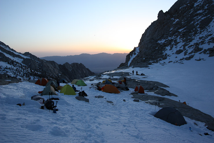
Like everyone else, I boiled up some water for breakfast (custom oatmeal blend for me). I wandered a bit taking pics while the water was heating up...
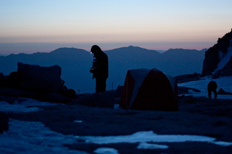
After breakfast, I walked over to the restroom area to view sunrise on Whitney. It wasn't as colorful as I had hoped today, but I could check off "seeing alpenglow on Whitney" from my to-do list...
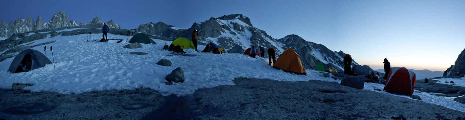
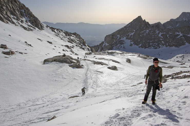
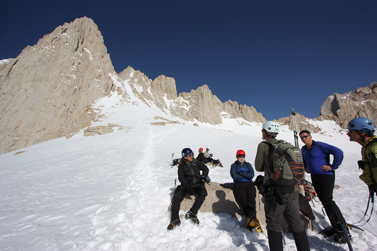
I debated quite a bit about whether to wear long underwear underneath the ice pants today. Given the forecast, I had a feeling we might be baking in the sun today, though parts of the final 400 would be in the cold shade. At the last minute, I changed out of them, quite sure the sun and exercise would keep me well toasted, like yesterday. The group departed for today's summit hike over a span of 7:10-7:30am, depending on when they were ready to go. Iceberg Lake, would be the first target of the day.
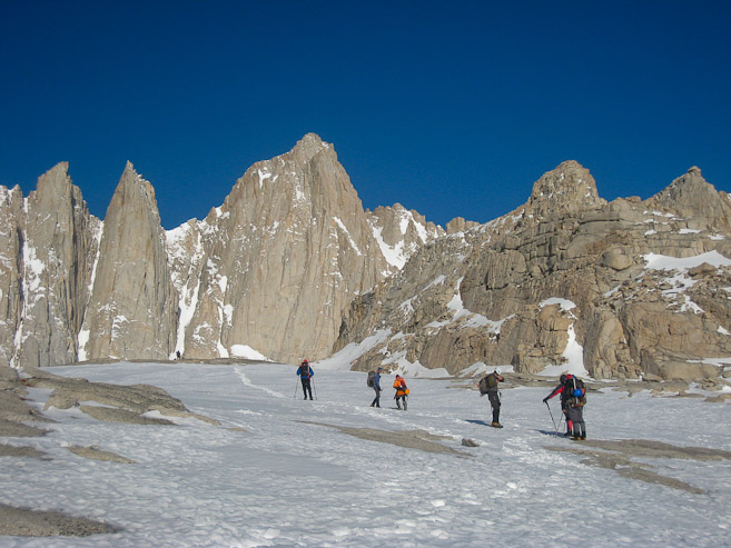
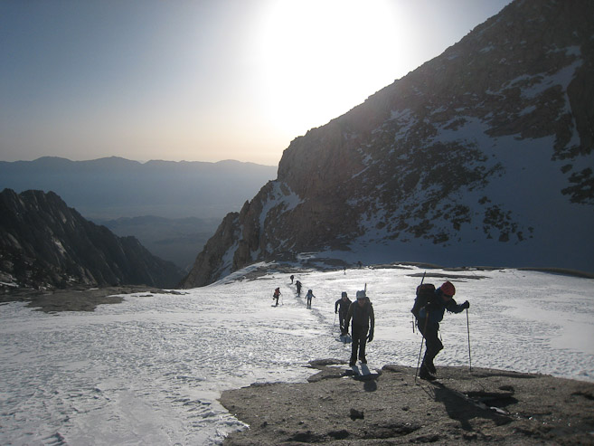
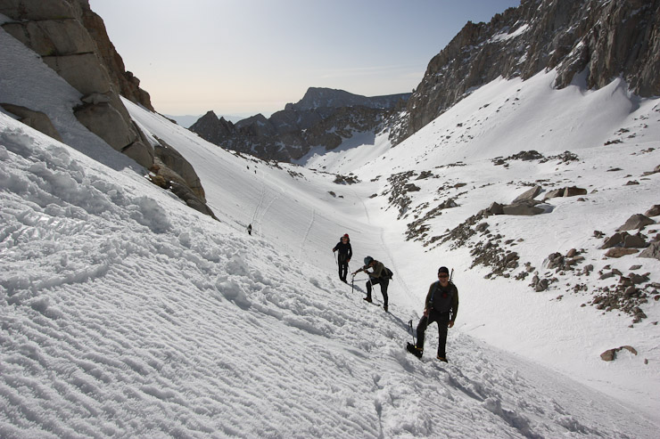
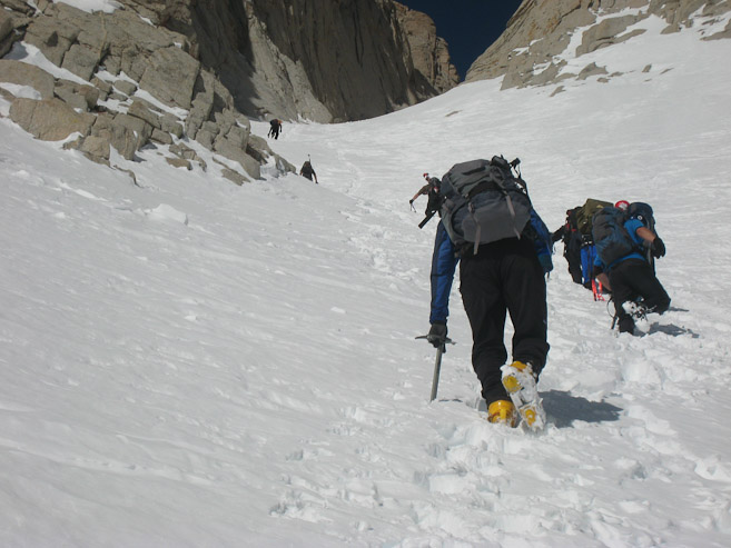
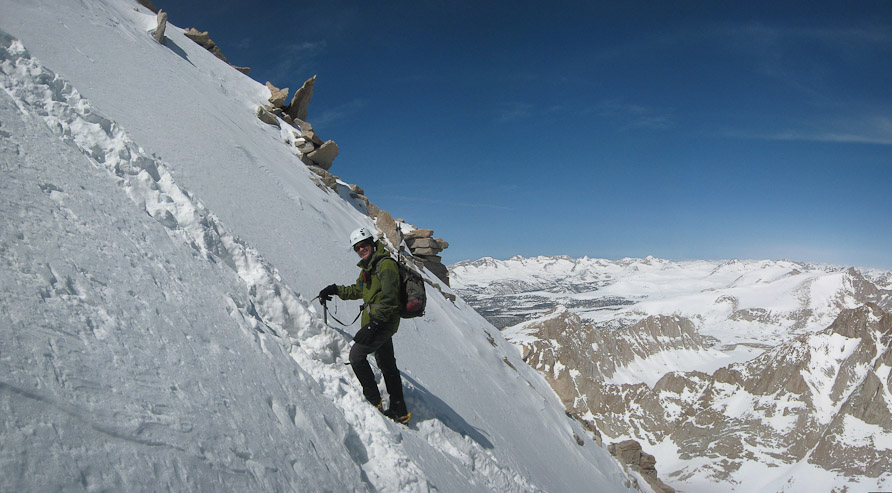
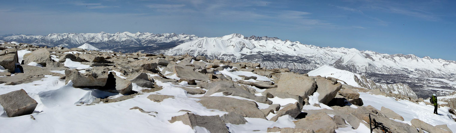
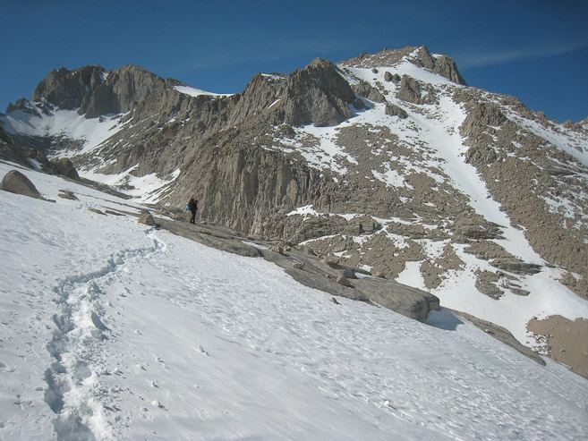
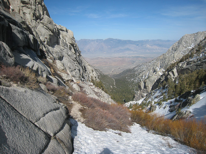
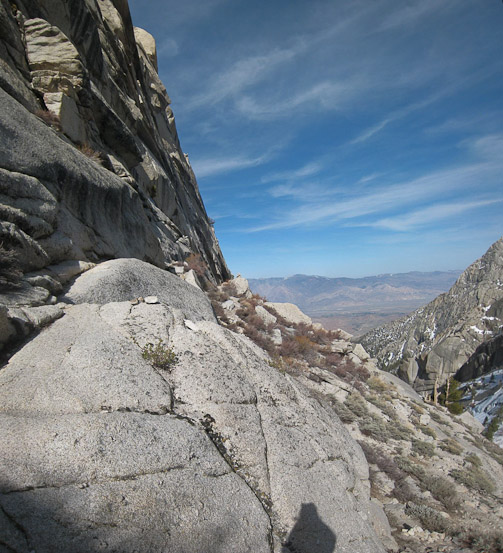
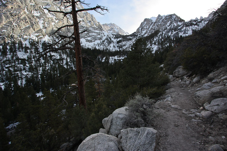
We headed straight towards Whitney over the rock above camp (a look forward and back). Corina, the pizza delivery girl from last night, had made it up this morning to join us (in the orange outfit)...
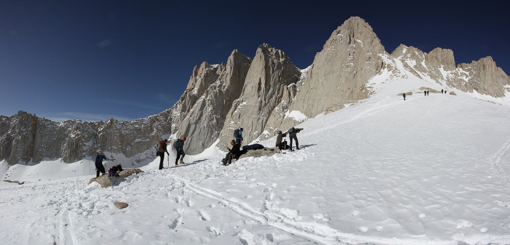
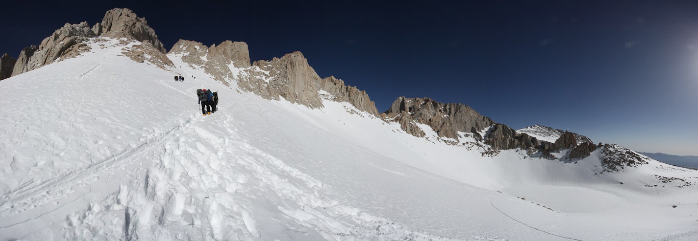
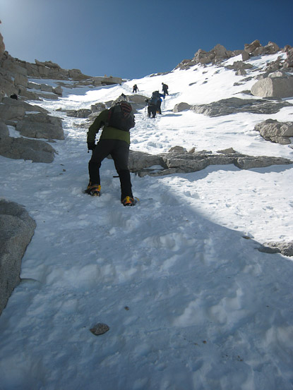
We climbed fairly gradually across the snow. I had expected solid snow, but it was soft enough to go without crampons...
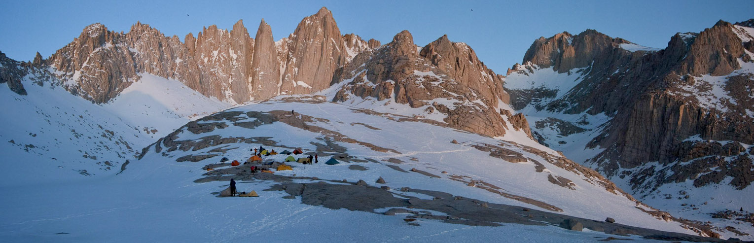
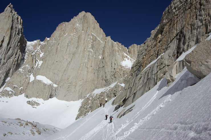
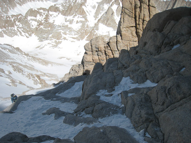
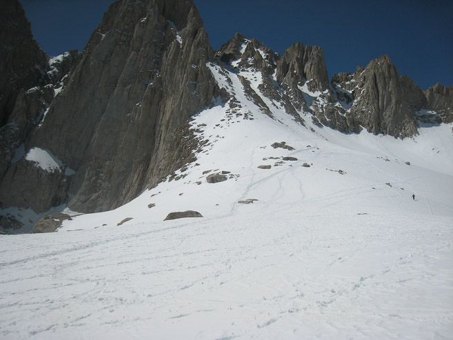
The east face of Whitney is ~2500'. I was reminded of Longs Peak's towering east face at Chasm Lake. A look back shows Thor Peak. Our camp site was below...
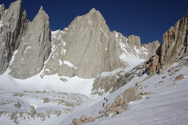
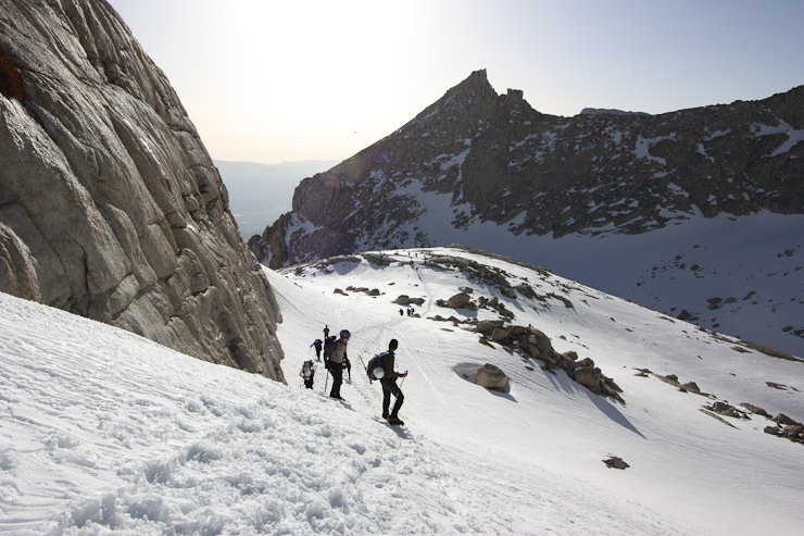
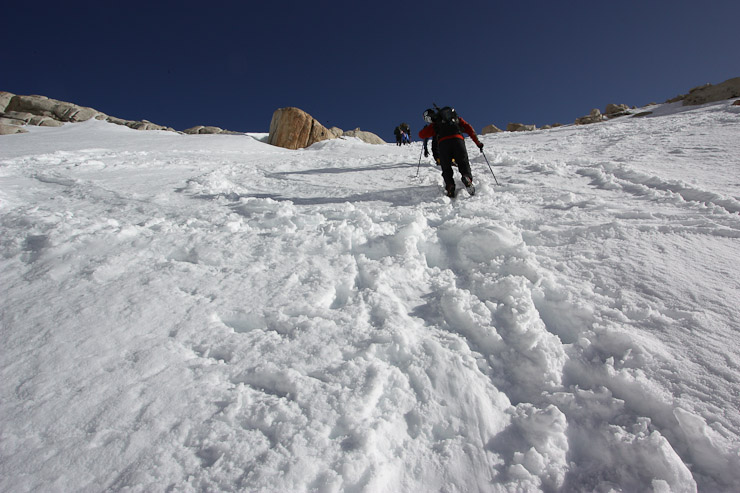
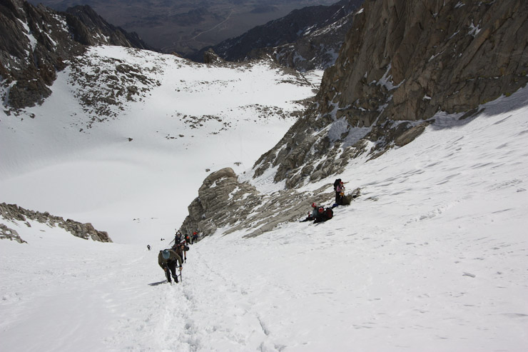
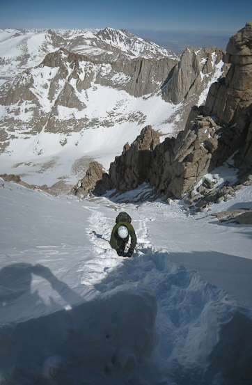
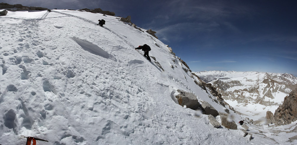
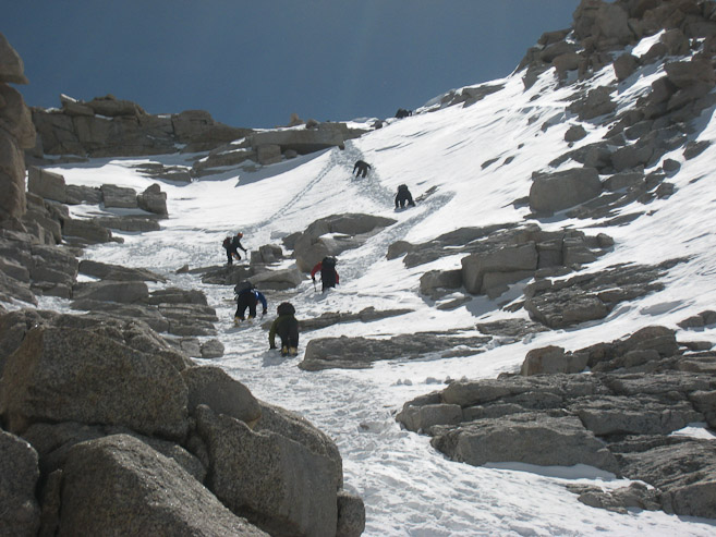
We continued on straight towards Whitney, traversing across a sloped snow field. Supposedly the summer route was different (a bit longer) in this area. The snow allowed for a short cut over the boulders. Me on the trail...
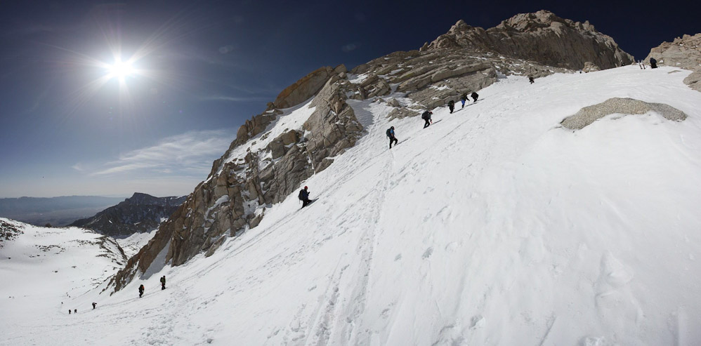
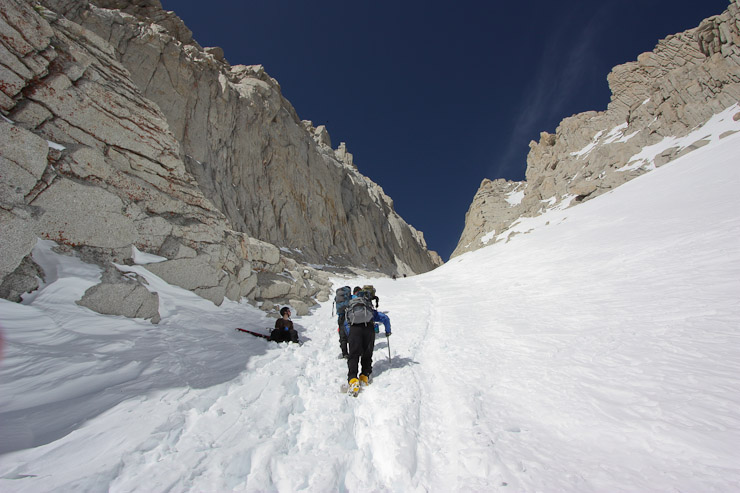
A look back shows 5 hikers following suit. Shin rounds the snow slope...
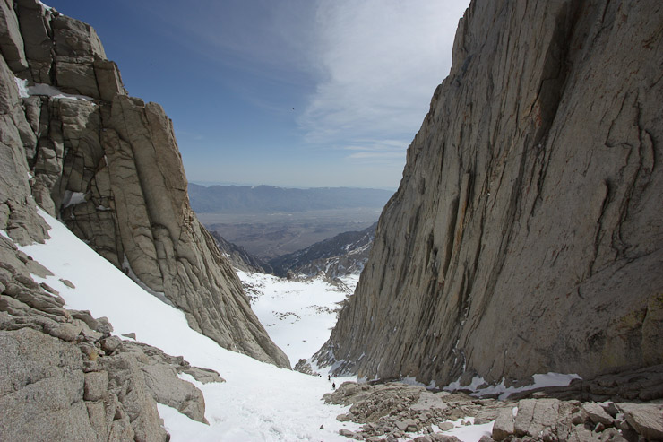
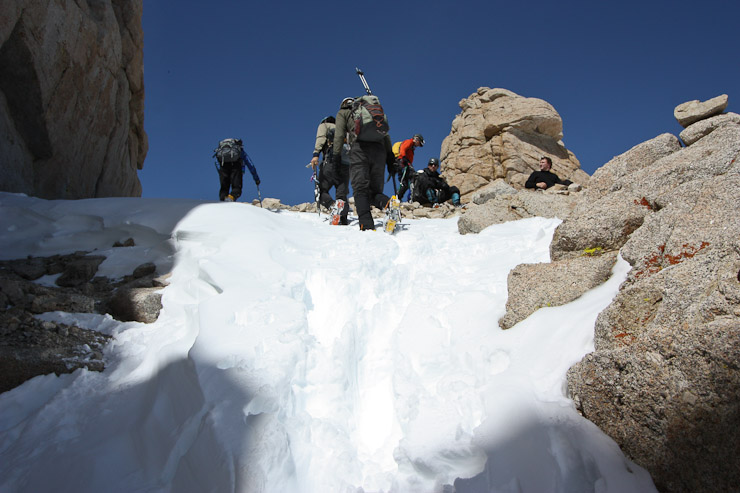
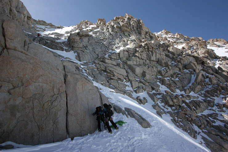
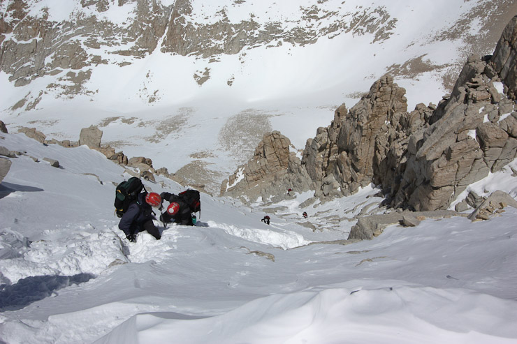
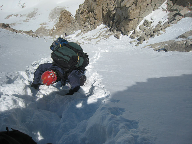
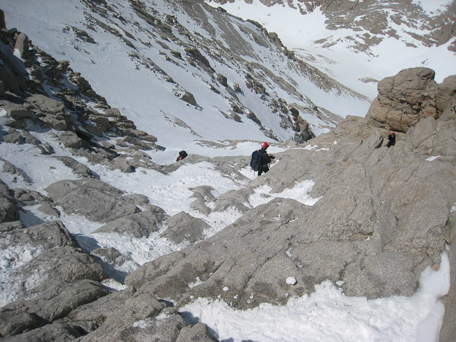
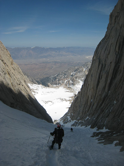
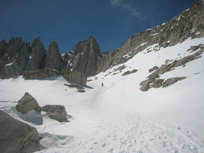
Up ahead we were approaching a gap in the rock, leading up to Iceberg Lake...
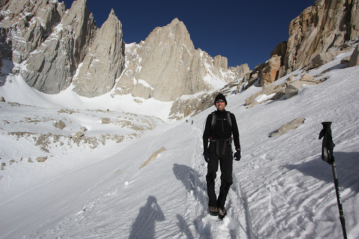
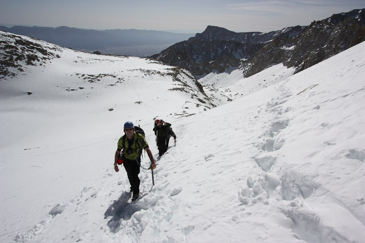
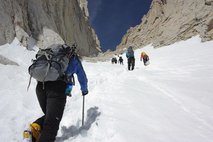
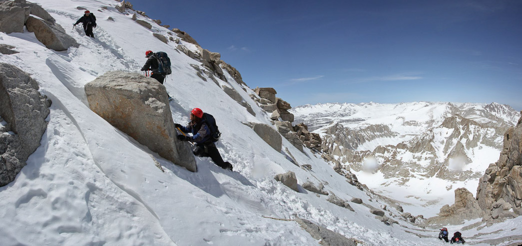
Shin snapped a pick of us as we began the steep climb to Iceberg. A final look back before beginning the climb... (1st pic by Shin)
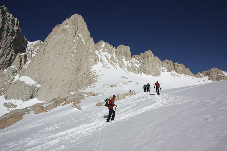
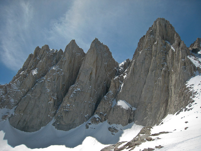
This snow pitch was steep, but had excellent steps kicked in, like a staircase. At the top, we had our first look at the Mountaineer's Route chute leading to Whitney's summit...
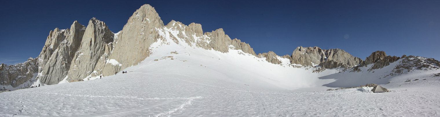
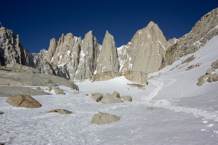
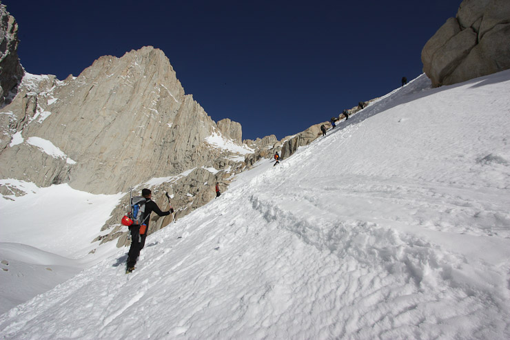
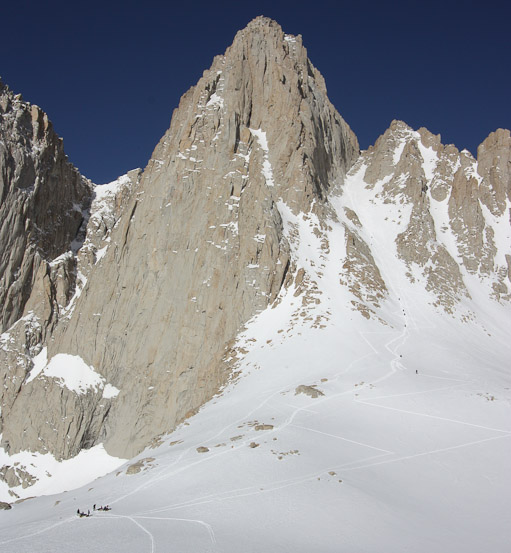
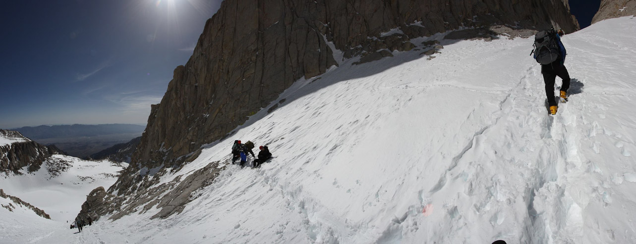
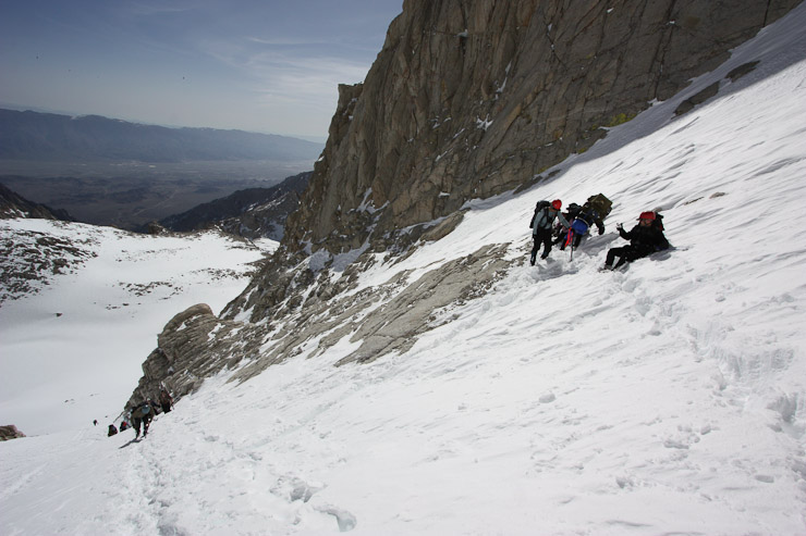
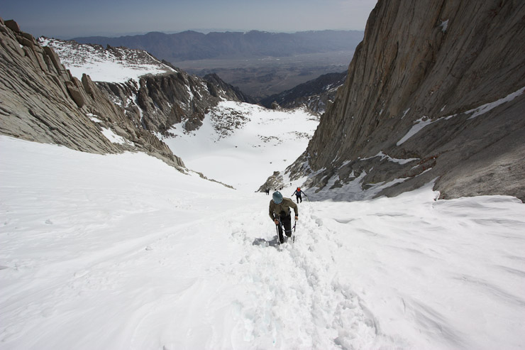
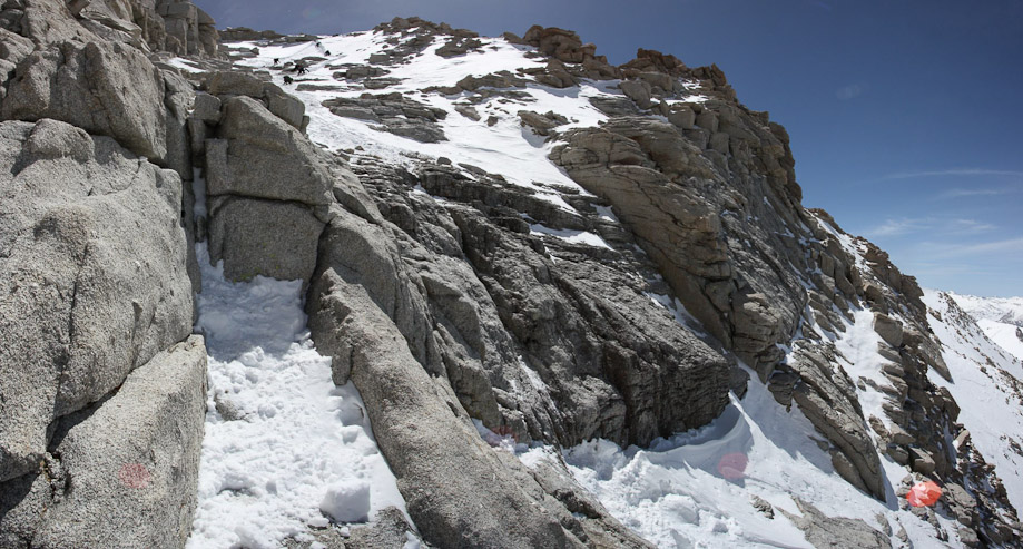
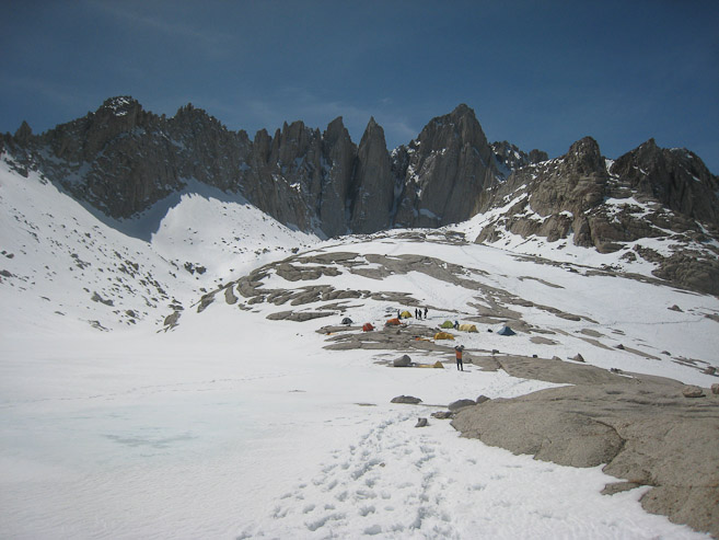
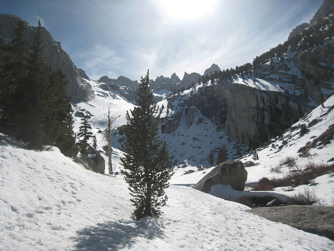
The group took a break on the rocks at the top of the climb. I immediately hiked across the basin to get some pics. Iceberg Lake (12,600') looks like a snow filled crater...
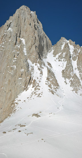
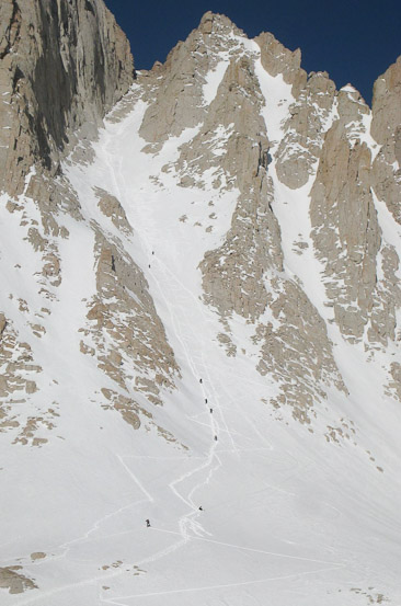
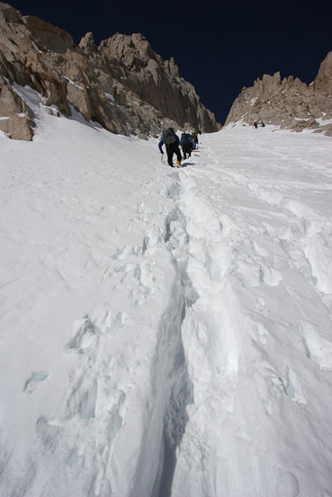
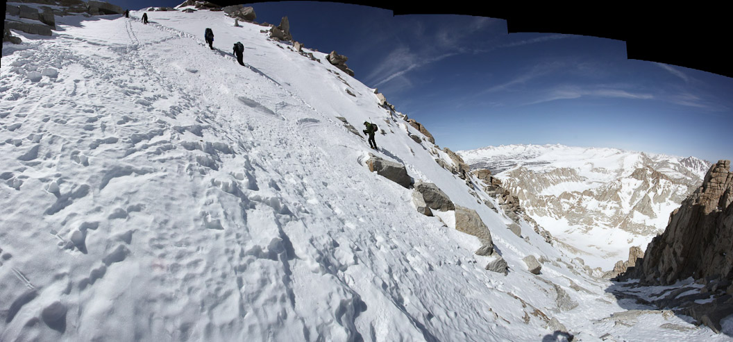
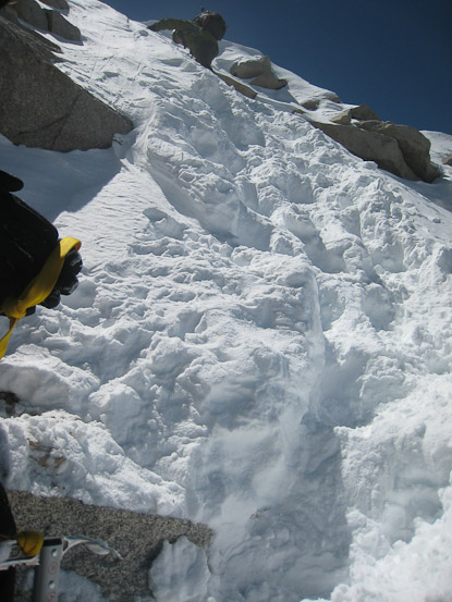
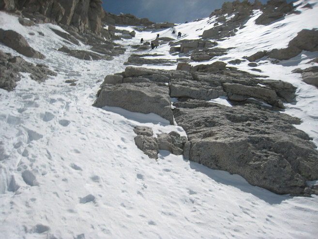
Here are several looks at the 1500' snow chute leading to the notch. Several people had already been cutting a trail up today...
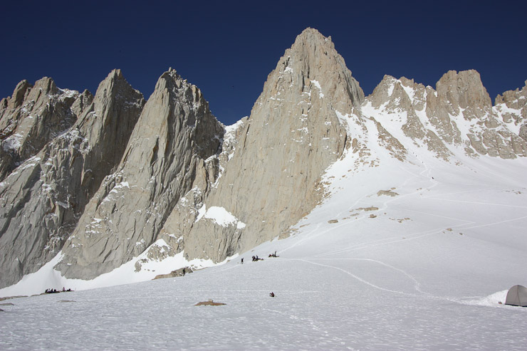
When I made my way over to the resting rocks, I found Alan, who had hiked in on Thursday and camped at Upper Boy Scout Lake last night. Alan coincidently lives just a few miles from me in CO, but hadn't met him until this trip. I filled him in on my lost boots outcome...
Other members of the group arrived at various intervals. It now made sense to break up into smaller groups going forward. Not everyone's agenda was to make the summit. Some just wanted to camp the night at Girl Scout Lake, some to reach Iceberg at the foot of the chute, and some to reach the notch and only admire the final 400' class 3 climb. Everyone had their personal challenge/goal for the weekend, and we all were well aware of the limits of our abilities, and would react accordingly based on the conditions at hand. My goal was the summit, and I was feeling good today.
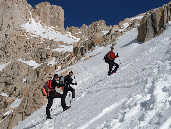
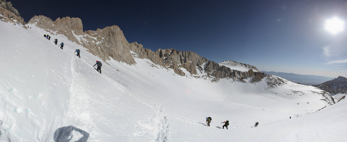
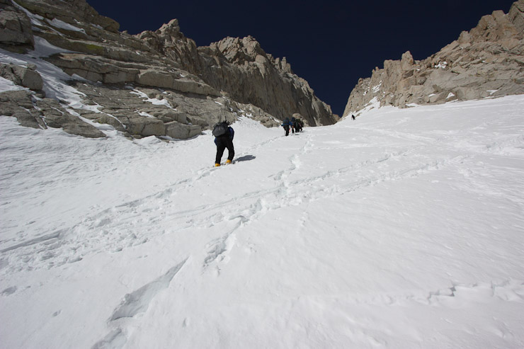
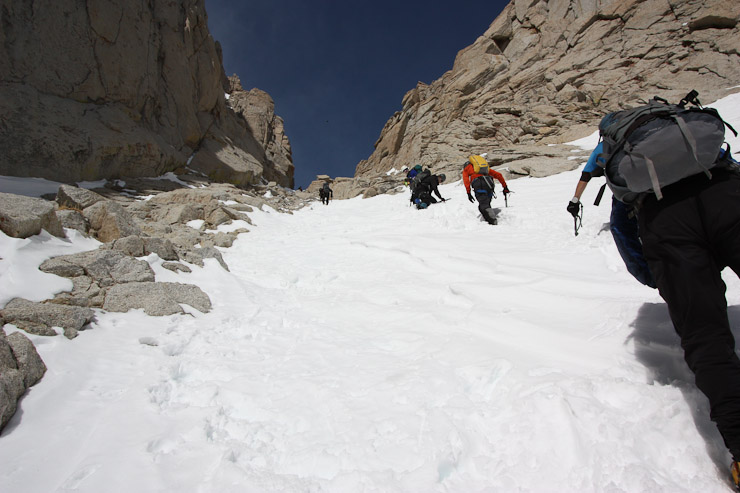
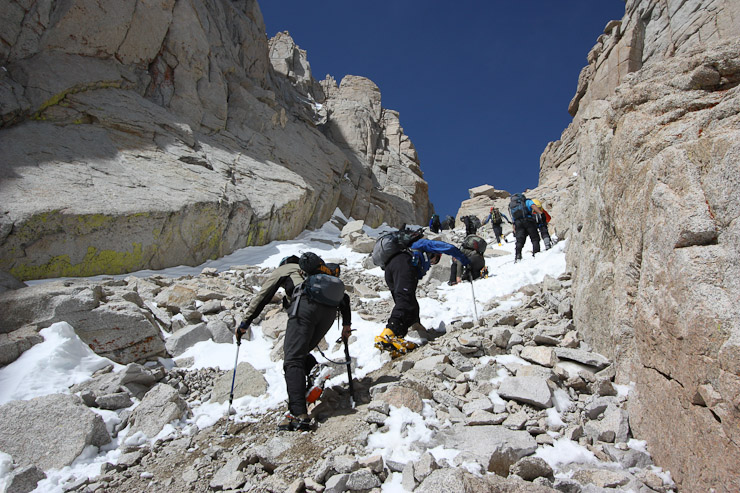
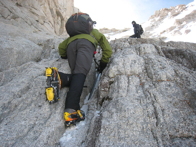
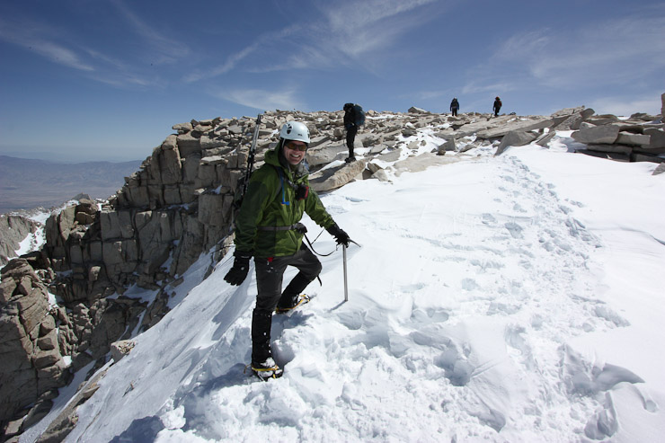
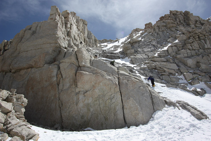
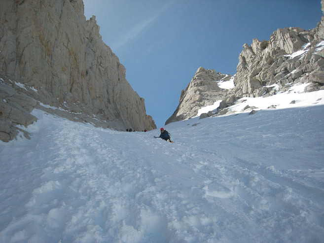
After slathering on more sun-screen, and strapping on crampons, a group of us began the 1500' climb up the chute.
Having put on crampons, I was ready to start the steep chute climb...
I had been anticipating harder snow, but apparently the sun had been baking the snow long enough to cause some deep boot tracks. It was 9am already as we started the chute...
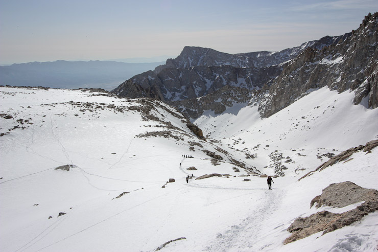
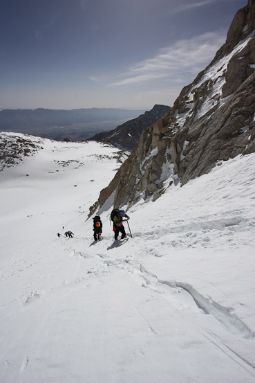
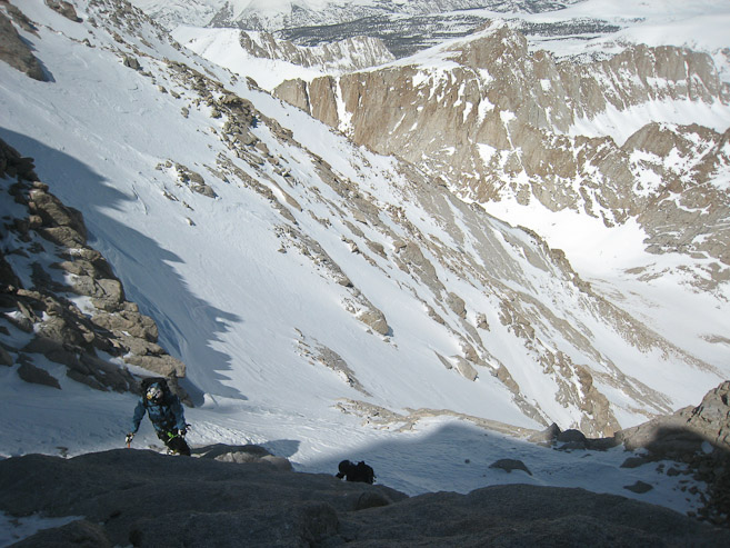
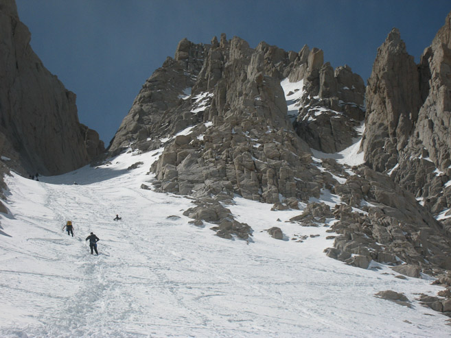
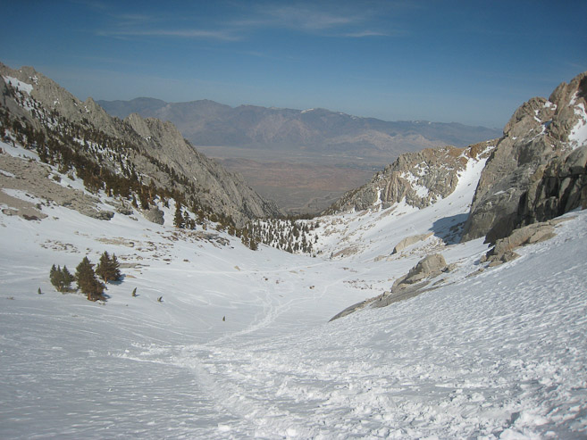
A look back at the valley we hiked in on to reach Iceberg Lake...
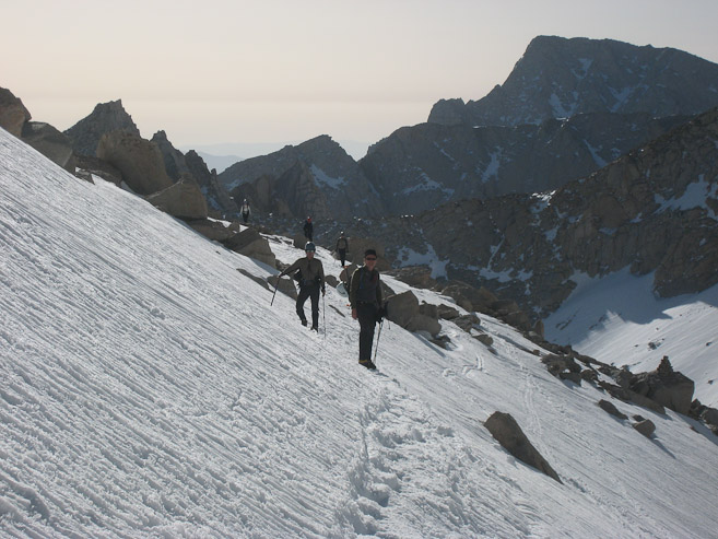
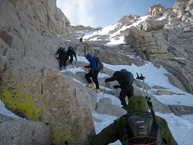
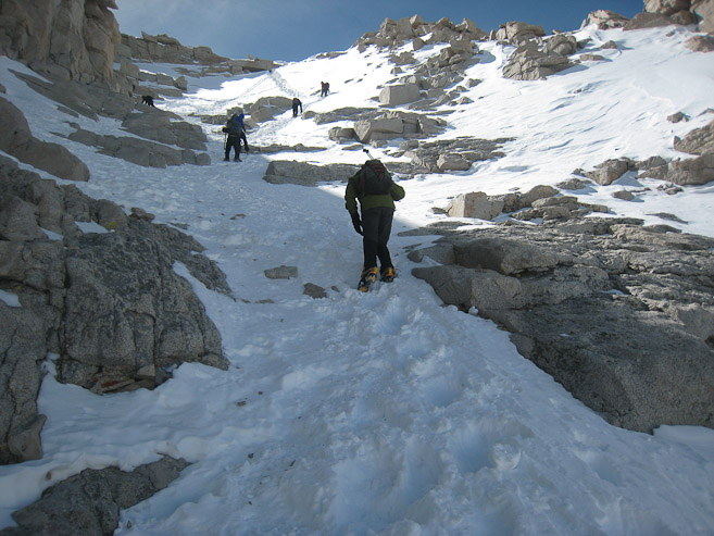
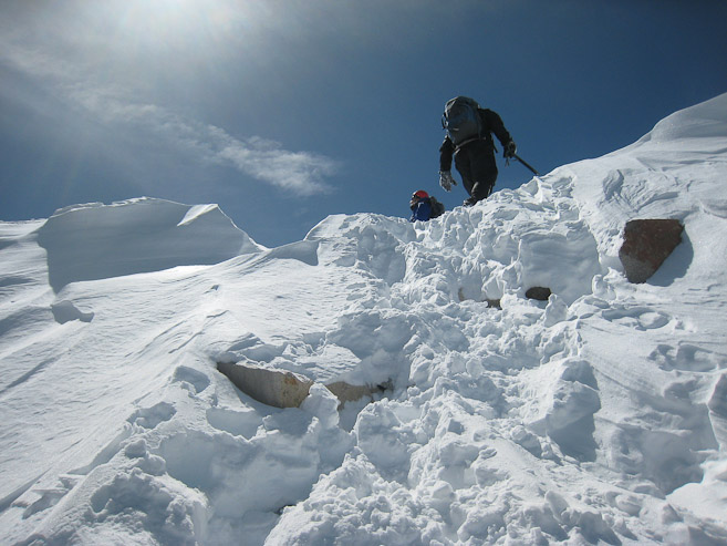
It was a bit of a conga line heading up the chute. Everyone followed the same set of tracks, since it was a lot of work to break a parallel trail in the softening snow...
Mark caught up to us...
I found a switchback carved in the chute, and hiked out to get a pic from the side...
It was a long slog up. The conga line stopped every 15 steps or so for a short rest. This gave me lots of time to take pics...
Another side view from ~1/3rd of the way up the chute...
It was quite hot out again today. I was very glad I bailed on the long underwear this morning...
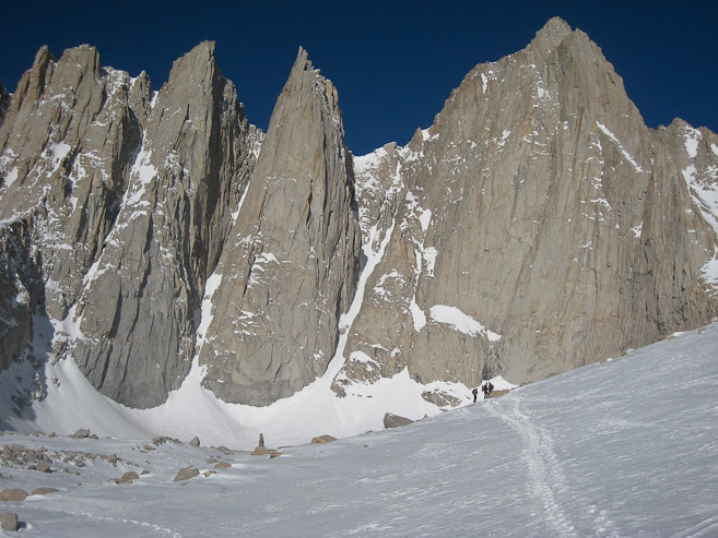
There was a lot of traffic up the MR route today. No surprise, since this was the 2nd to last weekend before the quota kicked in on Whitney permits, and the weather was superb. A few skiers were hiking up today too...
As we reached the upper portion of the chute, huge rock walls towered up on the south side...
A section of bare rock, ~2/3rds of the way up, made a good resting point, but our group continued to keep moving...
A couple of looks back...
Finally, we could see some bare rock ahead. The end must be near. I turned back to see Shin blazing up the chute, catching up to us. I was later shocked to hear he was 60 years old! He was in great shape, and doing awesome on the trail...
I overheard that the big block in the center of the gully marked the top of the chute. It was in sight. It's easy to overlook the impressive towering walls along the gully, when your head is contantly bent forward, leaning up the mountain, staring at the next boot track...
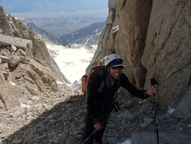
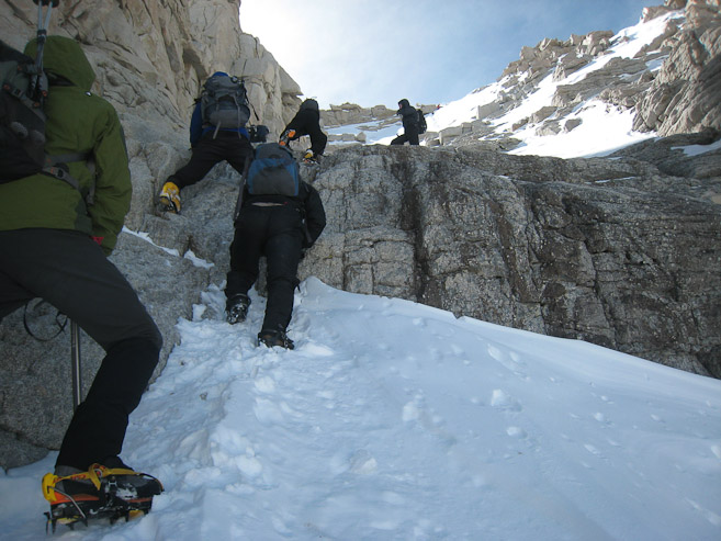
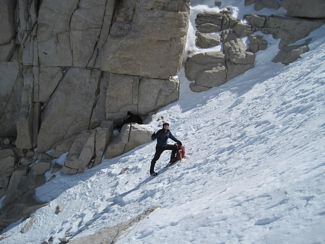
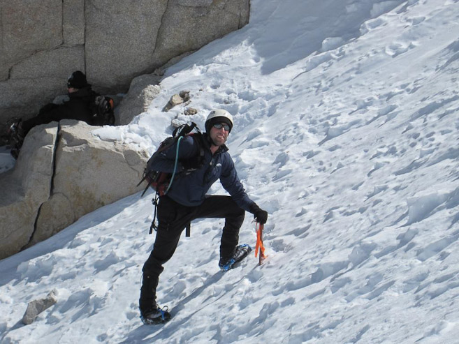
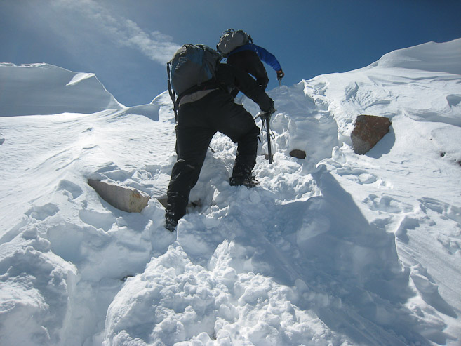
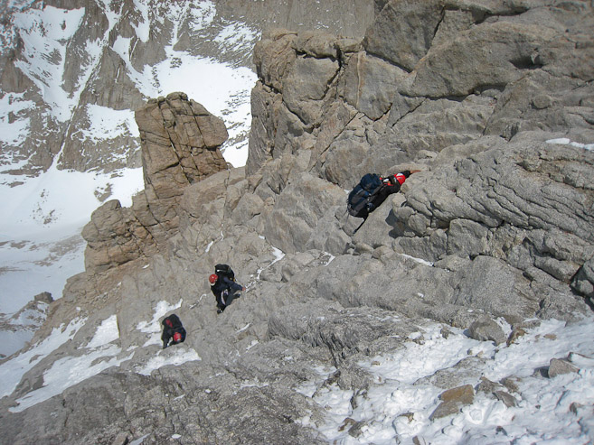
The final portion of the chute was a mix of dirt/rock/snow. Manuevering on rocks with crampons requires a little extra care... (2nd pic by Shin)
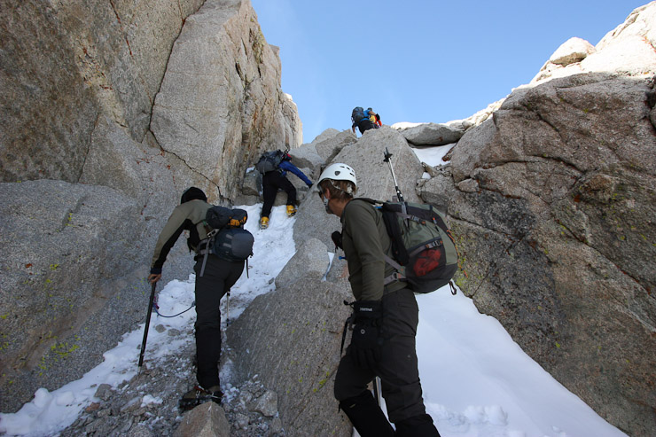
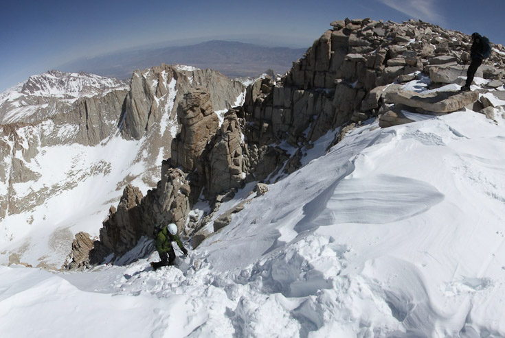
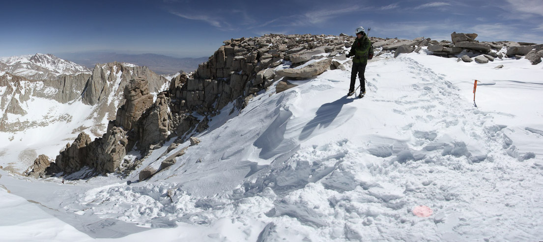
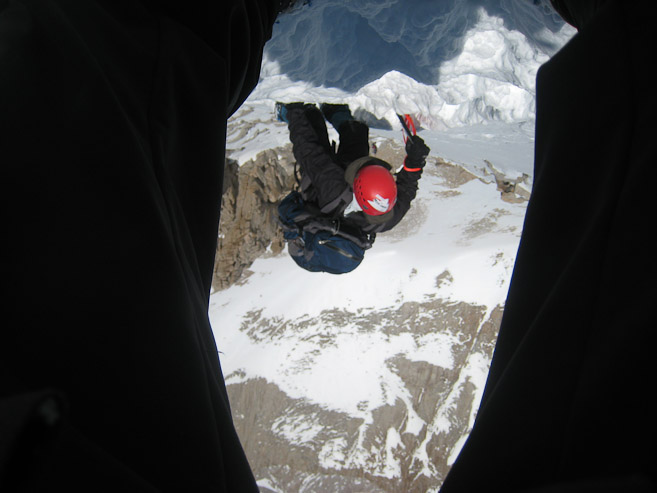
There was a hands on move to scramble up some rocks near the top of the chute (1st pic). Here we are, topping out at the notch! (2nd pic)
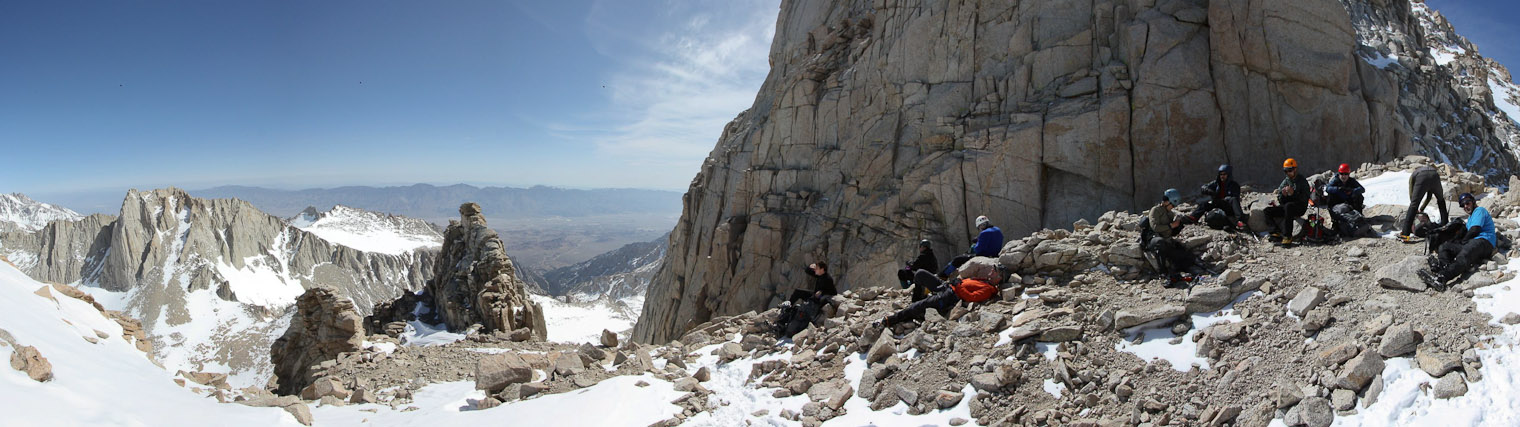
It was 10:30am when we reached the notch (14,100'). Everyone took a break, ate snacks, and took lots of pics. It was a bit chilly resting up here...
I stand in front of the imposing face of Mt Russell... (pic by Shin)
Another pic of me and Mt Russell. I then took a peak around the corner at the final 400', where a couple people were preparing some rope. Snow covered most of the entrance-way...
After ~20 minutes at the notch, resting and snacking we were ready to start the final 400'. Shin had set his limit at the notch, so we said good bye, and started the climb. Wes, Nick, Alan, James and I set out on the final 400' together.
The first 1/4th of the 400' was a mix of snow and rock. The snow was very firm here, allowing the crampons to hold tight, as long as the snow was a few inches thick. A look down from a short ways up...
Quickly we encountered a tricky rock section. This would turn out to be the "crux" of the 400' in my mind, at least for the conditions on this day. A look back down, before climbing the crux...
James works on climbing over the "crux". The obvious path was up this crack, which was a bit awkward with crampon on rock. The hand holds weren't particularly generous. But it was surmountable, and the rest beyond was mostly snow covered to the top...
A look back at someone else climbing the "crux", before tackling the 45-50 degree snow climb ahead...
I ventured off the main boot track following a sparse side track, to get some pics...
James takes a couple pics of me. I was highly enjoying this climb. It was a fairly easy ascent on the hard snow. A guy behind me found a cozy nook to rest in... (pics by James)
I took a pic back at James. Conditions were beautiful today. No wind and good snow for kicking in solid steps. A fall in this region, under icy conditions, would result in a couple hundred foot slide into rocks. This was the steepest snow climbing I had ever done...
After steady progress up the slope, I reached the top, expecting a tougher challenge ahead...
...but we had reached the summit (12:15pm)! James triumphantly tops out...
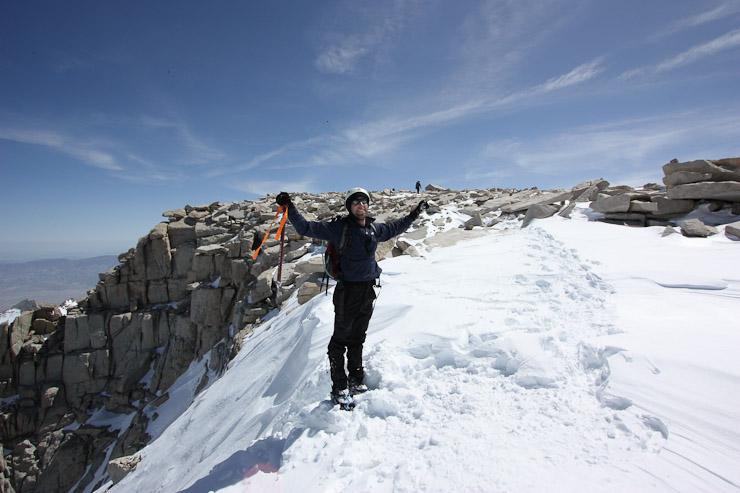
I went back to get a pic of me celebrating the ascent...
It was a fun climb, and much easier than I had anticipated. No doubt this section is a whole different ball game under more adverse conditions and weather. Of course there was still the downclimb in store, which would be just as challenging, if not more so...
Whitney's summit block expanse seemed as big as 3/4ths a football field. I left my crampons on, and scraped across the rocks towards the lookout points...
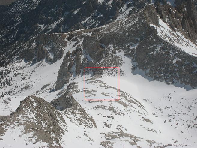
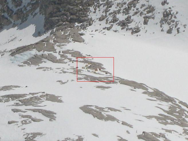
Here's a look back at our camp. The 2nd pic is a blow-up of the red box in the 1st pic. The red box in the 2nd pic is our camp. My tent is the one on the right (looks like a rock). To bad I didn't haul my 2lb. telephoto lens up to the summit (actually, that's plenty ok with me!)...
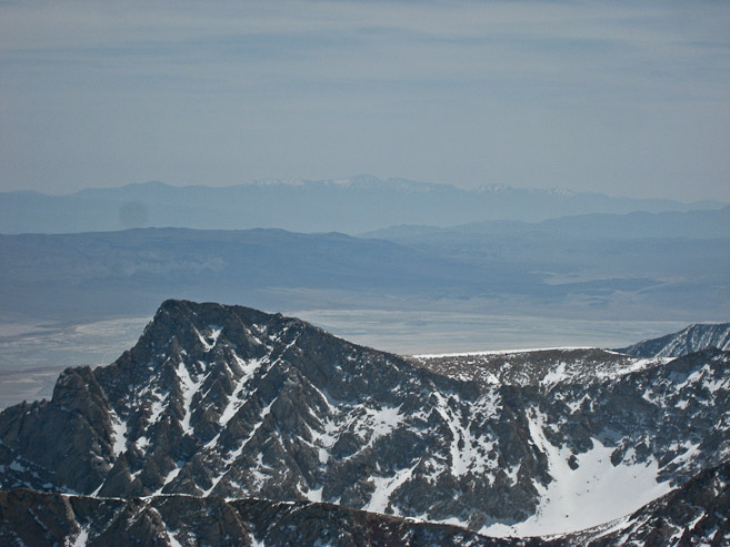
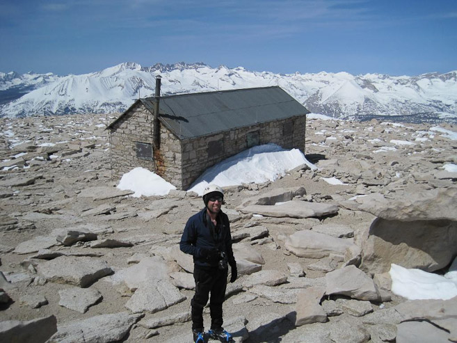
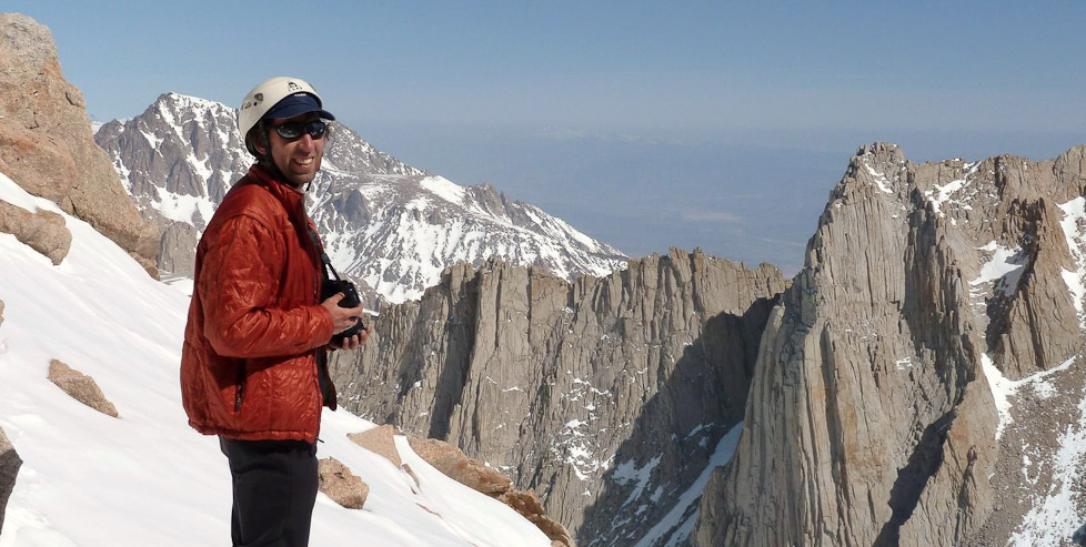
I could barely see Telescope Peak through the haze. It didn't look as impressive from up here. James takes a pic of me infront of the summit hut... (pic by James)
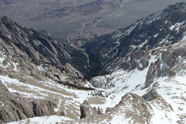
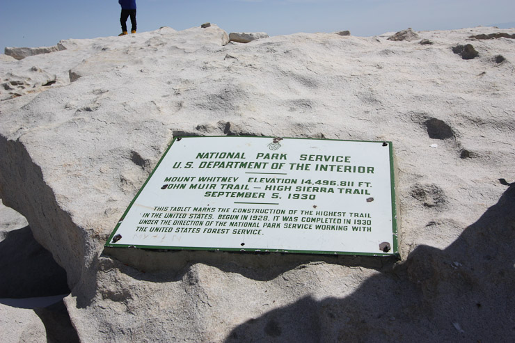
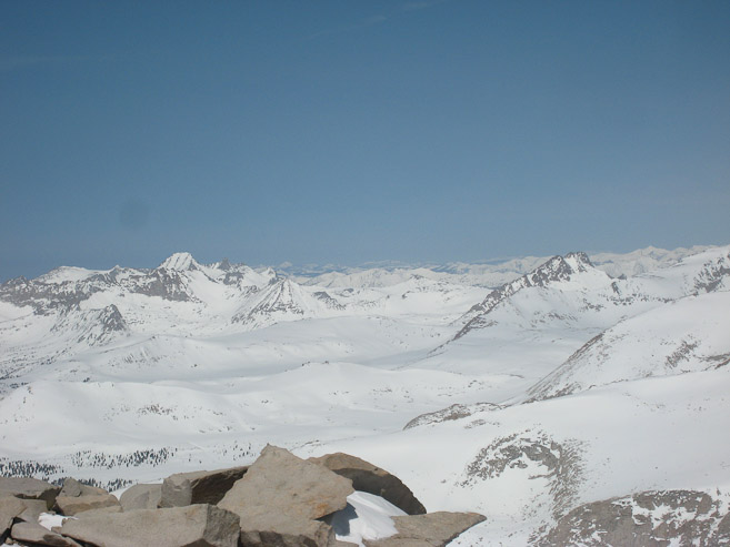
A look down at the Portal Road. The MR route is only 4 miles to the top, with almost 6200' gain. Seems like ~2000' of it came in the last .75 miles. At 14,494', Mt Whitney is only 61' higher than Mt Elbert in CO, but gets the prize as the tallest in the 48 states...
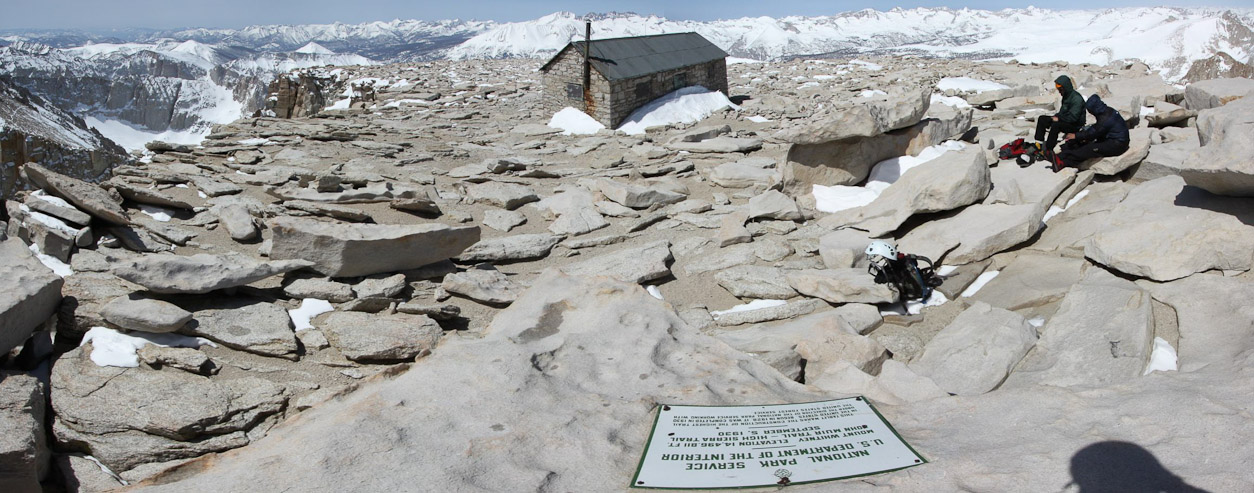
A wide look across the summit...

A look to the south...
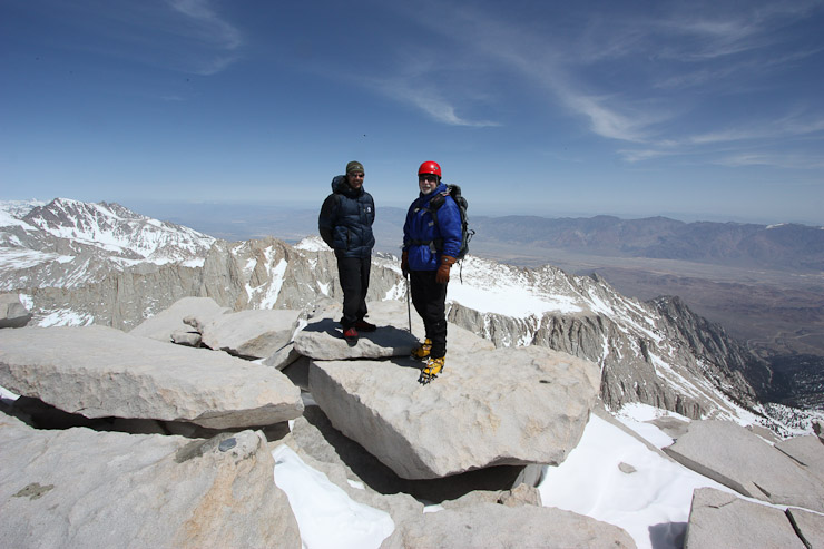
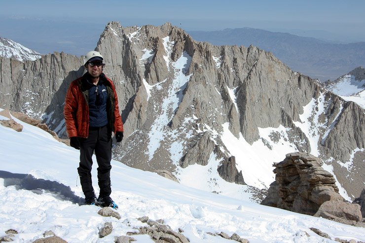
Alan and Wes pose on the summit, shortly before we head back. Alan and I were proud CO representatives on Whitney today. 12 out of the 13 California 14ers are in these Sierra mountains. There were some impressive looking peaks out there...
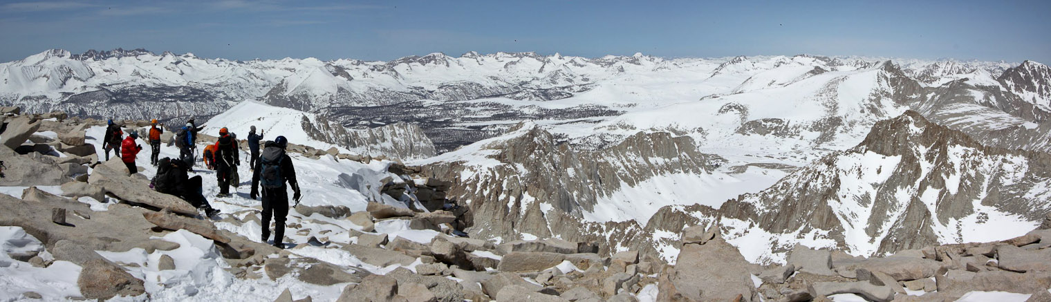
After almost an hour on the summit, we made our way back for the descent. As we arrived at the drop out place, we ran into the rest of our group. They had just summitted, and would be using rope to repel down later...
A couple other hikers start the descent, while a bunch of people from our group make their way across the summit block. Wes proposed scrambling down the rock spine, but that seemed much more complex than the snow to me. We ended up chosing the snow route...
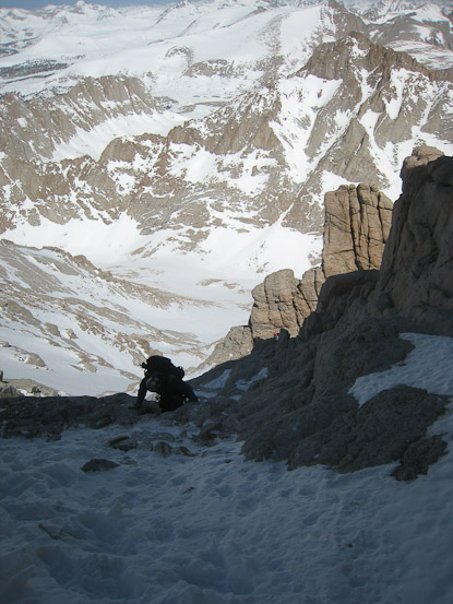
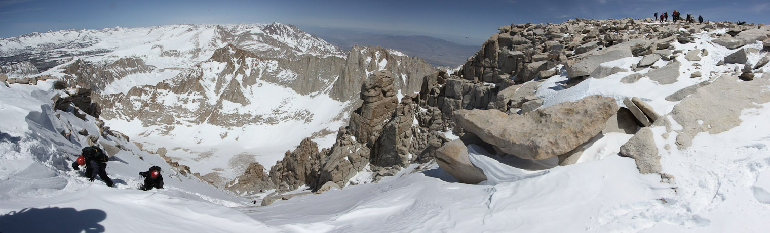
I volunteered to go first on the descent. It was necessary to downclimb, facing the mountain, using the ice axe as an anchor while walking down. This 2nd pic was my typical view while climbing down the steep snow...
These pics give justice to the steepness of the route. There was a small log jam, when we ran into a person trying to ascend the same tracks we were descending...

I took the parallel track down, which actually had better defined boot tracks, since the main trail was getting mushed out. I recommended this track to James...
I had no problems downclimbing in this snow, feeling quite at ease, and maintaining solid footing. It was quite enjoyable and expedient. I spent my time pausing for pics...
As I approached the rocks, the snow thinned out on my side, and became more treacherous. Later, I climbed back up a bit to kick in some steps connecting the side track back to the main trail, for those that followed me down the route I took...
When I reach the "crux", I noticed the group in front of me lowering themselves down some rock to the right of the "crux", along the edge of the rock rib. That looked much easier then descending the crack. I looked back up and saw the others still downclimbing...
A zoomed in shot of the downclimbers. Then a shot of the final descent to the notch, having bypassed the "crux"...
A look up having bypassed the "crux". It was straight forward to descend via the rock on the left side of the pic (where the shaded snow is). The "crux" going up was the slanty grooved rock in the middle. I informed the group to take this bypass, and everyone found it much better...
At 1:15pm we were back at the notch. The hardest part was done. Though I still wondered how descending the E-Ledges would play out with a heavy pack on later. We took off our crampons for the rest of the descent...
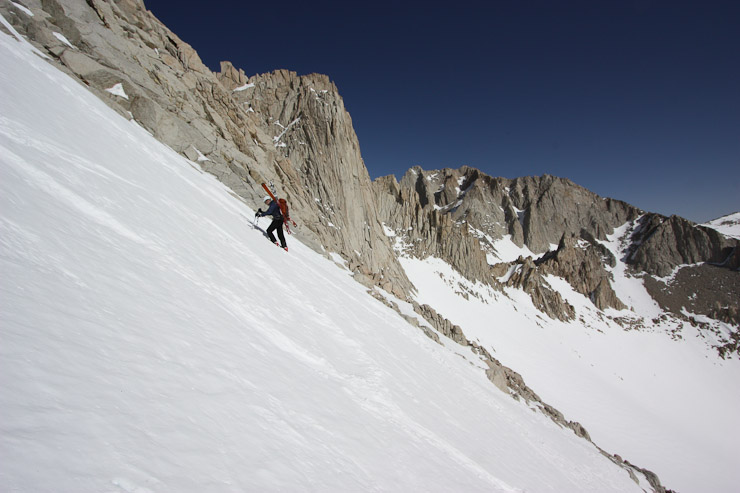
The snow in the 1500' chute had firmed up a bit in the shade, but was still soft enough for heel stepping down. Wes, Alan, and James all glissaded down long stretches...
I was content to simply long-step it down down the chute on the untouched snow, keeping my butt dry, and still making great speed. Snow descents are SO convenient! Conditions today were extremely friendly on the MR route...
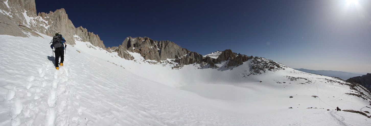
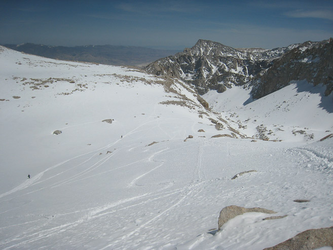
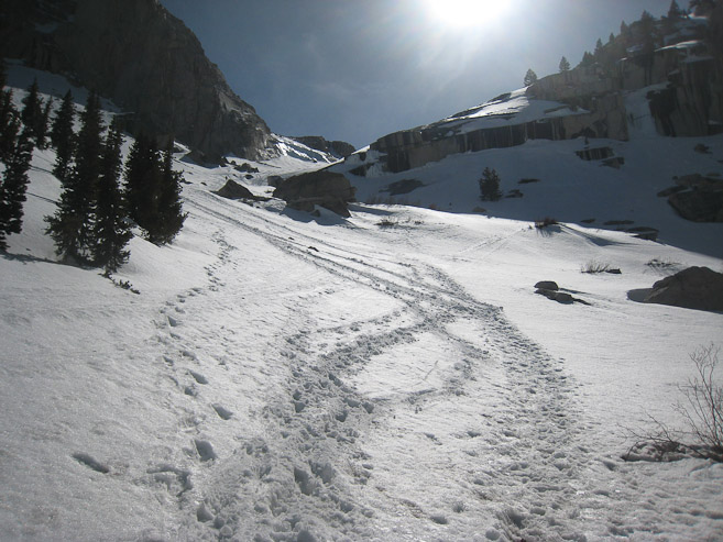
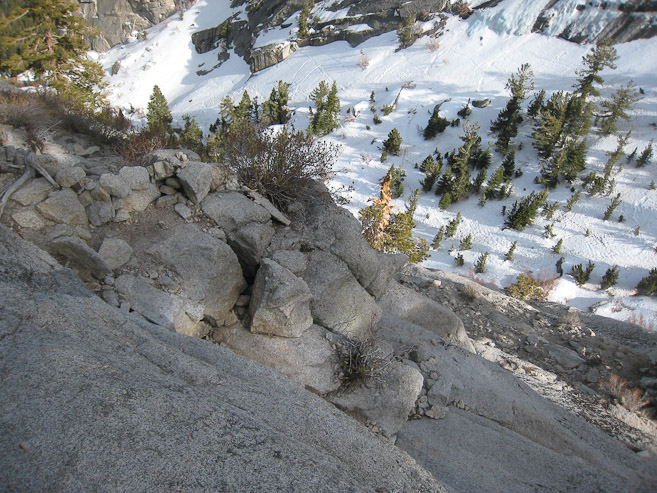
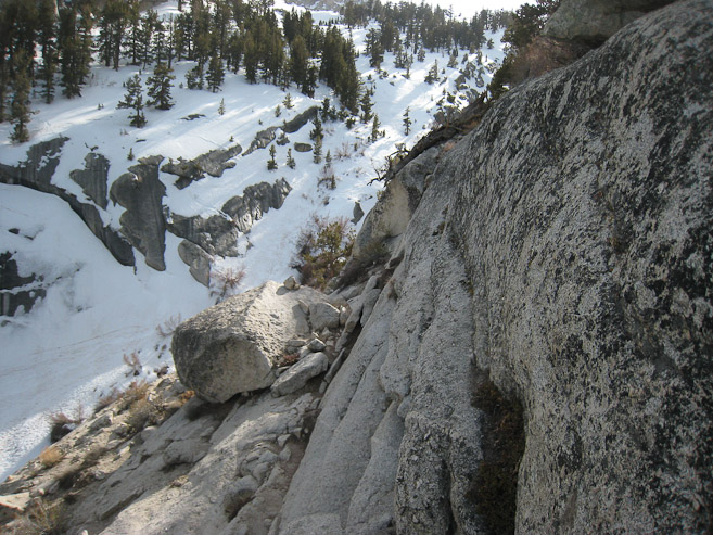
At Iceberg, Alan split off to head directly back to Upper Boy Scout Lake. The rest of us returned via our path from this morning. A look back at Whitney...
I made it back to camp at Girl Scout Lake just 25 minutes from leaving the notch. That was a fast elevation loss of 2500'. Some people were heading back to Lone Pine today, some planned another night here. Some that turned back before the summit were already packed up and gone...
I was debating whether to spend a 2nd night here, and climb Russell tomorrow with Alan. Russell had an awesome looking class 3 ridge with dramatic exposure, though not quite Little Bear - Blanca traverse extereme. I noticed a breeze picking up, and saw my tent starting to wobble a bit. The forecast was good for tonight/tomorrow, but in the end, I decided to pack out tonight, and have another rest day in prep for my move back to CO on Tuesday (had to pack up my apartment Monday). Plus, it would be nicer to avoid another cold and sleep challenged night. So I broke down camp, packed up my bag, donated my extra camp fuel to the group, and hit the trail at 3:35pm. Adam was also leaving at this time too. We planned to avoid the ledges and take the willow route.
Adam stands on the rock ahead, about to descend towards Upper Boy Scout Lake. The slanty snow chute visible in the 1st pic is the path leading up to Russels East Ridge (Russell is the peak on the left). A look down at the multiple tracks in the snow from all the activity today...
I descended quickly, and decided to continue down the rest of the way myself (Adam was well aquainted with the area, and told me he'd probably be a lot slower on the descent). Here are a couple looks back from near Lower Boy Scout Lake. I drank up at the lake, and emptied my bottles for a speedy descent the rest of the way...
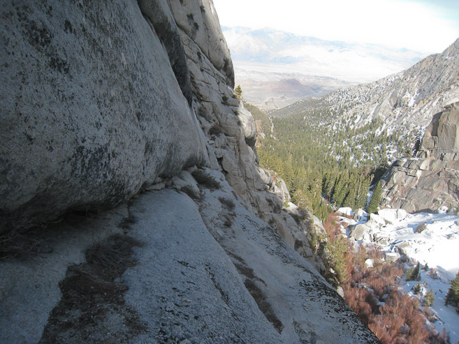
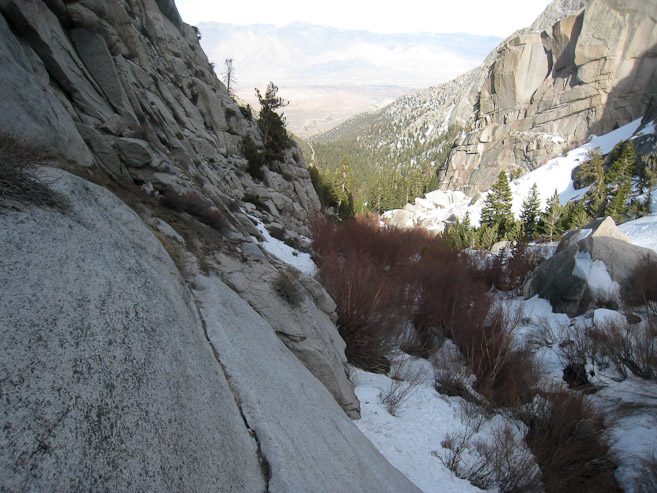
I had intended to take the willows route, but found myself back on the ledges. Adam said there was really only one way down the ledges, so it shouldn't be too complex to keep the trail. I had ascended it yesterday, and decided to try my luck descending it. This is the standard route, after all...
I recognized several exposed slabs, and worked my way down. These pics are from the most exposed sections...
Just below the area from the pics above, I got confused. I wanted to head down the ledge, but there was a log barrier (1st pic below). I looked back up the route I had descended, and remembered that part from yesterday, and tried looking for a different way down. I ended up going past the log a bit, wondering if we had actually come up past it, and this might be part of the trail. Eventually I got cliffed out, and had to retreat. I spent ~15 minutes back and forth, wondering if I would have to climb back up to Lower Boy Scout and camp the night, until I could follow some other hikers down. Then I finally came to my senses, and realized the trail blockage was meant to be seen, and that the trail must head in the opposite direction. When I pursued the trail down the opposite direction, I found myself descending easily. Not sure why I didn't see it originally. I'm usually good at deciphoring trails. Anyway, I was glad to be moving again, and relieved/victorious at solving this ledge puzzle. It's true, "there's really just one way down the ledges", you just have to find it. :-)

If you see this ledge with a log laying across the path (1st pic), turn around and head in the opposite direction down the ledge. If you go past this log blockage, you'll get cliffed out (2nd pic). This was the only confusing part of my descent...
The snow on the trail alongside the ledges was toughening up and slippery. I found myself on my butt frequently. This was more frusterating than the climb up this morning.
This pic (1st pic) almost looks like a cliff out, but it's the narrow "Elephant's Ear" section. There's a 4-5 inch flat part, if you look closely at the crack, and room to lean to the left against the rock as you cross. Shortly after the "Ear", I was off the ledges, and grabbed some water from a stream...
After finishing/solving the E-Ledges solo, I now had a greater appreciation for them. No longer were they a mysterious/forboding route, since I had figured out the puzzle, and next time it would be a delight in returning on them. It had felt like an intimate experience with those ledges, and I think of them fondly now. They add great character to the MR experience.
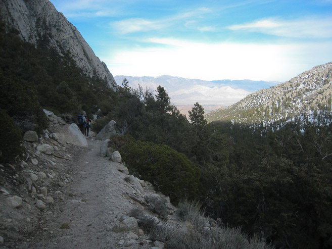
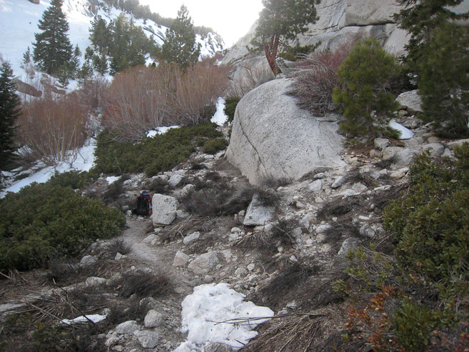
The main trail back was mostly dry, and in 25 minutes (since the ledges) I was back at the parking lot. My pack weighed 41 pounds. I lost 6 pounds since yesterday, despite having to carry back my WAG bags. Donating my fuel, and carrying no water helped...
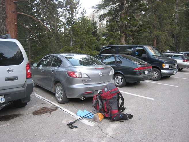
I grabbed my food from the bear bins, disposed of my WAG bags, and loaded up the car. Lots of people had bypassed the road closed sign to park at the trailhead...
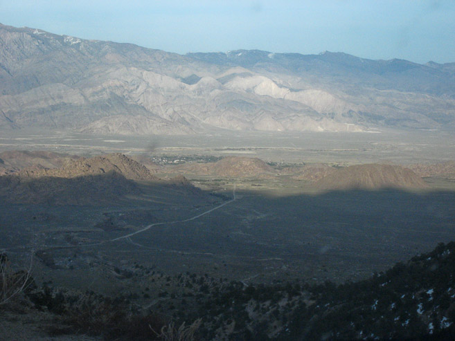
On the drive out, the sun was setting on the Alabama hills in the valley. A look back at Whitney from the Portal Road...
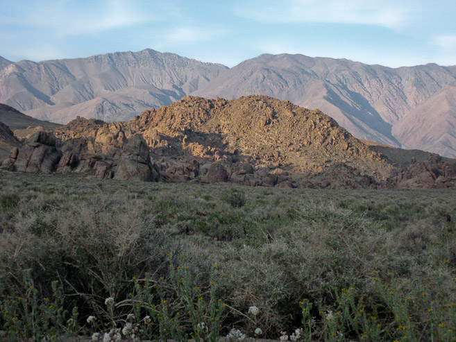
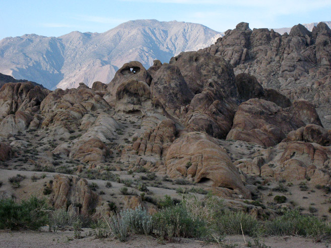
Before returning to town, I drove around the Alabama Hills. They were very scenic and expansive. You could spend days exploring them. Lots of movies are filmed here. There most be tons of high quality bouldering routes too...
I returned to town, and decided to stay at the hostel for the night. Doug wasn't in the office when arrived, but I gave the boots back to guy behind the counter, and signed up for a room. I ended up in the same 10 bed room from 2 nights ago, and I was the only person in it tonight. Wow, $22 for a 10 person room, with bathroom, all to myself! Good deal! I headed up to the room, started downloading pics from the trip, and took a hot shower. When I returned to the community room, Doug was there, and I filled him in on events, thanked him heavily for borrowing his high quality boots, and promised to show him pics after I grabbed some dinner. I returned with a Subway footlong, and spent the evening viewing pics with Doug, who enthusiastically supplied all sorts of stories and route variations as each pic triggered memories from his vast experiences on Whitney. Doug used to make weekly MR reports over a large portion of his life, and has climbed the route more than any other person (several hundreds of times). He also owns the Portal store at the trailhead, which is a popular place to order a burger when finishing a hike (it's not open this season as of yet). It was a treat to spend some quality time with this legend of the Sierras, and friendly/generous man, who saved my Whitney experience by loaning me his boots.
My experience at Lone Pine and Whitney will always be speicial, but not based on the mountain alone. The enthusiasm and support from all the people I met on this trip will leave me with warm memories of a passionate Sierra community that welcomed a stray Coloradoan into their adventure. My hat is off to Richard and Mike for going the extra mile to not only lead a group of 20 variously-experienced mountain loving adventurers on a trip of their lives, but also making it super fun for everyone, and having lots of fun doing it. I hope to capture that feeling in this journal.
Apon further thought, Mount Whitney is a fantastic peak. The MR route offers so much variety that you don't notice the killer elevation gain (ok, maybe that's a stretch). The trek has multiple theme parks: 1. Portal Land - Easy dirt trail from the trailhead through the scenic forest, up some switch backs, leading to the ledges. 2. Ledge Land - Some exposed scrambling up the ledges. Intimidating slabs, but straight forward. Convenient to follow someone with experience the first time. 3. Lake-hopping Land. Climb from Lower Boy Scout, to Upper Boy Scout, to Iceberg. Each lake is ~1000' per hop. 4. The Chute - 1500' slog up the chute from Iceberg, leading to the notch. Fun in the snow. 5. Final 400' - A high quality scramble to the summit. Not for the feint of heart.
No doubt I got spoiled by the favorable weather. These conditions were probably as ideal as they get. The MR route is also popular in the summer, but requires dealing with a lot more rock/tallus/scree. Still it's far shorter than the standard class 1 (or 2?) trail to Whitney (8 miles vs 20 miles).
If you're looking for a place to stay before/after the hike, the Whitney Portal Hostel is a fine budget place. Beds go for $25 (tax included) in the summer of 2010. They have a store with gear, maps, and info. Hopefully you'll get a chance to meet Doug there too. For more info on Whitney, hiker forums, and the hostel, go here: http://www.whitneyportalstore.com/ , and click on the Message Board.
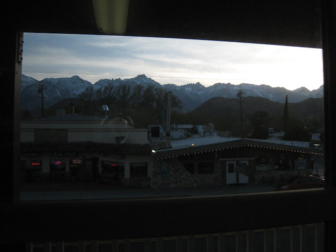
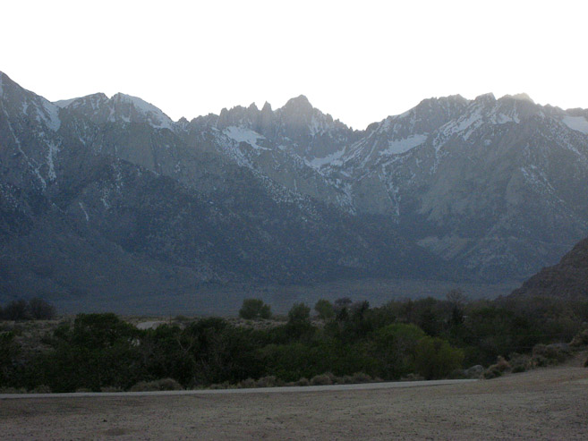
From the window of my room at the hostel, I gaze upon Whitney, where I stood earlier today...
Thus concludes a successful Whitney experience. I was fortunate enough to meet up with Nick, Wes, Mike, Holger, Corina (the pizza girl), and Doug again the following morning at the hostel to chat about the adventure and view some more pics, before finally starting the drive back to San Jose around noon. The 6.5 hour drive gave me plenty of time to re-live the past week in my head. If only they could invent a device to record one's thoughts while driving, I could have written this journal during the drive back...
I'm pumped up to hit the mountains back in Colorado this year. But I think I'll always feel a yearning every April, to re-visit the wonderful Whitney MR route. If I can't make it to the Sierra's in person, I hope re-reading this journal offers a sufficient fix.