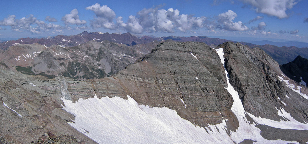
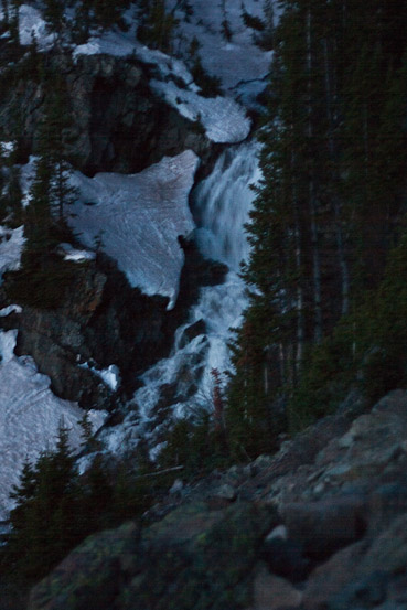
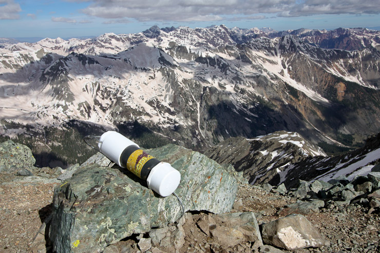
A pic of Conundrum from Aug 6th, 2005, with the Maroon Bells in the distance. This would be our target almost 5 years later, on June 5th, 2010 (in much snowier conditions)...
5 years ago this August, having just moved out to CO, Chris invited me on my 1st 14er trip, to Castle Peak. It was an eye opening experience to Colorado's colorful mountainous pallete, full of multi-colored rock, green vegetation in the valley, blue skies, and white snow. Drawing much attention across the basin from Castle sits it's little brother, Conundrum, 205' smaller than Castle's 14,265'. We didn't make it over to Conumdrum that August day (long before I became an obsessed 14er bagger), but I remembered Chris mentioning that he'd like to come back sometime, early in the hiking season, to make a snow ascent of Conundrum. I told him that sounded like fun.
A pic of Conundrum from Aug 6th, 2005, with the Maroon Bells in the distance. This would be our target almost 5 years later, on June 5th, 2010 (in much snowier conditions)...
Well, 5 years later, the weather, snow conditions, and personal calendars opened up an opportunity for us to return to Castle Creek trailhead to fulfill this plan. Rather than take the dramatic Conundrum Couloir (which dangles a massive cornice 600' above a 45-50 degree narrow shute), we planned to ascend the broad saddle between Castle and Conundrum.
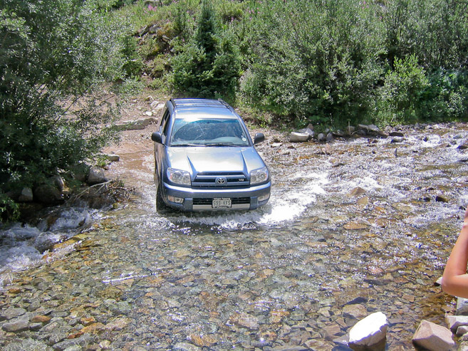
The big question on our mind was how far up the Castle Creek 4x4 road we'd be able to drive before reaching the snow. Reports of heavy snow drifts just beyond the 1st stream crossing had us resigned to accepting the extra 2 mile and ~1000' of gain we'd have to hike, to reach Pearl Pass (our parking spot the last time we were here). But a weeks worth of extremely warm temps gave us some hope that we'd be able to drive there. During our drive to Aspen, we observed massive streams and run-off pouring down the mountains, and realized that regardless of the snow conditions on the road, the stream crossing would likely be too fierce to drive through.
Sure enough, when we arrived at the trailhead (after a stop at McD's in Aspen for dinner) and reached the stream crossing (about 1 mile up the 4x4 road), our assumption was confirmed. The stream was a white water rapid! So we parked just below, in a pull-out, and spent the night in Chris's Fourrunner. The alarm was set for 3:50am, hoping to be on the trail by 4:15am.
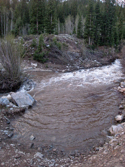
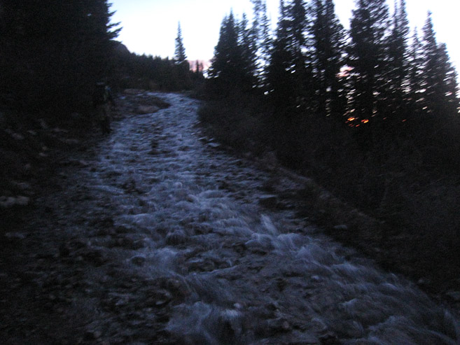
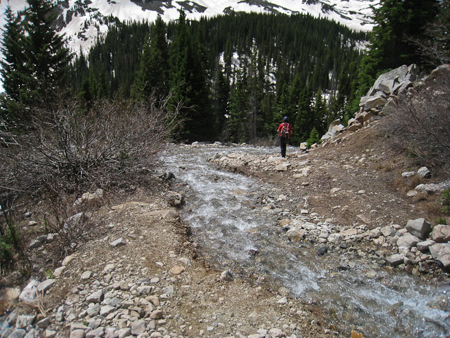
A look at the gushing stream that blocked our drive up the 4x4 road. The 2nd pic shows the same stream in Aug 2005. The massive melting over the past week was highly evident...
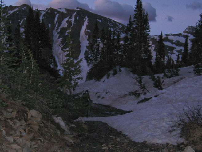
We both slept pretty poorly. I got ~2 hrs sleep, but such is the norm on a first night in the mountains (especially sleeping in a car). When Chris woke me up from my brief moment of quality sleep, I didn't need to think twice about wanting more sleep. The mountain awaited. The stars filled the sky, and it was modestly warm out (~mid 40s), here at ~10,190'. Our packs were prepped last night, which helped get us moving on the trail at 4:21am, a couple minutes after a group of skiers had passed our car, heading up the road.
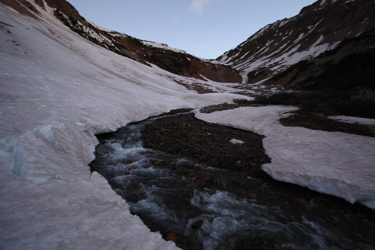
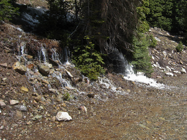
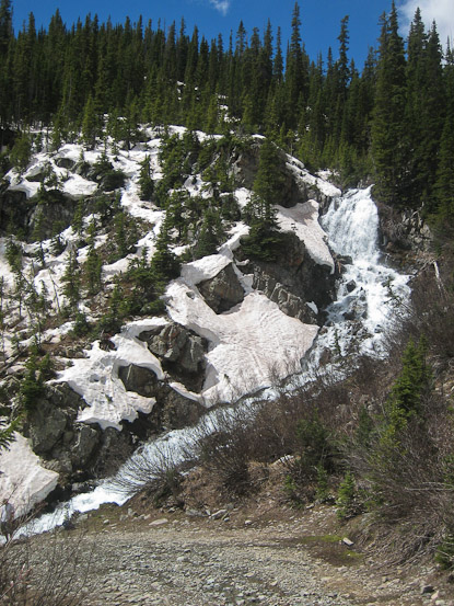
After crossing the stream on a bridge, we followed the wide 4x4 road through the forest, and in a few minutes, encountered a large snowbank that would have stopped our progress, had we been able to ford the stream. The road alternated between snow and dry. Some vehicles had made it another ~.5 miles past the stream. We passed a roaring waterfall on our way to Pearl Pass, where I recognized our parking spot from 5 years ago. Just beyond Pearl Pass, the road turned into a stream, as all the snow melt poured down the slope. It was like a main water pipe had broke and flooded the mountain. We would have to rely on the waterproofness of our boots today (of course, that was a given, since it's a snow climb).
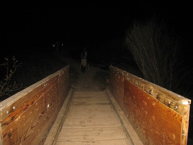
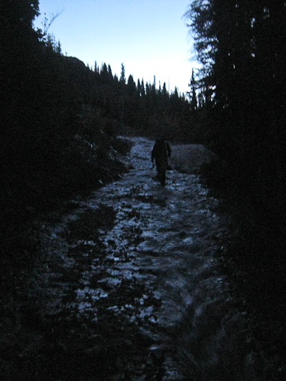
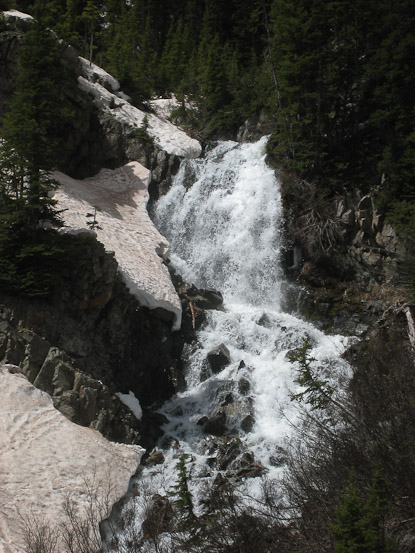
We cross the foot bridge over the stream at the start of our hike (4:21am). A look at a high volume waterfall in the pre-dawn light...
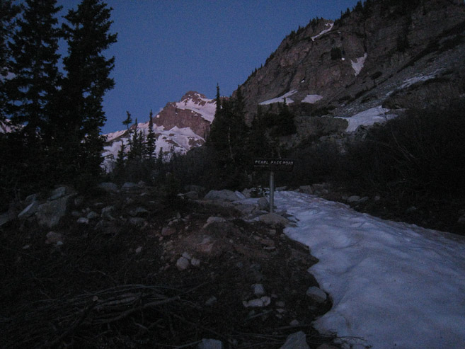
We reached Pearl Pass at 5:10am, ~1 mile and ~1000' of gain from our parking spot below the stream. Soon after, the road turned into a stream...
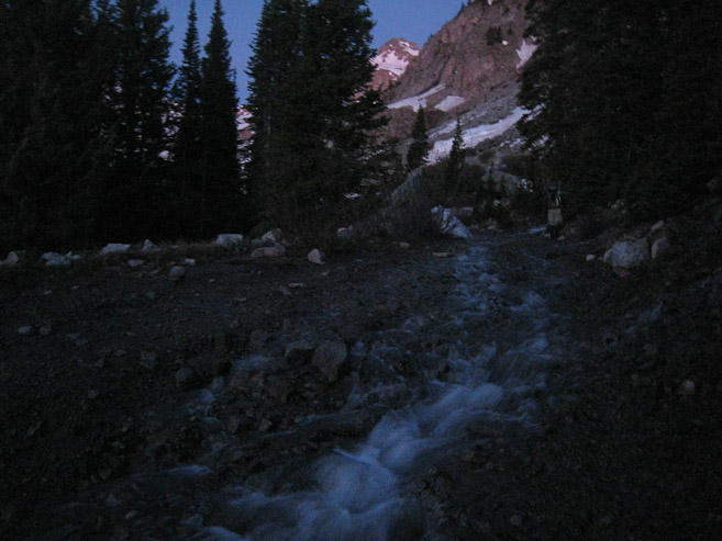
More pre-dawn pics of the water flowing down the 4x4 road...
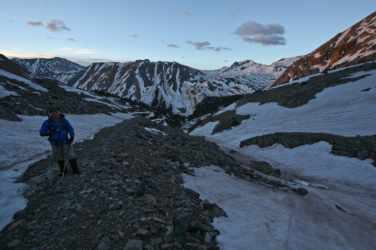
A look towards the horizen at 5:20am, 1 hr into our hike. Sunrise would be ~5:45am today...
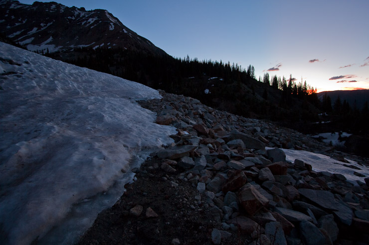
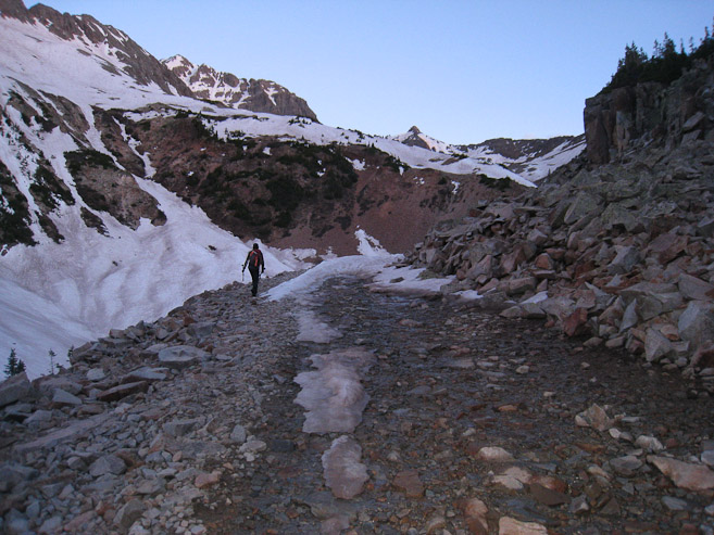
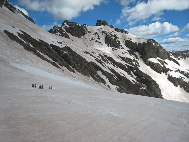
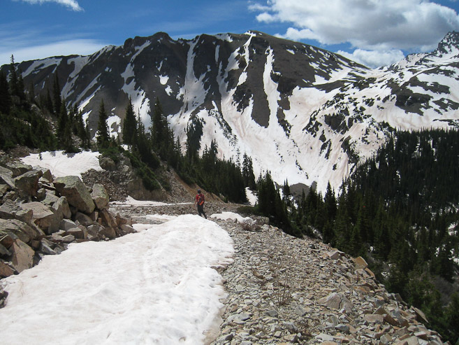
Large amounts of snow began to appear on the road. We walked along the bare edge where we could, and headed up towards the basin on the right side of the pic...
We encountered more water on the road, including this couple inch deep stretch. Chris takes a pic after I reach the other side of the water...
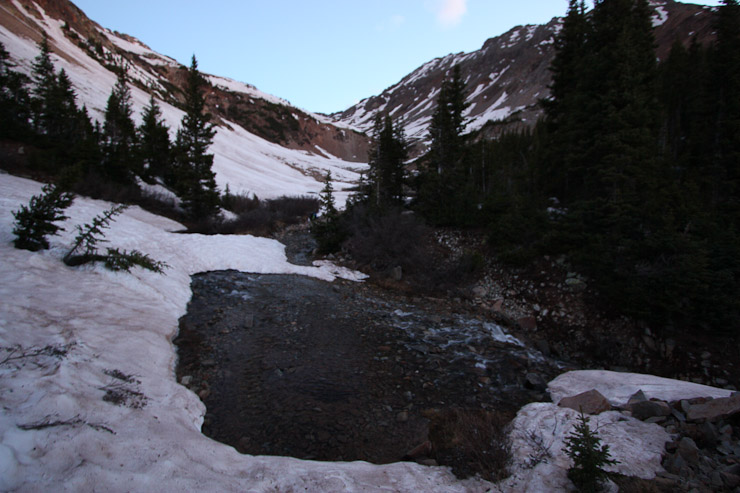
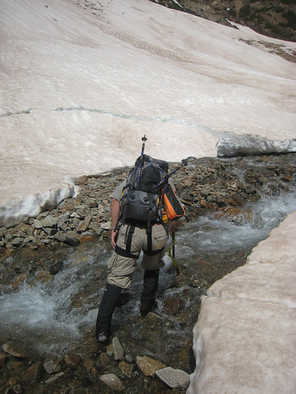
Further up, we had to cross a stream, where a snowbank was cracking, which made us evaluate the best way to cross. I hike up along the dry side of the road (2nd pic by Chris)...
The road led to a broad snow field, an obvious work of an avalanche. A look back at Chris from this same spot...
Chris takes a pic of me in front of the snowfield (pictured above), before we crossed it. The snow wasn't frozen, but was hard packed enough to offer easy footing...
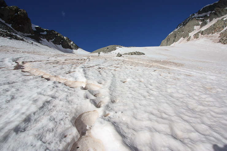
The road disappeared under the snow often. Most of the time we were able to pick it up again in a short distance. The fact that there were no footprints to follow was surprising, give the activity in the area last weekend, and no new snow. It made us work harder at trailfinding. It meant we were the first on the trail today (having passed the 3 skiers early on).
Chris reaches the rocks above the snow on the left...
A look back at me, climbing along the edge of the snow... (pic by Chris)
On one occasion, I led us up the "road", only to discover that we were off course, heading to an old mine. It cost us an extra ~100' of gain.
Chris backtracks down the false path, before we picked up the correct trail heading to the right...
Following the road was kind of annoying, due to the frequent snow slopes that required us to kick flat steps in the fairly solid snow. None of the snow slopes led to danger, and the snow was soft enough to generate friction, but it still required some effort to avoid slipping. Poles were helpful today...
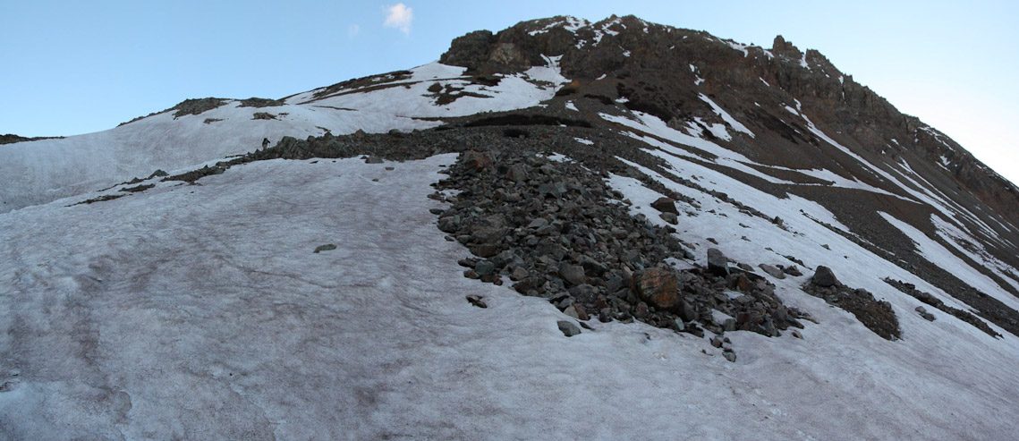
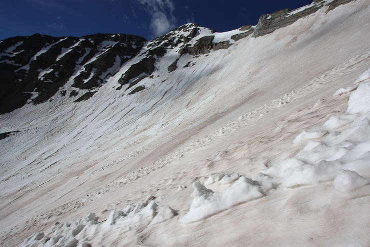
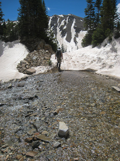
Finally the end of the road is in view, at the basin's entrance...
Prior to reaching the basin, we had to cross the longest stretches of snow slopes so far. I went slow, kicking in solid steps. Overall the hike up the road wasn't too pleasant (if I'm being very picky), considering all the water and snow slopes, but we managed a good pace, arriving to the basin (~12,500') at 6:50am, 2.5hrs since leaving the car.
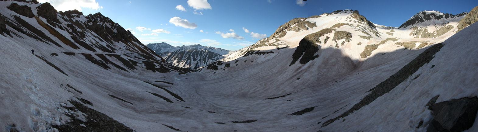
Looking back at the final large snow slopes to cross before arriving at the basin...
Chris arrives on dry ground at the bottom of the basin (6:53am)...
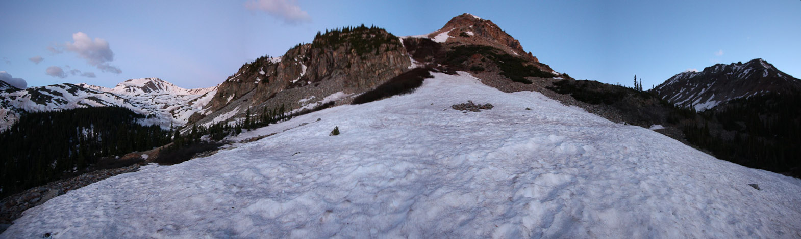
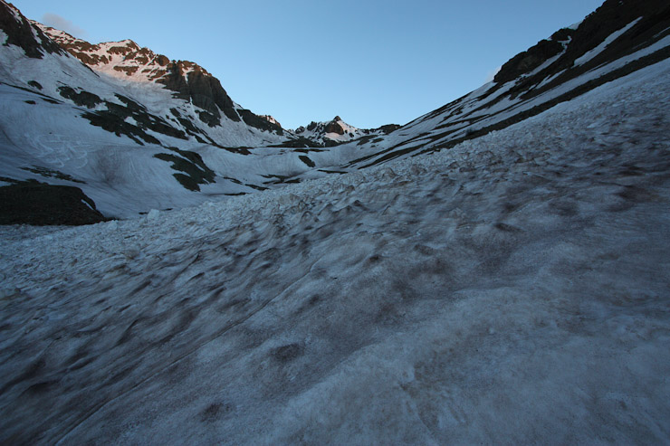
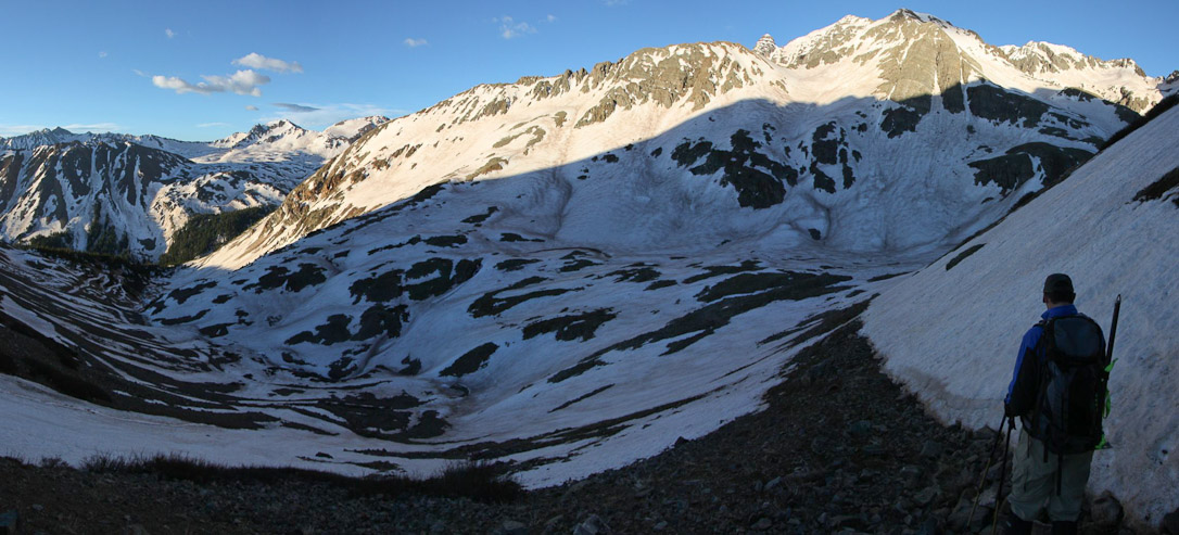
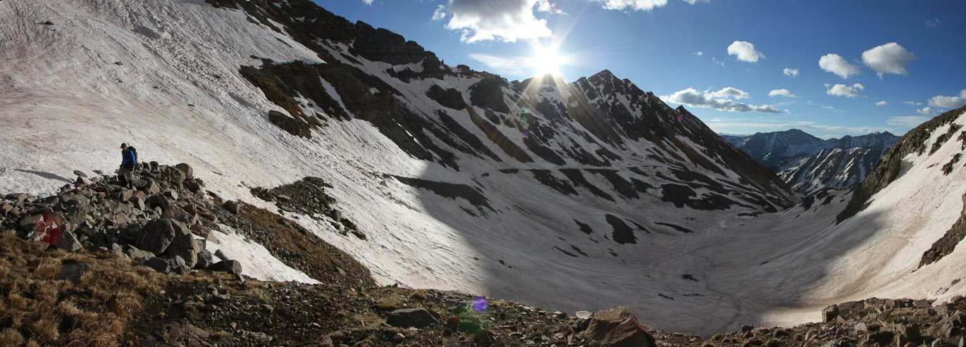
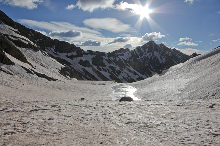
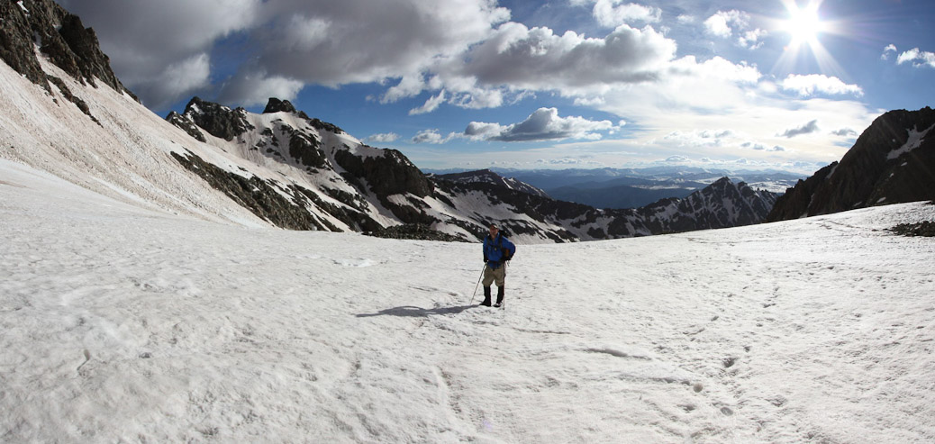
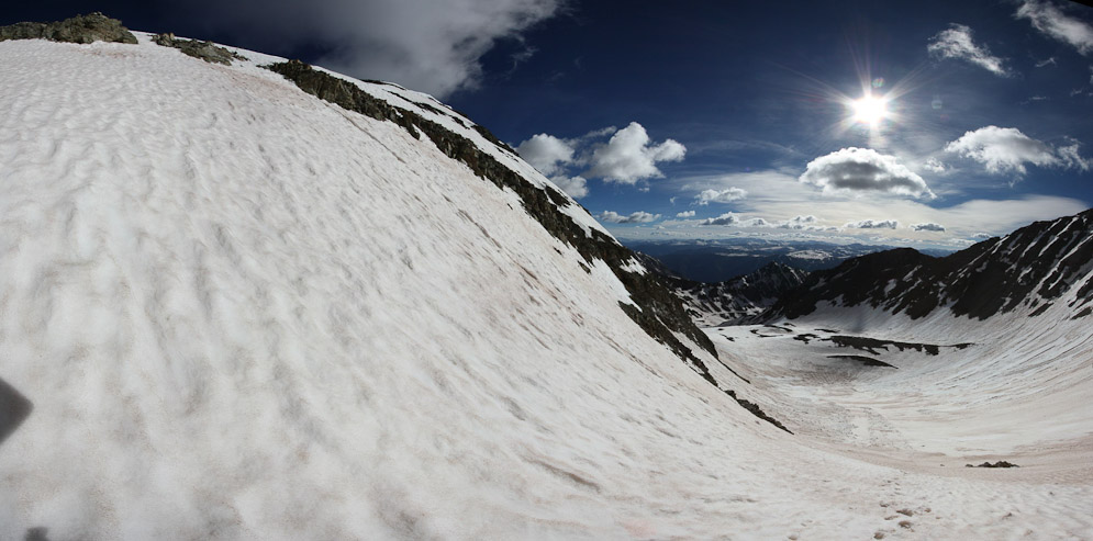
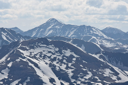
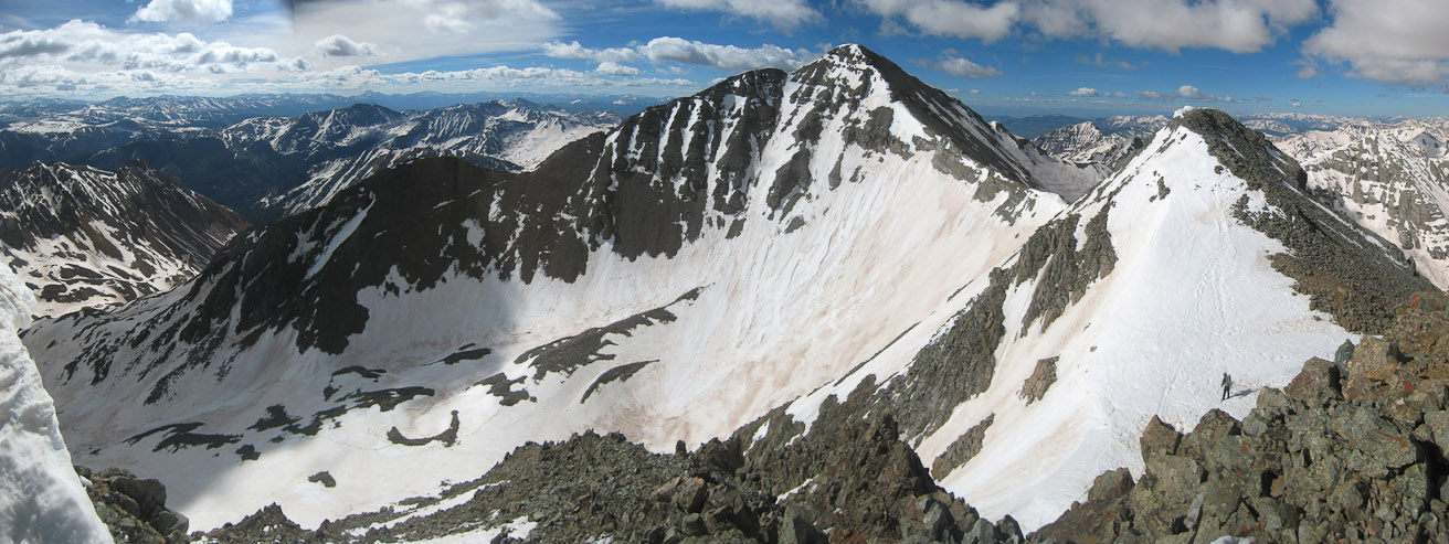
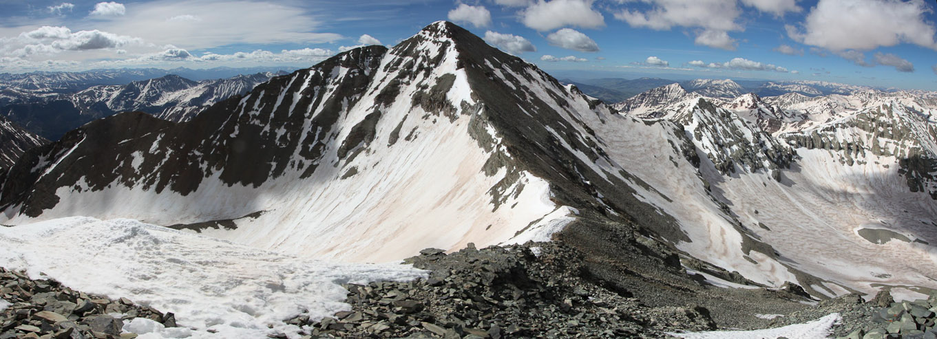
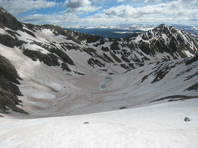
A look up from the bottom of the basin, with Conundrum in the center. It would be all snow the rest of the way...
We paused for a brief moment here, reflecting that NOW the fun part of the climb would begin. SNOW! And not the sidways slanty kind on the road... We'd already covered most of the distance, and ~2400' of gain. The remaining ~1500' was the reason we were here. After re-applying sunscreen, and taking a snack, I followed Chris up the snow. The first few steps were terribly soft and post-holey, but then the snow held firm enough under our boots.
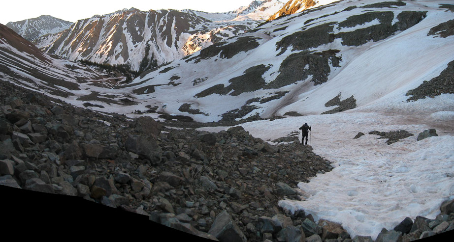
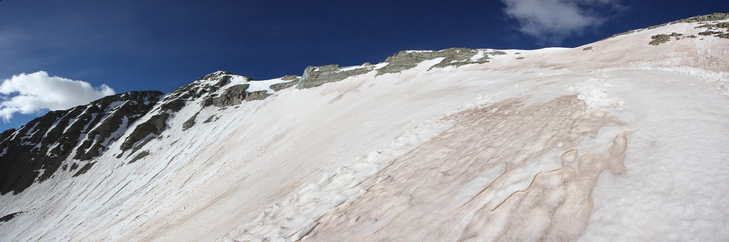
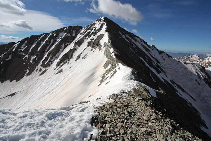
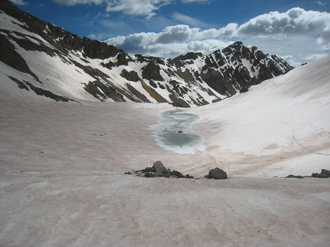
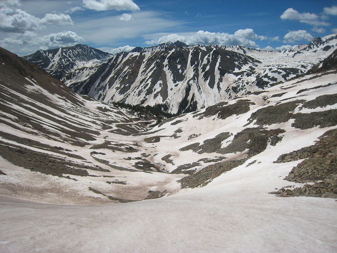
A better look up the basin, from just above the bottom lip of snow. We would be hiking up to the saddle, left of center...
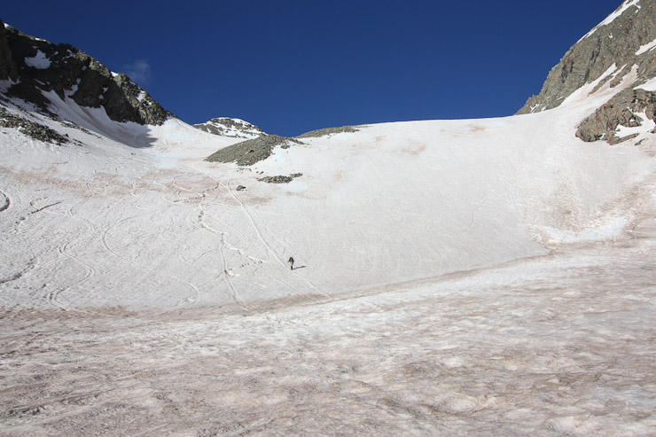
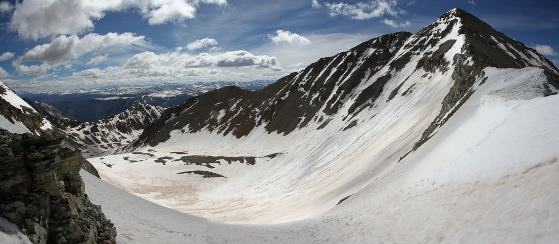
Chris led the way, and followed some tracks up the left side (less steep than the right). A look back down the lower basin...
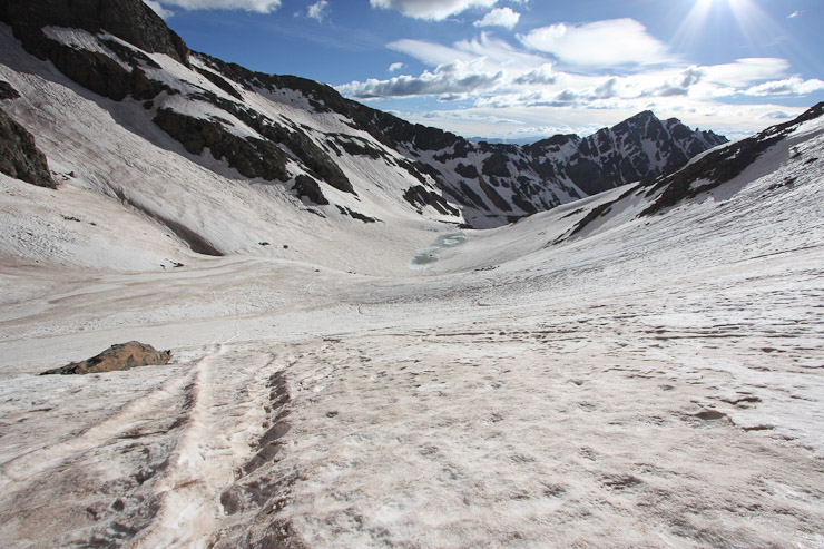
A look up and back as I climbed to the upper basin...
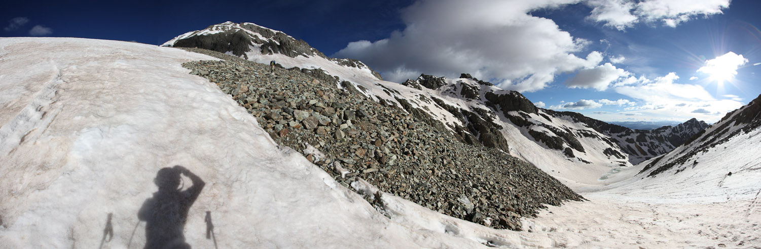
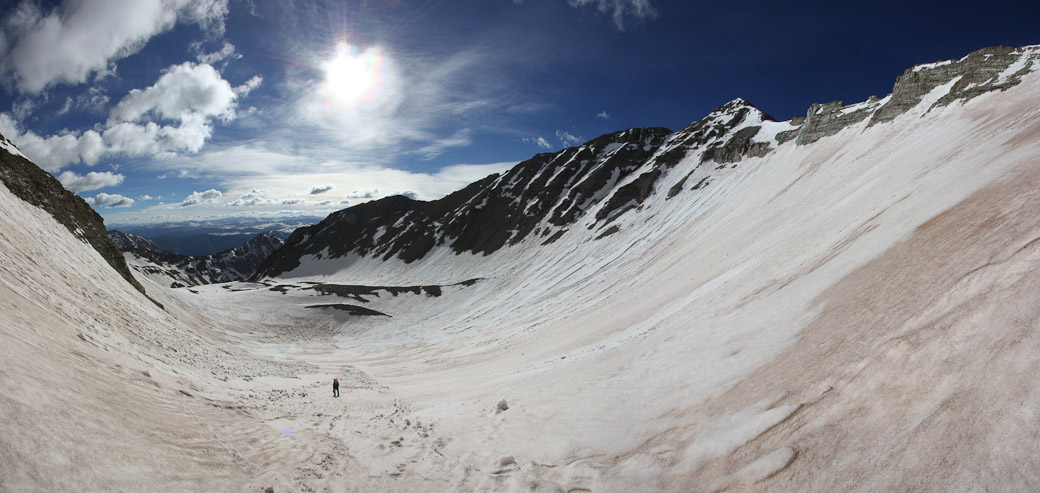
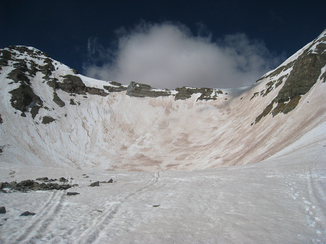
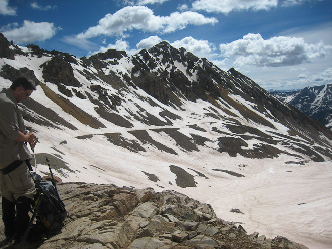
A wide look near the lip to the upper basin. We cut across the rocks, towards Conundrum...
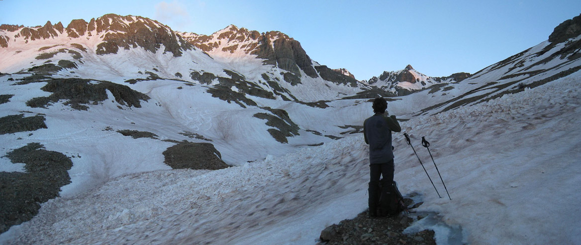
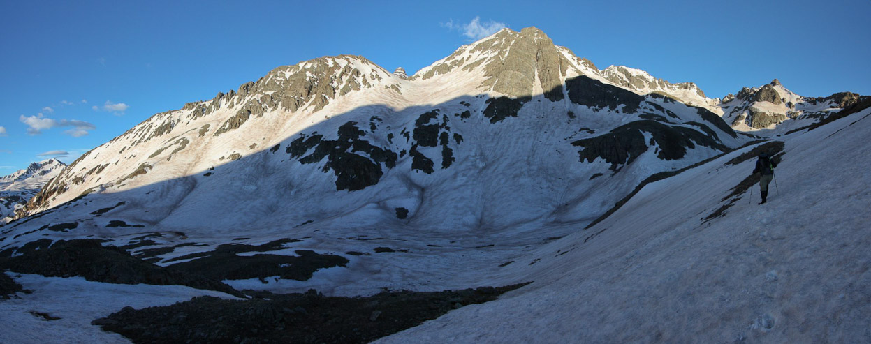
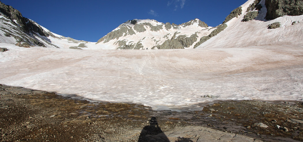
The snow was soft enough for us to dread the inevitable post-hole, but fortunately we managed to avoid sinking deeper than a handful of inches at worst. For the most part, the snow was packed enough to make for a pleasant climb. We arrived at the upper basin ~7:35am, where I spent awhile taking pics of Castle Peak. It was here that we decided to put on our crampons for the remainder of the hike, as the slope would steepen towards the saddle.
Chris stands at the opening of the upper basin...
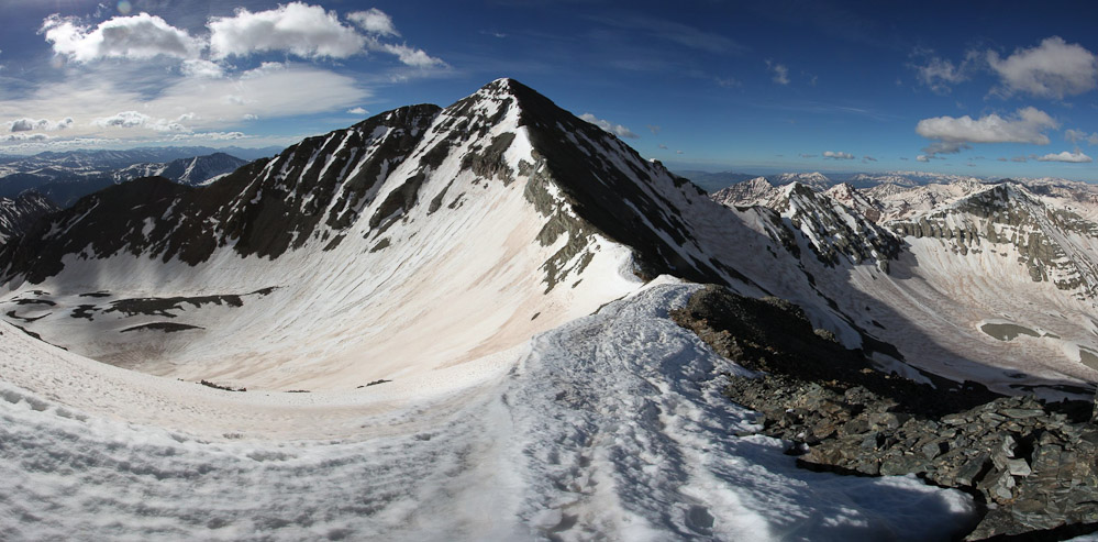
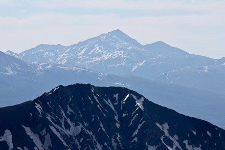
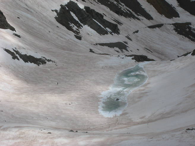
Castle Peak stands magestically across a sinkhole in the snow...
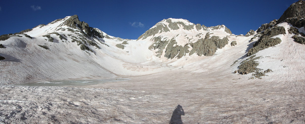
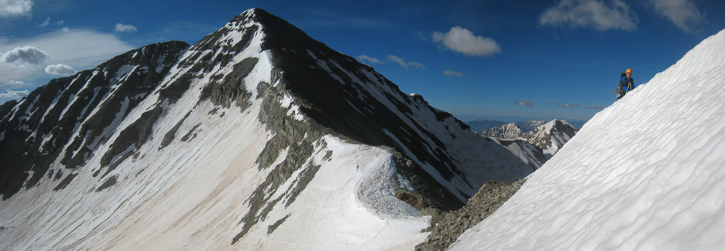
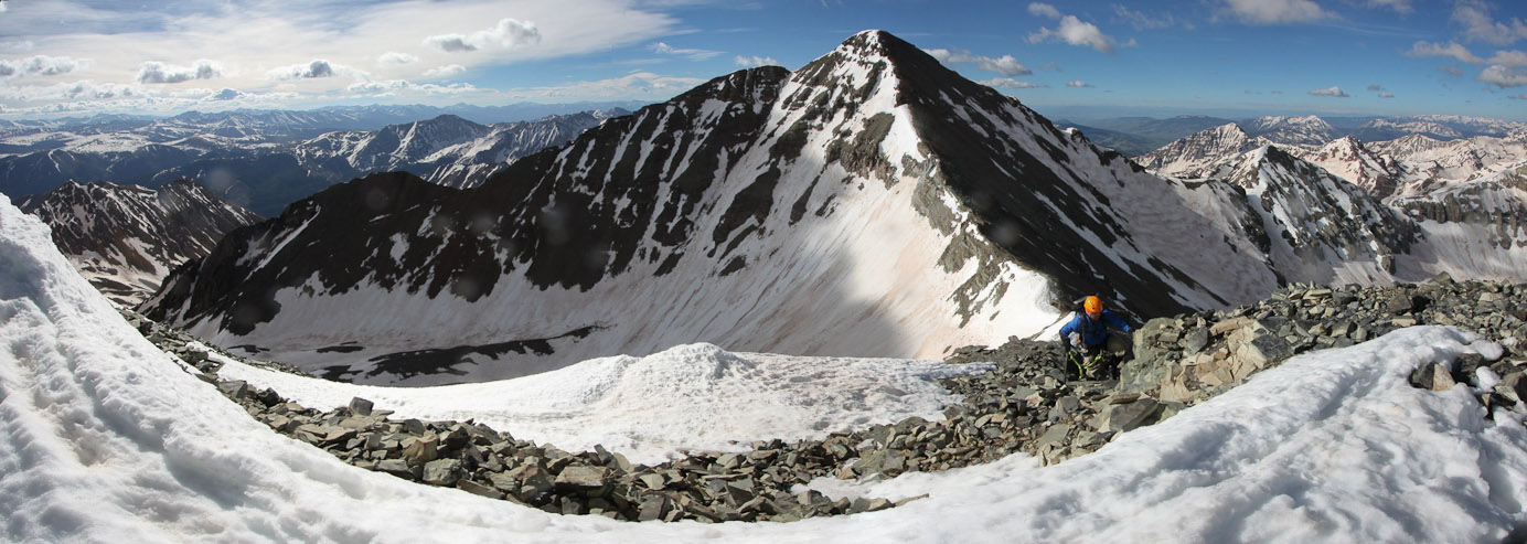
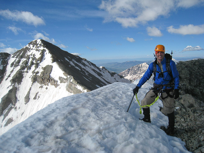
Chris puts on his crampons. Castle on the left, Conundrum on the right. We'd be climbing up the saddle in between, and ascending the ridge to Conundrum...
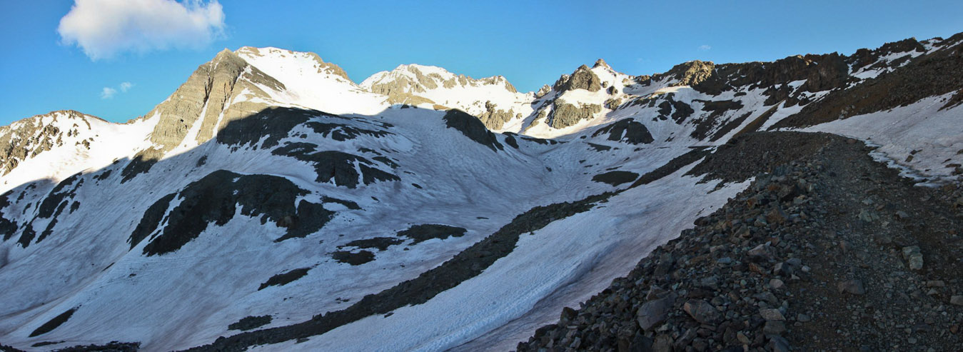
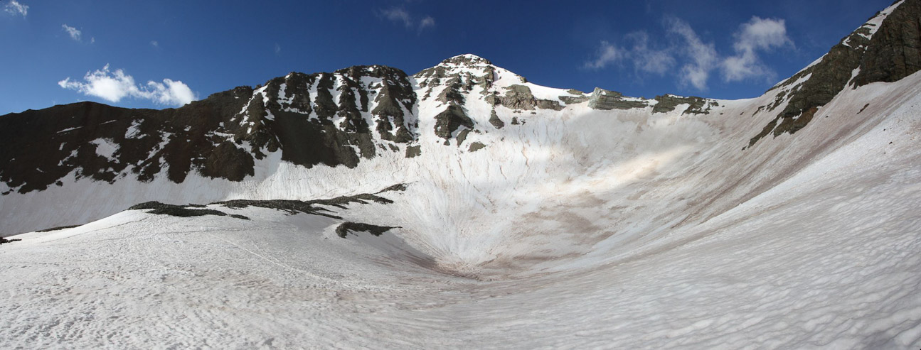
As we crossed the basin, we passed under the Conundrum Coulior, and verified that the massive cornice was still hanging over the chute. Given the warm temps and soft snow, we didn't want to be near it today, and continued towards the saddle.
A look up at the massive cornice above Conundrum Coulior. There were some interesting snow formations (foreground of 2nd pic), as we headed towards the saddle...
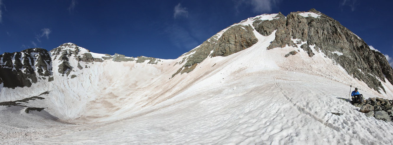
A look up the slope to the saddle, with Castle on the left...
A look back at Chris, and the upper basin. The snow wasn't hard, but crampons seemed to help a bit with the kick steps...
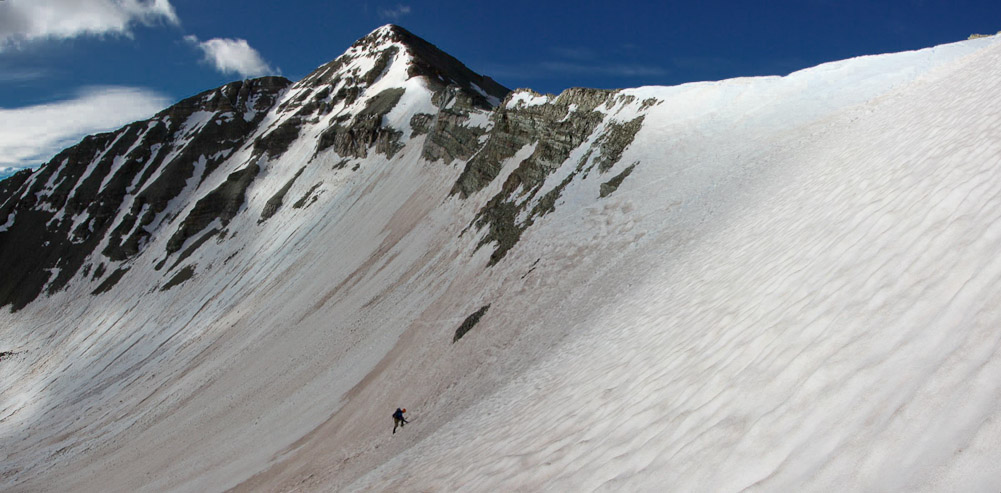
Chris approaches the steepest part of the climb, with Castle behind...
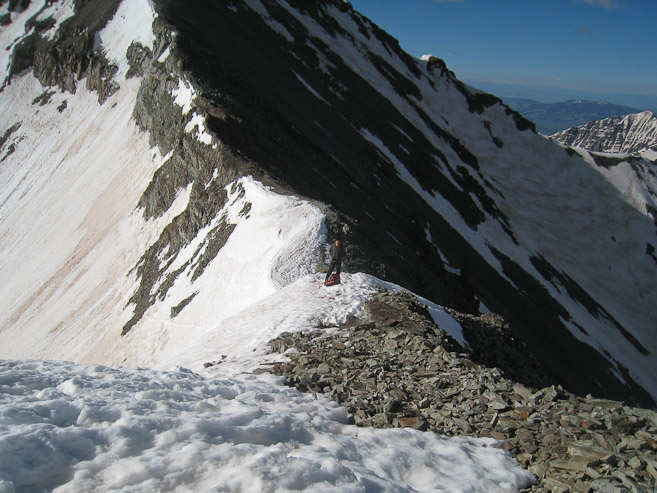
I aimed a bit further up the ridge, targeting the gap in the rocks up on the left...
I had a large head start on Chris, but ran into difficulties near the top of the ridge. The snow was super soft for the final 25', and I tried unsuccessfully to gain further ground. Chris meanwhile had ascended to the ridge near the bottom of the saddle, and had no problems gaining the ridge. I eventually stalled out ~15' from the ridge, and "waded" through the snow, traversing across til I caught the ridge further down, ~8:30am.
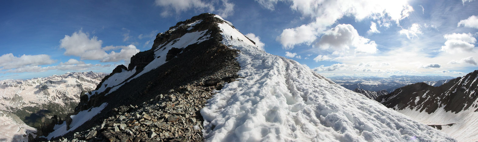
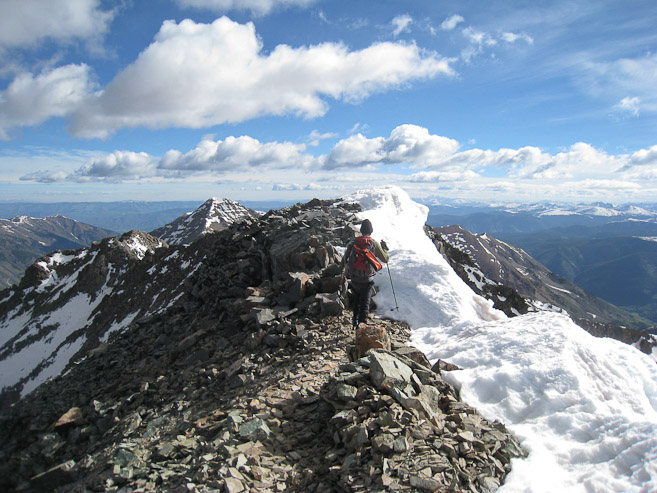
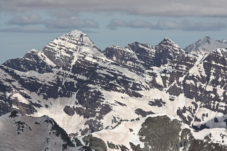
Once on the ridge, there was a mix of snow and rock. The snow became soft, and I recommended we stick to the rocks, which had a solid trail. It's always a little awkward using crampsons on rock, but we managed fine. There were a couple of easy class 3 moves, but for the most part, it was a simple climb to the summit. The wind was conveniently at our back, giving us a friendly push.
A sweet shot of Chris on the ridge, with Castle, while I was fighting the snow. I "swam" across and connected to the ridge further down. Chris gained the ridge where the rocks are...
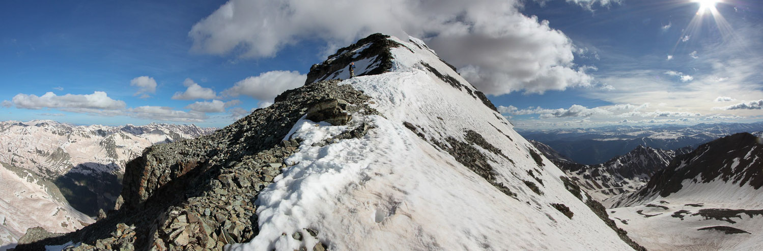
A look up at the ridge to Conundrum. There was a mostly dry path to the summit...
Another look up the ridge at Chris, a short ways up. We stuck to the snow for awhile, with our crampons, before it became too soft...
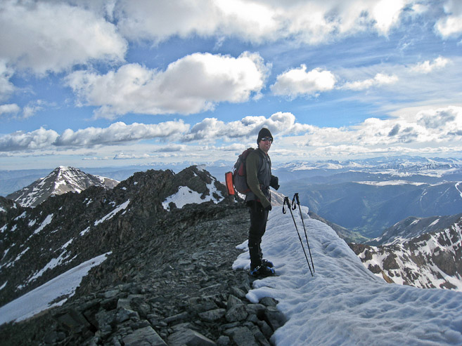
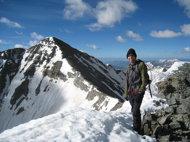
Chris gets a pic of me on the ridge. A look back at Castle... (1st pic by Chris)
At this point, we moved off the snow, which was soft and steep, and climbed the rock, which is part of the summer trail...
Looking back, after climbing the section of rock in the pic above. The ridge flattened out a bit...
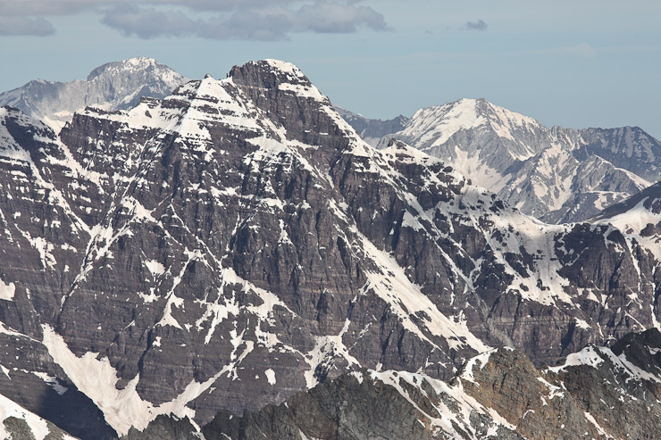
Chris is moments away from reaching the summit block...
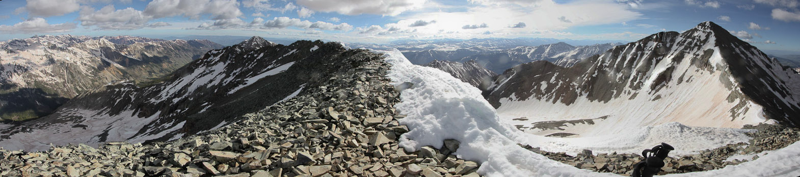
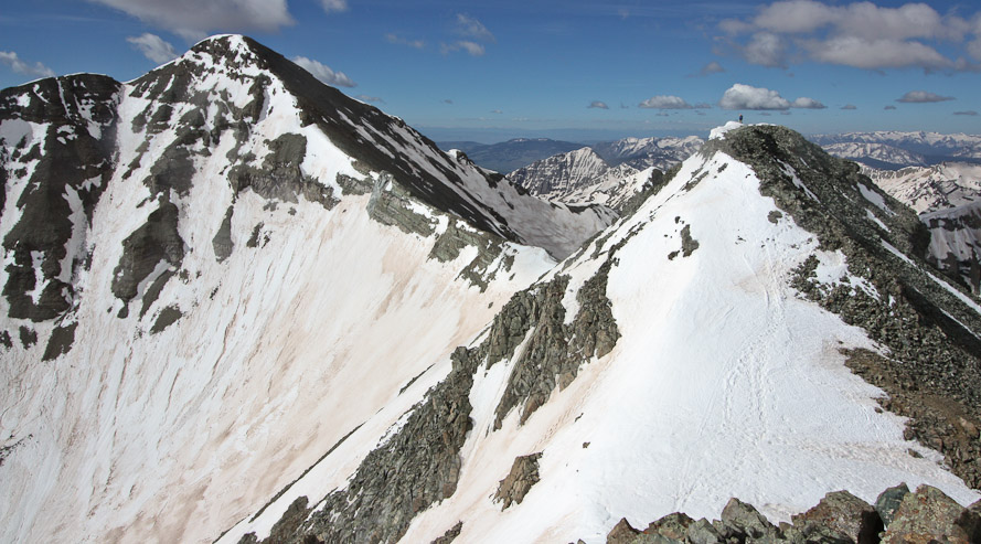
Looking east across the long summit block of Conundrum, with Castle on the right...
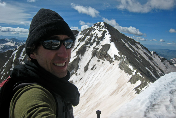
We reached the summit at 8:45am, under beautiful conditions. It was windy, but relatively mild compared to my mountain experiences over the past month. We took some summit pics, and then Chris made a call to his wife (he got better cell phone reception than me) before heading back down. I told him I needed a good 30 minutes up here to appreciate the view, take some photos, and relax. I also wanted to hike over to Conundrum's east summit, on the other side of the coulior. It's debatable which summit is "official". The maps list the west summit as "Conundrum", but the register is on the east (and it looks maybe a couple inches taller). I left my crampons and poles on the west summit, and scrambled to the east summit before Chris headed down, allowing for some photos of each other from across the gap.
Chris takes some pics of me reaching the summit...
Summit shots for each of us, with Castle...
The view of Castle and Conundrum's west summit, from the east summit. Chris is a tiny speck on Conundrum...
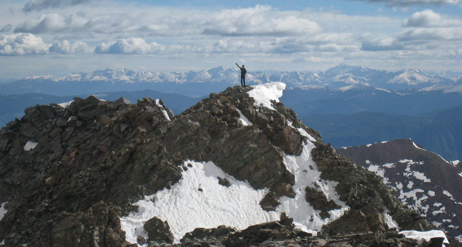
Chris takes a photo of me on the east summit, giving a thumbs up...
Chris started his descent, while I stayed on the east summit, taking pics, and feeling incredibly high (no pun intended) from this gorgeous setting. I decided to haul up my 2 lb. telephoto lens on this hike, given the surrounding beauty, and got to work taking pics. Despite the wind, I kept my down jacket in my pack, and made due with my icebreaker scarf (that thing works wonders!).
1st pic: The Maroon Bells (Snowmass makes an appearance on the far right). 2nd pic: Pyramid Peak (Capitol makes an appearance on the far left).
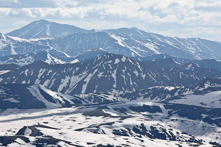
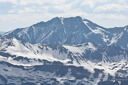
In order: Mt Elbert, La Plata, Huron.
In order: Harvard and Columbia, Yale, Princeton.
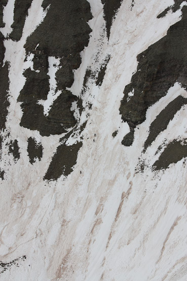
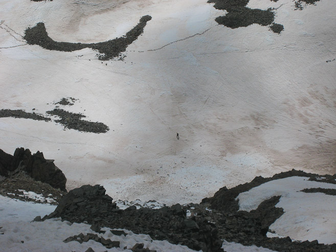
A pic of the summit register, with a 14ers.com sticker, and the Maroon Bells. Only 3 people had signed it in 2010! A close-up of some ants (hikers), climbing the north face of Castle...
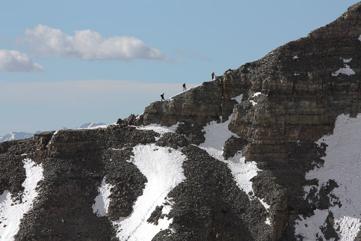
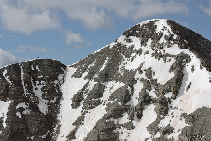
A close-up of some hikers on Castle's east ridge, followed by another pic later, when they are close to the top (really tiny ants)...
The weather was holding up beautifully, and this certainly was a magical spot. It almost felt tropical, with the ocean blue skies, scenic mountains, and golden sun. But after 40 minutes on the summit, I realized I better start thinking about the descent. When I edged over to return to the west summit, I saw some skiers in the gap, who had just ascended the coulior. On my way over, I asked them how the conditions were, and they said there was some rockfall, including some sizable chunks, and that they ran into a deep snow pocket too. I guess the warm conditions are making this route unstable (especially on warm mornings), so be careful if attempting it. There's also the wicked huge cornice to contemplate. They asked how the ridge to the saddle was, since they didn't want to ski down the coulior. I told them it was in good shape. When I got back to the west summit, I could see Chris down below, walking across the upper basin. After a few more pics, I started the descent at 9:38am, after over 50 minutes on the summit, leaving my crampons in my pack. Snow descents are always fun!
A wide view from Conundrum's east summit. I found out I had company, when two hikers appeared at the top of the coulior...
A self portrait with Castle, on the west summit...
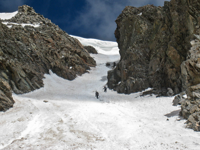
Chris walks across the upper basin, in this view from the summit. Chris was surprised to find hikers climbing the coulior at 9:30am. That cornice still looks scary. Turns out they were successful, since they posted a trip report online later... (2nd pic by Chris)
I work my way down the rock, which was much easier without crampons on. I made quick work of the ridge...
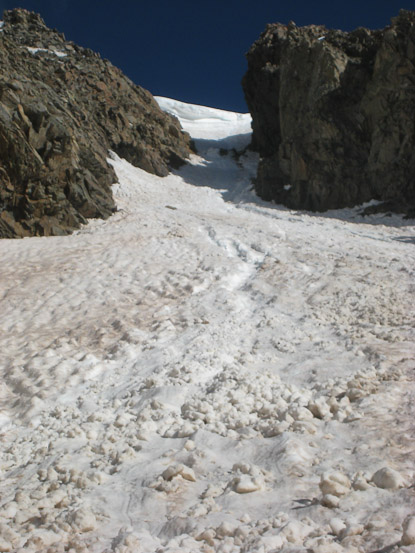
In 9 minutes I was at the saddle, starting my plunge stepping descent down the cushioning snow...
A look back at the saddle we descended. I peered up the coulior on my way back, again impressed with the sizable cornice. Chris later told me about the hikers he saw going up there. I hoped the conditions would be ok, given the sketchy report from the earlier hikers... (1st pic by Chris)
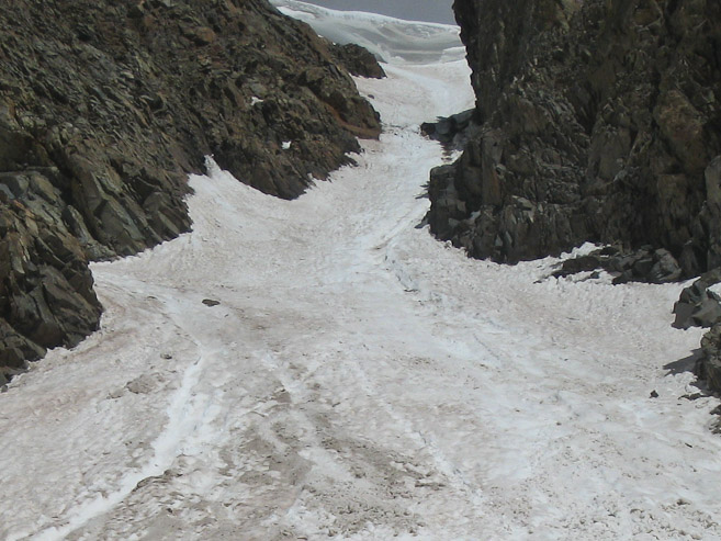
Snowshoes weren't needed on the trail today (at least during time we were on the trail). Some hikers stashed theirs in the upper basin. In 12 minutes from the top of the saddle, I reached the lip of the upper basin, and decided to take the shorter, steeper, left side down...
I could see Chris (the speck) in the lower basin. After a joyful run down the slope, I jogged parts of the lower basin, determined to catch up with Chris as soon as possible...
In 10 minutes from the upper basin, I reached the rocks at the end of the 4x4 road, where Chris had been waiting for a few minutes. I made it from summit to 4x4 road in 31 minutes. Man, I love speedy descents. We were both pumped from such a great snow climb, with gorgeous weather. I wondered how much more melting occurred on the road in the past few hours? Time to find out...
We started down the 4x4 road, passing the slanty snow slopes, at 10:10am. The hike was fairly uneventful, though we did lose the road under the snow once, and caught up again later (2nd pic from moment we realized we were off route)...
A pic of me hiking down a dry section of road. A look down at the stream crossing with the caving snowbanks...
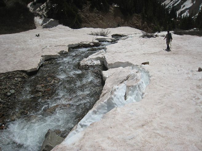
Chris crosses the stream. There were more cracks in the snow since early this morning. Wonder what it looked like by the end of the day...
More water along the road, and pouring down the mountain side...
A look at the road above Pearl Pass... (pic by Chris)
We had a better view of the gushing waterfall in the daylight...
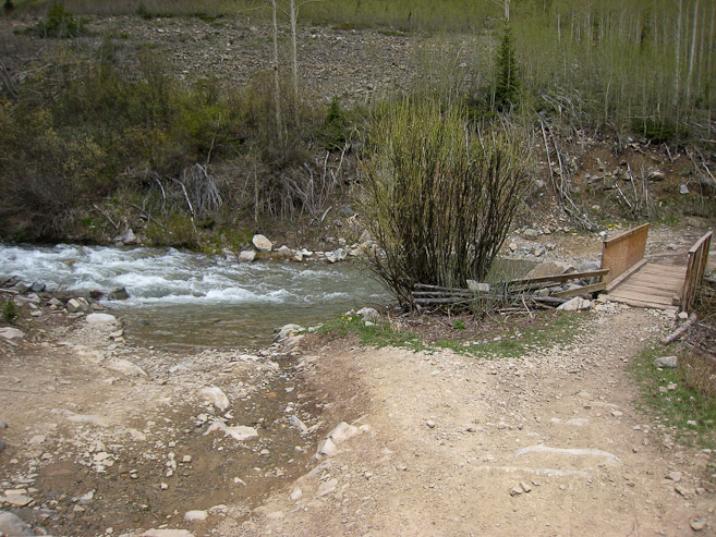
At the waterfall, there was a group of people inspecting the bridge, who happened to be engineers in charge of reconstructing the bridge. The current bridge still had the original base the miners installed (impressive construction to last so long). They planned to make a foot bridge, and redo the road bridge in a 2 day period this summer, before the 4x4 road opens all the way. Impressive!
We noticed 4-5 cars had braved the stream to park along the road before the snow got too thick. We crossed the stream, near our car, at 11:55am, for a 7hr 34min round trip hike. Total stats of 8 miles, with 4000' gain (including our extra 100' getting lost).

A look at the high volume stream. A few cars made it across today, though most choose to park before the crossing...
This marks 14er #30 for me, and what an enjoyable, memorable experience. Certainly Castle and Conundrum offer some of the most beautiful scenery in the state (among areas I've visited). Both my trips here have been spectacular. I'm glad we decided not to climb Conundrum on our 1st visit, which brought us back again to experience the area in a whole different environment.
Though the hike was over, my day was not done. I had left my car in Idaho Springs Friday in order to make a visit to Mt Evans later in the afternoon for some photos (it was "no road fee" weekend). I had considered climbing Mt. Spalding for some sunset pics of Mt Evans, but would have to see how I felt, and what the skies offered. On top of that, I also had planned to drive down to CO Springs in order to visit Pikes Peak for photos, and a potential summit attempt on the Crags. I had a lot to consider during the drive back to Idaho Springs. But that story deserves a separate web journal entry...