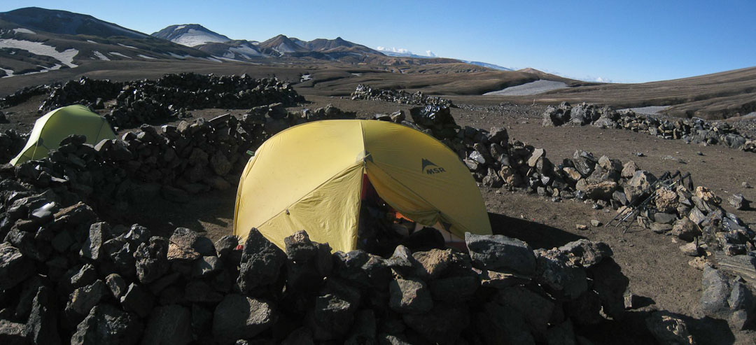
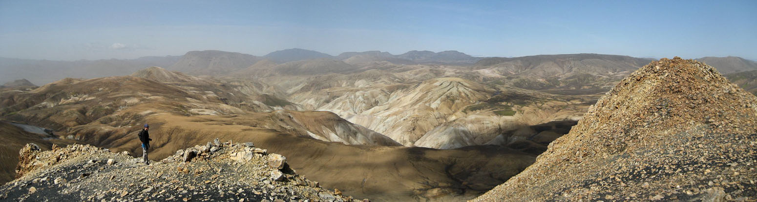
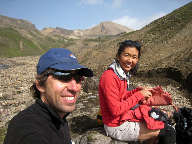
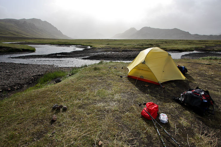
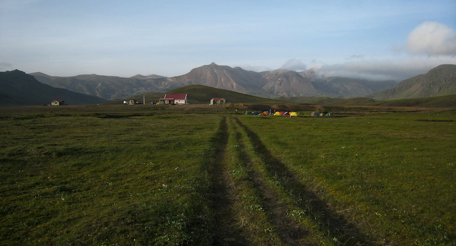
The view of our camp before breaking down the tent. The noisy neighbors are on the left (still sleeping in after their late night, no doubt)...
Hraftntinnusker to Alftavatn stats: 12 km, 4-5 hours, 490m loss
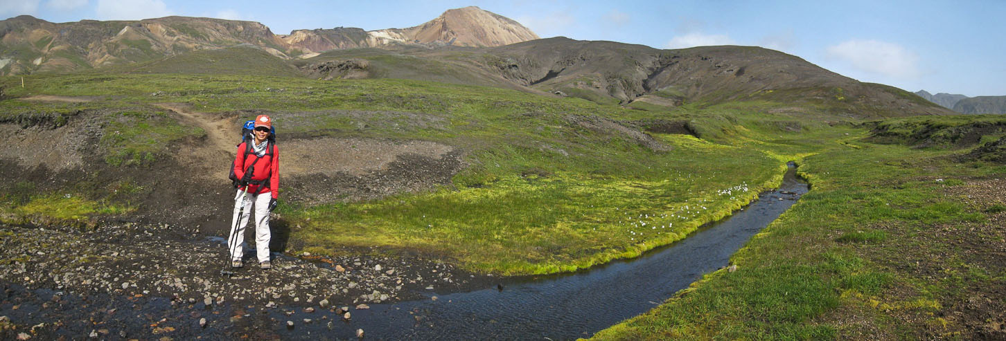
9:30pm, Alftavatn camp The noisy neighbors were annoying last night. I did some crosswords to try to sleep, but couldn't manage until ~11:40pm. Wendy wakes me with the 7:30am alarm, and we bring our breakfast supplies up to the hut to cook on a picnic table. It's the usual cereal blends, along with a dehydrated zuchini/sausage for Wendy. It's sunny and cloudless today! The weather has a large impact on my spirits whenever I'm hiking. We ask the warden about water availability, and he says there is none until the river crossing; Good thing we asked, cause we were thinking we could just fill up from streams all the way.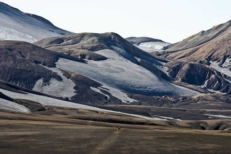
The view of our camp before breaking down the tent. The noisy neighbors are on the left (still sleeping in after their late night, no doubt)...
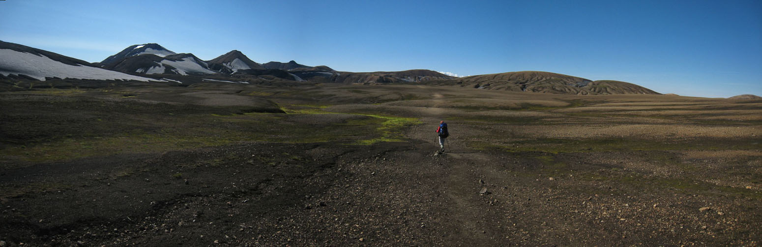
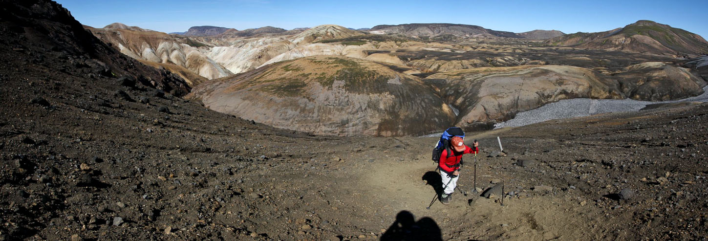
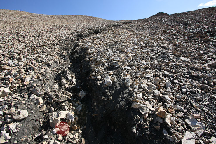
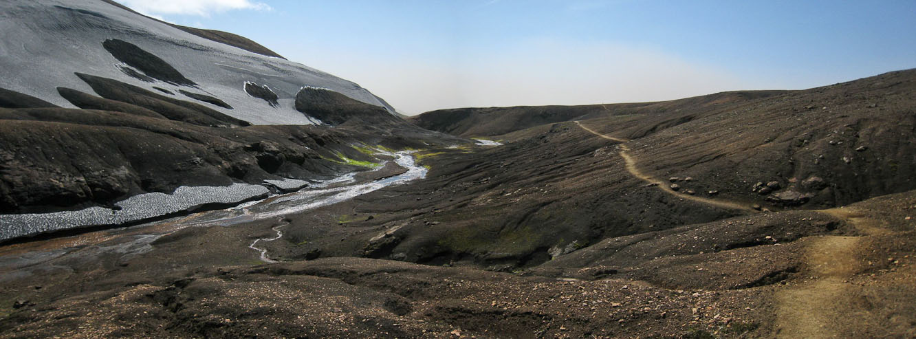
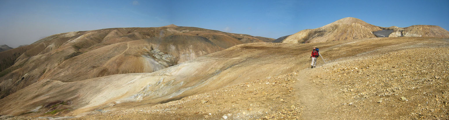
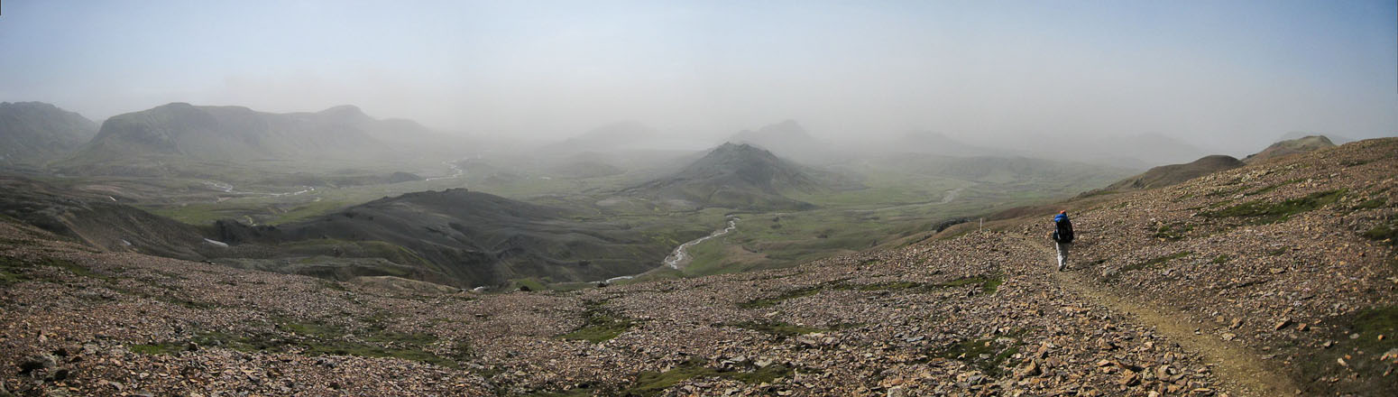
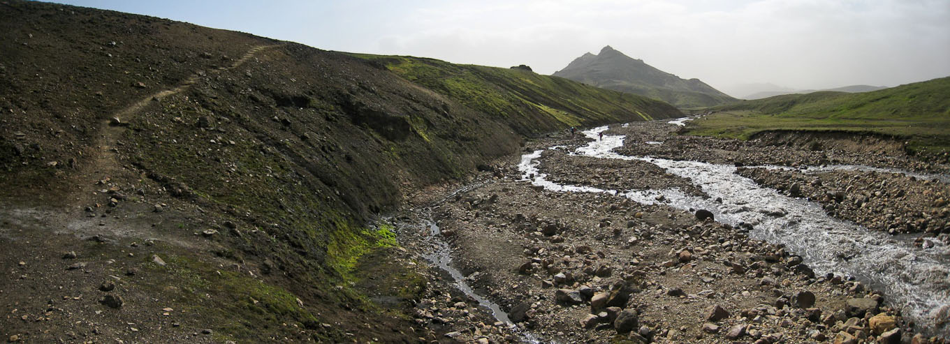
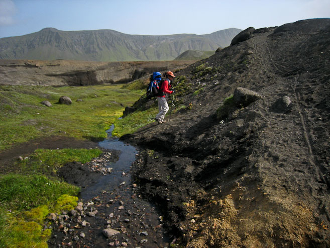
We leave camp ~10:10am, down the trail towards a series of ravines carved into the rocky/ashy landscape. Some of these ravines are deep and steep/slippery. We are careful to find the surest footing. The best footing occurs on "chocolate cake", a black sand/ash combo that gives like wet snow. The worst traction occurs on the compressed steep dirt with a fine layer of dirt/dust to get your feet slipping.
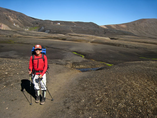
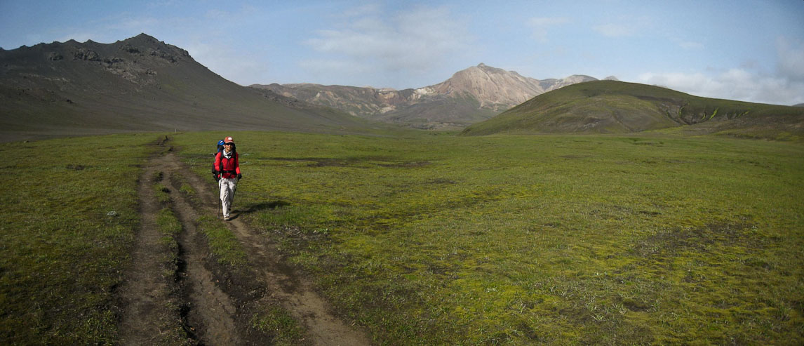
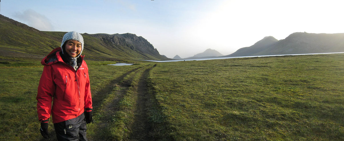
A look back at Wendy ~12 minutes into our hike, with the hut in the distance...
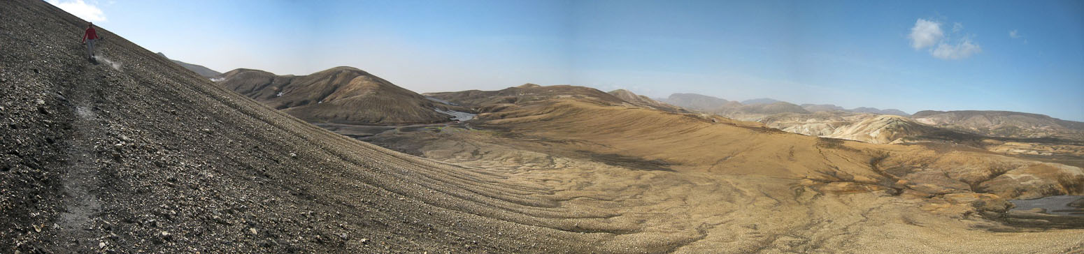
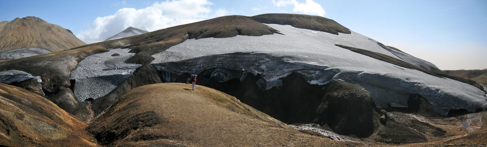
The terrain looked barren and flat, but was riddled with rolling ravines...
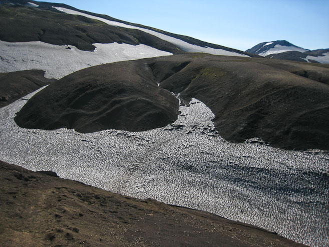
A pic looking down at a sizable snow-filled ravine, followed by a pic from the other side looking back at Wendy...
There was no snow on the trail, aside from the ravines, perhaps due to the recent ash? Vegetation was scarce here, but vividly colorful...
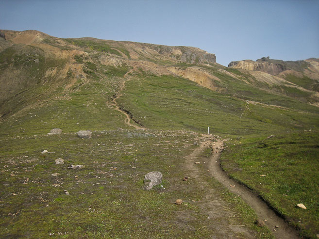
The trail was pretty simple to follow, and we could usually see hikers ahead of us (when they weren't in ravines)...
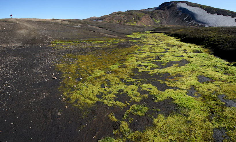
More of the neon green moss grew in the wet ravines...
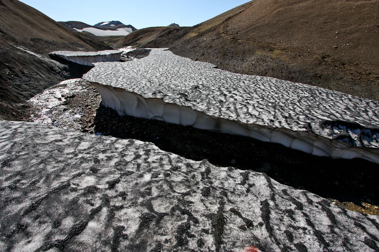
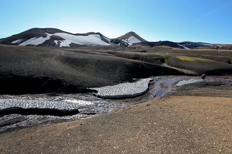
More snow filled ravines...
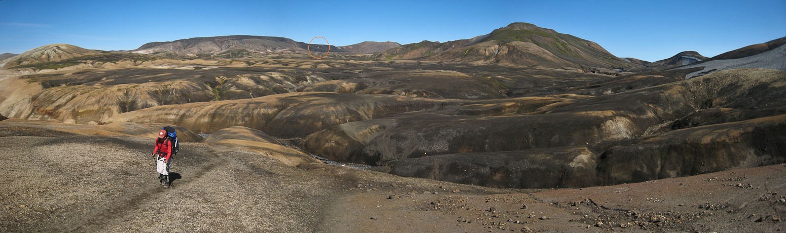
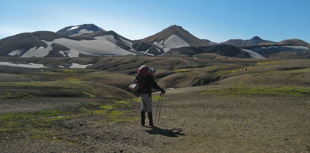
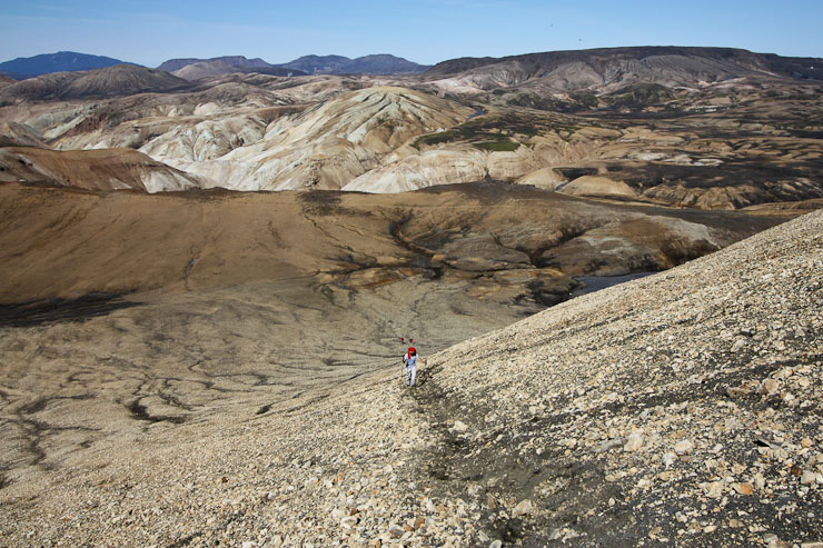
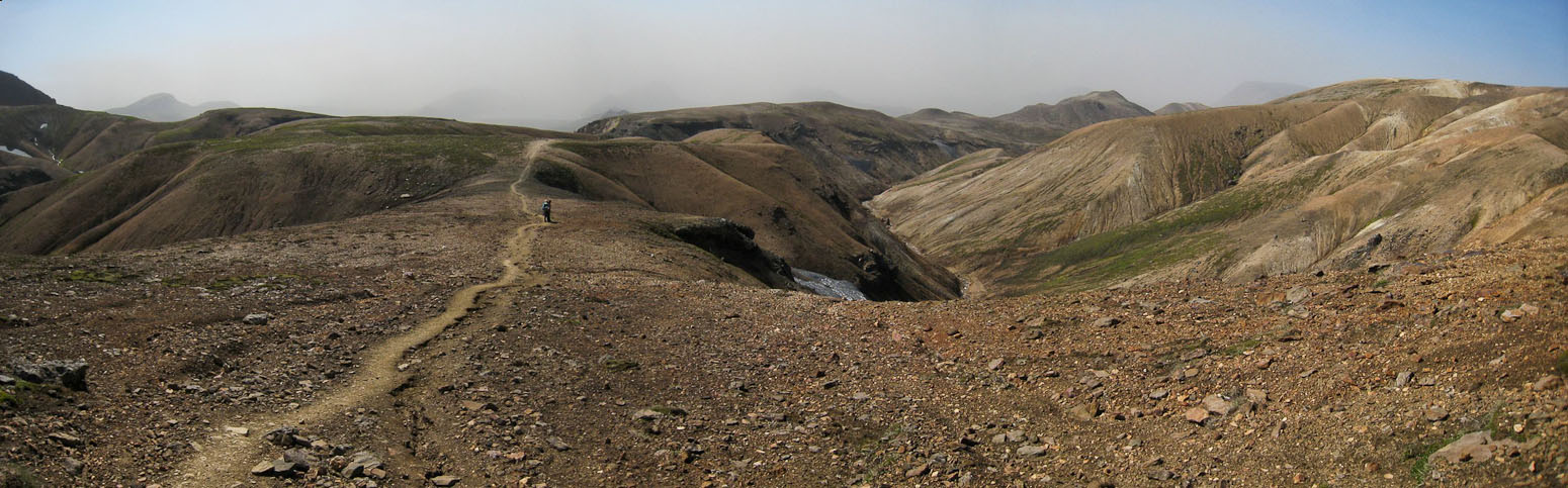
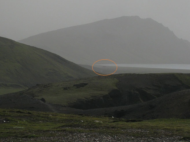
Descending and ascending ravines was tiring, and a bit tricky on the steep slippery dirt. A look back shows how far we've come in 75 minutes since leaving the hut (circled in the pic)...
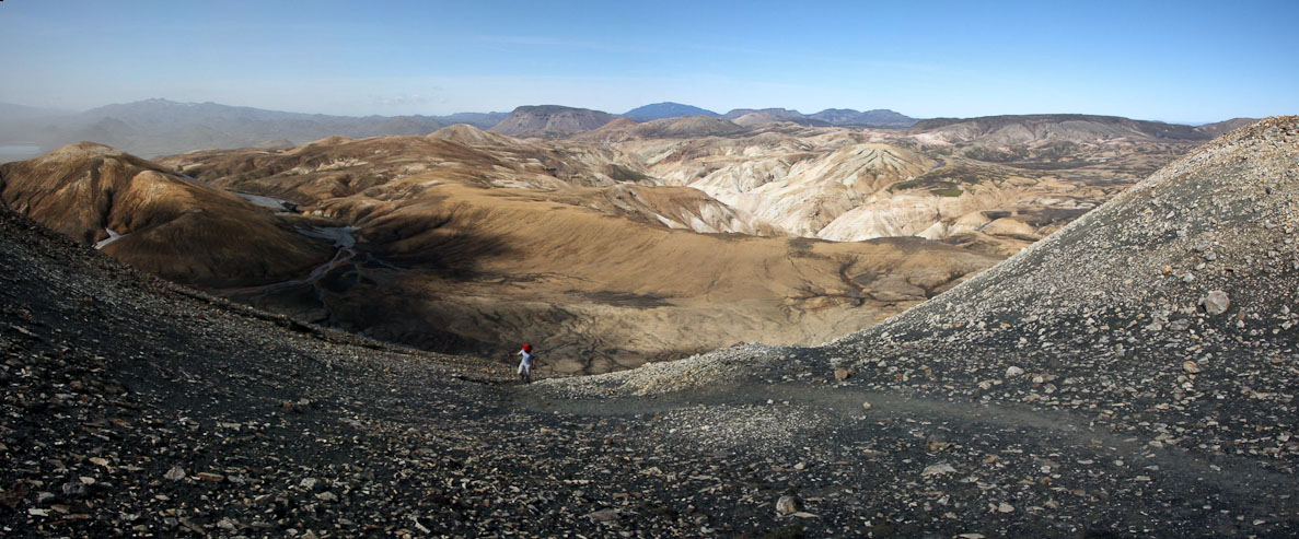
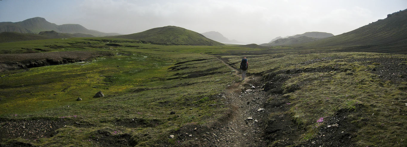
We follow a group of hikers heading on the same path ahead of us. After clearing the vast series of chocolate ravines, we reach a shelf and break for a snack (a popular choice by others too).
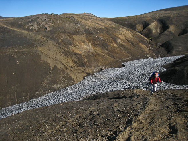
I begin the descent into the snowy ravine...
Wendy chugs up the incline. Poles were plenty useful on the slopes today...
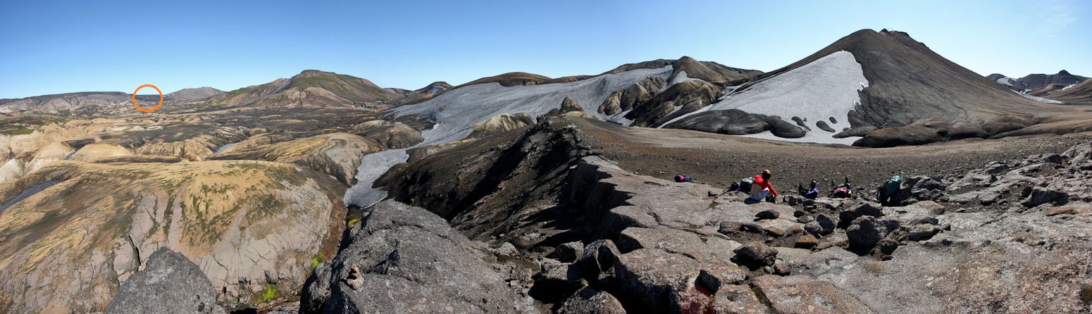
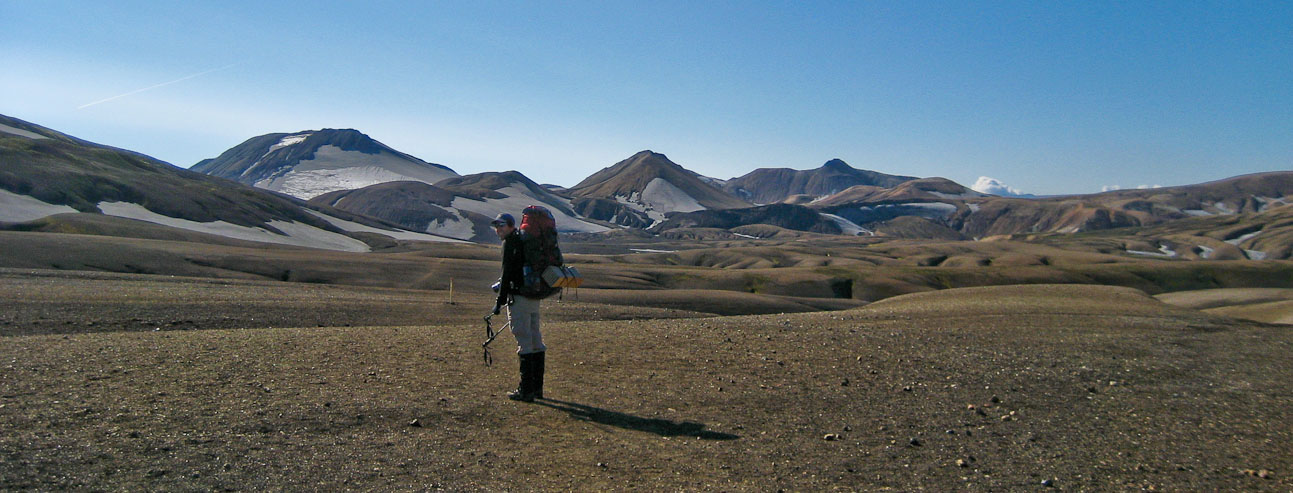
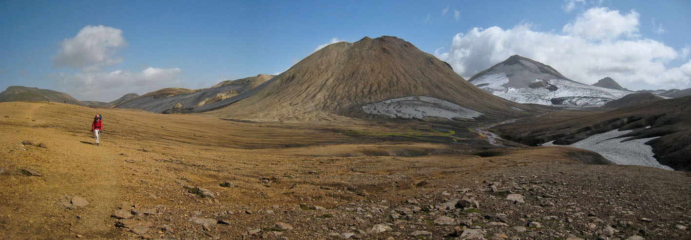
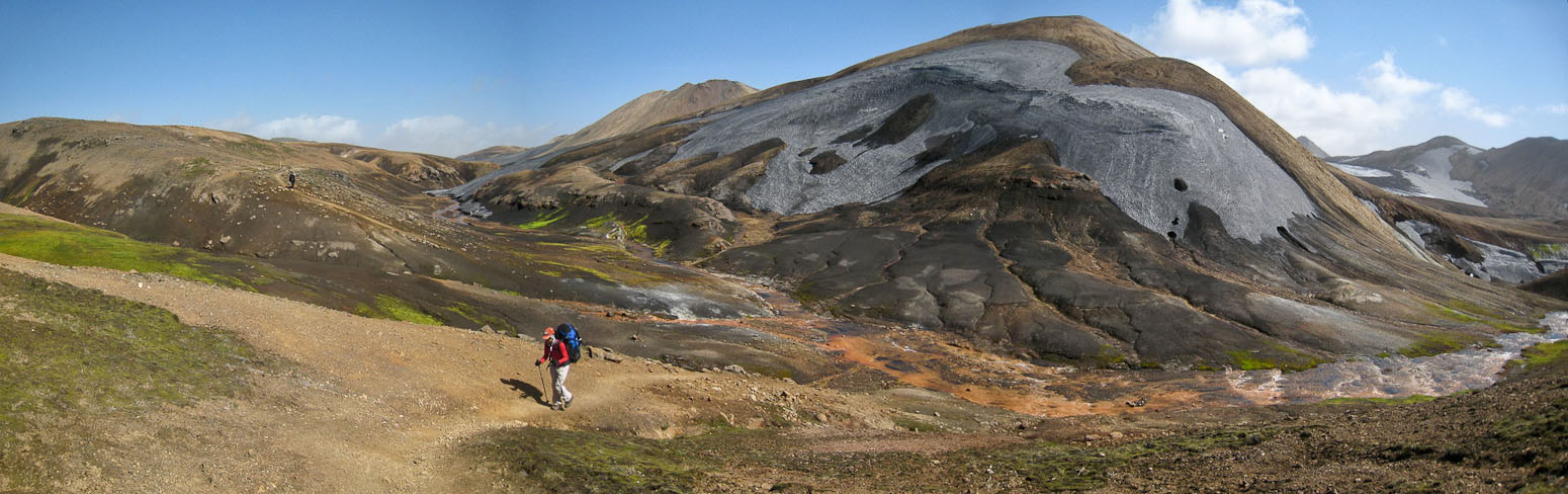
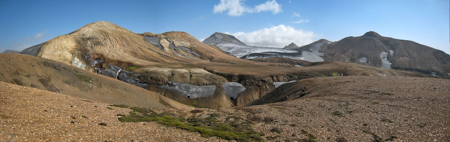
Time for a lunch break at the top of the climb, while looking back at all the ravines we crossed (on the left). The terrain changed at this point, with smoother trail ahead. Again, the hut we started out at 1.5hrs ago is circled...
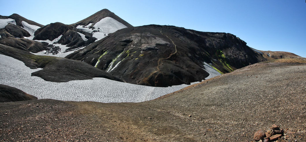
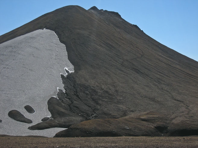
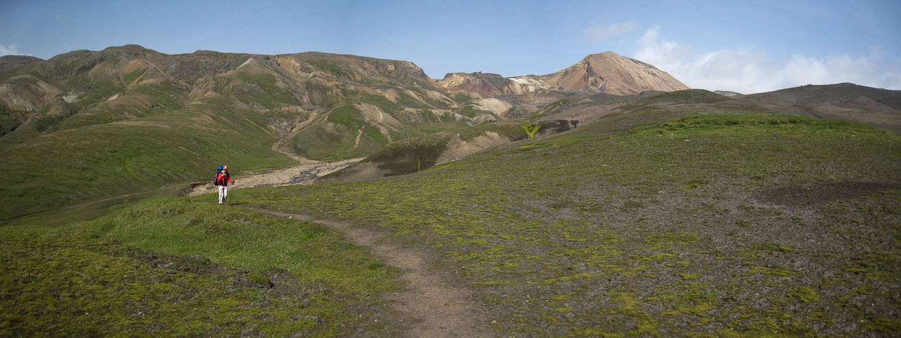
There is a trail leading up a mountain nearby, which I think is the famous Haskerdingur mountain (1281m), a popular side-hike. We decide to climb, expecting a 1-2 hour trip, but summit the steep rocky peak in 22 mintes, and realize this isn't the intended mountain. The real mountain is much bigger and farther. At least we have a good view of it, and part of today's trail. There is a ton of haze/dust to the south and growing, which is somewhat troublesome. It looks like our views are about to be hazed over soon.
We climb up the well etched, somewhat soft trail, passing a couple hikers on the way...
We reached the top in only 22 minutes...
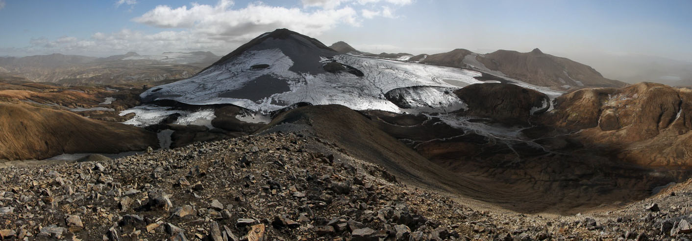
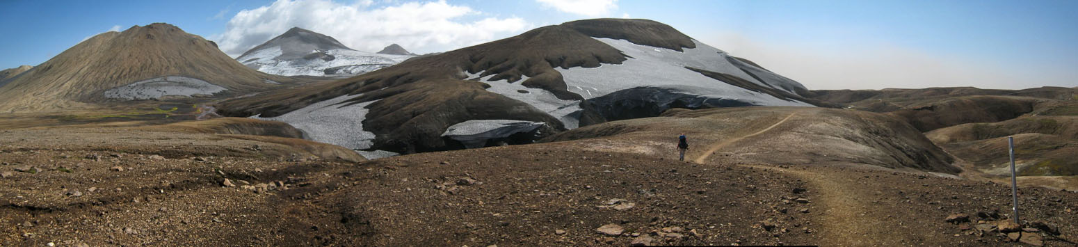
...and realized Haskerdingur was the big snow covered mountain to the east. Well, that would explain our short hike...
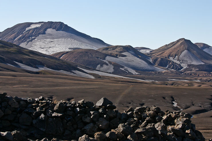
Interesting color on the hills...
We noticed heavy haze to the south, and I realized our visibility may drop as we continued in that direction...
After ~15 minutes at the top, we descend quickly. Our route ahead is in the middle of this pic...
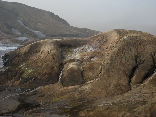
After a 10 minute descent, we're back to our packs, and get our handkerchief's ready for any ash/dust storm. We continue on the shelf and cross several more ravines, though these have some interesting steam vents and colorful vegetaion/mineral growth.
More dips in the trail ahead. Again, the small mountain we climbed is on the left...
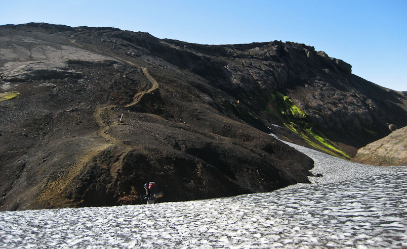
The trail led us into ravines right along the snow corniced hills...
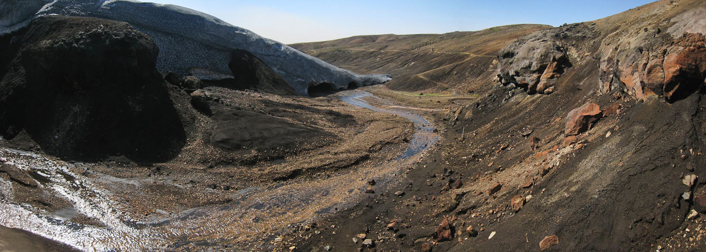
It was surprising that the trail dipped into this ravine, only to climb back out, but I suppose the trail was rougher above. Regardless, it was scenic...
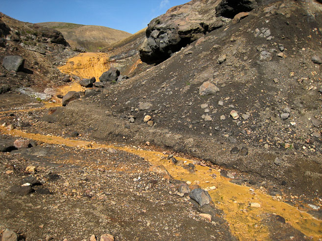
This ravine had colorful orange streams...
...and some "radioactive" green colored bacterial growth too. Cool!
The trail stayed low along the ravine a bit further, which led to more colors...
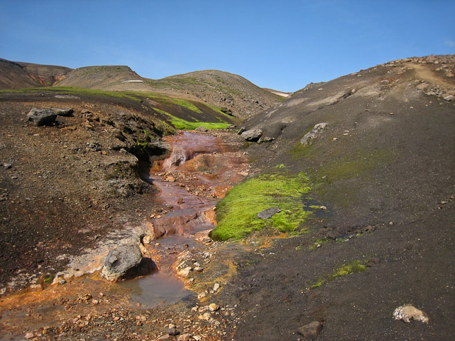
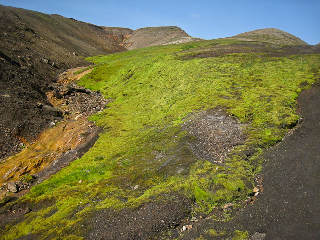
More orange and green!
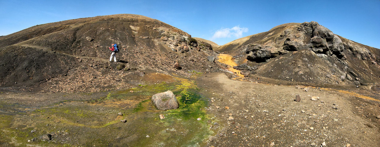
Soon we were climbing out of the colorful ravine for good. Looks like another hiker is on the trail behind us...
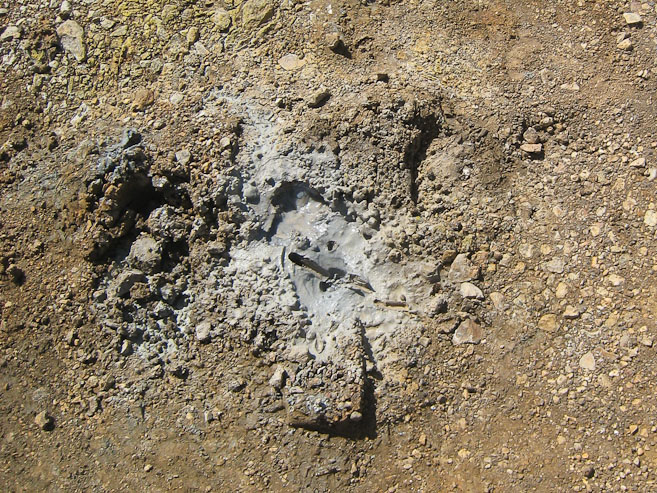
A close-up of the clay like surface beneath the dirt in this area...
Cool terrain...
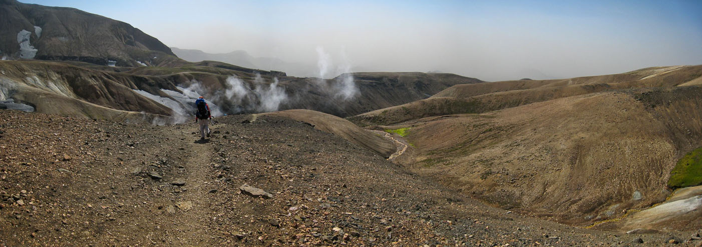
Heading for some steam vents, and another dip in the trail...
Fortunately the trail wasn't very steep...
You can look back across the dip, at the trail on the left...
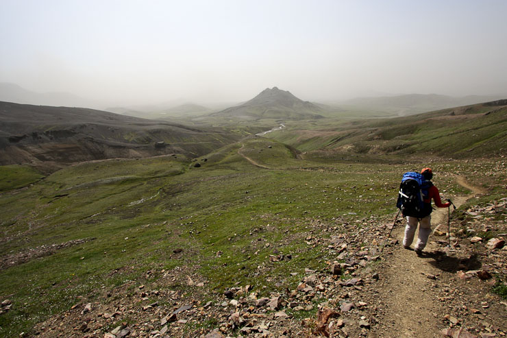
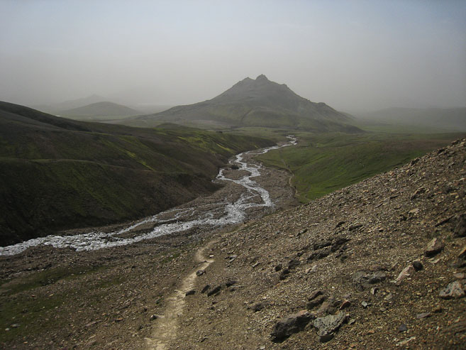
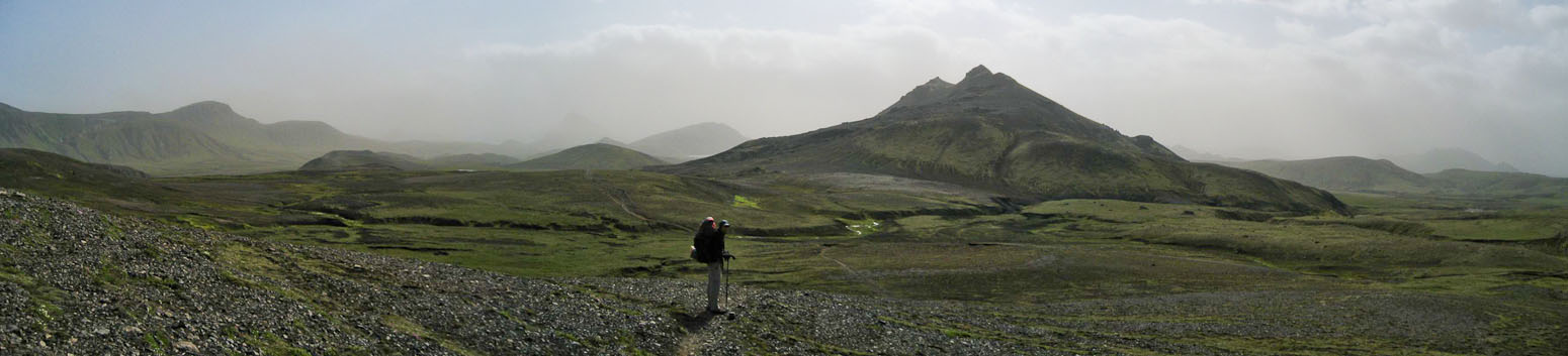
We were heading towards the haze. Sometime soon we'd begin a 1500' descent...
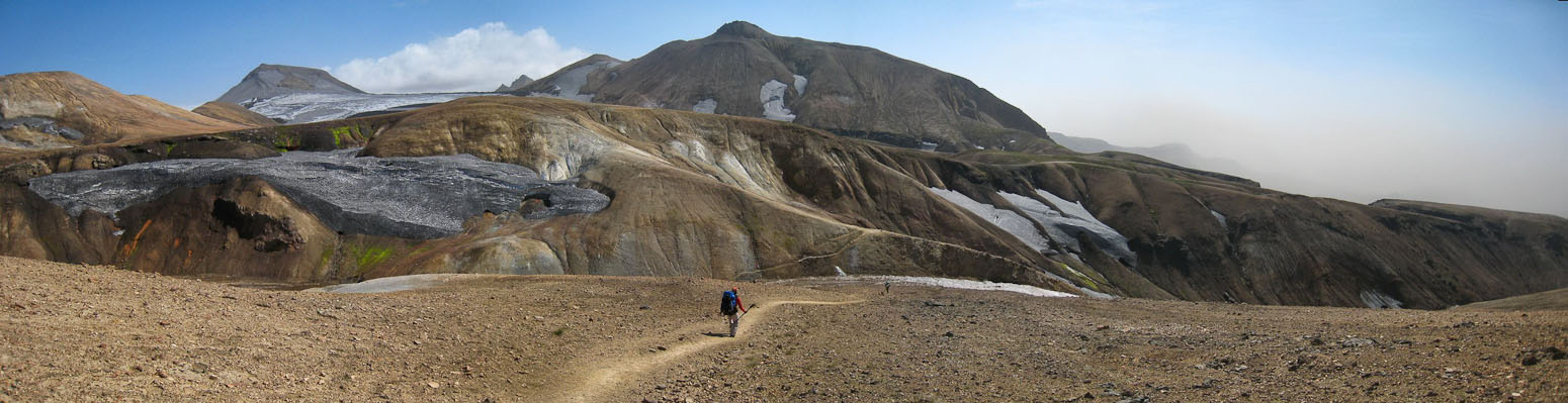
One last scenic view of a tumbling stream while on this elevated plateau, before reaching the beginning of the descent...
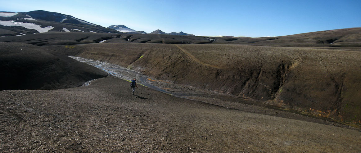
Eventually the ups and downs on the trail lead to the big 1500' descent of the day. We knew the 1st stream crossing of the trip awaited at the bottom, and wondered how tricky it would be.
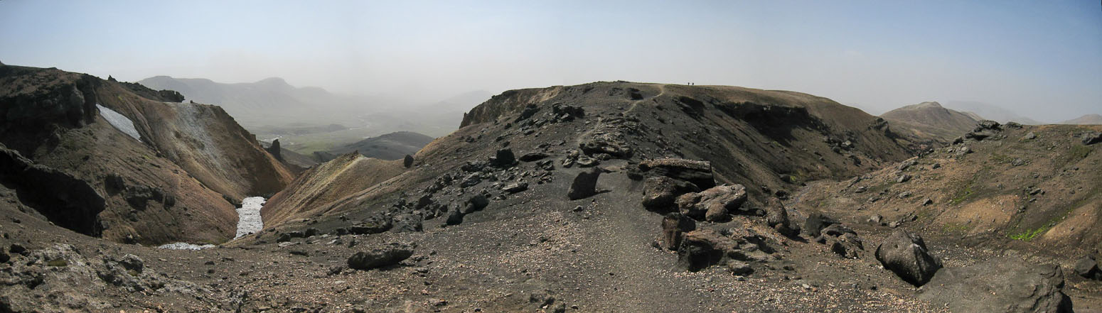
From the top of the pass, we can see many hikers stopped at the stream. Unfotunately, the haze shrouds views of the mountains to the south. The descent is actually not too slippery, and more manageable than we anticipated. However, Wendy had a slip while turning a corner, and got a small cut on her hand, which was a good opportunity to rest while fishing a bandaid from the first aid kit.
The descent wasn't as steep as we feared...
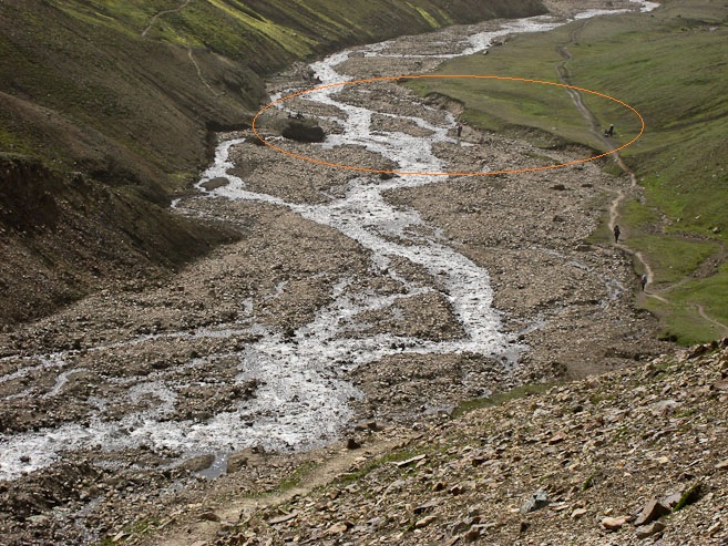
The river came into view, and I watched the hikers gathered at the bank, preparing for the crossing. They are circled in the 2nd pic...
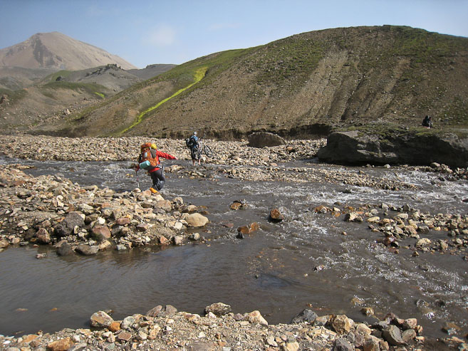
When we arrive at the river, we study the routes from the hikers ahead of us, as they cross. The water looks about 2/3rds of the way up to my knee, at the deepest, and is moving fairly swift. Wendy has Chaco sandals, but suddenly my open heeled flip-flops are not looking up to the task. After some considering, I bring out a bit of rope, and fashion some extra straps that attatch my foot to the flops in a solid manner. I walk around the rocks, and they feel sturdy. Wendy and I also wear our gaiters, which might keep our feet a little warmer. Wendy unzips the legs off her shorts/pants. After considerable debate, we pick one of the routes we saw some hikers cross, and with our boots tied together at the laces and draped across our necks, begin the crossing. I go first, with poles extended in my hands, which greatly help balance. Wendy follows right behind me. After 2 steps, our feet are COLD! This is snow melt from the mountains afterall… I didn't know if I should go quickly to get it over with before my feet got too cold, or go slow and make sure each step was balanced (I choose the latter). At the deepest section, the current gave a significant push, requiring some effort to hold the step. At that point I heard, "Hurry, my feet are cold!" from right behind me. I picked up the pace and soon reached the other side.
With poles, it was all pretty simple, and in half a minute, we were across. Wendy's feet were numb. She wore socks across (after seeing others with some type of sock on), but now realized it wasn't a good idea, and dug in her pack for a dry pair. We rested on a rock and ate a late lunch (same menu as yesterday's lunch) after drying off our feet. It was somewhat amusing to watch another pair of hikers arrived, and explore/deduce the best way to cross. They tried their best to avoid taking off boots, but in the end, hiked downstream and used Teva sandals to cross.
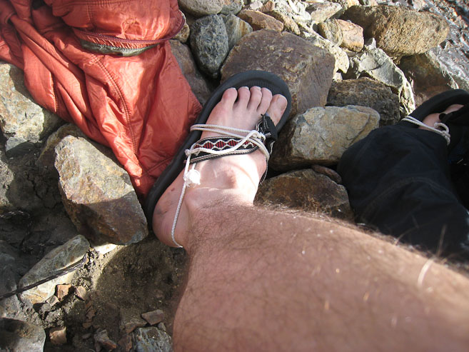
A look at my DIY sandal, using some rope and a flip flop. My make-shift sandals performed perfectly! Wendy and I pose for a self portrait on the other side of the river, while drying off our feet and eating a late lunch (~3:30pm)...
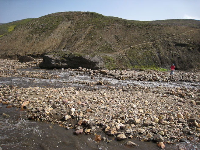
We resting, we watch as another couple of hikers scoured the bank for a good crossing point. They ended up crossing much further down the river...
We were now hiking across some rolling grassy hills, before reaching a completely flat 1.5 mile stretch along a road to tonight's hut.
A look back at the pass we descended, behind Wendy...
Some colorfully green grass appeared at a small creek...
Through the haze I could make out the next hut in the distance (circled). More green grass along another creek...
All flat the rest of the way towards the lake...
A look back, with the pass we descended in the distance...
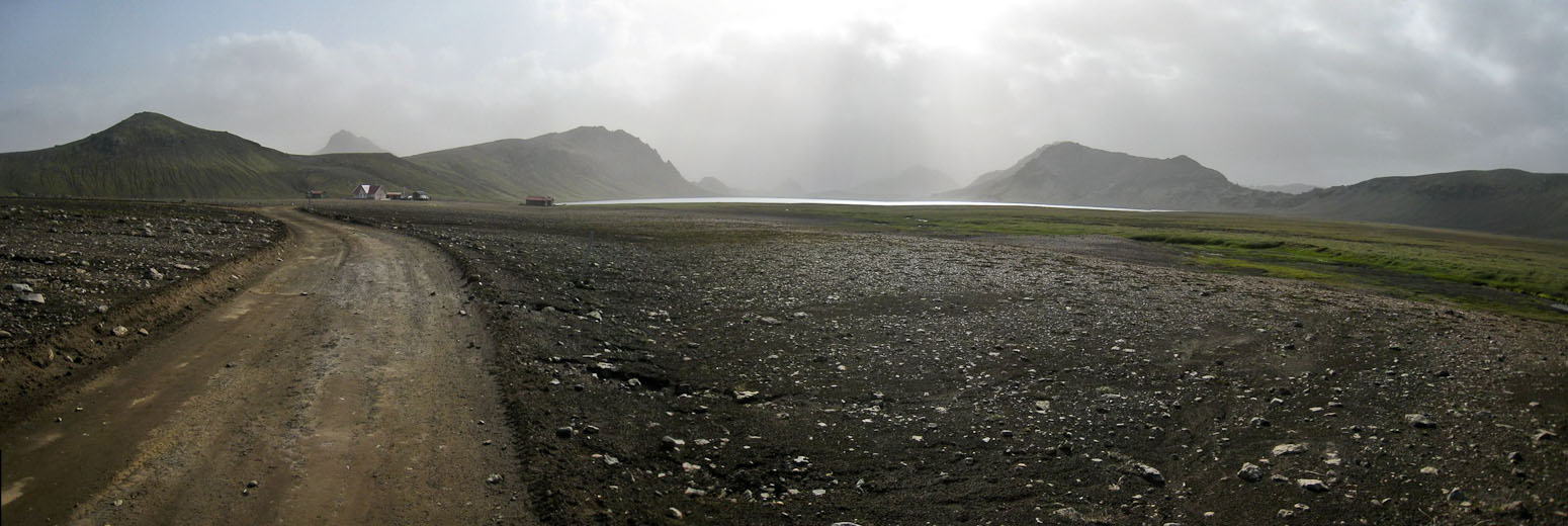
Eventually we reached a road, and followed it to Alftavatn hut...
It was windy and cold when we reached the Alftavatn hut ~5pm. We found an awesome tent spot with a streamside view on the perimeter of camp, and carefully setup the tent in the wind, extra sure to prevent any gear from blowing into the stream nearby. Everyone seemed to have disappeared into their tents. No one was making any side hikes today.
The restrooms here had flush toilets, and a pay shower. There was a garbage here as well! Always feels good to lighten the load, even if it's just food wrappers.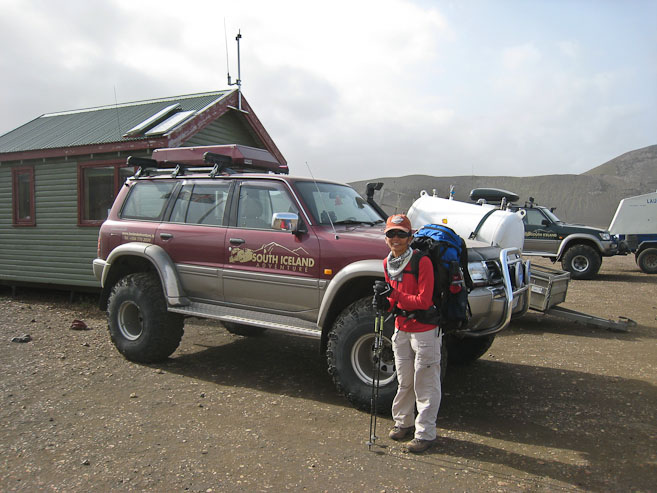
We were surprised to find an sweet flat spot on the edge of camp, with a scenic view along a stream, given that we arrived well after most of the hikers today. It was cold and windy out, so we hung out inside the tent a bit...
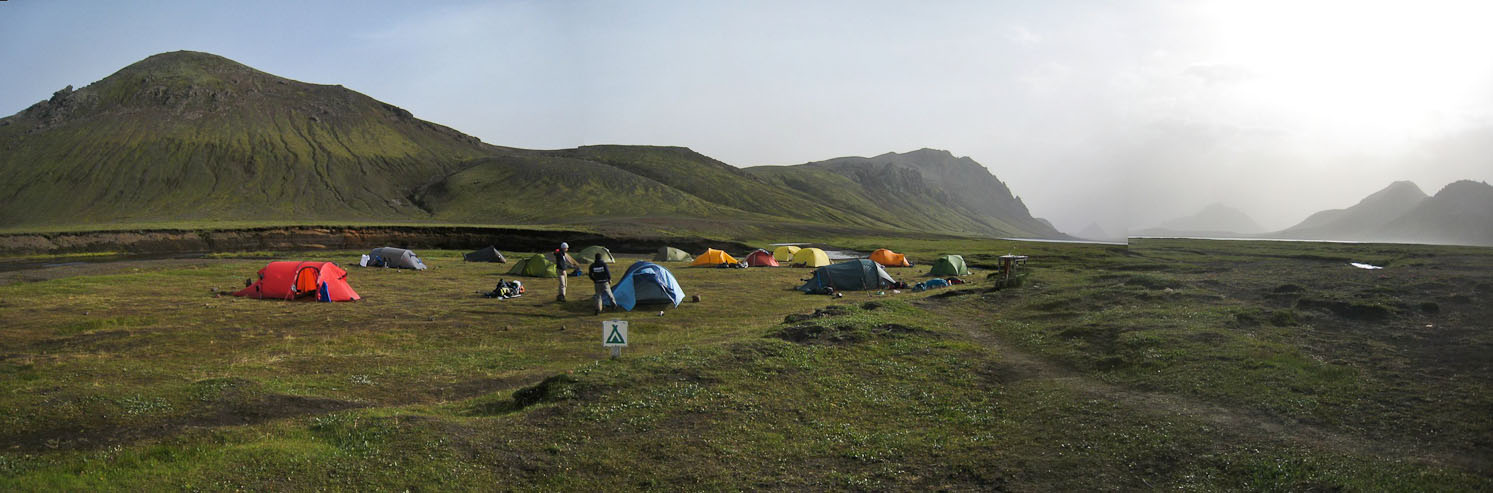
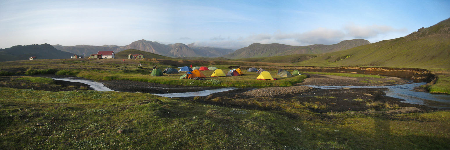
A wide view of camp, with the lake on the right. Our tent is the furthest away yellow one...
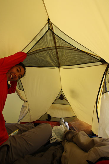
With no side hike on the agenda (thanks to the chilly/windy weather), we got started with dinner. Given the wind, we set up the stove in the tent's vestibule. Wendy was able to eat from inside the tent today. We cooked more of the same dehydrated goodness: Asparagus soup, fajitas (with cheese), pulled pork, yams, brussel sprouts (tasted too bitter reconstituted, but excellent as a dehydrated crunchy snack), zuchini w/ sausage, eggplant parmesian, flax meal cereal, and dehydrated pumpkin pie filling. It was a big long meal, but we felt we had too much food anyway, and it was an extremely enjoyable way to spend the early evening.
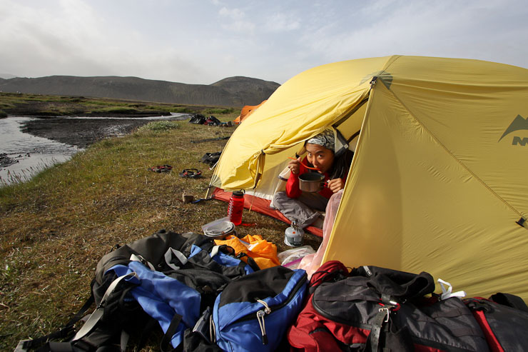
What a pleasant view from the tent!
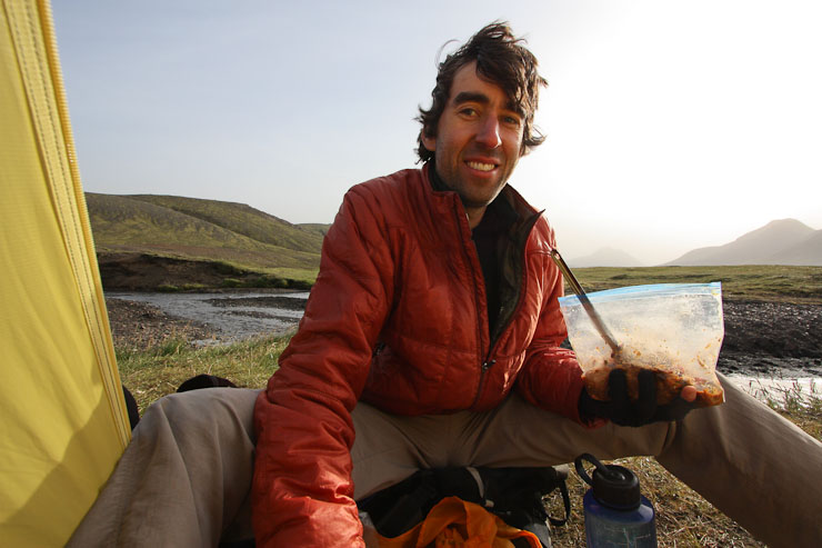
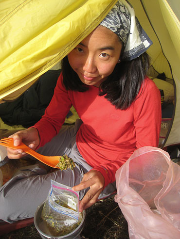
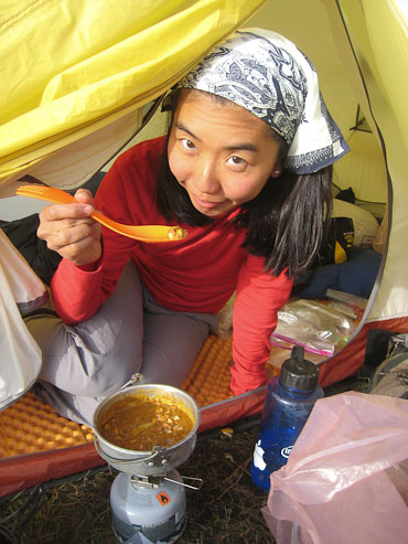
Pics of me with rehydrated fajitas, and Wendy featuring brussel sprouts and yams...
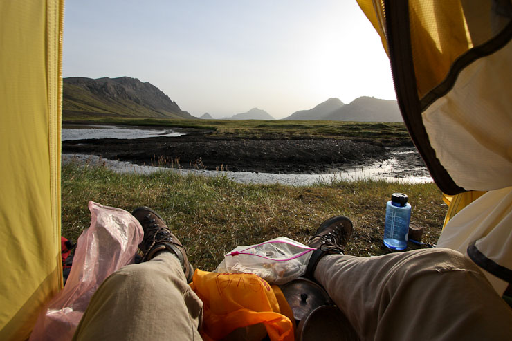
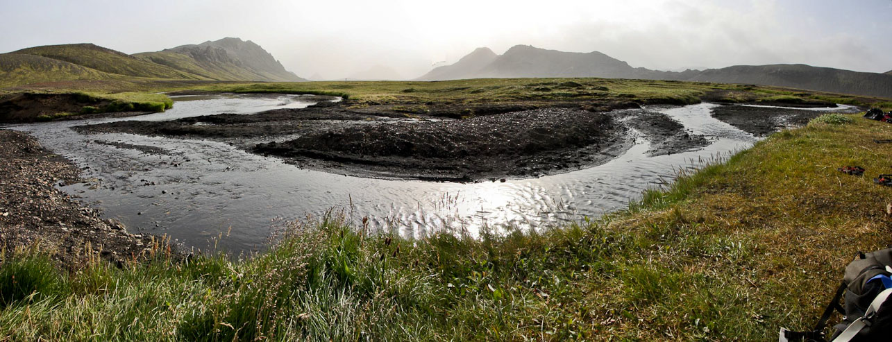
Ah... Relaxing after dinner, admiring some Iceland terrain...
After washing the dishes, we bundled up, wearing our rain pants, hats, gloves, and every layer we had, for a walk to the lake. It was windy and cold, but the air was less hazy, offering views of the angled mountains beyond the lake. Some gulls and a duck played along the lake. I hope it's not this windy overnight.
It was chilly and breezy out! We wore all our layers, including rain pants, to keep warm (which worked well)...
It turned out to be a pleasant walk along the lake, in the evening sun (8:45pm)...
A look back at camp upon our return. Ours is the right-most yellow tent. Sweet spot...
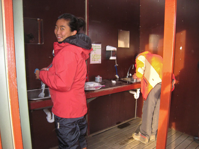
We brush our teeth in the wind sheltered sink area, and I ask the warden for info on the next stream crossing tomorrow. She says it's easier than the one from today, and the hardest stream crossing will be on the last day. When queried about the weather, she says "cloudy with some showers in the afternoon". We decide on a 5:30am wake up, to try to hike before the rain arrives.
It's too cold to want to shower tonight, even for Wendy. Really hoping for no late night bathroom needs in this cold. It's nice and warm in the tent. This cozy campground is very scenic. Wendy got some wind burn today. She's massaging her leg with the ball (nightly routine). Thought I might actually get out the deck of cards today after we set up camp, given the wind and cold, but didn't use them afterall…