The bathrooms were a decent walk from the tents. By the time we were ready to hike, the cloud coverage was lifting a bit...
Alfavatn to Emstrur stats: 15 km, 6-7 hrs, 40m loss
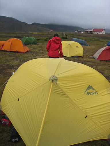
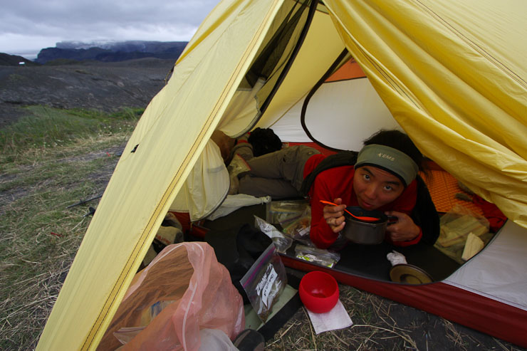
7:39pm, Emstrur camp Slept soundly with earplugs last night. Wendy's been using her iphone as an alarm, and woke me up at 5:30am. I curiously peak outside, and see clouds everywhere, blocking any views across the lake. I lay back in my sleeping bag, and listen to some gentle rain sprinkle on the tent for a few minutes. Well, time to make breakfast… We setup the stove in the vestibule like last night's dinner. Wendy ate her cereal from the tent, along with a package of freeze dried eggs & bacon (can dispose of the wrapper at this hut). It's cold out, but the wind has stopped. The tent fly is wet, so we pack it in a separate bag when breaking down camp. Our early start makes us one of the first groups to start the trail today (~8:30am).
The bathrooms were a decent walk from the tents. By the time we were ready to hike, the cloud coverage was lifting a bit...
Wendy looks both ways before crossing the road to start the hike today...
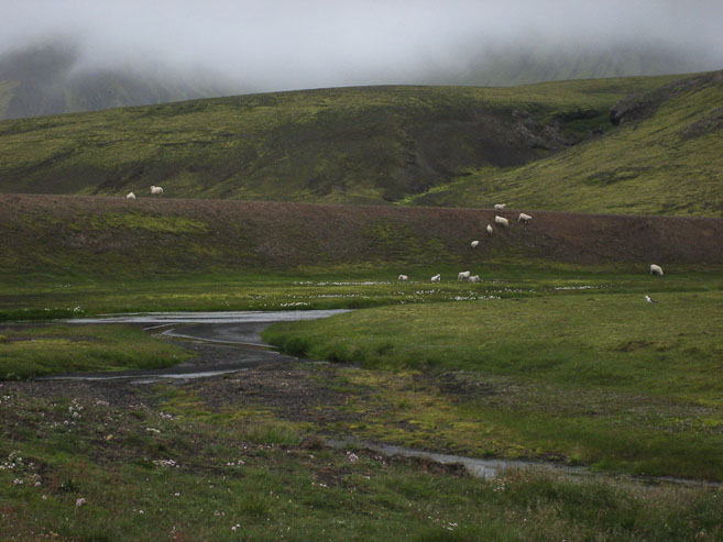
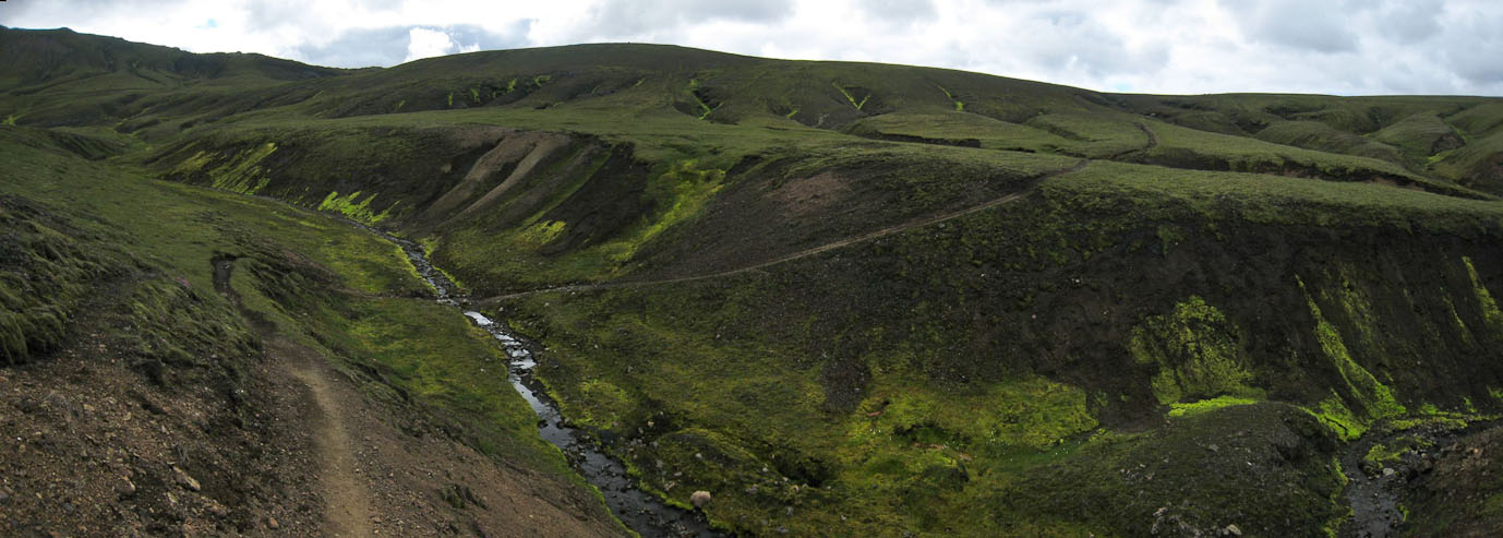
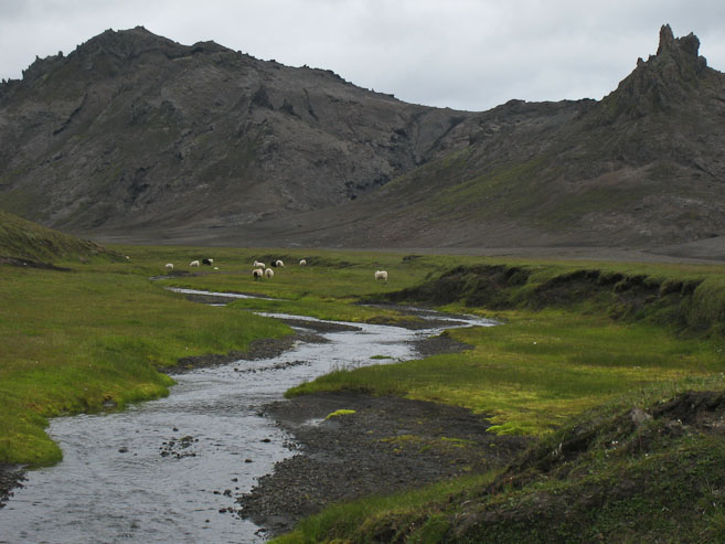
The trail climbed up a grassy hill, where a few sheep were roaming, before descending to a stream crossing.
A last look back at Alfavatn hut and the lake, before we turn the corner...
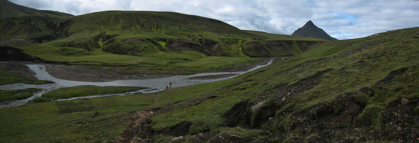
From the top of the hill, we could foresee an upcoming stream encounter...
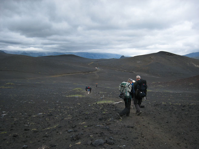
We were the 2nd hiking group on the trail today, thanks to our early start...
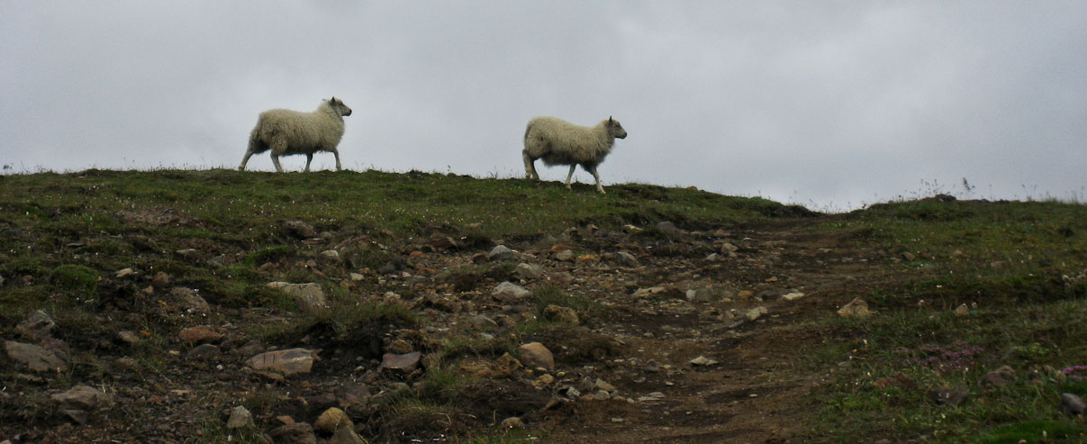
Wendy spent some time observing a couple of sheep, before we reached the stream...
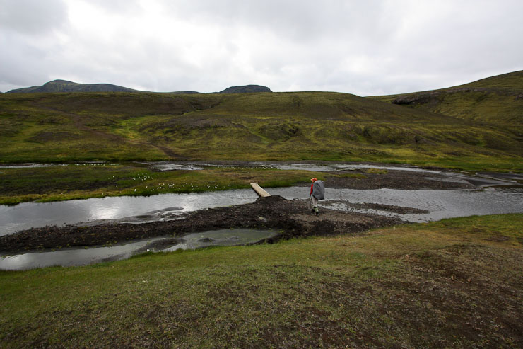
Could this be today's stream crossing? The people ahead of us had changed into sandles, but the water only came up to ankle height. After deliberation, I decided to wade in my boots and gaiters, while Wendy went with her sandals. It was a breeze to cross in boots, and my feet stayed dry. Wendy got to take another numbing foot bath, and managed fine.
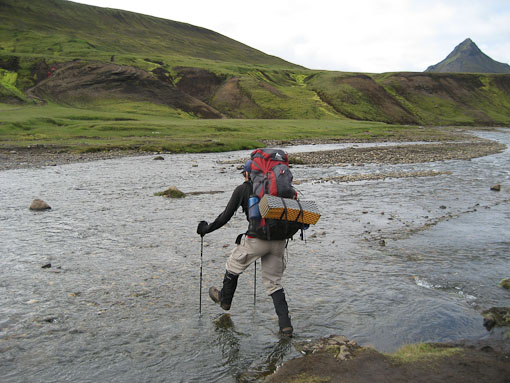
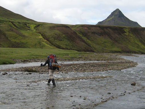
The stream only looked ankle deep, and I ventured to cross in my boots and gaiters. I came through unscathed (and totally dry)...
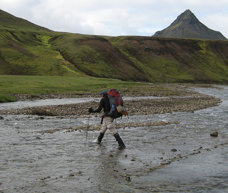
Wendy changed into sandals, and took the foot numbing option across the stream...
She doesn't seem to be in too much discomfort though...
A look back having climbed up a hill after the stream crossing...
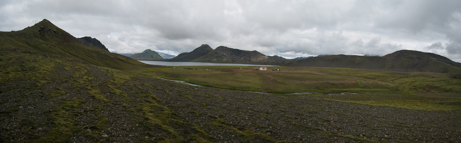
After traveling down and up several grassy ravines, we reached a road that led us to another hut.
me...
Wendy looking at a glacier in the distance...
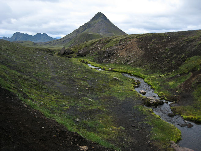
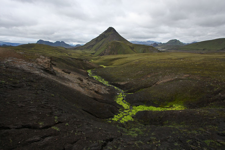
Bright vegetation near the water...
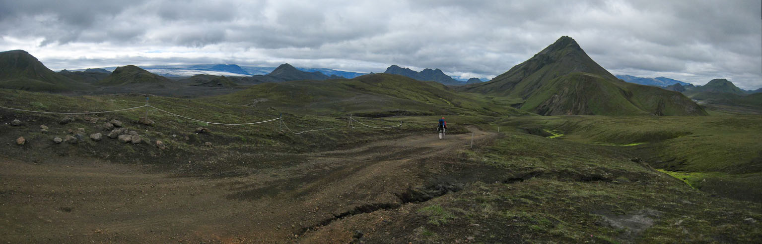
following a road...
...that led to a hut.
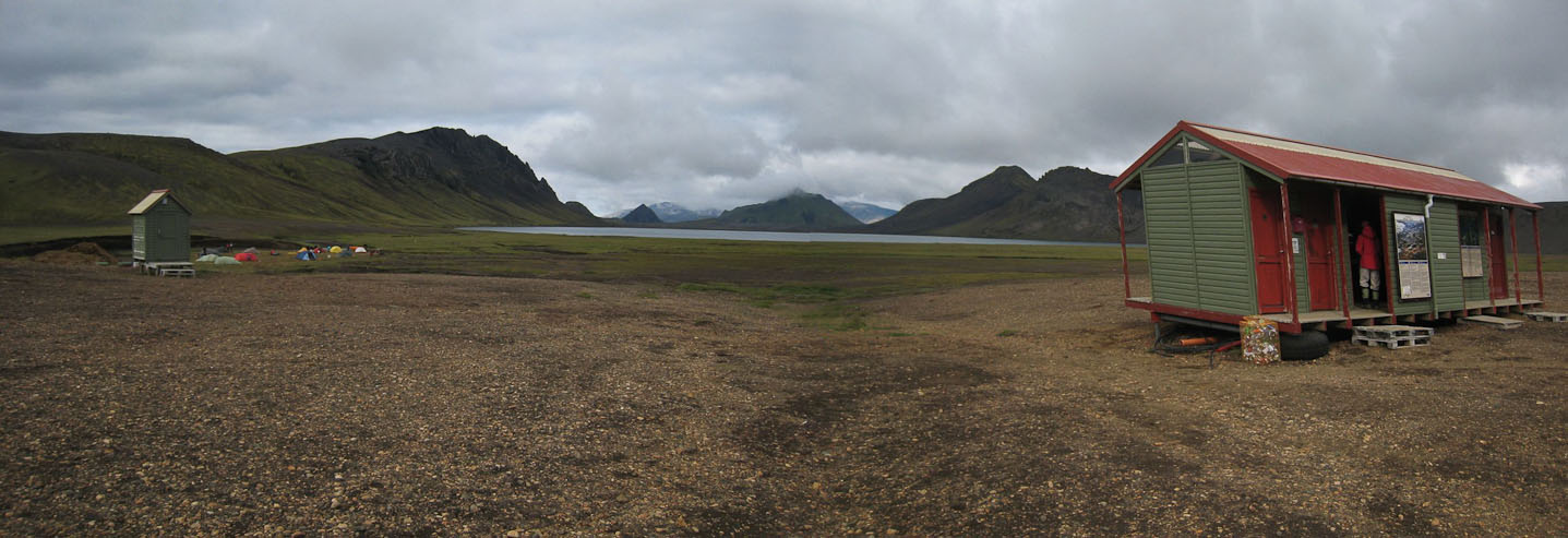
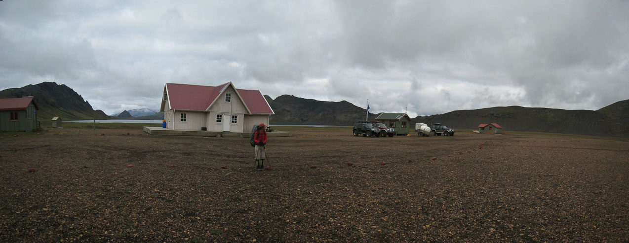
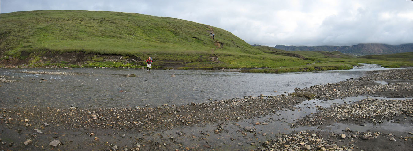
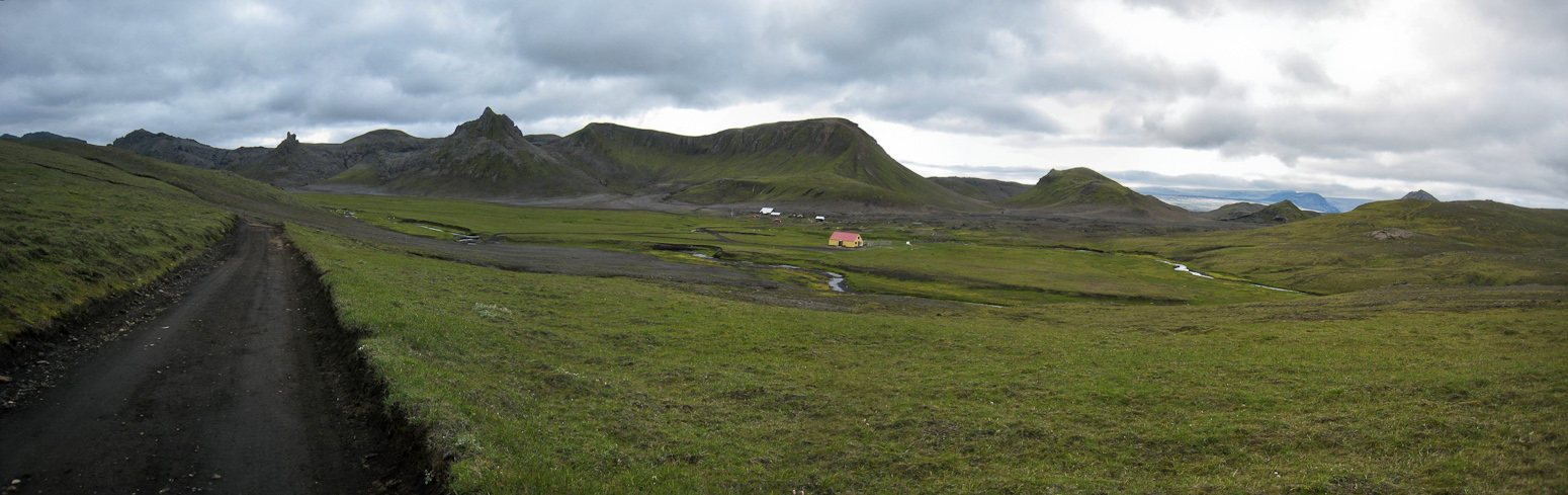
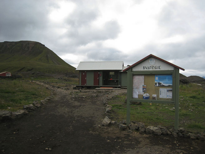
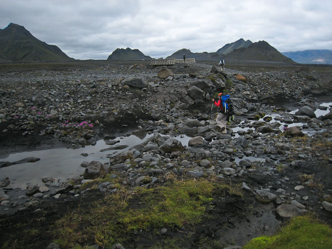
Encountering another hut just 1.5hrs into today's 10 mile hike was a bit of surprise. We drank up on water, used the restrooms, and continued on across a blackened lava rock field before running into the REAL stream crossing of the day (we thought we had already done it).
Wendy plugs in the earphones, as the scenery started getting pretty drab past the hut...
Shortly past the hut, we cross a river...
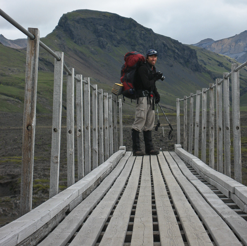
Me on the bridge...
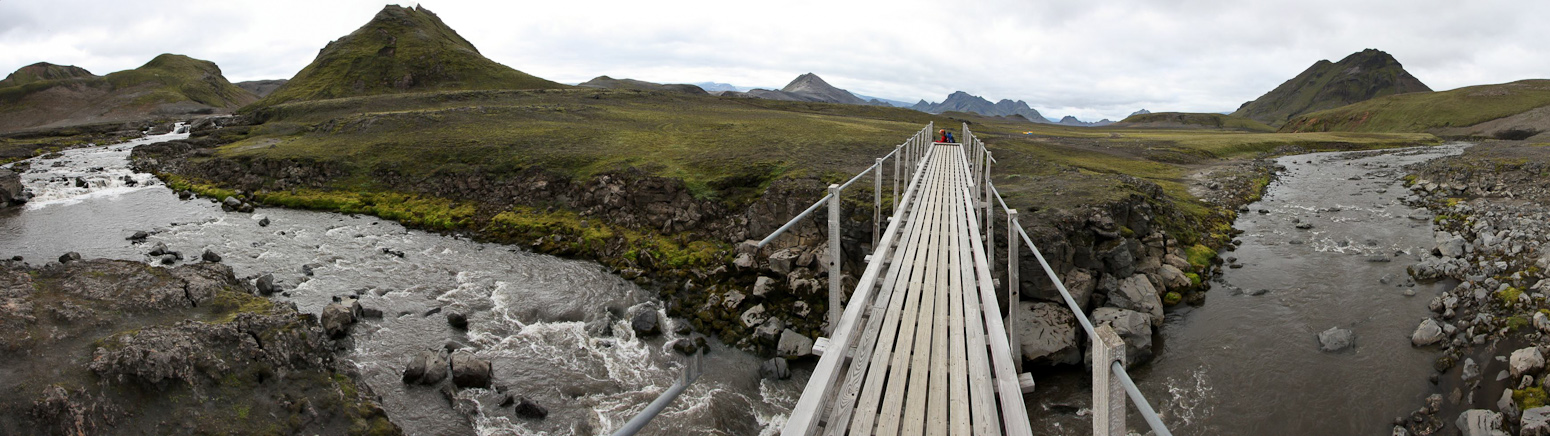
Glad we didn't have to ford through this river, but just ahead was the REAL river crossing on the day...
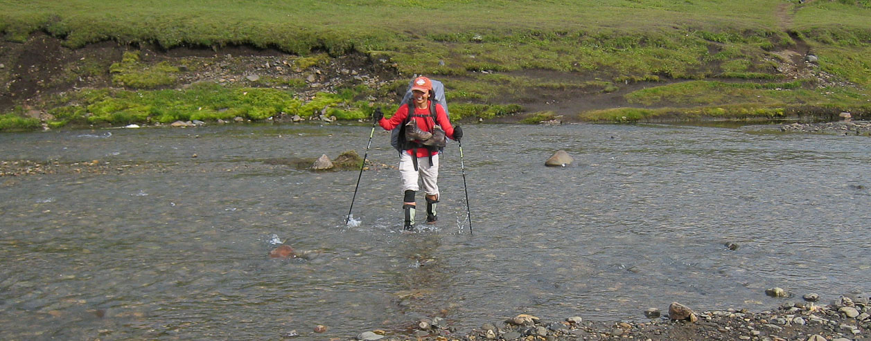
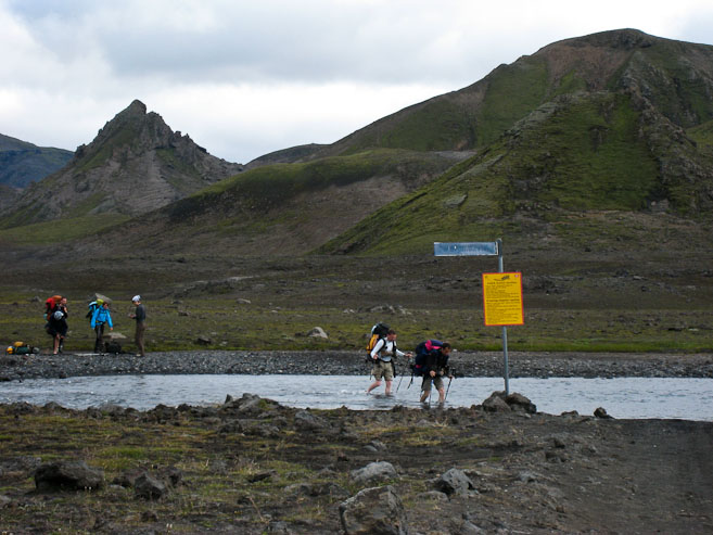
The stream was ~40' across, and conveniently, we were able to witness some other hikers cross, to measure the height. The water came to the upper shin in the deepest section. I got out my flip flops, which still had my rope attatchments, and was able to slide back into them. Wendy and I went together, and the overall experience was similar to yesterday's river crossing. Wendy's feet got numb again. Mine were chilled too, but I'm more used to having cold feet, and it didn't bother me much (for the short duration).
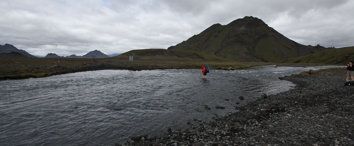
A look back from the other side, as more hikers reach the river...
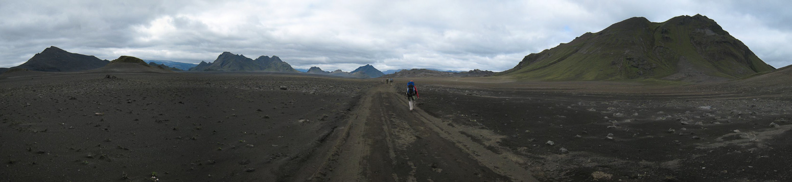
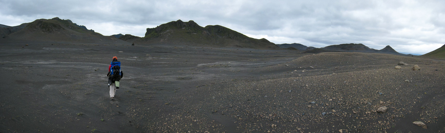
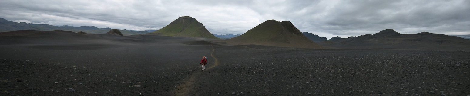
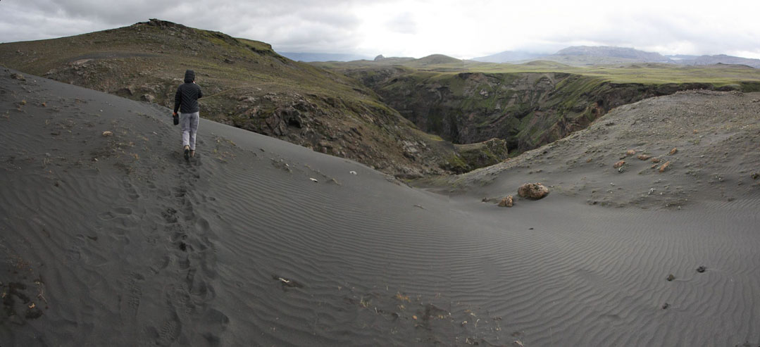
Once across the river, we looked back to see swarms of hikers approaching the river. The groups were catching up to us. We continued to walk along an ashy barren stretch of wasteland, hiking on a road at times. Not too scenic, especially with the gloomy overcast skies. The only unique thing was that the ash was like black sand, and we passed some small dunes.
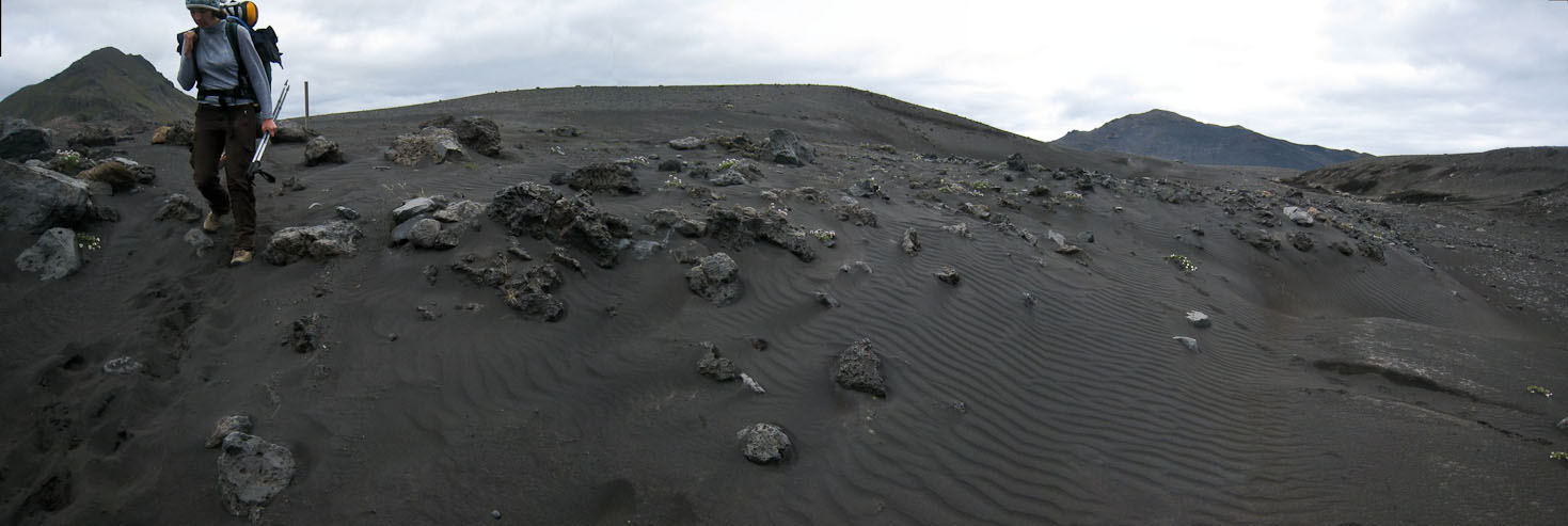
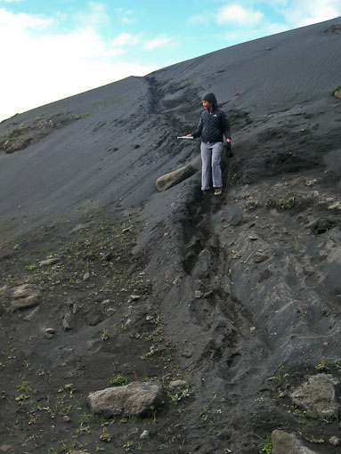
Hiking down an ash dune (just like black sand)...
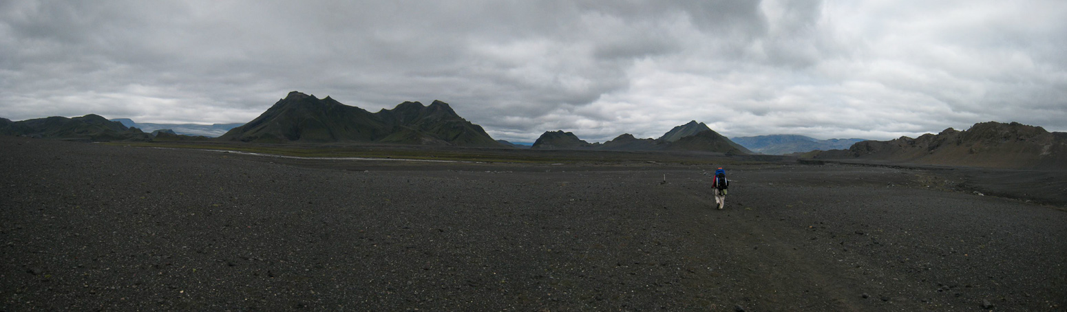
More flat emptyness, at least it was easy to keep a fast pace...
Finally a stream to break up the monotony...
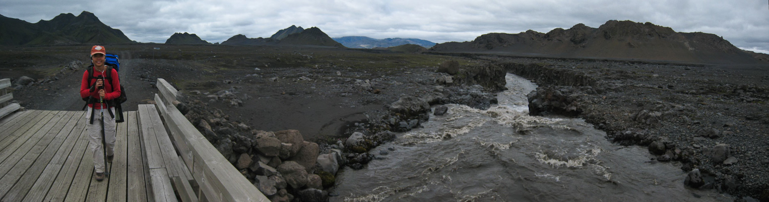
Glad there was a bridge over this river too. This was part of a 4x4 road...
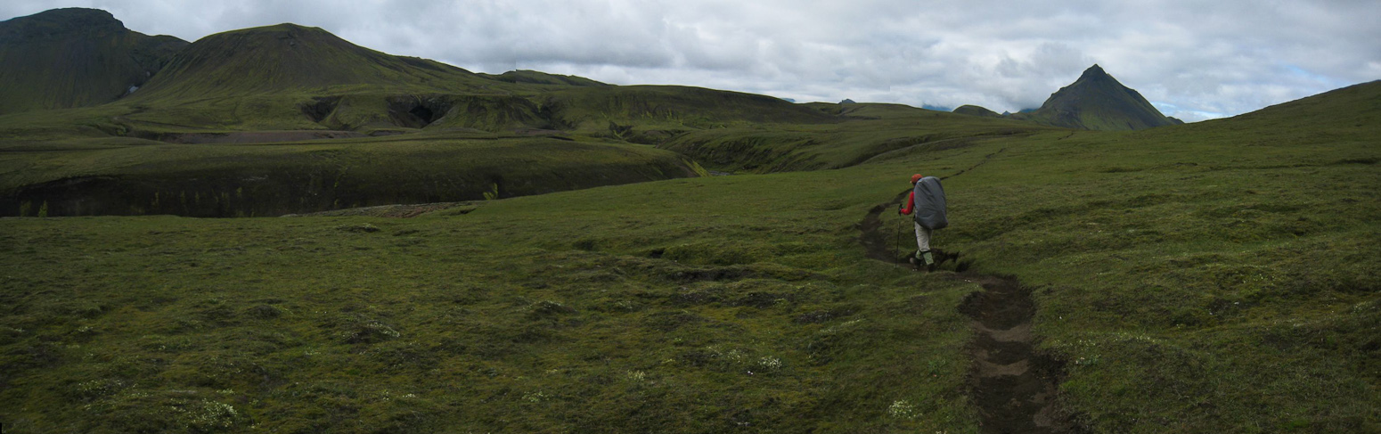
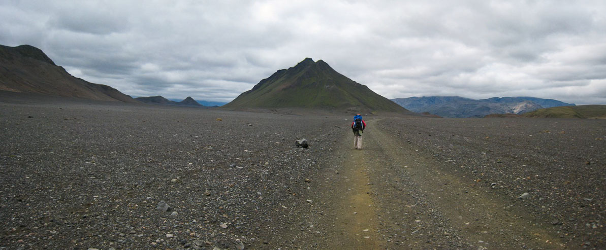
The trail was pretty dull, and we were keeping a fast pace across the flat terrain. But soon I realized we were separated from the other groups, and had missed a turn on the trail. I thought this was supposed to be well marked! Well, I had followed the road too far, and unfortunately, I was using a map I found online that was printed at 4 pages per sheet of paper. This wiped out most contour lines, rendering the map into a cartoon. I knew where we were, but needed to decide whether to back track, or take an alternate unmarked route. Wendy was doing good with her iphone tunes (useful entertainment given the bland views today), and didn't mind the delay. I decided to stick to the road, which would lead us to the hut, though perhaps miss out on better scenery from the main trail. Eventually we found some people who had come from the hut, and they let us know we were on the right path. Turns out our missed turn didn't cost us much, as we soon connected with the main trail, and learned from other hikers that we didn't miss anything interesting.
We hiked towards the opening in the ridge ahead of Wendy, where the trail emerged...
Back on the trail, and heading south...
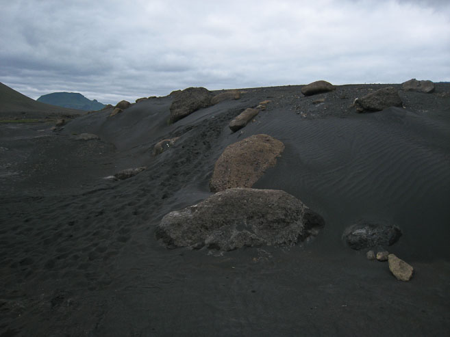
Another black sand/ash dune...
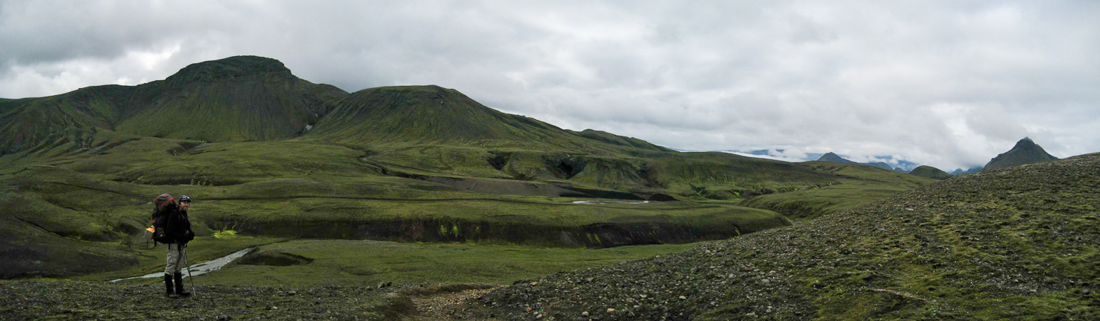
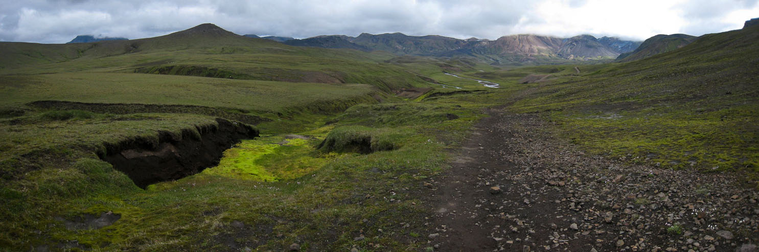
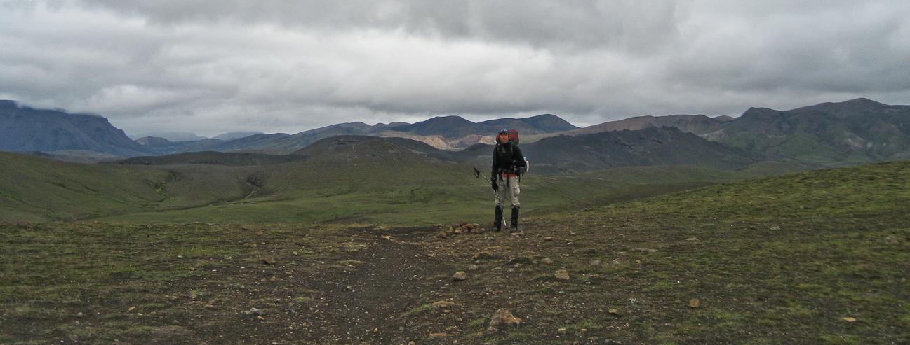
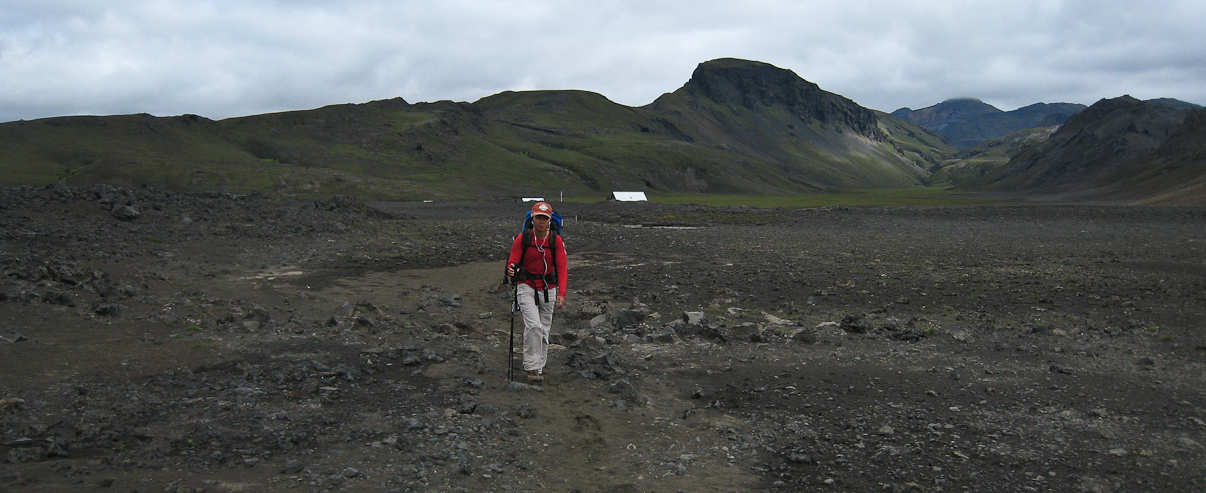
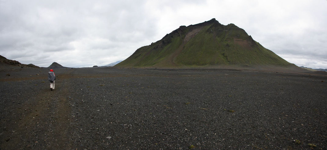
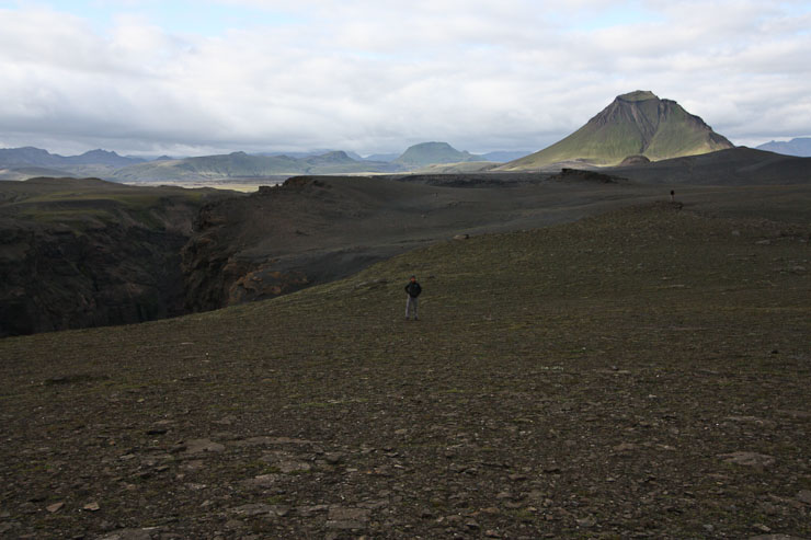
It felt good to be back on the main trail, sure of our heading, and in company of the many groups (ironically, since we always preferred to distance ourselves from the crowds). Our detour might have added no more than a mile and maybe 30 minutes. We continued across more ash dunes and wasteland until we reached a scenic pass (at least, I'd imagine it would be, without clouds blocking the glaciers/volcanos/peaks to the south). As we descended the pass, Emstrur hut came into view, where we arrived ~3pm with many other hikers, and scouted for a good tent site.
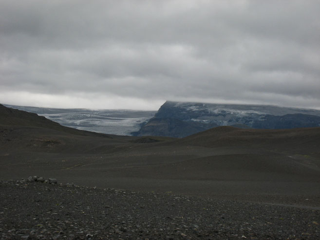
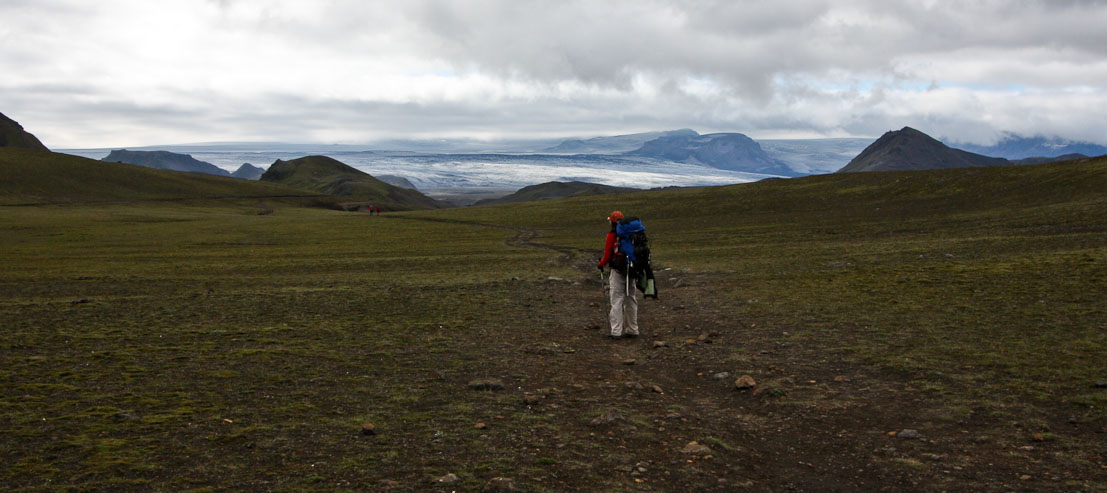
We could see obstructed views of a glacier ahead, and caught up to a group of hikers...
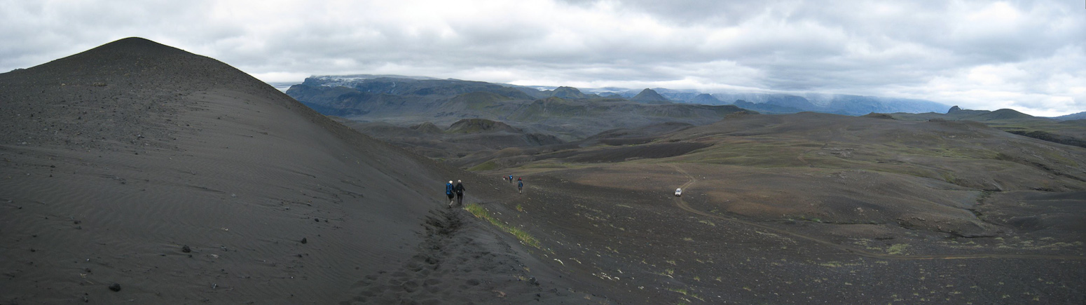
There's a car on that road down there! We started making our descent into the next basin...
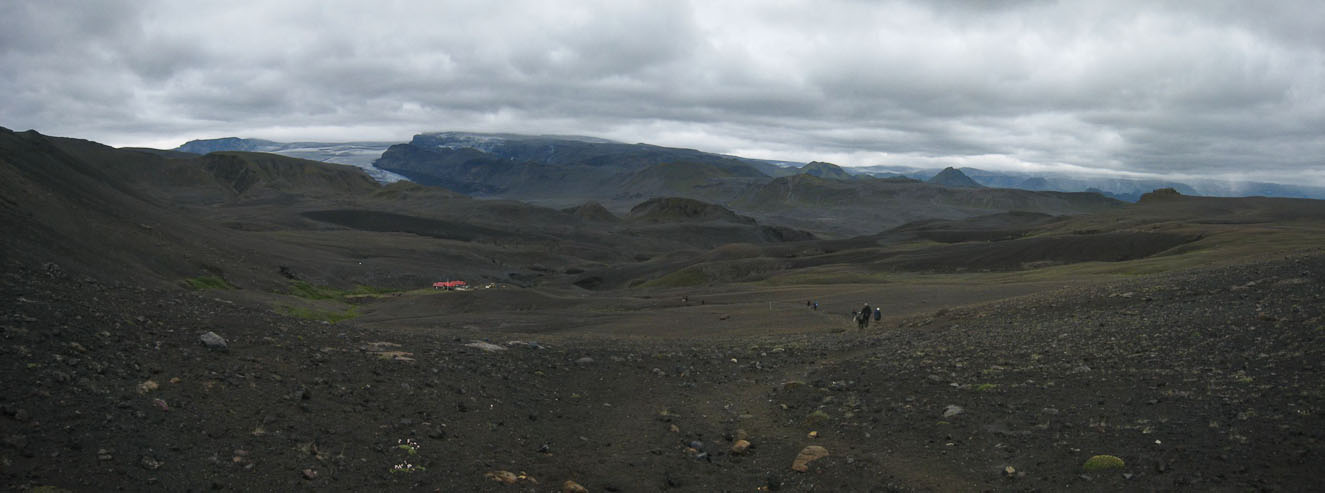
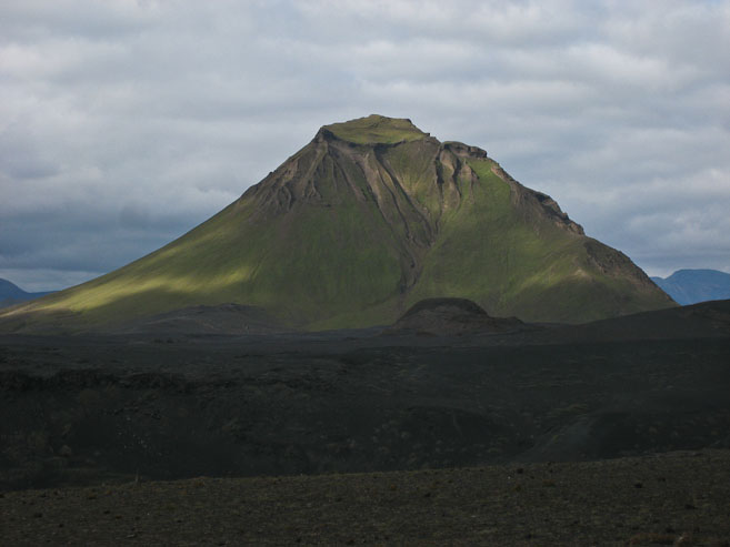
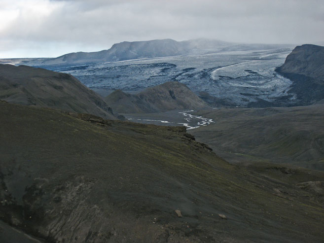
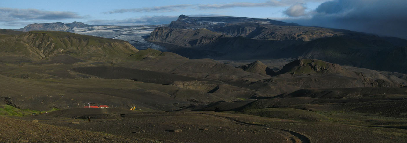
Soon we could see the red-roofed Emstrur hut, set below a glacier in the distance. No doubt this would be a stunning view clear skies. The recently erupted volcano would be visible on the right as well...
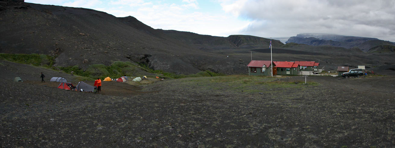
Wendy found a great spot on one of the grassy terraced tiers, which turned out to be the most flat site on this trip so far.
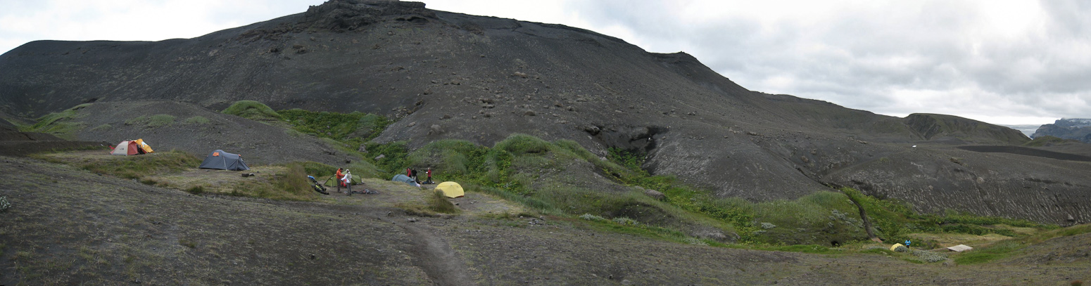
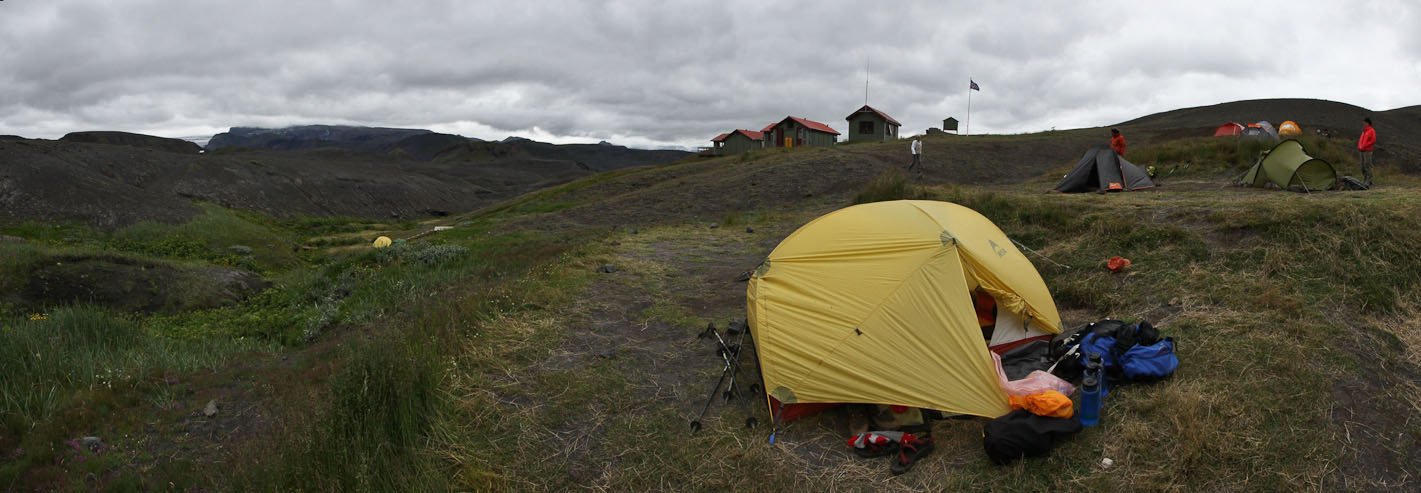
Another view of our tent spot...
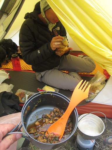
After the tent was setup, we realized we skipped lunch today, so started dinner at 4pm, setting up the stove in the vestibule. We ate another big meal, with more of the same dehydrated goodness as the past dinners.
After dinner, Wendy was ready to brush for an early bedtime, but I read about a short hike to a gorge nearby. It's a 20 minute walk to the gorge, so Wendy decides to bring her toiletries and do her dental duties on the hike.
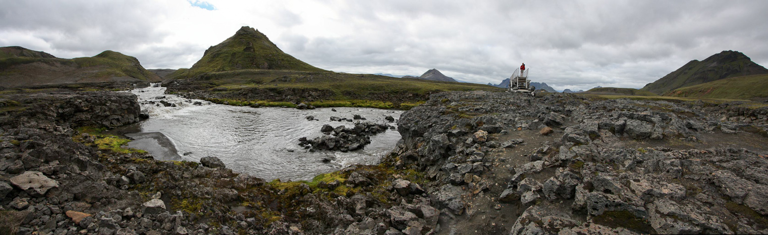
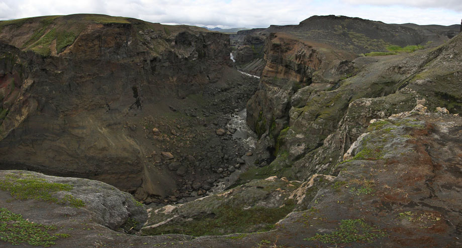
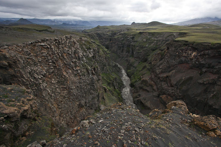
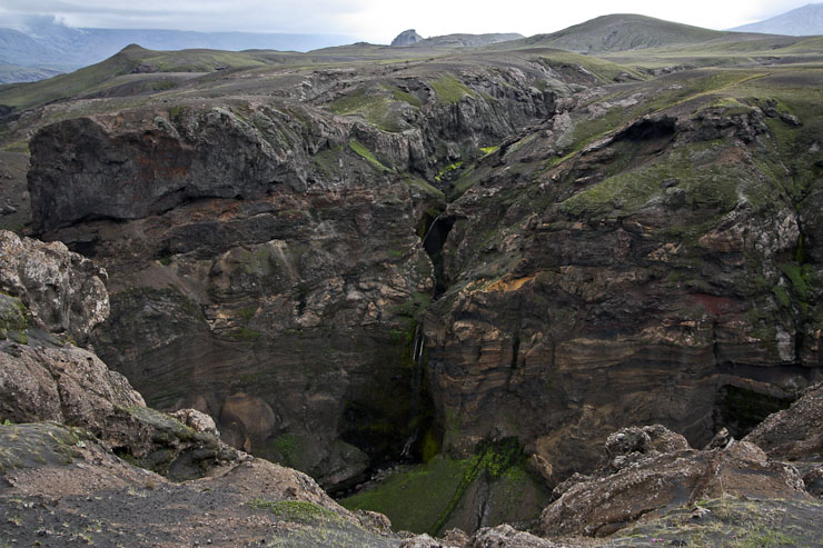
The trail to the gorge is easy to follow, and many others have decided to explore this area too. The gorge was carved by glacial flooding 2000 years ago, and has cliffs ~600' deep. It's a little unnerving to approach the edge and look down. We continue to walk along the gorge, noticing some waterfalls, and admiring the partially cloud obsrtucted views of a glacier across the valley. I floss my teeth as well. The whole hike takes about an hour.
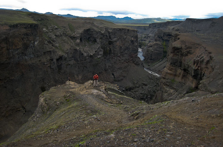
A pic of me in my orange jacket (someone else is further down the lookout point)...
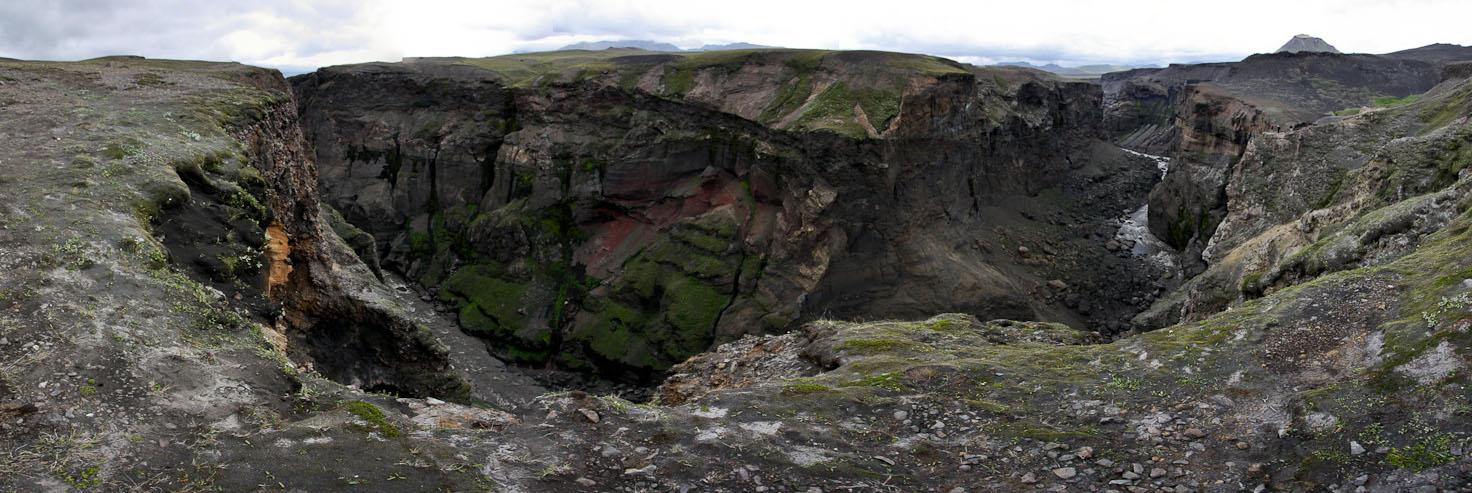
A wide look at the gorge. Would have been sweet with some sunlight...
A little bit of sun was breaking through the clouds...
We walked along the gorge, following a ~1hr loop trail from camp...
Armed with her toothbrush, Wendy simultasks while taking in the views. I also flossed, ask I admired this thin waterfall in the gorge...
A look at the glacier, as we return to camp...
Arriving back at camp, I noticed some blue skies clearing to the northeast...
Back at camp I brush my teeth, and notice that the cloud front is retreating, offering blue sky and sun to fall on camp and the glacier. I decide to hike back up to catch the views, and hopefully catch a glimpse of the volcanoto the south. The views west are good, but the clouds maintain their grip in the south, shielding the dramatic volcanoes to the south.
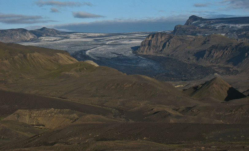 Close-up of the glacier...