2010 San Juan Trip #3: El Diente (14,159') North Buttress to Mt. Wilson (14,246') Traverse, Sept 4th, 2010
Maximize browser for best viewing
For the past 1.5 months, Tom and I had been targeting the Wilson group (the 3 western-most CO 14ers) over Labor Day weekend. These three 14ers (El Diente, Mt Wilson, Wilson Peak) also have challenging standard routes, and are lumped into the "hard" category by most peak-baggers. Our goal was to hike the "grand" traverse between El Diente and Mt. Wilson, along with Wilson Peak (potentially all in one big day).
As the long weekend approached, our party stabilized to 3 (Tom, Chris, and I), and we moved up our departure time to Friday afternoon, to help split up the long days of driving and hiking over the 3 day weekend. We hit the road at 3:20pm Friday afternoon, and soon realized we weren't the only mountain-bound vacationers this Labor Day weekend. Traffic was bogged down on I-70. After 9hrs on the road, including a Subway stop in Glenwood Springs, 2 gas fill-ups, a couple stops to rotate drivers, and a couple (brief) missed turns in the dark, we reached Navajo Lake Trailhead (elevation 9350') ~12:20am, where several vehicles and a few tents were present. In our attempt to be friendly neighbors, we parked ~50 yards down the road so that our noise wouldn't disturb any campers. However, minutes later, two Jeeps arrived at the trailhead and let out a car alarm blast...
I quickly discovered that my headlamp had run out of batteries. Note to self, check batteries, and pack extras... Fortunately, Chris had some extra AAAs I could use.
The weather forecast for Friday night, Saturday, and Saturday night called for 0% chance of rain. Rather than setup a tent in the dark (and have to re-pack it in the morning), I slept under the stars on my ground cloth and pad. Chris also slept under the stars. Tom decided to sleep in his Jeep. With good weather forecasted all day tomorrow, we hoped to fit in Mt Wilson, or the traverse, in addition to setting up camp at Navajo Lake.
By 1am, I was lying snug in my bag, staring at the stars and milky way above. The cool air on my face was comfortable, and the thick grass helped even out any lumps in the ground. I had the usual pre-hike dreams, all centered around waking up to find myself in some dilemma that would prevent the hike from happening. I was happy to wake up for real at 5:40am, and realize all was still good to go.
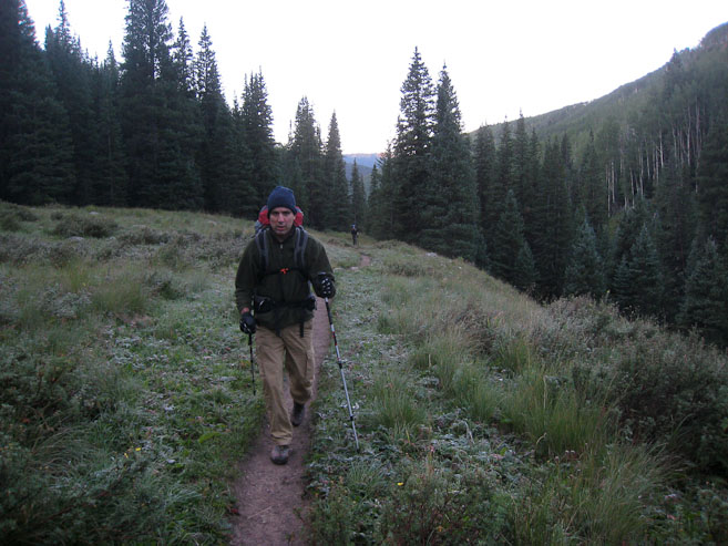
Everyone was up ~6am, and began prepping for the 4.5 mile backpack to Navajo Lake (~1800' gain). I noticed condensation on my sleeping bag, including some frost near the feet. We packed enough supplies for 2 nights at the lake, though knew there was a chance we'd return tomorrow, pending how much we could fit in today. At 6:50am, we were on the trail.
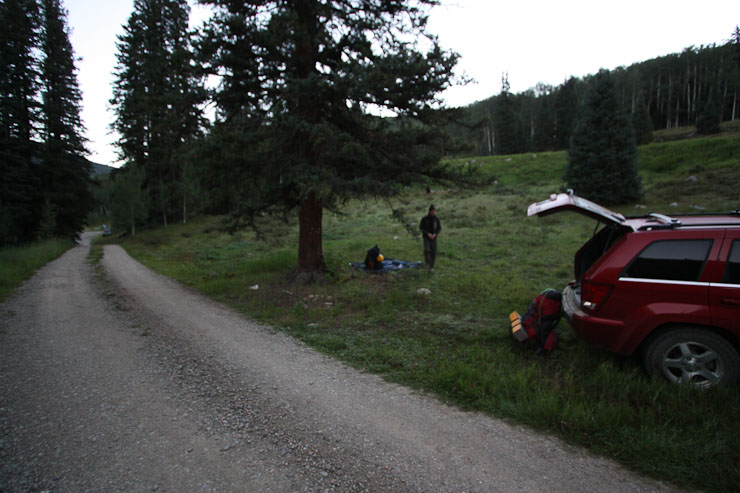
The Navajo Lake Trailhead parking lot is seen at the end of the road, past our camping spot. We left the car there and walked the extra 50 yards. Despite the frost along the trail, it didn't feel too cold out, thanks to the still air...
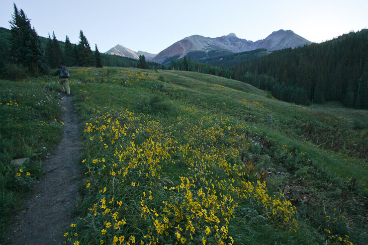
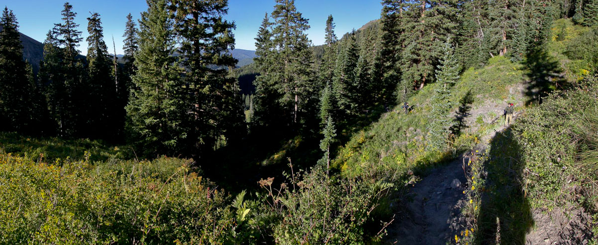
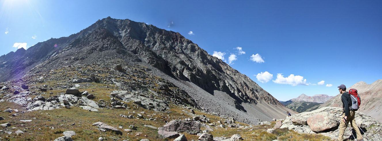
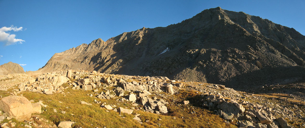
The trail was ideal for backpacking: easy grade, smooth dirt. We passed a meadow of daisies, along an aspen grove, catching our first glimpse of El Diente (1st pic). Some of the vegetation was starting to turn yellow, foreshadowing the end of summer...
The area was lush with vegetation...
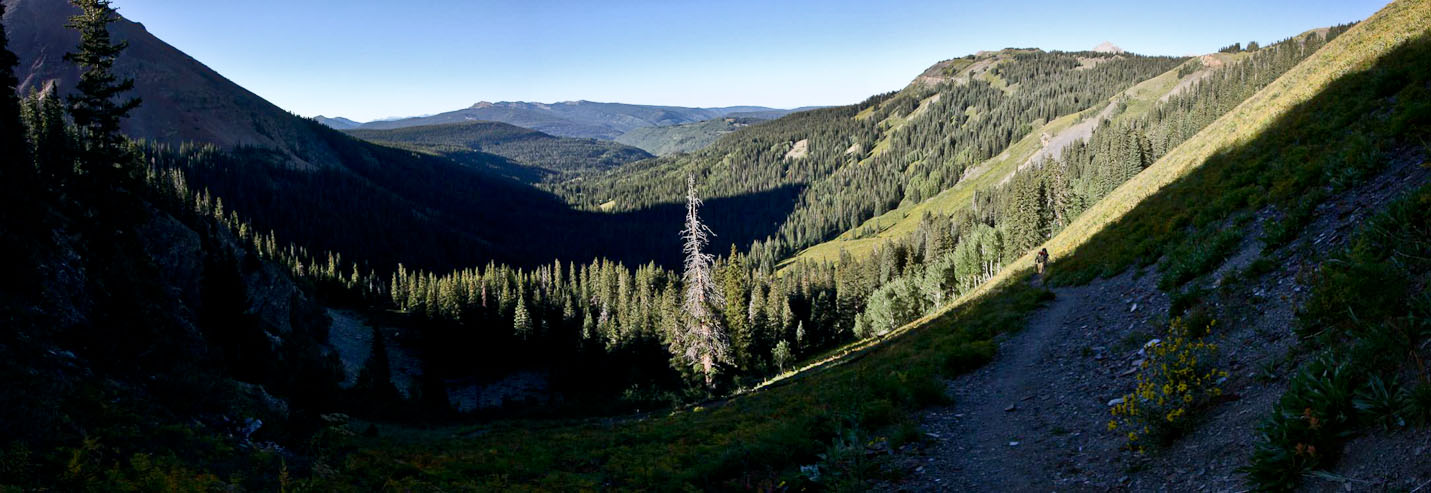
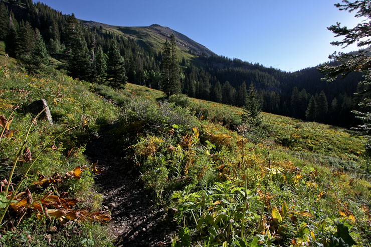
After ~3.5 miles, we started climbing out of the valley towards Navajo Basin...
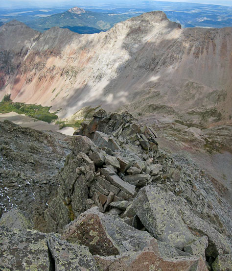
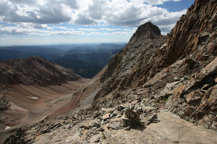
At the lip of the basin, a junction leading to Woods Lake TH made us wonder if that might have been a more convenient starting point. Later we found out it's about the same distance with a bit more gain (have to clear a pass), but the northern location would save significant drive time. Wonder why I hadn't heard more about it before. 3/4 of a mile after the junction, we reached Navajo Lake at 8:55am (2hr hike from the car).
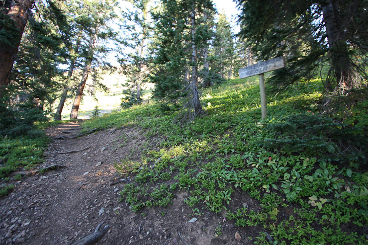
The trail sign: 4 miles to Woods Lake, .75 miles to Navajo Lake, elevation 11,130' (2nd pic)...
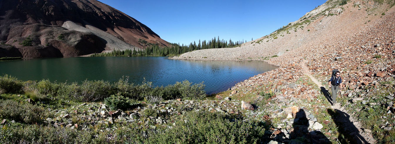
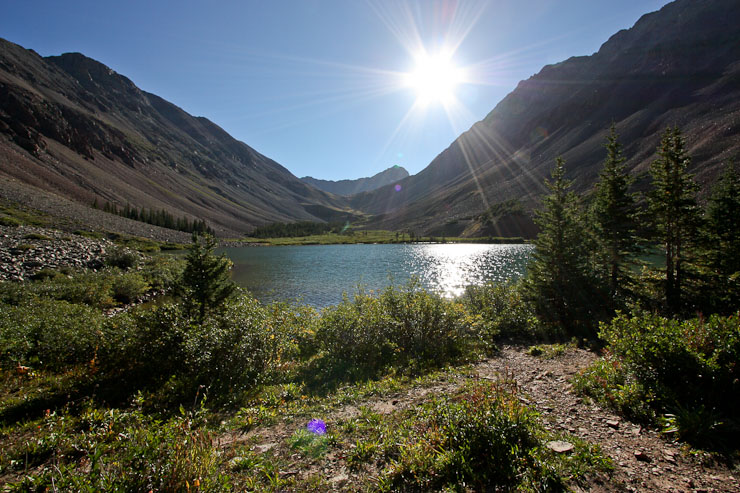
We passed the lake, aiming for a camp spot closer to the mountains...
I was a little worried that camping spots would be difficult to find, given the busy holiday weekend, but we found several decent spots, before deciding on a prime location next to a stream, that had 3 separate clearings. I went to work assembling my one-man tent and was shocked to discover I had packed a bag of poles from one of my other tents! I tried using the foreign poles with my tent, but after 3 legs were in, it was clear the 4th would not converge, and I was likely damaging the 3 legs as is. Good thing there was no rain forecast for today/tonight, cause I would be sleeping under the stars again.
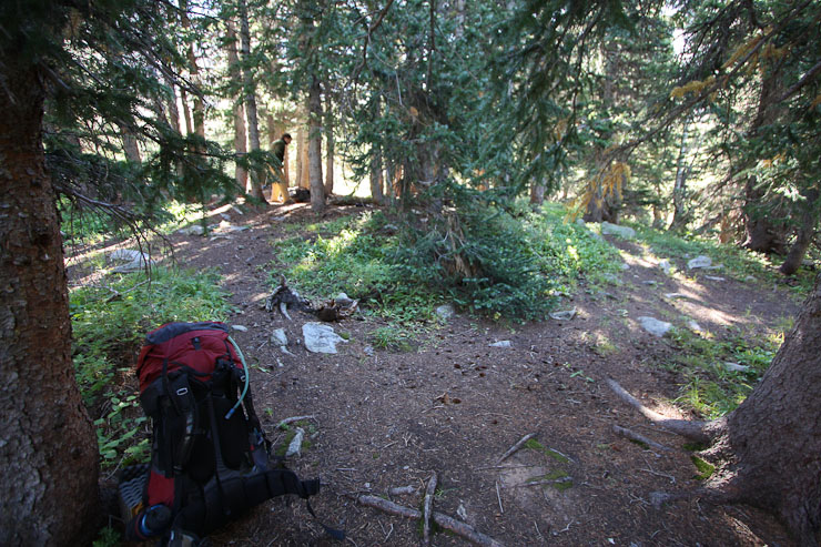
We setup camp and eat some lunch at 9:15am (or maybe 2nd breakfast?). I would soon discover that I brought the wrong poles for my tent!
While eating our meal, we debated whether to hike Wilson Peak, or attempt the traverse. Given the outstading weather forecast, and the fact that we were still fresh legged, we decided to tackle the traverse. After reading aweful reports on the dangerously loose route up El Diente's north slope, we planned to ascend via the class 4 north buttress, using 14ers.com's route guide for reference. After refilling our water supplies at the stream, and hanging our bags of food from a tree branch, we left camp (roughly 11,200') at ~10:15am, heading east up the basin. Tom brought along his new 30m rope (weighing 2.8lbs), just in case there was an excuse to use it during some nasty exposed section.
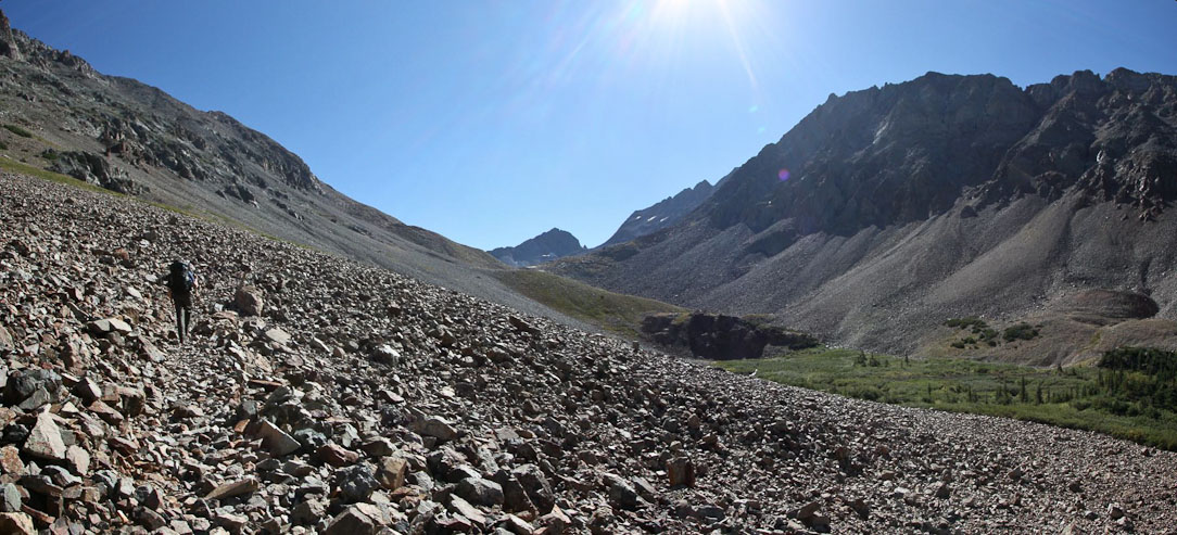
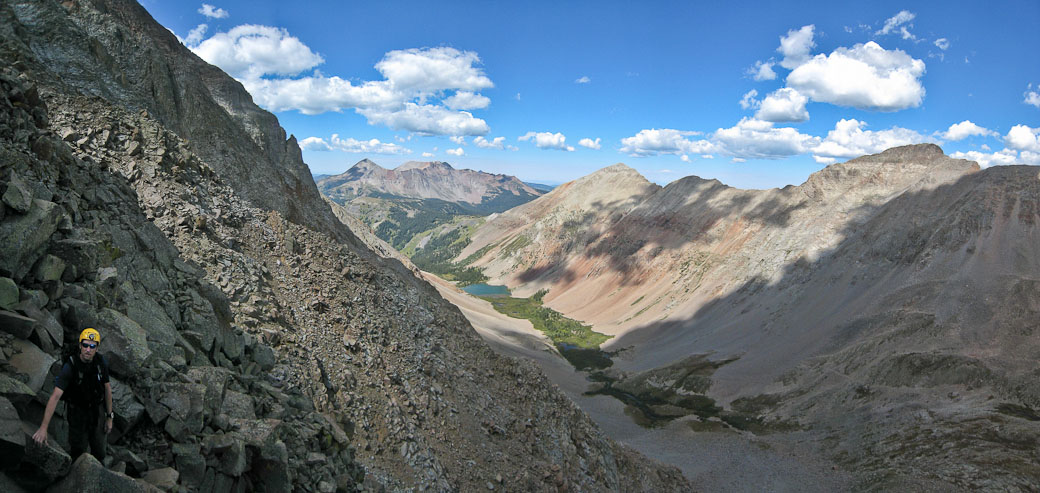
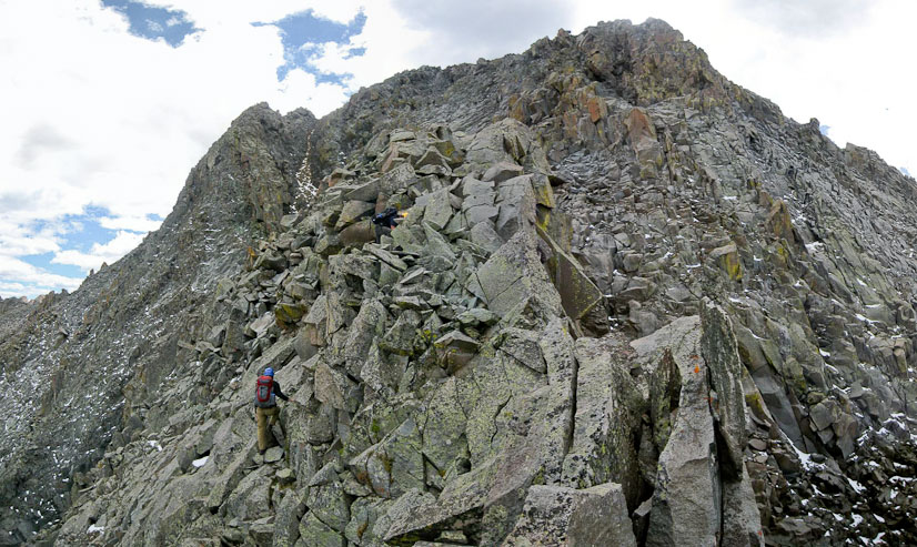
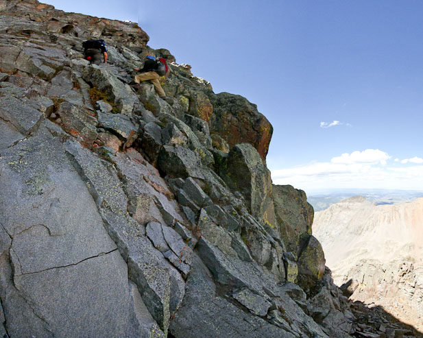
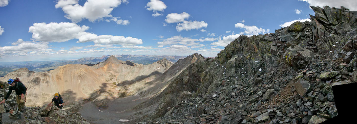
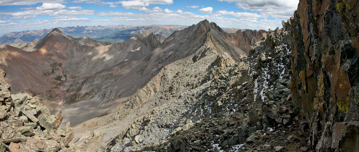
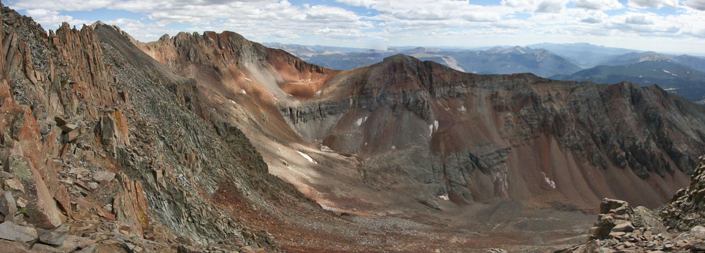
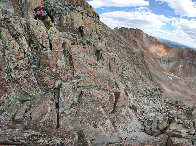
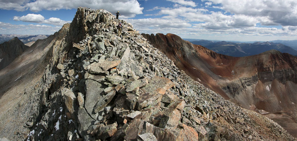
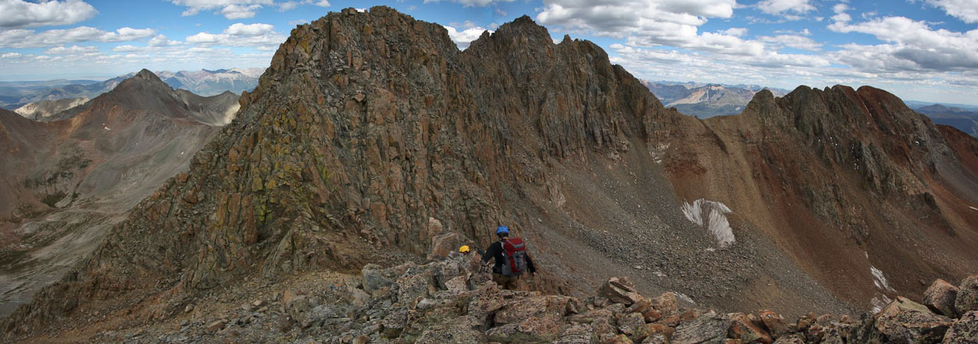
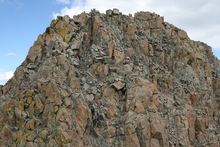
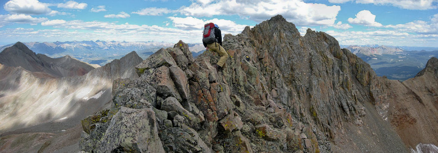
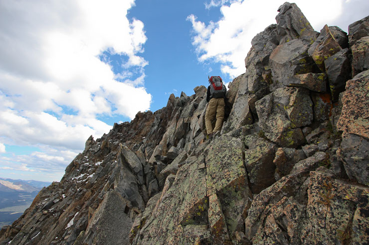
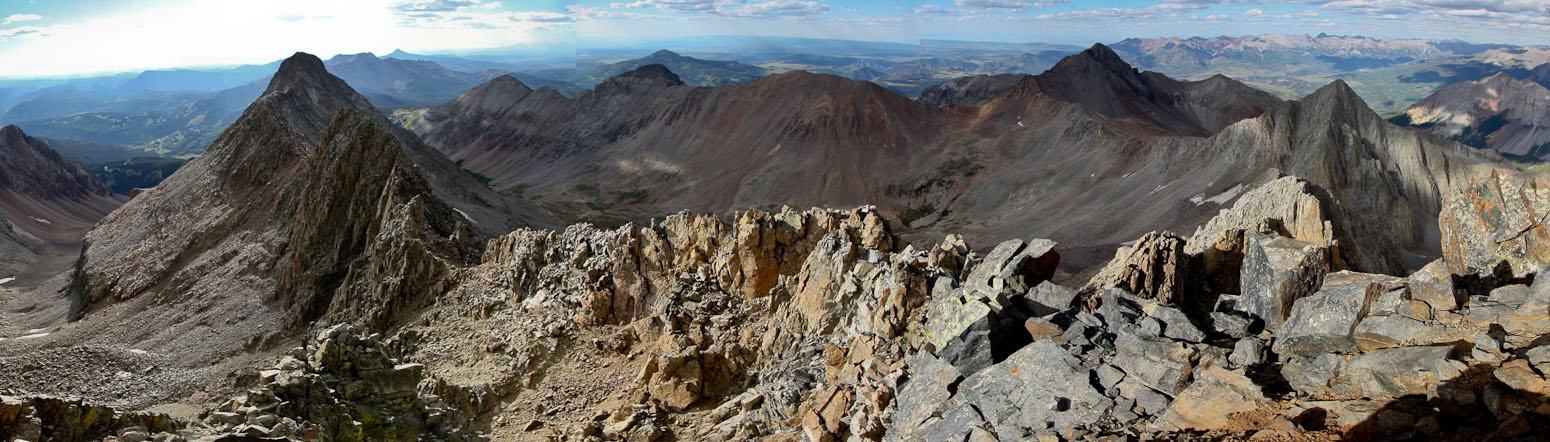
The trail led us across a talus field, further up the basin. The north buttress of El Diente is the prominent mountain arm on the right...
30 minutes into the hike, we reached the grassy band leading to the north buttress, ~11,800'. It would be a 2350' climb to El Diente from here. Navajo Lake is on the right...
Tom heads towards the base of the north buttress...
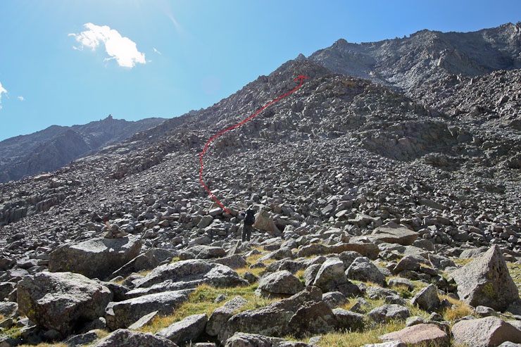
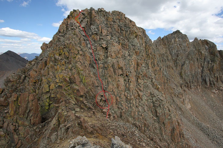
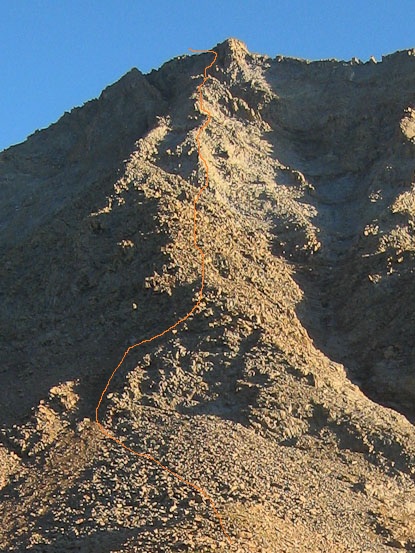
After consulting the 14ers.com guide (squinting at the B&W small pic), we choose the route in red to ascend the ridge ...
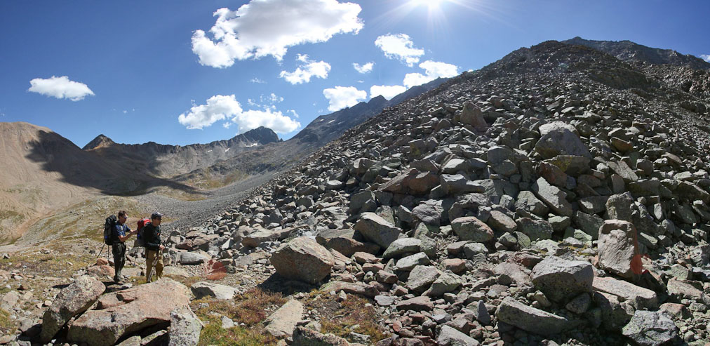
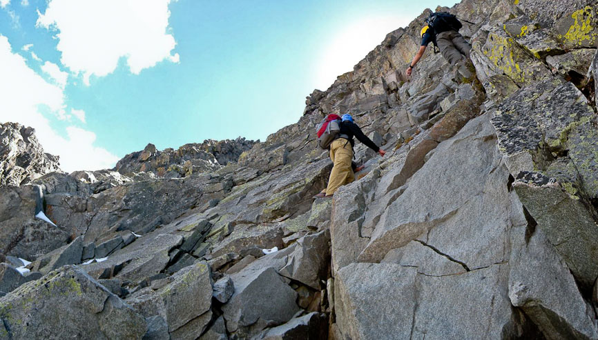
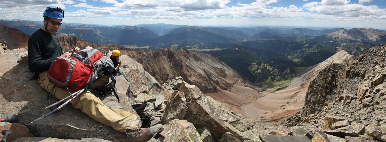
Last minute pack adjustments at the base of the buttress...

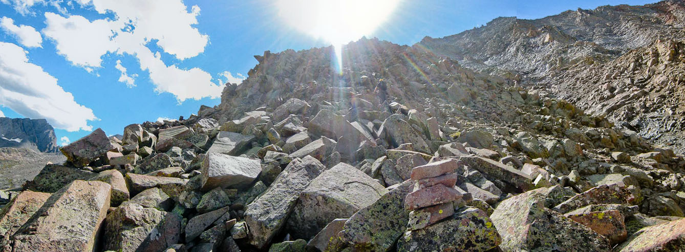
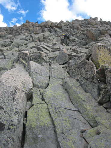
Lots of boulder hopping/scrambling on the agenda today...
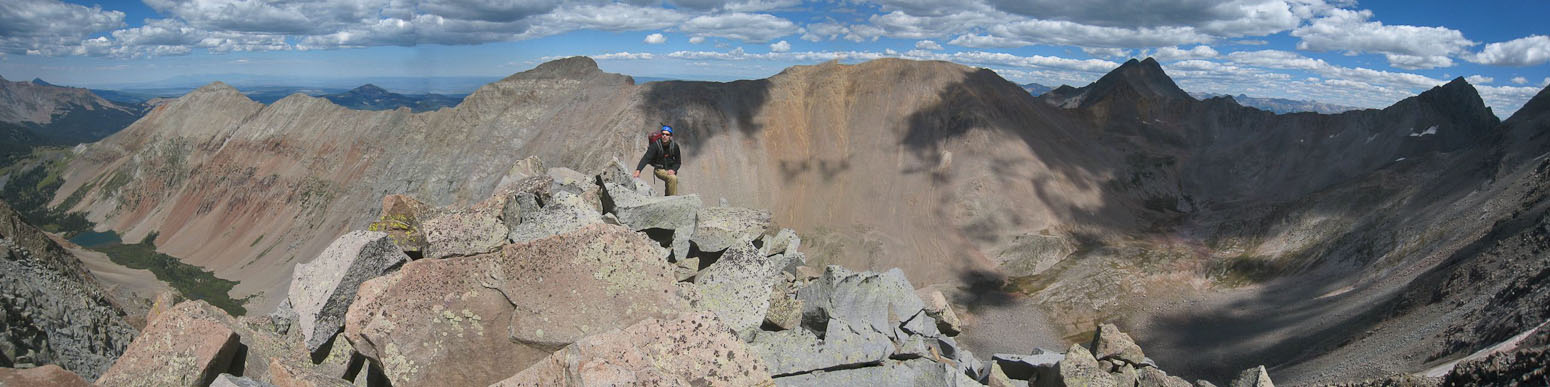
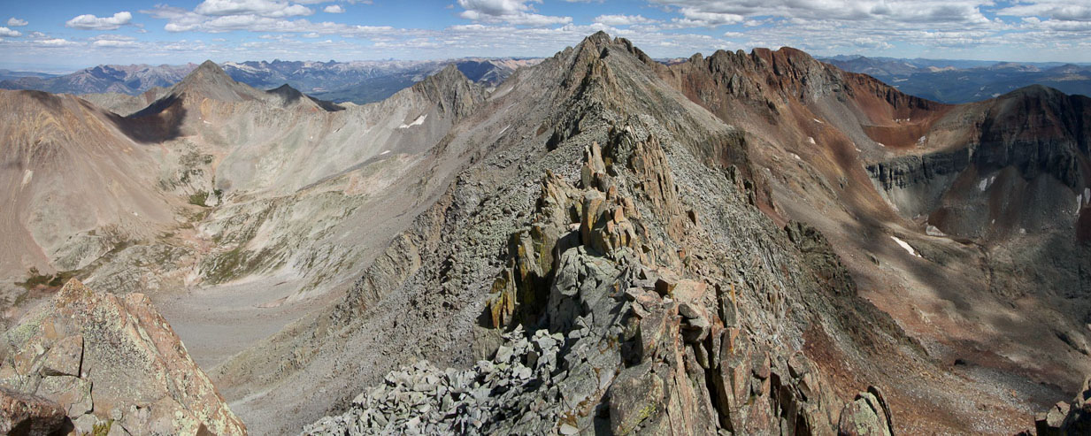
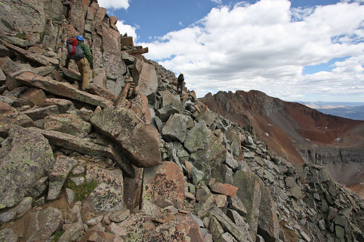
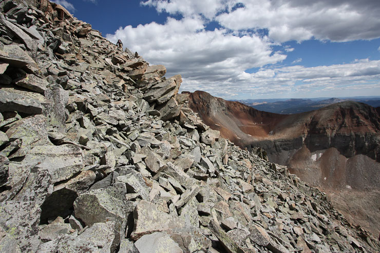
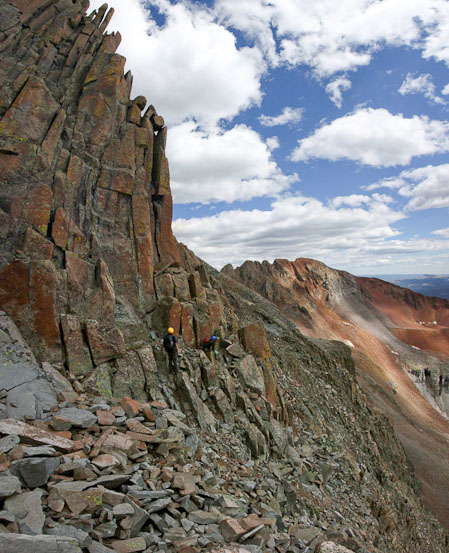
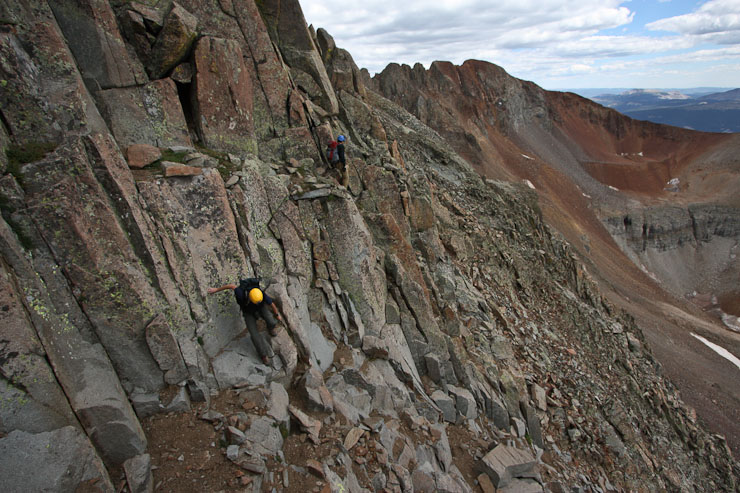
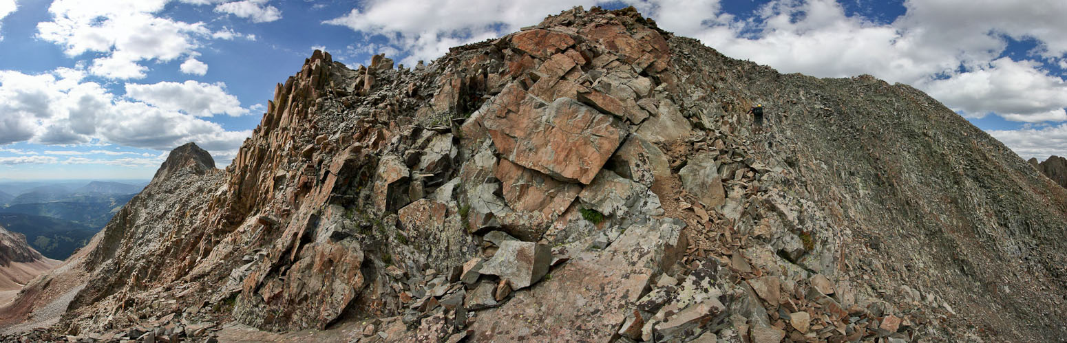
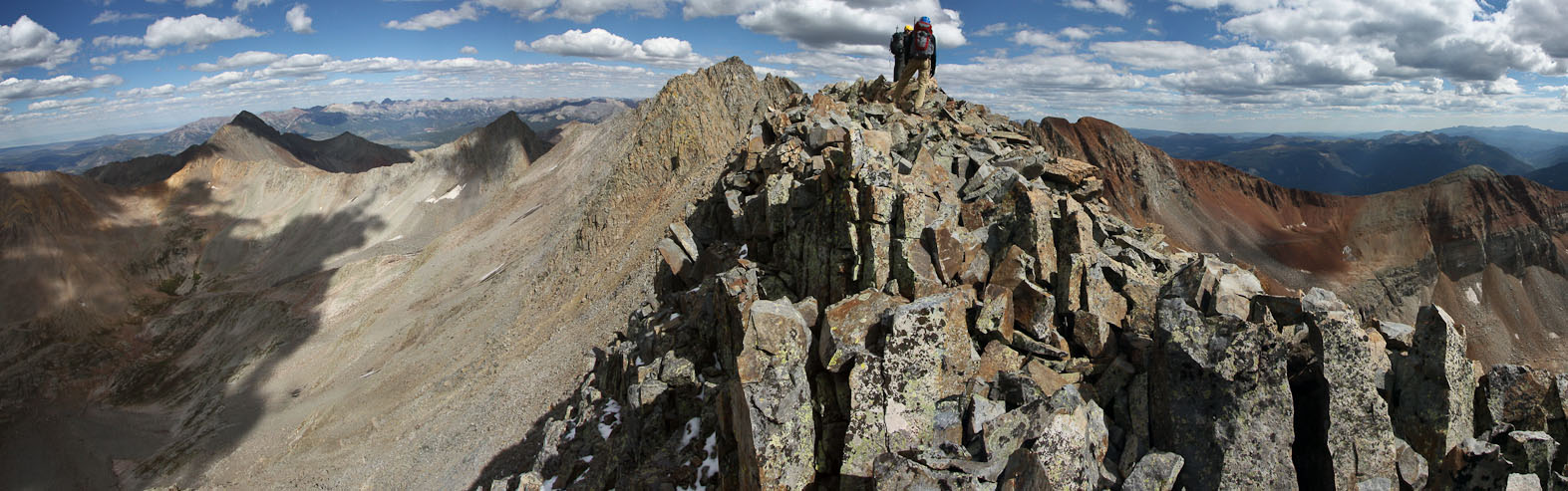
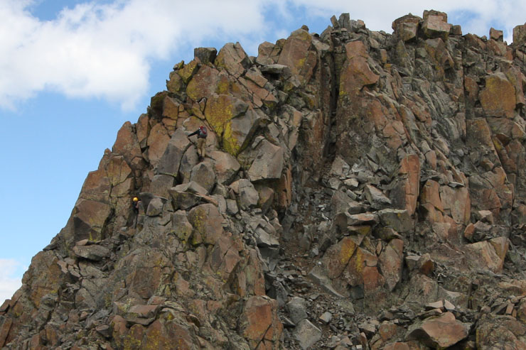
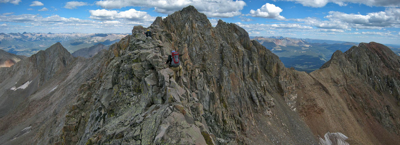
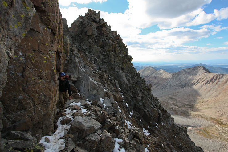
Once on top of the ridge, after following the route in red (3 pics up), there's not much more route finding necessary until you reach the exposed catwalk near the top of the buttress. Simply stay on the ridge top and scramble up. We stopped frequently to consult the guide, but in the end, simply climbed up, following the highest part of the ridge (or obvious easier path just off the ridge), and found occasional cairns, with solid class 3 climbing. There were 3 flat "bench" sections on the ridge before reaching the catwalk. It took us 2hr 10min to reach the catwalk (~13,800').

The view back towards the basin after reaching the 1st bench, 35 minutes from the base of the buttress. Navajo Lake on the left, Wilson Peak on the right...
A look up from the 1st bench, marked by a cairn of red rocks. Still a long way to go...
A look back towards Navajo Lake...
Tom working the boulders (or rather, the boulders working Tom)...
Looking down the buttress...
The rock on the buttress was pretty solid. We were careful not to dislodge rocks, and fortunately, it was quite manageable. Meanwhile, we heard a long thundering rock avalanche further up the basin, and our eyes immediately jumped towards the north slopes route. It looked like an airplane was shooting a machine gun at the mountain, causing puffs of dust to explode in a scattered pattern along the rock slope. The thought of being on that route during something like that was disturbing. We had seen some hikers on that route earlier, and figured they must have caused the huge rock slide. Fortunately, no one else was on that route below them. We choose the north buttress route to avoid that possible scenario.
The view ~1hr from the base of the buttress. Another bench is on the horizon. We heard and saw a huge rock slide on the slopes to the left...
A look back as Tom reaches the 3rd bench...
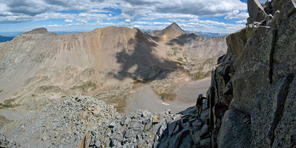
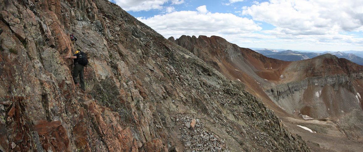
We stayed climber's right of the ridge, on a ledge, after the 3rd bench...
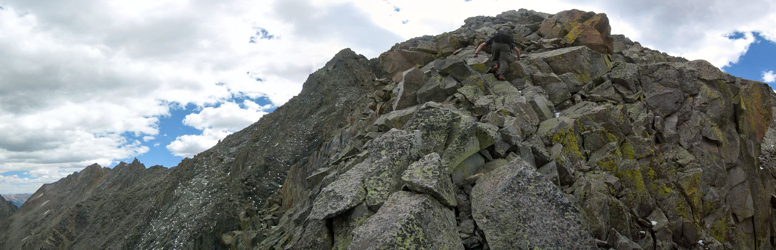
More class 3 scrambling up the buttress...
Finally, ~1:15pm, we reached the inclined catwalk, which confirmed we were on the right path (we had some trouble with the 14ers.com route description, but in general, just kept climbing up the ridge, along the most natural course)...
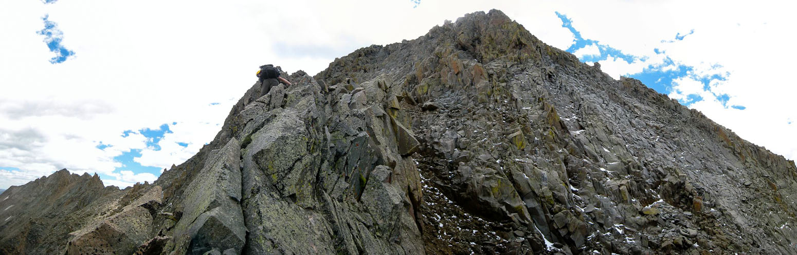
Tom and Chris opted to stay to the left as long as possible, but eventually needed to climb to the top of the catwalk (1st pic). I simply stayed on top from the start, which was very simple (easier than trying to bypass). A look back at the catwalk ~13,900' (2nd pic)...
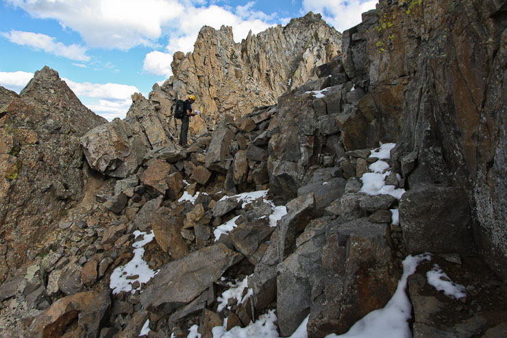
Beyond the catwalk is a saddle, which leads to the "crux" (if it wasn't the catwalk) of the climb. There is a route across exposed slabs to the left, where one is helpless should rockfall from above occur (as was voiced in many a trip report). There is also a recently reported alternate route up a solid class 3 gully towards the right (contributed my KeithK on 14ers.com). We opted for the gully route.
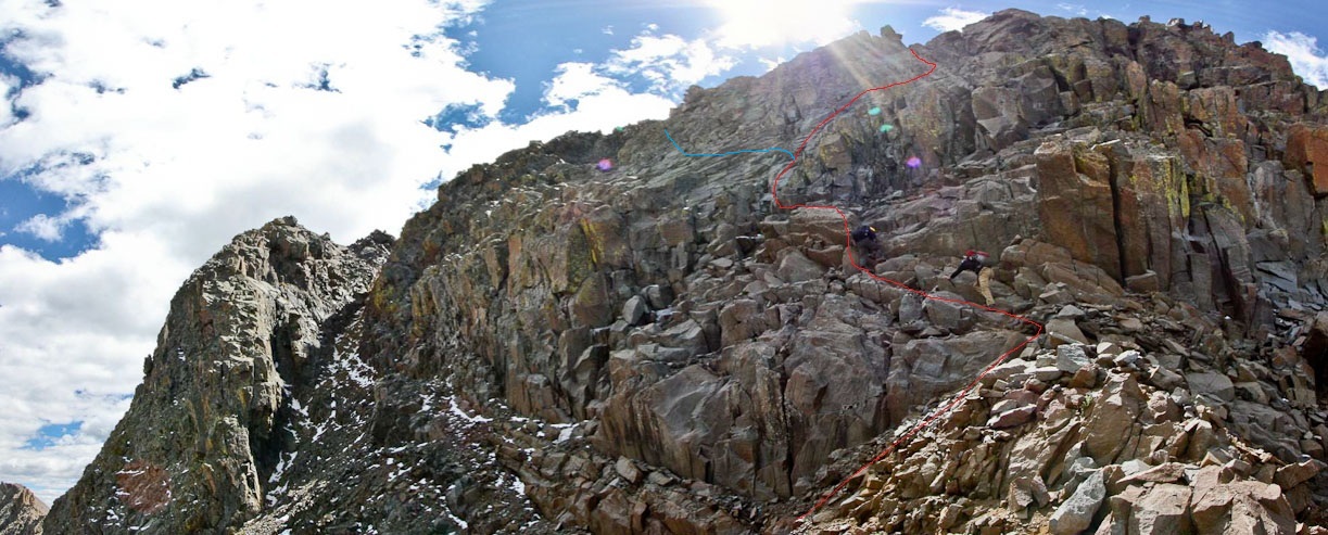
In this pic from the saddle after the catwalk, we took the path in red, leading up a solid class 3+ gully. The blue line indicates the approx route across the exposed slabs...
This point marks where we turned to the right, to avoid the slabs and climb the gully...
Not sure if it's actually a "gully", but we were able to ascend steep solid rock with good holds, leading up to (see next pics below)...
...twin chimneys. We climbed the one on the left, which was class 3, though the one of the right (with the sun) looked good too...
Above the chimney, we were almost to the top....
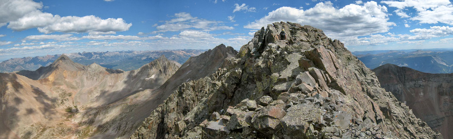
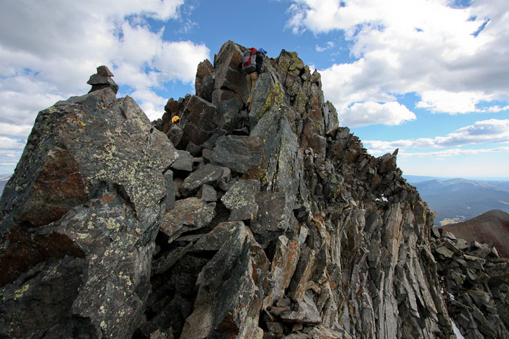
Quickly, we reached the ridge, and headed east towards the summit...
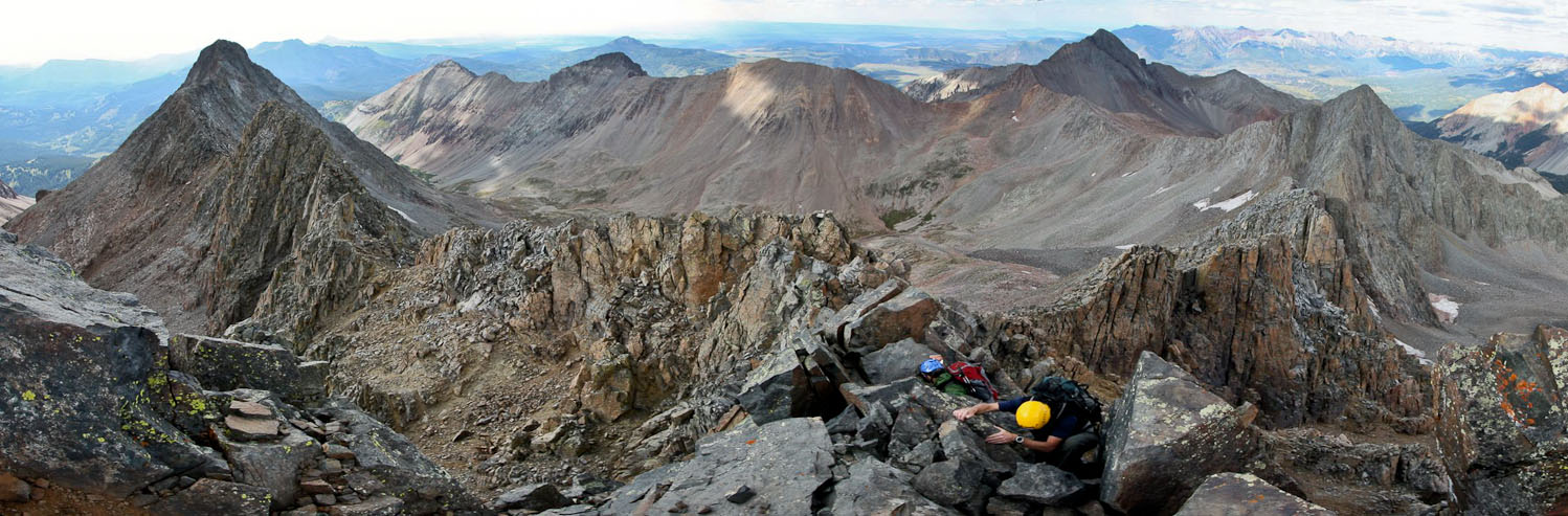
Two minutes later, we reached the summit (~1:50pm) of El Diente! Total time from camp near Navajo Lake: ~3hr 40min, 3000' gain...
We met another hiker at the summit, who had just finished the traverse from Mt Wilson. His companions opted to hike down the south side of El Diente to Kilpacker Basin, and make the long hike around and back into Navajo Basin, all in order avoid the loose rock on the north slope route of El Diente. That seemed like a HUGE long cut, but tells you how sketchy the north slopes route is considered by many.
We asked how the traverse was, and were informed that there was plenty of challenge on the ridge, but good holds wherever needed. He also mentioned that there is a way to bypass the class 3+ crux and coxcombs, just before the summit of Mt Wilson. I haven't seen that bypass show up in a trip report before. If anyone knows it, I'm sure plenty of people would be interested to hear more info.
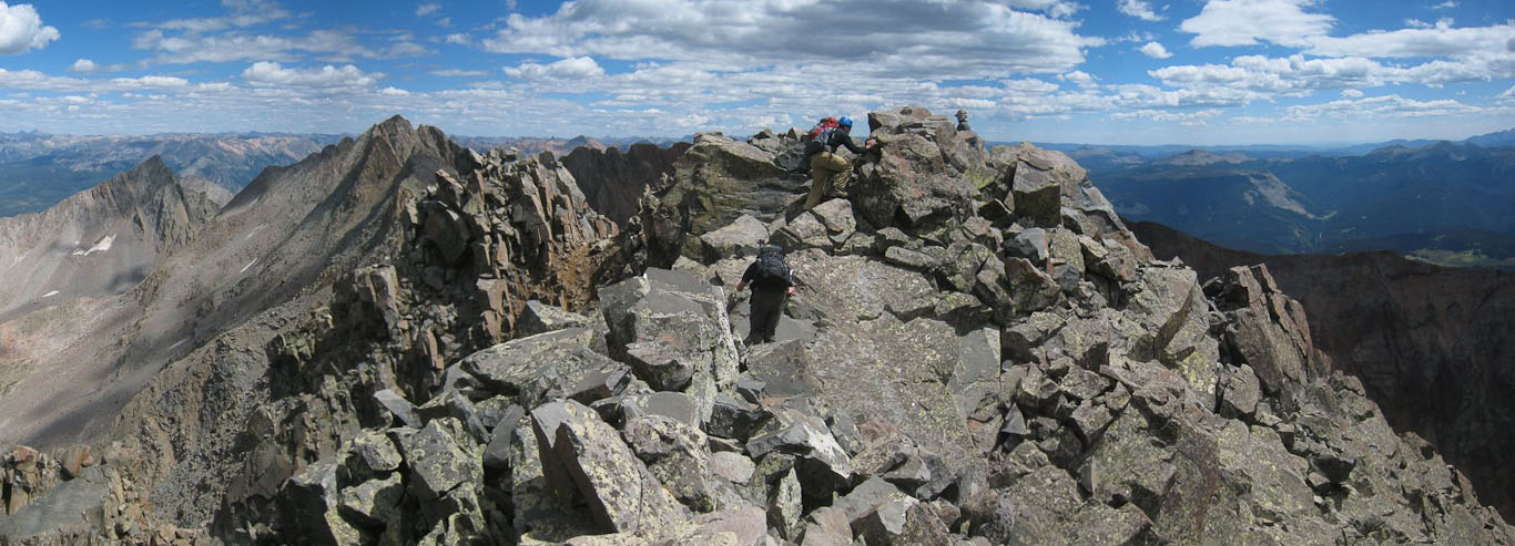
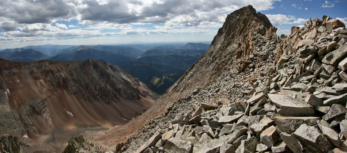
The summit of El Diente doesn't have much room for large parties...
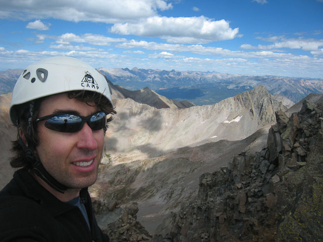
A self portrait on the summit. My head is blocking Wilson Peak, but Gladstone Peak is visible on the right...
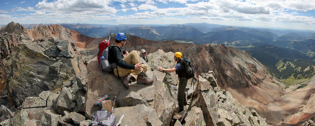
We spent 22 minutes at the summit, chatting with the hiker, eating a snack, and admiring the views. Kilpacker Basin, on the south is of El Diente, is below. The "easiest" route up El Diente, considered by many, is the south slope route from Kilpacker...
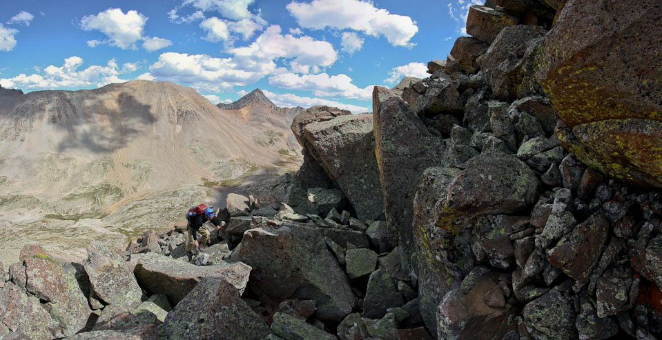
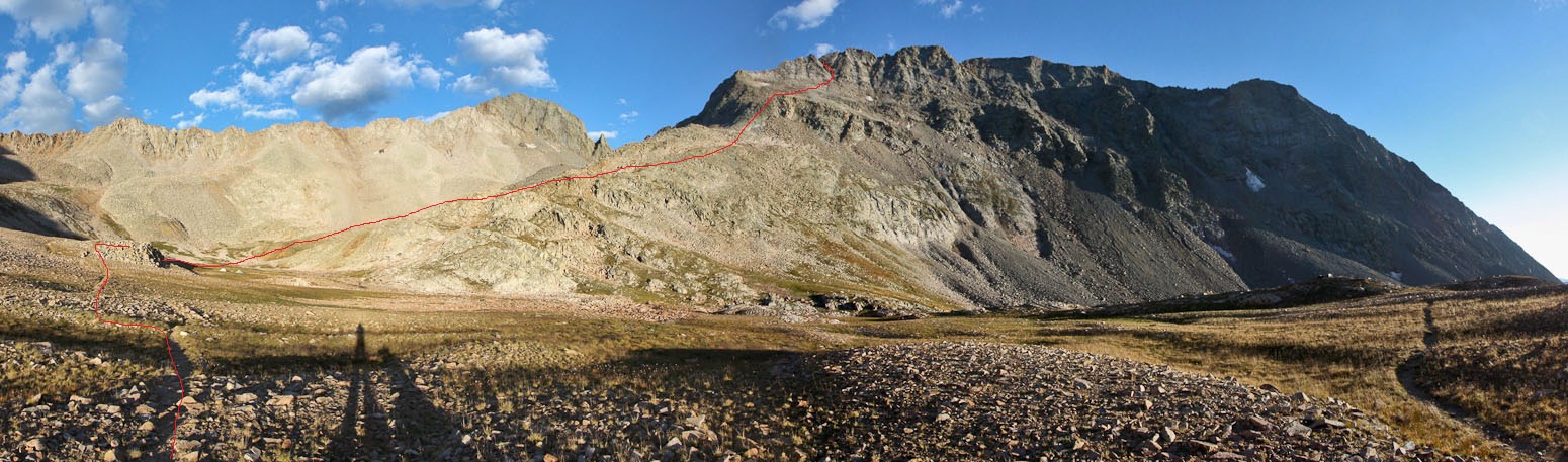
Chris and I both had printouts of the 14ers.com El Diente - Mt Wilson traverse description. We started out dropping to the left side of the ridge and traversing ~1/8th of a mile before crossing over to the right side, for the majority of the traverse.
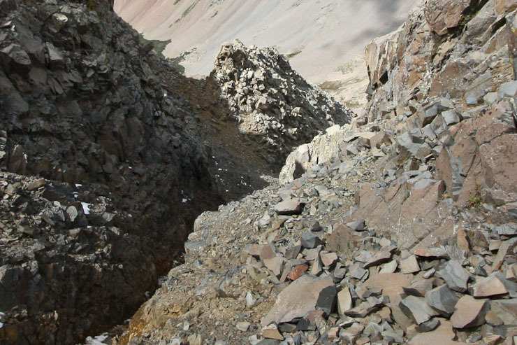
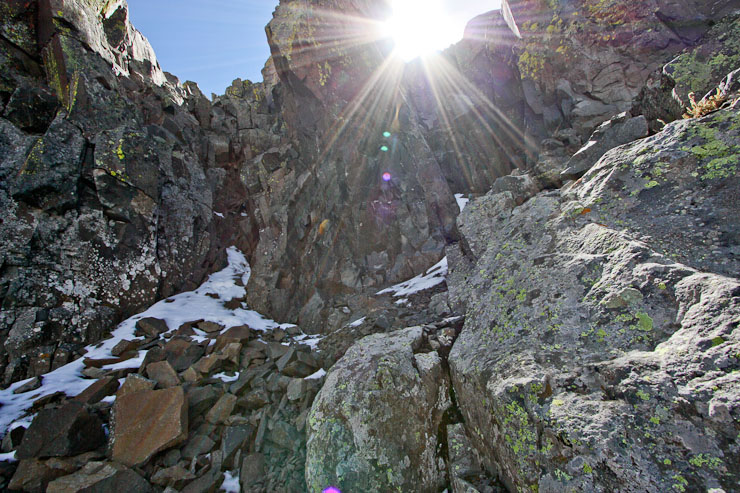
The traverse begins by following the red line into the gap (1st pic). A look down a gully at the saddle after the catwalk from our north buttress route. The size/scale is misleading. It looks like a simple walk up this gully from there, but this gully was not part of the route, likely due to steep loose rock near the sun line...
Mt Wilson appears straight ahead, on the other side of the traverse. We would cross to the other side of the ridge, once past the dark rock section...
Mt Wilson dead ahead, with a rough road in between us. Notice Chris and Tom descending in the lower right of the 1st pic. We would keep to the right side of the ridge to bypass the "organ pipes" and gendarmes. Also, a look over at Wilson Peak (2nd pic)...
A wide view looking down the traverse, with Wilson Peak on the left, and Mt Wilson in the center, before I followed Chris and Tom down the right side of the ridge...
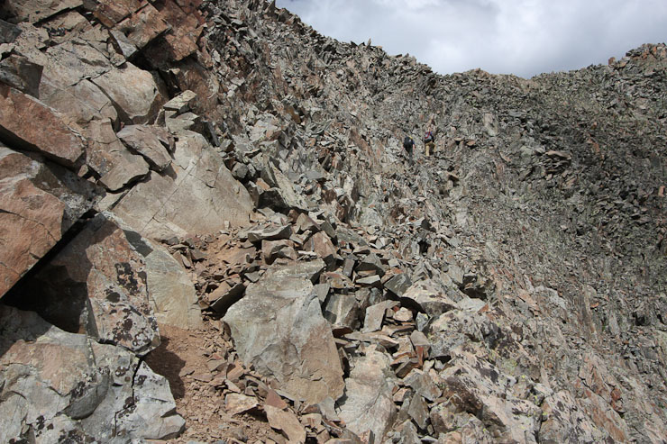
We dropped ~250' on steep loose rock, and then began traversing along the right side of the ridge, across ledges, and sloped boulder fields...
The trail was impressively cairned, resulting in easy trail finding. The scrambling stayed class 3, with good holds wherever needed...
A look back at "the tooth" (El Diente) from a short ways into the traverse. There were plenty of clouds out this afternoon, but nothing threatening...
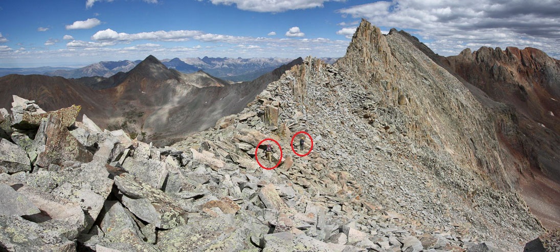
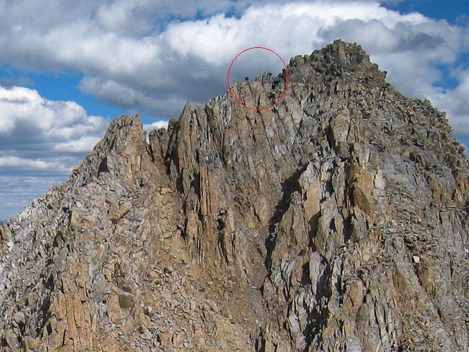
Tom and Chris are circled, as we near the ridge top, but still need to bypass the upcoming gendarme on the right...
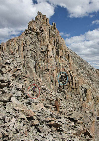
Tom and Chris are circled in the first pic. The blue circle indicates the path through the notch in the gendarme. Tom is standing in this notch in the 2nd pic...
Immediately beyond the notch, the trail continues along a ledge (marked in red)...
More ledges as we contour around the gendarmes...
Chris heads down to look for an easier route up to the next ledge...
I heard a cry from Chris, and looked up to see his nalgene bottle tumbling down the slope to the right. This felt somewhat familiar, as watched Tom lose a nalgene bottle down Lambslide 2 weeks ago on Kieners Route. Chris had been clipping his nalgene to his pack, so he was certainly surprised that it ejected. Fortunately Tom and I had plenty of water to share.
Chris lost a nalgene bottle down these slopes. We couldn't find where it ended up, and left it for dead...
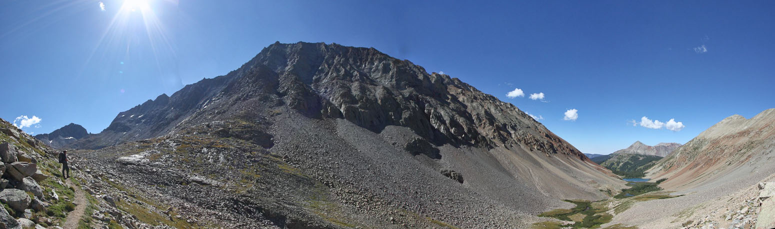
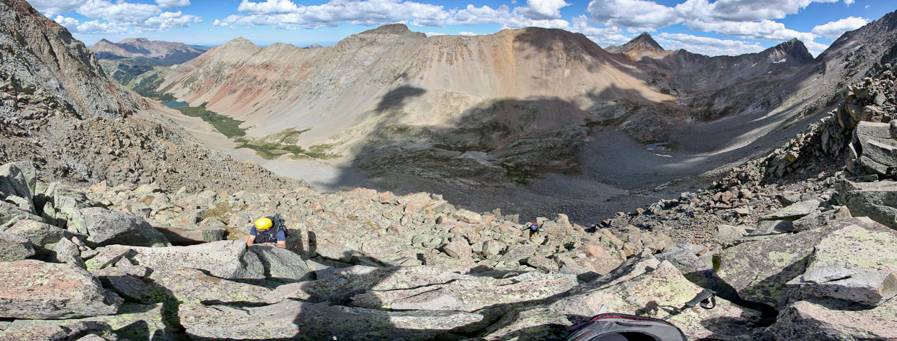
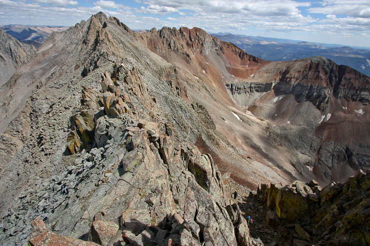
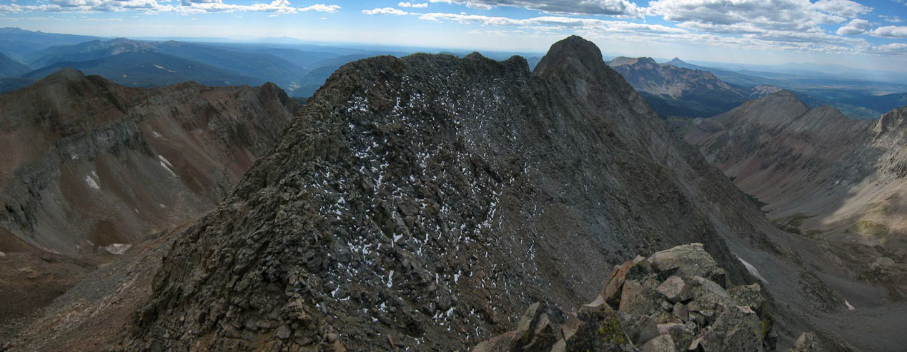
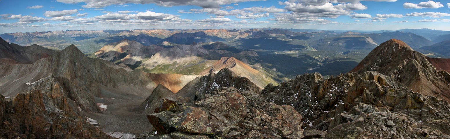
About halfway across the ridge, we bypassed the last gendarme, and now would head for the ridge. This pic shows a 180 degree view of the traverse, though most of the 2nd half is hidden (on the right)...
El Diente rises about Kilpacker Basin (1st pic). A look at the rock field to cross on the way to the ridge top...
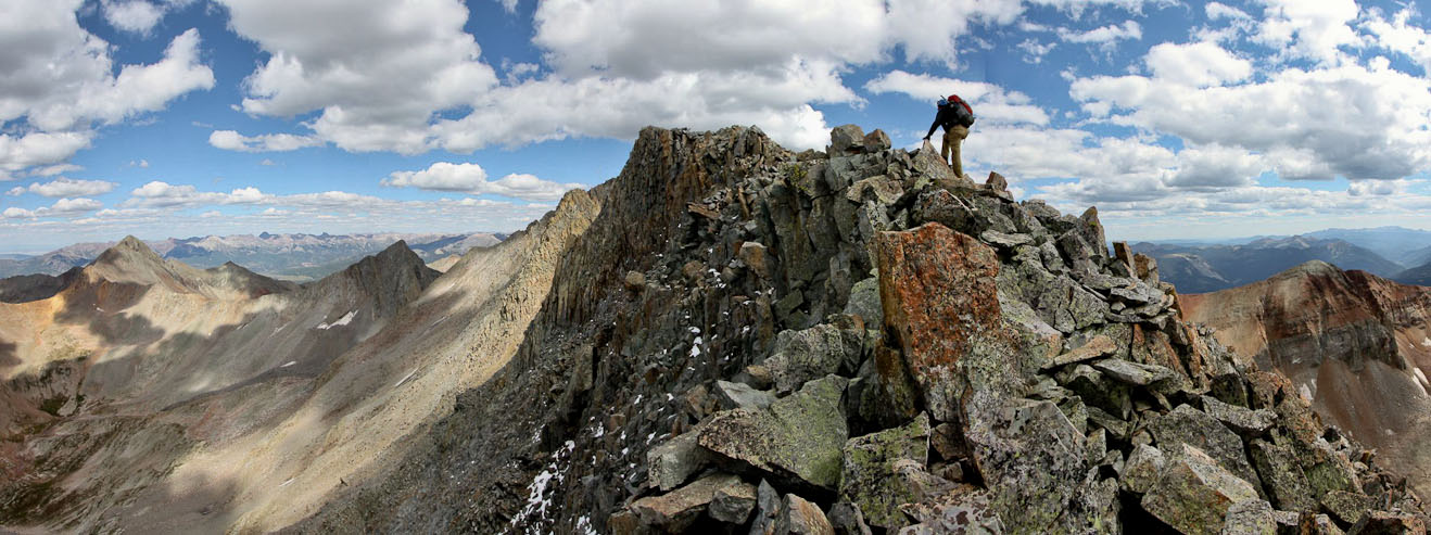
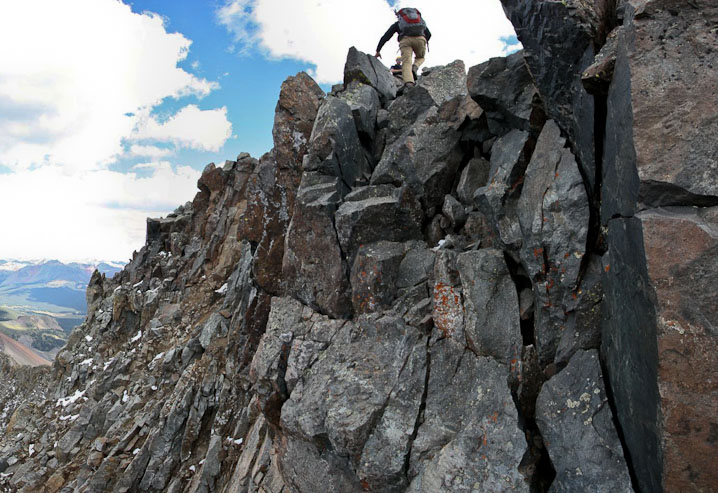
Tom steadies himself atop the ridge...
The ridge was scenic, but not too exposed...
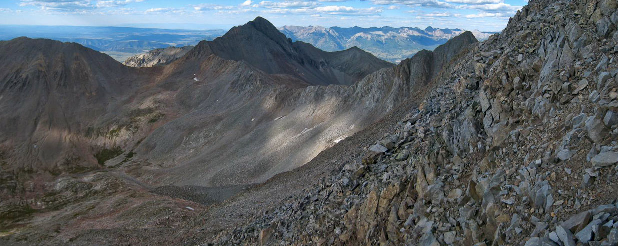
The clouds stayed friendly, even abating a little at 3:25pm. Mt Wilson on the left...
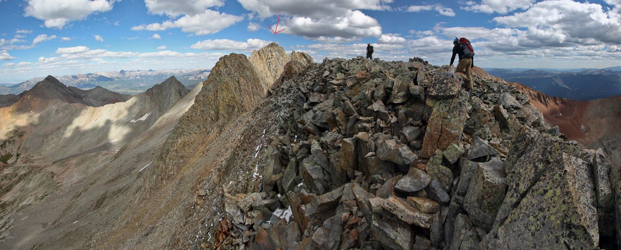
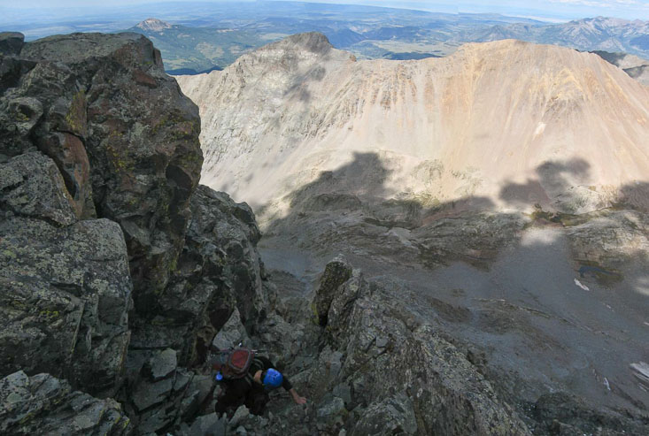
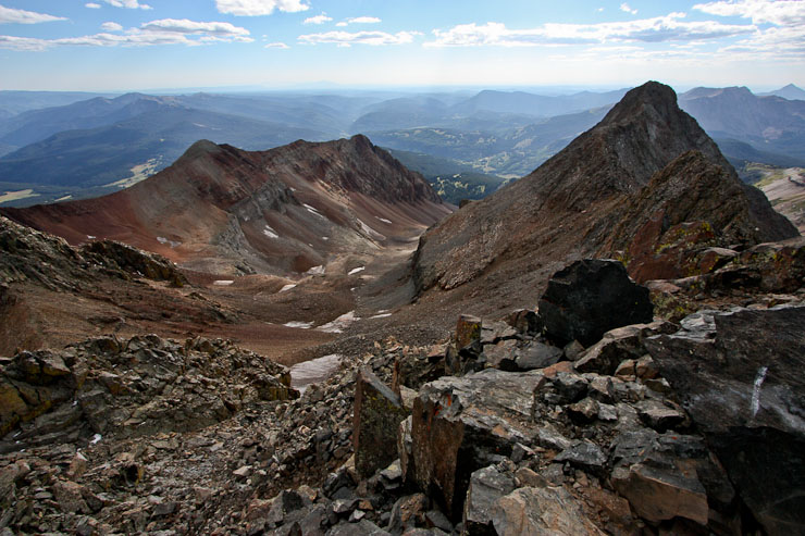
Mt Wilson, our destination at the end of the traverse is marked with the arrow. The crux is in front, in shadow...
The ridge looks intimidating as you prior to the saddle at the crux, but just climb the to the top (as Tom is doing), and the downclimb beyond isn't too bad....
The downclimb leading to the saddle before the class 4 crux...
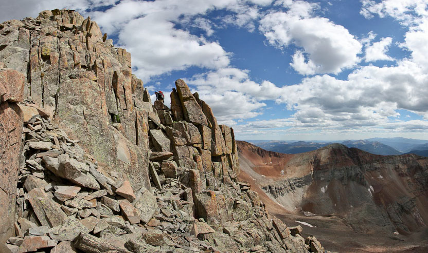
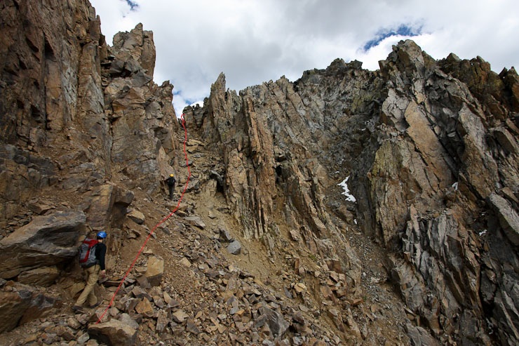
Up ahead was the crux of the traverse: a steep ~100' class 3+ scramble (Roach says class 3, but seems class 4) back up to the ridge. We had just been informed by a hiker on El Diente that a bypass existed to the right, but we hadn't heard of it in our prior research and online TRs. Based on TRs, the crux looked manageable, and I personally was looking forward to the climb, rather than wander up possible loose gullys, looking for the bypass. However, if anyone knows more about the bypass, I'd be interested to hear it. Chris and Tom debated about trying the bypass, but decided on the crux.
I opted to stay across the saddle to capture some pics of Tom and Chris ascending the crux. The climb looked incredible steep and scary from my vantage point, but I knew it was probably more manageable up close. I watched as Tom and Chris carefully made their way up, giving them some pointers near the top.
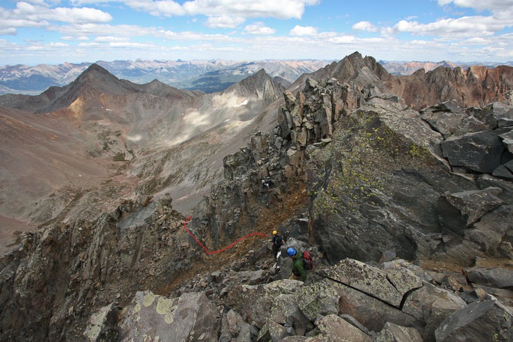
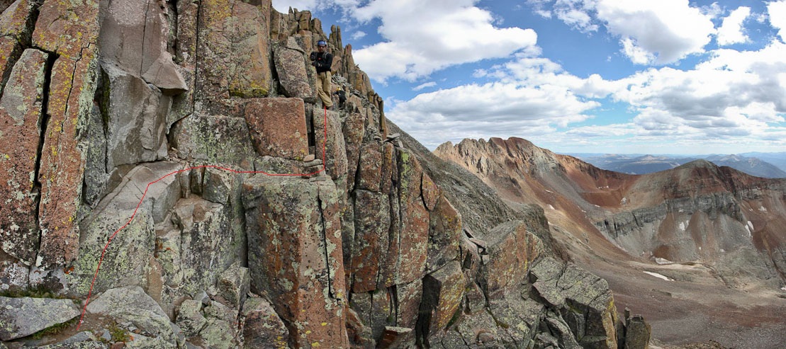
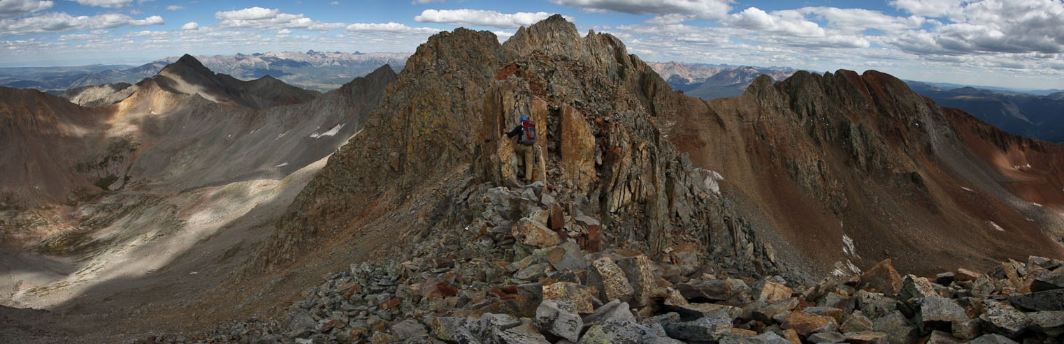
The 14ers.com route is outlined in red. Basically, follow the steep gray rock vein that slants to the left, then turn up near the yellow rock to the left of the chimney. Tom and Chris are in the circle at the bottom...
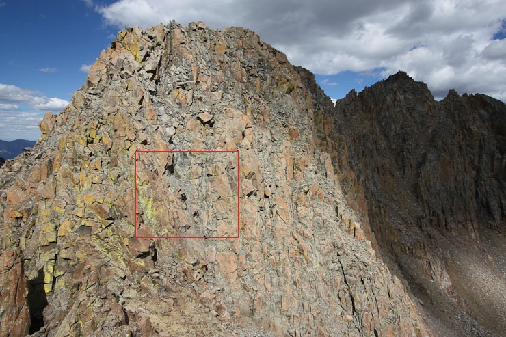
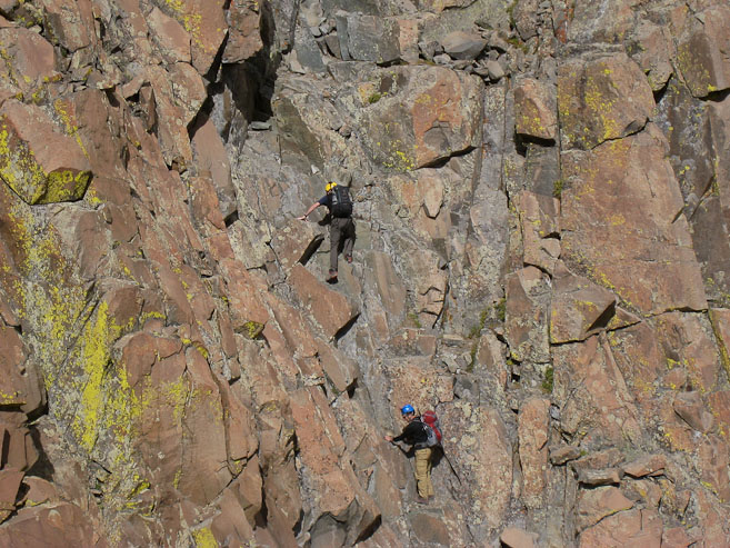
A look at Tom and Chris a couple minutes into the climb. The 2nd pic is a zoomed in shot of the area in the red box...
Tom and Chris are circled in the 1st pic. In the 2nd pic, Tom is about to climb up next to the yellow rock. Chris is to the lower left of Tom, looking for an easier way (but not to be found). I later read reports that there's an easier ascent to the right of the chimney...
Tom and Chris made it to the top of the crux in ~8 mintues. I then descended to the saddle, and looked up at the steep rock, remembering to start near the gray vein. It looked tricky, but there were perfect holds to be found, and mostly big solid rock every where. I found myself flying up until I reached the area under the chimney. I also made my way to the yellow rock, and quickly joined Tom and Chris at the top. It was a certainly the easiest crux move compared to the other "grand traverses" I've done (LB-Blanca, Crestones). Little did we know, that the trickiest part today was still to come...
A look back at the ridge and El Diente from atop the crux, at 4pm...
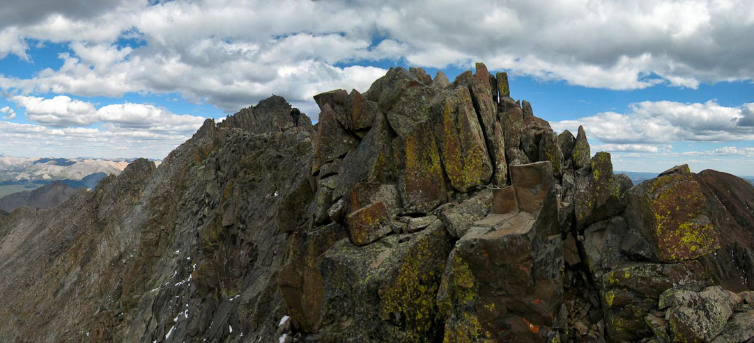
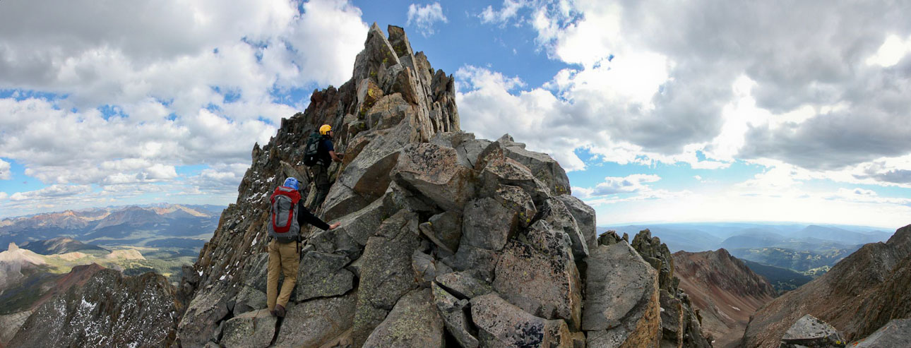
Up ahead was a narrow ridge with bumps (called "coxcombs", I learned today)...
Tom puts the coxcomb into a scissors hold. Certainly more exposure here than on the earlier parts of the traverse...
Tom and Chris kept to the right of the ridge, I stayed on top...

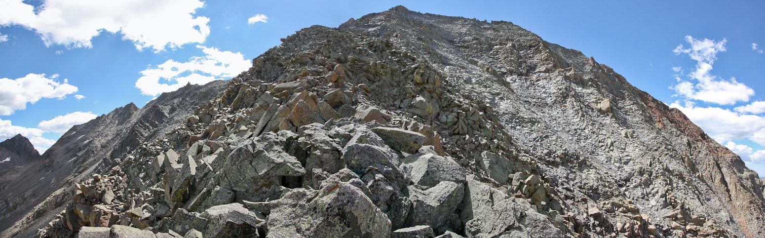
Up ahead we could see the summit of Mt Wilson, known for it's final class 4 pitch leading to the summit. A close-up shows some hikers descending along the top of the sharp ridge (circled in 2nd pic)...
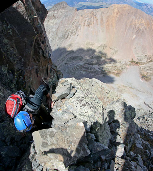
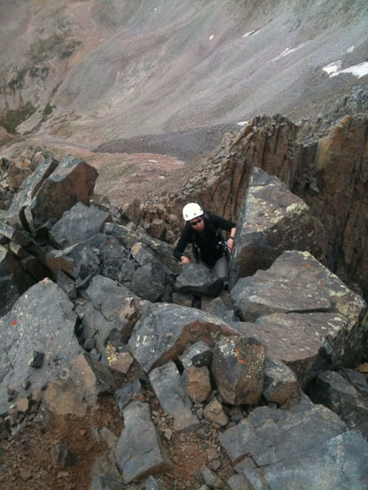
The ridge become too sharp, and we followed the guide, keeping to the left of the dark rock with yellow lichen. However, soon we reached a tough descent that had a couple inches of recent snow, causing treacherous footing. I found an alternate snow-free path to downclimb, that had good holds, but was steep, and slightly invertered for a couple of steps. Meanwhile, Tom and Chris were having trouble with the snow covered rocks where they were descending, and opted to use the 30m rope that Tom brought for assistance. Chris anchored the rope, and Tom held on as he worked his way down. Tom's foot slipped on a rock, turning him into a twirling pendulum for a second, until he regained his footing. Chris followed once Tom was off the rope. This pitch turned out to be the crux of traverse for us, and a surprise, since I had never heard anyone mention having difficulty on this part of the traverse in any trip reports. I think the snow played a big factor today.
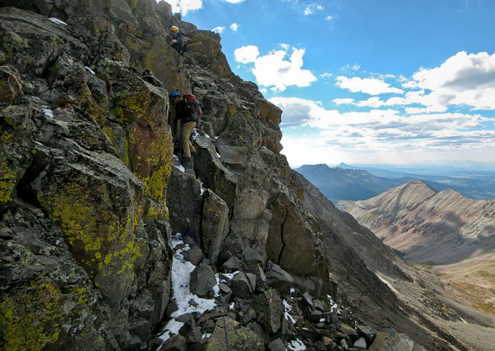
Tom holds on to a rope while downclimbing some slippery rock. We continued to stay to the left of the dark yellow rock (looking back)...
Chris consults the route guide after we finally clear the snowy section below the dark yellow rocks. We crossed to the other side of the ridge, aiming for the notch in the center of the 2nd pic, to begin the final class 4 pitch to Mt Wilson...

Tom and Chris start the final pitch...
Yikes! What a final pitch! I think we were all surprised at the difficulty of the ridge. Still, there were good holds to be had, and the rock was mostly stable...
We stayed to the left of the ridge, working our way up. In the 2nd pic, Tom investigates gaining the top of the ridge, but ends up heading back down to the left (where Chris's yellow hat is)...
Tom tops out at 5pm. I follow shortly (pic from Tom's iphone)...
There it is, the traverse from El Diente. 3 Grand Traverses down, just the Bells Traverse left. Took us 2hr 50min from El Diente to Mt Wilson...
The view east from teh summit...
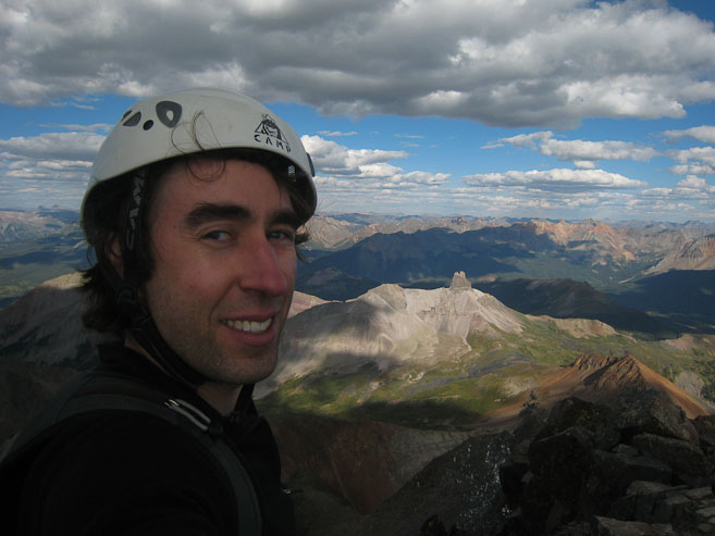
A look down the south slopes of Mt Wilson, which some people descend to return to Kilpacker Basin. A self portrait of me and a sunlit Lizards Head below...
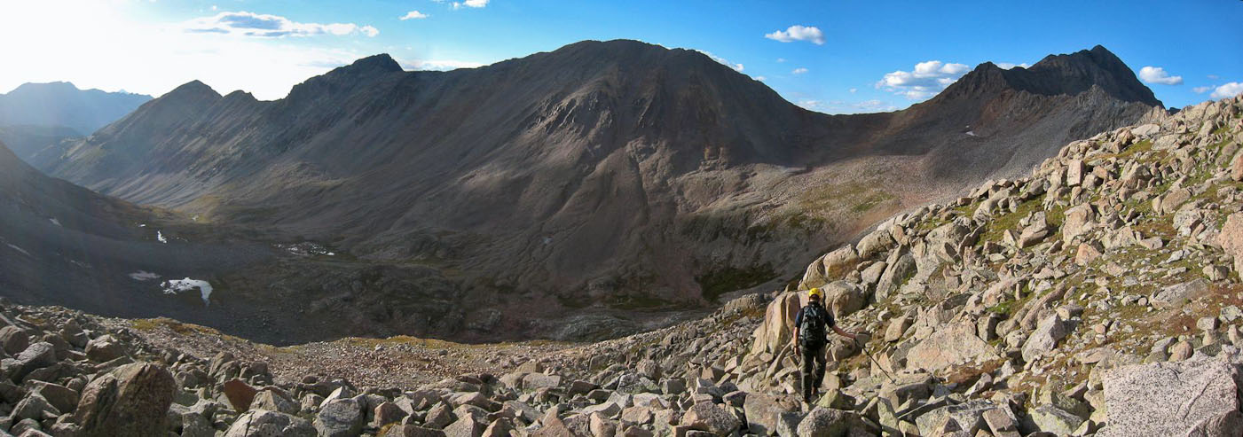
We had the summit to ourselves the entire 15 minutes we stayed on the peak. This was the 3rd 14er this year that I'd summited after 5pm (lots of good weather opportunities). But in order to get back to camp before sundown, we needed to hurry back. We all wondered how the initial descent off Mt Wilson would go, given it probably ranks as the toughest stretch of standard route on any 14er, in my opinion (maybe 2nd only to the hourglass of Little Bear). However, with a little care, it was a straight forward descent, using the available holds. After clearing the pitch, it was a along 2100' boulder hopping descent down to Navajo Basin.
Tom and Chris begin the descent at 5:15pm. Wilson Peak is right of center...
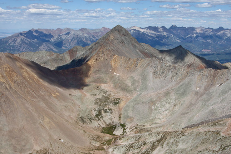
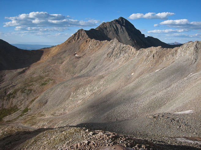
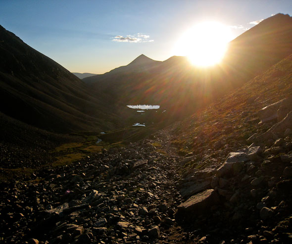
A look at Wilson Peak, tomorrow's plan, and the long rock slope back to the basin...
A look back up the rock slope, after 30 minutes of descent (1st pic). Mt Wilson in the evening sun (2nd pic). Looking back at some steep sections on the descent (3rd pic)...
An hour into the descent, vegetaion started mixing with the boulders...
A look back at Mt Wilson (left), the traverse, and El Diente (right)...
At 7pm, I was back in the basin. Chris was ahead, and Tom had stopped to fill up water at a stream.
Our approximate descent path in red...
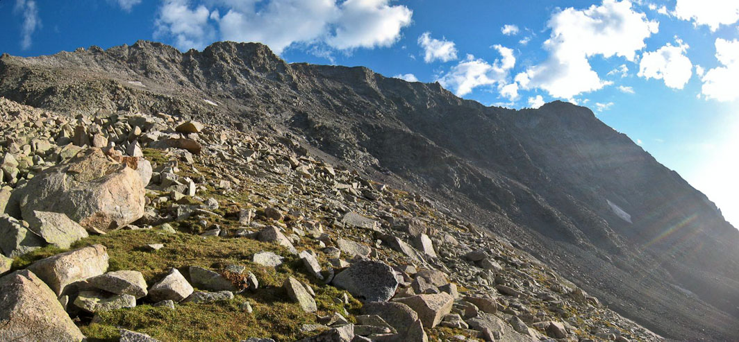
A look at El Diente, and the north buttress...

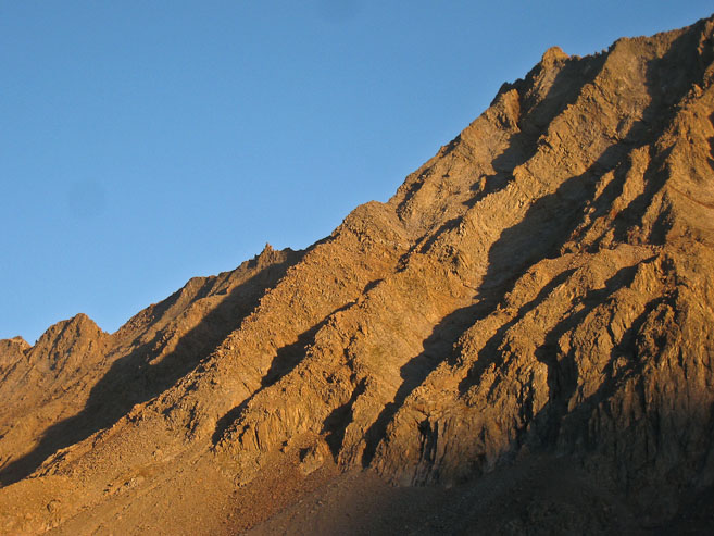
Our approximate ascent path up the north buttress today. Sunset was ~7:40pm today, and it was already 7:12pm as I passed by El Diente. The sun lit up the buttress in gold...
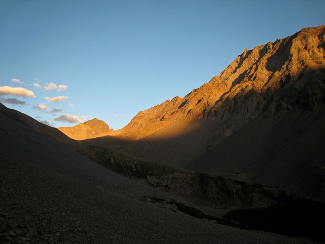
A couple last looks at the north buttress of El Diente before returning to camp ~7:30pm...
What a day! 2hrs of backpacking to Navajo Lake (1800' gain), followed by 9hrs 15min of climbing to bag El Diente, the traverse, and Mt Wilson (~3550' gain). I should sleep well tonight (even without a tent)! Back camp we cooked up our dinner. I made some dehydrated tomato bisque that turned out amazing, along with dehydrated fajitas. We planned to bag Wilson Peak tomorrow morning, leaving plenty of time to pack out and drive back to Fort Collins by night, so it was time to pig out on our food.
Without a tent to hang out in, I prepped all my gear for tomorrow outside, and prepped for bed. I reviewed all the ~600 pics I took on my cameras, and went to bed at 9:30pm. I tried sleeping inside my tent liner, but the mesh kept resting on my face, so I eventually opened it, and kept my head out in the cool mountain air. It felt much warmer tonight, compared to last night. But maybe my body was just warm from lots of hiking, and lots of food.
Despite a comfortable setting, I found myself unable to sleep. Maybe I was still pumped up from the day's adventure, or anticipating the adventure in store for tomorrow. Regardless, I just layed there, resting, and waiting. Eventually, I dared to look at my watch, and saw it was 1am. I decided to make a mental list of the remaining twelve 14ers I have left, then made a list of how many 14ers I hiked with various people (Tom leads the list with 20 out of my 46), and how many 14ers I hiked solo (15). This didn't seem to help me get to sleep, but it passed the time. Nothing better to kill time than thinking about 14ers, especially when sleeping amidst 3 of them. Eventually, I did fall to sleep. The last peak at my watch said 3:35am...
Go to Next Day
Back to trip Home