

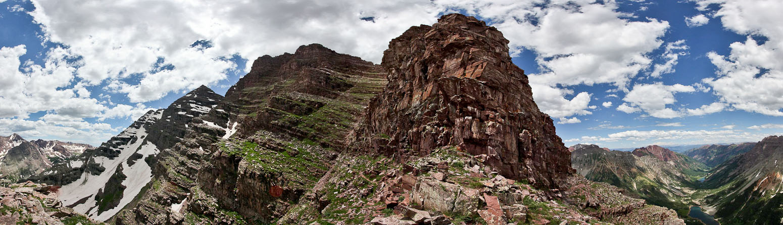
For the past 1.5 years, Tom, Chris, and I have been talking about the Bells Traverse. Last year we had a successful trip up Kieners Route on Longs Peak, as well as a Labor Day weekend El Diente - Mt Wilson Traverse. We didn't get to fit the Bells in last year, so it was high on our to-do list in 2011. I was excited at the opportunity to complete my 4th and final "Grand Traverse", as well as climb the 2 hardest (and most scenic) 14ers remaining on my list.
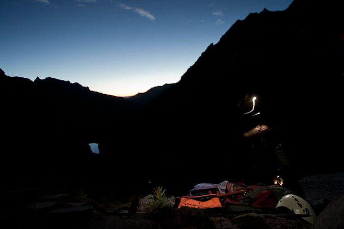
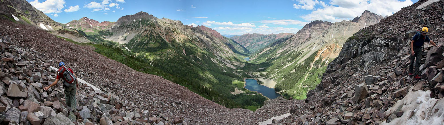
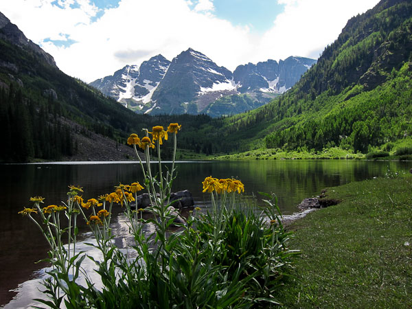
We left Fort Collins ~3pm Saturday in Chris's truck, stopping briefly in Leadville to drop off some 14er cards at two stores. After climbing the lush-green Independence Pass, we arrived in Aspen ~7pm, and grabbed a bite to eat at McD's (best value in town!). Summer in Aspen is gorgeous, and we saw paragliders floating high above the green ski slopes. We had debated about backpacking to Crater Lake, and wondered if all the sites would be taken on a prime July weekend, so decided to spend the night in Chris's truck at the trailhead. The overnight parking lot was full (must be lots of 4-pass hikers), so we made our way to the day parking lot, and found a few other groups prepping their cars for an overnight stay as well. The weather was pleasant, and we took the ~100' walk to Maroon Lake to gaze at our destination tomorrow. We could see the white Bell Cord cutting up steeply between the two peaks.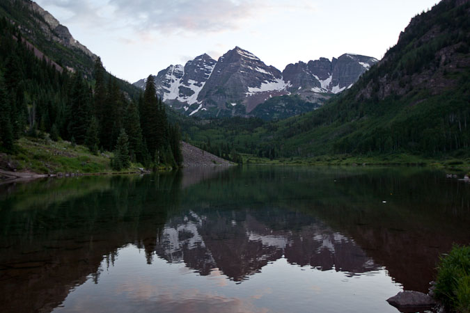
Targeting an early start, we set our alarms for 2:45am, and we off to sleep ~9:15pm. Tom and I slept in the back of the truck, while Chris reclined in the front seat. I slept amazingly well, by my standards, on the eve of such an epic adventure. And to our delight, the porcupines never once attacked the under-carraige of the car...
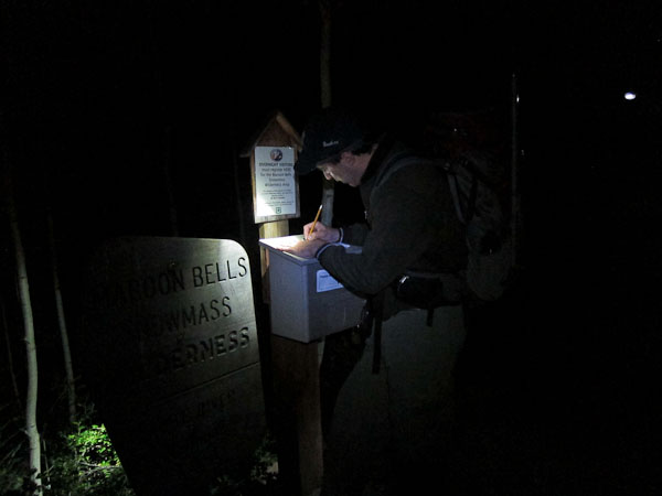
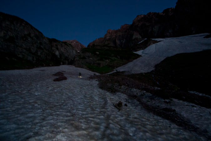
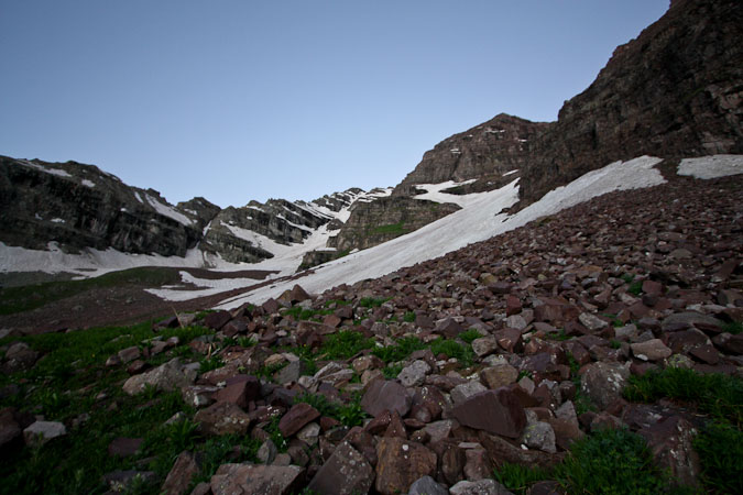
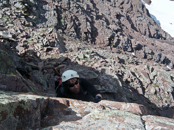
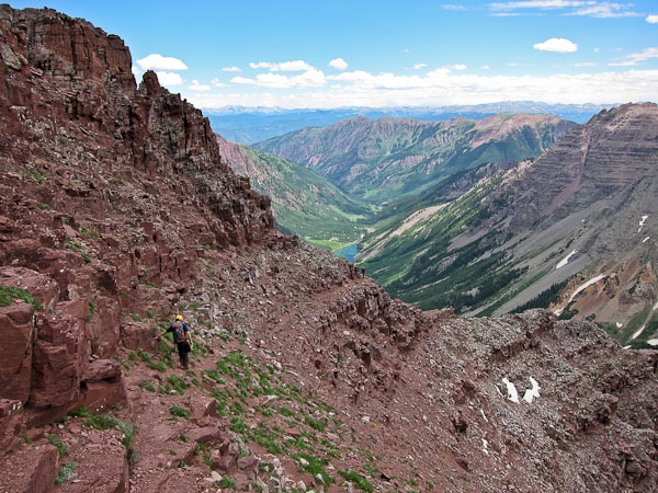
We all roused at 2:45am, and after quick work prepping our gear, and eating some snacks (a smushed plum and nectarine for me), we set off at 3:20am by headlamp, walking past Maroon Lake, and into the forests below the Bells. In ~40 minutes we had reached Crater Lake, and continued on, noticing what appeared to be many available campsites. It was quiet all around us, save for the occasional thin stream babbling across the trail.We kept a lookout for the turn off at the base of the Bell Cord, which was difficult to see in the dark. Fortunately, the landmark snow patches were easily visible, and so we cut up a dry stream bed, and bushwacked our way to some snow below "the garbage chute". Here we stopped to put on crampons, as we expected snow the rest of the way. In the valley below, we spotted a few other headlamps making their way to Crater Lake.
I scouted out the garbage chute from afar, but didn't see much snow, so we opted to head to the right, taking the longer bypass route.
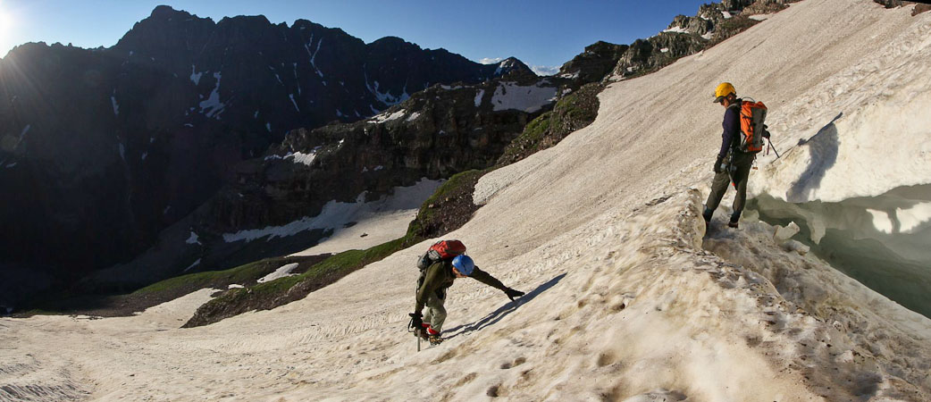
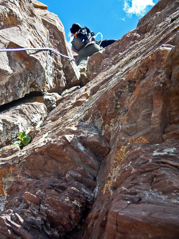
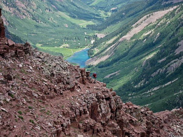
The snow led to a rock face, where we exited into a steep cascading small stream. Still wearing crampons, we climbed the wet rock and followed a grassy/rocky slope that led to the base of the Bell Cord.
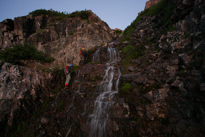
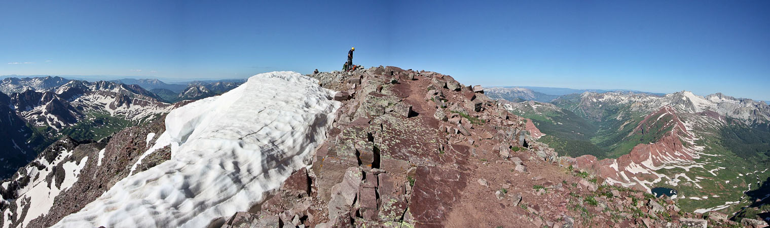
Getting wet wasn't on the agenda, but it was impossible to avoid some spray as we crossed the stream and skirted up the wet rocks. There was a rope along the cascade. 2nd pic: Almost at the start of the Bell Cord snow...
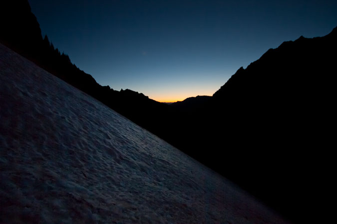
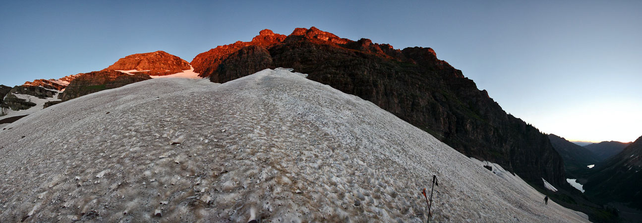
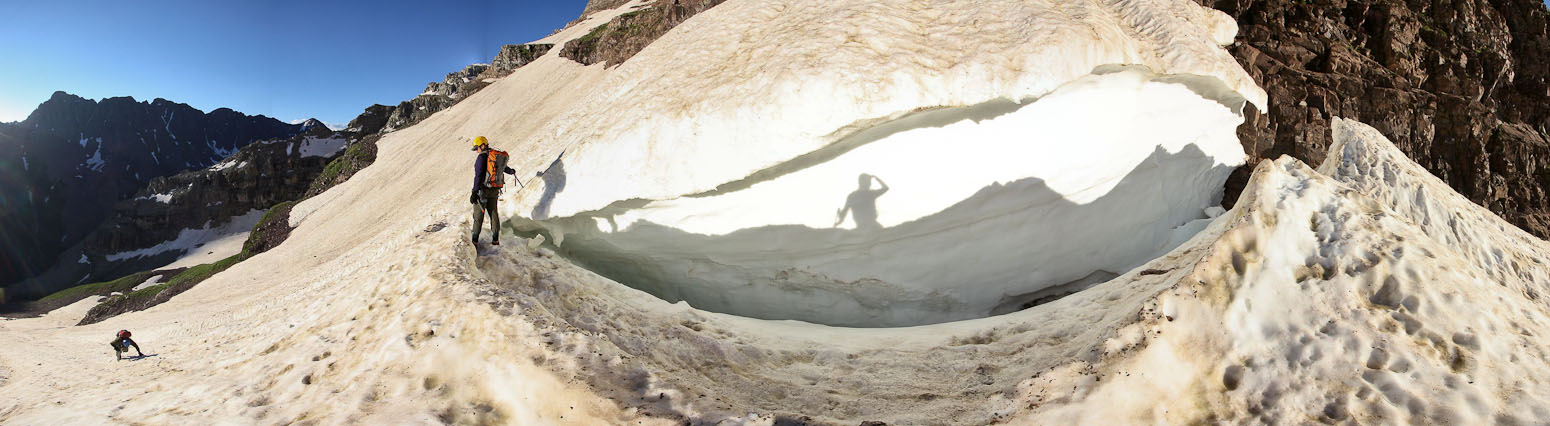
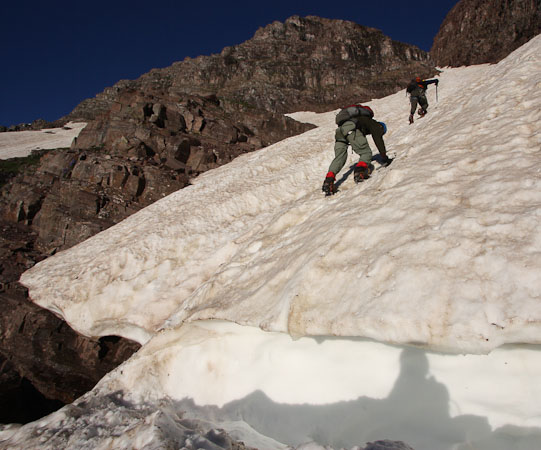
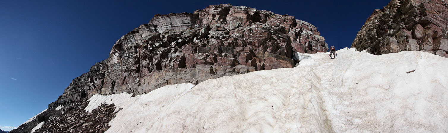
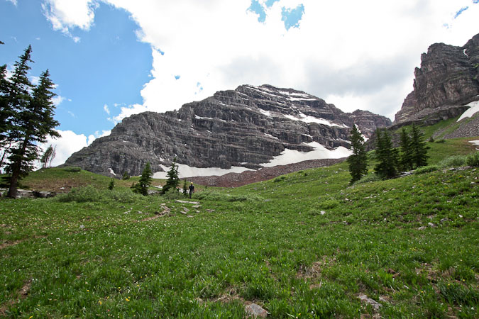
Shortly after reaching the snow, the sun broke out, turning the mountain red above us. Our route finding was done for the next ~1800', as we simply needed to follow the snow up.
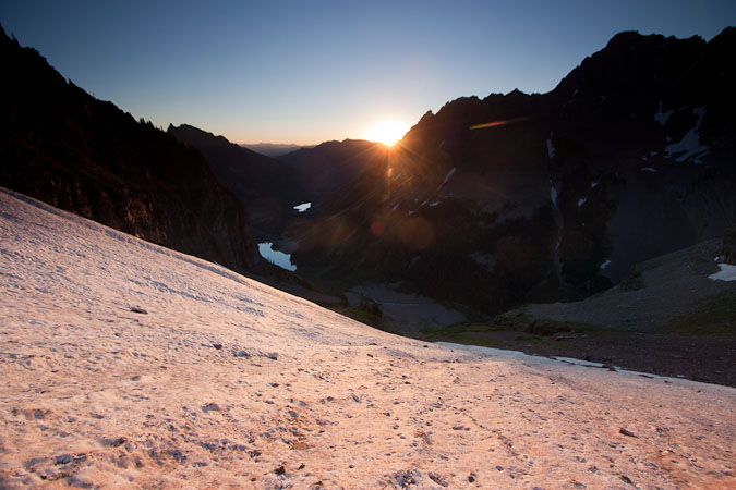
The sun reaches us at 6:12am...
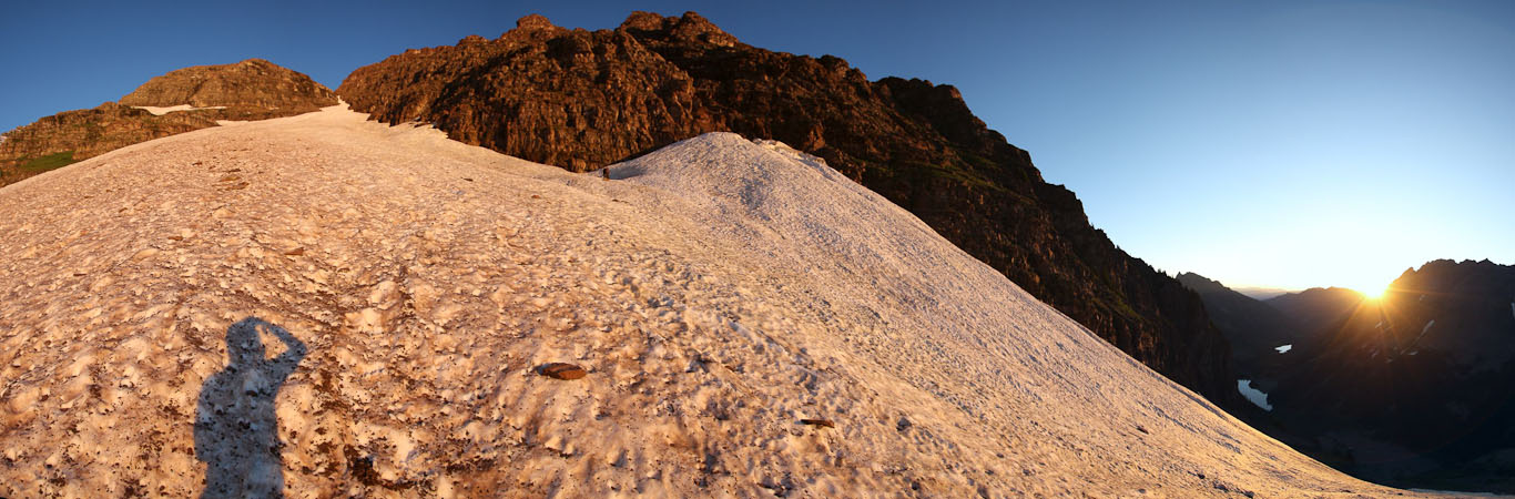
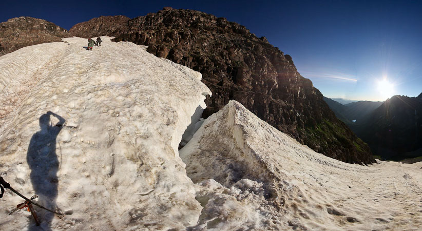
Another view during sunrise. Our path is straight up from my shadow...
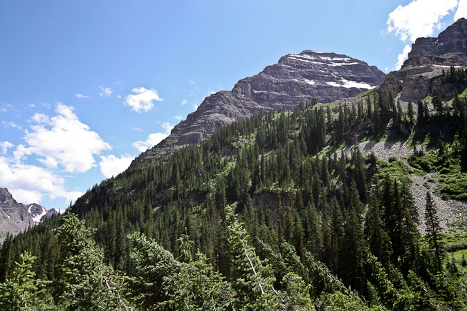
A look south, with Pyramid Peak on the left...
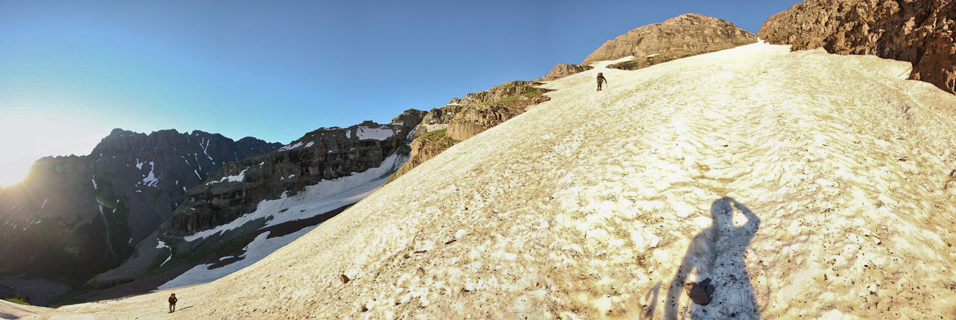
In no time, the slope reached a consistent 42-45 degrees. The snow was consolidated and had a soft enough surface for kicking in steps. Quite ideal. We all used ice axes, and I brought an extra trekking pole, which was very useful on the steep climb.
A look back at Tom, with Pyramid towering behind...
~35 minutes into the climb, we encountered this shrund (a crevasse in the snow). Cool looking...
Tom leans in...
Making our way past the shrund (a new word I learned from Chris today)...
We crossed another small gap in the snow...
After an hour on the snow climb, Tom and Chris found rock landing to take a rest, and remove a layer. The weather was beautiful: Sunny, cool, and not a breeze in the air. Pretty comfortable for a morning snow climb.
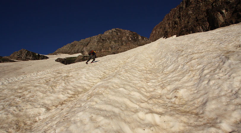
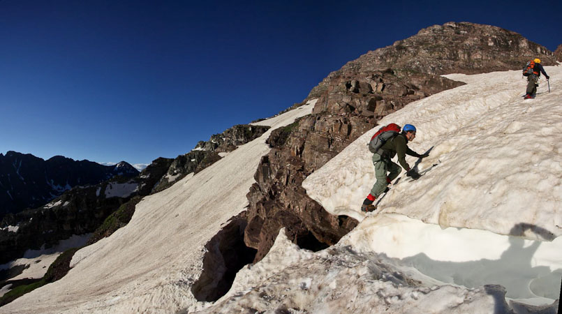
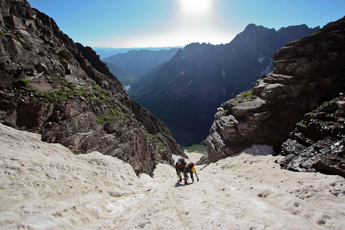
I led the way for the next 450', kicking in steps. The slope seemed to grow more steep the narrower it got. I totally thought my watch altimeter must be off, cause the elevation increased much more slowly than I was expecting. However, we all compared our alitimeters, including a GPS, and realized that it was just slow grueling work to gain advantage on this couloir.
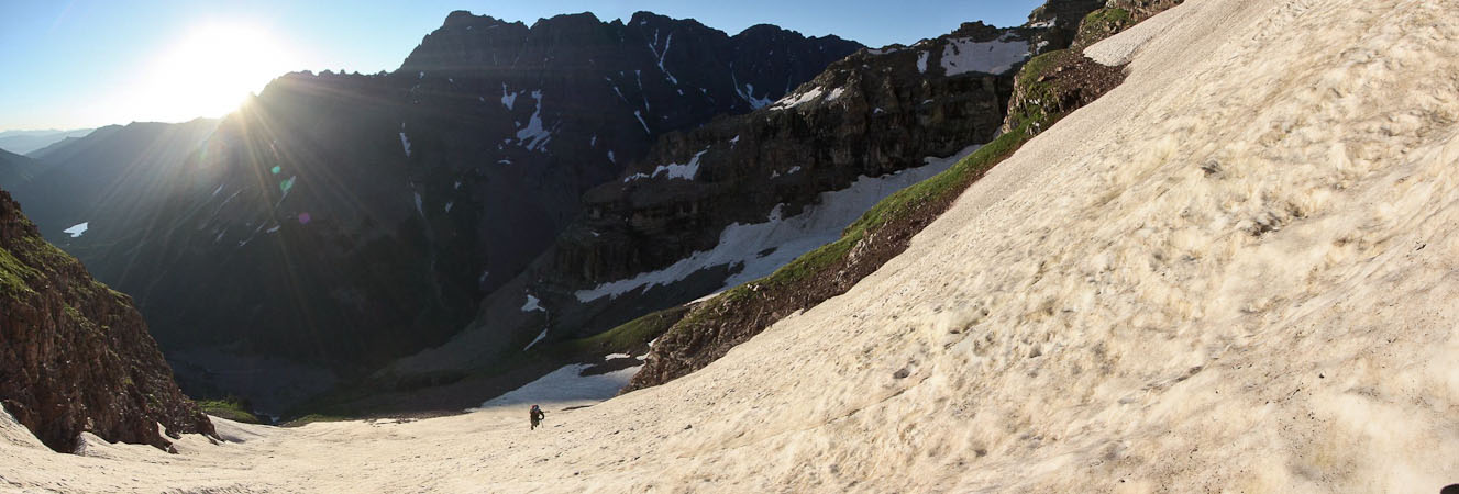
Looking back, we spotted a couple other hikers on the snow ~600' below. However, we never ended up seeing seeing them later on.
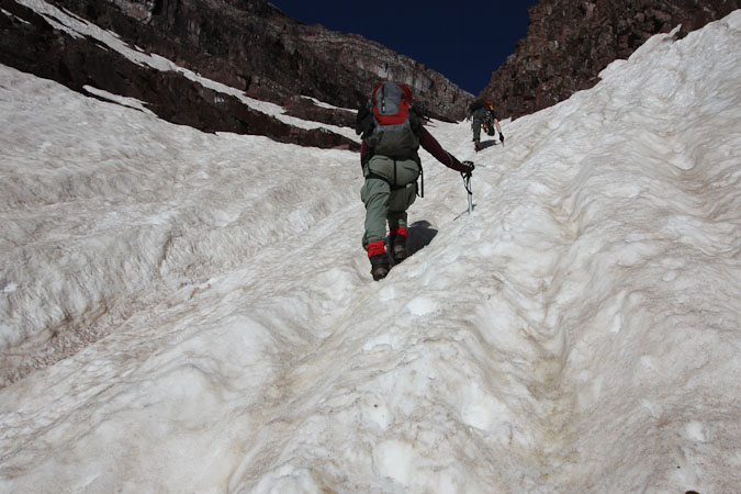
I learned another new word today: "runnel" - The long running channels/grooves that form in the snow. Some runnels were a couple feet deep...
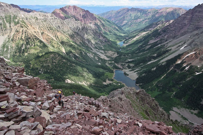
Just when it seemed like the end would never come, Chris reported that he could see the saddle ahead. The slope again grew steep, trying to resist us, but our determination held strong, and we topped out ~8:30am, after 2.5hrs on the Bell Cord. Many thanks to Chris for kicking in some high quality steps during the final stretch.
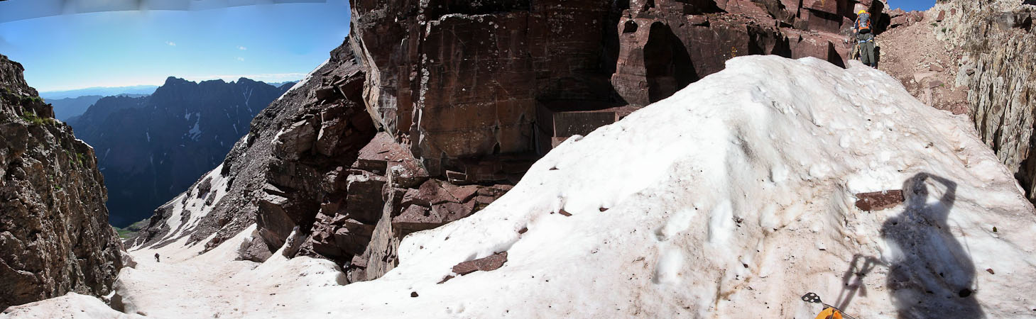
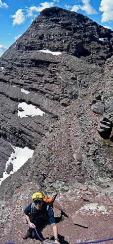
Chris reaches the dirt. Tom works his way up from below...
Tom tops out to the saddle, with Pyramid right behind him. The saddle was small. Their was still nary a breeze in the air this fine morning...
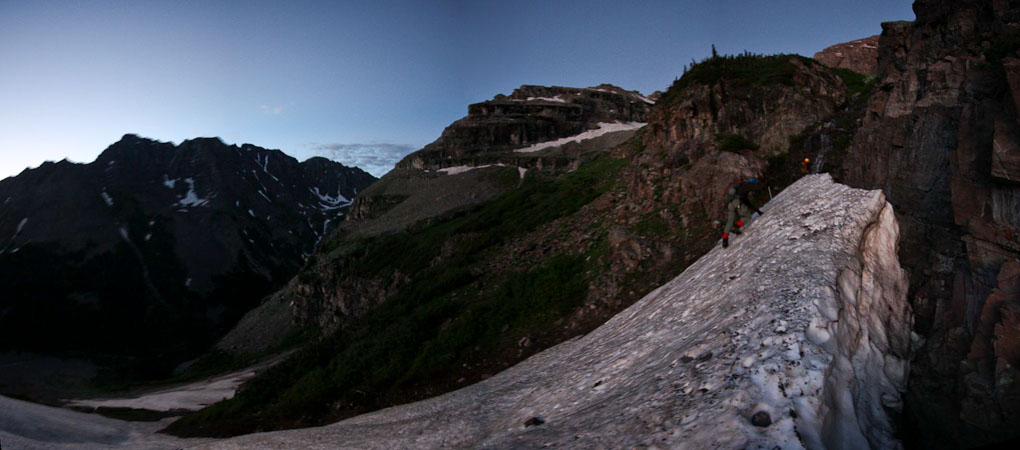
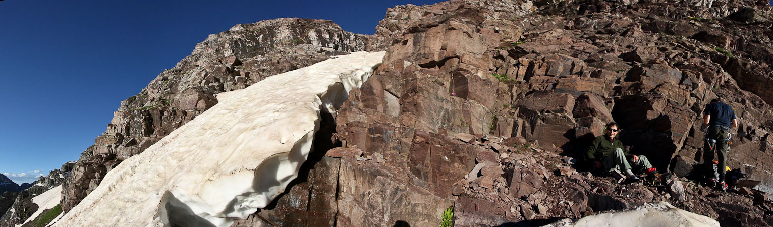
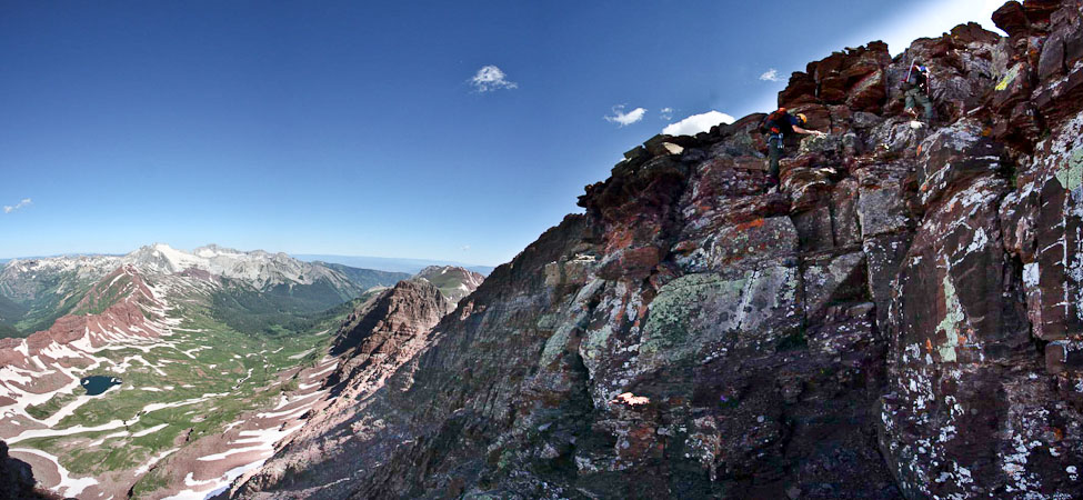
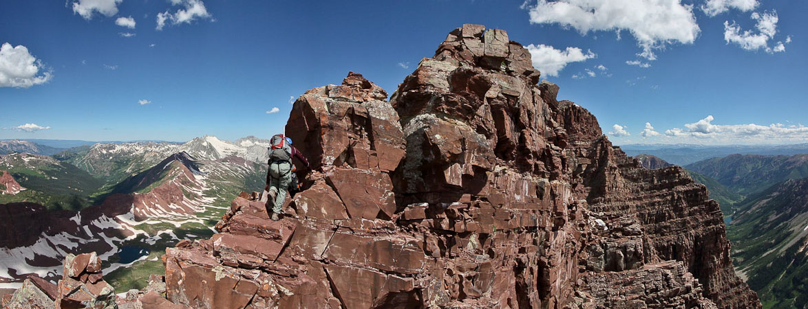
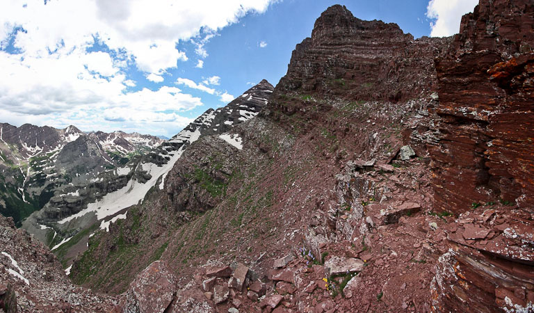
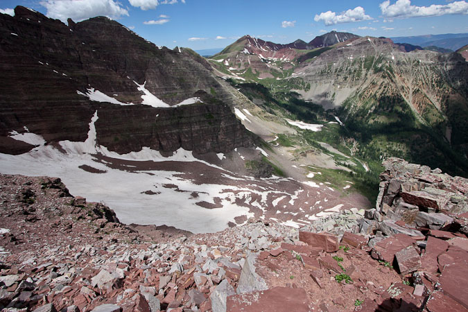
We stowed our crampons, and took a 15 minute break before continuing on the west side of the ridge, following some ledges towards Maroon Peak.
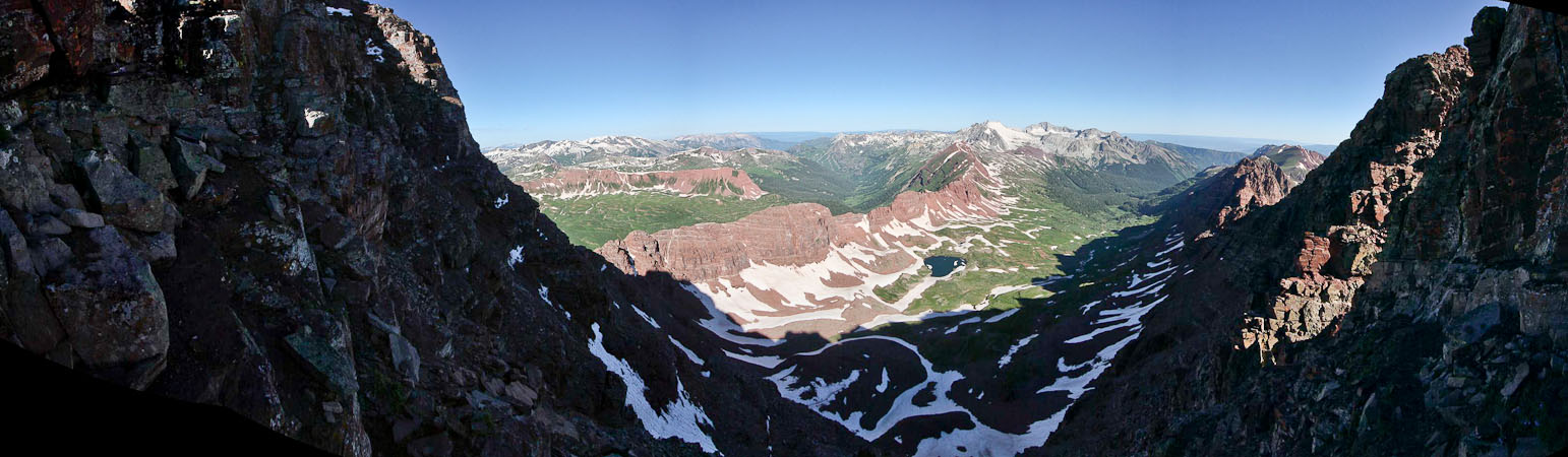
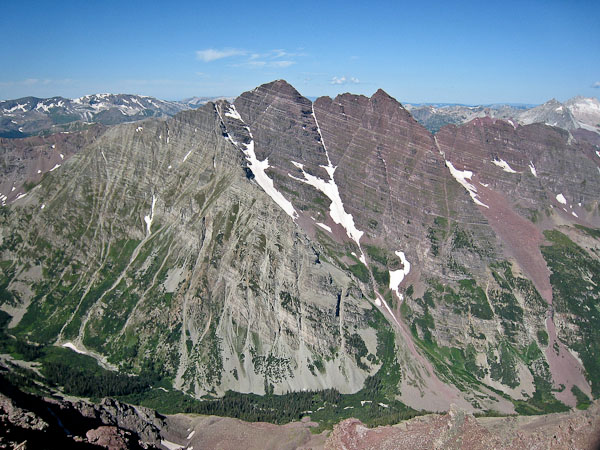
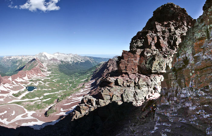
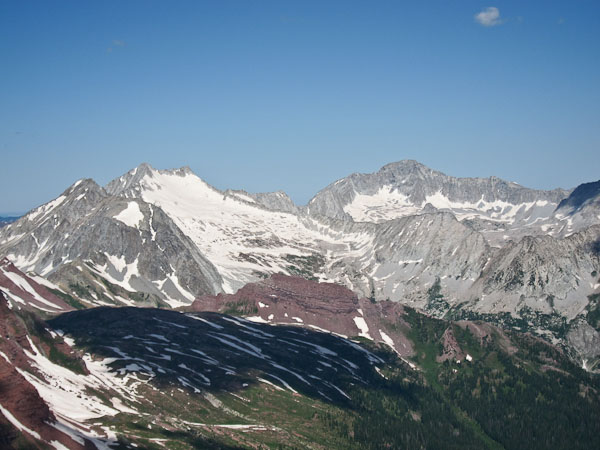
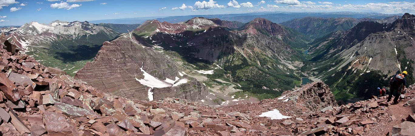
A glorious view while traversing the west side of the ridge. That's Snowmass and Capitol in the distance...
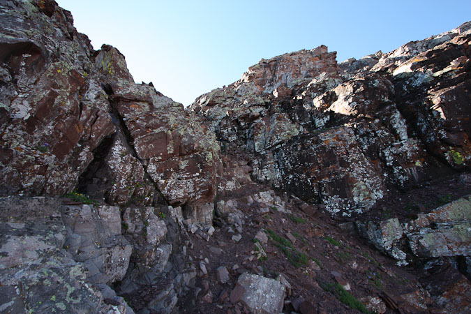
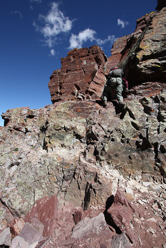
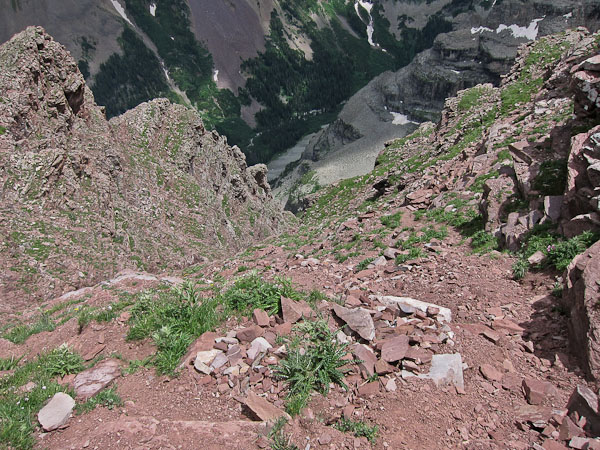
Past the ledges, we climbed up a loose gully, and worked our way up to the ridge crest, staying to the right side to bypass difficulties...

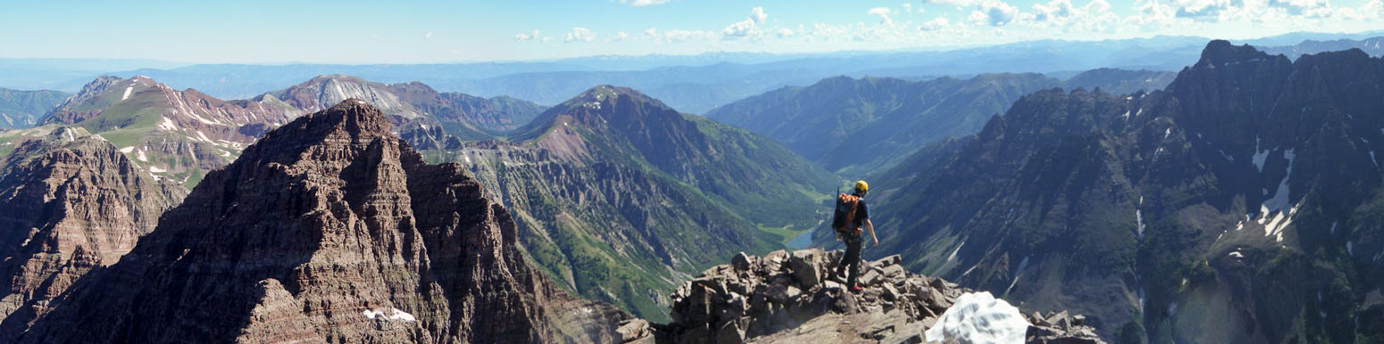
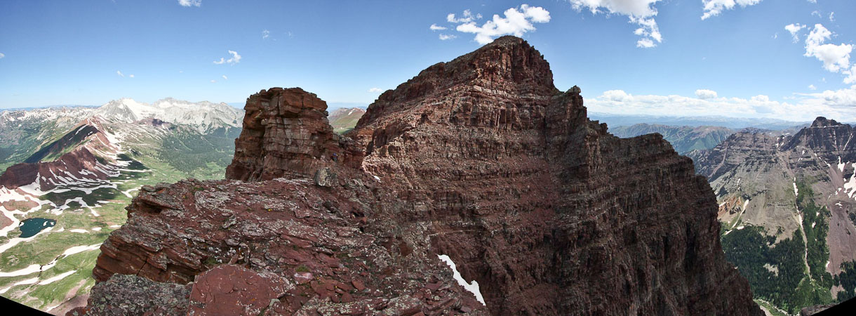
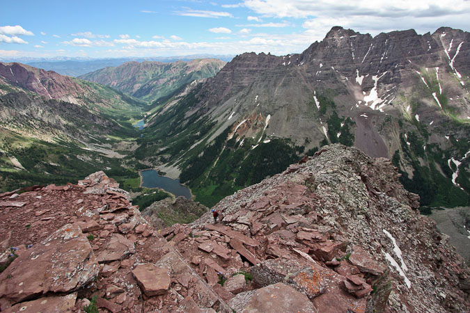
The summit is at hand!
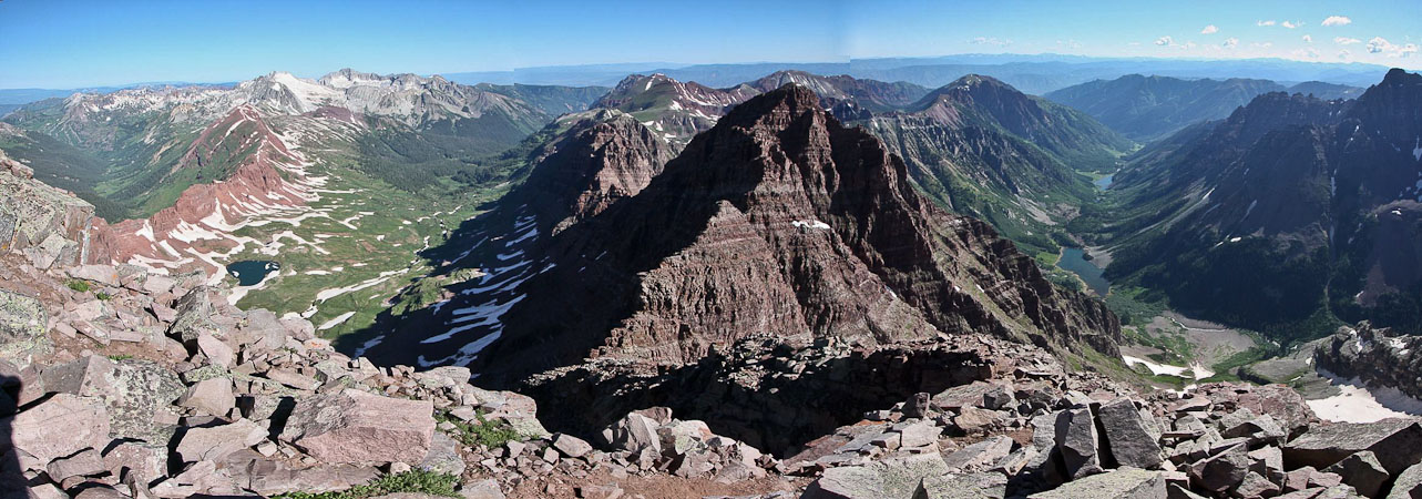
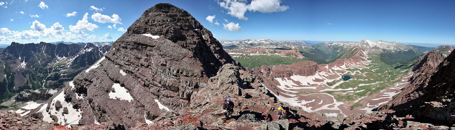
A look back towards the saddle in the ridge, with North Maroon further up the ridge (not to mention Snowmass and Cap on the left)...
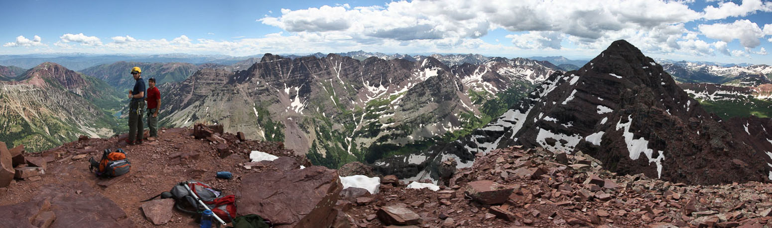
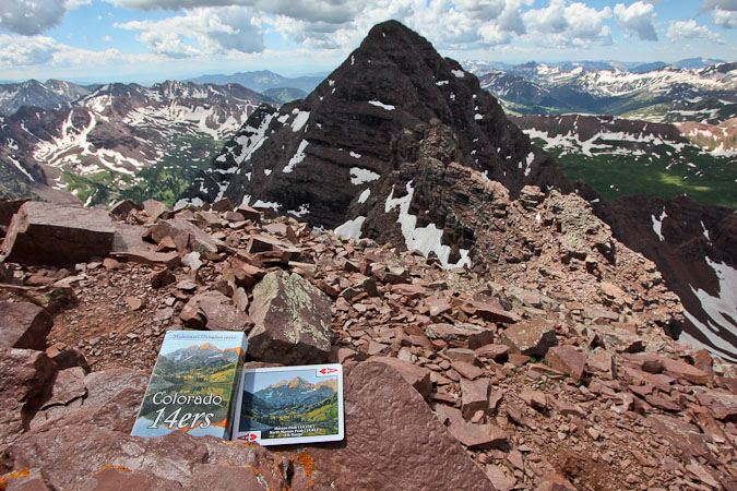
We reached the summit of Maroon Peak at 9:25am (just over 4 hrs from the trailhead), and had the place to ourselves...
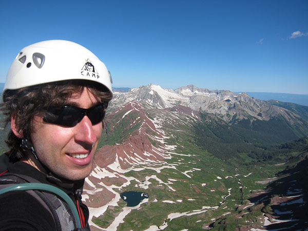
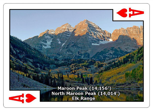
Token self-portait of me and 14er cards ($6.95) from the summit of Maroon Peak (14,156')...
After ~4500' of gain, I enjoyed a rest on the summit, and ate my slimy peanut-butter and banana tortilla wrap. I didn't realize how heavy that wrap was, and was glad it wasn't in my pack anymore.
This was 14er #57 for Tom (Capitol, in the distance, will be his finisher), and #52 for me. (Chris wasn't keeping track of his tally). Given the gorgeous weather, we decided to take on the traverse, and began our descent back to the saddle at 9:50am.
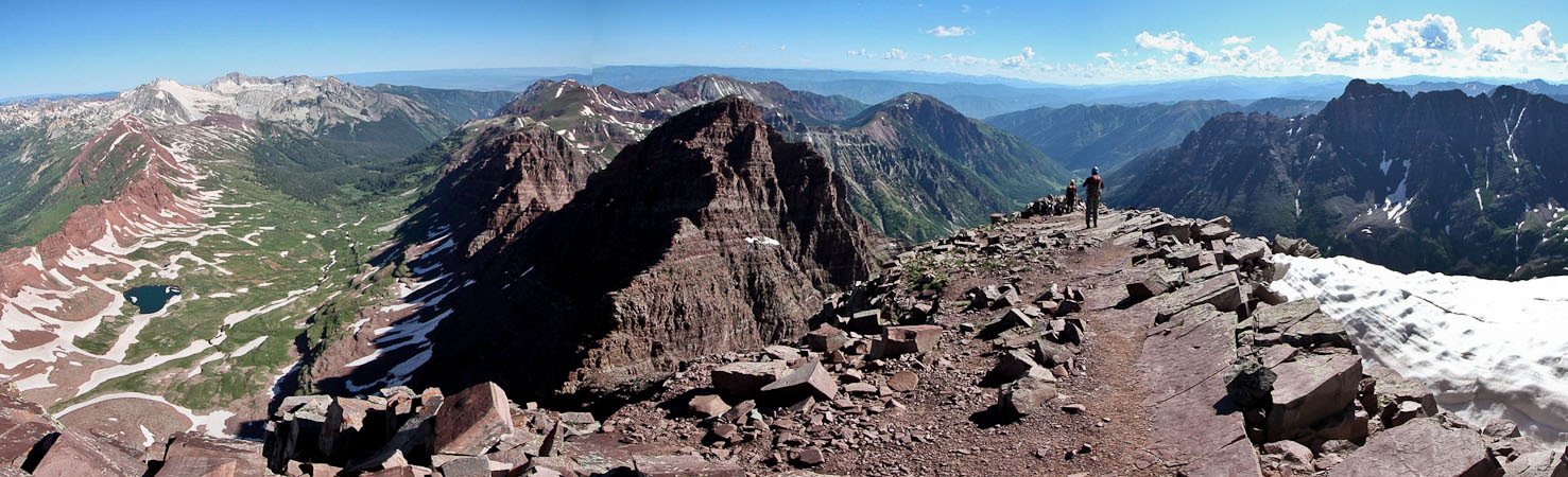
I take a pano of the same scene from behind Tom...
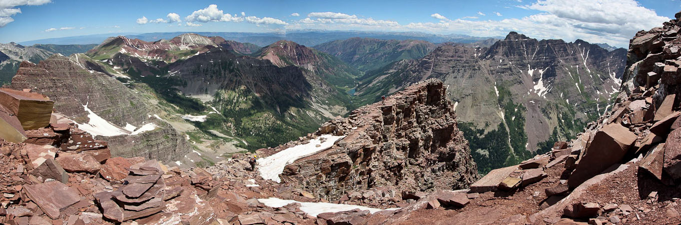
We re-traced our steps back down the ridge, down the gully...
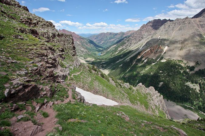
...and across the ledges, back to the saddle. From Maroon to saddle took just under 30 minutes...
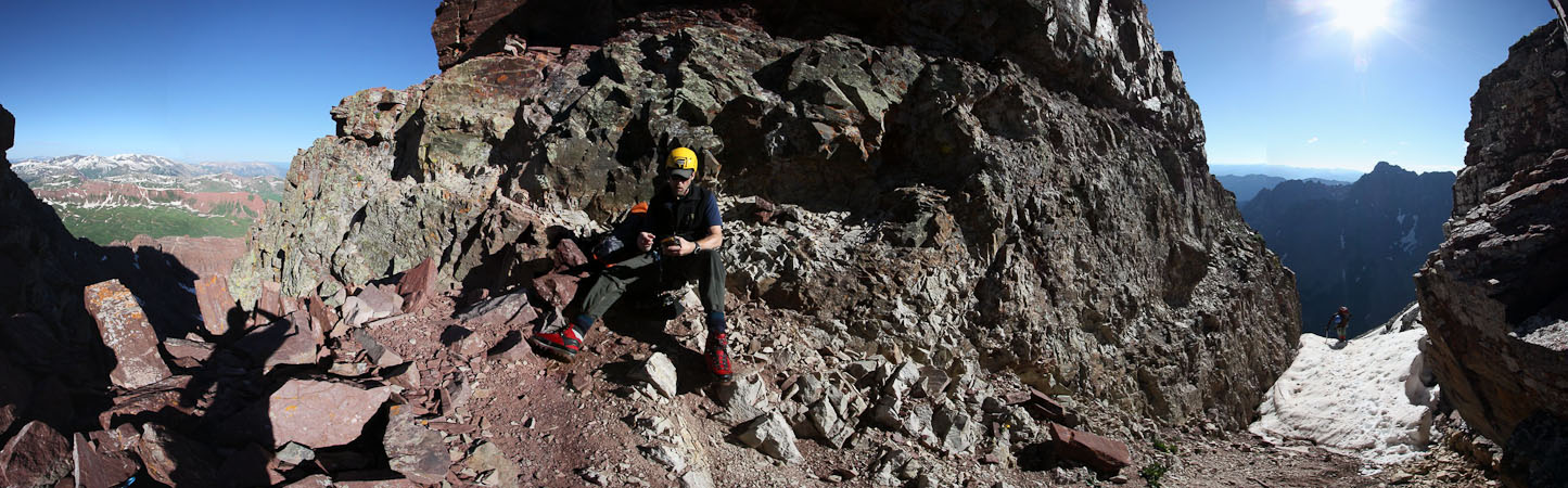
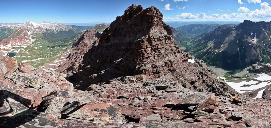
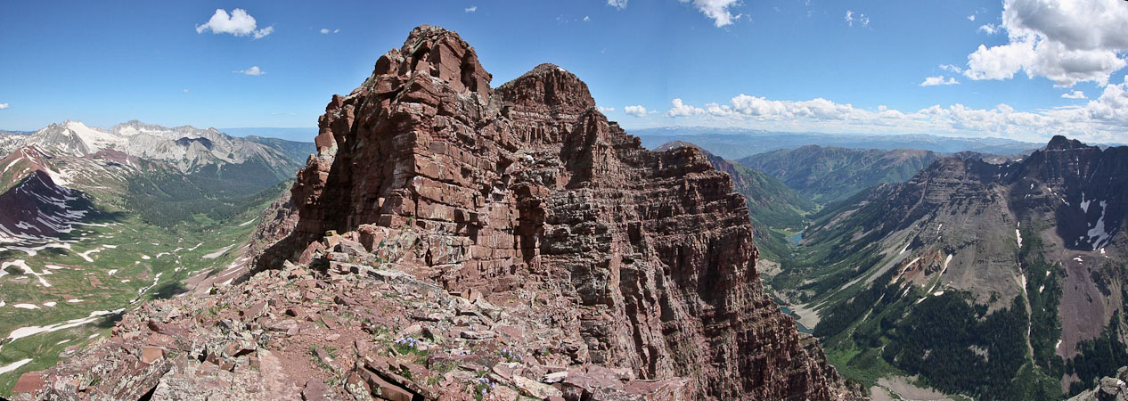
Now the crux(es) of the day were on the agenda. We had copies of the 14ers.com route description, and made them handy for reference.
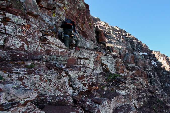
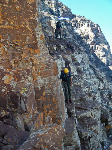
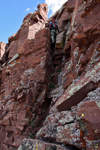
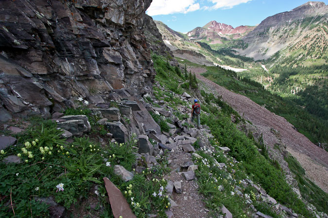
We climbed north from the saddle, and soon reached the first crux of the day: A dihedral/crack and several ledges, originating from the west side of the ridge. This was fun class 4, and not a problem. However we knew the toughies were still ahead.
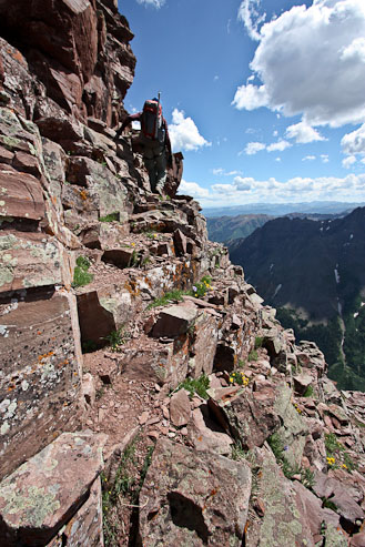
More scrambling along the west side of the ridge...
Looking back from the ridge top...
We followed the ridge top...
...until it dropped us in front of crux #2, straight ahead...
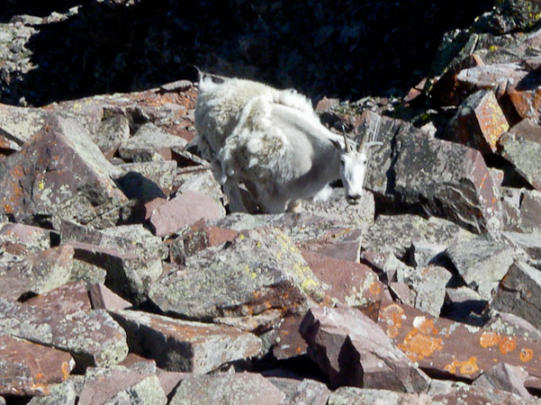
A mountain goat came by to wish us well (I'm assuming), and we climbed up to the next crux wall...
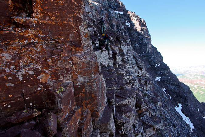
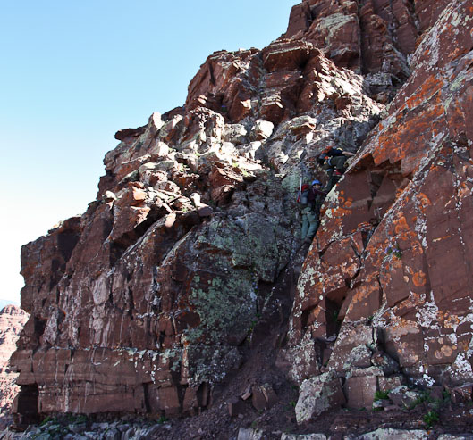
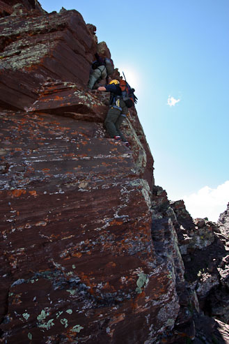
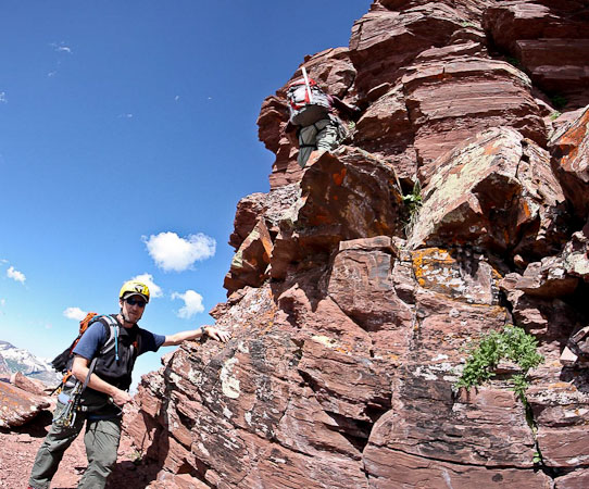
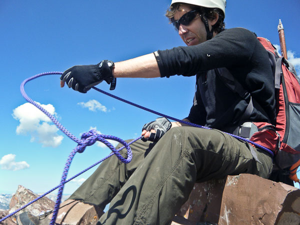
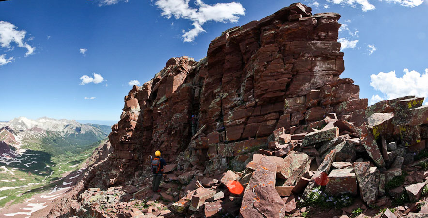
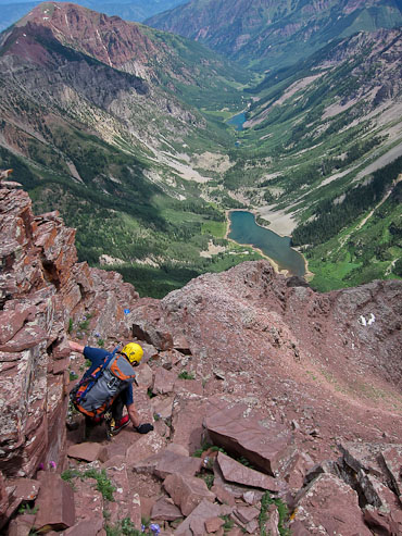
Crux wall #2 is often considered the toughest of the traverse. People coming in the opposite direction can rappel down it. It sure looked intimidating. Tom brought a rope along so we decided to bring it out. However someone still had to lead, and I volunteered to explore the route, with the rope tied to my waist.
The rock was solid, and holds were available, but it certainly felt a bit uneasy scaling a 20'+ wall. Once at the top, I found a stable spot to sit, and belayed Tom and Chris up. They climbed it just fine, and faster than me.
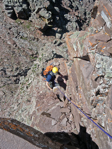
A belay action shot. Looking down as Chris begins the climb...
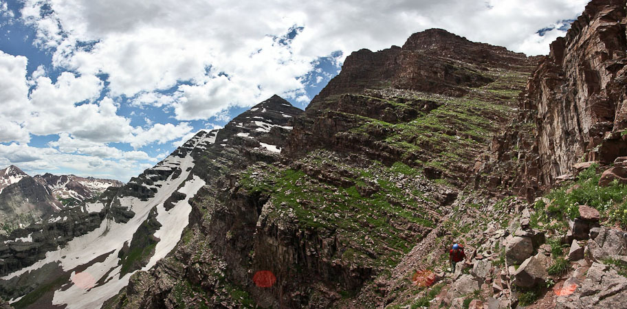
Having gained the cliffband of crux #2, the 3rd and final crux wall was soon encountered, this time on the west (shaded) side of the ridge. Tom and Chris inspected the 15-20' cliff band, which looked quite intimidating, where a bulging rock seemed to overhang inside the climbable crack.
The route is on the left, Tom stands in the crack...
However, Tom and Chris quickly climbed it, each a bit differently.
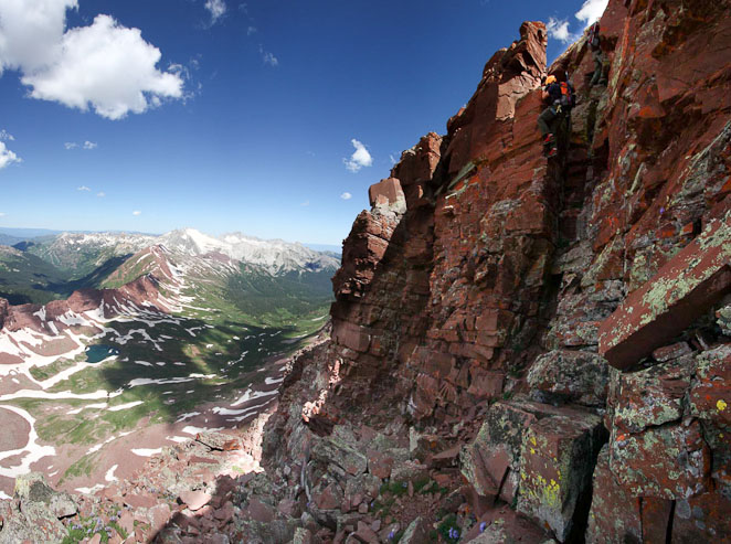
I decided to try Chris's approach, and found great holds, but didn't feel comfortable pulling my self up at the top, so I ended up wedging between the overhanging rock like Tom, and topped out.
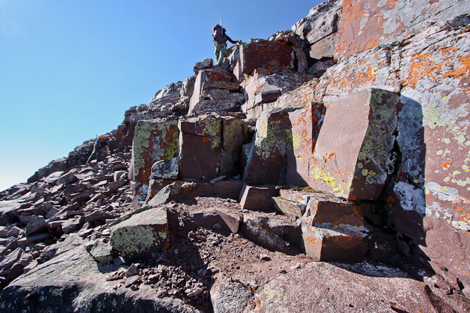
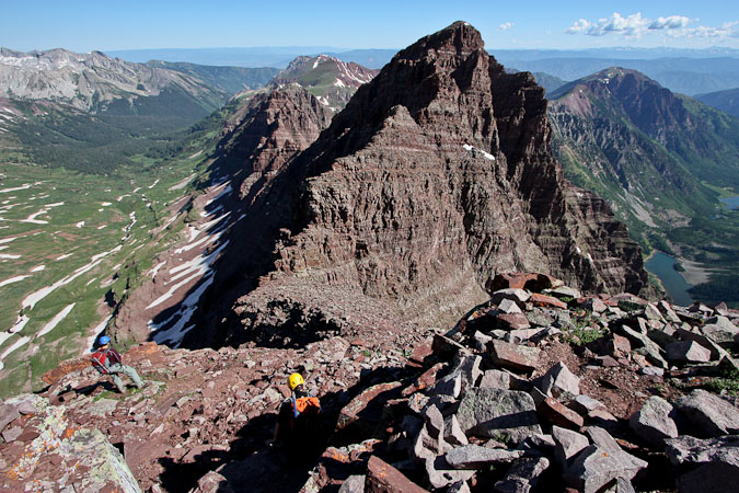
With the 3 main crux walls behind us, we somewhat expected the rest of the way to be a cakewalk, but there was still plenty of class 3/4 ridge climbing to go.
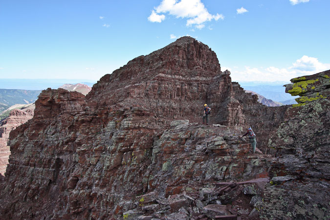
A look at Chris and Tom on the ridge (and in the shade? A cloud!). There was actually a tricky downclimb right before this point. A look over at Snowmass and Capitol...
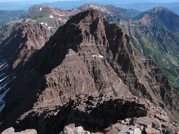
North Maroon is getting close!
As we traversed under the bump in the ridge (in the pic above), my camera came in contact with a rock, and the lens cap popped off. I tried to trap it with my foot, but it tumbled down a couple ledges, resting ~15-20' below. I scouted for a way down, but there was a good 6-7' wall that cliffed me out. So I continued on, and was happy to find a ledge/trail that led back down to my lens cap. Yay.
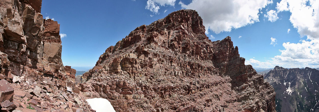
Climbing this last stretch to North Maroon felt very similar to the final stretch between the Bell Cord and Maroon Peak. Plenty of scrambling, and "choose your own adventure" routes. At one point, Chris and I followed an easier path than Tom took, only to turn around at a class 5 section and re-trace Tom's path.
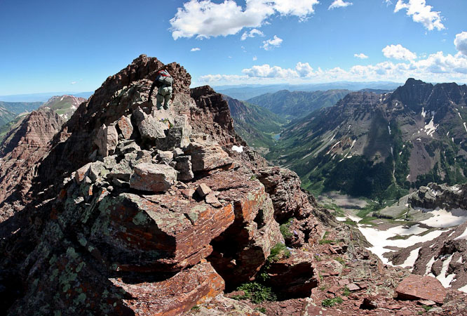
We finally summitted ~11:50am, making the traverse in 2hrs. Clouds were starting to gather, offering shade, and reminding us it was almost noon. N Maroon made 14er #53 for me, and was my Elk Range and Grand Traverse finisher.
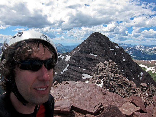
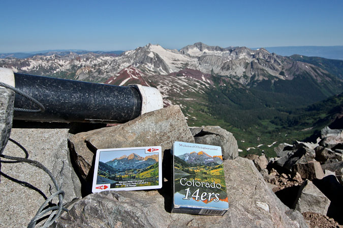
Again, an obligatory self-portait of me and 14er cards ($6.95) from the summit of North Maroon Peak (14,014').
After a solid 15 minutes on the summit, Tom led us down N. Maroon's standard route, a route he's visited a few times in the past.
Tom stands out on the landing, 300' below the summit. He once turned back from here long ago one October in waist deep snow, not knowing his group was so close to the summit...
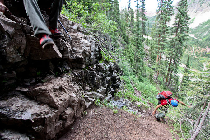
Just below the landing was the crux of the route. Tom and Chris rappelled down ~15' of wet steep rock, while I downclimbed a class 4 chimney, which had an awkward first move. Apparently there is also a class 3 route further down the ledge, though it has some deadly exposure. Still, even without seeing it, I'd recommend the class 3 section over the difficult class 4 chimney.
We were descending swiftly and smoothly until Tom stopped and told us that something didn't look right. He was well ahead of us, and said he got cliffed out. The trail we were following was thinning out. We consulted our route guides, and couldn't quite figure out where we were, but could see the trees far down straight below that we were supposed to reach eventually.
We hiked back up a bit, and climbed to lookout points on the left and right. It looked like the trail could be below us to the right. I found it cool that Tom asked to see the Ace of Hearts in my 14er card deck, to use the photo of the Bells as a reference. In the end we knew the right decision would be to climb back to the last cairn, and investigate further. These were the "Deadly Bells" after all. This turned out to be a wise decision, as we realized we had descended the wrong side of a ridge. We lost ~40 minutes, but now felt good to be on the right path.
1st pic: A peak to the north, looking down steep ledges, over to Buckskin path. Wrong way! 2nd pic: Back on track. Make sure you pick the side that has lots of grass...
Looking back at Tom on the trail, as we cut around the side of the mountain...
Bending the corner...
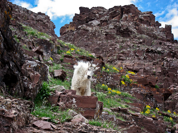
Another visit by a mountain goat, as we traverse around the mountain...
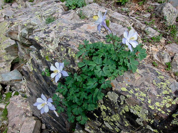
We saw many wild flowers on the trail today, though most in the dark this morning...
An 180 degree view as we cross a Boulder field, with Buckskin Path in view past the forest ahead...
A look back at North Maroon. 2nd pic: The path through the forest was steep and slippery on the mud, and included this small rock cliff to hop down...
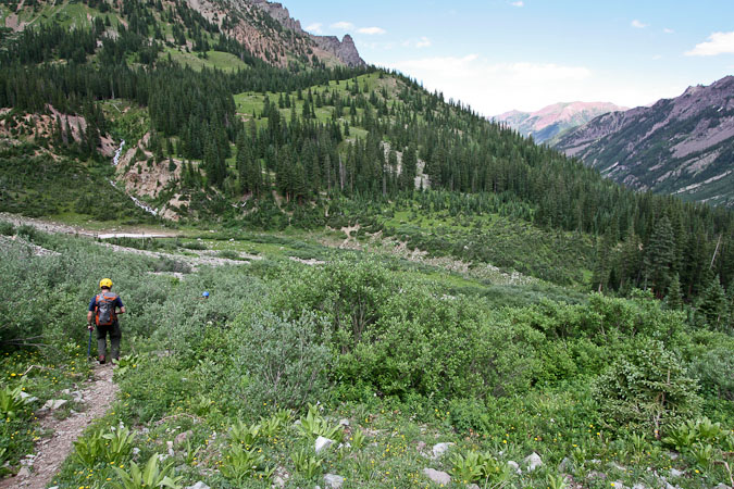
What variety on the N Maroon route! Willows, and a stream crossing...
I was glad I filled my bladder to the max for this hike, as I usually don't drink/carry much. But I had a feeling today was going to be a big day, and ended up drinking it all as we joined Buckskin Path for the final hour walk back to the trail head.
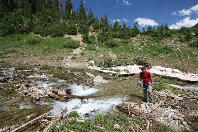
Tom used some iodine tablets in a water bottle at the creek, and we all dunked our hats in the refreshingly cool water for the final walk out. From here it would be all easy class 2 trail.
My knees started aching a bit even on the gentle descent. Too bad I lost my trekking pole somewhere on the Traverse today, as it would have been useful now.
Once we hit the Crater Lake trail junction, we saw lots of hikers. A few saw our ice axes and asked where we hiked. Once when we replied, "Both of the Maroon Bells", a hiker responded in surprise, "Even with all that gear??". Kind of funny.
We arrived back at the trailhead ~4:20pm, clocking in a 13hr circuit. Aside from the final 40 minutes of our hike, we didn't meet anyone on the trail all day, which was kind of surprising for a good weathered weekend in late July.
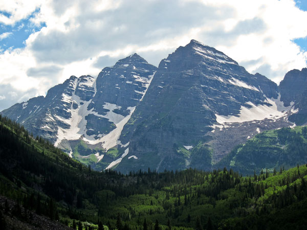
Having completed all 4 Grand Traverses, I'll say the Bells had some of the toughest/steepest pitches, though no where near as much exposure as Little Bear - Blanca. The Bell Cord - Traverse combo certainly offers amazing variety and scenery on the trail, and has to go down as an ultimate, classic, and epic 14er experience. Certainly be prepared, and have some class 4/5 experience.
My 5 remaining 14ers consists of Sneffels, and 4 Sawatches, all "easy ones". But the next I climb will likely be a repeat of Capitol with Tom in a couple weeks, as he goes for his finisher.