Got up at 8:20am (must have slept through my 7:40 alarm). Was comfy in the car, but had some trouble sleeping. Time shift. I think I got at least 5 ˝ hours.
6/29/04
11:59pm
Aurland-Laerdal mountain pass. Side of road.
Exhausting day!
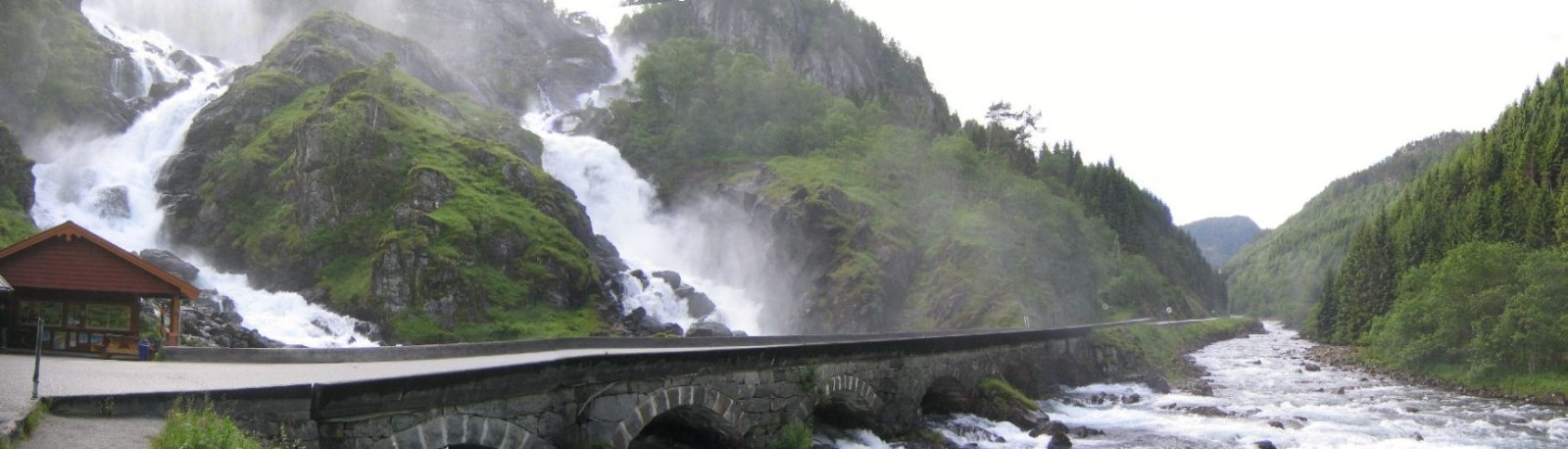
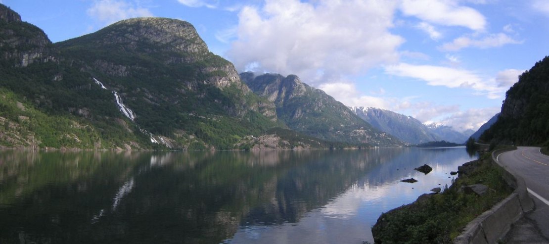
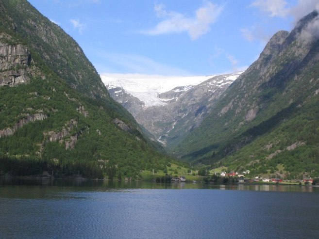
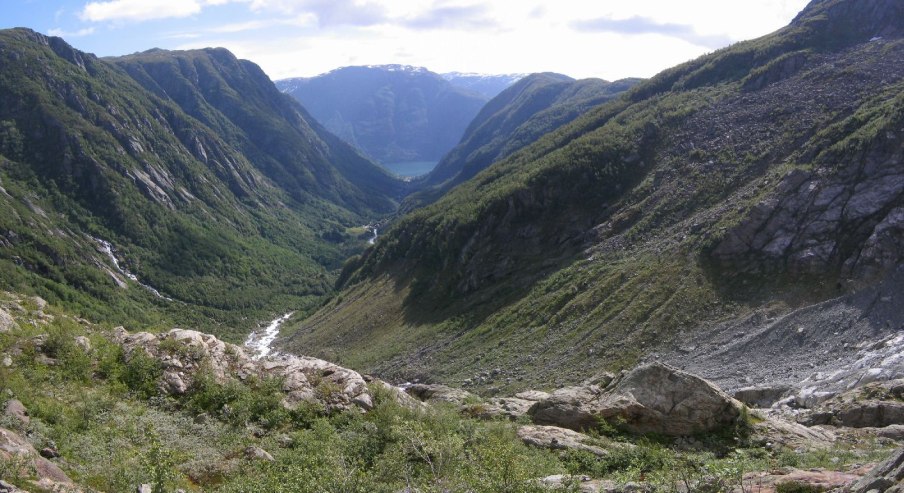
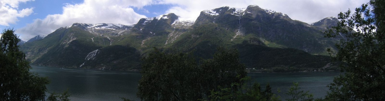
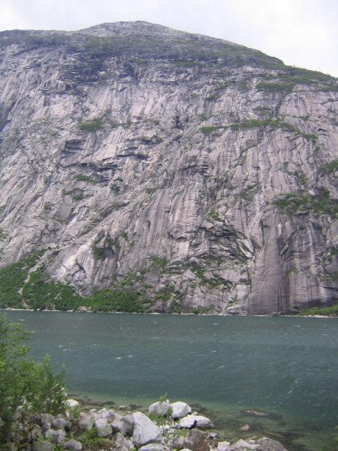
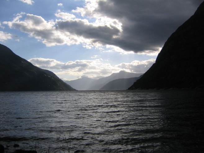
Drove to Odda first thing to hike to the Buerbreen glacier, a highly recommend, and fairly short hike I got from my e-book. It was gorgeous out! Probably mid-upper 60s and clear blue with some pretty white clouds. The drive to Buer was beautiful with many waterfalls streaming down large cliffs into the Sordnefjord. Could see the overhanging Buerbreen glacier from across the fjord as I drove. The fjord was green, due to the compounds in the glacier melt off. Extreme single lane road for several kms. Good thing it was early morning, and no one was going back yet.
Ate breakfast at the parking lot, and saw other people doing the same. I must have been the 1st person on the trail, cause I saw no one going up the whole hike. Started around 9:30am, in a three sided valley that opened to the fjord. Hiked past a farm, into a hilly forest, then up rocks towards the glacier hanging over the mountain above. There were waterfalls in all directions from the surrounding cliffs. There were numerous stream crossings, some nice bridges, and some rope that had been fixed to the side of steep rocks.
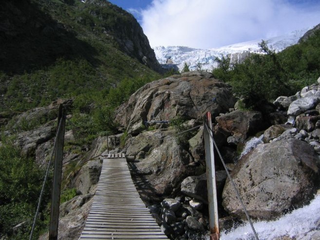
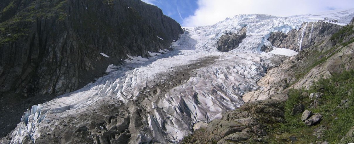
Followed the red "T" markers on rocks and came to the glacier. It had a huge white water stream gushing out under it that ran down the valley into the fjord. The stream had a light green tint to it. There were numerous waterfalls within the glacier itself. Couldn't get to the glacier cause another glacier further up was sending a stream down which didn't look crossable.
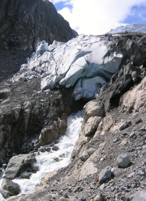
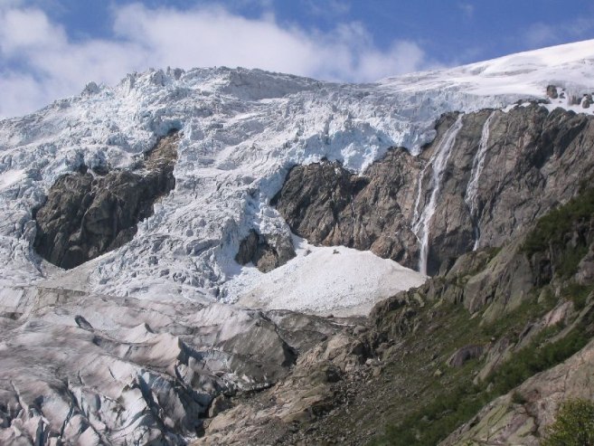
I thought this might be the end of the hike, cause I lost the "T"'s, so I scrambled a bit further up and found a "T". Follow it a bit higher for more nice views, and lost it again. Scrambled a bit more, took lots of pics, ate, then decided to go back. But quickly I found another "T" and took it all the way up to the snout of an upper glacier! I was able to touch this one, and admire it close up.
On the way back down I put on my recently purchased sunglasses for the 1st time, and was amazed at the help and clarity. I think I need a polarized filter for my camera. Took me 1 ˝ hrs to get to the top glacier. On the way down it was too hard to find the "T"s so I just cut down across rocks, eventually finding the trail. There were a large # of people enjoying the hike and taking pics of the glacier with the blue sky backdrop. Perfect weather! Definitely makes up for yesterday.
Jogged some of the flat part near the end of the trail (got a busy schedule), ate a can of tuna, and left. Very happy no one was coming during my drive back on the one-way road ~12:30.
Bought some water at a store in Odda. It was ~$1.75 for 1.5L. I bought 3 since I was out, and could use a bigger refill bottole. The price rang up really high, and I found there is a 12% tax on food here, plus an extra 12% deposit for the bottles. The food is pricy to begin with and that's only 4/5 of the total cost for a bottle of water.
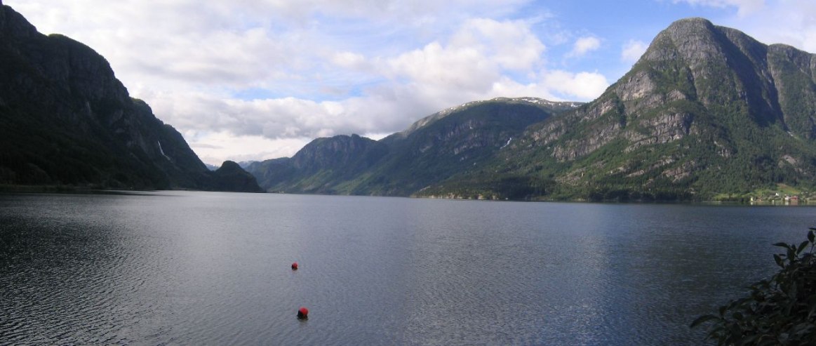
Extremely pleased with the Buerbreen hike (thank you e-book), I drove north towards Eidsjord. Stopped many times to take pics of scenery. Too many amazing waterfalls.
I had tons of hikes available in this region for today, but could only do 2 (and that with speedy hiking). I cut out the hikes to waterfalls, since they are so common here. Pics of the Simadalen valley on the web had reminded me of Rivendell in LOTR, so I hoping to fit that in, though it is long.
I stopped at the tourist office in Eidsfjord, and picked up very useful info and a map for the hike. She said it was a 4-6 hour hike. I was determined to do it under 4hrs, cause I'm super hiker…
So drove to the starting point, and started at 3:08pm. There was just a motorcycle in the parking lot, so I assumed it would be just Norway and me throughout the hike. This was another three sided valley. The ascending was steep and long. It was sunny and hot, and I was dripping in shorts and a t-shirt, given my strong attack. Had to stop and drink more than usual. But I knew once the ascent was over, I wouldn't need much water. I brought 1 liter of water, and drank 3/4ths, and ate my food, by the time I finished the climb.
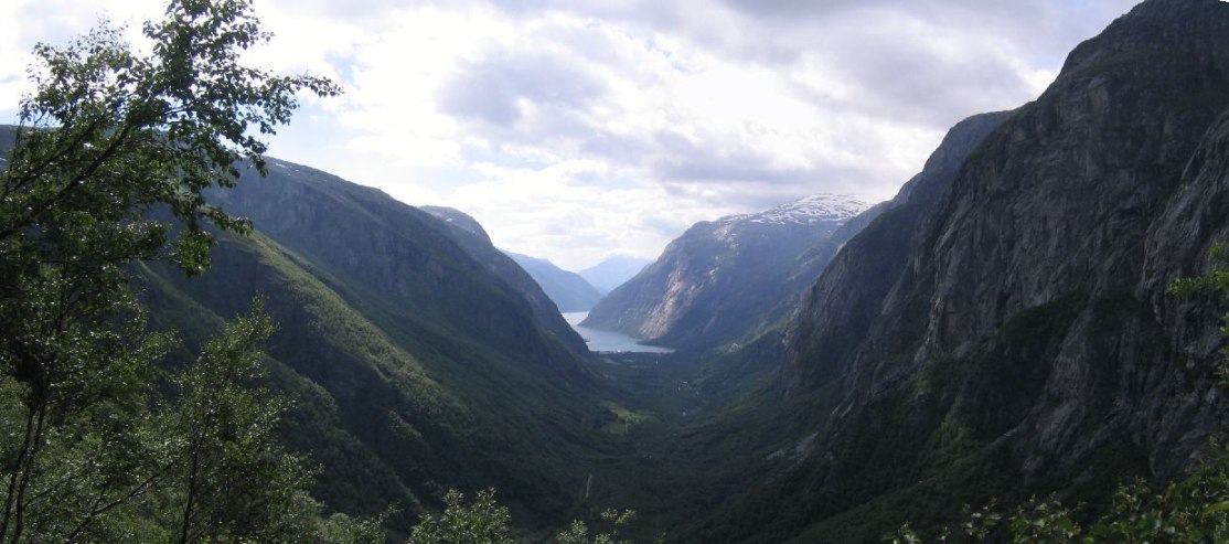
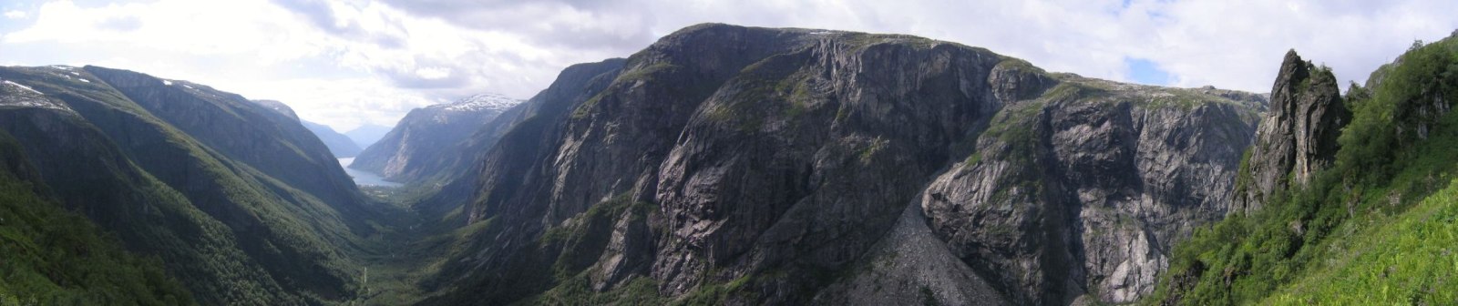
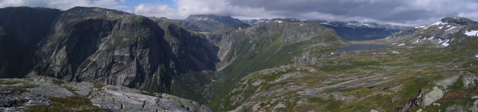
I had just climbed a lush green and ferny slope, and at the top of the "cliff"was a rocky plain with a lake, and further on the terrain rose to an even higher plateau with waterfalls running down to the lake. It was very beautiful.
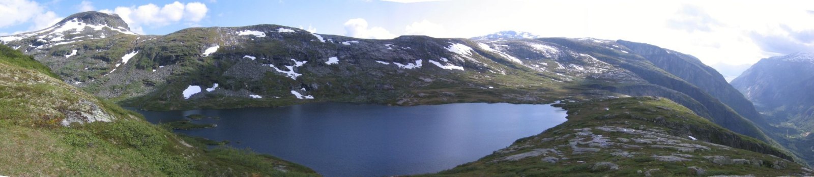
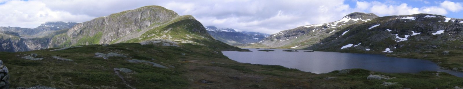
The walk on the plain was longer than I thought it would be, but extremely scenic and entertaining. The sun was still free from clouds most of the time.
About half way through the plains, I realized my water bottle fell out some where back. Wasn't much of a concern, cause I didn't expect to need it. Hopefully some one will find it and pick it up to recycle.
Eventually, the, the grass disappeared and I had to follow the "T"s on the rock surface. I always seem to lose the T trails a few times. Forest and grass paths are much better cause you can see the wear in the ground, but not on rock.
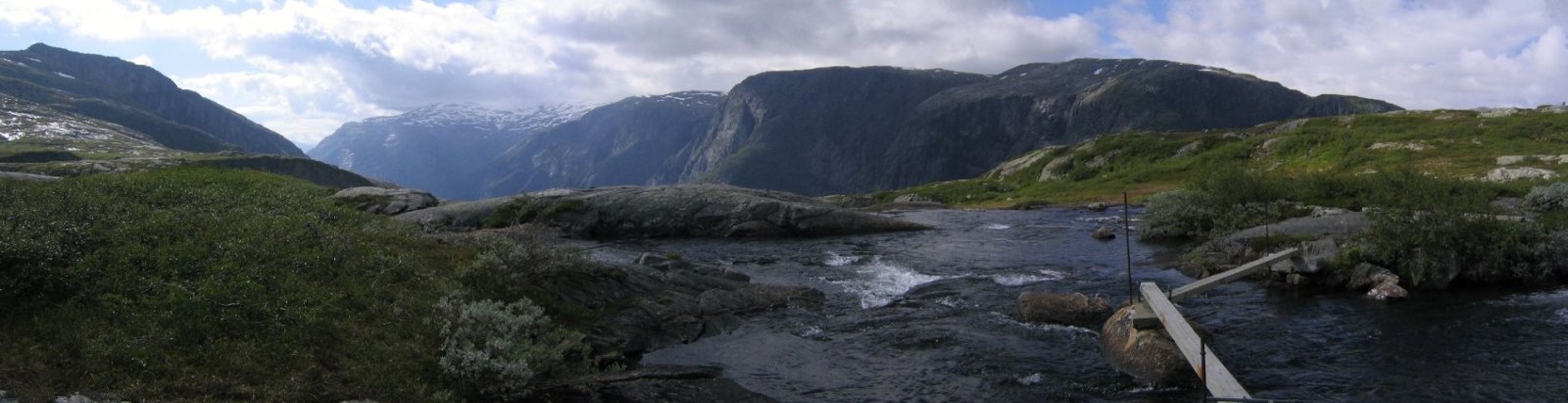
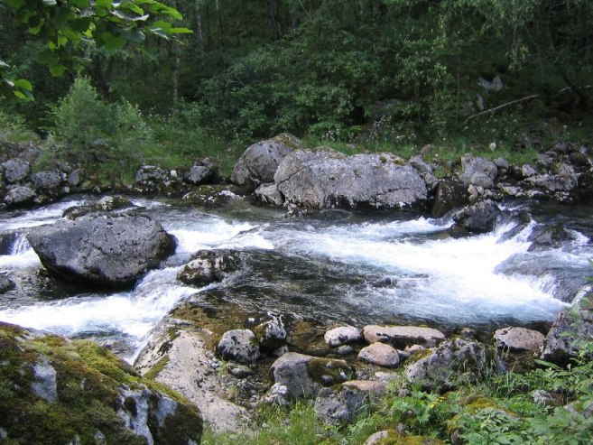
There were crystal clear brooks pouring towards the valley that looked so good to drink. I cupped some in my hand and wet my tongue just enough to try the flavor. Perfectly pure and cold! But I wasn't about to drink any, barring an emergency.
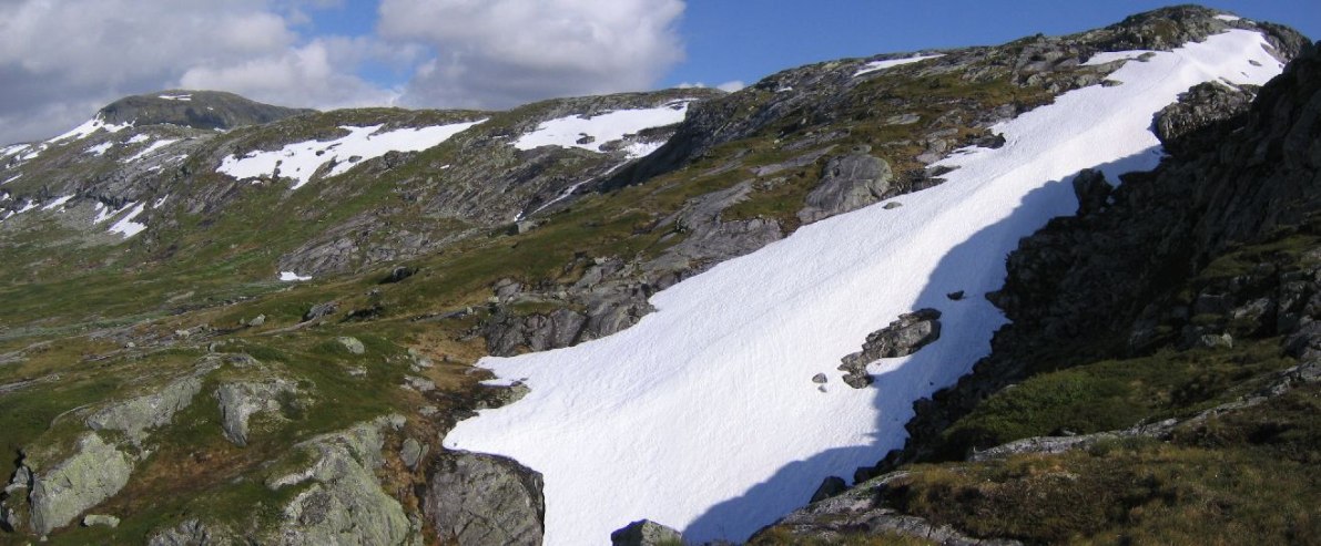
After I followed the path across a small snow patch, eventually I started to descend. Usually descents are a breeze for me, but this one was a pain. It was a long and skinny windy forest path with lots of overgrowth. There were tons of slippery rocks, which were hard to see. Had several slips, but I'm good at recovering…
Came across a stream and so badly wanted to take a bath. If only I brought some soap. I planned to find the brook at the bottom and wash up once I got to my car.
Eventually I got back to my lone car, just a few minutes under 4 hrs. I found a stream (rather a mild white water rapid) and found a small ankle deep pool off to the side. It was cold but refreshing. At my parents house we have a swimming pool kept at 90 degrees. I'm guessing the temp here was less than half that…
Drove to nearby town and caught the 8:20 ferry north. Just ~$8 for a car + driver. Only a 10 minute journey.
Then drove to Voss and stopped for gas, bought a map of the region, and called Karl. He was half way up a rock face, doing some climbing! 1:30pm in Andalsnes on Thursday I will meet him and Mariann. Cool! The gas station attendant let use their cell phone for free.
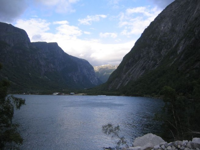
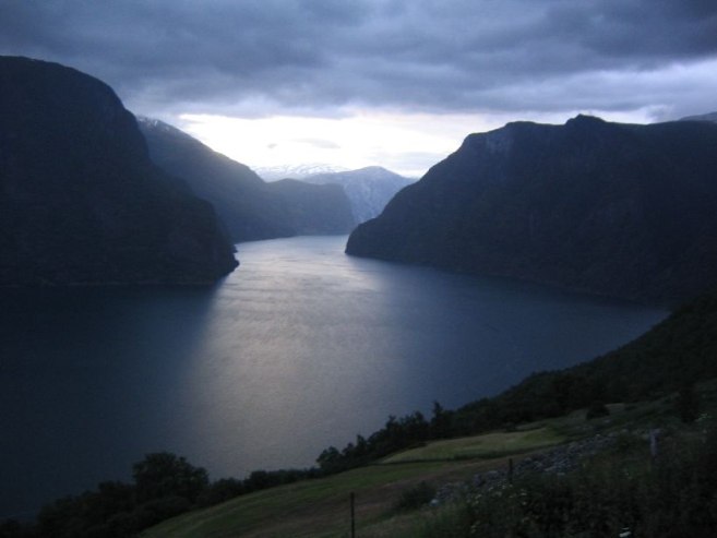
Drove through Gundvagen and Flam, to Aurland. Took pics on the way, even in the 10-11pm range. Decided to take the windy Aurland-Laerdal mountain road, rather than the worlds longest tunnel (24.5km), and look for a car spot for the night.
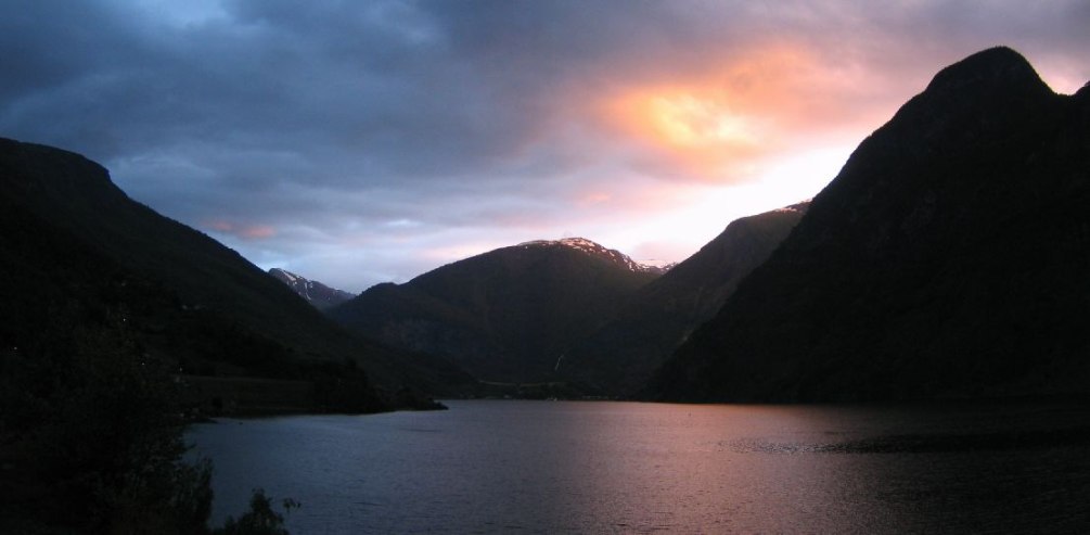
Talk about solitude… Driving the quiet winding mountain road at "dusk" (11:30pm), definitely makes one feel alone in this huge barren, but beautiful land, looking out over water, mountains, and feintly pink clouds. Very cool.
Found a nice spot in a pull over clearing that an RV also thought was a good idea. Ate more food. Ate 4 cans of tuna today! But I burned a ton of calories. Wish I could eat 7 bowl of cereal… It's still quite light out here, as I'm getting further north now. This road will be quiet, plus there is a pleasant sounding waterfall in the distance.
Today was an ideal aggressive day. Hopefully tomorrow I'll get to enjoy the views of this mountain road in the daylight.
Daily Totals:
Distance Driven: 263km (164 mi)
Elevation hiked: 4330ft (1280ft Buerbreen – ebook, ~3050ft Simadalen – map)