Slept very well in car. A good seven hours worth, which should be expected after yesterday’s exertion. As I was set for sleep, I realized I was parked on a slope, and if my leg bumped the stick shift into neutral (very easy), and somehow disengaged the parking break (pretty hard, but not entirely impossible), my car would slide backwards into a large, rather steep ditch. So I parked parallel to the edge on flat ground (made sure I didn’t go anywhere in neutral), spun the wheel to slant my tires, and wedged a water bottle under the parking break. Slept with confidence.
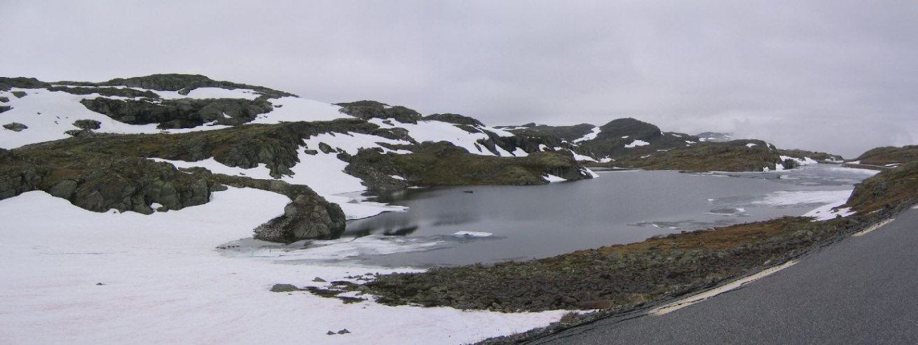
Woke up at 7:45, and was back on the road at 8:00. Heavy clouds surrounded me, as I had been parked about half way up the mountain. Well, I took this 48km mountain pass vs. the 24.5km tunnel for views. Maybe I should have driven the whole road last night in the never ending dusk while it was still clear. Got more cloudy as I climbed, but could still see good short views of the landscape. Then, as I started to descend the other side of the mountain, the view changed to blue sky and a bright green fjord at the bottom!
Decided to take the 89 Nkr ferry rather than the longer (but scenic) mountain toll road (60 Nkr) to reach Gaupne, and head up to the Jostedalbreen glacier to catch the 12:30 guided glacier tour.
And we are moving. Time to go on deck for a look.
6/30/04
9:55am
Stopped at Aroytunnellen for construction.
The ferry ride ended before I even realized in started. I had just got out and started making a PB tortilla, and saw everyone turning on their engines. I had to hurry back to the car. Not sure how I managed to miss the trip. Must be a really smooth ferry.
7/1/04
12:27am
Off E139 road, ~20km from Andalsnes
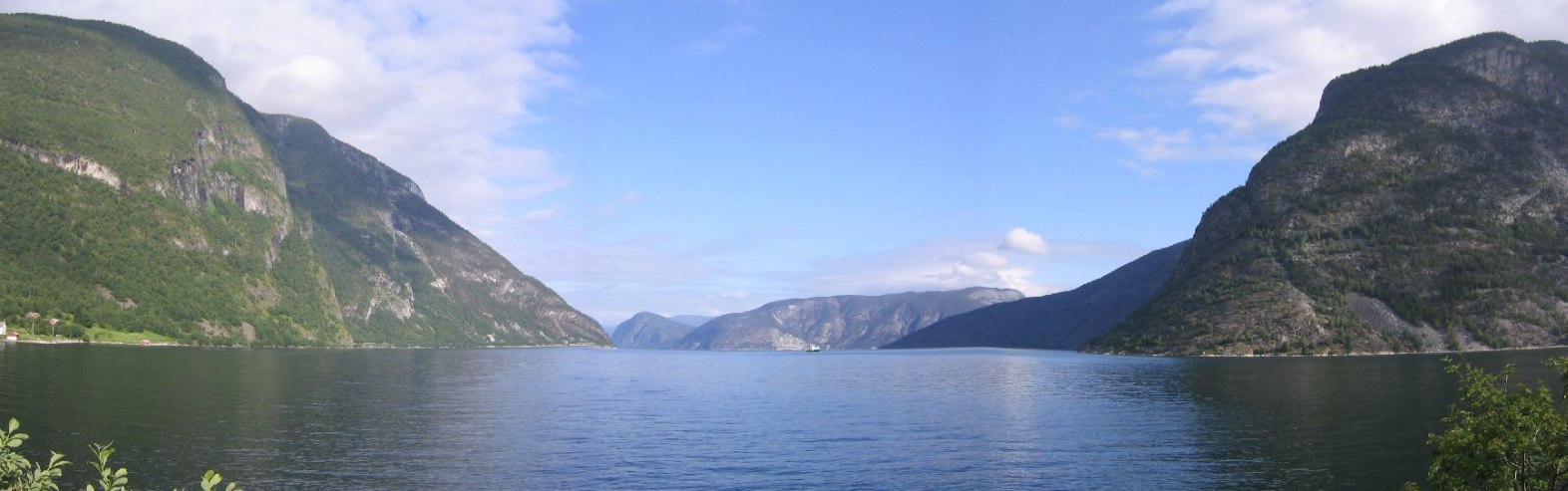
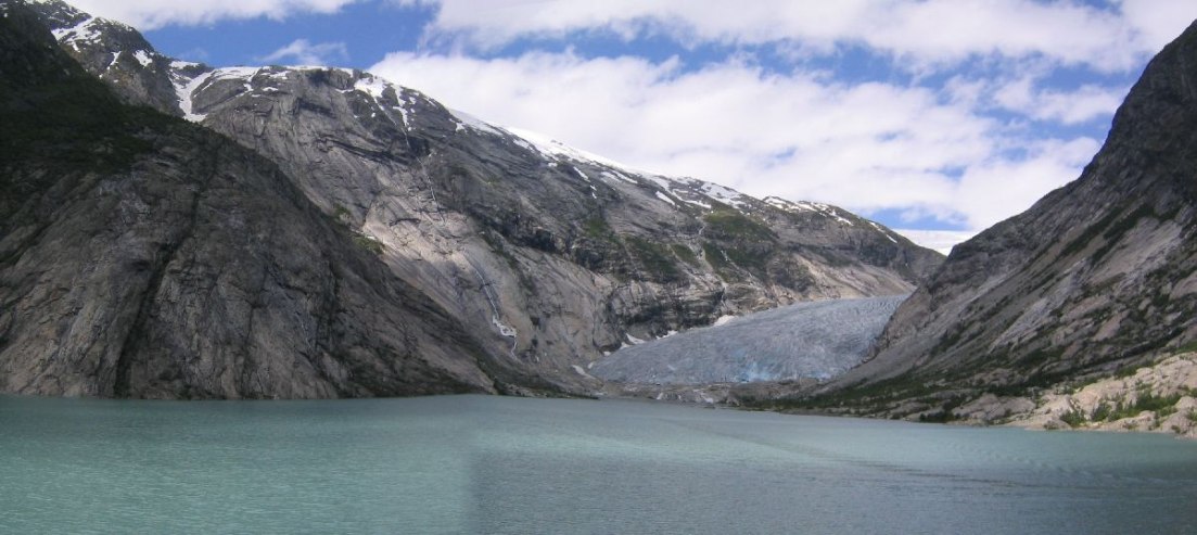
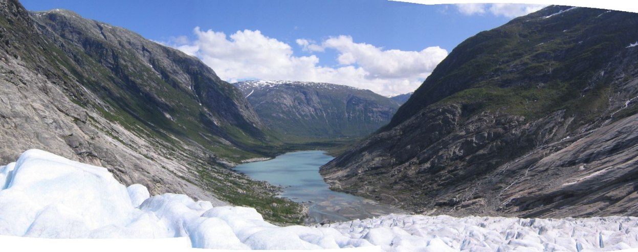
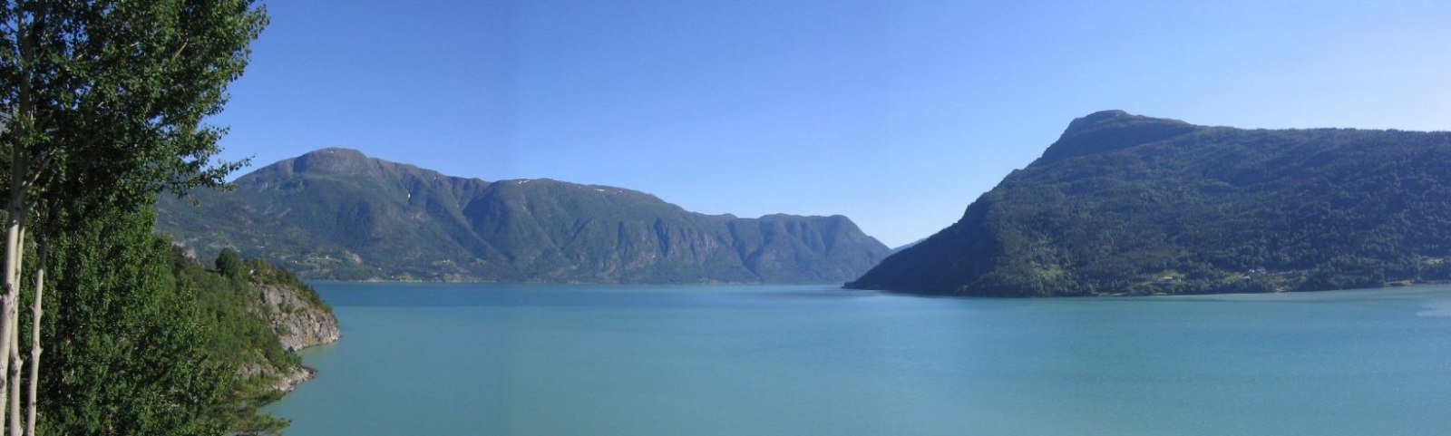
After the ferry, I drove along the Sognefjord up to towards the Jostedalbreen National park. Largest glacier in continental Europe. Was doing good on time to make the 12:30 glacier guiding on the Nigardsbreen glacier arm.
Bought my ticket at the visitors center. 390Nkr - $56, for 3 hours on the ice, which I decided was a better option over the 310Nkr – 2 hour ice tour at 12:00. Filled up water bottles in the WC.
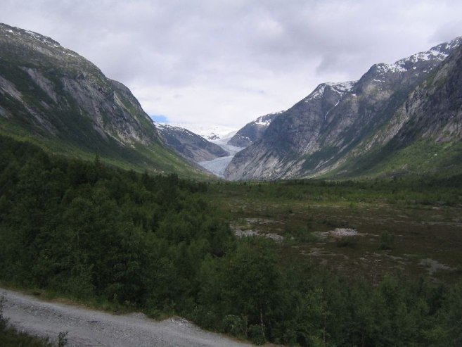
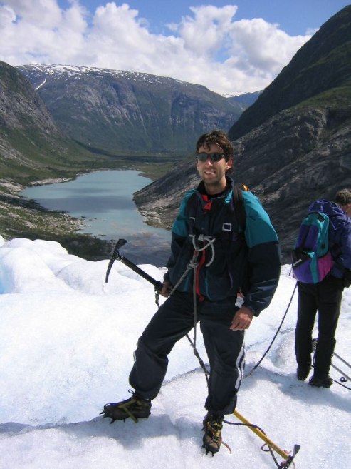
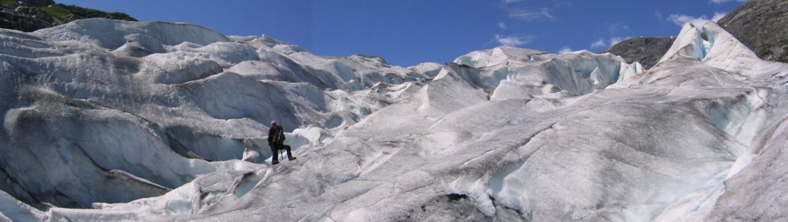
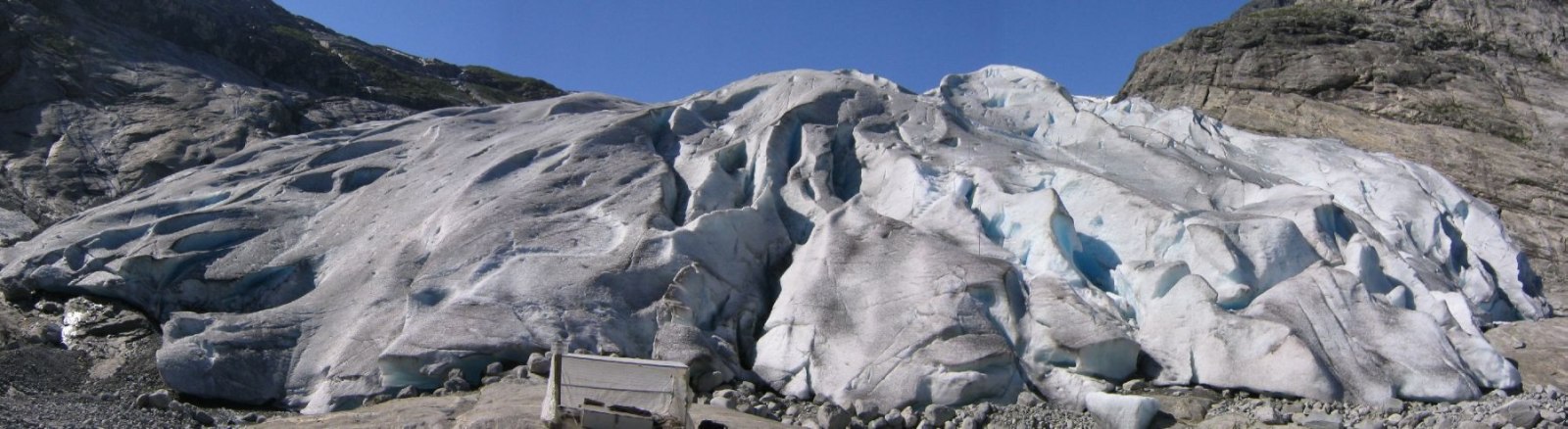
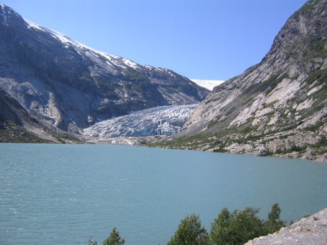
Paid a ~$4 toll to drive 5km to the glacier. I could have legged it, but needed the time spent for other travel today. Got crampons, an ice axe, and gloves, and took a boat across a green lake to the glacier. It was a 15 minute hike to the glacier snout. The weather was warm and sunny with passing clouds and little wind. Later in the day it would be cloudless even!
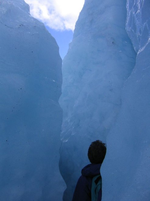
We roped together (3 couples, me, guide = 8), so if someone fell down a crevasse, the others would be able to save him. Well, they were unnecessary today. One good thing about being roped and led on a glacier is that there are no red “T” marks to search for.
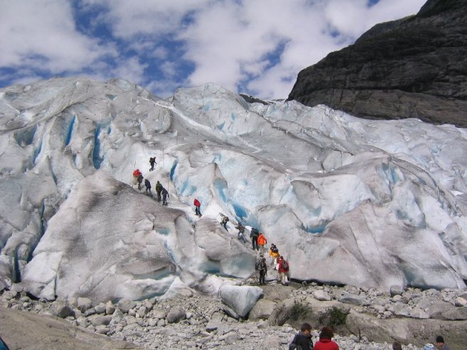
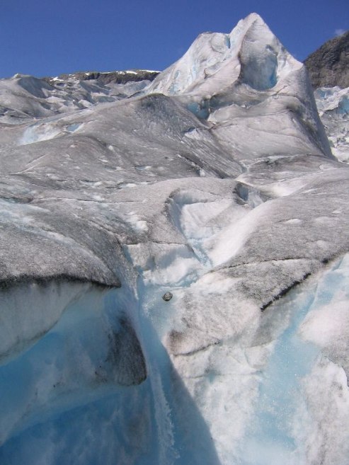
It was the glacier guide's 1st lead of a group. He found out the “Labyrinth” (some type of walkable crevasse) was closed (too dangerous). We climbed as high as possible on the glacier. Nothing that exciting, and I was thinking this weather might be better spent on a mountain, but then they found some crevasses to walk thru. I managed to take a few pics in there, though we were roped together and couldn’t stop. Then we breaked on a high lookout. Beautiful!
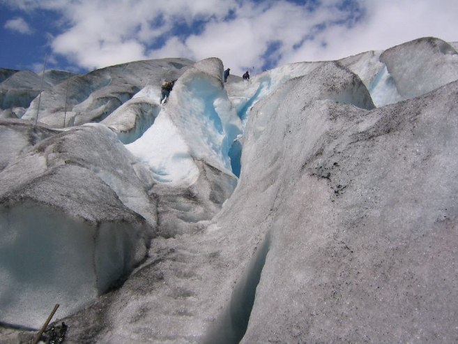
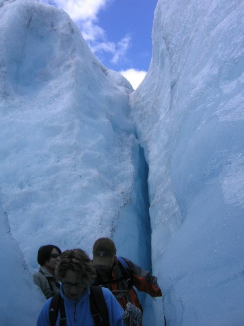
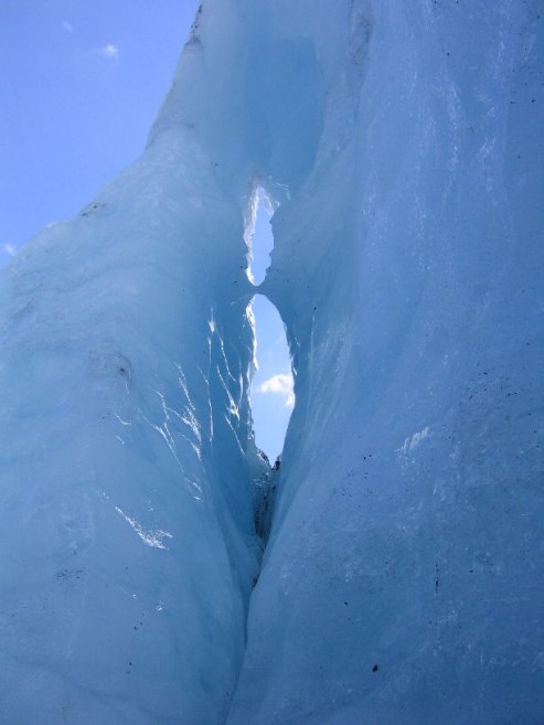
On the way back down, we visited “water world”, an area full of waterfalls and waterslides in the ice. It reminded me of a water park with the blue tubes. The blue ice on glaciers is due to pressure squeezing out the oxygen in the ice/water.
When we got down we took the boat back, and I was in the car at 5:00pm. Took lots of pics before I left.
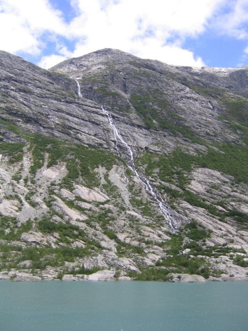
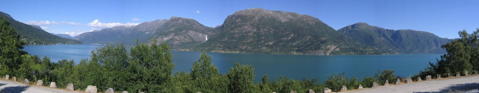
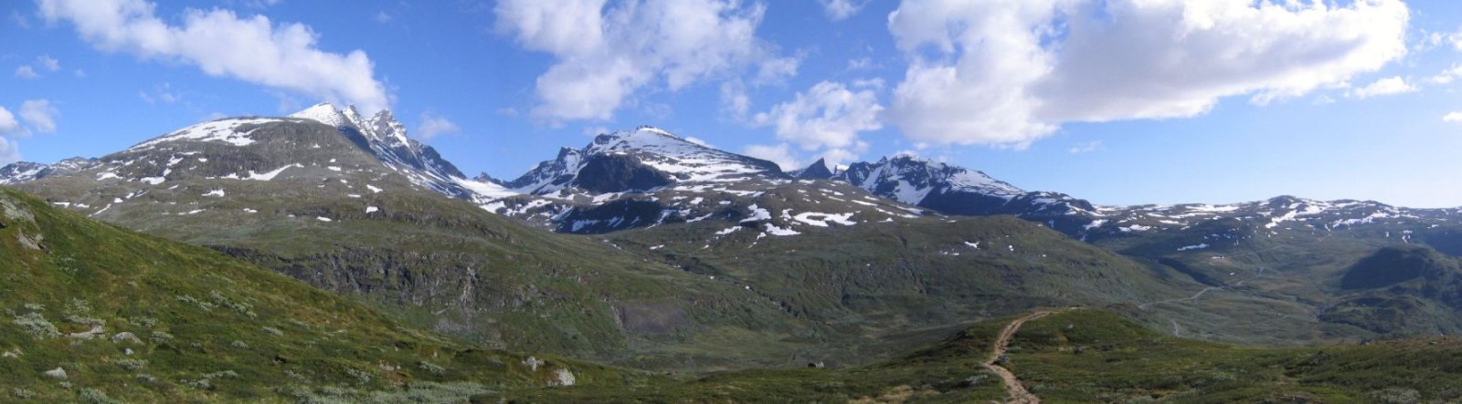
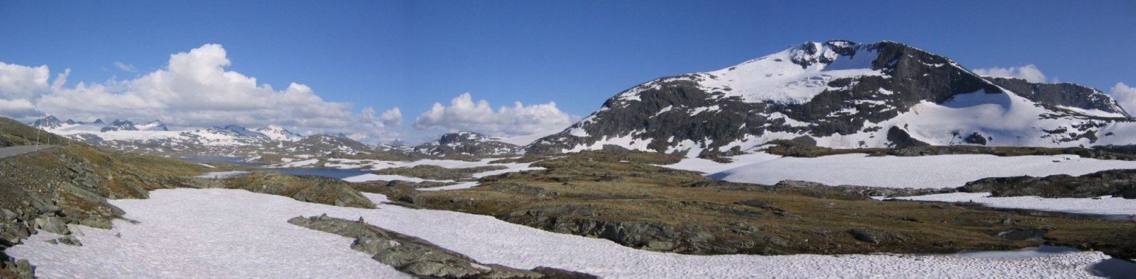
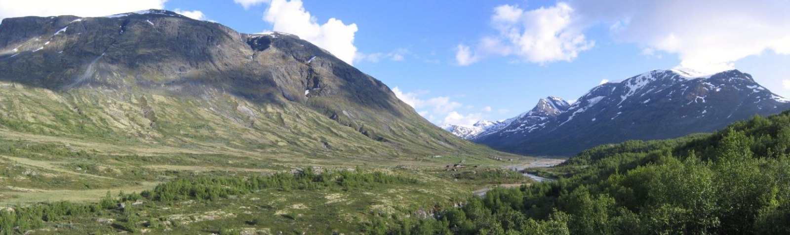
Drove back to the Sognefjord and continued my route northeast on the scenic Sognefjellet road under blue skies. Took the road from sea level up to 1434m (4740ft) along the Jotunheimen mountains. Saw lots of 2000+m snow capped peaks in the sun. Took lots of pics.
Stopped in Lom to call Karl and fill up on gas. No answer from Karl. I decided to go to Andalsnes via E139, therefore return via the popular Geirangerfjord and Trollstigen areas with Karl and Mariann. Drove to Vaga, and called Karl. Confirmed arrival and departure times. Plans look to work out perfectly. Pay phones take VISA, which is useful.
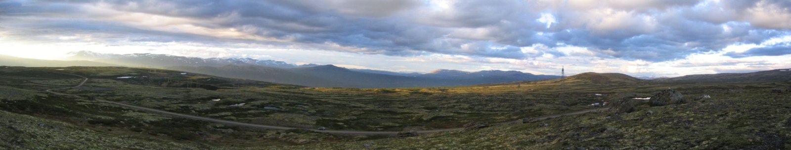
Drove the 30Nkr private toll road up to 1000m. Got out for a short 10:00pm walk (jog) up a small hill near the road for some pics. Very little traffice anywhere on all roads all day. Hadn’t expected the traffic and ferries to be so easy and manageable.
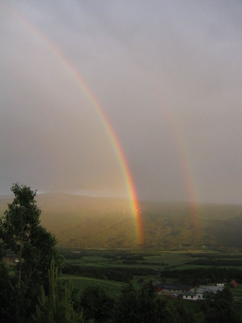
Turned on to E139 towards Andalsnes. Sun low on the horizon. Behind is a gentle but good sized rain cloud, which I noticed just before Lom. I looked around waiting for a rainbow. Sure enough, one pops up behind as I’m driving. I see there are 2 big trucks, 1 truck moving some type of wide load, and a caution truck behind that with flashing lights. Do I dare fall behind this group of traffic to stop and take some pics? I pulled over when I found a good view. A full rainbow! Many pics later I drive on, hoping to “chase” the rainbow, but soon we part ways. A 10:50pm rainbow though!
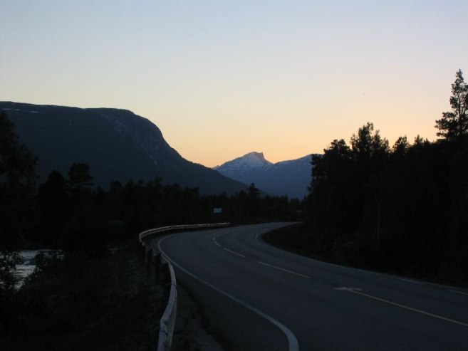
11:10 and I still see pink sun on the tips of mountains. I drove west towards Trollvegan, the 3000ft cliff before Andalsnes, and decided to stop for the night before I pass it, so I can see it with the morning sun (hopefully still clear out). Then I’ll try a short hike before meeting Karl and Mariann at 1:30.
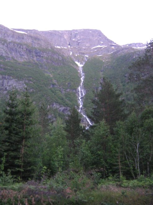
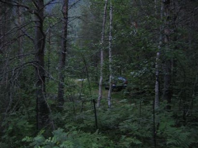
Found a nice spot ~50ft from the road, at a minor trailhead area, with the train tracks K & M will be coming in tomorrow running nearby. Pretty sure there aren’t any overnight routes, so shouldn’t be noisy. There’s a high waterfall as my view from the car. Soothing sounds. Gotta clean and repack my car for companions tomorrow.
Almost at northern most point of trip. 62 degrees 30 minutes latitude. 1:00am out, and looks like about 8:30 in MA during the end of June.
Thought of the day, while driving up a mountain road behind a large, slow bus: “You experience the same speed as the bus, but don’t get to ride it.”
Daily Totals:
Distance Driven: 415km (259 mi)
Elevation hiked: ~400ft (just a guess, all on ice)