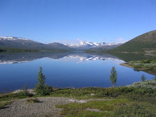
It was very cold last night, and I ended up moving into the car in the early morning, hoping it would be warmer there. But it was still cold, and I had little quality sleep. We were probably at 3000+ft elevation, much higher than on any previous night, so that might explain the surprisingly cold temps.
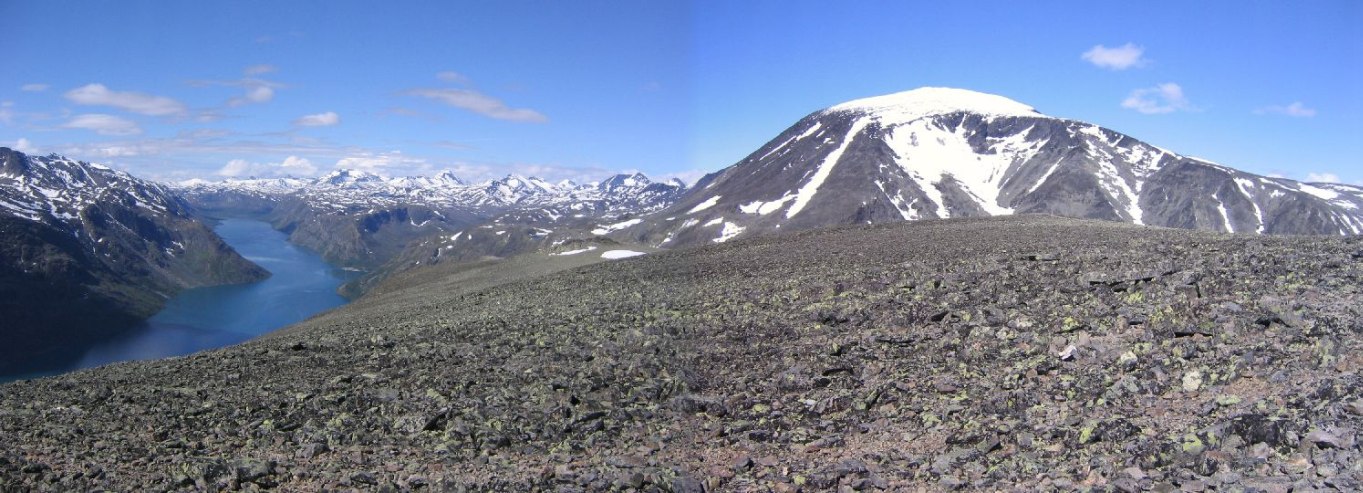
Got up at 7:40am, woke up Karl, and packed the tent. The sky is all blue! Excellent conditions for the Bessegen ridge hike, just 30km south, in Gjendesheim. We had considered hiking Galdhoppigan (Norway's tallest, over 8000ft), but it made for a longer trip back to Sandefjord afterwards, and was likely to be snowy. We had enough snow hiking yesterday at Skala.
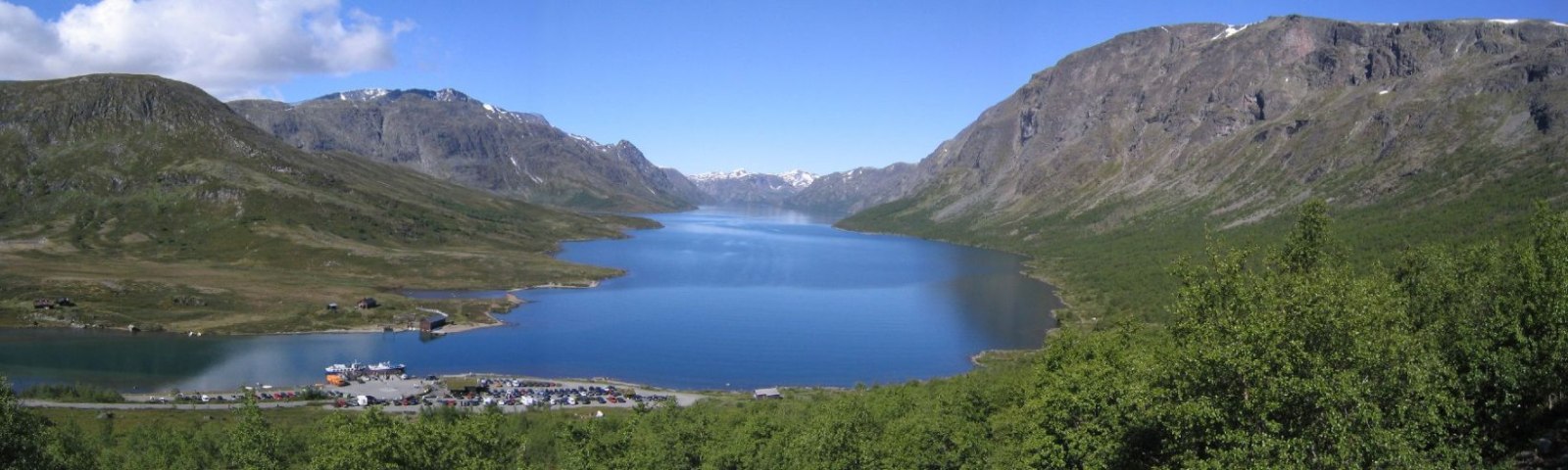
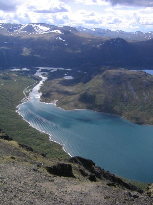
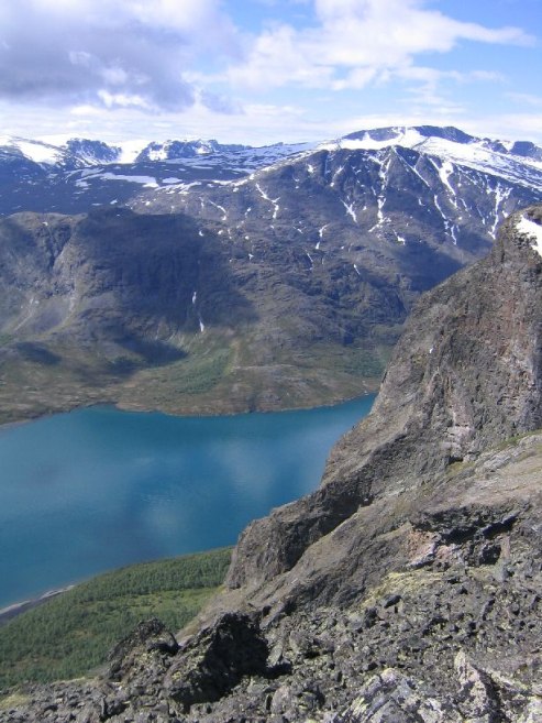
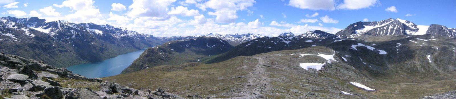
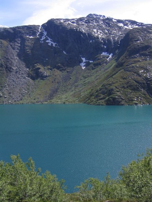
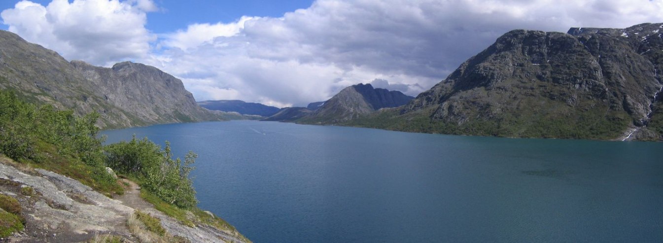
The Bessegen Ridge is considered the "best" hike in Norway, and is immortalized by a famous Norwegian writer in a poem. What makes it unique is a ridge separating two lakes (one blue, one green), and the mountainous backdrop.
Parked in Gjendesheim for 50Nkr (~$7.25), ate breakfast before hitting the trail at 9:26am. Starting elevation was about 1000m (3300ft), and needed to climb to the 1750m (5775ft) peak on the ridge. The trail was rocky, but well marked with red "T"s.
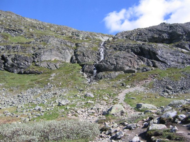
I knew this was an extremely popular hike, so I was expecting this to be a rather easy and short trail. But the climb was steep to the ridge, and then long along the wide stony ridge up to the peak.
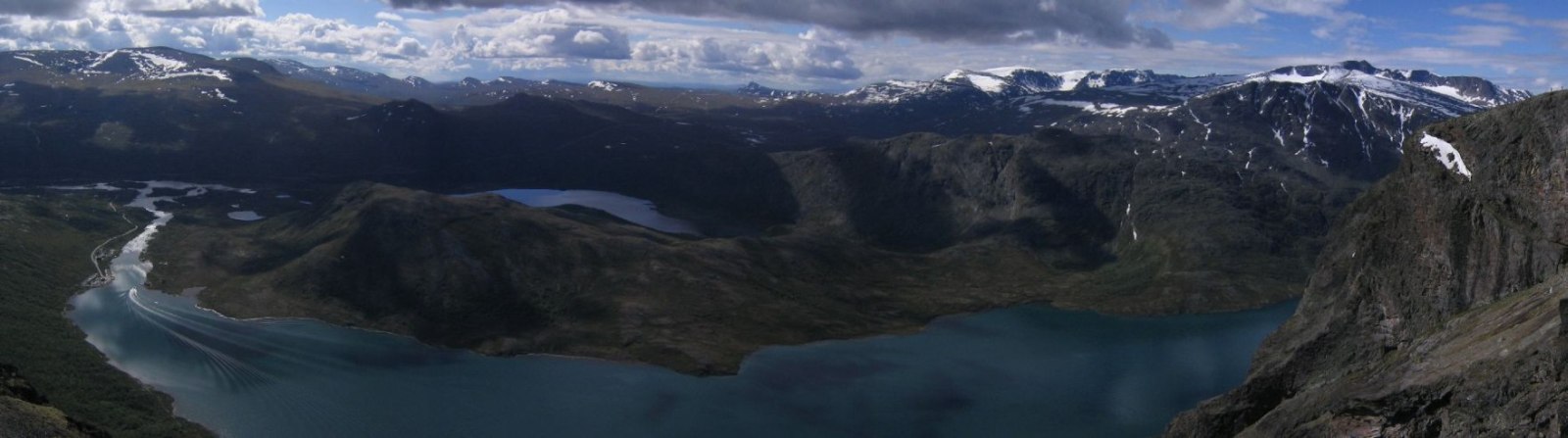
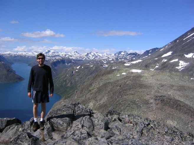
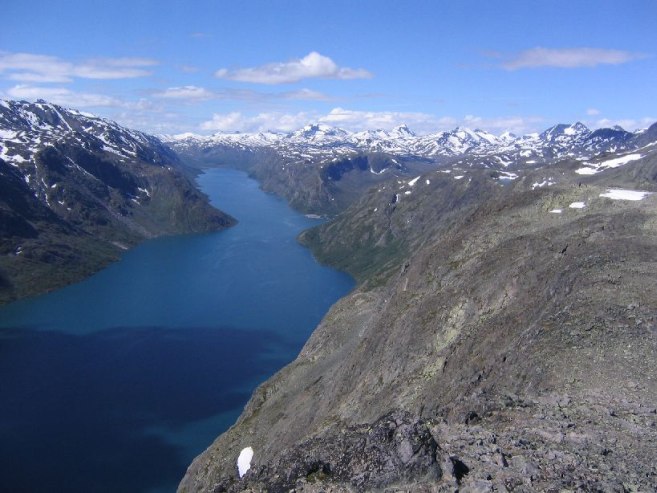
The mega-view of the 2 lakes was still a short ways down the ridge past the peak, so we descended a bit along the narrowing ridge, and came upon the spectacular scene at noon under blue skies with white peaked mountains in the distance. We took a rest, some pics, and ate a bit, while enjoying the top-notch view. It was a bit windy and cool up on the ridge. There were many people on the trail.
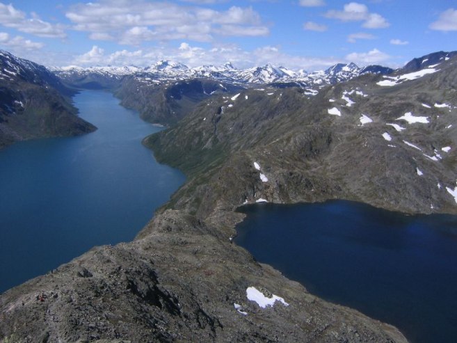
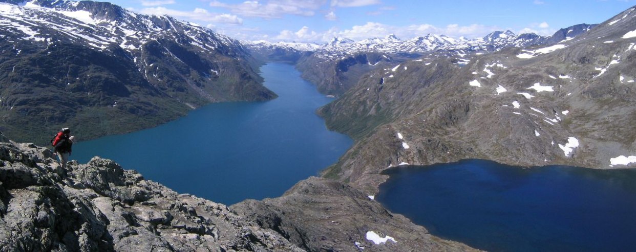
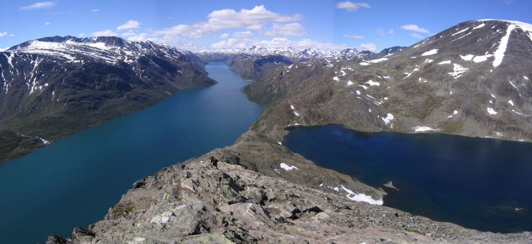
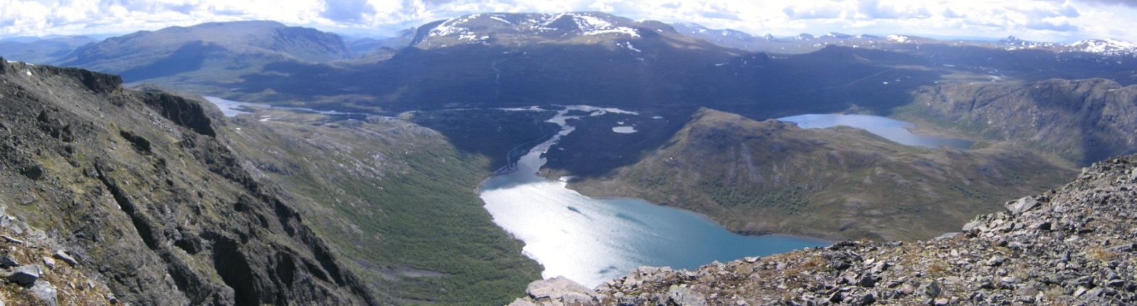
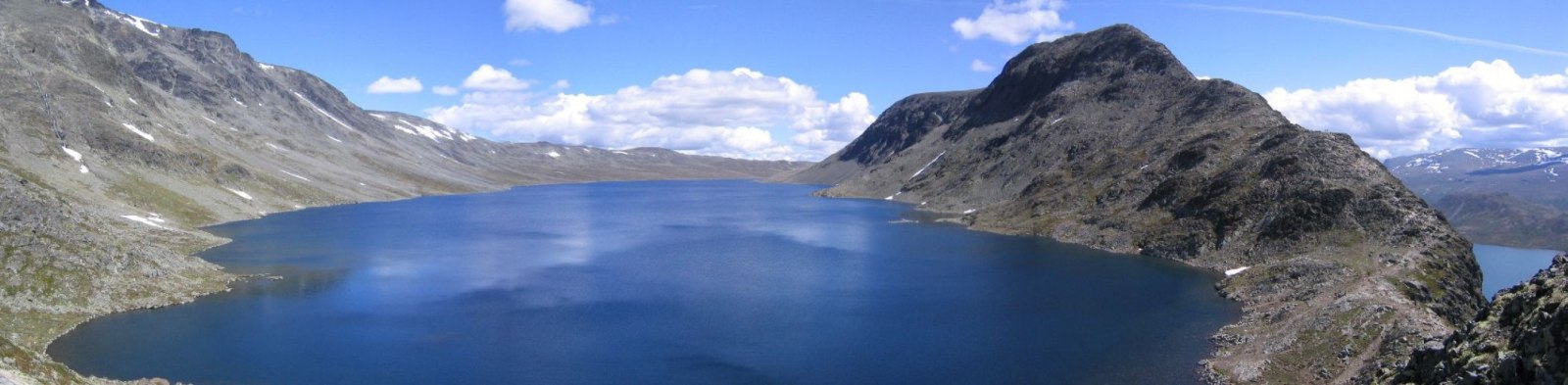
Ahead we saw the path continue down the narrowing ridge quite steeply, down to the lakes, and then back up another ~1000ft, before descending back to 1000m on the lake at the Memurubu hut, where we were hoping a timely ferry would take us back to Gjendesheim.
Karl's knees were hurting pretty badly during the descent at this point, after yesterday's near 8000ft of elevation, so he decided to play it safe and turn back now rather than continue down the ridge, back up the next mountain, and down to Memurubu. Plus we didn't know the ferry schedule, and wanted to leave ~4:00pm to get back to Sandefjord before too late.
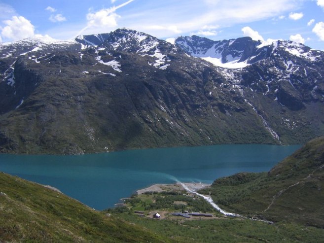
My legs still felt strong, so I gave Karl the keys, and decided to push further, planning to meet him at the car at 4:00, unsure whether I'd make it to the ferry, or turn back sooner. As I got ready to continue down the ridge, I saw an older man fall as he started the descent, but fortunately to no harm. I made my way down and found myself at the shore of the blue lake on the right. The green lake on the left was 1300ft below over a cliff.
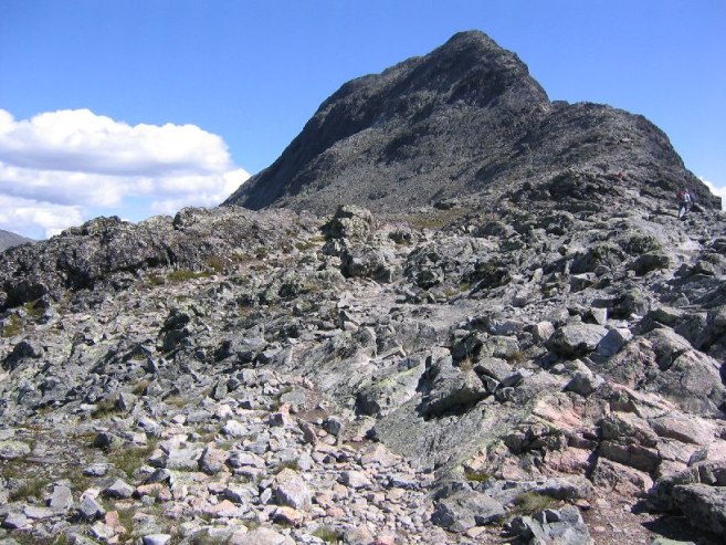
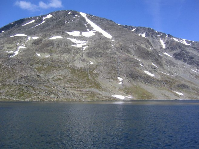
I could see the trail along the green lake from Memurubu to Gjendesheim from 1300ft above. No way to cut down there, due to steep cliffs, so I continued on up the next mountain, taking pics on the way. The ridge I had just descended looked super thin and steep.
At ~1pm I asked someone on the trail about the ferry schedule, and he said there was a 4:40pm ferry heading back. Not soon enough for me. He said the path along the green lake is a good option too, and is a 3 hr hike. If it was a flat easy trail, I figured I could jog it and make it in half the time. I was guessing it would be ~5 miles (I later found it was 6 miles). I asked how much farther til Memurubu, and he said 2 hours. Hmm… Need to be back in 3 hours. I'll have to hurry.
I was amazed how strong my legs were, given yesterday's efforts, but had lots of energy, and started running stretches. Stopping for pics was hurting my time. I was also out of pictures, and started deleting others to make room for a few more.
Made it down to the lake at Memurubu at 2:15. The posted ferry schedule at the dock looked like a 3:15 ferry would depart and arrive at 3:40. But I decided I'd rather run the trail, which I was expecting to be like a dirt road. So I ate my remaining 2 energy bars and took off.
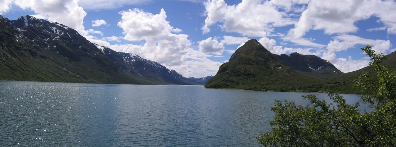
I soon found myself on an often muddy, rocky, and wet trail, and I was gaining elevation. Why elevation gain when I'm just going to end up along the lake?!? I reset my watch to measure this unnecessary altitude. I ran the path in sections that were suitable (and many that weren't), stopping for a last pic of my destination at the end of the lake.
I was working very hard, and the trail was much longer than I expected. Gjendesheim at the end of the lake didn't seem to get any closer after each curve of the lake, and I saw dark clouds approaching ahead. Kept the torrid pace, and dismay at climbing and descending "needless" altitude.
At 3:45pm I was finally around the last bend of the lake, but knew I'd be a little late. Ran the last mile pretty much non-stop, and got to the car at 4:13pm, feeling like I had just completed an iron-man race. My watch told me I had climbed a net 400m (1320ft) over the 6 miles, in just under 2 hours. Great finish to a week of Norway hiking! Karl was in the car reading, and it had been a slow, painful trip back for him, but turned out to be a good decision to head back when he did. Also, it turned out there wasn't a 3:15 ferry, so good thing I didn't wait around for one.
In a few minutes we set off for the 350km trip back to Sandefjord. The mountains thinned, and the terrain started to look like the Finger Lakes region of NY, then just hills and farmland. We made a few stops along the way, and talked about Nintendo games of old for most of the car ride. With Karl's great help navigating, we arrived at Mariann's parents house just before 10pm. The Euro-cup final was on the TV.
It took quite awhile emptying the car and repacking items into my two travel bags. The car is quite dirty inside. I put over 2400km on the car in a week, with just a drive to the airport left tomorrow.
Many thanks to Mariann's parents for their hospitality Sunday night. I took a warm shower for the first time in a week. Karl offered me a razor, but I'm bringing my beard back to the US (my souvenir). Ate my last can of tuna (16/16), this time with a little mayo.
Quite an exhausting day. Quite an exhausting two days, rather. Excellent weather during the hike today. Got my nose sunburned. The Bessegen hike will certainly always be remembered. A great way to end a Norway adventure. Glad to rest my legs tomorrow on the plane.
Daily Totals:
Distance Driven: 390km (244 mi)
Elevation hiked: 5140ft (map based estimated net elevation gain on 12+ mile roundtrip hike)