And I would be doing this hike solo, as my companions from my last hike, though up to the challenge in spirit, have bad knees that give them trouble after long distances. The Presi-Traverse took us 14hr 49min to finish, and the Pemi-loop was an extra 13.5 miles. I would need to set a fierce pace to finish this hike in daylight. A good amount of running would be needed to complete this hike.
Now let me try to explain why I'm not "crazy".
The secret to completing this hike was simple: Compared to the 20 mile Presi-Traverse hike, I just needed to go an extra 68% faster over a distance 68% longer in the same 15 hr block of time.
Ok, maybe I should add some other arguments to help my case...
As for the "emergency" aspect, I planned to bring extra food, a poncho/tarp, and an emergency blanket in case I somehow needed to spend the night. I also bought a water filter.
Ok, on to the report...
I set my alarm for 4:30am, and tried to sleep in my car. I was hoping for just a couple hours of sleep, but not at all surprised that I got ZERO. For the Presi-Traverse hike I got no sleep, though that was in a hostel bed. Not sure if I wasn't comfortble, not tired, or just too excited about the hike. No matter, most of my hiking this year has been on little sleep.
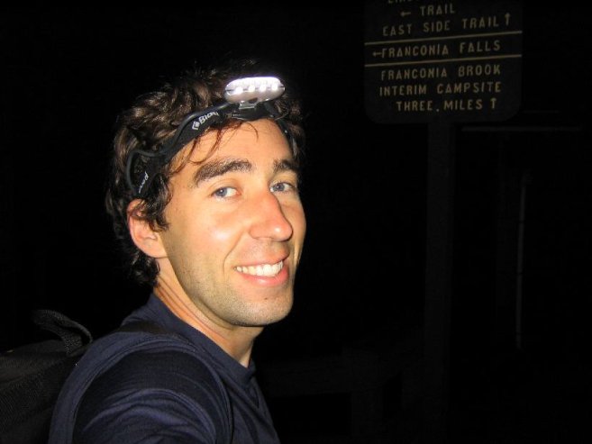
I eyed my watch at 4:13am, and figured I might as well just get up and start a little early. Sunrise was 5:48am, and I planned to hike with my headlight on the flat, long, straight Wilderness trail in the dark.
I put on some suntan lotion as I readied, just in case it might still provide some help later in the day...
4:53am
Wilderness Trailhead
0.0mi
1160' (0') For the elevations, my watch's accumulation total is in the parentheses
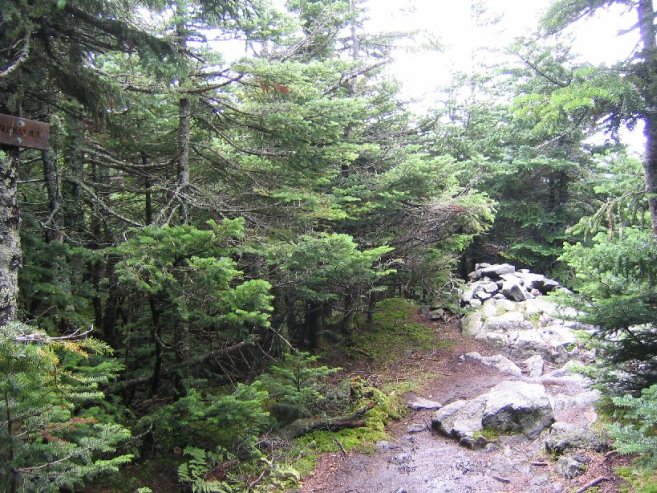
I took my first step onto the trail at 4:53am. Crossed a suspension bridge and followed the wide, flat, Wilderness Trail, an old logging road, along the river. Lots of railroad ties spanned the road. Wide enough for 2 lanes in Europe.
It was jog-able, but not in the dark with random roots, and wet spots.
At 5:15am, I deemed it light enough to turn off my light. Two steps later, I heard the first bird of the day chirping. The bird must have agreed with me about the light.
5:17am
Osseo Trail
1.5mi
1300' (217')
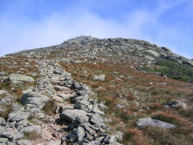
Turned left onto the Osseo Trail, which would lead me up to the Franconia Ridge from the southeast side.
Observation: The first person on a trail gets a unique experience; walking through any spider webbing across the trail that takes place over the night. I don't think any fantasy book I've read mentions that...
I took my first break of the day at 6:28am at an overlook, and had a banana and some water. Clouds were about, but sunlight would make its way through on occasion.
The trail had been nice and relaxed for the most part, but at this point began to climb very steeply. A series of wooden steps appeared, attatched to the steep hill, and climbed straight up the mountain. I guess that's not cheating if it's part of an official AMC sanctioned trail...
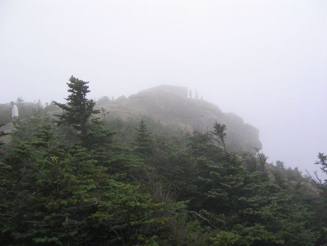
7:03am
Flume Summit
5.6mi
4328' (3202')
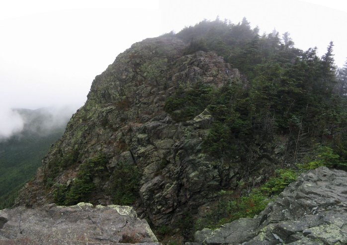
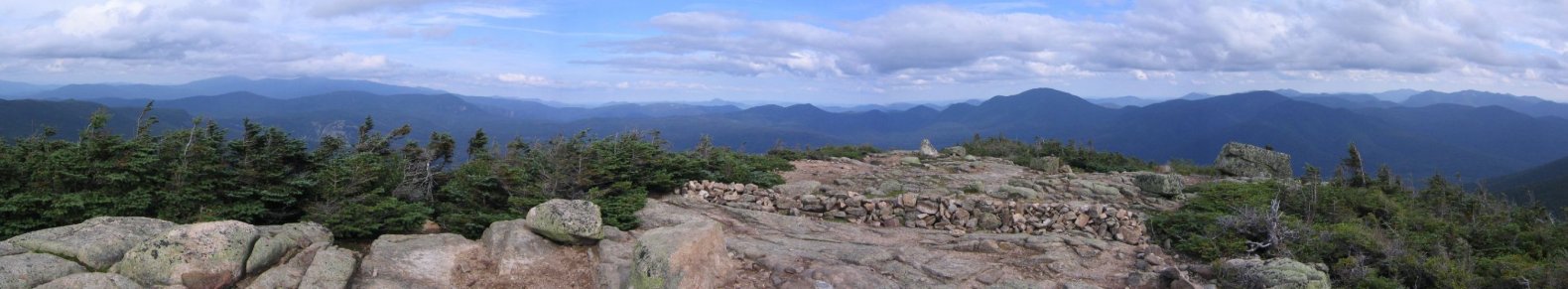
Soon I reached Flume, and admired its rocky peak and rock slide. (the merged pic came out a bit warped)
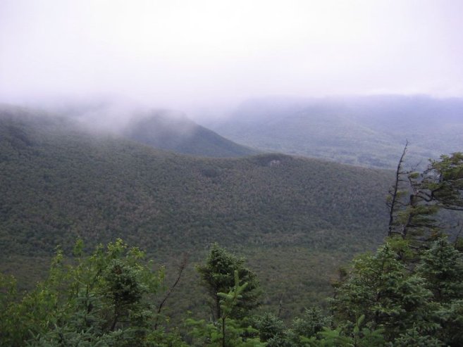
I wished for a clear view of the Pemigewasset Wilderness so I could see my whole route, but there was lots of cloud to the north.
I had hiked all the peaks on the Franconian Ridge this year already, so I wasn't concerned with views this morning, and maybe the clouds would prevent me from dawdling with my camera. I have to keep moving!
7:35am
Liberty Summit
6.7mi
4459' (3812')
Followed the familiar ridge trail to Liberty. It was quite windy and cool, but no need for the gloves and hat I brought.
Liberty summit was clouded over, though occasional breaks had me eagerly trying to spot the Bond range to the East. My return path would lead me along that ridge.
Best to keep moving, so I ate my second and last banana (bananas get mushed fast in a backpack), and continued north.
8:39am
Little Haystack
8.8mi
4780' (4783')
I hadn't been on this section of the Franconian ridge trail before. Soon I reached Little Haystack, site of the Falling Waters trail junction. This marks one of the most popular trails in all the White Mountains.

Still had not met any people on the trails yet. Guess no early risers today. I did see a tent next to the trail near Flume though.
9:00am
Lincoln Summit
9.5mi
5089' (5700')
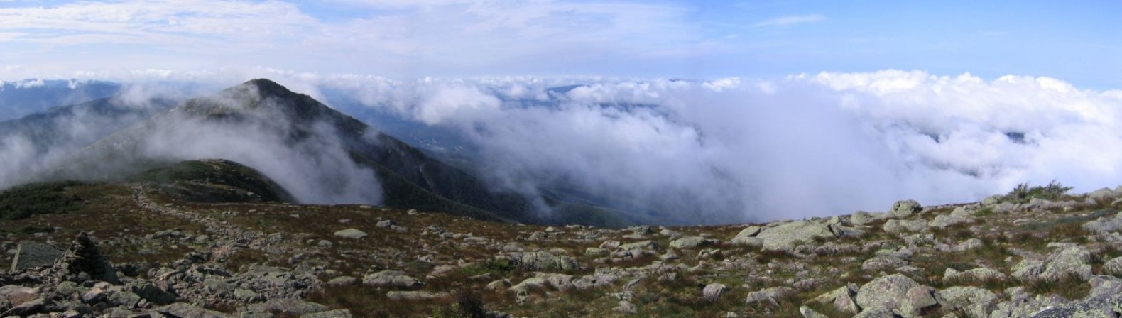
When I arrived at Lincoln, I was reminded of my Presi-Traverse hike, as I was above the clouds now. To the west lay a blanket of cloud.
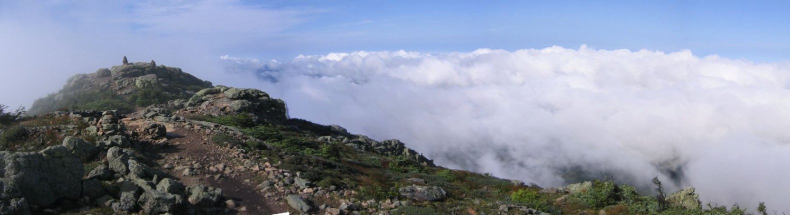
And to the north, Lafayette, my next destination, was trying to puncture through the cloud blanket, but the clouds were holding pretty well...
I was able to get some views of the Bond ridge to the west, but there was always some cloud presence blocking a complete picture. The clouds were thickest north in the Garfield, Galehead, and South Twin area.
9:24am
Lafayette Summit
10.5mi
5260' (6608')
Finally, at 9:12am, midway between Lincoln and Lafayette, I met people on the trail. The two guys probably hiked up to Lafeyette and were continuing to Little Haystack. We said the customary, "hi".
As I approached the summit, the skies cleared, and I saw a bunch of people atop. A woman making her way down past me asked where I started from. "Kancamangus Highway, 4:45 this morning," I replied. It didn't take her long to realize I wasn't joking, and she was pretty amazed.
Made it to Lafayette in 4 1/2 hours. That's 10.5 miles, and the highest elevation of the hike. Still not quite 1/3rd of the way through the hike though! I was making great time, considering I had climbed half of the hike's total elevation gain.
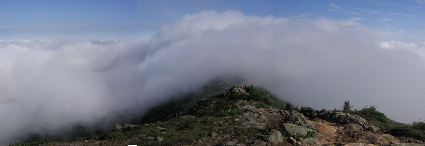
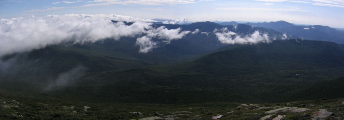
Looking back, Lincoln was still fighting off the clouds.
I overhead someone say the temperature was 47 degrees presently at the summit. The wind wasn't much of a factor as I sat next to a rock eating a can of tuna, some muffins, and a granola bar.
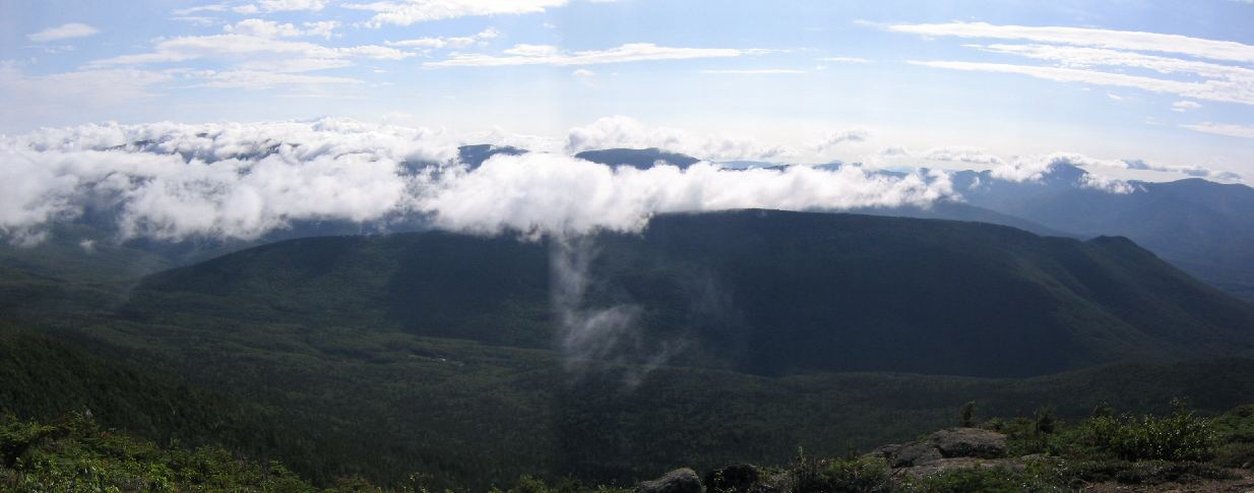
I could see the Bond ridge trying to part the clouds on the other side of the valley. Just a matter of time before I've over there looking back at the Franconian Ridge.
Now it was time to head to unexplored (by me) terrain. I've always wanted to head north of Lafayette to Garfield, and now was time for adventure. Too bad there was heavy clouds to the north. I couldn't see Mt Garfield from Lafayette, and wondered if the clouds would break by the time I arrived. It was 3.5 miles to Garfield.
11:10am
Garfield Summit
14.0mi
4500' (8904')
It was neat to see Lafayette from the north for the first time.
The trail from Lafayette to Garfield had a lot of ups and downs. From 5260' down to as low as the mid 3000s back up to 4500'. I passed some backpackers near Lafayette, probably Appalachin Trail hikers (as this was part of the AT), and thought of Ned and Lydia, two friends that hiked it last year.
I was a bit dissapointed with the wet trail. I could be jogging these descending stretches, but the ground had numerous soft, muddy, or puddle spots, where you had to find all the little rocks sticking out to avoid the ground (or just get wet, muddy feet). This had been the case very often today. I hoped the last easy 5 miles of today's hike would be dry, cause I was counting on a fast home stretch.
My legs were still strong, though I could notice a slight slow down in my pace during the uphill sections. I stopped for a peanut butter and cereal tortilla wrap about a mile before the summit. There were no other people on this fairly exhausting trail until I approached Garfield.
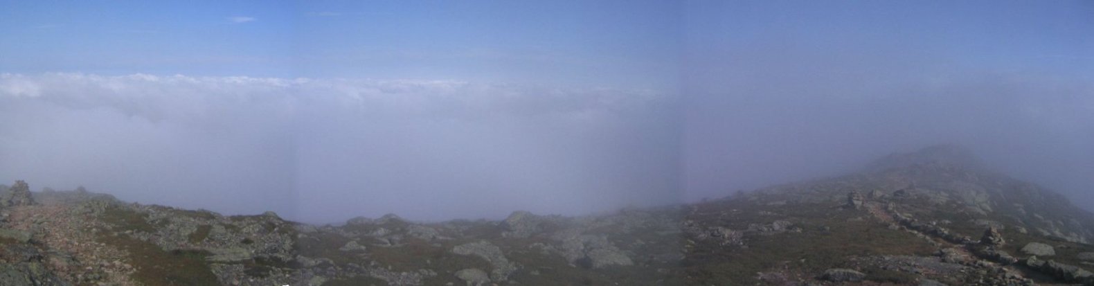
Garfield, not to my surprise, was still clouded over. There were a bunch of people hanging out at the summit, who were sure it would clear up soon and were waiting. Unfortunately I didn't have time to wait. I'll have to go back and visit Garfield again. It would have had a glorious view of the Pemi Wilderness, and my hike route.
Chatted briefly with one woman near Garfield summit, who was quite concerned when I told her about my hike (and lack of sleep).
"Are you sure you have enough water?" she asked, as I was continuing on my way.
"Yeah," I replied, and then added, "it's all over the trails today." (BTW, I still had about half of the 1.5L I carried from the beginning, plus my filter as a backup).
11:43am
Franconia Brook Trail
14.9mi
3420' (8944')
There were a ton of people coming up to Garfield via the trail I took descending the summit. This trail was STEEP but fortunately not for too long. It was also very wet, and there were lot of long flat sloped rocks. Not helpful for speed. Again if it were dry today, I could have jogged a bunch.
The Franconia Brook Trail was a "bail out" point. I could take an easy hike down to the valley and back to my car on this trail, though still about 12 miles away. Not the easiest of bail outs.
Of course, I continued on, happy with my progress, and legs.
1:00pm
Galehead Summit
17.6mi
4024' (10240')
I had managed to keep a relentless, solid, pace so far, with few stops. But the stretch from Garfield to Galehead was full of more ups and downs, and after 15+ miles in, I was starting to slacken my pace. The wet trails didn't help either.
But soon I would arrive at Galehead Hut, an oasis in the wilderness, where I could rest a bit and lunch at a table. I could see the hut to the left of Galehead (just below the clouds), from afar.
After a long couple of miles, the trail led me to the populated hut, where a .5 mile path jutted off to Galehead summit. I decided to ascend the peak first, and stop at the hut for a rest on my return.
Half way up I realized I could have left my backpack at the bottom, since I would be returning this way to the hut, but I decided to struggle the rest of the way, rather than abandon my pack. But man, that pack was feeling heavy...
There was a lookout point a short ways before the summit, but nothing that impressive. I was happy to see South Twin ahead was out of the clouds.

Reaching the summit was anti-climatic. Just a pile of rocks. No view.
So don't put Galehead high on your list of mountains to climb.
1:38pm (departure time)
Galehead Hut
18.1mi
3780' (10308')
Scampered down Galehead and arrived back at the hut. There were a handful of hikers around, relaxing in the sun outside.
Inside it was gorgeous! A full kitchen, muffins and brownies on the counter with basket asking for $1. I saw a sign that said "Bottomless bowl of hot chili: $2. Just ask the cook." Too bad I didn't see any cook around... Must be a dinner thing.
There were restrooms, bunk beds, books, games (trivia pursuit, monopoly, cards), and public water. I drank as much water as I could, and filled up my water bottles.
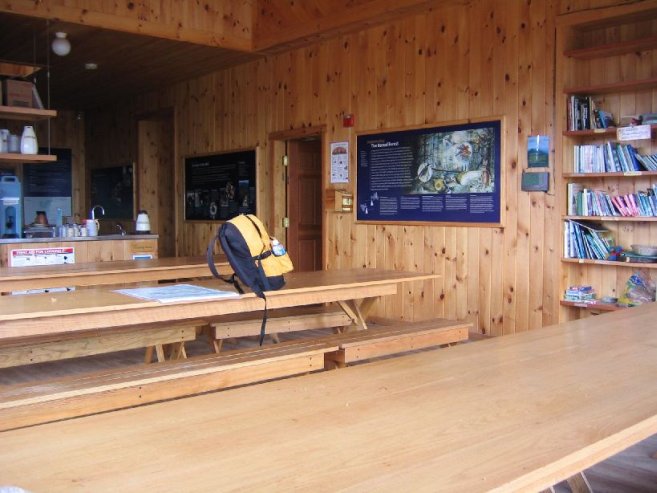
Ate a can of tuna and some peanuts. It was nice to sit at a table. But knew I couldn't stay long.
After 8hrs 45min, I was 18 miles in, a little over half way through. I had to remind myself that the 2nd half of the hike should go a lot faster, especially if I could jog the home stretch, so 8 hrs for the first half of the hike didn't mean a 16 hour pace for the whole thing.
I desperately wanted to hit the last 5 miles in daylight so I could run. That was enough motivation for me to get up and start hiking to South Twin.
2:25pm
South Twin Summit
18.9mi
4902' (11467')
If you look at the distance and elavation in the last two data points, you'll see a 1122' gain over .8 miles. That makes for one TOUGH 19th mile of the day!
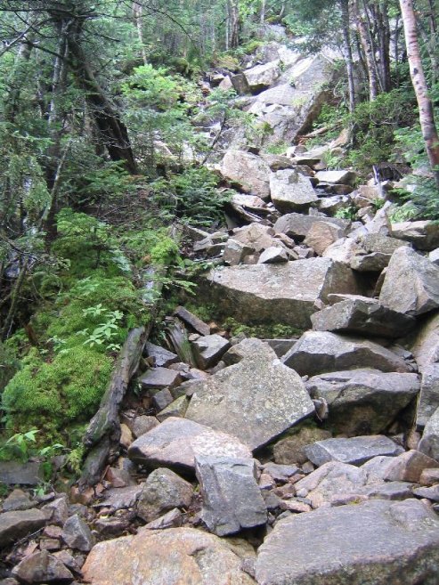
I started this daunting trail feeling that my lunch and short rest at the hut should make the hike to South Twin summit quite manageable. But after 15 minutes of staggering up the steep, rocky "staircase", I hit a wall.
Though my backpack was a can of tuna and some peanuts lighter, refilling my three .5L water bottles more than made up the weight. I remembered that I packed a bunch of grapes in a plastic container, and decided to lighten my load by eating them.
When I opened the container, I instantly became ravenous, and craved for the sugar in them! I realized my recent tuna and peanuts meal didn't offer much carbs and sugar, and I needed some energy fast. I tend to cut out sugar from my regular diet, but now I appreciate the value of sugars on long hikes.
Grapes were the power pellets I needed, and afterwards, I was energized and returned to my steady pace the rest of the way.
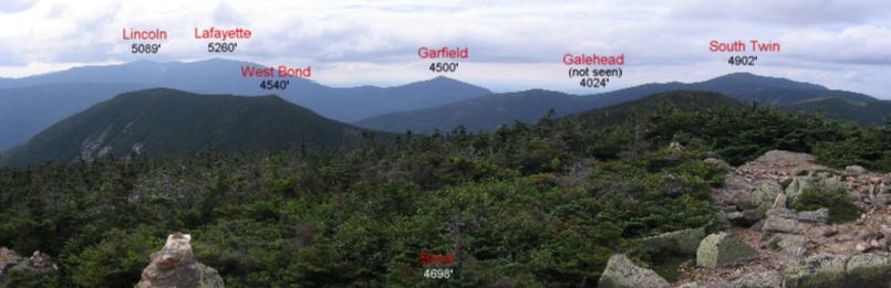
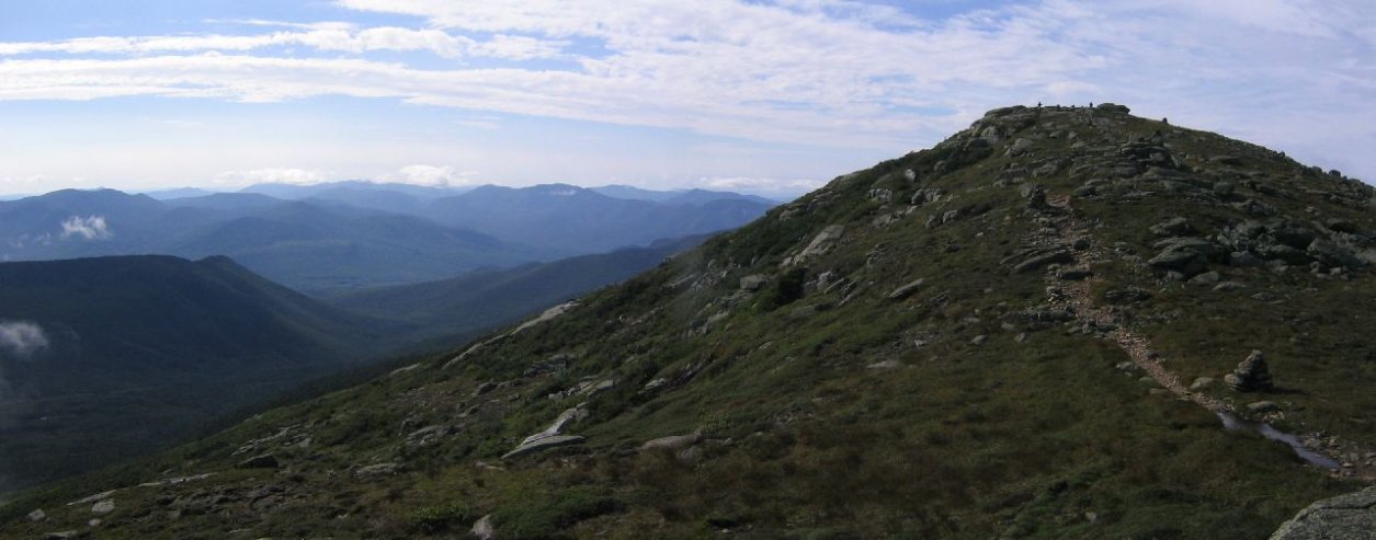
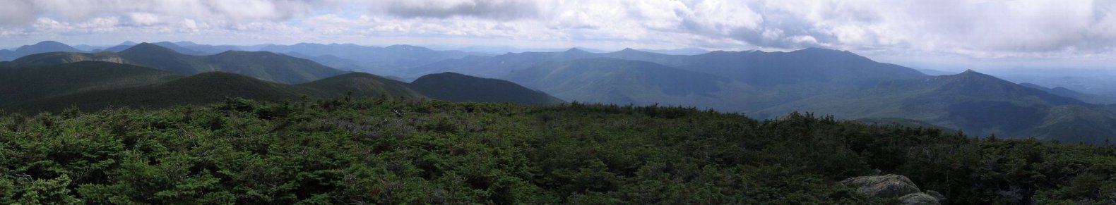
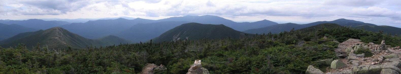
From the summit I could see the whole Franconian Ridge, and Garfield was now clear and really cool looking on the right. To the south I could see the Bond ridge, my return path.
I chatted with a couple of older guys on the summit, and they were excited about my hike. One guy was telling me about someone he knew that went on 200 mile trips over 4 days! Not sure if there was some exagerating there, but he offered to give me his name.
It was gorgeous from South Twin, and I would have loved to continue chatting with the folks, but at 9 1/2 hours in and 14.6 miles still to go, I hit the trail.

As I left, a guy, mid 50s, made it to the summit, and I heard him say it was his 3rd trip to the South Twin summit today. That's a good workout!
3:06pm
Bondcliff Trail
20.9mi
4508' (11845')
The next 2 miles led me along a gradual descent along dry trail. I could do some actual jogging finally!!!
This stretch was a breeze, and incredibly beautiful, as the open ridge yielded wondrous views of the Pemi Wilderness. It was cool to think I was on the Franconian Ridge, a giant blue wave of land 5 miles across the valley, just hours earlier in the day.
3:43pm
West Bond Summit
22.2mi
4540' (12365')
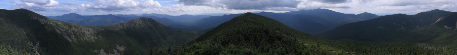
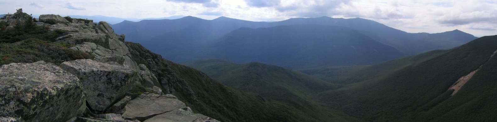
The Bondcliff trail continued to ride the ridge, and was gently sloped for the most part. The fine views continued out towards all the peaks I had climbed today.
I could see West Bond on the right, Bond on the left, and Bondcliff just peaking over the saddle in the middle.
Soon I reached the turn-off for the .5mi path to West Bond, and passed a man and woman on the trail. From West Bond, I had a fantastic 360 degree view. The Bondcliff ridge on the left looked sharp.
Before I left, the man and woman reached the summit, and they said this was their 46th of the 48 4000 footers, and Bond and Bondcliff would be their 47th and 48th later today. They were happy that I could take their picture for them, and wished me luck completing my monstrous hike.
4:17pm
Bond Summit
23.2mi
4698' (12864')
I made my way back to the Bondcliff trail (didn't even realize I had the option of leaving my pack at the trail again), and it was just .5 more miles to Bond.
Ever since South Twin, the trail had been smooth and easy, and I was making good time.
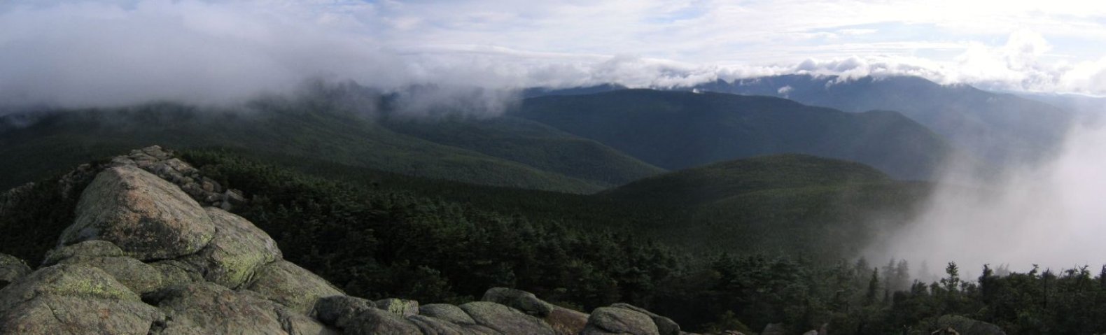
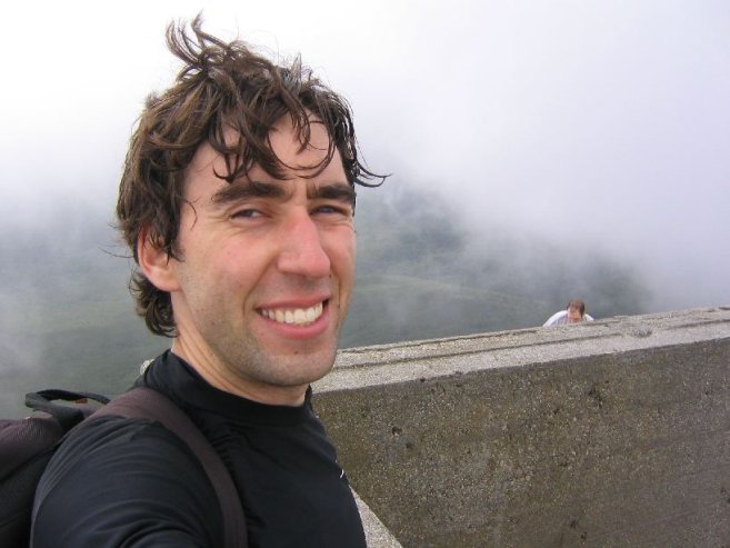
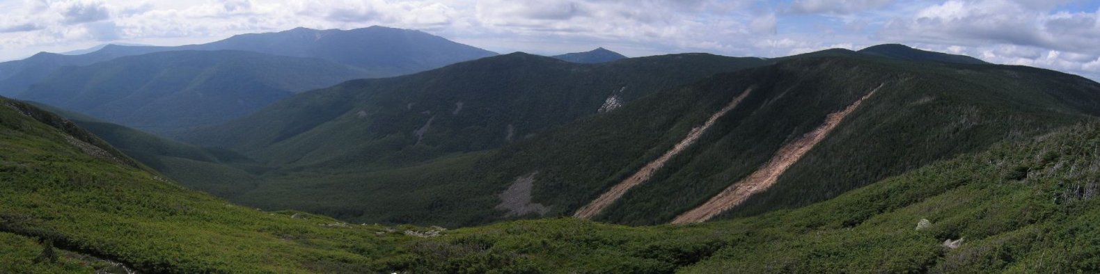
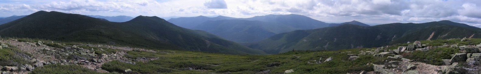
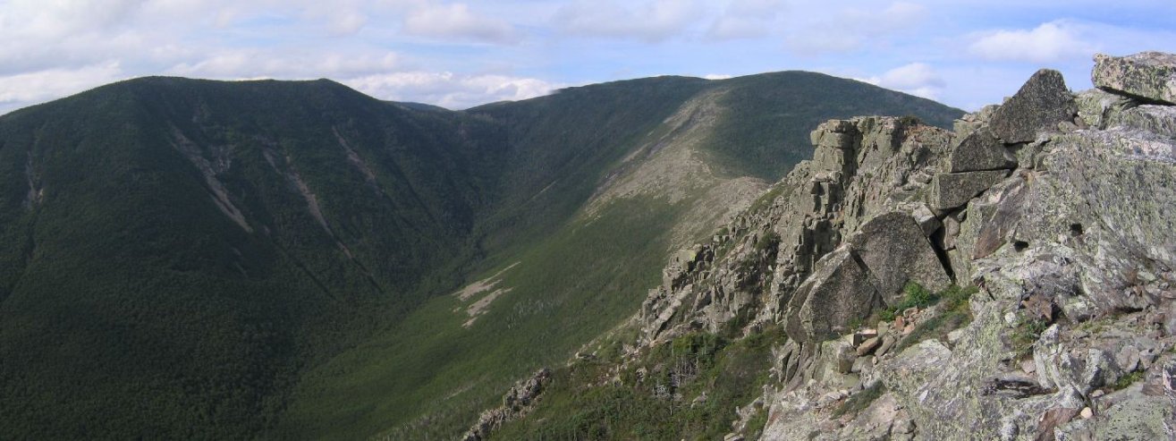
From Bond I took the picture that you see at the top of this page. Below is the original uncut version.
My decision to take the Franconian Ridge in the cloudy morning, leaving me favorable afternoon weather on the Bond ridge was paying off.
To the East (and south), I could see the Presidentials, though shrouded in cloud at the top.
Just one last peak on the list today: Bondcliff.

4:50pm
Bondcliff Summit
24.4mi
4265' (13215')
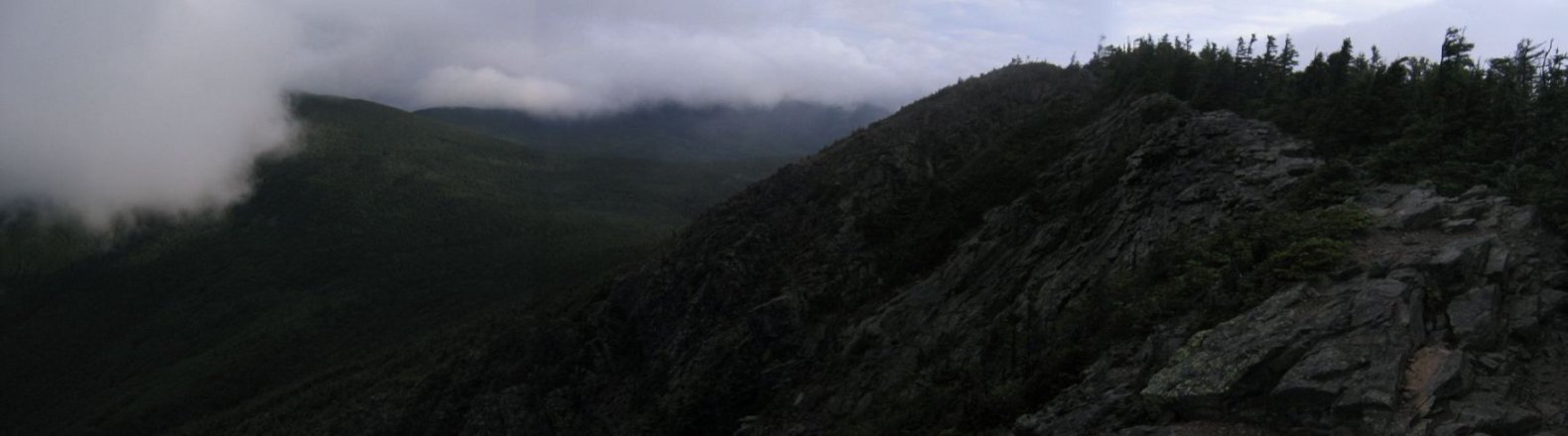
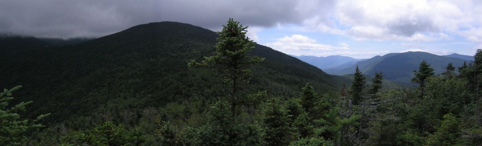
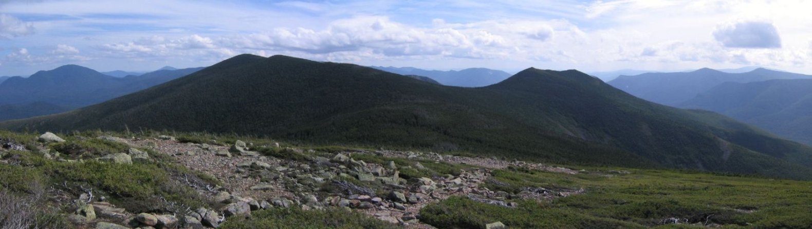
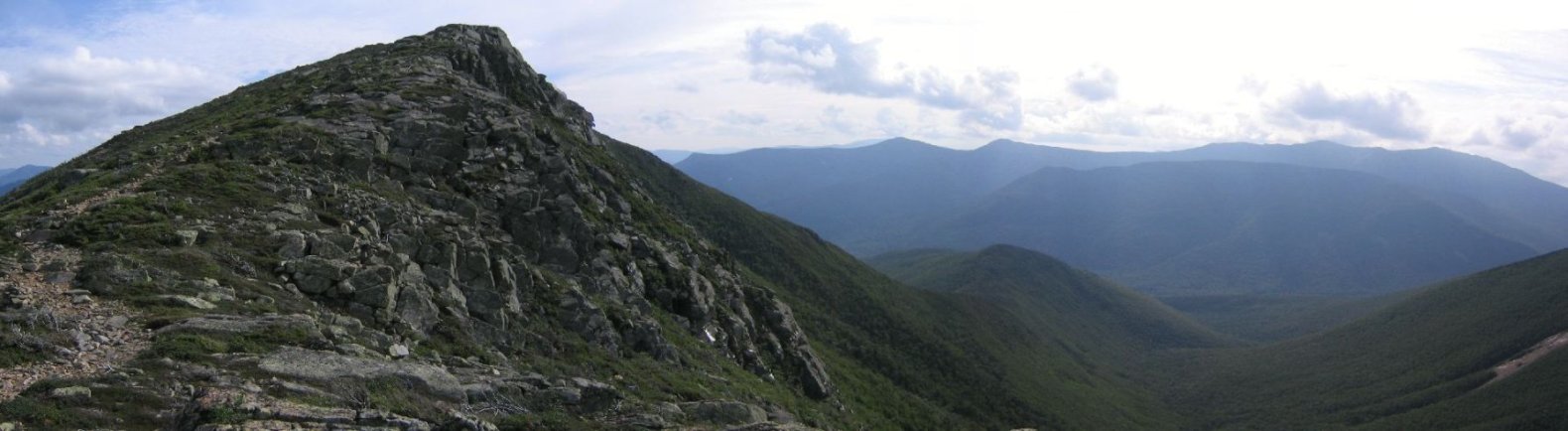
The ridge trial to Bondcliff was reminiscent of the Franconian ridge trail, but something made it stand out more. Maybe the large drop off to the right, or the Franconian Ridge as a back drop.
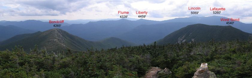
In this pic, you can see Flume, Liberty, Lincoln, and Lafayette on the ridge to the right of Bondcliff
I made it my goal to reach the summit by the 12 hour mark of my hike.
On my way across the ridge, a woman was coming in the opposite direction, and promptly asked, "Are you heading out, or turning back?"
It took me a while to understand what she meant, and I said, it was a long story, but I was heading back to the highway.
She said rather gravely, "Well, it's another 20-30 minutes to Bondcliff and at least 8 miles after that." Then she pointed to the north and said, "Look at those clouds. I don't like them. You should keep an eye on them."
I said I would, though one look at the clouds told me there was nothing to be concerned about, plus I noticed the wind was blowing from the south anyway. The conversation came off as a little odd to me.
Turns out she was the last person I'd meet on the trail for the next 9 miles.
I arrived at Bondcliff in good time, 3 minutes before my "12 hours hiked" point. It was pretty clear why they called this Bondcliff, and not South Bond.

I felt I was doing well on time, and hung out on the mountain for awhile to enjoy the last peak of the day. Got some good pics of West Bond and Bond. After a last look at the Pemi Wilderness I started the hike back to the highway, shortly after 5:00pm.
Of course, there was still another 9.1 miles to be taken care of, but it seemed like the hike was over. Now it was time to get into a jogging frame of mind.
6:16pm
Wilderness Trail
28.8mi
1600' (13373')
The trail down from Bondcliff descended 2600', but instead of a steep rocky slope I was expecting, the path gradually eased down in a amazingly smooth fashion the entire way to the Wilderness Trail!
I jogged at least half of the time on this trail, slowing for the occasional rocky or wet spots. For the most part the trail was dry. I had expected the last 5 miles to be jog-able, but not the last 9. Bonus!
I'm glad there was still plenty of light, cause at one point the path was a little confusing, and darkness would have delayed me slightly. Aside from this case, all the paths were extremely clear the entire day.
In a little over an hour I had covered the 4.4 miles to the Wilderness Trail. All that remained was 4.7 miles on the flat railroad tie road.
7:15pm
Wilderness Trailhead
33.5mi
1160' (13543')
I took off my long pants (leaving my shorts on), finished nearly all of my water, and set out to run the remaining 4.7 miles back, but found that the flat surface meant I had to supply more energy, rather that let gravity help me. Sometimes there were slight uphill gradients too.
After about 25 minutes I slowed to a walk, as my knees were starting to ache a bit. I walked for about 10 minutes, then started my jog again, right before the Osseo trail junction that I had taken early this morning.
That meant just 1.6 miles til the parking lot, and I jogged the rest of the way. Saw a few people on the trails as I neared the end.
I crossed the suspension bridge and checked my watch as I reached the trailhead: 7:15pm. I covered the final 4.7 miles in 1 hr, so my home stretch run strategy paid off. Definitely a key to finishing in the light.
I walked across the parking lot, taking in big triumphant lungfuls of air. A middle-aged park ranger in a hat and glasses walked by, and I exclaimed, "I just hiked the pemi-loop!".
He looked at me as he continued walking and said rather dryly, "I've done that many times."
Not sure if he meant it as a 1-day or 2-day hike, but I was kind of hoping for a more exciting response. So I walked to my car, and saw a guy nearby loading his pack for an evening hike, and explained how I had just hiked 33.5 miles, and asked him to take my picture.
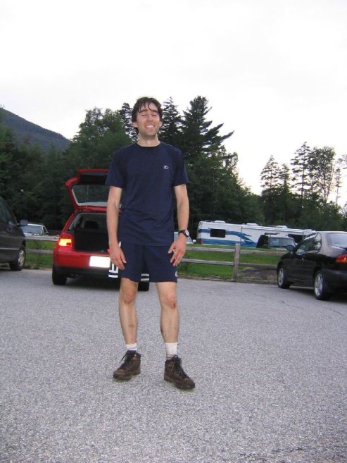
Now this guy was awesome! He got all excited about it, and congratulated me, and talked about how the most he had done in a day was 15 miles years ago, and how he doesn't get as much hiking in now as in the past, but he tries to start getting in shape a month ahead of time. I showed him my spreadsheet of times and distances I filled out during my hike, and he was really into it, and was amazed I did the hike in just generic brand shoes, which he called, "sneakers". He was an awesome guy!
After chatting for awhile, I packed my car, rolled down the windows, and as I pulled out, the guy was walking toward me waving a chili pepper at me.
"Do you like hot chili peppers?" he asked.
"Yes, definitely," I replied.
"Then have one from my home grown, organic garden. Just don't suck on it on the drive home. Thanks for the inspiration." And he handed me the chili pepper.
I thanked him, and drove back home. I slept really well that night, and used the chili pepper in a fajita the next day.
I packed too much. Had a can of tuna, 5 granola bars, a peanut butter wrap, and tons of left over peanuts that I didn't need. Plus the water filter (didn't use), and heavy poncho/tarp.
Also, had the ground been dryer, it would have helped improve my time some, but ideal conditions will probably never exist over 33.5 miles.
I only saw 2 moose prints the whole hike.
The worst injuries were just some bumps from a couple of trips on the trail. Not entirely unexpected over 33.5 miles.
Jogging is a necessity to complete this hike in daylight. I covered my last 9.1 miles in a little over 2 hours by jogging most of it.
I've now hiked 28 of the 48 4000 footers, since I starting hiking in NH 12 months ago. I hiked 17 of them in my last two trips (though 4 were repeats).
Once again, an incredible hike.