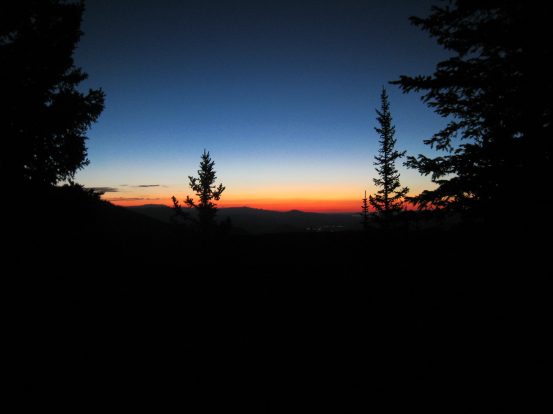
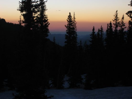
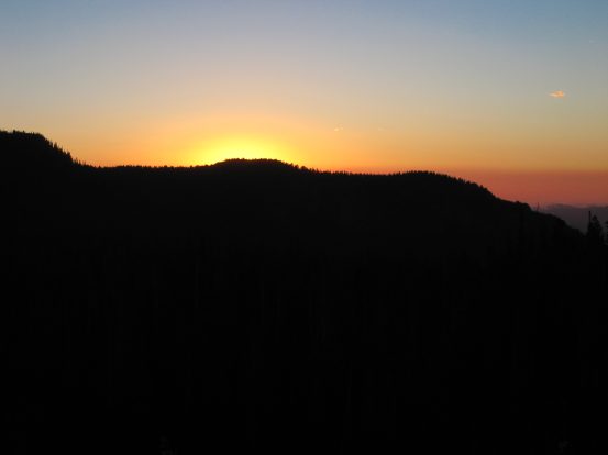
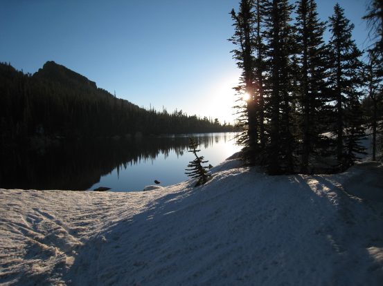
Some looks towards the northeast starting at 4:49am, and then 8 minutes later. We could see the lights of Estes Park in the valley...
This trip idea popped in a hurry this week. My friend Ben, who hiked the Little Bear - Blanca Traverse with me last year, read my web journal from Oxford/Belford last weekend, and expressed interest in getting out into the mountains again this season. Being pumped up from my recent 14ers, I asked him if he was free this weekend, and we were on. Given a Saturday only constraint, we looked into local peaks, in RMNP and the Indain Peaks. I remembered Chris, who hiked with me last week, mentioning a great fun snow climb in RMNP he did last year that had a unique ridge scramble. I wanted to take advantage of the late snow season to attempt my first snow climb, and this was the perfect route; safe from avalanches, not too long (~1000' of snow slope to climb after a 3 mile hike in), and a short drive from Fort Collins. By mid-week Ben and I had abandoned other options and were pumped to attempt Little Matterhorn.
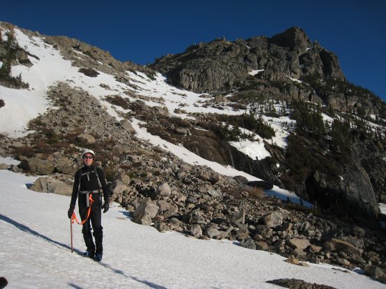
I'm a fan of catching sunrises, and likewise Ben (also an photo-afficionado) was interested in starting early to try to reach Odessa Lake for a sunrise view of Little Matterhorn. We figured we better start our hike by 4am, so we planned to leave Ft Collins at 2:45am. The early start would also be vital for catching the snow while it was still hard, before the sun would melt it into slushy mush. This would be Ben's first snow climb too, and he borrowed Chris's ice axe and crampons.
The drive from the park n' ride at rt392/I25 to Bear Lake trailhead took 1hr 10 minutes, which can only be achieved with empty roads at 3am. There were a couple of other cars at the trailhead, including a solo female with skis on her back who was off to Dragon's Tail. It took us til 4:15 before we hit the trail, donning our head lamps, and after a minute in, Ben noticed water running down the back of my pants, and I discovered my bladder had leaked most of my water through the bottom of my backpack. Fortunately, nothing in my pack was significantly wet. I hustled back to the car, refilled the bladder with my post-hike water bottle, tightened the lid, and walked back to Ben. Finally at 4:25am we were off for good. We'd have to high tail it to catch Odessa Lake by sunrise.
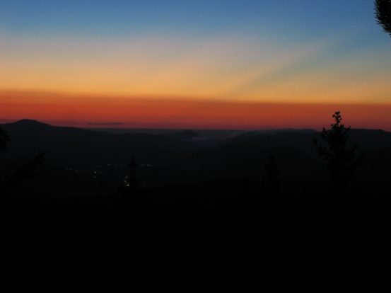
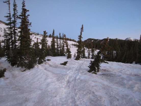
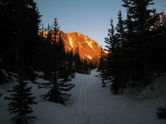
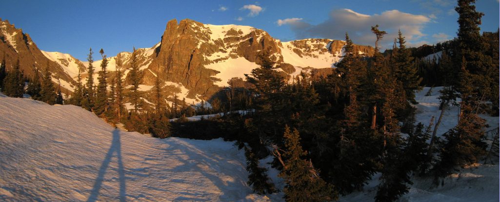
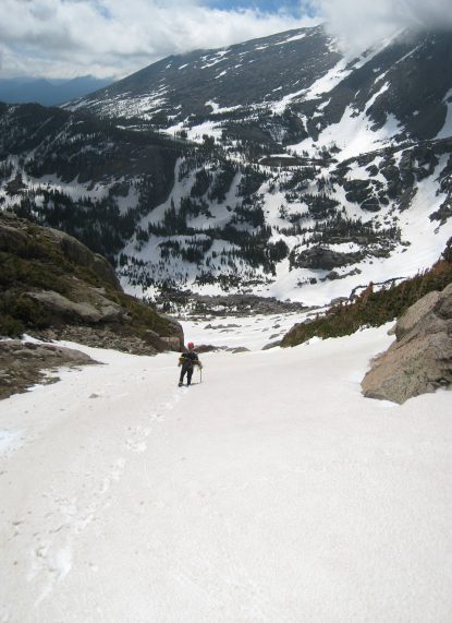
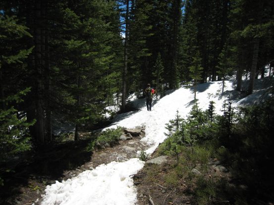
The trail was dry around Bear Lake and past the Odessa Lake turn-off, but soon we hit snow patches that quickly turned into constant hard-packed snow. By the Flattop trail junction it was all snow, and we continued to hike in bare boots over the very gradually inclining trail. We caught some open views to the east where a deep red band glowed on the horizen. We couldn't resist stopping to take photos for a few minutes here and there.
Some looks towards the northeast starting at 4:49am, and then 8 minutes later. We could see the lights of Estes Park in the valley...
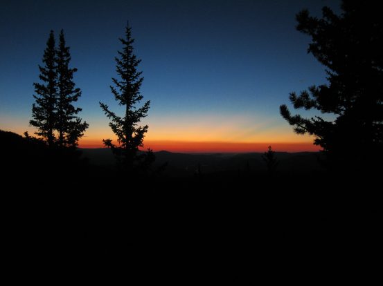
Some orange rays seem to arc out from the horizon into the blue....
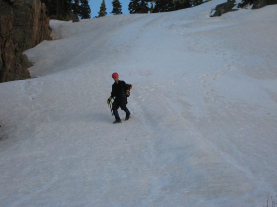
Our headlamps were no longer needed, and we pressed on, realizing we only had ~30 minutes to cover 2+ miles to reach Odessa Lake, which was very unrealistic. Hylene Lake and Two Rivers Lake were on the way, which were the new decent goals to reach in time for sunrise. The snow was hard and choppy, causing slippage, so we decided it was worth stopping to strap on our crampons to make faster progress.
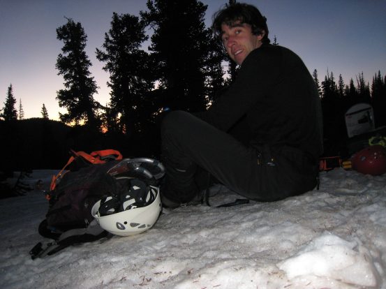
A tripod shot during our stop to put on crampons. I later remembered to use the crampon bag as a waterproof seat (like in the Patagonia ice trek). Movement across the snow was much more expedient now...
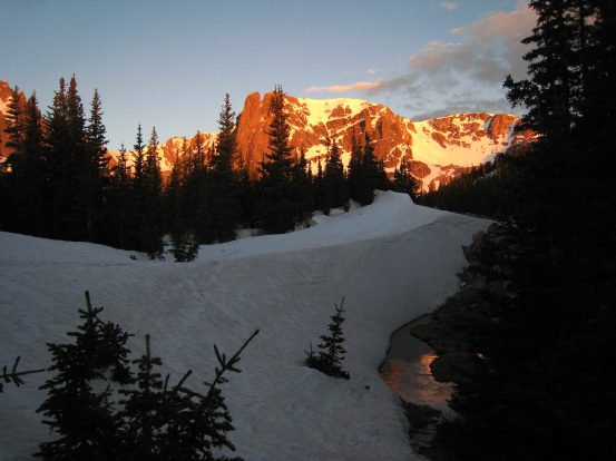
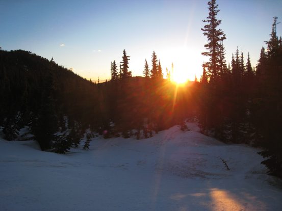
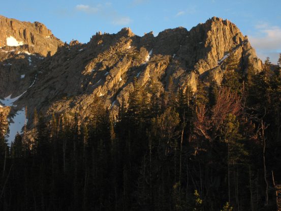
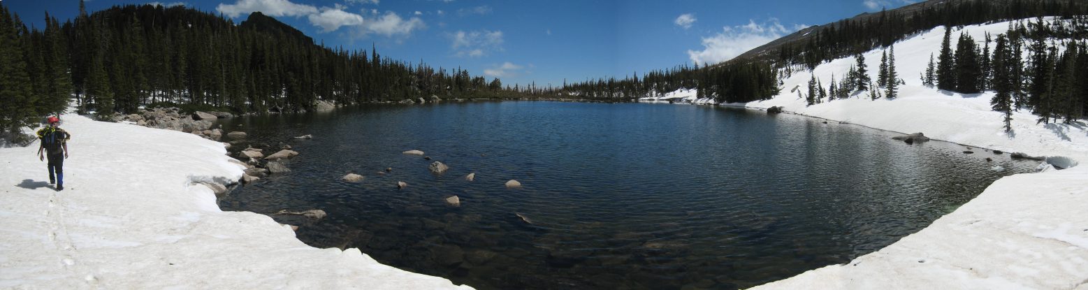
The sky continued to brighten, and the thick red band on the horizen faded away in the lightening sky. Soon we could see feintly pink Notchtop ahead in a clearing, and it was now time to push hard for the best photo ops. The trail weaved through a sparse forest, whose pine trees began glowing red with the sun's entrance. Our first glimpse of Little Matterhorn appeared, decked in red, in the distance. We stopped to take photos, and hurried on. Finally we reached Two Rivers Lake, with Notchtop Mountain bathed in gold across the waters. It was gorgeous! I bushwacked a short ways to the waters edge (piercing a hole in my pants with my crampons, as I forged through), and reached the lake's shore, gazing at the crisp golden reflection on the water.
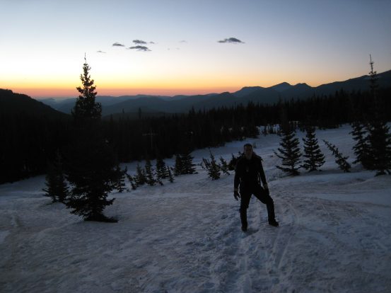
A few more glances towards the morning horizen. Ben stands on the firm snow...
Ben takes a pic of me ahead, with Notchtop starting to turn pink in the distance. A look to the horizen shows the sun almost ready to break...

A wider shot of this scene at 5:30am...
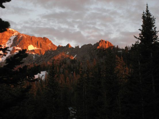
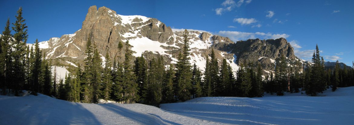
Notchtop emerges decked in red ahead on the left. In the right pic, we see red Little Matterhorn the small peak on the right side of the ridge...
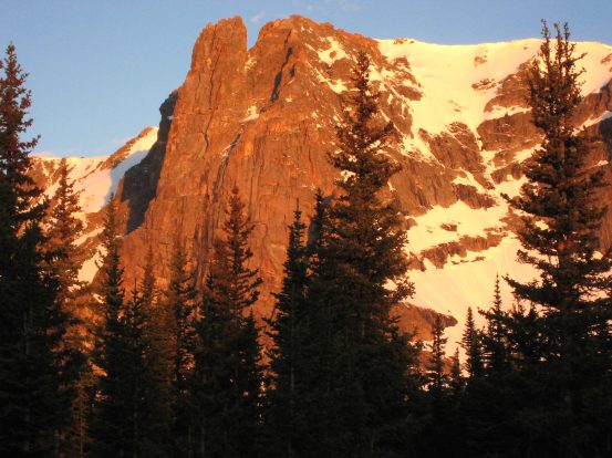
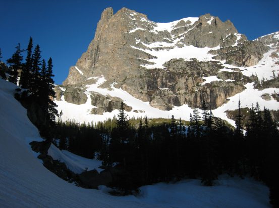
A zoomed in shot of Notchtop. I hustled on, hoping to reach a lake while the sun was still prime...
The sun had risen. Ben takes a pic with me in the distance, and the face of Little Matterhorn lit up on the right...
Notchtop emerged more and more into view, but still no lake...
A very long legged shadow of me across the pink snow...
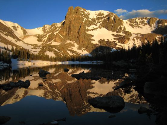
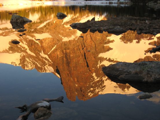
Finally, the jackpot view! The reflection on the water was almost crystal clear in the still morning air...
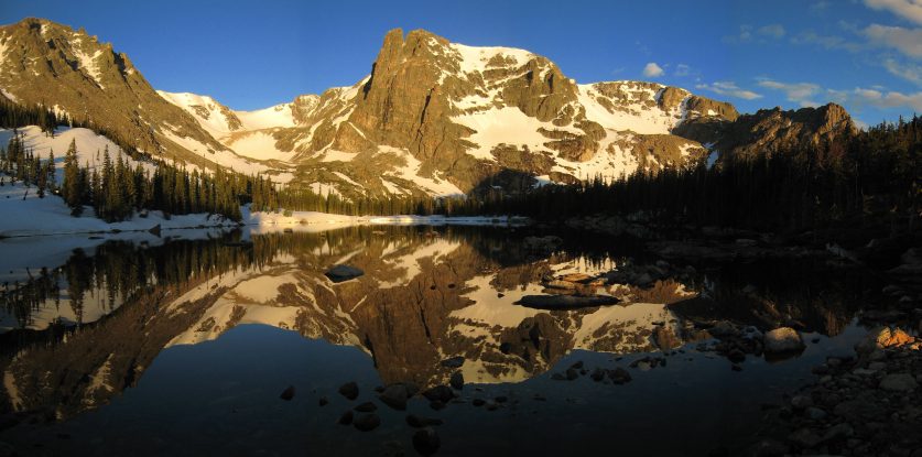
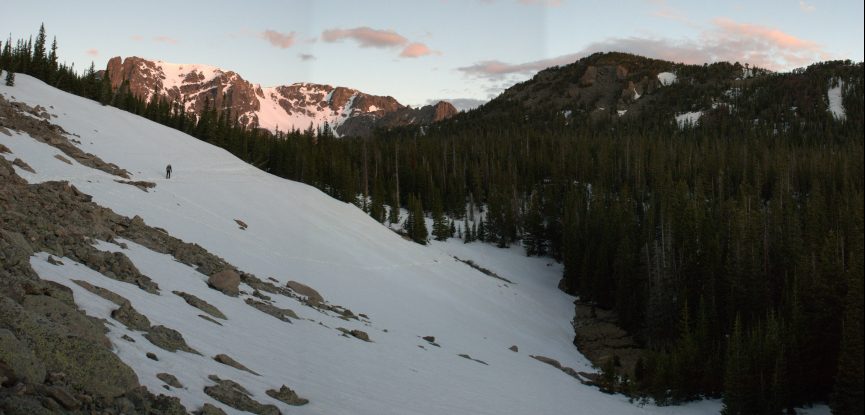
A wider view. Little Matterhorn is at the end of the ridge on the right...
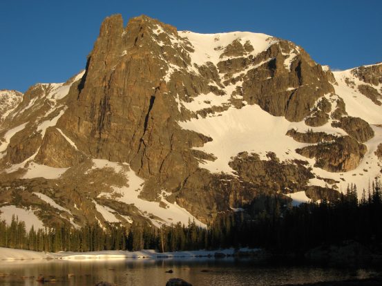
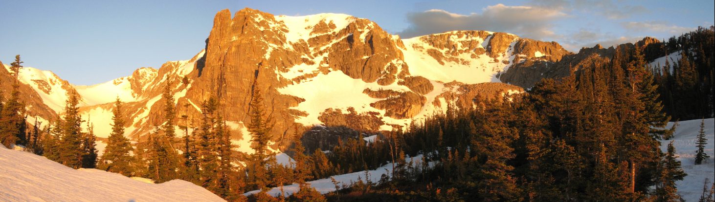
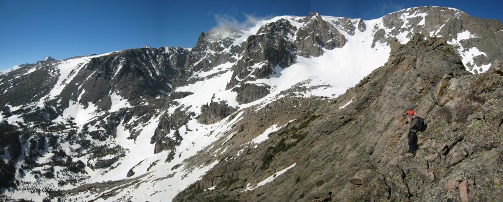
The jagged ridge running to the left of Matterhorn looked promising. Another look at Notchtop (12,160')...
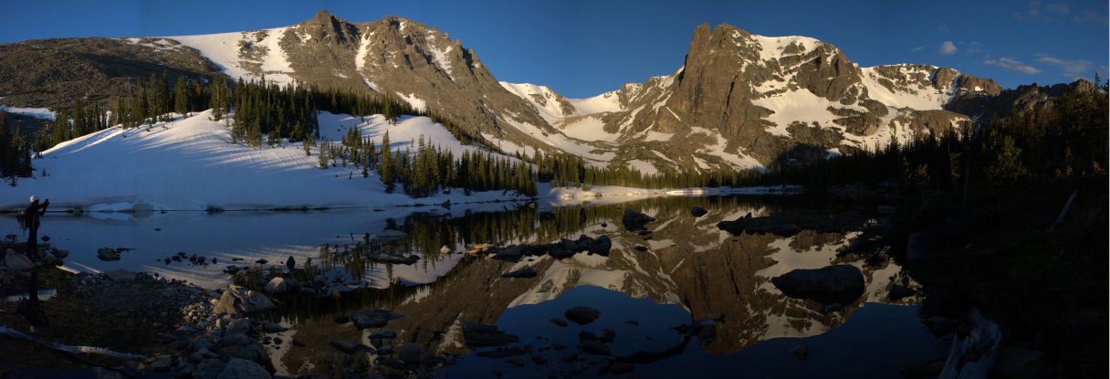
Ben's panoramic shot with me on the left before we depart Two Rivers Lake...
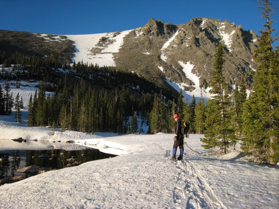
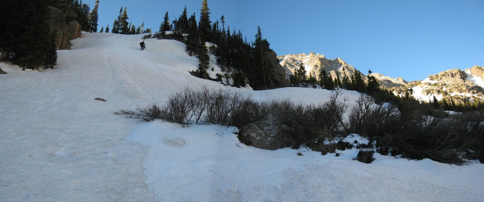
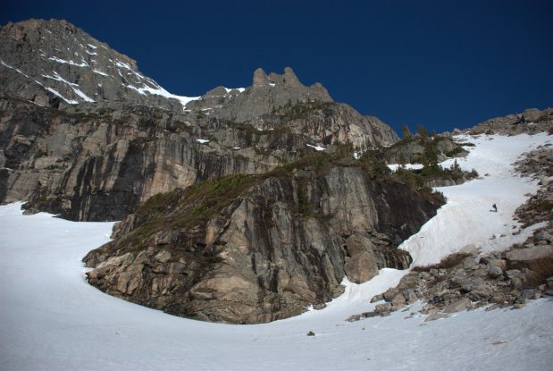
After we got our fill of pics and put on some sunscreen, we rounded the lake and followed the trail through the trees towards the mountains. Odessa Lake was a .5 mile sidetrip descending down the valley past the Little Matterhorn turn-off, and we both agreed to skip a visit there, and instead begin the climb while the snow was good. After reaching Lake Hylene, near the base of Notchtop, we turned to the right, and tried to figure out the best way to descend down the ~400' valley to Grace Falls, where the snow climb up to Matterhorn would begin.
We walked around the highly reflective Two Rivers Lake. Sunglasses would donned for the rest of the day...
A row of trees hide the drop down the valley beyond...
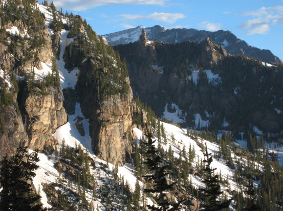
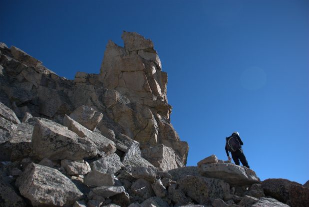
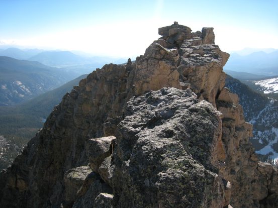
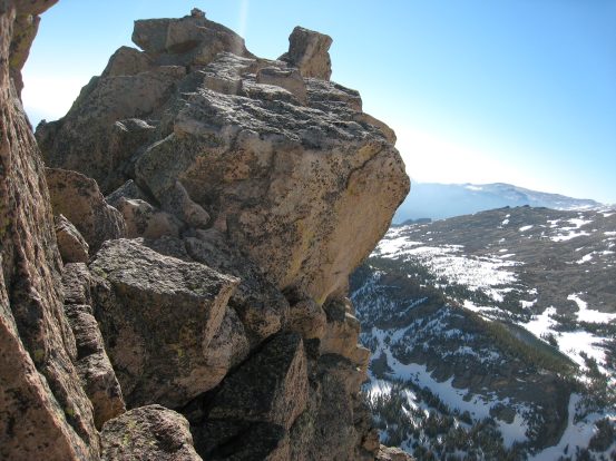
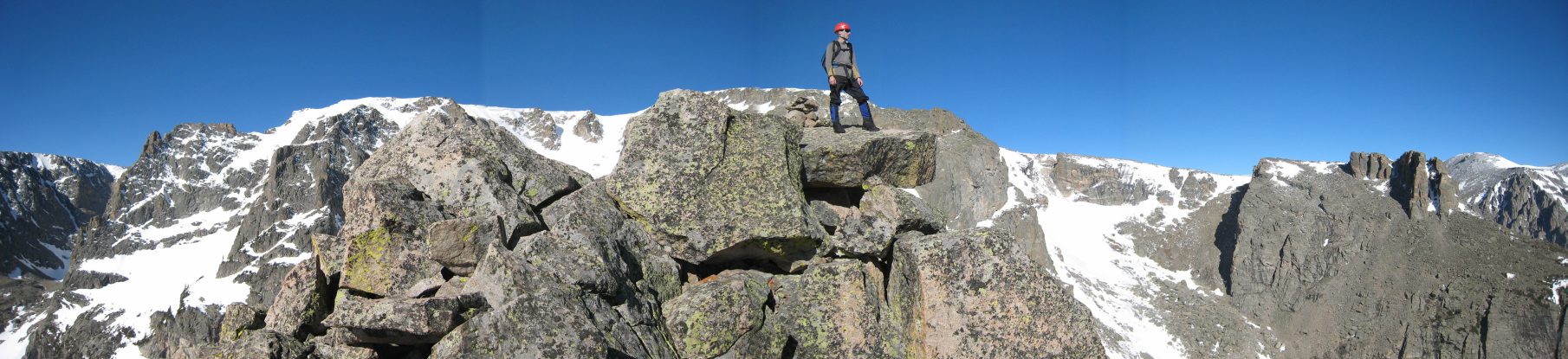
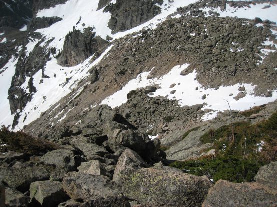
The rocky Little Matterhorn summit sticks out over the valley...
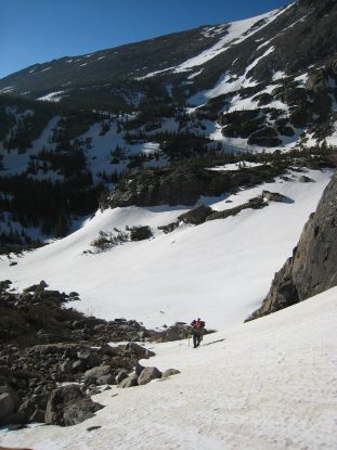
After hesitantly looking down the first steep snow slope, we decided to scout out more options to the left, and found an easier, though still steep gradient, to descend the ~400' down the valley. It was Ben's first time with crampons, and he was loving the ease at which they allowed this descent. From the valley, we worked our way through some trees, and crossed a stream over the immense snow of the valley. We saw Grace Falls, and the snow patch to its north, but we decided to climb the snow patch to its south, as it was closer, and required less of a descent to reach.
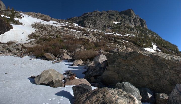
A scenic look across the valley at a rock spear. Ben makes his way down the snow slope...
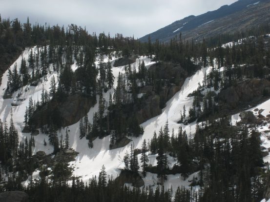
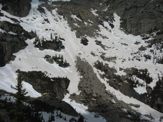
There were several chutes of snow leading down the valley, we chose one in the middle that was less steep that the north most chute...
A look from about half way down into the valley. We were aiming for the snow slope on the left of the picture..
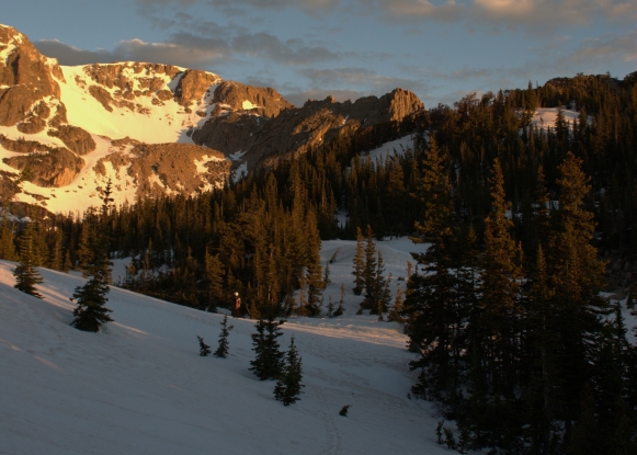
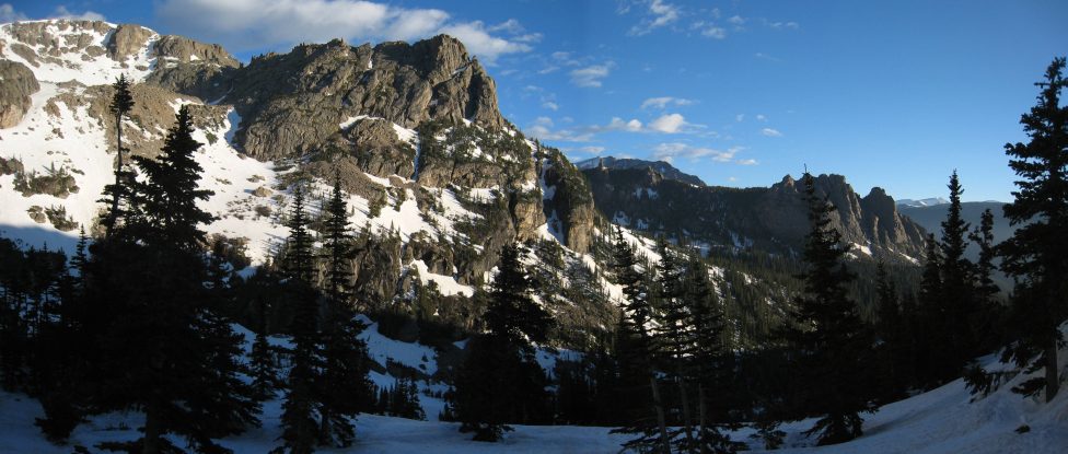
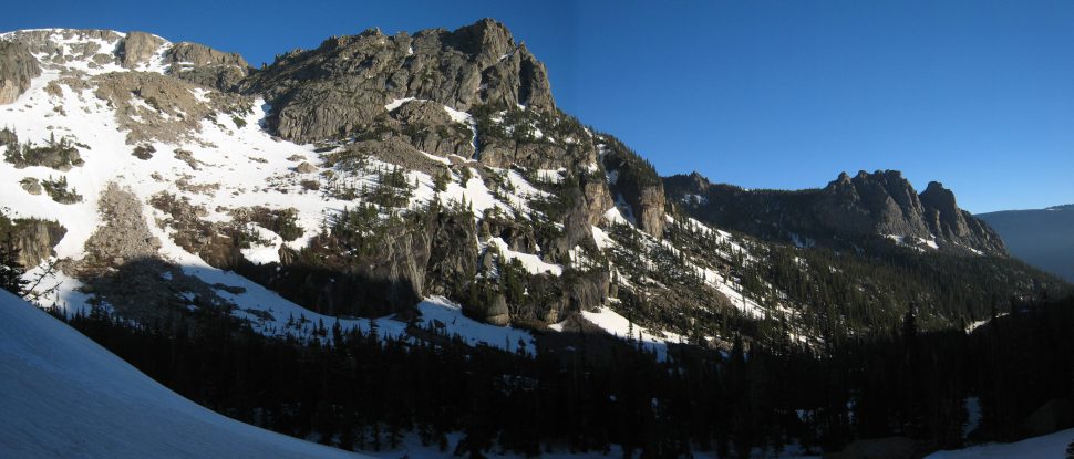
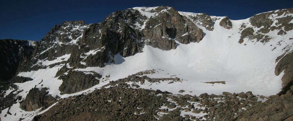
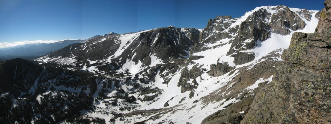
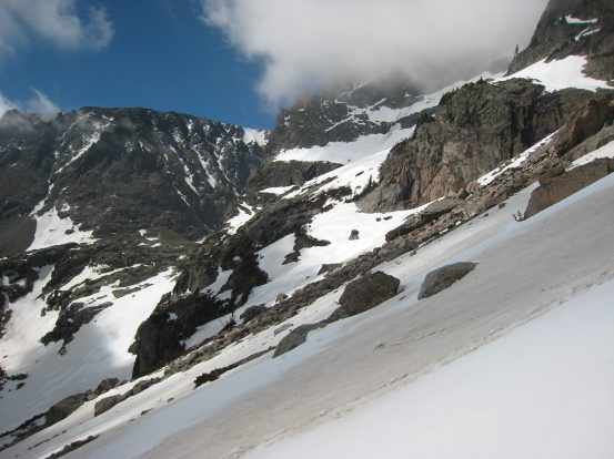
The impressive east face of Notchtop. After crossing the valley, we were ready to begin the ascent, starting with the snow on the left, and following it up and over to the right. Grace Falls is the thin stream of water on the brown rock behind...
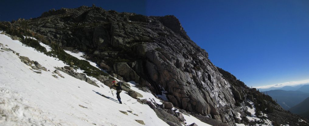
Ben hangs back and takes a couple of pics of me beginning the snow ascent...
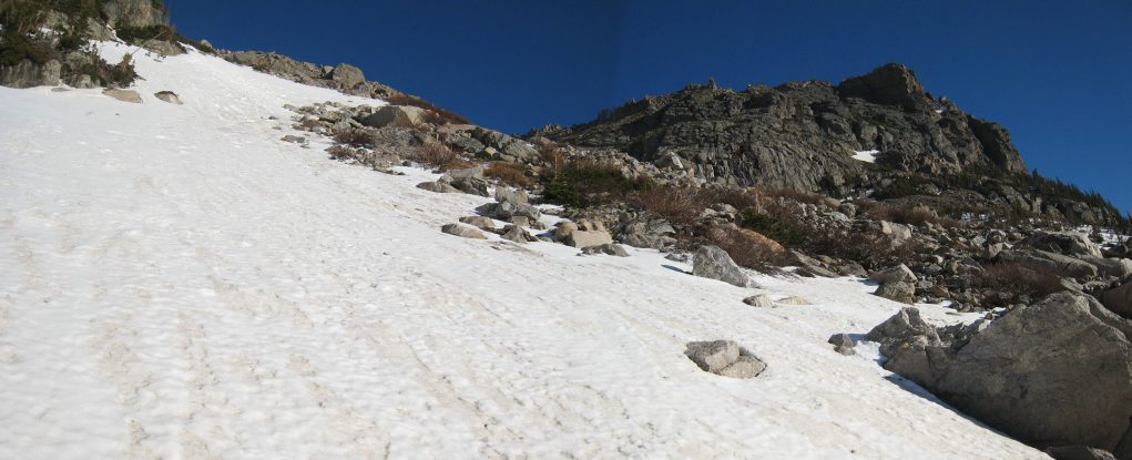
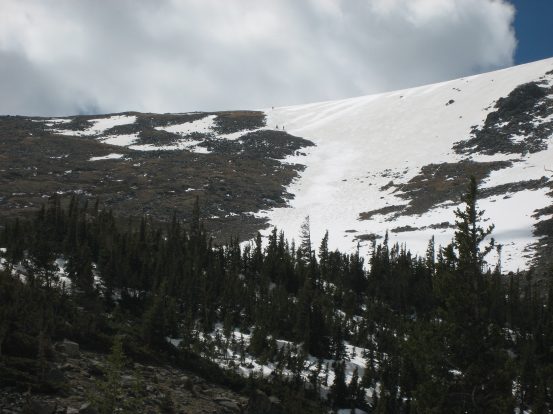
Little Matterhorn always seemed to be close by, but distances can be deceiving. It was a 1200' steep climb after all...

Ben makes his way up the slope. The chute we descended across the vally is the one directly over Ben's head in the 2nd pic...
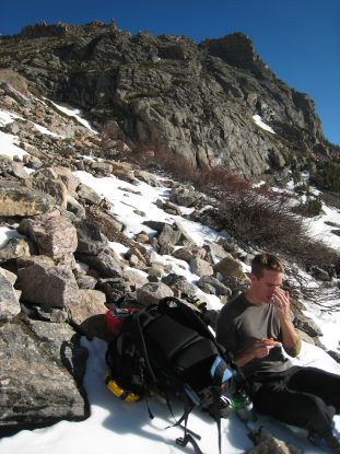
We reached a set of rocks where we had a snack, re-applied sunscreen, and then cut across the rocks to more snow towards Little Matterhorn...
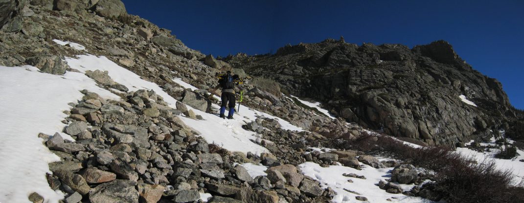
The snow was thin through a rocky stretch as we cut over towards Little Matterhorn. The snow was softening up fast in the sun, lessening the impact of the crampons...
Another snow field to climb as we near the access point for Little Matterhorn's ridge...
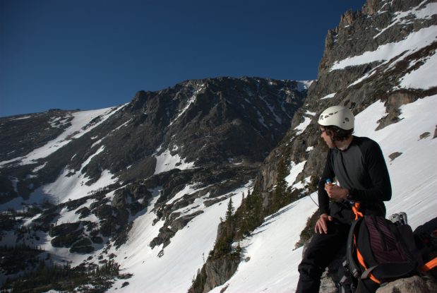
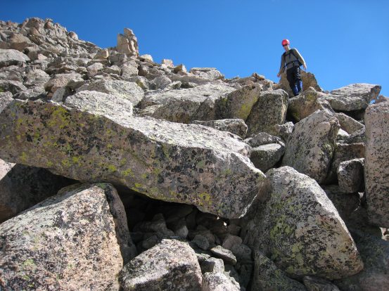
The long climb in the sun was very toasty, even in a single layer. After an hour's climb we reached a group of rocks at the start of a small basin that marked our switch from snow hiking to old fashioned rock scrambling up to the ridge. We ditched our snow gear and headed north towards "the Lizard", a big rock formation on the ridge that is a beacon for hikers wishing for easiest access to Matterhorn's ridge. It looked like just a short hike, but elevation has a way of making things take longer than it looks (turned out to take ~15 minutes to reach the ridge).
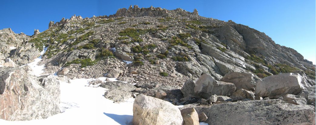
Here is our transition point from snow climb to rock scramble. We aimed for "The Lizard", the right most large rock sticking up on the ridge...
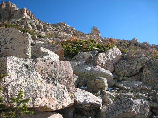
A look at the rocks where we stashed our snow gear, and the valley we came from below...
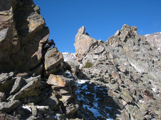
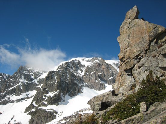
"The Lizard" stands guard at the top of the ridge. Chris refers to it as "The Pac-Man". It reminded me of a Dune worm...
The basin makes it pretty obvious when to stop the snow climb and head for the ridge...

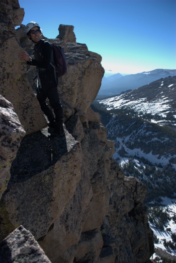
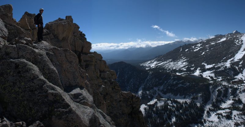
I reached the ridge first, and climbed up to take a look at the path ahead...
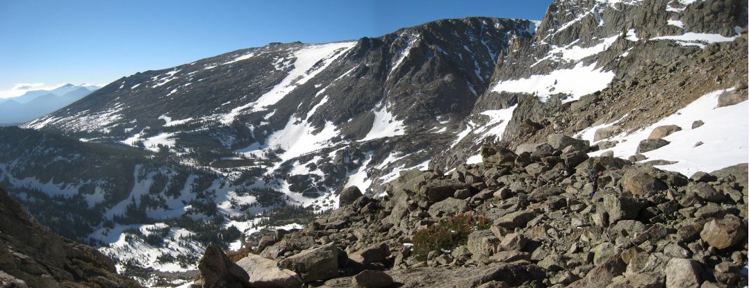
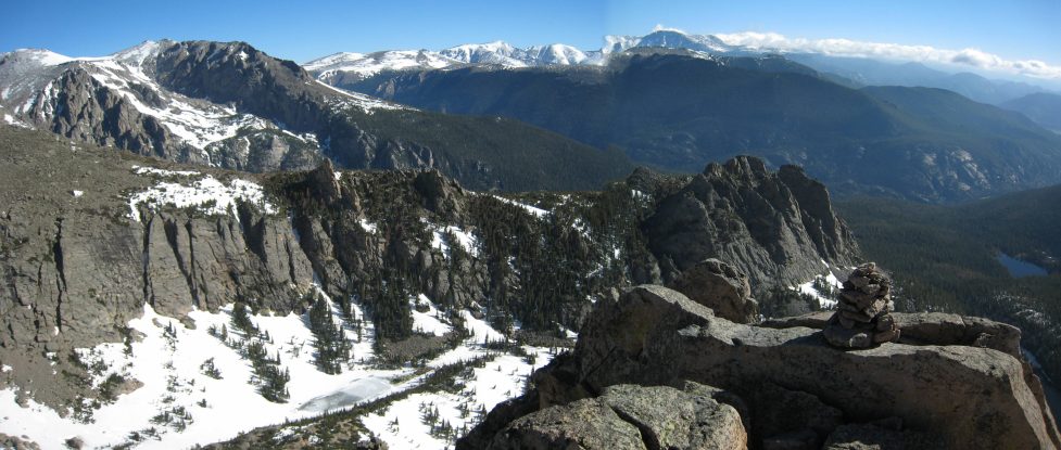
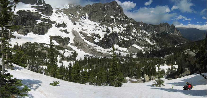
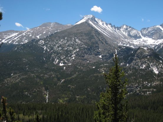
Two Rivers Lake and Lake Hylene can be seen just above the snow chutes we descended this morning in this stitched shot by Ben. Long's Peak sticks up over Flattop on the right...
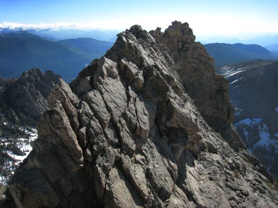
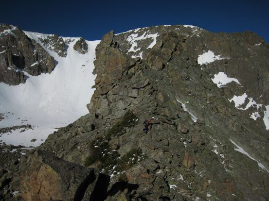
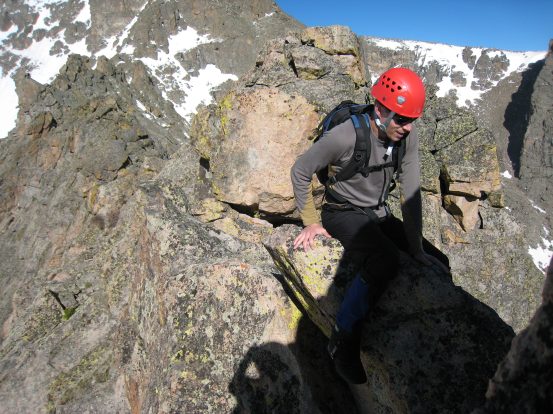
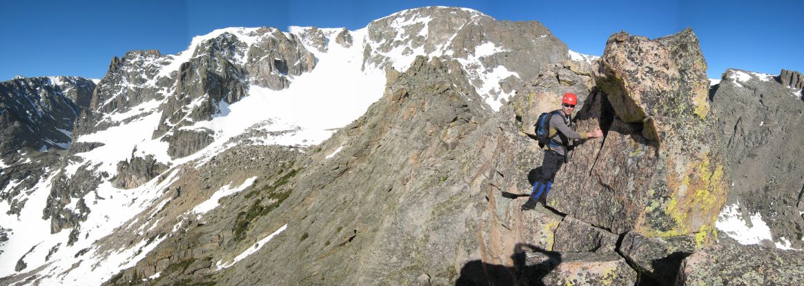
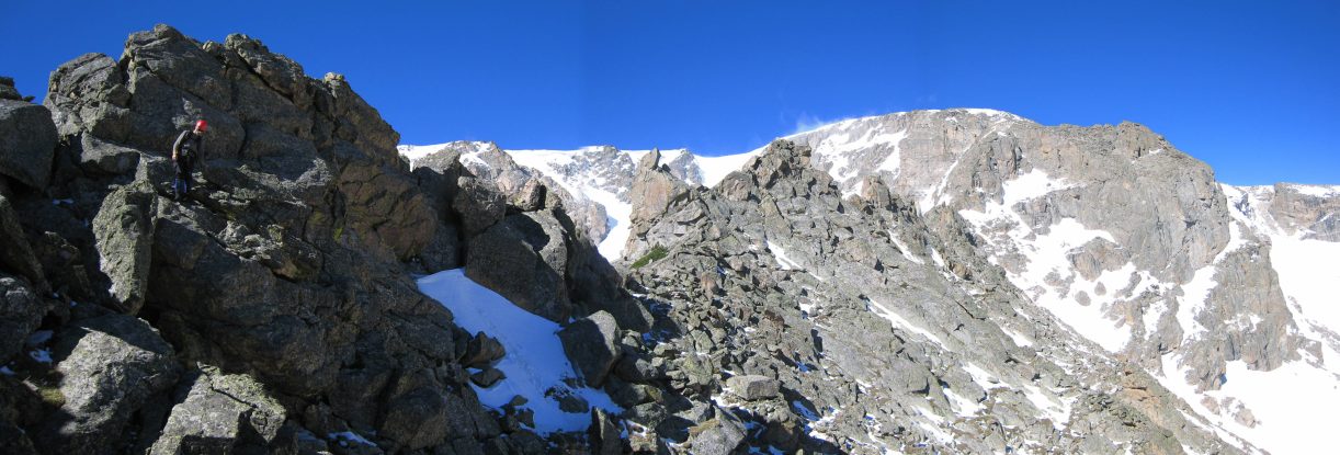
From my position, the ridge looked impressive, but there were large steep gaps throughout the knife edges, which meant we had to circumvent the ridge on the left. A look back at "The Pac-Man", as Ben nears the ridge...
After skirting around the first notch in the ridge and regaining the crest, we found another sharp gap that required further skirting, again to the left...
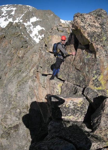
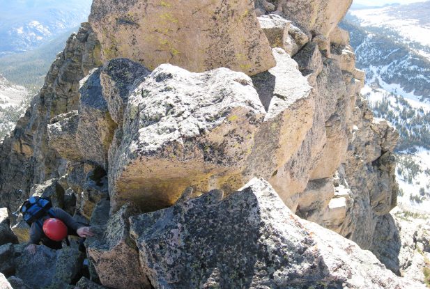
The ridge was feeling like a disappointment, as we largely had to stay off it so far, though the trail finding was still challenging. After circumventing the first two gaps, we found ourselves back on the crest, and staring at a short "catwalk-ish" section, followed by a skimpy ledge around the right side of a big boulder with 100' drop-off below. The alternative was a very steep downclimb to the left. We opted to stay on the ridge, as it was hard to see down the vertical downclimb, and the narrow path around the boulder, though exposed, had enough room to lean in, hold the rock, and side step across.
Back up on the ridge, with just a short but very exposed section left. This look down brought back memories of the LB traverse (though this "catwalk" was only ~3' long)...
I straddled the ridge and crossed first, followed by Ben. That was the easy part. To continue, we had to lean in against this rock face, and "strafe" across. That second ledge is only a few inches wide...
Me on the "fat" part of the ledge, just past the catwalk. Since it was possible to lean into the rock a bit, it was fairly simple to sidestep across the flat ledge, even with a large drop-off behind. Then a look back as Ben makes his way...
A more majestic view of this scene. The one difficulty was the overhanging rock over the thin ledge. You must be aware of it, and not bump your helmet into it, which might affect your balance...
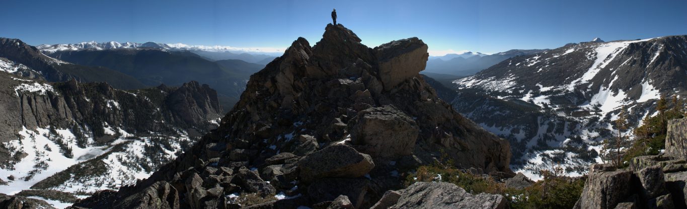
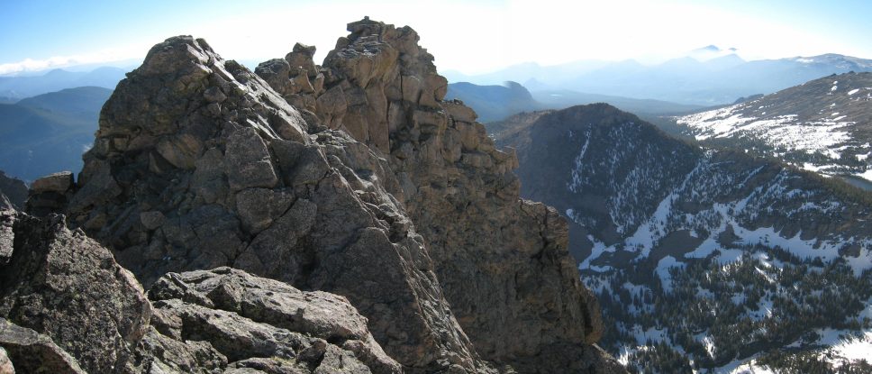
Once across the crux, it was smooth sailing along the ridge to the summit. We reached the scenic peak ~8:40am, and hung out in the beautiful weather, with a very light breeze, for a good 20 minutes. I ate my peanut butter, dried cranberry, dried mango, strawberry tortilla wrap for lunch. Ben had cell phone reception and called his wife. We watched the wisps of clouds start to form around the mountain tops, and perform aerobatic manuevers in the wind. After we had our fill of pics, we headed back along the ridge, this time looking for a route along the other side of the crux.
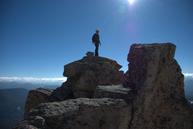
Me on the summit, ~8:40am. Ben makes a call to his wife on his cell phone from the peak...
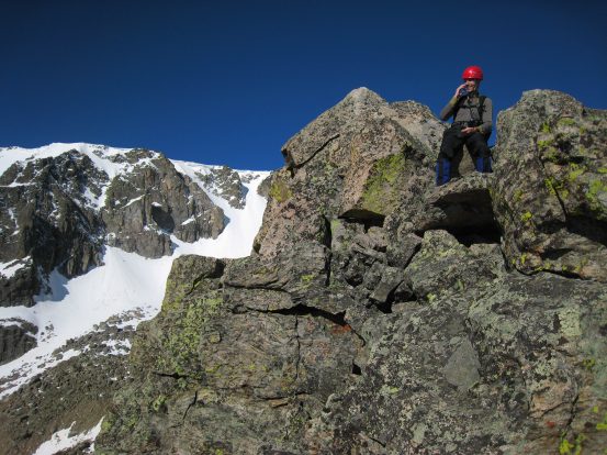
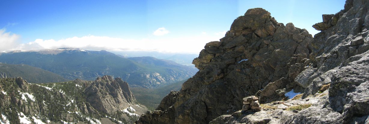
A look to the north where the Mummy Range lies. Filch Lake is on the right...
Pano-shot of Ben on the peak. Beautiful weather today...
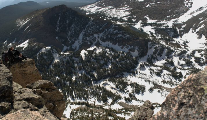
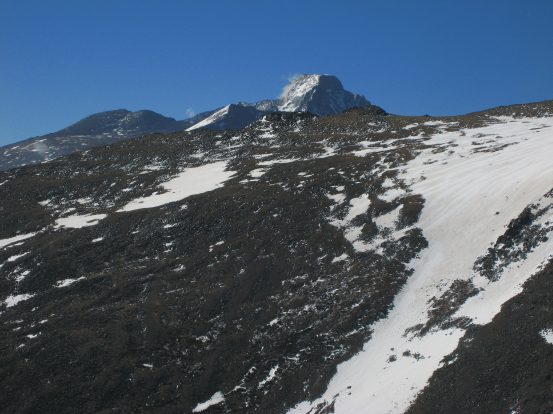
I find a cozy place to sit on the left, looking out over the valley that we hiked across. Odessa Lake has a lone piece of ice in it, in the 2nd pic. We had intended to arrive there for sunrise, to get a pic of Little Matterhorn from the front, where it actually looks like a sharp spiky peak if you look parallel to the ridge line...
A close-up of the snowy valley. We descended the chute just below the left edge of Lake Hylene...
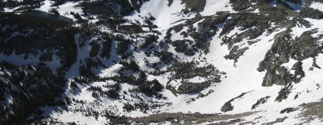
A zoomed out view, showing the snow climb leading up to the rocky basin...
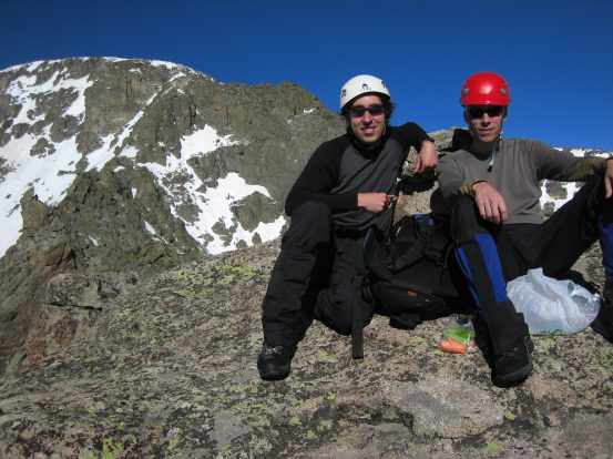
A self-portrait during lunch on the peak of Little Matterhorn. We could see some condensation arising from the top of Longs...
When we reached the crux on the way back, there was an easy trail leading down on the north side, but to regain the ridge required a steep upclimb with few footholds (not a problem if you have long legs though). We climbed up easily, and found ourselves just past the "catwalk". This is probably the easier path in this direction, but when heading towards the summit, this would be a difficult downclimb, and though the exposure is not as great, it is still steep with narrow ledges, where a fall would be likely unrecoverable.
Starting the hike back along the ridge...
Ben climbs up around the north side of the crux. It was pretty easy coming back this way, but would be more dangerous trying to down climb this section. Probably easier on the flat but thin and heavily exposed ledge on the right on the way out to the summit...
Beyond the crux, we took the same path out, again staying on the north side of the ridge mainly...
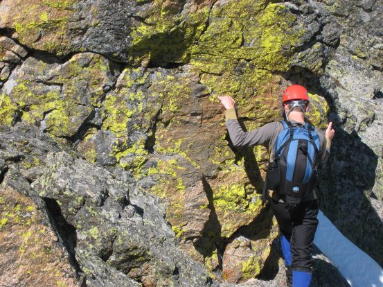
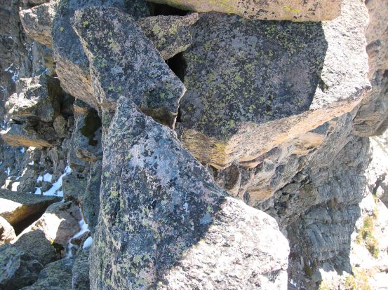
We noticed some flourescent green lichen growing on the ridge. Ben cuts through an opening in the ridge rock...
There was a feintly cairned trail on the north side of the ridge, though it's largely up to your trail finding skills to find the best way...
Ah, there's a cairn, looking back...
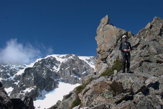
We reach the "Pac-man", which means it's time to head down towards the snow. Up close, the left half of this rock formation looks like a large stone rabbit...
The scramble down was uneventful, though required a bit of trail finding to avoid steep rocks and brush at times. There was also the occasional danger of sending loose rocks tumbling down a short ways...
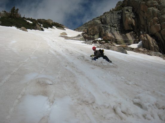
We reached our snow gear, and opted to forego the crampons on the descent, since the snow was now plenty soft to dig a boot into. We planned to hang to the left, where there was more snow for the descent, before cutting back to the right where we first began the ascent. With our trusty ice axes in hand, started walked down the snow, leaning back and digging in our heals, descending with ease. I tried glissading a bit and found that the snow was a bit too soft for the ice axe to be very effective as a break, but the slope was gentle enough that it was simple to just dig your heals in and stop. So we glissaded down long stretches, pausing to re-align and take pics, and made our way down to valley in ~30 minutes. Glissading is super convenient, even if it means a wet butt afterwards. The snow definitley beats slipping on loose rock and tallus during dry conditions. Little Matterhorn is a much more pleasant snow hike than dry hike, I'm sure.
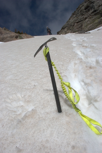
Ben heads down first, and takes a pic of Chris's borrowed ice axe, as I start the descent...
In no time we were glissading down the slope. Click this link for a 35 second VIDEO of a 1st person point of view glissade ride (10.5MB)...
As we neared the bottom, we could see the footprints in the snow we made across the valley this morning. We would retrace our steps...

A look up at the chute out of the valley. One shouldn't be subjected to an uphill hike of this magnitude on the way back...
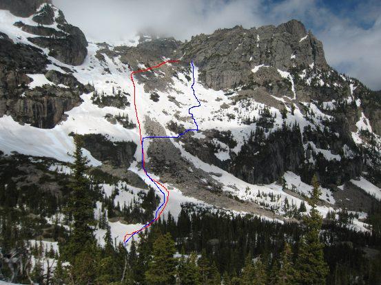
Our path up is in red, and our route down in blue. A close-up of the snow field...
After climbing out of the valley, it was smooth saying back to Bear Lake...
We saw some people snowboarding and skiing down a snow field across from Two Rivers Lake...
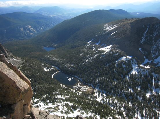
Two Rivers Lake, the site of this mornings stellar pics of Notchtop (from the other side)...
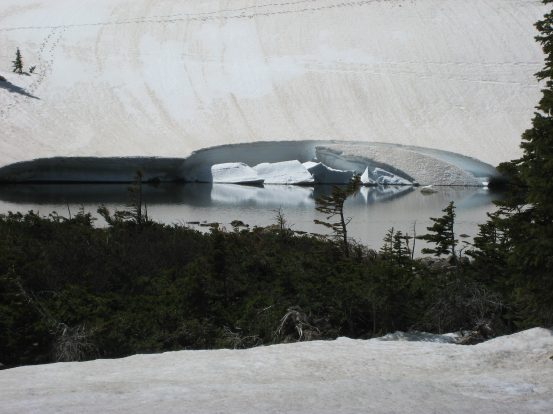
Check out the footprints above the collapsed snow bank. Wouldn't want to slip on that slope without an ice axe handy...
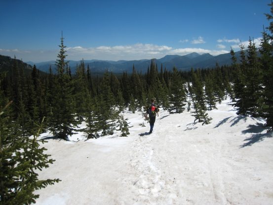
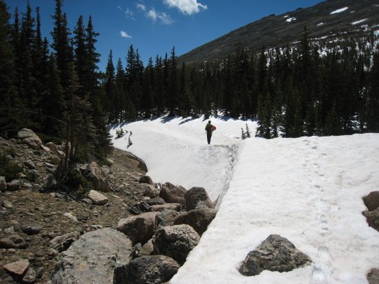
More shots of the trail on the way out. Beautiful weather all day. Still plenty of people hiking in at 12:00 as we left. We bare booted across the mushy snow all the way back...
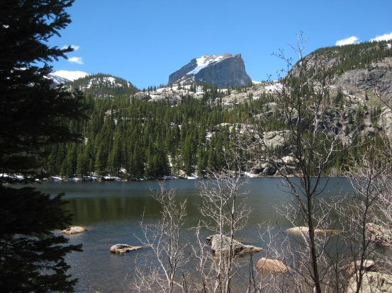
A look at Long's Peak as we neared Bear Lake. And of course, the classic view of Hallet's Peak from Bear Lake at the end of our hike...
It was a great hike, with excellent photos, a perfect intro to snow climbing, and a memorable ridge. Little Matterhorn is best climbed in the late spring while there is still snow, as I bet it would be a pain dealing with the boulders and scree. From Bear Lake it's just an 8 mile roundtrip hike to Little Matterhorn, with ~2700' gain, including the valley. As far as 11ers go, this is one offers plenty of excitement.