Mt Richthofen (12,940') attempt, Lake Agnes, CO, June 14th, 2008
Mt. Richthofen is located on the edge of RMNP, and is most easily accessible from outside the park, via Lake Agnes, just past Cameron Pass on Rt 14 from Fort Collins. This 12,941' peak is the highest in the Never Summer Range, and is a long steep slog to a class 3 coulier at the peak. Most of the elevation gain is on loose and steep rock scree, the really annoying kind, which is why I decided to try it this week (June 14th, 2008), when the north facing slopes were still covered with several feet of snow. This meant parking off of Rt 14, and hiking an extra 1.7 miles (and 550'), as the Lake Agnes trailhead road was still closed.
The hike has a good 2200' gain in the last mile, from Lake Agnes. I was concerned about avalanche danger, but after talking to several people at work, and reading info online, it looked very safe this time of year, as the remaining snow was very consolidated. I invited Wendy and Tom along for the hike, who all had the appropriate snow gear. It would surely be a fun snow climb, and a much bigger climb than my first snow climb (Little Matterhorn) last week.
Though we turned back at the 12,750' false summit, shortly before the peak, it was an impressive outing with gorgeous views and premier glissading. Here's the story...
We left from my house in Fort Collins at 3am, and drove all the way through town in 12 minutes, catching all the greens in the empty streets. Wendy laid out across the back seat, with blanket and pillow, asleep as I drove up the Poudre Canyon fiddling with the radio, bouncing around the AM talk radio channels. I didn't see a car on the road in the canyon, and after the ~70 mile drive, I had topped Cameron Pass (along the continental divide), where the giant Nohku Crags spring into view straight ahead. Lake Agnes lies on the other side of these peaks, and in a few miles we reached the Crag's Campground pull-off. Just prior to our arrivial, I stopped to take a pre-dawn pic of the mountains, when Tom pointed out a mysterious critter near the side of the road, which we think must have been a porcupine. Too bad the pic came out blurry...
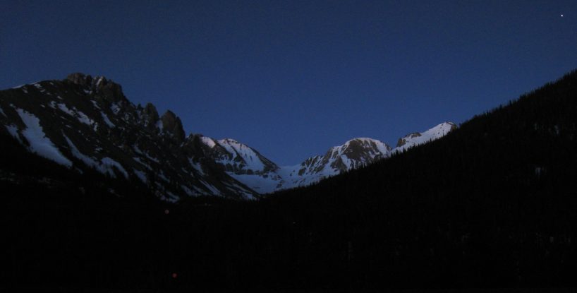
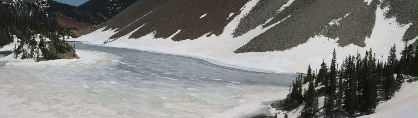
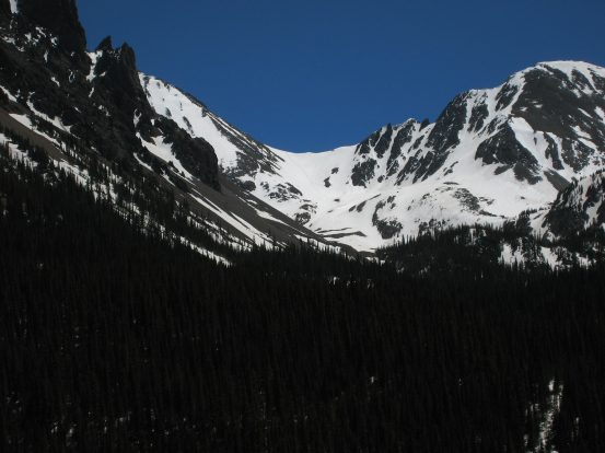
A pic of the jagged Nokhu Crags on the left, from Rt 14, 4:50am, a couple miles from the trailhead. Richthofen is the first white peak just to the right of the Crags. We would be ascending the pure white saddle in the middle of the picture. I caught a star in the upper right corner...
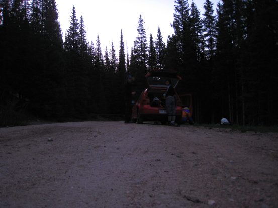
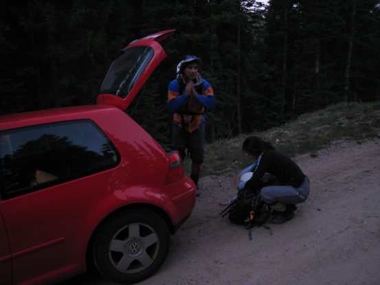
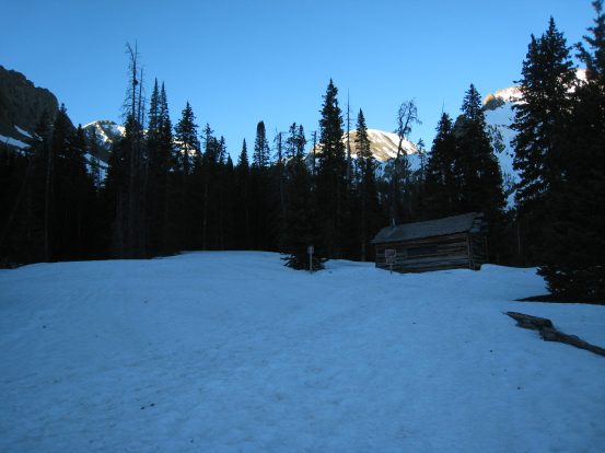
We were the first car parked at the trailhead. After paying the $6 state park fee, we readied our bags, and hit the trail ~5:20am. It was very cool out, but not windy...
The first quarter mile was on a mostly snow-free and flat dry road. Then we took a right across a bridge and up a steeper dirt road into the forest. The snow quickly thickened...
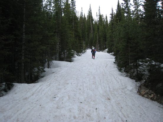
2-3 feet of snow covered the dirt road up to Lake Agnes's trailhead. We were able to bare boot up to the parking lot though...
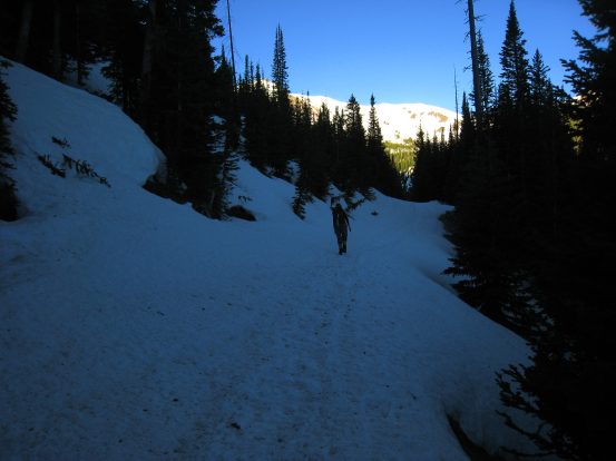
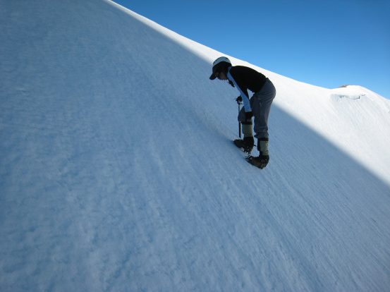
The Lake Agnes trailhead won't be accessible by car for another month at least, given the extensive snow. The latrine was open and usable though. Just past the trailhead, we opted to put on our crampons, as the snow was ice hard and the path was more rough. Crampons are like velcro over frozen snow...
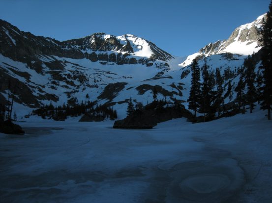
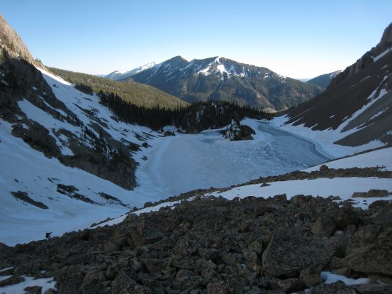
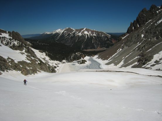
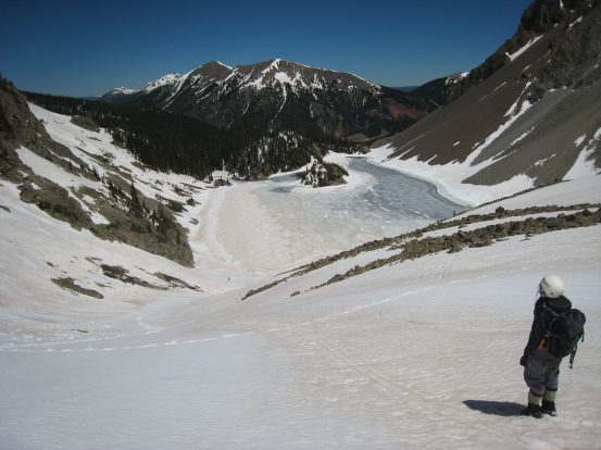
We followed some footprints that led us up a big hill, where we practiced some self arrests with the ice axe. The trail continued up and to the right, which seemed off course to Lake Agnes, as I had been here twice before, so we began bushwacking to the left, and eventually found ourselves above Lake Agnes, about even with the island. We scrambled down the snowy forested slope (an infrequent post-hole or 2 along the way), and arrived at the shore of frozen blue Lake Agnes.
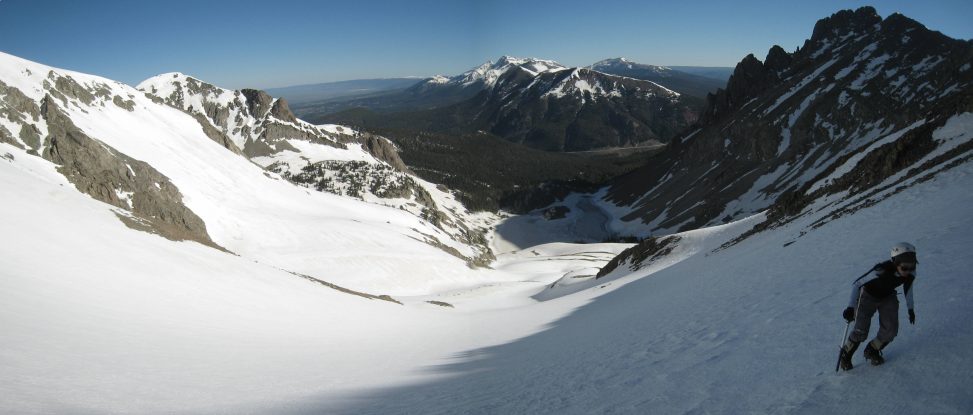
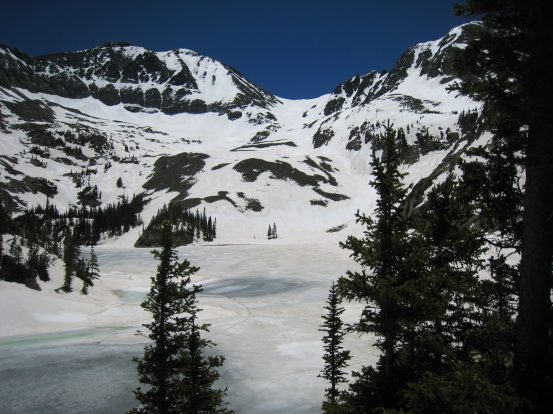
The view across the lake of the pure white snow covered saddle, in between Richthofen and Mt Mahler was daunting. The slope looked really steep, tall and far away, but I knew it would probably look a lot more manageable up close.
As we walked along the frozen edge of the lake, we decided that snowshoes would be pretty useless ahead, as the snow was ice hard, and we planned to glissade on the way back, so we stashed our snow shoes near a pile of rocks, and continued on towards the first snow slope, with a couple pounds less on our backs.
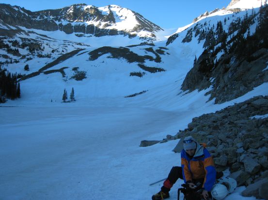
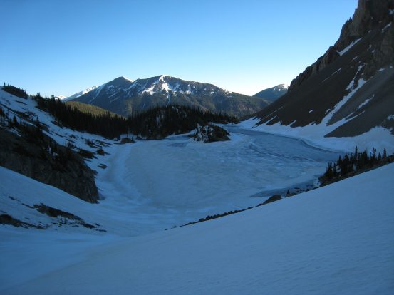
The view from the shore of frozen Lake Agnes. I had planned to hike across the other side of the lake, but the frozen edge of this shore was just as convenient. Tom removes his snowshoes from his pack. We left them at these rocks for the rest of the summit push...
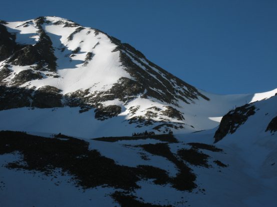
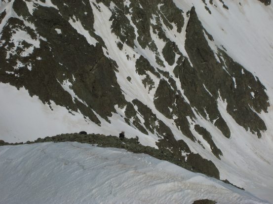
A close-up of the saddle (mostly in shadow still) with Richthofen's false summit on the left. The saddle looked like it had a small cornice, which was surprising, but figured it was too early to be concerned, as we'd get a much better look at it later. A look back across Lake Agnes...
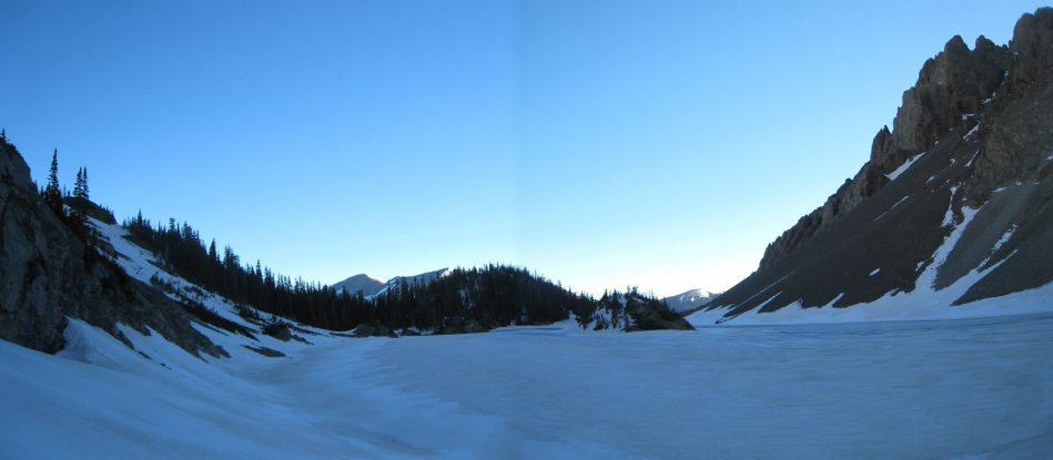
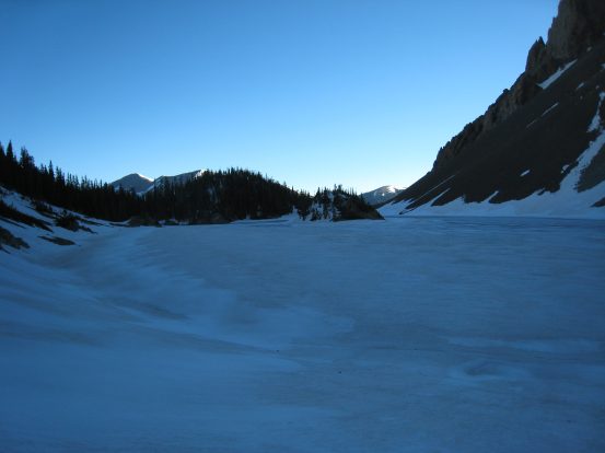
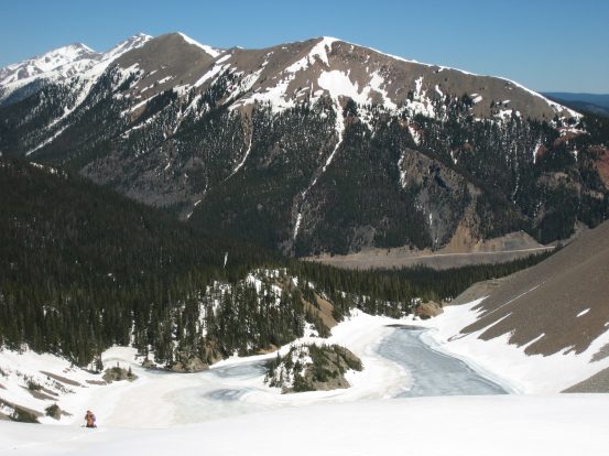
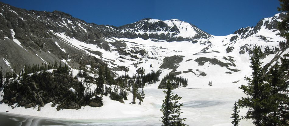
A wider view back at Lake Agnes, with the Nokhu Crags towering on the right...
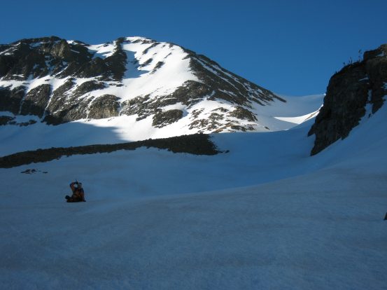
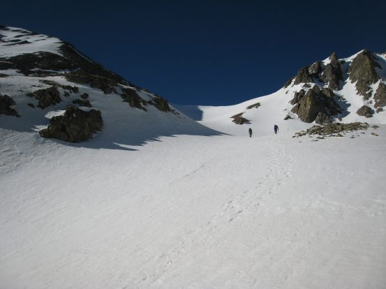
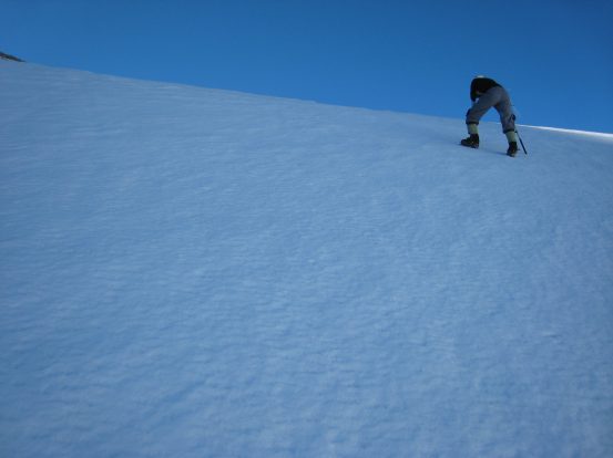
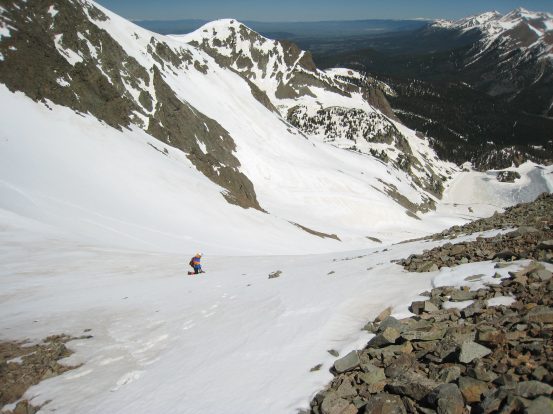
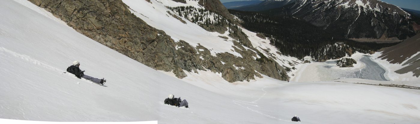
Wendy and Tom are off ahead on the first snow pitch, while I stayed behind for pics...
The first snow pitch was pretty steep, but gave us some confidence once we passed it. The snow was still ultra hard-frozen, ideal for the climb. A look back after the first hill...
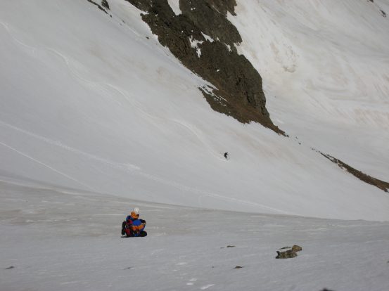
Tom sits and waits for the rest of us to catch up before hitting the next slope. That saddle was still looking menacing in the distance. A look back after the next slope...
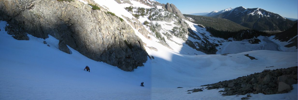
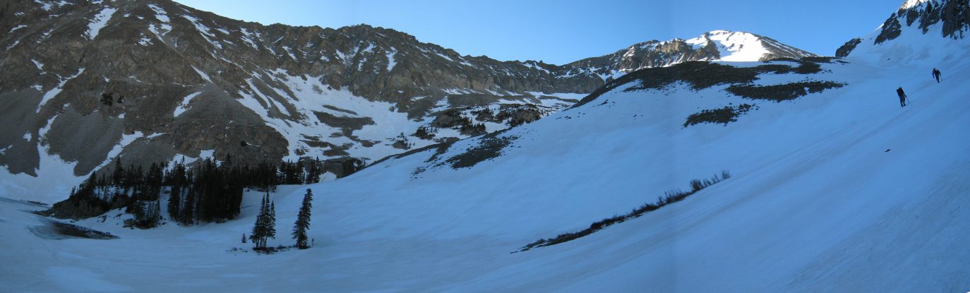
A look back at Tom and Wendy working their way up the next snow slope. This area is perfect for snow climbing, since it's north facing, and is nestled among the mountains, giving it plenty of shade late into the morning...
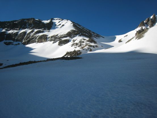
The ascent leveled off after the first 3 climbs as we drew closer to the saddle. We found ourselves in the sun for the first time today. We hoped to make it up the saddle before the sun reached it, softening it's snow...
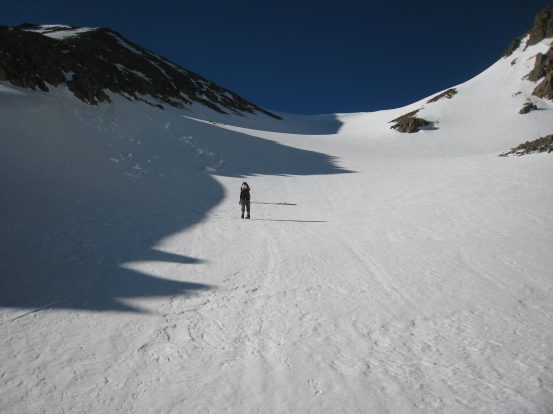
The saddle was looking less scary as we neared it, and despite our slow progress, the shade was holding well along it's left edge...
Richthofen's peak (or something on the ridge) looks pretty sharp based on that shadow on the snow. The shadows in the pic above are pretty cool too...
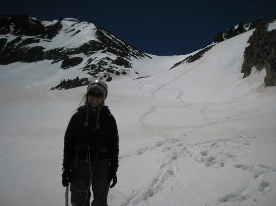
Wendy treads on. This was her first snow climb. We had hiked on a guided glacier tour in Patagonia in March, but this had a bit more elevation gain...
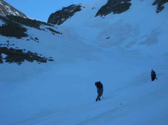
Back in the shade. Wendy leans in during the final long steep push for the saddle. The snow stayed perfectly firm during our entire ascent to the saddle...
Amazing what tilting the camera does to create danger...
However, these pics are NOT tilted. The final lip of the saddle was steep, but didn't have a cornice. A strong wind gusted now and then, pelting us with tiny ice crystals blown from the snow...
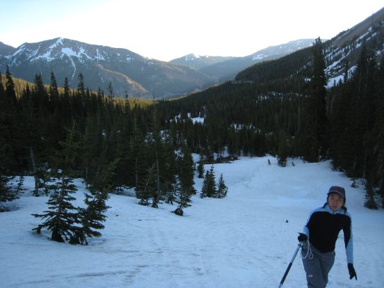
We finally reached the saddle at 8:25am. It was good we started early to have a long time with the hard snow. The ridge up Richthofen looked largely snow free. Despite the 1350' of gain from the lake (and another 1000' from car to lake), there was still 900' of gain left to claim the peak. Unfortunately, most of this would be on loose scree.
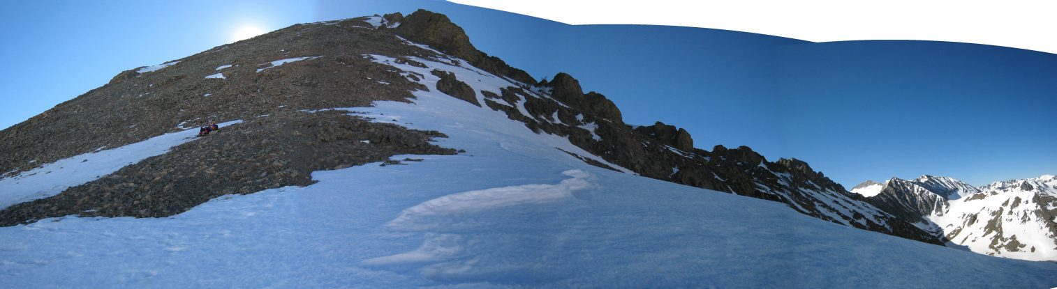
A look up towards Richthofen from the saddle. Some snow existed a short way up the ridge on the right, otherwise it was bare and full of loose rock and dirt...
Looking down towards the middle of the saddle, with Mount Mahler rising behind. Wendy and I climbed Mt Mahler in Sept 2005, from the north ridge...
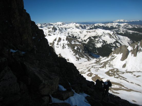
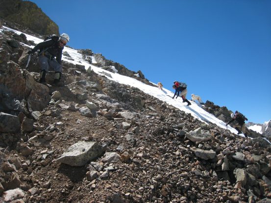
After a short rest, we started up the mountain, and soon took off our crampons to deal with the rock. Tom went off ahead, while Wendy and I worked our way up. This type of rock is not Wendy's cup of tea, and after climbing ~650' of this, and knowing there was just as much unpleasant downhill in store, she was content to wait while we finished the peak. We saw Tom high up ahead waiting at a false peak. He yelled down that the peak was just ahead. I knew he was referring to the false summit, and that the true peak was well beyond, and had a nontrivial class 3 coulier in store too. I told Wendy I'd catch up with Tom and check out the false summit, and then return, letting Tom know he could push for the summit solo.
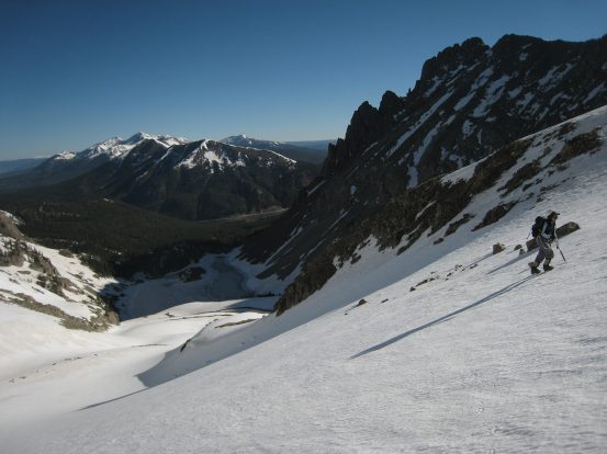
A look at Tepee Mountain, a popular destination to bag in combo with Richthofen. Wendy makes her way up the rocky slope...
There wasn't much of a marked path up the ridge, just some worn out areas here and there...
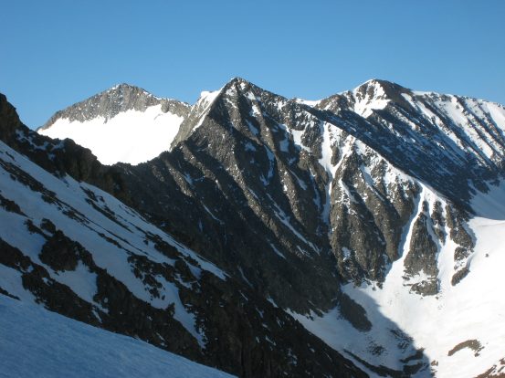
A close-up shot of Mt Mahler's peak across the saddle (probably a great time to hike it with snow covering the north side). A look up at Tom, from where Wendy decided to call it a day...
Turns out the loose scree ended right where Wendy and I had stopped, and the short scramble up to Tom was fun, with more stable rock. There was some snow to cross as well, though it was softening up enough to get by with bare boots. I had left my pack with Wendy, and just brought my ice axe with me. When I rejoined Tom after the 5 minute hike from Wendy, we ventured to the "summit-like" peak nearby, which had some snow along the ridge ascent which looked kind of exotic. This short section was really fun and interesting, and free of loose rock
A look back at Wendy from where I caught up with Tom...
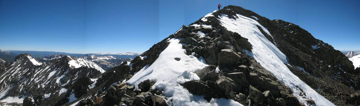
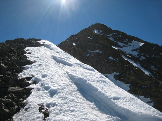
It was a fun ridge leading up to the false summit, with some snow mixed in...
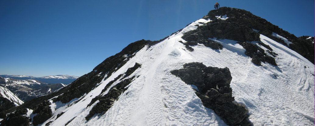
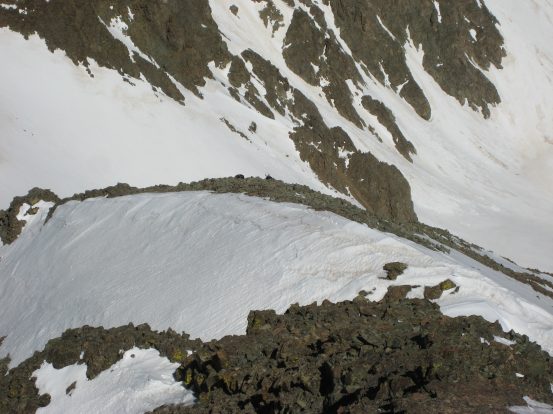
It almost looks like someone glissaded down the snow on the ridge top here, as Tom nears the false summit peak...
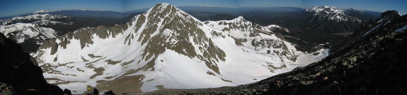
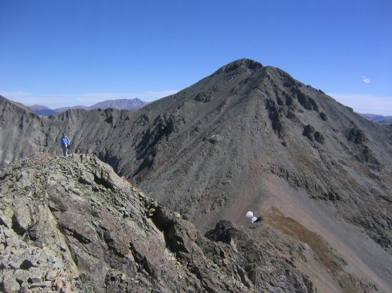
When we reached the top, sure enough we found Richtofen off in the distance, on the other side of a fairly narrow snow covered ridge, and could see the coulier carved out of "fist-like" peak. The snowy ridge looked a bit intimidating from this distance (though nothing close to a knife), and I had already decided to pass on the summit, rather than keep Wendy waiting another hour on the ridge. Not sure if the north facing class 3 coulier was filled with snow or not, but I definitely would needed my crampons to consider it, and would probably be very exposed if iced over. It was a beautiful peak to admire, and the views from the false summit were impressive. Upon seeing the remaining path to Richthofen, Tom quickly decided that he was ready to turn back as well. It was a beautiful peak to admire, and the views from the false summit at ~12,750' were impressive. At the time, staring at Richthofen, it was obvious and natural to head back rather than push an attempt, but later on my thoughts kept coming back to that cool ridge and coulier... However, it'll be there for another day.
 >
>
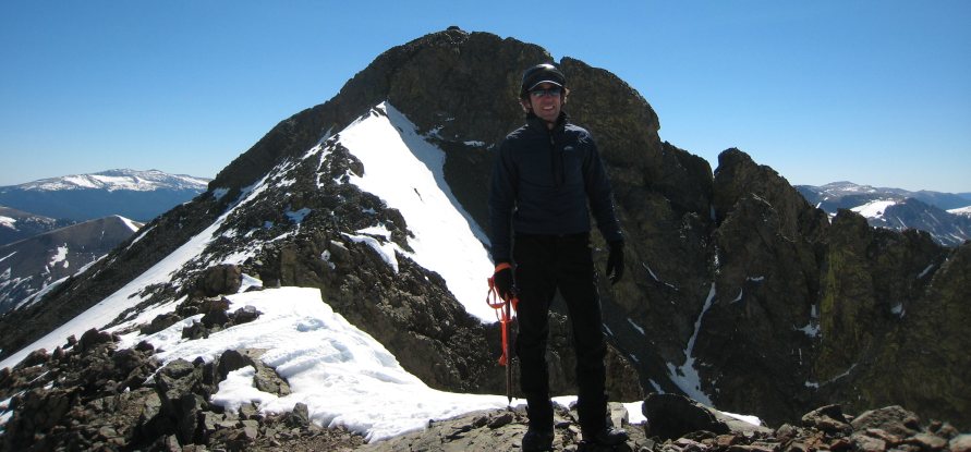
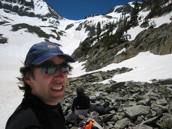
Me and Richthofen. I'll have to come back again sometime to bag it. It's really gorgeous up here...
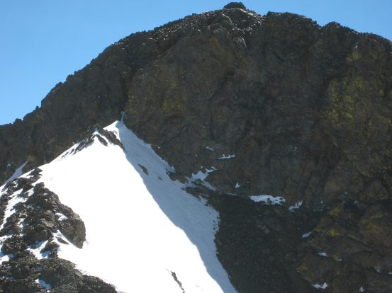
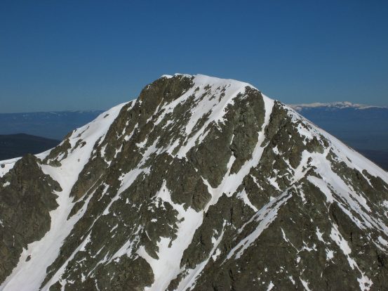
A good look at the coulier notch leading to the summit. Looks like an entertaining finish to the summit. A token view of Long's peak, from the northwest...
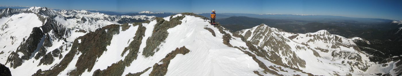
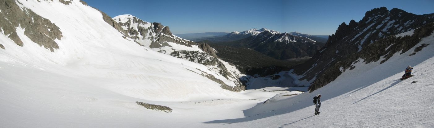
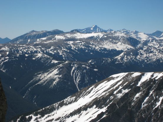
A panorama looking west from the false summit. Lake Agnes sits at the very right. It was windy up here...
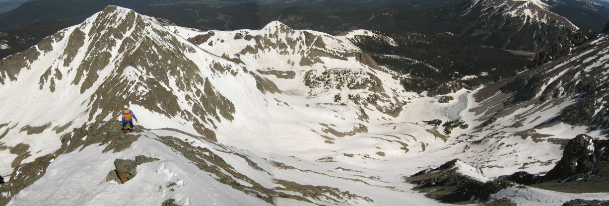
We start the short descent down the ridge back to Wendy. Mt Mahler doesn't look so tall from up here...
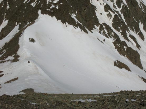
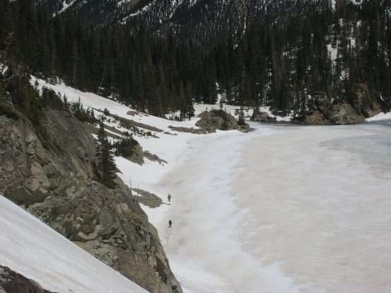
There's Wendy. After we caught up with her, we noticed several small dots moving around on the snow below. I saw 6 people and at least 3 dogs making their way up to the saddle...
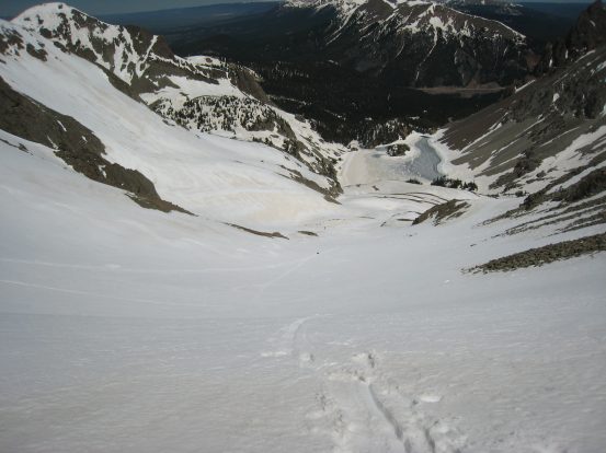
There was a snow slope leading straight down towards the lake from up where we were, but we couldn't see the entire slope down, as it got steep far away. I knew better than to try it out, and end up at a cliff, so we went back down the slow, loose rock/scree ridge. (We would later see there was indeed a cliff at the end of that snow)...
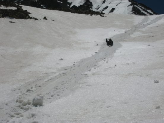
The way back was slow and unpleasant. As we neared the bottom, a couple of guys with 2 dogs passed us on the way up. They were hoping to reach the summit. Gotta give those dogs some big respect if they did make it. Eventually we reached the saddle, and contemplated our glissade...
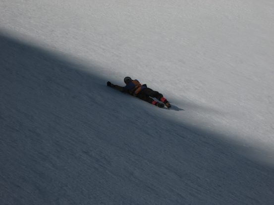
Tom gets ready to go first, as we watched a couple of skiers swerve down the hill along the more softened side of the hill. In the 2nd pic, notice a tiny speck in the center of the pic, where the line in the snow ends. That's Tom after a long, "yahoo"-laden glissade...
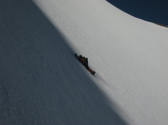
The top of the saddle was steep, and Wendy was nervous to try her first glissade in such a steep area, so we started the glissade in tandem. After a short ways we stopped, and Wendy was plenty comfortable to enjoy glissading the rest of the way solo. This area is prime for glissading, with long open run-outs. We quickly made our way back to the lake, glissading at every opportunity. There were probably five worthy stretches in total. The snow was definintely softer the further we descended. The whole scene was like a glorified Snow Park USA amusement park playground with blue skies, sun, and world-class scenery. We all had a blast on the descent.
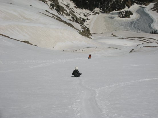
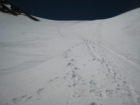
After glissading in tandem with Wendy initially, she quickly got the hang of it, and gleefully slid down the rest of the mountain. A look back at our tracks after the 1st glissade...
It was a pleasant descent of glissading, walking to the next glissade, and enjoying the scenery...
I tried to stay high, angling around the slopes, looking for the best glissade opportunities...
Three Wendy's! That can't be right...
Tom readies for the next glissade. There was scarcely a track in the snow on the way up this morning, but by noon there were plenty. I wonder if the snow will soften and refreeze, erasing all of our tracks for tomorrow...
Wendy was a pro glissader by the bottom of the hill, getting great distance, and keeping the legs up...
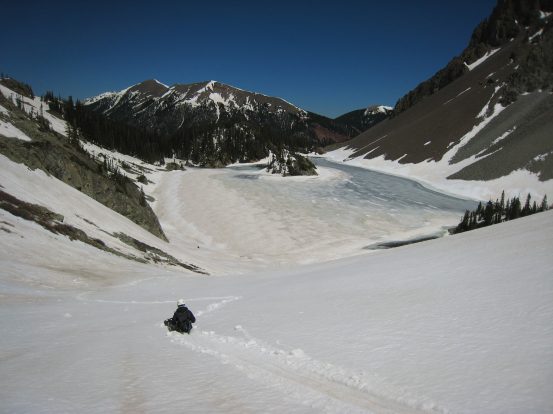
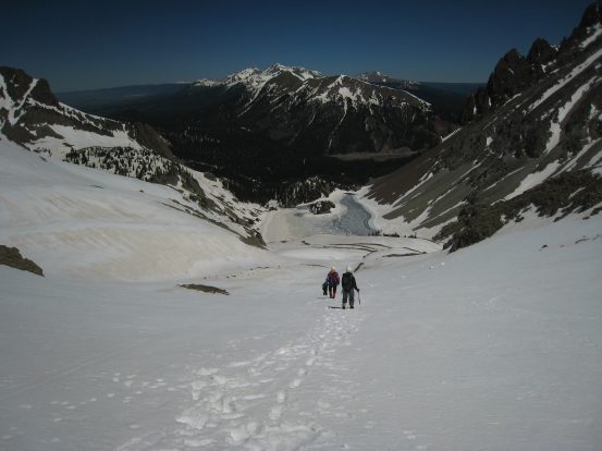
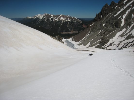
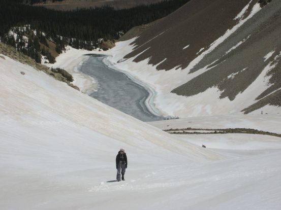
We arrived at Lake Agnes ~30 minutes after leaving the saddle, taking our time and enjoying the glissades and scenery. Lake Agnes is so beautiful with it's mountainous backdrop and protruding tree covered island. Definitely up there for most scenic lake in CO...
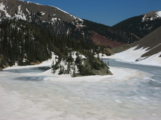
A close-up of the east bank of the lake. We saw some skiers making their way out on that side...
Wendy and Tom arrive at our snowshoes among the rocks below. I stayed and took pics for awhile, then made my last glissade of the descent, to join Tom and Wendy for lunch...
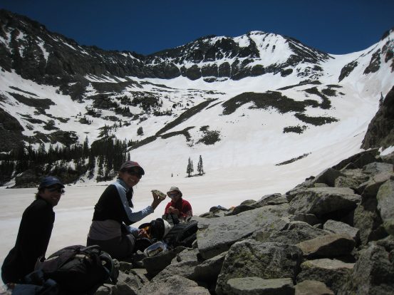
A self portrait from our lunch spot, and a look across the lake at our path up to the saddle, and to the false summit on the left (with the snowy top)...
We tried to hike around the lake to descend along the east side, but didn't find easy passage over the boulder this pic is taken from. So we bushwacked our way through the snow forest, still in bare boots, rarely post-holing, until we met up with the trail...
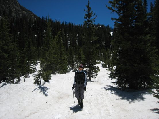
During our bushwacking we encountered a steep snow-slope with a not so great run out. Tom glissaded first and stopped just before the dirt, while Wendy and I did some brief sliding, and then down climbed the rest towards more snow. Wendy walks through the forest as we near the Lake Agnes trailhead...
When we reached the meadow next to the Lake Agnes trailhead, we started post-holing quite a bit, as the snow was well softened. Wendy had the advantage of walking last in line and figuring out the best foot step locations to avoid post holes. We still didn't bother with our snow shoes though, and hiked the road back down to our car. A couple of skiers passed us by on the way out. We arrived back at the car ~2pm. It was a long day on the trail, but with the gorgeous weather and scenery, it was the best place to be.
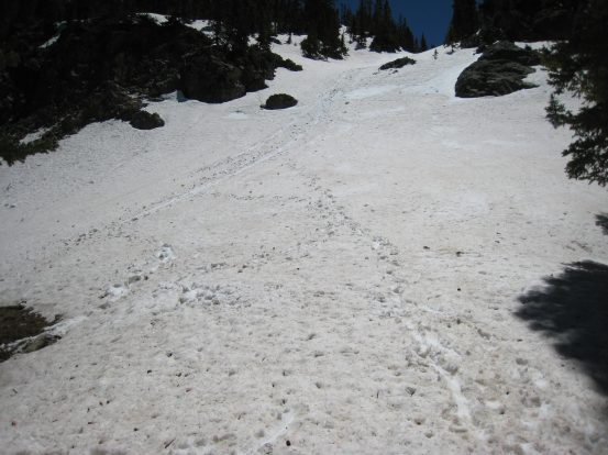
On the drive out, I stopped to take a pic of the saddle, and the false summit rising to the left. If you look closely on the left edge of the saddle, you can feintly see our glissade tracks angling diagonally down to the middle...
The drive out was smooth. At one point, I just put the car in neutral and coasted down the gently descending road for over 5 minutes, without needing to touch the gas or brake (just occasionally popping it into gear to slow around a curve). Playing with the manual shifting was my entertainment to keep me awake on the drive back to Fort Collins, and maybe helped save a couple of bucks in gas too.
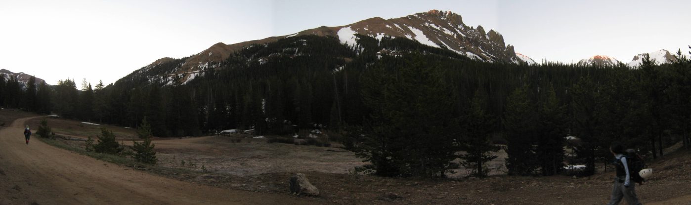
Perhaps later this season I'll come back to Lake Agnes and attempt the Richthofen, Tepee, and Static Peak, circuit. It's certainly is a beautiful place to return to...
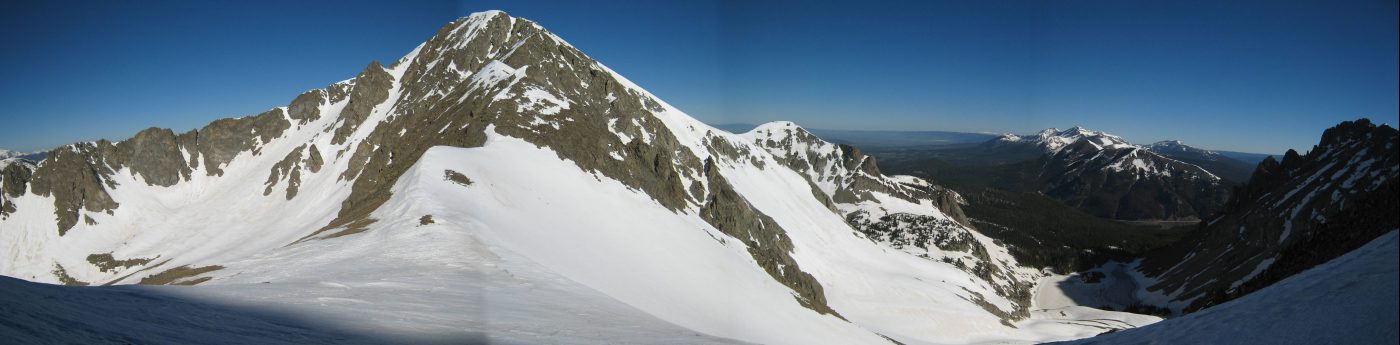
I've included a pic of Richthofen (and Wendy) from the summit of Mt. Mahler, taken Sept 11, 2005. You can see the saddle below, and the scree field leading up to the false summit, with the true summit beyond and to the left. Click here for more pics from this hike...
Back to main hiking page