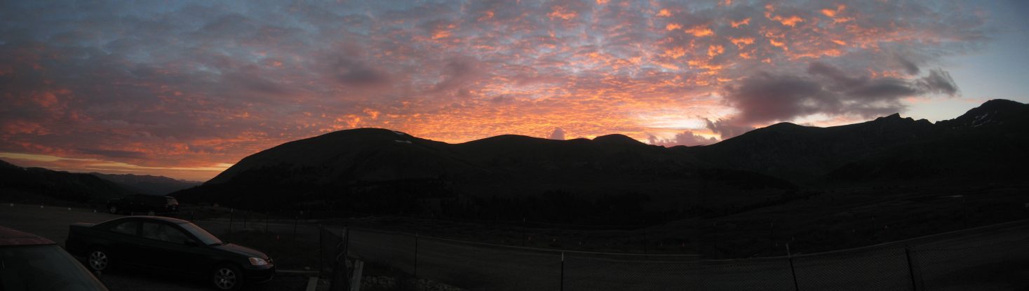
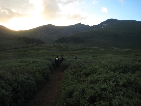
After a stop for gas and food, we arrived at the Guanella pass trailhead shortly before 6am, just in time to catch the morning sunrise beyond the mountains. ~10 cars were already parked, at this very popular location...
After a stop for gas and food, we arrived at the Guanella pass trailhead shortly before 6am, just in time to catch the morning sunrise beyond the mountains. ~10 cars were already parked, at this very popular location...
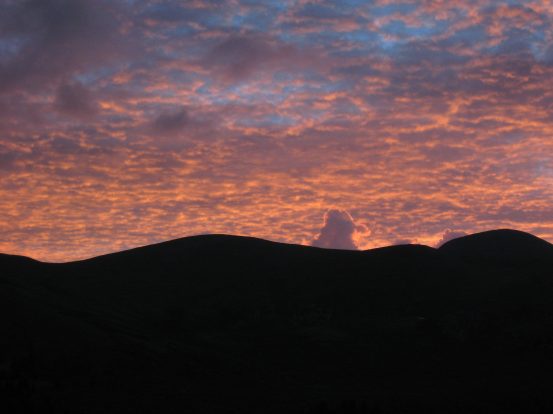
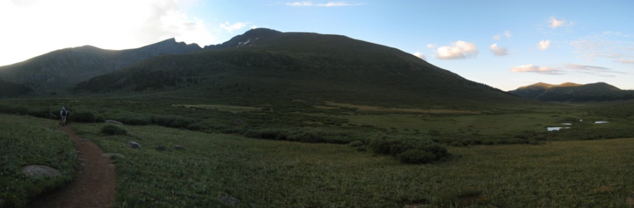
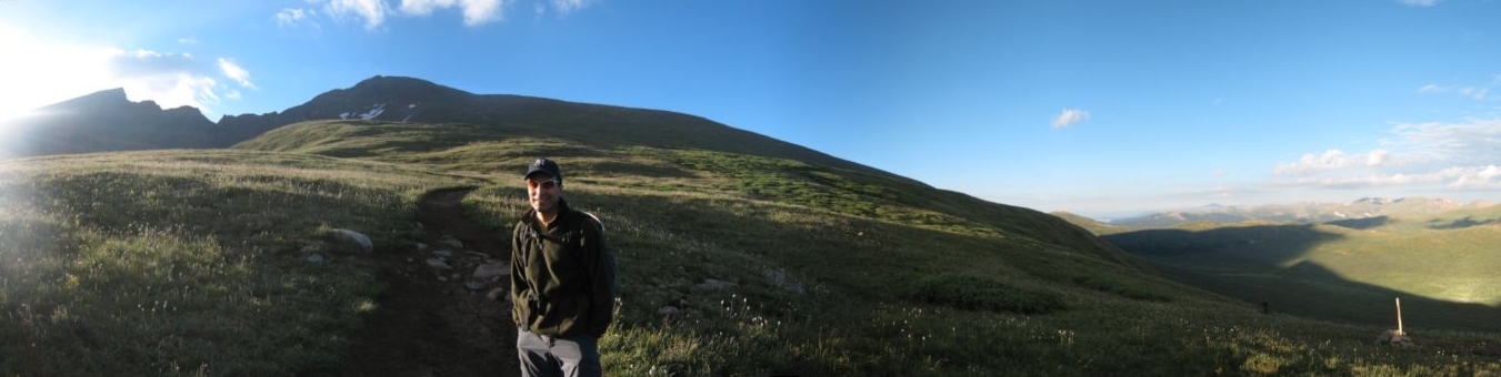
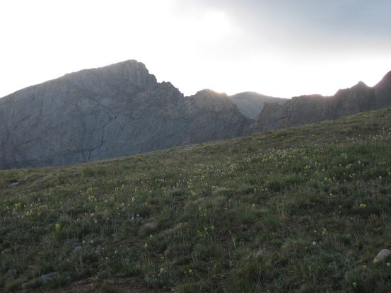
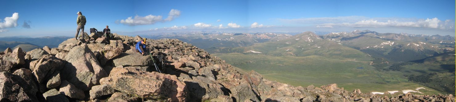
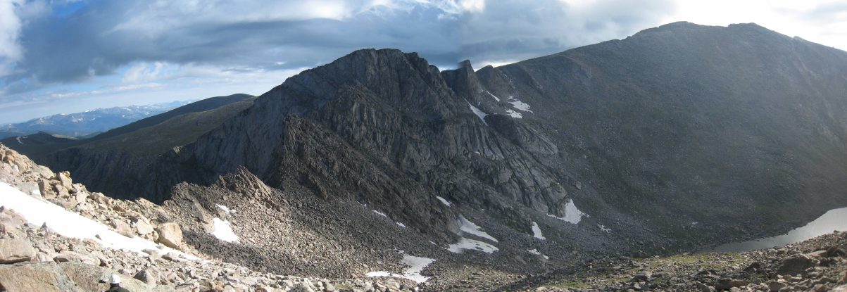
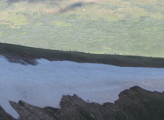
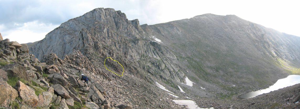
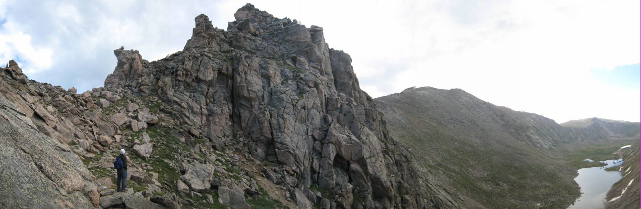
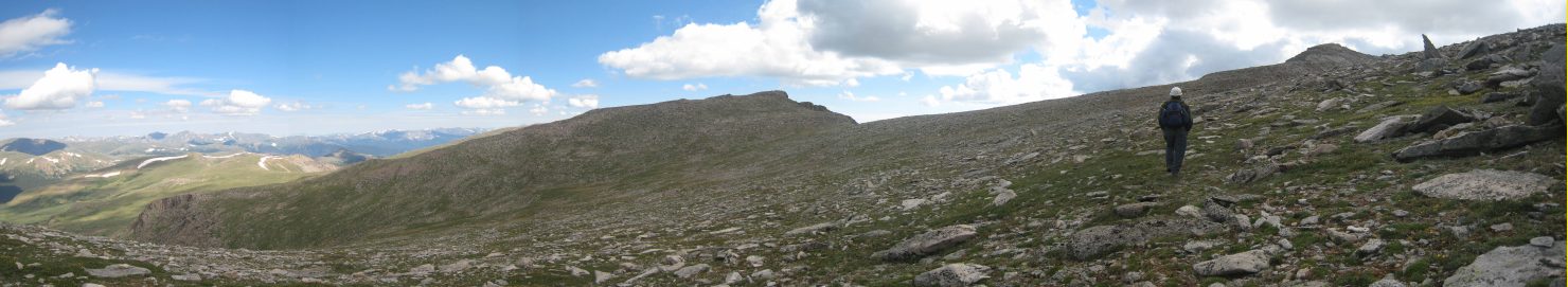
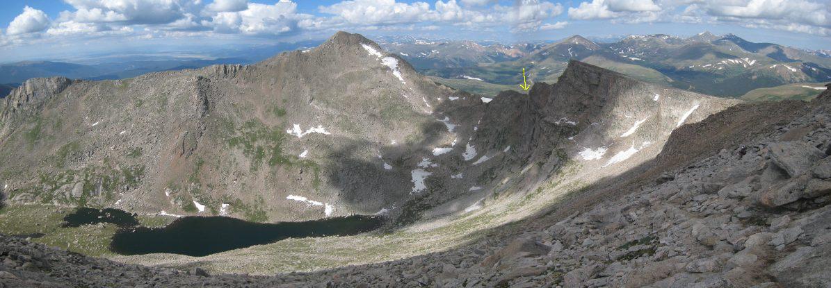
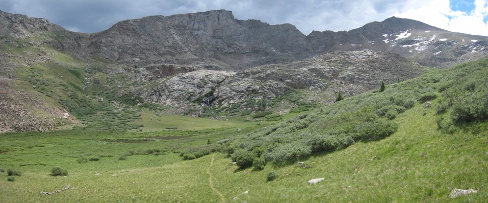
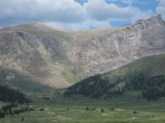
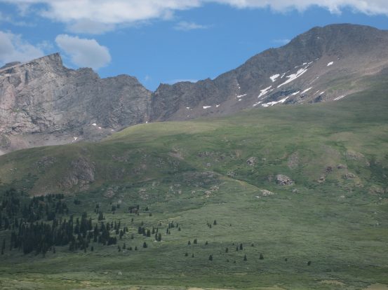
A pink cloud close-up. From the trailhead we could see Bierstadt on the right, with the choppy Sawtooth Ridge leading down to the left. Mount Evans is hidden behind the sharp point of the Sawtooth. We would be descending down the mountain from the shallow saddle to the left of center in the pic on the right (to the left of the Sawtooth), after summiting Evans...
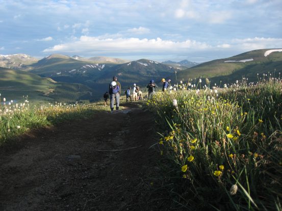
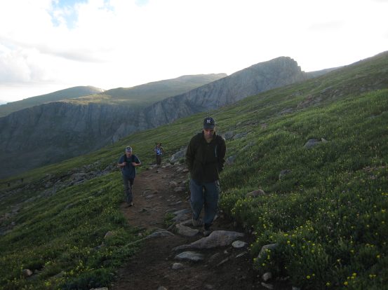
After prepping our bags, and visiting the latrine, we were on the trail at 6:13am. The heavily traveled 3 mile trail up to Bierstadt is extremely well maintained, and nearly impossible to get lost on...
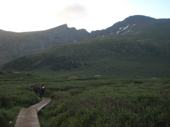
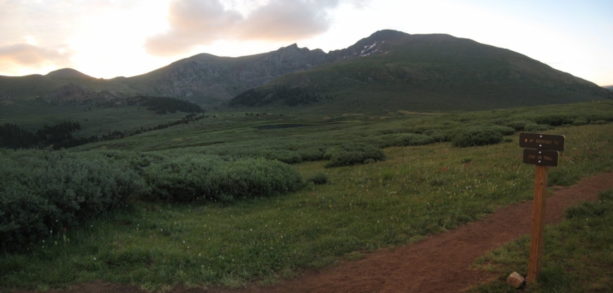
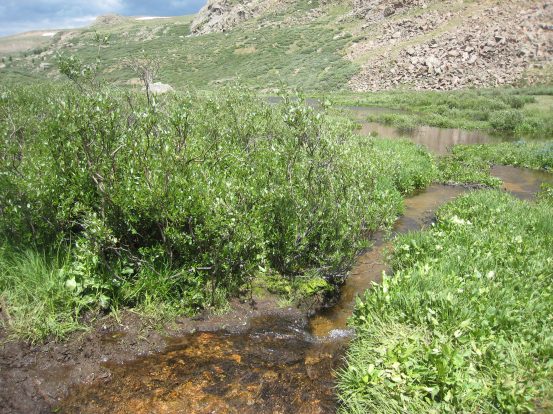
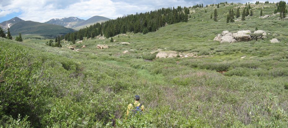
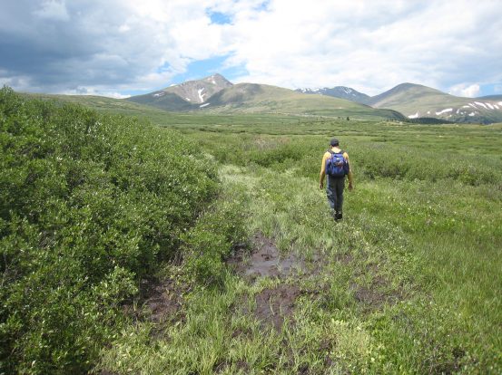
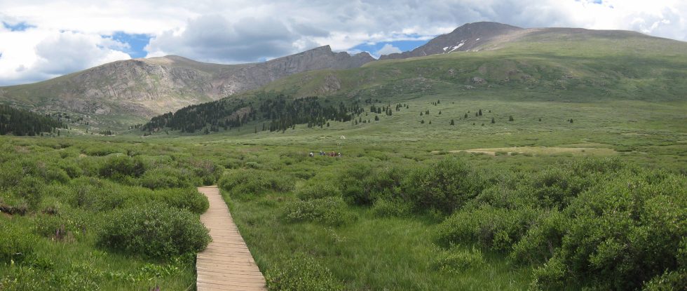
From the parking lot, the trail descended ~100' into a large field of willows. The trail was wide and mostly dry. Extremely convenient boardwalks were setup over the muddy/boggy portions...
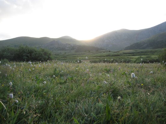
The morning hike was pretty, as we watched the sun light up the mountains behind us...
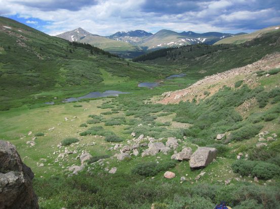
For the first portion of the hike we were in the shadow of Bierstadt. It'd be another an hour til the sun rose high enough to reach us. There was some chill air hanging in the valley of willows this morning. Some pretty ponds lay out to the right of Bierstadt...
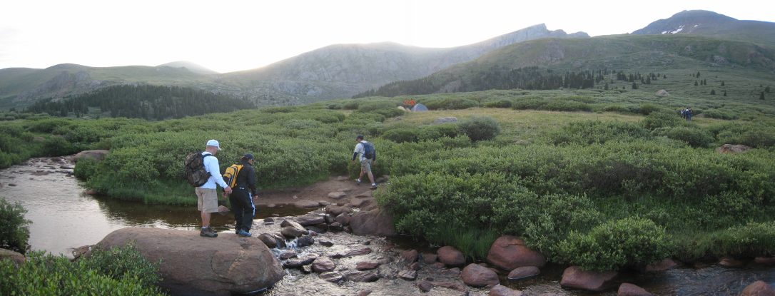
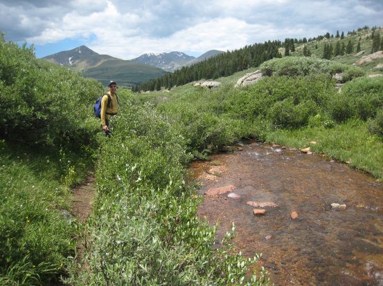
Early in the hike we reached what might be called "the crux" of the trail to Bierstadt. This small stream crossing was very manageable, but could be tricky with wet shoes/rocks, and did require some concentration...
After the stream crossing, the trail gradually rose along some long switchbacks through the willows. We had made up the 100' we lost in the valley about now...
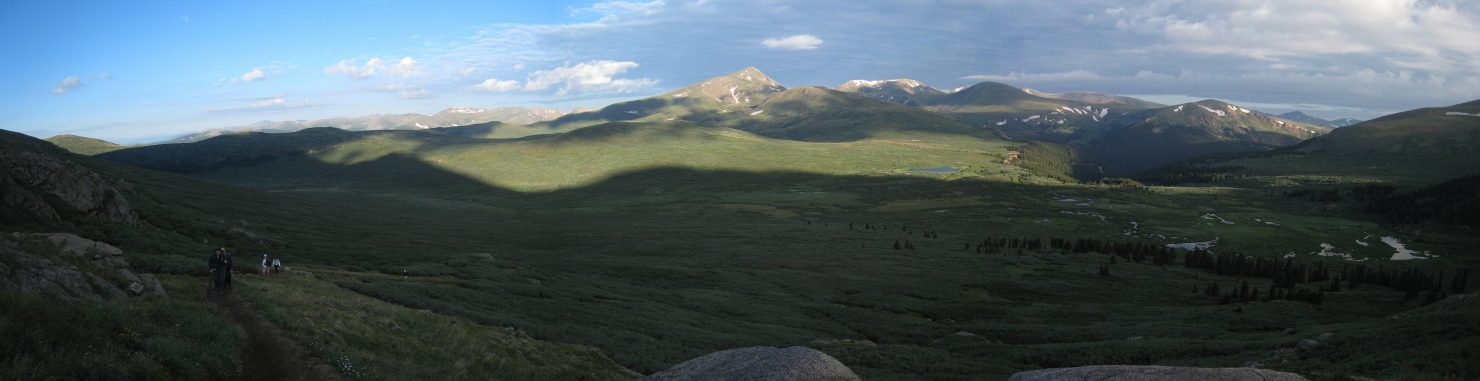
A look back down and the mostly shaded valley. We played leap frog with some of the other hikers out this morning. We passed a couple of hikers who were descending from a morning sunrise summit too...
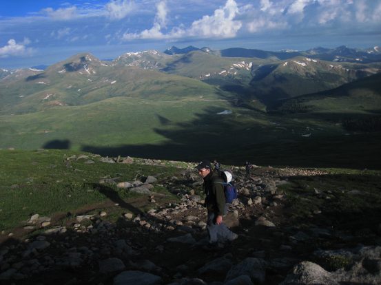
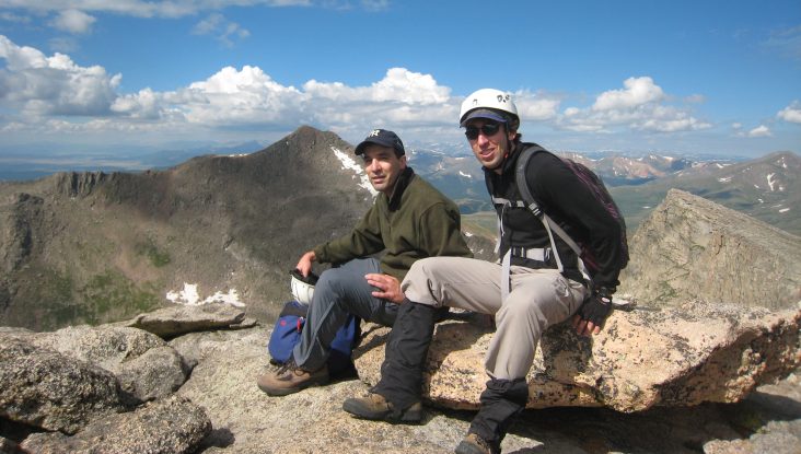
Tom is sporting the orange sunglasses today, as the sun finally breaks over the horizon, just to the left of the Sawtooth ~7am. At this point Chris and Justin decided they would be content with just summiting Bierstadt today, giving Tom and I the go ahead to charge on and meet back at the car later. We had walky-talkies to keep in communication as well...
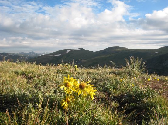
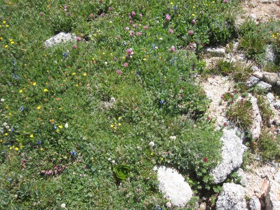
The sun was just high enough to light up the flowers on each side of the trail. More flowers nearby...
Tom and I head up to Bierstadt, working a swift pace, aiming to leave Chris and Justin with a short wait at the car later in the day, while we return from Evans. We were about half way up the mountain, with 1200' to go...
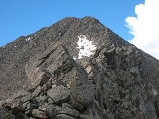
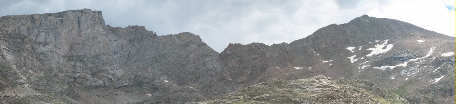
A close-up of the Sawtooth. We could see the narrow vertical ledges underneath the highest point, that we would be traversing across later. Plenty of small yellow flowers along the side of the trail...
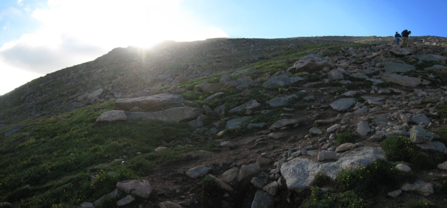
The switchbacks disappeared, and the trail became a straight climb up, but not steep enough to cause slippage on the dirt/rock trail...
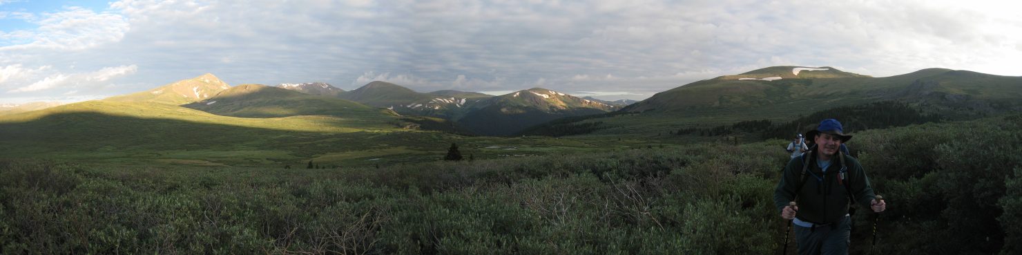
The 14ers Grays and Torreys were becoming visible as we gained elevation. They are the 2 dark peaks close together in the center of the pics...
There were certainly a lot of clouds out this morning, some looking quite grey. The forecast today was 20% of rain after 1pm, mostly cloudy. I hoped that meant the clouds would keep from getting threatening in the morning...
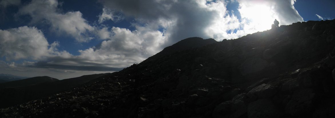
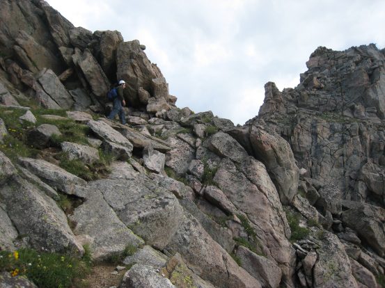
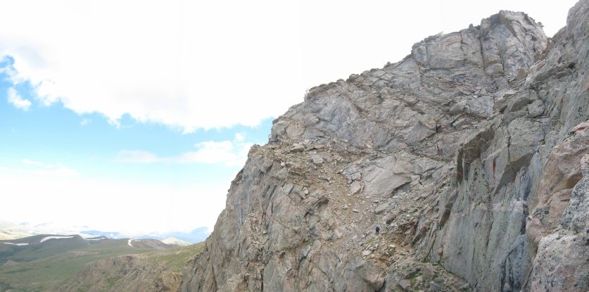
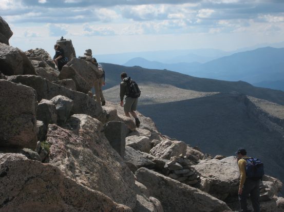
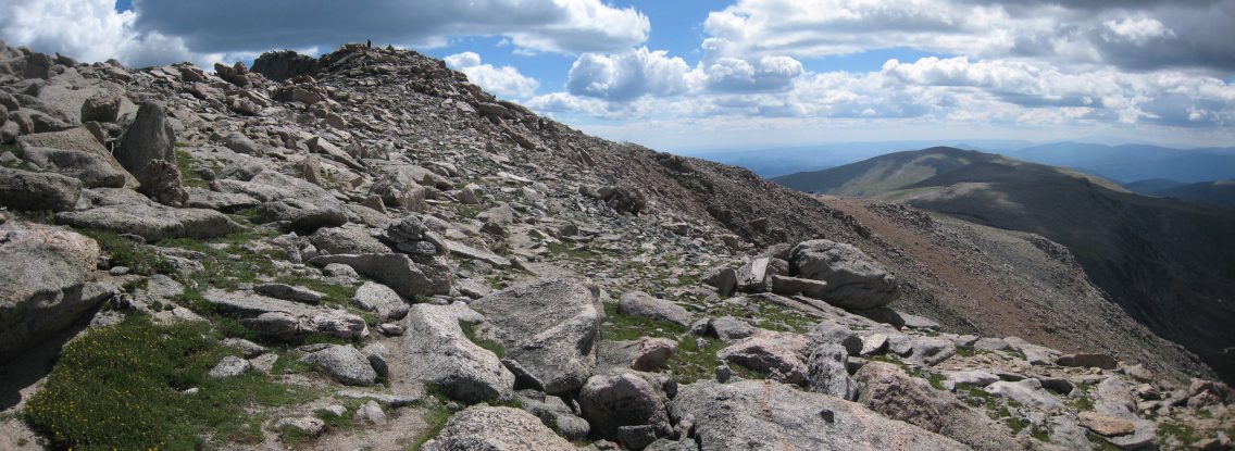
As we neared the top of the ridge, the trail became more rocky, and the peak of Bierstadt came into view...
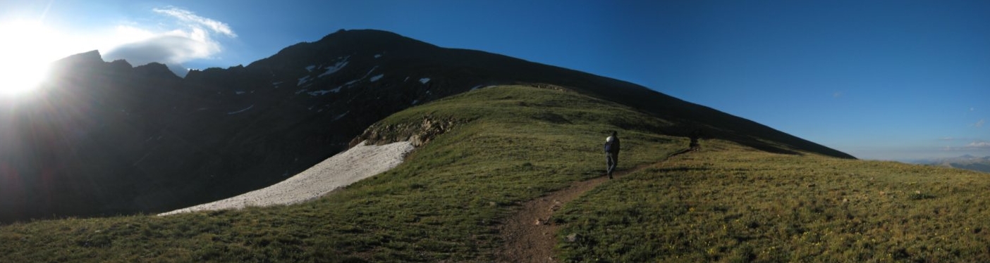
The first sign of snow near the trail appeared next to the summit. The trail ascended along the left side, avoiding any snow...
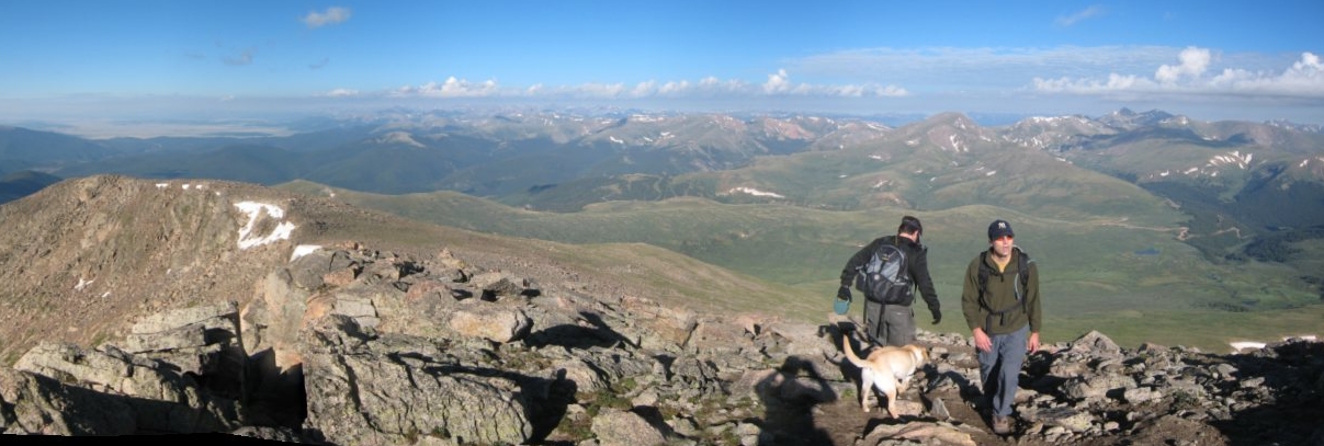
This guy and his dog were making their descent as we neared the summit...
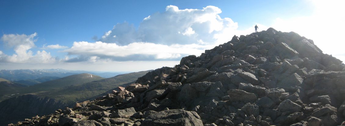
The final stretch to the peak was a very low grade short scramble...
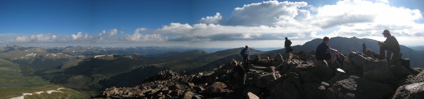
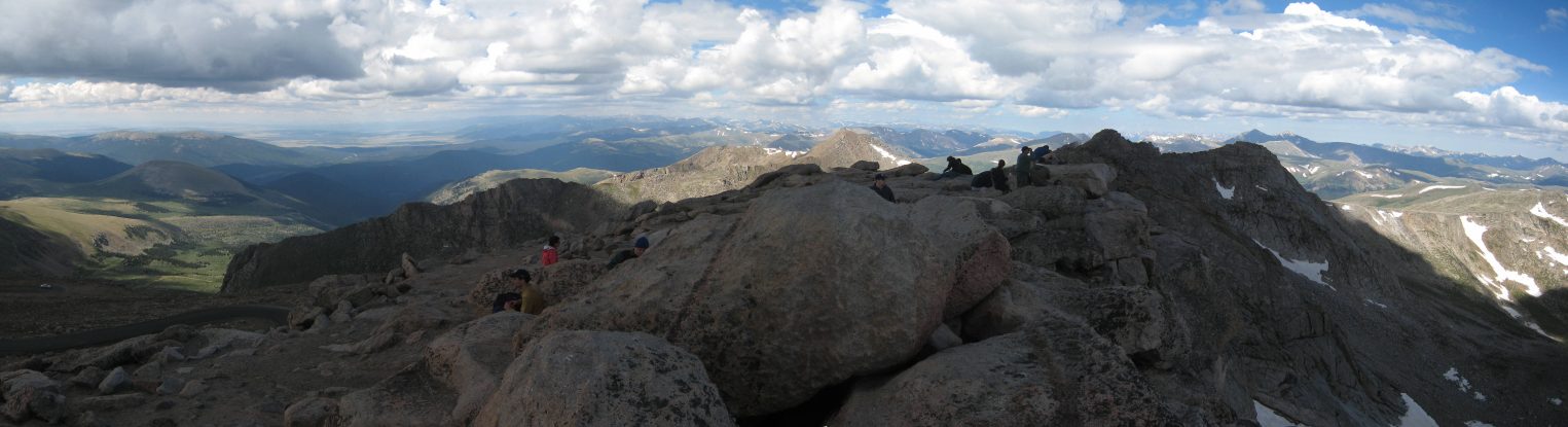
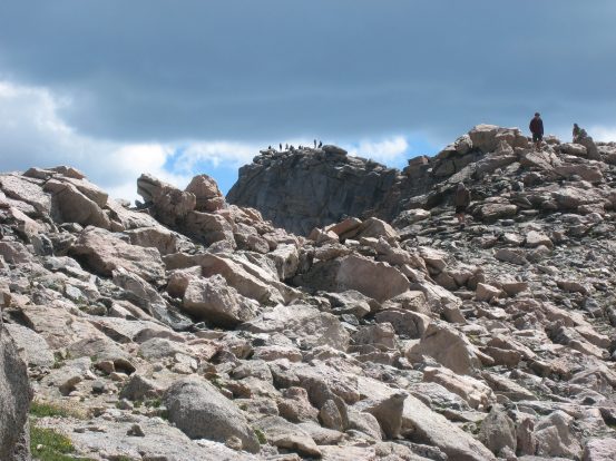
We reached the peak of Bierstadt at 8:15am. A handful of hikers were at the top, but there was plenty of space to find a quite spot. I understand this peak is packed with dozens of people later in the day...
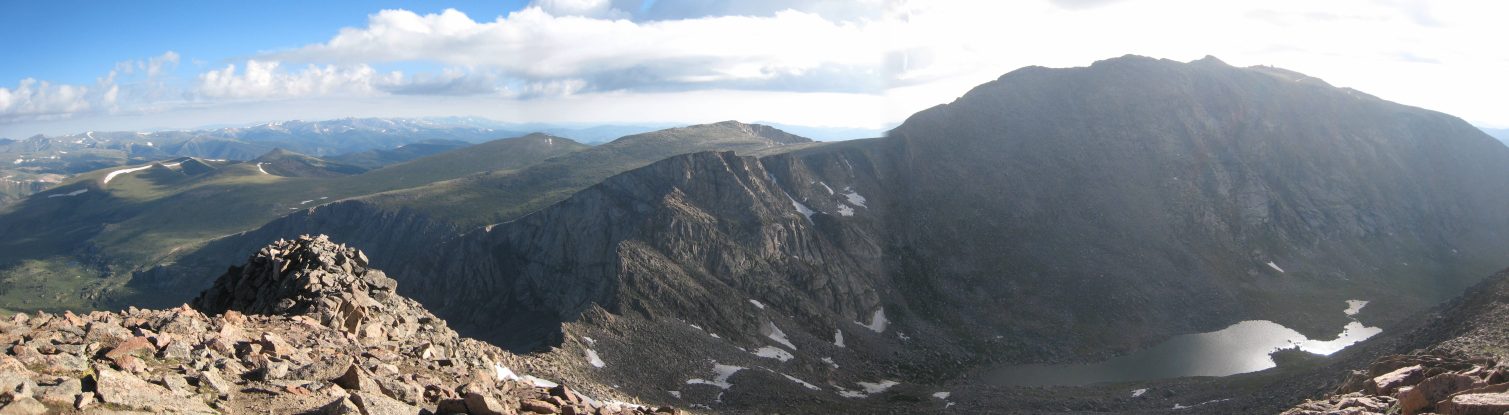
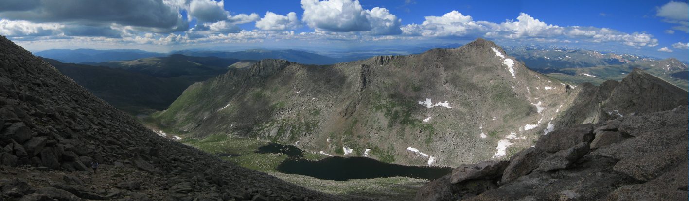
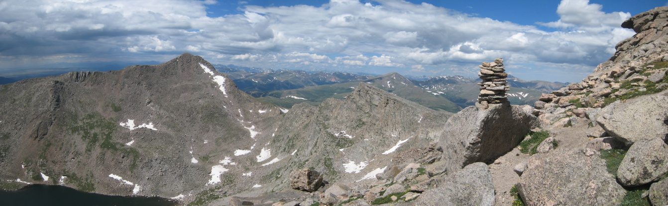
We sat down near the north end of the summit, overlooking the Sawtooth Ridge, and Evans on the right...
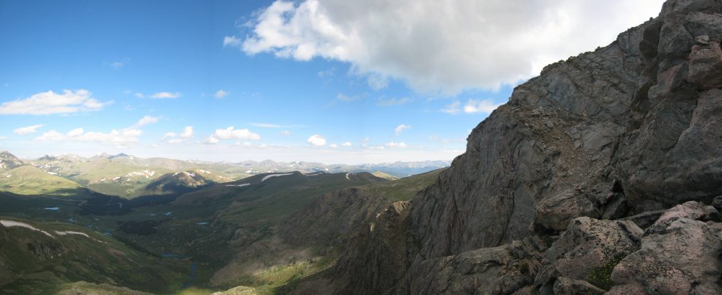
A look back across the summit to the south and west. The road to the trailhead can be seen in the distance...
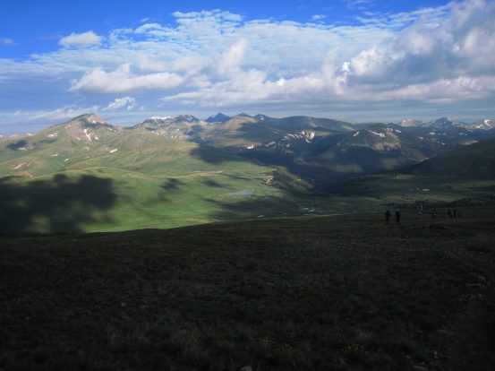
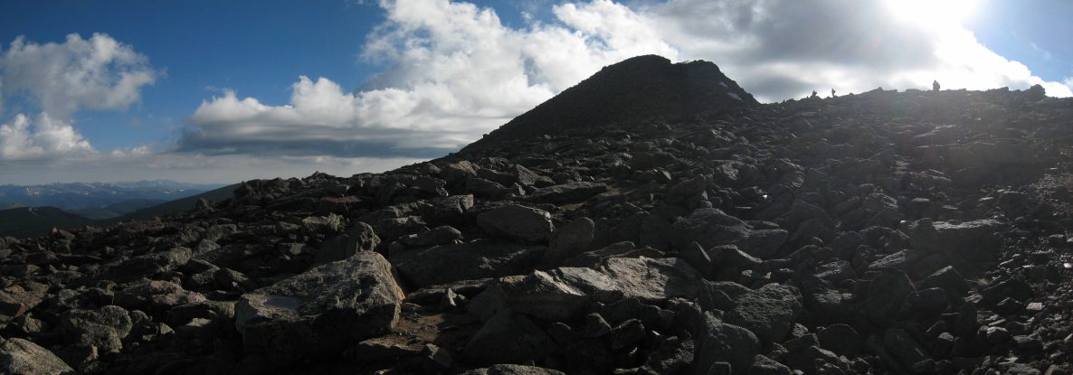
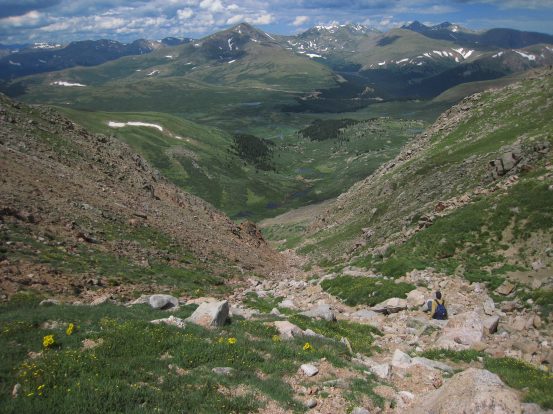
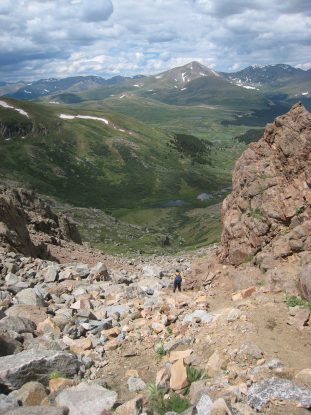
After a 10 minute break, we began the descent down the north side of Bierstadt to the Sawtooth, the main feature of today's hike...
There was a well marked trail heading down towards the Sawtooth, and it was pretty easy to avoid slipping on, or kicking down, loose rock (especially compared to descending Challenger last week)...
The grey clouds were not going away this morning, but at least they weren't gathering into a big mass. We could always bail on Evans and descend down on the other side of the Sawtooth if need be, so we continued on...
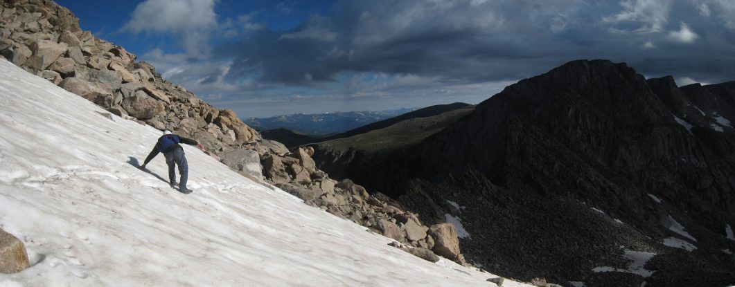
We encountered one soft snow patch during the descent, which was easy to dig into. It's possible to "under-scoot" it, but the standard route stays closer to the ridge, and it was a safe cross...
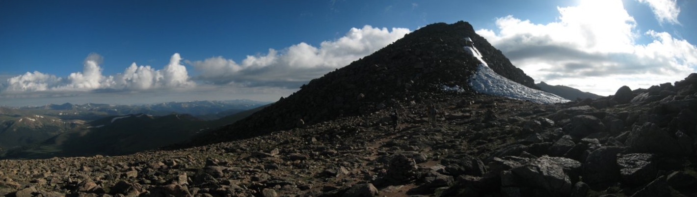
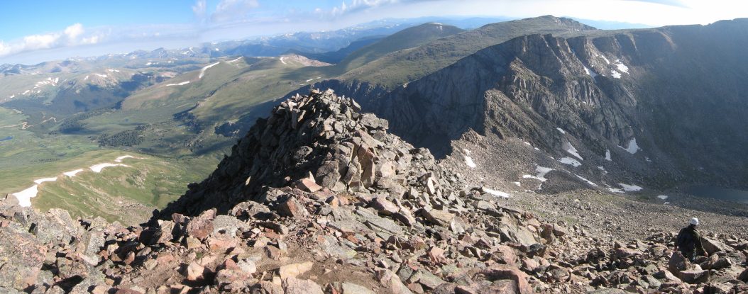
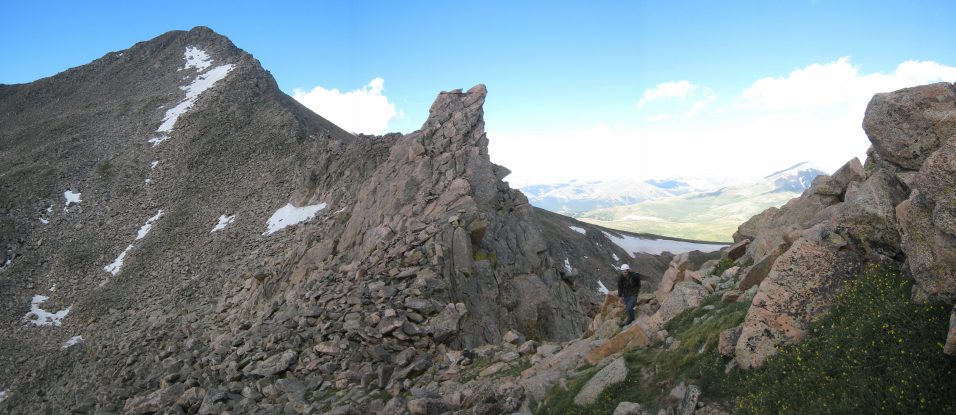
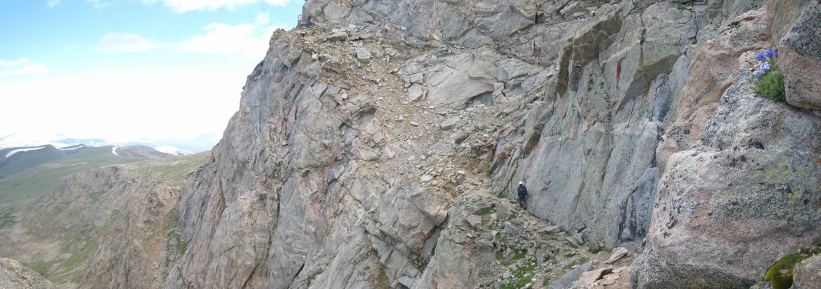
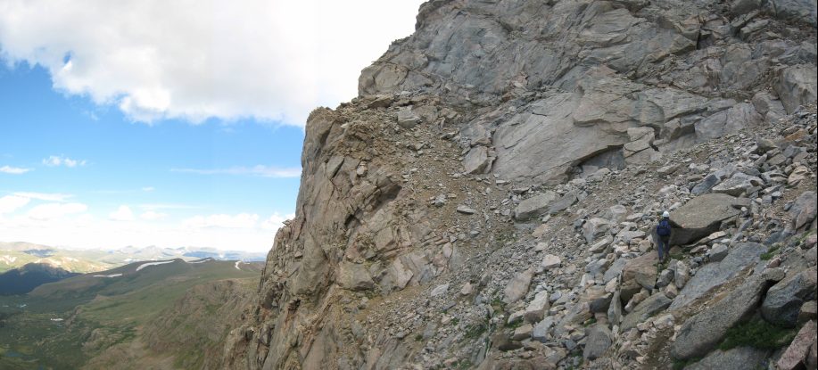
The trail continued to be well cairned, as it drew closer to the edge of the ridge. The Sawtooth was looking impressive ahead...
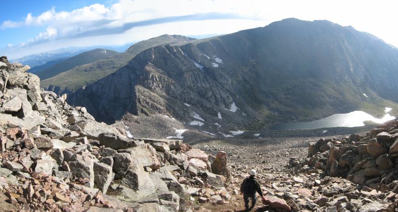
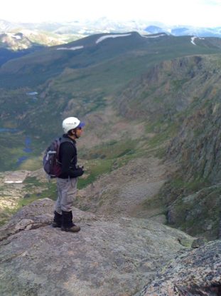
We reached the top of the ridge, and could look down the steep cliffs on the other side. Tom takes a pic with his iphone...
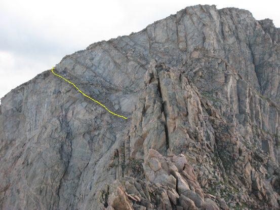
From the opening in the ridge we could see a swarm of ants climbing up the Bierstadt trail. Hikers were out in force today. Up ahead is a close-up of the "crux", the diagonal ledge leading up to the left side of the Sawtooth...
Here's the pic Tom took with his iphone, mentioned above, followed by a look back up to Bierstadt...
During the entire descent, I was using this dark line of rocks as beacon. The 14ers.com route description says the trail passes above it, and it seemed like a good target to keep in mind...
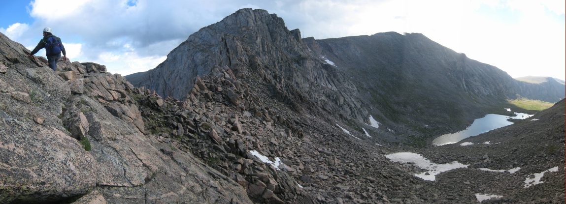
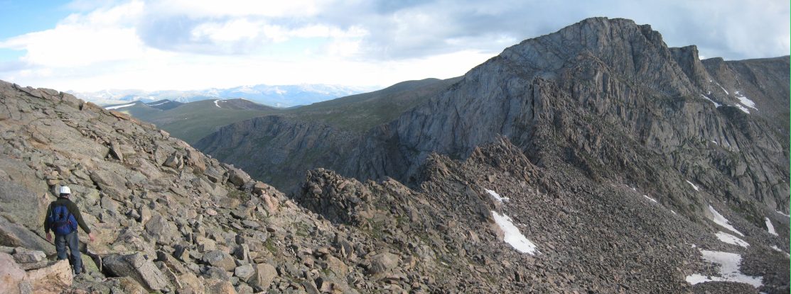
It was nice having the ridge entirely to ourselves while we were on it. Despite the large masses of hikers to Bierstadt, the Sawtooth portion adds quite a filter...
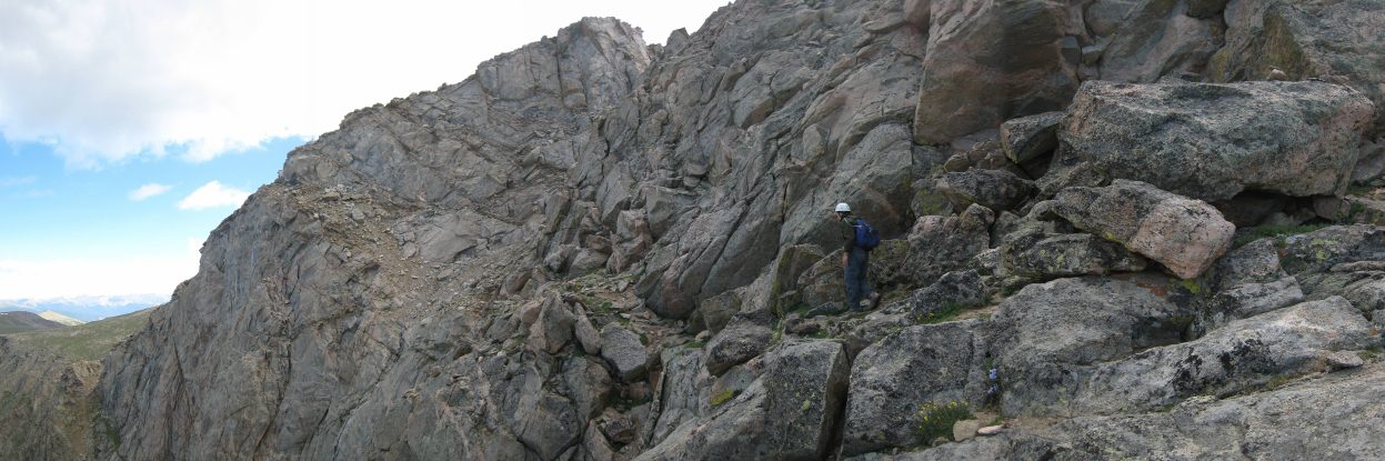
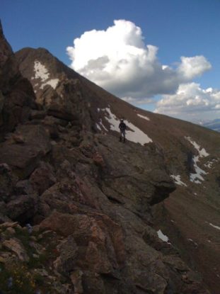
The trail held fairly well across the ridge, staying just to the right of the top. Tom prepares for a short scramble ahead...
As far as ridge hikes go, there's not a lot of exposure on this one, at least so far today. There was always a simple scramble to get around/over anything in the way...
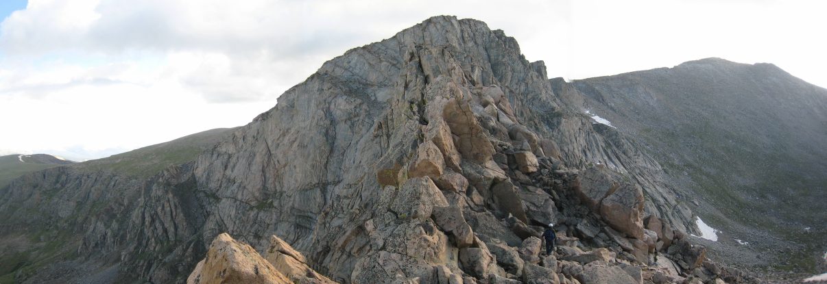
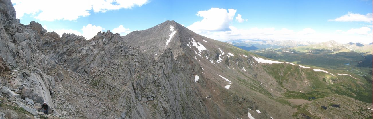
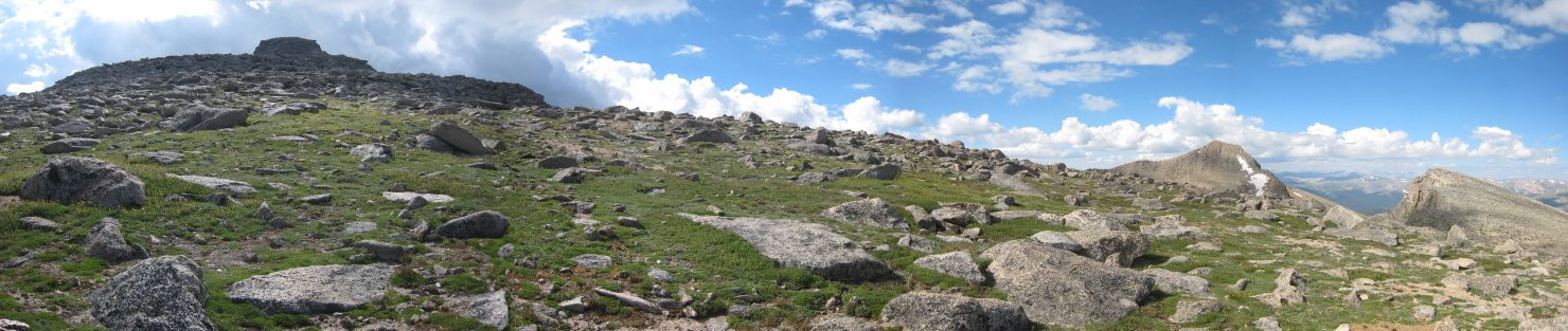
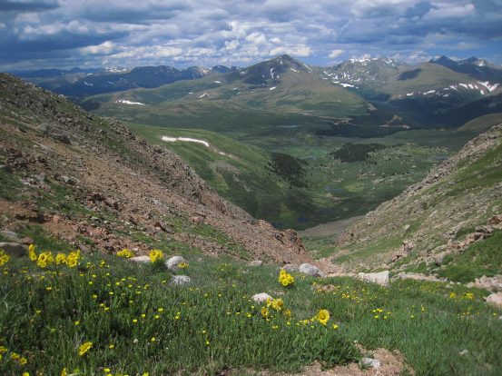
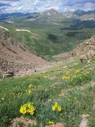
Finally we reached the low point on the saddle between Bierstadt and Sawtooth at 13,200'. There was some grass and yellow flowers sporadically distributed along the ridge area (as seen in the pic)...
From the low point on the ridge it's just a small climb (~150') around more rock before we cross to the other side of the ridge...
A look back at Bierstadt. We could see people standing on the top from time to time. After a short climb, we reached the crossover point...
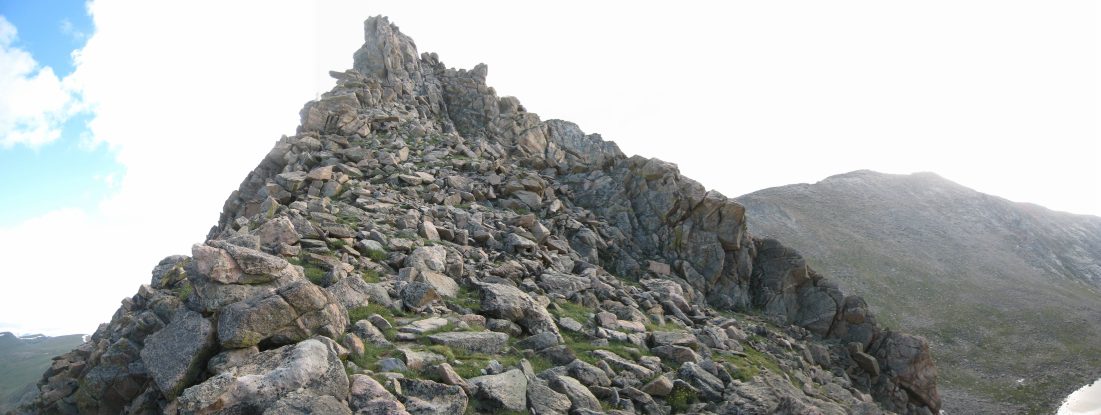
At this point we crested the ridge at a nice saddle spot on the left, and where excited to begin the "crux" of the Sawtooth...
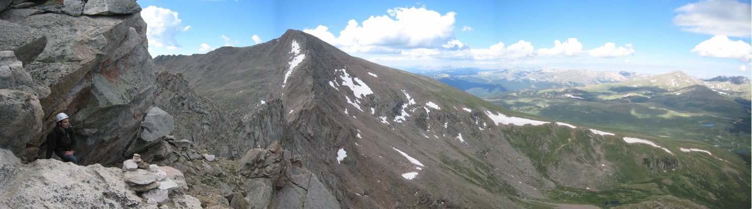
A first look from the saddle crossing. The slanty dirt slope on the rock ahead would be our path off of the Sawtooth Ridge...
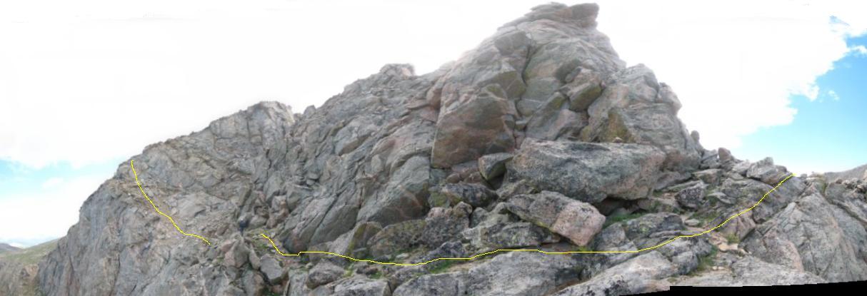
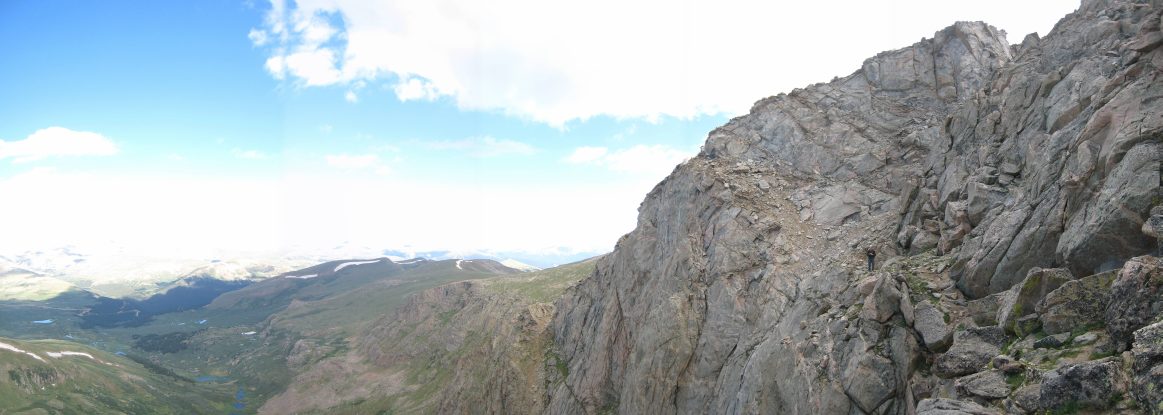
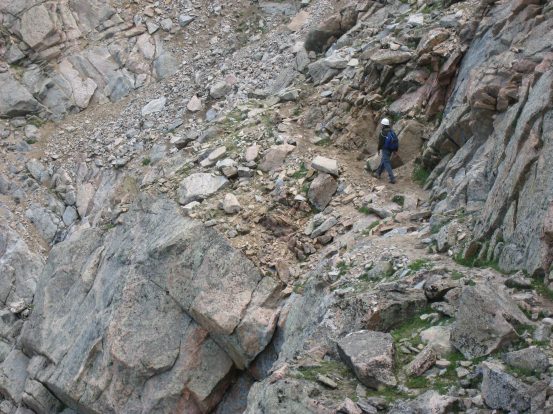
Here's a full view of the crux stretch from the crossover saddle to the finish. There is plenty of area to walk on the ledges, and there really isn't any cause for concern about the exposure...
Tom starts walking along the ledges. Looks a bit more exposed with a person to but things in perspective...
A look back at Bierstadt from the crossover point. A small speck stands atop its summit. Tom took a couple of iphone pics of me from where I took the above pics...
Tom stands along the ledge, before the upcoming short descent...
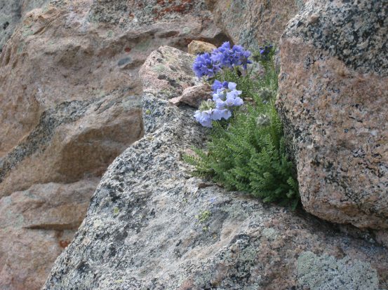
Tom stays close to the wall as the ledge narrows. Looks scarier that it is in person. How amazing is it that this lone purple flower plant on the right sits in such a photogenic location? Incredible that it found a place to grow among the steep rock here...
A close-up of the elements defying flowers, and a close-up of Tom nearing the low point of the ledges...
Tom (the dark spot near the bottom), helps put into perspective how wide the dirt slope ahead is...
It was simple to climb the slope, and one needn't stay close to the exposed edge...
Looking back at the sheer west cliff of the ridge, to Bierstadt. Tom makes his way up, in the bottom left...
Just as we reached the end of the Sawtooth, we ran into 3 people hiking in the opposite direction, who had intended to take the standard route up to Bierstadt. I thought it was impossible to get lost on the main trail, but apparently not. These hikers looked fit, and had done Kelso Ridge before, so this Sawtooth surprise may turn out to be an unexpected treat to their day (and hopefully not an painful death march)...
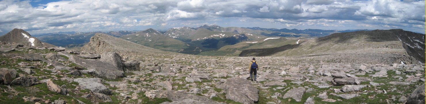
Once clear of the ridge, it was time to take a right and head up the gentle slopes towards Evans. It took us 1hr 15min from Bierstadt across the Sawtooth. Chris and Justin radioed in and reported that they were half way down Bierstadt already...
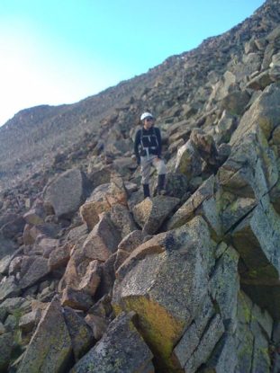
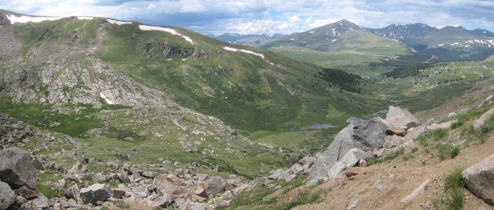
Many rocks were scattered about the smooth tundra, including a sharp jagged one. After bagging Evans, we would be descending down a gully to the left to cut back to the trailhead, instead of traversing the Sawtooth again...
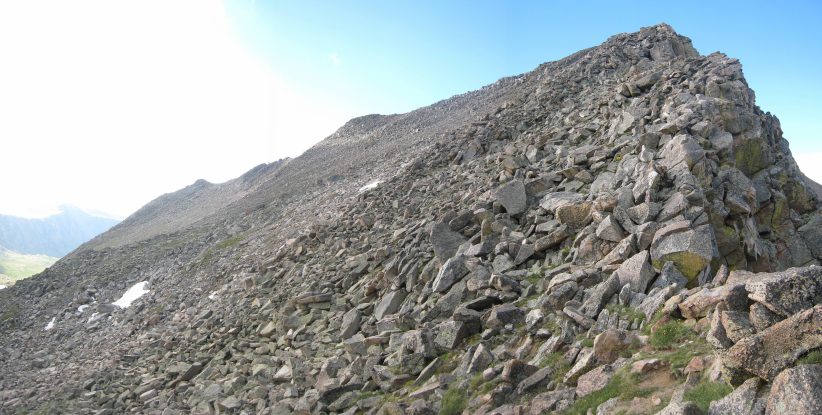
The trail was not marked well in this area, so it was mostly a "try to step on as little tundra as possible" type hike until we eventually saw some cairns, and the rocks thickened. Bierstadt sticks up on the right, along with the Sawtooth. We aimed for the large mound on the left...
A peak back at Bierstadt and the Sawtooth ridge, as we make our way up the slope...
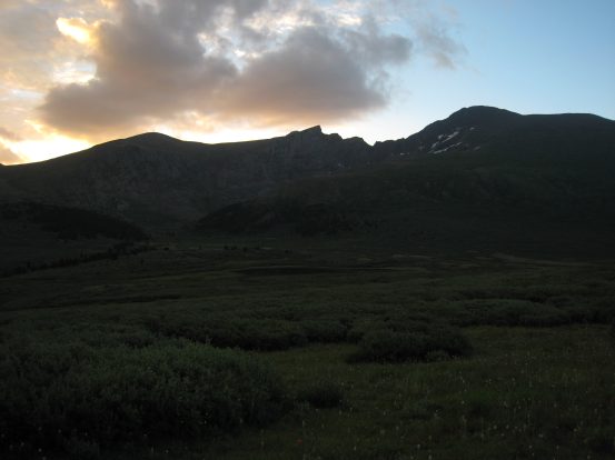
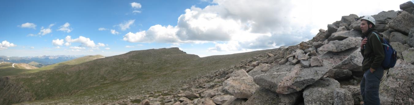
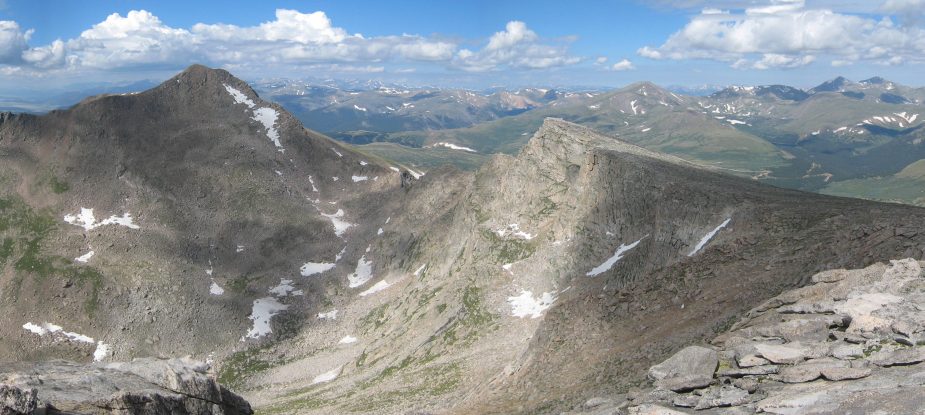
Evenutally we reached the start of Evan's ridge at 13,900'. Several people were stopped at this scenic lookout, most targeting just Evans today, having bypassed the Sawtooth by ascending the gully we'd be descending later. On the left you can see the Mt. Evans road that goes all the way to the summit. Mt. Evans still lies .7 miles further on this ridge...
One of the guys resting here took a photo of us, with Bierstadt to the left of Tom...
The clouds were still gathered above, but continued to stay benign. Bierstadt's long east ridge is pictured here, which is another, much less traveled, but (reportedly) spectacular route to the peak...
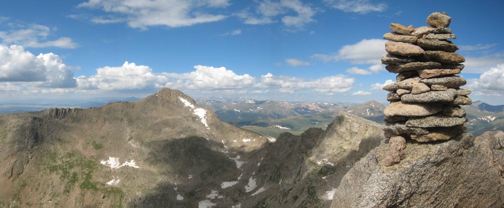
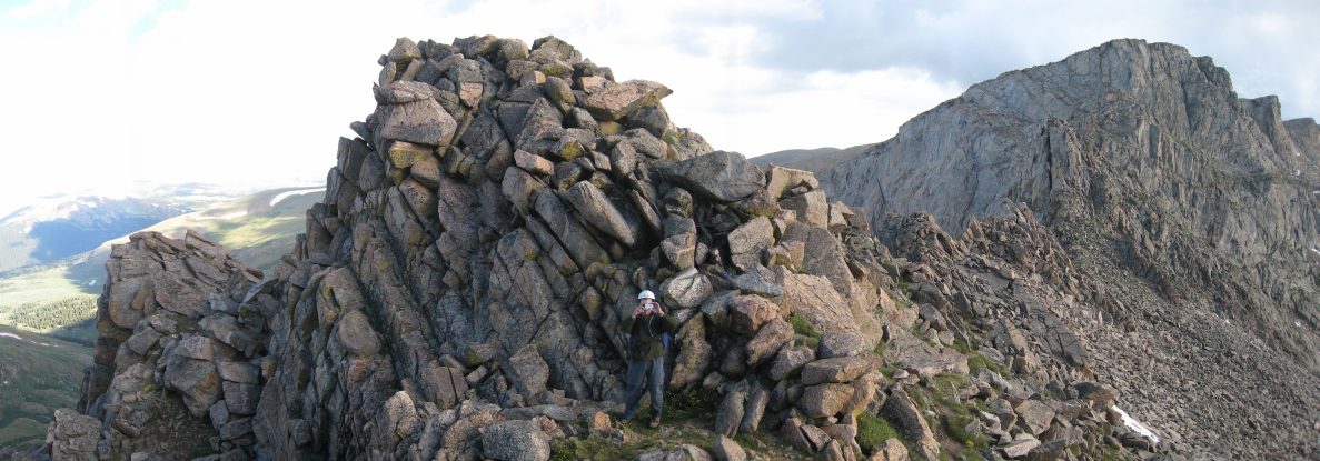
High quality cairnsmanship was displayed along the Evan's ridge trail...
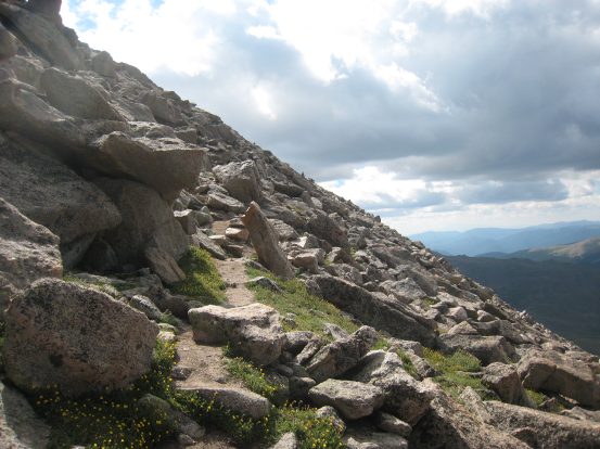
The trail quickly became a gently sloped rock scramble. The trail was well marked throughout. We saw several people coming and going on the trail...
Another look back at Bierstadt and the Sawtooth Ridge. You can see the snow near the top that we crossed, and the arrow marks the spot where we crossed to the other side...
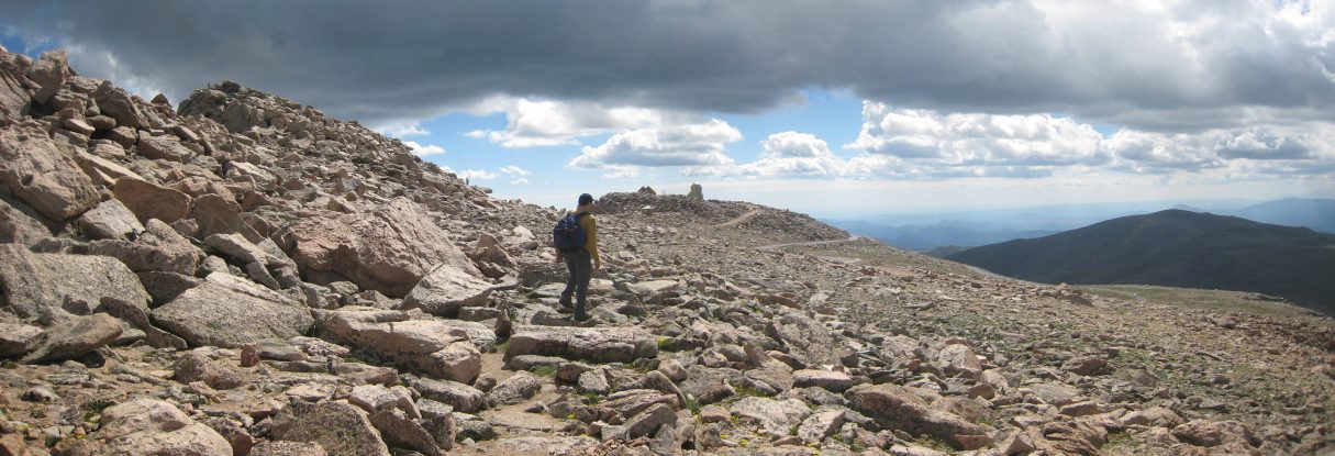
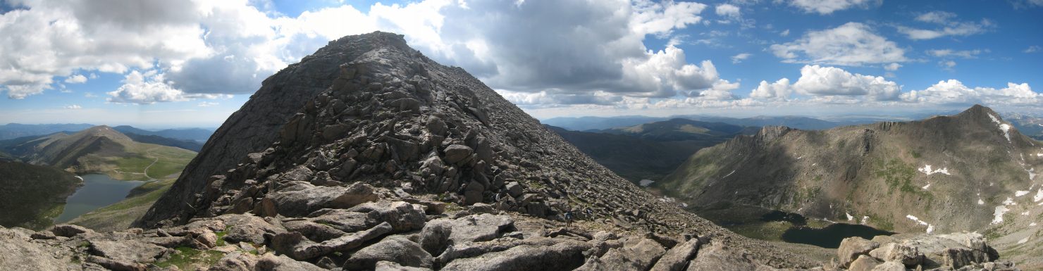
As we neared the summit, we could see the observatory ahead, and several cars and motorcycles rounding the bend in the road. The peak is on the left side of the pic...
After a ton of extreme, almost wheel chair accessible switchbacks, we reach the summit at 10:40am, along with plenty of tourists in sandals and dress shoes. Here's a view to the northeast...
And a view to the southwest. It was VERY chilly and windy at the peak. I had stripped down to my short-sleeve shirt during the hike, but had to put on another two layers up here...
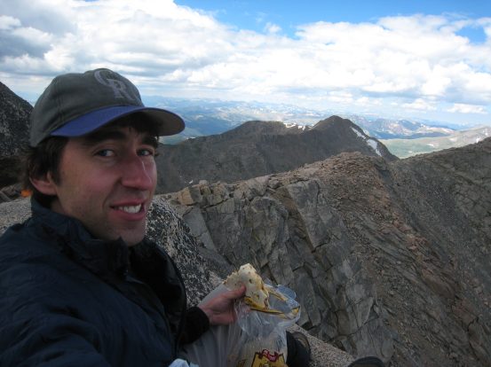
We crossed over to the west side and found an isolated cozy nook that faced Bierstadt to lounge and eat lunch. My peanut butter, banana, choc chip tortilla was ok, but the choc chips didn't quite pan out the way my imagination had hoped...
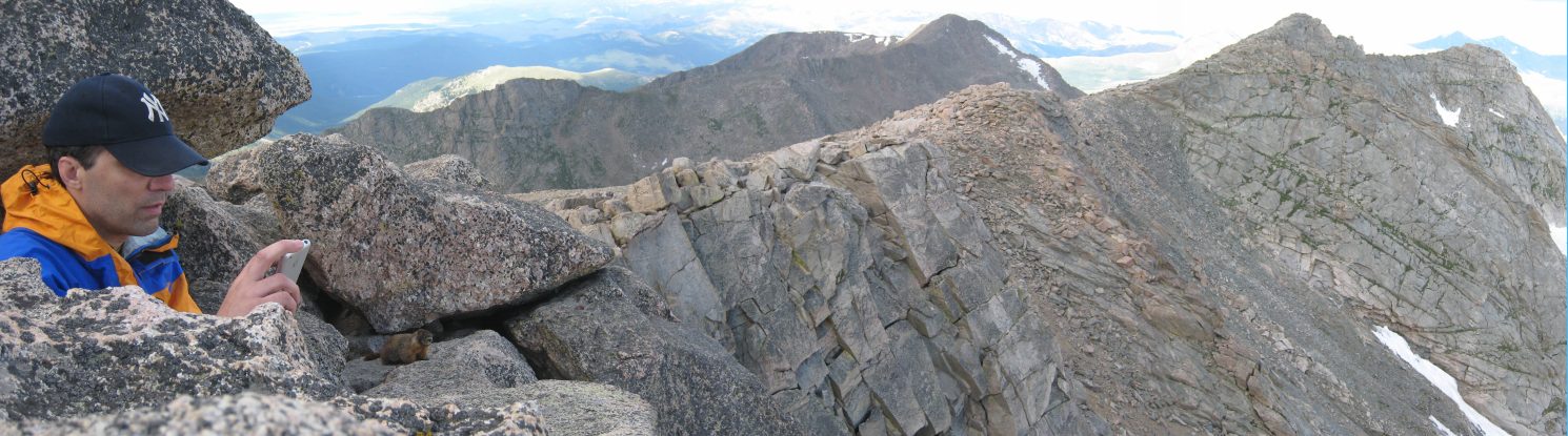
Tom had cell phone reception and tried calling Chris and Justin. We hiked in to Mt Evan on the near ridge, and the far ridge is Bierstadt. Notice the furry visitor that showed up next to Tom...
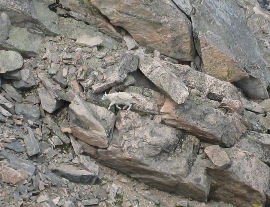
Here he is, perhaps checking for any crumb fallout. We also spotted a mountain goat down in the valley below, and watched him scamble up the mountain side...
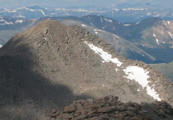
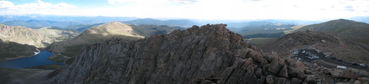
The goat made it's way to the top of the ridge, pictured here in front of Bierstadt. After hanging out at the summit for 20 minutes, we began our descent. Here's a look back at lots of people standing on the summit (in the center)...
We hiked back along the ridge, which suddenly became a lot warmer once we left the summit...
Soon after this last pic was taken, I felt myself start to trip on a rock, and was surprised to find myself unable to recover, and all of a sudden I was falling forward, smashing my shin on a rock, and landing on my hands. I tried to get up, but couldn't, and found that the shoelace hook on my gaiter had somehow caught on the edge a rock, which had sent me tumbling. I assumed it would leave a nice bruise on my shin no doubt, but fortunately the sharp pain was gone after 30 seconds, and I continued the descent, feeling a little betrayed by my gear.
Otherwise, the hike back across the ridge was uneventful, but still very scenic. Several more hikers passed us by, but the trail wasn't what I'd call "crowded" by any means...
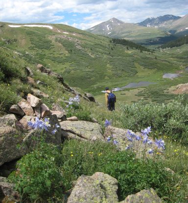
When we reached the end of the ridge, we let the broad slope gently funnel us towards the gully that lies beyond. There was no marked trail...
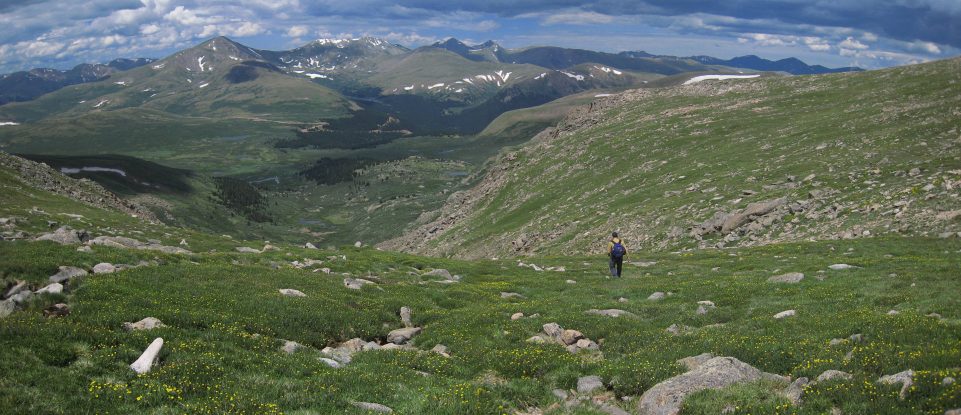
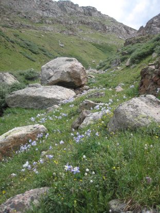
The grassy tundra was beautiful, with plenty of yellow flowers. I turned my ankle on the uneven ground, aggravating a nagging injury from the past couple weeks, and decided I'd take an ibruphofin, since I always carry them with me, but never use them. The injury was very mild, and would only mean I'd have to be more careful where I stepped...
There were lots of colored flowers scattered in the tundra. Soon we reached the top of the gully and picked up a trail heading down. The parking lot looked very far away, out by the road...
We radioed Chris and Justin again, just before descending the gully ~11:55am. They were watching a DVD in the car, and said they could see us along the top of the ridge. The gully was gorgeous, full of flowers in the tundra portions. The trail was well broken, and wasn't too loose or slippery (especially compared to Challenger last week)...
We made our way down, and could see the infamous willow area below amongst the ponds. Looked harmless from up here, but everyone says it's a muddy bog and a big slow nuisance to trek through...
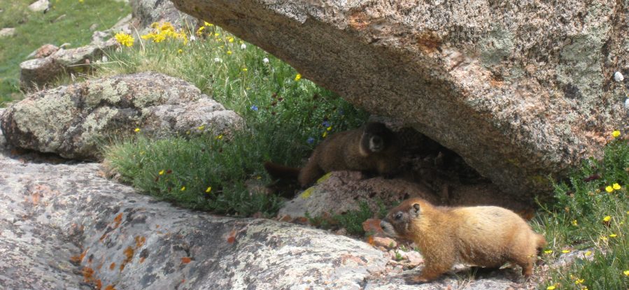
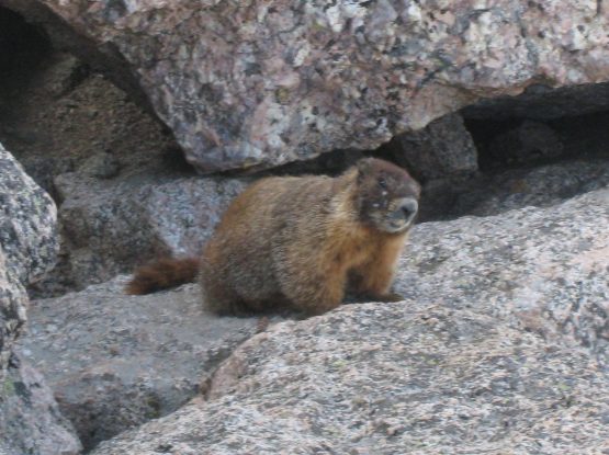
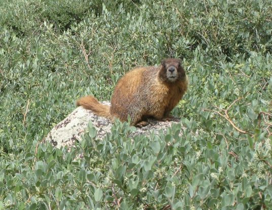
~2/3rds of the way down, we found some marmots, and more flowers...
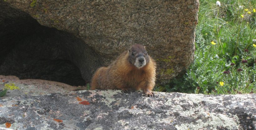
This marmot has a scenic home...
Another marmot, perched on a rock amongst the willows. We passed a vein of Columbine flowers too...
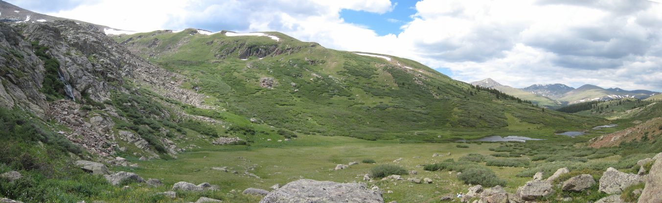
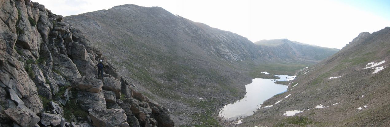
As we reached the bottom of the gully, we saw a waterfall emerge on the left (pictured). We saw very few hikers on the trial since we started the descent down the gully. It was great feeling at one with this beautiful area...
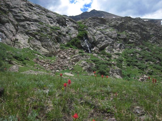
We could see the parking lot way out in the distance. It still looked far away, but we were making good time. It was 12:35pm when we finally reached the floor of the valley. Here's another look at the waterfall, with Bierstadt in the backdrop. More flowers down here...
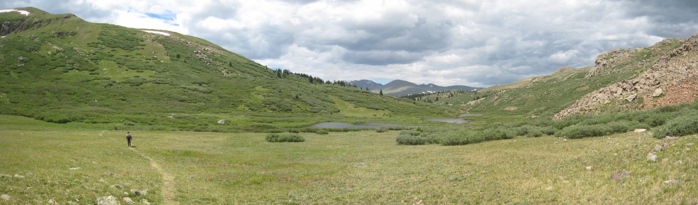
A wide view of the open valley. The trail is about to head into the willows, where things get messy. The trail was pretty visible up to this point, and I remembered reading about keeping the ponds and stream on your right side when hiking back to the trailhead. Good advice if the trail becomes questionable...
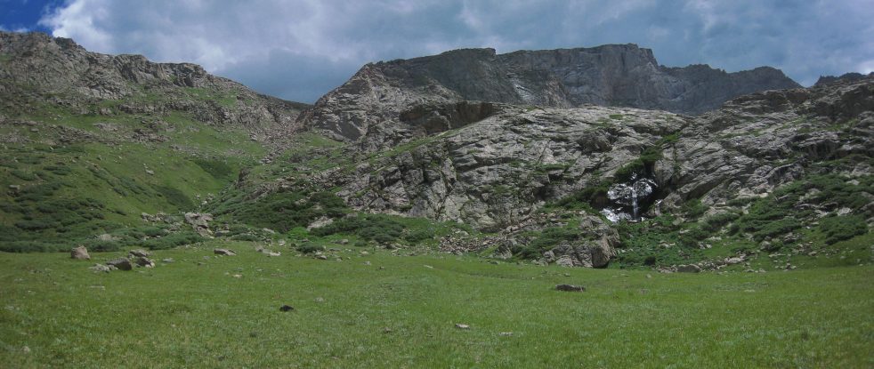
A look back at the gully we descended to the left of the waterfall. The Sawtooth Ridge towers above...
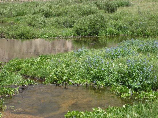
Our introduction to the willows was immediately wet and muddy. We cross a narrow muddy stream (that had some cool blue flowers), and found ourselves slogging through a bog...
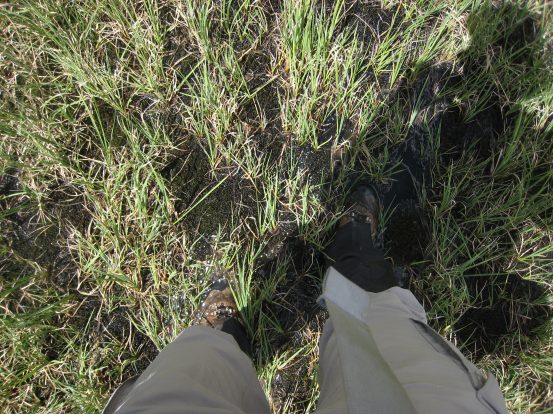
A pic straight down of my feet half submerged in mud. Moments after this pic, my right leg sunk in at least 18 inches just past the top of my gaiters. I wore my gaiters all day for this section, and it was finally paying off (despite my fall earlier). Anyone wearing a loose low-top shoe may lose it here. Sometimes it was possible to avoid the mud by walking on top of the downed willow bushes as much as possible...
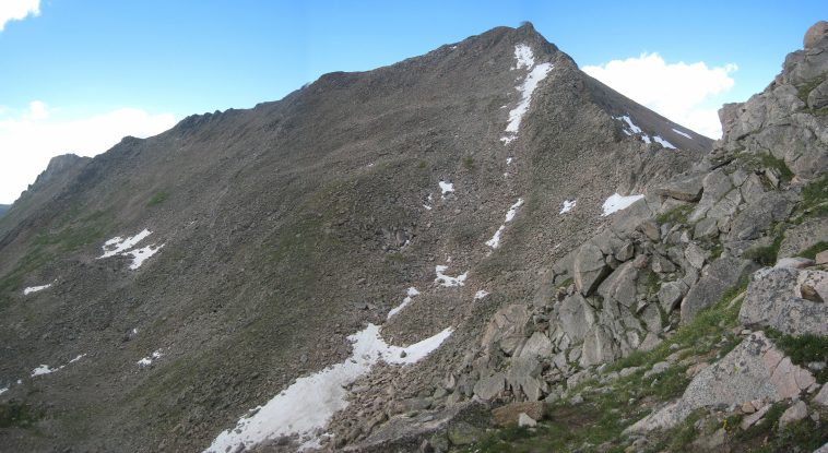
The view back, after passing the first batch of willows. The full Bierstadt - Sawtooth ridge is seen above, with the descending gully on the left...
A close-up of the Sawtooth Ridge, with Bierstadt on the right...
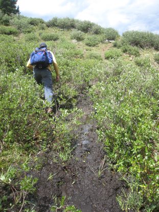
We weaved through the thick willows. The trail forked often, and we took which ever path seemed more broken in, or more dry. They all seemed to re-converge again later, and again fork...
A pic of Tom, keeping the stream to the right. :-) More mud on the trail. I again sank 18 inches into this stuff on the same foot. But the gaters were holding well. My feet were dry...
~1pm we reached the main trail, and rejoiced at seeing the boardwalks. No more mud! A look back at Bierstadt, the ridge, and the gully. Lots of people were on the trail...
We reached the parking lot at 1:23pm, and met up with Chris and Justin. They were impressed with our speed, as they had only been back for a couple hours. During their descent they estimated that they passed 70 hikers. Certainly a busy Sunday. Here's a couple of close-ups of the gully, and ridge...
When I took off my gater, I saw a large pink/red circular stain on my pants, and was confused. When I pulled up my pant leg, I was shocked to see an extremely deep hole in my shin! I'll let the pic below describe the detail. I couldn't believe that I felt absolutely no pain, but it looked like I had been shot. I was checking to see if any bone had been chipped, cause it looked so bad, but everything checked out ok. The fact that it didn't hurt at all either meant it wasn't too bad, or maybe it was totally numb. Tom, Chris, and Justin were all grossed out, and shocked that I wasn't in huge pain. I had a long horizontal imprint still etched in my leg from the edge of the rock. My gaiter and pant leg didn't have a puncture hole, so nothing made it's way inside, fortunately.
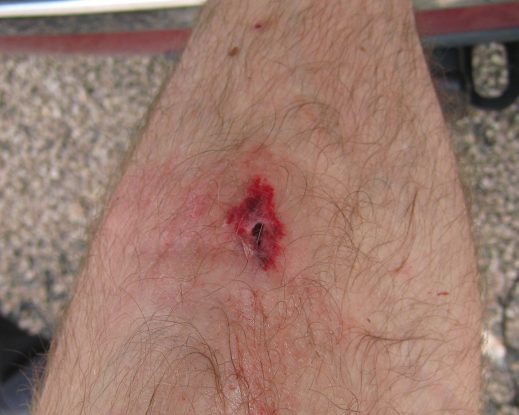
I think a BB pellet could land in there and not hit rim. Tom offered some alcohol pads, which stung a bit, and I lubed up with my neosporin before covering it with a band-aid. I'm glad Justin reminded me that I should get a picture, cause it totally wasn't in my train of thought at the time...
I was still baffled at why I had no pain, but given I just descended ~3000', I figured I was fine, barring potential for infection. I planned to stop by Urgent Care when we got back to Fort Collins to see if I needed stitches. We loaded the car, and stopped at a Burger King in Idaho Springs on the way back, before arriving in Fort Collins ~4:45pm. I took a shower, and then drove to the hospital down the street, where the doc sewed me up.
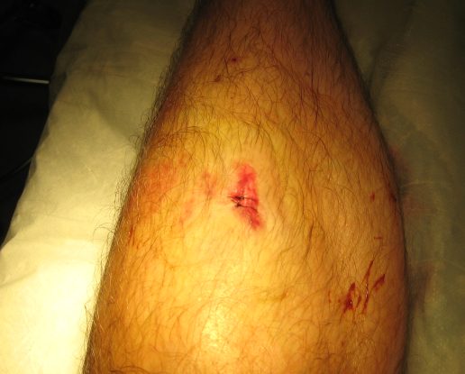
I happened to have my camera with me at the hospital, and conveniently took one last pic for this web journal. The doc thought I'd need three stitches, but two were enough. He was very surprised I had no pain too...
Thus concludes another successful 14er outing, upping my total to 12, and 6th of the year.