Challenger Point (14,081') & Kit Carson (14,165'), Sangre de Christo, CO, July 19th, 2008
For best viewing, maximize your browser window
After a 3 week hiking lull, I joined up with Chris (whom I hiked with on Belford/Oxford earlier this year, and who organized this trip), Tom (whom I hiked to Richtofen with last month), and Chris Sadler from work (I'll use Sadler in this report, since there are two Chris's) on a quest for Challenger Point and Kit Carson, two 14ers down in the Sangre de Christo range.
Friday, July 18th, 2008
We left from work ~10:15am Friday in Tom's Jeep. Chris and I had the option of watching a DVD from the back seat entertainment system, but the usual "pre-game" 14er excitement had us all chatting about mountains and adventure for the 4+ hour trip. The many giant 14ers out the window that we passed along the way only helped fuel the conversation. Tom mentioned how he loves seeing Mt. Princeton pop into view when driving on rt 285. Several times he would get excited as a new peak came into view around a bend, claiming it had to be Princeton. Eventually his beloved 14er did come into view near Buena Vista, where we stopped for a lunch break.
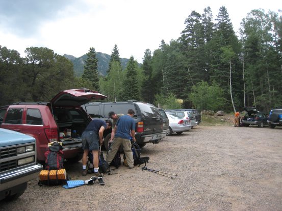
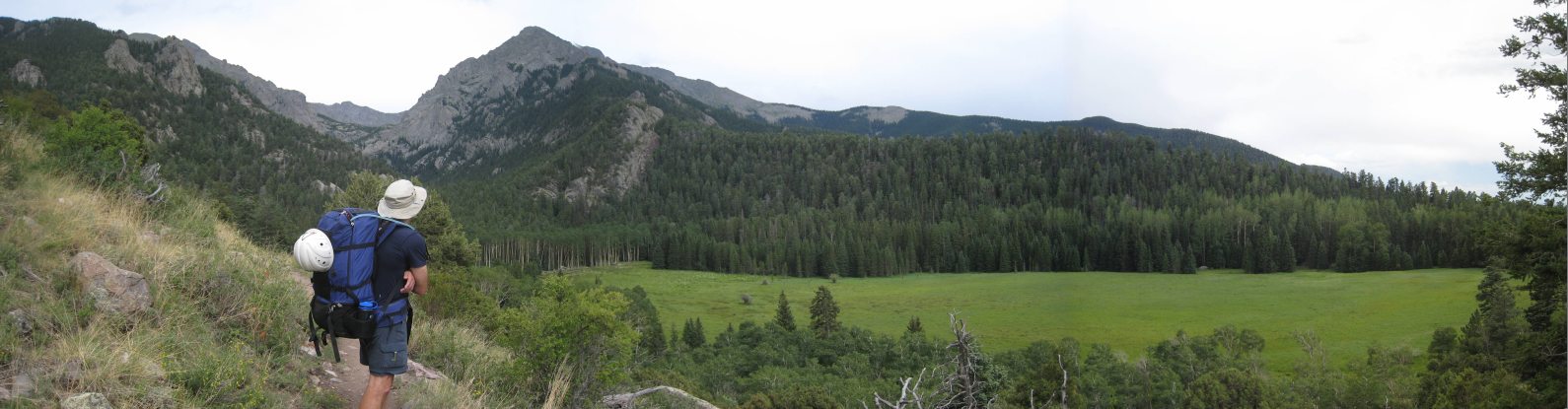
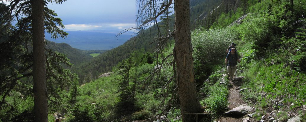
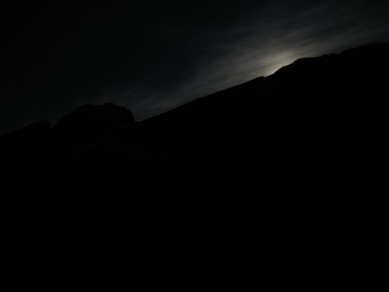
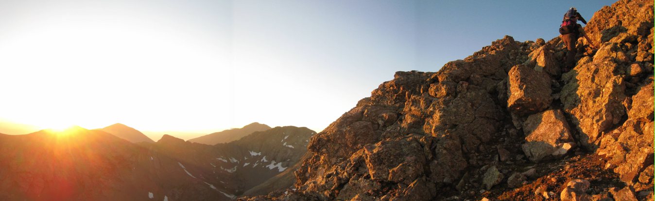
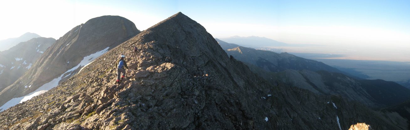
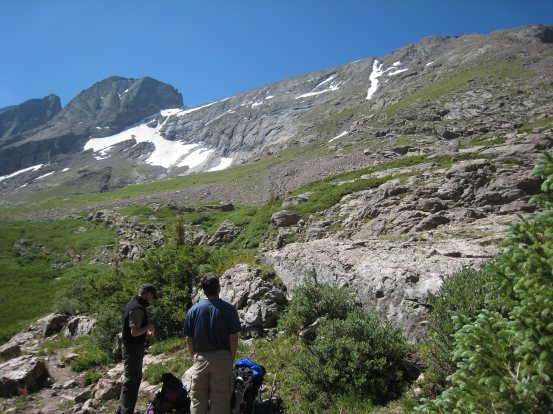
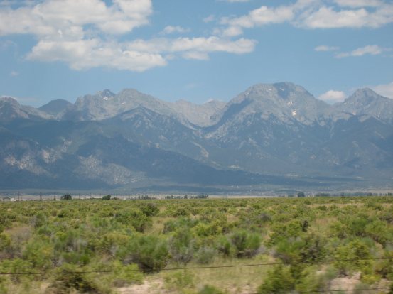
Throughout the drive, there were large masses of grey clouds gathered above the mountains around us, though the road managed to stay in the sun most of the time. The forecast for today was 40% chance of rain at the trailhead, and I was expecting to get wet today during the hike in to Willow Lake, if only for a brief cloud burst. As we neared our destination, we could see the Sand Dunes ahead to the south. We turned east towards the town of Crestone, located at the foot of the mountains, and now beheld the behemoth Challenger Point directly ahead, closing in. Soon we reached the turn-off for the 4x4 road to Willow Lake trailhead. The road was very smooth for a 4x4 road, and I bet a passenger car COULD make it, but I probably wouldn't try mine out. We arrived at the trailhead ~3pm and readied our packs for today's 4.5 mile, 2700' gain trek to Willow Lake.
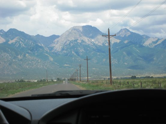
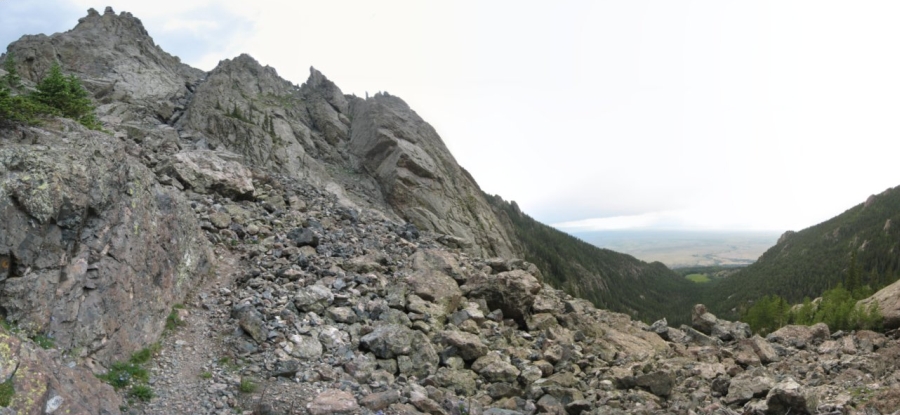
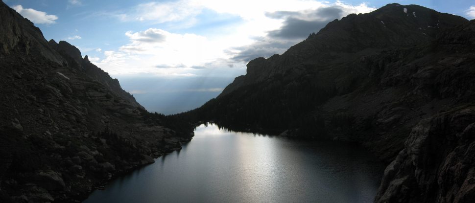
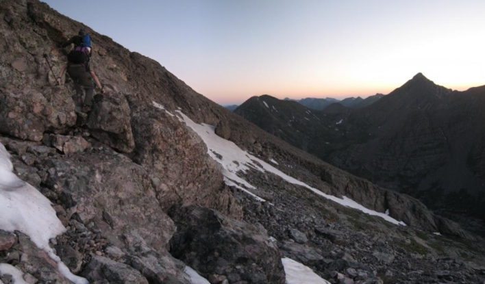
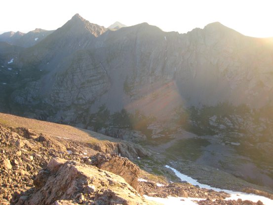
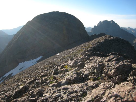
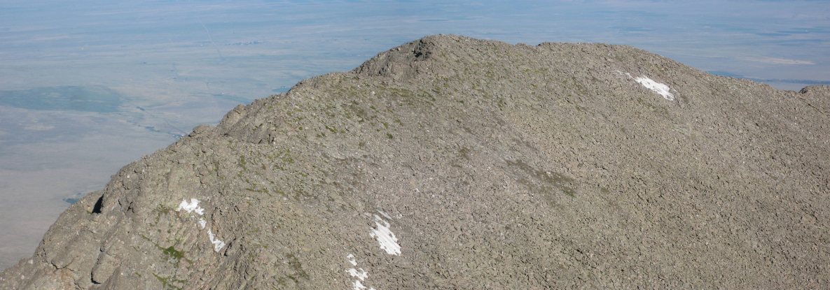
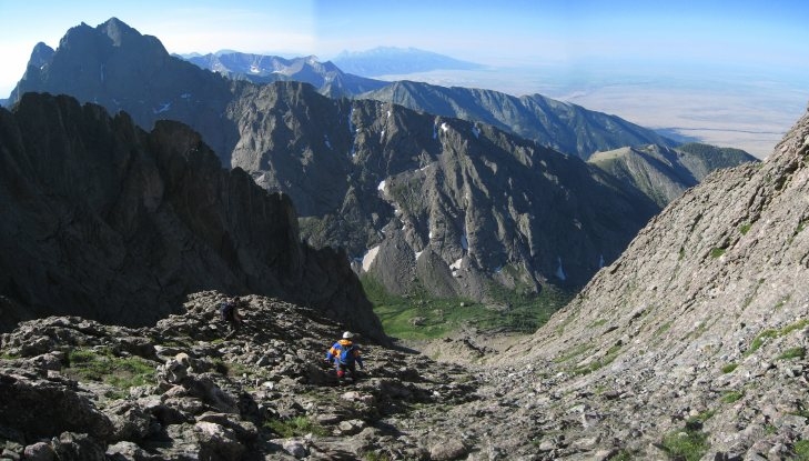
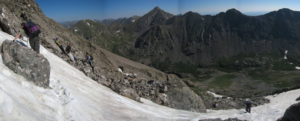
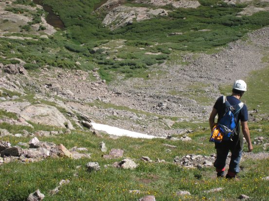
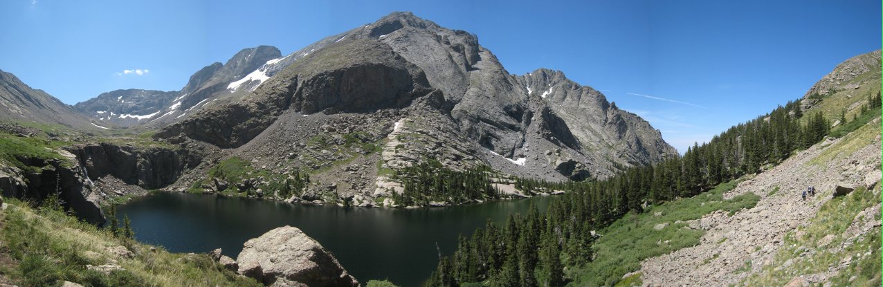
Challenger Point, the shaded ridge in the center, looms large as we drive east towards Crestone. After a benign 4x4 road, we arrive at the crowded Willow Lake trailhead at 3pm on Friday. The glut of cars made us wonder at the availability of campsites at the lake...
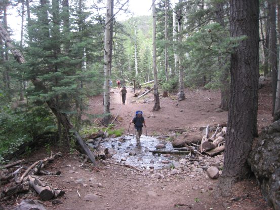
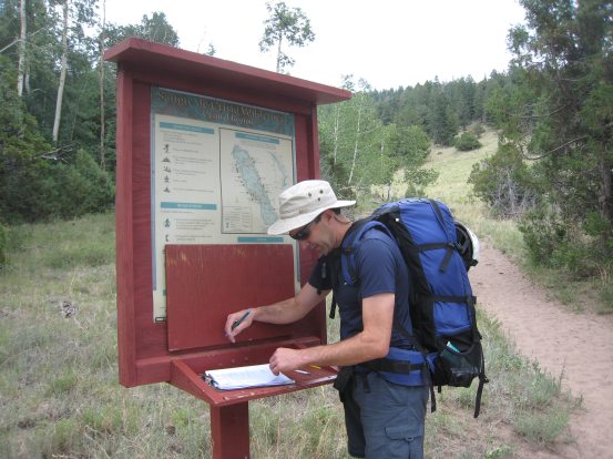
We started our hike at 3:13pm under cloudy skies, and soft rumbles of thunder. Immediately we crossed a stream, where I managed to slip and spash my foot in the water. Tom signed us in at the register. We counted ~25 people signed in and camping at the lake...
The first 40 minutes or so was all extremely gentle switchbacks, the kind that make you wonder why they didn't cut the trail straight up the hill and cut off 2/3rds of the distance. But then you remember your heavy backpack, and realize the gentle slope is worth the extra distance. It was obvious this was a backpacker's trail, designed for people carrying heavy loads.
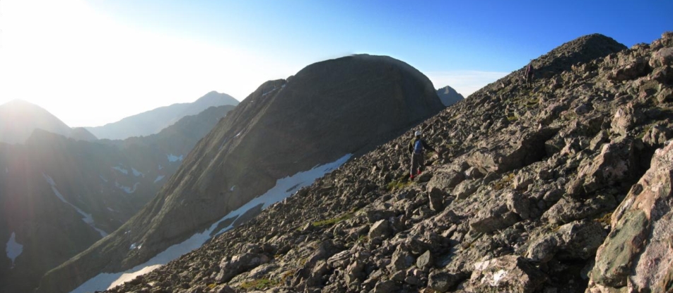
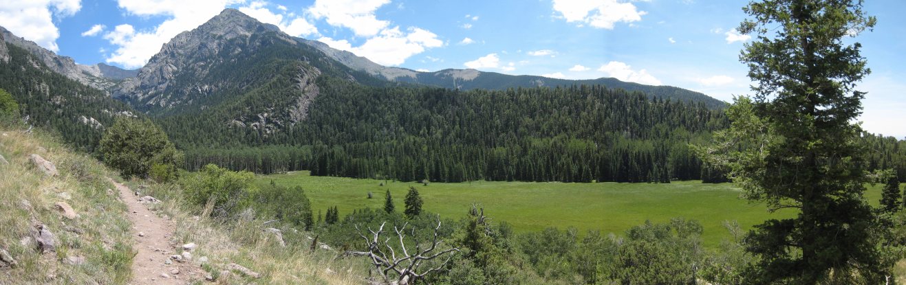
We hiked at a swift pace, and stopped briefly after ~40 minutes at large meadow, the first good view of the hike. I took some pics, and then found myself feeling light headed and starting to faint. I guess my body was a bit out of shape, but a quick 15 second sit on a log had me ready to go again. Right after we started hiking again, Tom found a snake on the trail. I don't think I've seen a snake at 10,100' before. It made it's way into the brush, and we continued on.
The first open view of the hike. Tom called it a "soccer field". Up ahead we could see the big ridge leading down from Challenger, and the basin where Willow Lake resides to its left...
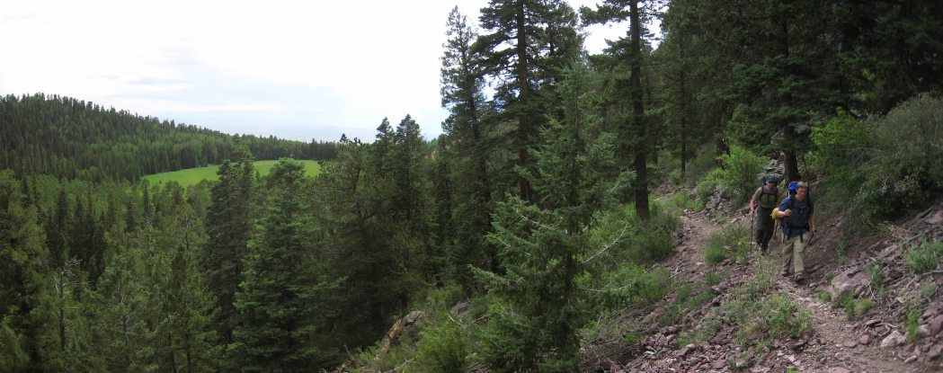
The trail straightened out and headed east towards the mountains, as the grassy field fell back into the distance...
The thunder stopped, and the sun bathed us from time to time, but grey clouds continued to dance around up ahead, and started to fill in the valley behind. It seemed wise to keep pushing for the lake, and hoping to set up camp before any rain came...
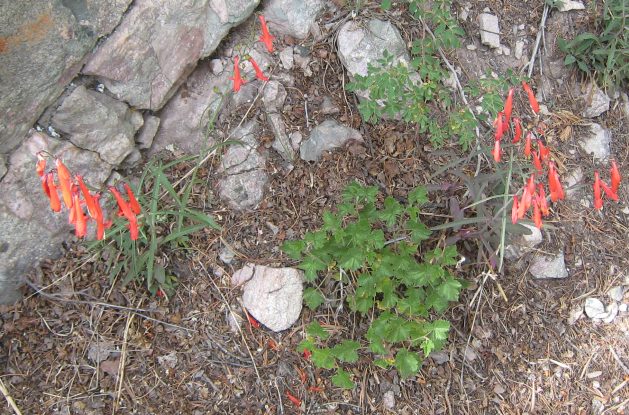
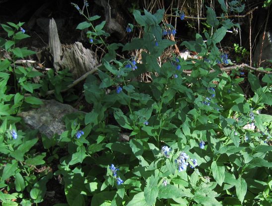
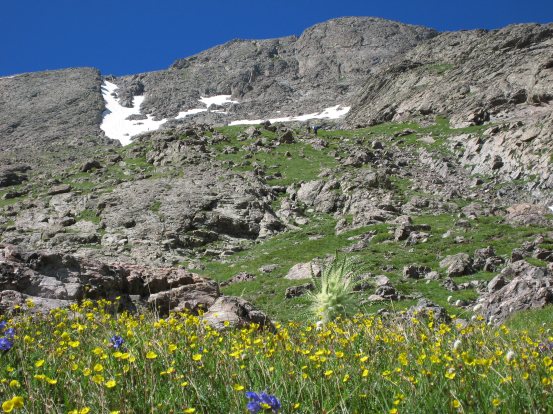
Some long red flowers that we hadn't seen before on other mountains appeared next to the trail, along with the familiar blue bells...
The trail steadily climbed the north side of the valley, and the grassy meadow faded further down the valley...
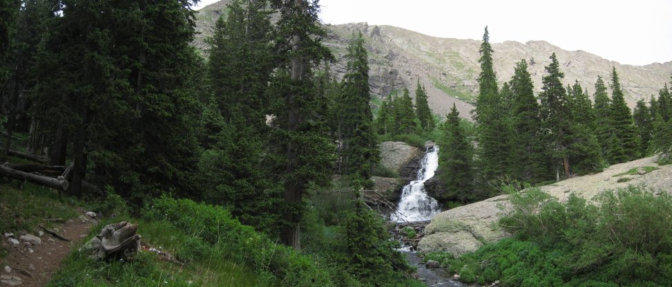
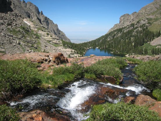
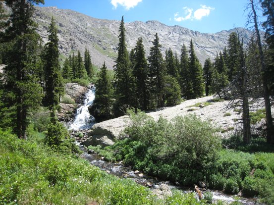
Eventually the trail led to a stream, fed by Willow Lake much further up. We could see cascades up ahead...
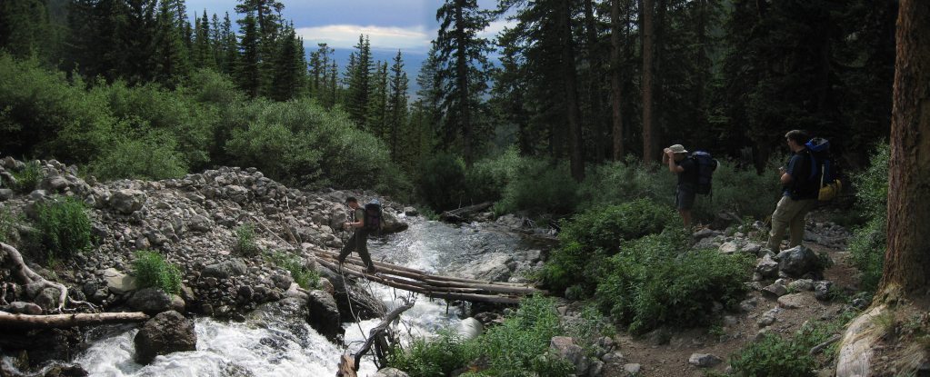
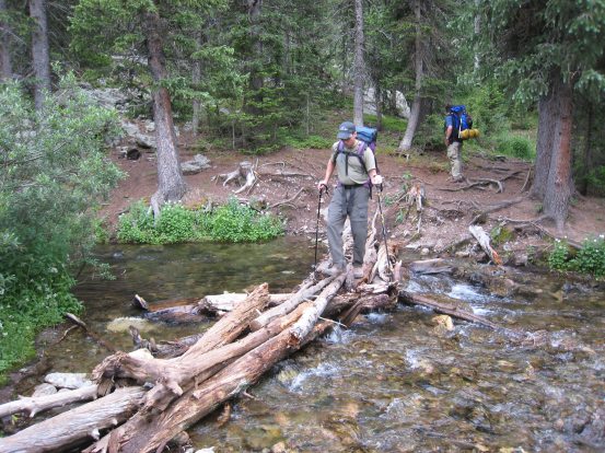
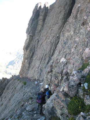
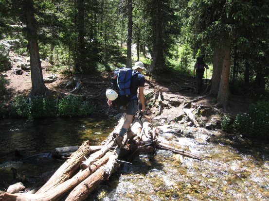
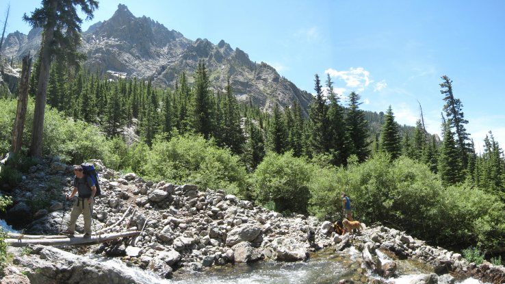
The valley narrowed, and the trail crossed the stream, leading us up the south side for a stretch. Sadler crosses first...
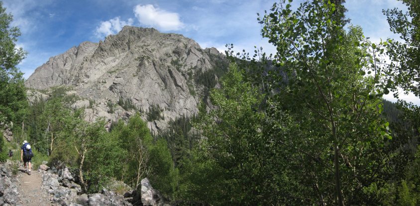
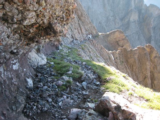
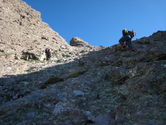
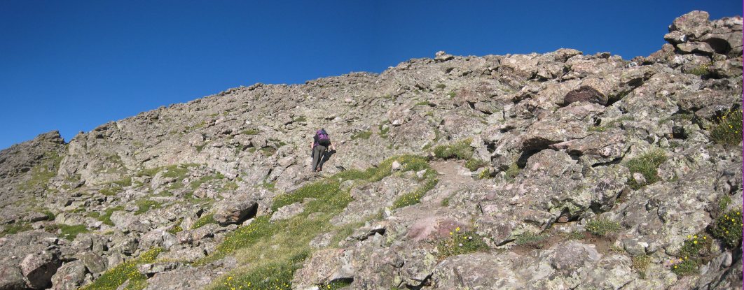
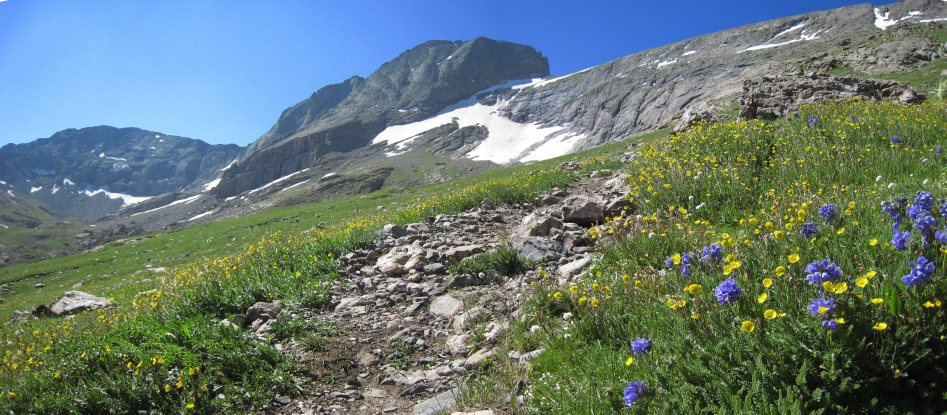
The trail led us up a series of ultra smooth switchbacks over a fairly steep rock scree slope. What a high quality trail!
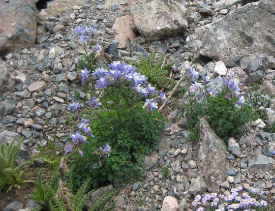
Columbine flowers grew along the scree slope. Soon we had to re-cross the stream, and continue the rest of the way on the north side...
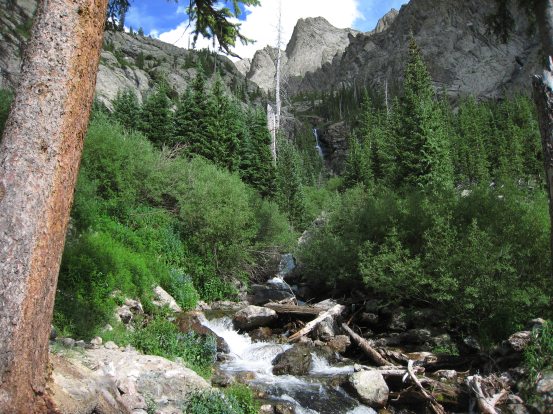
We were finally getting close to the lake, as the basin looked to be just above this cascade. The wind was starting to pick up a bit, and I felt a chill in the air. Still no rain though...
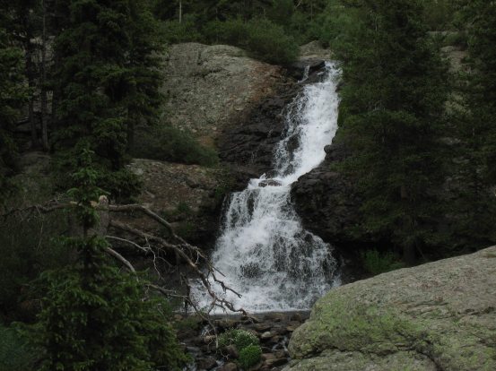
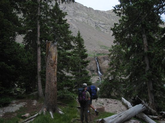
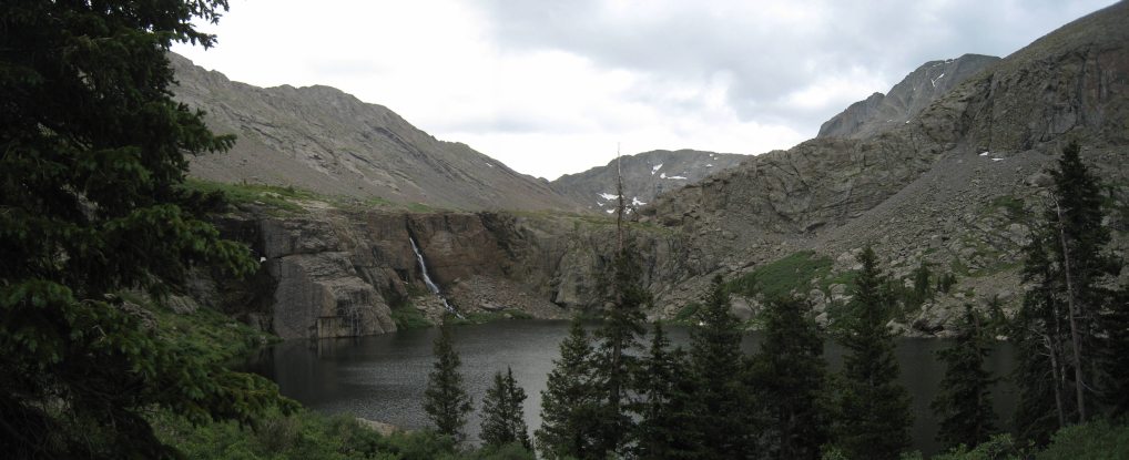
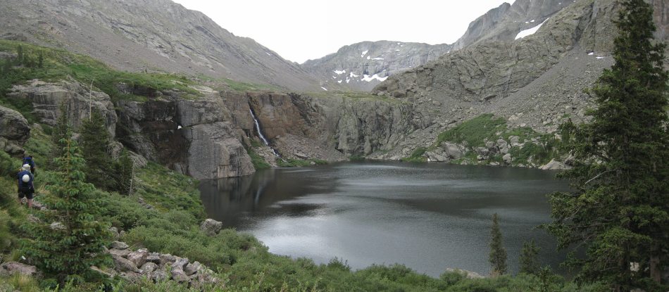
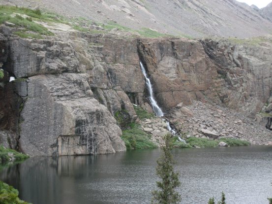
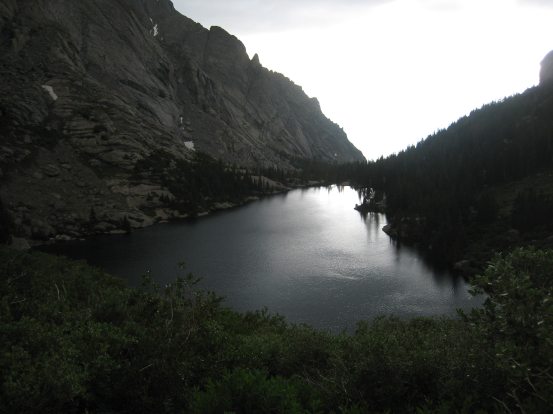
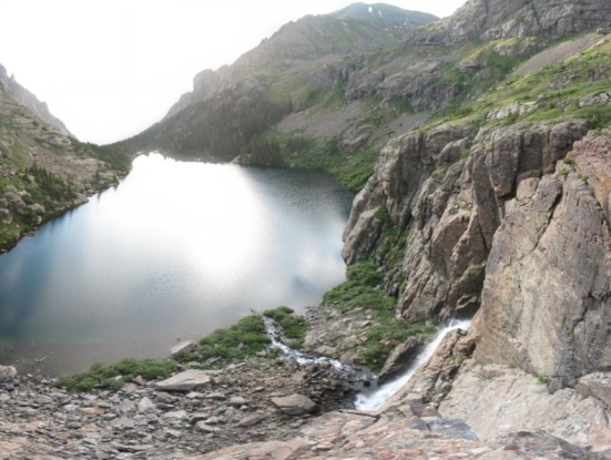
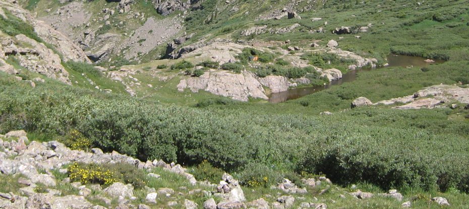
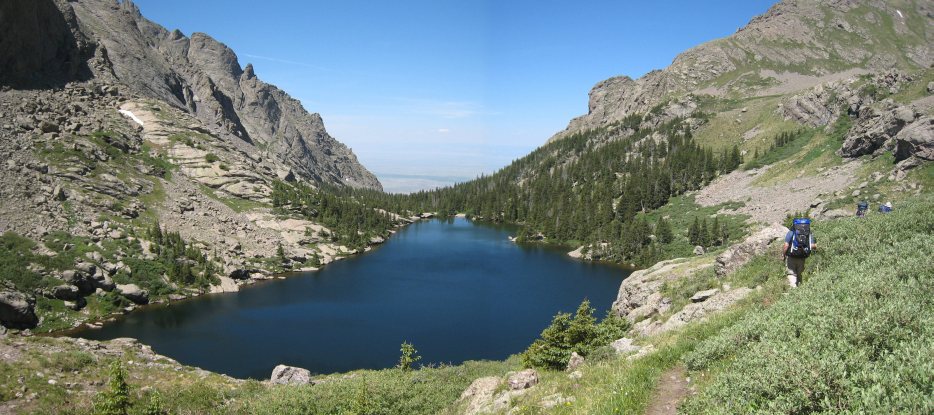
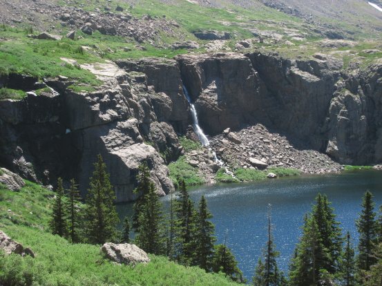
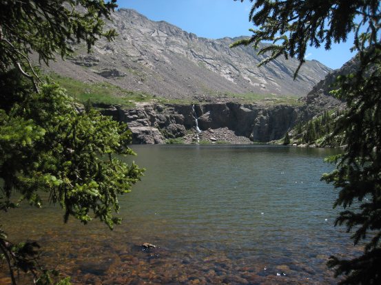
A close-up of the cascade shortly before the lake. And finally Willow Lake emerges beyond the opening in the trees! A couple of people coming down the trail earlier had informed us that camping above the lake near the waterfall was a good spot, and that they had just vacated it. We planned to camp up there, though it meant hualing our packs up another 200' and across the lake...
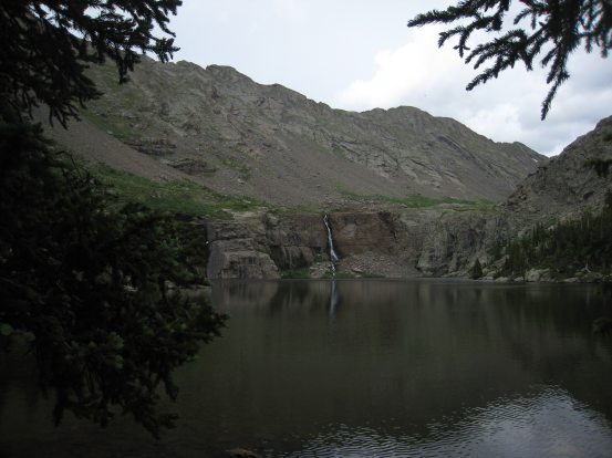
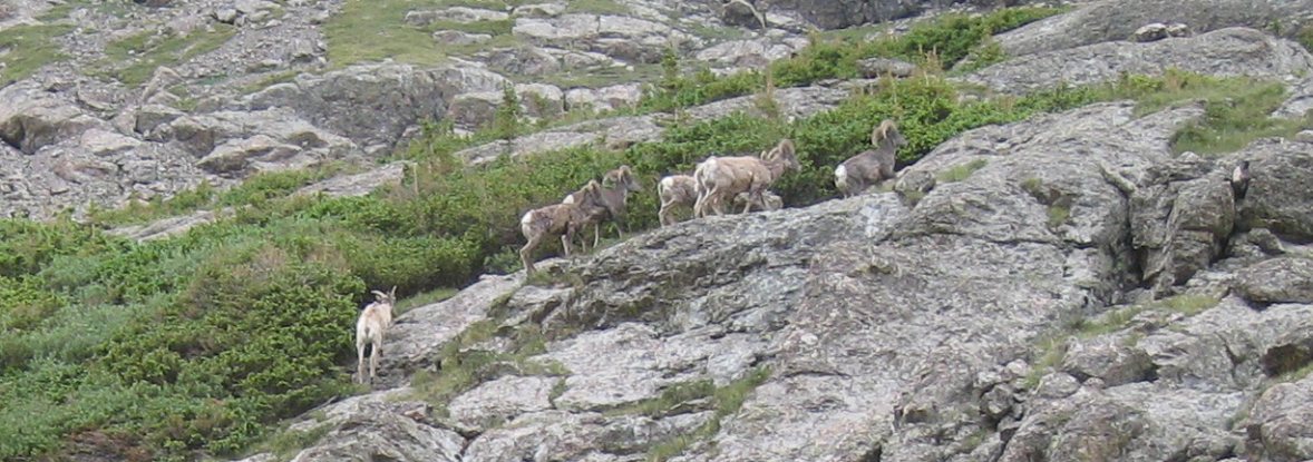
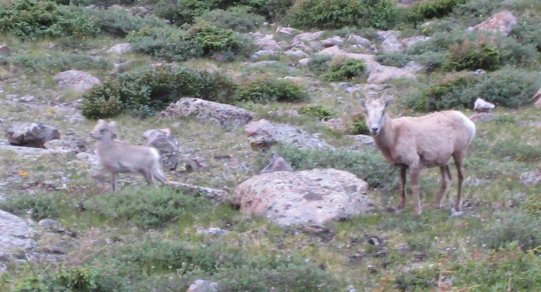
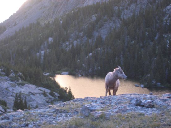
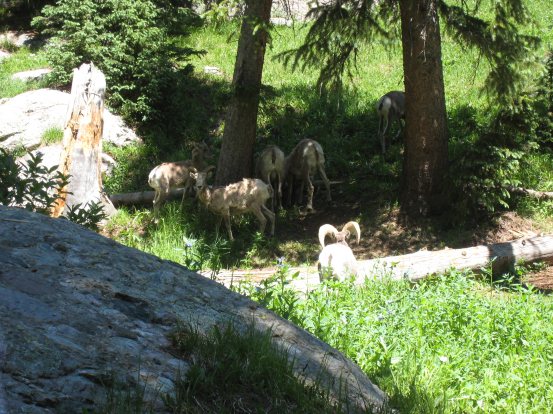
We took a brief stop at the lake to grab some pics, and noted that there weren't any tents visible near the waterfall. A passing hiker pointed out that there were a bunch of bighorn sheep across the lake near the falls. We followed the trail along the north side of the lake...
There were several camping areas on the east side of the lake that we passed, and the trail became confusing. We ended up following a path that hung low along the lake, and it soon became obvious, due to the occasional bushwacking, that this wasn't the official trail...
Still, we plowed on and found that this side trail did lead us back up above the lake. Sadler led the scouting expedition, and by the time I would be done taking pictures, the rest of the group would have already concluded on the proper course...
As we rounded the lake, Kit Carson appeared (the large rounded knob on the right)...
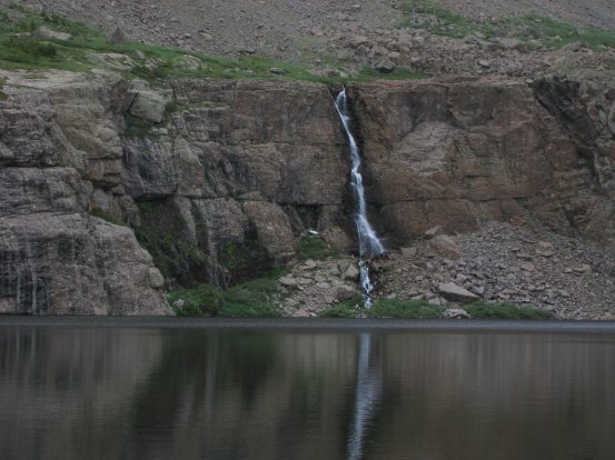
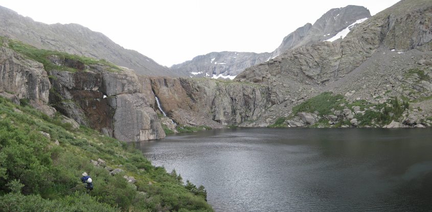
Another look at the waterfall. Soon we were above the lake, looking back across, and scouting out for camping sites...
It was cold and windy up above the lake, and my sweat drenched shirt was giving me chills. I was eager to get a tent up and change into something dry. The clouds seemed to be holding the rain, but the chilly temps were surprising. We didn't see many suitable camp sites along the trail above the lake, and ended up claiming the one obvious long narrow site tucked in among the willows. Tom and Sadler had bivvies, while Chris and I had our own tents, so we would be setting these up door to door to fit. It had been just 2hr 55min since we started our hike, to cover the nearly 7 miles and 2900' from the trailhead up to our camping site. I felt exhausted and cold, and knew I'd sleep well tonight. But first there was a tent to setup, water to pump at the nearby stream above the waterfall, and dinner to eat. We noticed a group of bighorns running up the nearby hill next to our camp.
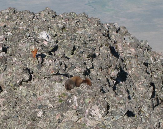
Some of the wildlife we saw as we set up camp. I also saw a marmot when we hiked in, but it stayed hidden, though I could hear the chirping...
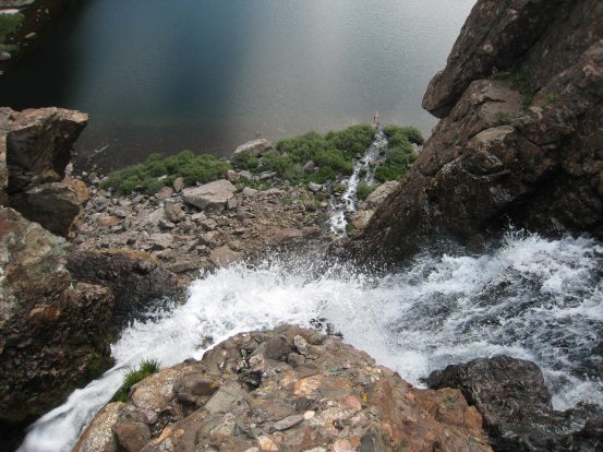
Looking out over the rock rim above Willow Lake and its waterfall. We pumped our water from the stream feeding the waterfall. I had to resist my Patagonian urges to just dip my water bottle straight into the stream...
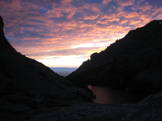
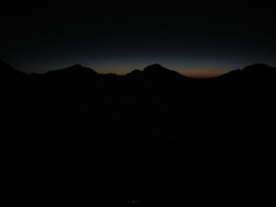
The clouds seemed to be thinning, and it looked like we'd escape the rain today. The forecast was for clear skies tonight and tomorrow. However there looked to be too many clouds in the west for a sunset today...
Changing into a dry shirt and adding some layers, after setting up my tent, made a big difference, though it was still surprisingly colder out than I expected. Patagonia evenings were not as chilly as this. I was kind of regretting that I didn't bring a stove to cook a hot meal. Tom on the other hand, brought a huge supply of home-grown veggies to cook with rice, and he generously shared his feast with us. I also ate my container of blended cereal, oatmeal, protein powder, and dehydrated milk. Tom also brought out some small plastic wine bottles, and shared them. It was some of the best tasting red wine I could remember.
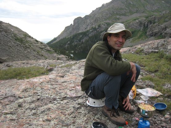
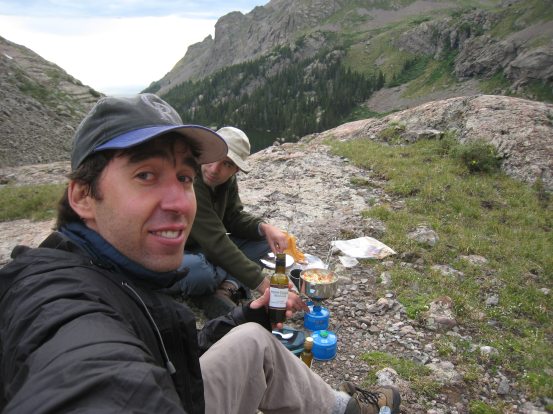
Master back-country chef Tom cooks up some organic veggies from his garden, along with some spice and rice. AND he brought some wine to share along with his hot stew, which was much appreciated. I gotta go on more backpacking trips with Tom...
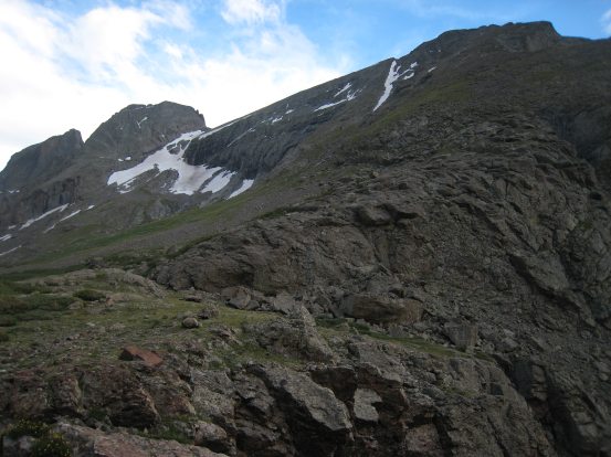
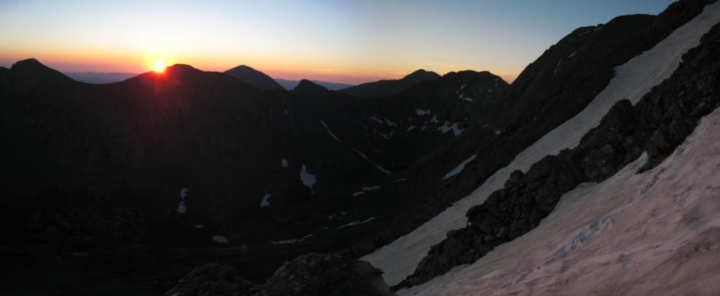
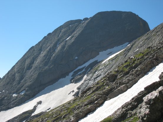
While eating, we stared up at Challenger (the big mountain on the right), and Kit Carson, the round summit above the snow on the left. The route along the diagonal patch of snow to Challenger looked tremendously steep. It would be quite a slog up tomorrow morning...
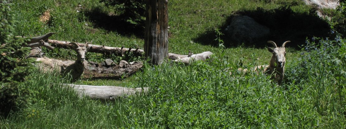
After dinner, Chris found a baby bighorn with its mother nearby. The baby would wander about, and then run away fast towards its mother as I approached. To my surprise, the sun found an opening through the clouds, and lit up some of the mountain behind us, and set the clouds glowing a rusty orange. We decided to set the alarm for 4am to be hiking by 4:30-5am. We had talked earlier about trying a hike under the full moon tonight to catch sunrise at the summit of Challenger, but the cold weather and wind made us think twice about being out so long without the sun.
A (blurry) baby bighorn with its mother. These two hung out for quite awhile near our camp...
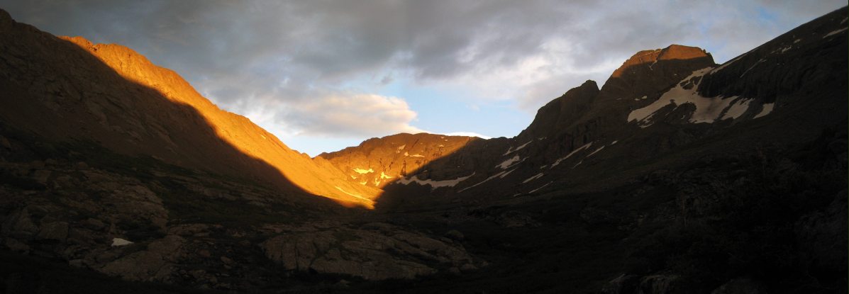
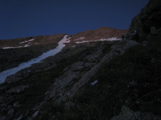
The sun illuminates the mountain tops in gold, including the peak of Kit Carson on the right...
A couple of views west out the valley...

Times like this I wish I had a SLR (and knowledge to use it). Little baby bighorn and mom in the late evening...
Just the momma bighorn, after the baby ran off again. A look out at the setting sunlight at 8:27pm...
Sadler found another good camp spot a short ways away, and set up his bivvy there. I brushed, and prepped my daypack for tomorrow, all while there was still enough daylight, and went to bed without using my headlamp that night. My merino wool shirt was still wet, and my pants and socks were a bit damp too. I tucked them in my sleeping bag hoping my body warmth would help dry them out. It was very warm in my sleeping bag and tent. A little too warm even. I discovered a sizable "speed bump" that my tent happened to cover, but I managed to work it as a lumbar support on my back. I was ready for bed.
Saturday, July 19th, 2008
From ~8:45pm on, I layed there, waiting for sleep to come after my exhausting afternoon, but it didn't arrive. Perhaps the uneven ground, or occasional flapping of the tent due to a gentle wind was enough to keep me awake, but time passed peacefully, and it was nice to lie down. I just wasn't exhausted enough to sleep. From time to time I checked my watch and soon noticed that there were shadows of the bushes on my tent, and it was bright out. The full moon was indeed out in force tonight. I was tempted to go out and see my surroundings, as I hadn't been out under a full moon in the mountains before. I heard some rustling in Chris's tent, and decided I'd unzip my tent and peak outside. Wow, the full moon was hanging over Kit Carson and shone brilliantly, liting up the basin. As I got out, I heard Chris do the same, and turned around to see Tom already outside, admiring the view too. It was almost magical that we all were summoned out together at exactly midnight. The air was completely still, and the chill from last night was gone.
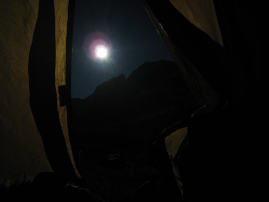
A midnight view of the full moon rising above Kit Carson from my open tent, and after stepping outside. I always think that night scenes in movies look fake cause there is too much light, but now if I just assume there was a full moon out I could believe it...
We were all impressed with the landscape, and agreed that we should get up earlier to hike with the unique full moon conditions and try to catch sunrise on top of Challenger. We set the alarm for 2:30am now, which still gave us over 2 more hours of sleep. Hopefully Sadler wouldn't mind getting woken up earlier to start in the moonlight. I went back inside my tent excited at the prospects of catching sunrise atop a 14er, blissfully unaware that our earlier start would turn out to be a bad idea... But I still had 2.5hrs of laying down to do first, since I didn't think I'd fall asleep tonight.
Sure enough, all I could do was lay there, and think. The glory of tomorrow pervaded my thoughts, and I started reliving the past day and writing this web journal in my head. On top of that, the trance-like music from Beck's new CD was swirling inside my subconscious amongst it all, building up the excitement for a crescendo that would come in a couple of hours.
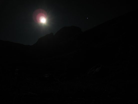
I was up and prepping for the day at 2:25am. I peaked outside my tent, and was disappointed to see that the moon had drawn closer to the horizen above Challenger, rather than higher into the sky overhead like I had expected. It looked like the moon would set before we began the climb. Nonetheless, we were all up, and we'd now be hiking in the dark shade of the full moon. The full moon was almost bright enough for me to put on my contacts without the aid of a headlamp, but I still turned on my light to help speed up the process.
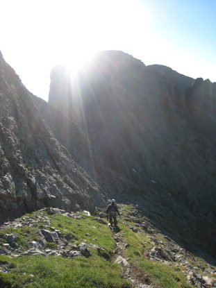
My damp clothes had successfully dried out in my sleeping bag, and I layered up. The air was still calm. We ate our breakfast (just some twizzlers and soy nuts for me), Tom and Sadler pumped water (Chris and I had enough from last night), and by the time we were ready to start the hike at 3:30am, the moon had set behind Challenger. Since it might be cold at the summit while waiting for sunrise, Sadler and I carried up down sleeping bags. We turned on our headlamps, stepped on the trail right next to camp, and headed towards Challenger .
A view of the moonlight now blocked by Challenger, moments before we were about to begin the hike. It would now be a typical pre-dawn hike...
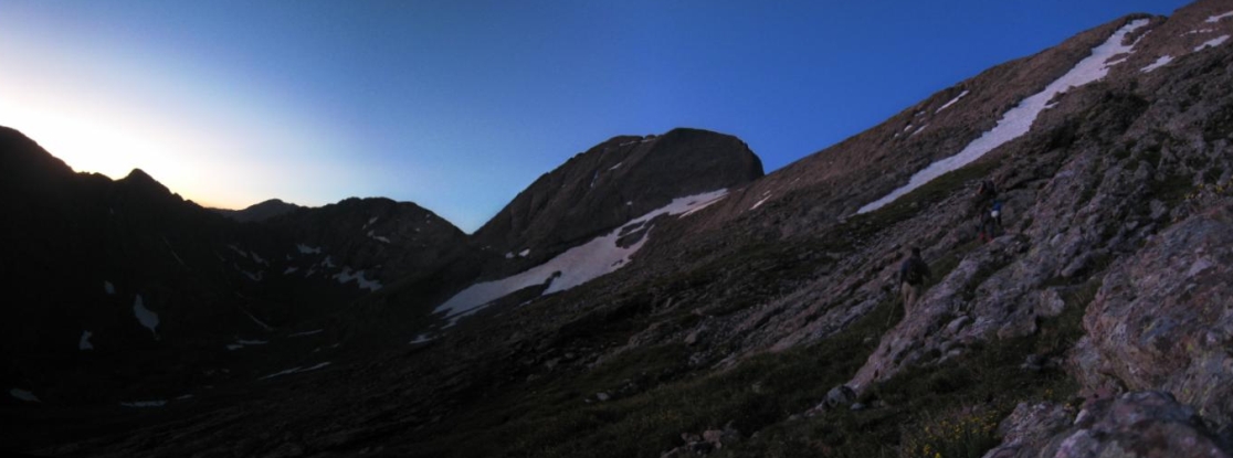
Sadler and Tom led, though Tom's headlamp was low on battery, so he stayed in between Sadler and Chris. I played caboose, messing with my camera from time to time, glad that others were spending the time trail-finding in the dark. After a quick pass through some willows, we began the climb, and was it ever a climb. There would be ~2000' of gain in the next mile. In the dark we searched for the dirt trail that ran up the grassy slope. Cairns were few and far between, and the dirt path was not always broken in enough to follow it easily in the dark. Still we forged ahead, climbing the very steep terrain, pacing ourselves slow enough to prevent heavy sweating (which would cause us to freeze when waiting for sunrise at the summit). Every now and then I ate a gaterade Jelly-Belly jelly bean, something they were handing out for free at ultimate summer league a few weeks ago. They were good.
Yikes, aliens in the dark! Oh wait, that's just Tom, Chris, and Sadler continuing up the trail after a brief pause at 3:48am...
Soon we lost sight of any cairns, but were still able to find a good route up the mountain. Around 4:40am, at ~13,000', we realized that something didn't look right. The long arm of snow we were supposed to follow was still way off to the left, and we were cliffed out from cutting over in that direction. Up ahead there was a choppy wall of rocks that didn't yield a viable route from this distance in the dark. We had the sinking suspicion that we traveled up the wrong rib in the mountain. After scouting around a bit, we found a safe way off the rib, where a narrow but very steep snowpatch was the only thing in our way from cutting back to the main trail. However this snowpatch was ice hard at this early hour, and despite the presence of footprints, without an ice axe or crampons, we would be one slip away from sliding down an uncontrollable ice chute for a couple hundred feet. So we had to grin and bear it, and accept the fact that it was time to climb back down to look for a way to cross below the snow patch.
Shortly before we reached this turn-around point. Chris stepped in an opening underneath a rock, and felt something alive move. In his surprise and eagerness to get his foot out, he twisted his ankle. Turns out a ptarmigan (large quail like bird) had been sleeping under there, and was now out sitting on a rock. Chris shined his light at it, and it took me a long time to finally make out the bird, as it is extremely camoflauged when it stays motionless, curled in a ball. Chris's ankle was swelling fast, and it pained him each step as we now decided to make our retreat down the mountain.
The view to the northeast at 4:45am, shortly after we discovered we were off trail, stuck on a rib with poor visibilty to commit to more unknown trail-blazing ahead...
Sunrise atop the 14er was long out of the picture now. We hiked down along the edge of the rib, hoping to find an easy way off this high rock spine, and across the snow down next to it. But alas, we had to drop 400' before finding safe passage. At this point Chris had to decide if he could bear the hike up to any 14ers on his ankle today, or head back to camp. He decided to press on with us for a bit, but then opted to head back, to soak his foot in the cold stream. By now there was plenty of light out, and route-finding was much easier. We left Chris, and the three of us continued up the rocky slope, now back on the standard route.
At 5:18am we had regained the standard route, where we could reach the snow patch on the left, and follow it up the mountain. The large mound on the right is part of the rib we had climbed up and backtracked down 400'...
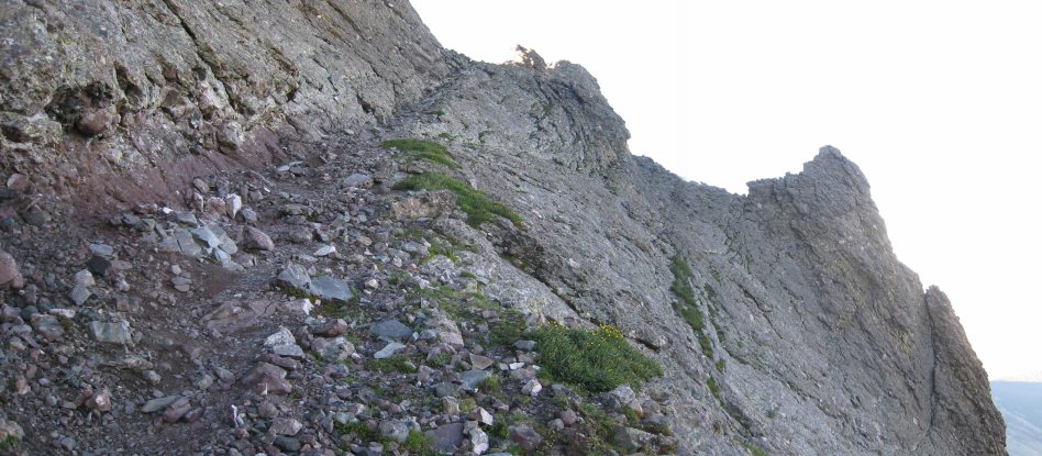
Our wrong turn off the trail in the dark caused us an hour delay, and 400' of extra gain today, and coincidently resulted in Chris's foot "kicking" a hidden ptarmigan, causing him to twist his ankle. Might be a good idea for other first timers to wait til sunlight to start this hike. The trail is not obvious in the dark, nor even in the light, as we'll see...
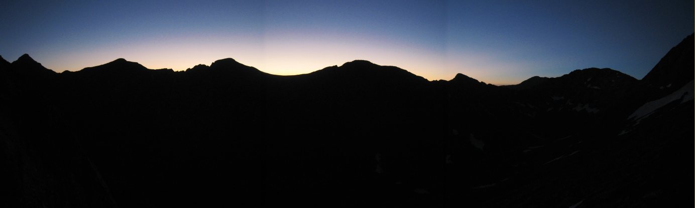
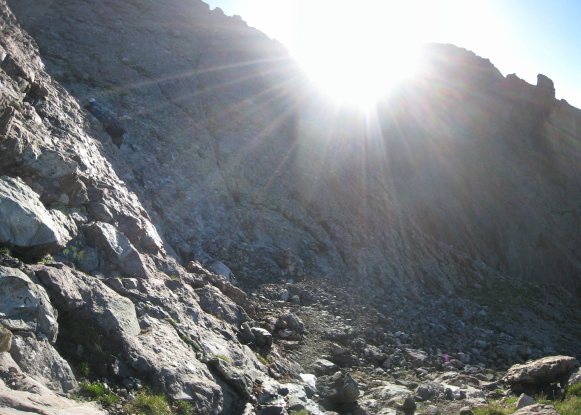
Sunrise was ~5:55am here. This view of the horizen was from 5:30am. We still had ~1400' to reach the summit...
We aimed for the long snow patch. Shortly after the second pic, Chris turned back to save his ankle...
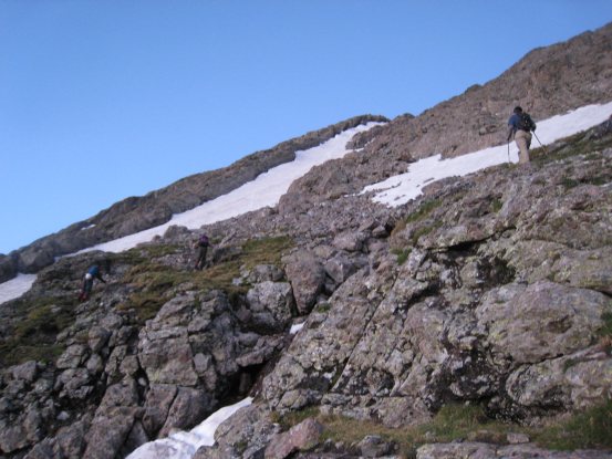
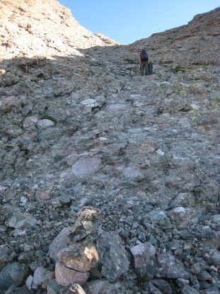
We three continued on, and noticed that the cairned trail all but disappeared amongst the rocks. We avoided snow and forged our own route up the mountain again...
At 5:52am the sun had cleared the horizon. It was a beautiful sunrise, even just partially up the mountain...
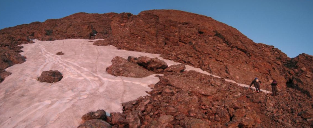
We had heard there wasn't any snow on the main route up to Challenger, but there was at least one short snow crossing necessary across the long snow patch for the standard route. Lots of the snow had footprints. The snow crossings should be easy later in the morning when it's soft...
However, the snow was very hard for us at this early hour, and we went further up circumventing the snow. This meant dealing with some class 3 and 4 scrambling, which was fun. We probably could have continued climbing our original route up the rib, and crossing over along this portion, but we couldn't be sure in the dark...
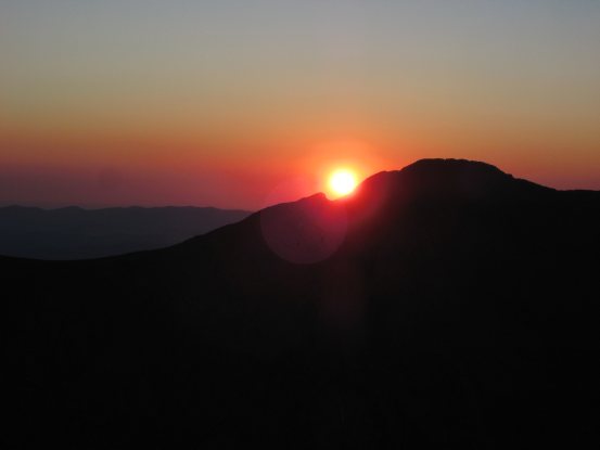
A close-up of sunrise, and the class 4 climb at the right side of the pic above...
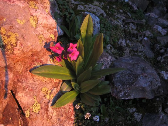
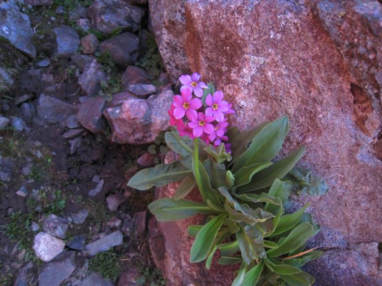
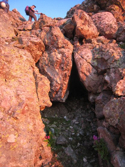
Close-ups of the two pink/purple flowers at the bottom of this pitch we took to avoid the snow...
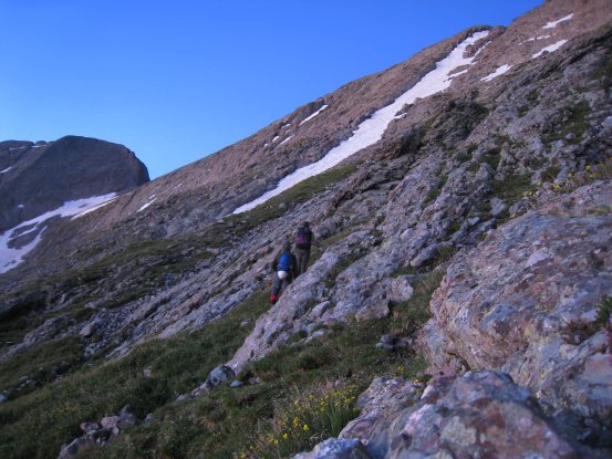
Sadler and Tom led, and scouted out the route, while I stayed back taking photos of the golden rock in the early sunlight...
It was convenient having two guides tell me which way to go, especially on this long steep climb, where you really don't want to waste energy exploring a dead end. I was a little disappointed with my stamina today, and liked the opportunity to rest a bit while snapping photos...
Another fun scramble as we make our way back towards the standard route...
This ascent up Challenger seemed even tougher than the long slog up Belford. The trail was much less defined as well. We continued to make our way towards the snow line, which would lead us up to the notch in the ridge...
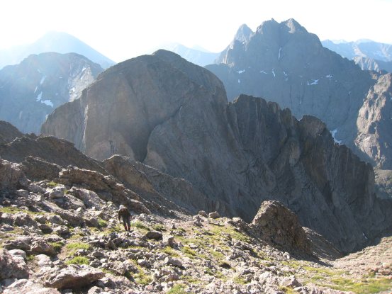
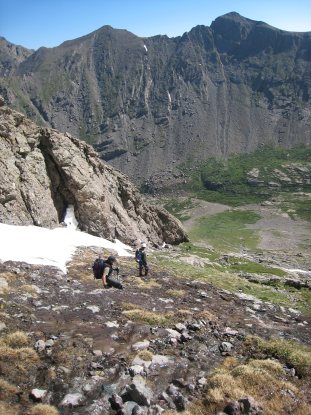
A look down from near the ridge at the basin we camped in. Finally we reached the ridge at 6:20am...
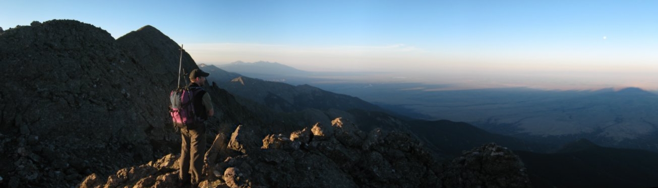
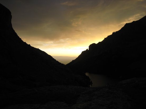
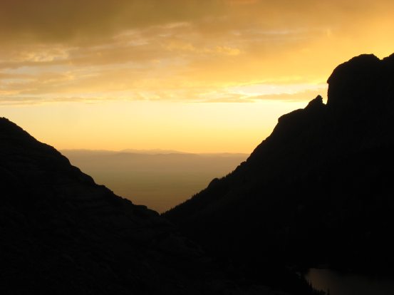
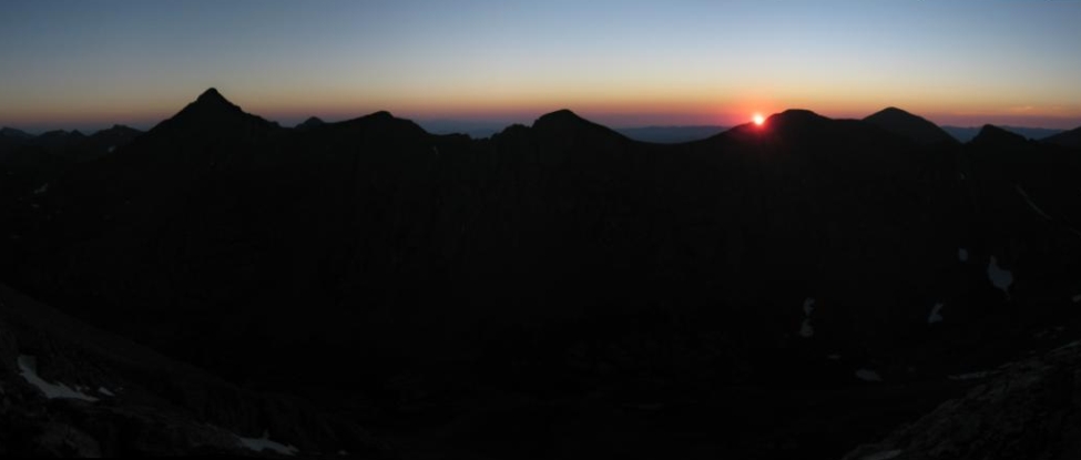
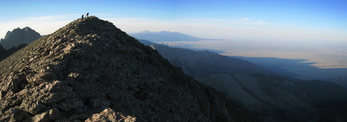
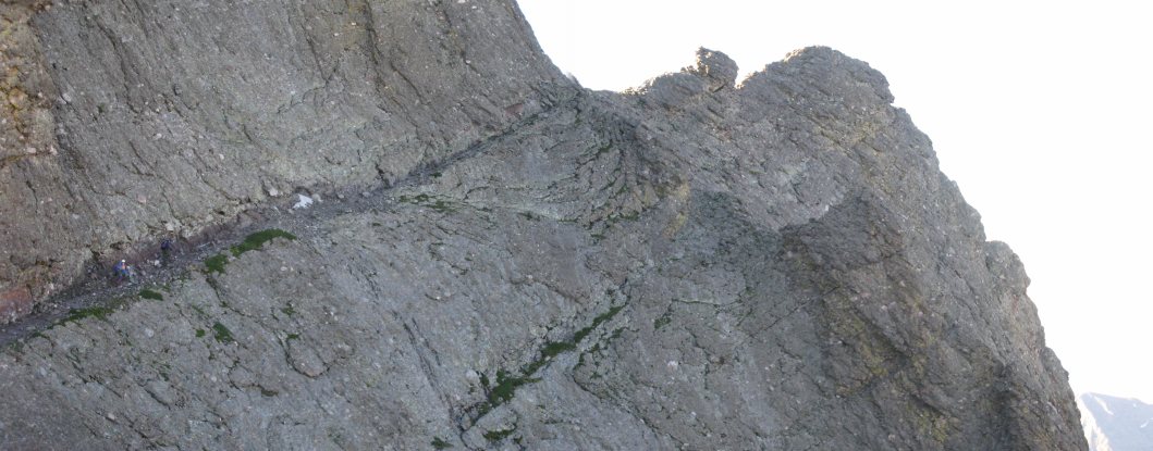
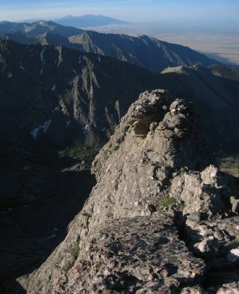
Sadler looks to the west from the lookout point just to the right of the ridge notch. The full moon was still visible above the horizen (right side of pic). The shadows of the Sangre de Christo mountains stretched far into the San Luis Valley. Challenger Point is the pointy peak on the left...
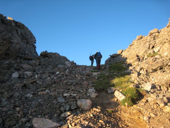
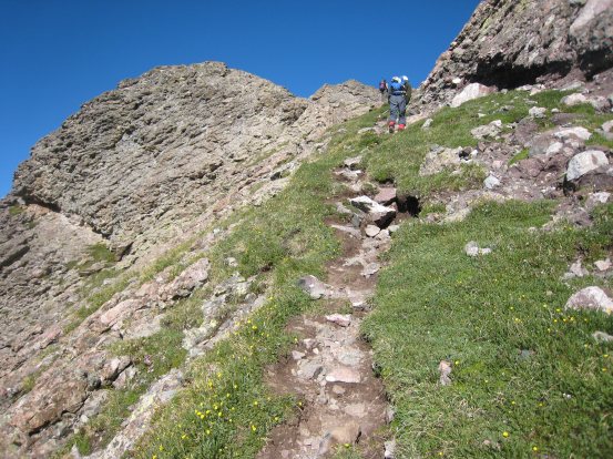
A look at the notch where the standard route hits the ridge. There is a cairned path leading up and over the rock mound on the left, but it's much easier to just continue on the dirt trail around the mound, which connects up to the ridge just past it...
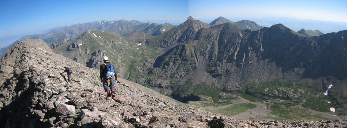
Challenger Point straight ahead. I thought it was easiest to walk along the ridge top as much as possible, as the exposure is not bad...
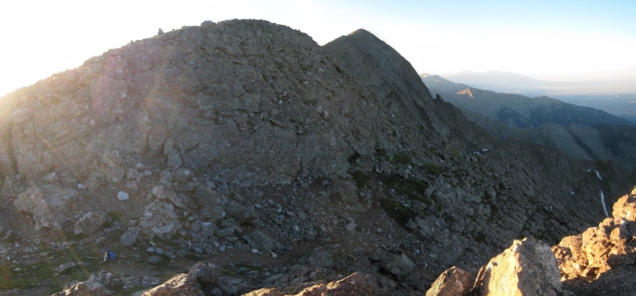
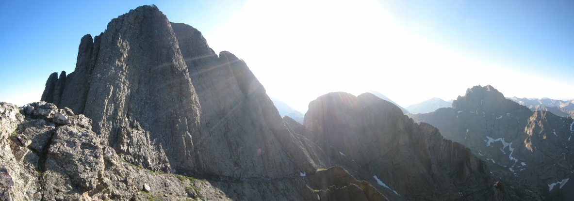
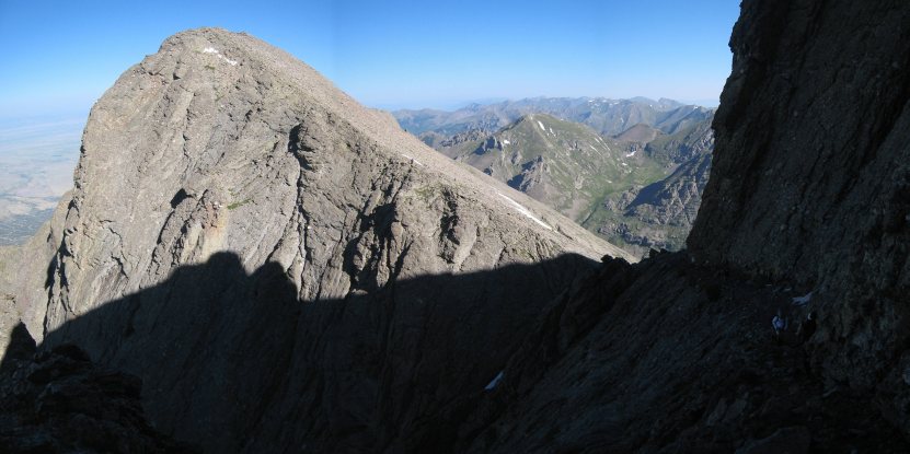
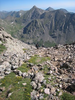
Kit Carson, our next 14er, is the large round peak in the center. But first we had to bag Challenger...
Sadler and Tom are the first two people to summit Challenger today. The Sand Dunes can be seen to the right of Challenger, in the distance...
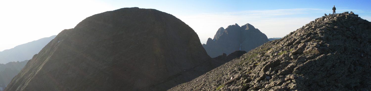
Tom stands on Challenger, with the monstrous Kit Carson to the left. Part of the "Avenue" (the diagonal ledge) can be seen. In the backdrop is Crestone Peak, another 14er...
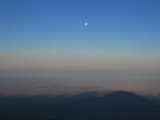
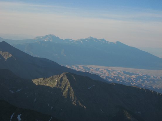
A cool shot of the full moon, and the shadows stretching into the San Luis Valley. A close-up of the Sand Dunes, with the Blanca group beyond...
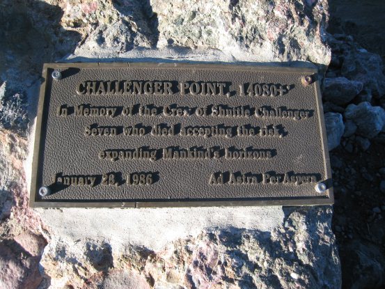
We summitted Challenger at 6:45am. I snacked on my grandma's "Honalulu Cake", a dense nut and date bar that is a favorite of mine. One small bite can fill a grown man's belly. :-) This peak was named in honor of the Challenger astonauts...
After 10-15 minutes on Challenger we began the short 300' descent towards Kit Carson's famous "Avenue", located just above the snow patch. There was a roughly cairned trail leading down to it...
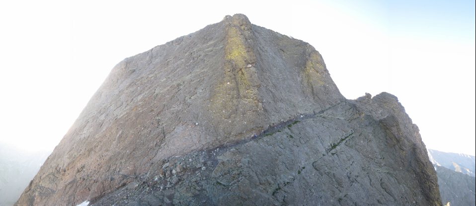
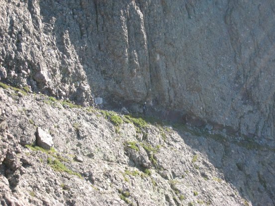
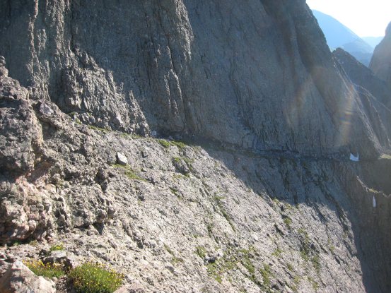
Here is the entire peak of Kit Carson, with the all too convenient Avenue running up along the sheer rock wall...
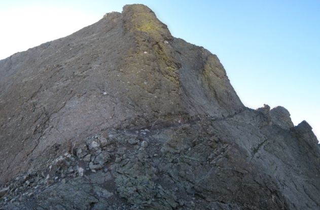
I told Tom and Sadler to go ahead, while I stayed on the Challenger side to take some photos. Kit Carson had a green colored stripe on the rock, as can be seen in the pic here and above...
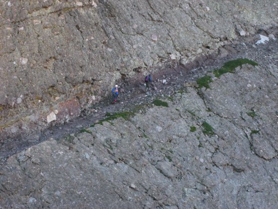
Tom and Sadler are on the left side of this pic. They are almost at the end of the "block". The Prow of Kit Carson extends out to the right, at the end of the Avenue...
I made my way down to the avenue and began the climb. It looked like an ancient road from a past age, cut straight from the rock, leading up to what could have been a magnificent fortress at the top of a mountain. Very Middle-Earth like...
When I caught up with Tom and Sadler at the top of the avenue, Sadler brought up the idea of leaving our gear here, since we'd be coming back this way after summitting Kit Carson. I took the opportunity of stashing my three pound sleeping bag amongst the rocks. That bag sure amounted to dead weight on this hike, but I now had an extra spring in my step without it.
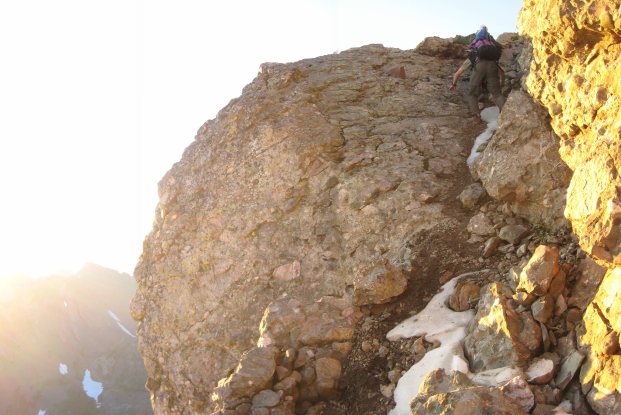
From the top of the Avenue, I climbed out on part of the Prow, and looked back to take this shot. The avenue continues around the corner and descends down the back side of Kit Carson. We had climbed the first part of the avenue along the left side of the peak, in this shot...
Tom took this pic of me out on the Prow (with his iphone), from his position on what I'll call "2nd Ave". His white helmet is visible in the center of the second picture, which I took from the Prow...
Here's a look out along the narrow Prow, and another look at "2nd Ave"...
A look down "2nd Ave", from the top, and then halfway down. There was a cool overhanging rock part at one point, seen in the 2nd pic. How convenient is this handy ledge that wraps around Kit Carson???
At the end of "2nd Ave" we turned to the left, and began "3rd Ave". This short descent led us to a cairn before the saddle of Kit Carson and Kat Carson (also known as Columbia Point), where we turned to the left, and began the class 3 climb to Kit Carson's summit. The 2nd pic is where we turned off at the cairn...
Sadler stayed to the left side of the alley, Tom to the right. I followed a large crack up towards the right. It was pretty simple Class 3 terrain. Much more fun and easier than the slog up to Challenger. The class 3 section was short before we reached a mix of grass and rock again...
The trail cut towards the left as we neared the peak of Kit Carson. The total ascent from the Avenue to the peak was ~350'...
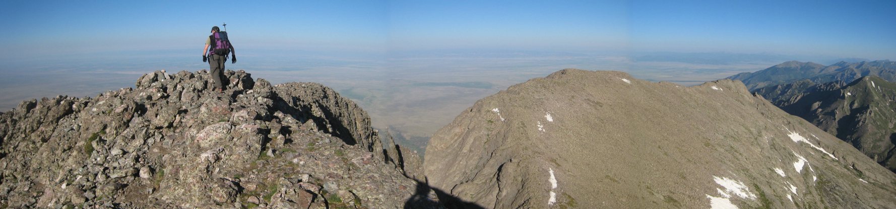
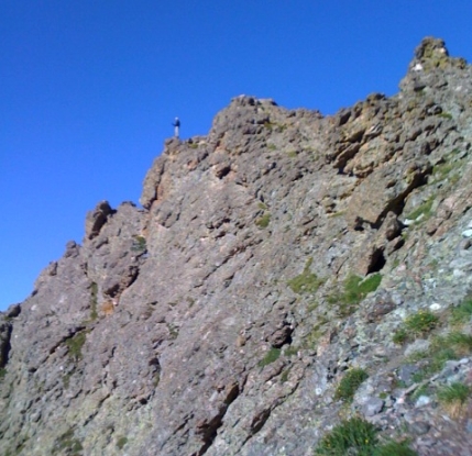
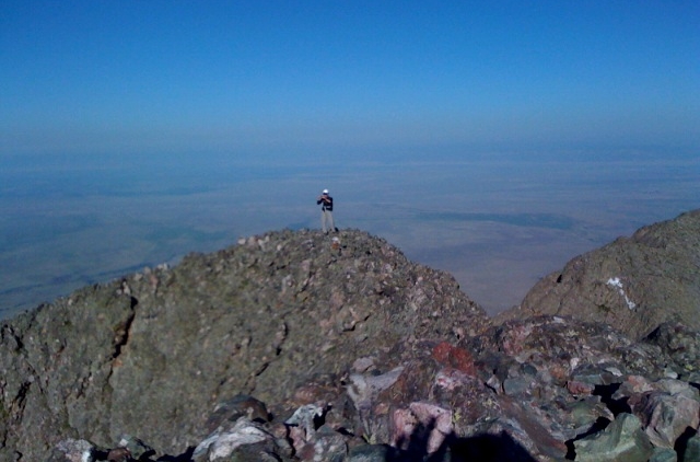
Sadler reaches Kit Carson's peak (14,165'), as Challenger sits just 400 yards off to the right at 14,081'. We summitted KC at 7:55am, 70 minutes after bagging Challenger (including our break at the top)...
A close-up of Challenger ~8am. I had hoped to see some people on it's summit, but apparently there weren't many early starters today...
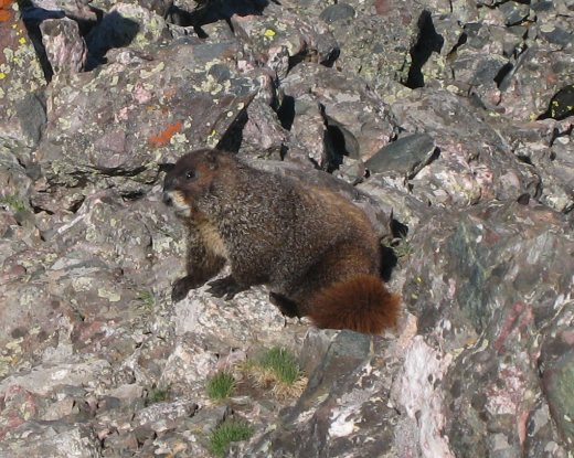
I found a big fat marmot a short ways off the summit to the west, across a short but narrow neck on the peak. I scrambled over and grabbed some pics. Out of all my hikes so far this year, this is my first pic of a marmot! (certain relatives have been asking for more marmot pictures) :-)
A look back along the narrow ledge to the summit. Tom's head pokes up above the peak. I think this extensions is part of the green stripe seen in the pics of Kit Carson from Challenger...
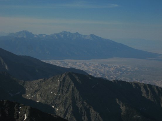
An iphone pic from Tom of me out on Kit Carson's sub-peak. And another look at the Sand Dunes and Blanca group. I stared a long time trying to make out parts of the Little Bear - Blanca Traverse that I did last year...
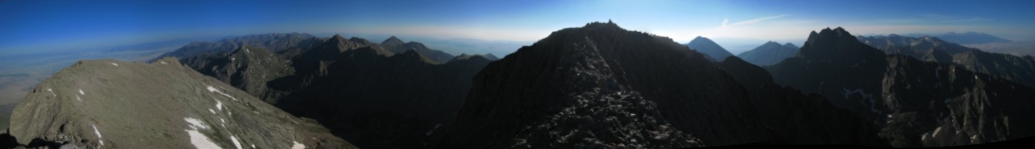
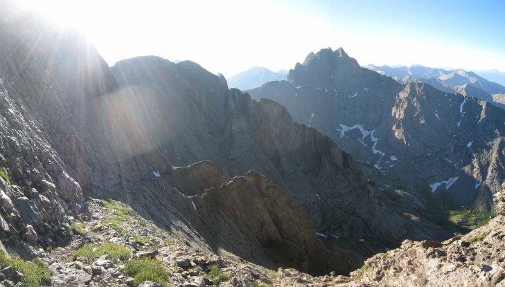
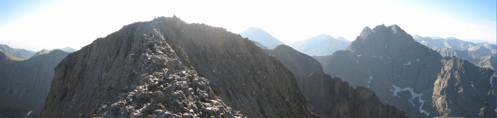
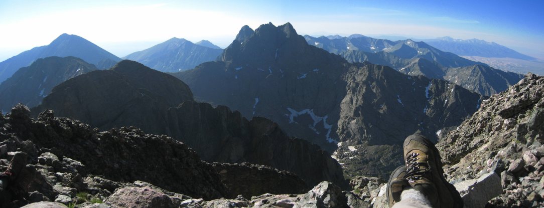
A sweeping view of several 14ers: Challenger on the left, Kit Carson in the center, Humboldt just to the right of Kit Carson, and Crestone Peak on the far right...
Tom investigates the register. 21 people signed it yesterday, which seems like a lot for a Friday...
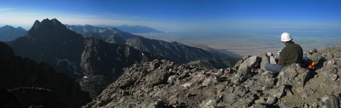
Crestone Peak looked intimidating and impressive, like a giant fortress. Crestone Needle (a separate 14er) appears right behind it on the left. It was great to lounge about and admire the views...
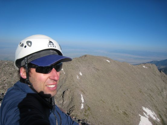
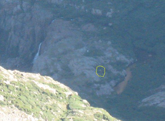
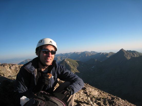
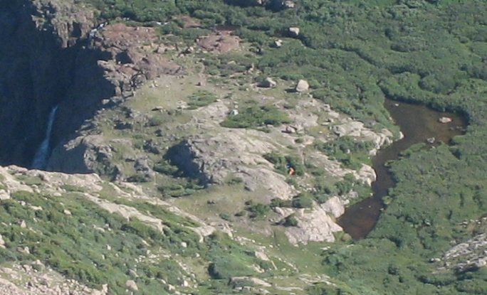
A self portrait on Kit Carson, with Challenger in the background. From the peak I could just make out my tent (circled), in this heavily zoomed in pic...
After 10-15 minutes on the summit, we began the descent back down the way we came up...
We hiked back up "3rd Ave", and then "2nd Ave". There was just one bit of snow on "2nd Ave", as seen in the second pic, but it was easily avoidable...
Once we finished the ascent up "2nd Ave", I picked up my sleeping bag, and as we turned to head down the final portion of the Avenue, we ran into the first hikers of the day. This would begin the barrage of hikers making their way up these 14ers that we'd see the rest of the day...
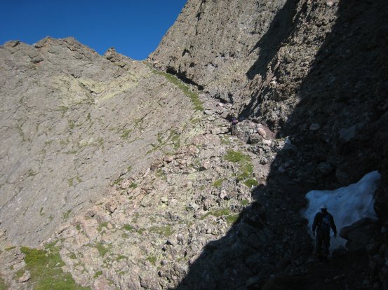
From the bottom of the Avenue we kept our elevation and traversed underneath Challenger across the small boulders until we reached the ridge again, a short ways from the notch leading back down the mountain. There are large cliffs below Challenger, so it's important to traverse to the notch...
My orange tent was more visible from here (no circle necessary). We reached the notch and began the descent at 9:20am...
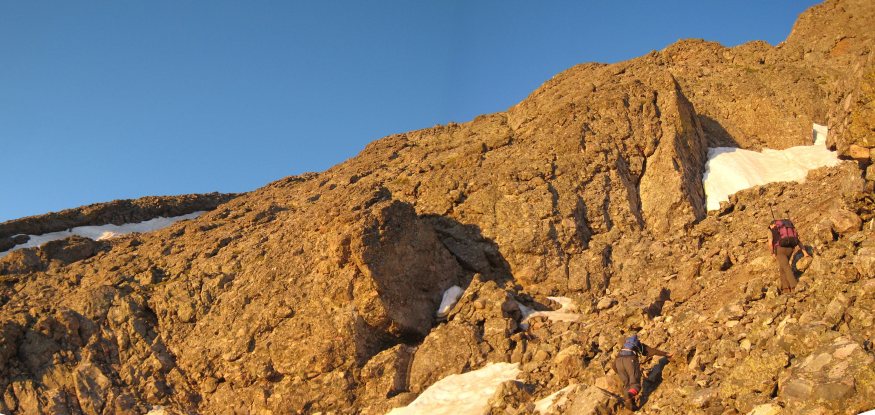
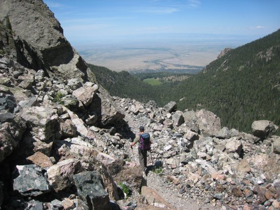
The descent down the loose dirt and rock wasn't TOO bad, though easy to kick small stones down, and there was hardly any broken trail to follow. We made good time and reached the long snow patch where several people had decided to rest. The snow was soft and the footprints were well etched, that we it was safe to cross. Sadler crossed high, Tom low...
A few people asked us if they were on the correct route, and we don't blame them for being confused. We looked towards the west and saw some hikers climbing way out past where we had first attempted. I've since read people recommending staying to right during the climb of Challenger, as there is more class 3 scrambling, no snow, less crowds, and still a viable route.
A look back up at Kit Carson and the cliffs underneath Challenger. After we cleared the rocks, the final 2/3rds of the descent was down a muddy trail/stream. We all landed on our butts more than once on the way down due to the slippery conditions. It was no doubt an unpleasant experience for many today...
Somehow we had ended up on top of the rock on the left this morning during our hike up, and later found ourselves in a pickle, in the dark...
A pic of Tom on his feet. Many a time I looked up to see him having just landed on his seat. Near the bottom of the mountain, the yellow and blue wildflowers were out in force. An odd spiky green plant stands out in the pic on the right too...
I spent some time at this spot taking lots of photos of the flowers with Kit Carson and Challenger reigning behind...
The final part of the descent led through the willows. I could see Sadler already back at camp, and talking with Chris...
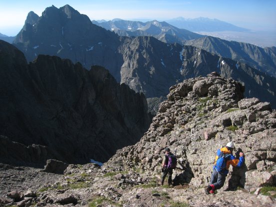
I got back to camp just before 11am, which made for a ~2hr 55min descent from Kit Carson. Chris told us that he decided to push for Challenger after all, and summitted about 45 minutes after we did. He'll have to come back for Kit Carson, but given the beauty of this area, a reason to come back is a good thing...
The descent down Challenger should not be underestimated, as it's loose dirt/rock portion followed by a slick, wet, steep slide. When we had arrived at camp ~6:15pm yesterday, we saw some older guys (late 50s?) coming down, who said they made both peaks, but it was VERY hard, which I imagine was in reference to the descent. They really had very little joy in their expressions.
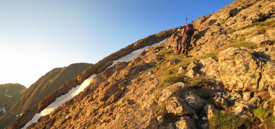
We packed up our gear and hit the trail ~11:20am. We made guesses as to how long the hike out would take. Sadler thought 1.5 hrs, Chris 1.75hrs, and I 2hrs.
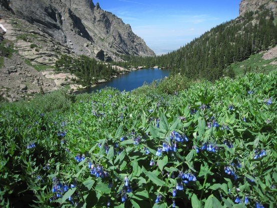
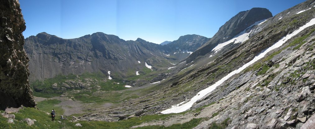
A couple of looks out over Willow Lake as we crossed above the waterfall and began our exit of the basin. Lots of blue flowers above the lake...
This time we found a trail that stayed high above the north side of the lake, rather than dropping down. We did see some hikers on the lower trail, who found the same path we did. The high trail was much easier...
A final look at Kit Carson before it would be hidden by Challenger. Challenger is one huge piece of rock...
The waterfall is lit by some sunlight on our way out. A sharp contrast to the drab grey hues from yesterday...

I stopped and took pics around the lake, and had to play catch up to the rest of the guys. The trail leaving the lake was a little confusing, due to the side paths to the various camp sites, but only one path leads out...
Shortly after leaving the lake I saw a big group of bighorn right off the trail...
A couple bighorn seemed curious as I stopped to take some pics. Moments later I finally caught up to the rest of my companions (after they stopped to wait for me)...
The hike back was just as we remembered it yesterday. A few stream crossings and plenty of switchbacks. We occasionally checked the clock to see how we were progressing on time...
A woman and her dog were resting along the side of this creek. Despite our fast pace, we were an hour in with about half way to go. We quickened the pace...
We passed several people on the way out, many with heavy backpacks. There were many day hikers too. We reached the meadow a little before 1pm. Fortunately the swelling in Chris's ankle had subsided a lot once he soaked it in the stream earlier, and he was doing fine on the hike out...
After tons of incredibly long and drawn-out switchbacks, we reached the sandy end of the trail, which felt good on the feet. We arrived back at the trialhead just a couple minutes past 2hrs mark of hiking...
The parking lot was packed, with many cars parked along the road leading in. It was great to arrive yesterday and get an early start this morning so that we had both peaks to ourselves today (even if it did amount to wrong turn). We loaded the car and headed back to Fort Collins ~1:30pm.
A couple of looks back at the mountains on our way out. Challenger Peak is on the right side of the ridge in the pic on the left. In the right pic, Challenger is right of center, with the shadow. Willow Lake sits up in the basin to Challenger's left...
Tom drove back, while I started prepping the pics on my laptop. Somehow I was able to stay awake the whole drive back, despite my lack of sleep last night. It was one VERY long day for me, but I was very happy to bag my 9th and 10th 14ers with such great company.
Back to main hiking page